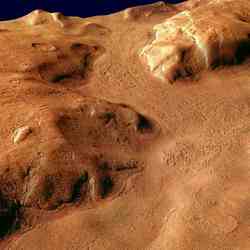
Spirit’s Mountaintop View

Mini-panorama taken by Spirit. Image credit: NASA/JPL Click to enlarge
Working atop a range of Martian hills, NASA’s Spirit rover is rewarding researchers with tempting scenes filled with evidence of past planet environments.

“When the images came down and we could see horizon all the way around, that was every bit as exhilarating as getting to the top of any mountain I’ve climbed on Earth,” said Chris Leger, a rover planner at NASA’s Jet Propulsion Laboratory, Pasadena, Calif.

The summit sits 82 meters (269 feet) above the edge of the surrounding plains. It is 106 meters (348 feet) higher than the site where Spirit landed nearly 20 months ago. Spirit and twin rover, Opportunity, successfully completed their three-month prime missions in April 2004. They have inspected dozens of rocks and soil targets since then, continuing their pursuit of geological evidence about formerly wet conditions on Mars.

“Spirit has climbed to the hilltop and looked over the other side, but NASA did not do this just to say we can do it. The Mars rovers are addressing fundamental questions about Martian history and planetary environments,” said NASA’s Mars Exploration Program Director Doug McCuistion.

The crest of “Husband Hill” offers Spirit’s views of possible routes into a basin to the south with apparently layered outcrops. Shortly after Spirit landed, it observed a cluster of seven hills about 3 kilometers (2 miles) east of its landing site. NASA proposed naming the range “Columbia Hills” in tribute to the last crew of Space Shuttle Columbia. The tallest of the hills commemorates Rick Husband, Columbia’s commander.

Volcanic rocks covering the plain Spirit crossed on its way to the hills bore evidence of only slight alteration by water. When Spirit reached the base of the hills five months after landing, it immediately began finding rocks with wetter histories.

“This climb was motivated by science,” said Steve Squyres of Cornell University, Ithaca, N.Y. Squyres is principal investigator for the rovers’ science instruments. “Every time Spirit has gained altitude, we’ve found different rock types. Also, we’re doing what any field geologist would do in an area like this: climbing to a good vantage point for plotting a route.”

Researchers are viewing possible routes south to apparently layered ledges and to a feature dubbed “home plate,” which might be a plateau of older rock or a filled-in crater.

The landing site and the Columbia Hills are within Gusev Crater, a bowl about 150 kilometers (95 miles) in diameter. The crater was selected as the landing site for the Spirit rover because the shape of the terrain suggests the crater once held a lake. Volcanic deposits appear to have covered any sign of ancient lakebed geology out on the plain, but scientists say the hills expose older layers that have been lifted and tipped by a meteorite impact or other event.

“We’re finding abundant evidence for alteration of rocks in a water environment,” said Ray Arvidson of Washington University, St. Louis, Mo. Arvidson is deputy principal investigator for the rovers’ science instruments. “What we want to do is figure out which layers were on top of which other layers. To do that it has been helpful to keep climbing for good views of how the layers are tilted to varying degrees. Understanding the sequence of layers is equivalent to having a deep drill core from drilling beneath the plains.”

Both Spirit and Opportunity have been extremely successful. Their solar panels are generating plenty of energy thanks to repeated dust-cleaning events. Spirit has driven 4,827 meters (3.00 miles), and Opportunity 5,737 meters (3.56 miles).

JPL manages the Mars Exploration Rover project for NASA’s Science Mission Directorate. For images and information about the rovers and their discoveries on the Web, visit: http://www.nasa.gov/vision/universe/solarsystem/mer_main.html or http://marsrovers.jpl.nasa.gov.

Original Source: NASA News Release

NASA Says Liquid Water Made Martian Gullies

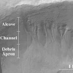
Alcove, channel, and debris apron of recent gullies on Mars. Image credit: NASA Click to enlarge
NASA scientists say liquid water formed recent gullies on Mars.

A NASA-led team will present its Mars gully findings at the American Astronomical Society’s Division for Planetary Sciences annual meeting in Cambridge, England, Sept. 5, 2005.

“The gullies may be sites of near-surface water on present-day Mars and should be considered as prime astrobiological target sites for future exploration,” ventured National Research Council scientist Jennifer Heldmann, principal author of the study who works at NASA Ames Research Center in California’s Silicon Valley.

“The gully sites may also be of prime importance for human exploration of Mars because they may represent locations of relatively near surface liquid water, which can be accessed by crews drilling on the red planet,” she added.

“If liquid water pops out onto Mars’ surface, it can create short gullies about 550-yards (500-meters) long,” Heldmann said. “We used a computer to simulate the flow of liquid water within gully channels,” Heldmann explained.

“Our model indicates that these fluvially-carved gullies were formed in the low temperature and low pressure conditions of present-day Mars by the action of relatively pure liquid water,” said Heldmann.

The science team found that the maximum length of gullies simulated in the computer models were comparable to the martian gullies studied. “We find that the short length of the gully features implies they did form under conditions similar to those on present-day Mars, with simultaneous freezing and rapid evaporation of nearly pure liquid water,” Heldmann said.

In addition, images taken by the Mars Global Surveyor spacecraft show ‘geologically young’ small-scale features on the red planet that resemble terrestrial water-carved gullies, according to scientists.

“The young geologic age of these gullies is often thought to be a paradox, because liquid water is unstable at the martian surface,” Heldmann said. At present martian air pressure and temperature, water will boil and freeze at very rapid rates, the scientists reported.

Team scientists noticed that images of some of Mars’ gullies show that they taper off into very small debris fields ? or no debris fields at all ? suggesting that water rushing through the gullies rapidly froze and/or evaporated.

“In the martian case, fluid well above the boiling point (which is a very low temperature at Mars’ low atmospheric pressure and air temperature) is suddenly exposed to the atmosphere,” said Heldmann. “The difference between the vapor and ambient pressures relative to the ambient pressure is large, and flash boiling can occur, leading to a violent loss of fluid.”

Scientists believe that ice probably would not accumulate in the gullies, because of the rapid evaporation of water and relatively high flow velocities, but in some cases, some ice could be carried downstream. The researchers studied computer simulations of both scenarios.

“We tested our model using known flow parameters and environmental conditions of perennial saline springs in the Mars analog environment of the Canadian High Arctic,” Heldmann noted.

In addition to Heldmann, Chris McKay, also of NASA Ames; Brian Toon, Michael Mellon and John Pitlick, of the University of Colorado, Boulder; Wayne Pollard, of McGill University, Montreal, Canada; and Dale Andersen, of the SETI Institute, Mountain View, Calif., are study co-authors.

Original Source: NASA News Release

Mineral Mapper Traveling to Mars

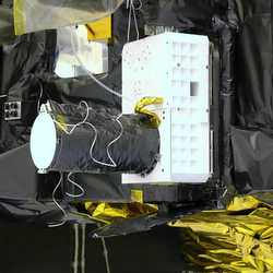
CRISM. Image credit: NASA Click to enlarge
With today?s launch of NASA?s Mars Reconnaissance Orbiter spacecraft from Cape Canaveral Air Force Station, Fla., the Compact Reconnaissance Imaging Spectrometer for Mars ? or CRISM ? joins the set of high-tech detectives seeking traces of water on the red planet.

Built by the Johns Hopkins University Applied Physics Laboratory (APL) in Laurel, Md., CRISM is the first visible-infrared spectrometer to fly on a NASA Mars mission. Its primary job: look for the residue of minerals that form in the presence of water, the ?fingerprints? left by evaporated hot springs, thermal vents, lakes or ponds on Mars when water could have existed on the surface.

With unprecedented clarity, CRISM will map areas on the martian surface down to house-sized scales ? as small as 60 feet (about 18 meters) across ? when the spacecraft is in its average orbit altitude of about 190 miles (more than 300 kilometers).

?CRISM plays a very important role in Mars exploration,? says APL?s Dr. Scott Murchie, the instrument?s principal investigator. ?Our data will identify sites most likely to have contained water, and which would make the best potential landing sites for future missions seeking fossils or even traces of life on Mars.?

Though certain landforms provide evidence that water may once have flowed on Mars, Murchie says scientists have little evidence of sites containing mineral deposits created by long-term interaction between water and rock. The NASA Rover Opportunity found evidence for liquid water in Meridian Planum ? a large plain near Mars? equator ? but that is only one of many hundreds of sites where future spacecraft could land.

Peering through a telescope with a 4-inch (10-centimeter) aperture, and with a greater capability to map spectral variations than any similar instrument sent to another planet, CRISM will read 544 ?colors? in reflected sunlight to detect minerals in the surface. Its highest resolution is about 20 times sharper than any previous look at Mars in infrared wavelengths.

?At infrared wavelengths, rocks that look absolutely the same to human eyes become very different,? Murchie says. ?CRISM has the capability to take images in which different rocks will ?light up? in different colors.?

CRISM is mounted on a gimbal, allowing it to follow targets on the surface as the orbiter passes overhead. CRISM will spend the first half of a two-year orbit mission mapping Mars at 650-foot (200-meter) scales, searching for potential study areas. Several thousand promising sites will then be measured in detail at CRISM?s highest spatial and spectral resolution. CRISM will also monitor seasonal variations in dust and ice particles in the atmosphere, supplementing data gathered by the orbiter?s other instruments and providing new clues about the Martian climate.

?CRISM will improve significantly on the mapping technology currently orbiting Mars,? says CRISM Project Manager Peter Bedini, of APL. ?We?ll not only look for future landing sites, but we?ll be able to provide details on information the Mars Exploration Rovers are gathering now. There is a lot more to learn, and after CRISM and the Mars Reconnaissance Orbiter there will still be more to learn. But with this mission we?re taking a big step in exploring and understanding Mars.?

As the Mars Reconnaissance Orbiter cruises to its destination, the CRISM operations team continues to fine-tune the software and systems it will use to command the instrument and receive, read, process, and store a wealth of data from orbit ? more than 10 terabytes when processed back on Earth, enough to fill more than 15,000 compact discs. The spacecraft is set to reach Mars next March, use aerobraking to circularize its orbit, and settle into its science orbit by November 2006.

APL, which has built more than 150 spacecraft instruments over the past four decades, led the effort to develop, integrate and test CRISM. CRISM?s co-investigators are top planetary scientists from Brown University, the Jet Propulsion Laboratory, Northwestern University, Space Science Institute, Washington University in St. Louis, University of Paris, the Applied Coherent Technology Corporation, and NASA?s Goddard Space Flight Center, Ames Research Center and Johnson Space Center.

The Jet Propulsion Laboratory, a division of the California Institute of Technology, Pasadena, manages the Mars Reconnaissance Orbiter mission for NASA’s Science Mission Directorate.

For more information on CRISM and the Mars Reconnaissance Orbiter, including instrument images, visit: http://crism.jhuapl.edu

Original Source: APL News Release

Mars Reconnaissance Orbiter Launched

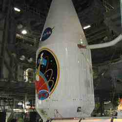
NASA’s Mars Reconnaissance Orbiter (MRO) launch. Image credit: NASA/KSC Click to enlarge
A seven-month flight to Mars began this morning for NASA’s Mars Reconnaissance Orbiter (MRO). It will inspect the red planet in fine detail and assist future landers.

An Atlas V launch vehicle, 19 stories tall with the two-ton spacecraft on top, roared away from Launch Complex 41 at Cape Canaveral Air Force Station at 7:43 a.m. EDT. Its powerful first stage consumed about 200 tons of fuel and oxygen in just over four minutes, then dropped away to let the upper stage finish the job of putting the spacecraft on a path toward Mars. This was the first launch of an interplanetary mission on an Atlas V.

“We have a healthy spacecraft on its way to Mars and a lot of happy people who made this possible,” said James Graf, project manager for MRO at NASA’s Jet Propulsion Laboratory (JPL), Pasadena, Calif.

MRO established radio contact with controllers 61 minutes after launch and within four minutes of separation from the upper stage. Initial contact came through an antenna at the Japan Aerospace Exploration Agency’s Uchinoura Space Center in southern Japan.

Health and status information about the orbiter’s subsystems were received through Uchinoura and the Goldstone, Calif., antenna station of NASA’s Deep Space Network. By 14 minutes after separation, the craft’s solar panels finished unfolding, enabling the MRO to start recharging batteries and operate as a fully functional spacecraft.

The orbiter carries six scientific instruments for examining the surface, atmosphere and subsurface of Mars in unprecedented detail from low orbit. For example, its high-resolution camera will reveal features as small as a dishwasher. NASA expects to get several times more data about Mars from MRO than from all previous Martian missions combined.

Researchers will use the instruments to learn more about the history and distribution of Mars’ water. That information will improve understanding of planetary climate change and will help guide the quest to answer whether Mars ever supported life. The orbiter will also evaluate potential landing sites for future missions. MRO will use its high-data-rate communications system to relay information between Mars surface missions and Earth.

Mars is 72 million miles from Earth today, but the spacecraft will travel more than four times that distance on its outbound-arc trajectory to intercept the red planet on March 10, 2006. The cruise period will be busy with checkups, calibrations and trajectory adjustments.

On arrival day, the spacecraft will fire its engines and slow itself enough for Martian gravity to capture it into a very elongated orbit. The spacecraft will spend half a year gradually shrinking and shaping its orbit by “aerobraking,” a technique using the friction of carefully calculated dips into the upper atmosphere to slow the vehicle. The mission’s main science phase is scheduled to begin in November 2006.

The launch was originally scheduled for August 10, but was delayed first due to a gyroscope issue on a different Atlas V, and the next day because of a software glitch.

The mission is managed by JPL, a division of the California Institute of Technology, Pasadena, for the NASA Science Mission Directorate. Lockheed Martin Space Systems, Denver, prime contractor for the project, built both the spacecraft and the launch vehicle.

NASA’s Launch Services Program at the Kennedy Space Center is responsible for government engineering oversight of the Atlas V, spacecraft/launch vehicle integration and launch day countdown management.

For more information about MRO on the Web, visit:
http://www.nasa.gov/mro

Original Source: NASA News Release

Mars Reconnaissance Orbiter Ready for Thursday Launch

The Mars Reconnaissance Orbiter. Image credit: NASA Click to enlarge
NASA’s Mars Reconnaissance Orbiter is ready for a morning launch on Thursday, Aug. 11. The spacecraft will arrive at Mars in March 2006 for a mission to understand the planet’s water riddles and to advance the exploration of the mysterious red planet.

The mission’s first launch opportunity window is 4:50 to 6:35 a.m. PDT, Thursday. If the launch is postponed, additional launch windows open daily at different times each morning through August. For trips from Earth to Mars, the planets move into good position for only a short period every 26 months. The best launch position is when Earth is about to overtake Mars in their concentric racing lanes around the Sun.

“The teams preparing this orbiter and its launch vehicle have done excellent work and kept to schedule. We have a big spacecraft loaded with advanced instruments for inspecting Mars in greater detail than any previous orbiter, and we have the first Atlas V launch vehicle to carry an interplanetary mission. A very potent and exciting combination,” said NASA’s Mars Exploration Program Director Doug McCuistion.

The mission will lift off from Launch Complex 41, Cape Canaveral Air Force Station, Fla. It is the first government launch of Lockheed Martin’s Atlas V launch vehicle. “We’re ready to fly, counting down through final procedures,” said Chuck Dovale, director for expendable-launch-vehicle launches at NASA Kennedy Space Center, Fla.

When the Mars Reconnaissance Orbiter arrives in March, it begins a half-year “aerobraking” process. The spacecraft will gradually adjust the shape of its orbit by using friction from carefully calculated dips into the top of the Martian atmosphere. The mission?s primary science phase starts in November 2006.

“Mars Reconnaissance Orbiter will give us several times more data about Mars than all previous missions combined,” said James Graf, project manager for the mission at NASA’s Jet Propulsion Laboratory, Pasadena Calif.

Researchers will use the data to study the history and distribution of Martian water. Learning more about what has happened to the water will focus searches for possible past or present Martian life. Observations by the orbiter will also support future Mars missions by examining potential landing sites and providing a communications relay between the Martian surface and Earth.

The craft can transmit about 10 times as much data per minute as any previous Mars spacecraft. This will serve both to convey detailed observations of the Martian surface, subsurface and atmosphere by the instruments on the orbiter and enable data relay from other landers on the Martian surface to Earth. NASA plans to launch the Phoenix Mars Scout in 2007 to land on the far northern Martian surface. NASA is also developing an advanced rover, the Mars Science Laboratory, for launch in 2009.

The mission is managed by JPL, a division of the California Institute of Technology, Pasadena, Calif., for the NASA Science Mission Directorate. Lockheed Martin Space Systems, Denver, built the spacecraft and is the prime contractor for the project.

NASA’s Launch Services Program at the Kennedy Space Center is responsible for government engineering oversight of the Atlas V, spacecraft/launch vehicle integration and launch day countdown management.

For more information about the Mars Reconnaissance Orbiter on the Web, visit: http://www.nasa.gov/mro.

Original Source: NASA News Release

Trick Plants to Grow on Mars

Peas growing onboard the International Space Station. Image credit: The crew of ISS Expedition 6, NASA. Click to enlarge
Anxiety can be a good thing. It alerts you that something may be wrong, that danger may be close. It helps initiate signals that get you ready to act. But, while an occasional bit of anxiety can save your life, constant anxiety causes great harm. The hormones that yank your body to high alert also damage your brain, your immune system and more if they flood through your body all the time.

Plants don’t get anxious in the same way that humans do. But they do suffer from stress, and they deal with it in much the same way. They produce a chemical signal — superoxide (O2-) — that puts the rest of the plant on high alert. Superoxide, however, is toxic; too much of it will end up harming the plant.

This could be a problem for plants on Mars.

According to the Vision for Space Exploration, humans will visit and explore Mars in the decades ahead. Inevitably, they’ll want to take plants with them. Plants provide food, oxygen, companionship and a patch of green far from home.

On Mars, plants would have to tolerate conditions that usually cause them a great deal of stress — severe cold, drought, low air pressure, soils that they didn’t evolve for. But plant physiologist Wendy Boss and microbiologist Amy Grunden of North Carolina State University believe they can develop plants that can live in these conditions. Their work is supported by the NASA Institute for Advanced Concepts.

Stress management is key: Oddly, there are already Earth creatures that thrive in Mars-like conditions. They’re not plants, though. They’re some of Earth’s earliest life forms–ancient microbes that live at the bottom of the ocean, or deep within Arctic ice. Boss and Grunden hope to produce Mars-friendly plants by borrowing genes from these extreme-loving microbes. And the first genes they’re taking are those that will strengthen the plants’ ability to deal with stress.

Ordinary plants already possess a way to detoxify superoxide, but the researchers believe that a microbe known as Pyrococcus furiosus uses one that may work better. P. furiosus lives in a superheated vent at the bottom of the ocean, but periodically it gets spewed out into cold sea water. So, unlike the detoxification pathways in plants, the ones in P. furiosus function over an astonishing 100+ degree Celsius range in temperature. That’s a swing that could match what plants experience in a greenhouse on Mars.

The researchers have already introduced a P. furiosus gene into a small, fast-growing plant known as arabidopsis. “We have our first little seedlings,” says Boss. “We’ll grow them up and collect seeds to produce a second and then a third generation.” In about one and a half to two years, they hope to have plants that each have two copies of the new genes. At that point they’ll be able to study how the genes perform: whether they produce functional enzymes, whether they do indeed help the plant survive, or whether they hurt it in some way, instead.

Eventually, they hope to pluck genes from other extremophile microbes — genes that will enable the plants to withstand drought, cold, low air pressure, and so on.

The goal, of course, is not to develop plants that can merely survive Martian conditions. To be truly useful, the plants will need to thrive: to produce crops, to recycle wastes, and so on. “What you want in a greenhouse on Mars,” says Boss, “is something that will grow and be robust in a marginal environment.”

In stressful conditions, notes Grunden, plants often partially shut down. They stop growing and reproducing, and instead focus their efforts on staying alive–and nothing more. By inserting microbial genes into the plants, Boss and Grunden hope to change that.

“By using genes from other sources,” explains Grunden, “you’re tricking the plant, because it can’t regulate those genes the way it would regulate its own. We’re hoping to [short-circuit] the plant’s ability to shut down its own metabolism in response to stress.”

If Boss and Grunden are successful, their work could make a huge difference to humans living in marginal environments here on Earth. In many third-world countries, says Boss, “extending the crop a week or two when the drought comes could give you the final harvest you need to last through winter. If we could increase drought resistance, or cold tolerance, and extend the growing season, that could make a big difference in the lives of a lot of people.”

Their project is a long-term one, emphasize the scientists. “It’ll be a year and a half before we actually have [the first gene] in a plant that we can test,” points out Grunden. It’ll be even longer before there’s a cold- and drought-loving tomato plant on Mars–or even in North Dakota. But Grunden and Boss remain convinced they will succeed.

“There’s a treasure trove of extremophiles out there,” says Grunden. “So if one doesn’t work, you can just go on to the next organism that produces a slightly different variant of what you want.”

“Amy’s right,” agrees Boss. “It is a treasure trove. And it’s just so exciting.”

Original Source: NASA News Release

Mars Reconnaissance Orbiter Will Launch on August 10

Perspective view of Reull Vallis. Image credit: ESA Click to enlarge
The Mars Reconnaissance Orbiter, set to launch on August 10, will search for evidence that liquid water once persisted on the surface of Mars. This orbiter also will provide detailed surveys of the planet, identifying any obstacles that could jeopardize the safety of future landers and rovers.

Jim Graf, Project Manager for the Mars Reconnaissance Orbiter, gave a talk where he provided an overview of the mission. In part one of this edited transcript, Graf discusses previous studies of Mars, and describes the steps that will put MRO in orbit around the Red Planet.

“In the 1900s, our knowledge of Mars was based on looking at albedo features, the bright and dark spots. And, guess what? They moved all over. We didn’t know about the dust storms that cover the planet, since all we could do was look at Mars through a telescope from afar. We also saw a lot of straight lines, and some people believed those lines were canals that brought water from the poles down to the arid regions. There were little green men running around in oases all over.

Fast-forward sixty-five years to when Mariner 4 came by, we saw a moon-like surface: craters, no real water, devoid of life, no Martians, no oases, no canals. At that particular point in time we said, ‘There’s nothing really there. Let’s go look elsewhere.’ But thankfully, future Mariners were in the queue and already had been approved for going to Mars to investigate it more thoroughly. When they arrived there, our image of Mars changed. We saw evidence that water once flowed on the surface. There were craters that had been partly subsumed, crater walls that were partly destroyed as if water flowed by. Other images showed almost delta-like regions, where water had been captured in one area and then came down in streams and gullies.

The wide angle view of the martian north polar cap was acquired on March 13, 1999, during early northern summer. The light-toned surfaces are residual water ice that remains through the summer season. The nearly circular band of dark material surrounding the cap consists mainly of sand dunes formed and shaped by wind. Credit: NASA/JPL/Malin Space Science Systems

We’ve had a lot of orbiters since the Mariner missions, and not only do we see water features in the land, but we also see evidence of tectonics, or possibly volcanic activity. Olympus Mons is the largest volcano in the solar system. Valles Marineris, named after the Mariner spacecraft that found it, is 4,000 kilometers wide, the same distance across as the United States, and it’s 6 kilometers deep. It has tributaries that dwarf our Grand Canyon. So the planet has started coming alive, not with Martians, but geologically.

The thermal emission spectrometer on Mars Global Surveyor told us about the minerals in the surface. We saw hematite in one particular area on the planet. If you look at this area through a regular telescope there is nothing to suggest that there was once water there. But if you look at it through a spectrometer, you can see the minerals and say, ‘There’s hematite there. On Earth, hematite is generally created at the base of lakes and rivers. So, what made that hematite on Mars?’

We decided to send the Opportunity rover there. It landed in Eagle Crater, which is about 20 meters in diameter and has a very flat surface. There are little nodules called ‘blueberries’ on this surface, and these nodules contained the hematite that was seen from orbit. After months of intense investigation with the rover, we think there was standing water in this area that created the hematite.

The rover is investigating an area that’s only about a kilometer or two in area – that’s all it can rove and see. So you’ve got to ask yourself, ‘Is the rest of the planet like this?’ And the answer is no. The Spirit rover landed on the other side of the planet, in Gusev Crater, and it’s very different geologically from where Opportunity landed.

It’s wonderful to have two intensive investigations on opposite sides of the planet. But there’s a lot more to the planet than just those two sites. From orbit, these sites are just pinpricks.

Mars is a dynamic planet, and we really need the yin and the yang of a lander and orbiter to understand it. A lander goes down and intensively investigates a particular area, and then orbiters take that basic knowledge and apply it to the entire globe.

The Mars Reconnaissance Orbiter — affectionately known as MRO, or Mister O — will take that basic knowledge we have from the landers, and use the most advanced instruments that we can develop to investigate the entire planet. We want to characterize the present climate on Mars, and to look for changes in that climate. We want to study complex, layered terrain, and understand why it came about. And, most of all, we want to find evidence of water. On Earth, wherever you have water, plus the basic nutrients and energy, you will find life. So if we find liquid water on Mars, we may also find life there, or life that was there at one time. So one of our objectives for MRO is to follow the water.

When you only have two landers in a decade, you want to put them down in some place on that vast planet where you know you’re going to get the maximum science. That’s what we did with Opportunity, sending it to where we saw hematite from orbit. We have two more landers coming up: one in ’07 and one in ’09. Where are we going to land those? MRO will provide information on composition, which will tell you where you want to go scientifically, and it will provide detailed imaging, which will tell you where you can go safely.

Once the landers are down on the surface, we have to get the data from them back to Earth. MRO will provide a basic fundamental link for those landers, so they can send an immense amount of data back, taking full advantage of the huge telecommunications system that we have onboard the spacecraft.

There are five phases to the MRO mission. We like to think of it as MRO’s five easy pieces. We say that ironically, because none of these are easy.

The first one is the launch. I think of it as a wedding. You spend years and years getting ready for it and it’s over in a few hours, and it better go right or else you’re never going to be able to recover.

Then we have a cruise phase, where we leave Earth orbit and head to Mars. It takes about seven months to get there.

Third, we have the approach and orbit insertion. This is where we’ll have so much energy that we’d fly right by the planet. We’ll have to fire our thrusters to slow ourselves down so gravity can catch us and bring us into orbit. It’s white-knuckle time.

After that, we get into what we consider to be the most dangerous phase: the aerobraking. We dip into the atmosphere a little bit at a time, taking energy out of the orbit.

Finally, we get to the gravy. We turn the science instruments on and we get two Earth years worth of science, plus two more years worth of relay support, with the main mission ending in December of 2010.

So let’s go back and talk about each phase. First, we’ll be launched August 10, 2005 at 8:00 in the morning Eastern Time, on an Atlas V-401 rocket. This type of vehicle has flown twice before and our particular vehicle, oddly enough, has a serial number of 007. I like to think of it as License to Recon.’

It has two stages. The first stage uses RD-180 engines that come from Russia, and it will launch us on our way. Eventually it will burn out and we will separate the first and second stage, go through a coast period, fire the second stage – we actually fire it twice, and the second time is a long burn – and that puts us on our cruise phase.

Once we’re in orbit, we deploy our solar arrays and our high-gain antenna, which is used for communicating back to Earth. This is when all the major deployments are done. This is different from other missions that had to do additional major deployments once they got to Mars.

When we approach Mars, we will go under the south pole. As we start coming up on the other side, we will fire our main engines. We have six engines, and each puts out 170 Newtons of thrust, so we have over 900 Newtons that will be fired. We will fire our hydrazine thrusters for about 30 minutes. Then we go behind the planet, and we will not have any telemetry at that particular point in time until the burn is completed and the spacecraft emerges from behind Mars.

When that happens, we will be in a very elliptical orbit. Our orbit will extend out from the planet at the furthest point – apoapsis – about 35,000 kilometers and we will be about 200 kilometers at the closest point. This sets up the next phase, the aerobraking.

In aerobraking, we will use the backs of the solar arrays, the body of the spacecraft, and the back of the high-gain antennae to create drag, slowing us down as it goes through the atmosphere. So, every time we are close to the planet, we will dip through the atmosphere and slow ourselves down. Now the way orbital mechanics work, if you take energy out through drag, you bring the apoapsis down. So over about a seven to eight month period, we will dip into the planet’s atmosphere 514 times, slowly bringing our orbit down to our final science orbit.

Then we get into the gravy of doing the science. Removing the covers off our instruments are the last minor deployments that we have to do, and then we start acquiring data. We can acquire data over the entire planet — the mountains, the valleys, the poles — for two years.”

Original Source: NASA Astrobiology

Mars Express Preparing to Look Underground

Artist’s impression of MARSIS deployment complete. Image credit: ESA Click to enlarge
MARSIS, the sounding radar on board ESA?s Mars Express spacecraft, is collecting the first data about the surface and the ionosphere of Mars.

The radar started its science operations on 4 July 2005, after the first phase of its commissioning was concluded on the same day. Due to the late deployment of MARSIS, it was decided to split the commissioning, originally planned to last four weeks, into two phases, one of which has just ended and the second one to be started by December this year.

This has given the instrument the chance to start scientific observations earlier than initially foreseen, while still in the Martian night. This is the environmental condition favourable to subsurface sounding, because the ionosphere is more ?energised? during the daytime and disturbs the radio signals used for subsurface observations.

From the beginning of the commissioning, the two 20-metre long antenna booms have been sending radio signals towards the Martian surface and receiving echoes back. ?The commissioning phase confirmed that the radar is working very well, and that it can be operated at full power without interfering with any of the spacecraft systems,? says Roberto Seu, Instrument Manager for MARSIS, from the University of Rome ?La Sapienza?, Italy.

MARSIS is a very complex instrument, capable of operating at different frequency bands. Lower frequencies are best suited to probe the subsurface and the highest frequencies are used to probe shallow subsurface depths, while all frequencies are suited to study the surface and the upper atmospheric layer of Mars.

?During the commissioning we have worked to test all transmission modes and optimise the radar performance around Mars,? says Prof. Giovanni Picardi, Principal Investigator for MARSIS, University of Rome ?La Sapienza?. ?The result is that since we have started the scientific observations in early July, we are receiving very clean surface echoes back, and first indication about the ionosphere.?

The MARSIS radar is designed to operate around the orbit ?pericentre?, when the spacecraft is closer to the planet?s surface. In each orbit, the radar has been switched on for 36 minutes around this point, dedicating the central 26 minutes to subsurface observations and the first and last five minutes of the slot to active ionosphere sounding.

Using the lower frequencies, MARSIS has been mainly investigating on the northern flat areas between 30? and 70? latitudes, at all longitudes. ?We are very satisfied about the way the radar is performing. In fact, the surface measurements taken so far match almost perfectly with the existing models of the Mars topography,? said Prof. Picardi. Thus, these measurements provided an excellent test.

The scientific reason to concentrate the first data analysis on flat regions lies in the fact that the subsurface layers here are in principle easier to identify, but the question is still tricky. ?As the radar is appearing to work so well for the surface, we have good reasons to think that the radio waves are correctly propagating also below the surface,? added Prof. Picardi.

?The biggest part of our work just started, as we now have to be sure that we clearly identify and isolate those echoes that come from the subsurface. To do this, we have to carefully screen all data and make sure that signals that could be interpreted as coming from different underground layers are not actually produced by surface irregularities. This will keep us occupied for a few more weeks at least.?

The first ionospheric measurements performed by MARSIS have also revealed some interesting preliminary findings. The radar responds directly to the number of charged particles composing the ionosphere (plasma). This has shown to be higher than expected at times.

?We are now analysing the data to find out if such measurements may result from sudden increases of solar activity, like the one observed on 14 July, or if we have to make new hypotheses. Only further analysis of the data can tell us,? said Jeffrey Plaut, Co-Principal Investigator, from NASA Jet Propulsion Laboratory, Pasadena, USA.

MARSIS will continue send signals to hit the surface and penetrate the subsurface until the middle of August, when the nighttime portion of the observations will have almost ended. After that, observation priority will be given to other Mars Express instruments that are best suited to work during daytime, such as the HRSC camera and the OMEGA mapping spectrometer.

However, MARSIS will continue surface and ionospheric investigations during daytime, with the ionospheric sounding being reserved for more than 20% percent of all Mars Express orbits, in all possible Sun illumination conditions.

In December 2005, the Mars Express orbit pericentre will enter the nighttime again. By then, the pericentre will have moved closer to the South pole, allowing MARSIS to restart optimal probing of the subsurface, this time in the southern hemisphere.

Original Source: ESA Portal

Is Methane Evidence of Life on Mars?

Mars. Image credit: NASA Click to enlarge
Are microbes making the methane that’s been found on Mars, or does the hydrocarbon gas come from geological processes? It’s the question that everybody wants to answer, but nobody can. What will it take to convince the jury?

Many experts told Astrobiology Magazine that the best way to judge whether methane has a biological origin is to look at the ratio of carbon-12 (C-12) to carbon-13 (C-13) in the molecules. Living organisms preferentially take up the lighter C-12 isotopes as they assemble methane, and that chemical signature remains until the molecule is destroyed.

“There may be a way of distinguishing the origin of methane, whether biogenic or not, by using stable isotope measurements,” says Barbara Sherwood Lollar, an isotope chemist at the University of Toronto.

But isotope signals are subtle, best performed by accurate spectrometers placed on the martian surface rather than on an orbiting spacecraft orbit.

And there are complications. For one thing, an average martian methane level of 10 parts per billion (ppb) may be too faint for accurate isotope measurement, even for a spectroscope placed on Mars. Also, the C-12 to C-13 ratio of methane alone is not always proof of life. For example, the “Lost City” hydrothermal vent field in the Atlantic Ocean did not show a clear isotope signature, says James Kasting, professor of earth and mineral science at Penn State University.

“The methane is not that strongly fractionated, but they still think it might be biological,” says Kasting. “At Lost City, you can’t figure out if it’s biological or not by the isotopes. How are we going to figure that out on Mars?”

By expanding the search, responds Sherwood Lollar. Instead of measuring only carbon, she suggests measuring hydrogen isotopes, because biological systems also prefer hydrogen (H) to the heavier deuterium (2H).

A second approach would look at the longer, heavier hydrocarbons — ethane, propane and butane — that are related to methane, and that sometimes appear with biogenic or abiogenic methane. Sherwood Lollar detected these hydrocarbons while investigating abiogenic methane trapped in pores in ancient rocks in the Canadian Shield, a large deposit of Precambrian igneous rock. “When the water gets trapped over very, very long time periods,” she says, an abiogenic reaction between water and rock makes methane, ethane, propane and butane.

If the longer-chain abiogenic hydrocarbons are ever detected in the martian atmosphere, how could we distinguish them from similar hydrocarbons that are the breakdown products of kerogen, a remnant of decomposing living matter? The answer, Sherwood Lollar repeats, could be found in the isotopes. Abiogenic hydrocarbon chains would contain a higher proportion of heavier isotopes than the hydrocarbon chains derived from the breakdown of kerogen.

“Future missions to Mars plan to look for the presence of higher hydrocarbons as well as methane,” Sherwood Lollar says. “If this isotopic pattern can be identified in martian methane and ethane for instance, then this type of information could help resolve abiogenic versus biogenic origin.”

Isotopes figure prominently in several upcoming space missions that could slake the growing thirst for evidence on the methane mystery:

* The Phoenix lander, scheduled for launch in August 2007, will go to an ice-rich region near the North Pole, and “dig up dirt and analyze the dirt, along with the ice,” says William Boynton of the University of Arizona, who will direct the mission. The lander’s mass spectrometer will measure isotopes in any methane trapped in the soil, if the concentration is sufficient. “We won’t be able to measure the isotope ratio [in the atmosphere], because it won’t be a high enough concentration,” Boynton says.

* Mars Science Laboratory, scheduled for launch sometime between 2009 and 2011, is a 3,000-kilogram, six-wheel rover packed with scientific instruments. The tunable laser spectrometer and mass spectrometer-gas chromatograph may both be able to ferret out isotope ratios of carbon and other elements.

* Beagle 3, a successor to Britain’s lost-in-space Beagle 2, may carry an improved mass spectrometer capable of measuring carbon isotope ratios, but the project has yet to be approved. The craft would not launch until at least 2009.

From these launch dates, it’s clear the jury on this who-dun-it must remain sequestered for years, until hard data on the source of methane on Mars can be aired in the scientific courtroom. At this point, it’s fair to say that many expert witnesses take the possibility of a biogenic source rather seriously. For example, Vladimir Krasnopolsky, who led one of the teams that found methane on the planet, says, “Bacteria, I think, are plausible sources of methane on Mars, the most likely source.” But he expects the microbes to be found in oases, “because the martian conditions are very hostile to life. I think these bacteria may exist in some locations where conditions are warm and wet.”

That observation points to a possible win-win situation for those who want to find life on Mars, says Timothy Kral of the University of Arkansas, who grows methanogens for a living. If, as calculations suggest, asteroids and comets are not a likely to be delivering methane to Mars, then either methane-making organisms must be living in the subsurface, or there is a place where it’s warm enough for abiogenic generation.

“Even though it is not an indication of life directly, it’s an indication that there is warming,” says Kral. In those conditions, “there is heat, energy for organisms to grow.”

A lot has changed in the past year. Kral, who has spent a dozen years growing methanogens in a simulated martian environment, says, “Prior to last year, when people asked if I thought there was life on Mars, I would giggle. I would not be in this business if I did not think it was possible, but there was no real evidence for any life. Then, all of a sudden, last year, they found methane in the atmosphere, and we suddenly have a piece of real scientific evidence saying that it’s possible” that Mars is the second living planet.

Original Source: NASA Astrobiology
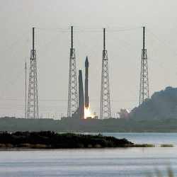
Water Ice in a Martian Crater

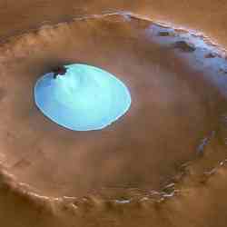
Perspective view of crater with water ice. Image credit: ESA Click to enlarge
This image, taken by the High Resolution Stereo Camera (HRSC) on board ESA?s Mars Express spacecraft, shows a patch of water ice sitting on the floor of an unnamed crater near the Martian north pole.

The HRSC obtained this image during orbit 1343 with a ground resolution of approximately 15 metres per pixel. The unnamed impact crater is located on Vastitas Borealis, a broad plain that covers much of Mars’s far northern latitudes, at approximately 70.5? North and 103? East.

The crater is 35 kilometres wide and has a maximum depth of approximately 2 kilometres beneath the crater rim. The circular patch of bright material located at the centre of the crater is residual water ice.

This white patch is present all year round, as the temperature and pressure are not high enough to allow sublimation of water ice.

It cannot be frozen carbon dioxide since carbon dioxide ice had already disappeared from the north polar cap at the time the image was taken (late summer in the Martian northern hemisphere).

There is a height difference of 200 metres between the crater floor and the surface of this bright material, which cannot be attributed solely to water ice.

It is probably mostly due to a large dune field lying beneath this ice layer. Indeed, some of these dunes are exposed at the easternmost edge of the ice.

Faint traces of water ice are also visible along the rim of the crater and on the crater walls. The absence of ice along the north-west rim and walls may occur because this area receives more sunlight due to the Sun?s orientation, as highlighted in the perspective view.

Original Source: ESA Mars Express