Opportunity Checks the Edge of the Crater

Image credit: NASA/JPL
NASA’s Mars Opportunity rover began its latest adventure today inside the martian crater informally called Endurance. Opportunity will roll in with all six wheels, then back out to the rim to check traction by looking at its own track marks.

“We’re going in, but we’re doing it cautiously,” said Jim Erickson, deputy project manager for the Mars Exploration Rovers at NASA’s Jet Propulsion Laboratory, Pasadena, Calif. Barring any surprises, Opportunity will enter the stadium-sized crater Wednesday for two to three weeks of scientific studies.

“NASA has made a careful decision. The potential science benefits of sending Opportunity into the crater are well worth the calculated risk the rover might not be able to climb back out,” said JPL’s Dr. Firouz Naderi, manager of NASA’s Mars Exploration Program. “Inside the Endurance crater waits the possibility for the most compelling science investigations Opportunity could add to what it has already accomplished. We have done the ground testing necessary to evaluate the likelihood of exiting the crater afterwards.”

“Spirit and Opportunity are well into their bonus periods after successfully completing their three-month primary missions in April,” Naderi said. “Both rovers are starting new chapters. Spirit is within a stone’s throw of Columbia Hills, and Opportunity is entering the crater.”

Dr. Steve Squyres of Cornell University, Ithaca, N.Y., the rovers’ principal investigator, said, “We expect the science return of going a short way into Endurance to be very high.” The target for inspection within the crater is an exposure of rock layers beneath a layer that corresponds to rocks Opportunity previously examined in the shallower Eagle crater, where the rover landed in January.

The sulfur-rich layer seen in Eagle yielded evidence that a body of gently flowing water once covered the area. The underlying rock layers come from an earlier period. Opportunity’s observations from the rim of Endurance already have shown their composition differs from the Eagle crater’s layers.

“If there was a change in rock type, there was a change in environment,” Squyres said. “This unit will tell us what came before the salty water environment the Eagle crater unit told us about. We want to get to the contact between the two units to see how the environment changed. Is it gradual? Is it abrupt?” Even if the lower layers formed under dry conditions, they may have been exposed to water later. The water’s effect on them could have left telltale evidence of that interaction.”

One section of the target outcrop is only five to seven meters (16 to 23 feet) from the crater rim in an area dubbed Karatepe. The rover team’s plan is to get there, examine the rocks for several days, and then exit the crater. Reaching lower-priority targets, like at the bottom of the crater, would entail driving on sand, with a higher risk of not getting out again.

The strategy for driving on the crater’s inner slope is to keep wheels on rock surfaces instead of sand, said JPL rover-mobility engineer Randy Lindemann. The team ran trials with a test rover on a surface specifically built to simulate Karatepe’s surface conditions. “The tests indicate we have a substantial margin of safety for going up a rocky slope of 25 degrees,” Lindemann said. Opportunity’s observations from the rim at the top of the planned entry route show a slope of less than 20 degrees.

Spirit, launched one year ago Thursday, has driven more than 3.2 kilometers (2 miles) inside the Gusev Crater. A trench it dug in May exposed soil with relatively high levels of sulfur and magnesium, reported Dr. Johannes Brueckner, of Max-Planck-Institut fuer Chemie, Mainz, Germany. Spirit’s alpha particle X-ray spectrometer showed concentrations of these two elements varied in parallel at different locations in the trench, suggesting they may be paired as a magnesium sulfate salt.

Squyres said, “The most likely explanation is water percolated through the subsurface and dissolved out minerals. As the water evaporated near the surface, it left concentrated salts behind. I’m not talking about a standing body of water like we saw signs of at Eagle crater, but we also have an emerging story of subsurface water at Gusev,” he said.

JPL, a division of the California Institute of Technology in Pasadena, manages the Mars Exploration Rover project for NASA’s Office of Space Science, Washington, D.C.

For images and information about the Mars project on the Internet, visit http://marsrovers.jpl.nasa.gov & http://athena.cornell.edu.

Original Source: NASA/JPL News Release

Opportunity’s Exit Strategy

Image credit: NASA/JPL
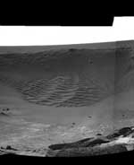
The Opportunity rover continues to cruise around the rocky rim of Endurance Crater, which is about stadium-sized in diameter. The false color image (banner) was taken by the navigation camera on May 21, 2004. This crater excavated by the impact of a tiny asteroid or a piece of a comet is about 130 meters (430 feet) wide and, from the highest point on the rim, more than 20 meters (66 feet) deep, 10 times as deep as Eagle.

An exposure of outcrop in a cliff high on the inner wall across from the rover’s current position reveals a stack of layers 5 to 10 meters (16 to 33 feet) tall. Other exposures around the inner slope of the crater may be more accessible than the cliff, and chunks from the same layers may have been thrown out onto surrounding ground by the crater-forming impact.

Team members are analyzing images like these in detail while searching for the safest route to enter and exit the steep crater. In addition to slope, good entry and exit paths are sought where stable rock predominates over loose sand which may cause slippage or loss of wheel traction. The best current candidate is a portion of Endurance called Karatepe.

In the Mars simulation environment on Earth, called the JPL sandbox or ‘Mars Yard’, mobility experts, scientists and engineers are testing the rover’s slip limits at a twenty-five degree tilt.

Inside Endurance Crater are multiple layers of exposed rocks that might provide information about a much longer period of environmental history. From the viewpoints around the rim, Opportunity’s miniature thermal emission spectrometer is returning data for mapping the mineral composition of the rocks exposed in the crater’s interior.

At Eagle Crater, an outcrop of bedrock only about the height of a street curb yielded evidence that the site was once covered by a body of salty water deep enough to splash in. “That was the last dying gasp of a body of water,” principal investigator Steve Squyres said. “The question that has intrigued us since we left Eagle Crater is what preceded that. Was there a deep body of water for a long time? Was there a shallow, short-lived playa? We don’t know.”

Although the stack of rock layers at Endurance is more than 10 times thicker than the bedrock exposure at Eagle Crater, it is still only a small fraction of the 200-meter-thick (650-foot-thick) stack seen from orbit at some other locations in Mars’ Meridian Planum region.

A close-up look at the Endurance Crater rocks could help with interpreting the other exposures seen from orbit. “It’s possible that the whole stack was deposited in water — some particles washed in by flowing water and others chemically precipitated out of the water,” said Dr. Phil Christensen of Arizona State University, Tempe, lead scientist for the rover’s spectrometer. “An alternative is that wind blew sand in.”

Brian Cooper, leader of JPL’s squad of rover drivers for Spirit and Opportunity, said the initial view of the crater doesn’t settle accessibility questions yet. “The slope right in front of us averages 18 to 20 degrees. Getting into the crater is no problem, but we have a lot more work to do to assess whether we could get back out. That depends on soil properties and slippage, as well as slope.” The planned circuit around the rim will also require careful navigation. “If you don’t go close enough to the lip, you can’t look in, but if you go too far, you could fall in,” he said. “We’re going to have a very interesting few weeks.”

When the rover tried to exit its much smaller (20 meter diameter) Eagle Crater–the mission’s initial landing site–the exit slope proved steep enough to lose wheel traction until a backup plan to maneuver through loose sand friction with six-wheel contacts.

When NASA sent astronauts to the lunar surface more than 30 years ago, it was decided not to allow them to enter craters as fresh and steep as Endurance, but Opportunity may be able to do what no human has done before on another planet.

Original Source: Astrobiology Magazine

Opportunity Will Enter the Crater

Image credit: NASA/JPL
NASA has decided the potential science value gained by sending Opportunity into a martian impact crater likely outweighs the risk of the intrepid explorer not being able to get back out.

Opportunity has been examining the rim of stadium-sized “Endurance” crater since late May. The rover team used observations of the depression to evaluate potential science benefits of entering the crater and the traversability of its inner slopes.

The soonest Opportunity could enter Endurance is early next week. It will drive to the top of a prospective entry-and-
exit route on the southern edge of the crater and make a final check of the slope. If the route is no steeper than what recent testing runs at NASA’s Jet Propulsion Laboratory, Pasadena, Calif., suggest a rover can climb, controllers plan to radio Opportunity the command to go into the crater.

“This is a crucial and careful decision for the Mars Exploration Rovers’ extended mission,” said Dr. Edward Weiler, NASA’s Associate Administrator for Space Science. “Layered rock exposures inside Endurance Crater may add significantly to the story of a watery past environment that Opportunity has already begun telling us. The analysis just completed by the rover team shows likelihood that Opportunity will be able to drive to a diagnostic rock exposure, examine it, and then drive out of the crater. However, there’s no guarantee of getting out again, so we also considered what science opportunities outside the crater would be forfeited if the rover spends its remaining operational life inside the crater.”

At a rock outcrop in a small impact feature nicknamed, “Eagle Crater,” where Opportunity first landed, the rover found small-scale rock textures and evaporite mineral compositions testifying that a body of salty water covered the site long ago.

The wet environment may have been a suitable habitat for life, if it ever existed on Mars. However, only the uppermost layer of the region’s layered crust was exposed at Eagle Crater, not deeper layers that could reveal what the environment was like earlier.

The rock layer seen at Eagle Crater appears at Endurance Crater, too. At Endurance, though, it lies above exposures of thicker, older layers, which are the main scientific temptation for sending Opportunity inside the crater.

“Answering the question of what came before the evaporites is the most significant scientific issue we can address with Opportunity at this time,” said Dr. Steve Squyres of Cornell University, Ithaca, N.Y., principal investigator for the science instruments on both rovers. “We’ve read the last chapter, the record of the final gasps of an evaporating body of water. What came before? It could have been a deep-water environment. It could have been sand dunes. It could have been a volcano. Whatever we learn about that earlier period will help us interpret the upper layer’s evidence for a wet environment and understand how the environment changed.”

Richard Cook, project manager at JPL for the rovers, said that reaching one exposure of the older rock layers inside Endurance requires driving only about 5 to 7 meters (16 to 23 feet) into the 130-meter-diameter (140-yard-diameter) crater. The rover is on the rim at that site, which had been dubbed “Karatepe.”

“We’ll take an incremental approach, edging our way down to the target,” Cook said. The plan is to use the tools on Opportunity’s robotic arm to analyze the exposed layers for several days, then drive in reverse back up the slope and exit the crater. The slope between the rim and the layered outcrop at Karatepe is about 25 degrees.

“We have done testing that says we can do 25 degrees, provided the wheels are on a rock surface and not loose sand,” Cook said. Engineers and scientists on the rover team built a test surface mimicking the rocks and sand seen in Opportunity’s images of Endurance Crater. The surface was tilted to 25 degrees, and a test rover climbed it. If portions of the route to the outcrop turn out to be between 25 and 30 degrees, the team plans to proceed slowly and use Opportunity to assess the amount of traction the rover is getting.

Opportunity and its twin, Spirit, successfully completed their primary three-month missions on Mars in April.

JPL, a division of the California Institute of Technology in Pasadena, manages the Mars Exploration Rover project for NASA’s Office of Space Science, Washington. Images and additional information about the project are available from JPL at:

http://marsrovers.jpl.nasa.gov

Spirit Sees Layered Rock in Nearby Hills

Image credit: NASA/JPL
More than a month into bonus time after a successful primary mission on Mars, NASA’s Spirit rover has sighted possibly layered rock in hills just ahead, while twin Opportunity has extended its arm to pockmarked stones on a crater rim to gather clues of a watery past.

Both robotic geologists of the Mars Exploration Rover Project remain healthy. Engineers at NASA’s Jet Propulsion Laboratory, Pasadena, Calif., quickly restored Spirit from two unexpected computer reboots in May triggered by low- probability software glitches. “We had bad luck to hit two very unlikely scenarios just eight days apart, but in both cases the software team was able to figure out the problem within a day,” said Joe Snyder, a Lockheed Martin software engineer on JPL’s rover team.

Spirit has driven more than 2.9 kilometers (1.8 miles) since arriving at Mars five months ago, more than three-fourths of that since completing its three-month primary mission. It now has only about 400 meters (440 yards) to go — possibly less than a week of driving — before reaching the base of a range of hills informally named “Columbia Hills,” which scientists identified in January as a desirable but potentially unreachable destination for the rover.

“This is the first time we’ve ever had a close look at hills on Mars,” said Dr. James Rice of Arizona State University, Tempe, a member of the rovers’ science team. In 1997, hills called “Twin Peaks” tantalized scientists from only about one kilometer (1,100 yards) away from the Mars Pathfinder landing site. “We could only observe Twin Peaks from a distance and wonder about them, but now with a more capable rover we can get to Columbia Hills,” Rice said. He spoke at a press briefing today at JPL.

Rocks in Columbia Hills may provide insight both into both how hills form on Mars and whether the ancient environment at this part of Mars was wet. Images Spirit has taken as it nears the hills already show boulders and potential rock outcrops. “These rocks are much older than what we’ve been driving across,” Rice said. “We could find a lot of geological history locked in them. They may be some of the oldest material ever seen on Mars.”

On the rim of stadium-sized “Endurance Crater,” halfway around Mars from Spirit, Opportunity has been using its microscopic imager to examine the texture of rocks, adding information about a past lake or sea environment that also left its mark in the smaller crater, “Eagle,” where Opportunity landed.

“We’re looking at rocks that have very interesting surface textures,” said science-team member Dr. Wendy Calvin of the University of Nevada, Reno. “These rocks appear to be from the same geological layer as the outcrop at Eagle Crater, but they have some differences from what we saw there.” One rock called “Pyrrho” on the Endurance rim has a braided ripple pattern. Another, “Diogenes,” compared with rocks seen earlier, has more of the disc-shaped cavities that scientists interpret as sites where crystals formed in the rocks, then disappeared as the chemistry of water in the rocks varied.

From an overlook point on the southeastern edge of Endurance, Opportunity used its panoramic camera and miniature thermal emission spectrometer to study the inside of the crater, supplementing a similar survey made earlier from the western edge. Both instruments can be used to assess mineral composition from a distance. “We see a strong basaltic character in the sand at the bottom and in some of the rocks in the wall of the crater,” Calvin said. That is a contrast to the sulfate-rich composition of the overlying layer, which resembles the Eagle Crater outcrop. “We expect the basaltic material to tell us about environmental conditions from an earlier time,” she said.

Scientists and engineers are evaluating the potential science benefits of sending Opportunity into Endurance Crater and assessing whether the rover would be able to climb back out. A decision about whether to enter the crater will be based on those factors.

Mission controllers have begun frequent use of a “deep sleep” mode for Opportunity, reported JPL’s Matt Wallace, mission manager. It is a more complete overnight shutdown that conserves energy but at a calculated tradeoff of risking damage to the miniature thermal emission spectrometer. The strategy has approximately tripled the amount of time the solar-powered rover can work during the day. So far, the spectrometer has survived, but as the martian winter advances, scientists expect to lose the use of that instrument.

JPL, a division of the California Institute of Technology in Pasadena, manages the Mars Exploration Rover project for NASA’s Office of Space Science, Washington, D.C. Images and additional information about the project are available from JPL at http://marsrovers.jpl.nasa.gov and from Cornell University, Ithaca, N.Y., at http://athena.cornell.edu.

Original Source: NASA/JPL News Release

ESA Releases Its Findings on Beagle 2

Image credit: ESA
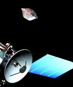
The Mars Express spacecraft, carrying the Beagle 2 lander, was launched on 2 June last year, arriving in the vicinity of Mars in December. The separation of Beagle 2 from Mars Express occurred on 19 December. The satellite continued its mission with its successful insertion into a Mars orbit on 25 December, the day on which Beagle 2 was due to land.

The first radio contact with Beagle 2 was expected shortly after the scheduled landing time but no signal was received. Many radio contacts were attempted over the following days and weeks, but without result. By early February it became clear that there was no prospect of communicating with Beagle 2 and a joint ESA/UK inquiry was set up to investigate the circumstances and possible reasons that prevented completion of the Beagle 2 mission.

The report was commissioned jointly by Lord Sainsbury and ESA?s Director General, Jean-Jacques Dordain. It is not therefore a public inquiry. The Commission of Inquiry was led by ESA?s Inspector General, Ren? Bonnefoy, with David Link (former Director at Matra-Marconi Space, now EADS-Astrium(UK)) as co-Chairman.

The Commission of Inquiry, which included senior managers and experts from within Europe and also NASA and Russia, held several meetings in the UK and in ESA, interviewing the key actors, directors, managers, scientists, and engineers, who participated in the development of Beagle 2. The report has been submitted to the UK Minister for Science and Innovation and the Director General of ESA and accepted. No single technical failure or shortcoming was unambiguously identified but a few credible causes for Beagle 2?s loss were highlighted. More importantly, the Board made it clear that there were programmatic and organisational reasons that led to a significantly higher risk of Beagle 2 failure, than otherwise might have been the case.

The scope of the Inquiry covered a wide range of important issues of concern to the UK, ESA and other Member States in ESA. Some of these matters are necessarily confidential between governments and the Agency and cannot be released.

Furthermore, the development of Beagle 2 entailed close working relations between many firms in the UK. Many of those firms invested their own funds in the project and formed relations which remain commercially sensitive.

Although deciding that the Report should remain confidential, we believe it is important that the full set of Recommendations is published together with our appreciation of lessons learnt. You will, of course, have an opportunity to hear at first hand about our plans to implement those Recommendations and to ask questions.

Lessons learnt
The Inquiry Board has not singled out any act by any individual, nor any technical failure that in itself could have been the unique cause of failure of Beagle 2. In the Inquiry Board?s work, many individual decisions were analysed. However, there are institutional lessons to be learnt, many of which flow from treating the lander as an instrument, which at the time was the standard practice.

The Commission has proposed a set of 19 Recommendations on which the UK Government, ESA and the Beagle 2 project team are agreed. They can be grouped in three parts:

* those concerning best practice when selecting a complex project ? such as the Beagle 2 lander ? assessing its overall benefits and risks, planning means to manage and mitigate risks and ensuring that it is fully integrated within the overall management of the mission;
* those concerned with technical factors which may have contributed to the loss of Beagle 2, for example specification, development and testing of the airbags;
* and those concerning technical enhancements for future landers which would have aided our understanding of events during Beagle 2?s descent and subsequently improved our ability to find it or reactivate it.

In 1997, due to the failure of an earlier Russian mission, equipment was available for a mission to Mars. At the same time it was known that Mars would be at a point of closest approach to Earth during the summer of 2003. As a result ESA Member States selected the Mars Express mission, though the schedule was tight, and ESA invited proposals to consider the addition of a lander. Three European teams proposed landers and Beagle 2 was selected. It is now clear that the very high potential scientific benefits of the project may have contributed to a collective institutional underestimate by us all of the corresponding means to identify and mitigate risks that arose during development and subsequently proved difficult to resolve due to the very tight financial, mass and schedule constraints imposed by the rigid schedule set by that closest point of approach, and by overall budget constraints.

Implementation plan
1. ESA will return to Mars but next time the approach must have the capacity to handle the complexity, and scientists, engineers and industry will need to agree from the start the formal partnership arrangements and responsibilities that will apply throughout;

2. Any future complex instrument or lander must be implemented under the same management process as the mission spacecraft. BNSC has already led the way in implementing such a new policy with the European MIRI instrument for the James Webb Space Telescope. Nevertheless, scientific groups will be fully integrated into those overall arrangements;

3. A dedicated Exploration Directorate in ESA has been set up to coordinate technical requirements and approaches Europe-wide and will take responsibility for securing European capabilities for crucial elements for planetary missions;

4. Confidential Debriefing will be given to all scientific groups and industrial companies in Beagle 2 on request;

5. ESA Member States will be confidentially debriefed on the implications of this new approach in future programmes and to partnership arrangements.

The recommendations of the Commission of Inquiry:
Recommendation 1
Future lander missions should be under the responsibility of an Agency with appropriate capability and resources to manage it. The lander/orbiter mission should be managed as an integrated whole. Nationally-funded science instruments should be included in the lander on the same basis as on the orbiter.

Recommendation 2
For future science payloads which are critical to overall mission success or have a very high public profile, the ESA Executive should make a formal, comprehensive assessment of all aspects of the proposals including technical, management and finance, and advise Space Science Policy Committee (SPC) accordingly before acceptance. If the assessment is not positive, ESA should advise the SPC not to accept the proposal.

Recommendation 3
Sponsoring Agencies of nationally-funded contributions to ESA projects should ensure that the required financing is committed at the outset to meet the estimated Cost at Completion and require that a structured development programme is established.

Recommendation 4
In addition to the ESA-led reviews of interfaces, formal Project Reviews of nationally-funded contributions to ESA missions should be undertaken by the sponsoring Agency to a standard agreed with ESA and should cover the entire project.

Recommendation 5
When an independent review of a nationally-funded project, such as the Casani review of Beagle 2, is commissioned, it is essential that ESA and the Sponsoring Agency ensure that its recommendations are properly dispositioned and those which are agreed are actioned and followed up through a formal process.

Recommendation 6
For future projects, Heads of Agreement or similar formal arrangements between co-operating entities, ESA, and national sponsors, should be put in place at the outset of projects and should include formal consultations at key stages of the projects to jointly consider its status.

Recommendation 7
Fixed price contracting should be avoided solely as a mechanism for controlling costs, and used only where the sponsor and contractor are in alignment on the requirements and scope of the work and the sharing of risks between them. Both parties should be confident that the contractor has sufficient margins to manage his uncertainties and risks.

Recommendation 8
For future high-profile/high-risk projects, ESA and any Sponsoring Agency should manage the expectations of the outcome of the project in a balanced and objective way to prepare for both success and failure.

Recommendation 9
At the start of a programme, the funding authority (ies) should require that there is system-level documentation. This is necessary to provide all partners with the technical requirements for the project and sufficient design description and justification such that the margins and risks being taken in each partner?s area of responsibility are visible.

Recommendation 10
Future planetary missions should be designed with robust margins to cope with the inherent uncertainties, and they should not be initiated without adequate and timely resources to achieve that.

Recommendation 11
Future planetary entry missions should include a minimum telemetry of critical performance measurements and spacecraft health status during mission critical phases such as entry and descent.

Recommendation 12
For future planetary entry missions, a more robust communications system should be used, allowing direct commanding of the lander for essential actuations and resets without software involvement ? enabling recoveries in catastrophic situations.

Recommendation 13
Planetary probe missions involving high-level shocks from pyros and other events should undergo representative shock environmental testing at system level.

Recommendation 14
Adequate and realistic deployment tests should be performed, and sufficient time and resources must be available in the development of a new planetary mission.

Recommendation 15
Elimination of internal connectors for mass saving should be avoided if at all possible. But if unavoidable, a stringent system of check and independent crosscheck should be followed during the final wiring operation.

Recommendation 16
A back-up for the entry detection event (T0) must be included in the design of planetary entry probes.

Recommendation 17
Future planetary entry missions should include a release of the back cover and front shield, which is aerodynamically stable and analytically predictable to avoid uncontrolled contact of front shield with the lander.

Recommendation 18
Sufficient difference between ballistic coefficients of all separated items, e.g. back covers assembly and the main parachute, or other positive means, must be ensured to exclude collision after separation.

Recommendation 19
Adequate competencies in air bag and parachute technology must be available for future European planetary missions, making best use of existing expertise e.g. in USA and Russia.

Original Source: ESA News Release
Rover Analyzing Ejected Rock

Image credit: NASA/JPL
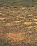
NASA’s Mars Exploration Rover Opportunity has begun sampling rocks blasted out from a stadium-sized impact crater the rover is circling, and the very first one may extend our understanding about the region’s wet past.

Opportunity is spending a few weeks examining the crater, informally named “Endurance,” from the rim, providing information NASA will use for a decision about whether to send the rover down inside. That decision will take into account both the scientific allure of rock layers in the crater and the operational safety of the rover. Opportunity has completed observations from the first of three planned viewpoints located about one-third of the way around the rim from each other. Mission controllers at NASA’s Jet Propulsion Laboratory, Pasadena, Calif., are sending the rover around the crater’s rim counterclockwise.

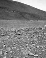
“As we were proceeding from our first viewpoint toward our second viewpoint, we saw a rock that looked like nothing we’d ever seen before,” said Dr. Steve Squyres of Cornell University, Ithaca, N.Y., principal investigator for the science instruments on both Mars Exploration Rovers. The rock appears to have come from below the area’s current surface level, tossed up by the impact that excavated Endurance Crater.

This rock, dubbed “Lion Stone,” is about 10 centimeters tall and 30 centimeters long (4 inches by 12 inches). In some ways it resembles rocks that provided evidence of past water at the smaller crater, “Eagle Crater,” in which Opportunity landed. Like them, it has a sulfur-rich composition, fine layering and spherical concretions, and likely formed under wet conditions.

“However,” Squyres said, “it is different in subtle ways from what we saw at Eagle Crater: a little different in mineralogy, a little different in color. It may give us the first hint of what the environment was like before the conditions that produced the Eagle Crater rocks.”

Inside Endurance Crater are multiple layers of exposed rocks that might provide information about a much longer period of environmental history. From the viewpoints around the rim, Opportunity’s miniature thermal emission spectrometer is returning data for mapping the mineral composition of the rocks exposed in the crater’s interior.

“We see the coarse hematite grains on the upper slopes and basaltic sand at the bottom,” said Dr. Phil Christensen of Arizona State University, Tempe, lead scientist for that spectrometer. “Most exciting is the basalt signature in the layered cliffs.” Basalt is volcanic in origin, but the thinness of the layers visible in the cliffs suggests they were emplaced some way other than as flows of lava, he said.

“Our working hypothesis is that volcanically erupted rock was broken down into particles that were then transported and redeposited by wind or by liquid water,” Christensen said.

At a press conference today in Montreal, Canada, Christensen and Squyres presented previews of rover-science reports scheduled this week at a joint meeting of the American Geophysical Union and the Canadian Geophysical Union.

Although the stack of rock layers at Endurance is more than 10 times thicker than the bedrock exposure at Eagle Crater, it is still only a small fraction of the 200-meter-thick (650- foot-thick) stack seen from orbit at some other locations in Mars’ Meridian Planum region. A close-up look at the Endurance Crater rocks could help with interpreting the other exposures seen from orbit. “It’s possible that the whole stack was deposited in water — some particles washed in by flowing water and others chemically precipitated out of the water,” Christensen said. “An alternative is that wind blew sand in.”

Halfway around Mars from Opportunity, Spirit is driving toward highlands informally named “Columbia Hills,” where scientists hope to find older rocks than the ones on the plain the rover has been crossing. The rover could reach the edge of the hills by mid-June. “Spirit is making breathtaking progress,” Squyres said. “The other day it covered 124 meters [407 feet] in one day. And that’s not a parking lot we’re crossing. It’s hilly, rock-strewn terrain. This kind of pace bodes well for having lots of rover capability left when we get to the hills.”

JPL, a division of the California Institute of Technology in Pasadena, manages the Mars Exploration Rover project for NASA’s Office of Space Science, Washington, D.C. Images and additional information about the project are available from JPL at http://marsrovers.jpl.nasa.gov and from Cornell University at http://athena.cornell.edu.

Original Source: NASA/JPL News Release

NASA Considers Risking Rover on Dangerous Descent

Image credit: NASA/JPL
Scientists and engineers celebrated when they saw the first pictures NASA’s Opportunity sent from the rim of a stadium- sized crater that the rover reached after a six-week trek across martian flatlands.

Multiple layers of exposed bedrock line much of the inner slope of the impact crater informally called “Endurance.” Such layers and their thicknesses may reveal what the environment on Mars was like before the salty standing body of water evaporated to produce the telltale rocks that were explored in the tiny “Eagle” Crater. That?s where Opportunity spent its first eight weeks on Mars.

“It’s the most spectacular view we’ve seen of the martian surface, for the scientific value of it but also for the sheer beauty of it,” Dr. Steve Squyres of Cornell University, Ithaca, N.Y., said about a color panorama of Endurance Crater released at a news conference today at NASA’s Jet Propulsion Laboratory, Pasadena, Calif. He is the principal investigator for the science instruments on both Opportunity and its twin Mars Exploration Rover, Spirit.

In coming days, Opportunity will circle the rim of Endurance, observing the crater’s interior from various angles. Scientists and engineers have begun to identify interesting science targets and assess how difficult it would be for the rover to descend partway into the crater and climb back out. “We will need to decide whether the science is compelling enough to send the rover into a crater it might never leave, or whether to explore other sites first before entering Endurance,” said Orlando Figueroa, director of the Mars Exploration Program, NASA Headquarters, Washington.

At Eagle Crater, an outcrop of bedrock only about the height of a street curb yielded evidence that the site was once covered by a body of salty water deep enough to splash in. “That was the last dying gasp of a body of water,” Squyres said. “The question that has intrigued us since we left Eagle Crater is what preceded that. Was there a deep body of water for a long time? Was there a shallow, short-lived playa? We don’t know.”

The strategy for seeking answers is to examine older rocks from deeper layers, so Opportunity was sent on drives totaling about 800 meters (half a mile) to reach the deepest crater nearby, Endurance. This crater excavated by the impact of a tiny asteroid or a piece of a comet is about 130 meters (430 feet) wide and, from the highest point on the rim, more than 20 meters (66 feet) deep, 10 times as deep as Eagle. An exposure of outcrop in a cliff high on the inner wall across from the rover’s current position reveals a stack of layers 5 to 10 meters (16 to 33 feet) tall. Other exposures around the inner slope of the crater may be more accessible than the cliff, and chunks from the same layers may have been thrown out onto surrounding ground by the crater-forming impact.

“There is a rock unit below what we saw at Eagle Crater,” Squyres said. “It looks fundamentally different from anything we’ve seen before. It’s big. It’s massive. It has a story to tell us.”

Brian Cooper, leader of JPL’s squad of rover drivers for Spirit and Opportunity, said the initial view of the crater doesn’t settle accessibility questions yet. “The slope right in front of us averages 18 to 20 degrees. Getting into the crater is no problem, but we have a lot more work to do to assess whether we could get back out. That depends on soil properties and slippage, as well as slope.” The planned circuit around the rim will also require careful navigation. “If you don’t go close enough to the lip, you can’t look in, but if you go too far, you could fall in,” he said. “We’re going to have a very interesting few weeks.”

When NASA sent astronauts to the lunar surface more than 30 years ago, it was decided not to allow them to enter craters as fresh and steep as Endurance, but Opportunity may be able to do what no human has done before on another planet.

Scientists and engineers working with the other rover, Spirit, are also examining images of a destination area to identify possible targets of study and to assess how well the rover can get to them. However, that destination area, informally named “Columbia Hills,” still lies several weeks of travel ahead of Spirit. Images and surface-temperature information from the NASA orbiters Mars Global Surveyor and Mars Odyssey are supplementing Spirit’s own increasingly detailed pictures of the hills. Nighttime surface temperatures indicate that some areas within the hills are rockier than others, said Amy Knudson, a rover science team collaborator from Arizona State University, Tempe.

“The hills represent a different rock unit, likely older than the plains we’re on,” Knudson said. “There are intriguing features in the hills and we want to investigate the processes that formed them. We’re especially interested to see if water played any role.”

JPL, a division of the California Institute of Technology in Pasadena, manages the Mars Exploration Rover project for NASA’s Office of Space Science, Washington, D.C. Images and additional information about the project are available from JPL at http://marsrovers.jpl.nasa.gov and from Cornell University at http://athena.cornell.edu.

Original Source: NASA/JPL News Release

Planetary Society Wants to Aim for Mars

The Planetary Society has come on strong to support the human exploration of the Solar System with a new petition – Aim for Mars – that they intend to deliver to the US Congress. One of the cool things with this petition is that they’ve opened it up to people from other countries as well, as there are ways we can support the initiative (I’m from Canada, remember). They’ve also got lots of other resources to help you understand how to get involved.

Sign the petition!

Fraser Cain
Publisher
Universe Today

Opportunity Reaches Endurance Crater

Image credit: NASA/JPL
This 180-degree view [false-color] from the navigation camera on the Mars Exploration Rover Opportunity is the first look inside “Endurance Crater.” The view is a cylindrical projection constructed from four images. The crater is about 130 meters (about 430 feet) in diameter.

Plans are for the rover first to circumnavigate the 1,350-foot perimeter of the crater, then mission planners will be faced with the tough decision about whether to go into Endurance. One potential hazard that choice might entail stems from the steep walls and fine soil.

Even when exiting the much smaller Eagle Crater (about 1/7th the size of Endurance, the rover eventually ground to a halt. The rover’s wheel traction is generally rated to between 15 and 20 degrees for climbing slopes, but particularly near a crater rim, the soil is through to resemble talcum or powdered cement, rather than sand.

Scientists expect to release a spectacular color, high-resolution panorama of Endurance for their next news conference scheduled Thursday.

One characteristic that struck onlookers even from a distance was the layering along the rim and similarity of light colored outcrops thought to represent ancient Martian bedrock. Such stratigraphy reveals a layered history, where the newest sediments deposit on top and the older material is exposed below. By reading this layering like tree rings, scientists hope to read more chapters of their ongoing mystery: what happened to surface water on Mars?

Compared to the most detailed layer at Eagle crater (about 16 inches high), the much older and deeper layers at Endurance appear to be up to 8 feet tall in places. The more layers, the farther back in martian times the bedrock may reveal.

A key scientific objective for this part of Opportunity’s extended mission will be to seek geologic context for the outcrop in the “Eagle” crater by reaching other outcrops in the “Endurance” crater and perhaps elsewhere. Other science objectives are to continue atmospheric studies at both sites to encompass more of Mars’ seasonal cycle and to calibrate and validate data from Mars orbiters for additional types of rocks and soils examined on the ground.

Meanwhile on the opposite side of the planet, the Spirit rover logged another record-breaking day of driving. The last odometer reading turned nearly 100 yards, a goal-to-goal trek traversing the length of a football field.

“We’re going to continue exploring and try to understand the water story at Gusev,” said JPL’s Dr. Mark Adler, deputy mission manager for Spirit. Spirit is in pursuit of geological evidence for an ancient lake thought to have once filled Gusev Crater. Reaching “Columbia Hills,” which could hold geological clues to that water story, is one of several objectives for the extended mission.

New engineering objectives are to traverse more than a kilometer (0.62 mile) to demonstrate mobility technologies; to characterize solar-array performance over long durations of dust deposition at both landing sites; and to demonstrate long-term operation of two mobile science robots on a distant planet. During the past month or so, rover teams at JPL have switched from Mars-clock schedules to Earth-clock schedules designed to be less stressful and more sustainable over a longer period towards what is hoped will be another September mission extension.

Original Source: Astrobiology Magazine

Mars Express Radar Deployment Delayed

Image credit: ESA
The MARSIS team has advised ESA to delay the deployment of the MARSIS radar instrument on board Mars Express, scheduled for this week.

New and improved computer models suggest that, during deployment, the radar booms may swing back and forth with larger amplitudes than previously expected. If this happened, the booms might come too close to delicate components of the spacecraft body. Further simulations and tests are under way to better understand the situation.

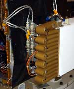
The two main radar booms are 20-metre long hollow cylinders, of 2.5 centimetres diameter, folded up in a box like a concertina (accordion). When the box is opened, the elastic energy of the compressed glass-fibre booms will let them unfold like a jack-in-the-box.

After the booms spring out, they will eventually lock in a straight line, taking up the shape that they had before being folded into the box. The deployment procedure of each boom is expected to last about 10 minutes.

Simulations carried out four years ago by the radar boom’s manufacturer, Astro Aerospace, California, USA, indicated that the deployment should be smooth, without significantly swinging back and forth. However, the radar team has now advised ESA that a new and refined analysis of the boom dynamics indicates that a sort of “backlash” might take place before the boom locks into its position.

Although a successful deployment is not in question, Mars Express mission managers want to make sure that the booms are not subjected to excessive mechanical stress and that they do not interfere with the spacecraft as they deploy.

The MARSIS team and their industrial contractors are now performing further tests and simulations to confirm that the deployment will have no impact on the safety of the spacecraft. These simulations will then be reviewed by ESA’s experts. Based on the results, expected within a few weeks, ESA will decide when and how to activate MARSIS.

MARSIS will study the sub-surface of Mars to a depth of a few kilometres. The instrument’s antennas will send radio waves towards the planet and analyse how they are reflected by any surface that they encounter. In this way, MARSIS can investigate the sub-surface mineralogical composition and will reveal the presence of any underground reservoir of water or ice.

Original Source: ESA News Release