Minerals in Martian Spherules Point to Water

Image credit: NASA/JPL
A major ingredient in small mineral spheres analyzed by NASA’s Mars Exploration Rover Opportunity furthers understanding of past water at Opportunity’s landing site and points to a way of determining whether the vast plains surrounding the site also have a wet history.

The spherules, fancifully called blueberries although they are only the size of BBs and more gray than blue, lie embedded in outcrop rocks and scattered over some areas of soil inside the small crater where Opportunity has been working since it landed nearly two months ago.

Individual spherules are too small to analyze with the composition-reading tools on the rover. In the past week, those tools were used to examine a group of berries that had accumulated close together in a slight depression atop a rock called “Berry Bowl.” The rover’s Moessbauer spectrometer, which identifies iron-bearing minerals, found a big difference between the batch of spherules and a “berry-free” area of the underlying rock.

“This is the fingerprint of hematite, so we conclude that the major iron-bearing mineral in the berries is hematite,” said Daniel Rodionov, a rover science team collaborator from the University of Mainz, Germany. On Earth, hematite with the crystalline grain size indicated in the spherules usually forms in a wet environment.

Scientists had previously deduced that the martian spherules are concretions that grew inside water-soaked deposits. Evidence such as interlocking spherules and random distribution within rocks weighs against alternate possibilities for their origin. Discovering hematite in the rocks strengthens this conclusion. It also adds information that the water in the rocks when the spherules were forming carried iron, said Dr. Andrew Knoll, a science team member from Harvard University, Cambridge, Mass.

“The question is whether this will be part of a still larger story,” Knoll said at a press briefing today at NASA’s Jet Propulsion Laboratory, Pasadena, Calif. Spherules below the outcrop in the crater apparently weathered out of the outcrop, but Opportunity has also observed plentiful spherules and concentrations of hematite above the outcrop, perhaps weathered out of a higher layer of once-wet deposits. The surrounding plains bear exposed hematite identified from orbit in an area the size of Oklahoma — the main reason this Meridiani Planum region of Mars was selected as Opportunity’s landing site.

“Perhaps the whole floor of Meridiani Planum has a residual layer of blueberries,” Knoll suggested. “If that’s true, one might guess that a much larger volume of outcrop once existed and was stripped away by erosion through time.”

Opportunity will spend a few more days in its small crater completing a survey of soil sites there, said Bethany Ehlmann, a science team collaborator from Washington University, St. Louis. One goal of the survey is to assess distribution of the spherules farther from the outcrop. After that, Opportunity will drive out of its crater and head for a much larger crater with a thicker outcrop about 750 meters (half a mile) away.

Halfway around Mars, NASA’s other Mars Exploration Rover, Spirit, has been exploring the rim of the crater nicknamed “Bonneville,” which it reached last week. A new color panorama shows “a spectacular view of drift materials on the floor” and other features, said Dr. John Grant, science team member from the National Air and Space Museum in Washington. Controllers used Spirit’s wheels to scuff away the crusted surface of a wind drift on the rim for comparison with drift material inside the crater.

A faint feature at the horizon of the new panorama is the wall of Gusev Crater, about 80 kilometers (50 miles) away, said JPL’s Dr. Albert Haldemann, deputy project scientist. The wall rises about 2.5 kilometers (1.6 miles) above Spirit’s current location roughly in the middle of Gusev Crater. It had not been seen in earlier Spirit images because of dust, but the air has been clearing and visibility improving, Haldemann said.

Controllers have decided not to send Spirit into Bonneville crater. “We didn’t see anything compelling enough to take the risk to go down in there,” said JPL’s Dr. Mark Adler, mission manager. Instead, after a few more days exploring the rim, Spirit will head toward hills to the east informally named “Columbia Hills,” which might have exposures of layers from below or above the region’s current surface.

The main task for both rovers is to explore the areas around their landing sites for evidence in rocks and soils about whether those areas ever had environments that were watery and possibly suitable for sustaining life. JPL, a division of the California Institute of Technology in Pasadena, manages the Mars Exploration Rover project for NASA’s Office of Space Science, Washington, D.C. Images and additional information about the project are available from JPL at http://marsrovers.jpl.nasa.gov and from Cornell University, Ithaca, N.Y., at http://athena.cornell.edu.

Original Source: NASA/JPL News Release

Mars Express Finds South Pole Water Ice

Image credit: ESA
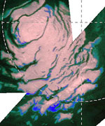
Thanks to ESA?s Mars Express, we now know that Mars has vast fields of perennial water ice, stretching out from the south pole of the Red Planet.

Astronomers have known for years that Mars possessed polar ice caps, but early attempts at chemical analysis suggested only that the northern cap could be composed of water ice, and the southern cap was thought to be carbon dioxide ice.

Recent space missions then suggested that the southern ice cap, existing all year round, could be a mixture of water and carbon dioxide. But only with Mars Express have scientists been able to confirm directly for the first time that water ice is present at the south pole too.

Mars Express made observations with its OMEGA instrument to measure the amounts of sunlight and heat reflected from the Martian polar region. When planetary scientists analysed the data, it clearly showed that, as well as carbon dioxide ice, water ice was present too.

The results showed that hundreds of square kilometres of ?permafrost? surround the south pole. Permafrost is water ice, mixed into the soil of Mars, and frozen to the hardness of solid rock by the low Martian temperatures. This is the reason why water ice has been hidden from detection until now – because the soil with which it is mixed cannot reflect light easily and so it appears dark.

However, OMEGA looked at the surface with infrared eyes and, being sensitive to heat, clearly picked up the signature of water ice. The discovery hints that perhaps there are much larger quantities of water ice all over Mars than previously thought.

Using this data, planetary scientists now know that the south polar region of Mars can be split into three separate parts. Part one is the bright polar cap itself, a mixture of 85% highly reflective carbon dioxide ice and 15% water ice.

The second part comprises steep slopes known as ?scarps?, made almost entirely of water ice, that fall away from the polar cap to the surrounding plains. The third part was unexpected and encompasses the vast permafrost fields that stretch for tens of kilometres away from the scarps.

The OMEGA observations were made between 18 January and 11 February this year, when it was late summer for the Martian southern hemisphere and temperatures would be at their highest. Even so, that is probably only ?130 degrees Celsius and the ice that Mars Express has observed is a permanent feature of this location.

During the winter months, scientists expect that carbon dioxide from the atmosphere will freeze onto the poles, making them much larger and covering some of the water ice from view.

Mars Express and OMEGA will now continue looking for water ice and minerals across the surface of the planet. In May, another Mars Express instrument, the Mars Advanced Radar for Subsurface and Ionospheric Sounding (MARSIS), will begin collecting data, looking for water underground.

It will be particularly exciting when MARSIS looks at the south pole because, once planetary scientists know how deep the ice reaches, they will be able to calculate exactly how much water there is. Knowing this is very important to understand how Mars evolved and if it ever harboured life.

Original Source: ESA News Release

Background on the Rover Airbag System

Image credit: NASA/JPL
Here I was: 26 years old, I had never worked on a flight project before, and all eyes were on me. Every time I walked by the Pathfinder project office, Tony Spear, the project manager, would throw his arm around me and announce, “Hey everybody, the whole mission is riding on this guy right here.”

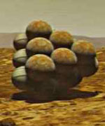
Our task was to design and build airbags for Pathfinder’s landing on Mars an approach that had never been used on any mission. Airbags may seem like a simple, low-tech product, but it was eye-opening to discover just how little we knew about them. We knew that the only way to find out what we needed to learn was to build prototypes and test them. We just didn’t know how ignorant we were going to be.

Airbags seemed like a crazy idea to a lot of people. Nobody ever said that, mind you, but there seemed to be a widespread feeling that the airbags weren’t going to work. “We’ll let you guys go off and fool around until you fall flat on your faces.” That was the unspoken message I received day after day.

Everyone’s main fear about using these giant airbags was that the lander would be buried in an ocean of fabric when the airbags deflated. I began the search for a solution by building scale models of the airbags and lander, and I played with them in my office for a couple of months.

I built the models out of cardboard and plastic, and taped them up with packing tape I got from the hardware store and ribbon from the fabric store. I used a small raft inflator that I had at home to pump up my model airbags. Over and over again, I filled the miniature airbags and then let them deflate, watching what happened.

I fooled around with a dozen or more approaches before I finally came up with something that I thought worked. Slowly but surely, I came up with the idea of using cords that zigzag through belt loops inside the airbags. Pull the cords a certain way, and the cords would draw in all of the fabric and contain it. Wait to open the lander until after all of the airbags had retracted, and the fabric would be tucked neatly underneath.

Testing on another scale
Once we built large-scale models to conduct drop tests, we started by doing simple vertical drops, first at 30 feet, and then up to 70 feet. The bags performed well, although the way they bounced like a giant ball was interesting to observe. People began to realize that the concept might just be reasonably sound. But we still had our doubters. Even after we had the mechanics figured out for the airbags, a big question remained: What about the rocky Martian terrain?

Landing on Mars, we had to accept whatever Mother Nature gave us. The Pathfinder wouldn’t have a landing strip. To simulate conditions on Mars, we brought in large lava rocks the size of a small office desk. They were real lava rocks that our geologists had gone out and picked; if you tried to handle one of them, you would cut up your hands.

The more landscape simulations we tested, the more we started tearing up the airbags. Things were not looking good. Once again, we realized that this was an area that we just didn’t understand. The challenge was to protect the bladder layer, essentially the inner tube of the airbag system, with as little fabric as possible because the project could not afford to just throw mass at the problem. We tried material after material heavy duty Kevlars and Vectrans among them applying them in dozens of different configurations to the outside of the airbag.

Ultimately, we knew that we could just throw on more and more material and come up with a reasonably performing airbag system, but the weight of that solution would have come at the expense of something else another component of Pathfinder would have to be sacrificed. We weren’t, however, going to Mars just to land there and take a few pictures. We wanted to go there and do science and we needed instruments to do that science. So there was a lot of motivation to come up with the lowest-mass, highest-performance airbag system that we could.

5, 4, 3, 2, 1
Each test became like a ritual, because it took between eight and ten hours to prepare the system including transporting the airbags into the vacuum chamber, getting all of the instrumentation wired up, raising the airbags up to the top of the chamber, making sure all the rocks were in the right place, and preparing the nets.

The vacuum chamber where we did the drop tests used so much power that we were only able to test in the middle of the night. Once the doors of the vacuum chamber were closed, it took three or four hours just to pump down the chamber. At that point, everybody either broke for dinner or went to relax for a while, before coming back at midnight or whatever the appointed hour was. Then we had another 45 minutes of going over all of the instrumentation, going through checklists, and then ultimately the countdown.

The last 30 seconds of the countdown were excruciating. All of that anticipation, and then the whole impact lasted less than one second.

When we finished a drop test, we knew right away whether it was a success or failure. Brian Muirhead, the flight systems manager, was always insistent that I call him immediately-no matter how late it was. At 4 a.m., I would call him at his home and have to give him the news, “Brian, we failed another test.”

Each test was followed by a high-pressure rush to figure out what went wrong, what test to run next, how to fix the extensively damaged bags, and how to simultaneously incorporate whatever new “experimental fix” we came up with. As a team, we agreed upon a course of action, usually in a surly, sleep-deprived mood over a greasy breakfast at a local diner. Then the ILC Dover folks would figure out any new patterns that needed to be generated as well as the detailed engineering to ensure the seams and stitch designs could handle the test loads. Our hero was our lead sewer, who incidentally sewed Neil Armstrong and Buz Aldren’s moon suits. She worked under less-than-ideal conditions while we slept and turned our sometimes unusual ideas into reality. Usually by the next day we were ready to do it all over again.

Tony Spear and Brian understood the challenges we were facing. They knew we had a solid team working on this, and I always kept them informed on the technical progress. They were always understanding, but that’s not to say they were always happy.

Back to the drawing board
We said, “Okay, let’s start doing analysis, computer modeling of the airbags and the impact against the rocks.” At the same time, we expanded our test program to understand how to optimize this airbag abrasion layer.

It turned out that the time, money, and effort we expended on the computer modeling didn’t pay off. Though we ran the most sophisticated programs available back in 1993 and 1994, the results didn’t help us design the abrasion layer. We had to rely on our prototypes.

After doing dozens of drop tests, looking at the data, and studying what was happening, we started to realize that a single layer of heavy material wasn’t the solution. Multiple layers of lightweight material might prove stronger.

We were forced to decide on the final abrasion layer design in order to meet our scheduled Qualification drop tests. In spacecraft terms, this is supposed to be the last test that you run in order to qualify your final design. By the time you get to that point, there is supposed to be no question whatsoever that you have a fully functioning system that meets all of the mission requirements. It is supposed to be a check-the-box process that the system is ready for flight. The problem was that at that point we had still only experienced partial success; we’d never had that A+, 100% grade on any of our drop tests.

Flying in to watch that last drop test, my plane was delayed. One of my colleagues at the test facility called and asked me, “Do you want us to wait for you?” I told him, “No, go ahead.”

When I got to the facility, the test crew wasn’t there. I went into the control room and ran into the guy who processes the videotapes. “So what happened?” I asked him. “Did you guys do the test?” He pointed at a VCR and said, “The video is in there. Just go ahead and press play.”

So, I hit play. Down comes the airbag in the video it hits the platform and explodes catastrophically. My heart sank. We weren’t going to make it. But then I realized that there was something strangely familiar about the video I had just watched. In an instant it came to me; they had put in the videotape from our worst drop test. The practical joke could mean only one thing: We had had a successful drop test, and were finally good to go.

Original Source: NASA/JPL Story

Spirit Sees the Earth

Image credit: NASA/JPL
Consistently highly rated among those memorable ‘money-shots’ from the current Mars’ surface exploration is a view looking back towards the Earth. On Thursday, the Spirit rover team released the banner image showing the Earth as a tiny gray dot in the martian sky near the horizon.

The history of such views backwards towards the home planet, Terra Firma, have captivated the imagination for a generation of astronomers. This glimpse from the surface of another planet offers an unrivalled perspective that stretches beyond just seeing our home as one of many planets, or the only pale blue dot in our solar system.

As Carl Sagan’s widow, Anne Druyan , described this perspective image to Astrobiology Magazine, such earth views make “us look at this tiny planet, at the pale blue dot, and to see it in its real context, in its actual circumstances, in its true tininess. I don’t know anyone who’s able to really see that one-pixel Earth and not feel like they want to protect the Earth; that we have much more in common with each other than we’re likely to have with anyone anywhere else.”

The evocative phrase describing the Earth as a ‘pale blue dot’ was coined by Carl Sagan after seeing our planet as a single pixel. The view was taken from the departing Voyager spacecraft. The entire earth could be encompassed as a flicker of light. The first image of Earth ever taken from another planet that actually shows our home as a planetary disk was captured by the Mars Orbital Camera on May 8th.

One question that might be answerable from such a world-view is could a scientist on Mars identify from such a perspective that the Earth harbored life. In 1993, a team of researchers inspired by Carl Sagan, used an Earth fly-by of the Galileo spacecraft on its way to Jupiter to catch a glimpse of how the Earth might appear from afar. For astrobiologists, Sagan’s results were surprising.

Rather than seeing the Earth as an obvious candidate for life, the Galileo pictures gave surprisingly few clues of the biological potential of our own planet.

From afar, how Galileo missed the obvious signs of terrestrial life as we would have expected to see them, was at first disconcerting to the scientific community, because future missions aim to observe more distant extrasolar planets and detect what would be visible in the spectra–the ‘pale blue dot’ scenario.

One answer may lie in the fact that the spacecraft made its observations while still quite close to the Earth.

“The spectrograph was designed to look at small areas of Jupiter, so the field of view of the spectrograph was quite small,” said Nick Woolf of Arizona, in earlier discussions with the Astrobiology Magazine.

“Also, since the surface brightness of Jupiter [the Gaileo’s intended visual target] is far less than the Earth, the spectrograph detectors saturated except when the spectrograph was pointed at the darkest area of Earth – a cloud-free section of sea,” Woolf noted. The cloud-free sea is considered very dark relative to the dominance of bright clouds in a global picture of Earth. Thus it should come as no surprise that Galileo was successful in only imaging a relatively dark and lifeless planet, mainly because its design was not intended to look at Earth, but to probe Jupiter instead.

A spectroscope that might detect infrared or visible light looking back on Earth or outwards to other planets might focus mainly on four gases that are found in Earth’s atmosphere and linked to life:

* Water vapor A baseline sign, indicating the presence of liquid water, a requirement of known life.
* Carbon dioxide Can be created by biological and non-biological processes. Because it is necessary for photosynthesis, it would indicate the possible presence of green plants.
* Methane Considered suggestive of life, it also can be made both by biological and non-biological processes.
* Molecular oxygen (O2) – or its proxy, ozone (O3). The most reliable indicator of the presence of life, but still not conclusive.

Unless molecular oxygen in the atmosphere is constantly replenished by photosynthesis, it is quickly consumed in chemical reactions, in the atmosphere, on land and in seawater. So the presence of a large amount of oxygen in an extrasolar planet’s atmosphere would be a sign that it might host an ecosystem like present-day Earth’s.

An additional oxygen-related biosignature is the possibility of detecting green plants that make oxygen. Chlorophyll reflects near-infrared light very strongly, a phenomenon known as the “red edge” because the light is just beyond the range of colors human eyes can see. (If humans could see the red edge, plants would look red instead of green.) Near-infrared cameras would have no trouble picking up this distinctive signal.

Not only are earth-views aesthetically interesting, while offering a chance to test remote sensing scenarios, the rovers more practically depend on a daily sky view to navigate. The rover design does not possess any intrinsic way of knowing its orientation as north or south for instance, because Mars doesn’t offer a strong magnetic field that might typically give a compass reading. So scientists point the rover’s mobile panoramic camera to do a sun sighting daily, which also provides today’s orientation. Navigating by stars on Mars is also possible although the rovers’ solar power arrays typically are put into electronic sleep-modes at night to conserve power.

Spirit imaged stars on March 11, 2004, after it awoke during the martian night for a communication session with NASA’s Mars Global Surveyor orbiter. This image is an eight-second exposure. Longer exposures were also taken. The images tested the capabilities of the rover for night-sky observations. Scientists will use the results to aid planning for possible future astronomical observations from Mars.

Original Source: NASA Astrobiology Magazine

Spirit at the Edge of Bonneville Crater

Image credit: NASA/JPL
NASA’s Spirit has begun looking down into a crater it has been approaching for several weeks, providing a view of what’s below the surrounding surface.

Spirit has also been looking up, seeing stars and the first observation of Earth from the surface of another planet. Its twin, Opportunity, has shown scientists a “mother lode” of hematite now considered a target for close-up investigation.

“It’s been an extremely exciting and productive week for both of the rovers,” said Spirit Mission Manager Jennifer Trosper at NASA’s Jet Propulsion Laboratory, Pasadena, Calif.

Dr. Chris Leger, a rover driver at JPL, said, “The terrain has been getting trickier and trickier as we’ve gotten close to the crater. The slopes have been getting steeper and we have more rocks.” Spirit has now traveled a total of 335 meters (1,099 feet).

Spirit’s new position on the rim of the crater nicknamed “Bonneville” offers a vista in all directions, including the crater interior. The distance to the opposite rim is about the length of two football fields, nearly 10 times the diameter of Opportunity’s landing-site crater halfway around the planet from Spirit.

Initial images from Spirit’s navigation camera do not reveal any obvious layers in “Bonneville’s” inner wall, but they do show tantalizing clues of rock features high on the far side, science-team member Dr. Matt Golombek of JPL said at a news briefing today. “This place where we’ve just arrived has opened up, and it’s going to take us a few days to get our arms around it.?

Scientists anticipate soon learning more about the crater from Spirit’s higher-resolution panoramic camera and the miniature thermal emission spectrometer, both of which can identify minerals from a distance. They will use that information for deciding whether to send Spirit down into the crater.

From the crater rim and during martian nighttime earlier today, Spirit took pictures of stars, including a portion of the constellation Orion. Shortly before dawn four martian days earlier, it photographed Earth as a speck of light in the morning twilight. The tests of rover capabilities for astronomical observations will be used in planning possible studies of Mars’ atmospheric characteristics at night. Those studies might include estimating the amounts of dust and ice particles in the atmosphere from their effects on starlight, said Dr. Mark Lemmon, a science team member from Texas A&M University, College Station.

Opportunity has been looking up, too. It has photographed Mars’ larger moon, Phobos, passing in front of the Sun twice in the past week, and Mars’ smaller moon, Deimos, doing so once.

Opportunity’s miniature thermal emission spectrometer has taken upward-looking readings of the atmospheric temperature at the same time as a similar instrument, the thermal emission spectrometer on NASA’s Mars Global Surveyor orbiter, took downward-pointed readings while passing overhead. “They were actually looking directly along the same path,” said science team member Dr. Michael Wolff of the Martinez, Ga., branch of the Space Science Institute, Boulder, Colo. The combined readings give the first full temperature profile from the top of Mars’ atmosphere to the surface.?

When pointed at the ground, Opportunity’s miniature thermal emission spectrometer has checked the abundance of hematite in all directions from the rover’s location inside its landing-site crater. This mineral, in its coarse-grained form, usually forms in a wet environment. Detection of hematite from orbit was the prime factor in selection of the Meridiani Planum region for Opportunity’s landing site.

“The plains outside our crater are covered with hematite,” said Dr. Phil Christensen of Arizona State University, Tempe, lead scientist for the instrument. “The rock outcrop we’ve been studying has some hematite. Parts of the floor of the crater, interestingly enough, have virtually none.” The pattern fits a theory that the crater was dug by an impact that punched through a hematite-rich surface layer, he said. One goal for Opportunity’s future work is to learn more about that surface layer to get more clues about the wet past environment indicated by sulfate minerals identified last week in the crater’s outcrop.

Christensen said that before Opportunity drives out of the crater in about 10 days, scientists plan to investigate one area on the inner slope of the crater that he called “the mother lode of hematite.”

JPL, a division of the California Institute of Technology in Pasadena, manages the Mars Exploration Rover project for NASA’s Office of Space Science, Washington, D.C. Images and additional information about the project are available from JPL at http://marsrovers.jpl.nasa.gov and from Cornell University at http://athena.cornell.edu.

Original Source: NASA/JPL News Release

NASA’s Future Plans for Mars Exploration

Image credit: NASA/JPL
Since their arrivals on Mars, our two robotic wanderers have sent us incredible images and data from one of our nearest neighbors in the Solar System. The primary science objective of the Mars Exploration Rovers (MERs) is to determine to what degree the past action of liquid water on Mars has influenced the Red Planet’s environment over time.

While there is no direct evidence of liquid water on the surface of Mars today, the record of past water activity on Mars can be found in the rocks, minerals, and geologic landforms, particularly in some specific, diagnostic features that we believe form only in the presence of water. That is why both MERs are equipped with special tools to enable them to study a diverse collection of rocks and soils that may hold clues to past water activity on Mars and determine whether the planet ever had the potential to harbor life in the long-distant past, or, much less likely, today.

The information that NASA has gleaned in just the short amount of time that Spirit and Opportunity have been on the surface of Mars has been incredibly revealing. We have images that show rocks and surface structures in unprecedented detail. We are seeing a side of Mars that is vastly different from what we have encountered during past missions, because we targeted these special rovers to explore places that we knew would be compelling.

While we are incredibly pleased with the data and images we have obtained thus far and look forward to many more, we must not forget that traveling to and exploring Mars is a very challenging endeavor. As I have said many times before – both here on Capitol Hill and in the press – Mars is an extremely exciting and compelling Solar System destination, but it is also an incredibly difficult target, as history has often proven.

The landing and subsequent rollout of the two Rovers were practically picture perfect, which is a daunting engineering feat in and of itself, and one which makes me proud of NASA’s talented and capable Mars team. However, lest we became too confident about our Mars conquest, we were reminded of the significant challenges that operating on the Red Planet entails when the Spirit rover presented the Mars team with a serious technical challenge.

Spirit touched down in an area of Mars known as the Gusev Crater on January 4, 2004. After eighteen days of nearly flawless operation and after returning significant scientific data, including striking pictures of distant hills – and a rock affectionately dubbed “Adirondack ” – the Spirit rover developed an apparent communications problem that initially baffled the entire Mars team. In the ensuing days, Spirit sent us intermittent signals, and we sent the spacecraft numerous queries to try to diagnose the exact nature of the problem.

We were able to determine that the problem was related to software, and the team at JPL developed the necessary procedures and protocols to get Spirit back in business. Had Spirit’s communication problem been a hardware issue, we would be in much more dire straits for obvious reasons. Spirit is now performing as it was intended and continuing to explore its Martian surroundings.

Having actual data transmissions from Spirit’s descent to the Martian surface also provided significant benefits for the team planning the landing of the second Mars rover, Opportunity. Actual descent data from the first spacecraft were used to confirm our models of the behavior of the Martian atmosphere and weather – models which we depended on to plan Opportunity’s descent. The data from Spirit indicated that, while the descent was within the predicted limits of our engineering model, it was close to edge of the anticipated margins.

Armed with this new knowledge, NASA opted to open Opportunity’s parachute earlier to provide for a slower descent and a more gentle arrival on the Red Planet. On January 25, 2004, Opportunity bounced onto the opposite side of Mars – in an area called Meridiani Planum – from where its twin had landed.

The new landing location was “a world away ” from Gusev Crater in more ways than just distance. The initial images transmitted later that day fascinated the science team, revealing an area of dark soil and possible bedrock – a feature we have long searched for but never seen before on any planet’s surface – interspersed with patches of the more familiar red Martian soil. This region of Mars particularly interested planetary geologists because they believed it may contain abundant deposits of hematite, a mineral that, when found on Earth, has usually formed in the presence of persistent liquid water. We now know that their suspicions were correct.

On March 2, 2004, NASA announced that the Opportunity rover had found strong evidence that the area called Meridiani Planum was once soaking wet. Evidence found in an outcrop of rock led scientists to this important conclusion. Clues from the rocks’ composition, such as the presence of sulfates and salts, and the rocks’ physical attributes (e.g., niches where crystals once grew) helped make the case for a watery history. This area is scientifically compelling, and we intend to study it in further detail, hopefully revealing more secrets of the Red Planet.

Missions to Mars are launched approximately every two years (26 months), when the orbital alignments of the Earth and Mars allow the minimum amount of fuel to be used on the long trip. At each of these launch opportunities, NASA plans to send robotic spacecraft to Mars to continue searching for evidence of water, studying the rocks and soil of the planet, and attempting to answer the question, “Did life ever arise on Mars?” The Mars Exploration Program will attack this question by seeking to understand, in a systematic way, the current state and evolution of the atmosphere, surface, and interior of Mars, the potential for life on Mars in the past or present, and develop knowledge and technology necessary for future human exploration.

NASA’s Mars Program
This program is the result of an intensive planning process involving the broad science and technology community. The program incorporates the lessons learned from previous missions and builds upon, as well as responds to, scientific discoveries from past and on-going missions. In addition to the MERs, missions that comprise this systematic approach to Mars exploration are:

1. Mars Global Surveyor (MGS) – launched in 1996, this mission continues to return an unprecedented amount of data regarding Mars’ surface features and composition, atmosphere, weather, and magnetic properties. Scientists are using the data gathered from this mission both to learn about the Earth by comparing it to Mars and to build a comprehensive data set to aid in planning future missions. MGS also serves as a telecommunications relay for the MER missions, as well as a device for photographing landed spacecraft on the surface, such as the rovers.

2. Mars Odyssey – launched in 2001, the Odyssey orbiter is presently mapping the mineralogy and morphology of the Martian surface while achieving global mapping of the elemental composition of the surface and the abundance of hydrogen in the shallow subsurface. Its maps of hydrogen have suggested vast amounts of near-surface water ice in the polar regions of the planet. It also serves as a telecommunications relay for the MER missions.

3. Mars Reconnaissance Orbiter (MRO) – scheduled for launch in 2005, MRO will focus on analyzing the surface at unprecedented new scales in an effort to follow tantalizing hints of water detected in images from the MGS and Odyssey spacecraft and to bridge the gap between surface observations and measurements from orbit. For example, MRO will measure thousands of Martian landscapes at 20- to 30-centimeter (8- to 12-inch) resolution, enabling observation of features the size of beach balls, while also mapping their mineralogies. This will help NASA target future landed laboratories to the best sites to search for evidence of life.

4. Phoenix – scheduled to launch in 2007, this mission will conduct a stationary, surface-based investigation of water ice contained within Martian soils, as well as searching for organic molecules and observing modern climate dynamics. It aims to “follow the water” and measure indicator molecules at high-latitude sites where Mars Odyssey has discovered evidence of large water ice concentrations in the Martian soil. Phoenix was selected as the first of the competed Mars Scout missions.

5. Mars Science Laboratory (MSL) – schedule to launch in 2009, this next generation rover represents a major leap in surface measurements and pave the way for future sample return and astrobiology missions. A long-life power source is planned to allow the science laboratory to conduct experiments for up to two years. Instruments for this surface laboratory may provide direct evidence of organic materials, if any exist, and will be able to search up to several feet beneath the surface. MSL will also demonstrate technologies for accurate landing and hazard avoidance in order to reach what may be very promising, but difficult-to-reach, scientific sites. Its landing location will be based on observations by the Mars Reconnaissance Orbiter. In the ensuing decade, from 2011-2018, NASA plans additional science orbiters, rovers, and landers, and the first mission to return the most promising Martian samples to Earth.

Current strategies call for the first sample return mission to be launched by 2014. Options that would significantly increase the rate of missions launched and/or accelerate the schedule of exploration are under study. Technology development for advanced capabilities, such as miniaturized surface science instruments and deep drilling to several hundred feet, will also be carried out in this period.

NASA has developed a campaign to explore Mars that will change and adapt over time in response to what is discovered and learned with each mission. The plan is meant to be a robust, flexible, long-term program that will provide the highest probability for success. We are moving from the early era of global mapping and limited surface exploration to a much more intensive and discovery-responsive approach. We will establish a sustained presence in orbit around Mars and on the surface with long-duration exploration of some of the most scientifically promising and intriguing places on the planet.

We plan to “follow the water,” so that in the not-too-distant future we may finally know the answers to the most far-reaching questions about the Red Planet we humans have asked over the generations: Did life ever arise there, and does life exist there now?

What’s Next
On January 14, 2003, President Bush announced his new vision for NASA and the Nation’s space program, and just last month the President’s FY 2005 budget was released. Both of those events support and indeed strengthen NASA’s vision for Mars exploration over the next decade and beyond. NASA’s comprehensive, robotic approach to exploring Mars and learning the intricacies of its environment will not only seek to achieve the science goals outlined in this testimony, it will also serve as a solid foundation for the President’s vision of eventually conducting a human exploration mission to Mars.

Original Source: Astrobiology Magazine

Terraforming Mars One Piece at a Time

Image credit: NASA
Locally, Earth has its habitable extremes: Antarctica, the Sahara desert, the Dead Sea, Mount Etna. Globally, our blue planet is positioned in the solar system’s habitable zone, or ‘Goldilocks’ region where the temperature and pressure are just right to support liquid water and life. Across the borders from this goldilocks zone orbit our two neighbors: the runaway greenhouse planet, Venus–which in goldilocks’ terms is ‘too hot’–and the frigid red planet, Mars, which is ‘too cold’.

With an average global temperature of -55 C, Mars is a very cold planet. The standard models for warming Mars raise this average temperature with greenhouse gases first, then plant cold-adapted crops and photosynthetic microbes. This terraforming model includes various refinements such as orbital mirrors and chemical factories which pour out fluorocarbons. Eventually with the help of biology, industrialization, and time, the atmosphere would begin to get thicker (the current martian atmosphere is 99% thinner than the Earth’s). To terraform Mars, depending on the choice and concentration of greenhouse gases used, can take many decades to centuries before an astronaut might begin to lift a visor and for the first time, breathe martian air. Such proposals would initiate the first conscious effort at planetary engineeering, and aim to change the global environment into one less hostile to life as we know it terrestrially.

Another version to these global changes is a local one familiar to those who have trekked the Sahara. Occasionally life blossoms into a desert oasis. A local strategy to change Mars, according to biologist Omar Pensado Diaz, director of the Mex-Areohab project, can best be compared to transforming Mars one oasis at a time. The minimum size of the oasis extends to the diameter of a dome-shaped plastic cover, much like a greenhouse with a space heater. In this way, microterraforming is the smaller alternative for a planet that otherwise is an open system leaking to space. Diaz contrasts the way a physicist might change Mars with industrial tools to the hothouse methods of a biologist.

Diaz talked with Astrobiology Magazine about what it might mean to remodel Mars with tiny stadiums, until they grow into lush, desert oases.

Astrobiology Magazine (AM) : Would it be correct to conclude that you are studying the differences between a global and local terraforming strategy?

Omar Pensado Diaz (OPD): I am looking forward to integrating the models, rather focusing on their differences. Global terraforming, or warming a planet with super greenhouse gases, is a strategy or model conceived from the perspective of physics; while the model I propose is seen from a biological point of view.

I am talking about a model called microterraforming, which will be possible with a tool named the Minimal Unit of Terraforming (MUT). The concept of a Minimal Unit of Terraforming is explained as an ecosystem running as the fundamental unit of nature. A MUT comprises a group of living organisms and their physical and chemical environment where they live, but applied to the development of a biological colonization and remodeling process on Mars.

An artist’s conception of how a terraformed Mars, with an ocean spanning most of its northern hemisphere, might look from orbit.Mars, as terraformed by Michael Carroll. In 1991 this image was used on the front cover of the ‘Making Mars Habitable’ issue of Nature.

Technically speaking, it is a pressurized dome-shaped greenhouse that would contain and protect an interior ecosystem. This complex would not be isolated from the surroundings; on the contrary it would be constantly in contact with it, but in a controlled way.

What is important is gas exchange between the MUT Units and the Martian environment, so the ecosystem itself has a dramatic role. The objective of this process is to generate photosynthesis. Here is where we must consider plants as covering the surface and chemical factories processing the atmosphere.

AM: What would be the advantages of working locally, using your model of an oasis in a desert? By biological analogy to a fundamental terraforming unit, do you mean like how biological cells have an internal equilibrium, but also exchanges with an external one that differs for the whole host?

OPD: The advantages I find in this model are that we can initiate a terraforming process faster, but in stages, that is why it is microterraforming.

But the major and most important advantage is that we can make plant life begin to participate in this process with the help of technology. Life is information and it processes the information around it, beginning an adaptation process to the inner conditions of the unit. Here we maintain that life has plasticity and that it not only adapts to the surrounding conditions, but also it adapts the environment to its own circumstances. In the language of genetics, this means that there are an interaction between the genotype and the environment, producing the adaptation of phenotypical expressions to the dominant conditions.

Now, in a small environment such as a Unit with a diameter of approximately 15 or 20 yards, we could have a much warmer environment than outside the Unit.

AM: Describe what a Unit might look like.

OPD: A transparent, plastic-fiber, double-layered dome. The dome would generate a greenhouse effect inside that would raise significantly the temperature during the daytime and would protect the inside from low temperatures at night. Furthermore, the atmosphere’s pressure would be higher inside by 60 to 70 millibars. That would be enough to allow the plants’ photosynthetic processes as well as liquid water.

In thermodynamic terms, we are now talking about a lack of equilibrium. In order to reactivate Mars, we need to create a thermodynamic disequilibrium. The Unit would generate what is needed first, like ground degassing from temperature differences. Such process is an objective along with the path to a global strategy.

Strictly speaking, the Units would be like carbon dioxide capturing traps; they would release oxygen and generate biomass. The oxygen would then be released to the atmosphere periodically. A valve system would release gases to the outside and once the inner atmospheric pressure had decreased up to 40 or 35 milibars, the valves would close automatically. And others would open and, by suction, gas would get inside the Unit and the original atmospheric pressure would level off. This system would not only allow the release of oxygen but also the release of other gases.

AM: In such an oasis model, it is an open system, but would it have no effect on regional conditions. In other words, would local leakage get diluted, and in those cases, how is microterraforming different from just operating greenhouses?

OPD: The greenhouses–in this case the Minimal Unit of Terraforming–are thought to begin a gradual change on Mars. The difference depends on its range of action, since that’s where the microterraforming process begins. Besides, it depend on how you look at it, because with this method we are trying to repeat the evolution pattern that once was successful on Earth, in order to transform the planet’s atmosphere into another and to make Mars enter in a stage of thermodynamic disequilibrium.

The major advantage is that we can control a terraforming process at a micro-scale; we can turn Mars into a similar place to the Earth faster and make it interact with the surrounding environment at the same time. That is the most important aspect of it: to get ahead with faster processes. As I said before, the idea is to follow the same evolution pattern that developed on Earth soon after photosynthesis appeared. There were terrestrial plants that remodeled and terraformed the Earth, generating carbon dixoide from the surface and distributing it to the atmosphere that existed at that time.

Drs. Chris McKay and Robert Zubrin presented an interesting model that proposes to collocate three large orbital mirrors. The mirrors would reflect the Sun’s light to the south pole of Mars and sublimate the dry ice (carbon dioxide snow) layer in order to increase the greenhouse effect and then accelerate the planet’s global warming.

Such mirrors would be the size of Texas.

I think that if the same infrastructure used in those mirrors were instead used to build domes for a Minimal Unit of Terraforming over the Martian surface, we would be generating higher degassing rates and oxygenating the atmosphere faster. In addition, part of the surface would be warmed anyway, since the Units would hold solar heat, not reflect it from the surface.

The lack of liquid water for the ecosystems inside the Units is debatable; however, a variant of a proposal by Dr. Adam Bruckner from the University of Washington, can be used. It consists on using a zeolite (mineral catalyst) condenser; then, extracting water from the moisture of incoming air. Water would pour inside daily. Again, we would be activating some stages of a hydrological cycle, capturing carbon dioxide, releasing gases to the atmosphere and making the surface a more fertile ground. We would be doing an accelerated terraforming on a very small part of Mars, but if we put hundreds of those Units, the degassing effects over the surface and atmosphere will have planetary repercussions.

AM: When closed biospheres have operated on Earth like Biosphere 2, problems arose with–for instance–oxygen loss due to combination with rock to form carbonates. Are there examples today of large-scale, self-sustaining systems on Earth?

OPD: Large-scale, self-sustaining systems built by humans? I don’t know any, but life itself is a self-sustaining system that takes from the surrounding environment what it needs to work.

That was the problem of closed biospheres, they were not able to make a feedback circuit as it happens on Earth. Furthermore, the system I propose would not be closed; it would interact with the environment of Mars in intervals, by releasing part of what would have been processed by the action of photosynthesis while incorporating new gases. The Minimal Unit of Terraforming will not be a closed system.

If we take into account James Lovelock’s ‘Gaia theory’, we could consider Earth as a large-scale, self-sustaining system, because the biogeochemical cycles are active–a situation that is not happening today on Mars. A large portion of its oxygen is combined with its surface, giving the planet an oxidized character. In this sense, inside the Minimal Unit of Terraforming, the biogeochemical cycles would be reactivated. These domes would liberate oxygen and carbonates, among others, so the release would begin to flow gradually to the planet’s atmosphere.

AM: The quickest method often cited for global terraforming is to introduce fluorocarbons into the Martian atmosphere. With small percentage changes, big temperature and pressure changes follow. This relies on solar interaction. Would a closed bubble have this mechanism available, for instance if ultraviolet light is not penetrating into the domes?

OPD: We are talking about an alternate way from that–not using fluorocarbons and other greenhouse gases. The method we propose captures carbon dioxide for biomass increase, liberates oxygen and inner heat storage, all to generate a carbon dioxide degassing inside the Unit. Other gases trapped in the ground today would be released to the Martian atmosphere to densify it gradually. Actually, the direct exposure of an ecosystem to ultraviolet rays would be counterproductive for the carbon dioxide capture, biomass formation and ground gas generation. Precisely, the dome functions to protect an ecosystem from cold and ultraviolet radiation, as well as maintaining its inner pressure.

Now, the dome would be an important heat trap and a thermal insulator. Making the earlier cell analogy, the dome is like a biological membrane that drives the local ecosystem to thermodynamic disequilibrium. That disequilibrium would allow life to develop.

AM: Would high local concentrations of greenhouse gases (like methane, carbon dioxide or CFCs) be locally toxic before having any effects globally?

OPD: Life can adapt to conditions that are toxic for us; an elevated carbon dioxide concentration can be beneficial for plants, and even increase their production, or, as with methane, there are some methanogenic organisms that require this gas for their subsistence.

Such gases are appropriate for raising the global temperature; on the other hand, carbon dioxide is the most appropriate gas for plant life. The aim is to reproduce evolutionary patterns leading to a gradual adaptation of these organisms to a new environment, and the adaptation of the environment to these organism.

AM: Global terraforming on Mars has time ranges that vary between a century to even long times. Are there ways to estimate whether local efforts might accelerate habitability, using the oasis model you suggest?

OPD: That will depend on the plants’ photosynthetic efficiency and their capability to adapt themselves to the environment while adapting the environment. However, we can consider two appraisals: one local and one global.

In a more explicit way, those appraisals can be first measured on each Minimal Unit of Terraforming through its photosynthetic efficiency, oxygenation speed, carbon dioxide capture and degassing of the dome’s surface. This rate would depend on the solar incidence and the greenhouse effect. At a global level, the speed of the planet’s remodelling would depend on how many Minimal Units could be installed all over the Martian surface. That is to say, if there exist more Minimal Units of Terraforming, the planet’s transformation would be completed faster.

I’d like to clarify something I think is important at this point. The major achievement would be to turn Mars into a green planet before humans could inhabit it in the way we do on Earth today. It would be extraordinary to see how plant life responds, first inside the Minimal Unit of Terraforming and then, when those machines had finished their cycle and life emerges as an explosion to the exterior, to see the unstoppable speciation that would take place, since life would respond to the environment and the environment would respond to life.

And so, we may watch trees, such as pines that on Earth have a large and straight timber. On Mars we may have a more pliable species, one strong enough to resist low temperatures and blowing winds. As photosynthetic machines, the pines would be fulfilling their role as planetary transformers, keeping water, minerals and carbon dioxide for the accumulation of biomass.

AM: What future plans do you have for the research?

OPD: I want to initiate partial simulations of the Martian conditions. This is needed to probe and improve the operation of the Minimal Unit of Terraforming, as well as the physiological response of plants in such conditions. In other words, rehearsals.

This is a multidisciplinary and inter-institutional investigation, so the participation of engineers, biologists and genetic specialists will be necessary as well as other scientific organizations interested in the subject. I must say this is just the first attempt; it is a theory of what could be done and one that we could try on our own planet, for instance, by fighting against the aggressive desert spreading, by rehabilitating grounds and creating obstacles to stop its gradual advance.

Original Source: Astrobiology Magazine

Here’s an article about a similar project. Remember Biosphere 2?

What’s that Bunny on Mars?

Image credit: NASA/JPL
Like a rabbit in a hat, the identity of an oddity that looks like “bunny ears” in a picture from Mars has eluded the science and engineering teams.

The public, also fascinated with the mysterious object, has asked in a slew of e-mails: What is it?

It is a yellowish object measuring about 4 to 5 centimeters (about 2 inches) long that made its debut when Opportunity’s eyes welcomed Earth to a new neighborhood on Mars in her mission success panoramic image. Meridiani Planum is a landscape unlike any other stop on our decades-long tour of the red planet. Still, it wasn’t the conspicuous bedrock outcropping near the horizon that initially fascinated many people. It was the “bunny ears.”

Bemused by Bunny
Temporarily sharing a large workroom in the building that houses rover mission control, engineers were still meticulously reconstructing the events of entry, descent and landing and scientists were anxiously poring over the pictures their most recently successful twin was returning.

Jeff Johnson, a scientist from the U.S. Geological Survey and a member of the panoramic camera team, heard from others about a small, fuzzy-looking object in the mission success panorama. Viewing the image on his computer screen, Johnson wondered aloud, “What in the world is this?” Colleagues gathered around his computer table, trying to make sense of the oddity.

Most team members agreed that the “bunny ears” had been, at some point, part of the rover or its lander. The yellowish color led many to conclude that the object was a piece of airbag material.

The Mars Pathfinder mission set a precedent in 1997 for puzzling pieces around the landing site. An object dubbed “Pinky” caught the attention of the Pathfinder science team and the public. Although never positively identified, it was thought to be a piece of Kapton tape – an adhesive used often in aerospace applications.

How Did They Track the Mysterious Object?
To further complicate the Meridiani mystery, when Johnson tried to image the quirky “ears” at higher resolution, they had vanished from where they were originally spotted – about 4.5 meters (15 feet) from the lander. Johnson, intrigued by their disappearance, was good-naturedly assigned by Steve Squyres (the mission’s principal investigator) to “track the bunny.” He discovered that the object was visible in navigation camera images acquired on landing day – but lying a meter (about 3 feet) further from the lander, up the crater slope. Using JPL-designed software, scientists are able to measure the “bunny ears” in each image where they appear. The object is about the same size in every image.

“After looking at pictures of Opportunity’s lander up-close, I think we might have, again, spotted the bunny,” said Johnson. “It looks as if the object has been blown under the north-facing egress ramp.”

Johnson and his colleagues believe that a light wind whirling from the north over Opportunity’s Challenger Memorial Station landing site could have transported the article. Its small size indicates that it would be easily carried by even a light wind. The three-color Pancam images acquired of the object as part of the mission success panorama even showed some evidence that the object moved slightly between images from the gentle wind. Johnson estimates that the breeze pushed the “bunny ears” an estimated 5 to 6 meters (about 16 to 20 feet).

“There’s no evidence of a mark that it left in the soil as it moved,” Johnson noted. “It was light enough and small enough to not leave any footprints’.”

If Not a Bunny, Then What?
Without seeing the “bunny ears” object up close with our own eyes, it’s difficult to provide a positive identification. However, scientists and engineers are quick to deflate the myth that it is anything inexplicable.

“Our team believes that this odd-looking feature is a piece of soft material that definitely came from our vehicle,” said Rob Manning, lead engineer for entry, descent and landing. “We cannot say exactly where it came from but we can say that there are several possibilities: cotton insulation, Vectran covers and wraps from the airbag, Zylon bridle tensioning ties, or felt insulation from the gas generators…. The list goes on. We do not think this is parachute material, however, due to its color (it does not look blue enough to be the undyed nylon or red enough to be the dyed nylon).

Knowing the possibility that we could have left a bit of a mess nearby, once we saw this feature we only marveled at how clean everything looked and we have not given it another thought. We try to make sure that bits do not fall off, but they do, and we were not at all surprised.”

Johnson took the visual color clues a step further. He measured the visible light spectrum from the Pancam image of the “bunny ears” and compared it to the spectrum of a sample of airbag material. The nearly identical spectra are distinct from typical martian soil or rock spectra and lead Johnson to believe that the “bunny ears” are, indeed, a wayward piece of airbag material or something similar.

Original Source: Astrobiology Magazine

Opportunity Sees Phobos and Deimos

Image credit: NASA/JPL
NASA’s Mars Exploration Rovers have become eclipse watchers.

Though the Viking landers in the 1970s observed the shadow of one of Mars’ two moons, Phobos, moving across the landscape, and Mars Pathfinder in 1997 observed Phobos emerge at night from the shadow of Mars, no previous mission has ever directly observed a moon pass in front of the Sun from the surface of another world.

The current rovers began their eclipse-watching campaign this month. Opportunity’s panoramic camera caught Mars’ smaller moon, Deimos, as a speck crossing the disc of the Sun on March 4. The same camera then captured an image of the larger moon, Phobos, grazing the edge of the Sun’s disc on March 7.

Rover controllers at NASA’s Jet Propulsion Laboratory, Pasadena, Calif., are planning to use the panoramic cameras on both Opportunity and Spirit for several similar events in the next six weeks. Dr. Jim Bell of Cornell University, Ithaca, N.Y., lead scientist for those cameras, expects the most dramatic images may be the one of Phobos planned for March 10.

“Scientifically, we’re interested in timing these events to possibly allow refinement of the orbits and orbital evolution of these natural satellites,” Bell said. “It’s also exciting, historic and just plain cool to be able to observe eclipses on another planet at all.”

Depending on the orientation of Phobos as it passes between the Sun and the rovers, the images might also add new information about the elongated shape of that moon.

Phobos is about 27 kilometers long by about 18 kilometers across its smallest dimension (17 miles by 11 miles). Deimos’ dimensions are about half as much, but the pair’s difference in size as they appear from Mars’ surface is even greater, because Phobos travels in a much lower orbit.

The rovers’ panoramic cameras observe the Sun nearly every martian day as a way to gain information about how Mars’ atmosphere affects the sunlight. The challenge for the eclipse observations is in the timing. Deimos crosses the Sun’s disc in only about 50 to 60 seconds. Phobos moves even more quickly, crossing the Sun in only 20 to 30 seconds.

Scientists use the term “transit” for an eclipse in which the intervening body covers only a fraction of the more-distant body. For example, from Earth, the planet Venus will be seen to transit the Sun on June 8, for the first time since 1882. Transits of the Sun by Mercury and transits of Jupiter by Jupiter’s moons are more common observations from Earth.

From Earth, our Moon and the Sun have the appearance of almost identically sized discs in the sky, so the Moon almost exactly covers the Sun during a total solar eclipse. Because Mars is farther from the Sun than Earth is, the Sun looks only about two-thirds as wide from Mars as it does from Earth. However, Mars’ moons are so small that even Phobos covers only about half of the Sun’s disc during an eclipse seen from Mars.

JPL, a division of the California Institute of Technology in Pasadena, manages the Mars Exploration Rover project for NASA’s Office of Space Science, Washington, D.C.

Images of the March 4 and March 7 eclipses are available online at http://marsrovers.jpl.nasa.gov/gallery/press/opportunity/20040308a.html. Other images from the rovers and additional information about the project are available from JPL at http://marsrovers.jpl.nasa.gov and from Cornell University at http://athena.cornell.edu.

Original Source: NASA/JPL News Release

Now Spirit Finds Evidence of Past Water

Image credit: NASA/JPL
NASA’s Spirit has found hints of a water history in a rock at Mars’ Gusev Crater, but it is a very different type of rock than those in which NASA’s Opportunity found clues to a wet past on the opposite side of the planet.

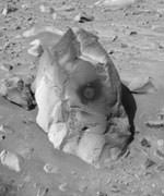
A dark volcanic rock dubbed “Humphrey,” about 60 centimeters (2 feet) tall, shows bright material in interior crevices and cracks that looks like minerals crystallized out of water, Dr. Ray Arvidson of Washington University, St. Louis, reported at a NASA news briefing today at NASA’s Jet Propulsion Laboratory, Pasadena, Calif. He is the deputy principal investigator for the rovers’ science instruments.

“If we found this rock on Earth, we would say it is a volcanic rock that had a little fluid moving through it,” Arvidson said. If this interpretation is correct, the fluid — water with minerals dissolved in it — may have been carried in the original magma that formed the rock or may have interacted with the rock later, he said.

The clues appear in an interior exposure of “Humphrey” where Spirit’s rock abrasion tool scraped away the rock’s surface to a depth of 2 millimeters (.08 inch). To gain more confidence that the bright material seen in cracks and pores is not dust that has intruded from the surface over the millenia, scientists intend to have Spirit grind more deeply into another dark rock, not yet selected. The bright material is not debris from the grinding process, said Stephen Gorevan of Honeybee Robotics, New York, lead scientist for the abrasion tool.

The amount of water suggested by the possible crystals in “Humphrey” is far less than what is indicated by the minerals and structures that Opportunity has revealed in rocks at Meridiani. Rover scientists announced the Opportunity findings earlier this week. “Mars is a diverse planet,” Arvidson said today.

Spirit is headed toward a crater nicknamed “Bonneville,” about 150 meters (500 feet) in diameter, where scientists hope to see rocks from beneath the region’s surface volcanic layer. Those rocks may tell yet a different story from an earlier era of Gusev Crater’s past.

At Meridiani Planum, Opportunity has finished taking a set of 114 microscope images of a rock called “Last Chance” to examine details of the rock’s layering structure. The sequence required more than 400 commands and more than 200 positions of Opportunity’s robotic arm, said Opportunity Mission Manager Matt Wallace of JPL. “Our activities are getting increasingly complex,” he noted.

Spirit completed its 60th martian day, or sol, at Gusev late Thursday. Opportunity completed its 40th sol at Meridiani at 9:32 a.m. Friday, PST. “Between the two rovers, we’ve had a terrific 100 days on Mars. This last week has been particularly exciting,” Wallace said.

A new color view, combining several frames from Opportunity’s panoramic camera, adds information about the rover’s likely destination after finishing work in and around the small crater where it landed. From partway up the inner slope of that 22-meter-diameter (72-foot-diameter) crater, the rover has an improved view of a crater nicknamed “Endurance,” about 10 times as big and about 700 meters (2,300 feet) to the east. “We can see features in the rim, maybe streaks, maybe layers,” said Dr. Jim Bell of Cornell University, Ithaca, N.Y., lead scientist for both rovers? panoramic cameras.

The same new view across the flat plain of Meridiani also shows Opportunity?s jettisoned heat shield, a trail of marks left by the airbag bounces and a solitary dark rock about 40 centimeters (16 inches) across. Bell said, “Not only did we get incredibly lucky to get this hole-in-one in the crater, but on the way into the crater we hit with the airbags the only rock around.”

Both rovers carry magnets supplied by Denmark for experiments to analyze martian dust. Dust covers much of Mars’ surface and hangs in the atmosphere, occasionally rising into giant dust storms. One of the magnets is designed to exclude any magnetic dust particles from landing in the center of a target area. During Spirit’s time on Mars, dust has accumulated on other parts of the target while the center has remained “probably the cleanest area anywhere on the surface of the rover,” said Dr. Morten Madsen, science team member from the Center for Planetary Science, Copenhagen, Denmark.

“Most, if not all of the dust particles in the martian atmosphere are magnetic,” Madsen said. Another of the magnets is within reach of the rover’s robotic arm. Examination of dust on the target by instruments on the end of the arm will soon yield further information about the composition of the dust, he said.

JPL, a division of the California Institute of Technology in Pasadena, manages the Mars Exploration Rover project for NASA’s Office of Space Science, Washington, D.C. Images and additional information about the project are available from JPL at http://marsrovers.jpl.nasa.gov and from Cornell University at http://athena.cornell.edu.

Original Source: NASA/JPL News Release