Ancient Rivers Lasted a While on Mars

Image credit: NASA/JPL

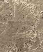
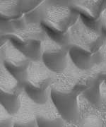
NASA’s Mars Global Surveyor spacecraft has revealed new features on Mars that look like ancient river deltas. This discovery might help answer the mystery of how long water flowed on the surface of the Red Planet. The shape of this formation suggests that a river flowed into a body of water for quite a while, changing its course and building up layers of sediment over time. The area is about 13 km long and 11 km wide, and located in a crater in the southern hemisphere.

Newly seen details in a fan-shaped apron of debris on Mars may help settle a decades-long debate about whether the planet had long-lasting rivers instead of just brief, intense floods.

Pictures from NASA’s Mars Global Surveyor orbiter show eroded ancient deposits of transported sediment long since hardened into interweaving, curved ridges of layered rock. Scientists interpret some of the curves as traces of ancient meanders made in a sedimentary fan as flowing water changed its course over time.

“Meanders are key, unequivocal evidence that some valleys on early Mars held persistent flows of water over considerable periods of time,” said Dr. Michael Malin of Malin Space Science Systems, San Diego, which supplied and operates the spacecraft’s Mars Orbiter Camera.

“The shape of the fan and the pattern of inverted channels in it suggest it may have been a real delta, a deposit made where a river enters a body of water,” he said. “If so, it would be the strongest indicator yet Mars once had lakes.”

Malin and Dr. Ken Edgett, also of Malin Space Science Systems, have published pictures and analysis of the landform in today’s online edition of Science Express. The images with captions are available online from the Mars Orbiter Camera team, at http://www.msss.com/mars_images/moc/2003/11/13/ and from NASA’s Jet Propulsion Laboratory, Pasadena, Calif., at http://photojournal.jpl.nasa.gov/catalog/PIA04869.

The fan covers an area about 13 kilometers (8 miles) long and 11 kilometers (7 miles) wide in an unnamed southern hemisphere crater downslope from a large network of channels that apparently drained into it billions of years ago.

“This latest discovery by the intrepid Mars Global Surveyor is our first definitive evidence of persistent surface water,” commented Dr. Jim Garvin, NASA’s Lead Scientist for Mars Exploration, NASA Headquarters, Washington, D.C. “It reaffirms we are on the right pathway for searching the record of martian landscapes and eventually rocks for the record of habitats. Such localities may serve as key landing sites for future missions, such as the Mars Science Laboratory in 2009,” continued Garvin. “These astounding findings suggest that “following the water” with Mars Global Surveyor, Mars Odyssey, and soon with the Mars Exploration Rovers, is a powerful approach that will ultimately allow us to understand the history of habitats on the red planet.”

No liquid water has been detected on Mars, although one of the previous major discoveries from Mars Global Surveyor pictures suggests that some gullies have been cut in geologically recent times by the flow of ephemeral liquid water. Another NASA orbiter, Mars Odyssey, has discovered extensive deposits of near-surface ice at high latitudes. Mars’ atmosphere is now so thin that, over most of the planet, any liquid water at the surface would rapidly evaporate or freeze, so evidence of persistent surface water in the past is also evidence for a more clement past climate.

Malin and Edgett estimate that the volume of material in the delta-like fan is about one-fourth the volume of what was removed by the cutting of the upstream channels. Their analysis draws on information from Mars Global Surveyor’s laser altimeter and from cameras on Mars Odyssey and NASA’s Viking Orbiter, as well as images from the Mars Orbiter Camera.

“Because the debris in this fan is now cemented, it shows that some sedimentary rocks on Mars were deposited by water,” Edgett said. “This has been suspected, but never so clearly demonstrated before.”

The camera on Mars Global Surveyor has returned more than 155,000 pictures since the spacecraft began orbiting Mars on Sept. 12, 1997. Still, its high-resolution images cover only about three percent of the planet’s surface. Information about Mars Global Surveyor is available on the Internet at http://mars.jpl.nasa.gov/mgs.

JPL, a division of the California Institute of Technology, Pasadena, manages Mars Global Surveyor for NASA’s Office of Space Science in Washington. JPL’s industrial partner is Lockheed Martin Space Systems, Denver, which developed and operates the spacecraft. Malin Space Science Systems and the California Institute of Technology built the Mars Orbiter Camera. Malin Space Science Systems operates the camera from facilities in San Diego.

Original Source: NASA/JPL News Release

Mars Express is Nearly There

Image credit: ESA

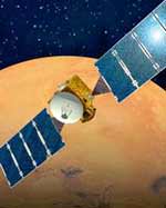
The European Space Agency’s mission to Mars, Mars Express, is right on schedule to arrive at the Red Planet on December 25, 2003. The British-built Beagle 2 lander will also reach Mars the same day, but it will be released from Mars Express on December 19. Beagle 2 doesn’t have any propulsion system of its own, so it’s critical that Mars Express releases it on the right trajectory. It will plunge through Mars’ atmosphere, deploy a parachute, and then land on the surface with the help of an airbag. Assuming everything went well, it will then be able to start examining rocks searching for evidence of life.

Europe’s mission to the Red Planet, Mars Express, is on schedule to arrive at the planet on Christmas Day, 2003.

The lander, Beagle 2, is due to descend through the Martian atmosphere and touch down also on 25 December.

Mars Express is now within 20 million kilometres of the Red Planet and the next mission milestone comes on 19 December, when Mars Express will release Beagle 2. The orbiter spacecraft will send Beagle 2 spinning towards the planet on a precise trajectory.

Into orbit
Beagle has no propulsion system of its own, so it relies on correct aiming by the orbiter to find its way to the planned landing site, a flat basin in the low northern latitudes of Mars.

ESA engineers will then fire the orbiter’s main engine in the early hours of 25 December to put Mars Express into orbit around Mars (called Mars Orbit Insertion, or MOI).

Landing
When Beagle 2 begins its descent, it will be slowed by friction with the Martian atmosphere. Nearer to the surface, parachutes will deploy and large gas-filled bags will inflate to cushion the final touchdown. Beagle 2 should bounce to a halt on Martian soil early on Christmas morning.

The first day on Mars is important for the lander because it has only a few hours to collect enough sunlight with its solar panels to recharge its battery.

Waiting for signal
We then have to wait for the radio ‘life’ signal from Beagle 2, relayed through the US Mars Odyssey spacecraft, to see if the probe has survived the landing. This could take hours or even days.

If nothing is received on Christmas morning, the UK Jodrell Bank Telescope will search for the faint radio signal from Beagle 2 in the evening. The Mars Express orbiter can also search for the lander but, because of its orbit, it will not be in place to do this until early January.

If all goes well, Mars Express and Beagle 2 will then begin their main mission – trying to answer the questions of whether there has been water, and possibly life, on Mars.

Original Source: ESA News Release

Big Dunes on Mars

Image credit: NASA/JPL

Mars has the largest volcano, the deepest canyon, and it’s got the biggest sand dunes. Several conditions on the Red Planet, including its low gravity, air pressure and sand probably contribute to the gigantic sand dunes that can form there. Dunes have been seen by the Mars Global Surveyor which reach twice as tall as they get on Earth. The Mars Exploration Rovers, currently on track to reach Mars in early 2004 will have cameras on board that may help scientists take a closer look at the sand that makes up these gigantic dunes.

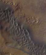
Mars is kind of like Texas: things are just bigger there. In addition to the biggest canyon and biggest volcano in the solar system, Mars has now been found to have sand ripples twice as tall as they would be on Earth.

Initial measurements of some of the Red Planet’s dunes and ripples using stereo-images from the Mars Orbiter Camera onboard the Mars Global Surveyor have revealed ripple features reaching almost 20 feet high and dunes towering at 300 feet.

One way to imagine the taller dimension of ripples on Mars is to visualize sand ripples on Earth, then stretch out the vertical dimension to double height, without changing the horizontal dimension.

“They do seem higher in relation to ripples on Earth,” said Kevin Williams of the Smithsonian National Air and Space Museum. Williams will be presenting this latest insight into the otherworldly scale of Marscapes on Monday, Nov. 3 at the annual meeting of the Geological Society of America in Seattle, WA.

Ripples are common on Mars and usually found in low-lying areas and inside craters, says Williams. On Earth they tend to form in long parallel lines from sand grains being pushed by water or air at right angles to the ripple lines. Dunes, on the other hand, are formed when grains of sand actually get airborne and “saltate” (a word based on the Latin verb “to jump”). That leads to cusp-shaped, star-shaped, and other dune arrangements that allow materials to pile sand much higher.

How exactly Martian dunes and ripples form is still unknown, says Williams, since the images from space give us no clues to the grain sizes or whether they are migrating or moving in any way. Though there are Viking spacecraft images from almost 30 years ago to compare with, the images do not have the resolution to confirm whether ripples have moved much in that time. For now, the dimensions of ripple-forms on Mars are the only indications of whether they are large ripples or small dunes. Williams’ results came about from the advantageous combination of image parameters to get the first height measurements of these ripple-like features at the limit of image resolution.

According to Williams, it’s likely the doubled heights of Mars ripples relative to their spacing is made possible by the same thing that makes Mars’ volcanoes so tall: lower gravity. With about one-third the gravity of Earth, sand, silt, and dust can theoretically stack up higher before gravity causes a slope failure.

However, other differences could play roles in making these large piles of sand as well. “It could also be from different wind speeds, air densities or other factors,” said Williams. Mars has a perennially subfreezing, very thin atmosphere in which global dust storms have been known to obscure the surface from view.

The study of Mars dunes and ripples has been underway since Viking spacecraft images of Mars first revealed such features in the late 1970s and early 1980s, says Williams. The primary difficulty of the work continues to be in discerning the close-up details, like the exact heights of features and grain sizes. As with dunes and ripples on Earth, these wind-blown features could reveal a lot about local and regional weather and wind currents ? if more was known about ripple and dune building under the very un-Earthlike conditions of Mars.

So far the only close-encounters humans have ever had with Martian dunes were with the Viking Landers and the Pathfinder mission, which sent the Sojourner rover trundling among Martian boulders. “There were some small dunes in the area of Pathfinder,” Williams said.

There are also likely to be ripples or small dunes within range of the far more mobile Mars Exploration Rovers now enroute to the Red Planet, Williams said. The Mars Exploration Rovers, Spirit and Opportunity, are larger and will be able to travel much further than Sojourner, making it more likely they will be taking a closer look at ripples as well as other geological features of Mars.

Original Source: Geological Society of America News Release

Desert in Chile Could Help Explain Mars Environment

Image credit: NASA

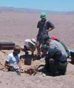
A team of scientists have traveled to one of the driest places on Earth to help understand why past missions to Mars have failed to detect any life in the soil. The Atacama Desert is located in a region of Chile which is blocked on both sides by high mountain ranges, so it’s incredibly dry. The scientists have studied the soil and realized that organic material is there, it’s just so minimal that the instruments on board the Viking lander, which visited Mars in the 1970s, wouldn’t have been able to sense them. More sophisticated instruments should be installed on future missions to find evidence of life.

A team of scientists from NASA, the Universidad Nacional Autonoma de Mexico, Louisiana State University and several other research organizations has discovered clues from one of Earth’s driest deserts about the limits of life on Earth, and why past missions to Mars may have failed to detect life.

The results were published this week in Science magazine in an article entitled “Mars-like Soils in the Atacama Desert, Chile, and the Dry Limit of Microbial Life.”

NASA’s Viking missions to Mars in the 1970s showed the martian soil to be disappointingly lifeless and depleted in organic materials, the chemical precursors necessary for life. Last year, in the driest part of Chile’s Atacama Desert, the research team conducted microbe-hunting experiments similar to Viking’s, and no evidence of life was found. The scientists called the finding “highly unusual” in an environment exposed to the atmosphere.

“In the driest part of the Atacama, we found that, if Viking had landed there instead of on Mars and done exactly the same experiments, we would also have been shut out,” said Dr. Chris McKay, the expedition’s principal investigator, who is based at NASA Ames Research Center, Moffett Field, Calif. “The Atacama appears to be the only place on Earth Viking would have found nothing.”

During field studies, the team analyzed Atacama’s depleted Mars-like soils and found organic materials at such low levels and released at such high temperatures that Viking would not have been able to detect them, said McKay, who noted that the team did discover a non-biological oxidative substance that appears to have reacted with the organics — results that mimicked Viking’s results.

“The Atacama is the only place on Earth that I’ve taken soil samples to grow microorganisms back at the lab and nothing whatsoever grew,” said Dr. Fred A. Rainey, a co-author from Louisiana State University, who studies microorganisms in extreme environments.

According to the researchers, the Atacama site they studied could serve as a valuable testbed for developing instruments and experiments that are better tailored to finding microbial life on Mars than the current generation. “We think Atacama’s lifeless zone is a great resource to develop portable and self-contained instruments that are especially designed for taking and analyzing samples of the martian soil,” McKay said.

More sophisticated instruments on future sample-return Mars missions are a necessity if scientists are to avoid contaminating future martian samples, McKay noted. “We’re still doing the first steps of instrument development for Mars.” Recently, researchers have developed a method to extract DNA from soil without humans getting involved in processing the data, which is “a step in the right direction,” according to McKay.

The reason Chile’s Atacama Desert is so dry and virtually sterile, researchers say, is because it is blocked from moisture on both sides by the Andes mountains and by coastal mountains. At 3,000 feet, the Atacama is 15 million years old and 50 times more arid than California’s Death Valley. The scientists studied the driest part of the Atacama, an area called the ‘double rain shadow.’ During the past four years, the team’s sensor station has recorded only one rainfall, which shed a paltry 1/10 of an inch of moisture. McKay hypothesizes that it rains in the arid core of the Atacama on average of only once every 10 years.

The Atacama research was funded by NASA’s Astrobiology Science and Technology for Exploring Planets program, by Louisiana State University, the National Science Foundation and by several other organizations.

The article was also authored by Dr. Rafael Navarro-Gonzalez, Dr. Paola Molina and Dr .Jose de la Rosa from the Universidad Nacional Autonoma de Mexico, Mexico City, MX; Danielle Bagaley, Becky Hollen and Alanna Small, Louisiana State University, Baton Rouge, LA.; Dr. Richard Quinn, the SETI Institute, Mountain View, Calif.; Dr. Frank Grunthaner, NASA Jet Propulsion Laboratory, Pasadena, Calif.; Dr. Luis Caceres, Instituto del Desierto y Departameno de Ingenieria, Quimica; and Dr. Benito Gomez-Silva, Instituto del Desierto y unidad de Bioquimica, Universidad de Antofagasta, Antofagasta, Chile.

For images of the field experiments, please go to: http://www.sciencemag.org

Original Source: NASA News Release

Mars Rover Should Work Fine

Image credit: NASA/JPL

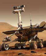
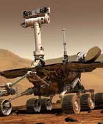
NASA engineers have been working through a problem with one of the Mars rovers currently traveling to the Red Planet, and they think they’ve got a solution. Back in August, engineers detected that Spirit’s M?ssbauer spectrometer – a device for identifying iron-bearing rocks – was sending back incorrect readings. They’ve been able to compensate for the readings, so long as Spirit continues to behave on Mars as it’s working right now. The rovers will land on Mars in January 2004.

A series of tests of one of the science instruments on NASA’s Mars Exploration Rover Spirit has enabled engineers and scientists to identify how to work around an apparent problem detected in August.

Tests now indicate that all of the science instruments on both Spirit and its twin, Opportunity, are in suitable condition to provide full capabilities for examining the sites on Mars where they will land in January.

Spirit’s M?ssbauer spectrometer, a tool for identifying the types of iron-bearing minerals in rocks and soil, returned data that did not fit expectations during its first in-flight checkup three months ago. A drive system that rapidly vibrates a gamma-ray source back and forth inside the instrument appeared to show partial restriction in its motion.

“The drive system is adjustable. We can change its velocity. We can change its frequency,” said Dr. Steve Squyres of Cornell University, Ithaca, N.Y., principal investigator for the rovers’ science instruments. “We’ve found a set of parameters that will give us good M?ssbauer science if the instrument behaves on Mars the way it is behaving now.”

The corrective countermeasures include using a higher frequency of back-and-forth motion. “With these settings, whatever happened during launch will not decrease the quality of the data we get from the instrument,” said Dr. G?star Klingelh?fer, of Johannes Gutenberg University, Mainz, Germany, lead scientist for the M?ssbauer spectrometers on both rovers. “The instrument was designed with enough margin in its performance that we can make this change with no significant science impact.”

A possible explanation for the instrument’s behavior since launch is that intense vibration of the spacecraft during launch shook something inside the spectrometer slightly out of position, he said.

Landings on Mars are risky. Most attempts over the years have failed. And even if the spacecraft survives the landing, there is the potential that individual components could be damaged. “One remaining issue with the M?ssbauer Spectrometer on Spirit, as with all the instruments, is that we can’t be one hundred percent sure it?ll operate on Mars the way it?s operating now,” Squyres said. “We?ll breathe easier once we?ve done all our post-landing health checks.”

Another fact that has emerged from the in-flight checkouts of the M?ssbauer spectrometers on both spacecraft is that the internal calibration channel of the M?ssbauer spectrometer on Opportunity is not functioning properly. But because the instrument has the redundancy of a separate, completely independent external calibration method, this problem will not hamper use of that instrument, Squyres said.

Spirit is on course to arrive at Mars’ Gusev Crater at 04:35 Jan. 4, 2004, Universal Time, which is 8:35 p.m. Jan. 3, Pacific Standard Time and 11:35 p.m. Jan. 3, Eastern Standard Time. (These are “Earth received times,” meaning they reflect the delay necessary for a speed-of-light signal from Mars to reach Earth; on Mars, the landing will have happened nearly 10 minutes earlier.) Three weeks later, Opportunity will arrive at a level plain called Meridiani Planum on the opposite side of Mars from Gusev. Each rover will examine its landing area for geological evidence about the history of water there, key information for assessing whether the site ever could have been hospitable to life.

As of 13:00 Universal Time on Nov. 5 (5 a.m. PST; 8 a.m. EST), Spirit will have traveled 367.4 million kilometers (228.3 million miles) since its launch on June 10 and will still have 119.6 million kilometers (74.3 million miles) to go before reaching Mars. Opportunity will have traveled 296 million kilometers (184 million miles) since its launch on July 7 and will still have 160 million kilometers (99.2 million miles) to go to reach Mars.

The Jet Propulsion Laboratory, a division of the California Institute of Technology, manages the Mars Exploration Rover project for NASA’s Office of Space Science, Washington, D.C. Additional information about the project is available from JPL at http://mars.jpl.nasa.gov/mer and from Cornell University, Ithaca, N.Y., at http://athena.cornell.edu.

Original Source: NASA/JPL News Release
Green Minerals on Mars Say it’s Dry

Image credit: NASA

Astronomers have uncovered a green mineral on Mars called olivine that could indicate that the planet has been completely dry for at least a billion years, since the mineral was exposed to the Martian air. Olivine is found in many rocks on Earth, and it’s highly susceptible to chemical weathering. If liquid water was present at any time in the past, the olivine would have altered into other materials – but this hasn’t happened. The areas will be further investigated in 2005 by the upcoming Mars Reconnaissance Orbiter, which has 100 times the resolution of the Mars Global Surveyor.

The presence of a common green mineral on Mars suggests that the Red Planet could have been cold and dry since the mineral has been exposed, which may have been more than a billion years ago, according to new research appearing in the Oct. 24 edition of Science.

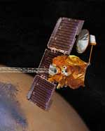
Todd Hoefen, a Denver-based U.S. Geological Survey (USGS) geophysicist, led a team of researchers from USGS, Arizona State University and NASA, that found abundant quantities of olivine on Mars at least locally. They based their conclusions on data obtained from a Thermal Emission Spectrometer (TES) carried by NASA’s Mars Global Surveyor (MGS) spacecraft.

Olivine, a transparent, green-colored mineral found in many rocks containing magnesium and iron (mafic igneous rocks), is highly susceptible to chemical weathering and readily alters to other minerals in the presence of liquid water (minerals such as iddingsite, goethite, serpentine, chlorite, smectite, maghemite and hematite). Except for trace amounts of hematite, which gives Mars its red color, none of these other weathering products have been detected at kilometer scales on Mars.

The team detected a 30,000 square kilometer (18,720 square mile) area rich in olivine, in the Nili Fossae region of Mars, which makes up ~ 0.02 % of the planet by area. Nili Fossae has been interpreted as a complex of grabens (long depressions between geologic faults) and fractures related to the formation of the Isidis impact basin, where post-impact faulting most plausibly exposed the locally abundant olivine. They have also found smaller deposits of olivine all over the planet, all indicating a surface at least regionally dominated by volcanic processes.

The fact that so much olivine is exposed at the surface in the Nili Fossae region indicates that there has been little to no weathering due to water, thus no liquid water-mineral chemical reactions. The absolute age of the surface is somewhat uncertain but is probably over 3 billion years old, on the basis of our best current estimates. If, however, such surfaces have been more recently exposed, one would not expect for the olivine to have been chemically altered due to the current environmental conditions on Mars (cold, dry).

It took approximately three years for the MGS spacecraft and the TES instrument to gather the data for the analysis, and another year for scientists to analyze and fully interpret the results. The MGS spacecraft is healthy and continues to map Mars.

“The detection of minerals such as olivine that serve as fingerprints of the geological processes responsible for forming the Martian surface we are exploring today is a vital part of the overall Mars Exploration Program science strategy,” stated Dr. Jim Garvin, NASA’s Lead Scientist for Mars at NASA Headquarters. “The provocative findings by Hoefen and his team will be further investigated when NASA’s 2005 Mars Reconnaissance Orbiter turns its hyperspectral imaging spectrometer, with 100 times the spatial resolution of the MGS TES instrument, on these olivine-rich regions in a few years,” continues Garvin.

The USGS serves the nation by providing reliable scientific information to describe and understand the Earth; minimize loss of life and property from natural disasters; manage water, biological, energy, and mineral resources; and enhance and protect our quality of life.

Original Source: NASA News Release

New Method for Finding Life on Mars

Image credit: NASA

Is there life on Mars? A team of scientists from the University of Glasgow have developed a method they believe will help detect evidence of life in ancient rocks – perhaps helping uncover if there’s life on Mars. With their technique, the rocks are crushed to release tiny amounts of liquid water, and then special detectors are used to search for the presence of biomolecules in the water. Once the technique has been proven to work, the researchers believe it could be miniaturized and flown aboard future Mars landers.

A new UK project could help detect evidence of life on Mars and improve our understanding of how life evolved on Earth. The aim is to develop a technique that can identify biomolecules in water that have been trapped in rocks for millions to billions of years.

The three-year initiative will be carried out by geologists and bioengineers at the University of Aberdeen and the University of Glasgow, with funding from the UK’s Engineering and Physical Sciences Research Council.

The initiative is being led by Dr John Parnell of the University of Aberdeen’s Geology and Petroleum Geology Department, in collaboration with Professor Jonathan Cooper of the University of Glasgow’s Department of Electronics.

Professor Cooper says, ‘With our collaborators in Aberdeen, we are fortunate to have the possibility of working on one of the most exciting projects in the universe, the search for life on other planets!’

As well as analysing samples from Earth, the technique could be used to obtain important information from water sealed within rock samples brought back from Mars. The team will also consider how the technique could be miniaturised for incorporation into spacecraft that travel to other planets.

The research will explore significant technological challenges at the interface between the physical sciences and engineering. These include microfluidic methods for sample pre-concentration (ie the extraction and handling of exceptionally small amounts of fluid), single molecule detection technologies to locate very small amounts of biomaterials and the elimination of contaminants.

The project is highly innovative, attempting to access a source of biomolecules that have not been tapped before. Analysis of material dating from the time before the Earth’s fossil record became extensive is a major project aim, potentially resulting in our knowledge of the development of life on Earth being significantly enhanced.

Original Source: University of Glasgow News Release

ESA Chooses Designers for New Mars Missions

Image credit: ESA

Three European firms have won contracts to design the European Space Agency’s ExoMars spacecraft – a mission that is expected to launch to the Red Planet in 2009. ExoMars will consist of an orbiter and a rover that will land on Mars, and explore some of its surface. The three winning teams are Alenia Spazio, Alcatel Space and EADS Astrium. Teams have also been selected to provide design studies for the Mars Sample Return mission – where a spacecraft will land on Mars, collect samples, and then return them to Earth.

A major milestone in ESA?s long-term Aurora programme of Solar System exploration has been passed with the announcement of the winners of competitive contracts for two of the programme?s key robotic missions ? ExoMars and Earth re-entry Vehicle Demonstrator (EVD).

A major milestone in ESA?s long-term Aurora programme of Solar System exploration has been passed with the announcement of the winners of competitive contracts for two of the programme?s key robotic missions ? ExoMars and Earth re-entry Vehicle Demonstrator (EVD).

Alenia Spazio (Italy), Alcatel Space (France) and EADS Astrium (France) are heading the three industrial teams selected to carry out a full mission design for ExoMars, the Aurora exobiology mission to Mars.

At the same time, two industrial teams, headed by EADS LV (Launch Vehicles) of France and Surrey Satellite Technology Limited (SSTL) of the United Kingdom respectively, have been selected for the pre-development phase (officially known as Pre-Phase A) of the EVD mission.

?Following the Invitations To Tender (ITTs) for these contracts, issued in April-May 2003, there was an overwhelming and enthusiastic response from industry,? said Bruno Gardini, Aurora Project Manager.

?We were delighted by the number and the excellence of the proposals received,? he added. ?It was also pleasing to see that many of them included new, innovative ideas from industry.?

ExoMars
The ExoMars mission, to be launched in 2009, is the first of the major Flagship missions in the Aurora programme. It includes an orbiter and a descent module that will land a large (200 kg), high-mobility rover on the surface of Mars. After delivery of the lander/rover, the ExoMars orbiter will also operate as a data relay satellite between the Earth and the vehicle on the Martian surface.

The primary objective of the ExoMars rover will be to search for signs of life, past or present, on the Red Planet. Additional measurements will be taken to identify potential surface hazards for future human missions, to determine the distribution of water on Mars and to measure the chemical composition of the surface rocks.

Three parallel Phase A studies for the ExoMars Mission will be carried out by industrial teams that include companies from ESA member states and Canada:

  • * Alenia Spazio (Italy) with subcontractors OHB (Germany), GMV (Spain), SEA (UK), SSC (UK) and Laben (Italy).
  • * Alcatel Space (France) with subcontractors Deimos (Spain), ETCA (Belgium), Fluid Gravity Engineering (UK), Kayser Threde (Germany), Laben (Italy), MD Robotics (Canada), NGC Aerospatiale (Canada), QinetiQ (UK), Vorticity (UK).
  • * EADS Astrium (France) with subcontractors Astrium Ltd. (UK), EADS LV (France) and SAS (Belgium).

The contracts cover the design of the entire ExoMars mission, from launch, through the long interplanetary voyage to the landing of the rover on the planet.

?This is an exciting landmark for the Aurora programme, since these are the first contracts dedicated to mission development rather than technical studies,? said Gardini.

?With the participation of all major European aerospace companies, the proposed concepts will make the best use of their extensive experience, gathered over many years, in the design and development of interplanetary missions,? he said.

?The studies will also bring to fruition several years of efforts from national and international programmes in investigating and planning Mars missions.

?From the quality of the proposals, the agency is very confident that the technical baseline will be fully consolidated by the end of the Phase A studies and that the spacecraft design will then be defined to a level of detail commensurate with a prompt start of Phase B.?

Depending on the availability of funding, the Phase B studies for ExoMars are planned to start in 2004.

Earth re-entry Vehicle Demonstrator (EVD)
The second Aurora Flagship mission is a Mars Sample Return (MSR), planned for 2011. Its main goal will be the retrieval of rock samples from the Martian surface and subsurface for subsequent analysis in laboratories on Earth.

In order to ensure the success of this challenging mission, a number of new technologies will have to be developed and tested. Conceived as a small, technology-driven Arrow-class mission, the Earth re-entry Vehicle Demonstration will be used to validate the design of the small MSR capsule that will bring back the precious samples of Martian soil.

The EVD is expected to be launched in 2007. The baseline mission foresees the insertion into a highly elliptical Earth orbit of a small spacecraft carrying a re-entry capsule. In order to reproduce the final phase of a typical Mars return mission, the capsule will then carry out a ballistic re-entry into Earth?s atmosphere at speeds of up to 45,000 km/h.

Two industrial teams have been selected for the parallel EVD mission Pre-Phase A studies. The concept presented by the industrial team, under the leadership of EADS LV (France) with the participation of OHB System (Germany) and Plansee (Austria) is solidly based on the experience of past projects.

The industrial team led by SSTL (UK), a company well known for its experience in small highly integrated spacecraft, has devised a very innovative concept well adapted for a small technology mission. The participation of highly specialised companies, Fluid Gravity Engineering (UK), Kayser Threde GmbH (D) and Vorticity Ltd. (UK) ensures an excellent coverage of the mission?s most critical technologies.

?The expectations are for highly competitive and exciting Pre-Phase A studies,? said Gardini.

The next Aurora contract for Phase A studies will concern the Mars Sample Return mission. Industrial proposals were submitted on 1 August and the evaluation is nearly completed. The names of the selected companies are expected to be announced in early October.

Original Source: ESA News Release

10,000 New Images of Mars

Image credit: NASA/JPL

NASA has released 10,232 new images of the Red Planet taken by the Mars Global Surveyor spacecraft, including wind whipped polar dunes, steep-walled valleys, and boulder-strewn terrain. The images were taken over the course of several months, from August 2002 to February 2003, and they include views all over the planet. This brings the total number of images taken by Surveyor in six years of observation to more than 134,000.

Thousands of newly released portraits of martian landscapes from NASA’s Mars Global Surveyor spacecraft testify to the diversity of ways geological processes have sculpted the surface of our neighboring planet.

Swirling textures that some scientists call “taffy-pull terrain? fill one new image from the plains of southern Mars, for example. Other images reveal details of features such as wind-whipped polar dunes and steep-sided valleys carved by flowing water or lava.

The 10,232 newly released pictures from the Mars Orbiter Camera on Mars Global Surveyor bring the total number of images in the camera’s online gallery to more than 134,000. The new batch is at: http://www.msss.com/mars_images/moc/2003/09/30/.

“Mars just keeps astounding us with its complexity,” said Dr. Ken Edgett, staff scientist for Malin Space Science Systems, San Diego, Calif, which built and operates the Mars Orbiter Camera.

The new group of images was taken between August 2002 and February 2003, then validated and archived by the camera team. It includes many views of north polar terrain, extremely clear-atmosphere views of a deep southern basin named Hellas Planitia, and a variety of martian landforms between the north pole and the southern middle latitudes. The pictures show martian surface details down to the size of a large sport utility vehicle.

Since Mars Global Surveyor began orbiting Mars six years ago, the mission has provided a wealth of information about the planet’s atmosphere and interior, as well at its surface.

Evaluation of landing sites for NASA’s Spirit and Opportunity, two Mars Exploration Rover spacecraft due to land on Mars in January 2004, relied heavily on mineral mapping, detailed imagery and topographic measurements by Global Surveyor.

Additional information about Mars Global Surveyor is available online at: http://mars.jpl.nasa.gov/mgs/.

In addition to semi-annual releases of large collections of archived pictures, the Mars Orbiter Camera team posts a new image daily and recently began soliciting public suggestions for camera targets on Mars. The full gallery is available at: http://www.msss.com/moc_gallery/.

Original Source: NASA News Release

First Public Mars Images Released

Image credit: NASA/JPL

For the past few weeks, NASA has been letting the public select targets for the Mars Global Surveyor spacecraft, and the first image was released today. The location was the summit crater of a giant volcano called Pavonis Mons – the walls and floor of the crater are covered with thick dust. It was suggested by U.S. Marine Lance Corporal Robert F. Sanders, of Jacksonville, N.C. from the hundreds of selections submitted so far. Mars Global Surveyor has taken 120,000 images of the planet’s surface in high detail, but this is only 3% of the entire planet.

If you were given a chance to aim the camera on NASA’s Mars Global Surveyor Mars Orbiter and take a picture of something on the red planet, what would you shoot?

Now we know, after NASA released today the first picture selected from hundreds of public suggestions. The photo reveals a thick layer of dust blanketing the floor and wall of the summit crater atop a tall volcano called Pavonis Mons.

“It’s such a thrill to see it,” said U.S. Marine Lance Corporal Robert F. Sanders, of Jacksonville, N.C., who suggested the crater close up as a photo target for the Mars Global Surveyor camera. “I spent hours coming up with suggestions, but I didn’t know whether any of them would be accepted.”

The resulting picture shows details as small as a large SUV in a strip of ground about 9 kilometers (5.6 miles) long within the summit crater of Pavonis Mons.

“We’ve received hundreds of really good ideas since we began accepting public suggestions last month,” said Dr. Ken Edgett, staff scientist for Malin Space Science Systems, which operates the Mars Orbital Camera. “We were excited last week, when the predicted ground track intersected a publicly suggested location for the first time.” Accepted targets are not imaged until the spacecraft’s regular orbiting pattern goes directly over them.

The captioned image and an accompanying wide-angle view for context are available on the Internet from NASA’s Jet Propulsion Laboratory, Pasadena, Calif., at http://photojournal.jpl.nasa.gov/catalog/PIA04735. They are also available from Malin Space Science Systems, San Diego, at http://www.msss.com/mars_images/moc/2003/09/12/.

The camera on Mars Global Surveyor has returned more than 120,000 pictures since the spacecraft began orbiting Mars on Sept. 12, 1997. Still, its high-resolution images have covered only about three percent of the planet’s surface. Three percent of Mars, while seemingly small, represents a huge amount of “real estate,” or nearly 5 million square kilometers (about 3 million square miles), that has been observed at spectacular resolution.

Information about how to submit suggestions is available on the Internet at the Mars Orbiter Camera Target Request Site, at http://www.msss.com/plan/intro.

“Taking public suggestions enhances the science return,” Edgett said. “Every suggestion we get has the potential for discovery.”

“As Mars Global Surveyor continues its legacy of SUV-scale exploration, we’re excited to offer for the first time an innovative approach for direct public participation in Mars exploration,” said Dr. Jim Garvin, NASA’s lead scientist for Mars. “Increasing the breadth of science activities, by working together with the public to uncover the mysteries of Mars, is an important part of NASA’s mission to inspire the next generation of explorers.”

Information about Mars Global Surveyor is available on the Internet at http://mars.jpl.nasa.gov/mgs.

JPL, a division of the California Institute of Technology, Pasadena, manages Mars Global Surveyor for NASA’s Office of Space Science in Washington. JPL’s industrial partner is Lockheed Martin Space Systems, Denver, which developed and operates the spacecraft. Malin Space Science Systems and the California Institute of Technology built the Mars Orbiter Camera. Malin Space Science Systems operates the camera from facilities in San Diego.

Original Source: NASA/JPL News Release