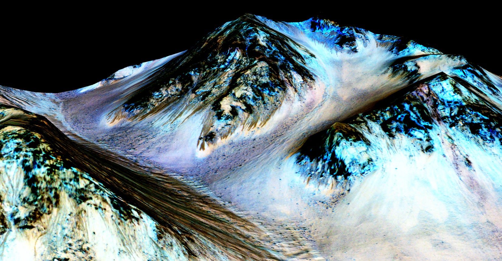
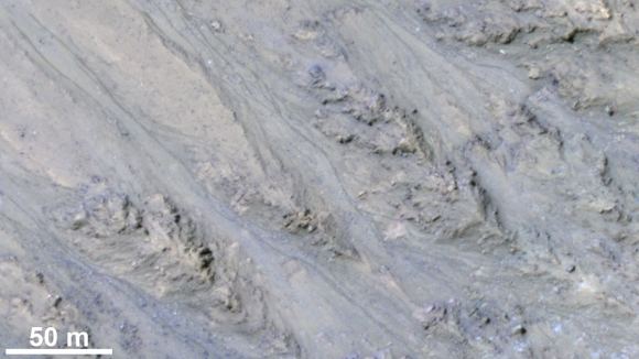
Mars modern landscape is something of a paradox. It’s many surface features are very similar to those on Earth that are caused by water-borne erosion. But for the life of them, scientists cannot imagine how water could have flown on Mars’ cold and desiccated surface for most of Mars’ history. Whereas Mars was once a warmer, wetter place, it has had a very thin atmosphere for billions of years now, which makes water flow and erosion highly unlikely.
In fact, while the surface of Mars periodically becomes warm enough to allow for ice to thaw, liquid water would boil once exposed to the thin atmosphere. However, in a new study led by an international team of researchers from the UK, France and Switzerland, it has been determined that a different kind of transport process involving the sublimation of water ice could have led to the Martian landscape becoming what it is today.
The study, which was led Dr. Jan Raack – a Marie Sklodowska-Curie Research Fellow at The Open University – was recently published in the scientific journal Nature Communications. Titled “Water Induced Sediment Levitation Enhances Downslope Transport on Mars”, this research study consisted of experiments that tested how processes on Mars’ surface could allow water transport without it being in liquid form.
To conduct their experiments, the team used the Mars Simulation Chamber, an instrument at The Open University that is capable of simulating the atmospheric conditions on Mars. This involved lowering the atmospheric pressure inside the chamber to what is normal for Mars – about 7 mbar, compared to 1000 mbar (1 bar or 100 kilopascals) here on Earth – while also adjusting temperatures.
On Mars, temperatures range from a low of -143 °C (-255 °F) during winter at the poles to a high of 35 °C (95 °F) at the equator during midday in the summer. Having recreated these conditions, the team found that when water ice exposed to the simulated Martian atmosphere, it would not simply melt. Instead, it would become unstable and begin violently boiling off.
However, the team also found that this process would be capable of moving large amounts of sand and sediment, which would effectively “levitate” on the boiling water. This means that, compared to Earth, relatively small amounts of liquid water are capable of moving sediment across the surface of Mars. These levitating pockets of sand and debris would be capable of forming tje large dunes, gullies, recurring slope lineae, and other features observed on Mars.
In the past, scientists have indicated how these features were the result of sediment transportation down slopes, but were unclear as to the mechanisms behind them. As Dr. Jan Raack explained in a OUNews press release:
“Our research has discovered that this levitation effect caused by boiling water under low pressure enables the rapid transport of sand and sediment across the surface. This is a new geological phenomenon, which doesn’t happen on Earth, and could be vital to understanding similar processes on other planetary surfaces.”
Through these experiments, Dr. Raack and his colleagues were able to shed light on how conditions on Mars could allow for features that we tend to associate with flowing water here on Earth. In addition to helping to resolve a somewhat contentious debate concerning Mars’ geological history and evolution, this study is also significant when it comes to future exploration missions.
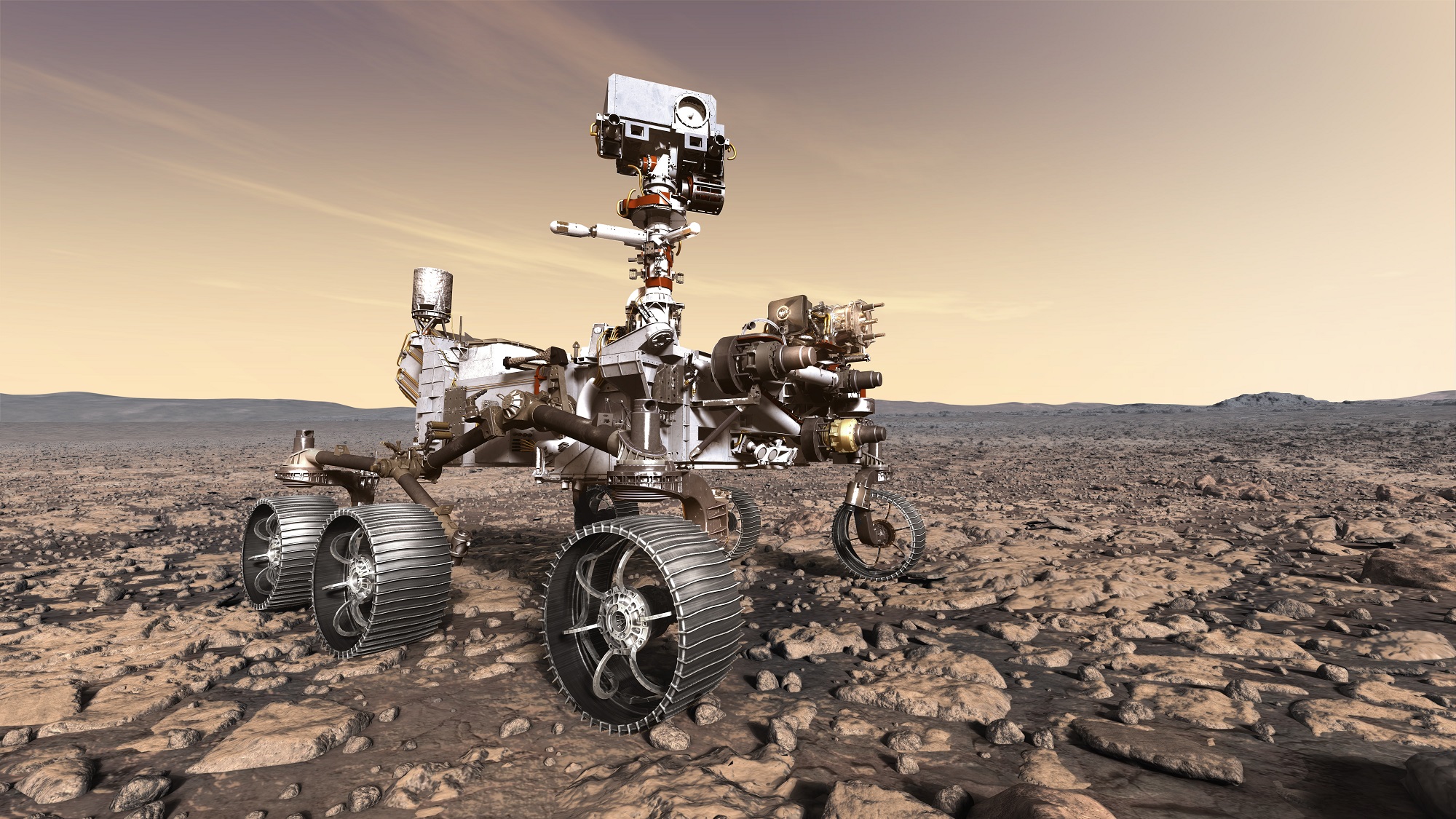
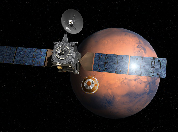
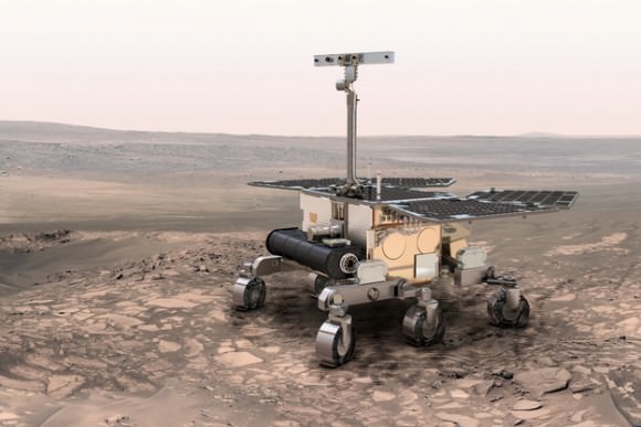
Dr. Raack acknowledges the need for more research to confirm their study’s conclusions, and indicated that the ESA’s ExoMars 2020 Rover will be well-situated to conduct it once it is deployed :
“This is a controlled laboratory experiment, however, the research shows that the effects of relatively small amounts of water on Mars in forming features on the surface may have been widely underestimated. We need to carry out more research into how water levitates on Mars, and missions such as the ESA ExoMars 2020 Rover will provide vital insight to help us better understand our closest neighbour.”
5 years after a heart throbbing Martian touchdown, Curiosity is climbing Vera Rubin Ridge in search of “aqueous minerals” and “clays” for clues to possible past life while capturing “truly breathtaking” vistas of humongous Mount Sharp – her primary destination – and the stark eroded rim of the Gale Crater landing zone from ever higher elevations, NASA scientists tell Universe Today in a new mission update.
“Curiosity is doing well, over five years into the mission,” Michael Meyer, NASA Lead Scientist, Mars Exploration Program, NASA Headquarters told Universe Today in an interview.
“A key finding is the discovery of an extended period of habitability on ancient Mars.”
The car-sized rover soft landed on Mars inside Gale Crater on August 6, 2012 using the ingenious and never before tried “sky crane” system.
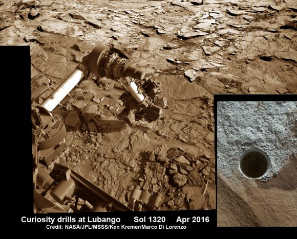
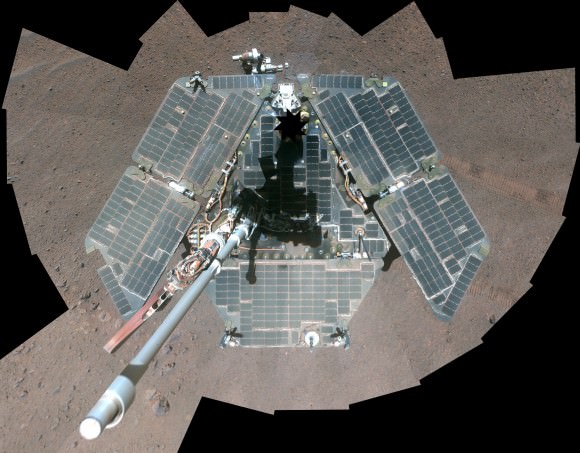
A rare glimpse of Curiosity’s arm and turret mounted skyward pointing drill is illustrated with our lead mosaic from Sol 1833 of the robot’s life on Mars – showing a panoramic view around the alien terrain from her current location in October 2017 while actively at work analyzing soil samples.
“Your mosaic is absolutely gorgeous!’ Jim Green, NASA Director Planetary Science Division, NASA Headquarters, Washington D.C., told Universe Today
“We are at such a height on Mt Sharp to see the rim of Gale Crater and the top of the mountain. Truly breathtaking.”
The rover has ascended more than 300 meters in elevation over the past 5 years of exploration and discovery from the crater floor to the mountain ridge. She is driving to the top of Vera Rubin Ridge at this moment and always on the lookout for research worthy targets of opportunity.
Additionally, the Sol 1833 Vera Rubin Ridge mosaic, stitched by the imaging team of Ken Kremer and Marco Di Lorenzo, shows portions of the trek ahead to the priceless scientific bounty of aqueous mineral signatures detected by spectrometers years earlier from orbit by NASA’s fleet of Red Planet orbiters.
“Curiosity is on Vera Rubin Ridge (aka Hematite Ridge) – it is the first aqueous mineral signature that we have seen from space, a driver for selecting Gale Crater,” NASA HQ Mars Lead Scientist Meyer elaborated.
“And now we have access to it.”
The Sol 1833 photomosaic illustrates Curiosity maneuvering her 7 foot long (2 meter) robotic arm during a period when she was processing and delivering a sample of the “Ogunquit Beach” for drop off to the inlet of the CheMin instrument earlier in October. The “Ogunquit Beach” sample is dune material that was collected at Bagnold Dune II this past spring.
The sample drop is significant because the drill has not been operational for some time.
“Ogunquit Beach” sediment materials were successfully delivered to the CheMin and SAM instruments over the following sols and multiple analyses are in progress.
To date three CheMin integrations of “Ogunquit Beach” have been completed. Each one brings the mineralogy into sharper focus.
What’s the status of the rover health at 5 years, the wheels and the drill?
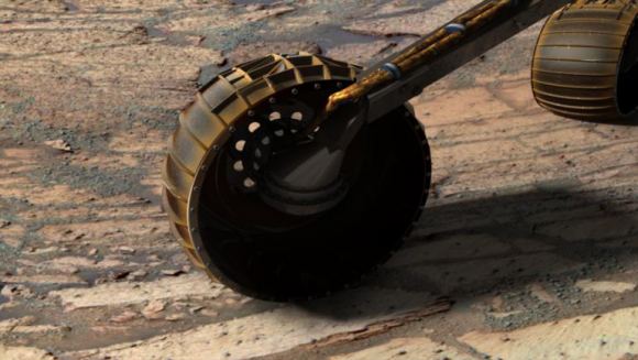
“All the instruments are doing great and the wheels are holding up,” Meyer explained.
“When 3 grousers break, 60% life has been used – this has not happened yet and they are being periodically monitored. The one exception is the drill feed (see detailed update below).”
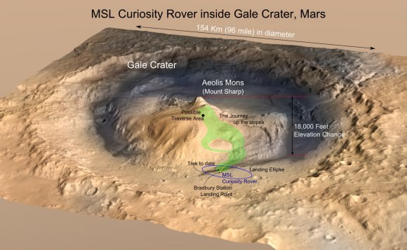
NASA’s 1 ton Curiosity Mars Science Laboratory (MSL) rover is now closer than ever to the mineral signatures that were the key reason why Mount Sharp was chosen as the robots landing site years ago by the scientists leading the unprecedented mission.
Along the way from the ‘Bradbury Landing’ zone to Mount Sharp, six wheeled Curiosity has often been climbing. To date she has gained over 313 meters (1027 feet) in elevation – from minus 4490 meters to minus 4177 meters today, Oct. 19, 2017, said Meyer.
The low point was inside Yellowknife Bay at approx. minus 4521 meters.
VRR alone stands about 20 stories tall and gains Curiosity approx. 65 meters (213 feet) of elevation to the top of the ridge. Overall the VRR traverse is estimated by NASA to take drives totaling more than a third of a mile (570 m).
“Vera Rubin Ridge” or VRR is also called “Hematite Ridge.” It’s a narrow and winding ridge located on the northwestern flank of Mount Sharp. It was informally named earlier this year in honor of pioneering astrophysicist Vera Rubin.
The intrepid robot reached the base of the ridge in early September.
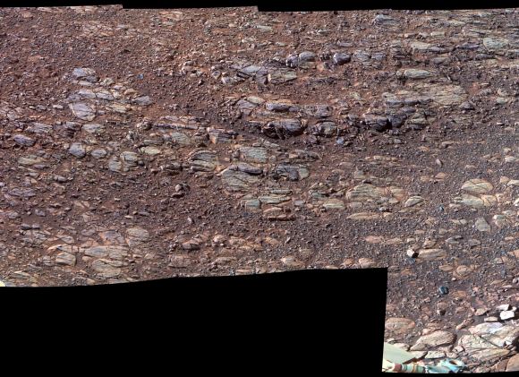
The ridge possesses steep cliffs exposing stratifications of large vertical sedimentary rock layers and fracture filling mineral deposits, including the iron-oxide mineral hematite, with extensive bright veins.
VRR resists erosion better than the less-steep portions of the mountain below and above it, say mission scientists.
What’s ahead for Curiosity in the coming weeks and months exploring VRR before moving onward and upwards to higher elevation?
“Over the next several months, Curiosity will explore Vera Rubin Ridge,” Meyer replied.
“This will be a big opportunity to ground-truth orbital observations. Of interest, so far, the hematite of VRR does not look that different from what we have been seeing all along the Murray formation. So, big question is why?”
“The view from VRR also provides better access to what’s ahead in exploring the next aqueous mineral feature – the clay, or phyllosilicates, which can be indicators of specific environments, putting constraints on variables such as pH and temperature,” Meyer explained.
The clay minerals or phyllosilicates form in more neutral water, and are thus extremely scientifically interesting since pH neutral water is more conducive to the origin and evolution of Martian microbial life forms, if they ever existed.
How far away are the clays ahead and when might Curiosity reach them?
“As the crow flies, the clays are about 0.5 km,” Meyer replied. “However, the actual odometer distance and whether the clays are where we think they are – area vs. a particular location – can add a fair degree of variability.”
The clay rich area is located beyond the ridge.
Over the past few months Curiosity make rapid progress towards the hematite-bearing location of Vera Rubin Ridge after conducting in-depth exploration of the Bagnold Dunes earlier this year.
“Vera Rubin Ridge is a high-standing unit that runs parallel to and along the eastern side of the Bagnold Dunes,” said Mark Salvatore, an MSL Participating Scientist and a faculty member at Northern Arizona University, in a mission update.
“From orbit, Vera Rubin Ridge has been shown to exhibit signatures of hematite, an oxidized iron phase whose presence can help us to better understand the environmental conditions present when this mineral assemblage formed.”
Curiosity is using the science instruments on the mast, deck and robotic arm turret to gather detailed research measurements with the cameras and spectrometers. The pair of miniaturized chemistry lab instruments inside the belly – CheMin and SAM – are used to analyze the chemical and elemental composition of pulverized rock and soil gathered by drilling and scooping selected targets during the traverse.
A key instrument is the drill which has not been operational. I asked Meyer for a drill update.
“The drill feed developed problems retracting (two stabilizer prongs on either side of the drill retract, controlling the rate of drill penetration),” Meyer replied.
“Because the root cause has not been found (think FOD) and the concern about the situation getting worse, the drill feed has been retracted and the engineers are working on drilling without the stabilizing prongs.”
“Note, a consequence is that you can still drill and collect sample but a) there is added concern about getting the drill stuck and b) a new method of delivering sample needs to be developed and tested (the drill feed normally needs to be moved to move the sample into the chimera). One option that looks viable is reversing the drill – it does work and they are working on the scripts and how to control sample size.”
Ascending and diligently exploring the sedimentary lower layers of Mount Sharp, which towers 3.4 miles (5.5 kilometers) into the Martian sky, is the primary destination and goal of the rover’s long term scientific expedition on the Red Planet.
“Lower Mount Sharp was chosen as a destination for the Curiosity mission because the layers of the mountain offer exposures of rocks that record environmental conditions from different times in the early history of the Red Planet. Curiosity has found evidence for ancient wet environments that offered conditions favorable for microbial life, if Mars has ever hosted life,” says NASA.
Stay tuned. In part 2 we’ll discuss the key findings from Curiosity’s first 5 years exploring the Red Planet.
As of today, Sol 1850, Oct. 19, 2017, Curiosity has driven over 10.89 miles (17.53 kilometers) since its August 2012 landing inside Gale Crater from the landing site to the ridge, and taken over 445,000 amazing images.
Stay tuned here for Ken’s continuing Earth and planetary science and human spaceflight news.
Today, there are multiple lines of evidence that indicate that during the Noachian period (ca. 4.1 to 3.7 billion years ago), microorganisms could have existed on the surface of Mars. These include evidence of past water flows, rivers and lakebeds, as well as atmospheric models that indicate that Mars once had a denser atmosphere. All of this adds up to Mars having once been a warmer and wetter place than it is today.
However, to date, no evidence has been found that life ever existed on Mars. As a result, scientists have been trying to determine how and where they should look for signs of past life. According to a new study by a team of European researchers, extreme lifeforms that are capable of metabolizing metals could have existed on Mars in the past. The “fingerprints” of their existence could be found by looking at samples of Mars’ red sands.
For the sake of their study, which recently appeared in the scientific journal Frontiers of Microbiology, the team created a “Mars Farm” to see how a form of extreme bacteria might fare in an ancient Martian environment. This environment was characterized by a comparatively thin atmosphere composed of mainly of carbon dioxide, as well as simulated samples of Martian regolith.
They then introduced a strain of bacteria known as Metallosphaera sedula, which thrives in hot, acidic environments. In fact, the bacteria’s optimal conditions are those where temperatures reach 347.1 K (74 °C; 165 °F) and pH levels are 2.0 (between lemon juice and vinegar). Such bacteria are classified as chemolithotrophs, which means that they are able to metabolize inogranic metals – like iron, sulfur and even uranium.
These stains of bacteria were then added to the samples of regolith that were designed to mimic conditions in different locations and historical periods on Mars. First, there was sample MRS07/22, which consisted of a highly-porous type of rock that is rich in silicates and iron compounds. This sample simulated the kinds of sediments found on the surface of Mars.
Then there was P-MRS, a sample that was rich in hydrated minerals, and the sulfate-rich S-MRS sample, which mimic Martian regolith that was created under acidic conditions. Lastly, there was the sample of JSC 1A, which was largely composed of the volcanic rock known as palagonite. With these samples, the team was able to see exactly how the presence of extreme bacteria would leave biosignatures that could be found today.
As Tetyana Milojevic – an Elise Richter Fellow with the Extremophiles Group at the University of Vienna and a co-author on the paper – explained in a University of Vienna press release:
“We were able to show that due to its metal oxidizing metabolic activity, when given an access to these Martian regolith simulants, M. sedula actively colonizes them, releases soluble metal ions into the leachate solution and alters their mineral surface leaving behind specific signatures of life, a ‘fingerprint’, so to say.”
The team then examined the samples of regolith to see if they had undergone any bioprocessing, which was possible thanks to the assistance of Veronika Somoza – a chemist from the University of Vienna’s Department of Physiological Chemistry and a co-author on the study. Using an electron microscope, combined with analytical spectroscopy technique, the team sought to determine if metals with the samples had been consumed.
In the end, the sets of microbiological and mineralogical data they obtained showed signs of free soluble metals, which indicated that the bacteria had effectively colonized the regolith samples and metabolized some of the metallic minerals within. As Milojevic indicated:
“The obtained results expand our knowledge of biogeochemical processes of possible life beyond Earth, and provide specific indications for detection of biosignatures on extraterrestrial material – a step further to prove potential extra-terrestrial life.”
In effect, this means that extreme bacteria could have existed on Mars billions of years ago. And thanks to the state of Mars today – with its thin atmosphere and lack of precipitation – the biosignatures they left behind (i.e. traces of free soluble metals) could be preserved within Martian regolith. These biosignatures could therefore be detected by upcoming sample-return missions, such as the Mars 2020 rover.
In addition to pointing the way towards possible indications of past life on Mars, this study is also significant as far as the hunt for life on other planets and star systems is concerned. In the future, when we are able to study extra-solar planets directly, scientists will likely be looking for signs of biominerals. Among other things, these “fingerprints” would be a powerful indicator of the existence of extra-terrestrial life (past or present).
Studies of extreme lifeforms and the role they play in the geological history of Mars and other planets is also helpful in advancing our understanding of how life emerged in the early Solar System. On Earth too, extreme bacteria played an important role in turning the primordial Earth into a habitable environment, and play an important role in geological processes today.
Last, but not least, studies of this nature could also pave the way for biomining, a technique where strains of bacteria extract metals from ores. Such a process could be used for the sake of space exploration and resource exploitation, where colonies of bacteria are sent out to mine asteroids, meteors and other celestial bodies.
Thanks to decades of exploration using robotic orbiter missions, landers and rovers, scientists are certain that billions of years ago, liquid water flowed on the surface of Mars. Beyond that, many questions have remained, which include whether or not the waterflow was intermittent or regular. In other words, was Mars truly a “warm and wet” environment billions of years ago, or was it more along the lines of “cold and icy”?
These questions have persisted due to the nature of Mars’ surface and atmosphere, which offer conflicitng answers. According to a new study from Brown University, it appears that both could be the case. Basically, early Mars could have had significant amounts of surface ice which experienced periodic melting, producing enough liquid water to carve out the ancient valleys and lakebeds seen on the planet today.
For the sake of their study, Palumbo and her colleagues sought to find the bridge between Mars’ geology (which suggests the planet was once warm and wet) and its atmospheric models, which suggest it was cold and icy. As they demonstrated, it’s plausible that during the past, Mars was generally frozen over with glaciers. During peak daily temperatures in the summer, these glaciers would melt at the edges to produce flowing water.
After many years, they concluded, these small deposits of meltwater would have been enough to carve the features observed on the surface today. Most notably, they could have carved the kinds of valley networks that have been observed on Mars southern highlands. As Palumbo explained in a Brown University press release, their study was inspired by similar climate dynamics that take place here on Earth:
“We see this in the Antarctic Dry Valleys, where seasonal temperature variation is sufficient to form and sustain lakes even though mean annual temperature is well below freezing. We wanted to see if something similar might be possible for ancient Mars.”
To determine the link between the atmospheric models and geological evidence, Palumbo and her team began with a state-of-the-art climate model for Mars. This model assumed that 4 billion years ago, the atmosphere was primarily composed of carbon dioxide (as it is today) and that the Sun’s output was much weaker than it is now. From this model, they determined that Mars was generally cold and icy during its earlier days.
However, they also included a number of variables which may have also been present on Mars 4 billion years ago. These include the presence of a thicker atmosphere, which would have allowed for a more significant greenhouse effect. Since scientists cannot agree how dense Mars’ atmosphere was between 4.2 and 3.7 billion years ago, Palumbo and her team ran the models to take into account various plausible levels of atmospheric density.
They also considered variations in Mars’ orbit that could have existed 4 billion years ago, which has also been subject to some guesswork. Here too, they tested a wide range of plausible scenarios, which included differences in axial tilt and different degrees of eccentricity. This would have affected how much sunlight is received by one hemisphere over another and led to more significant seasonal variations in temperature.
In the end, the model produced scenarios in which ice covered regions near the location of the valley networks in the southern highlands. While the planet’s mean annual temperature in these scenarios was well below freezing, it also produced peak summertime temperatures in the region that rose above freezing. The only thing that remained was to demonstrate that the volume of water produced would be enough to carve those valleys.
Luckily, back in 2015, Professor Jim Head and Eliot Rosenberg (an undergraduate with Brown at the time) created a study which estimated the minimum amount of water required to produce the largest of these valleys. Using these estimates, along with other studies that provided estimates of necessary runoff rates and the duration of valley network formation, Palumbo and her colleagues found a model-derived scenario that worked.
Basically, they found that if Mars had an eccentricity of 0.17 (compared to it’s current eccentricity of 0.0934) an axial tilt of 25° (compared to 25.19° today), and an atmospheric pressure of 600 mbar (100 times what it is today) then it would have taken about 33,000 to 1,083,000 years to produce enough meltwater to form the valley networks. But assuming for a circular orbit, an axial tile of 25°, and an atmosphere of 1000 mbar, it would have taken about 21,000 to 550,000 years.
The degrees of eccentricity and axial tilt required in these scenarios are well within the range of possible orbits for Mars 4 billion years ago. And as Head indicated, this study could reconcile the atmospheric and geological evidence that has been at odds in the past:
“This work adds a plausible hypothesis to explain the way in which liquid water could have formed on early Mars, in a manner similar to the seasonal melting that produces the streams and lakes we observe during our field work in the Antarctic McMurdo Dry Valleys. We are currently exploring additional candidate warming mechanisms, including volcanism and impact cratering, that might also contribute to melting of a cold and icy early Mars.”
It is also significant in that it demonstrates that Mars climate was subject to variations that also happen regularly here on Earth. This provides yet another indication of how our two plane’s are similar in some ways, and how research of one can help advance our understanding of the other. Last, but not least, it offers some synthesis to a subject that has produced a fair share of disagreement.
The subject of how Mars could have experienced warm, flowing water on its surface – and at a time when the Sun’s output was much weaker than it is today – has remained the subject of much debate. In recent years, researchers have advanced various suggestions as to how the planet could have been warmed, ranging from cirrus clouds to periodic bursts of methane gas from beneath the surface.
While this latest study has not quite settled the debate between the “warm and watery” and the “cold and icy” camps, it does offer compelling evidence that the two may not be mutually exclusive. The study was also the subject of a presentation made at the 48th Lunar and Planetary Science Conference, which took place from March 20th to 24th in The Woodland, Texas.
When it comes to planning missions to Mars and other distant locations in the Solar System, the threat posed by radiation has become something of an elephant in the room. Whether it is NASA’s proposed “Journey to Mars“, SpaceX’s plans to conduct regular flights to Mars, or any other plan to send crewed missions beyond Low Earth Orbit (LEO), long-term exposure to space radiation and the health risks this poses is an undeniable problem.
But as the old saying goes, “for every problem, there is a solution”; not to mention, “necessity is the mother of invention”. And as representatives from NASA’s Human Research Program recently indicated, the challenge posed by space radiation will not deter the agency from its exploration goals. Between radiation shielding and efforts aimed at mitigation, NASA plans to proceed with mission to Mars and beyond.
Since the beginning of the Space Age, scientists have understood how beyond Earth’s magnetic field, space is permeated by radiation. This includes Galactic Cosmic Rays (GCRs), Solar Particle Events (SPEs) and the Van Allen Radiation Belts, which contains trapped space radiation. Much has also been learned through the ISS, which continues to provide opportunities to study the effects of exposure to space radiation and microgravity.
For instance, though it orbits within Earth’s magnetic field, astronauts receive over ten times the amount of radiation than people experience on average here on Earth. NASA is able to protect crews from SPEs by advising them to seek shelter in more heavily shielded areas of the station – such as the Russian-built Zvezda service module or the US-built Destiny laboratory.
However, GCRs are more of a challenge. These energetic particles, which are primarily composed of high-energy protons and atomic nuclei, can come from anywhere within our galaxy and are capable of penetrating even metal. To make matters worse, when these particles cut through material, they generate a cascade reaction of particles, sending neutrons, protons and other particles in all directions.
This “secondary radiation” can sometimes be a greater risk than the GCRs themselves. And recent studies have indicated that the threat they pose to living tissue can also have a cascading effect, where damage to one cell can then spread to others. As Dr. Lisa Simonsen, a Space Radiation Element Scientist with NASA’s HRP, explained:
“One of the most challenging parts for the human journey to Mars is the risk of radiation exposure and the inflight and long-term health consequences of the exposure. This ionizing radiation travels through living tissues, depositing energy that causes structural damage to DNA and alters many cellular processes.”
To address this risk, NASA is currently evaluating various materials and concepts to shield crews from GCRs. These materials will become an integral part of future deep-space missions. Experiments involving these materials and their incorporation into transport vehicles, habitats and space suits are currently taking place at the NASA Space Radiation Laboratory (NSRL).
At the same time, NASA is also investigating pharmaceutical countermeasures, which could prove to be more effective than radiation shielding. For instance, potassium iodide, diethylenetriamine pentaacietic acid (DTPA) and the dye known as “Prussian blue” have been used for decades to treat radiation sickness. During long-term missions, astronauts will likely need to take daily doses of radiation meds to mitigate exposure to radiation.
Space radiation detection and mitigation technologies are also being developed through NASA’s Advanced Exploration Systems Division. These include the Hybrid Electronic Radiation Assessor for the Orion spacecraft, and a series of personal and operational dosimeters for the ISS. There are also existing instruments which are expected to play an important role when crewed mission to Mars begin.
Who can forget the Radiation Assessment Detector (RAD), which was one of the first instruments sent to Mars for the specific purpose of informing future human exploration efforts. This instrument is responsible for identifying and measuring radiation on the Martian surface, be it radiation from space or secondary radiation produced by cosmic rays interacting with the Martian atmosphere and surface.
Because of these and other preparations, many at NASA are naturally hopeful that the risks of space radiation can and will be addressed. As Pat Troutman, the NASA Human Exploration Strategic Analysis Lead, stated in a recent NASA press statement:
“Some people think that radiation will keep NASA from sending people to Mars, but that’s not the current situation. When we add the various mitigation techniques up, we are optimistic it will lead to a successful Mars mission with a healthy crew that will live a very long and productive life after they return to Earth.
Scientists are also engaged in ongoing studies of space weather in order to develop better forecasting tools and countermeasures. Last, but not least, multiple organizations are looking to develop smaller, faster spacecraft in order to reduce travel times (and hence, exposure to radiation). Taken together, all of these strategies are necessary for long-duration spaceflights to Mars and other locations throughout the Solar System.
Granted, there is still considerable research that needs to be done before we can say with any certainty that crewed missions to Mars and beyond will be safe, or at least not pose any unmanageable risks. But the fact that NASA is busy addressing these needs from multiple angles demonstrates how committed they are to seeing such a mission happen in the coming decades.
“Mars is the best option we have right now for expanding long-term, human presence,” said Troutman. “We’ve already found valuable resources for sustaining humans, such as water ice just below the surface and past geological and climate evidence that Mars at one time had conditions suitable for life. What we learn about Mars will tell us more about Earth’s past and future and may help answer whether life exists beyond our planet.”
Beyond NASA, Roscosmos, the Chinese National Space Agency (CSNA) have also expressed interest in conducting crewed mission to the Red Planet, possibly between the 2040s or as late as the 2060s. While the European Space Agency (ESA) has no active plans for sending astronauts to Mars, they see the establishment of an International Lunar Village as a major step towards that goal.
Beyond the public sector, companies like SpaceX and non-profits like MarsOne are also investigating possible strategies for protecting and mitigating against space radiation. Elon Musk has been quite vocal (especially of late) about his plans to conduct regular trips to Mars in the near future using the Interplanetary Transport System (ITS) – also known as the BFR – not to mention establishing a colony on the planet.
And Baas Landsdorp has indicated that the organization he founded to establish a human presence on Mars will find ways to address the threat posed by radiation, regardless of what a certain report from MIT says! Regardless of the challenges, there is simply no shortage of people who want to see humanity go to Mars, and possibly even stay there!
And be sure to check out this video about the Human Research Program, courtesy of NASA:
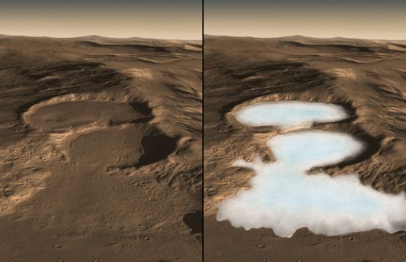
It is now a well-understood fact that Mars once had quite a bit of liquid water on its surface. In fact, according to a recent estimate, a large sea in Mars’ southern hemisphere once held almost 10 times as much water as all of North America’s Great Lakes combined. This sea existed roughly 3.7 billion years ago, and was located in the region known today as the Eridania basin.
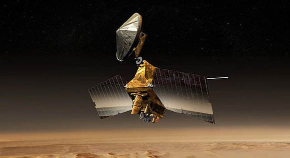
However, a new study based on data from NASA’s Mars Reconnaissance Orbiter (MRO) detected vast mineral deposits at the bottom of this basin, which could be seen as evidence of ancient hot springs. Since this type of hydrothermal activity is believed to be responsible for the emergence of life on Earth, these results could indicate that this basin once hosted life as well.
Together, this international team used data obtained by the MRO’s Compact Reconnaissance Spectrometer for Mars (CRISM). Since the MRO reached Mars in 2006, this instrument has been used extensively to search for evidence of mineral residues that form in the presence of water. In this respect, CRISM was essential for documenting how lakes, ponds and rivers once existed on the surface of Mars.
In this case, it identified massive mineral deposits within Mars’ Eridania basin, which lies in a region that has some of the Red Planet’s most ancient exposed crust. The discovery is expected to be a major focal point for scientists seeking to characterize Mars’ once-warm and wet environment. As Paul Niles of NASA’s Johnson Space Center said in a recent NASA press statement:
“Even if we never find evidence that there’s been life on Mars, this site can tell us about the type of environment where life may have begun on Earth. Volcanic activity combined with standing water provided conditions that were likely similar to conditions that existed on Earth at about the same time — when early life was evolving here.”
Today, Mars is a cold, dry place that experiences no volcanic activity. But roughly 3.7 billion years ago, the situation was vastly different. At that time, Mars boasted both flowing and standing bodies of water, which are evidenced by vast fluvial deposits and sedimentary basins. The Gale Crater is a perfect example of this since it was once a major lake bed, which is why it was selected as the landing sight for the Curiosity rover in 2012.
Since Mars had both surface water and volcanic activity during this time, it would have also experienced hydrothermal activity. This occurs when volcanic vents open into standing bodies of water, filling them with hydrated minerals and heat. On Earth, which still has an active crust, evidence of past hydrothermal activity cannot be preserved. But on Mars, where the crust is solid and erosion is minimal, the evidence has been preserved.
“This site gives us a compelling story for a deep, long-lived sea and a deep-sea hydrothermal environment,” Niles said. “It is evocative of the deep-sea hydrothermal environments on Earth, similar to environments where life might be found on other worlds — life that doesn’t need a nice atmosphere or temperate surface, but just rocks, heat and water.”
Based on their study, the researchers estimate that the Eridania basin once held about 210,000 cubic km (50,000 cubic mi) of water. Not only is this nine times more water than all of the Great Lakes combined, it is as much as all the other lakes and seas on ancient Mars combined. In addition, the region also experienced lava flows that existed after the sea is believed to have disappeared.
From the CRISM’s spectrometer data, the team identified deposits of serpentine, talc and carbonate. Combined with the shape and texture of the bedrock layers, they concluded that the sea floor was open to volcanic fissures. Beyond indicating that this region could have once hosted life, this study also adds to the diversity of the wet environments which are once believed to have existed on Mars.
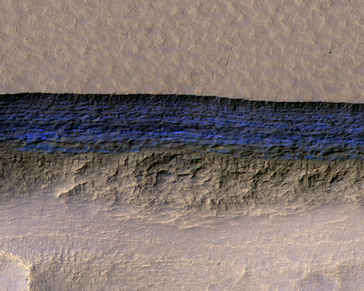
Between evidence of ancient lakes, rivers, groundwater, deltas, seas, and volcanic eruptions beneath ice, scientists now have evidence of volcanic activity that occurred beneath a standing body of water (aka. hot springs) on Mars. This also represents a new category for astrobiological research, and a possible destination for future missions to the Martian surface.
The study of hydrothermal activity is also significant as far as finding sources of extra-terrestrial, like on the moons of Europa, Enceladus, Titan, and elsewhere. In the future, robotic missions are expected to travel to these worlds in order to peak beneath their icy surfaces, investigate their plumes, or venture into their seas (in Titan’s case) to look for the telltale traces of basic life forms.
The study also has significance beyond Mars and could aid in the study of how life began here on Earth. At present, the earliest evidence of terrestrial life comes from seafloor deposits that are similar in origin and age to those found in the Eridania basin. But since the geological record of this period on Earth is poorly preserved, it has been impossible to determine exactly what conditions were like at this time.
Given Mars’ similarities with Earth, and the fact that its geological record has been well-preserved over the past 3 billion years, scientists can look to mineral deposits and other evidence to gauge how natural processes here on Earth allowed for life to form and evolve over time. It could also advance our understanding of how all the terrestrial planets of the Solar System evolved over billions of years.
Today, it is well understood that Mars is a cold, dry, and geologically dead planet. However, billions of years ago when it was still young, the planet boasted a denser atmosphere and had liquid water on its surface. Millions of years ago, it also experienced a significant amount of volcanic activity, which resulted in the formation of it’s massive features – like Olympus Mons, the largest volcano in the Solar System.
Until recently, scientists have understood that Martian volcanic activity has been driven by sources other than tectonic movement, which the planet has been devoid of for billions of years. However, after conducting a study of Martian rock samples, a team of researchers from the UK and United States concluded that eons ago, Mars was more volcanically active than previously thought.
On Earth, the majority of volcanism occurs as a result of plate tectonics, which are driven by convection in the Earth’s mantle. But on Mars, the majority of volcanic activity is the result of mantle plumes, which are highly-localized upwellings of magma that rise from deep within the mantle. This is due to the fact that Mars’ surface has remained static and cool for the past few billion years.
Because of this, Martian volcanoes (though similar in morophology to shield volcanoes on Earth), grow to much larger sizes than those on Earth. Olympus Mons, for example, is not only the largest shield volcano on Mars, but the largest in the Solar System. Whereas the tallest mountain on Earth – Mt. Everest – is 8,848 m (29,029 ft) in height, Olympus Mons stands some 22 km (13.6 mi or 72,000 ft) tall.
For the sake of their study, Dr. Cohen and his colleagues used radioscopic dating techniques, which are commonly used to determine the age and eruption rate of volcanoes on Earth. However, such techniques have not been previously used for shield volcanoes on Mars. As a result, the team’s study of Martian meteorite samples was the first detailed analysis of growth rates in Martian volcanoes.
The six samples they examined are known as nakhlites, a class of Martian meteorite that formed from basaltic magma roughly 1.3 billion years ago. These came to Earth roughly 11 million years ago after being were blasted from the face of Mars by an impact event. By conducting an analysis of Martian meteorites, the team was able to uncover about 90 million years’ worth of new information about Mars’ volcanic past.
As Dr. Cohen explained in a University of Glasgow press release:
“We know from previous studies that the nakhlite meteorites are volcanic rocks, and the development of age-dating techniques in recent years made the nakhlites perfect candidates to help us learn more about volcanoes on Mars.”
The first step was to demonstrate that the rock samples were indeed Martian in origin, which the team confirmed by measuring their exposure to cosmogenic radiation. From this, they determined that the rocks were expelled from the Martian surface 11 million years ago, most likely as a result of an impact event on the Martian surface. They then applied a high-precision radioscopic technique known as 40Ar/39Ar dating.
This consisted of using a noble gas mass spectromomer to measure the amount of argon built up in the samples, which is the result of the natural radioactive decay of potassium. From this, they were able to obtain 90 million years’ worth of new information about the Martian surface. The results of their analysis indicated that there are significant differences in volcanic history between the Earth and Mars. As Dr. Cohen explained:
“We found that the nakhlites formed from at least four eruptions over the course of 90 million years. This is a very long time for a volcano, and much longer than the duration of terrestrial volcanoes, which are typically only active for a few million years. And this is only scratching the surface of the volcano, as only a very small amount of rock would have been ejected by the impact crater – so the volcano must have been active for much longer.”
In addition, the team was also able to narrow down which volcanoes their rock samples came from. Previous studies conducted by NASA revealed several candidates for the possible nakhlite source crater. However, only one of the locations matched their results in terms of the age of the volcanic eruptions and the impact that would have ejected the samples into space.
This particular crater (which is currently unnamed) is located in the volcanic plains known as Elysium Planitia, roughly 900 km (560 mi) away from summit of the Elysium Mons volcano – which stands 12.6 km (7.8 mi) tall. It is also located about 2000 km (1243 mi) north of where the NASA Curiosity rover currently is. As Cohen explained, NASA has some wonderfully detailed satellite images of this particular crater.
“It is 6.5 km wide, and has preserved ejecta rays of debris,” he said. “And we were able to see multiple horizontal bands on the crater walls – which indicating the rocks form layers, with each layer interpreted as a separate lava flow. This study has been able to provide a clearer picture into the history of the nakhlite meteorites, and in turn the largest volcanoes in the solar system.”
In the future, sample return and crewed missions to Mars are sure to clear up this picture even further. Given that Mars, like Earth, is a terrestrial planet, knowing all we can about its geological history will ultimately improve our understanding of how the rocky planets of the Solar System formed. In short, the more we know about Mars’ volcanic history, the most we will be able to learn about the Solar System’s formation and evolution.
Before NASA can mount its proposed “Journey to Mars“, which will see astronauts set foot on the Red Planet for the first time in history, a number of logistical and technical issues need to be addressed first. In addition to a launch vehicle (the Space Launch System), a crew capsule (the Orion Multi-Purpose Crew Vehicle), and a space station beyond the Moon (the Deep Space Gateway), the astronauts will also need a space habitat in orbit of Mars.
To build this habitat, NASA has reached out to its long-time contractor, Lockheed Martin. And on Saturday, September 28th, at the International Astronautical Congress (IAC) in Adelaide, Australia, the aerospace company revealed new details about its Mars Base Camp. When NASA’s proposed crewed mission to Mars takes place in the 2030s, this base will be the outpost from which crews will conduct research on the Martian surface.
The details revealed at the conference included how their proposed base camp aligns with other key components of NASA’s Mars mission, which Lockheed Martin is also working with NASA to develop. These include the Deep Space Gateway positioned in cislunar orbit, and a Mars surface lander – a reusable, single-stage craft capable of descending to the Martian surface from orbit.
Along with NASA’s SLS and Orion spacecraft, these vital pieces of infrastructure will allow for not just one, but repeated crewed mission to Mars. As Lisa Callahan – the vice president and general manager of Commercial Civil Space at Lockheed Martin – said in the course of the company’s presentation at the IAC:
“Sending humans to Mars has always been a part of science fiction, but today we have the capability to make it a reality. Partnered with NASA, our vision leverages hardware currently in development and production. We’re proud to have Orion powered-on and completing testing in preparation for its Exploration Mission-1 flight and eventually its journey to Mars.”
Overall, the purpose of the Mars Base Camp is very simple. Basically, it consists of an orbital outpost where scientist-astronauts will be transported to after leaving Earth and flying from the Deep Space Gateway into orbit around Mars. From this base, crews will be able to conduct real-time scientific exploration of the Martian atmosphere, followed by missions to the surface.
As Lockheed Martin’s indicates on their website, the major components of their base camp will be launched separately. Some will be pre-positioned in orbit around Mars ahead of time while others will be assembled in cis-lunar space for the journey to Mars. In the end, six astronauts will launch on an Orion spacecraft – which serves as the heart of the Mars Base Camp interplanetary ship – and assemble all the component in orbit around Mars.
This is also consistent with Phase II and Phase III of NASA’s “Journey to Mars”, which are known as the “Proving Ground” and “Earth Independent” phases, respectively. Phase II calls for a series of missions to test the capabilities of the Space Launch System (SLS), Orion spacecraft, and deep space habitats, as well as multiple crewed missions and spacewalks in cislunar space.
Phase III will then consist of the refinement and testing of entry, descent, and landing techniques, as well as in-situ resource utilization. Once these are complete, Phase III will culminate with crewed missions to Martian orbit, followed by landed missions to the Martian surface. The first mission involving the Mars Base Camp are intended to be an extended stay in orbit around the Red Planet.
This will allow astronauts to gain vital experience with extended operations far from Earth and its protective magnetic field. This will be followed by the arrival of the surface lander, which would allow the astronauts to land and conduct missions on the surface. The lander would be mated to the base camp between missions and descend to the surface using supersonic retro-propulsion.
The lander also relies on Orion avionics and systems as its command deck, and is powered by engines that use a liquid-hydrogen/liquid-oxygen propellant. Each mission to the surface would likely last two weeks at a time and consist of four astronauts conducting research and collecting samples for return to the base camp. The crews would then take off in the Lander and return it the station, where it would refuel and restock for future missions.
Since the lander’s fuel can be manufactured from water, it is likely that a source of subsurface water ice will also come into play during these surface missions. If the necessary infrastructure is brought to the surface, it could even be used for the in-situ manufacture of rocket fuel. As such, it is understandable by locating a source of subsurface water ice is a major focal point of future NASA and SpaceX missions.
As noted, the Mars Base Camp is aligned with other mission components, which include the Deep Space Gateway. Here too, NASA has contracted Lockheed Martin to develop the concept’s architecture. This past summer, the company was awarded a Phase II contract by NASA to create designs for this space habitat, which is intended to build on the lessons learned from the International Space Station (ISS).
In the end, the Deep Space Gateway and the Mars Base Camp will allow for the development and testing of other space systems in cis-lunar space before sending them on to Mars. The Gateway will also allow astronauts to conduct lunar research and live and work in orbit around the Moon for months at a time. This will come in handy once they begin making transits to and from Mars.
Ever since NASA first announced its proposal for a “Journey to Mars” in 2010, scientists, space enthusiasts and the general public ave eagerly awaited the release of key details. Given that such a mission comes with major technical and logistical challenges, how they intend to address them has been a major point of interest. Other points of interest have included timelines as well as the vehicles, systems and technologies that would be involved.
This latest announcement is just one of many to be made by NASA and its partners in recent months. As the “Journey to Mars” slowly approaches, more and more details have become available, and what this mission will look like has slowly taken form. As Lockheed Martin states on their website:
“Since the first Viking lander touched down on Mars 40 years ago, humanity has been fascinated with the Red Planet. Lockheed Martin built NASA’s first Mars lander and has been a part of every NASA Mars mission since. We’re ready to deliver the future, faster. Mars is closer than you think. We’re ready to accelerate the journey.”
And be sure to check out this promotional video about the Mars Base Camp, courtesy of Lockheed Martin:
Finding a source of Martian water – one that is not confined to Mars’ frozen polar regions – has been an ongoing challenge for space agencies and astronomers alike. Between NASA, SpaceX, and every other public and private space venture hoping to conduct crewed mission to Mars in the future, an accessible source of ice would mean the ability to manufacture rocket fuel on sight and provide drinking water for an outpost.
So far, attempt to locate an equatorial source of water ice have failed. But after consulting old data from the longest-running mission to Mars in history – NASA’s Mars Odyssey spacecraft – a team of researchers from the John Hopkins University Applied Physics Laboratory (JHUAPL) announced that they may have found evidence of a source of water ice in the Medusae Fossae region of Mars.
This region of Mars, which is located in the equatorial region, is situated between the highland-lowland boundary near the Tharsis and Elysium volcanic areas. This area is known for its formation of the same name, which is a soft deposit of easily-erodible material that extends for about 5000 km (3,109 mi) along the equator of Mars. Until now, it was believed to be impossible for water ice to exist there.
However, a team led by Jack Wilson – a post-doctoral researcher at the JHUAPL – recently reprocessed data from the Mars Odyssey spacecraft that showed unexpected signals. This data was collected between 2002 and 2009 by the mission’s neutron spectrometer instrument. After reprocessing the lower-resolution compositional data to bring it into sharper focus, the team found that it contained unexpectedly high signals of hydrogen.
To bring the information into higher-resolution, Wilson and his team applied image-reconstruction techniques that are typically used to reduce blurring and remove noise from medical and spacecraft imaging data. In so doing, the team was able to improve the data’s spatial resolution from about 520 km (320 mi) to 290 km (180 mi). Ordinarily, this kind of improvement could only be achieved by getting the spacecraft much closer to the surface.
“It was as if we’d cut the spacecraft’s orbital altitude in half,” said Wilson, “and it gave us a much better view of what’s happening on the surface.” And while the neutron spectrometer did not detect water directly, the high abundance of neutrons detected by the spectrometer allowed the research team to calculate the abundance of hydrogen. At high latitudes on Mars, this is considered to be a telltale sign of water ice.
The first time the Mars Odyssey spacecraft detected abundant hydrogen was in 2002, which appeared to be coming from subsurface deposits at high latitudes around Mars. These findings were confirmed in 2008, when NASA’s Phoenix Lander confirmed that the hydrogen took the form of water ice. However, scientists have been operating under the assumption that at lower latitudes, temperatures are too high for water ice to exist.
These scans have suggested that there was either low-density volcanic deposits or water ice below the surface, though the results seemed more consistent with their being no water ice to speak of. As Wilson indicated, their results lend themselves to more than one possible explanation, but seem to indicate that water ice could part of the subsurface’s makeup:
“[I]f the detected hydrogen were buried ice within the top meter of the surface. there would be more than would fit into pore space in soil… Perhaps the signature could be explained in terms of extensive deposits of hydrated salts, but how these hydrated salts came to be in the formation is also difficult to explain. So for now, the signature remains a mystery worthy of further study, and Mars continues to surprise us.”
Given Mars’ thin atmosphere and the temperature ranges that are common around the equator – which get as high as 308 K (35 °C; 95 °F) by midday during the summer – it is a mystery how water ice could be preserved there. The leading theory though is that a mixture of ice and dust was deposited from the polar regions in the past. This could have happened back when Mars’ axial tilt was greater than it is today.
However, those conditions have not been present on Mars for hundreds of thousands or even millions of years. As such, any subsurface ice that was deposited there should be long gone by now. There is also the possibility that subsurface ice could be shielded by layers of hardened dust, but this too is insufficient to explain how water ice could have survived on the timescales involved.
In the end, the presence of abundant hydrogen in the Medusae Fossae region is just another mystery that will require further investigation. The same is true for deposits of water ice in general around the equatorial region of Mars. Such deposits mean that future missions would have a source of water for manufacturing rocket fuel.
This would shave billions of dollars of the costs of individual mission since spacecraft would not need to carry enough fuel for a return trip with them. As such, interplanetary spacecraft could be manufactured that would be smaller, lighter and faster. The presence of equatorial water ice could also be used to provide a steady supply of water for a future base on Mars.
Crews could be rotated in and out of this base once every two years – in a way that is similar to what we currently do with the International Space Station. Or – dare I say it? – a local source of water could be used to supply drinking, sanitation and irrigation water to eventual colonists! No matter how you slice it, finding an accessible source of Martian water is critical to the future of space exploration as we know it!
For years, Elon Musk and the company he founded to reduce the associated costs of space exploration (SpaceX) have been leading the charge in the development of private spaceflight. Beyond capturing the attention of the world with reusable rocket tests and the development of next-generation space vehicles, Musk has also garnered a lot of attention for his long-term plans.
These plans were the subject of a presentation made on Friday, September 29th, during the International Astronautical Congress (IAC) – which ran from September 25th to September 29th in Adelaide, Australia. During the course of the presentation, Musk detailed his plans to send cargo ships to Mars by 2022 and to conduct regular aerospace trips between major cities here on Earth.