International Space Station Achieves 15 Years of Continuous Human Presence in Orbit

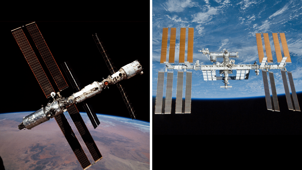
The International Space Station (ISS) has grown tremendously in size and complexity and evolved significantly over 15 years of continuous human occupation from Nov. 2, 2000 to Nov. 2, 2015. Credit: NASA

The International Space Station (ISS) achieved 15 years of a continuous human presence in orbit, as of today, Nov. 2, aboard the football field sized research laboratory ever since the first Russian/American crew of three cosmonauts and astronauts comprising Expedition 1 arrived in a Soyuz capsule at the then much tinier infant orbiting complex on Nov. 2, 2000.

Today, the space station is host to the Expedition 45 crew of six humans – from America, Russia and Japan – that very symbolically also includes the first ever crew spending one year aboard and that highlights the outposts expanding role from a research lab to a deep space exploration test bed for experiments and technologies required for sending humans on interplanetary journeys to the Martian system in the 2030s.

The ISS was only made possible by over two decades of peaceful and friendly international cooperation by the most powerful nations on Earth on a scale rarely seen.

“I believe the International Space Station should be considered for the Nobel Peace Prize,” said NASA Administrator Charles Bolden last week during remarks to the Center for American Progress in Washington, DC., on October 28, 2015.

“Exploration has taught us more than we have ever known about our Universe and our place in it.”

“The ISS has already taught us what’s possible when tens of thousands of people across 15 countries collaborate so that human beings from different nations can live and work in space together.”

“Yet, for all these accomplishments, when you consider all the possibilities ahead of us you can only reach one conclusion; We are just getting started!”
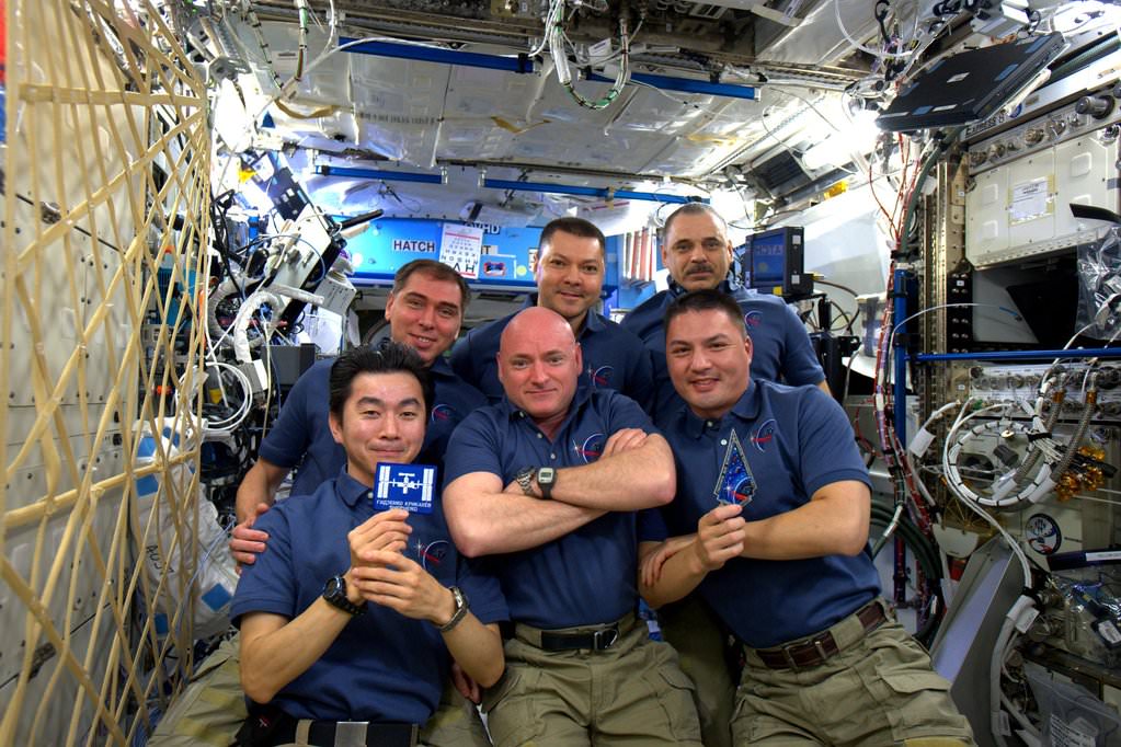
6 person ISS Expedition 45 Crew celebrates 15 Years of operation with humans on 2 Nov 2015.  Credit: NASA
6 person ISS Expedition 45 Crew celebrates 15 Years of operation with humans on 2 Nov 2015. Credit: NASA

“No better place to celebrate #15YearsOnStation! #HappyBday, @space_station! Thanks for the hospitality! #YearInSpace.” tweeted NASA astronaut Scott Kelly from the ISS today along with a crew portrait.

The space station is the largest engineering and construction project in space combining the funding, hardware, knowhow, talents and crews from 5 space agencies and 15 countries – NASA, Roscomos, ESA (European Space Agency), JAXA (Japan Aerospace and Exploration Agency) and CSA (Canadian Space Agency).

NASA astronaut Tracy Caldwell Dyson, an Expedition 24 flight engineer in 2010, took a moment during her space station mission to enjoy an unmatched view of home through a window in the Cupola of the International Space Station, the brilliant blue and white part of Earth glowing against the blackness of space.  Credits: NASA
NASA astronaut Tracy Caldwell Dyson, an Expedition 24 flight engineer in 2010, took a moment during her space station mission to enjoy an unmatched view of home through a window in the Cupola of the International Space Station, the brilliant blue and white part of Earth glowing against the blackness of space. Credits: NASA

The collaborative work in space has transcended our differences here on Earth and points the way forward to an optimistic future that benefits all humanity.

The station orbits at an altitude of about 250 miles (400 kilometers) above Earth. It measures 357 feet (109 meters) end-to-end and has an internal pressurized volume of 32,333 cubic feet, equivalent to that of a Boeing 747.

The uninterrupted human presence on the station all began when Expedition 1 docked at the outpost on Nov. 2, 2000, with its first residents including Commander William Shepherd of NASA and cosmonauts Sergei Krikalev and Yuri Gidzenko of Roscosmos.

For the first station trio in November 2000, the vehicle included three modules; the Zarya module and the Zvezda service module from Russia and the Unity module from the US.
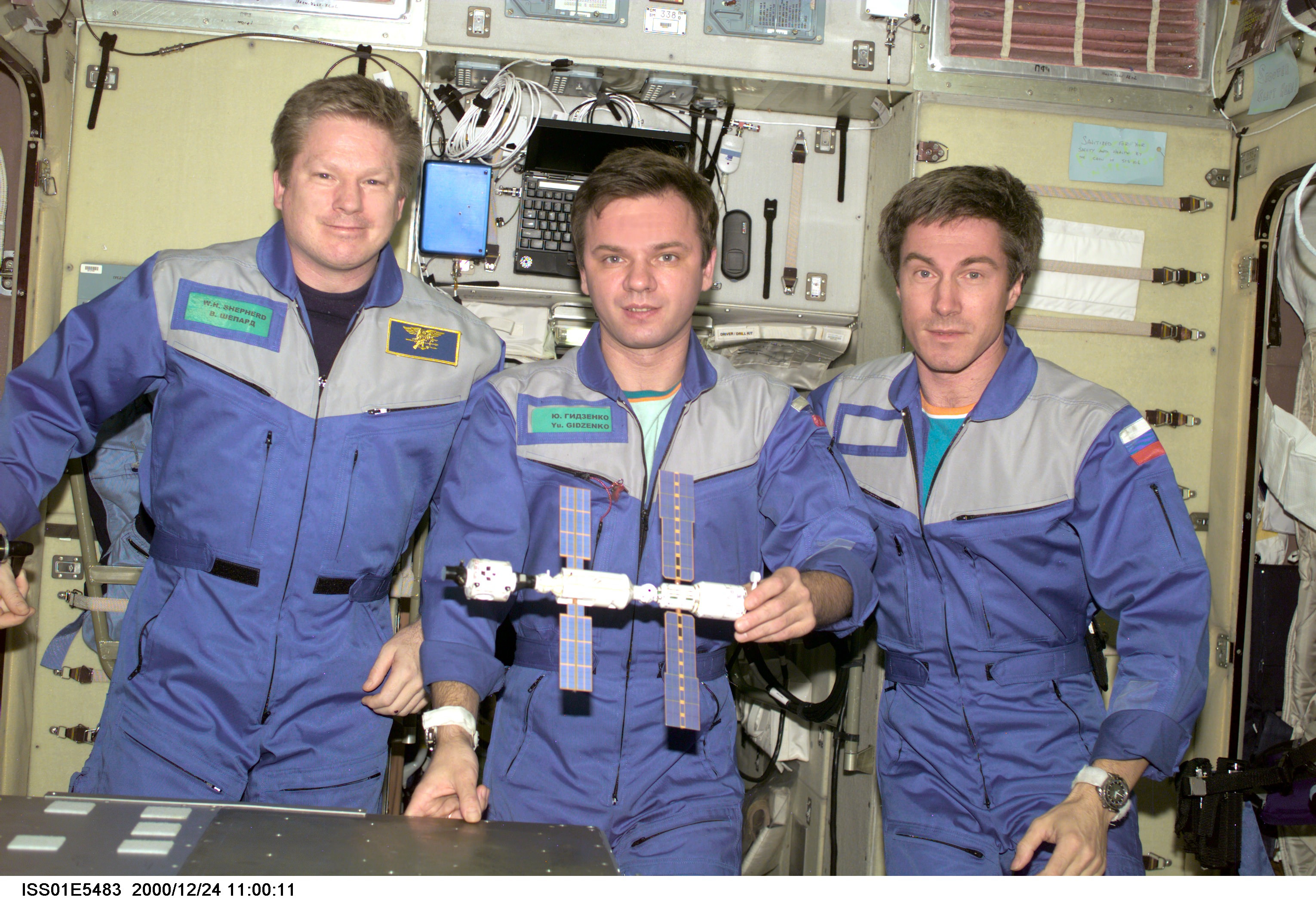
In this photo, Expedition 1 crew members (from left to right) Commander Bill Shepherd, and Flight Engineers Yuri Gidzenko and Sergei Krikalev pose with a model of their home away from home.  Image Credit: NASA
In this photo, Expedition 1 crew members (from left to right) Commander Bill Shepherd, and Flight Engineers Yuri Gidzenko and Sergei Krikalev pose with a model of their home away from home. Image Credit: NASA

Over the past 15 years, after more than 115 construction and logistics flight, the station has grown by leaps and bounds from its small initial configuration of only three pressurized modules from Russian and America into a sprawling million pound orbiting outpost sporting a habitable volume the size of a six bedroom house, with additional new modules and hardware from Europe, Japan and Canada.

The ISS has been visited by over 220 people from 17 countries.

The “1 Year ISS crew” reflects the international cooperation that made the station possible and comprises current ISS commander NASA astronaut Scott Kelly and Russian cosmonaut Mikhail Kornienko, who are now just past the half way mark of their mission.

“Over the weekend, I called NASA astronaut Scott Kelly, who is currently halfway through his one-year mission aboard the International Space Station, to congratulate him on setting the American records for both cumulative and continuous days in space,” Bolden said in a NASA statement released today.

“I also took the opportunity to congratulate Commander Kelly — and the rest of the space station crew — for being part of a remarkable moment 5,478 days in the making: the 15th anniversary of continuous human presence aboard the space station.”
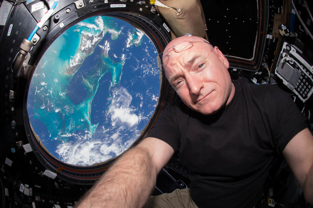
Scott Kelly, U.S. astronaut and commander of the current Expedition 45 crew, broke the US record for time spent in space on Oct. 16, 2015. Credit: NASA

The complete Expedition 45 crew members include Station Commander Scott Kelly and Flight Engineer Kjell Lindgren of NASA, Flight Engineers Mikhail Kornienko, Oleg Kononenko and Sergey Volkov of the Russian Federal Space Agency (Roscosmos) and Flight Engineer Kimiya Yui of the Japan Aerospace Exploration Agency.

For the first nine years, the station was home to crews of two or three. Starting in 2009 the crew size was doubled to a permanent crew of six humans after the habitable volume, research facilities, equipment and supporting provisions had grown sufficiently.

“Humans have been living in space aboard the International Space Station 24-7-365 since Nov. 2, 2000. That’s 15 Thanksgivings, New Years, and holiday seasons astronauts have spent away from their families. 15 years of constant support from Mission Control Houston. And 15 years of peaceful international living in space,” says NASA.
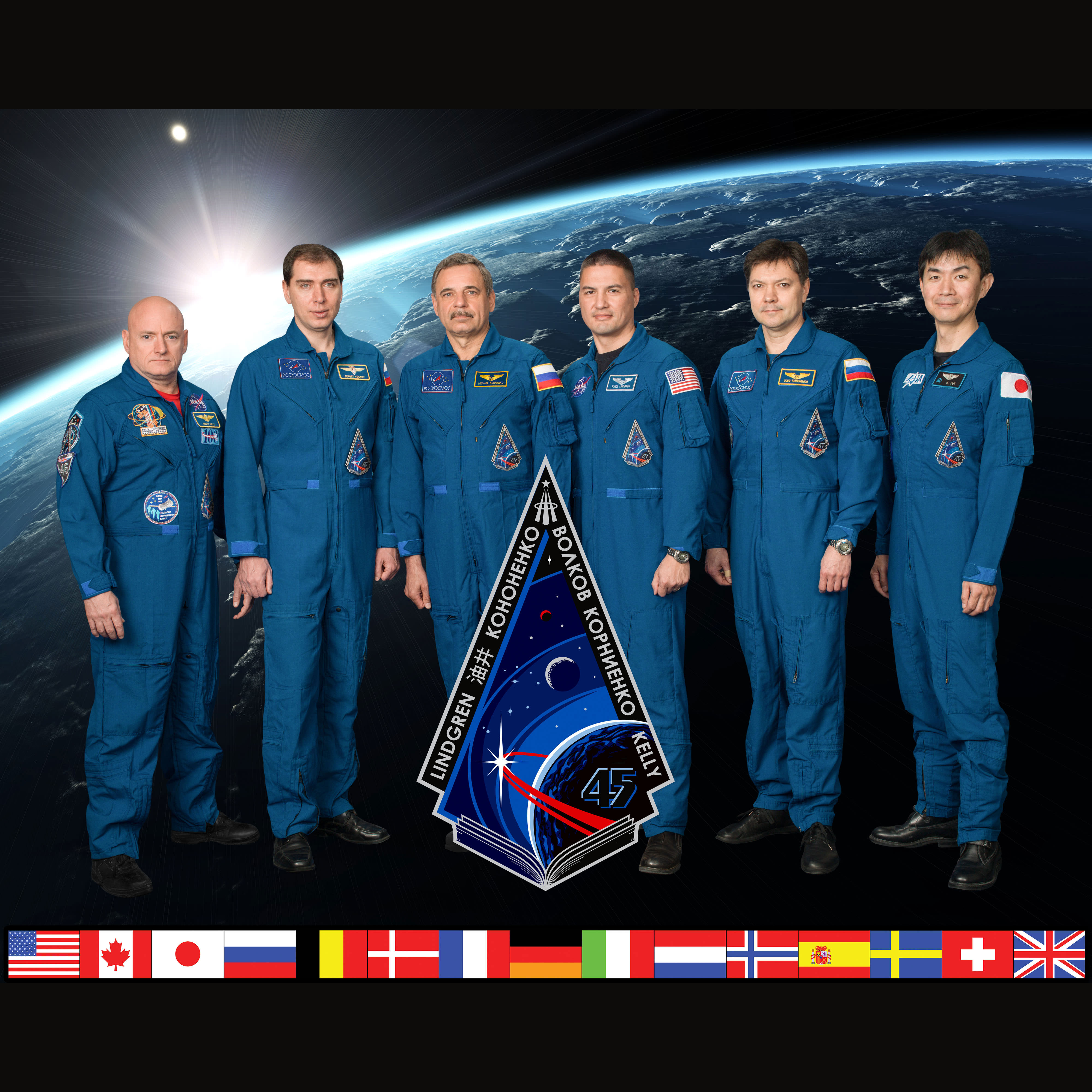
Expedition 45 Crew Portrait: Station Commander Scott Kelly and Flight Engineer Kjell Lindgren of NASA, Flight Engineers Mikhail Kornienko, Oleg Kononenko and Sergey Volkov of the Russian Federal Space Agency (Roscosmos) and Flight Engineer Kimiya Yui of the Japan Aerospace Exploration Agency.  Credit: NASA/Roscosmos/JAXA
Expedition 45 Crew Portrait: Station Commander Scott Kelly and Flight Engineer Kjell Lindgren of NASA, Flight Engineers Mikhail Kornienko, Oleg Kononenko and Sergey Volkov of the Russian Federal Space Agency (Roscosmos) and Flight Engineer Kimiya Yui of the Japan Aerospace Exploration Agency. Credit: NASA/Roscosmos/JAXA

The US contributed and built the largest number of segments of the space station, followed by Russia.

NASA’s Space Shuttles hauled the US segments aloft inside the orbiters huge payload bay, starting from the first construction mission in 1998 carrying the Unity module to the final shuttle flight STS-135 in 2011, which marked the completion of construction and retirement of the shuttles.

With the shuttle orbiters now sitting in museums and no longer flying, the Russian Soyuz capsule is the only means of transporting crews to the space station and back.

The longevity of the ISS was recently extended from 2020 to 2024 after approval from President Obama. Most of the partners nations have also agreed to the extension. Many in the space community believe the station hardware is quite resilient and hope for further extensions to 2028 and beyond.

“The International Space Station, which President Obama has extended through 2024, is a testament to the ingenuity and boundless imagination of the human spirit. The work being done on board is an essential part of NASA’s journey to Mars, which will bring American astronauts to the Red Planet in the 2030s,” says Bolden.

“For 15 years, humanity’s reach has extended beyond Earth’s atmosphere. Since 2000, human beings have been living continuously aboard the space station, where they have been working off-the-Earth for the benefit of Earth, advancing scientific knowledge, demonstrating new technologies, and making research breakthroughs that will enable long-duration human and robotic exploration into deep space.”

A key part of enabling long duration space missions to Mars is the 1 Year ISS Mission.

Scott Kelly recently set the US records for most time in space and longest single space mission.

In coming years, additional new pressurized modules and science labs will be added by Russia and the US.

And NASA says the stations crew size will expand to seven after the US commercial Starliner and Dragon space taxis from Boeing and SpaceX start flying in 2017.

NASA is now developing the new Orion crew capsule and mammoth Space Launch System (SLS) heavy lift rocket to send astronauts to deep space destination including the Moon, asteroids and the Red Planet.

In the meantime, Kelly and his crew are also surely looking forward to the arrival of the next Orbital ATK Cygnus resupply ship carrying science experiments, provisions, spare parts, food and other goodies after it blasts off from Florida on Dec. 3 – detailed in my story here.
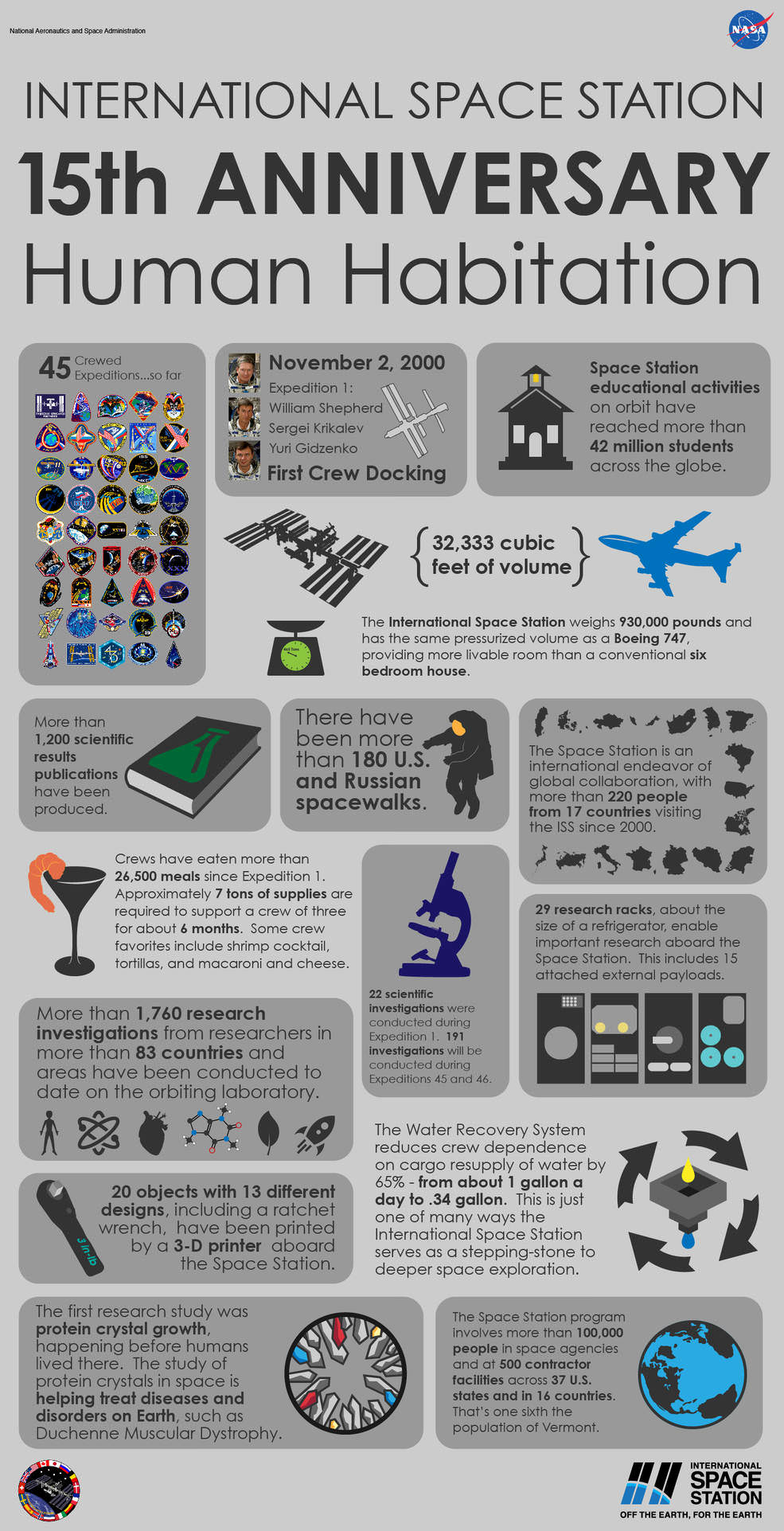
Infographic: 15 Years of Continuous Human Presence Aboard the International Space Station.  Credit: NASA
Infographic: 15 Years of Continuous Human Presence Aboard the International Space Station. Credit: NASA

Stay tuned here for Ken’s continuing Earth and planetary science and human spaceflight news.
Ken Kremer

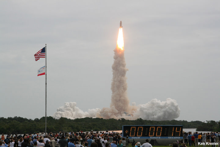
STS-135: Last launch using RS-25 engines that will now power NASA’s SLS deep space exploration rocket. NASA’s 135th and final shuttle mission takes flight on July 8, 2011 at 11:29 a.m. from the Kennedy Space Center in Florida bound for the ISS and the high frontier with Chris Ferguson as Space Shuttle Commander. Credit: Ken Kremer/kenkremer.com
STS-135: Last launch using RS-25 engines that will now power NASA’s SLS deep space exploration rocket. NASA’s 135th and final shuttle mission takes flight on July 8, 2011 at 11:29 a.m. from the Kennedy Space Center in Florida bound for the final flight to the ISS and the high frontier with Chris Ferguson as Space Shuttle Commander. Credit: Ken Kremer/kenkremer.com

Stunning Planetary Trio Pictures from Around the World

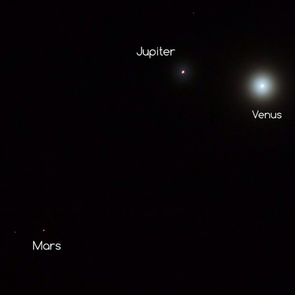
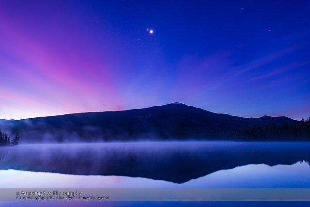
The conjunction of Venus (brightest), Jupiter (above Venus) and Mars (dimmer below Venus & Jupiter) looking east in the morning twilight on October 25, 2015, as seen from the west shore of Lake Annette, in Jasper National Park, Alberta. The mountain is the Watchtower. Morning mist covers the lake waters. Haze in the sky adds the natural glows around the planets — no filters were used. Credit and copyright: Alan Dyer.

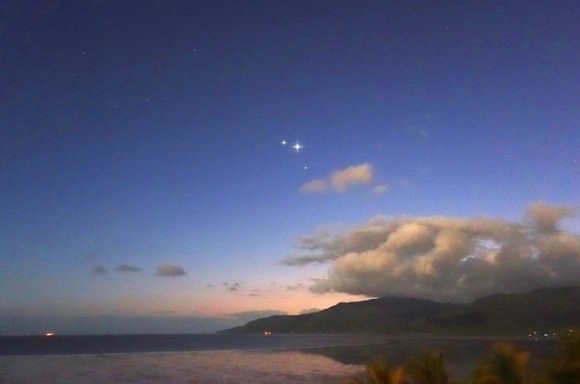
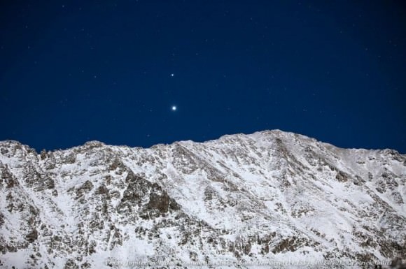
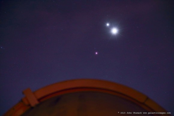
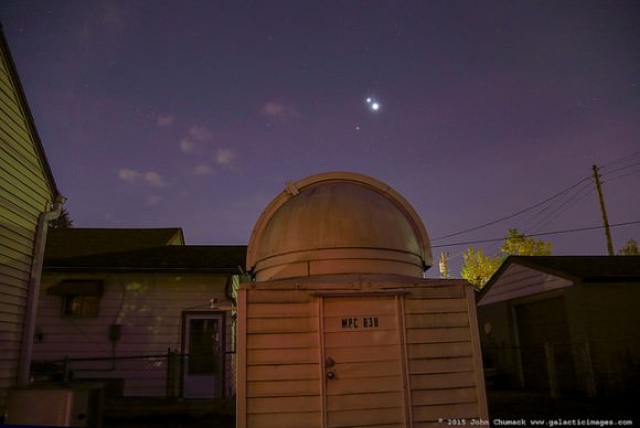
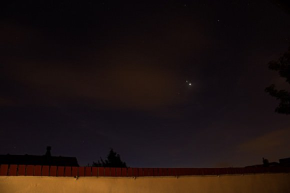
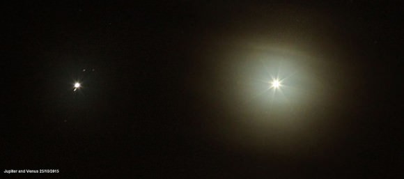
Have you seen the views in the morning skies this week, with three planets huddling together at dawn? Just one degree separated planets Jupiter and Venus, with Mars sneaking in nearby. Astrophotographers were out in full force to capture the scene!

Above, the very talented photographer Alan Dyer from Canada captured a stunning image of the planetary trio over Lake Annette, in Jasper National Park, Alberta, Canada. He took several gorgeous shots, and so we’ve added one more of his below, plus dozens of other wonderful shots from our astrophotographer friends around the world. Each of these images are from Universe Today’s Flickr pool, so you can click on each picture to get a larger view on Flickr.

Enjoy these great views, as there won’t be a more compact arrangement of three planets again until January 10, 2021.

A panorama of roughly 120° showing a star- and planet-filled sky in the dawn twilight over Lake Annette in Jasper National Park, Alberta, on the morning of October 25, 2015.   At left, to the east, are the two bright planets, Venus (brightest) and Jupiter in a close conjunction 1° apart (and here almost merging into one glow), plus reddish Mars below them, all in Leo, with the bright star Regulus above them. Right of centre, to the south, is Orion and Canis Major, with the bright star Sirius low in the south. At upper right are the stars of Taurus, including Aldebaran and the Hyades star cluster. Venus was near greatest elongation on this morning. Credit and copyright: Alan Dyer.
A panorama of roughly 120° showing a star- and planet-filled sky in the dawn twilight over Lake Annette in Jasper National Park, Alberta, on the morning of October 25, 2015.
At left, to the east, are the two bright planets, Venus (brightest) and Jupiter in a close conjunction 1° apart (and here almost merging into one glow), plus reddish Mars below them, all in Leo, with the bright star Regulus above them. Right of centre, to the south, is Orion and Canis Major, with the bright star Sirius low in the south. At upper right are the stars of Taurus, including Aldebaran and the Hyades star cluster. Venus was near greatest elongation on this morning. Credit and copyright: Alan Dyer.
Taken from Coral Towers Observatory in Queensland, Australia on October 28, 2014. Venus is to the right of and slightly below Jupiter and Mars is to the right of and below Venus. The pre-dawn landscape is illuminated by moonlight. Credit and copyright: Joseph Brimacombe.
Jupiter, Venus, and Mars rise behind the 14,155 foot peak of Mount Democrat in Colorado. Credit and copyright: Patrick Cullis.
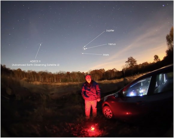
Spooky Selfie, Three Planets and a Dead Satellite. The planetary conjunction of Jupiter, Venus and Mars on October 26, 2015, along with the ADEOS II satellite, which died in orbit in 2003 after the solar panels failed. Credit and copyright: Tom Wildoner.
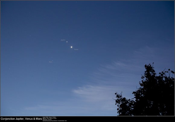
Planetary conjunction of Jupiter, Venus and Mars as seen from Search Results     Map of Le Puy Saint-Bonnet, 49300 Cholet, France     Le Puy Saint-Bonnet, 49300 Cholet, France     Le Puy-Saint-Bonnet in France on October 26, 2015. Credit and copyright: David de Cueves.
Planetary conjunction of Jupiter, Venus and Mars as seen from Search Results
Map of Le Puy Saint-Bonnet, 49300 Cholet, France
Le Puy Saint-Bonnet, 49300 Cholet, France
Le Puy-Saint-Bonnet in France on October 26, 2015. Credit and copyright: David de Cueves.
Venus, Jupiter and Mars grace the morning skies in France on October 26, 2015. Credit and copyright: Frank Tyrlik.

Here’s a timelapse from Damien Weatherley of his planet imaging session from the morning of October 25, 2015:

Astronomy timelapse 25.10.15

Venus, Jupiter & Mars create a close triangle in the eastern sky at dawn! John Chumack captured this image above his backyard Observatory in Dayton, Ohio on 10-26-2015. Credit and copyright: John Chumack.
A zoomed out view of the planetary trio from John Chumack's observatory in Dayton, Ohio on October 25, 2015. Credit and copyright: John Chumack.
A zoomed out view of the planetary trio from John Chumack’s observatory in Dayton, Ohio on October 25, 2015. Credit and copyright: John Chumack.
Conjunction of Venus, Jupiter & Mars on the morning of  Monday Oct. 26, 2015. Credit and copyright: Holly Roberts.
Conjunction of Venus, Jupiter & Mars on the morning of Monday Oct. 26, 2015. Credit and copyright: Holly Roberts.
Jupiter and Venus conjunction on October 25, 2015. They were approximately with a degree and a half of each other. Jupiter's moons are visible. Credit and copyright: Chris Lyons.
Jupiter and Venus conjunction on October 25, 2015. They were approximately with a degree and a half of each other. Jupiter’s moons are visible. Credit and copyright: Chris Lyons.
Venus and the almost invisible Jupiter struggled to shine through the haze on the morning of October 25, 2015, as seen in Malaysia. Credit and copyright: Shahrin Ahmad.
Venus and the almost invisible Jupiter struggled to shine through the haze on the morning of October 25, 2015, as seen in Malaysia. Credit and copyright:Shahrin Ahmad.
Venus, Jupiter and Mars in the hazy, cloudy morning skies over the UK on October 25, 2015. Credit and copyright: Sarah and Simon Fisher.

And here’s just a reminder that this planetary conjunction has been setting up for a while. Here’s a shot from October 10 of the planets as they started moving closer together:

A spooky planetary conjunction of Venus, Jupiter and Mars on October 10, 2015 on the Isle of Mull, Scotland. Credit and copyright: Shaun Reynold.

The Puzzle of Planetary Protection

MSL Curiosity is busy investigating the surface of Mars, to see if that planet could have harbored life. Image: NASA/JPL/Cal-Tech

The recent announcement by NASA confirming the presence of liquid water on Mars pulls planetary protection into the spotlight and is causing some serious head-scratching in the scientific community. On the one hand, having existing liquid water on the Red Planet is a cause for wonder, excitement, and a strong desire to investigate it in a great deal more depth to look for the possibility of life. On the other hand, there is the dilemma of protecting a potential biosphere from contamination from Earthly bugs. As keen as the Curiosity mission team is to take advantage of the rover to have a much closer look at recurring slope lineae (RSL), the rover itself is just not clean enough.
Continue reading “The Puzzle of Planetary Protection”

Boulder Extraction and Robotic Arm Mechanisms For NASA’s Asteroid Redirect Mission Start Rigorous Testing at NASA Goddard

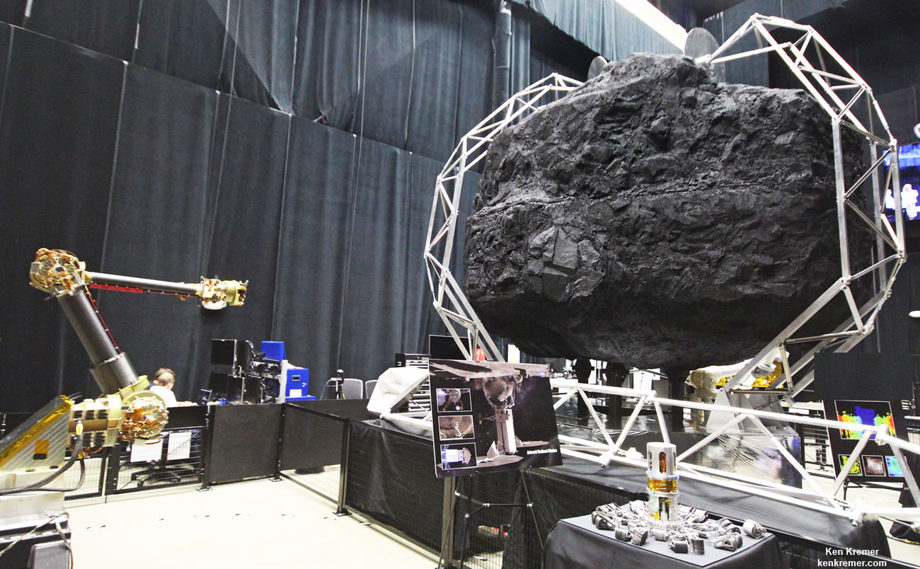
Robotic sampling arm and capture mechanism to collect a multi-ton boulder from an asteroid are under development at NASA Goddard and other agency centers for NASA’s unmanned Asteroid Redirect Vehicle and eventual docking in lunar orbit with Orion crew vehicle by the mid 2020s. Credit: Ken Kremer/kenkremer.com

NASA GODDARD SPACE FLIGHT CENTER, MD – Rigorous testing has begun on the advanced robotic arm and boulder extraction mechanisms that are key components of the unmanned probe at the heart of NASA’s Asteroid Redirect Robotic Mission (ARRM) now under development to pluck a multi-ton boulder off a near-Earth asteroid so that astronauts visiting later in an Orion crew capsule can harvest a large quantity of samples for high powered scientific analysis back on Earth. Universe Today inspected the robotic arm hardware utilizing “leveraged robotic technology” during an up close visit and exclusive interview with the engineering development team at NASA Goddard.

“The teams are making great progress on the capture mechanism that has been delivered to the robotics team at Goddard from Langley,” NASA Associate Administrator Robert Lightfoot told Universe Today.

“NASA is developing these common technologies for a suite of missions like satellite servicing and refueling in low Earth orbit as well as autonomously capturing an asteroid about 100 million miles away,” said Ben Reed, NASA Satellite Servicing Capabilities Office (SSCO) Deputy Project Manager, during an exclusive interview and hardware tour with Universe Today at NASA Goddard in Greenbelt, Maryland, regarding concepts and goals for the overall Asteroid Redirect Mission (ARM) initiative.

NASA is leveraging technology originally developed for satellite servicing such as with the Robotic Refueling Mission (RRM) currently on board the International Space Station (ISS) and repurposing them for the asteroid retrieval mission.

“Those are our two near term mission objectives that we are developing these technologies for,” Reed explained.

ARRM combines both robotic and human missions to advance the new technologies required for NASA’s agency wide ‘Journey to Mars’ objective of sending a human mission to the Martian system in the 2030s.

The unmanned Asteroid Redirect Robotic Mission (ARRM) to grab a boulder is the essential first step towards carrying out the follow on sample retrieval with the manned Orion Asteroid Redirect Mission (ARM) by the mid-2020s.

ARRM will use a pair of highly capable robotic arms to autonomously grapple a multi-ton (> 20 ton) boulder off the surface of a large near-Earth asteroid and transport it to a stable, astronaut accessible orbit around the Moon in cislunar space.

“Things are moving well. The teams have made really tremendous progress on the robotic arm and capture mechanism,” Bill Gerstenmaier, NASA Associate Administrator for Human Exploration and Operations, told Universe Today.

Then an Orion crew capsule can fly to it and the astronauts will collect a large quantity of rock samples and gather additional scientific measurements.

“We are working on a system to rendezvous, capture and service different [target] clients using the same technologies. That is what we are working on in a nut shell,” Reed said.

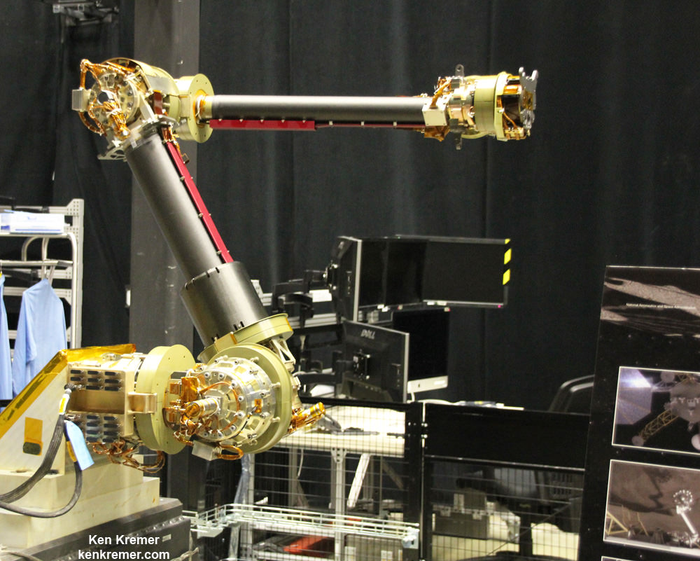
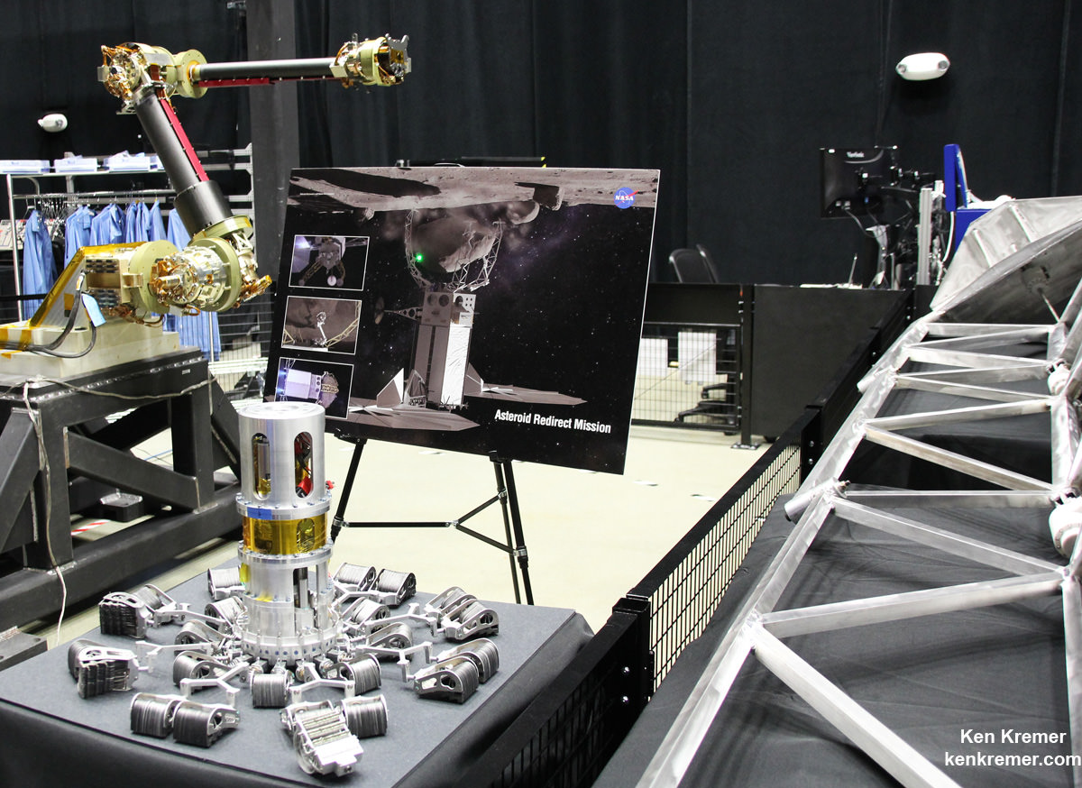
This engineering design unit of the robotic servicing arm is under development to autonomously extract a boulder off an asteroid for NASA’s asteroid retrieval mission and  is being tested at NASA Goddard.   It has seven degrees of freedom and mimics a human arm.   Credit: Ken Kremer/kenkremer.com
This engineering design unit of the robotic servicing arm is under development to autonomously extract a boulder off an asteroid for NASA’s asteroid retrieval mission and is being tested at NASA Goddard. It has seven degrees of freedom and mimics a human arm. Credit: Ken Kremer/kenkremer.com

“Right now the plan is to launch ARRM by about December 2020,” Reed told me. But a huge amount of preparatory work across the US is required to turn NASA’s plan into reality.

Key mission enabling technologies are being tested right now with a new full scale engineering model of the ‘Robotic Servicing Arm’ and a full scale mockup of the boulder snatching ARRM Capture Module at NASA Goddard, in a new facility known as “The Cauldron.”

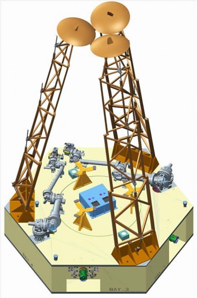
Capture Module comprising two robotic servicing arms and three boulder grappling contact and restraint system legs for NASA’s Asteroid Redirect Robotic Mission (ARRM).   Credit: NASA
Capture Module comprising two robotic servicing arms and three boulder grappling contact and restraint system legs for NASA’s Asteroid Redirect Robotic Mission (ARRM). Credit: NASA
The ARRM capture module is comprised of two shorter robotic arms (separated by 180 degrees) and three lengthy contact and restraint system capture legs (separated by 120 degrees) attached to a cradle with associated avionics, computers and electronics and the rest of the spacecraft and solar electric power arrays.

“The robotic arm we have here now is an engineering development unit. The 2.2 meter-long arms can be used for assembling large telescopes, repairing a failed satellite, removing orbital debris and capturing an asteroid,” said Reed.

“There are two little arms and three big capture legs.”

“So, we are leveraging one technology development program into multiple NASA objectives.”

“We are working on common technologies that can service a legacy orbiting satellite, not designed to be serviced, and use those same technologies with some tweaking that we can go out with 100 million miles and capture an asteroid and bring it back to the vicinity of the Moon.”

“Currently the [capture module] system can handle a boulder that’s up to about 3 x 4 x 5 meters in diameter.”

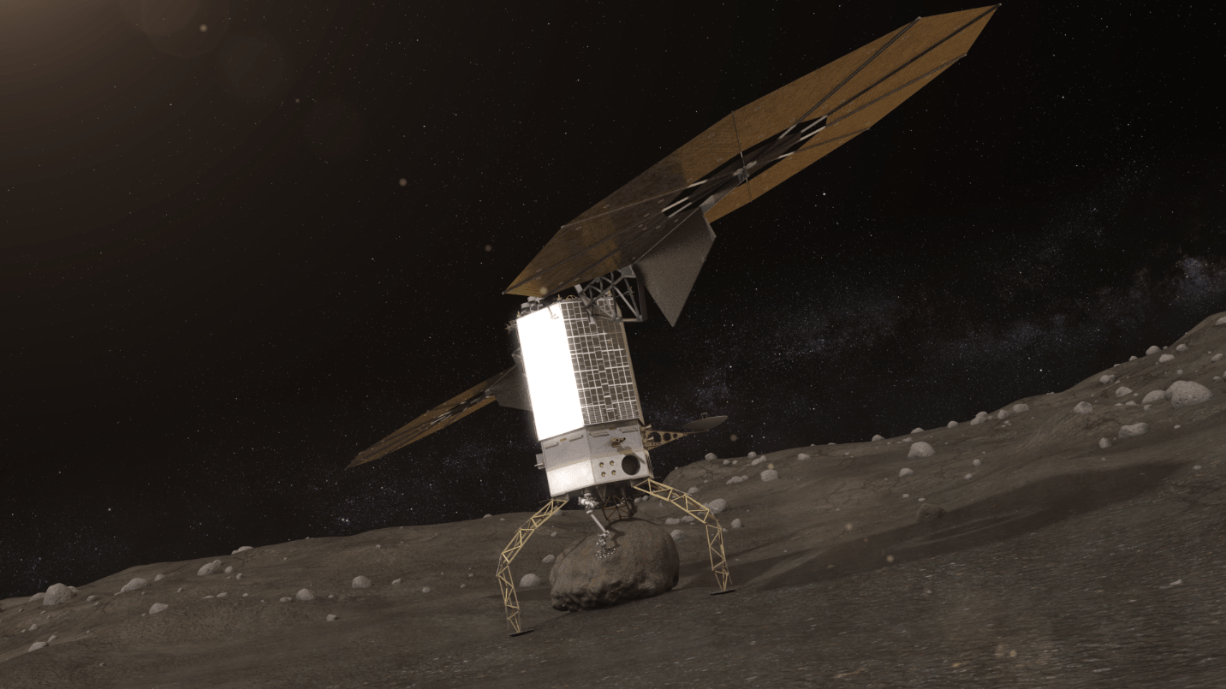
Artists concept of NASA’s Asteroid Redirect Robotic Mission capturing an asteroid boulder before redirecting it to a astronaut-accessible orbit around Earth's moon.  Credits: NASA
Artists concept of NASA’s Asteroid Redirect Robotic Mission capturing an asteroid boulder before redirecting it to a astronaut-accessible orbit around Earth’s moon. Credits: NASA

The Cauldron is a brand new Goddard facility for testing technologies and operations for multiple exploration and science missions, including satellite servicing and ARRM that just opened in June 2015 for the centers Satellite Servicing Capabilities Office.

Overall project lead for ARRM is the Jet Propulsion Laboratory (JPL) with numerous contributions from other NASA centers and industrial partners.

“This is an immersive development lab where we bring systems together and can do lifetime testing to simulate what’s in space. This is our robotic equivalent to the astronauts NBL, or neutral buoyancy lab,” Reed elaborated.

“So with this same robotic arm that can cut wires and thermal blankets and refuel an Earth sensing satellite, we can now have that same arm go out on a different mission and be able to travel out and pick up a multi-ton boulder and bring it back for astronauts to harvest samples from.”

“So that’s quite a technical feat!”

The Robotic Servicing Arm is a multi-jointed powerhouse designed to function like a “human arm” as much as possible. It builds on extensive prior research and development investment efforts conducted for NASA’s current Red Planet rovers and a flight-qualified robotic arm developed for the Defense Advanced Research Projects Agency (DARPA).

“The arm is capable of seven-degrees-of-freedom to mimic the full functionally of a human arm. It has heritage from the arm on Mars right now on Curiosity as well as ground based programs from DARPA,” Reed told me.

“It has three degrees of freedom at our shoulder, two at our elbow and two more at the wrist. So I can hold the hand still and move the elbow.”

The arm will also be equipped with a variety of interchangeable “hands” that are basically tools to carry out different tasks with the asteroid such as grappling, drilling, sample gathering, imaging and spectrometric analysis, etc.

View of the robotic arm above and gripper tool below that initially grabs the asteroid boulder before the capture legs wrap around as planned for NASA’s upcoming unmanned ARRM Asteroid Redirect Robotic Mission that will later dock with an Orion crew vehicle. Credit: Ken Kremer/kenkremer.com

The ARRM spacecraft will carefully study, characterize and photograph the asteroid in great detail for about a month before attempting the boulder capture.

Why does the arm need all this human-like capability?

“When we arrive at an asteroid that’s 100 million miles away, we are not going to know the fine local geometry until we arrive,” Reed explained to Universe Today.

“Therefore we need a flexible enough arm that can accommodate local geometries at the multi-foot scale. And then a gripper tool that can handle those geometry facets at a much smaller scale.”

“Therefore we chose seven-degrees-of-freedom to mimic humans very much by design. We also need seven-degrees-of-freedom to conduct collision avoidance maneuvers. You can’t do that with a six-degree-of-freedom arm. It has to be seven to be a general purpose arm.”

How will the ARRM capture module work to snatch the boulder off the asteroid?

“So the idea is you come to the mother asteroid and touch down and make contact on the surface. Then you hold that position and the two arms reach out and grab the boulder.”

“Once its grabbed the boulder, then the legs straighten and pull the boulder off the surface.”

“Then the arms nestle the asteroid onto a cradle. And the legs then change from a contact system to become a restraint system. So the legs wrap around the boulder to restrain it for the 100 million mile journey back home.

“After that the little arms can let go – because the legs have wrapped around and are holding the asteroid.”

“So now the arm can also let go of the gripper system and pick up a different tool to do other things. For example they can collect a sample with another tool. And maybe assist an astronaut after the crew arrives.”

“During the 100 million mile journey back to lunar orbit they can be also be preparing the surface and cutting into it for later sample collection by the astronauts.”

Be sure to watch this video animation:

Since the actual asteroid encounter will occur very far away, the boulder grappling will have to be done fully autonomously since there will be no possibility for real time communications.

“The return time for communications is like about 30 minutes. So ‘human in the loop’ control is out of the question.

“Once we get into hover position over the landing site we hit the GO button. Then it will be very much like at Mars and the seven minutes of terror. It will take awhile to find out if it worked.”

Therefore the team at Goddard has already spent years of effort and practice sessions just to get ready for working with the early engineering version of the arm to maximize the probability of a successful capture.

“In this facility we put systems together to try and practice and rehearse and simulate as much of the mission as is realistically possible.”

“It took a lot of effort to get to this point, in the neighborhood of four years to get the simulation to behave correctly in real time with contact dynamics and the robotic systems. So the arm has to touch the boulder with force torque sensors and feed that into a computer to measure that and move the actuators to respond accordingly.”

“So the capture of the boulder is autonomous. The rest is teleoperated from the ground, but not the capture itself.”

How realistic are the rehearsals?

“We are practicing here by reaching out with the arm to grasp the client target using autonomous capture [procedures]. In space the client [target] is floating and maybe tumbling. So when we reach out with the arm to practice autonomous capture we make the client tumble and move – with the inertial properties of the target we are practicing on.”

“Now for known objects like satellites we know the mass precisely. And we can program all that inertial property data in very accurately to give us much more realistic simulations.”

“We learned from all our astronaut servicing experiences in orbit is that the more we know for the simulations, the easier and better the results are for the astronauts during an actual mission because you simulated all the properties.”

“But with this robotic mission to an asteroid there is no backup like astronauts. So we want to practice here at Goddard and simulate the space environment.”

ARRM will launch by the end of 2020 on either an SLS, Delta IV Heavy or a Falcon Heavy. NASA has not yet chosen the launch vehicle.

Several candidate asteroids have already been discovered and NASA has an extensive ongoing program to find more.

Orion crew capsule docks to NASA’s asteroid redirect vehicle grappling captured asteroid boulder orbiting the Moon. Credit: NASA

Again, this robotic technology was selected for development for ARRM because it has a lot in common with other objectives like fixing communications satellites, refueling satellites and building large telescopes in the future.

NASA is also developing other critical enabling technologies for the entire ARM project like solar electric propulsion that will be the subject of another article.

Therefore NASA is leveraging one technology development program into multiple spaceflight objectives that will greatly assist its plans to send ‘Humans to Mars’ in the 2030s with the Orion crew module launched by the monster Space Launch System (SLS) rocket.

The maiden uncrewed launch of the Orion/SLS stack is slated for November 2018.

Stay tuned here for Ken’s continuing Earth and Planetary science and human spaceflight news.

Ken Kremer

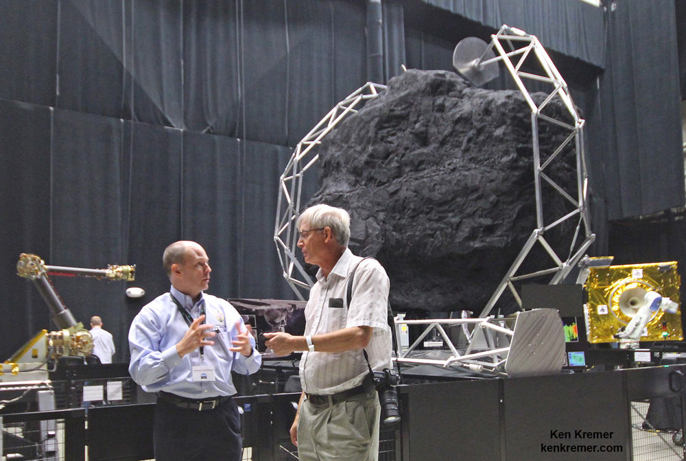
At NASA Goddard robotics lab Ben Reed/NASA Satellite Servicing Capabilities Office (SSCO) Deputy Project Manager and Ken Kremer/Universe Today discuss the robotic servicing arm and asteroid boulder capture mechanism being tested for NASA’s upcoming unmanned ARRM Asteroid Redirect Robotic Mission that will dock with an Orion crew vehicle in lunar orbit by the mid 2020s for sample return collection. Credit: Ken Kremer/kenkremer.com

NASA’s Space Launch System Passes Critical Design Review, Drops Saturn V Color Motif

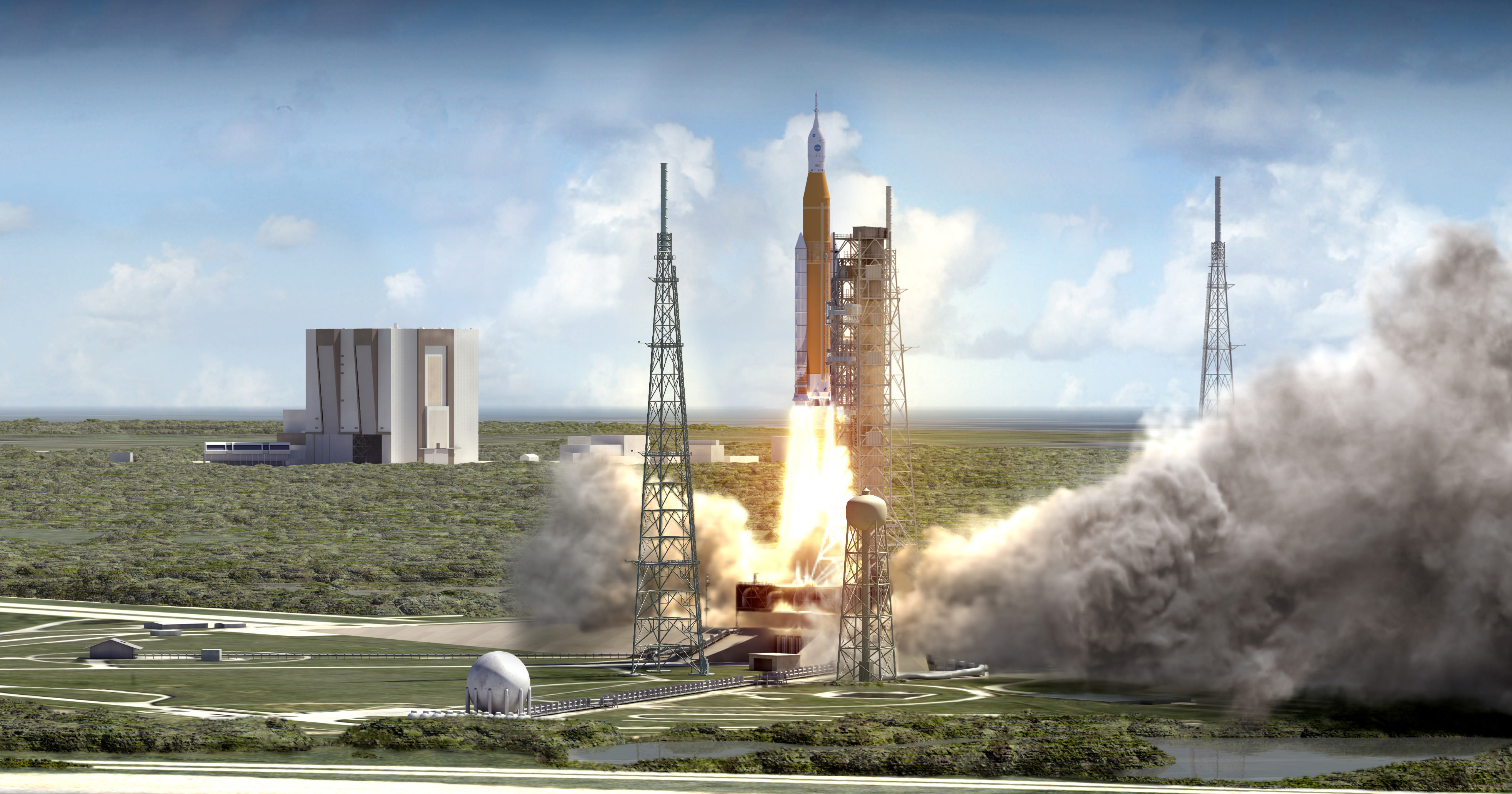
NASA’s Space Launch System (SLS) blasts off from launch pad 39B at the Kennedy Space Center in this artist rendering showing a view of the liftoff of the Block 1 70-metric-ton (77-ton) crew vehicle configuration. Credit: NASA/MSFC

NASA’s Space Launch System (SLS) blasts off from launch pad 39B at the Kennedy Space Center in this artist rendering showing a view of the liftoff of the Block 1 70-metric-ton (77-ton) crew vehicle configuration. Credit: NASA/MSFC
Story/imagery updated[/caption]

The SLS, America’s first human-rated heavy lift rocket intended to carry astronauts to deep space destinations since NASA’s Apollo moon landing era Saturn V, has passed a key design milestone known as the critical design review (CDR) thereby clearing the path to full scale fabrication.

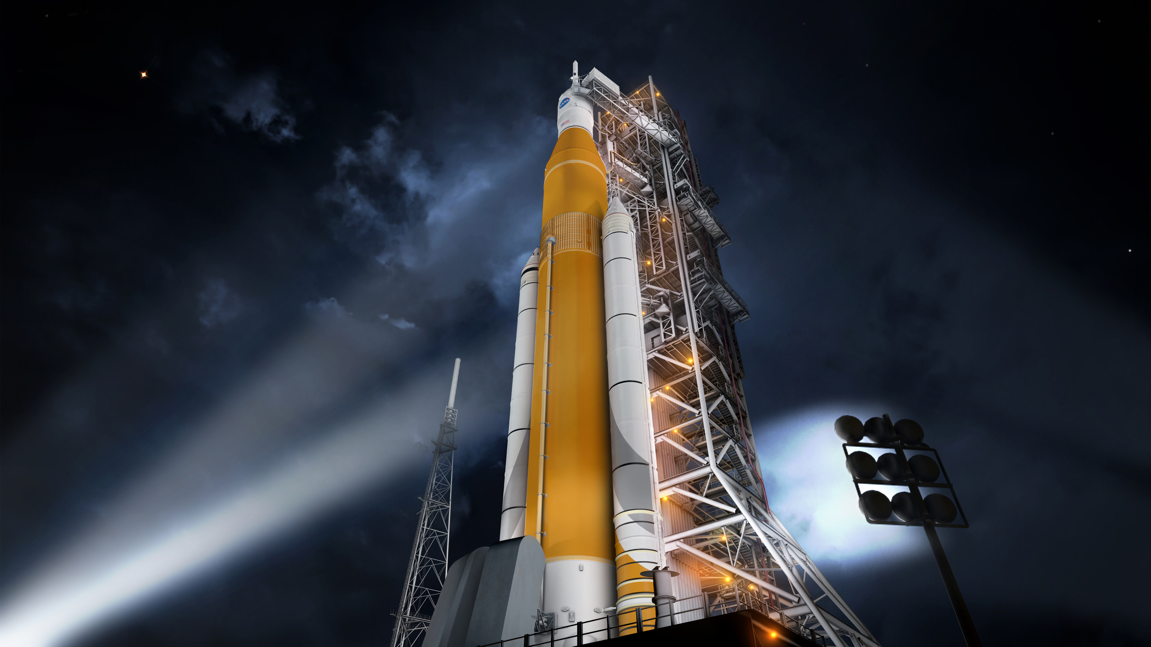
NASA also confirmed they have dropped the Saturn V white color motif of the mammoth rocket in favor of burnt orange to reflect the natural color of the SLS boosters first stage cryogenic core. The agency also decided to add stripes to the huge solid rocket boosters.

NASA announced that the Space Launch System (SLS) has “completed all steps needed to clear a critical design review (CDR)” – meaning that the design of all the rockets components are technically acceptable and the agency can continue with full scale production towards achieving a maiden liftoff from the Kennedy Space Center in Florida in 2018.

“We’ve nailed down the design of SLS,” said Bill Hill, deputy associate administrator of NASA’s Exploration Systems Development Division, in a NASA statement.

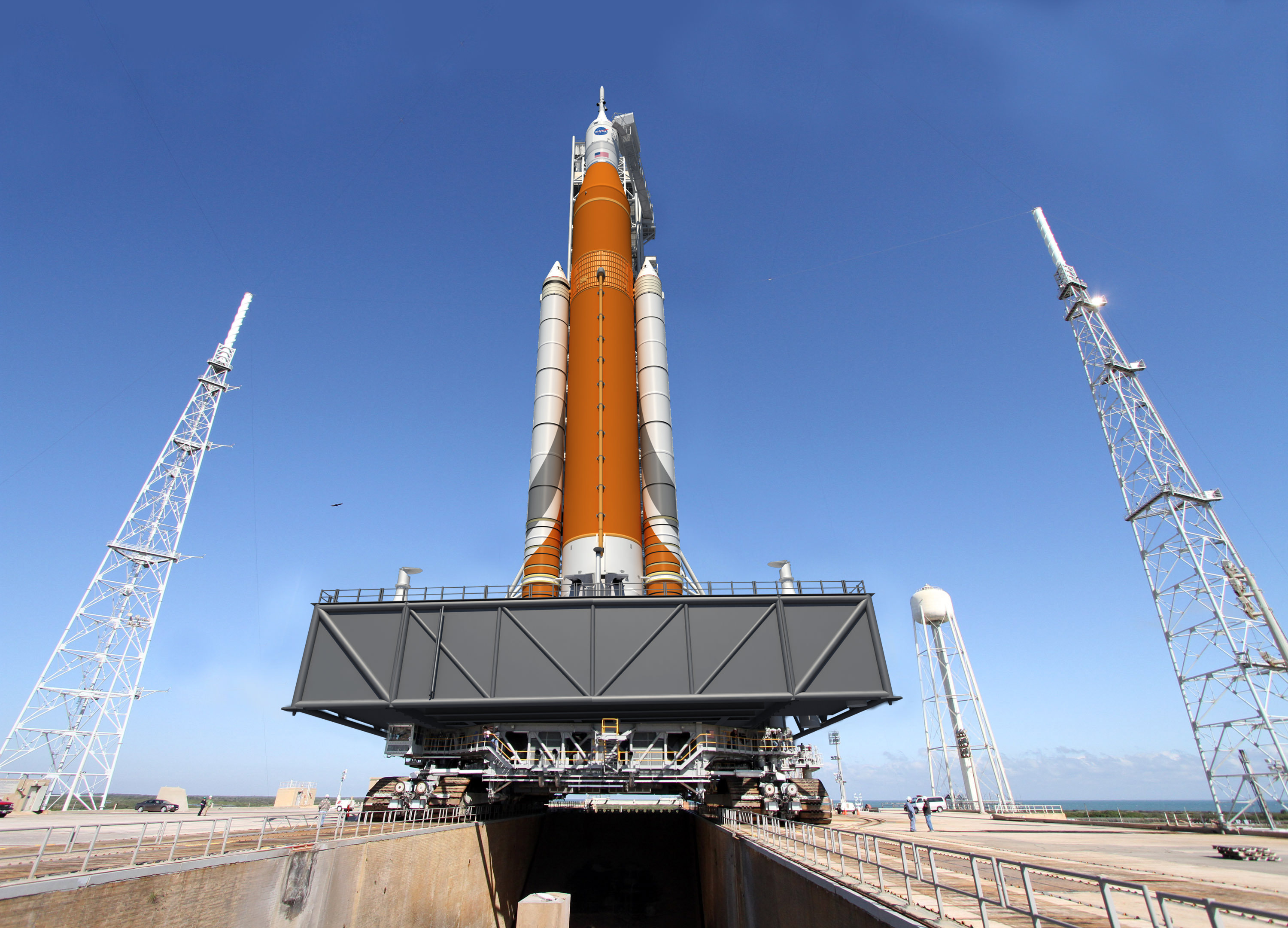
Artist concept of the SLS Block 1 configuration on the Mobile Launcher at KSC. Credit: NASA/MSFC

Blastoff of the NASA’s first SLS heavy lift booster (SLS-1) carrying an unmanned test version of NASA’s Orion crew capsule is targeted for no later than November 2018.

Indeed the SLS will be the most powerful rocket the world has ever seen starting with its first liftoff. It will propel our astronauts on journey’s further into space than ever before.

SLS is “the first vehicle designed to meet the challenges of the journey to Mars and the first exploration class rocket since the Saturn V.”

Crews seated inside NASA’s Orion crew module bolted atop the SLS will rocket to deep space destinations including the Moon, asteroids and eventually the Red Planet.

“There have been challenges, and there will be more ahead, but this review gives us confidence that we are on the right track for the first flight of SLS and using it to extend permanent human presence into deep space,” Hill stated.

The core stage (first stage) of the SLS will be powered by four RS-25 engines and a pair of five-segment solid rocket boosters (SRBs) that will generate a combined 8.4 million pounds of liftoff thrust in its inaugural Block 1 configuration, with a minimum 70-metric-ton (77-ton) lift capability.

Overall the SLS Block 1 configuration will be some 10 percent more powerful than the Saturn V rockets that propelled astronauts to the Moon, including Neil Armstrong, the first human to walk on the Moon during Apollo 11 in July 1969.

Graphic shows Block I configuration of NASA’s Space Launch System (SLS). Credits: NASA/MSFC

The SLS core stage is derived from the huge External Tank (ET) that fueled NASA Space Shuttle’s for three decades. It is a longer version of the Shuttle ET.

NASA initially planned to paint the SLS core stage white, thereby making it resemble the Saturn V.

But since the natural manufacturing color of its insulation during fabrication is burnt orange, managers decided to keep it so and delete the white paint job.

“As part of the CDR, the program concluded the core stage of the rocket and Launch Vehicle Stage Adapter will remain orange, the natural color of the insulation that will cover those elements, instead of painted white,” said NASA.

There is good reason to scrap the white color motif because roughly 1000 pounds of paint can be saved by leaving the tank with its natural orange pigment.

This translates directly into another 1000 pounds of payload carrying capability to orbit.

“Not applying the paint will reduce the vehicle mass by potentially as much as 1,000 pounds, resulting in an increase in payload capacity, and additionally streamlines production processes,” Shannon Ridinger, NASA Public Affairs spokeswomen told Universe Today.

After the first two shuttle launches back in 1981, the ETs were also not painted white for the same reason – in order to carry more cargo to orbit.

“This is similar to what was done for the external tank for the space shuttle. The space shuttle was originally painted white for the first two flights and later a technical study found painting to be unnecessary,” Ridinger explained.

Artist concept of the Block I configuration of NASA’s Space Launch System (SLS). The SLS Program has completed its critical design review, and the program has concluded that the core stage of the rocket will remain orange along with the Launch Vehicle Stage Adapter, which is the natural color of the insulation that will cover those elements.  Credits: NASA
Artist concept of the Block I configuration of NASA’s Space Launch System (SLS). The SLS Program has completed its critical design review, and the program has concluded that the core stage of the rocket will remain orange along with the Launch Vehicle Stage Adapter, which is the natural color of the insulation that will cover those elements. Credits: NASA

NASA said that the CDR was completed by the SLS team in July and the results were also further reviewed over several more months by a panel of outside experts and additionally by top NASA managers.

“The SLS Program completed the review in July, in conjunction with a separate review by the Standing Review Board, which is composed of seasoned experts from NASA and industry who are independent of the program. Throughout the course of 11 weeks, 13 teams – made up of senior engineers and aerospace experts across the agency and industry – reviewed more than 1,000 SLS documents and more than 150 GB of data as part of the comprehensive assessment process at NASA’s Marshall Space Flight Center in Huntsville, Alabama, where SLS is managed for the agency.”

“The Standing Review Board reviewed and assessed the program’s readiness and confirmed the technical effort is on track to complete system development and meet performance requirements on budget and on schedule.”

The final step of the SLS CDR was completed this month with another extremely thorough assessment by NASA’s Agency Program Management Council, led by NASA Associate Administrator Robert Lightfoot.

“This is a major step in the design and readiness of SLS,” said John Honeycutt, SLS program manager.

The CDR was the last of four reviews that examine SLS concepts and designs.

NASA says the next step “is design certification, which will take place in 2017 after manufacturing, integration and testing is complete. The design certification will compare the actual final product to the rocket’s design. The final review, the flight readiness review, will take place just prior to the 2018 flight readiness date.”

“Our team has worked extremely hard, and we are moving forward with building this rocket. We are qualifying hardware, building structural test articles, and making real progress,” Honeycutt elaborated.

Numerous individual components of the SLS core stage have already been built and their manufacture was part of the CDR assessment.

The SLS core stage is being built at NASA’s Michoud Assembly Facility in New Orleans. It stretches over 200 feet tall and is 27.6 feet in diameter and will carry cryogenic liquid hydrogen and liquid oxygen fuel for the rocket’s four RS-25 engines.

On Sept. 12, 2014, NASA Administrator Charles Bolden officially unveiled the world’s largest welder at Michoud, that will be used to construct the core stage, as I reported earlier during my on-site visit – here.

The first stage RS-25 engines have also completed their first round of hot firing tests. And the five segment solid rocket boosters has also been hot fired.

NASA decided that the SRBs will be painted with something like racing stripes.

“Stripes will be painted on the SRBs and we are still identifying the best process for putting them on the boosters; we have multiple options that have minimal impact to cost and payload capability, ” Ridinger stated.

With the successful completion of the CDR, the components of the first core stage can now proceed to assembly of the finished product and testing of the RS-25 engines and boosters can continue.

“We’ve successfully completed the first round of testing of the rocket’s engines and boosters, and all the major components for the first flight are now in production,” Hill explained.

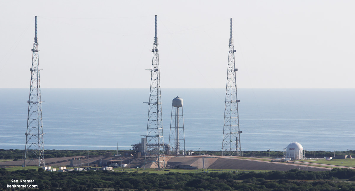
View of NASA’s future SLS/Orion launch pad at Space Launch Complex 39B from atop  Mobile Launcher at the Kennedy Space Center in Florida.  Former Space Shuttle launch pad 39B is now undergoing renovations and upgrades to prepare for SLS/Orion flights starting in 2018. Credit: Ken Kremer/kenkremer.com
View of NASA’s future SLS/Orion launch pad at Space Launch Complex 39B from atop Mobile Launcher at the Kennedy Space Center in Florida. Former Space Shuttle launch pad 39B is now undergoing renovations and upgrades to prepare for SLS/Orion flights starting in 2018. Credit: Ken Kremer/kenkremer.com

NASA plans to gradually upgrade the SLS to achieve an unprecedented lift capability of 130 metric tons (143 tons), enabling the more distant missions even farther into our solar system.

The first SLS test flight with the uncrewed Orion is called Exploration Mission-1 (EM-1) and will launch from Launch Complex 39-B at the Kennedy Space Center (KSC).

The SLS/Orion stack will roll out to pad 39B atop the Mobile Launcher now under construction – as detailed in my recent story and during visit around and to the top of the ML at KSC.

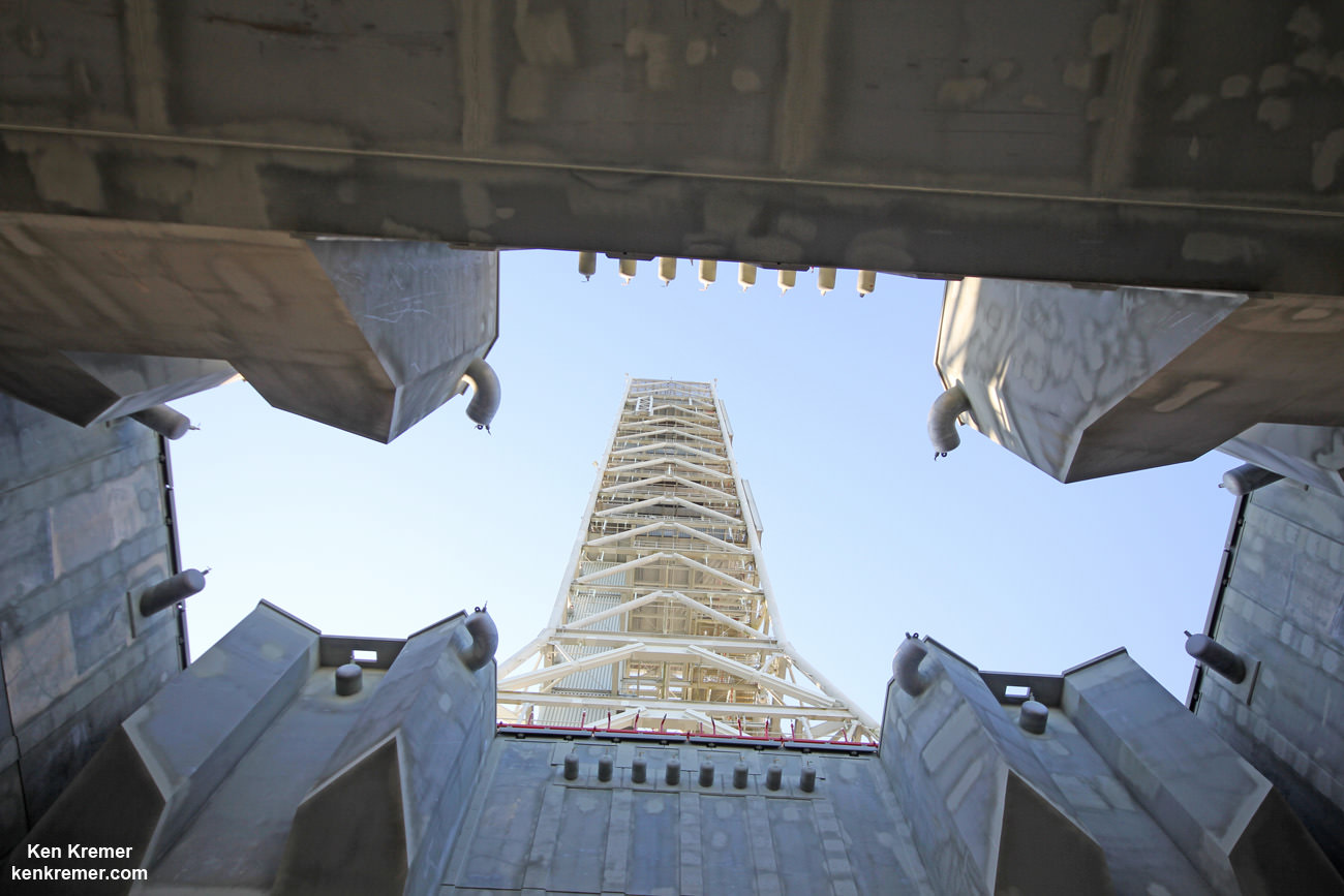
Looking up from beneath the enlarged exhaust hole of the Mobile Launcher to the 380 foot-tall tower astronauts will ascend as their gateway for missions to the Moon, Asteroids and Mars.   The ML will support NASA's Space Launch System (SLS) and Orion spacecraft during Exploration Mission-1 at NASA's Kennedy Space Center in Florida.  Credit: Ken Kremer/kenkremer.com
Looking up from beneath the enlarged exhaust hole of the Mobile Launcher to the 380 foot-tall tower astronauts will ascend as their gateway for missions to the Moon, Asteroids and Mars. The ML will support NASA’s Space Launch System (SLS) and Orion spacecraft during Exploration Mission-1 at NASA’s Kennedy Space Center in Florida. Credit: Ken Kremer/kenkremer.com

Orion’s inaugural mission dubbed Exploration Flight Test-1 (EFT) was successfully launched on a flawless flight on Dec. 5, 2014 atop a United Launch Alliance Delta IV Heavy rocket Space Launch Complex 37 (SLC-37) at Cape Canaveral Air Force Station in Florida.

Stay tuned here for Ken’s continuing Earth and Planetary science and human spaceflight news.
Ken Kremer

Wide view of the new welding tool at the Vertical Assembly Center at NASA’s Michoud Assembly Facility in New Orleans at a ribbon-cutting ceremony Sept. 12, 2014.  Credit: Ken Kremer – kenkremer.com
Wide view of the new welding tool at the Vertical Assembly Center at NASA’s Michoud Assembly Facility in New Orleans at a ribbon-cutting ceremony Sept. 12, 2014. Credit: Ken Kremer – kenkremer.com

Scientists Want ExoMars Rover to Land at Oxia Planum

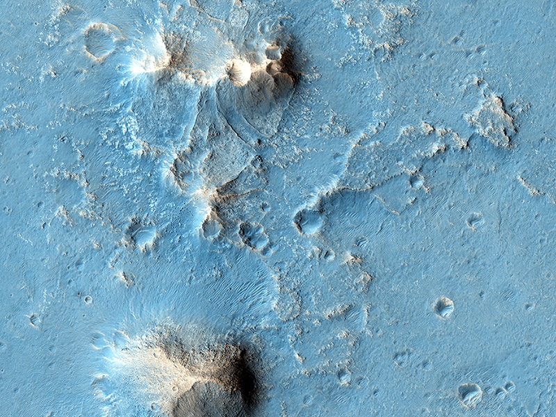
Possible future Mars landing site in Oxia Planum. Credit: NASA/JPL/University of Arizona.

The joint ESA and Russian ExoMars rover’s top priority is to search the Martian surface for signs of life, past or present, and scientists think they know just the spot where – if life ever existed or exists on Mars – it might be found. Today the ExoMars team announced that the equatorial region named Oxia Planum has been recommended as the primary candidate for the landing site.

“Our preliminary analysis shows that Oxia Planum appears to satisfy the strict engineering constraints while also offering some very interesting opportunities to study, in situ, places where biosignatures might best be preserved,” said Jorge Vago, ESA’s project scientist.

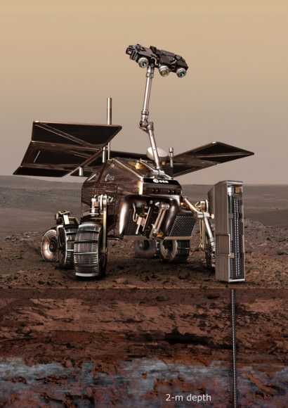
An artist's conception of the ExoMars 2018 rover on the Red Planet. Image credit: ESA
An artist’s conception of the ExoMars 2018 rover on the Red Planet. Image credit: ESA

The rover is currently scheduled to launch in 2018 and land on Mars in 2019, but the timetable is still under review, depending on any issues with construction of the rover. While the final landing site won’t be selected by both ESA and Roscosmos until six months before launch, this recommendation will weigh heavily in the decision.

Some of the priority requirements for the landing site is that is must show abundant morphological and mineralogical evidence for long-duration, or frequently reoccurring water activity, and that there should be numerous sedimentary rock outcrops.

From orbital study by previous missions, Oxia Planum is known to contain clays, and there appears to be remnants of a possible fan or delta, as seen in the image above from the HiRISE camera on the Mars Reconnaissance Orbiter. This would be one of the potential science targets.

The site selection process has been under way since late 2013, when the science community was asked to propose candidates. In October 2014, four candidates were chosen by the Landing Site Selection Working Group. Now this month, October 2015, the same group met to determine two candidate sites that conform best to both the engineering constraints of descent and landing, and the best possible scientific return of the mission. But their preference for now is Oxia Planum. The team will continue to debate the merits and safety of the proposed sites.

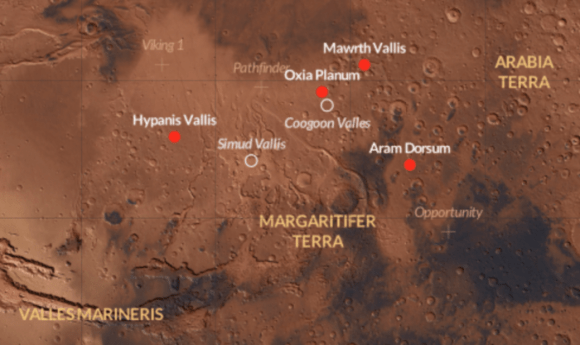
ExoMars rover 2018 landing site candidates. Credit: ESA/CartoDB.

ESA said that all four sites that have been under study – Aram Dorsum, Hypanis Vallis, Mawrth Vallis and Oxia Planum – show evidence of having been influenced by water in the past, and are likely representative of global processes operating in the Red Planet’s early history.
Additionally, all locations offer the opportunity of landing at a scientifically interesting site or finding one within a 1 km drive from the touchdown point, with numerous targets accessible along a typical 2 km traverse planned for the mission of 218 martian days (each 24 hours 37 minutes).

The ExoMars mission is a dual mission with one part launching in 2016 (the Trace Gas Orbiter plus an Entry, Descent and Landing Demonstrator Module) and the rover tentatively scheduled to launch in 2018. As final site selection comes closer, the scientists involved with the mission are anticipating the mission. Professor Andrew Coates who leads the ExoMars PanCam team for the 2018 rover tweeted this today:

Further reading: ESA

ExoMars Heads to the Red Planet in 2016

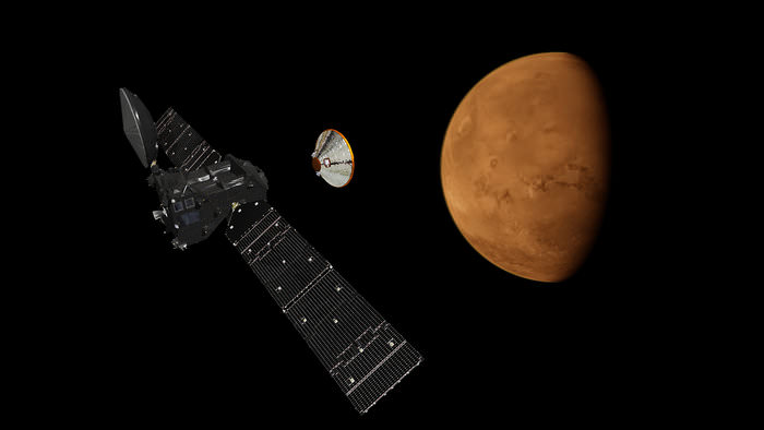
An artist's concept of the S EDM Lander separating from the ExoMars Trace Gas Orbiter. Image Credit: ESA

The 2016 launch window for Mars missions is fast approaching along with opposition, and ESA is refining its target window for ExoMars. Mars launch season offers the optimal time to make the trip from Earth to Mars, as missions prepare to break the surly bonds and head towards the Red Planet next spring. NASA’s InSight lander will also make the trip.

ExoMars is the first joint European Space Agency (ESA) Roscosmos mission to the Red Planet. The ExoMars Trace Gas Orbiter is under contract to Thales Alenia Space, and the EDM stationary lander dubbed Schiaparelli after the 19th century Italian astronomer is being constructed by Airbus Defense and Space. This would be Russia’s first successful Mars lander mission for over a dozen tries if successful.

The ExoMars Trace gas Orbiter in the lab. Image credit: ESA
The ExoMars Trace Gas Orbiter in the lab. Image credit: ESA

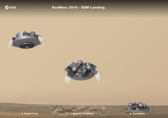
The ExoMars project is a two-part mission, and will culminate in an ExoMars rover in 2018. The key objective for the Trace Gas Orbiter, lander and rover to follow in 2018 is to seek out the controversial source of methane on Mars. A product of biology—think bovine flatulence—on Earth, researchers have proposed various sources—inorganic and otherwise—as a source of the anomalous methane seen in the Martian atmosphere. The Trace Gas Orbiter will remain on-station in orbit through 2018 to relay communications from the ExoMars rover. The Entry, Descent and Landing Demonstrator Module Schiaparelli will demonstrate key technologies for landing, including a hybrid Buck Rodgers fins-first style retro-rocket landing reminiscent of Viking, along with a deformable underside meant to absorb impact.

Image credit: ESA
The landing sequence for the EDL Lander. Image credit: ESA

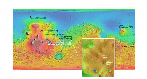
The landing with be a dramatic one on Meridiani Planum at the expected height of dust storm season, and we may get some interesting footage from the onboard descent camera. Along with weather and atmospheric measurements, the EDM Lander will also make the first electrical field measurements from the surface of Mars.

Image credit: MOLA Science Team and NASA/JPL/Arizona State Unversity
The landing ellipse for EDL. Note that its very close to the NASA rover Opportunity. Image credit: MOLA Science Team and NASA/JPL/Arizona State University

Unfortunately, EDM’s life will be short; Roscosmos originally intended to supply a 100-watt plutonium-powered RTG for the lander, but later opted due to export control to use an on-board battery. The EDM’s lifespan will be measured in a few days, at best.

Heading to Mars in 2016

An issue related to two propulsion system sensors aboard the EDM Lander recently prompted mission planners to opt for a launch for ExoMars at the end of the window next year, with liftoff set for March 14th atop a Proton rocket from the Baikonur Cosmodrome in Kazakhstan instead of January, as originally intended. NASA’s Mars InSight will depart Earth for the Red Planet just ten days earlier on March 4th from Vandenberg AFB in a rare dramatic night shot of an Atlas 5 rocket deploying an interplanetary mission from the US West Coast. InSight’s primary objective is to study seismic activity and the Martian interior, and will land in one of four selected sites (1 primary and 3 backup) in Elysium Planitia on September 28th, 2016.

Naturally, ESA and Roscomos are taking every precaution to assure the success of ExoMars and EDM. The 2011 failure of Phobos-Grunt highlighted the perils of tempting the ‘Great Martian Ghoul’ with more tasty spacecraft. Space is hard, and landing on Mars even more so.

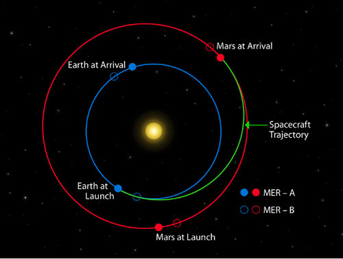
Opposition 2016 for Mars occurs on May 22nd, 2016. Mars is always high in the early morning sky a few months prior to opposition, presenting an optimal window to send spacecraft to the Red Planet on the most efficient in trajectory in terms of fuel and time. This 3-month wide window comes around every 26 months leading up to opposition season. Oppositions of Mars are now getting more favorable, and the next opposition after 2016 in 2018 will be nearly as favorable as the historic 2003 event.

Image credit: NASA/JPL
Typical Earth to Mars launch trajectories, in this case, for NASA’s twin Mars Exploration Rovers.  Image credit: NASA/JPL

Our robots are swiftly colonizing Mars on our behalf. Here’s a Who’s Who scorecard of functioning spacecraft. On the surface: NASA’s Opportunity and Mars Curiosity rovers. In orbit: Mars Odyssey, (Since 2001!) Mars Express, HiRISE, India’s Mars Orbiter, and MAVEN. Add the ExoMars 2016 and 2018 missions, InSight and the Mars 2020 rover for NASA, and we’ve truly established a redundant sort of ‘telepresence’ on and around Mars.

An artist's conception of the ExoMars 2018 rover on the Red Planet. Image credit: ESA
An artist’s conception of the ExoMars 2018 rover on the Red Planet. Image credit: ESA

Will the EDM Lander become the first successful non-NASA lander to approach the Red Planet?  Keep an eye on the Insight and the first of two ExoMars missions, as Earth invades Mars in 2016!

Opportunity Rover Prospecting for Water Altered Minerals at Crater Rim in Marathon Valley

Panoramic view from NASA’s Opportunity rover looking down the floor of Marathon Valley and out to the vast expense of Endeavour Crater. Marathon Valley holds significant deposits of water altered clay minerals. This composite photo mosaic shows the rover’s robotic arm reaching out at left to investigate Martian rocks holding clues to the planets watery past, and robot shadow and wheel tracks visible at right. The mosaic combines a flattened fisheye hazcam image at left with a trio of navcam camera images taken on Sol 4144 (Sept. 20, 2015) and colorized. Credit: NASA/JPL/Cornell/Ken Kremer/kenkremer.com/Marco Di Lorenzo

As NASA’s Opportunity rover approaches the 12th anniversary of landing on Mars, her greatest science discoveries yet are likely within grasp in the coming months since she has successfully entered Marathon Valley from atop a Martian mountain and is now prospecting downhill for outcrops of water altered clay minerals.

The valley is the gateway to alien terrain holding significant caches of the water altered minerals that formed under environmental conditions conducive to support Martian microbial life forms, if they ever existed. But as anyone who’s ever climbed down a steep hill knows, you have to be extra careful not to slip and slide and break something, no matter how beautiful the view is – Because no one can hear you scream on Mars! See the downward looking valley view above.

After a years long Martian mountain climbing and mountain top exploratory trek, Opportunity entered a notch named Marathon Valley from atop a breathtakingly scenic ridge overlook atop the western rim of Endeavour Crater.

Marathon Valley measures about 300 yards or meters long and cuts downhill through the west rim of Endeavour crater from west to east. Endeavour crater spans some 22 kilometers (14 miles) in diameter.

See our photo mosaics illustrating Opportunity’s view around and about Marathon Valley and Endeavour Crater, created by the image processing team of Ken Kremer and Marco Di Lorenzo.

Our mosaic above affords a downward looking view from Marathon Valley on Sol 4144, Sept. 20. It uniquely combines raw images from the hazcam and navcam cameras to gain a wider perspective panoramic view of the steep walled valley, and also shows the rover at work stretching out the robotic arm to potential clay mineral rock targets at left. Opportunity’s shadow and wheel tracks are visible at right.

Mosaic view from Opportunity rover looking along the high walls and down the floor of Marathon Valley with deposits of water altered clay minerals and out to the vast expense of Endeavour Crater. This navcam camera photo mosaic was assembled from images taken on Sol 4159  (Oct. 5, 2015) and colorized.  Credit: NASA/JPL/Cornell/Marco Di Lorenzo/Ken Kremer/kenkremer.com
Mosaic view from Opportunity rover looking along the high walls and down the floor of Marathon Valley with deposits of water altered clay minerals and out to the vast expense of Endeavour Crater. This navcam camera photo mosaic was assembled from images taken on Sol 4159 (Oct. 5, 2015) and colorized. Credit: NASA/JPL/Cornell/Marco Di Lorenzo/Ken Kremer/kenkremer.com

In late July, Opportunity began the decent into the valley from the western edge and started investigating scientifically interesting rock targets by conducting a month’s long “walkabout” survey ahead of the upcoming frigid Martian winter – the seventh since touchdown at Meridiani Planum in January 2004.

The walkabout was done to identify targets of interest for follow up scrutiny in and near the valley floor. Opportunity’s big sister Curiosity conducted a similarly themed “walkabout” at the base of Mount Sharp near her landing site located on the opposite side of the Red Planet.

“The valley is somewhat like a chute directed into the crater floor, which is a long ways below. So it is somewhat scary, but also pretty interesting scenery,” writes Larry Crumpler, a science team member from the New Mexico Museum of Natural History & Science, in a mission update.

“Its named Marathon Valley because the rover traveled one marathon’s distance to reach it,” Prof. Ray Arvidson, the rover Deputy Principal Investigator of Washington University told Universe Today.

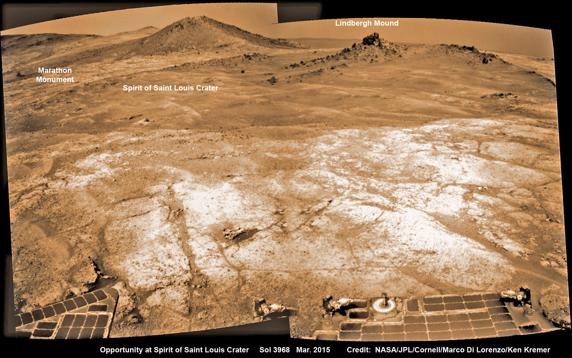
The NASA rover exceeded the distance of a marathon on the surface of Mars on March 24, 2015, Sol 3968. Opportunity has now driven over 26.46 miles (42.59 kilometers) over nearly a dozen Earth years.

Opportunity’s view (annotated) on the day the NASA rover exceeded the distance of a marathon on the surface of Mars on March 24, 2015, Sol 3968 with features named in honor of Charles Lindbergh’s historic solo flight across the Atlantic Ocean in 1927. Rover stands at Spirit of Saint Louis Crater near mountaintop at Marathon Valley overlook and Martian cliffs at Endeavour crater holding deposits of water altered clay minerals.  This navcam camera photo mosaic was assembled from images taken on Sol 3968 (March 24, 2015) and colorized.  Credit: NASA/JPL/Cornell/Marco Di Lorenzo/Ken Kremer/kenkremer.com
Opportunity’s view (annotated) on the day the NASA rover exceeded the distance of a marathon on the surface of Mars on March 24, 2015, Sol 3968 with features named in honor of Charles Lindbergh’s historic solo flight across the Atlantic Ocean in 1927. Rover stands at Spirit of Saint Louis Crater near mountaintop at Marathon Valley overlook and Martian cliffs at Endeavour crater holding deposits of water altered clay minerals. This navcam camera photo mosaic was assembled from images taken on Sol 3968 (March 24, 2015) and colorized. Credit: NASA/JPL/Cornell/Marco Di Lorenzo/Ken Kremer/kenkremer.com

Now for the first time in history, a human emissary has arrived to conduct an up close inspection of and elucidate clues into this regions potential regarding Martian habitability.

The ancient, weathered slopes around Marathon Valley hold a motherlode of ‘phyllosilicate’ clay minerals, based on data obtained from the extensive Mars orbital measurements gathered by the CRISM spectrometer on NASA’s Mars Reconnaissance Orbiter (MRO) – accomplished earlier at the direction of Arvidson.

'Hinners Point' Above Floor of 'Marathon Valley' on Mars. This Martian scene shows contrasting textures and colors of "Hinners Point," at the northern edge of "Marathon Valley," and swirling reddish zones on the valley floor to the left. Credit: NASA/JPL-Caltech/Cornell Univ./Arizona State Univ.
‘Hinners Point’ Above Floor of ‘Marathon Valley’ on Mars. This Martian scene shows contrasting textures and colors of “Hinners Point,” at the northern edge of “Marathon Valley,” and swirling reddish zones on the valley floor to the left. Credit: NASA/JPL-Caltech/Cornell Univ./Arizona State Univ.

Initially the science team was focused on investigating the northern region of the valley while the sun was still higher in the sky and generating more power for research activities from the life giving solar arrays.

“We have detective work to do in Marathon Valley for many months ahead,” said Opportunity Deputy Principal Investigator Ray Arvidson, of Washington University in St. Louis.

But now that the rover is descending into a narrow valley with high walls, the rovers engineering handlers back on Earth have to exercise added caution regarding exactly where they send the Opportunity on her science forays during each sols drive, in order to maintain daily communications.

The high walls to the north and west of the valley ridgeline has already caused several communications blackouts for the “low-elevation Ultra-High-Frequency (UHF) relay passes to the west,” according to the JPL team controlling the rover.

Indeed on two occasions in mid September – coinciding with the days just before and after our Sol 4144 (Sept. 20) photo mosaic view above, “no data were received as the orbiter’s flight path was below the elevation on the valley ridgeline.

On Sept 17 and Sept. 21 “the high ridgeline of the valley obscured the low-elevation pass” and little to no data were received. However the rover did gather imagery and spectroscopic measurements for later transmission.

Now that winter is approaching the rover is moving to the southern side of Marathon Valley to soak up more of the sun’s rays from the sun-facing slope and continue research activities.

“During the Martian late fall and winter seasons Opportunity will conduct its measurements and traverses on the southern side of the valley,” says Arvidson.

“When spring arrives the rover will return to the valley floor for detailed measurements of outcrops that may host the clay minerals.”

The shortest-daylight period of this seventh Martian winter for Opportunity will come in January 2016.

NASA’s Opportunity Rover scans along a spectacular overlook toward Marathon Valley on March 3, 2015, showing flat-faced rocks exhibiting a completely new composition from others examined earlier. Marathon Valley and Martian cliffs on Endeavour crater hold deposits of water altered clay minerals. This navcam camera photo mosaic was assembled from images taken on Sol 3948 (March 3, 2015) and colorized. Credit: NASA/JPL/Cornell/Ken Kremer/kenkremer.com/Marco Di Lorenzo

As of today, Sol 4168, Oct, 15, 2015 Opportunity has taken over 206,300 images and traversed over 26.46 miles (42.59 kilometers).

Stay tuned here for Ken’s continuing Earth and planetary science and human spaceflight news.
Ken Kremer

Nearly 12 Year Traverse Map for NASA’s Opportunity rover from 2004 to 2015. This map shows the entire path the rover has driven during almost 12 years and more than a marathon runners distance on Mars for over 4163 Sols, or Martian days, since landing inside Eagle Crater on Jan 24, 2004 - to current location at the western rim of Endeavour Crater and descending into Marathon Valley. Rover surpassed Marathon distance on Sol 3968 and marked 11th Martian anniversary on Sol 3911. Opportunity discovered clay minerals at Esperance – indicative of a habitable zone - and is currently searching for more at Marathon Valley.  Credit: NASA/JPL/Cornell/ASU/Marco Di Lorenzo/Ken Kremer/kenkremer.com
Nearly 12 Year Traverse Map for NASA’s Opportunity rover from 2004 to 2015
This map shows the entire path the rover has driven during almost 12 years and more than a marathon runners distance on Mars for over 4163 Sols, or Martian days, since landing inside Eagle Crater on Jan 24, 2004 – to current location at the western rim of Endeavour Crater and descending into Marathon Valley. Rover surpassed Marathon distance on Sol 3968 and marked 11th Martian anniversary on Sol 3911. Opportunity discovered clay minerals at Esperance – indicative of a habitable zone – and is currently searching for more at Marathon Valley. Credit: NASA/JPL/Cornell/ASU/Marco Di Lorenzo/Ken Kremer/kenkremer.com

Why Don’t We See the Curiosity Rover’s Arm When it Takes a Selfie?

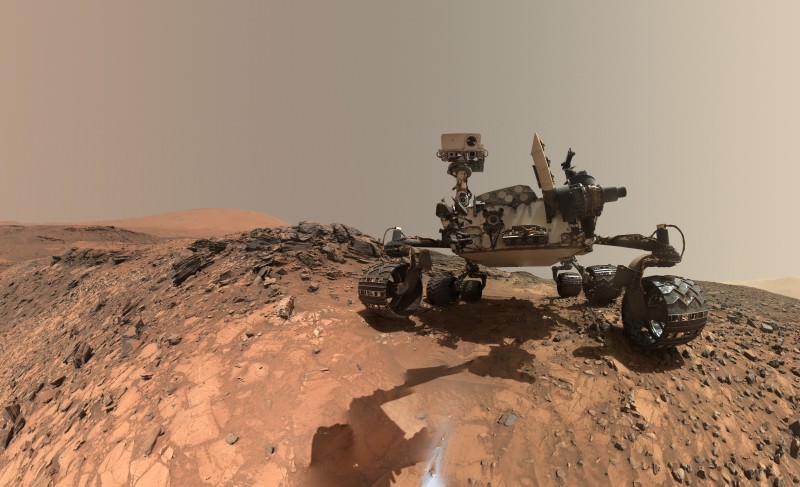
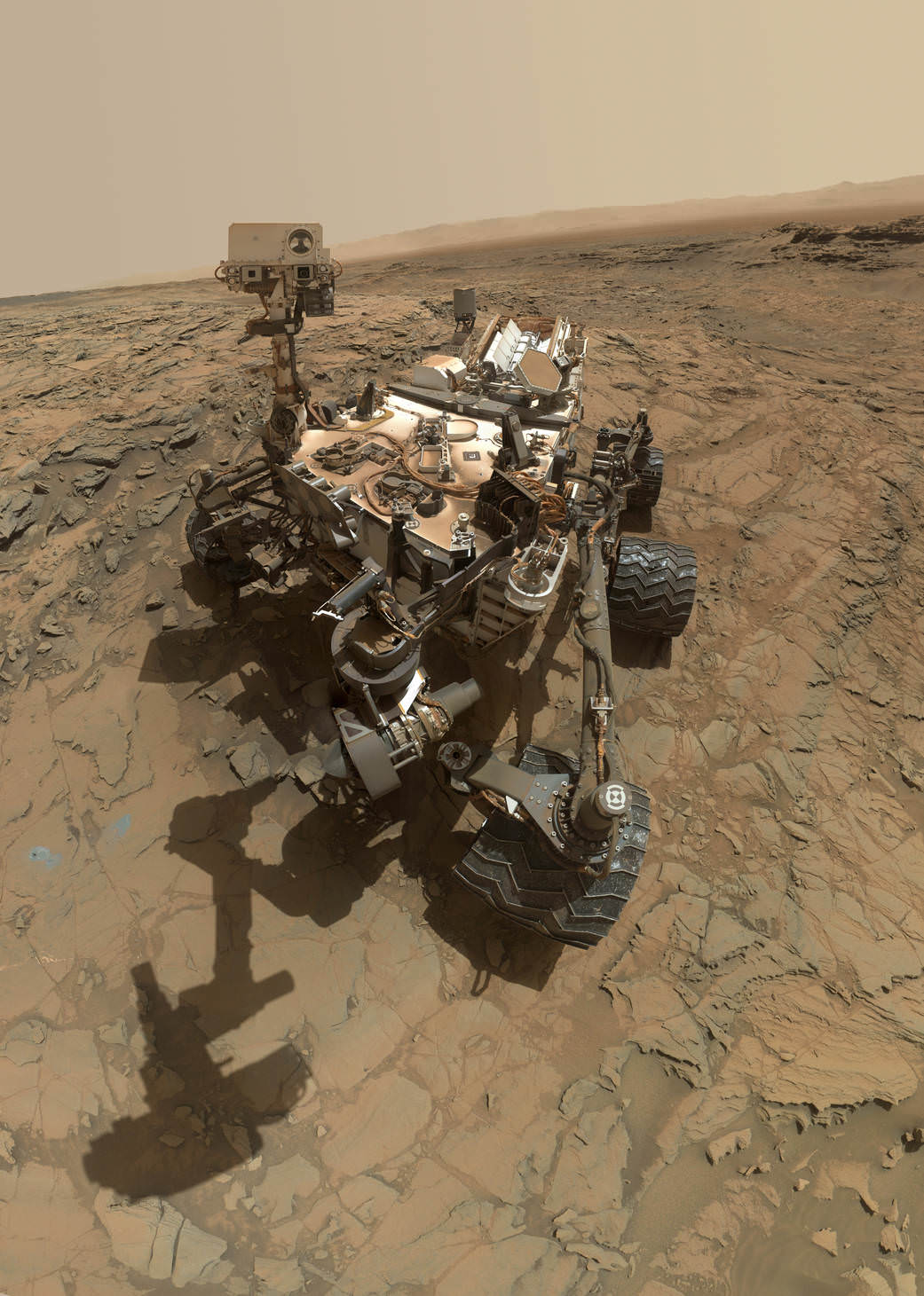
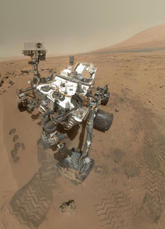
This self-portrait of NASA's Curiosity Mars rover shows the vehicle at the "Big Sky" site. Credit: NASA/JPL-Caltech/MSSS

Every time the Curiosity rover takes a ‘selfie’ on Mars, we get the same questions: “How was this picture taken?” “Why isn’t the rover’s arm or the camera visible in this picture?” “In all of Curiosity’s selfies, the camera mast is never visible… why?” And (sigh) “What is NASA hiding???”

The answer is simple and quite logical. Look any selfie image you’ve taken. Does your hand show up in the picture?

No, because it is behind the camera.

The same is true with the rover’s arm. For the most part, it is behind the camera, so it isn’t part of the picture. In your own selfies, if you’ve done a good job of positioning things, your arm doesn’t appear in the photo either. For example, take a look at this selfie taken last night by Astronomy Cast co-host Pamela Gay of her co-host (and Universe Today publisher) Fraser Cain, along with their fellow speakers at the Next Frontiers Symposium at Ohio State University.

You’ll notice Pamela’s arm isn’t showing, even though she took the picture of herself, just like the rover takes pictures of itself.

Just think of the rover’s arm as the ultimate interplanetary selfie stick. The best selfie-stick pictures are where the stick doesn’t show up in the image and it appears you had your own photographer. That’s what happens with the Curiosity rover self-portraits.

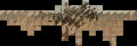
It’s important to note that while the rover selfies look like they are just one single image taken by the wide-angle camera on the rover, it is actually a series of individual images stitched together. The picture above is made from dozens of images the rover took of itself with the Mars Hand Lens Imager (MAHLI) camera at the end of the rover’s robotic arm. Curiosity moves its robotic arm around and over itself and the ground, taking pictures from every angle. These pictures are then stitched, just like panoramic images are put together to form a complete image of your total view. The rover’s arm isn’t long enough to make the camera’s field of view big enough to get the entire rover in one shot (similar to how it works if you hold your camera/phone close to your face you only get one feature, like your nose or eyes, not your entire body.)

Update: As for the questions of why the rover’s arm doesn’t show up in these rover selfie images, I conferred with Guy Webster from JPL and he said that portions of the arm do show up in some of the images used to create the selfie shots, but the portion of the arm pictured is very limited, and the team feels it would be even more confusing to include the small parts of the arm that are in some of the images and so have decided to leave it out entirely.

“Some of the component images do indeed show glimpses of the arm,” Webster said via email. “There’s selectivity in choosing which parts of which component frames to use in assembling the mosaic, to avoid having discontinuous bits of arm in the scene. That would cause confusion even quicker than making choices that leave out the arm.”

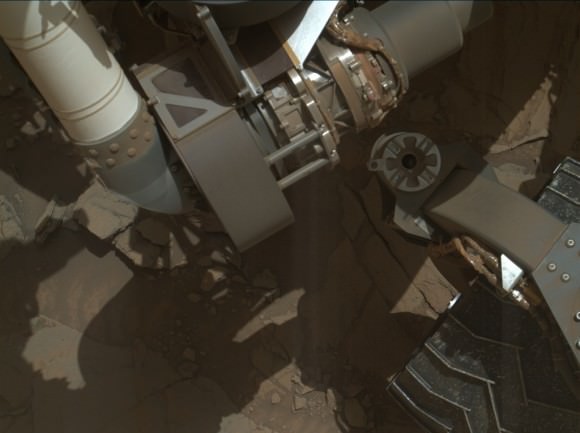
For example, here is one image from the series of pictures taken by the MAHLI to create the selfie, and it shows just a small piece of the arm, near the “shoulder”:

A small portion of the Curiosity rover's robotic arm (the white 'tube' on the top left of the image) shows up in one of the original raw images used to create the montage 'selfie.' Credit: NASA/JPL-Caltech/MSSS.
A small portion of the Curiosity rover’s robotic arm (the white ‘tube’ on the top left of the image) shows up in one of the original raw images used to create the montage ‘selfie.’ Credit: NASA/JPL-Caltech/MSSS.

You can see the entire collection of MAHLI images from Sol 1126 (Oct. 6, 2015) here. You can see how few images show parts of the arm, and how little of the arm shows up in the ones that do.

For the most part, though, because of the flexibility of the robotic arm and the way it is able to move, the arm ends up behind the camera. As Curiosity’s Engineering Camera Team Leader Justin Maki explains in the video below, “The rover is imaging the deck while the arm is behind the camera, and then to image the ground … again the arm is behind the camera when taking these pictures. When we stitch them all together, you don’t see the arm in any of the pictures.”

Click on the image to start the video (which shows very well why the arm isn’t in most of the shots):

It’s interesting to note, that while the lead image above — the latest rover selfie — does not include the rover’s robotic arm, the shadow of the arm is visible on the ground. You’ll notice there seems to be an extra “joint” in the arm, which is just part of the image editing, particularly the stacking of the images where the ground is, where the image editors used more than one image for that area. For the selfie image below, taken in 2012, the imaging team chose not to include any shadow of the arm.

A color self-portrait photo of Curiosity standing on Mars, on sol 84 (October 31, 2012). The photo is a mosaic of images shot with MAHLI, the camera on the end of the robotic arm. Credit: NASA/JPL/MSSS.

Why does the rover imaging team take these rover selfies? Are they just joining in on the selfie craze here on Earth?

These images are actually a great way for the rover team to look at all the components on Curiosity and make sure everything looks like it’s in good shape. The wheels are of particular interest because there has been some damage to them from driving over sharp rocks. These images also document various areas where the rover has worked, and often include things like the holes the rover has drilled into the Martian rocks and soil.

Emily Lakdawalla at The Planetary Society has written an extremely detailed post on how the rover takes self-portraits. She created this composite image of the 72 individual frames the Mars Hand Lens Imager (MAHLI) had to take in order to cover the 360-degree view showing the rover’s underside, a “belly selfie“:

Curiosity's arm-mounted MAHLI camera took 72 individual photos over a period of about an hour in order to cover the entire rover and a lower hemisphere including 360 degrees around the rover and more than 90 degrees of elevation. It took 2 tiers of 20 images to cover the entire horizon, and fewer images at lower elevations to cover the bottom of the image sphere. The arm was kept out of most of the images but it was impossible to keep the arm's shadow from falling on the ground in positions immediately in front of the rover. Credit: NASA/JPL/MSSS/Emily Lakdawalla.
Curiosity’s arm-mounted MAHLI camera took 72 individual photos over a period of about an hour in order to cover the entire rover and a lower hemisphere including 360 degrees around the rover and more than 90 degrees of elevation. It took 2 tiers of 20 images to cover the entire horizon, and fewer images at lower elevations to cover the bottom of the image sphere. The arm was kept out of most of the images but it was impossible to keep the arm’s shadow from falling on the ground in positions immediately in front of the rover. Credit: NASA/JPL/MSSS/Emily Lakdawalla.

Here’s another longer video from JPL that explains all the rover’s cameras.

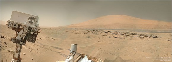
A mosaic of images from NASA's Curiosity rover shows what appears to be a "selfie" with a Martian mountain (Aeolis Mons)in the background. Credit: NASA/JPL-Caltech /MSS/ Image editing by Jason Major.
A mosaic of images from NASA’s Curiosity rover shows what appears to be a “selfie” with a Martian mountain (Aeolis Mons)in the background. Credit: NASA/JPL-Caltech /MSS/ Image editing by Jason Major.

Curiosity Snaps ‘Big Sky’ Drill Site Selfie at Martian Mountain Foothill

This self-portrait of NASA's Curiosity Mars rover shows the vehicle at the "Big Sky" site. Credit: NASA/JPL-Caltech/MSSS

This self-portrait of NASA’s Curiosity Mars rover shows the vehicle at the “Big Sky” site, where its drill collected the mission’s fifth taste of Mount Sharp, at lower left corner. The scene combines images taken by the Mars Hand Lens Imager (MAHLI) camera on Sol 1126 (Oct. 6, 2015). Credit: NASA/JPL-Caltech/MSSS
See below navcam drilling photo mosaic at Big Sky[/caption]

NASA’s Curiosity rover has managed to snap another gorgeous selfie while she was hard at work diligently completing her newest Martian sample drilling campaign – at the ‘Big Sky’ site at the base of Mount Sharp, the humongous mountain dominating the center of the mission’s Gale Crater landing site – which the science team just confirmed was home to a life bolstering ancient lake based on earlier sample analyses.

And the team is already actively planning for the car sized robots next drill campaign in the next few sols, or Martian days!

Overall ‘Big Sky’ marks Curiosity’s fifth ‘taste’ of Mount Sharp – since arriving at the mountain base one year ago – and eighth drilling operation since the nail biting Martian touchdown in August 2012.

NASA’s newly published self-portrait was stitched from dozens of images taken at Big Sky last week on Oct. 6, 2015, or Sol 1126, by the high resolution Mars Hand Lens Imager (MAHLI) color camera at the end of the rover’s 7 foot long robotic arm. The view is centered toward the west-northwest.

At Big Sky, the Curiosity Mars Science Laboratory (MSL) bored into an area of cross-bedded sandstone rock in the Stimson geological unit on Sept. 29, or Sol 1119. Stimson is located on the lower slopes of Mount Sharp inside Gale Crater.

NASA Curiosity rover reaches out with robotic arm to drill into cross-bedded sandstone rock at ‘Big Sky’ target on Sol 1119, Sept. 29, 2015, in this photo mosaic stitched from navcam  camera raw images and colorized.  Big Sky is located in the Stimson unit on the lower slopes of Mount Sharp inside Gale Crater.  Credit: NASA/JPL/Ken Kremer/kenkremer.com/Marco Di Lorenzo
NASA Curiosity rover reaches out with robotic arm to drill into cross-bedded sandstone rock at ‘Big Sky’ target on Sol 1119, Sept. 29, 2015, in this photo mosaic stitched from navcam camera raw images and colorized. Big Sky is located in the Stimson unit on the lower slopes of Mount Sharp inside Gale Crater. Credit: NASA/JPL/Ken Kremer/kenkremer.com/Marco Di Lorenzo

“Success! Our drill at “Big Sky” went perfectly!” wrote Ryan Anderson, a planetary scientist at the USGS Astrogeology Science Center and a member of the Curiosity ChemCam team.

The drill hole is seen at the lower left corner of the MAHLI camera selfie and appears grey along with grey colored tailing – in sharp contrast to the rust red surface. The hole itself is 0.63 inch (1.6 centimeters) in diameter.

Another panoramic view of the ‘Big Sky’ location shot from the rover’s eye perspective with the mast mounted Navcam camera, is shown in our photo mosaic view herein and created by the image processing team of Ken Kremer and Marco Di Lorenzo. The navcam mosaic was stitched from raw images taken up to Sol 1119 and colorized.

“With Big Sky, we found the ordinary sandstone rock we were looking for,” said Curiosity Project Scientist Ashwin Vasavada, in a statement.

The Big Sky drilling operation is part of a coordinated multi-step campaign to examine different types of sandstone rocks to provide geologic context.

“It also happens to be relatively near sandstone that looks as though it has been altered by fluids — likely groundwater with other dissolved chemicals. We are hoping to drill that rock next, compare the results, and understand what changes have taken place.”

Per normal operating procedures, the Big Sky sample was collected for analysis of the Martian rock’s ingredients in the rover’s two onboard laboratories – the Chemistry and Mineralogy X-Ray diffractometer (CheMin) and the Sample Analysis at Mars (SAM) instrument suite.

“We are all eagerly looking forward to the CheMin results from Big Sky to compare with our previous results from “Buckskin”! noted Anderson.

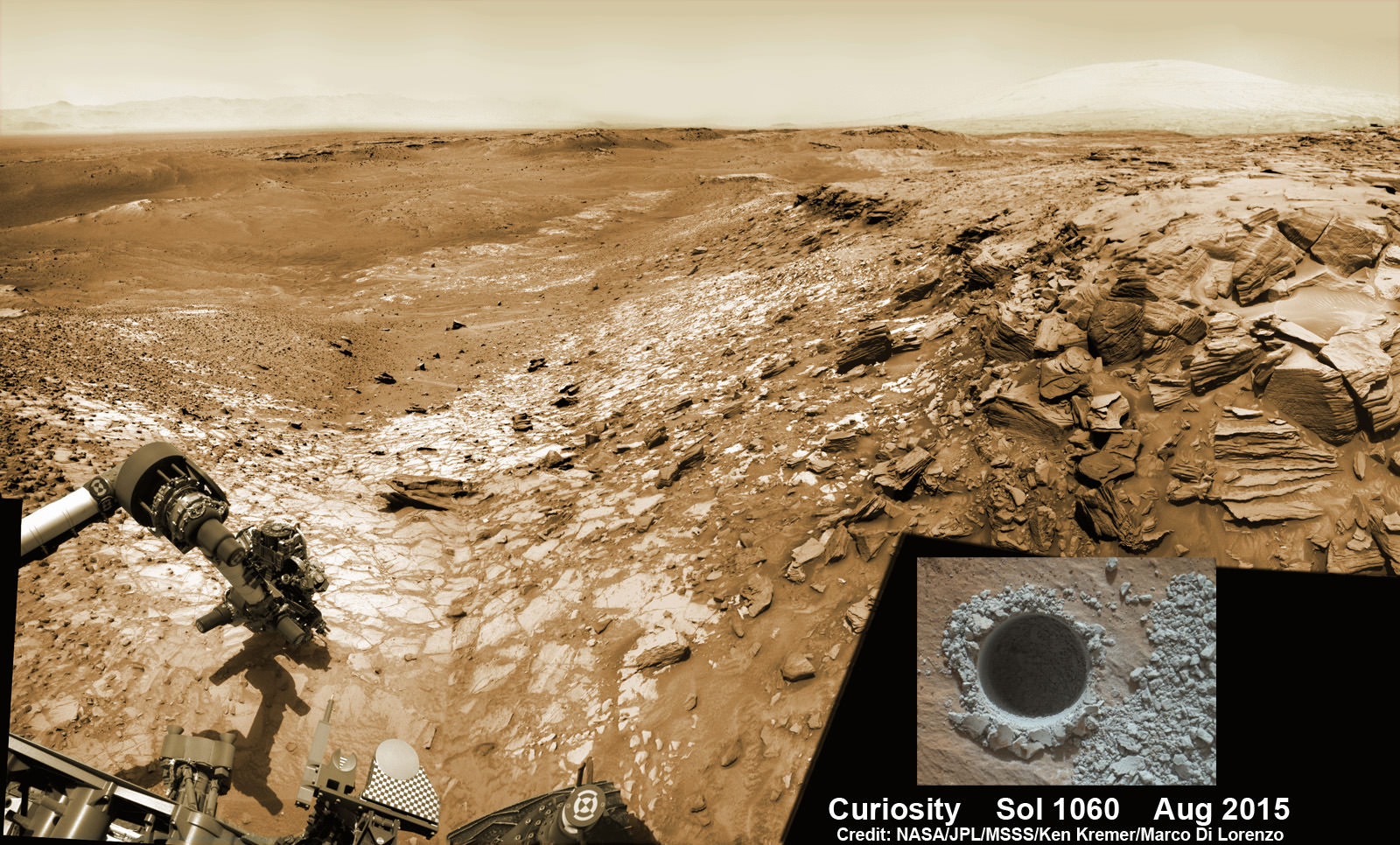
Curiosity extends robotic arm and conducts sample drilling at “Buckskin” rock target at bright toned “Lion” outcrop at the base of Mount Sharp on Mars, seen at right.   Gale Crater eroded rim seen in the distant background at left, in this composite multisol mosaic of navcam raw images taken to Sol 1059, July 30, 2015.  Navcam camera raw images stitched and colorized. Inset: MAHLI color camera up close image of full depth drill hole at “Buckskin” rock target on Sol 1060.  Credit:  NASA/JPL-Caltech/MSSS/Ken Kremer/kenkremer.com/Marco Di Lorenzo
Curiosity extends robotic arm and conducts sample drilling at “Buckskin” rock target at bright toned “Lion” outcrop at the base of Mount Sharp on Mars, seen at right. Gale Crater eroded rim seen in the distant background at left, in this composite multisol mosaic of navcam raw images taken to Sol 1059, July 30, 2015. Navcam camera raw images stitched and colorized. Inset: MAHLI color camera up close image of full depth drill hole at “Buckskin” rock target on Sol 1060. Credit: NASA/JPL-Caltech/MSSS/Ken Kremer/kenkremer.com/Marco Di Lorenzo

This past weekend, Curiosity successfully fed pulverized and sieved samples of Big Sky to the inlet ports for both CheMin and SAM on the rover deck.

“The SAM analysis of the Big Sky drill sample went well and there is no need for another analysis, so the rest of the sample will be dumped out of CHIMRA on Sol 1132,” said Ken Herkenhoff, Research Geologist at the USGS Astrogeology Science Center and an MSL science team member, in a mission update.

Concurrently the team is hard at work readying the rover for the next drill campaign within days, likely at a target dubbed “Greenhorn.”

So the six wheeled rover drove about seven meters to get within range of Greenhorn.

With the sample deliveries accomplished, attention shifted to the next drilling campaign.

Today, Wednesday, Oct. 14, or Sol 1133, Curiosity was commanded “to dump the “Big Sky” sample and “thwack” CHIMRA (the Collection and Handling for in-Situ Martian Rock Analysis) to clean out any remnants of the sample,” wrote Lauren Edgar, a Research Geologist at the USGS Astrogeology Science Center and a member of MSL science team, in a mission update.

The ChemCam and Mastcam instruments are simultaneously making observations of the “Greenhorn” and “Gallatin Pass” targets “to assess chemical variations across a fracture.”

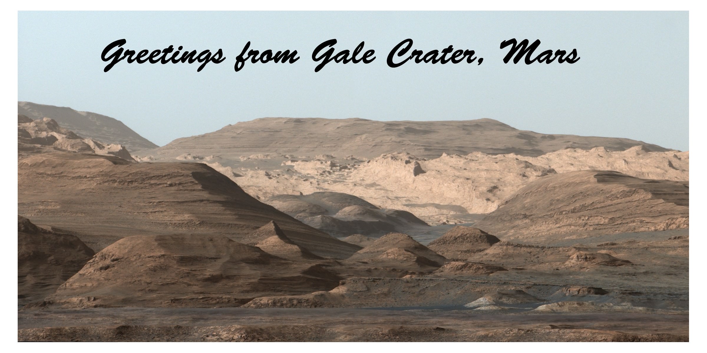
This Martian "postcard" comes after Mars Curiosity drilled its eighth hole on the Red Planet.  This composite image looking toward the higher regions of Mount Sharp was taken on September 9, 2015, by NASA's Curiosity rover. In the foreground -- about 2 miles (3 kilometers) from the rover -- is a long ridge teeming with hematite, an iron oxide.  Credits: NASA/JPL-Caltech/MSSS
This Martian “postcard” comes after Mars Curiosity drilled its eighth hole on the Red Planet. This composite image looking toward the higher regions of Mount Sharp was taken on September 9, 2015, by NASA’s Curiosity rover. In the foreground — about 2 miles (3 kilometers) from the rover — is a long ridge teeming with hematite, an iron oxide. Credits: NASA/JPL-Caltech/MSSS

Curiosity has already accomplished her primary objective of discovering a habitable zone on the Red Planet – at the Yellowknife Bay area – that contains the minerals necessary to support microbial life in the ancient past when Mars was far wetter and warmer billions of years ago.

As of today, Sol 1133, October 14, 2015, she has driven some 6.9 miles (11.1 kilometers) kilometers and taken over 274,600 amazing images.

Stay tuned here for Ken’s continuing Earth and planetary science and human spaceflight news.

Ken Kremer

Curiosity looks toward fabulous canyons and buttes at the base of Mount Sharp from the Stimson sand dunes on Mars on Sol 1100, Sept. 10  2015 in this photo mosaic stitched from Mastcam color camera raw images.  Credit: NASA/JPL/MSSS/Ken Kremer/kenkremer.com/Marco Di Lorenzo
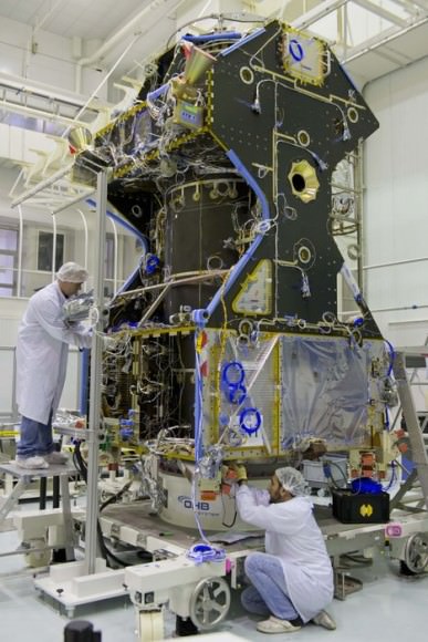
Curiosity looks toward fabulous canyons and buttes at the base of Mount Sharp from the Stimson sand dunes on Mars on Sol 1100, Sept. 10 2015 in this photo mosaic stitched from Mastcam color camera raw images. Credit: NASA/JPL/MSSS/Ken Kremer/kenkremer.com/Marco Di Lorenzo