Curiosity Drills Deep into First High Silica Martian Rock on Third Touchdown Anniversary

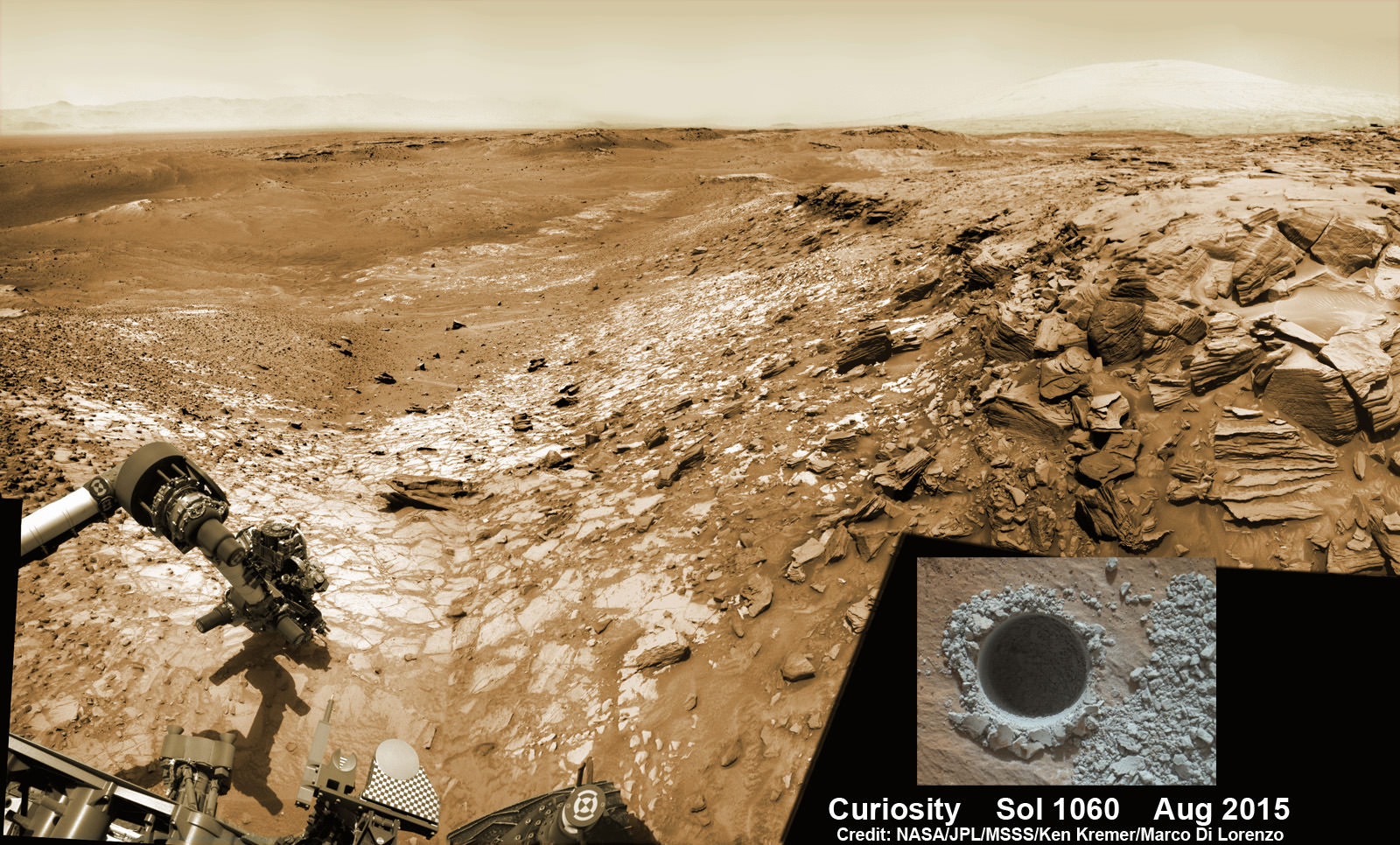
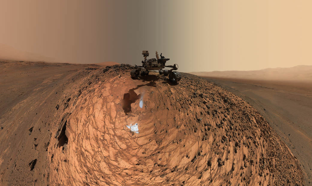
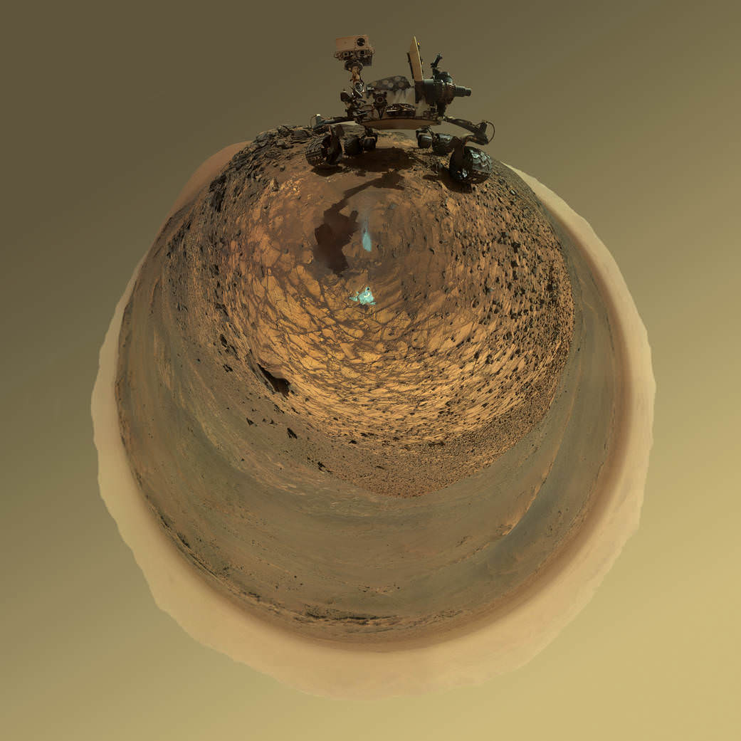
Curiosity extends robotic arm and conducts sample drilling at “Buckskin” rock target at bright toned “Lion” outcrop at the base of Mount Sharp on Mars, seen at right. Gale Crater eroded rim seen in the distant background at left, in this composite multisol mosaic of navcam raw images taken to Sol 1059, July 30, 2015. Navcam camera raw images stitched and colorized. Inset: MAHLI color camera up close image of full depth drill hole at “Buckskin” rock target on Sol 1060. Credit: NASA/JPL-Caltech/MSSS/Ken Kremer/kenkremer.com/Marco Di Lorenzo

Curiosity extends robotic arm and conducts sample drilling at “Buckskin” rock target at bright toned “Lion” outcrop at the base of Mount Sharp on Mars, seen at right, during August 2015. Gale Crater eroded rim seen in the distant background at left, in this composite multisol mosaic of navcam raw images taken to Sol 1059, July 30, 2015. Navcam camera raw images stitched and colorized. Inset: MAHLI color camera up close image of full depth drill hole at “Buckskin” rock target on Sol 1060. Credit: NASA/JPL-Caltech/MSSS/Ken Kremer/kenkremer.com/Marco Di Lorenzo
Story updated[/caption]

NASA’s Curiosity Mars Science Laboratory (MSL) rover has successfully drilled into the first high silica rock target on Mars after recently discovering this new type of rock that’s unlike any found before – as she is about to mark the 3rd anniversary since the hair-raising touchdown on the Red Planet.

The SUV-sized rover bored a full depth hole into a Mars outcrop at a target dubbed “Buckskin” as commanded by the mission team over the weekend, after first conducting a mini drill test to assess the safety of the intended drill campaign to sample the alien rock interior beneath the Martian crater floor.

“This morning, the MSL operations team was very happy to see that drilling into Buckskin was successful!” said Ken Herkenhoff, Research Geologist at the USGS Astrogeology Science Center and an MSL science team member, in a mission update.

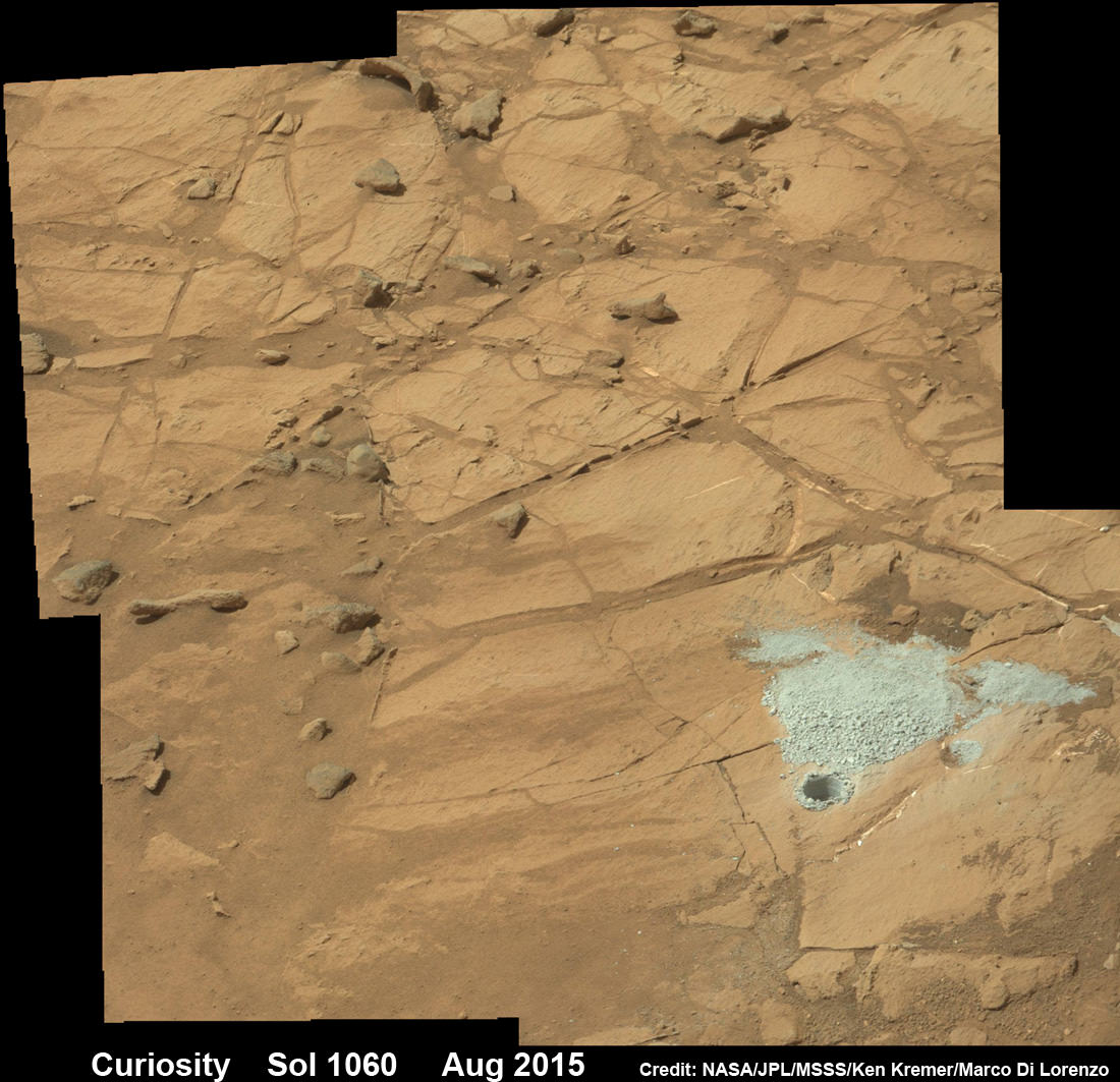
Confirmation of the success of the full depth drilling into “Buckskin” on Sol 1060 at the bright toned “Lion” outcrop came later after receipt of new high resolution images from the rover showing the approximately 1.6 cm (0.63 inch) diameter bore hole next to the initial mini hole test, along with the indicative residue of grey colored tailings from the Martian subsurface seen distributed around the new hole.

“Successful drilling at Buckskin!” added team member Professor John Bridges of the University of Leicester, England, in an update.

“Like the other drill holes this is showing how thin red Mars is,” Bridges elaborated.

Beneath a thin veneer of rusty red colored iron oxide, the Red Planet is remarkably grey as demonstrated by Curiosity’s prior drilling campaigns.

The hole was bored to a full depth of about 2.6 inches (6.5 centimeters) using the percussion drill on the terminus of the 7 foot-long (2.1 meter-long) robotic arm.

Curiosity rover successfully drills into Martian outcrop  at Buckskin rock target at current work site at base of Mount Sharp in August 2015, in this mosaic showing full depth drill hole and initial test hole, with grey colored subsurface tailings and mineral veins on surrounding Red Planet terrain.  This high resolution photo mosaic is a multisol composite of color images taken by the mast mounted Mastcam-100 color camera up to Sol 1060, July 31, 2015.   Credit:  NASA/JPL-Caltech/Ken Kremer/kenkremer.com/Marco Di Lorenzo
Curiosity rover successfully drills into Martian outcrop at Buckskin rock target at current work site at base of Mount Sharp in August 2015, in this mosaic showing full depth drill hole and initial test hole, with grey colored subsurface tailings and mineral veins on surrounding Red Planet terrain. This high resolution photo mosaic is a multisol composite of color images taken by the mast mounted Mastcam-100 color camera up to Sol 1060, July 31, 2015. Credit: NASA/JPL-Caltech/Ken Kremer/kenkremer.com/Marco Di Lorenzo

Buckskin was “chosen because this sedimentary horizon has some very high silica enrichments,” Bridges explains.

The findings of elevated levels of silicon as well as hydrogen were derived from data collected by Curiosity’s laser-firing Chemistry & Camera (ChemCam) and Dynamic Albedo of Neutrons (DAN) instruments on certain local area rocks.

Silica is a rock-forming compound containing silicon and oxygen, commonly found on Earth as quartz.

“High levels of silica could indicate ideal conditions for preserving ancient organic material, if present, so the science team wants to take a closer look,” say mission team officials.

See the rover at work reaching out with her robotic arm and drilling into Buckskin, as illustrated in our new mosaics of mastcam and navcam camera raw images created by the image processing team of Ken Kremer and Marco Di Lorenzo (above and below).

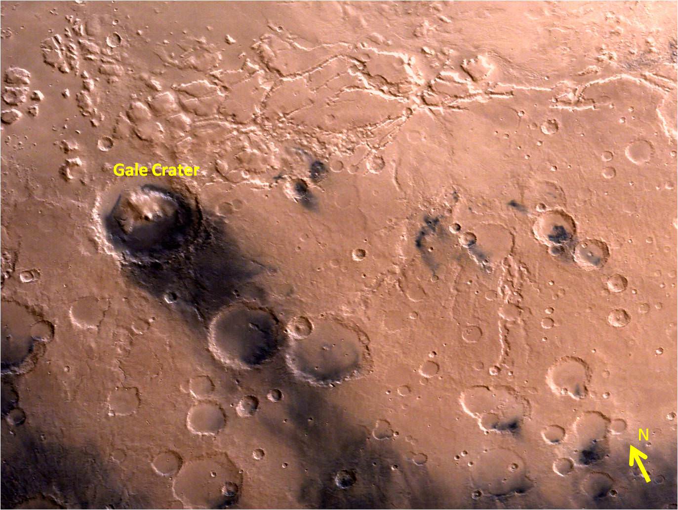
“Buckskin” sits at the base of Mount Sharp, a huge layered mountain that dominates the center of the 96 mile-wide (154 kilometers-wide) Gale Crater landing site.

Exploring the sedimentary layers of Mount Sharp, which towers 3.4 miles (5.5 kilometers) into the Martian sky, is the primary destination and goal of the rovers long term scientific expedition on the Red Planet.

The silica enrichment “may have occurred as the Gale sediments were altered by subsurface fluids after burial. As the basaltic composition was altered (as we saw from the clay and Fe oxide at Yellowknife Bay) ultimately a lot of silica is released which can be precipitated at horizons like this,” explains Bridges.

The Curiosity Mars Science Laboratory (MSL) rover safely touched down on the crater floor on August 5, 2012 following the unprecedented and nail-biting sky crane maneuver that delivered her with pinpoint precision to a landing site nearby Mount Sharp inside Gale Crater.

The goal of the drilling is to provide geologic context for Curiosity’s long term climb up the mountains sedimentary layers by collecting samples to assess the habitability of the Red Planet over billions of years of time.

So the plan was for the robot to process and pulverize the samples for eventual delivery to the onboard pair of miniaturized chemistry labs located inside her belly – SAM and CheMin. Tiny samples are fed to a trio of inlet ports on the rover deck through the sieved filters.

Images are taken to document and assess the entire sample collection and delivery process.

After gathering the Buckskin sample, a portion was transferred to the robots scoop for inspection.

Then the first portion was successfully fed into CheMin for inorganic elemental analysis over the weekend.

“The activities planned for last weekend completed successfully, including sample dropoff to CheMin and analysis of the minerals present,” Herkenhoff confirmed.

The one ton robots next steps involve “dumping the portion of the drill sample that has not been sieved and Mastcam, ChemCam, MAHLI, and APXS observations of the dump pile. ChemCam and Mastcam will also observe nearby targets “Martz” and “Mountain Home.” MAHLI will image the drill hole, tailings and CheMin inlet at night using its LEDs for illumination.”

Curiosity MAHLI camera image taken of Buckskin drill hole on Sol 1060 on July 31, 2015. Credit: NASA/JPL/MSSS

After completing these science activities, the six wheeled rover will move on to the next exciting destination.

“It’s been a great couple of weeks at the Lion outcrop, but it’s time to move on,” says Lauren Edgar, Research Geologist at the USGS Astrogeology Science Center and an MSL science team member, in the latest mission update from today, August 4, Sol 1065.

“After a successful investigation that included observations by almost every science instrument, we’re getting ready to drive away tomorrow. That means that today (and tomorrow before we drive) is the last call for science observations.”

For about the past two months, the six wheeled robot has been driving around and exploring a geological contact zone named “Marias Pass” – an area on lower Mount Sharp, by examining the rocks and outcrops with her suite of state-of-the-art science instruments.

“Marias Pass” is a geological context zone where two rock types overlap – pale mudstone meets darker sandstone.

The prior hole was drilled at Telegraph Peak on Feb. 24, 2015, on Sol 908.

Curiosity recently celebrated 1000 Sols of exploration on Mars on May 31, 2015 – detailed here with our Sol 1000 mosaic also featured at Astronomy Picture of the Day on June 13, 2015.

NASA’s Martian Curiosity rover looks backs to 1000 Sols of science and exploration on the surface of the Red Planet.  Robot wheel tracks lead back through valley dunes.  Gale Crater rim seen in the distant hazy background.  Sol 997 (May 28, 2015) navcam camera raw images stitched and colorized. Credit:  NASA/JPL-Caltech/ Marco Di Lorenzo/Ken Kremer/kenkremer.com Featured on APOD on June 13, 2015
NASA’s Martian Curiosity rover looks backs to 1000 Sols of science and exploration on the surface of the Red Planet. Robot wheel tracks lead back through valley dunes. Gale Crater rim seen in the distant hazy background. Sol 997 (May 28, 2015) navcam camera raw images stitched and colorized. Credit: NASA/JPL-Caltech/ Marco Di Lorenzo/Ken Kremer/kenkremer.com
Featured on APOD on June 13, 2015

As of today, Sol 1065, August 4, 2015, she has driven some 11 kilometers and taken over 256,000 amazing images.

Curiosity has already accomplished her primary objective of discovering a habitable zone on the Red Planet – at the Yellowknife Bay area – that contains the minerals necessary to support microbial life in the ancient past when Mars was far wetter and warmer billions of years ago.

Stay tuned here for Ken’s continuing Earth and planetary science and human spaceflight news.

Ken Kremer

Curiosity extends robotic arm and conducts test drill at “Buckskin” rock target at bright toned “Lion” outcrop on the lower region of Mount Sharp on Mars, seen at right.   Gale Crater eroded rim seen in the distant background at left, in this composite multisol mosaic of navcam raw images taken to Sol 1059, July 30, 2015.  Navcam camera raw images stitched and colorized. Credit:  NASA/JPL-Caltech/Ken Kremer/kenkremer.com/Marco Di Lorenzo
Curiosity extends robotic arm and conducts test drill at “Buckskin” rock target at bright toned “Lion” outcrop on the lower region of Mount Sharp on Mars, seen at right. Gale Crater eroded rim seen in the distant background at left, in this composite multisol mosaic of navcam raw images taken to Sol 1059, July 30, 2015. Navcam camera raw images stitched and colorized. Credit: NASA/JPL-Caltech/Ken Kremer/kenkremer.com/Marco Di Lorenzo

Curiosity Discovers Mars Rock Like None Before, Sets Drill Campaign

Curiosity extends robotic arm and conducts test drill at “Buckskin” rock target at bright toned “Lion” outcrop on the lower region of Mount Sharp on Mars, seen at right. Gale Crater eroded rim seen in the distant background at left, in this composite multisol mosaic of navcam raw images taken to Sol 1059, July 30, 2015. Navcam camera raw images stitched and colorized. Credit: NASA/JPL-Caltech/Ken Kremer/kenkremer.com/Marco Di Lorenzo

On the eve of the 3rd anniversary since her nail biting touchdown inside Gale Crater, NASA’s car sized Curiosity Mars Science Laboratory (MSL) rover has discovered a new type of Martian rock that’s surprisingly rich in silica – and unlike any other targets found before.

Excited by this new science finding on Mars, Curiosity’s handlers are now gearing the robot up for her next full drill campaign today, July 31 (Sol 1060) into a rock target called “Buckskin” – which lies at the base of Mount Sharp, the huge layered mountain that is the primary science target of this Mars rover mission.

“The team selected the “Buckskin” target to drill,” says Lauren Edgar, Research Geologist at the USGS Astrogeology Science Center and an MSL science team member, in a mission update.

“It’s another exciting day on Mars!”

See the rover at work reaching out with her robotic arm and drilling into Buckskin, as illustrated in our new mosaics of navcam camera images created by the image processing team of Ken Kremer and Marco Di Lorenzo (above and below). Also featured at Alive Universe Images – here.

NASA Curiosity rover inspects ‘Buckskin’ rock outcrop on Mars with APXS mineral spectrometer in this hazcam camera raw image taken on July 29, 2015 (Sol 1058), colorized and linearized.  Credit:  NASA/JPL-Caltech/Marco Di Lorenzo/Ken Kremer/kenkremer.com
NASA Curiosity rover inspects ‘Buckskin’ rock outcrop on Mars with APXS mineral spectrometer in this hazcam camera raw image taken on July 29, 2015 (Sol 1058), colorized and linearized. Credit: NASA/JPL-Caltech/Marco Di Lorenzo/Ken Kremer/kenkremer.com

For about the past two months, the six wheeled robot has been driving around and exploring a geological contact zone named “Marias Pass” – an area on lower Mount Sharp, by examining the rocks and outcrops with her suite of state-of-the-art science instruments.

The goal is to provide geologic context for her long term expedition up the mountains sedimentary layers to study the habitability of the Red Planet over eons of time.

Data from Curiosity’s “laser-firing Chemistry & Camera (ChemCam) and Dynamic Albedo of Neutrons (DAN), show elevated amounts of silicon and hydrogen, respectively,” in certain local area rocks, according to the team.

Silica is a rock-forming compound containing silicon and oxygen, commonly found on Earth as quartz.

“High levels of silica could indicate ideal conditions for preserving ancient organic material, if present, so the science team wants to take a closer look.”

Curiosity conducts test drill at “Buckskin” rock target at bright toned “Lion” outcrop on the lower region of Mount Sharp on Mars.   Gale crater rim seen in the distant background, in this composite mosaic of navcam raw images taken to Sol 1059, July 30, 2015.  Navcam camera raw images stitched and colorized. Credit:  NASA/JPL-Caltech/Ken Kremer/kenkremer.com/Marco Di Lorenzo  Inset: MAHLI camera up close image of  test drill at “Buckskin” rock target.  Credit: NASA/JPL-Caltech/MSSS
Curiosity extends robotic arm and conducts test drill at “Buckskin” rock target at bright toned “Lion” outcrop on the lower region of Mount Sharp on Mars. Gale crater rim seen in the distant background, in this composite mosaic of navcam raw images taken to Sol 1059, July 30, 2015. Inset: MAHLI camera up close image of test drill at “Buckskin” rock target. Navcam camera raw images stitched and colorized. Credit: NASA/JPL-Caltech/Ken Kremer/kenkremer.com/Marco Di Lorenzo Credit: NASA/JPL-Caltech/MSSS

Therefore the team scouted targets suitable for in depth analysis and sample drilling and chose “Buckskin”.

“Buckskin” is located among some high-silica and hydrogen enriched targets at a bright outcrop named “Lion.”

An initial test bore operation was conducted first to confirm whether that it was indeed safe to drill into “Buckskin” and cause no harm to the rover before committing to the entire operation.

The bore hole is about 1.6 cm (0.63 inch) in diameter.

“This test will drill a small hole in the rock to help determine whether it is safe to go ahead with the full hole,” elaborated Ryan Anderson, planetary scientist at the USGS Astrogeology Science Center and an MSL science team member.

So it was only after the team received back new high resolution imagery last night from the arm-mounted MAHLI camera which confirmed the success of the mini-drill operation, that the “GO” was given for a full depth drill campaign. MAHLI is short for Mars Hand Lens Imager.

“We successfully completed a mini drilling test yesterday (shown in the MAHLI image). That means that today we’re going for the FULL drill hole” Edgar confirmed.

“GO for Drilling.”

So it’s a busy day ahead on the Red Planet, including lots of imaging along the way to document and confirm that the drilling operation proceeds safely and as planned.

“First we’ll acquire MAHLI images of the intended drill site, then we’ll drill, and then we’ll acquire more MAHLI images after drilling,” Edgar explains.

“The plan also includes Navcam imaging of the workspace, and Mastcam imaging of the target and drill bit. In addition to drilling, we’re getting CheMin ready to receive sample in an upcoming plan. Fingers crossed!” Surface observations with the arm-mounted Alpha Particle X-ray Spectrometer (APXS) instrument are also planned.

If all goes well, the robot will process and pulverize the samples for eventual delivery to the onboard pair of miniaturized chemistry labs located inside her belly – SAM and CheMin. Tiny samples will be fed to the inlet ports on the rover deck through the sieved filters.

A rock outcrop dubbed "Missoula," near Marias Pass on Mars, is seen in this image mosaic taken by the Mars Hand Lens Imager on NASA's Curiosity rover. Pale mudstone (bottom of outcrop) meets coarser sandstone (top) in this geological contact zone, which has piqued the interest of Mars scientists.   Credit: NASA/JPL-Caltech/MSSS
A rock outcrop dubbed “Missoula,” near Marias Pass on Mars, is seen in this image mosaic taken by the Mars Hand Lens Imager on NASA’s Curiosity rover. Pale mudstone (bottom of outcrop) meets coarser sandstone (top) in this geological contact zone, which has piqued the interest of Mars scientists. Credit: NASA/JPL-Caltech/MSSS

Meanwhile the team is studying a nearby rock outcrop called “Ch-paa-qn” which means “shining peak” in the native Salish language of northern Montana.”

Anderson says the target is a bright patch on a nearby outcrop. Via active and passive observations with the mast-mounted ChemCam laser and Mastcam multispectral imager, the purpose is to determine if “Ch-paa-qn” is comprised of calcium sulfate like other white veins visible nearby, or perhaps it’s something else entirely.

A rock fragment dubbed "Lamoose" is shown in this picture taken by the Mars Hand Lens Imager (MAHLI) on NASA's Curiosity rover. Like other nearby rocks in a portion of the "Marias Pass" area of Mt. Sharp, Mars, it has unusually high concentrations of silica. The high silica was first detected in the area by the Chemistry & Camera (ChemCam) laser spectrometer. This rock was targeted for follow-up study by the MAHLI and the arm-mounted Alpha Particle X-ray Spectrometer (APXS).  Credits: NASA/JPL-Caltech/MSSS
A rock fragment dubbed “Lamoose” is shown in this picture taken by the Mars Hand Lens Imager (MAHLI) on NASA’s Curiosity rover. Like other nearby rocks in a portion of the “Marias Pass” area of Mt. Sharp, Mars, it has unusually high concentrations of silica. The high silica was first detected in the area by the Chemistry & Camera (ChemCam) laser spectrometer. This rock was targeted for follow-up study by the MAHLI and the arm-mounted Alpha Particle X-ray Spectrometer (APXS). Credits: NASA/JPL-Caltech/MSSS

Before arriving by the “Lion” outcrop last week, Curiosity was investigating another outcrop area nearby, the high-silica target dubbed “Elk” with the ChemCam instrument, while scouting around the “Marias Pass” area in search of tasty science targets for in-depth analysis.

Sometimes the data subsequently returned and analyzed is so extraordinary, that the team decides on a return trip to a spot previously departed. Such was the case with “Elk” and the rover was commanded to do a U-turn to acquire more precious data.

“One never knows what to expect on Mars, but the Elk target was interesting enough to go back and investigate,” said Roger Wiens, the principal investigator of the ChemCam instrument from the Los Alamos National Laboratory in New Mexico.

Soon, ChemCam will have fired on its 1,000th target. Overall the laser blaster has been fired more than 260,000 times since Curiosity landed inside the nearly 100 mile wide Gale Crater on Mars on Aug. 6, 2012, alongside Mount Sharp.

“ChemCam acts like eyes and ears of the rover for nearby objects,” said Wiens.

“Marias Pass” is a geological context zone where two rock types overlap – pale mudstone meets darker sandstone.

The rover spotted a very curious outcrop named “Missoula.”

“We found an outcrop named Missoula where the two rock types came together, but it was quite small and close to the ground. We used the robotic arm to capture a dog’s-eye view with the MAHLI camera, getting our nose right in there,” said Ashwin Vasavada, the mission’s project scientist at NASA’s Jet Propulsion Laboratory in Pasadena, California.

White mineral veins, possibly comprised of calcium sulfate, filled the fractures by depositing the mineral from running groundwater.

“Such clues help scientists understand the possible timing of geological events,” says the team.

Read more about Curiosity in an Italian language version of this story at Alive Universe Images – here.

NASA’s Martian Curiosity rover looks backs to 1000 Sols of science and exploration on the surface of the Red Planet.  Robot wheel tracks lead back through valley dunes.  Gale Crater rim seen in the distant hazy background.  Sol 997 (May 28, 2015) navcam camera raw images stitched and colorized. Credit:  NASA/JPL-Caltech/ Marco Di Lorenzo/Ken Kremer/kenkremer.com
NASA’s Martian Curiosity rover looks backs to 1000 Sols of science and exploration on the surface of the Red Planet. Robot wheel tracks lead back through valley dunes. Gale Crater rim seen in the distant hazy background. Sol 997 (May 28, 2015) navcam camera raw images stitched and colorized. Credit: NASA/JPL-Caltech/ Marco Di Lorenzo/Ken Kremer/kenkremer.com
Featured on APOD on June 13, 2015

As of today, Sol 1060, July 31, 2015, she has taken over 255,000 amazing images.

Curiosity recently celebrated 1000 Sols of exploration on Mars on May 31, 2015 – detailed here with our Sol 1000 mosaic also featured at Astronomy Picture of the Day on June 13, 2015.

Stay tuned here for Ken’s continuing Earth and planetary science and human spaceflight news.
Ken Kremer

Red Mars, Gray Mars: "Mini-start hole" drill maneuver was successful.  Image of mini start drill hole taken by Mars Hand Lens Imager (MAHLI) aboard NASA's Mars rover Curiosity on July 30, 2015, Sol 1059. Credit: NASA/JPL-Caltech/MSSS
Red Mars, Gray Mars: “Mini-start hole” drill maneuver was successful. Image of mini start drill hole taken by Mars Hand Lens Imager (MAHLI) aboard NASA’s Mars rover Curiosity on July 30, 2015, Sol 1059. Credit: NASA/JPL-Caltech/MSSS
Curiosity conducts test drill at “Buckskin” rock target at bright toned “Lion” outcrop on the lower region of Mount Sharp on Mars, seen at right.   Gale crater rim seen in the distant background at left, in this composite mosaic of navcam raw images taken to Sol 1059, July 30, 2015.  Navcam camera raw images stitched. Credit:  NASA/JPL-Caltech/Ken Kremer/kenkremer.com/Marco Di Lorenzo
Curiosity extends robotic arm and conducts test drill at “Buckskin” rock target at bright toned “Lion” outcrop on the lower region of Mount Sharp on Mars, seen at right. Gale crater rim seen in the distant background at left, in this composite mosaic of navcam raw images taken to Sol 1059, July 30, 2015. Navcam camera raw images stitched. Credit: NASA/JPL-Caltech/Ken Kremer/kenkremer.com/Marco Di Lorenzo

The Planet Mars

The Planet Mars. Image credit: NASA

Mars, otherwise known as the “Red Planet”, is the fourth planet of our Solar System and the second smallest (after Mercury). Named after the Roman God of war, its nickname comes from its reddish appearance, which has to do with the amount of iron oxide prevalent on its surface. Every couple of years, when Mars is at opposition to Earth (i.e. when the planet is closest to us), it is most visible in the night sky.

Because of this, humans have been observing it for millennia, and its appearance in the heavens has played a large role in the mythology and astrological systems of many cultures. And in the modern era, it has been a veritable treasure trove of scientific discoveries, which have informed our understanding of our Solar System and its history.

Size, Mass and Orbit:

Mars has a radius of approximately 3,396 km at its equator, and 3,376 km at its polar regions – which is the equivalent of roughly 0.53 Earths. While it is roughly half the size of Earth, it’s mass – 6.4185 x 10²³ kg – is only 0.151 that of Earth’s. It’s axial tilt is very similar to Earth’s, being inclined 25.19° to its orbital plane (Earth’s axial tilt is just over 23°), which means Mars also experiences seasons.

At its greatest distance from the Sun (aphelion), Mars orbits at a distance of 1.666 AUs, or 249.2 million km. At perihelion, when it is closest to the Sun, it orbits at a distance of 1.3814 AUs, or 206.7 million km. At this distance, Mars takes 686.971 Earth days, the equivalent of 1.88 Earth years, to complete a rotation of the Sun. In Martian days (aka. Sols, which are equal to one day and 40 Earth minutes), a Martian year is 668.5991 Sols.

Composition and Surface Features:

With a mean density of 3.93 g/cm³, Mars is less dense than Earth, and has about 15% of Earth’s volume and 11% of Earth’s mass. The red-orange appearance of the Martian surface is caused by iron oxide, more commonly known as hematite (or rust). The presence of other minerals in the surface dust allow for other common surface colors, including golden, brown, tan, green, and others.

As a terrestrial planet, Mars is rich in minerals containing silicon and oxygen, metals, and other elements that typically make up rocky planets. The soil is slightly alkaline and contains elements such as magnesium, sodium, potassium, and chlorine. Experiments performed on soil samples also show that it has a basic pH of 7.7.

Although liquid water cannot exist on Mars’ surface, owing to its thin atmosphere, large concentrations of ice water exist within the polar ice caps – Planum Boreum and Planum Australe. In addition, a permafrost mantle stretches from the pole to latitudes of about 60°, meaning that water exists beneath much of the Martian surface in the form of ice water. Radar data and soil samples have confirmed the presence of shallow subsurface water at the middle latitudes as well.

Like Earth, Mars is differentiated into a dense metallic core surrounded by a silicate mantle. This core is composed of iron sulfide, and thought to be twice as rich in lighter elements than Earth’s core. The average thickness of the crust is about 50 km (31 mi), with a maximum thickness of 125 km (78 mi). Relative to the sizes of the two planets, Earth’s crust (averaging 40 km or 25 mi) is only one third as thick.

Artist rendition of the formation of rocky bodies in the solar system - how they form and differentiate and evolve into terrestrial planets. Image credit: NASA/JPL-Caltech
Artist rendition of the formation of rocky bodies in the solar system – how they form and differentiate and evolve into terrestrial planets. Image credit: NASA/JPL-Caltech

Current models of its interior imply that the core region measures between 1,700 – 1850 kilometers (1,056 – 1150 mi) in radius, consisting primarily of iron and nickel with about 16–17% sulfur. Due to its smaller size and mass, the force of gravity on the surface of Mars is only 37.6% of that on Earth. An object falling on Mars falls at 3.711 m/s², compared to 9.8 m/s² on Earth.

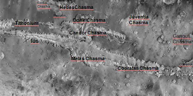
The surface of Mars is dry and dusty, with many similar geological features to Earth. It has mountain ranges and sandy plains, and even some of the largest sand dunes in the Solar System. It also has the largest mountain in the Solar System, the shield volcano Olympus Mons, and the longest, deepest chasm in the Solar System: Valles Marineris.

The surface of Mars has also been pounded by impact craters, many of which date back billions of years. These craters are so well preserved because of the slow rate of erosion that happens on Mars. Hellas Planitia, also called the Hellas impact basin, is the largest crater on Mars. Its circumference is approximately 2,300 kilometers, and it is nine kilometers deep.

Mars also has discernible gullies and channels on its surface, and many scientists believe that liquid water used to flow through them. By comparing them to similar features on Earth, it is believed these were were at least partially formed by water erosion.  Some of these channels are quite large, reaching 2,000 kilometers in length and 100 kilometers in width.

Mars’ Moons:

Mars has two small satellites, Phobos and Deimos. These moons were discovered in 1877 by the astronomer Asaph Hall and were named after mythological characters. In keeping with the tradition of deriving names from classical mythology, Phobos and Deimos are the sons of Ares – the Greek god of war that inspired the Roman god Mars. Phobos represents fear while Deimos stands for terror or dread.

Phobos and Deimos, photographed here by the Mars Reconnaissance Orbiter, are tiny, irregularly-shaped moons that are probably strays from the main asteroid belt. Credit: NASA - See more at: http://astrobob.areavoices.com/2013/07/05/rovers-capture-loony-moons-and-blue-sunsets-on-mars/#sthash.eMDpTVPT.dpuf
Phobos and Deimos, photographed here by the Mars Reconnaissance Orbiter, are tiny, irregularly-shaped moons that are probably strays from the main asteroid belt. Credit: NASA

Phobos measures about 22 km (14 mi) in diameter, and orbits Mars at a distance of 9234.42 km when it is at periapsis (closest to Mars) and 9517.58 km when it is at apoapsis (farthest). At this distance, Phobos is below synchronous altitude, which means that it takes only 7 hours to orbit Mars and is gradually getting closer to the planet. Scientists estimate that in 10 to 50 million years, Phobos could crash into Mars’ surface or break up into a ring structure around the planet.

Meanwhile, Deimos measures about 12 km (7.5 mi) and orbits the planet at a distance of 23455.5 km (periapsis) and 23470.9 km (apoapsis). It has a longer orbital period, taking 1.26 days to complete a full rotation around the planet. Mars may have additional moons that are smaller than 50- 100 meters (160 to 330 ft) in diameter, and a dust ring is predicted between Phobos and Deimos.

Scientists believe that these two satellites were once asteroids that were captured by the planet’s gravity. The low albedo and the carboncaceous chondrite composition of both moons – which is similar to asteroids – supports this theory, and Phobos’ unstable orbit would seem to suggest a recent capture. However, both moons have circular orbits near the equator, which is unusual for captured bodies.

Another possibility is that the two moons formed from accredit material from Mars early in its history. However, if this were true, their compositions would be similar to Mars itself, rather than similar to asteroids. A third possibility is that a body impacted the Martian surface, who’s material was ejected into space and re-accreted to form the two moons, similar to what is believed to have formed the Earth’s Moon.

Atmosphere and Climate:

Planet Mars has a very thin atmosphere which is composed of 96% carbon dioxide, 1.93% argon and 1.89% nitrogen along with traces of oxygen and water. The atmosphere is quite dusty, containing particulates that measure 1.5 micrometers in diameter, which is what gives the Martian sky a tawny color when seen from the surface. Mars’ atmospheric pressure ranges from 0.4 – 0.87 kPa, which is equivalent to about 1% of Earth’s at sea level.

Because of its thin atmosphere, and its greater distance from the Sun, the surface temperature of Mars is much colder than what we experience here on Earth. The planet’s average temperature is -46 °C (-51 °F), with a low of -143 °C (-225.4 °F) during the winter at the poles, and a high of 35 °C (95 °F) during summer and midday at the equator.

The planet also experiences dust storms, which can turn into what resembles small tornadoes. Larger dust storms occur when the dust is blown into the atmosphere and heats up from the Sun. The warmer dust filled air rises and the winds get stronger, creating storms that can measure up to thousands of kilometers in width and last for months at a time. When they get this large, they can actually block most of the surface from view.

Trace amounts of methane have also been detected in the Martian atmosphere, with an estimated concentration of about 30 parts per billion (ppb). It occurs in extended plumes, and the profiles imply that the methane was released from specific regions – the first of which is located between Isidis and Utopia Planitia (30°N 260°W) and the second in Arabia Terra (0°N 310°W).

Mars, as it appears today, Credit: NASA
Artist’s concept of what Mars atmosphere appears like today. Credit: NASA

It is estimated that Mars must produce 270 tonnes of methane per year. Once released into the atmosphere, the methane can only exist for a limited period of time (0.6 – 4 years) before it is destroyed. Its presence despite this short lifetime indicates that an active source of the gas must be present.

Several possible sources have been suggested for the presence of this methane, ranging from volcanic activity, cometary impacts, and the presence of methanogenic microbial life forms beneath the surface. Methane could also be produced by a non-biological process called serpentinization involving water, carbon dioxide, and the mineral olivine, which is known to be common on Mars.

The Curiosity rover has made several measurements for methane since its deployment to the Martian surface in August of 2012. The first measurements, which were made using its Tunable Laser Spectrometer (TLS), indicated that there were less than 5 ppb at its landing site (Bradbury Landing). A subsequent measurement performed on September 13th detected no discernible traces.

On December 16th, 2014, NASA reported that the Curiosity rover had detected a “tenfold spike”, likely localized, in the amount of methane in the Martian atmosphere. Samples measurements taken between late 2013 and early 2014 showed an increase of 7 ppb; whereas before and after that, readings averaged around one-tenth that level.

Regions where methane appears notably localized in Northern Summer (A, B1, B2), andtheir relationship to mineralogical and geo-morphological domains. (A.) Observations of methane near the Syrtis Major volcanic district. (B.) Geologic map of Greeley and Guest (41) superimposed on the topographic shaded-relief from MOLA (42). The most ancient terrain (Npld, Nple) is Noachian in age (~3.6 - 4.5 billion years old, when Mars was wet), and is overlain by volcanic deposits from Syrtis Major of Hesperian (Hs) age (~3.1 - 3.6 billion yrs old). (Credit: Mumma, et al., 2009, Figure 3)
Regions where methane appears notably localized in Northern Summer and their relationship to mineralogical and geo-morphological domains. Credit: Mumma, et al., 2009.

Ammonia was also tentatively detected on Mars by the Mars Express satellite, but with a relatively short lifetime. It is not clear what produced it, but volcanic activity has been suggested as a possible source.

Historical Observations:

Earth astronomers have a long history of observing the “Red Planet”, both with the naked eye and with instrumentation. The first recorded mentions of Mars as a wandering object in the night sky were made by Ancient Egyptian astronomers, who by 1534 BCE were familiar with the planet’s “retrograde motion”. In essence, they deduced that the planet, though it appeared to be a bright star, moved differently than the other stars, and that it would occasionally slow down and reverse course before returning to its original course.

By the time of the Neo-Babylonian Empire (626 BCE – 539 BCE), astronomers were making regular records of the position of the planets, systematic observations of their behavior and even arithmetic methods for predicted the positions of the planets. For Mars, this included detailed accounts of its orbital period and its passage through the zodiac.

By classical antiquity, the Greeks were making additional observations on Mars’ behavior that helped them to understand its position in the Solar System. In the 4th century BCE, Aristotle noted that Mars disappeared behind the Moon during an occultation, which indicated it was farther away than the Moon.

Figure of the heavenly bodies - Illuminated illustration of the Ptolemaic geocentric conception of the Universe by Portuguese cosmographer and cartographer Bartolomeu Velho (?-1568). From his work Cosmographia, made in France, 1568 (Bibilotèque nationale de France, Paris).
Illustration of the Ptolemaic geocentric conception of the Universe by Portuguese cosmographer and cartographer Bartolomeu Velho from his work Cosmographia (1568). Credit: Bibilotèque nationale de France, Paris.

Ptolemy, a Greek-Egyptian astronomer of Alexandria (90 CE – ca. 168 CE), constructed a model of the universe in which he attempted to resolve the problems of the orbital motion of Mars and other bodies. In his multi-volume collection Almagest, he proposed that the motions of heavenly bodies were governed by “wheels within wheels”, which attempted to explain retrograde motion.  This became the authoritative treatise on Western astronomy for the next fourteen centuries.

Literature from ancient China confirms that Mars was known by Chinese astronomers by at least the fourth century BCE. In the fifth century CE, the Indian astronomical text Surya Siddhanta estimated the diameter of Mars. In the East Asian cultures, Mars is traditionally referred to as the “fire star”, based on the Five elements.

Modern Observations:

The Ptolemaic model of the Solar System remained canon for western astronomers until the Scientific Revolution (16th to 18th century CE). Thanks to Copernicus’ heliocentric model, and Galileo’s use of the telescope, Mars proper position relative to Earth and the Sun began to become known. The invention of the telescope also allowed astronomers to measure the diurnal parallax of Mars and determine its distance.

This was first performed by Giovanni Domenico Cassini in 1672, but his measurements were hampered by the low quality of his instruments. During the 17th century, Tycho Brahe also employed the diurnal parallax method, and his observations were measured later by Johannes Kepler. During this time, Dutch astronomer Christiaan Huygens also drew the first map of Mars which included terrain features.

Map of Mars, by Giovanni Schiaparelli (), showing the Martian "canals". Credit: Public Domain
Map of Mars by Giovanni Schiaparelli (1877) that shows the famous Martian “canals”. Credit: Wikipedia Commons

By the 19th century, the resolution of telescopes improved to the point that surface features on Mars could be identified. This led Italian astronomer Giovanni Schiaparelli to produce the first detailed map of Mars after viewing it at opposition on September 5th, 1877. These maps notably contained features he called canali – a series of long, straight lines on the surface of Mars – which he named after famous rivers on Earth. These were later revealed to be an optical illusion, but not before spawning a wave of interest in Mars’ “canals”.

In 1894, Percival Lowell – inspired by Schiaparelli’s map – founded an observatory which boasted two of the largest telescopes of the time – 30 and 45 cm (12 and 18 inch). Lowell published several books on Mars and life on the planet, which had a great influence on the public, and the canals were also observed by other astronomers, like Henri Joseph Perrotin and Louis Thollon of Nice.

Seasonal changes like the diminishing of the polar caps and the dark areas formed during Martian summer, in combination with the canals, led to speculation about life on Mars. The term “Martian” became synonymous with extra-terrestrial for quite some time, though telescopes never reached the resolution needed to provide any proof. Even in the 1960s, articles were published on Martian biology, putting aside explanations other than life for the seasonal changes on Mars.

Exploration of Mars:

With the advent of the space age, probes and landers began to be sent to Mars by the late 20th century. These have yielded a wealth of information on the geology, natural history, and even the habitability of the planet, and increased our knowledge of the planet immensely. And while modern missions to Mars have dispelled the notions of there being a Martian civilization, they have indicated that life may have existed there at one time.

Efforts to explore Mars began in earnest in the 1960s. Between 1960 and 1969, the Soviets launched nine unmanned spacecraft towards Mars, but all failed to reach the planet. In 1964, NASA began launching Mariner probes towards Mars. This began with Mariner 3 and Mariner 4, two unmanned probes that were designed to carry out the first flybys of Mars. The Mariner 3 mission failed during deployment, but Mariner 4 – which launched three weeks later – successfully made the 7½-month long voyage to Mars.

Mariner 4 captured the first close-up photographs of another planet (showing impact craters) and provided accurate data about the surface atmospheric pressure, and noted the absence of a Martian magnetic field and radiation belt. NASA continued the Mariner program with another pair of flyby probes – Mariner 6 and 7 – which reached the planet in 1969.

During the 1970s, the Soviets and the US competed to see who could place the first artificial satellite in orbit of Mars. The Soviet program (M-71) involved three spacecraft – Cosmos 419 (Mars 1971C), Mars 2 and Mars 3. The first, a heavy orbiter, failed during launch. The subsequent missions, Mars 2 and Mars 3, were combinations of an orbiter and a lander, and would be the first rovers to land on a body other than the Moon.

They were successfully launched in mid-May 1971 and reached Mars about seven months later. On November 27th, 1971, the lander of Mars 2 crash-landed due to an on-board computer malfunction and became the first man-made object to reach the surface of Mars. In December 2nd, 1971, the Mars 3 lander became the first spacecraft to achieve a soft landing, but its transmission was interrupted after 14.5 seconds.

Mariner 9 view of the Noctis Labyrinthus "labyrinth" at the western end of Valles Marineris. Credit: NASA
Mariner 9 view of the Noctis Labyrinthus “labyrinth” at the western end of Valles Marineris. Credit: NASA

Meanwhile, NASA continued with the Mariner program, and scheduled Mariner 8 and 9 for launch in 1971. Mariner 8 also suffered a technical failure during launch and crashed into the Atlantic Ocean. But the Mariner 9 mission managed to not only make it to Mars, but became the first spacecraft to successfully establish orbit around it. Along with Mars 2 and Mars 3, the mission coincided with a planet-wide dust storm. During this time, the Mariner 9 probe managed to rendezvous and take some photos of Phobos.

When the storm cleared sufficiently, Mariner 9 took photos that were the first to offer more detailed evidence that liquid water might have flowed on the surface at one time. Nix Olympica, which was one of only a few features that could be seen during the planetary duststorm, was also determined to be the highest mountain on any planet in the entire Solar System, leading to its reclassification as Olympus Mons.

In 1973, the Soviet Union sent four more probes to Mars: the Mars 4 and Mars 5 orbiters and the Mars 6 and Mars 7 fly-by/lander combinations. All missions except Mars 7 sent back data, with Mars 5 being most successful. Mars 5 transmitted 60 images before a loss of pressurization in the transmitter housing ended the mission.

By 1975, NASA launched Viking 1 and 2 to Mars, which consisted of two orbiters and two landers. The primary scientific objectives of the lander mission were to search for biosignatures and observe the meteorologic, seismic and magnetic properties of Mars. The results of the biological experiments on board the Viking landers were inconclusive, but a reanalysis of the Viking data published in 2012 suggested signs of microbial life on Mars.

Image from Mars taken by the Viking 2 lander. Credit: NASA

The Viking orbiters revealed further data that water once existed on Mars, indicating that large floods carved deep valleys, eroded grooves into bedrock, and traveled thousands of kilometers. In addition, areas of branched streams in the southern hemisphere, suggest that surface once experienced rainfall.

Mars was not explored again until the 1990’s, at which time, NASA commenced the Mars Pathfinder mission – which consisted of a spacecraft that landed a base station with a roving probe (Sojourner) on the surface. The mission landed on Mars on July 4th, 1997, and provided a proof-of-concept for various technologies that was would be used by later missions, such as an airbag landing system and automated obstacle avoidance.

This was followed by the Mars Global Surveyor (MGS), a mapping satellite that reached Mars on September 12th, 1997, and began its mission on March 1999. From a low-altitude, nearly polar orbit, it observed Mars over the course of one complete Martian year (nearly two Earth years) and studied the entire Martian surface, atmosphere, and interior, returning more data about the planet than all previous Mars missions combined.

Among key scientific findings, the MGS took pictures of gullies and debris flows that suggest there may be current sources of liquid water, similar to an aquifer, at or near the surface of the planet. Magnetometer readings showed that the planet’s magnetic field is not globally generated in the planet’s core, but is localized in particular areas of the crust.

The spacecraft’s laser altimeter also gave scientists their first 3-D views of Mars’ north polar ice cap. On November 5th, 2006, MGS lost contact with Earth, and all efforts by NASA to restore communication ceased by January 28th, 2007.

The North Polar Basin is the large blue low-lying area at the northern end of this topographical map of Mars. Its elliptical shape is partially obscured by volcanic eruptions (red, center left). Credit: NASA/JPL/USGS

In 2001, NASA’s Mars Odyssey orbiter arrived at Mars. Its mission was to use spectrometers and imagers to hunt for evidence of past or present water and volcanic activity on Mars. In 2002, it was announced that the probe had detected large amounts of hydrogen, indicating that there are vast deposits of water ice in the upper three meters of Mars’ soil within 60° latitude of the south pole.

On June 2, 2003, the European Space Agency (ESA) launched the Mars Express spacecraft, which consisted of the Mars Express Orbiter and the lander Beagle 2. The orbiter entered Martian orbit on December 25th, 2003, and Beagle 2 entered Mars’ atmosphere on the same day. Before the ESA lost contact with the probe, the Mars Express Orbiter confirmed the presence of water ice and carbon dioxide ice at the planet’s south pole, while NASA had previously confirmed their presence at the north pole of Mars.

In 2003, NASA also commenced the Mars Exploration Rover Mission (MER), an ongoing robotic space mission involving two rovers – Spirit and Opportunity – exploring the planet Mars. The mission’s scientific objective was to search for and characterize a wide range of rocks and soils that hold clues to past water activity on Mars.

The Mars Reconnaissance Orbiter (MRO) is a multipurpose spacecraft designed to conduct reconnaissance and exploration of Mars from orbit. The MRO launched on August 12th, 2005, and attained Martian orbit on March 10th, 2006. The MRO contains a host of scientific instruments designed to detect water, ice, and minerals on and below the surface.

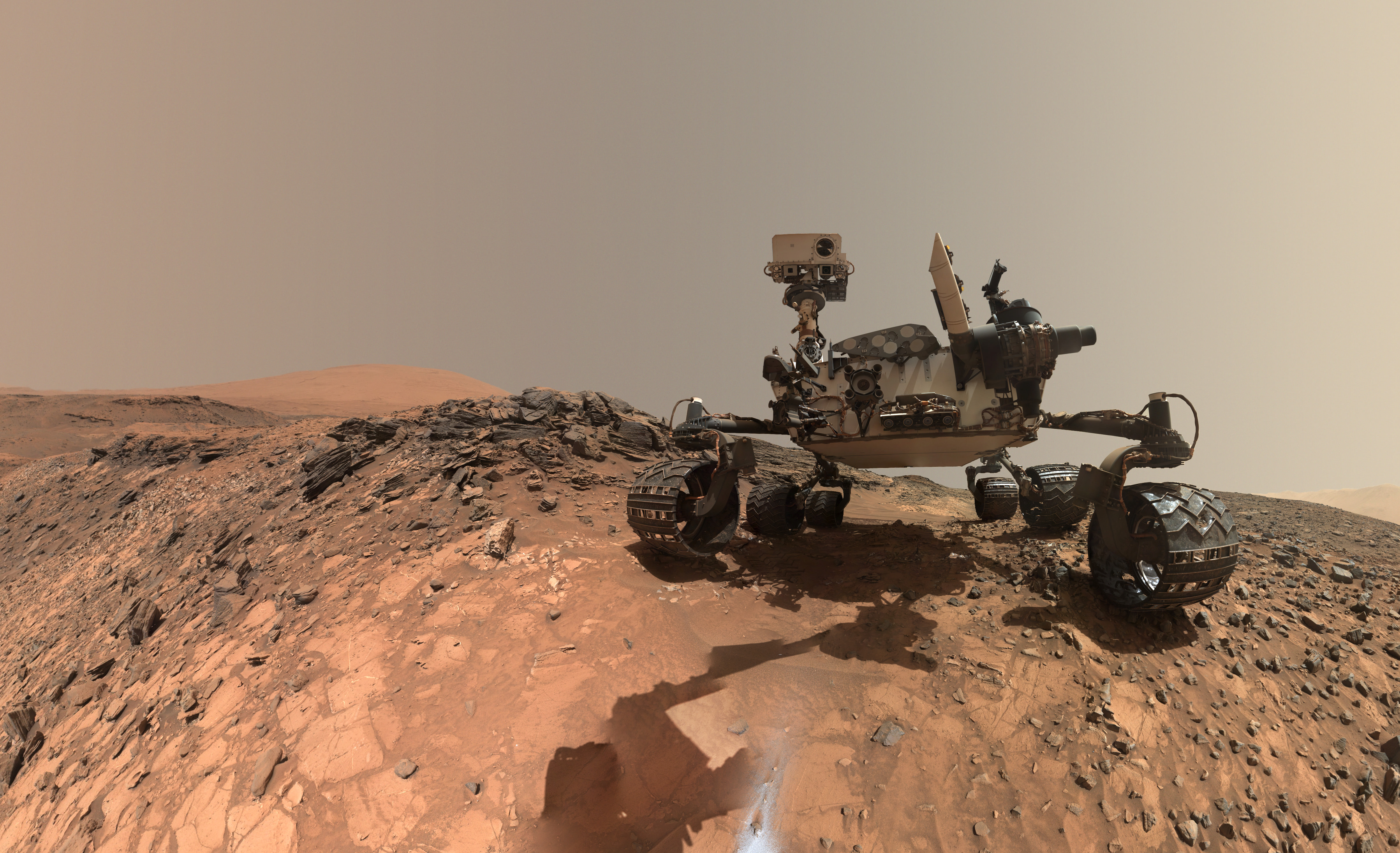
Mosaic self-portrait of Curiosity at the John Klein outcrop on Feb. 3, 2013 (NASA/JPL-Caltech/MSSS)
Mosaic self-portrait of Curiosity at the John Klein outcrop on Feb. 3, 2013. Credit: NASA/JPL-Caltech/MSSS

Additionally, the MRO is paving the way for upcoming generations of spacecraft through daily monitoring of Martian weather and surface conditions, searching for future landing sites, and testing a new telecommunications system that will speed up communications between Earth and Mars.

The NASA Mars Science Laboratory (MSL) mission and its Curiosity rover landed on Mars in the Gale Crater (at a landing site named “Bradbury Landing”) on August 6th, 2012. The rover carries instruments designed to look for past or present conditions relevant to the habitability of Mars, and has made numerous discoveries about atmospheric and surface conditions on Mars, as well as the detection of organic particles.

NASA’s Mars Atmosphere and Volatile EvolutioN Mission (MAVEN) orbiter was launched on November 18th, 2013, and reached Mars on September 22nd, 2014. The purpose of the mission is to study the atmosphere of Mars and also serve as a communications relay satellite for robotic landers and rovers on the surface.

Most recently, the Indian Space Research Organisation (ISRO) launched the Mars Orbiter Mission (MOM, also called Mangalyaan) on November 5th, 2013. The orbiter successfully reached Mars on September 24th, 2014, and was the first spacecraft to achieve orbit on the first try. A technology demonstrator, who’s secondary purpose is to study the Martian atmosphere, MOM is India’s first mission to Mars, and has made the ISRO the fourth space agency to reach the planet.

An artist's conception of MAVEN orbiting Mars. Image Credit: NASA / Goddard Space Flight Center
An artist’s conception of the MAVEN orbiter arriving at Mars. Credit: NASA/Goddard Space Flight Center

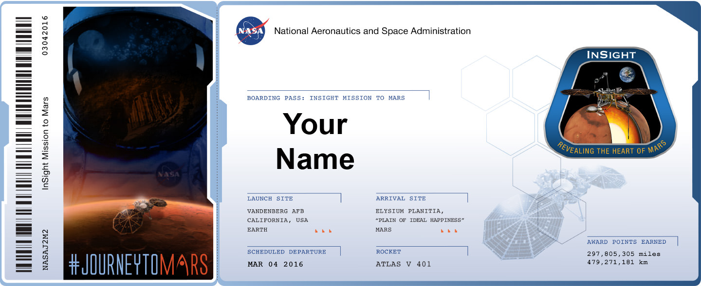
Future missions to Mars include NASA’s Interior Exploration using Seismic Investigations, Geodesy and Heat Transport (InSIGHT) lander. This mission, which is planned for launch in 2016, involves placing a stationary lander equipped with a seismometer and heat transfer probe on the surface of Mars. The probe will then deploy these instruments into the ground to study the planets interior and get a better understanding of its early geological evolution.

The ESA and Roscosmos are also collaborating on a large mission to search for biosignatures of Martian life, known as Exobiology on Mars (or ExoMars). Consisting of an orbiter that will be launched in 2016, and a lander that will be deployed to the surface by 2018, the purpose of this mission will be to map the sources of methane and other gases on Mars that would indicate the presence of life, past and present.

The United Arab Emirates also has a plan to send an orbiter to Mars by 2020. Known as Mars Hope, the robotic space probe will be deployed in orbit around Mars for the sake of studying its atmosphere and climate. This spacecraft will be the first to be deployed by an Arab state in orbit of another planet, and is expected to involve collaboration from the University of Colorado, the University of California, Berkeley and Arizona State University, as well the French space agency (CNES).

Crewed Missions:

Numerous federal space agencies and private companies have plans to send astronauts to Mars within the not-too-distant future. For instance, NASA has confirmed that it plans to conduct a manned mission to Mars by 2030. In 2004, human exploration of Mars was identified as a long-term goal in the Vision for Space Exploration – a public document released by the Bush administration.

Concept for NASA Design Reference Mission Architecture 5.0 (2009
Concept for NASA Design Reference Mission Architecture 5.0 (2009). Credit: NASA

In 2010, President Barack Obama announced his administration’s space policy, which included increasing NASA funding by $6 billion over five years and completing the design of a new heavy-lift launch vehicle by 2015. He also predicted a U.S.-crewed orbital Mars mission by the mid-2030s, preceded by an asteroid mission by 2025.

The ESA also has plans to land humans on Mars between 2030 and 2035. This will be preceded by successively larger probes, starting with the launch of the ExoMars probe and a planned joint NASA-ESA Mars sample return mission.

In Robert Zubrin (founder of the Mars Society) proposed a low-cost human mission to NASA known as Mars Direct, which he expanded on in his 1996 book The Case for Mars. According to Zubrin, the plan calls for a new class of heavy-lift rockets (similar to the Saturn V) to send human explorers and payloads to the Red Planet. A modified proposal, known as “Mars to Stay”, involves a possible one-way trip, where the astronauts would become Mars’ first colonists.

Similarly, MarsOne, a Netherlands-based non-profit organization, hopes to establish a permanent colony on the planet beginning in 2027. The original concept included launching a robotic lander and orbiter as early as 2016 to be followed by a human crew of four in 2022. Subsequent crews of four will be sent every few years, and funding is expected to be provided in part by a reality TV program that will document the journey.

Artist's concept of a Martian astronaut standing outside the Mars One habitat. Credit: Bryan Versteeg/Mars One
Artist’s concept of a Martian astronaut standing outside the Mars One habitat. Credit: Bryan Versteeg/Mars One

SpaceX and Tesla CEO Elon Musk has also announced plans to establish a colony on Mars. Intrinsic to this plan is the development of the Mars Colonial Transporter (MCT), a spaceflight system that would rely of reusable rocket engines, launch vehicles and space capsules to transport humans to Mars and return to Earth.

As of 2014, SpaceX has begun development of the large Raptor rocket engine for the Mars Colonial Transporter, and a successful test was announced in September of 2016. In January 2015, Musk said that he hoped to release details of the “completely new architecture” for the Mars transport system in late 2015.

In June 2016, Musk stated in the first unmanned flight of the MCT spacecraft would take place in 2022, followed by the first manned MCT Mars flight departing in 2024. In September 2016, during the 2016 International Astronautical Congress, Musk revealed further details of his plan, which included the design for an Interplanetary Transport System (ITS) – an upgraded version of the MCT.

Mars is the most studied planet in the Solar System after Earth. As of the penning of this article, there are 3 landers and rovers on the surface of Mars (Phoenix, Opportunity and Curiosity), and 5 functional spacecraft in orbit (Mars Odyssey, Mars Express, MRO, MOM, and MAVEN). And more spacecraft will be on their way soon.

These spacecraft have sent back incredibly detailed images of the surface of Mars, and helped discover that there was once liquid water in Mars’ ancient history. In addition, they have confirmed that Mars and Earth share many of the same characteristics – such as polar icecaps, seasonal variations, an atmosphere, and the presence of flowing water. They have also shown that organic life can and most likely did live on Mars at one time.

In short, humanity’s obsession with the Red Planet has not waned, and our efforts to explore its surface and understand its history are far from over. In the coming decades, we are likely to be sending additional robotic explorers, and human ones as well. And given time, the right scientific know-how, and whole lot of resources, Mars may even be suitable for habitation someday.

We have written many interesting articles about Mars here at Universe Today. Here’s How Strong Is The Gravity On Mars?, How Long Does It Take To Get To Mars?, How Long Is A Day On Mars?, Mars Compared To Earth, How Can We Live On Mars?

Astronomy Cast also has several good episodes on the subject – Episode 52: Mars, Episode 92: Missions to Mars – Part 1, and Episode 94: Humans to Mars, Part 1 – Scientists.

For more information, check out NASA’s Solar System Exploration page on Mars and NASA’s Journey to Mars.

Moonspotting-A Guide to Observing the Moons of the Solar System

Triple crescents. Image credit:

Like splitting double stars, hunting for the faint lesser known moons of the solar system offers a supreme challenge for the visual observer.

Sure, you’ve seen the Jovian moons do their dance, and Titan is old friend for many a star party patron as they check out the rings of Saturn… but have you ever spotted Triton or Amalthea?

Welcome to the challenging world of moon-spotting. Discovering these moons for yourself can be an unforgettable thrill.

One of the key challenges in spotting many of the fainter moons is the fact that they lie so close inside the glare of their respective host planet. For example, +11th magnitude Phobos wouldn’t be all that tough on its own, were it not for the fact that it always lies close to dazzling Mars. 10 magnitudes equals a 10,000-fold change in brightness, and the fact that most of these moons are swapped out is what makes them so tough to see. This is also why many of them weren’t discovered until later on.

But don’t despair. One thing you can use that’s relatively easy to construct is an occulting bar eyepiece.   This will allow you to hide the dazzle of the planet behind the bar while scanning the suspect area to the side for the faint moon. Large aperture, steady skies, and well collimated optics are a must as well, and don’t be afraid to crank up the magnification in your quest. We mentioned using such a technique previously as a method to tease out the white dwarf star Sirius b in the years to come.

Image credit
A homemade occulting bar eyepiece with the barrel removed. One bar is a strip of foil, and the other is a E-string from a guitar. Image credit: Dave Dickinson

What follows is a comprehensive list of the well known ‘easy ones,’ along with some challenges.

We included a handy drill down of magnitudes, orbital periods and maximum separations for the moons of each planet right around opposition. For the more difficult moons, we also noted the circumstances of their discovery, just to give the reader some idea what it takes to see these fleeting worlds.  Remember though, many of those old scopes used speculum metal mirrors which were vastly inferior to commercial optics available today. You may have a large Dobsonian scope available that rivals these scopes of yore!

Image credit:
The orbits of the Martian moons. Image credit: Starry Night Education Software

Mars- The two tiny moons of Mars are a challenge, as it’s only possible to nab them visually near opposition, which occurs about once every 26 months.   Mars next reaches opposition on May 22nd, 2016.

Phobos:

Magnitude:  +11.3

Orbital period:  7 hours 39 minutes

Maximum separation: 16”

Deimos:

Magnitude:  +12.3

Orbital period: 1 day 6 hours and 20 minutes

Maximum separation: 54”

The moons of Mars were discovered by American astronomer Asaph Hall during the favorable 1877 opposition of Mars using the 26-inch refracting telescope at the U.S. Naval Observatory.

Jupiter- Though the largest planet in our solar system also has the largest number of moons at 67, only the four bright Galilean moons are easily observable, although owners of large light buckets might just be able to tease out another two.  Jupiter next reaches opposition March 8th, 2016.

Ganymede:

Magnitude: +4.6

Orbital period: 7.2 days

Maximum separation: 5’

Callisto

Magnitude: +5.7

Orbital period: 16.7 days

Maximum separation: 9’

Io

Magnitude: +5.0

Orbital period: 1.8 days

Maximum separation: 1’ 50”

Europa

Magnitude: +5.3

Orbital period: 3.6 days

Maximum separation: 3’

Amalthea

Magnitude:  +14.3

Orbital period: 11 hours 57 minutes

Maximum separation: 33”

Himalia

Magnitude: +15

Orbital period: 250.2 days

Maximum separation: 52’

Note that Amalthea was the first of Jupiter’s moons discovered after the four Galilean moons. Amalthea was first spotted in 1892 by E. E. Barnard using the 36” refractor at the Lick Observatory. Himalia was also discovered at Lick by Charles Dillon Perrine in 1904.

Titan and Rhea imaged via Iphone and a Celestron NexStar 8SE telescope. Image credit: Andrew Symes (@failedprotostar)

Saturn- With a total number of moons at 62, six moons of Saturn are easily observable with a backyard telescope, though keen-eyed observers might just be able to tease out another two:

(Note: the listed separation from the moons of Saturn is from the limb of the disk, not the rings).

Titan

Magnitude: +8.5

Orbital period: 16 days

Maximum separation: 3’

Rhea

Magnitude: +10.0

Orbital period: 4.5 days

Maximum separation: 1’ 12”

Iapetus

Magnitude: (variable) +10.2 to +11.9

Orbital period: 79 days

Maximum separation: 9’

Enceladus

Magnitude: +12

Orbital period: 1.4 days

Maximum separation: 27″

Dione

Magnitude: +10.4

Orbital period: 2.7 days

Maximum separation: 46”

Tethys

Magnitude: +10.2

Orbital period: 1.9 days

Maximum separation: 35”

Mimas

Magnitude: +12.9

Orbital period: 0.9 days

Maximum separation: 18”

Hyperion

Magnitude: +14.1

Orbital period: 21.3 days

Maximum separation: 3’ 30”

Phoebe

Magnitude: +16.6

Orbital period: 541 days

Maximum separation: 27’

Hyperion was discovered by William Bond using the Harvard observatory’s 15” refractor in 1848, and Phoebe was the first moon discovered photographically by William Pickering in 1899.

Image credit:
The orbits of the moons of Uranus. Image credit: Starry Night Education software

Uranus- All of the moons of the ice giants are tough. Though Uranus has a total of 27 moons, only five of them might be spied using a backyard scope. Uranus next reaches opposition on October 12th, 2015.

Titania

Magnitude: +13.9

Orbital period:

Maximum separation: 28”

Oberon

Magnitude: +14.1

Orbital period: 8.7 days

Maximum separation: 40”

Umbriel

Magnitude: +15

Orbital period: 4.1 days

Maximum separation: 15”

Ariel

Magnitude: +14.3

Orbital period: 2.5 days

Maximum separation: 13”

Miranda

Magnitude: +16.5

Orbital period: 1.4 days

Maximum separation: 9”

The first two moons of Uranus, Titania and Oberon, were discovered by William Herschel in 1787 using his 49.5” telescope, the largest of its day.

Triton in orbit around Neptune near opposition in 2011. Image credit: Efrain Morales

Neptune- With a total number of moons numbering 14, two are within reach of the skilled amateur observer. Opposition for Neptune is coming right up on September 1st, 2015.

Triton

Magnitude: +13.5

Orbital period: 5.9 days

Maximum separation: 15”

Nereid

Magnitude: +18.7

Orbital period: 0.3 days

Maximum separation: 6’40”

Triton was discovered by William Lassell using a 24” reflector in 1846, just 17 days after the discovery of Neptune itself. Nereid wasn’t found until 1949 by Gerard Kuiper.

Pluto-Yes… it is possible to spy Charon from Earth… as amateur astronomers proved in 2008.

Charon

Magnitude: +16

Orbital period: 6.4 days

Maximum separation: 0.8”

Image credit
Pluto! Click here for a (possible) capture of Charon as well. Image credit: Wendy Clark

In order to cross off some of the more difficult targets on the list, you’ll need to know exactly when these moons are at their greatest elongation. Sky and Telescope has some great apps in the case of Jupiter and Saturn… the PDS Rings node can also generate corkscrew charts of lesser known moons, and Starry Night has ‘em as well. In addition, we tend to publish cork screw charts for moons right around respective oppositions, and our ephemeris for Charon elongations though July 2015 is still active.

Good luck in crossing off some of these faint moons from your astronomical life list!

Red-faced Pluto Full of Surprises

New Horizons scientists combined the latest black and white map of Pluto’s surface features (left) with a map of the planet’s colors (right) to produce a detailed color portrait of the planet’s northern hemisphere (center). Credits: NASA/JHUAPL/SWRI

Hey, Mars, you’ve got company. Looks like there’s a second “red planet” in the Solar System — Pluto. Color images returned from NASA’s New Horizons spacecraft, now just 10 days from its encounter with the dwarf planet, show a distinctly ruddy surface with patchy markings that strongly resemble Mars’ appearance in a small telescope.

Animation of Pluto rotating from photos taken by New Horizons two weeks before the flyby. Credit:
Animation of Pluto’s rotation from photos taken by New Horizons two weeks before the flyby. What are those four nearly parallel dark streaks? Credit: NASA/JHUAPL/SWRI

On Mars, iron oxide or rust colors the planet’s soil, while Pluto’s coloration is likely caused by hydrocarbon molecules called tholins that are formed when cosmic rays and solar ultraviolet light interact with methane in Pluto’s atmosphere and on its surface. Airborne tholins fall out of the atmosphere and coat the surface with a reddish gunk.

Scientists at Johns Hopkins University’s Hörst Laboratory have produced complex chemical compounds called tholins, which may give Pluto its reddish hue. Credits: Chao He, Xinting Yu, Sydney Riemer, and Sarah Hörst, Johns Hopkins University
Scientists at Johns Hopkins University’s Hörst Laboratory have produced complex chemical compounds called tholins, which may give Pluto its reddish hue.
Credits: Chao He, Xinting Yu, Sydney Riemer, and Sarah Hörst, Johns Hopkins University

A particular color or wavelength of UV light called Lyman-alpha is most effective at stimulating the chemical reactions that build hydrocarbons at Pluto. Recent measurements with New Horizons’ Alice instrument reveal the diffuse glow of Lyman-alpha light all around the dwarf planet coming from all directions of space, not just the Sun.

Since one of the main sources of Lyman-alpha light besides the Sun are regions of vigorous star formation in young galaxies, Pluto’s cosmetic rouge may originate in events happening millions of light years away.

Triton's pink too! Montage of Neptune's largest moon, Triton (1,683 miles in diameter) and the planet Neptune showing the moon's sublimating south polar cap (bottom) and enigmatic "cantaloupe terrain". Credit: NASA
Triton’s pink too! Montage of Neptune’s largest moon, Triton (1,683 miles in diameter) and the planet Neptune showing the moon’s sublimating south polar cap (bottom) and enigmatic “cantaloupe terrain”. Photo taken by Voyager 2 in 1989. Credit: NASA

“Pluto’s reddish color has been known for decades, but New Horizons is now allowing us to correlate the color of different places on the surface with their geology and soon, with their compositions,” said New Horizons principal investigator Alan Stern of the Southwest Research Institute, Boulder, Colorado.

Tholins have been found on other bodies in the outer Solar System, including Titan and Triton, the largest moons of Saturn and Neptune, respectively, and made in laboratory experiments that simulate the atmospheres of those bodies.

True color photos showing the two hemispheres of Pluto. At right, you can clearly see the four streaks in a row. New Horizons will approach fly by the hemisphere on the left side.
True color photos showing the two hemispheres of Pluto photographed on June 27, 2015. At left, a large, dark red patch is visible. The four streaks in a row are seen at right. New Horizons will fly by the hemisphere in the left image. Credit:  NASA/JHUAPL/SWRI

As you study the photos and animation, you’ll notice that Pluto’s largest dark spot is redder than the most of the surface; you also can’ help but wonder what’s going on with those four evenly-spaced dark streaks in the equatorial zone. When I first saw them, my reaction was “no way!” They look so neatly lined up I assumed it was an image artifact, but after seeing the rotating movie, maybe not. It’s more likely that low resolution enhances the appearance of alignment.

Dark streaks on Triton formed by deposits from ice or cryovolcanos. Credit: NASA
Dark streaks on Triton deposited downwind from ice or cryovolcanos. Credit: NASA

But what are they? Located as they are on the Charon-facing side of Pluto, they may be related to long-ago tidal stresses induced by each body on the other as they slowly settled into their current tidally-locked embrace or something as current as seasonal change.

Voyager 2 photographed cyrovolcanos at Triton during its 1989 flyby of the Neptune system. Nitrogen geysers and plumes of gas and ice as high as 5 miles (8 km) were seen erupting from active volcanoes, leaving dark streaks on its icy surface.

Images showing the increase in detail from late June through July 1 as New Horizons homes in on Pluto. Credit:
Images showing the increase in detail from late June through July 1 as New Horizons homes in on Pluto. That possible big crater (seen in bottom middle photo) now looks more like a large, dark patch, BUT we still don’t know for sure what it is. Credit: NASA / JHUAPL / SwRI / Björn Jónsson

It's instructive to compare these images based on observations with the Hubble Space Telescope made well before New Horizons's arrival. They appear to record the large dark spot and possible the multiple streaks. Credit: NASA/ESA
It’s instructive to compare these images, based on observations with the Hubble Space Telescope made well before New Horizons’s arrival, with current photos. They appear to record the large dark spot and possibly the multiple streaks. Credit: NASA/ESA

Seasonal heating from the Sun is the most likely cause for Triton’s eruptions; Pluto’s dark streaks may have a similar origin.

Animation of Pluto and Charon from images taken between June 23 and June 29. Credit:
Animation of Pluto and Charon from images taken between June 23 and June 29. Credit: NASA/JHUAPL/SWR

To give you a better picture in your head how big these small bodies are, Pluto and Charon would both fit within the United States with room to spare. Credit: Laboratory for Atmospheric and Space Physics (LASP)
To better picture in your head how big these small bodies really are, Pluto and Charon would both fit within the United States with room to spare. Credit: Laboratory for Atmospheric and Space Physics (LASP)

Today, New Horizons lies just 7.4 million miles (11.9 million km) from its target. Sharpness and detail visible will rapidly improve in just a few days.

“Even at this resolution, Pluto looks like no other world in our Solar System,” said mission scientist Marc Buie of the Southwest Research Institute, Boulder in a recent press release.

Indeed!

Last-Minute Father’s Day Gift: Give Him a Crater on Mars

Examples of craters various craters on Mars. Credit: NASA/JPL/Univ. of Arizona.

We all know that Mars Needs Moms, but Dad rocks the Red Planet too! If you’re looking for a last-minute gift for Dad, the commercial space company Uwingu has a special Father’s Day promotion where you can name a crater on Mars after your dad (or any other special person in your life.) You’ll get a unique decorative Father’s Day certificate that you can download and print,or for an extra fee you can have the certificate professionally printed and framed.

Uwingu’s Mars Map Crater Naming Project at allows anyone to help name approximately 590,000 unnamed, scientifically cataloged craters on Mars. The company uses out-of-the-box idea to help address funding shortages for researchers, scientists, educators and students. Uwingu’s Mars map grandfathers in all the already named craters on Mars, but opens the remainder up for naming by people around the globe.

“This is an out-of-this-world way to honor dads across this planet,” said Dr. Alan Stern, Uwingu’s CEO. “Help your dad join our Dads on Mars club!”

uwingu

Uwingu also announced that anyone purchasing the 50 largest craters named by Father’s Day will receive a 2-for-1 bonus: a gift certificate of equal value; allowing them to put additional crater names on the Mars map for free anytime in 2015.

Prices for naming craters depend on the size of the crater, and begin at $5. Half of Uwingu’s revenues go to fund the Uwingu Fund for space research and education grants.

As we’ve reported previously, Uwingu knows that the names likely won’t officially be approved by the IAU, but said they will be similar to the names given to features on Mars by the mission science teams (such as Mt. Sharp on Mars –the IAU-approved name is Aeolis Mons) or even like Pike’s Peak, a mountain in Colorado which was named by the public, in a way, as early settlers started calling it that, and it soon became the only name people recognized.

“Mars scientists and Apollo astronauts have named features on the Red Planet and the Moon without asking for the IAU’s permission,” Stern said. In the past, Stern has said that he realizes having people pay to suggest names for with no official standing may be controversial, and he’s willing to take the chance – and the heat – to try a innovative ways to provide funding in today’s climate of funding cuts.

Said Uwingu’s Ellen Butler, “I’m excited to name a crater on the Uwingu Mars map in honor of my own dad. It’ll be fun to share this with him on Father’s Day. I know he’ll love telling his friends that I named a crater for him!”

First Interplanetary CubeSats to Launch on NASA’s 2016 InSight Mars Lander

NASA's two small MarCO CubeSats will be flying past Mars in 2016 just as NASA's next Mars lander, InSight, is descending to land on the surface. MarCO, for Mars Cube One, will provide an experimental communications relay to inform Earth quickly about the landing. Credits: NASA/JPL-Caltech

NASA’s two small MarCO CubeSats will be flying past Mars in 2016 just as NASA’s next Mars lander, InSight, is descending to land on the surface. MarCO, for Mars Cube One, will provide an experimental communications relay to inform Earth quickly about the landing. Credits: NASA/JPL-Caltech
See fly by and cubesat spacecraft graphics and photos below[/caption]

CubeSats are taking the next great leap for science – departing Earth and heading soon for the fourth rock from the Sun.

For the first time, two tiny CubeSat probes will launch into deep space in early 2016 on their first interplanetary expedition – aiming for the Red Planet as part of an experimental technology relay demonstration project aiding NASA’s next Mission to Mars; the InSight lander.

NASA announced the pair of briefcase-sized CubeSats, called Mars Cube One or MarCO, as a late and new addition to the InSight mission, that could substantially enhance communications options on future Mars missions. They were designed and built by NASA’s Jet Propulsion Laboratory (JPL), Pasadena, California.

InSight, which stands for Interior Exploration Using Seismic Investigations, Geodesy and Heat Transport, is a stationary lander. It will join NASA’s surface science exploration fleet currently comprising of the Curiosity and Opportunity missions which by contrast are mobile rovers.

InSight is the first mission to understand the interior structure of the Red Planet. Its purpose is to elucidate the nature of the Martian core, measure heat flow and sense for “Marsquakes.”

The full-scale mock-up of NASA's MarCO CubeSat held by Farah Alibay, a systems engineer for the technology demonstration, is dwarfed by the one-half-scale model of NASA's Mars Reconnaissance Orbiter behind her.  Credits: NASA/JPL-Caltech
The full-scale mock-up of NASA’s MarCO CubeSat held by Farah Alibay, a systems engineer for the technology demonstration, is dwarfed by the one-half-scale model of NASA’s Mars Reconnaissance Orbiter behind her. Credits: NASA/JPL-Caltech

Because of their small size – roughly 4 inches (10 centimeters) square) – and simplicity using off-the-shelf components, they are a favored platform for university students and others seeking low cost access to space – such as the Planetary Society’s recently successful Light Sail solar sailing cubesat demonstration launched in May. Six units are combined together to create MarCO.

Over the past few years many hundreds of cubesats have already been deployed in Earth orbit – including many dozens from the International Space Station (ISS) – but these will be the first going far beyond our Home Planet.

Data relayed by MarCO at 8 kbps in real time could reveal InSight’s fate on the Martian surface within minutes to mission controllers back on Earth, rather than waiting for a potentially prolonged period of agonizing nail-biting lasting an hour or more.

The two probes, known as MarCO-A and MarCO-B, will operate during InSight’s highly complex entry, descent and landing (EDL) operations as it descends through the thin Martian atmosphere. Their function is merely to quickly relay landing data. But the cubesats will have no impact on the ultimate success of the mission. They will intentionally sail by but not land on Mars.

“MarCO is an experimental capability that has been added to the InSight mission, but is not needed for mission success,” said Jim Green, director of NASA’s planetary science division at the agency’s headquarters in Washington, in a statement.

The MarCO Cubesats will serve as a test bed for a revolutionary communications mode that seeks to quickly relay data back to Earth about the status of InSight – in real time – as it plummets down to the Red Planet for the “Seven Minutes of Terror” that hopefully climaxes with a soft landing.

The MarCO duo will fly by past Mars at a planned distance and altitude of about 3,500 kilometers as InSight descends towards the surface during EDL operations. They will rapidly retransmit signals coming from the lander in real time, directly back to NASA’s huge Deep Space Network (DSN) receiving dish antennas back on Earth.

 MarCO cubesats fly by trajectory for rapid communications relay as NASA’s InSight spacecraft lands on Mars in September 2016. Credit: NASA/JPL-Caltech

MarCO cubesats fly by trajectory for rapid communications relay as NASA’s InSight spacecraft lands on Mars in September 2016. Credit: NASA/JPL-Caltech

For this flight, six cubesats will be joined together to provide the additional capability required for the journey to Mars and to accomplish their communications task.

The six-unit MarCO CubeSat has a stowed size of about 14.4 inches (36.6 centimeters) by 9.5 inches (24.3 centimeters) by 4.6 inches (11.8 centimeters) and weighs 14 kilograms.

The solar powered probes will be outfitted with UHF and X-band communications gear as well as propulsion, guidance and more.

The overall cost to design, build, launch and operate MarCO-A and MarCO-B is approximately $13 million, a NASA spokesperson told Universe Today.

InSight and MarCO are slated to blastoff together on March 4, 2016 atop a United Launch Alliance Atlas V rocket from Vandenberg Air Force Base, California.

After launch, both MarCO CubeSats will separate from the Atlas V booster and travel along their own trajectories to the Red Planet.

“MarCO will fly independently to Mars,” says Green.

They will be navigated independently from InSight. They will all reach Mars at approximately the same time for InSight’s landing slated for Sept. 28, 2016.

MarCO’s two solar panels and two radio antennas will unfurl after being released from the Atlas booster. The high-gain, X-band antenna is a flat panel engineered to direct radio waves the way a parabolic dish antenna does,” according to a NASA description.

The softball-size radio “provides both UHF (receive only) and X-band (receive and transmit) functions capable of immediately relaying information received over UHF.”

MarCO cubesat graphic annotated to show dimensions, instruments, physical characteristics and capabilities.  Credit: NASA/JPL-Caltech
MarCO cubesat graphic annotated to show dimensions, instruments, physical characteristics and capabilities. Credit: NASA/JPL-Caltech

During EDL, InSight will transmit landing data via UHF radio to the MarCO cubesats sailing past Mars as well as to NASA’s Mars Reconnaissance Orbiter (MRO) soaring overhead.

MarCO will assist InSight by receiving the lander information transmitted in the UHF radio band and then immediately forward EDL information to Earth using the X-band radio. By contrast, MRO cannot simultaneously receive information over one band while transmitting on another, thus delaying confirmation of a successful landing possibly by an hour or more.

Engineers for NASA's MarCO technology demonstration display a full-scale mechanical mock-up of the small craft in development as part of NASA's next mission to Mars. Mechanical engineer Joel Steinkraus and systems engineer Farah Alibay are on the team at NASA's Jet Propulsion Laboratory, Pasadena, California, preparing twin MarCO (Mars Cube One) CubeSats for a March 2016 launch.  Credit: NASA/JPL-Caltech
Engineers for NASA’s MarCO technology demonstration display a full-scale mechanical mock-up of the small craft in development as part of NASA’s next mission to Mars. Mechanical engineer Joel Steinkraus and systems engineer Farah Alibay are on the team at NASA’s Jet Propulsion Laboratory, Pasadena, California, preparing twin MarCO (Mars Cube One) CubeSats for a March 2016 launch. Credit: NASA/JPL-Caltech

“Ultimately, if the MarCO demonstration mission succeeds, it could allow for a “bring-your-own” communications relay option for use by future Mars missions in the critical few minutes between Martian atmospheric entry and touchdown,” say NASA officials.

It’s also very beneficial and critical to the success of future missions to have a stream of data following the progress of past missions so that lessons can be learned and applied, whatever the outcome.

“By verifying CubeSats are a viable technology for interplanetary missions, and feasible on a short development timeline, this technology demonstration could lead to many other applications to explore and study our solar system,” says NASA.

InSight will smash into the Martian atmosphere at high speeds of approximately 13,000 mph in September 2016 and then decelerate within a few minutes for landing via a heat shield, retro rocket and parachute assisted touchdown on the plains at flat-lying terrain at “Elysium Planitia,” some four degrees north of Mars’ equator, and a bit north of the Curiosity rover.

As I reported in recently here, InSight has now been assembled into its flight configuration and begun a comprehensive series of rigorous environmental stress tests that will pave the path to launch in 2016 on a mission to unlock the riddles of the Martian core.

The countdown clock is ticking relentlessly towards liftoff in less than nine months time in March 2016.

NASA's InSight Mars lander spacecraft in a Lockheed Martin clean room near Denver. As part of a series of deployment tests, the spacecraft was commanded to deploy its solar arrays in the clean room to test and verify the exact process that it will use on the surface of Mars.  Credits: NASA/JPL-Caltech/Lockheed Martin
NASA’s InSight Mars lander spacecraft in a Lockheed Martin clean room near Denver. As part of a series of deployment tests, the spacecraft was commanded to deploy its solar arrays in the clean room to test and verify the exact process that it will use on the surface of Mars. Credits: NASA/JPL-Caltech/Lockheed Martin

Stay tuned here for Ken’s continuing Earth and planetary science and human spaceflight news.

Ken Kremer

Dazzling Gallery From India’s MOM Mars Orbiter Camera

Spectacular 3D view of Arsia Mons, a huge volcano on Mars, taken by camera on India's Mars Orbiter Mission (MOM). Credit: ISRO

Spectacular 3D view of Arsia Mons, a huge volcano on Mars, taken by camera on India’s Mars Orbiter Mission (MOM). Credit: ISRO
Story updated with more details and imagery[/caption]

India’s first ever robotic explorer to the Red Planet, the Mars Orbiter Mission, more affectionately known as MOM, has captured an absolutely dazzling array of images of the fourth rock from the Sun.

The Indian Space Research Organization (ISRO), India’s space agency, has recently published a beautiful gallery of images featuring a variety of picturesque Martian canyons, volcanoes, craters, moons and more.

We’ve gathered a collection here of MOM’s newest imagery snapped by the probes Mars Color Camera (MCC) for the enjoyment of Martian fans worldwide.

The spectacular 3D view of the Arsia Mons volcano, shown above, was “created by draping the MCC image on topography of the region derived from the Mars Orbiter Laser Altimeter (MOLA), one of five instruments on board NASA’s Mars Global Surveyor (MGS) spacecraft.

The Arsia Mons image was taken from Mars orbit on 1 April 2015 at a spatial resolution of 556 meters from an altitude of 10707 km. Volcanic deposits can be seen located at the flanks of the Mons, according to ISRO.

The view of Pital crater below was released in late May and taken on 23 April 2015. Pital is a 40 km wide impact crater located in the Ophir Planum region of Mars and the image shows a chain of small impact craters. It is located in the eastern part of Valles Marineris region, says an ISRO description. MCC took the image from an altitude of 808 km.

Pital crater is an impact crater located in Ophir Planum region of Mars, which is located in the eastern part of Valles Marineris region. This  image is taken by Mars Color Camera (MCC) on 23-04-2015 at a spatial resolution of  ~42 m from an altitude of 808 km. Credit: ISRO
Pital crater is an impact crater located in Ophir Planum region of Mars, which is located in the eastern part of Valles Marineris region. This image is taken by Mars Color Camera (MCC) on 23-04-2015 at a spatial resolution of ~42 m from an altitude of 808 km. Credit: ISRO

It is an odd shaped crater, neither circular nor elliptical in shape, possibly due to “regional fracture in the W-E trending fracture zone.”

A trio of images, including one in stunning 3D, shows various portions of Valles Marineris, the largest known canyon in the Solar System.

Three dimensional view of Valles Marineris center portion from India’s MOM Mars Mission.   Credit: ISRO
Three dimensional view of Valles Marineris center portion from India’s MOM Mars Mission. Credit: ISRO

Valles Marineris stretches over 4,000 km (2,500 mi) across the Red Planet , is as much as 600 km wide and measures as much as 7 kilometers (4 mi) deep.

Valles Marineris from India’s Mars Mission.   Credit: ISRO
Valles Marineris from India’s Mars Mission. Credit: ISRO

For context here’s a previously taken global image of the red planet from MOM showing Valles Marinaris and Arsia Mons, which belongs to the Tharsis Bulge trio of shield volcanoes. They are both near the Martian equator.

Olympus Mons, Tharsis Bulge trio of volcanoes and Valles Marineris from ISRO's Mars Orbiter Mission. Note the clouds and south polar ice cap.   Credit: ISRO
Olympus Mons, Tharsis Bulge trio of volcanoes and Valles Marineris from ISRO’s Mars Orbiter Mission. Note the clouds and south polar ice cap. Credit: ISRO

Valles Marineris is often called the “Grand Canyon of Mars.” It spans about as wide as the entire United States.

A gorgeous view of Phobos, the largest of Mars’ two tiny moons, silhouetted against the surface is shown below.

Phobos, one of the two natural satellites of Mars silhouetted against the Martian surface.  Credit: ISRO
Phobos, one of the two natural satellites of Mars silhouetted against the Martian surface. Credit: ISRO

MOM’s goal is to study Mars atmosphere, surface environments, morphology, and mineralogy with a 15 kg (33 lb) suite of five indigenously built science instruments. It is also sniffing for methane, a potential marker for biological activity.

MOM is India’s first deep space voyager to explore beyond the confines of her home planets influence and successfully arrived at the Red Planet after the “history creating” orbital insertion maneuver on Sept. 23/24, 2014 following a ten month journey from Earth.
MOM swoops around Mars in a highly elliptical orbit whose nearest point to the planet (periapsis) is at about 421 km and farthest point (apoapsis) at about 76,000 km, according to ISRO.

It takes MOM about 3.2 Earth days or 72 hours to orbit the Red Planet.

Higher resolution view of a portion of Valles Marineris canyon from India’s MOM Mars Mission.   Credit: ISRO
Higher resolution view of a portion of Valles Marineris canyon from India’s MOM Mars Mission. Credit: ISRO

MOM was launched on Nov. 5, 2013 from India’s spaceport at the Satish Dhawan Space Centre, Sriharikota, atop the nations indigenous four stage Polar Satellite Launch Vehicle (PSLV) which placed the probe into its initial Earth parking orbit.

The $73 million MOM mission was expected to last at least six months. In March, ISRO extended the mission duration for another six months since its healthy, the five science instruments are operating fine and it has sufficient fuel reserves.

And with a communications blackout between Mars and Earth imminent as a result of natures solar conjunction, it’s the perfect time to catch up on all things Martian.

Solar conjunctions occur periodically between Mars and Earth about every 26 months, when the two planets line up basically in a straight line geometry with the sun in between as the two planets travel in their sun-centered orbits.

Since Mars will be located behind the Sun for most of June, communications with all the Terran spacecraft at the planet is diminished to nonexistent.

“MOM faces a communication outage during June 8-25,” according to The Hindu.

Normal science operations resume thereafter.

“Fuel on the spacecraft is not an issue,” ISRO Satellite Centre Director M. Annadurai told The Hindu.

Image of Tyrrhenus Mons in Hesperia Planum region taken by Mars Color Camera (MCC) on 25-02-2015 at a spatial resolution of 166m from an altitude of 3192km.  Tyrrhenus Mons is an ancient martian volcano and image shows its timeworn gullies and wind streaks.  Credit: ISRO
Image of Tyrrhenus Mons in Hesperia Planum region taken by Mars Color Camera (MCC) on 25-02-2015 at a spatial resolution of 166m from an altitude of 3192km. Tyrrhenus Mons is an ancient martian volcano and image shows its timeworn gullies and wind streaks. Credit: ISRO

Including MOM, Earth’s invasion fleet at the Red Planet numbers a total of seven spacecraft comprising five orbiters from NASA, ESA and ISRO as well as the sister pair of mobile surface rovers from NASA – Curiosity and Opportunity.

Stay tuned here for Ken’s continuing Earth and planetary science and human spaceflight news.

Ken Kremer

The Martian Curiosity Looks Back on 1000 Sols of Exploration on the Red Planet

NASA’s Martian Curiosity rover looks backs to 1000 Sols of science and exploration on the surface of the Red Planet. Robot wheel tracks lead back through valley dunes. Gale Crater rim seen in the distant hazy background. Sol 997 (May 28, 2015) navcam camera raw images stitched and colorized. Credit: NASA/JPL-Caltech/ Marco Di Lorenzo/Ken Kremer/kenkremer.com Featured on APOD on June 13, 2015

Looking back 1000 Sols on the Red Planet
NASA’s Martian Curiosity rover looks backs to 1000 Sols of science and exploration on the surface of the Red Planet. Robot wheel tracks lead back through valley dunes. Gale Crater rim seen in the distant hazy background. Sol 997 (May 28, 2015) navcam camera raw images stitched and colorized. Credit: NASA/JPL-Caltech/ Marco Di Lorenzo/Ken Kremer/kenkremer.com
Featured on APOD on June 13, 2015
Story updated[/caption]

The Martian Curiosity celebrates 1000 Sols on Mars!

Marking the occasion with utter glee, the car sized robot snapped a cool mosaic view (above) looking back to 1000 Sols of high impact exploration and discovery on the Red Planet, showing her wheel tracks leading back through valley dunes from the foothills of humongous Mount Sharp and across the alien surface floor and out to the distant rim of the Gale Crater landing site she descended to nearly three years ago in August 2012.

“A thousand thanks to the best team a rover could have. Celebrating 1,000 sols. Here’s to the Martian days ahead!” the robot tweeted.

But at 1K sols she’s not content to just bask in the Martian sunshine during the history making event. Rather, she is as always hard at work, reaching out with the high tech robotic arm and inspecting intriguing rock outcrops spread out all around her.

Check out Curiosity’s current workspace, looking back and hard at work in our new photo mosaics herein created by the imaging team of Marco Di Lorenzo and Ken Kremer. They are also featured at NBC News – here – and Alive Space Images (in Italian) – here and here.

Curiosity rover at work for 1000 Sols on Mars.  This composite multi sol photo mosaic shows outstretched robotic arm inspecting intriguing rock outcrops.   The APXS spectrometer is investigating a target called ‘Ronan’ on the Stimson overlying outcrop.   Navcam camera raw images taken from sols 997 to 1000 are stitched and colorized.  Credit: NASA/JPL/Ken Kremer/kenkremer.com/Marco Di Lorenzo
Curiosity rover at work for 1000 Sols on Mars
This composite multi sol photo mosaic shows outstretched robotic arm inspecting intriguing rock outcrops. The APXS spectrometer is investigating a target called ‘Ronan’ on the Stimson overlying outcrop. Navcam camera raw images taken from sols 997 to 1000 are stitched and colorized. Credit: NASA/JPL/Ken Kremer/kenkremer.com/Marco Di Lorenzo

The raw images for the look back mosaic were taken after she arrived at her current location on Martian Sol 997, or Earth’s Day May 28, 2015.

The Curiosity Mars Science Laboratory (MSL) rover officially celebrated 1000 Martian Sols on May 31, 2015 since she safely touched down on the crater floor on August 5, 2012 following the nail-biting and unprecedented sky crane maneuver that delivered her with pinpoint precision to a landing site nearby Mount Sharp.

“An MSL landmark day. We have reached 1000 sols on Mars. Looking back the remarkable thing is how few serious problems there have been,” says team member Professor John Bridges of the University of Leicester, England, in an update.

Exploring the sedimentary layers of Mount Sharp, which towers 3.4 miles (5.5 kilometers) into the Martian sky, form the primary destination and goal of her scientific expedition.

The six wheeled robot and her team of handlers back on Earth, are eeking out every last drop of science before she and all of Earth’s entire Martian invasion fleet enter solar conjunction, when Mars is behind the sun and little or no communications will be possible for most of the month of June. Activities will be limited per safety protocols.

“However, there is one issue even Curiosity can’t avoid – Conjunction. For much of June, Mars will be obscured from Earth by the Sun. Few science operations,” explains Bridges.

Curiosity rover rolls across Mars at the foothills of Mount Sharp, seen in the background, in this mosaic of images taken on April 11, 2015 (Sol 952).  Navcam camera raw images stitched and colorized. Credit:  NASA/JPL-Caltech/ Marco Di Lorenzo/Ken Kremer/kenkremer.com
Curiosity rover rolls across Mars at the foothills of Mount Sharp, seen in the background, in this mosaic of images taken on April 11, 2015 (Sol 952). Navcam camera raw images stitched and colorized. Credit: NASA/JPL-Caltech/ Marco Di Lorenzo/Ken Kremer/kenkremer.com

NASA’s long-lived Opportunity rover labors on the opposite side of Mars.

After a short drive Curiosity arrived at her current location at “Marias Pass” on Sol 997, where she will stay stationary during the conjunction period out of an abundance of caution.

“A short bump on Sol 997 put Curiosity in a great position to investigate a few different rock units in Marias Pass, using the instruments on the rover’s arm,” wrote MSL and USGS mission scientist Ken Herkenhoff in an update.

She also reached within an eyelash of 10.6 kilometers (6.6 mi) of total driving.

“The 2.5 m drive brings our total odometry to 10,599 m,” noted Herkenoff.

Along the way she discovered the chemical ingredient minerals necessary to support life, as well as low levels of some organic molecules and some traces of methane, and and ample evidence for lakes and streams of liquid water.

“Curiosity is now parked for the next few weeks. But we are parked in front of a beautiful outcrop that shows the contact between the underlying Pahrump unit and the overlying Stimson unit.”

Our arm photo mosaic herein shows the seven foot (2 m) long robotic arm and its APXS spectrometer deployed at the target called “Ronan”, which is part of the overlying Stimson outcrop unit.

The rover is also using the ChemCam, MastCam and MAHLI cameras and spectrometers and other instruments to characterize the outcrop and its texture and composition in detail.

The robotic arm will be stowed during the June conjunction period.

Curiosity arrived at the Pahrump Hills at the base of Mount Sharp back in September 2014. Since then she has conducted an intensive investigation of the rocks and a trio of drilling operations to elucidate how this area fits in context with Mount Sharp and the habitable region discovered on the crater floor at Yellowknife Bay back in the spring of 2013.

In recent weeks, Curiosity has been driving up hills with slopes of as much as 21 degrees, higher than ever before, on an exciting journey endeavoring to slowly ascend up to the lower layers of Mount Sharp.

The current Martian outcrop area under investigation is a place where two distinctive geologic types of bedrock meet and where pale rock meets darker overlying rock.

“Such contacts can reveal clues about how the environmental conditions that produced one type of rock were related to the conditions that produced the other,” says NASA.

“The rover science team wants to examine an outcrop that contains the contact between the pale rock unit the mission analyzed lower on Mount Sharp and a darker, bedded rock unit that the mission has not yet examined up close.”

The team is also scouting around for the presence of mineral veins, like those recently discovered at the “Garden City” outcrop, that formed in the past during periods of flowing liquid water that could be favorable for microbial life forms if they ever existed.

Curiosity investigates a beautiful outcrop of scientifically enticing dark and light mineral veins at ”Garden City” outcrop at the base of Mount Sharp at current location on Mars.   This  photo mosaic was stitched  from Mastcam color camera raw images. Credit:  NASA/JPL-Caltech/MSSS/Ken Kremer/kenkremer.com/Marco Di Lorenzo
Curiosity investigates a beautiful outcrop of scientifically enticing dark and light mineral veins at ”Garden City” outcrop at the base of Mount Sharp at current location on Mars. This photo mosaic was stitched from Mastcam color camera raw images. Credit: NASA/JPL-Caltech/MSSS/Ken Kremer/kenkremer.com/Marco Di Lorenzo

Because there’s a plethora of treacherous dunes, the team has had to monitor operations carefully and alter the route on occasion to maintain safe operations.

Curiosity has already accomplished her primary objective of discovering a habitable zone on the Red Planet that contains the minerals necessary to support microbial life in the ancient past when Mars was far wetter and warmer billions of years ago.

This March 6, 2015 (Sol 917), mosaic of images from the Navcam camera on NASA's Curiosity Mars rover shows the position in which the rover held its arm for several days after a transient short circuit triggered onboard fault-protection programming to halt arm activities on Feb. 27, 2015, Sol 911.  The rover team chose to hold the arm in the same position for several days of tests to diagnose the underlying cause of the Sol 911 event.  Navcam camera raw images stitched and colorized. Credit:  NASA/JPL-Caltech/Ken Kremer/kenkremer.com/Marco Di Lorenzo
This March 6, 2015 (Sol 917), mosaic of images from the Navcam camera on NASA’s Curiosity Mars rover shows the position in which the rover held its arm for several days after a transient short circuit triggered onboard fault-protection programming to halt arm activities on Feb. 27, 2015, Sol 911. The rover team chose to hold the arm in the same position for several days of tests to diagnose the underlying cause of the Sol 911 event. Navcam camera raw images stitched and colorized. Credit: NASA/JPL-Caltech/Ken Kremer/kenkremer.com/Marco Di Lorenzo

To date, Curiosity’s odometer totals over 5.1 miles (8.4 kilometers) since landing inside Gale Crater on Mars in August 2012.

As of today, Sol 1001, June 1, 2015, she has taken over 246,000 amazing images.

Stay tuned here for Ken’s continuing Earth and planetary science and human spaceflight news.

Ken Kremer

NASA’s Journey to Mars Ramps Up with InSight, Key Tests Pave Path to 2016 Lander Launch

NASA's InSight Mars lander spacecraft in a Lockheed Martin clean room near Denver. As part of a series of deployment tests, the spacecraft was commanded to deploy its solar arrays in the clean room to test and verify the exact process that it will use on the surface of Mars. Credits: NASA/JPL-Caltech/Lockheed Martin

NASA’s ‘Journey to Mars’ is ramping up significantly with ‘InSight’ – as the agency’s next Red Planet lander has now been assembled into its flight configuration and begun a comprehensive series of rigorous and critical environmental stress tests that will pave the path to launch in 2016 on a mission to unlock the riddles of the Martian core.

The countdown clock is ticking relentlessly and in less than nine months time, NASA’s InSight Mars lander is slated to blastoff in March 2016.

InSight, which stands for Interior Exploration Using Seismic Investigations, Geodesy and Heat Transport, is a stationary lander. It will join NASA’s surface science exploration fleet currently comprising of the Curiosity and Opportunity missions which by contrast are mobile rovers.

But before it will even be allowed to get to the launch pad, the Red Planet explorer must first prove its mettle and show that it can operate in and survive the harsh and unforgiving rigors of the space environment via a battery of prelaunch tests. That’s an absolute requirement in order for it to successfully carry out its unprecedented mission to investigate Mars deep interior structure.

InSight’s purpose is to elucidate the nature of the Martian core, measure heat flow and sense for “Marsquakes.” These completely new research findings will radically advance our understanding of the early history of all rocky planets, including Earth and could reveal how they formed and evolved.

“Today, our robotic scientific explorers are paving the way, making great progress on the journey to Mars,” said Jim Green, director of NASA’s Planetary Science Division at the agency’s headquarters in Washington, in a statement.

“Together, humans and robotics will pioneer Mars and the solar system.”

The science deck of NASA's InSight lander is being turned over in this April 29, 2015, photo from InSight assembly and testing operations inside a clean room at Lockheed Martin Space Systems, Denver.  The large circular component on the deck is the protective covering to be placed over InSight's seismometer after the seismometer is placed directly onto the Martian ground.   Credits: NASA/JPL-Caltech/Lockheed Martin
The science deck of NASA’s InSight lander is being turned over in this April 29, 2015, photo from InSight assembly and testing operations inside a clean room at Lockheed Martin Space Systems, Denver. The large circular component on the deck is the protective covering to be placed over InSight’s seismometer after the seismometer is placed directly onto the Martian ground. Credits: NASA/JPL-Caltech/Lockheed Martin

The launch window for InSight opens on March 4 and runs through March 30, 2016.

InSight will launch atop a United Launch Alliance (ULA) Atlas V rocket from Vandenberg Air Force Base, California.

InSight counts as NASA’s first ever interplanetary mission to launch from California.

The car sized probe will touch down near the Martian equator about six months later in the fall of 2016.

The prime contractor for InSight is Lockheed Martin Space Systems in Denver, Co and the engineering and technical team recently finished assembling the lander into its final configuration.

So now the time has begun to start the shakedown that literally involve “shaking and baking and zapping” the spacecraft to prove its ready and able to meet the March 2016 launch deadline.

During the next seven months of environmental testing at Lockheed’s Denver facility, “the lander will be exposed to extreme temperatures, vacuum conditions of nearly zero air pressure simulating interplanetary space, and a battery of other tests.”

“The assembly of InSight went very well and now it’s time to see how it performs,” said Stu Spath, InSight program manager at Lockheed Martin Space Systems, Denver, in a statement.

“The environmental testing regimen is designed to wring out any issues with the spacecraft so we can resolve them while it’s here on Earth. This phase takes nearly as long as assembly, but we want to make sure we deliver a vehicle to NASA that will perform as expected in extreme environments.”

The first test involves “a thermal vacuum test in the spacecraft’s “cruise” configuration, which will be used during its seven-month journey to Mars. In the cruise configuration, the lander is stowed inside an aeroshell capsule and the spacecraft’s cruise stage – for power, communications, course corrections and other functions on the way to Mars — is fastened to the capsule.”

After the vacuum test, InSight will be subjected to a series of tests simulating the vibrations of launch, separation and deployment shock, as well as checking for electronic interference between different parts of the spacecraft and compatibility testing.

Finally, a second thermal vacuum test will expose the probe “to the temperatures and atmospheric pressures it will experience as it operates on the Martian surface.”

The $425 million InSight mission is expected to operate for about two years on the Martian surface.

Artist rendition of NASA’s Mars InSight (Interior exploration using Seismic Investigations, Geodesy and Heat Transport) Lander. InSight is based on the proven Phoenix Mars spacecraft and lander design with state-of-the-art avionics from the Mars Reconnaissance Orbiter (MRO) and Gravity Recovery and Interior Laboratory (GRAIL) missions. Credit: JPL/NASA

InSight is an international science mission and a near duplicate of NASA’s successful Phoenix Mars landing spacecraft, Bruce Banerdt, InSight Principal Investigator of NASA’s Jet Propulsion Laboratory (JPL), Pasadena, California, told Universe Today.

“InSight is essentially built from scratch, but nearly build-to-print from the Phoenix design,” Banerdt, of NASA’s Jet Propulsion Laboratory (JPL) in Pasadena , Calif, told me. The team can keep costs down by re-using the blueprints pioneered by Phoenix instead of creating an entirely new spacecraft.

3 Footpads of Phoenix Mars Lander atop Martian Ice.  NASA’s Mars InSight spacecraft design is based on the successful 2008 Phoenix lander. This mosaic shows Phoenix touchdown atop Martian ice.  Phoenix thrusters blasted away Martian soil and exposed water ice.  InSight carries instruments to peer deep into the Red Planet and investigate the nature and size of the mysterious Martian core.  Credit: Ken Kremer/kenkremer.com/Marco Di Lorenzo/NASA/JPL/UA/Max Planck Institute
3 Footpads of Phoenix Mars Lander atop Martian Ice. NASA’s Mars InSight spacecraft design is based on the successful 2008 Phoenix lander. This mosaic shows Phoenix touchdown atop Martian ice. Phoenix thrusters blasted away Martian soil and exposed water ice. InSight carries instruments to peer deep into the Red Planet and investigate the nature and size of the mysterious Martian core. Credit: Ken Kremer/kenkremer.com/Marco Di Lorenzo/NASA/JPL/UA/Max Planck Institute

It is funded by NASA’s Discovery Program as well as several European national space agency’s and countries. Germany and France are providing InSight’s two main science instruments; HP3 and SEIS through the Deutsches Zentrum für Luft- und Raumfahrt. or German Aerospace Center (DLR) and the Centre National d’Etudes Spatiales (CNES).

“The seismometer (SEIS, stands for Seismic Experiment for Interior Structure) is from France (built by CNES and IPGP) and the heat flow probe (HP3, stands for Heat Flow and Physical Properties Probe) is from Germany (built by DLR),” Banerdt explained.

SEIS and HP3 are stationed on the lander deck. They will each be picked up and deployed by a robotic arm similar to that flown on Phoenix with some modifications.

Stay tuned here for Ken’s continuing Earth and planetary science and human spaceflight news.

Ken Kremer