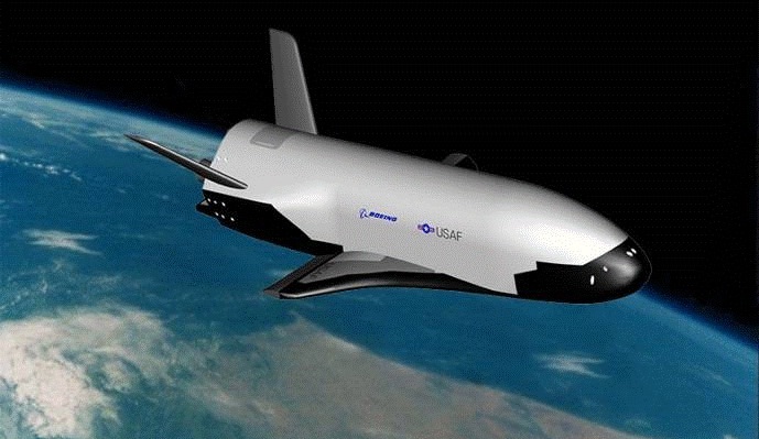
An artists' conception of the X-37B in Earth orbit. Credit: The U.S. Air Force.
A secretive mission will pass a quiet milestone at the end of this month when the U.S. Air Force’s unmanned spaceplane the X-37B surpasses 500 days in space.
Launched atop an Atlas V rocket flying in a 401 configuration from Cape Canaveral Florida after several delays on December 11th, 2012 on OTV-3, the X-37B has already surpassed its own record of 469 days in space set on OTV-2. Said milestone was crossed last month. If the current mission stays in space until April 25th of this year, it will have surpassed 500 days in space.
Two X-37Bs were built for the USAF, and the first test mission flew in 2010. NASA performed drop glide tests with an early variant of the X-37A in 2005 and 2006, and DARPA is thought to be a primary customer for the program as well.
Measuring just 8.8 metres in length, the X-37B is tiny compared to its more famous spaceplane cousin the U.S. Space Shuttle. The X-37B has a maximum weight at liftoff of 4,990 kilograms and features a payload bay 2.1 by 1.2 metres in size.
The spacecraft itself is solar powered, as it unfurls a panel — as depicted in many artists’ conceptions — once it’s in orbit. Of course, its mission profile is classified, and the X-37B could land unannounced at any time. The previous landings occurred at Vandenberg Air Force Base in California and were only announced shortly thereafter.
Not only is this the longest continuous mission for any spaceplane, but the ATV-3 is also the smallest, lightest and only the second spaceplane to land autonomously, the first being the Russian space shuttle Buran that flew one mission and landed after one orbit at the Baikonur Cosmodrome on November 15th, 1988.
The X-37B awaiting encapsulation for launch. Credit: U.S. Air Force.
The idea of a reusable spaceplane has been around since the dawn of the Space Age. The U.S. Space Shuttle program was the most high profile of these, having flown 135 missions from 1981 to 2011. But even the space shuttle launch system wasn’t fully reusable, expending its large orange external fuel tank after every mission and requiring extensive refurbishment for the solid rocket motors and orbiter after each and every flight. The Soviets abandoned Buran in 1988, and other examples of spaceplanes such as North American’s X-15 surpassed the 100 kilometre in altitude Kármán line marking the boundary to space, but were suborbital only. And this year, customers may get a chance to make similar suborbital hops into space aboard Virgin Galactic’s SpaceShipTwo spaceplane at $250,000 dollars a ticket.
But the most ambitious design for a true spaceplane was conceived in the 1960’s: Boeing’s X-20 Dyna-Soar, which was never built.
Classified satellites such as the X-37B are part of a longstanding and fascinating “secret space race” that has paralleled and shadowed the more well known space programs of various nations over the decades. These include the Corona program which ran from 1959 to 1972 and was only declassified in 1995, and satellites such as Lacrosse 5, which is notorious among satellite sleuths for the orbital “vanishing act” it sometimes pulls.
And speaking of which, you can track the X-37B from your backyard, tonight. Ground spotters first pegged its position in low Earth orbit during OTV-1 on May 22nd 2010, and the spacecraft currently sits in a 392 x 296 kilometre (nearly circular) orbit in an 43.5 degree inclination, making it visible from latitudes 55 degrees north to south. On a favorable overhead pass, the X-37B is easily visible shining at greater than magnitude +1. OTV-3’s NORAD ID designation is 39025 or 2012-071A, and although – like most classified payloads – it’s not available to the public on Space-Track, Heavens-Above does list upcoming sighting opportunities. Be sure to start watching a bit early, as the X-37B has been known to maneuver a bit in its orbit on occasion.
Of course, just what the X-37B is doing in orbit is anybody’s guess. Speculation is that it’s serving as a test bed for new technologies. Certainly, the ability to place interchangeable payloads in orbit is immediately apparent. It’s also worth noting that the X-37B makes multiple daily passes on its northward apex over North Korea and China. There’s also been speculation that the X-37B was designed to keep tabs on the Chinese space station Tiangong-1, although this can easily be refuted as they both lie in different orbits. There’s no word as to what’s to become of Tiangong-1, though China had said it was set to deorbit the station at the end of 2013, and it is still in space.
Looking ahead into the future, there has been talk about a larger crewed variant known as the X-37C, which will undoubtedly fly much shorter missions. For now, we can watch and wonder what it’s up to, as the X-37B glides silently overhead. Perhaps one day, its mission will declassified, and its tale can be told.
-For more info sat-tracking, check out our how-to post and also read about the fascinating true role that amateurs played during the Cold War and Operation Moonwatch.
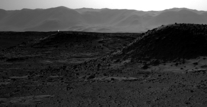
A cosmic ray hit on a camera on the Curiosity rover produced what looks like a 'light' on Mars. Credit: NASA/JPL
Thanks to everyone who has emailed, Tweeted and texted me about the “artificial bright light” seen on Mars. And I’m so sorry to disappoint all the folks who were hoping for aliens, but what you see above is just an image artifact due to a cosmic ray hitting the right-side navigation camera on the Curiosity rover.
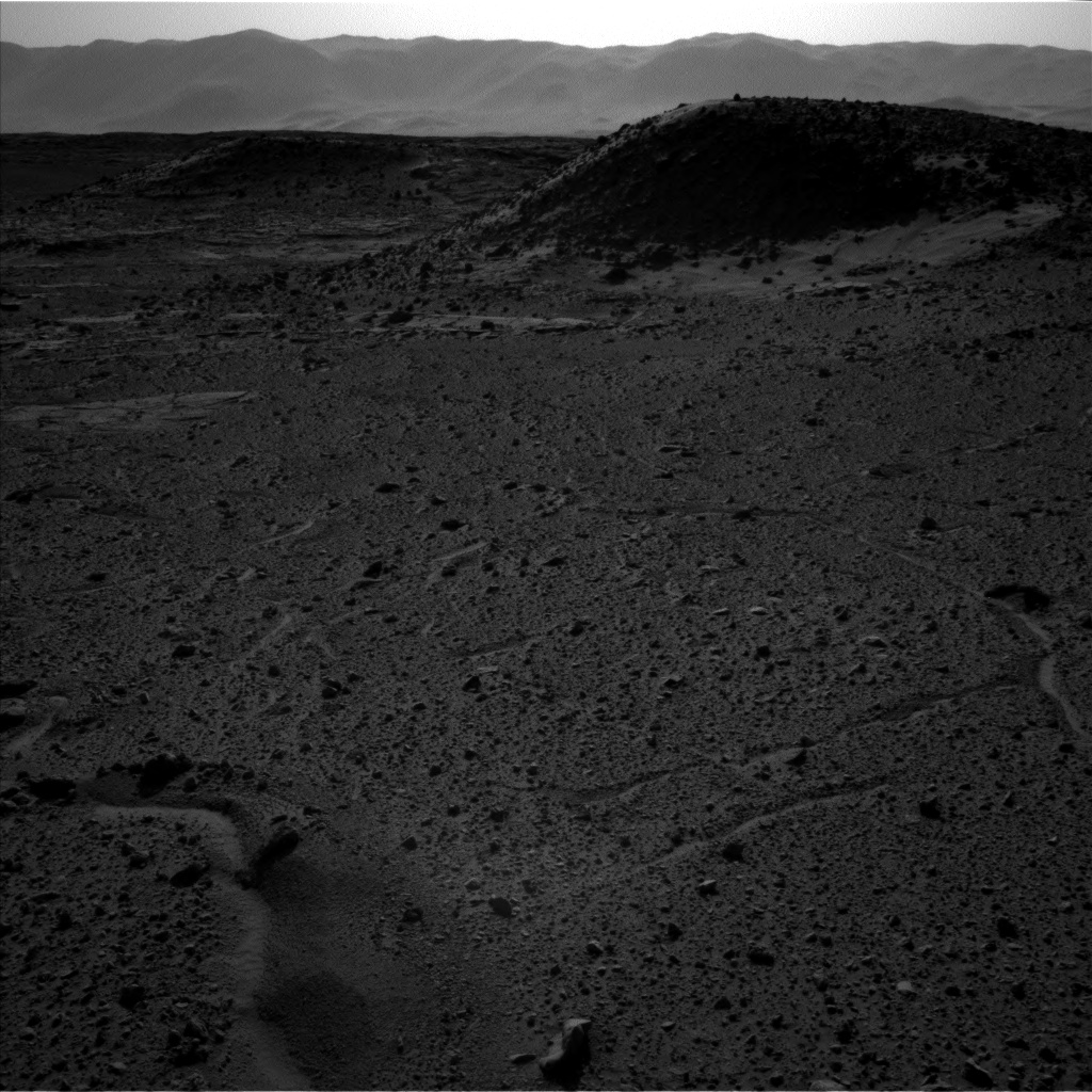
If you do a little research, you can see that the light is not in the left-Navcam image that was taken at the exact same moment (see that image below). Several imaging experts agree this is a cosmic ray hit, and the fact that it’s in one ‘eye’ but not the other means it’s an imaging artifact and not something in the terrain on Mars shooting out a beam of light.
Update: JPL imaging specialists with the MSL mission have now weighed in on these images. “In the thousands of images we’ve received from Curiosity, we see ones with bright spots nearly every week,” said Justin Maki in a press release from JPL. Maki is leader of the team that built and operates the Navigation Camera. “These can be caused by cosmic-ray hits or sunlight glinting from rock surfaces, as the most likely explanations.”
If the bright spots in the April 2 and April 3 images are from a glinting rock, the directions of the spots from the rover suggest the rock could be on a ridge about 175 yards (160 meters) from the rover’s April 3 location.
The bright spots appear in images from the right-eye camera of the stereo Navcam, but not in images taken within one second of those by the left-eye camera. Maki said, “Normally we can quickly identify the likely source of a bright spot in an image based on whether or not it occurs in both images of a stereo pair. In this case, it’s not as straightforward because of a blocked view from the second camera on the first day.”
The left-Navcam image from April 4, 2014 shows no ‘light.’ Credit: NASA/JPL.
Cosmic ray hits happen frequently on spacecraft that don’t have the benefit of being in Earth’s thick atmosphere. And frequently, people seem to get excited about what shows up in imagery that have been affected. For example, one guy thought there was a huge base on Mars based on some he saw on Google Mars.
Getting hit by a cosmic ray can have some serious consequences for a spacecraft — sometimes it can put them into what’s called “safe mode” where only basic functions operate, or other times it can mess up data (like what happened with Voyager 2 in 2010 where the data sent back to Earth was unreadable). Usually, engineers are able to fix the problem and get the spacecraft back in working order.
Cosmic rays can even show up in imagery taken by astronauts on the International Space Station, like this one by astronaut Don Pettitt in 2012:
A cosmic ray hit on a camera appears as a segmented line in the image. Credit: NASA/Don Pettit..
Astronauts also report seeing flashes — even with their eyes closed — whenever cosmic rays zip through their eyeballs. You can read more about that here.
And so far, none of these blips, lights or flashes seen on space imagery has ever been “because aliens.”
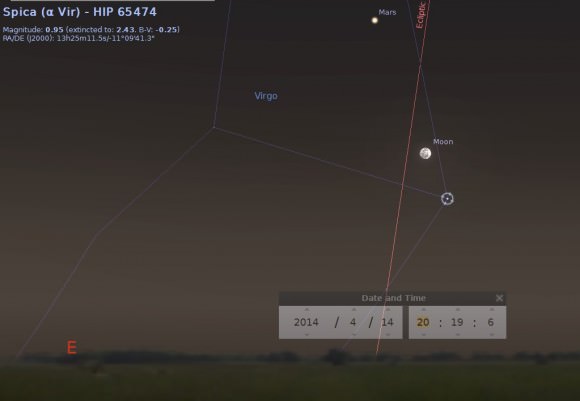
Additionally, if you want to see bright lights associated with Mars, all you have to do is look up in the sky at night and see Mars shining brilliantly in the sky right now. Mars is in opposition, where it is closest to the Earth, and the “official” closest moment happens today, April 8th! Find out more about how to see it or watch different webcasts taking place today at our previous article here.
Mars, the Full Moon and Spica rising in the east on April 14th. Created using Stellarium.
And for those of you who think we shouldn’t give “air time” to nutty claims like lights on Mars, it is our policy to address and debunk such claims (for example, see our article debunking the latest end of the world claim) in order to make sure the real story and good doses of reality are out there, too, and available to people who are looking for the real story.
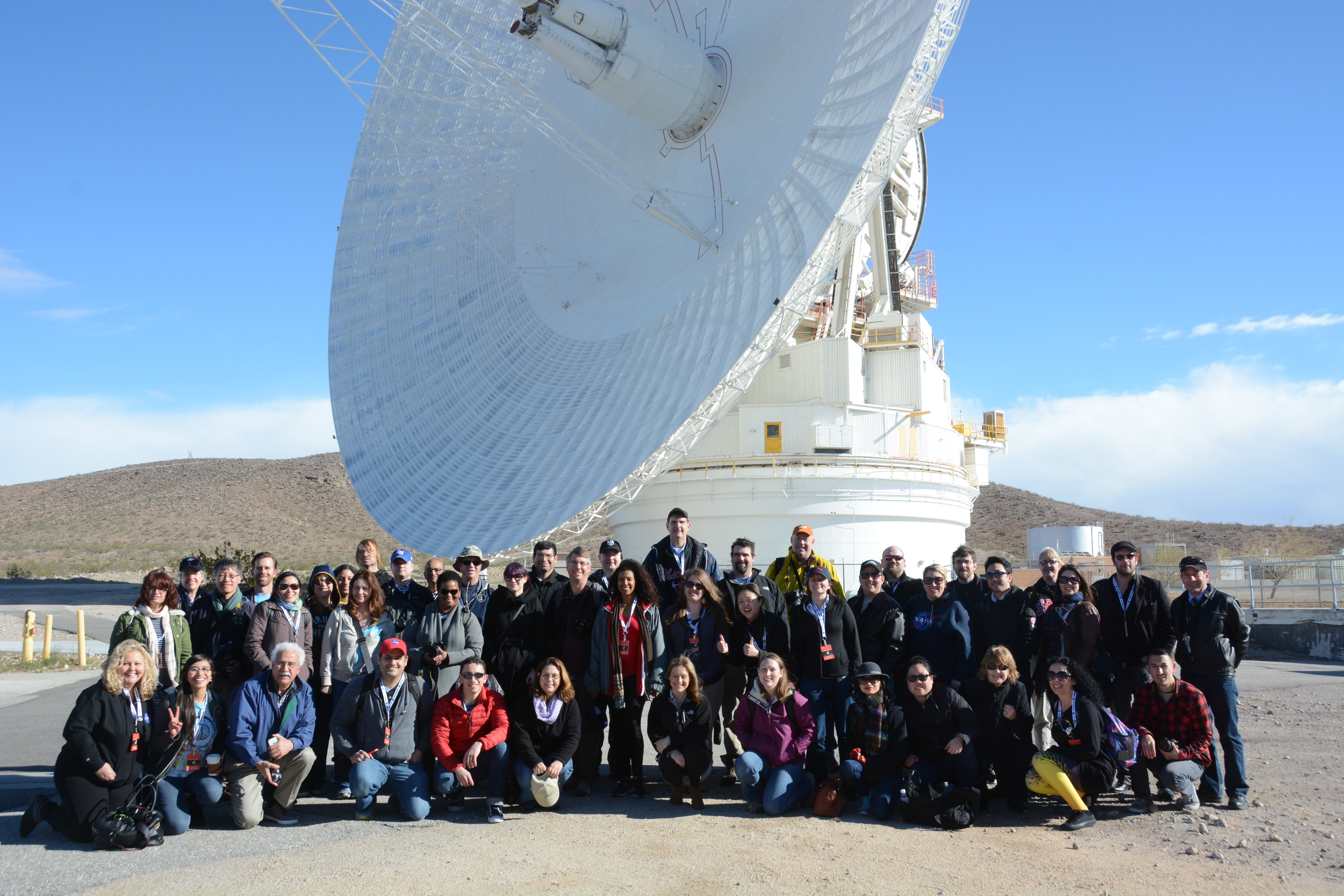
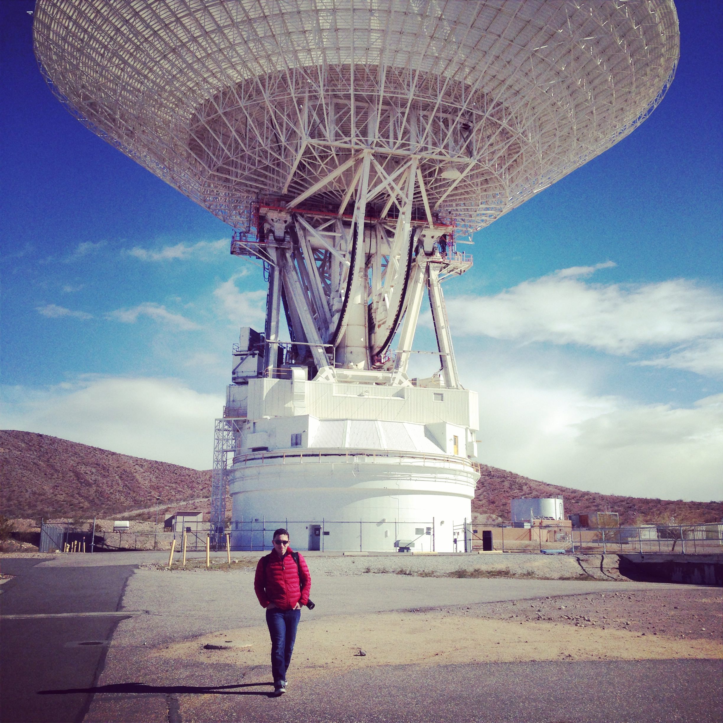
The participants of the DSN NASA Social gathered in front of the DSS-14 70-meter antenna at Goldstone, April 2, 2014.
When you’re talking to spacecraft billions of miles away, you need a powerful voice. And when you’re listening for their faint replies from those same staggering distances, you need an even bigger set of ears. Fortunately, NASA’s Deep Space Network has both — and last week I had the chance to see some of them up close and in person as one of the lucky participants in a NASA Social! Here’s my overview of what happened on those two exciting days.
(And if this doesn’t make you want to apply for the next Social, I don’t know what will.)
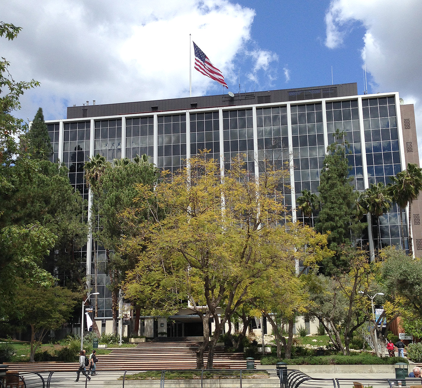
The main building at Jet Propulsion Laboratory in Pasadena (J. Major)
The event began on April 1 (no foolin’) at NASA’s Jet Propulsion Laboratory in Pasadena. Nestled at the feet of steep pine-covered hills northeast of Los Angeles, JPL’s campus is absolutely gorgeous… not quite the location you might imagine for the birthplace of robotic interplanetary explorers! But for over 55 years JPL has been developing some of the world’s most advanced spacecraft, from the Ranger probes which took NASA’s first close-up images of the Moon to the twin Voyagers that toured the Solar System’s outer planets, countless Earth-observing satellites that have revolutionized our ability to monitor global weather, and all of the rovers that have been our first “wheels on the ground” on Mars.
Of course, none of those missions would have been possible if we didn’t have the ability to communicate with the spacecraft. That’s why NASA’s Deep Space Network is such an integral — even if not oft-publicized — part of each and every mission… and has been for 50 years.
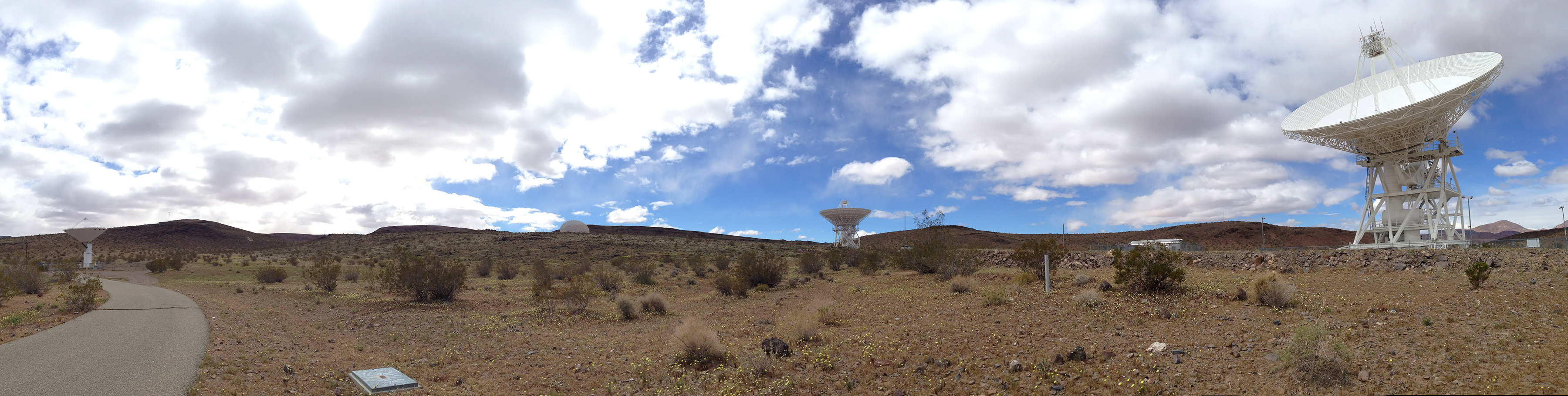
In fact, that was the purpose of this Social event which gathered together 50 space fans from across the U.S. — to celebrate the achievements of the DSN with an eye-opening tour of both JPL and the DSN’s Goldstone facility with its flagship 70-meter dish, located amongst the rocky scrub-covered hills in the middle of a military base in California’s Mojave desert.
For many participants — including myself — it was the first time visiting JPL. I can’t tell you how many times I’ve written about the news that comes out of it, featured its amazing images, and typed the credit line “NASA/JPL-Caltech” in the caption of a picture, so for me it was incredible to actually be there in person. Just driving through the front gate at JPL, with “Welcome To Our Universe” mounted over the window of the guard station, was mind-blowing!
Setting up camp in Mission Control (J. Major)This 16-inch-wide plaque is set into the floor of the “dark room” at JPL Mission Control, covered by a pane of clear acrylic. (J. Major)
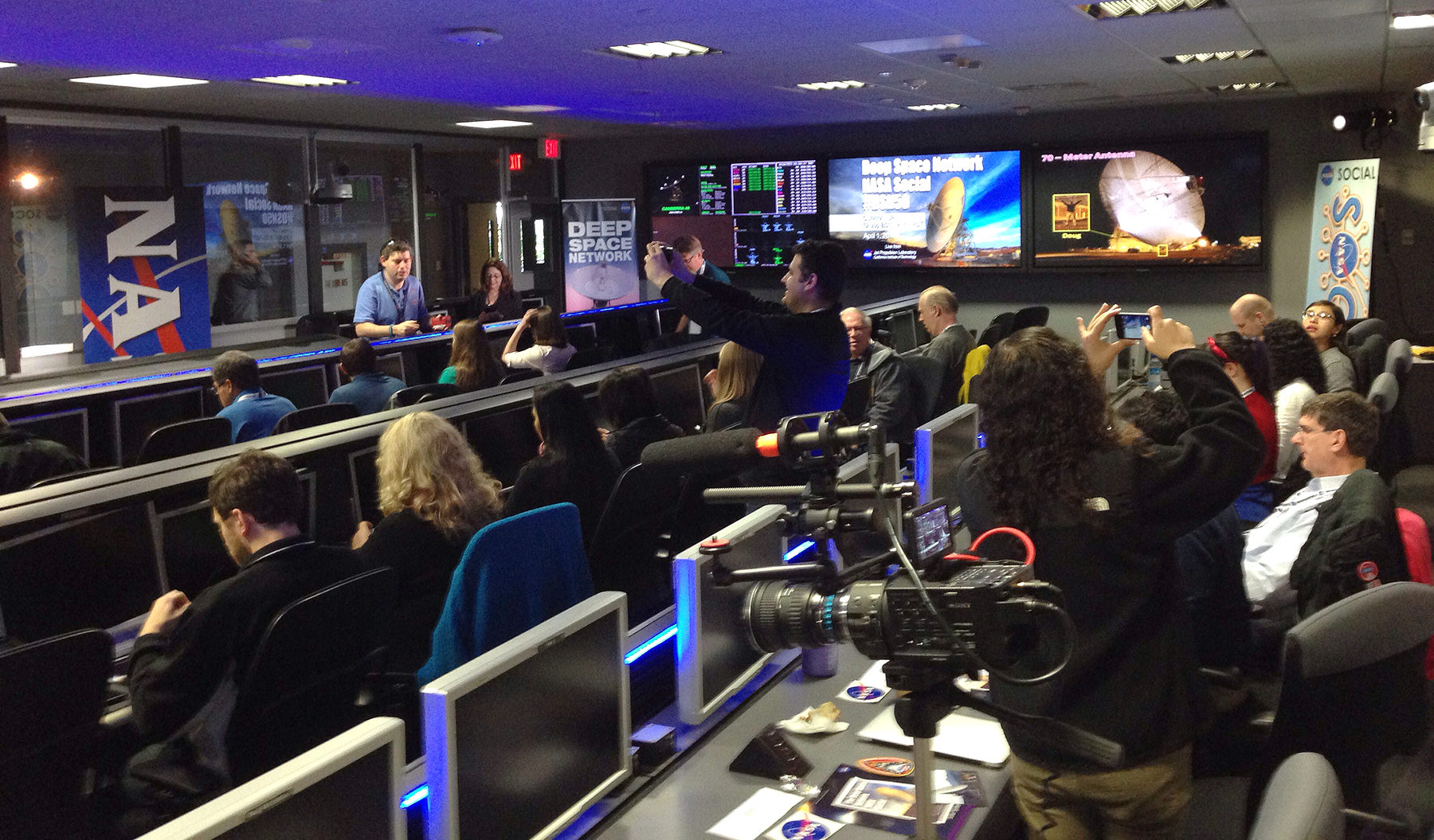
From the Visitor’s Center we were gathered into groups and taken into the heart of JPL to get a look at the Mission Control room, aka the “center of the universe.” This is where all the data from ongoing space exploration missions arrives (after being collected by the Deep Space Network, of course.) And we didn’t just get to see Mission Control — we actually set up our computers there and got to take our seats at the very same desks that top JPL and NASA engineers and scientists used during the MSL landing in August 2012! In fact we were treated to a replay of Curiosity’s landing on the screens against the wall that first displayed the rover’s images of Gale Crater. The whole experience was a bit surreal — I vividly recall watching it live, and there we were in the same room as if it were happening all over again! (We even got to re-enact the celebration of the touchdown announcement as our group photo.)
After several presentations and Q&A sessions with NASA mission engineers — recorded live for NASA TV — we all embarked on a tour of JPL’s rock-strewn “Mars Yard” where a stunt double of Curiosity, named “Maggie,” resides in a super high-tech garage. Maggie helps engineers determine what Curiosity can and can’t do on Mars… much more safely than actually having the “real” rover attempt itself.
Watch the NASA TV coverage from Mission Control below:
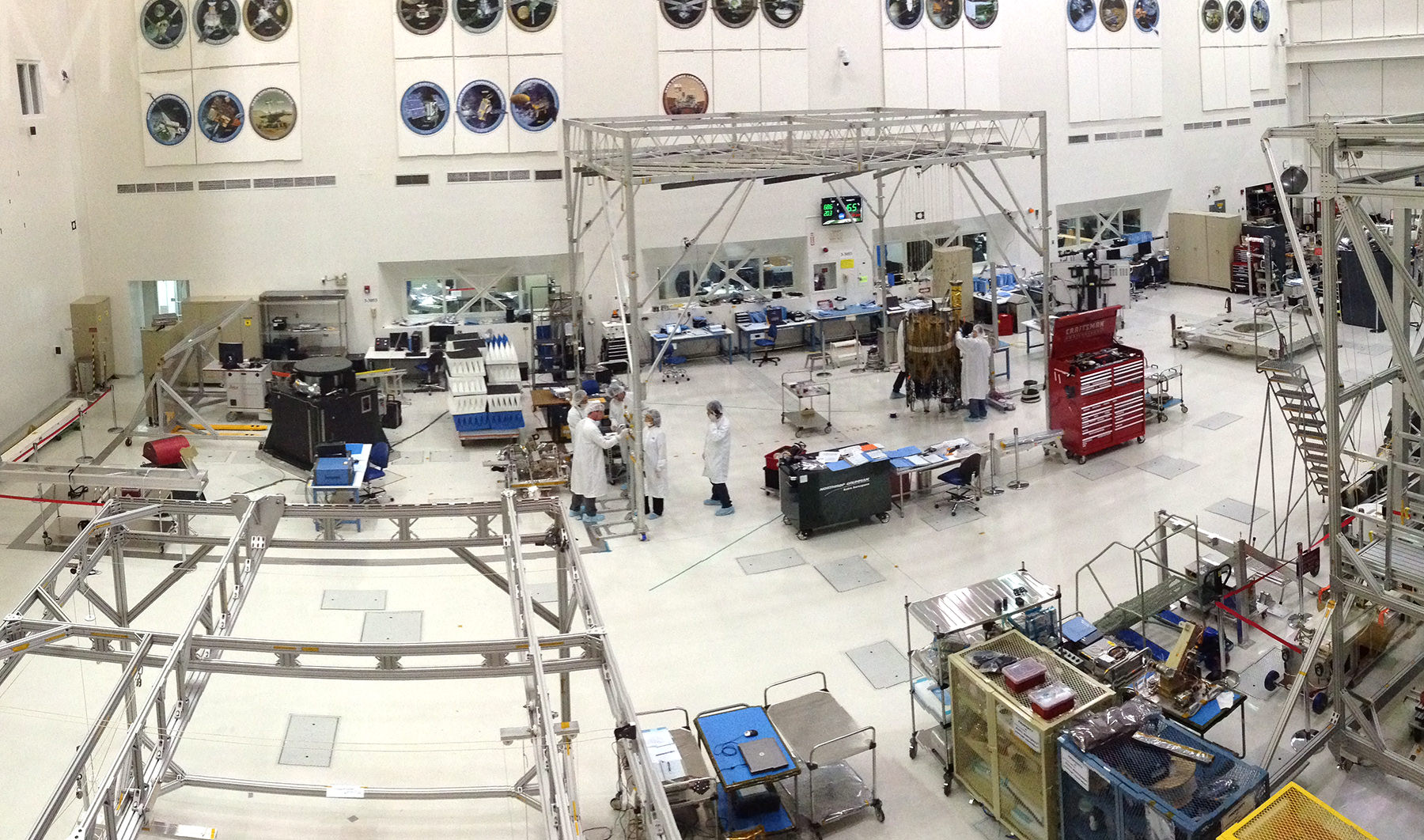
The group then got the chance to see an actual spacecraft being built in the Spacecraft Assembly Facility, a huge clean room where engineers were building components of the upcoming SMAP (Soil Moisture Active Passive) satellite. Slated for launch in October, SMAP will take measurements of the planet’s soil moisture in its freeze/thaw states from orbit over a period of three years. As we watched from the windowed viewing platform several “bunny-suited” engineers were busy working on SMAP’s 6-meter reflector. In another six months or so the parts that were scattered around that clean room will be performing science in orbit!
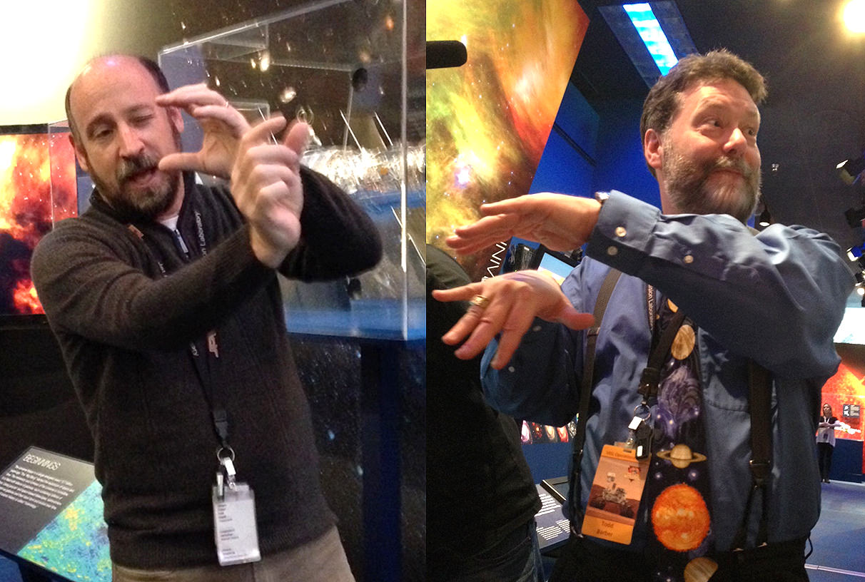
Where space explorers are born: JPL’s Spacecraft Assembly Facility (J. Major)Randii Wessen (left) and Todd Barber (right) demonstrate… well, I’m not sure what they were demonstrating but it was very entertaining! (J. Major)
From there it was off to the JPL museum and some intimate (and highly animated!) discussions about mission technology with project formulator Randii Wessen and propulsion engineer Todd Barber. Afterward I took the opportunity to talk with Todd a bit about his role on the Cassini mission, for which he’s the lead propulsion engineer.
(You all know how much I adore Cassini, so that was a real treat.)
When we got back to Mission Control we had a chance to meet with and have photos taken with JPL’s very own “Mohawk guy” Bobak Ferdowsi, who achieved widespread fame during the internet broadcast landing of Curiosity. I had Bobak sign my toy Curiosity rover, which now has a “BF” on the back of its die-cast RTG. One for the space shelf!
The second half of the Social began early the next day — for me, very early. After getting up at 3:15 a.m. and making a two-hour drive from Pasadena to Barstow in the dark, I and the other participants met up with the Social bus in a park-and-ride lot at 6:00 just as the Sun was beginning to brighten the eastern sky. (Some had stayed overnight in Barstow, while others made the early drive out like I did.) Once the bus filled, we headed north into the Mojave to arrive at NASA’s Deep Space Network Communications Complex at Goldstone, located within the Fort Irwin military training area.
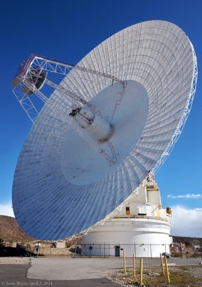
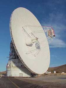
The 70-meter dish at NASA’s DSN complex at Goldstone (J. Major)
The location is rugged and remote — the perfect place to listen for the faint signals from spacecraft trundling across dusty Mars and soaring through the farthest reaches of the Solar System! The nine main DSN antennas at Goldstone are scattered across several square miles of desert, enormous dishes pointed more-or-less directly upward, aiming at the locations of distant spacecraft in order to both receive and transmit data. All of them are huge, but by far the most impressive is the gigantic 70-meter DSS-14 dish that towers above the rest in both height and width.
Recently renovated , the fully-positionable DSS-14 “Mars antenna” dish (so called because of its first mission tracking the Mariner 4 spacecraft in 1965) weighs in at 2.7 million kilograms yet “floats” atop a thin film of oil a quarter of a millimeter thick!
How smoothly does a three-thousand-ton radar dish move? We got to find out — check out the video below:
(Note: as it turned out, DSS-14 wasn’t turning to communicate with anything… the show was just for us!)
Of course, we all spent plenty of time taking pictures of the 70-meter, both inside and out — we were treated to a tour of this and several other dish sites hosted by JPL’s Jeff Osman, a specialist in the DSN antennas and their operations.
(One of us even chose to record the DSS-14 antenna with pencils and paper — watch fellow Social participant Jedediah Dore’s sketch and account of the experience here.)
Jim Erickson, JPL’s Project Manager for the Mars Rovers and MRO, speaks during the 50th Anniversary Event (J. Major)
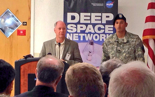
The highlight of the day at Goldstone was (if not just being there!) was being present for the official celebration of the facility’s 50th anniversary. Featuring speakers from JPL and DSN, as well as many esteemed guests, the event — held indoors because of strong winds outside — commemorated the impact and important contributions of the complex over the past half-century of space exploration. According to speaker Jim Erickson of JPL, “There hasn’t been a time in my career when the DSN wasn’t there for us.”
After that the NASA Social group was invited to take a few moments to mingle with speakers and guests — when else would I have a chance to chat with JPL director Dr. Charles Elachi? — and then we all returned to our own meeting room where refreshments were waiting and a (quite delicious) DSN50 cake was cut and served.
It was truly a fantastic and well-planned event, giving 50 people the chance to see an integral part of our space program that, although it doesn’t usually receive the same kind of exposure that rocket launches and planetary landings enjoy, makes all of it possible.
Here’s to 50 more years of DSN and its long-distance relationship with all of our intrepid space explorers!
__________________
See what communications are currently coming in and going out of the DSN dishes — in Goldstone as well as in Madrid and Canberra — here, and learn more about the history of Goldstone here.
And a big thanks to Courtney O’Connor, Veronica McGregor, John Yembrick, and Stephanie Smith for putting this NASA Social together, Annie Wynn and Shannon Moore for setting up and organizing participant groups on Facebook and Google (which makes offsite planning so much easier), Jeff Osman and Shannon McConnell for the tours of the DSN sites and, of course, everyone at JPL and Goldstone who helped to make the event a wonderful success!
Would you like to be a part of a NASA Social? Find out what events are coming up and how to apply for them here.
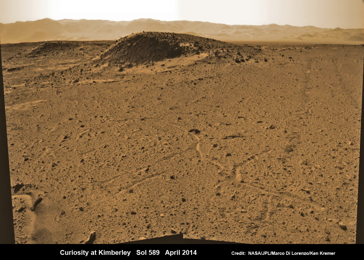
Curiosity maneuvers into ‘Kimbeley’ and scans scientifically intriguing Martian rock outcrops in search of next drilling location exhibiting several shallow hills in foreground and dramatic Gale crater rim backdrop. Rover tracks at right in this colorized Navcam photomosaic assembled from raw images snapped on Sol 589, April 3, 2014. Credit: NASA/JPL/Marco Di Lorenzo /Ken Kremer - kenkremer.com
Curiosity maneuvers into ‘Kimbeley’ and scans scientifically intriguing Martian rock outcrops in search of next drilling location exhibiting several shallow hills in foreground and dramatic Gale crater rim backdrop. Rover tracks at right in this colorized Navcam photomosaic assembled from raw images snapped on Sol 589, April 3, 2014.
Credit: NASA/JPL/Marco Di Lorenzo /Ken Kremer – kenkremer.com[/caption]
NASA’s car sized Curiosity rover has arrived at a scientifically enticing science destination at “The Kimberley Waypoint” where researchers hope to carry out the next drilling operation into alien Martian terrain in search of further clues about ancient Red Planet environments that may have been favorable for life.
“We are officially in ‘The Kimberley’ now,” Curiosity Principal Investigator John Grotzinger, of the California Institute of Technology, Pasadena, told Universe Today.
Since arriving in the Kimberley region, Curiosity’s earth-bound handlers have been maneuvering the 1 ton robot to thoroughly survey the destination dubbed “The Kimberley”.
Why was Kimberley chosen as a science destination?
“The Kimberley” has interesting, complex stratigraphy,” Grotzinger told me.
The team moved the six wheeled robot further this week in search of a suitable location to conduct the next drilling operation. The terrain is replete with diverse rock types and extensive outcrops.
I asked Grotzinger if today’s (April 5) location at ‘The Kimberley’ is the intended drill site?
“It’s a possible drill site,” Grotzinger replied.
“Pending further evaluation,” he noted.
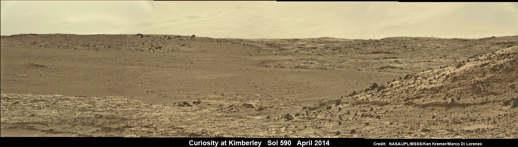
Curiosity scans scientifically intriguing rock outcrops of Martian terrain at ‘The Kimberley’ waypoint in search of next drilling location, beside low hill at right. Mastcam color photomosaic assembled from raw images snapped on Sol 590, April 4, 2014. Credit: NASA/JPL/MSSS/Ken Kremer – kenkremer.com/Marco Di Lorenzo
Curiosity drove the final stretch of some 98 feet (30 meters) on Wednesday, April 2, required to arrive at a major stopping waypoint planned since early 2013 for up close study of the Red Planet’s rocks.
Along the recent dune filled path to ‘The Kimberley’, Curiosity snapped breathtaking landscapes around the irresistible ‘Junda’ outcrop, much like a tourist.
See our photomosaics showing the spectacularly inviting terrain around Kimberly and Junda, above and below, by Marco Di Lorenzo and Ken Kremer.
Martian landscape with rows of curved rock outcrops at ‘Kimberly’ in the foreground and spectacular Mount Sharp on the horizon. NASA’s Curiosity Mars rover pulled into Kimberly waypoint dominated by layered rock outcrops as likely drilling site. This colorized navcam camera photomosaic was assembled from imagery taken on Sol 576 (Mar. 20, 2014). Credit: NASA/JPL-Caltech/Marco Di Lorenzo/Ken Kremer-kenkremer.com
The state-of-the-art robot now sits at a vantage point at “The Kimberley” enabling a detailed photographic survey of the rock exposures and surroundings with the high resolution Mastcam cameras.
The new imagery will be used to select the most scientifically productive drilling locations.
“It is named after a remote region of western Australia,” Grotzinger informed me.
The team chose Kimberley because its lies at the intersection of four different types of rocks, including striated rocks overlain by others and deposited in a decipherable geological relationship to each other.
Researchers directed Curiosity on a pinpoint drive to ‘Kimberley’ after high resolution imagery and mineral mapping spectrometry gathered by NASA’s powerful telescopic cameras aboard the Mars Reconnaissance Orbiter (MRO) circling overhead piqued their interest.
Curiosity looks back at Martian sand dunes and rover tracks after passing by Junda outcrop (right) on Sol 548 (Feb. 19, 2014) with Gale Crater rim and Mount Sharp on the distant horizon. Navcam colorized photomosaic. Credit: NASA/JPL-Caltech/Ken Kremer- kenkremer.com/Marco Di Lorenzo
“This is the spot on the map we’ve been headed for, on a little rise that gives us a great view for context imaging of the outcrops at the Kimberley,” said Melissa Rice, Curiosity science planning lead, of Caltech.
The team expects Curiosity to investigate Kimberley for several weeks of observations, including sample-drilling and onboard laboratory analysis of the area’s rocks with the CheMin and SAM miniaturized chemistry labs.
If drilling is warranted, Kimberley would be the site of Curiosity’s first drilling operation since boring into the ‘John Klein’ and ‘Cumberland’ outcrop targets during the spring of 2013 at Yellowknife Bay.
The robot has conducted cleaning activities of SAM, CheMin and the CHIMRA sample handling mechanism in anticipation of boring into the Martian outcrops and delivering powdery, pulverized samples of cored Martian rocks to SAM and CheMin – waiting patiently inside the robots belly to eat something exciting from the Red Planet.
Curiosity departed the Yellowknife Bay region in July 2013 where she discovered a habitable zone and thereby accomplished the primary goal of the mission.
To date, Curiosity’s odometer totals 3.8 miles (6.1 kilometers) since landing inside Gale Crater on Mars in August 2012. She has taken over 137,000 images.
The sedimentary foothills of Mount Sharp, which reaches 3.4 miles (5.5 km) into the Martian sky, is the 1 ton robots ultimate destination inside Gale Crater because it holds caches of water altered minerals. Such minerals could possibly indicate locations that sustained potential Martian life forms, past or present, if they ever existed.
Curiosity has some 4 kilometers to go to reach the base of Mount Sharp.
She may arrive at the lower reaches of Mount Sharp sometime in the latter half of 2014, but must first pass through a potentially treacherous dune field.
Stay tuned here for Ken’s continuing Curiosity, Opportunity, Chang’e-3, SpaceX, Orbital Sciences, LADEE, MAVEN, MOM, Mars and more planetary and human spaceflight news.
Learn more at Ken’s upcoming presentations at the NEAF convention on April 12/13 and at Washington Crossing State Park, NJ on April 6.
Map of Curiosity Mars Rover’s Drives to ‘the Kimberley’ Waypoint. This map shows the route driven by NASA’s Curiosity Mars rover during March and April 2014 in its approach to and arrival at a waypoint called “the Kimberley,” which rover team scientists chose in 2013 as the location for the mission’s next major investigations. Credit: NASA/JPL-Caltech/Univ. of Arizona
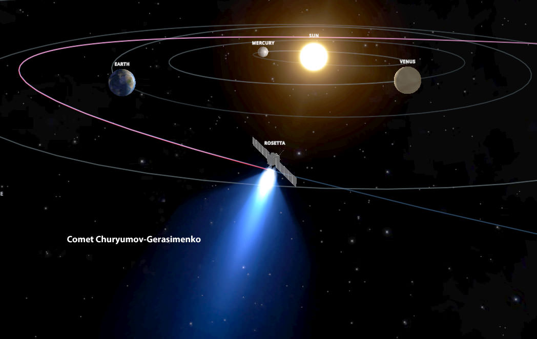
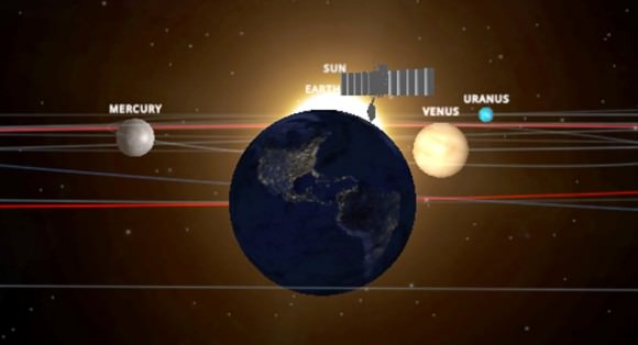
Frame from the Rosetta Mission simulation shows the probe and comet when closest to the sun in late 2015. Credit: INOVE
Hang onto your space helmets. With a few moves of the mouse, you can now follow the European Rosetta mission to its target comet with this interactive 3-D simulator. Go ahead and give it a click – it’s live! The new simulator was created by INOVE Space Models, the same group that gave us the 3-D solar system and Comet ISON interactive models.
The embedded version gives you a taste, so be sure to also check out the full-screen version. You can either click play to watch the mission from start to finish or you can drop it at key points by selecting from list of 11 highlights on the left side of your screen. A tick-tock at the bottom of the screen helps reference the time and what the spacecraft is doing at that moment in the video.
To interact with the model, simply click the screen. The action stops, allowing you to zoom in and out by scrolling; to change orbital viewpoints hold down the mouse button and drag. So easy!
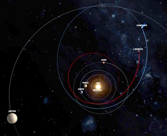
Simulator view of Rosetta’s first Earth flyby / gravity assist in March 2005. The probe flew by Earth three times and Mars once to conserve fuel and send it beyond the asteroid belt to rendezvous with Comet Churyumov-Gerasimenko. Credit: INOVE
I like the realism of the simulation, the attention paid to the planets’ variable spin rates and orbital periods and how well model illustrates the complicated maneuvers required to “fling” the probe to Comet Churyumov-Gerasimenko. And I do mean fling. Watching the video from a face-on solar system perspective I was struck by how Rosetta’s flight path resembled a spiral after repeated gravity assists by Mars and Earth.
Rosetta heads toward Comet C-G after its final Earth flyby in this face-on view. Credit: INOVE
Whether you’re a teacher or an armchair space enthusiast looking for an easy-to-understand, graphic way to find out how Rosetta will meet its target, I doubt you’ll find a more effective tool.
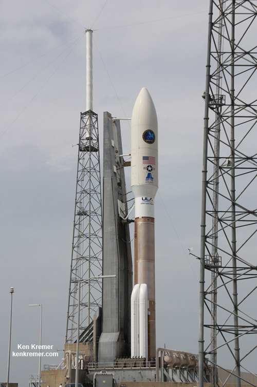
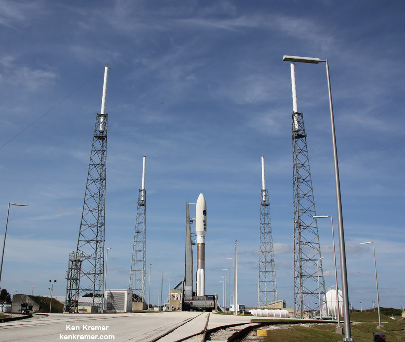
United Launch Alliance Atlas V rocket – powered by Russian made RD-180 engines – and Super Secret NROL-67 intelligence gathering payload poised for launch at Space Launch Complex 41 at Cape Canaveral Air Force Station, FL, in March 2014. Credit: Ken Kremer – kenkremer.com
CAPE CANAVERAL AIR FORCE STATION, FL – The sudden and unexpected outage of a crucial tracking radar that is mandatory to insure public safety, has forced the scrub of a pair of launches planned for this week from Cape Canaveral, FL, that are vital to US National Security, United Launch Alliance, SpaceX and NASA.
The tracking radar is an absolutely essential asset for the Eastern Range that oversees all launches from Cape Canaveral Air Force Station and the Kennedy Space Center on the Florida Space Coast.
The pair of liftoffs for the National Reconnaissance Office (NRO) and SpaceX/NASA had been slated just days apart on March 25 and March 30.
Urgent repairs are in progress.
Both launches have now been postponed for a minimum of 3 weeks, according to a statement I received from the 45th Space Wing of the US Air Force that controls the critical launch control systems, communications, computers and radar elements.
An Atlas V rocket carrying the super secret NROL-67 intelligence gathering spy satellite for the National Reconnaissance Office and a SpaceX Falcon 9 rocket carrying a Dragon cargo freightor bound for the International Space Station (ISS) were both in the midst of the final stages of intensive pre-launch processing activities this week.
The Eastern range radar was apparently knocked out by a fire on March 24, a short time after the early morning rollout of the United Launch Alliance (ULA) Atlas V rocket to the launch pad at Space Launch Complex 41 on Cape Canaveral.
“An investigation revealed a tracking radar experienced an electrical short, overheating the unit and rendering it inoperable,” according to today’s explanatory statement from the USAF 45th Space Wing.
“The outage resulted in an inability to meet minimum public safety requirements needed for flight, so the launch was postponed.”
A SpaceX spokesperson likewise confirmed to me that their launch was also on hold.
Artwork for Super Secret NROL-67 payload launching on Atlas V rocket. Credit: NRO/ULA
A fully functional tracking radar is an absolute requirement to ensure the success and safety of any launch.
The range radar must also be functioning perfectly in order to destroy the rocket in a split second in the event it veers off course to the nearby heavily populated areas along the Space Coast.
Myself and other space journalists had been working at Pad 41 on March 24 and setting up our remote cameras to capture spectacular up close views of the blastoff that had then been scheduled for March 25.
Atlas V rocket and Super Secret NROL-67 intelligence gathering payload following rollout to Space Launch Complex 41 at Cape Canaveral Air Force Station, FL, on March 24, 2014. Credit: Ken Kremer – kenkremer.com
Insufficient maintenance and antiquated equipment due to a lack of US government funding and investment in infrastructure may be implicated.
The Air Force is also looking into the feasibility of reviving an inactive radar as a short term quick fix.
But in order to use the retired backup system, it will also have to re-validated to ensure utility and that all launch control and public safety requirements are fully met.
Simultaneously, the engineering team is recalculating launch trajectories and range requirements.
Such a revalidation process will also require an unknown period of time.
The full impact of putting these two launches on hold for the NRO and SpaceX is not known at this time.
An upgraded SpaceX Falcon 9 rocket with Dragon cargo capsule bound for the ISS is slated to launch on March 16, 2014 from Space Launch Complex 40 at Cape Canaveral, FL. File photo. Credit: Ken Kremer/kenkremer.com
Furthermore, the USAF will need to determine the downstream scheduling impact on the very busy manifest of all of the remaining launches throughout 2014 – averaging more than one per month.
Neither the NRO nor NASA and SpaceX have announced firm new launch dates.
The earliest possible Atlas V launch date appears to be sometime in mid-April, but that assessment can change on a dime.
In the meantime, personnel from the 45th Space Wing will continue to work diligently to repair the range radar equipment as quickly as possible.
ULA engineers also rolled the Atlas V rocket back to its processing hanger until a new launch target date is set.
SpaceX likewise awaits a target launch date for the Dragon CRS-3 cargo mission packed with some 5000 pounds of science experiments and supplies for the six man station crew.
It seems likely that the next Orbital Sciences Antares/Cygnus launch to the ISS will also have to be postponed since Dragon and Cygnus berth at the same station port.
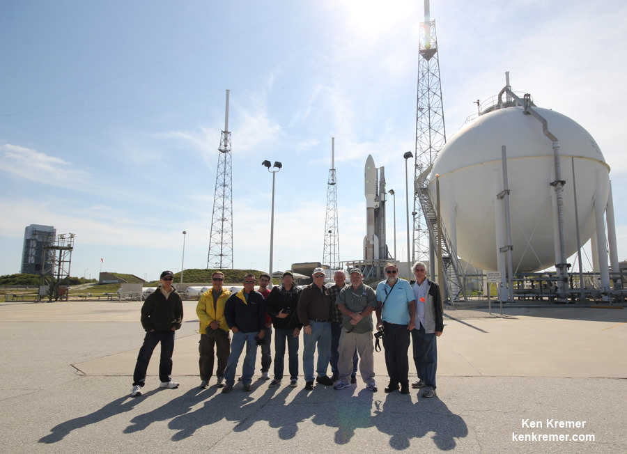
Space journalists and photographers pose at Launch Pad 41 during camera setup with the Atlas V rocket slated to loft super secret NROL-67 spy satellite to orbit; Ben Cooper, Don Hludiak, Mike Howard, Mike Deep, Matthew Travis, Hap Griffin, Jeff Seibert, Alan Walters, Julian Leek, Ken Kremer/Universe Today at right. Credit: Ken Kremer – kenkremer.com
Stay tuned here for Ken’s continuing Atlas V NROL 67, SpaceX, Orbital Sciences, commercial space, Orion, Chang’e-3, LADEE, Mars rover, MAVEN, MOM and more planetary and human spaceflight news.
Learn more at Ken’s upcoming presentations at the NEAF astro/space convention, NY on April 12/13 and at Washington Crossing State Park, NJ on April 6. Also at the Quality Inn Kennedy Space Center, Titusville, FL, March 29.
Sensors aboard NASA’s Terra satellite are aiding the search for MH 370. Credit: NASA
NASA has actively joined the hunt for the missing Malaysian Airline flight MH-370 that mysteriously disappeared without a trace more than two weeks ago on March 8, 2014.
Sensors aboard at least two of NASA’s unmanned Earth orbiting global observation satellites as well as others flying on the manned International Space Station (ISS) are looking for signs of the jetliner that could aid the investigators from a multitude of nations and provide some small measure of comfort to the grieving families and loved ones of the passengers aboard.
“Obviously NASA isn’t a lead agency in this effort. But we’re trying to support the search, if possible,” Allard Beutel, NASA Headquarters, Office of Communications director, told Universe Today this evening.
NASA’s airplane search assistance comes in two forms; mining existing space satellite observing data and retargeting space based assets for new data gathering since the incident.
The Malaysian Airline Boeing 777-2H6ER jetliner went missing on March 8 while cruising en route from Kuala Lampur, Malaysia to Beijing, China. See cockpit photo below.
Accurate facts on why MH-370 vanished with 239 passengers aboard have sadly been few and far between.
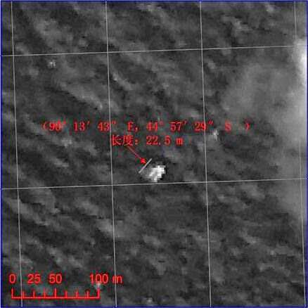
Chinese satellite image of possible debris of MH 370. Credit: China/SASTIND
Last week, the search area shifted to a wide swath in the southern Indian Ocean when potential aircraft debris was spotted in a new series of separate satellite images from Australia and China government officials.
A prior set of official Chinese government satellite images at a different location yielded absolutely nothing.
The area is now focused 2,500 km (1,600 mi) south west of Perth, a city on the western coast of Australia.
NASA’s search support was triggered upon activation of the International Charter on Space and Major Disasters.
Available data from NASA’s Terra and Aqua satellites has already been transmitted to the U.S. Geological Survey and new data are now being collected in the search area.
“In response to activation of the International Charter on Space and Major Disasters last week regarding the missing Malaysia Airlines jetliner, NASA sent relevant space-based data to the U.S. Geological Survey’s Earth Resources Observations and Science Hazard Data Distribution System that facilitates the distribution of data for Charter activations,” according to a NASA statement.
And it’s important to note that NASA satellites and space-based cameras are designed for long-term scientific data gathering and Earth observation.
“They’re really not meant to look for a missing aircraft,” Beutel stated.
“The archive of global Earth-observing satellite data is being mined for relevant images. These include broad-area views from the MODIS [instrument] on NASA’s Terra and Aqua satellites,” Beutel informed me.
The next step was to retarget both satellites and another high resolution camera aboard the ISS.
“In addition, two NASA high-resolution assets have been targeted to take images of designated search areas: the Earth Observing-1 satellite and the ISERV camera on the International Space Station,” Beutel explained.
Sensors aboard NASA’s Aqua satellite are aiding the search for MH 370. Credit: NASA
Aqua and Terra were already gathering new observations with the MODIS instrument in the search area off Australia last week. MODIS measures changes in Earth’s cloud cover.
Here are the satellite observation times and capabilities:
• MODIS on the Aqua satellite observed at about 1:30 p.m. local time as it passes overhead from pole-to-pole
• MODIS on the Terra satellite observed at about 10:30 a.m. local time
• The width (field of view) of a MODIS observation is 2,300 kilometers
• One pixel of a MODIS image – the limit of how small a feature it can see – is about 1 kilometer.
A new set of high resolution Earth imaging cameras are being sent to the ISS and are loaded aboard the SpaceX CRS-3 Dragon resupply capsule now slated for blastoff on March 30.
The newly launchedNASA/JAXAGPM precipitation monitoring satellite which will cover this ocean area in the future is still in the midst of science instrument checkout.
The International Space Station (ISS) in low Earth orbit. Credit: NASA
Ships and planes from at least 26 countries have been being dispatched to the new based on the new satellite imagery to search for debris and the black boxes recording all the critical engineering data and cockpit voices of the pilot and copilot and aid investigators as to what happened.
No one knows at this time why the Malaysia Airlines flight mysteriously disappeared.
Map of possible MH 370 debris locations published 1: 12 March (disproved), 2: 20–23 March 2014. Credit: Wikipedia
Flight deck view of the missing MH 370 aircraft, showing many of the communication systems now under investigation. Credit: Chris FinneyPhoto of Malaysia Air Boeing 777-200
The Dragon spacecraft, filled with about 4,600 lbs of cargo bound for the space station, is mated with Falcon 9. Credit: SpaceX
KENNEDY SPACE CENTER, FL – Following last week’s sudden and late in the processing flow postponement of the SpaceX Falcon 9 rocket launch, SpaceX announced a reset of its next cargo mission launch for NASA to the International Space Station (ISS) to a new target date of Sunday, March 30.
The commercially developed Falcon 9 booster and Dragon cargo vessel are slated for a spectacular night time liftoff from Cape Canaveral Air Force Station in Florida at 10:50 p.m. EDT on March 30, SpaceX announced on Friday.
This mission, soaring to space under a resupply contract to NASA, could ignite a revolution in both rocketry and robotics.
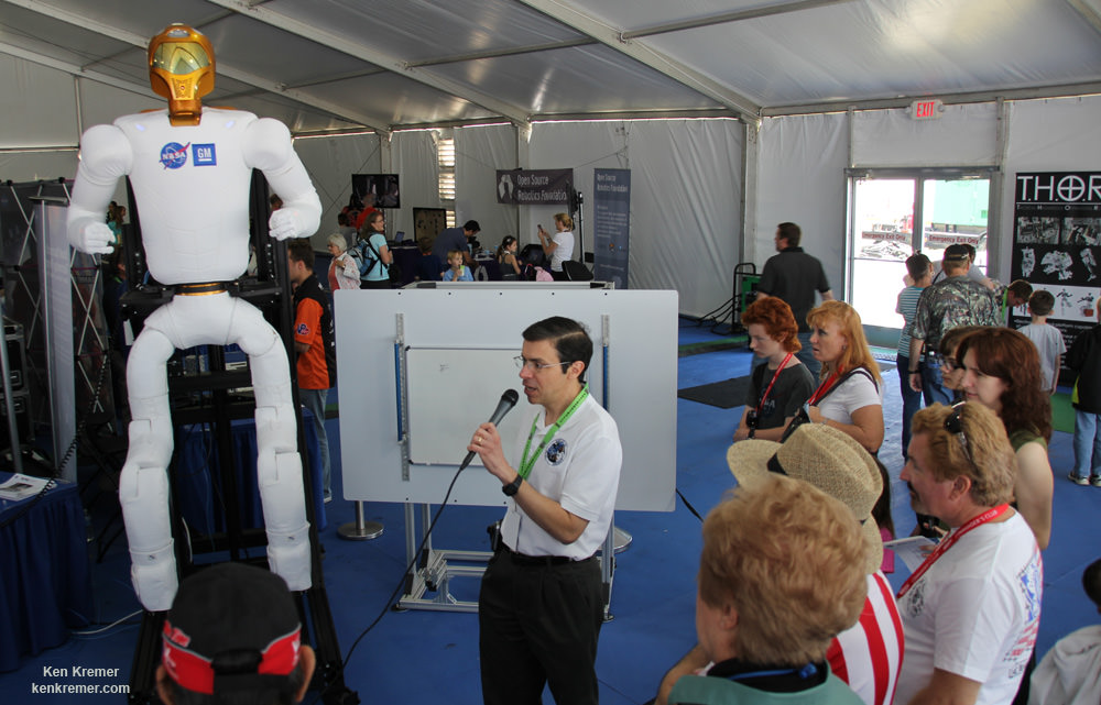
The first stage of the Falcon 9 rocket sports a quartet of never before tried landing legs and the Dragon freighter is loaded with a set of lanky legs to enable mobility in space for NASA’s Robonaut 2 standing at the cutting edge of space robotics technology.
Launch preparations were suddenly halted less than 72 hours prior to the then planned March 16 early morning launch because of unspecified technical issues concerning the sudden discovery of “contamination,” sources told me.
The Falcon 9 rocket with landing legs in SpaceX’s hangar at Cape Canaveral, Fl, preparing to launch Dragon to the space station this Sunday March 30. Credit: SpaceX
“To ensure the highest possible level of mission assurance and allow additional time to resolve remaining open items, the team is taking additional time to resolve open items and ensure SpaceX does everything possible on the ground to prepare for a successful launch,” according to a statement from SpaceX.
Several sources told me that the problem related to “contamination” that was found in the “unpressurized truck section” at the rear of the Dragon spacecraft.
“An unknown contaminant of unknown origin was found on a blanket in the Dragon trunk,” independent sources said to Universe Today soon after the postponement was announced.
“After careful review and analysis, engineering teams representing both the ISS and SpaceX have determined Dragon is ready to fly ‘as-is.’ All parties agree that the particular constituents observed in Dragon’s trunk are in line with the previously defined environments levels and do not impose additional risk to the payloads,” SpaceX announced in a new statement.
With the contamination issues now resolved, the launch is back on track.
Robonaut 2 engineering model equipped with new legs like those heading to the ISS on upcoming SpaceX CRS-3 launch were on display at the Kennedy Space Center Visitor Complex on March 15, 2014. Credit: Ken Kremer – kenkremer.com
NASA Television will air live coverage on Sunday.
In case the launch is delayed, the backup launch opportunity is at 9:39 p.m. Wednesday, April 2.
Altogether, this unmanned SpaceX CRS-3 mission will deliver over 5000 pounds of science experiments, a pair of legs for Robonaut 2, a high definition imaging camera suite, an optical communications experiment and essential gear, spare parts, crew provisions, food, clothing and supplies to the six person crews living and working aboard the ISS soaring in low Earth orbit under NASA’s Commercial Resupply Services (CRS) contract.
SpaceX is under contract to NASA to deliver 20,000 kg (44,000 pounds) of cargo to the ISS during a dozen Dragon cargo spacecraft flights over the next few years at a cost of about $1.6 Billion.
To date SpaceX has completed two operational cargo resupply missions and a test flight. The last flight dubbed CRS-2 blasted off a year ago on March 1, 2013 atop the initial version of the Falcon 9 rocket.
Following the rescheduled March 30 launch and a series of orbit raising and course corrections over the next two days, Dragon will rendezvous and dock at the Earth facing port on the station’s Harmony module on Wednesday, April 2.
Falcon 9 SpaceX CRS-2 launch of Dragon spacecraft on March 1, 2013 to the ISS from pad 40 at Cape Canaveral, Florida.- shot from the roof of the Vehicle Assembly Building. Credit: Ken Kremer/www.kenkremer.com
Stay tuned here for Ken’s continuing SpaceX, Orbital Sciences, commercial space, Orion, Chang’e-3, LADEE, Mars rover, MAVEN, MOM and more planetary and human spaceflight news.
Learn more at Ken’s upcoming presentations at the NEAF astro/space convention on April 12/13 and at Washington Crossing State Park, NJ on April 6. Also evenings at the Quality Inn Kennedy Space Center, Titusville, FL, March 24/25 and March 29/30
.
And watch for Ken’s upcoming SpaceX launch coverage at Cape Canaveral & the Kennedy Space Center press site.
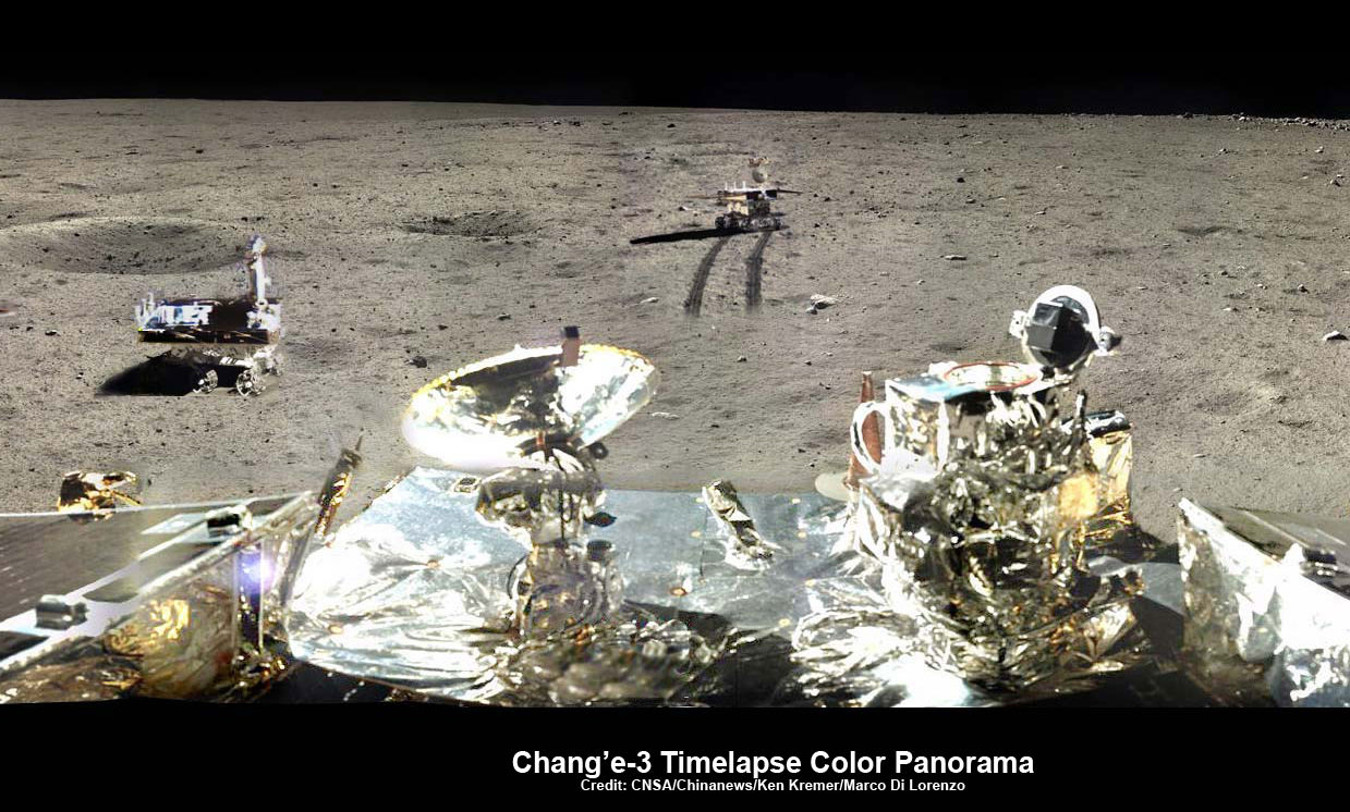
Chang’e-3/Yutu Timelapse Color Panorama This newly expanded timelapse composite view shows China’s Yutu moon rover at two positions passing by crater and heading south and away from the Chang’e-3 lunar landing site forever about a week after the Dec. 14, 2013 touchdown at Mare Imbrium. This cropped view was taken from the 360-degree timelapse panorama. See complete 360 degree landing site timelapse panorama herein and APOD Feb. 3, 2014. Chang’e-3 landers extreme ultraviolet (EUV) camera is at right, antenna at left. Credit: CNSA/Chinanews/Ken Kremer/Marco Di Lorenzo – kenkremer.com. See our complete Yutu timelapse pano at NASA APOD Feb. 3, 2014: http://apod.nasa.gov/apod/ap140203.htm
Chang’e-3/Yutu Timelapse Color Panorama
This newly expanded timelapse composite view shows China’s Yutu moon rover at two positions passing by crater and heading south and away from the Chang’e-3 lunar landing site forever about a week after the Dec. 14, 2013 touchdown at Mare Imbrium. This cropped view was taken from the 360-degree timelapse panorama. See complete 360 degree landing site timelapse panorama herein and APOD Feb. 3, 2014. Chang’e-3 landers extreme ultraviolet (EUV) camera is at right, antenna at left. Credit: CNSA/Chinanews/Ken Kremer/Marco Di Lorenzo – kenkremer.com.
See our complete Yutu timelapse pano at NASA APOD Feb. 3, 2014: http://apod.nasa.gov/apod/ap140203.htm[/caption]
KENNEDY SPACE CENTER, FL – China’s maiden moon rover Yutu awoke from her regular two week long slumber on Friday, March 14, to begin the 4th Lunar Day since the probes history making touchdown on the surface of Earth’s nearest neighbor in mid December 2013.
But the endearing robot is still ailing and suffering from mechanical control issues that popped up in late January 2014 according to Chinese space officials.
The Chang’e-3 mothership lander that deposited Yutu onto the pockmarked lunar surface also awoke two days earlier on Wednesday, March 12.
“Yutu and the lander have restarted their operations and are exploring as scheduled,” according to China’s State Administration of Science, Technology and Industry for National Defence (SASTIND), responsible for executing the Chang’e-3 mission.
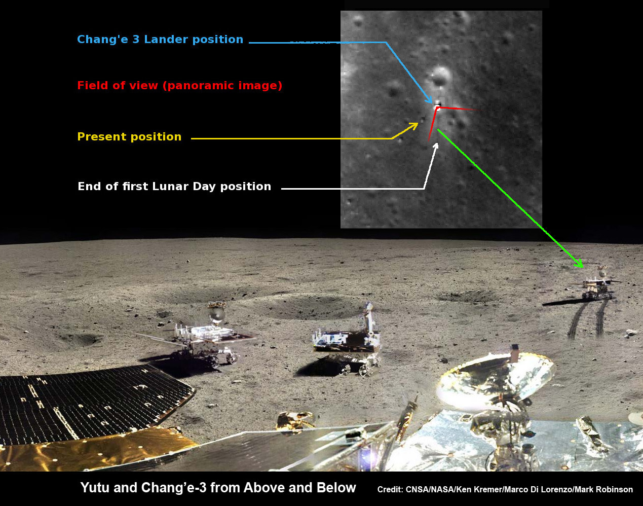
Yutu rover drives around Chang’e-3 lander – from Above And Below. Composite view shows China’s Yutu rover and tracks driving in clockwise direction around Chang’e-3 lander from Above And Below (orbit and surface). The Chang’e-3 timelapse lander color panorama (bottom) and orbital view (top) from NASA’s LRO orbiter shows Yutu rover after it drove down the ramp to the moon’s surface and began driving around the landers right side, passing by craters and heading south on Lunar Day 1. It then moved northwest during Lunar Day 2. Arrows show Yutu’s positions over time. Credit: CNSA/NASA/Ken Kremer/Marco Di Lorenzo/Mark Robinson
Yutu is China’s first ever Moon rover and successfully accomplished a soft landing on the Moon on Dec. 14, 2013, piggybacked atop the Chang’e-3 mothership lander.
However, “the control issues that have troubled Yutu since January remain,” says China’s government owned Xinhua news agency.
The hugely popular ‘Yutu’ rover is still suffering from an inability to maneuver its life giving solar panels. It is also unable to activate its six wheels and move around the surface – as I reported here.
At the time that Yutu’s 2nd Lunar sleep period began on Jan. 25, 2014, Chinese space officials had announced that the robot’s future was in jeopardy after it suffered an unidentified “ mechanical control anomaly” due to the “complicated lunar surface.”
360-degree time-lapse color panorama from China’s Chang’e-3 lander
This new 360-degree time-lapse color panorama from China’s Chang’e-3 lander shows the Yutu rover at five different positions, including passing by crater and heading south and away from the Chang’e-3 lunar landing site forever during its trek over the Moon’s surface at its landing site from Dec. 15-22, 2013 during the 1st Lunar Day. Credit: CNSA/Chinanews/Ken Kremer/Marco Di Lorenzo – kenkremer.com. See our Yutu timelapse pano at NASA APOD Feb. 3, 2014: http://apod.nasa.gov/apod/ap140203.htm
Earlier this month, China announced that “Yutu suffered a control circuit malfunction in its driving unit.”
“The control circuit problem prevented Yutu from entering the second dormancy as planned,” said Ye Peijian, chief scientist of the Chang’e-3 program, in an exclusive interview with Xinhua.
A functioning control circuit is required to lower the rovers mast and protect the delicate components and instruments mounted on the mast from directly suffering from the extremely harsh cold of the Moon’s recurring night time periods.
“Normal dormancy needs Yutu to fold its mast and solar panels,” said Ye according to CCTV, China’s state run broadcaster.
Fortunately, the panoramic camera, radar and other sciene instruments and equipment are functioning normally, says SASTIND.
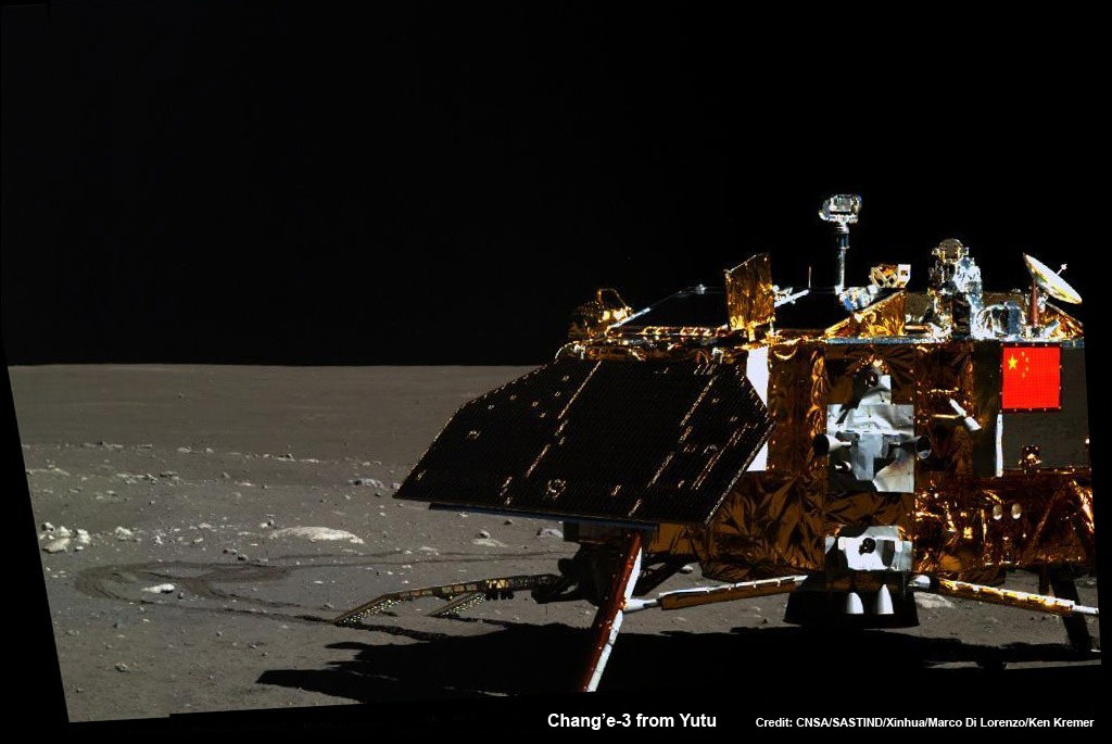
Yutu even snapped at least a pair new images of the lander during Lunar Day 3.
See our mosaic of Yutu’s Lunar Day 3 lander image as well as our the complete 360 degree timelapse color panorama from Lunar Day 1 herein and at NASA APOD on Feb. 3, 2014 – assembled by Marco Di Lorenzo and Ken Kremer.
Mosaic of the Chang’e-3 moon lander and the lunar surface taken by the camera on China’s Yutu moon rover from a position south of the lander during Lunar Day 3. Note the landing ramp and rover tracks at left. Credit: CNSA/SASTIND/Xinhua/Marco Di Lorenzo/Ken Kremer
By reawakening on March 14, the 140 kg robot also survived for its three month design lifetime on the moon.
Yutu’s goal is to accomplish a roving expedition to investigate the moon’s surface composition and natural resources.
So far the 1200 kg Chang’e-3 lander is functioning as planned during its first three lunar days, says SASTIND.
“The lander’s optical telescope, extreme ultraviolet camera and lunar dust measurement device completed scheduled tasks and obtained a large amount of data,” says China’s government owned Xinhua news agency.
China is only the 3rd country in the world to successfully soft land a spacecraft on Earth’s nearest neighbor after the United States and the Soviet Union.
Stay tuned here for Ken’s continuing Chang’e-3, Orion, Orbital Sciences, SpaceX, commercial space, LADEE, Mars and more planetary and human spaceflight news. Learn more at Ken’s upcoming presentations at the NEAF astro/space convention on April 12/13.
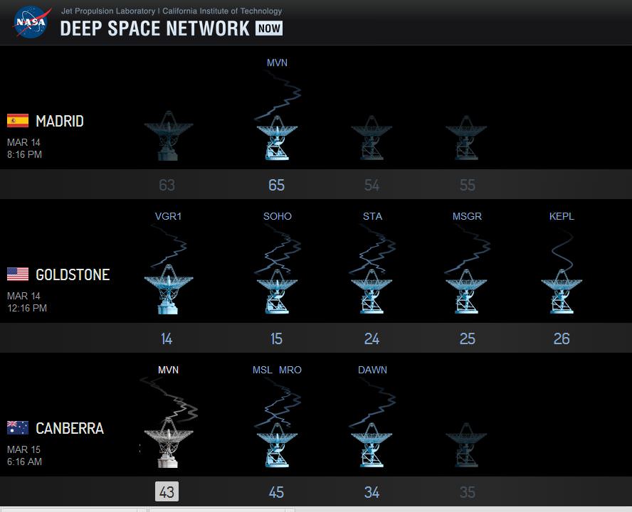
A screenshot of the new Deep Space Network visualization tool from NASA's 'Eyes on the Solar System' simulator.
How do scientists and engineers communicate with their spacecraft? All the robotic missions going to various points in our Solar System wouldn’t be possible if not for the Deep Space Network. And now there’s a fun new tool to watch how that communication works.
DSN Now is a live visualization of NASA’s Deep Space Network usage and which spacecraft the various antennae are talking to.
It shows realtime data of which of the three antenna complexes are being used to communicate with the various missions, how far away the spacecraft are, and various other details about data rates, speeds and modes. DSN Now is from NASA’s wonderful Eyes on the Solar System website (which uses real data to provide simulated 3-D views from of the Solar System). DSN Now came online today, March 14, 2014.
The Deep Space Network is not only used for sending commands and receiving data, but also for orbit determination, which is keeping track of where the spacecraft are with radiometric tracking data so that spacecraft navigators can get probes exactly where the scientists want them to go. The three 70-meter antennas, located at the DSN complexes at Goldstone, California, Madrid, Spain, and Canberra, Australia.