Curiosity Finds Evidence of An Ancient Streambed on Mars

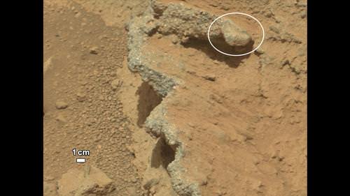
NASA’s Curiosity rover found evidence for an ancient, flowing stream on Mars at a few sites, including the rock outcrop pictured here, which the science team has named “Hottah” after Hottah Lake in Canada’s Northwest Territories. Credit: NASA/JPL/Caltech

The Curiosity rover has come across a place in Gale Crater where ankle-to-hip-deep water once vigorously flowed: an ancient streambed containing evidence of gravel that has been worn by water. At a press briefing today, members of the Mars Science Laboratory team said the rover has found “surprising” outcrops and gravel near the rover landing site that indicate water once flowed in this region, and likely flowed for a long time.

“Too many things that point away from a single burst event,” said Curiosity science co-investigator William Dietrich of the University of California, Berkeley. “I’m comfortable to argue that it is beyond the 1,000 year timescales, even though this is very early on in our findings.”

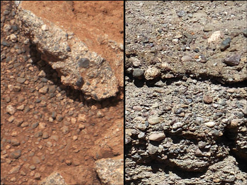
This set of images compares the Link outcrop of rocks on Mars (left) with similar rocks seen on Earth (right). Credit: NASA/JPL/Caltech

From the size of gravel found by the rover, the science team can interpret the water was moving about 1 meter (3 feet) per second, with a depth somewhere between ankle and hip deep.

“Plenty of papers have been written about channels on Mars with many different hypotheses about the flows in them,” said Dietrich. “This is the first time we’re actually seeing water-transported gravel on Mars. This is a transition from speculation about the size of streambed material to direct observation of it.”

What Curiosity found on Mars was described as conglomerate rock made up of water-transported gravels, meaning the gravel is now cemented into a layers of rock, and the sizes and shapes of stones offer clues to the speed and distance of a long-ago stream’s flow.

“The shapes tell you they were transported and the sizes tell you they couldn’t be transported by wind. They were transported by water flow,” said Curiosity science co-investigator Rebecca Williams of the Planetary Science Institute.

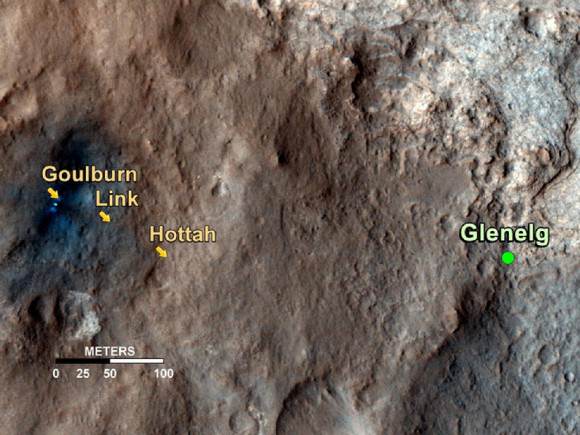
The discovery comes from examining two outcrops, called “Hottah” and “Link,” with the telephoto capability of Curiosity’s mast camera during the first 40 days after landing. Those observations followed up on earlier hints from another outcrop, named Goulburn, which was exposed by thruster exhaust as Curiosity touched down.

“Hottah looks like someone jack-hammered up a slab of city sidewalk, but it’s really a tilted block of an ancient streambed,” said Mars Science Laboratory Project Scientist John Grotzinger of the California Institute of Technology.

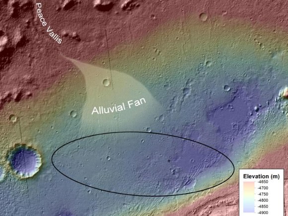
An alluvial fan, or fan-shaped deposit where debris spreads out downslope are usually formed by water, and new observations from Curiosity of rounded pebbles embedded with rocky outcrops provide concrete evidence that water did flow in this region on Mars. Elevation data were obtained from stereo processing of images from the High Resolution Imaging Science Experiment (HiRISE) camera on NASA’s Mars Reconnaissance Orbiter. Image credit: NASA/JPL-Caltech/UofA

Even though the team classified the finding as “surprising,” they later said they actually weren’t too surprised at what they found so early in the mission – just 51 sols, or Martian days, in.

“We are getting better about integrating the orbital data,” said Grotzinger. “We see an alluvial fan and debris flow from orbit, and then see these water-transported pebbles from the ground. This is not rocket science, but shows exactly the reason we chose this landing site, and you build on those foundations you think you are mostly likely to establish. Now we’ll look at more rocks and get more context to recreate the environment in greater detail along with understanding the chemistry of the time to see if this is a place that could be habitable.”

Asked if it was hard to come to consensus on this long-term, quickly flowing water statement, given the large number of scientists involved with the mission, Grotziner said, “Given the evidence we have from orbit that has been analyzed, when we arrive with a robot we can test the hypothesis pretty quickly. If the geological signal for this process is large enough, it is easy to achieve a consensus pretty quickly.”

The finding site lies between the north rim of Gale Crater and the base of Aeolis Mons, or Mount Sharp, a mountain inside the crater. To the north of the crater, a channel named Peace Vallis feeds into the alluvial fan. The abundance of channels in the fan between the rim and conglomerate suggests flows continued or repeated over a long time, not just once or for a few years, the science team said.

But interestingly, the rover has already moved on from this spot, and yesterday took the longest drive yet, of between 52-53 meters, heading towards the Glenelg region where they want to do their first scooping and tests soil samples in Curiosity’s two instruments, SAM (Sample Analysis at Mars) and ChemMin (Chemistry & Mineralogy X-Ray Diffraction/X-Ray Fluorescence Instrument). These two experiments will study powdered rock and soil samples scooped up by the robotic arm.

The Glenelg area marks the intersection of three kinds of terrain: bedrock for drilling, several small craters that may represent an older or harder surface, and also terrain similar to where Curiosity landed, so the science team can do comparisons.

“A long-flowing stream can be a habitable environment,” said Grotzinger. “But it is not our top choice as there might be other places that have preserved organic carbon better than this, and we need to assess the potential for preservation of organics. We’re still going to Mount Sharp, but this is insurance that we have already found our first potentially habitable environment.”

The slope of Aeolis Mons contains clay and sulfate minerals, which have been detected from orbit. This can be good preservers of carbon-based organic chemicals that are potential ingredients for life.

As for what’s next for Curiosity, Grotzinger said they have a couple of targets in the next 2-4 sols, and then they will park for a long period of time, about 2-3 weeks to prepare for reaching Glenelg. “This is such a complex set of processes that have never been done on Mars before, so we are going to be conservative and go slowly to make sure everything is working as it should. Then we’ll go to Glenelg and choose first candidate for drilling.”

This map shows the path on Mars of NASA’s Curiosity rover toward Glenelg. Credit: NASA/JPL/Caltech/University of Arizona

Sources: Press briefing, NASA press release

Paddleboat Mission to Titan Proposed

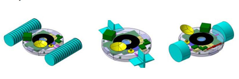
Three concepts for the TALISE boat mission to Titan: screw propelled (left), paddle wheels (center) and inflatable wheels (right). Credit: Urdampilleta, et al.

Is sending a boat to Titan an outlandish idea? Maybe, said a group of European scientists and engineers, but they’re working on a plan. The Titan Lake In-situ Sampling Propelled Explorer (TALISE) proposes a sending an instrument-laden boat-probe to Saturn’s largest moon that could be propelled by paddles, inflatable wheels or screws. The probe would land in the middle of Ligeia Mare – Titan’s biggest lake, near the moon’s north pole — then set sail for the coast, taking scientific measurements along the way.

“The main innovation in TALISE is the propulsion system,” says Igone Urdampilleta from SENER, an engineering company in Spain and a member of the TALISE team. “This allows the probe to move, under control, from the landing site in the lake, to the closest shore. The displacement capability would achieve the obtaining of liquid and solid samples from several scientific interesting locations on Titan’s surface such as the landing place, along the route towards the shore and finally at the shoreline.”

In a presentation at the European Planetary Science Congress on September 27, 2012, the TALISE team says that since Titan has a thick atmosphere, a diameter between that of Earth and the planet Mercury, and a network of seas, lakes and rivers, it is in many respects more like a planet than a moon.

And it’s time to go there and do a little in-situ science. The principle objective of the mission would be to characterize Titan’s environment and the chemical composition of the lakes and terrain.

While the Cassini-Huygens mission landed the Huygens probe on Titan in 2005, it transmitted data for only about 90 minutes after touchdown. The TALISE mission would last six months to a year.

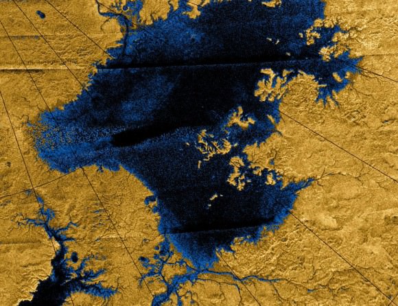
Images from the Cassini mission show river networks draining into the lakes in Titan’s north polar region. Credit: NASA/JPL/USGS

The Cassini orbiter has confirmed that lakes, seas and rivers of liquid hydrocarbons cover much of the Titan’s northern hemisphere, and these hydrocarbons may rain down on the surface, forming the frigid liquid bodies. With surface temperature at -178 degrees Celsius (-289 degrees Fahrenheit), Titan’s environment is too cold for life as we may know it, but its environment, rich in the building blocks of life, is of great interest to astrobiologists, the team said.

“The chemical composition of the lakes of Titan is still not well determined,” the TALISE team wrote in their abstract. “The detection of other compounds and the investigation of influence of both, photochemistry and the atmosphere on the chemical composition of liquids of Titan lakes remain challenging in the absence of in situ measurements. Therefore, it is next step to understand the Titan lakes environment, its relationship with the climate behavior, the surrounding solid substrate and analyze the organic inventory including the possibility of prebiotic compounds.”

The actual configuration of the boat is still under consideration, and they are considering various in-situ propulsion methods through the liquid hydrocarbon seas. In addition to paddle wheels, screw propulsion and inflatable wheels, they are also looking at tank wheels, air propeller, liquid propeller and a hovercraft design.

The TALISE concept is being developed as a partnership between SENER and the Centro de Astrobiología in Madrid, Spain, and the mission is still in the very early stages of feasibility studies and preliminary mission architecture design, but they are hoping to be ready for a future space science mission call for proposals.

Sources: EPSC, TALISE team abstract

Endeavour Departs Kennedy Forever for California Home

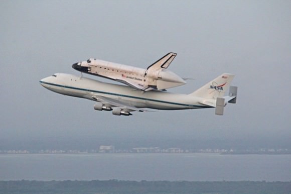
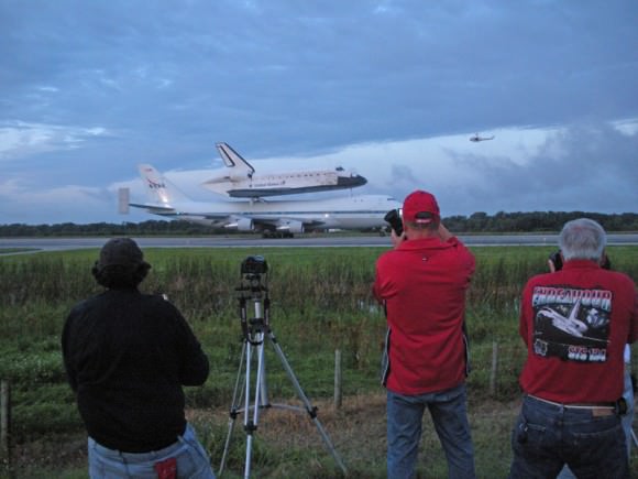
Image caption: Endeavour departs Kennedy Space Center forever on Sept 19 on last flight of NASA’s Space Shuttle Program. Credit: Ken Kremer

Under cloudy skies at first light, Space Shuttle Endeavour departed NASA’s Kennedy Space Center in Florida early Wednesday morning, Sept. 19, at about 7:22 a.m. EDT marking the final flight of NASA’s storied shuttle program.

The 100 ton Endeavour was secured atop NASA’s specially modified 747 Shuttle Carrier Aircraft for the cross-country ferry flight to California and Los Angeles International Airport.

The farewell flight went off without a hitch following two days of weather related delays. The shuttle & 747 Shuttle Carrier Aircraft (SCA) Jumbo Jet were in tip top shape.

Image caption: Endeavour’s Final Takeoff atop modified Boeing 747 from the Kennedy Space Center on Sept. 19 to California home. Credit: Ken Kremer – www.kenkremer.com

Hordes of local spectators and excited tourists from several continents caught a magnificent last glimpse of the piggybacked pair as they flew two looping north-south farewells over the Florida Space Coast making a low pass over nearby beaches, Patrick Air Force Base, Cape Canaveral Air Force Station, Kennedy Space Center Visitor Complex, and the shuttle landing runway at Kennedy before leaving the area to a mix of emotions both happy and sad.

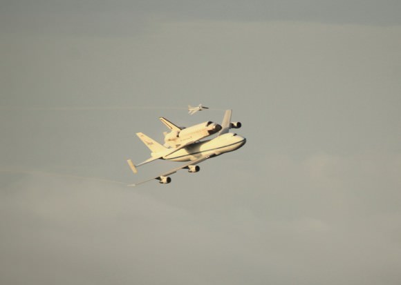
Then all of a sudden after some 25 minutes, the dynamic duo disappeared without warning into the hazy clouds, flying on a north east heading and across the Florida panhandle.

After making low-level passes over NASA’s Stennis Space Center in southwest Mississippi and the Michoud Assembly Facility in New Orleans, Endeavour touched down at the Johnson Space Center at about 10:40 a.m. at Houston’s Ellington Field for a curtailed overnight stay.

Image caption: Endeavour departs Kennedy Space Center on Sept 19 on last flight accompanied by T-38 training jet. Credit: Ken Kremer

21 years after rolling out from the Palmdale assembly facility in California where she was constructed, Endeavour landed at Edwards Air Force Base at 3:50 p.m. EDT today, Sept. 20.

Early Friday morning (Sept. 21), Endeavour and the SCA will take flight on a victory lap initially heading north for low level passes over Sacramento and the San Francisco Bay area including the Golden Gate bridge – akin to the April 2012 flight of Enterprise over NYC. Then the pair will turn south and pass over NASA’s Ames Research Center, Vandenberg Air Force Base and NASA’s Jet Propulsion Laboratory before heading into the Los Angeles area and landing at Los Angeles International Airport.

In October, Endeavour will be towed over 2 days through the streets of Inglewood and Los Angelos to begin a new mission inspiring future explorers at her permanent new home at the California Science Center.

Endeavour was NASA’s youngest orbiter and flew 25 missions and traveled 122,883,151 miles during 299 days in space.

NASA’s trio of shuttle orbiters were forcibly retired in July 2011 following the successful STS-135 mission to the International Space Station.

Ken Kremer

Image caption: Endeavour prepares for final takeoff from the Shuttle Landing Facility at KSC. Credit: Brent Houston

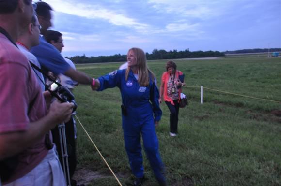
Image caption: STS-130 astronaut Kay Hire greets space enthusiasts at the shuttle landing strip during the flyaway of Endeavour. Credit: Klaus Krueger

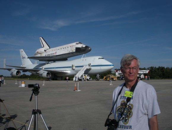
Ken Kremer with Space Shuttle Endeavour and the 747 Shuttle Carrier Aircraft (SCA) at the Shuttle Landing Facility at the Kennedy Space Center for final flyaway departure in September 2012 reporting for Universe Today. Credit: Brent Houston

Gaia Mission Passes Vital Tests

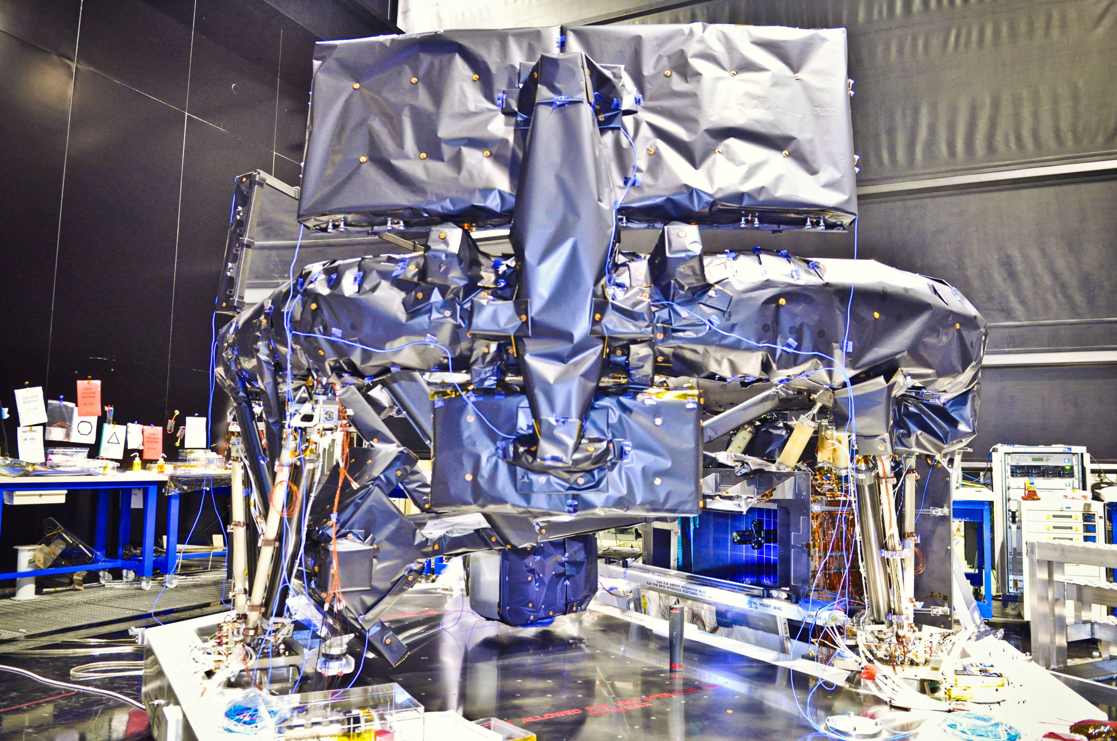
Caption: Fully integrated Gaia payload module with nearly all of the multilayer insulation fabric installed. Credit: Astrium SAS

Earlier this month ESA’s Gaia mission passed vital tests to ensure it can withstand the extreme temperatures of space. This week in the Astrium cleanroom at Intespace in Toulouse, France, had it’s payload module integrated, ready for further testing before it finally launches next year. This is a good opportunity to get to know the nuts and bolts of this exciting mission that will survey a billion stars in the Milky Way and create a 3D map to reveal its composition, formation and evolution.

Gaia will be operating at a distance of 1.5 million km from Earth (at L2 Lagrangian point, which keeps pace with Earth as we orbit the Sun) and at a temperature of -110°C. It will monitor each of its target stars about 70 times over a five-year period, repeatedly measuring the positions, to an accuracy of 24 microarcseconds, of all objects down to magnitude 20 (about 400,000 times fainter than can be seen with the naked eye) This will provide detailed maps of each star’s motion, to reveal their origins and evolution, as well as the physical properties of each star, including luminosity, temperature, gravity and composition.

The service module houses the electronics for the science instruments and the spacecraft resources, such as thermal control, propulsion, communication, and attitude and orbit control. During the 19-day tests earlier this month, Gaia endured the thermal balance and thermal-vacuum cycle tests, held under vacuum conditions and subjected to a range of temperatures. Temperatures inside Gaia during the test period were recorded between -20°C and +70°C.

“The thermal tests went very well; all measurements were close to predictions and the spacecraft proved to be robust with stable behavior,” reports Gaia Project Manager Giuseppe Sarri.

For the next two months the same thermal tests will be carried out on Gaia’s payload module, which contains the scientific instruments. The module is covered in multilayer insulation fabric to protect the spacecraft’s optics and mirrors from the cold of space, called the ‘thermal tent.’

Gaia contains two optical telescopes that can precisely determine the location of stars and analyze their spectra. The largest mirror in each telescope is 1.45 m by 0.5 m. The Focal Plane Assembly features three different zones associated with the science instruments: Astro, the astrometric instrument that detects and pinpoints celestial objects; the Blue and Red Photometers (BP/RP), that determines stellar properties like temperature, mass, age, elemental composition; and the Radial-Velocity Spectrometer (RVS),that measures the velocity of celestial objects along the line of sight.

The focal plane array will also carry the largest digital camera ever built with, the most sensitive set of light detectors ever assembled for a space mission, using 106 CCDs with nearly 1 billion pixels covering an area of 2.8 square metres

After launch, Gaia will always point away from the Sun. L2 offers a stable thermal environment, a clear view of the Universe as the Sun, Earth and Moon are always outside the instruments’ fields of view, and a moderate radiation environment. However Gaia must still be shielded from the heat of the Sun by a giant shade to keep its instruments in permanent shadow. A ‘skirt’ will unfold consisting of a dozen separate panels. These will deploy to form a circular disc about 10 m across. This acts as both a sunshade, to keep the telescopes stable at below –100°C, and its surface will be partially covered with solar panels to generate electricity.

Once testing is completed the payload module will be mated to the service module at the beginning of next year and Gaia will be launched from Europe’s Spaceport in French Guiana at the end of 2013.

Find out more about the mission here

NASA Probes Play the Music of Earth’s Magnetosphere

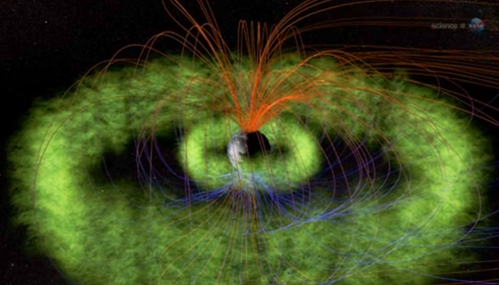
Launched on August 30, 2012, NASA’s twin Radiation Belt Storm Probe (RBSP) satellites have captured recordings of audible-range radio waves emitted by Earth’s magnetosphere. The stream of chirps and whistles heard in the video above consist of 5 separate occurrences captured on September 5 by RBSP’s Electric and Magnetic Field Instrument Suite and Integrated Science (EMFISIS) instrument.

The events are presented as a single continuous recording, assembled by the (EMFISIS) team at the University of Iowa and NASA’s Goddard Space Flight Center.

Called a “chorus”, this phenomenon has been known for quite some time.

“People have known about chorus for decades,” says EMFISIS principal investigator Craig Kletzing of the University of Iowa. “Radio receivers are used to pick it up, and it sounds a lot like birds chirping. It was often more easily picked up in the mornings, which along with the chirping sound is why it’s sometimes referred to as ‘dawn chorus.’”

The radio waves, which are at frequencies that are audible to the human ear, are emitted by energetic particles within Earth’s magnetosphere, which in turn affects (and is affected by) the radiation belts.

The RBSP mission placed a pair of identical satellites into eccentric orbits that will take them from as low as 375 miles (603 km) to as far out as 20,000 miles (32,186 km). During their orbits the satellites will pass through both the stable inner and more variable outer Van Allen belts, one trailing the other. Along the way they’ll investigate the many particles that make up the belts and identify what sort of activity occurs in isolated locations — as well as across larger areas.

Read: New Satellites Will Tighten Knowledge of Earth’s Radiation Belts

Audio Credit: University of Iowa. Visualisation Credit: NASA/Goddard Space Flight Center. (H/T to Peter Sinclair at climatecrocks.com.)

It Only Happens on Mars: Carbon Dioxide Snow is Falling on the Red Planet

Observations by NASA’s Mars Reconnaissance Orbiter have detected carbon-dioxide snow clouds on Mars and evidence of carbon-dioxide snow falling to the surface. Image credit: NASA/JPL-Caltech

In 2008, we learned from the Phoenix Mars lander that it snows in Mars northern hemisphere — perhaps quite regularly – from clouds made of water vapor. But now, Mars Reconnaissance Orbiter data has revealed the clearest evidence yet of carbon-dioxide snowfalls on Mars. Scientists say this is the only known example of carbon-dioxide snow falling anywhere in our solar system.

“These are the first definitive detections of carbon-dioxide snow clouds,” said Paul Hayne from the Jet Propulsion Laboratory, lead author of a new study published in the Journal of Geophysical Research. “We firmly establish the clouds are composed of carbon dioxide — flakes of Martian air — and they are thick enough to result in snowfall accumulation at the surface.”

Scientists have known for decades that carbon-dioxide exists in ice in Mars’ seasonal and permanent southern polar caps. Frozen carbon dioxide, sometimes called “dry ice” here on Earth, requires temperatures of about -125 Celsius (- 193 degrees Fahrenheit), which is much colder than needed for freezing water.

Even though we like to think Mars is a lot like Earth, findings like this remind us that Mars is indeed quite different. But just as the water-based snow falls during the winter in Mars’ northern hemisphere, the CO2 snowfalls occurred from clouds around the Red Planet’s south pole during winter in the southern hemisphere.

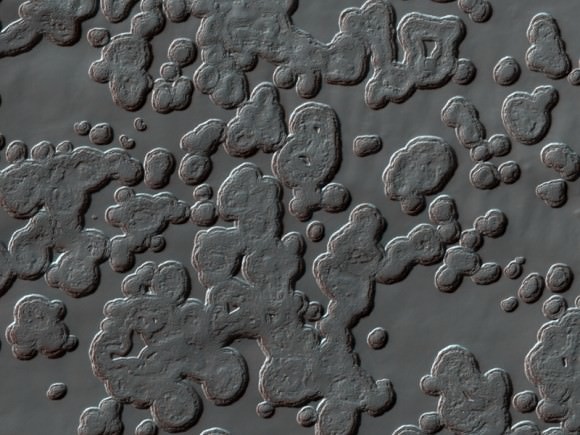
“Swiss Cheese Terrain” on Mars South Pole residual CO2 ice cap. Credit: NASA/JPL/University of Arizona

Hayne and six co-authors analyzed data gained by looking at clouds straight overhead and sideways with the Mars Climate Sounder, one of six instruments on the Mars Reconnaissance Orbiter. This instrument records brightness in nine wavebands of visible and infrared light as a way to examine particles and gases in the Martian atmosphere. The analysis was conducted while Hayne was a post-doctoral fellow at the California Institute of Technology in Pasadena.

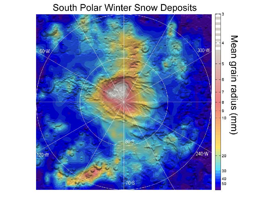
The data provide information about temperatures, particle sizes and their concentrations. The new analysis is based on data from observations in the south polar region during southern Mars winter in 2006-2007, identifying a tall carbon-dioxide cloud about 500 kilometers (300 miles) in diameter persisting over the pole and smaller, shorter-lived, lower-altitude carbon dioxide ice clouds at latitudes from 70 to 80 degrees south.

“One line of evidence for snow is that the carbon-dioxide ice particles in the clouds are large enough to fall to the ground during the lifespan of the clouds,” co-author David Kass of JPL said. “Another comes from observations when the instrument is pointed toward the horizon, instead of down at the surface. The infrared spectra signature of the clouds viewed from this angle is clearly carbon-dioxide ice particles and they extend to the surface. By observing this way, the Mars Climate Sounder is able to distinguish the particles in the atmosphere from the dry ice on the surface.”

Mars’ south polar residual ice cap is the only place on the Red Planet where frozen carbon dioxide persists on the surface year-round. Just how the carbon dioxide from Mars’ atmosphere gets deposited has been in question. It is unclear whether it occurs as snow or by freezing out at ground level as frost. These results show snowfall is especially vigorous on top of the residual cap.

“The finding of snowfall could mean that the type of deposition — snow or frost — is somehow linked to the year-to-year preservation of the residual cap,” Hayne said.

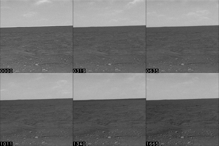
Images from the Phoenix lander show water vapor clouds on Mars are producing snow.  Credit:  NASA/JPL-Caltech/University of Arizona/Texas A&M University
Clouds on Mars are producing snow. Credit: NASA/JPL-Caltech/University of Arizona/Texas A&M University

In 2008, science teams from the Phoenix mission were able to observe water-ice clouds in the Martian atmosphere and precipitation that fell to the ground at night and sublimate into water in the morning. Phoenix scientist James Whiteway and his colleagues said that clouds and precipitation on Mars play a role in the exchange of water between the ground and the atmosphere and when conditions are right, snow falls regularly on Mars.

“Before Phoenix we did not know whether precipitation occurs on Mars,” Whiteway said. “We knew that the polar ice cap advances as far south as the Phoenix site in winter, but we did not know how the water vapor moved from the atmosphere to ice on the ground. Now we know that it does snow, and that this is part of the hydrological cycle on Mars.”

It will be interesting to follow up on this discovery and learn more about Mars CO2 cycle and how it might affect the Martian atmosphere and surface processes.

Source: NASA

JPL’s Torture Chamber for Spacecraft

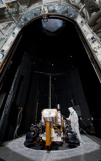
The Mars Science Laboratory rover, Curiosity being tested under Martian conditions in JPL’s space simulator on March 8, 2011. Credit: NASA/JPL-Caltech

This is a place where engineers inflict all sorts of cruelty. It’s also a National Historic Landmark that is now 50 years old. What is it? The Jet Propulsion Laboratory’s Space Simulator. While the name sounds like it could be a video game or virtual reality trainer, it actually is the place where spacecraft go to see if they’ve the right stuff to survive the harsh environment in space.

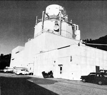
Known as the “25-Foot Space Simulator,” it is capable of producing true interplanetary conditions such as extreme cold, high vacuum, and intense solar radiation that is big enough for most spacecraft to fit inside.

Exterior View of Twenty-Five-Foot Space Simulator, in 1983. Credit: NASA/JPL.

Just like the feared simulations that astronauts go through during training for a spaceflight, where Sim-Sups (Simulation Supervisors) conjure up all sorts of scenarios where everything that can go wrong does, the Space Simulator allows engineers to test the complete spacecraft in its flight configuration for most any type of conditions, searching for any problems imaginable.

Over the years spacecraft tested in this facility include the Ranger, Surveyor, Mariner, and Voyager spacecraft and recently, the Curiosity rover took its turn inside this torture chamber.

Doug Smith from Caltech’s Engineering & Science magazine calls it the Ultimate Evil Tanning Bed — expressly designed to deliver a fatal sunburn to anything placed inside.

The Space Simulator chamber is a stainless-steel cylindrical vessel 8.23 meters (27 feet) in diameter and 26 meters (85 feet) high. The walls and floor are lined with thermally opaque aluminum cryogenic shrouds that can deliver a temperature range of -195° to 93° C ( -320° to +200°F) by liquid or gaseous nitrogen. The solar simulation system consists of an array of 37 xenon 20- to 30-kilowatt compact arc lamps that can produce a variety of beam sizes and intensities. If your spacecraft is going to be seared by the Sun at Mercury or be subject to the freezing temperatures in the Kuiper Belt, this facility can test if every bolt, wire, switch, solder point and component can survive.

Once a spacecraft is put inside the chamber, it takes about 75 minutes to get the conditions to the desired levels, and depending on how quickly the engineers want to see how their spacecraft fared, test conditions can be terminated and access provided to the test item in about 2-1/2 hours.

There’s even a setting for geosynchronous orbit simulation that can test declination angle change and much more, all in a vacuum environment.

The facility’s construction started in 1961 and was completed in 1962 at a cost of $4 million.

The first spacecraft to submit to the torture chamber’s extremes was the Mariner 1 spacecraft that was headed to Venus. It passed the torture chamber’s test, but unfortunately the spacecraft had to be destroyed by a Range Safety officer within minutes after it veered off-course during launch on July 22, 1962 due to a defective signal from the Atlas launch vehicle and a bug in the program equations of the ground-based guiding computer. (The Space Simulator just can’t test for problems like that, regrettably.)

But, JPL had already built an identical spacecraft and Mariner 2 launched a month later on August 27, 1962, sending it on a 3½-month flight to Venus.

In the 50 years the Space Simulator has been in operation, every spacecraft built at JPL has been subject to the torture chamber before heading out to the real torture of the harsh space environment.

“It’s a rare thing when a spacecraft goes into the simulator and the engineers don’t learn something important and modify the design to work better,” saids Andrew Rose, the technical manager for JPL’s Environmental Test Laboratory group.

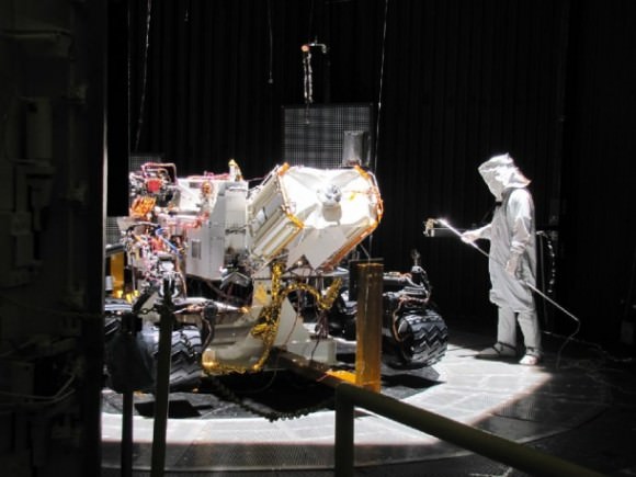
The Curiosity rover inside the Space Simulator. Credit: NASA/JPL

Over the years, the simulator has been upgraded to provide all sorts of environments, and earlier this year, the Curiosity rover took its turn inside, being sealed in a near-vacuum environment, with temperature cooled to – 130° C (-202 ° F) with the giant light panels simulating the sparse Mars’ sunshine and the various radiation intensities found on Mars.

Even more evils await future spacecraft that will be tested in JPL’s Space Simulator.

This article was updated on 9/8/2012

Sources: Caltech, National Park Service

Bradbury Landing on Mars Chronicled in 3-D

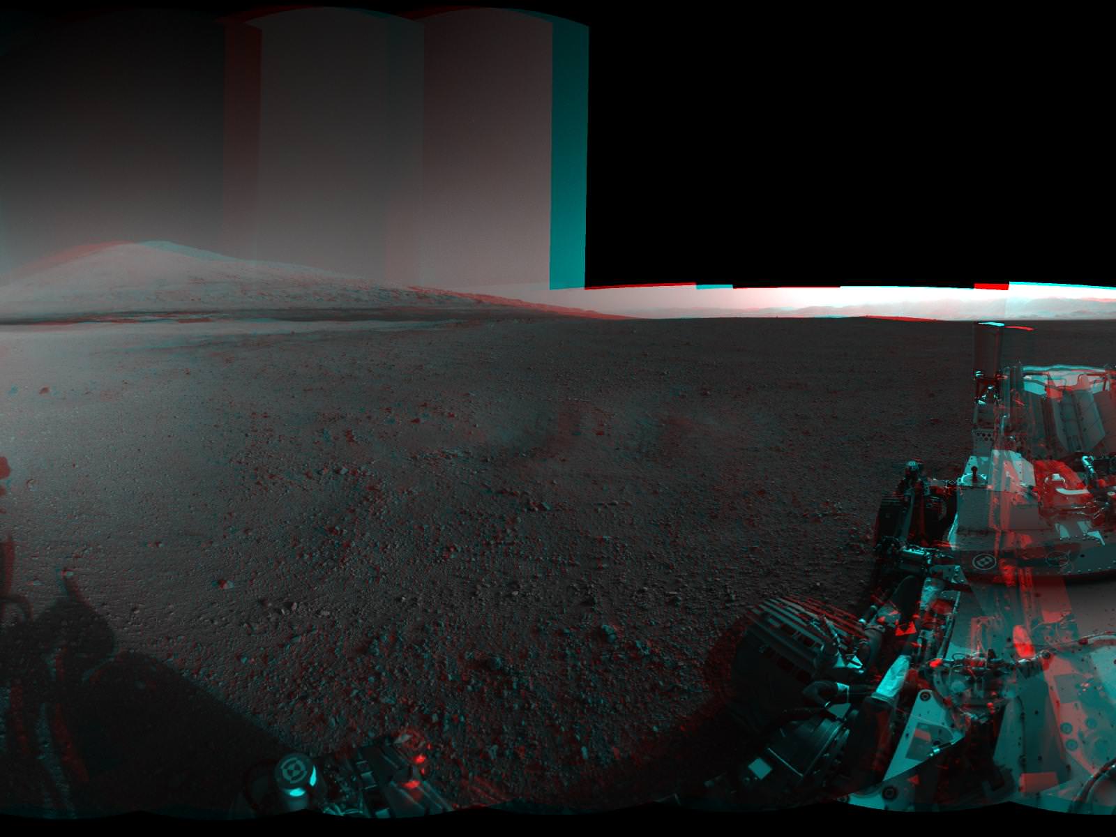
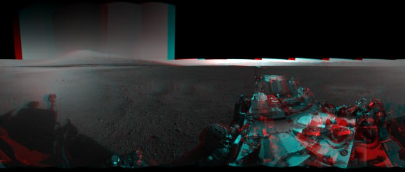
Image Caption:3-D View from Bradbury Landing- from Navcam cameras.. See the full panorama below. Credit: NASA/JPL-Caltech

Now you can enjoy the thrills of Curiosity’s touchdown site at Bradbury Landing as if you there – chronicled in stunning 3 D !! Check out this glorious 360-degree stereo panorama just released by JPL.

The pano was assembled by JPL from individual right and left eye images snapped by the rover’s mast mounted navigation cameras on sols 2 and 12 of the mission – Aug. 8 and 18, 2012.

So whip out your handy-dandy, red-blue (cyan) anaglyph glasses and start exploring the magnificent home of NASA’s newest Mars rover inside Gale Crater.

Image Caption: Complete 360 degree Panoramic 3-D View from Bradbury Landing by NASA’s Curiosity Mars rover. Credit: NASA/JPL-Caltech

The mosaic shows Curiosity’s eventual mountain destination – Mount Sharp – to its visible peak at the right, as well as the eroded rim of Gale Crater and a rover partial self portrait. Curiosity cannot see the actual summit from the floor of Gale Crater at Bradbury landing.

In about a year, the 1 ton behemoth will begin climbing up the side of Mount Sharp – a layered mountain some 3.4 miles (5.5 kilometers) high that contains deposits of hydrated minerals.

Curiosity will investigate and sample soils and rocks with her powerful suite of 10 state of the art science instruments.

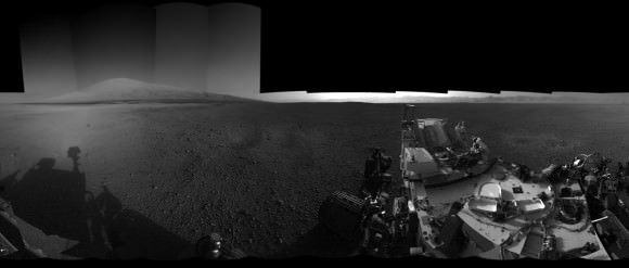
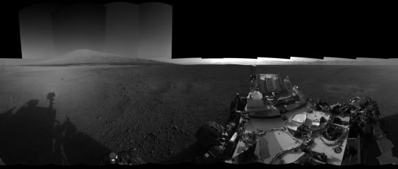
See below JPL’s individual right and left eye pano’s from which the 3-D mosaic was created.

Image Caption: Complete 360 degree Panoramic left eye View from Bradbury Landing by NASA’s Curiosity Mars rover – from Navcam cameras. Credit: NASA/JPL-Caltech

Image Caption: Complete 360 degree Panoramic right eye View from Bradbury Landing by NASA’s Curiosity Mars rover- from Navcam cameras. Credit: NASA/JPL-Caltech

The rover has now departed Bradbury landing and begun her long Martian Trek on an easterly path to Glenelg – her first stop designated for a lengthy science investigation.

Glenelg lies at the intersection of three distinct types of geologic terrain.

So far Curiosity has driven 358 feet (109 meters) and is in excellent health.

Ken Kremer

Mars Trek begins for Curiosity

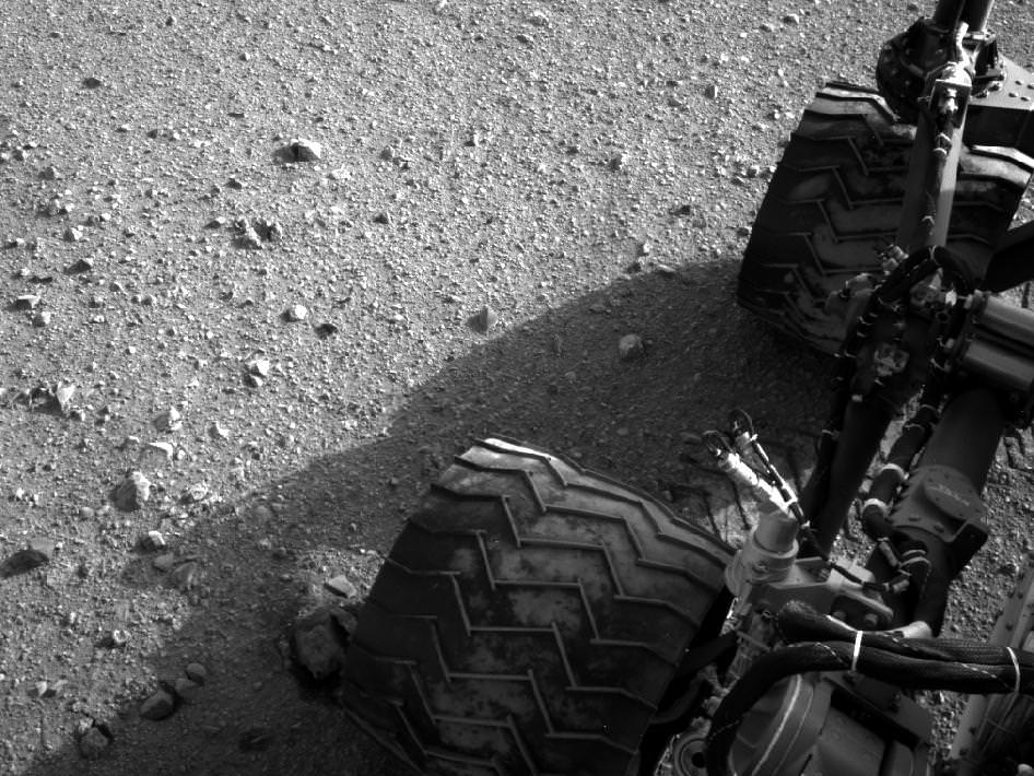
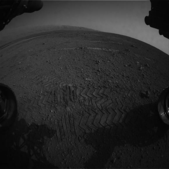
Image Caption: Martian Soil caked on Curiosity’s right middle and rear wheels after Sol 22 Drive. Credit: NASA/JPL-Caltech

Mars Trek has begun for NASA’s Curiosity rover. The mega rover has departed from her touchdown vicinity at “Bradbury Landing” and set off on a multi-week eastwards traverse to her first science target which the team has dubbed “Glenelg”

Glenelg lies about a quarter mile (400 meters) away and the car-sized rover drove about 52 feet (16 meters) on Tuesday, Aug 28 or Sol 22 of the mission.

The science team selected Glenelg as the first target for detailed investigation because it sits at the intersection of three types of geologic terrain, affording the researchers the chance to get a much more comprehensive look at the diversity of geology inside the Gale Crater landing site.

The Sol 22 drive was the third overall for Curiosity and the farthest so far. At this new location, some 33 feet ( 10 m) from Bradbury Landing , the Mastcam color camera is collecting high resolution images to create a 3 D map of features off in the distance that will aid the rover drivers in planning a safe traverse route.

“This drive really begins our journey toward the first major driving destination, Glenelg, and it’s nice to see some Martian soil on our wheels,” said mission manager Arthur Amador of NASA’s Jet Propulsion Laboratory in Pasadena, Calif. “The drive went beautifully, just as our rover planners designed it.”

In about a week, the science team plans to deploy the 7 ft (2.1 meter) long robotic arm and test the science instruments in the turret positioned at the terminus of the arm.

“We are on our way, though Glenelg is still many weeks away,” said Curiosity Project Scientist John Grotzinger of the California Institute of Technology in Pasadena. “We plan to stop for just a day at the location we just reached, but in the next week or so we will make a longer stop.”

Perhaps in about a year or so, Curiosity will reach the base of Mount Sharp, her ultimate destination, and begin climbing up the side of the 3.6 mile (5.5 km) high mound in search of hydrated minerals that will shed light on the duration of Mars watery past.

The goal is to determine if Mars ever had habitats capable of supporting microbial life in the past or present during the 2 year long primary mission phase. Curiosity is equipped with a sophisticated array of 10 state of the art science instruments far beyond any prior rover.

Ken Kremer

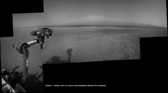
Image Caption: Curiosity Points to her ultimate drive destination – Mount Sharp – with unstowed robotic arm on Aug. 20. This navigation camera (Navcam) mosaic was assembled from images on multiple Sols. Curiosity will search for hydrated minerals using the robotic arm and a neutron detector on the body. Image stitching and processing by Ken Kremer and Marco Di Lorenzo. Featured at APOD on 27 Aug 2012. Credit: NASA/JPL-Caltech/Ken Kremer/Marco Di Lorenzo

Hot Dog! WISE Finds a Bounty of Black Holes

From a NASA press release:

NASA’s Wide-field Infrared Survey Explorer (WISE) mission has led to a bonanza of newfound supermassive black holes and extreme galaxies called hot DOGs, or dust-obscured galaxies.

Images from the telescope have revealed millions of dusty black hole candidates across the universe and about 1,000 even dustier objects thought to be among the brightest galaxies ever found. These powerful galaxies, which burn brightly with infrared light, are nicknamed hot DOGs.

“WISE has exposed a menagerie of hidden objects,” said Hashima Hasan, WISE program scientist at NASA Headquarters in Washington. “We’ve found an asteroid dancing ahead of Earth in its orbit, the coldest star-like orbs known and now, supermassive black holes and galaxies hiding behind cloaks of dust.”

WISE scanned the whole sky twice in infrared light, completing its survey in early 2011. Like night-vision goggles probing the dark, the telescope captured millions of images of the sky. All the data from the mission have been released publicly, allowing astronomers to dig in and make new discoveries.

The latest findings are helping astronomers better understand how galaxies and the behemoth black holes at their centers grow and evolve together. For example, the giant black hole at the center of our Milky Way galaxy, called Sagittarius A*, has 4 million times the mass of our sun and has gone through periodic feeding frenzies where material falls towards the black hole, heats up and irradiates its surroundings. Bigger central black holes, up to a billion times the mass of our sun, may even shut down star formation in galaxies.

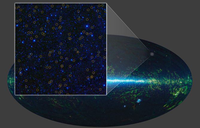
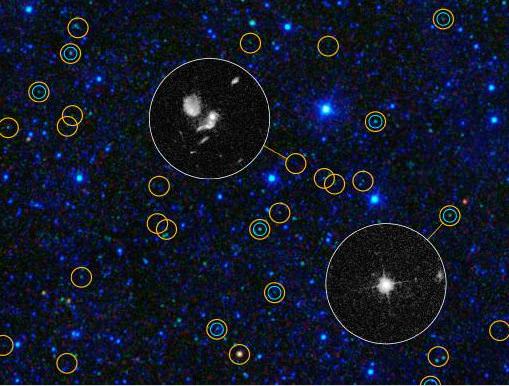
In one study, astronomers used WISE to identify about 2.5 million actively feeding supermassive black holes across the full sky, stretching back to distances more than 10 billion light-years away. About two-thirds of these objects never had been detected before because dust blocks their visible light. WISE easily sees these monsters because their powerful, accreting black holes warm the dust, causing it to glow in infrared light.

This zoomed-in view of a portion of the all-sky survey from WISE shows a collection of quasar candidates. Image credit: NASA/JPL-Caltech/UCLA

“We’ve got the black holes cornered,” said Daniel Stern of NASA’s Jet Propulsion Laboratory, Pasadena, Calif., lead author of the WISE black hole study and project scientist for another NASA black-hole mission, the Nuclear Spectroscopic Telescope Array (NuSTAR). “WISE is finding them across the full sky, while NuSTAR is giving us an entirely new look at their high-energy X-ray light and learning what makes them tick.”

In two other WISE papers, researchers report finding what are among the brightest galaxies known, one of the main goals of the mission. So far, they have identified about 1,000 candidates.

These extreme objects can pour out more than 100 trillion times as much light as our sun. They are so dusty, however, that they appear only in the longest wavelengths of infrared light captured by WISE. NASA’s Spitzer Space Telescope followed up on the discoveries in more detail and helped show that, in addition to hosting supermassive black holes feverishly snacking on gas and dust, these DOGs are busy churning out new stars.

“These dusty, cataclysmically forming galaxies are so rare WISE had to scan the entire sky to find them,” said Peter Eisenhardt, lead author of the paper on the first of these bright, dusty galaxies, and project scientist for WISE at JPL. “We are also seeing evidence that these record setters may have formed their black holes before the bulk of their stars. The ‘eggs’ may have come before the ‘chickens.'”

More than 100 of these objects, located about 10 billion light-years away, have been confirmed using the W.M. Keck Observatory on Mauna Kea, Hawaii, as well as the Gemini Observatory in Chile, Palomar’s 200-inch Hale telescope near San Diego, and the Multiple Mirror Telescope Observatory near Tucson, Ariz.

The WISE observations, combined with data at even longer infrared wavelengths from Caltech’s Submillimeter Observatory atop Mauna Kea, revealed that these extreme galaxies are more than twice as hot as other infrared-bright galaxies. One theory is their dust is being heated by an extremely powerful burst of activity from the supermassive black hole.

“We may be seeing a new, rare phase in the evolution of galaxies,” said Jingwen Wu of JPL, lead author of the study on the submillimeter observations. All three papers are being published in the Astrophysical Journal.

The three technical journal articles, including PDFs, can be found at http://arxiv.org/abs/1205.0811, http://arxiv.org/abs/1208.5517 and http://arxiv.org/abs/1208.5518 .

Lead image caption: With its all-sky infrared survey, NASA’s Wide-field Infrared Survey Explorer, or WISE, has identified millions of quasar candidates. Image credit: NASA/JPL-Caltech/UCLA