Curiosity Sends Back Incredible Hi-Res Views of Mt. Sharp

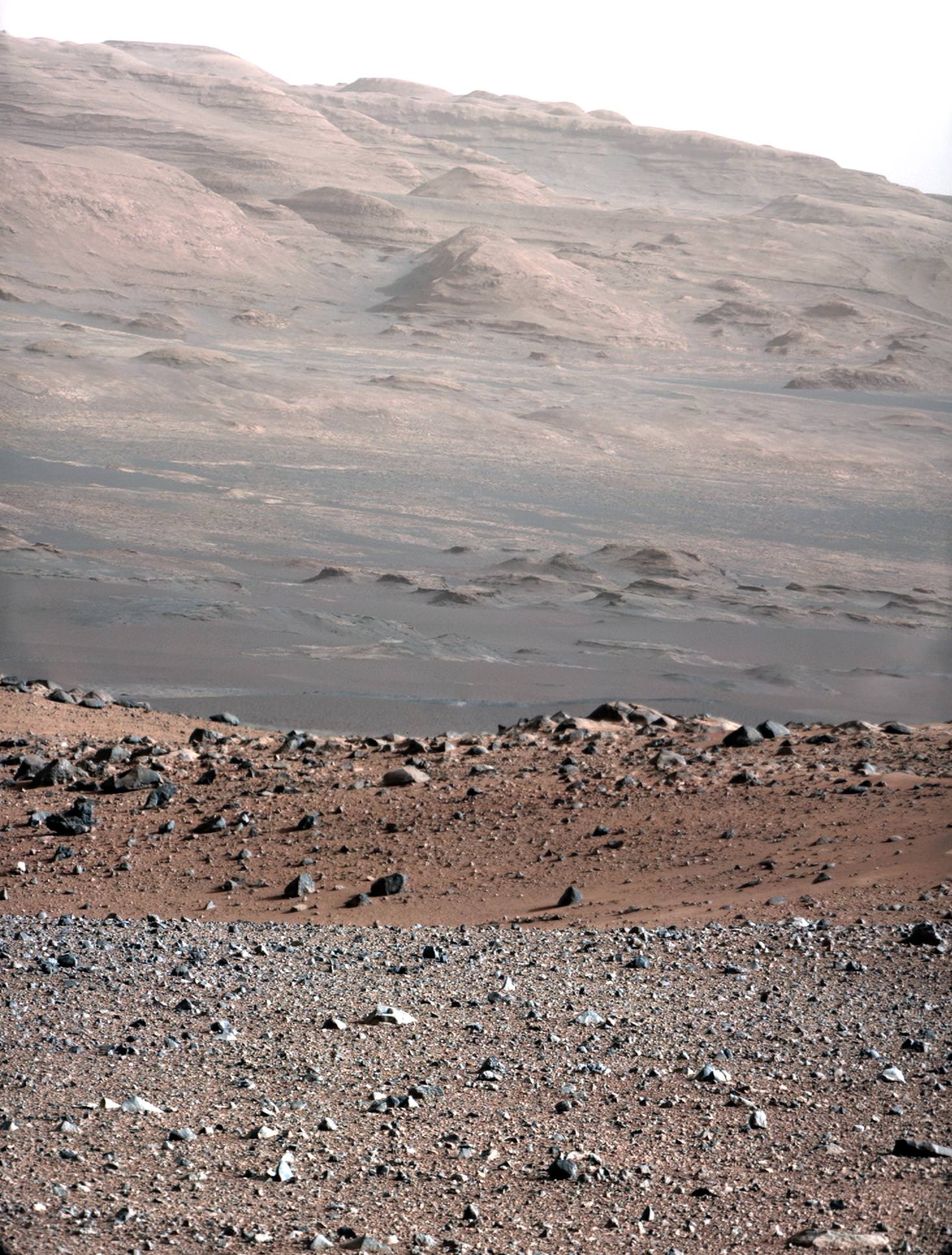
Wow — what a view! This image, released today, is a high-resolution shot of the Curiosity rover’s ultimate goal: the stratified flanks of Gale Crater’s 3.4-mile (5.5-km) high central peak, Mount Sharp. The image was taken with Curiosity’s 100mm telephoto Mastcam as a calibration test… if views like this are what we can expect from the MSL mission, all I can say is (and I’ve said it before) GO CURIOSITY!


“This is an area on Mount Sharp where Curiosity will go,” said Mastcam principal investigator Michael Malin of Malin Space Science Systems. “Those layers are our ultimate objective. The dark dune field is between us and those layers. In front of the dark sand you see redder sand, with a different composition suggested by its different color. The rocks in the foreground show diversity — some rounded, some angular, with different histories. This is a very rich geological site to look at and eventually to drive through.”

Read more: Take a Trip to Explore Gale Crater

The gravel-strewn region in the foreground is Curiosity’s immediate landing area. Then the ground dips into a low depression called a swale, then rises up again to the edge of a crater that’s rimmed with larger rocks. Quite a bit beyond that (about 2.2 miles/3.7 km away) are fields of dunes composed of darker material, and then the hummocky base of Mount Sharp itself begins to rise up about 3.4 miles (5.5 km) in the distance.

The topmost ridges of Mount Sharp visible above are actually 10 miles (16.2 km) away.

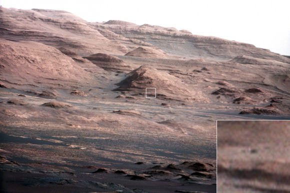
A crop of the full-size image shows a large rock at the foot of a knoll that’s about the same size as Curiosity (which is this big compared to a person and previous rovers):

The rocky mound just behind the boulder in that image is itself about 1,000 feet (300 meters) across and 300 feet (100 meters) high. Gale Crater isn’t a place for a faint-hearted rover!

The colors have been modified from the original image in order to help better discern landforms and differences in surface materials. Here, the images look more like what we’d see under natural Earthly lighting.

Curiosity already is returning more data from the Martian surface than have all of NASA’s earlier rovers combined.

“We have an international network of telecommunications relay orbiters bringing data back from Curiosity,” said JPL’s Chad Edwards, chief telecommunications engineer for NASA’s Mars Exploration Program. “Curiosity is boosting its data return by using a new capability for adjusting its transmission rate.”

See more images from Curiosity here, and keep up to date on the mission at the MSL website here.

“The knowledge we hope to gain from our observation and analysis of Gale Crater will tell us much about the possibility of life on Mars as well as the past and future possibilities for our own planet. Curiosity will bring benefits to Earth and inspire a new generation of scientists and explorers, as it prepares the way for a human mission in the not too distant future.”

– NASA Administrator Charles Bolden in a message transmitted to the Curiosity rover and then back to Earth, August 27, 2012

Images: NASA/JPL-Caltech

Neil Armstrong; 1st Human on the Moon – Apollo 11, Tributes and Photo Gallery

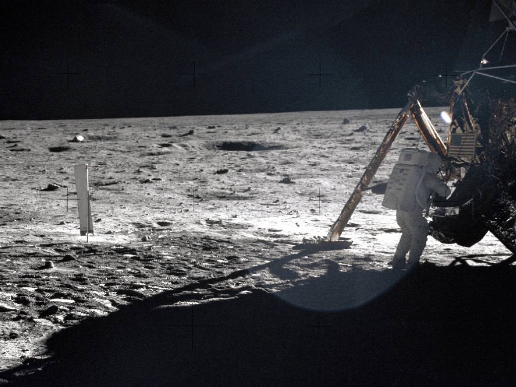
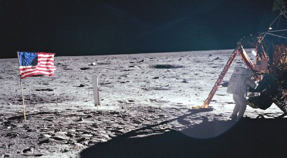
Image Caption: On the Lunar Surface – Apollo 11 astronauts trained on Earth to take individual photographs in succession in order to create a series of frames that could be assembled into panoramic images. This frame from fellow astronaut Buzz Aldrin’s panorama of the Apollo 11 landing site is the only good picture of mission commander Neil Armstrong on the lunar surface. Credit: NASA

In memory of Neil Armstrong, First Man to set foot on the Moon, here’s a summary of Apollo 11 highlights and a collection of some tributes and photos to celebrate his life and the indelible inspiration he gave to current generations and all those yet to come to take up the noble torch for science and exploration. He became an everlasting icon for the ages when he took, “one giant leap for mankind”, and accomplished one of the greatest feats in human history.

Armstrong passed away at age 82 on Saturday, August 25, 2012 due to complications from heart bypass surgery.

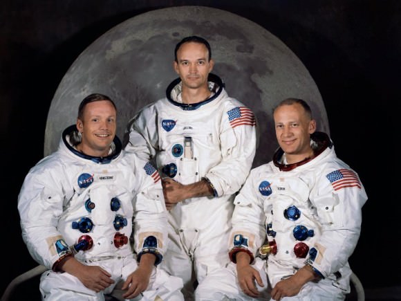
Neil Armstrong was the commander of the three man crew of Apollo 11, which included Buzz Aldrin and Michael Collins.

Apollo 11 Crew. The Apollo 11 lunar landing mission crew, pictured from left to right, Neil A. Armstrong, commander; Michael Collins, command module pilot; and Edwin E. Aldrin Jr., lunar module pilot. Credit: NASA

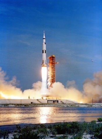
The trio blasted off on their bold, quarter of a million mile moon mission from Cape Canaveral, Florida on July 16, 1969 to fulfill the lunar landing quest set by President John F. Kennedy early in the decade.


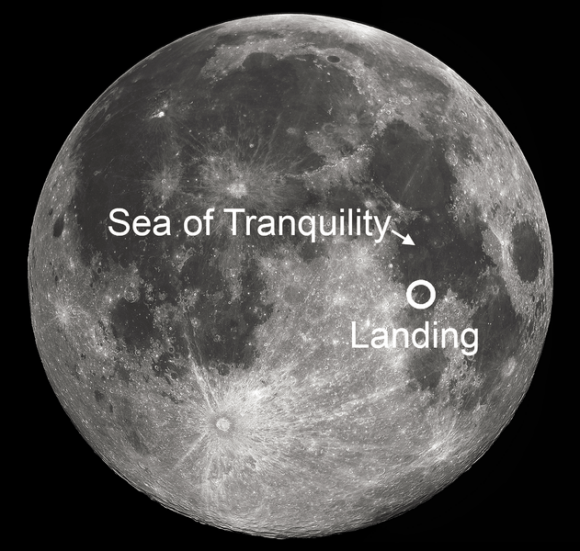
Armstrong and Aldrin safely touched down at the Sea of Tranquility on the lunar surface on July 20, 1969 as hundreds of millions across the globe watched in awe and united in purpose.

“Houston, Tranquility Base here. The Eagle has landed !,” Armstrong called out and emotional applause erupted at Mission Control – “You got a bunch of guys about to turn blue.”

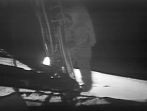
Armstrong carried all of humanity with him when he stepped off the footpad of NASA’s Apollo 11 Lunar Module and became the first representative of the human species to walk on the surface of another celestial body.

His first immortal words,

“That’s one small step for [a] man, one giant leap for mankind.”

During their 2 ½ hours moonwalk Armstrong and Aldrin unveiled a plaque on the side of the lunar module. Armstrong read the words;

“Here men from the planet Earth first set foot upon the moon. July 1969 A.D. We came in peace for all mankind.”

The duo collected about 50 pounds (22 kg) of priceless moon rocks and set out the first science experiments placed by people on another world.

Altogether Armstrong and Aldrin spent about 21 hours on the moon’s surface. Then they said goodbye to the greatest adventure and fired up the LM ascent engine to rejoin Michael Collins circling above in the Apollo 11 Command Module.

Tributes to Armstrong have been pouring in – He is often described as a reluctant hero who gave credit to others.

“Armstrong, the lunar Adam,” wrote Virginia Adams

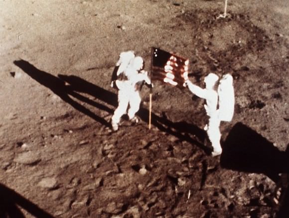
Armstrong and Aldrin plant the US flag on the Lunar Surface, July 1969. Credit: NASA

In a statement, NASA Administrator Charles Bolden said in part,

“As long as there are history books, Neil Armstrong will be included in them, remembered for taking humankind’s first small step on a world beyond our own.

“Besides being one of America’s greatest explorers, Neil carried himself with a grace and humility that was an example to us all. When President Kennedy challenged the nation to send a human to the moon, Neil Armstrong accepted without reservation.

“As we enter this next era of space exploration, we do so standing on the shoulders of Neil Armstrong. We mourn the passing of a friend, fellow astronaut and true American hero.”

Armstrong’s family released a statement that said in part;

“We are heartbroken to share the news that Neil Armstrong has passed away following complications resulting from cardiovascular procedures.

“Neil was our loving husband, father, grandfather, brother and friend.

“Neil Armstrong was also a reluctant American hero who always believed he was just doing his job. He served his Nation proudly, as a navy fighter pilot, test pilot, and astronaut. He also found success back home in his native Ohio in business and academia, and became a community leader in Cincinnati.

“For those who may ask what they can do to honor Neil, we have a simple request. Honor his example of service, accomplishment and modesty, and the next time you walk outside on a clear night and see the moon smiling down at you, think of Neil Armstrong and give him a wink.”

“He was the best, and I will miss him terribly,” said Michael Collins, Apollo 11 command module pilot.

Buzz Aldrin, Apollo 11 lunar module pilot, released a statement that said in part,

“I am very saddened to learn of the passing of Neil Armstrong today. Neil and I trained together as technical partners but were also good friends who will always be connected through our participation in the Apollo 11 mission. Whenever I look at the moon it reminds me of the moment over four decades ago when I realized that even though we were farther away from earth than two humans had ever been, we were not alone. Virtually the entire world took that memorable journey with us.”

More photos of Neil Armstrong and crew at NASA here

Ken Kremer

Armstrong training on an X-15. Credit: NASA

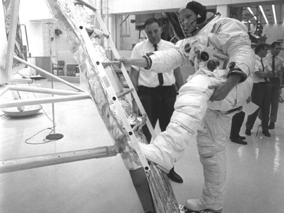
Training for Apollo 11 on the Lunar Module. Credit: NASA

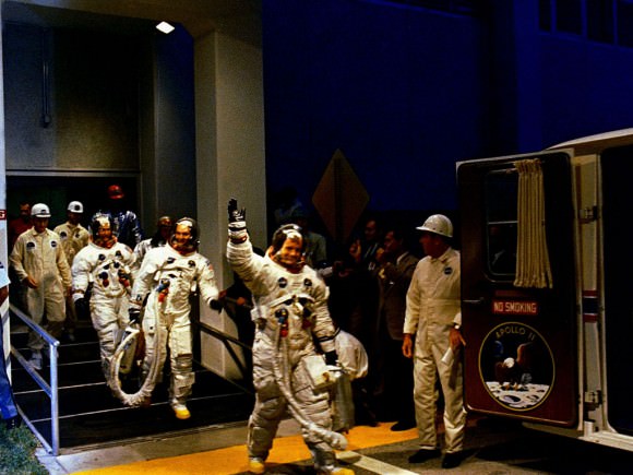
The Apollo 11 crew leaves Kennedy Space Center’s Manned Spacecraft Operations Building during the pre-launch countdown. Mission commander Neil Armstrong, command module pilot Michael Collins, and lunar module pilot Buzz Aldrin prepare to ride the special transport van to Launch Complex 39A where their spacecraft awaited them. Liftoff occurred at 9:32 a.m. EDT, July 16, 1969. Credit: NASA

Apollo 11 liftoff from Pad 39 at the Kennedy Space Center on July 16, 1969. Credit: NASA

Neil Armstrong about to become the first person to set foot on the lunar surface -TV camera view. Credit: NASA

What Are The Radiation Belts?

NASA’s twin Radiation Belt Storm Probe (RBSP) satellites, scheduled to launch from Cape Canaveral Friday, August 24* at 4:08 a.m. ET, will enter into an eccentric orbit around our planet, repeatedly passing through both of the Van Allen radiation belts that surround Earth like enormous high-intensity particle filled inner tubes. The plasma contained within these belts can affect satellites, spacecraft and communication here on Earth, and are affected in turn by outbursts of solar energy from the Sun — especially during periods of solar maximum. But how do these invisible yet powerful radiation belts actually work, and how will two six-foot-wide satellites help us learn more about them? Watch the video.

(And then read more here.)

Video: NASA

*UPDATE: After several delays due to weather and technical issues, the RBSP mission successfully launched on Thursday, August 30.

Video: What Would Mars Look Like to an Astronaut in Orbit?

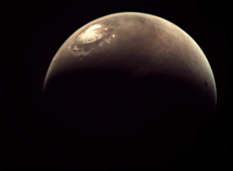
Image of Mars from Mars Express. Credit: ESA

Future human Mars mission preview! The team from Mars Express put this great video together which shows what Mars looks like from above, during an elliptical orbit. They created it using 600 individual still images captured by the Visual Monitoring Camera (VMC), and it shows the view from a visiting spacecraft’s slow descent from high above the planet, then speeds up during closest approach, and then slows down again as the orbital distance increases.

A Mars Express VMC camera image of Mars from May, 2012. Credit: ESA

Visible are giant Martian volcanoes, a quick glimpse of the ice-covered South Pole, and Mars terminator as day turns to night. Then quickly daylight returns, and then the visitor sees the North Pole, followed by the long climb away from the planet over the equator. Finally, at the end of the movie — look closely! –the disk of Phobos can be seen crossing over Mars.

The VMC is being used almost like a Mars webcam! It consists of a small CMOS-based optical camera, which can be fitted with an on-pixel RGB color filter for color images. So, it is basically an ordinary camera, but it is in an extraordinary place! It originally provided simple, low-tech images of Beagle lander separation — a mission which, unfortunately failed and crashed. But the VMC has been resurrected to provide views of the Red Planet. It’s not a scientific instrument, but it does provide fantastic views of Mars – including crescent views of the planet not obtainable from Earth.

The images used here were taken during Mars Express’ 8,194th orbit of Mars on May 27, 2010 between 02:00 and 09:00 UTC (04:00-11:00 CEST).

More info on VMC.

Curiosity’s Sundial Carries a Message of Hope

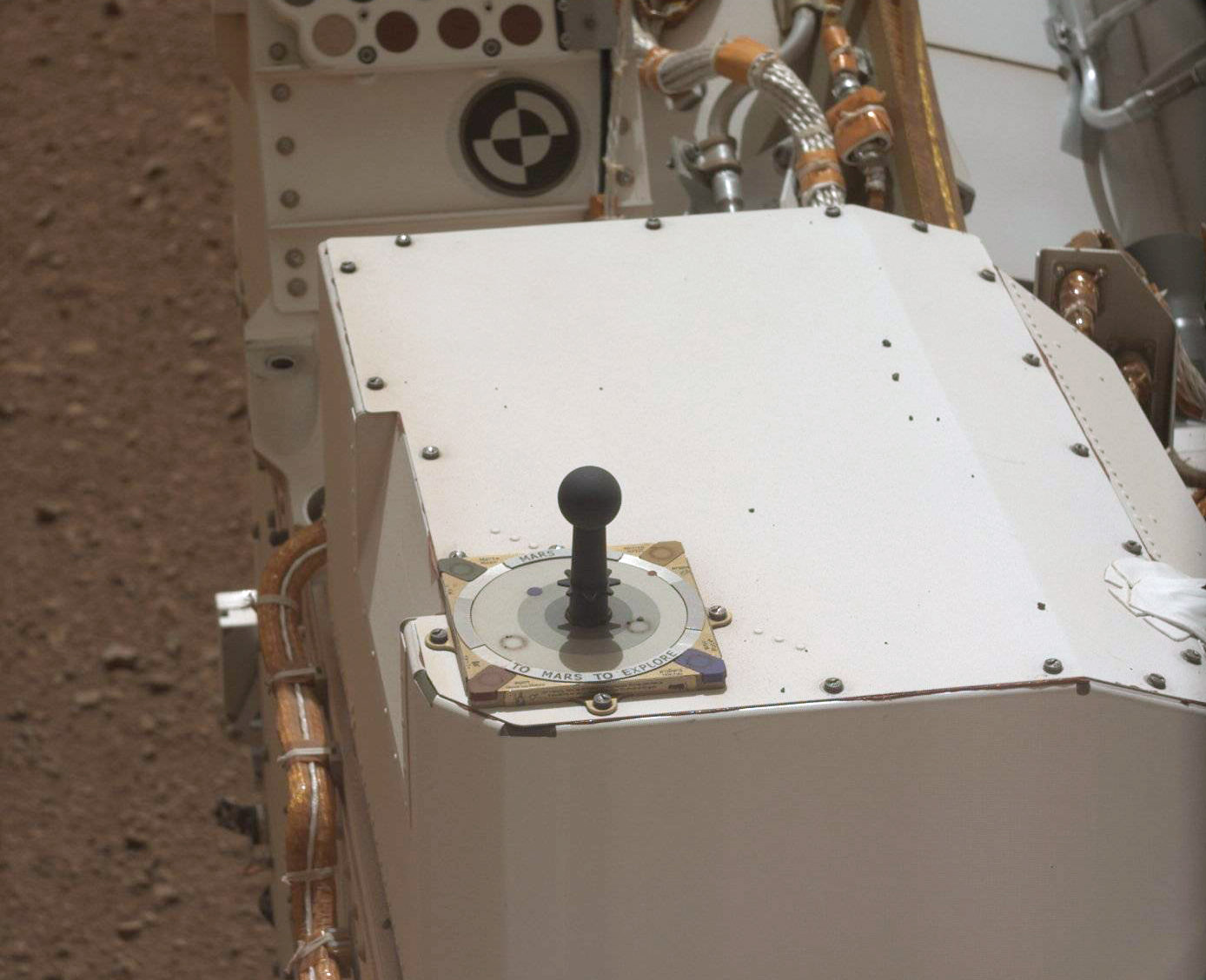
Image from Curiosity's Mastcam shows the rover's MarsDial (NASA/JPL-Caltech)

 A recent high-definition image from Curiosity’s Mastcam shows the rover’s sundial (NASA/JPL-Caltech)

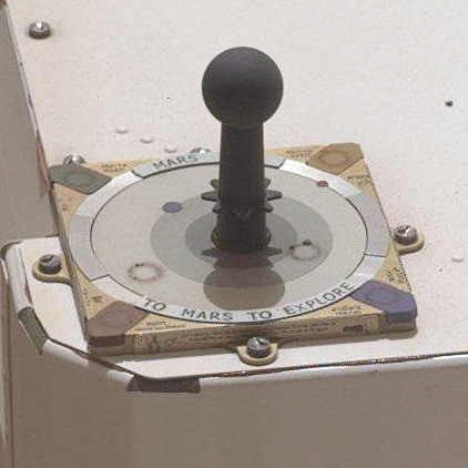
While Curiosity is definitely loaded up with some of the most high-tech instruments ever made to investigate the surface of Mars, it also carries a very low-tech instrument: a sundial (aka the “MarsDial”) which can be used to determine the position of the Sun in the sky and the season on Mars just like they do here on Earth. Curiosity’s sundial also has additional color calibration tools for the rover’s Mastcam, which captured the image above on August 19 — the 13th “Sol” of the mission.

The connection between a device invented by people thousands of years ago being in use today on a robotic explorer on another planet didn’t go unnoticed by the Mars Exploration Rover team either; in addition to the words “Mars 2012” and “To Mars, To Explore” around its top bezel, Curiosity’s sundial also carries a message of history, hope and inspiration printed along its edges…

Along with line drawings and the word for “Mars” in sixteen languages, Curiosity’s sundial bears the following inscription:

“For millennia, Mars has stimulated our imaginations. First, we saw Mars as a wandering star, a bringer of war from the abode of the gods. In recent centuries, the planet’s changing appearance in telescopes caused us to think that Mars had a climate like the Earth’s. Our first space age views revealed only a cratered, Moon-like world, but later missions showed that Mars once had abundant liquid water. Through it all, we have wondered: Has there been life on Mars? To those taking the next steps to find out, we wish a safe journey and the joy of discovery.”

Curiosity’s successful landing on Mars at 10:31 p.m. on August 5, 2012 (PDT) was only the first (although very exciting!) step of its mission, and the first of hopefully many next steps to explore our neighboring world. Perhaps one day this message will be revisited by human explorers on Mars who may then reflect back on how it all began, and all of the innovations, hope and — well, curiosity — that made each of their rust-dusted steps possible.

Follow the sun, Curiosity!

Find out more about Curiosity’s many science and exploration instruments on JPL’s interactive 3D page here, and keep up with the latest MSL downloaded images here.

Desert RATS Begin Simulated Asteroid Mission Today

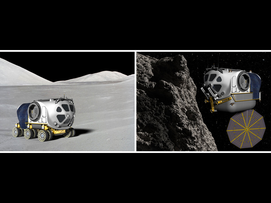
Caption: Artist’s Concept, Space Exploration Vehicle Use Comparison. Credit: NASA

Conspiracy theories abound that the Apollo landings all took place on a film set in California, but today NASA’s Desert RATS team begins a mission to asteroid Itokawa. They will land, rove and even undertake spacewalks, without ever stepping foot out of their home base at Johnson Space Center in Texas. This is no hoax however, but a simulated mission to test out NASA’s audacious plan to send astronauts to an asteroid by 2025.

The Desert RATS have been testing robots and other tools that could be used on future exploration missions since 1997, (this is their 15th mission) usually doing analog missions out in the field. “Desert” refers to the Arizona desert, where a lot of the team’s activities take place and “RATS” stands for “Research and Technology Studies.”

However, since they are now testing out a zero-G visit to an asteroid, the team will use mockups inside JSC’s Space Vehicle Mockup Facility, which offers a medley of tools and simulators that would be difficult to transport to a field test location.

For example, the Multi-Mission Space Exploration Vehicle (MMSEV) is designed to both rove across a planetary surface on a wheeled chassis or fly in space using advanced propulsion systems. Four crew members will take it in turns to live in and operate the simulator to explore the asteroid.

The MMSEV can be put on a sled on an air-bearing floor to simulate the moves that the crew might feel during a real mission. There will also be a 50-second delay in voice transmission, going each way to simulate the light-speed travel time between Earth and the asteroid.

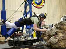
The crew can also undertake spacewalks using ARGOS (Active Response Gravity Offload System) an overhead gantry crane system that simulates the reduced gravity environment. In reality nothing would stop astronauts from just floating off the surface but NASA is thinking about using jetpacks, tethers, bungees, nets or spiderwebs to allow them to float just above the surface attached to a smaller mini-spaceship.

A team of scientists from the Astromaterials Research and Exploration Science Directorate will ensure proper scientific methods are applied to asteroid sample collection techniques throughout the 10 day mission.

The mission is slated to run until August 30th or 31st. Find out more here or follow the NASA Desert RATS team on Twitter

Second image caption: ARGOS can be used to make spacewalkers feel as though they weigh 1/6 of their weight, as they would on the moon, or 1/3, as on Mars. Photo credit: NASA

Sweeping Panoramic Vista of Mount Sharp and Gale Crater from Curiosity

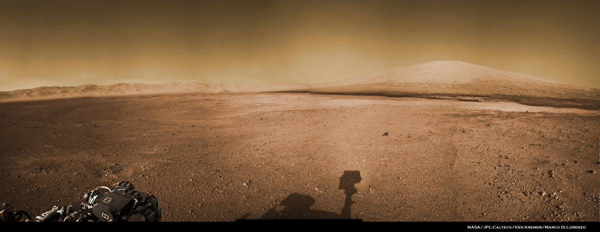
Image Caption: Panoramic Vista of Mount Sharp (at right) and Gale Crater from NASA’s Curiosity rover on Mars. Curiosity will eventually climb 3.4 mile high Mount Sharp in search of hydrated minerals. This colorized panoramic mosaic shows more than half of the landing site surrounding Curiosity in the distance to the visible peak of Mount Sharp and a portion of the stowed robotic arm (at left) and the shadow of the camera mast (center) in the foreground. The mosaic was assembled from new navigation camera (Navcam) images snapped by Curiosity on Sol 2 and Sol 12 and colorized based on Mastcam imagery from Curiosity. Image stitching and processing by Ken Kremer and Marco Di Lorenzo. See black and white version below. Credit: NASA/JPL-Caltech/Ken Kremer/Marco Di Lorenzo

At last the Curiosity mega rover is beaming back the first higher resolution panoramic images that many of us have longed to see – a complete view to the visible summit of towering Mount Sharp, the mountain she will scale, surrounded by the sweeping vistas of the tall eroded rim of Gale Crater, her touchdown site barely 2 weeks ago.

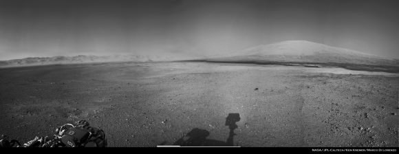
See our panoramic mosaics above and below incorporating the best available raw images to date. Curiosity’s stowed robotic arm and the shadow cast by the camera mast are visible in the foreground.

The new images from Curiosity’s mast mounted navigation cameras (Navcam) show the huge mountains peak to as far up as the rover can see from her vantage point some 7 kilometers (4 miles) from the base of the 18,000 foot (5.5 km) high Mount Sharp which is taller than Mount Rainier, the tallest peak in the contiguous United States.

By stitching together the newly received full resolution Navcam images from Sols 2 and 12, we (Ken Kremer and Marco Di Lorenzo) have created a panoramic mosaic showing the breathtaking expanse to the top of Mount Sharp combined with the perspective of Gale Crater from the rover’s eye view on the crater’s gravelly surface.

Image Caption: Panoramic Vista of Mount Sharp (at right) and Gale Crater from NASA’s Curiosity rover on Mars. Curiosity will eventually climb 3.4 mile high Mount Sharp in search of hydrated minerals. This panoramic mosaic shows more than half of the landing site surrounding Curiosity in the distance to the peak of Mount Sharp and a portion of the stowed robotic arm (at left) and the shadow of the camera mast (center) in the foreground. The mosaic was assembled from new navigation camera (Navcam) images snapped by Curiosity on Sol 2 and Sol 12. Image stitching and processing by Ken Kremer and Marco Di Lorenzo. Credit: NASA/JPL-Caltech/Ken Kremer/Marco Di Lorenzo – www.kenkremer.com

In coming weeks, Curiosity will take aim at Mount Sharp with the pair of high resolution Mastcam cameras (34 mm and 100) mounted on the rover’s mast and eventually provide much clearer images to the peak resulting in the most spectacular pictures imaginable of the mysterious mountain that holds the mother lode of hydrated mineral deposits that the robot was sent to investigate by NASA. So far the Mastcam cameras have only imaged the lower reaches of Mount Sharp.

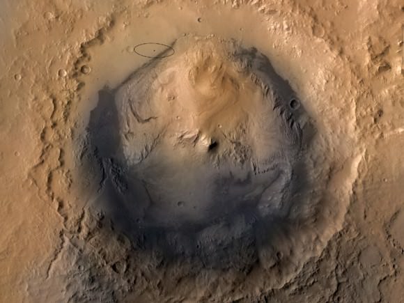
The nuclear powered, car sized Curiosity rover was specifically engineered to accomplish a pinpoint landing inside the 96 mile (154 km) wide Gale Crater beside Mount Sharp so she could scale the mountain and take soil and rock samples of the clays and hydrated sulfated minerals that scientists believe formed in liquid water that flowed billions of years ago.

Mount Sharp is a gigantic mound that covers the entire central portion of Gale Crater and learning how it formed is one of the many mysteries researchers seek to unveil with the highly sophisticated 1 ton robot.

John Grotzinger, the project scientist for NASA’s Curiosity Mars Science Lab (MSL) rover, says that the hydrated minerals are all located in about the first 400 meters or so of Mount Sharp’s vertical elevation, based on spectral data collected by NASA and ESA spacecraft orbiting Mars. He says Curiosity will spend about a year traversing and investigating targets on the crater floor before reaching the foothills of Mount Sharp.

Curiosity will eventually spend years climbing Mount Sharp in the valleys between the 1 to 3 story tall mesas and buttes at the giant mountain’s base and lower elevations in search of sedimentary layers of the clay and hydrated sulfate mineral deposits.

The powerful ChemCam laser that Curiosity successfully test fired today will be absolutely key to finding the best targets for detailed analysis by her 10 state of the art science instruments.

The mission goal is to ascertain whether the Red Planet was ever capable of supporting microbial life, past or present and to search for the signs of life in the form of organic molecules during the 2 year primary mission phase.

Ken Kremer

Image Caption: Gale Crater and Mount Sharp from orbit with Curiosity landing site ellipse

Curiosity Blasts 1st Mars Rock with Powerful Laser Zapper

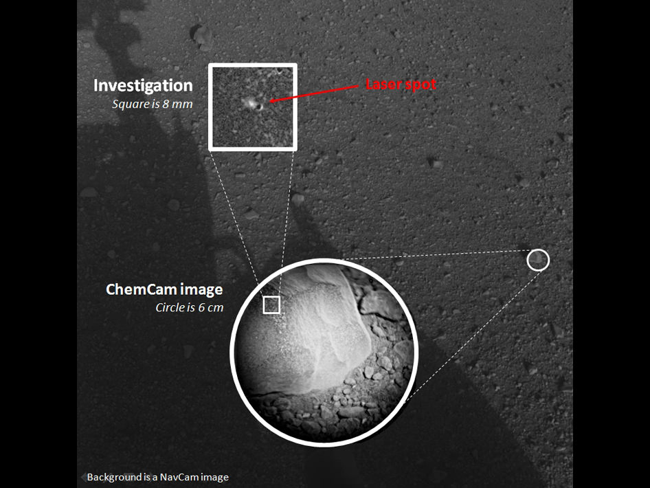
Image Caption: PewPew !! – First Laser Zapped rock on Mars. This composite image, with magnified insets, depicts the first laser test by the Chemistry and Camera, or ChemCam, instrument aboard NASA’s Curiosity Mars rover. The composite incorporates a Navigation Camera image taken prior to the test, with insets taken by the camera in ChemCam. The circular insert highlights the rock before the laser test. The square inset is further magnified and processed to show the difference between images taken before and after the laser interrogation of the fist-sized rock, called “Coronation.” It is the first rock on any extraterrestrial planet to be investigated with such a laser test. ChemCam inaugurated use of its laser when it used the beam to investigate Coronation during Curiosity’s 13th day after landing. Credit: NASA/JPL-Caltech/LANL/CNES/IRAP

NASA’s Curiosity rover successfully blasted a Mars rock with a powerful laser beam, for the first time in history, today Aug. 19, inaugurating a revolutionary new era in planetary science with a new type of instrument that will deliver bountiful discoveries. The fist sized Martian rock zapped during the maiden laser target practice shots was appropriately dubbed “Coronation”.

The ChemCam instrument mounted at the top of Curiosity’s mast fired a total of 30 one-million watt pulses over a 10 second period at the 3 inch wide rock that vaporized a pinhead sized spot into an ionized, glowing plasma.

Each pulse lasted about five one-billionths of a second and was sufficient in energy to generate a spark of plasma to be observed with the ChemCam telescope and trio of spectrometers below deck in order to identify the elemental composition.

“Yes, I’ve got a laser beam attached to my head. I’m not ill tempered; I zapped a rock for science. PewPew,” tweeted Curiosity.

The NASA composite image above shows Coronation before and after the laser shots – watch out little Martians !

“We got a great spectrum of Coronation — lots of signal,” said ChemCam Principal Investigator Roger Wiens of Los Alamos National Laboratory, N.M. “Our team is both thrilled and working hard, looking at the results. After eight years building the instrument, it’s payoff time!”

Image caption: This mosaic shows the first target Curiosity zapped with the ChemCam laser, before being blasted on Aug. 19. The 3 inch wide rock was provisionally named N165 and is now called “Coronation”. Credit: NASA/JPL-Caltech/MSSS/LANL

ChemCam recorded spectra from the laser-induced spark during all 30 pulses at 6,144 different wavelengths of ultraviolet, visible and infrared light. The purpose of this test was target practice to make sure the laser could be precisely aimed and to characterize the instrument.

Ultimately the goal is use the laser to penetrate below the dusty surface and reveal the interior composition of the targeted rocks using the telescopic camera and spectrometers.

ChemCam, which stands for Chemistry and Camera, is a joint project between the US and France said Wiens at a news briefing on Aug. 17. “The science team is half French and half US.”

“It’s surprising that the data are even better than we ever had during tests on Earth, in signal-to-noise ratio,” said ChemCam Deputy Project Scientist Sylvestre Maurice of the Institut de Recherche en Astrophysique et Planetologie (IRAP) in Toulouse, France. “It’s so rich, we can expect great science from investigating what might be thousands of targets with ChemCam in the next two years.”

ChemCam is a remote sensing instrument and will get the most use of any of Curiosity’s instruments. It will be analyzing about 14,000 samples and help winnow down the targets and guide Curiosity to the most interesting samples for more detailed analysis, Wiens explained.

ChemCam uses a technique called laser-induced breakdown spectroscopy that has precedent in determining the composition of targets in other extreme environments such as inside nuclear reactors and on the sea floor, but is unprecedented in interplanetary exploration.

NASA’s 1 ton mega rover Curiosity is the biggest and most complex robot ever sent to the surface of another planet, sporting a payload of 10 state of the art science instruments weighing 15 times more than any prior roving vehicle. Curiosity’s goal is to determine if Mars was ever capable of supporting microbial life, past or present and to search for the signs of life in the form of organic molecules during the 2 year primary mission phase.

Ken Kremer

“The Hobbit” Author Gets a Crater on Mercury

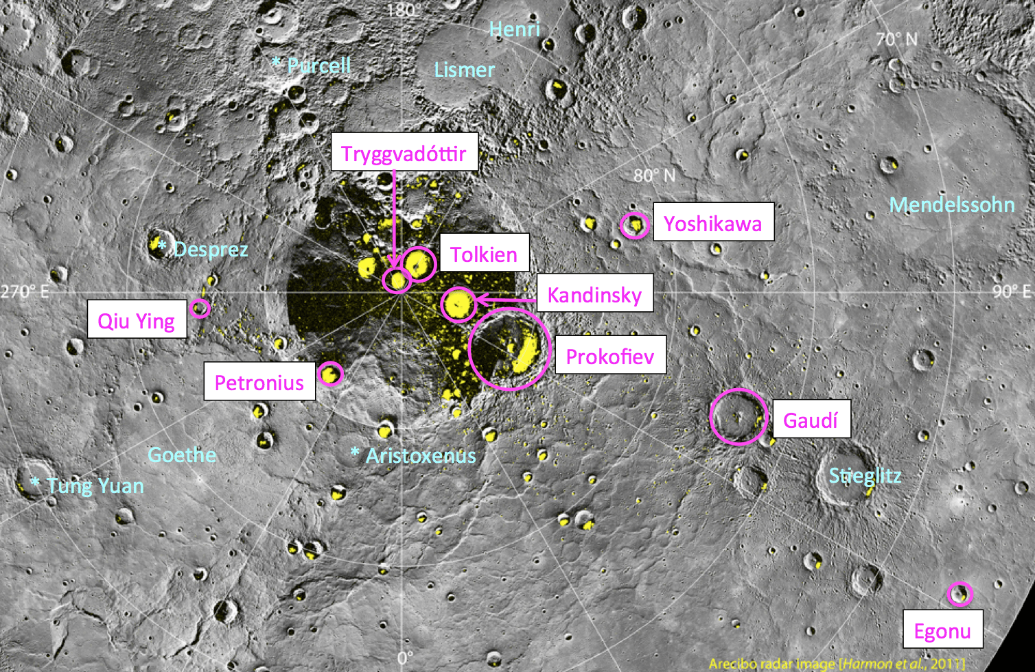
Here’s a little something to please fans of space, art and fantasy alike (and those who enjoy all three): on August 6 the International Astronomical Union approved names for 9 craters on Mercury, one of which is named for J.R.R. Tolkien, revered author of The Hobbit and The Lord of the Rings (among other seminal fantasy works.)

The crater Tolkien is approximately 30 miles (48 km) in diameter. All 9 newly-named craters are located in Mercury’s north polar region and exhibit radar evidence of water ice hidden in their shadowy pocketses.

IAU procedure for craters on Mercury has them named after “deceased artists, musicians, painters, and authors who have made outstanding or fundamental contributions to their field and have been recognized as art historically significant figures for more than 50 years.” Find out who all 9 new craters are named for after the jump:

Egonu, for Uzo Egonu (1931-1996), a Nigerian-born painter who at 13 was sent to England to study art, first at a private school in Norfolk and later at the Camberwell School of Arts and Crafts. Exile, alienation, and the pain of displaced peoples were recurrent themes in his work.

Gaudí­, after Antoni Gaudí­ (1852-1926), a Spanish architect whose work concentrated largely on the Catalan capital of Barcelona. He was very skilled with ceramics, stained glass, wrought-iron forging, and carpentry and integrated these crafts into his architecture.

Kandinsky, for Wassily Kandinsky (1866-1944), a Russian painter and art theorist credited with painting the first purely abstract works.

Petronius, for Titus Petronius (c. AD 27-66), a Roman courtier during the reign of Nero. He is generally believed to be the author of the Satyricon, a satirical novel believed to have been written during the Neronian era.

Prokofiev, for Sergei Prokofiev (1891-1953), a Russian composer, pianist, and conductor who is considered one of the major composers of the 20th century. His best-known works include the ballet Romeo and Juliet — from which “Dance of the Knights” is taken — and Peter and the Wolf.

Tolkien, for John Ronald Reuel (J. R. R.) Tolkien (1892-1973), an English writer, poet, philologist, and university professor, best known as the author of the classic fantasy novels The Hobbit and The Lord of the Rings.

Tryggvadóttir, for Nina Tryggvadóttir (1913-1968), one of Iceland’s most important abstract expressionist artists and one of very few Icelandic female artists of her generation. She primarily worked in painting, but she also created collages, stained glass work, and mosaics.

Qiu Ying, for Shifu Qiu Ying (1494-1552), a Chinese painter who specialized in the gongbi brush technique, a careful realist method in Chinese painting. He is regarded as one of the Four Great Masters of the Ming Dynasty.

Yoshikawa, for Eiji Yoshikawa (1892-1962), a Japanese historical novelist best known for his revisions of older classics including The Tale of the Heike, Tale of Genji, Outlaws of the Marsh, and Romance of the Three Kingdoms.

“These designations expand the opportunities to recognize the contributions to the arts by the most creative individuals from many cultures and eras. The names of those individuals are now linked in perpetuity to the innermost planet.”

– Sean Solomon, MESSENGER Principal Investigator

The craters were imaged by NASA’s MESSENGER spacecraft, currently in extended mission around Mercury. Learn more about the preciousss MESSENGER mission here. (Gollum! Gollum!)

Image credit: NASA/Johns Hopkins University Applied Physics Laboratory/Carnegie Institution of Washington 

New Satellites Will Tighten Knowledge of Earth’s Radiation Belts


Surrounding our planet like vast invisible donuts (the ones with the hole, not the jelly-filled kind) are the Van Allen radiation belts, regions where various charged subatomic particles get trapped by Earth’s magnetic fields, forming rings of plasma. We know that the particles that make up this plasma can have nasty effects on spacecraft electronics as well as human physiology, but there’s a lot that isn’t known about the belts. Two new satellites scheduled to launch on August 23 August 24 will help change that.

“Particles from the radiation belts can penetrate into spacecraft and disrupt electronics, short circuits or upset memory on computers. The particles are also dangerous to astronauts traveling through the region. We need models to help predict hazardous events in the belts and right now we are aren’t very good at that. RBSP will help solve that problem.”
– David Sibeck, RBSP project scientist, Goddard Space Flight Center

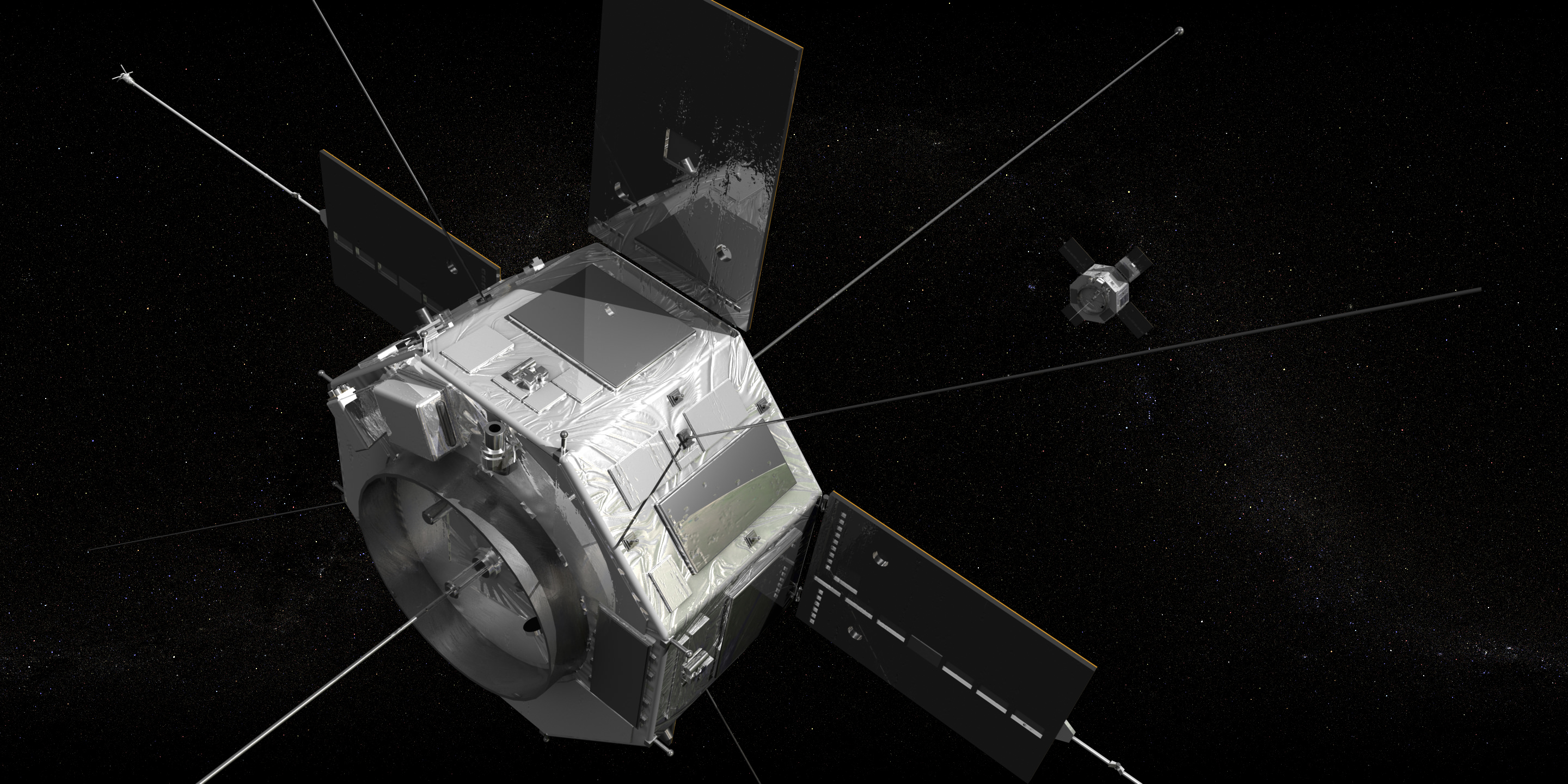
NASA’s Radiation Belt Storm Probes (RBSP) mission will put a pair of identical satellites into eccentric orbits that take them from as low as 375 miles (603 km) to as far out as 20,000 miles (32,186 km). During their orbits the satellites will pass through both the stable inner and more variable outer Van Allen belts, one trailing the other. Along the way they’ll investigate the many particles that make up the belts and identify what sort of activity occurs in isolated locations and across larger areas.

“Definitely the biggest challenge that we face is the radiation environment that the probes are going to be flying through,” said Mission Systems Engineer Jim Stratton at APL. “Most spacecraft try to avoid the radiation belts — and we’re going to be flying right through the heart of them.”

Read: The Van Allen Belts and the Great Electron Escape

Each 8-sided RBSP satellite is approximately 6 feet (1.8 meters) across and weighs 1,475 pounds (669 kg).

The goal is to find out where the particles in the belts originate from — do they come from the solar wind? Or Earth’s own ionosphere? — as well as to find out what powers the belts’ variations in size and gives the particles their extreme speed and energy. Increased knowledge about Earth’s radiation belts will also help in the understanding of the plasma environment that pervades the entire Universe.

Read: What Are The Radiation Belts?

Ultimately the information gathered by the RBSP mission will help in the design of future science and communications satellites as well as safer spacecraft for human explorers.

The satellites are slated to launch aboard a United Launch Alliance Atlas V rocket from Cape Canaveral Air Force Station no earlier than 4:08 a.m. EDT on August 24.

Find out more about the RBSP mission here.

Video/rendering: NASA/GSFC.