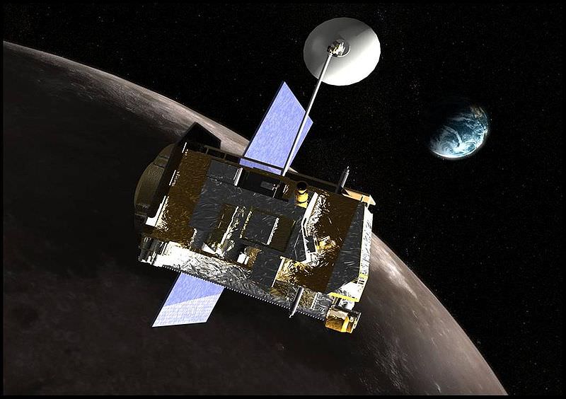
While people across North America marvelled at the blood-red moon early this morning, some NASA engineers had a different topic on their minds: making sure the Lunar Reconnaissance Orbiter would survive the period of extended shadow during the eclipse.
LRO uses solar panels to get energy for its batteries, so for two passes through the Earth’s shadow it would not be able to get any sunlight at all. Tweets on the official account show all as well in the first few hours after the eclipse.
“The spacecraft will be going straight from the moon’s shadow to the Earth’s shadow while it orbits during the eclipse,” stated Noah Petro, LRO’s deputy project scientist at NASA’s Goddard Space Flight Center, in a release before the eclipse occurred.
“We’re taking precautions to make sure everything is fine,” Petro added. “We’re turning off the instruments and will monitor the spacecraft every few hours when it’s visible from Earth.”
LRO’s Twitter account asked “Who turned off the heat and lights?” during the eclipse, then reported a happy acquisition of signal after the shadow passed by. “AOS, and sunlight, sweet sunlight! My batteries are charging again before I make another trip to the lunar far side.”
Hear more about LRO’s eclipse journey in the video below. For more information, check out NASA’s LRO website. UPDATE, 10:28 a.m. EDT: NASA’s Lunar Atmosphere and Dust Environment Explorer (LADEE) spacecraft also is fine after the eclipse, according to its Twitter account.
The December 21st 2010 Solstice eclipse. Photos by author.
Are you ready for some eclipse action? We’re now within 24 hours of the Moon reaching its ascending node along the ecliptic at 13:25 Universal Time (UT)/ 9:25 AM EDT on Tuesday morning and meeting the shadow of the Earth just over seven hours earlier.
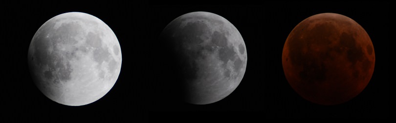
We’ve written about viewing prospects for tonight’s lunar eclipse. This eclipse is the first total lunar eclipse since December 10th, 2011 and is the first in a series of four — known as an eclipse tetrad — visible from North America in 2014 and 2015. Totality lasts 1 hour and 18 minutes and falls just 29 minutes short of the theoretical maximum, which was last neared on January 21st, 2000 and won’t be topped until July 27th, 2018.
This will be an early morning event for U.S. East Coasters spanning 2:00 to 5:30 AM local (from the start of the partial umbral phases and totality), and a midnight spanning-event for the Pacific coast starting at 11:00 PM Monday night until 2:30 AM Tuesday morning on the 15th.
And as always with celestial events, the chief question on every observer’s mind is: will the skies be clear come show time? Should I stay put, or ponder going mobile?
When it comes to astronomical observing, a majority a mainstream weather resources only tell part of the story, often only listing cloud cover and precipitation percentages. Seeing, transparency, and low versus middle and high cloud decks can often mean the difference between a successful observing session and deciding to pack it in and watch Cosmos reruns online. But the good news is, you don’t need crystal clear skies to observe a total lunar eclipse, just a view of the Moon, which can easily “burn through” a high cirrus cloud deck. We’re going to share a few sites that are essential tools for planning an observing session and what they say about the prospects for seeing tonight’s eclipse.
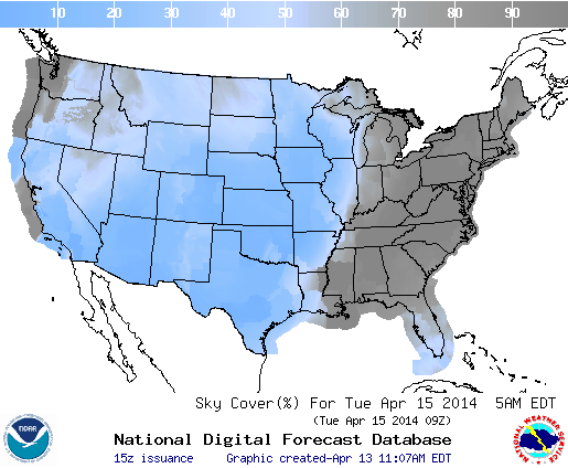
Cloud cover prospects towards the end of tomorrow morning’s lunar eclipse. Credit: NOAA.
Now the bad news: things aren’t looking good for eastern North America. In fact, the dividing line between “cloudy” and “clear” runs right down through central Ontario and follows the Mississippi River at mid-eclipse, which occurs at 7:47 UT/3:47 AM EDT. There’s a high pressure front sweeping eastward, bringing rain and cloudy skies with it. The Florida peninsula and parts of New England and the Canadian Maritimes may have shots at viewing the eclipse through partly cloudy skies.
The National Oceanic and Atmospheric Administration maintains a great interactive site with graphical interactive forecasts, to include satellite maps. Another long-standing source of good info is the Weather Underground. For tailor-made astronomy forecasts, we’re checking Clear Sky Chart (formerly Clear Sky Clock) and SkippySky daily for upcoming prospects. A great feature in SkippySky is that it not only gives you cloud cover maps, but layers them with high versus middle and low clouds… again, a thin high cloud deck during the lunar eclipse could still mean game on!
Clouded out? There’s a half dozen webcasts planned for tonight’s lunar eclipse as well.
Dependable Slooh will have a live broadcast with commentary on the eclipse starting at 2AM EDT/6:00 UT:
Also, our good friends at the Virtual Telescope Project will be covering the lunar eclipse as part of their ongoing Global Astronomy Month campaign and will utilize several North American observers to cover the event:
NASA is also planning a broadcast out of the Marshall Space Flight Center of the eclipse along with a discussion on Reddit with NASA planetary scientist Renee Weber also starting at 2:00 AM EDT:
And finally, we hope to launch our very own initiation into the world of eclipse webcasting with an hour-long broadcast of the crucial phase transition from partial to total eclipse starting at 2:30 AM EDT/6:30 UT, weather willing:
And hey, word is that doomsday purveyor John Hagee is planning a broadcast of a more “End of the World” bent tonight as well. We didn’t know he was an astronomy fan…
Prospects call for a brighter than normal eclipse, as atmospheric sciences professor at the University of Colorado Richard Keen notes that the Earth’s stratosphere is currently relatively clear of dust and volcanic ash. Still, we’ve been surprised before. The darkness and color of the eclipsed Moon is expressed on what’s known as the Danjon scale. As during eclipses previous, we’ll be data-mining Twitter for estimates and averages to see how they stack up… tweet those observations to #DanjonNumber.
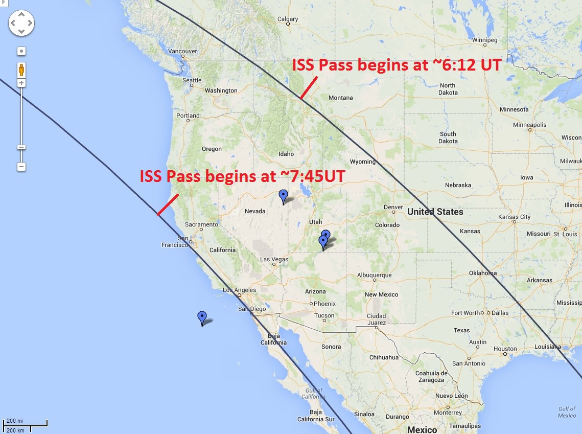
Opportunities to catch the ISS transiting the Moon during tonight’s eclipse. Credit: CALSky.
We also ran the possibilities for catching a shadow transit of the International Space Station in front of the eclipsed Moon for North American observers. To our knowledge, this has never been done before. Live near one of the two paths depicted above? You may be the first to accomplish this unusual feat. Check in with CALSky for specifics.
Our backyard “eclipse broadcasting station.”
Finally, ever wonder when the next eclipse will occur during the Sunday night Virtual Star Party? If you’re like us, you consider and ponder such astronomical occurrences… and it turns out, the very last lunar eclipse in the current tetrad next year on September 28th, 2015 does just that. And stick around until July 13th, 2037 and we’ll have the first ever total solar eclipse occurring during the show… we just need someone in Australia to stream it!
Tonight’s eclipse is number 56 of saros 122. Reader Rob Sparks notes that the last eclipse (55) in this series occurred on April 4th 1996 and also hosted an extra-special celestial treat, as Comet Hyakutake was just beginning to put on its memorable performance.
In short, don’t fear the “Blood Moon,” but do get out and catch tonight’s fine lunar eclipse… we’ll be doing a post-eclipse photo roundup tomorrow, so be sure to send those pics in to Universe Today!
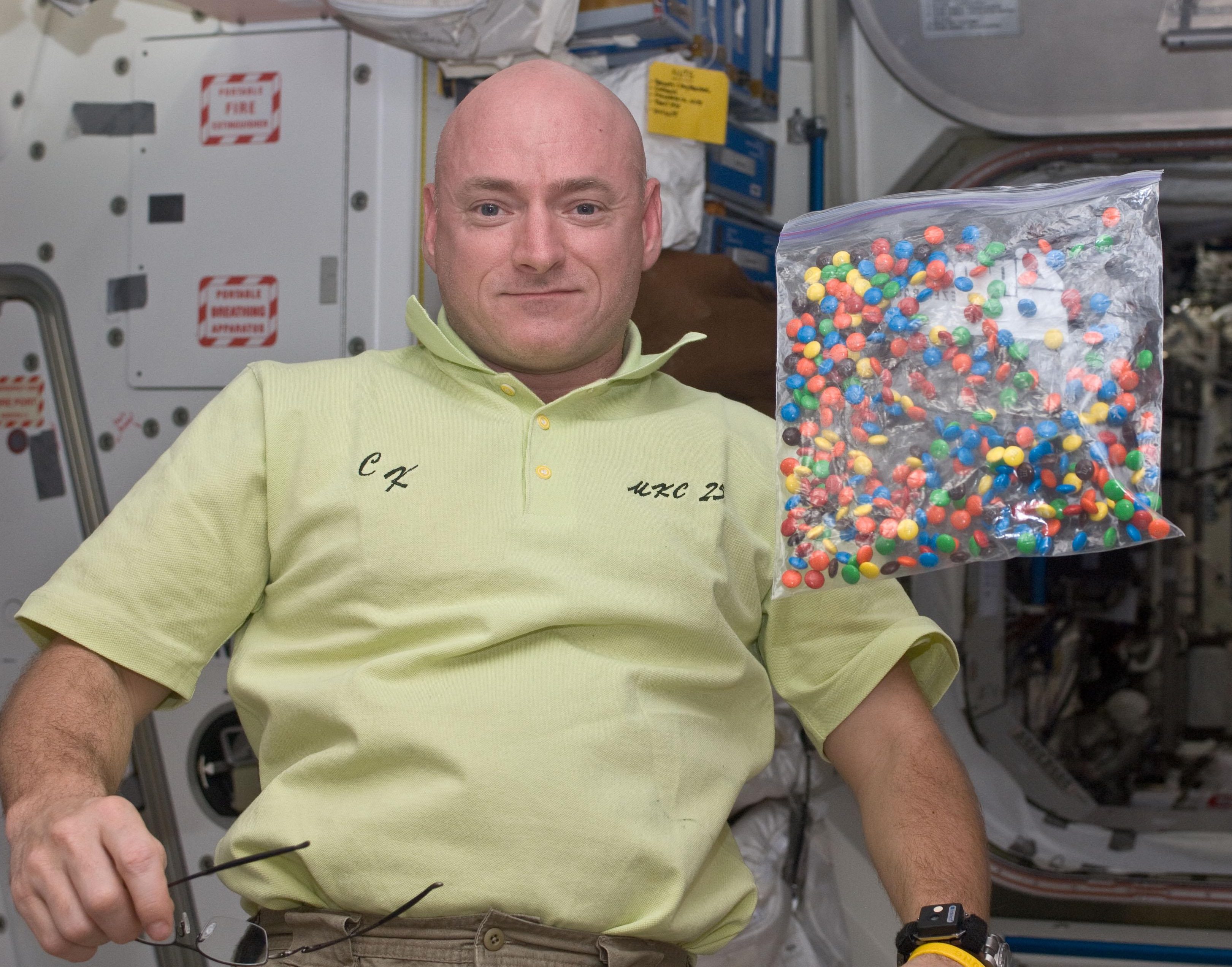
NASA astronaut Scott Kelly during Expedition 25 in 2010, floating with a bag of candy in the Unity node of the International Space Station. Credit: NASA
When planning for long-duration space travel, many people would think along the lines of not forgetting a towel or something of that nature. But we on Earth who are spoiled by the astounding pictures beamed from space must realize that even astronauts can get tired of looking at the same few walls for months at a time.
Scott Kelly is going to spend a year in space in 2015, and he highlighted boredom as one of the things he will need to fight against during his time on the International Space Station.
“There are things I will do a little bit differently with regards to pacing myself. You wouldn’t think this is true, but you do have to kind of stay entertained over that kind of period,” said Scott Kelly in a NASA interview late last week, which you can watch above.
“No matter how exciting that kind of things is, no matter how beautiful the Earth is, when you’re doing it for a year there is still the factor of trying to keep yourself engaged and interested.”
Kelly also highlighted some of the training challenges he will face being that he will be up there twice as long as the typical six-month space station mission. While it won’t take twice as long to do emergency training, he is required to do it with twice as many astronauts/cosmonauts because he will be working with four crews in space.
He also will train with two different Soyuz spacecraft commanders (which will add “complexity”, he noted) and have twice as much science to perform. That includes several “twin” studies where scientists will compare Kelly and his identical brother Mark, a four-time shuttle flyer who retired from the program in 2011.
Another lesson learned from his last six-month flight in 2010? “I know what I want to bring this time that I didn’t have last time,” Kelly said, although he didn’t elaborate on what those items are.
Kelly and Russian cosmonaut Mikhail Kornienko will begin their mission just under one year from now.
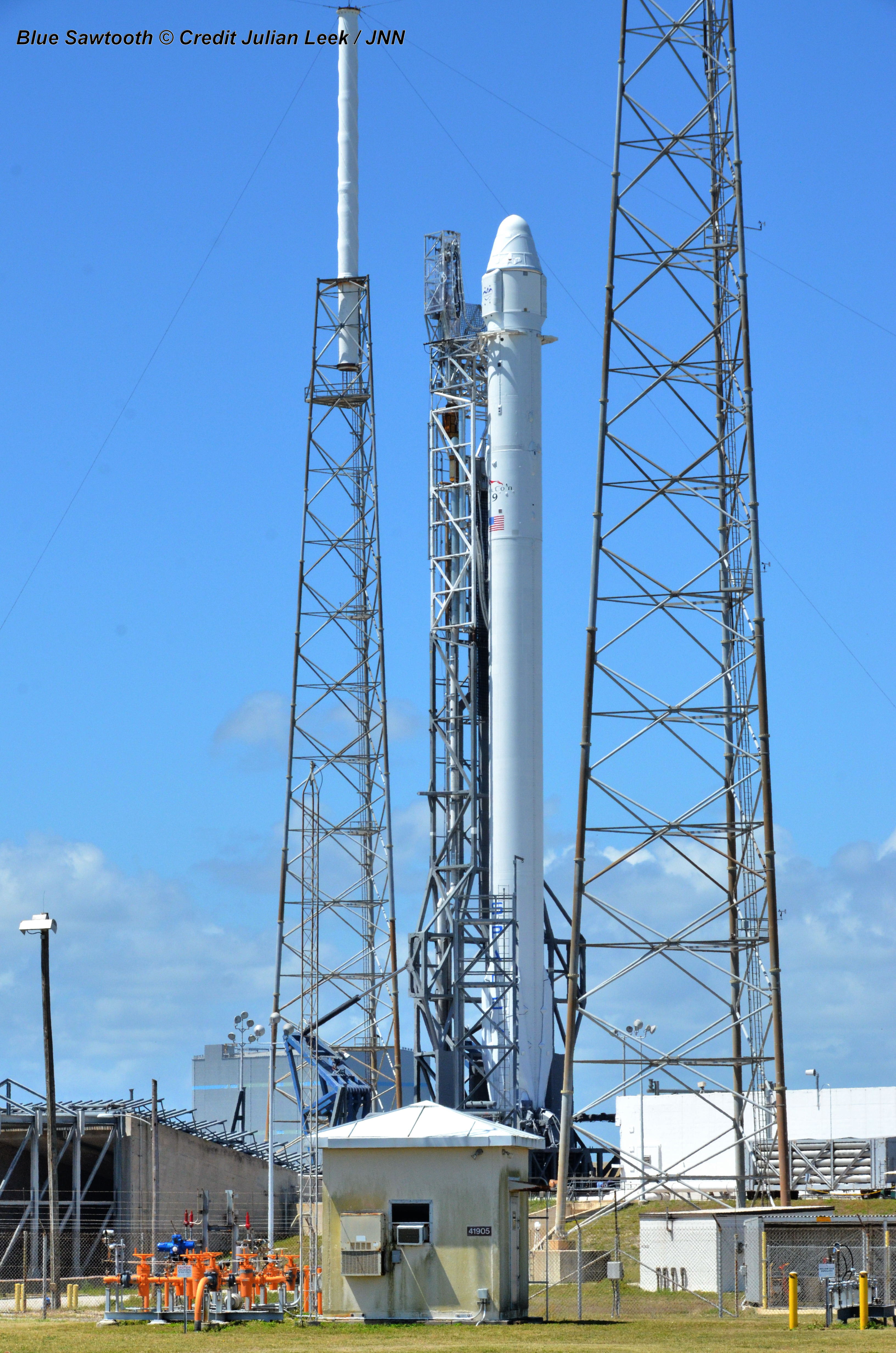
SpaceX Falcon 9 rocket preparing for April 18, 2014 liftoff from Space Launch Complex 40 at the Cape Canaveral Air Force Station, Fla. Credit: Julian Leek
SpaceX Falcon 9 rocket preparing for April 14, 2014 liftoff from Space Launch Complex 40 at the Cape Canaveral Air Force Station, Fla. Credit: Julian Leek Watch the SpaceX Launch Live here – NASA TV link below[/caption]
Following closely on the heels of Thursday’s spectacular Atlas V rocket blastoff from Cape Canaveral and a last moment computer failure at the ISS over the weekend, an upgraded Space X Falcon 9 rocket is now poised to launch on Monday (April 14) and complete a double barreled salvo of liftoffs from the Florida Space Coast merely 4 days apart – if all goes well.
The SpaceX Falcon 9 rocket carrying a Dragon resupply freighter is slated to launch on Monday at 4:58 p.m. EDT, 2058 GMT, from Launch Complex 40 at the Cape Canaveral Air Force Station, Fla.
Update 4/14- 345 PM: Todays launch attempt scrubbed due to 1st stage Helium leak. Friday is earliest target date
This flight marks the third operational Dragon resupply mission to the 1 million pound International Space Station (ISS).
NASA TV live coverage will begin at 3:45 p.m. EDT and conclude at approximately 5:20 p.m.
Weather forecasters are predicting an 80 percent chance of favorable weather conditions at the scheduled liftoff time.
SpaceX Falcon 9 rocket preparing for April 14, 2014 liftoff from Space Launch Complex 40 at the Cape Canaveral Air Force Station, Fla. Credit: Julian Leek
Monday’s launch was temporarily put in doubt by the unexpected loss on Friday (April 11) of a backup computer command relay box called a multiplexer/demultiplexer (MDM) that resides in the station’s S0 truss.
The primary MDM continued to function normally.
The MDM’s provide commanding to the station’s external cooling system, Solar Alpha Rotary joints, Mobile Transporter rail car and insight into other truss systems.
It must function in order for the astronauts to use the robotic arm to grapple and berth the Dragon at a station docking port when it arrives on Wednesday, April 16, at about 7 a.m. EDT.
NASA managers held an extensive series of review meetings since Friday with ISS program managers, station partners, and SpaceX to exhaustively consider all possibilities and insure it was safe to fly the Dragon mission.
NASA gave the final go ahead after a readiness review this Sunday morning of managers, engineers and flight controllers.
ISS crew members will conduct a spacewalk to replace the failed MDM unit after the Dragon arrives.
This unmanned SpaceX mission dubbed CRS-3 mission will deliver some 5000 pounds of science experiments, a pair of hi tech legs for Robonaut 2, a high definition imaging camera suite, an optical communications experiment (OPALS) and essential gear, the VEGGIE lettuce growing experiment, spare parts, crew provisions, food, clothing and supplies to the six person crews living and working aboard the ISS soaring in low Earth orbit under NASA’s Commercial Resupply Services (CRS) contract.
Robonaut 2 engineering model equipped with new legs like those heading to the ISS on upcoming SpaceX CRS-3 launch were on display at the Kennedy Space Center Visitor Complex on March 15, 2014. Credit: Ken Kremer – kenkremer.com
This launch has already been postponed twice since mid-March.
The original March 16 launch target was postponed 2 days before liftoff due to contamination issues with insulation blankets located inside the unpressurized trunk section of Dragon.
The second postponement from March 30 occurred when an electrical short knocked out the critical Air Force tracking required to insure a safe launch from the Eastern Range in case the rocket veers off course towards populated ares and has to be destroyed in a split second.
SpaceX is under contract to NASA to deliver 20,000 kg (44,000 pounds) of cargo to the ISS during a dozen Dragon cargo spacecraft flights over the next few years at a cost of about $1.6 Billion.
To date SpaceX has completed two operational cargo resupply missions and a test flight. The last flight dubbed CRS-2 blasted off a year ago on March 1, 2013 atop the initial version of the Falcon 9 rocket.
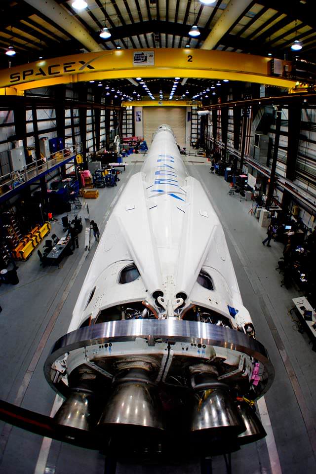
The Falcon 9 rocket with landing legs in SpaceX’s hangar at Cape Canaveral, Fl, preparing to launch Dragon to the space station this Sunday March 30. Credit: SpaceXAnother major goal for SpaceX with this launch involves the attachment of landing legs to the first stage of the firm’s next-generation Falcon 9 rocket that counts as a major first step towards a future goal of building a fully reusable rocket.
For this Falcon 9 flight, the rocket will sprout legs for a controlled soft landing in the Atlantic Ocean, guided by SpaceX engineers.
Eventually SpaceX will test land landings in a ramped up series of rocket tests
Stay tuned here for Ken’s continuing SpaceX, Orbital Sciences, commercial space, Orion, Chang’e-3, LADEE, Mars rover, MAVEN, MOM and more planetary and human spaceflight news.
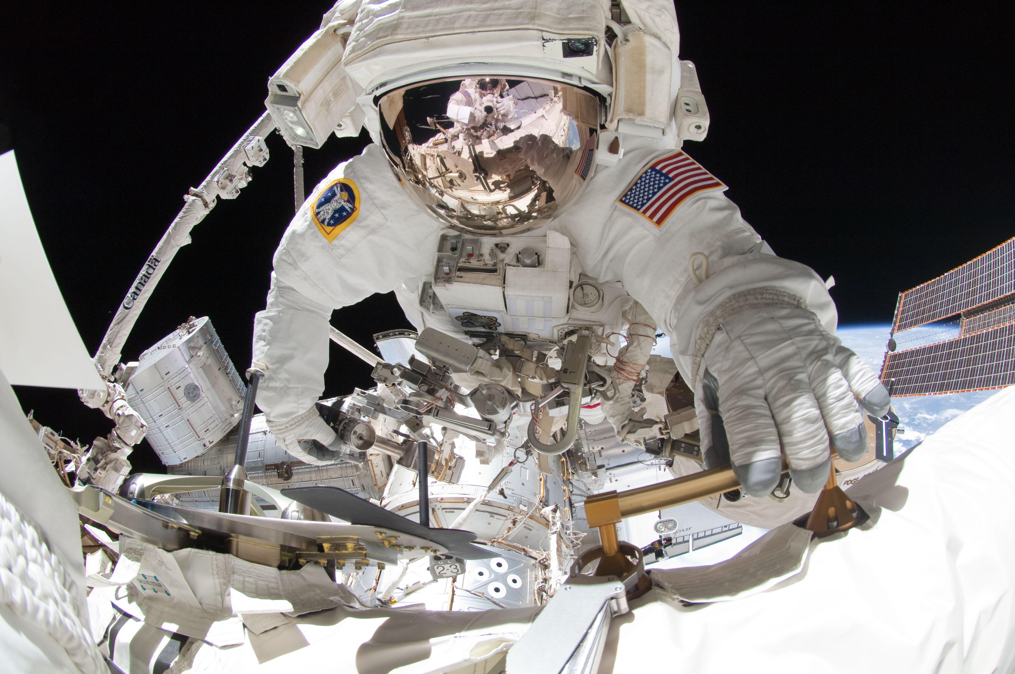
NASA astronaut Greg Chamitoff during a 2011 spacewalk on the International Space Station. Reflected in his visor is NASA crewmate Mike Fincke. Both astronauts were mission specialists aboard shuttle mission STS-134. Credit: NASA
As contingency spacewalks go, the urgent task should be easy: a quick 2.5-hour run to swap out a failed backup computer that controls several systems on the International Space Station, including robotics. But NASA doesn’t want to go ahead with it until spare spacesuit parts arrive, in the aftermath of a life-threatening suit leak that took place last summer.
Those parts are on board the much-delayed SpaceX Dragon spacecraft sitting on a launch pad waiting for its next window to open. For this and other reasons, NASA decided to move ahead with the launch as planned Monday at 4:58 p.m. EDT (8:58 p.m. UTC). The spacewalk would take place April 22 — if Dragon gets there as planned on Wednesday.
“We need to get it [Dragon] on board as soon as we practically can,” said Mike Suffredini, the International Space Station’s program manager, in a phone briefing with reporters Sunday (April 13). That’s because Dragon is carrying a new spacesuit, components to fix an existing spacesuit, critical research experiments and food for the six crew members of Expedition 39.
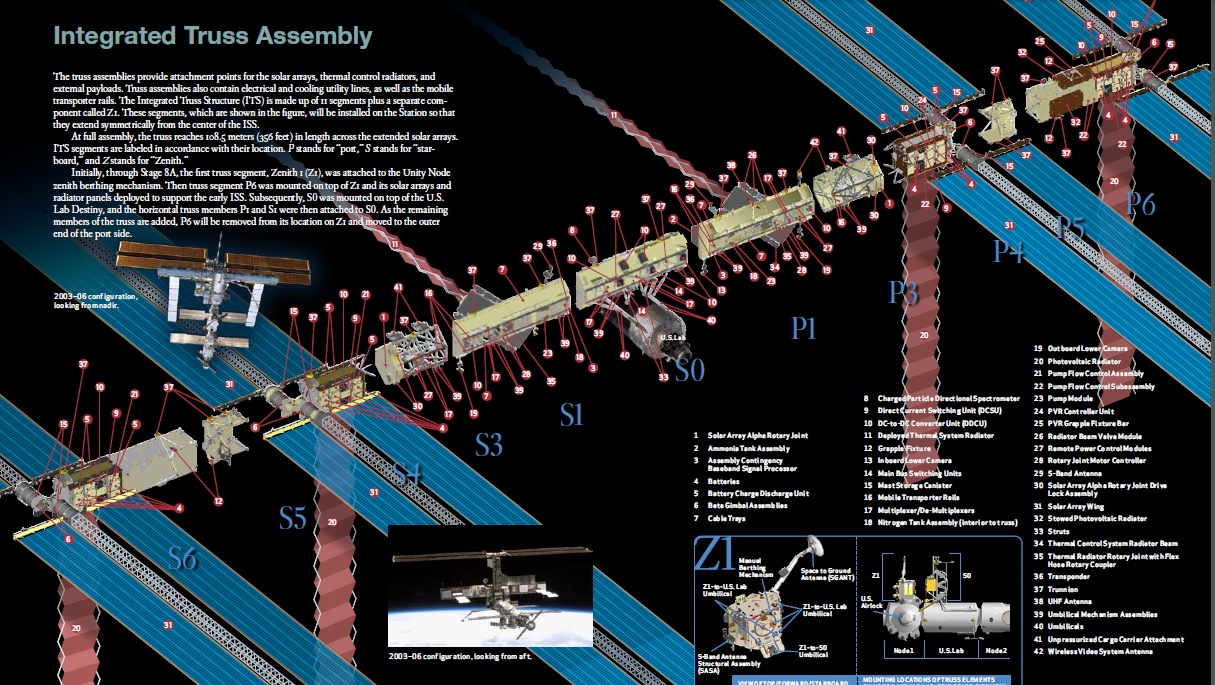
The challenge, however, is making sure the station could be ready even if the primary multiplexer demultiplexer (MDM) fails before spacewalkers can make the backup replacement. There are more than a dozen MDMs on station, but each one controls different functions. This primary MDM not only controls a robotics mobile transporter, but also radiators and a joint to move the station’s solar arrays, among other things. The computer sits on the S0 truss on station, which you can view in the diagram below.
A diagram of the truss segments on the International Space Station. Click for a larger version. Screenshot of p. 3 of this PDF document: http://www.nasa.gov/pdf/167129main_Systems.pdf. Credit: NASA
“The biggest driver for us is the positioning of the solar arrays as we look to the next failure,” Suffredini said. NASA needs to reposition the arrays when a vehicle approaches because plumes from the thrusters can put extra “loads” or electrical power on the system.
At the same time, enough power must flow to the station for it to operate. Luckily, the angle of the sun is such these days that the array can sit in the same spot for a while, at least two to three weeks, Suffredini said. NASA configured the station so that even if the primary computer fails, the array will automatically position correctly.
NASA also will move a mobile transporter on station today so that the station’s robotic arm is ready to grasp the Dragon when it arrives, meaning that even if the primary computer fails the transporter will be in the right spot. If Dragon is delayed again, the next launch opportunity is April 18 and the spacewalk would be pushed back.
Dragon’s precious payload of items includes several intended to make NASA spacewalks safer. The suit leak was due to contamination in the fan pump separator of Suit 3011 that plugged a tiny hole inside the water separation part of the unit. Water then escaped and got into the helmet, causing a near-emergency for Luca Parmitano — who was using the spacesuit in July.
European Space Agency astronaut Luca Parmitano on a spacewalk July 9, 2016 during Expedition 36. Here, Parmitano is riding the end of the robotic Canadarm2. Credit: NASA
NASA installed snorkels and absorbent helmet pads into its spacesuits while awaiting the results of an investigation, and also pushing back all nonessential spacewalks. The agency now has recommendations in hand and is addressing those with the hope of resuming non-contingency spacewalks this summer.
Today, Suffredini also provided an update on what the contamination was. “The anomaly was the result of contamination introduced by filters essentially used to clean and scrub the water loops for us,” he said.
“Those introduced large amounts of silica into the system, and that silica eventually coagulates in the area of the fan pump sep [separator] and after many uses, it eventually can build up to the point where it plugs the holes and you can’t separate the water from the air.”
The next spacewalk will use Suit 3011 (which got a new fan pump separator for contingency spacewalks in December) and Suit 3005, which will use the new separator on board Dragon. The cooling lines on spacesuits on board station have been purged with fresh water to reduce the silica buildup, and astronauts will use new filters that they know are clean.
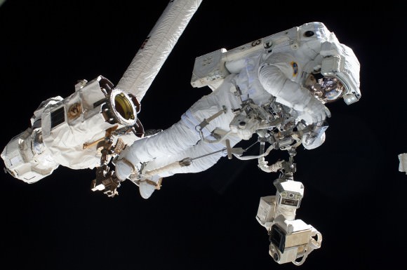
Expedition 15’s Clay Anderson (on Canadarm2) and STS-118’s Rick Mastracchio (right) during an August 2007 maintenance spacewalk on the International Space Station. The NASA astronauts relocated an S-Band antenna subassembly, installed a new transponder and retrieved another transponder. Credit: NASA
If for some reason Suit 3005 can’t be used, Suffredini added, the new suit could be put in place instead after some testing to make sure it’s ready. “We’re in a very good posture for the EVA [extra-vehicular activity],” Suffredini said.
NASA hasn’t decided who will go on the spacewalks yet, he added. There are at least two or three spare MDMs on station; the one needed for this particular spacewalk is inside the U.S. Destiny laboratory, which is handily right next to the S0 truss and spacesuit worksite.
Of the “big 12” repair jobs the astronauts train for, the MDM replacement is among the easiest, Suffredini said, adding astronauts never encountered an external MDM failure on station before.
The last set of contingency spacewalks took place in December to replace a failed ammonia pump that affected science experiments on station. Expedition 39’s Rick Mastracchio was among the pair “outside” during those spacewalks.
We will keep you apprised as circumstances warrant.
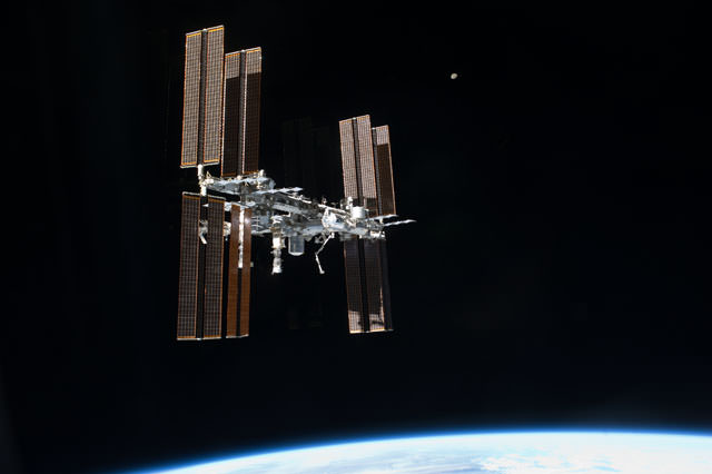
A view of the International Space Station as seen by the last departing space shuttle crew, STS-135. Credit: NASA
NASA is preparing a contingency spacewalk to deal with a broken backup computer component on the International Space Station, the agency said in an update Saturday (April 12). While there’s no timeline yet for the spacewalk, the agency must consider carefully when to do it given a cargo ship is supposed to arrive at station on Wednesday.
The SpaceX Dragon spacecraft — already delayed due to an unrelated radar problem — is still scheduled to launch Monday at 4:58 p.m. EDT (8:58 p.m. UTC) to arrive at station two days later. Although the computer controls some robotic systems, NASA added the Canadarm2 that will grapple Dragon has other redundancies in place. The question is if the station itself has enough redundancy for the launch to go forward.
“A final decision on whether to launch Dragon Monday will not be made until another status meeting is conducted Sunday morning,” NASA stated.
The failure poses no risk to the crew and normal station operations are not affected, NASA emphasized. The failure was uncovered Friday “during a routine health check” of a box called EXT-2, which backs up a primary component that sits outside on the S0 truss (near the station’s center).
Expedition 39 commander Koichi Wakata performs maintenance on the Carbon Dioxide Removal Assembly on the International Space Station. Picture taken in April 2014. Credit: NASA
Earlier Saturday, a docked Progress robotic spacecraft boosted the station’s altitude in a planned maneuver to ready for the next Soyuz spacecraft launch, which will carry half of the Expedition 40 crew in May.
If spacewalks do go forward, this would be the second required contingency set required since Luca Parmitano experienced a life-threatening leak in a NASA spacesuit last July. NASA ordered an investigation, received a report in February and has halted all nonessential spacewalks while it addresses the recommendations. (Russian spacewalks in Orlan spacesuits are unaffected.)
The only NASA spacewalks that happened since summer took place in December, when an ammonia pump failure crippled science experiments on station. NASA’s Rick Mastracchio and his now returned-to-Earth crewmate Mike Hopkins performed two contingency spacewalks, successfully replacing the pump. The agency has snorkels and absorbent pads ready for its spacesuits as backup if another leak occurs.
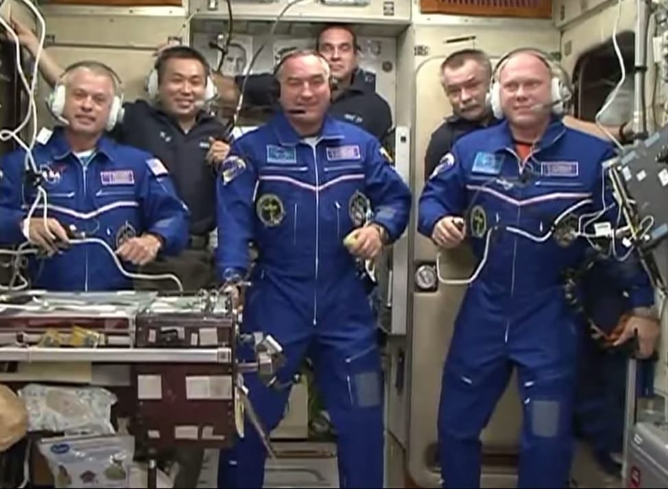
The Expedition 39 crew on March 27, 2014 a few hours after the second half of the crew arrived on a Soyuz spacecraft. From left, Steve Swanson (NASA), Koichi Wakata (Japan Aerospace Exploration Agency), Alexander Skvortsov (Roscomos), Rick Mastracchio (NASA), Mikhail Tyurin (Roscomos) and Oleg Artemyev (Roscosmos). Credit: NASA (YouTube/screenshot)
A backup computer that controls “some systems associated with robotics” on the International Space Station is not “responding to commands”, NASA said in a late-night statement Eastern time Friday (April 11).
The crew is safe, there’s no “immediate” change to space station operations, and because the primary computer is working, there’s also no alteration to the SpaceX Dragon launch to the station on Monday — which requires the robotic Canadarm2 for berthing. NASA added, however, that there are “further evaluations” going on, meaning the date could change depending on what controllers figure out.
If the computer does need to be replaced, crew members of Expedition 39 will need to do at least one spacewalk, the agency added. NASA is allowing contingency spacewalks in American spacesuits to go forward as the agency addresses problems raised in a report about a life-threatening spacesuit leak in July.
Below the jump is the statement NASA put out tonight concerning the situation.
The Mission Control team at NASA’s Johnson Space Center in Houston confirmed Friday night that a backup computer on the exterior of the International Space Station (ISS) called a Multiplexer-Demultiplexer (MDM) is not responding to commands. The station’s MDM computers control some systems associated with robotics aboard the space station.
The primary MDM operating aboard the space station is functioning normally and there is no immediate impact to space station operations. The computer outage does not pose a risk to the six crew members aboard the space station. ISS teams are assessing next steps to attempt to bring the computer back online or replace it.
Replacing the backup MDM, if needed, would require a spacewalk. The backup MDM would provide redundancy for robotic systems that will be needed to attach the SpaceX Dragon spacecraft currently scheduled to launch on Monday and rendezvous with the ISS on Wednesday. NASA is continuing to work toward a Monday launch of the SpaceX cargo resupply mission pending further evaluations by the ISS Program. The latest information will be available here at www.nasa.gov/station.
We will keep you apprised as the situation progresses.
Expedition 39’s crew portrait. Front row: commander Koichi Wakata (Japan Aerospace Exploration Agency) at right, and NASA astronaut Steve Swanson. Back row, left to right: Russian cosmonauts Oleg Artemyev, Alexander Skvortsov, Mikhail Tyurin and NASA astronaut Rick Mastracchio. Credit: NASA
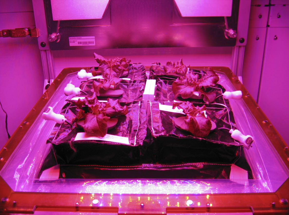
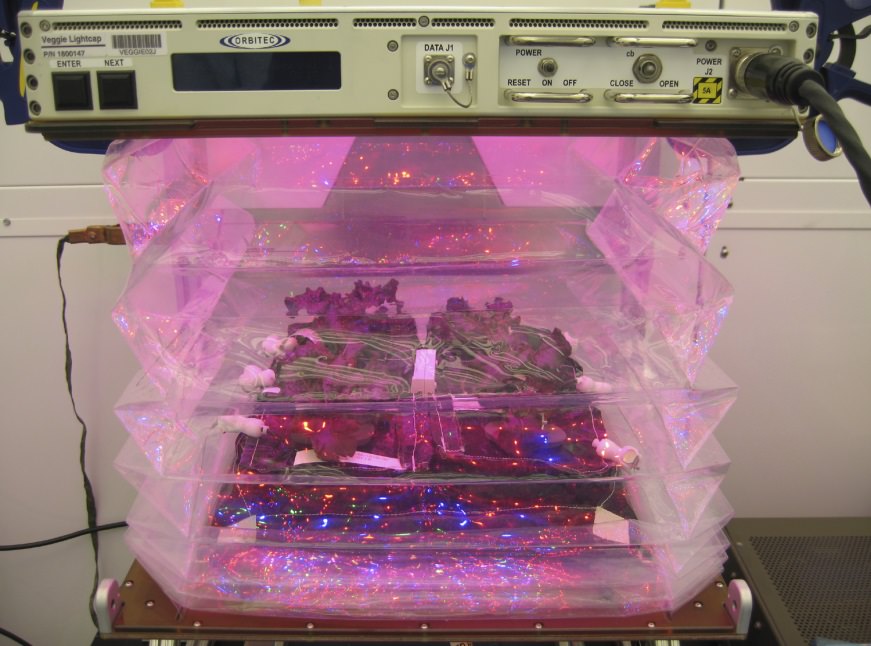
Romaine lettuce grows inside a prototype "Veggie" pillow (NASA/Gioia Massa)
Freeze-dried bags of dehydrated “astronaut food” may seem like a fun novelty for school kids on Earth, but despite all the hard work that goes into providing the residents of the Space Station with nutritious and varied meal options there’s one thing that remains a rare and elusive commodity on astronauts’ menus: fresh produce.
Although fruit and vegetables do occasionally find their way aboard the ISS via resupply missions (to the delight of the crew) researchers are moving one step closer to actually having a vegetable garden in orbit. On Monday, April 14 Friday, April 18, NASA’s Veg-01 experiment will launch to the ISS aboard a SpaceX Dragon capsule to test the in-flight viability of an expandable plant growth chamber named “Veggie.”
In development for several years, Veggie is now getting its chance to be space-tested with the launch of the SpaceX-3 resupply mission. Veggie uses clear collapsible bellows as miniature greenhouses, inside which plant “pillows” can be cultivated with the aid of root-mats and a bank of LED lights.
Crops successfully grown in Veggie include lettuce, Swiss chard, radishes, Chinese cabbage and peas. (NASA)
Astronauts will see how well “Outredgeous” romaine lettuce fares in microgravity inside the Veg-01 experiment, and can also use the LED bank as a light source for other experiments.
“Veggie will provide a new resource for U.S. astronauts and researchers as we begin to develop the capabilities of growing fresh produce and other large plants on the space station,” said Gioia Massa, the NASA payload scientist for Veggie. “Determining food safety is one of our primary goals for this validation test.”
While other plant-growth experiments are currently aboard ISS, Veggie boasts the simplest design and largest growing area of any of them to date.
Veggie’s Teflon bellows is expandable to 11.5 inched wide by 14 inches deep. Credit: NASA/Bryan Onate
“Our hope is that even though VEGGIE is not a highly complex plant growth apparatus, it will allow the crew to rapidly grow vegetables using a fairly simple nutrient and water delivery approach.”
– Howard Levine, Ph.D. and chief scientist at Kennedy Space Center (2012)
In addition to providing fresh food, maintaining a miniature garden in orbit would be therapeutic for astronauts on long-duration missions.
“Based upon anecdotal evidence, crews report that having plants around was very comforting and helped them feel less out of touch with Earth,” Massa said. “You could also think of plants as pets. The crew just likes to nurture them.”
The Veggie system was developed for NASA by Orbital Technologies Corporation (ORBITEC) in Madison, Wisconsin, via a Small Business Innovative Research Program. Its innovations may eventually lead to better food production not only in space but also in limited-resource regions on Earth.
With the ultimate success of Veggie, ISS astronauts may soon find themselves floating in line at the in-house salad bar. (Watch out for those rogue croutons!)
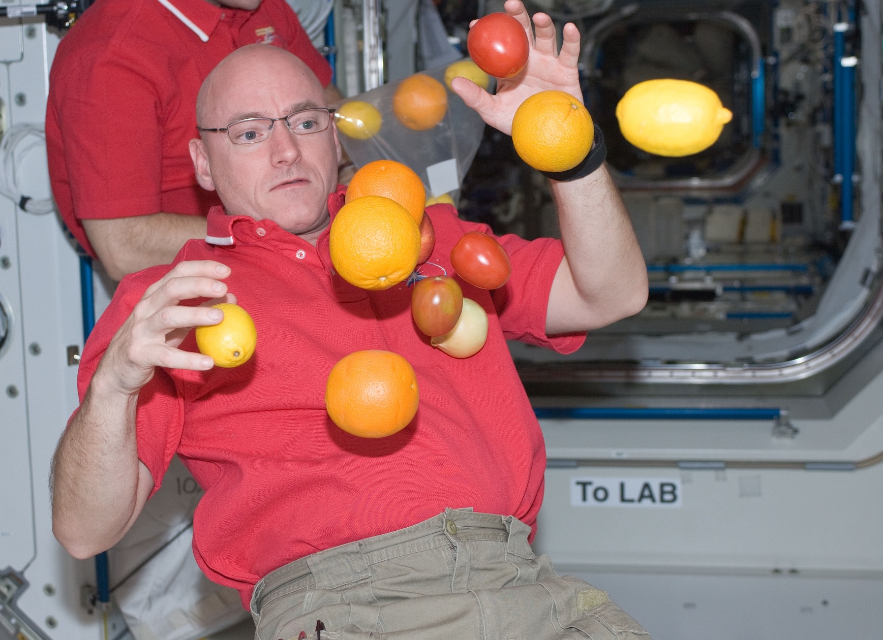
NASA astronaut Scott Kelly plays with fresh fruit in the Unity node of the International Space Station. This 2010 picture was taken during Expedition 25. Credit: NASA
Identical twin astronauts, one headed to space for a year and the other happily at home. Imagine just how excited health researchers are by the prospect of this situation which yes, is happening for real. Scott Kelly is preparing to blast off on a lengthy mission to the International Space Station in 2015 while his retired twin, Mark, will serve as a control.
The 50-year-old men will do a suite of experiments before, during and after the mission to see how much (if at all) Scott’s body changes from his brother in the long term. This ranges from examining their DNA, to their vision, and even changes in the gut.
“These will not be 10 individual studies,” stated Craig Kundrot of NASA’s human research program at the Johnson Space Center. “The real power comes in combining them to form an integrated picture of all levels from biomolecular to psychological. We’ll be studying the entire astronaut.”
One experiment will examine telomeres, which NASA says are “molecular caps” that sit on the ends of human DNA. As the theory goes, these telomeres are affected in space by cosmic rays (high-energy particles originating from outside the solar system) — which could speed up the aging process. If Scott’s telomeres change after the mission, this could help determine if space is linked to rapid aging.
Another experiment asks how the immune system alters. “We already know that the human immune system changes in space. It’s not as strong as it is on the ground,” said Kundrot. “In one of the experiments, Mark and Scott will be given identical flu vaccines, and we will study how their immune systems react.”
Then there are experiments looking at gut bacteria that help digestion, seeking out how human vision changes, and even a phenomenon known as “space fog” — how some astronauts find themselves losing alertness in orbit.
Although the twins have inherent fascination for researchers and sociologists, the Kellys themselves have emphasized that to them, having an identical counterpart is something that always was.
NASA astronaut Mark Kelly peers out a window during the penultimate shuttle mission, STS-134, in 2011. Around his neck is the ring of his wife, Gabrielle Giffords, who was recovering from a gunshot head wound during the mission. Credit: NASA
“We didn’t know anything differently and, you know, he’s not my clone,” Scott said in a joint 2010 NASA interview with Mark.
“You know, a lot of times people would ask, ‘So what’s it like to be a twin?’ and … the response I would usually give is, ‘Well, what’s it like not to be a twin?’ I mean, it’s just, it is,” Mark added, to which Scott responded, “It’s more like … he’s my brother but we just happen to have the same birthday, to me.”
Scott will leave Earth with Russian cosmonaut Mikhail Kornienko in 2015 for the first one-year mission in space since a handful of lengthy stays on the former Russian space station, Mir, in the 1990s. Scott will serve as Expedition 43/44 flight engineer and have the distinction of commanding two space station missions, Expedition 45 and 46. (He also commanded Expedition 26 in 2010.)
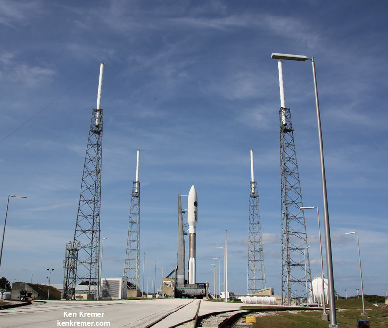
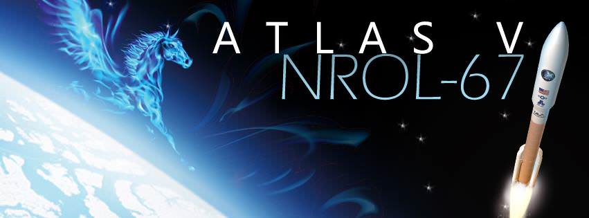
Atlas V rocket and Super Secret NROL-67 intelligence gathering payload following rollout to Space Launch Complex 41 at Cape Canaveral Air Force Station, FL, on March 24, 2014. Credit: Ken Kremer - kenkremer.com
The Florida Space Coast is about to ignite with a doubled barreled dose of spectacular rocket launches from Cape Canaveral over the next few days that were suddenly postponed two weeks ago amidst final launch preparations when an electrical short completely knocked out use of the US Air Force’s crucial tracking radar that is mandatory to insure public safety.
A pair of liftoffs vital to US National Security and NASA/SpaceX are now slated for April 10 and April 14 from Cape Canaveral Air Force Station after revitalizing the radar systems.
The tracking radar is an absolutely essential asset for the Eastern Range that oversees all launches from Cape Canaveral Air Force Station and the Kennedy Space Center in Florida.
The United Launch Alliance Atlas V is now slated to launch on Thursday, April 10 at 1:45 p.m. EDT.
Artwork for Super Secret NROL-67 payload launching on Atlas V rocket. Credit: NRO/ULA
The SpaceX Falcon 9 is slated to launch on Monday, April 14 at 4:58 p.m. EDT.
The Falcon 9 is lofting a SpaceX Dragon cargo ship and delivering some 5000 pounds of science experiments and supplies for the six man space station crew – under a resupply contract with NASA.
The pair of liftoffs of the Atlas V and Falcon 9 boosters for the NRO and SpaceX/NASA had been slated just days apart on March 25 and March 30, respectively.
Falcon 9 and Dragon static fire test on March 8, 2014. Credit: SpaceX
I was on site at Cape Canaveral Launch Pad 41 photographing the Atlas V rocket carrying the NRO payload in anticipation of the launch.
Shortly thereafter a fire of unexplained origin in the radar equipment unexpected occurred and knocked the tracking radar off line. When no quick fix was possible, both launches were delayed indefinitely pending repairs.
“The tracking radar experienced an electrical short, overheating the unit and rendering the radar inoperable,” said the USAF in a statement I received from the 45th Space Wing that controls the critical launch control systems, communications, computers and radar elements at the Eastern Range.
On Monday, April 7, the Air Force announced that range repairs were on target and that a retired, inactive radar had been brought back online.
“A radar that was previously in standby status has been brought back to operational status while the repair work is being accomplished,” said the USAF in a statement.
A fully functional tracking radar is an absolute requirement to ensure the success and safety of every rocket launch.
Insufficient maintenance and antiquated equipment due to a lack of US government funding and investment in infrastructure may be at fault for the electrical short.
The Eastern range radar must function perfectly in order to destroy any rocket in a split second in the event it abruptly veers off course towards the nearby populated areas along the Florida Space Coast.
The Atlas V rocket was rolled out earlier today to Space Launch Complex 41 in preparation for Thursday’s NROL-67 launch. The weather forecast shows a 90 percent chance of favorable weather conditions for launch.
The Dragon spacecraft, filled with about 4,600 lbs of cargo bound for the space station, is mated with Falcon 9. Credit: SpaceX
Stay tuned here for Ken’s continuing Atlas V NROL 67, SpaceX, Orbital Sciences, commercial space, Orion, Chang’e-3, LADEE, Mars rover, MAVEN, MOM and more planetary and human spaceflight news.
Learn more at Ken’s upcoming presentations at the NEAF astro/space convention, NY on April 12/13.