Mosaic images of Comanche outcrop from NASA's Spirit rover, which ceased communications to Earth in 2010. Credit: NASA/JPL-Caltech/Cornell University/Arizona State University
Science is an iterative process, with each discovery building on those made before. This means that as new evidence comes into play, you need to examine the evidence in context of what you know now, and what you knew before. Sometimes the evidence points to new theories. And sometimes, like in this case concerning Mars, it points to older ones.
The Spirit rover spent six years (2004-2010) exploring Gusev Crater, which is just a little south of the Martian equator. Scientists have been back and forth about whether it once was a vast lake of water, but some new research could swing the pendulum towards the water hypothesis.
The water track hinges on magnesium-iron carbonate minerals found in Columbia Hills, a 300-foot (91-meter) feature about two miles (3.2 kilometers) away from Spirit’s landing site. When the minerals were first found in the hills’ Comanche outcrop in 2010, scientists (which included the lead author of the study) attributed this to ancient hot springs activity.
It was a bit of a disappointment for those who had picked Gusev as a landing site from the belief that it was indeed an ancient lake. “From orbit, Gusev looked, with its southern rim breached by a meandering river channel, as if it once held a lake – and water-deposited rocks were the rover mission’s focus,” Arizona State University stated.
Spirit, however, initially found that the crater was lined with volcanic rocks and not the sediments scientists needed to support the lake theory. When it did find evidence of water in the hills, it was linked to hydrothermal activity.
A 2004 image of an outcrop at Columbia Hills on Mars, taken by the rover Spirit. Credit: NASA/JPL
The new analysis suggests that Comanche (and other outcrops in the vicinity) got their liquid from water on the surface that was of a much lower temperature than what you would find in a hot spring –which originates underground.
This is because Comanche and the surrounding area are believed to have started as a buildup of volcanic ash (called a tephra) from eruptions somewhere around Gusev. As the theory goes, waters penetrated Gusev at the south, lingered, and created a “briny solution”. Over time, the brine evaporated and what remained was carbonate minerals residue that coated the rocks.
“The lake didn’t have to be big,” stated Steve Ruff, an associate research professor at Arizona State University who led the research. “The Columbia Hills stand 300 feet high, but they’re in the lowest part of Gusev. So a deep, crater-spanning lake wasn’t needed.”
Locator image for Comanche outcrops in the Columbia Hill of Gusev Crater, Mars. Yellow line marks Spirit’s traverse. Pancam panoramic images were taken near the true summit of Husband Hill (Everest Pan) and at the location of the Seminole outcrop. Spirit was then located on the left side of Home Plate. Image width is ~1000 m. Image courtesy of NASA/UA/HiRISE using PSP_001513_1655_red image. After Arvidson et al. [2008]Getting more information, however, would be one way to add credence to the theory. That’s why the team is also pushing for the forthcoming NASA Mars 2020 rover to land in Gusev Crater, which would be unprecedented among Mars missions as each lander and/or rover has gone to a different spot. Site selection has not been finalized yet.
“Going back to Gusev would give us an opportunity for a second field season there, which any terrestrial geologist would understand,” stated Ruff. “After the first field season with Spirit, we now have a bunch more questions and new hypotheses that can be addressed by going back.”
The NASA P-3B's shadow on sea ice off of southeast Greenland during an IceBridge survey on Apr. 9, 2013. Flying at a low altitude allows IceBridge researchers to gather detailed data. Credit: NASA / Jim Yungel
How much is the polar ice melting, and how are the sheets being affected by climate change? These are some of the questions that NASA’s Operation IceBridge seeks to answer. You can see a quick overview of the mission in the video above.
“IceBridge, a six-year NASA mission, is the largest airborne survey of Earth’s polar ice ever flown,” NASA stated in the YouTube description accompanying the video.
“It will yield an unprecedented three-dimensional view of Arctic and Antarctic ice sheets, ice shelves and sea ice. These flights will provide a yearly, multi-instrument look at the behavior of the rapidly changing features of the Greenland and Antarctic ice,” the agency added.
The aerial survey is intended to supplement information from NASA’s Ice Cloud and Land Elevation Satellite (ICESat), which has been orbiting Earth since 2003, and the forthcoming ICESat-2 that is expected to launch in early 2016.
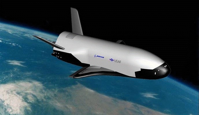
An artists' conception of the X-37B in Earth orbit. Credit: The U.S. Air Force.
A secretive mission will pass a quiet milestone at the end of this month when the U.S. Air Force’s unmanned spaceplane the X-37B surpasses 500 days in space.
Launched atop an Atlas V rocket flying in a 401 configuration from Cape Canaveral Florida after several delays on December 11th, 2012 on OTV-3, the X-37B has already surpassed its own record of 469 days in space set on OTV-2. Said milestone was crossed last month. If the current mission stays in space until April 25th of this year, it will have surpassed 500 days in space.
Two X-37Bs were built for the USAF, and the first test mission flew in 2010. NASA performed drop glide tests with an early variant of the X-37A in 2005 and 2006, and DARPA is thought to be a primary customer for the program as well.
Measuring just 8.8 metres in length, the X-37B is tiny compared to its more famous spaceplane cousin the U.S. Space Shuttle. The X-37B has a maximum weight at liftoff of 4,990 kilograms and features a payload bay 2.1 by 1.2 metres in size.
The spacecraft itself is solar powered, as it unfurls a panel — as depicted in many artists’ conceptions — once it’s in orbit. Of course, its mission profile is classified, and the X-37B could land unannounced at any time. The previous landings occurred at Vandenberg Air Force Base in California and were only announced shortly thereafter.
Not only is this the longest continuous mission for any spaceplane, but the ATV-3 is also the smallest, lightest and only the second spaceplane to land autonomously, the first being the Russian space shuttle Buran that flew one mission and landed after one orbit at the Baikonur Cosmodrome on November 15th, 1988.
The X-37B awaiting encapsulation for launch. Credit: U.S. Air Force.
The idea of a reusable spaceplane has been around since the dawn of the Space Age. The U.S. Space Shuttle program was the most high profile of these, having flown 135 missions from 1981 to 2011. But even the space shuttle launch system wasn’t fully reusable, expending its large orange external fuel tank after every mission and requiring extensive refurbishment for the solid rocket motors and orbiter after each and every flight. The Soviets abandoned Buran in 1988, and other examples of spaceplanes such as North American’s X-15 surpassed the 100 kilometre in altitude Kármán line marking the boundary to space, but were suborbital only. And this year, customers may get a chance to make similar suborbital hops into space aboard Virgin Galactic’s SpaceShipTwo spaceplane at $250,000 dollars a ticket.
But the most ambitious design for a true spaceplane was conceived in the 1960’s: Boeing’s X-20 Dyna-Soar, which was never built.
Classified satellites such as the X-37B are part of a longstanding and fascinating “secret space race” that has paralleled and shadowed the more well known space programs of various nations over the decades. These include the Corona program which ran from 1959 to 1972 and was only declassified in 1995, and satellites such as Lacrosse 5, which is notorious among satellite sleuths for the orbital “vanishing act” it sometimes pulls.
And speaking of which, you can track the X-37B from your backyard, tonight. Ground spotters first pegged its position in low Earth orbit during OTV-1 on May 22nd 2010, and the spacecraft currently sits in a 392 x 296 kilometre (nearly circular) orbit in an 43.5 degree inclination, making it visible from latitudes 55 degrees north to south. On a favorable overhead pass, the X-37B is easily visible shining at greater than magnitude +1. OTV-3’s NORAD ID designation is 39025 or 2012-071A, and although – like most classified payloads – it’s not available to the public on Space-Track, Heavens-Above does list upcoming sighting opportunities. Be sure to start watching a bit early, as the X-37B has been known to maneuver a bit in its orbit on occasion.
Of course, just what the X-37B is doing in orbit is anybody’s guess. Speculation is that it’s serving as a test bed for new technologies. Certainly, the ability to place interchangeable payloads in orbit is immediately apparent. It’s also worth noting that the X-37B makes multiple daily passes on its northward apex over North Korea and China. There’s also been speculation that the X-37B was designed to keep tabs on the Chinese space station Tiangong-1, although this can easily be refuted as they both lie in different orbits. There’s no word as to what’s to become of Tiangong-1, though China had said it was set to deorbit the station at the end of 2013, and it is still in space.
Looking ahead into the future, there has been talk about a larger crewed variant known as the X-37C, which will undoubtedly fly much shorter missions. For now, we can watch and wonder what it’s up to, as the X-37B glides silently overhead. Perhaps one day, its mission will declassified, and its tale can be told.
-For more info sat-tracking, check out our how-to post and also read about the fascinating true role that amateurs played during the Cold War and Operation Moonwatch.
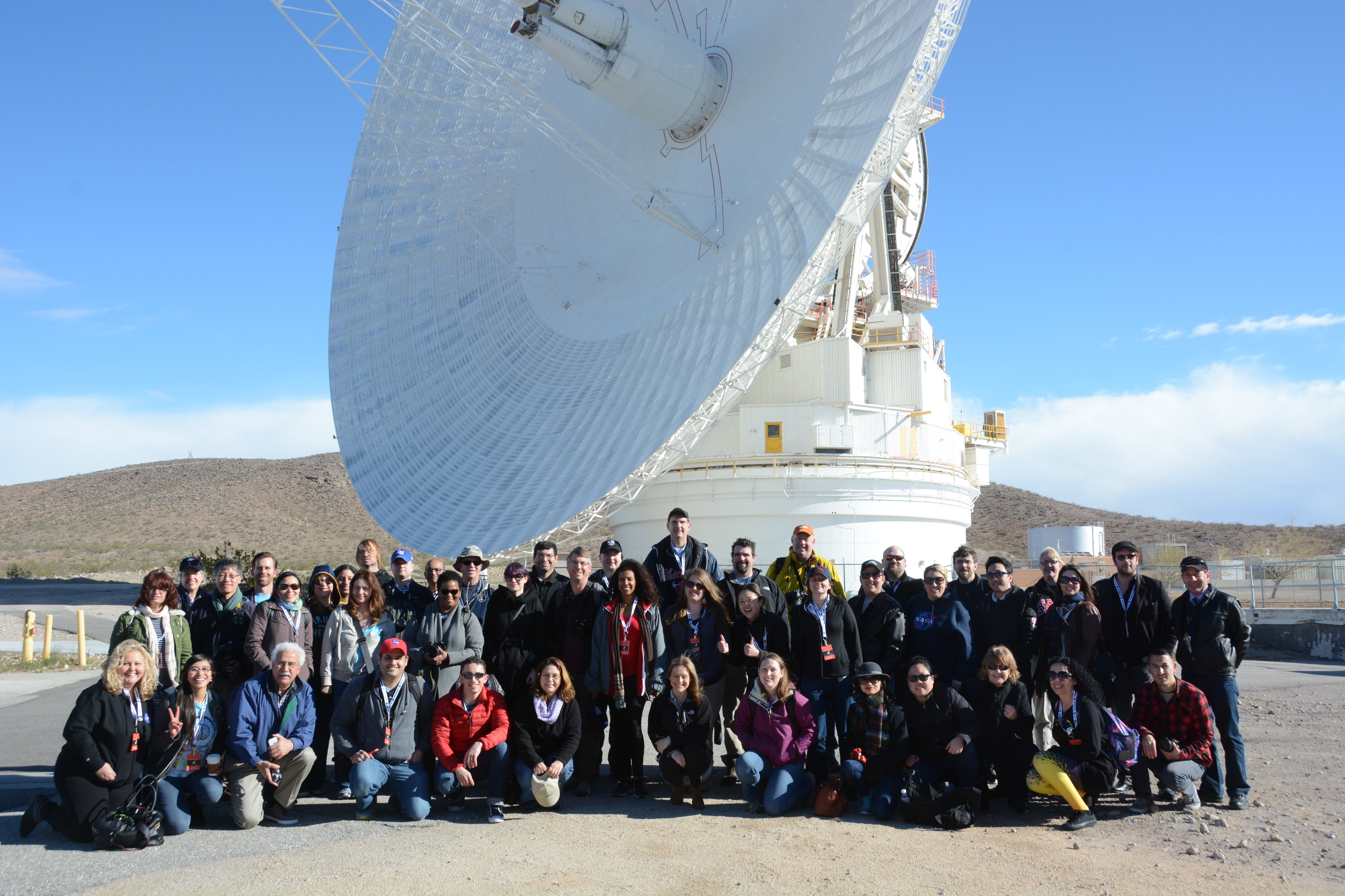
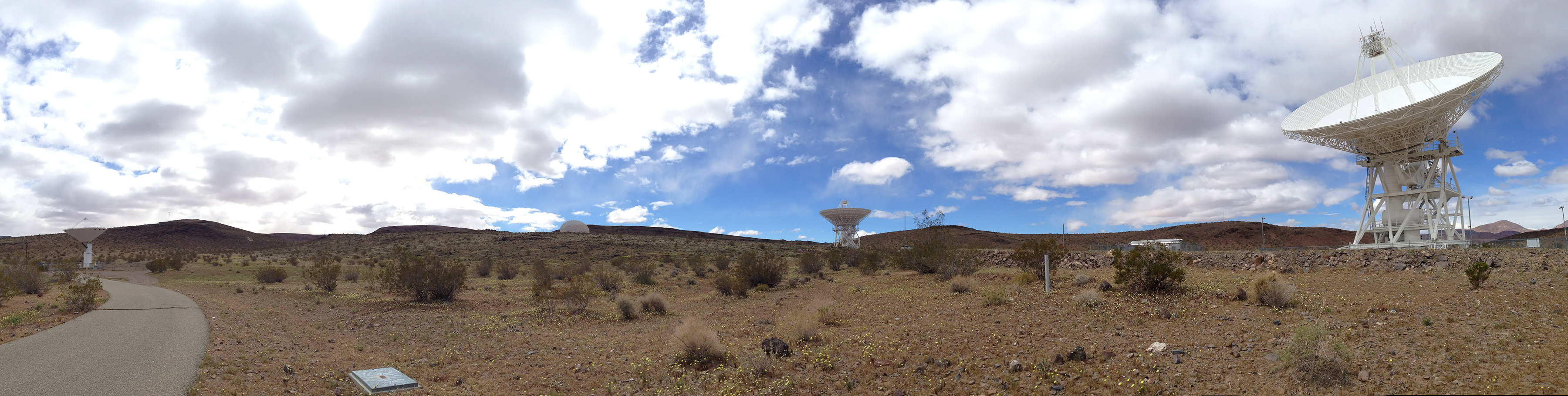
The participants of the DSN NASA Social gathered in front of the DSS-14 70-meter antenna at Goldstone, April 2, 2014.
When you’re talking to spacecraft billions of miles away, you need a powerful voice. And when you’re listening for their faint replies from those same staggering distances, you need an even bigger set of ears. Fortunately, NASA’s Deep Space Network has both — and last week I had the chance to see some of them up close and in person as one of the lucky participants in a NASA Social! Here’s my overview of what happened on those two exciting days.
(And if this doesn’t make you want to apply for the next Social, I don’t know what will.)
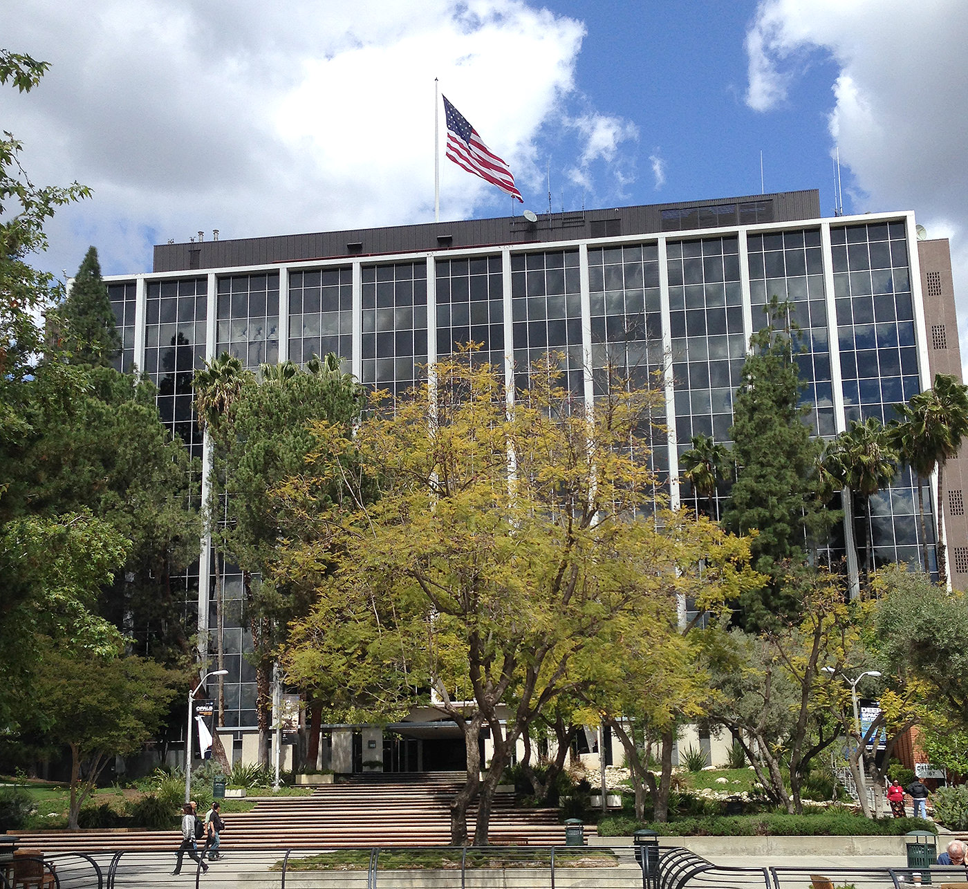
The main building at Jet Propulsion Laboratory in Pasadena (J. Major)
The event began on April 1 (no foolin’) at NASA’s Jet Propulsion Laboratory in Pasadena. Nestled at the feet of steep pine-covered hills northeast of Los Angeles, JPL’s campus is absolutely gorgeous… not quite the location you might imagine for the birthplace of robotic interplanetary explorers! But for over 55 years JPL has been developing some of the world’s most advanced spacecraft, from the Ranger probes which took NASA’s first close-up images of the Moon to the twin Voyagers that toured the Solar System’s outer planets, countless Earth-observing satellites that have revolutionized our ability to monitor global weather, and all of the rovers that have been our first “wheels on the ground” on Mars.
Of course, none of those missions would have been possible if we didn’t have the ability to communicate with the spacecraft. That’s why NASA’s Deep Space Network is such an integral — even if not oft-publicized — part of each and every mission… and has been for 50 years.
In fact, that was the purpose of this Social event which gathered together 50 space fans from across the U.S. — to celebrate the achievements of the DSN with an eye-opening tour of both JPL and the DSN’s Goldstone facility with its flagship 70-meter dish, located amongst the rocky scrub-covered hills in the middle of a military base in California’s Mojave desert.
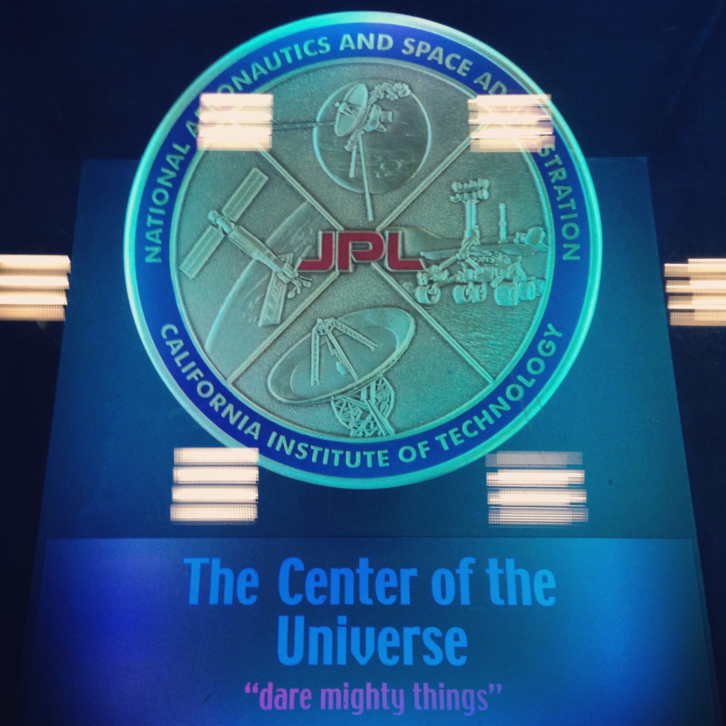
For many participants — including myself — it was the first time visiting JPL. I can’t tell you how many times I’ve written about the news that comes out of it, featured its amazing images, and typed the credit line “NASA/JPL-Caltech” in the caption of a picture, so for me it was incredible to actually be there in person. Just driving through the front gate at JPL, with “Welcome To Our Universe” mounted over the window of the guard station, was mind-blowing!
Setting up camp in Mission Control (J. Major)This 16-inch-wide plaque is set into the floor of the “dark room” at JPL Mission Control, covered by a pane of clear acrylic. (J. Major)
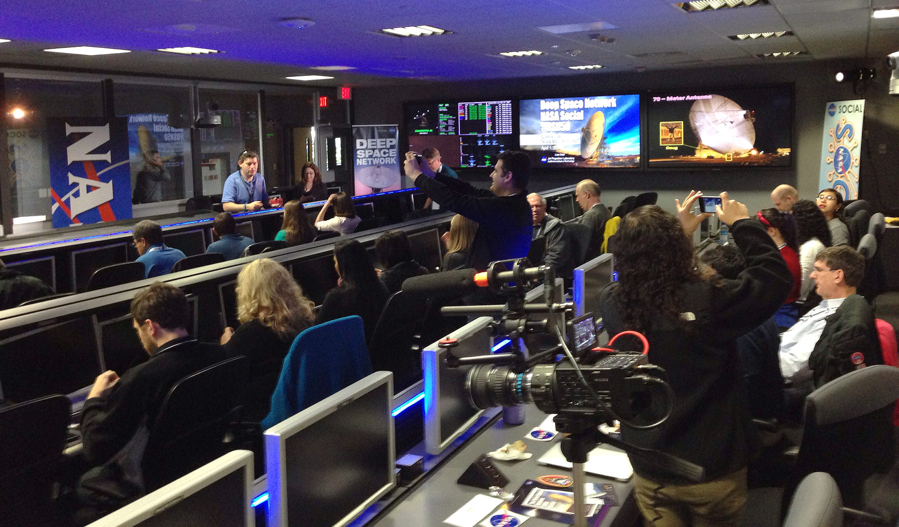
From the Visitor’s Center we were gathered into groups and taken into the heart of JPL to get a look at the Mission Control room, aka the “center of the universe.” This is where all the data from ongoing space exploration missions arrives (after being collected by the Deep Space Network, of course.) And we didn’t just get to see Mission Control — we actually set up our computers there and got to take our seats at the very same desks that top JPL and NASA engineers and scientists used during the MSL landing in August 2012! In fact we were treated to a replay of Curiosity’s landing on the screens against the wall that first displayed the rover’s images of Gale Crater. The whole experience was a bit surreal — I vividly recall watching it live, and there we were in the same room as if it were happening all over again! (We even got to re-enact the celebration of the touchdown announcement as our group photo.)
After several presentations and Q&A sessions with NASA mission engineers — recorded live for NASA TV — we all embarked on a tour of JPL’s rock-strewn “Mars Yard” where a stunt double of Curiosity, named “Maggie,” resides in a super high-tech garage. Maggie helps engineers determine what Curiosity can and can’t do on Mars… much more safely than actually having the “real” rover attempt itself.
Watch the NASA TV coverage from Mission Control below:
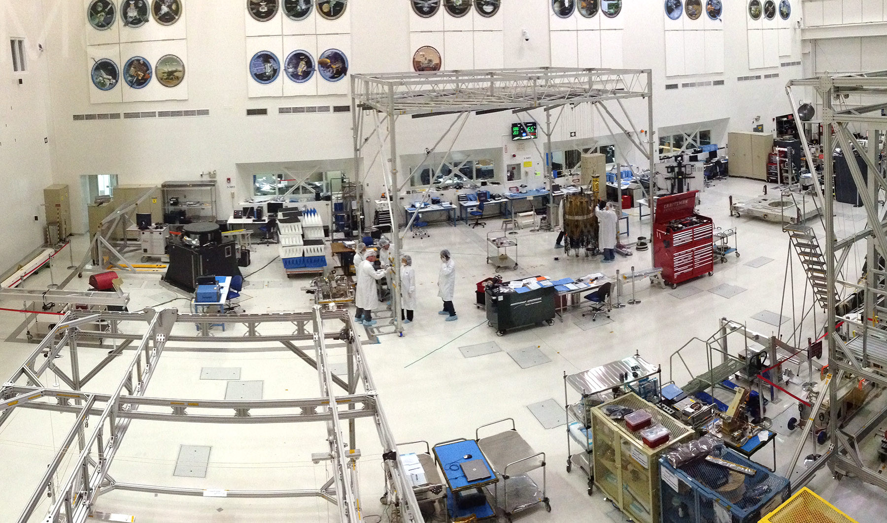
The group then got the chance to see an actual spacecraft being built in the Spacecraft Assembly Facility, a huge clean room where engineers were building components of the upcoming SMAP (Soil Moisture Active Passive) satellite. Slated for launch in October, SMAP will take measurements of the planet’s soil moisture in its freeze/thaw states from orbit over a period of three years. As we watched from the windowed viewing platform several “bunny-suited” engineers were busy working on SMAP’s 6-meter reflector. In another six months or so the parts that were scattered around that clean room will be performing science in orbit!
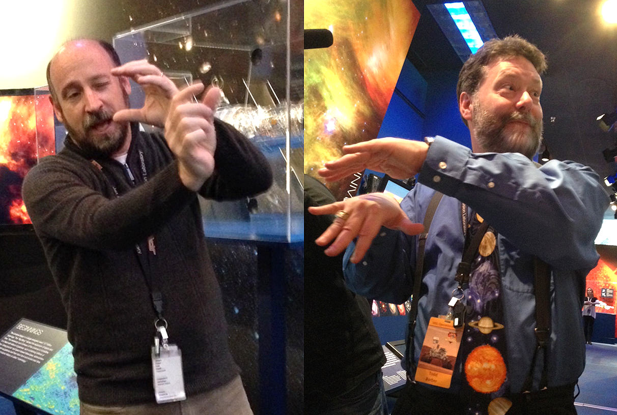
Where space explorers are born: JPL’s Spacecraft Assembly Facility (J. Major)Randii Wessen (left) and Todd Barber (right) demonstrate… well, I’m not sure what they were demonstrating but it was very entertaining! (J. Major)
From there it was off to the JPL museum and some intimate (and highly animated!) discussions about mission technology with project formulator Randii Wessen and propulsion engineer Todd Barber. Afterward I took the opportunity to talk with Todd a bit about his role on the Cassini mission, for which he’s the lead propulsion engineer.
(You all know how much I adore Cassini, so that was a real treat.)
When we got back to Mission Control we had a chance to meet with and have photos taken with JPL’s very own “Mohawk guy” Bobak Ferdowsi, who achieved widespread fame during the internet broadcast landing of Curiosity. I had Bobak sign my toy Curiosity rover, which now has a “BF” on the back of its die-cast RTG. One for the space shelf!
The second half of the Social began early the next day — for me, very early. After getting up at 3:15 a.m. and making a two-hour drive from Pasadena to Barstow in the dark, I and the other participants met up with the Social bus in a park-and-ride lot at 6:00 just as the Sun was beginning to brighten the eastern sky. (Some had stayed overnight in Barstow, while others made the early drive out like I did.) Once the bus filled, we headed north into the Mojave to arrive at NASA’s Deep Space Network Communications Complex at Goldstone, located within the Fort Irwin military training area.
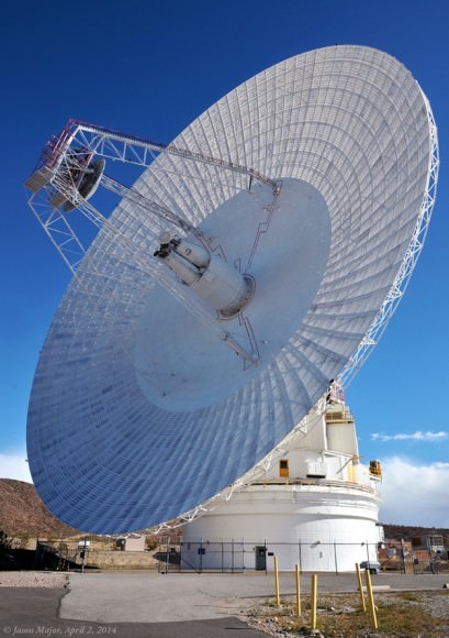
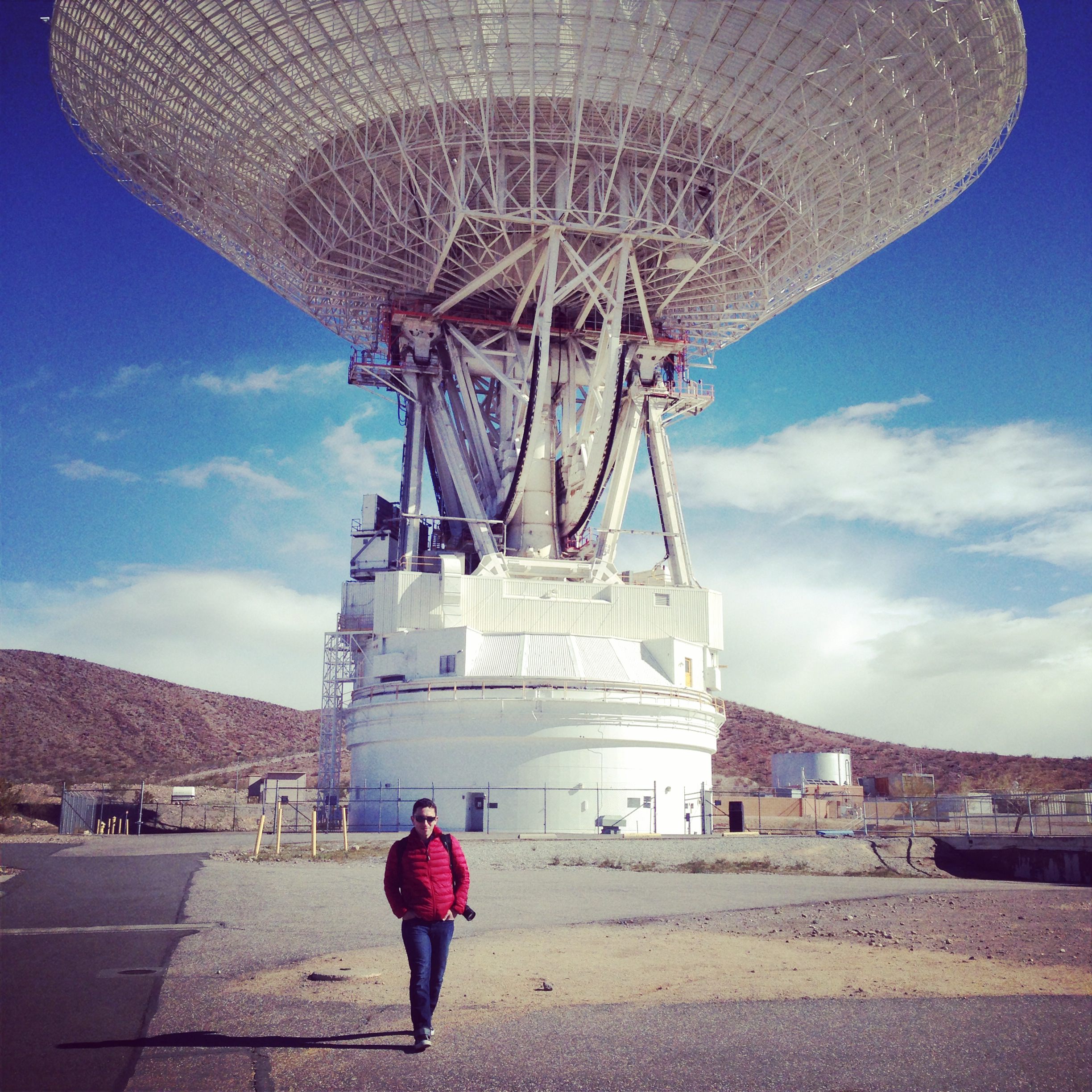
The 70-meter dish at NASA’s DSN complex at Goldstone (J. Major)
The location is rugged and remote — the perfect place to listen for the faint signals from spacecraft trundling across dusty Mars and soaring through the farthest reaches of the Solar System! The nine main DSN antennas at Goldstone are scattered across several square miles of desert, enormous dishes pointed more-or-less directly upward, aiming at the locations of distant spacecraft in order to both receive and transmit data. All of them are huge, but by far the most impressive is the gigantic 70-meter DSS-14 dish that towers above the rest in both height and width.
Recently renovated , the fully-positionable DSS-14 “Mars antenna” dish (so called because of its first mission tracking the Mariner 4 spacecraft in 1965) weighs in at 2.7 million kilograms yet “floats” atop a thin film of oil a quarter of a millimeter thick!
How smoothly does a three-thousand-ton radar dish move? We got to find out — check out the video below:
(Note: as it turned out, DSS-14 wasn’t turning to communicate with anything… the show was just for us!)
Of course, we all spent plenty of time taking pictures of the 70-meter, both inside and out — we were treated to a tour of this and several other dish sites hosted by JPL’s Jeff Osman, a specialist in the DSN antennas and their operations.
(One of us even chose to record the DSS-14 antenna with pencils and paper — watch fellow Social participant Jedediah Dore’s sketch and account of the experience here.)
Jim Erickson, JPL’s Project Manager for the Mars Rovers and MRO, speaks during the 50th Anniversary Event (J. Major)
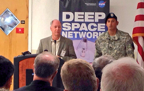
The highlight of the day at Goldstone was (if not just being there!) was being present for the official celebration of the facility’s 50th anniversary. Featuring speakers from JPL and DSN, as well as many esteemed guests, the event — held indoors because of strong winds outside — commemorated the impact and important contributions of the complex over the past half-century of space exploration. According to speaker Jim Erickson of JPL, “There hasn’t been a time in my career when the DSN wasn’t there for us.”
After that the NASA Social group was invited to take a few moments to mingle with speakers and guests — when else would I have a chance to chat with JPL director Dr. Charles Elachi? — and then we all returned to our own meeting room where refreshments were waiting and a (quite delicious) DSN50 cake was cut and served.
It was truly a fantastic and well-planned event, giving 50 people the chance to see an integral part of our space program that, although it doesn’t usually receive the same kind of exposure that rocket launches and planetary landings enjoy, makes all of it possible.
Here’s to 50 more years of DSN and its long-distance relationship with all of our intrepid space explorers!
__________________
See what communications are currently coming in and going out of the DSN dishes — in Goldstone as well as in Madrid and Canberra — here, and learn more about the history of Goldstone here.
And a big thanks to Courtney O’Connor, Veronica McGregor, John Yembrick, and Stephanie Smith for putting this NASA Social together, Annie Wynn and Shannon Moore for setting up and organizing participant groups on Facebook and Google (which makes offsite planning so much easier), Jeff Osman and Shannon McConnell for the tours of the DSN sites and, of course, everyone at JPL and Goldstone who helped to make the event a wonderful success!
Would you like to be a part of a NASA Social? Find out what events are coming up and how to apply for them here.
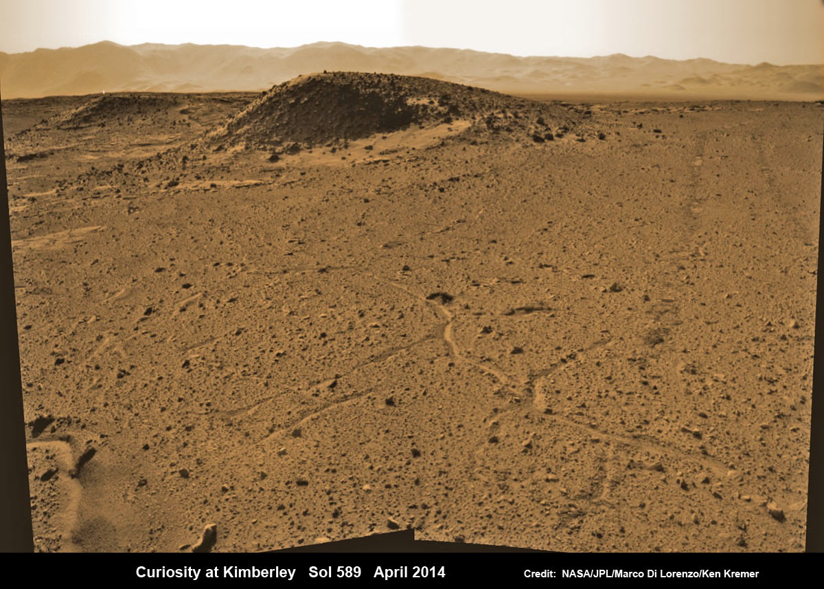
Curiosity maneuvers into ‘Kimbeley’ and scans scientifically intriguing Martian rock outcrops in search of next drilling location exhibiting several shallow hills in foreground and dramatic Gale crater rim backdrop. Rover tracks at right in this colorized Navcam photomosaic assembled from raw images snapped on Sol 589, April 3, 2014. Credit: NASA/JPL/Marco Di Lorenzo /Ken Kremer - kenkremer.com
Curiosity maneuvers into ‘Kimbeley’ and scans scientifically intriguing Martian rock outcrops in search of next drilling location exhibiting several shallow hills in foreground and dramatic Gale crater rim backdrop. Rover tracks at right in this colorized Navcam photomosaic assembled from raw images snapped on Sol 589, April 3, 2014.
Credit: NASA/JPL/Marco Di Lorenzo /Ken Kremer – kenkremer.com[/caption]
NASA’s car sized Curiosity rover has arrived at a scientifically enticing science destination at “The Kimberley Waypoint” where researchers hope to carry out the next drilling operation into alien Martian terrain in search of further clues about ancient Red Planet environments that may have been favorable for life.
“We are officially in ‘The Kimberley’ now,” Curiosity Principal Investigator John Grotzinger, of the California Institute of Technology, Pasadena, told Universe Today.
Since arriving in the Kimberley region, Curiosity’s earth-bound handlers have been maneuvering the 1 ton robot to thoroughly survey the destination dubbed “The Kimberley”.
Why was Kimberley chosen as a science destination?
“The Kimberley” has interesting, complex stratigraphy,” Grotzinger told me.
The team moved the six wheeled robot further this week in search of a suitable location to conduct the next drilling operation. The terrain is replete with diverse rock types and extensive outcrops.
I asked Grotzinger if today’s (April 5) location at ‘The Kimberley’ is the intended drill site?
“It’s a possible drill site,” Grotzinger replied.
“Pending further evaluation,” he noted.
Curiosity scans scientifically intriguing rock outcrops of Martian terrain at ‘The Kimberley’ waypoint in search of next drilling location, beside low hill at right. Mastcam color photomosaic assembled from raw images snapped on Sol 590, April 4, 2014. Credit: NASA/JPL/MSSS/Ken Kremer – kenkremer.com/Marco Di Lorenzo
Curiosity drove the final stretch of some 98 feet (30 meters) on Wednesday, April 2, required to arrive at a major stopping waypoint planned since early 2013 for up close study of the Red Planet’s rocks.
Along the recent dune filled path to ‘The Kimberley’, Curiosity snapped breathtaking landscapes around the irresistible ‘Junda’ outcrop, much like a tourist.
See our photomosaics showing the spectacularly inviting terrain around Kimberly and Junda, above and below, by Marco Di Lorenzo and Ken Kremer.
Martian landscape with rows of curved rock outcrops at ‘Kimberly’ in the foreground and spectacular Mount Sharp on the horizon. NASA’s Curiosity Mars rover pulled into Kimberly waypoint dominated by layered rock outcrops as likely drilling site. This colorized navcam camera photomosaic was assembled from imagery taken on Sol 576 (Mar. 20, 2014). Credit: NASA/JPL-Caltech/Marco Di Lorenzo/Ken Kremer-kenkremer.com
The state-of-the-art robot now sits at a vantage point at “The Kimberley” enabling a detailed photographic survey of the rock exposures and surroundings with the high resolution Mastcam cameras.
The new imagery will be used to select the most scientifically productive drilling locations.
“It is named after a remote region of western Australia,” Grotzinger informed me.
The team chose Kimberley because its lies at the intersection of four different types of rocks, including striated rocks overlain by others and deposited in a decipherable geological relationship to each other.
Researchers directed Curiosity on a pinpoint drive to ‘Kimberley’ after high resolution imagery and mineral mapping spectrometry gathered by NASA’s powerful telescopic cameras aboard the Mars Reconnaissance Orbiter (MRO) circling overhead piqued their interest.
Curiosity looks back at Martian sand dunes and rover tracks after passing by Junda outcrop (right) on Sol 548 (Feb. 19, 2014) with Gale Crater rim and Mount Sharp on the distant horizon. Navcam colorized photomosaic. Credit: NASA/JPL-Caltech/Ken Kremer- kenkremer.com/Marco Di Lorenzo
“This is the spot on the map we’ve been headed for, on a little rise that gives us a great view for context imaging of the outcrops at the Kimberley,” said Melissa Rice, Curiosity science planning lead, of Caltech.
The team expects Curiosity to investigate Kimberley for several weeks of observations, including sample-drilling and onboard laboratory analysis of the area’s rocks with the CheMin and SAM miniaturized chemistry labs.
If drilling is warranted, Kimberley would be the site of Curiosity’s first drilling operation since boring into the ‘John Klein’ and ‘Cumberland’ outcrop targets during the spring of 2013 at Yellowknife Bay.
The robot has conducted cleaning activities of SAM, CheMin and the CHIMRA sample handling mechanism in anticipation of boring into the Martian outcrops and delivering powdery, pulverized samples of cored Martian rocks to SAM and CheMin – waiting patiently inside the robots belly to eat something exciting from the Red Planet.
Curiosity departed the Yellowknife Bay region in July 2013 where she discovered a habitable zone and thereby accomplished the primary goal of the mission.
To date, Curiosity’s odometer totals 3.8 miles (6.1 kilometers) since landing inside Gale Crater on Mars in August 2012. She has taken over 137,000 images.
The sedimentary foothills of Mount Sharp, which reaches 3.4 miles (5.5 km) into the Martian sky, is the 1 ton robots ultimate destination inside Gale Crater because it holds caches of water altered minerals. Such minerals could possibly indicate locations that sustained potential Martian life forms, past or present, if they ever existed.
Curiosity has some 4 kilometers to go to reach the base of Mount Sharp.
She may arrive at the lower reaches of Mount Sharp sometime in the latter half of 2014, but must first pass through a potentially treacherous dune field.
Stay tuned here for Ken’s continuing Curiosity, Opportunity, Chang’e-3, SpaceX, Orbital Sciences, LADEE, MAVEN, MOM, Mars and more planetary and human spaceflight news.
Learn more at Ken’s upcoming presentations at the NEAF convention on April 12/13 and at Washington Crossing State Park, NJ on April 6.
Map of Curiosity Mars Rover’s Drives to ‘the Kimberley’ Waypoint. This map shows the route driven by NASA’s Curiosity Mars rover during March and April 2014 in its approach to and arrival at a waypoint called “the Kimberley,” which rover team scientists chose in 2013 as the location for the mission’s next major investigations. Credit: NASA/JPL-Caltech/Univ. of Arizona
You can enter NASA’s ‘Take the Plunge’ contest and guess LADEE’s impending lunar impact date, expected on or before April 21, 2014. Credit: NASA
You can enter NASA’s ‘Take the Plunge’ contest and guess LADEE’s impending lunar impact date, expected on or before April 21, 2014. Credit: NASA Contest entry details below – deadline soon[/caption]
When will LADEE hit the Moon for its looming end of mission finale?
NASA’s resoundingly successful LADEE lunar dust exploring mission is nearly out of gas – and needs your help, now!
With its inevitable doom approaching, NASA needs you to summon your thoughts and is challenging you to participate in a ‘Take the Plunge’ contest – figuratively not literally – and guess LADEE’s impending impact date.
LADEE, which stand for Lunar Atmosphere and Dust Environment Explorer, will smack violently into the Moon and scatter into zillions of bits and pieces sometime in the next two and a half weeks, on or before about April 21.
But exactly when will it impact the lunar surface? NASA wants to hear your best guess!
The ‘Take the Plunge’ contest was announced by NASA today, April 4, at a media briefing.
This dissolve animation compares the LRO image (geometrically corrected) of LADEE captured on Jan 14, 2014 with a computer-generated and labeled image of LADEE . LRO and LADEE are both NASA science spacecraft currently in orbit around the Moon. Credit: NASA/Goddard/Arizona State University
Between now and its inevitable doom, mission controllers will command LADEE to continue gathering groundbreaking science.
And it will do so at an even lower attitude that it orbits today by firing its orbit maneuvering thrusters tonight and this weekend.
The couch sized probe seeks to eek out every last smidgeon of data about the Moons ultra tenuous dust and atmospheric environment from an ultra low altitude just a few miles (km) above the pockmarked lunar surface.
But because the moon’s gravity field is so uneven, the probes thrusters must be frequently fired to keep it on course and prevent premature crashes.
“The moon’s gravity field is so lumpy, and the terrain is so highly variable with crater ridges and valleys that frequent maneuvers are required or the LADEE spacecraft will impact the moon’s surface,” said Butler Hine, LADEE project manager at Ames.
“Even if we perform all maneuvers perfectly, there’s still a chance LADEE could impact the moon sometime before April 21, which is when we expect LADEE’s orbit to naturally decay after using all the fuel onboard.”
LADEE will fly as low as fly approximately 1 to 2 miles (2 to 3 kilometers) above the surface.
Everyone of all ages is eligible to enter NASA’s “Take the Plunge: LADEE Impact Challenge.”
The submissions deadline is 3 p.m. PDT Friday, April 11.
NASA says that winners post impact. They will receive a commemorative, personalized certificate from the LADEE program via email.
Series of LADEE star tracker images features the lunar terrain. Credit: NASA Ames
Watch for my upcoming story on LADEE’s science accomplishments and what’s planned for her final days.
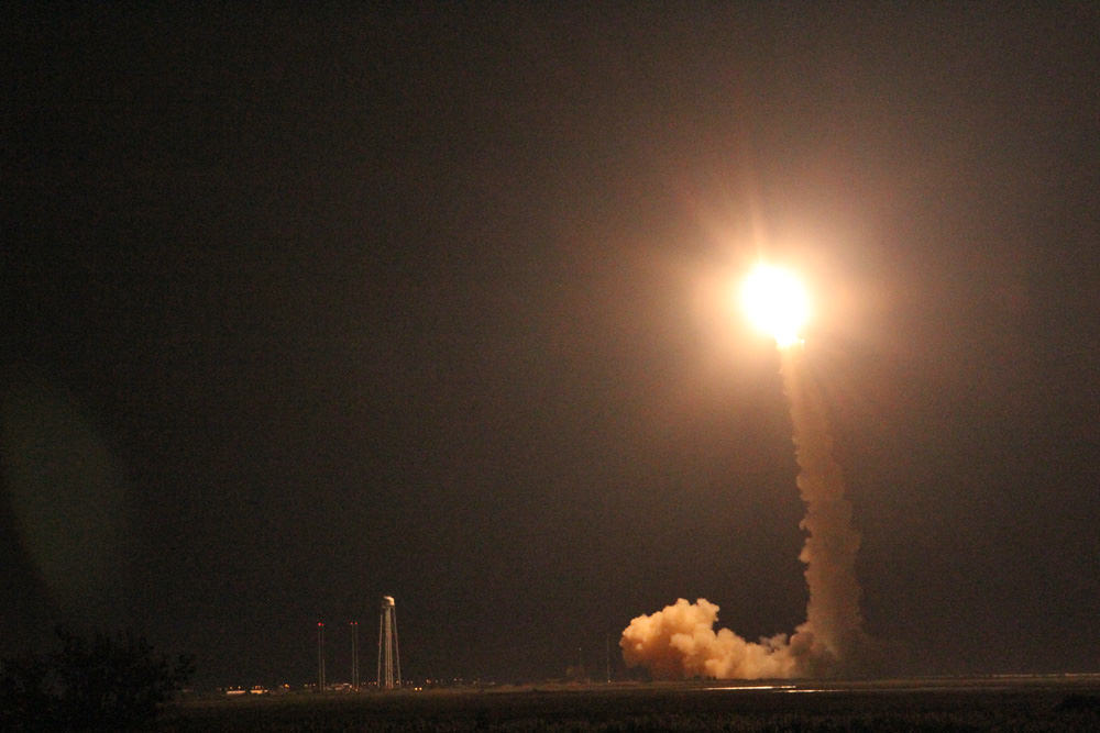
LADEE was launched on Sept. 6, 2013 from NASA Wallops in Virginia on a science mission to investigate the composition and properties of the Moon’s pristine and extremely tenuous atmosphere, or exosphere, and untangle the mysteries of its lofted lunar dust dating back to the Apollo Moon landing era.
Launch of NASA’s LADEE lunar orbiter on Friday night Sept. 6, at 11:27 p.m. EDT on the maiden flight of the Minotaur V rocket from NASA Wallops, Virginia, viewing site 2 miles away. Antares rocket launch pad at left. Credit: Ken Kremer/kenkremer.com
The science mission duration had initially been planned to last approximately 100 days and finish with a final impact on the Moon on about March 24th.
NASA granted LADEE a month long extension since the residual rocket fuel is more than anticipated due to the expertise of LADEE’s navigation engineers and the precision of the launch atop the Orbital Sciences Minotaur V rocket and orbital insertion.
Stay tuned here for Ken’s continuing LADEE, Chang’e-3, Orion, Orbital Sciences, SpaceX, commercial space, Mars rover and more planetary and human spaceflight news.
Learn more at Ken’s upcoming presentations at the NEAF astro/space convention, NY on April 12/13 and at Washington Crossing State Park, NJ on April 6.
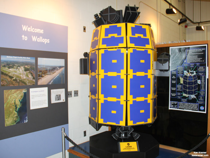
Full scale model of NASA’s LADEE lunar orbiter on display at the free visitor center at NASA’s Wallops Flight Facility in Virginia. Credit: Ken Kremer/kenkremer.com
One of the first pictures released from UrtheCast in April 2014 showed several hundred square miles around Moneague, Jamaica. Credit: UrtheCast
UrtheCast — the company aiming to bring high-definition pictures of Earth to the public — is among the exemptions after NASA severed most ties officially with Russia yesterday (April 2), the company said in a press release.
“It is business as usual for the company, as we continue the commissioning of our cameras on the International Space Station,” stated Wade Larson, UrtheCast President and chief operating officer.
“The ISS has long enjoyed a privileged position in international diplomacy and has survived unscathed during multiple international crises in recent years. In fact, we understand that the ISS has been nominated for this year’s Nobel Peace Prize. I think that says a lot.”
The news came around the same time that UrtheCast revealed its first pictures from its two cameras, which were installed by Russian spacewalkers in January following a failed attempt in December.
The new pictures reveal a few hundred square miles of Moneague, Jamaica and Santa Cruz de Mara, Venezuela, both taken on March 28.
“This is a pivotal moment for the company and for everyone who’s been a part of the vision that we set in motion in the fall of 2010. Our team has been working extremely hard to make certain that we reach this goal of democratizing a very powerful perspective on the planet,” stated Scott Larson, UrtheCast co-founder and chief executive officer.
The company is promising there will soon be a “near realtime” stream of Earth observations from the cameras’ perch on the International Space Station. Read more about the company’s plans in this past Universe Today story.
Following a leaked memo early yesterday, NASA released an official statement saying that it would sever most ties with Russia except for those related to International Space Station operations. The United States is among several countries condemning Russia’s decision to bring troops to Crimea a few weeks ago. The decision will likely affect several planetary science agreements with Russia, planetary scientist Barbara Cohen said on Twitter after the news was released.
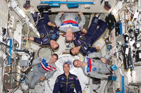
Expedition 38 crew members proudly sport their national flags in this March 2014 picture from the International Space Station. Pictured (clockwise from top center) are Russian cosmonaut Oleg Kotov, commander; Japan Aerospace Exploration Agency astronaut Koichi Wakata, Russian cosmonaut Sergey Ryazanskiy, NASA astronauts Rick Mastracchio and Mike Hopkins, and Russian cosmonaut Mikhail Tyurin, all flight engineers. Credit: NASA
NASA plans to cease most work with the Russian Federal Space Agency amid growing tensions concerning the Ukrainian crisis, a spokesperson confirmed with a statement to Universe Today Wednesday evening (April 2).
While the International Space Station will still see work to “maintain safe and continuous operation”, most other NASA activities with Roscosmos will cease, the statement read. It added (citing the Obama administration) that Congress now faces a choice between fully funding human U.S. launches again in 2017, or facing years more of sending money to the Russians for Soyuz launches from Kazakhstan.
In full, this is the statement that Bob Jacobs, NASA’s deputy associate administrator of communications, sent to Universe Today (UPDATE, 8:54 p.m. EDT — this is also now available on NASA’s G+ page)
Given Russia’s ongoing violation of Ukraine’s sovereignty and territorial integrity, NASA is suspending the majority of its ongoing engagements with the Russian Federation. NASA and Roscosmos will, however, continue to work together to maintain safe and continuous operation of the International Space Station.
NASA is laser focused on a plan to return human spaceflight launches to American soil, and end our reliance on Russia to get into space. This has been a top priority of the Obama Administration’s for the past five years, and had our plan been fully funded, we would have returned American human spaceflight launches – and the jobs they support – back to the United States next year.
With the reduced level of funding approved by Congress, we’re now looking at launching from U.S. soil in 2017. The choice here is between fully funding the plan to bring space launches back to America or continuing to send millions of dollars to the Russians. It’s that simple. The Obama Administration chooses to invest in America – and we are hopeful that Congress will do the same.
It is unclear from this statement exactly what activities would constitute “safe and continuous operation” of station. So, for example, it’s unclear so far if (for example) NASA will still send photographers to cover launches and landing in Russia, or to what extent NASA TV broadcasts of Russian spacewalks would be affected.
Since the shuttle retired in 2011, NASA and other space agencies such as the European Space Agency have relied on Russian Soyuz spacecraft to bring astronauts to the International Space Station. Crews are generally made up of large proportions of Russian cosmonauts and American astronauts, as well as a few astronauts from other agencies. The current Expedition 39 crew has has three Russians, two Americans and a Japanese commander, Koichi Wakata. Expedition 40 will launch aboard a Soyuz spacecraft in May, if all goes to plan.
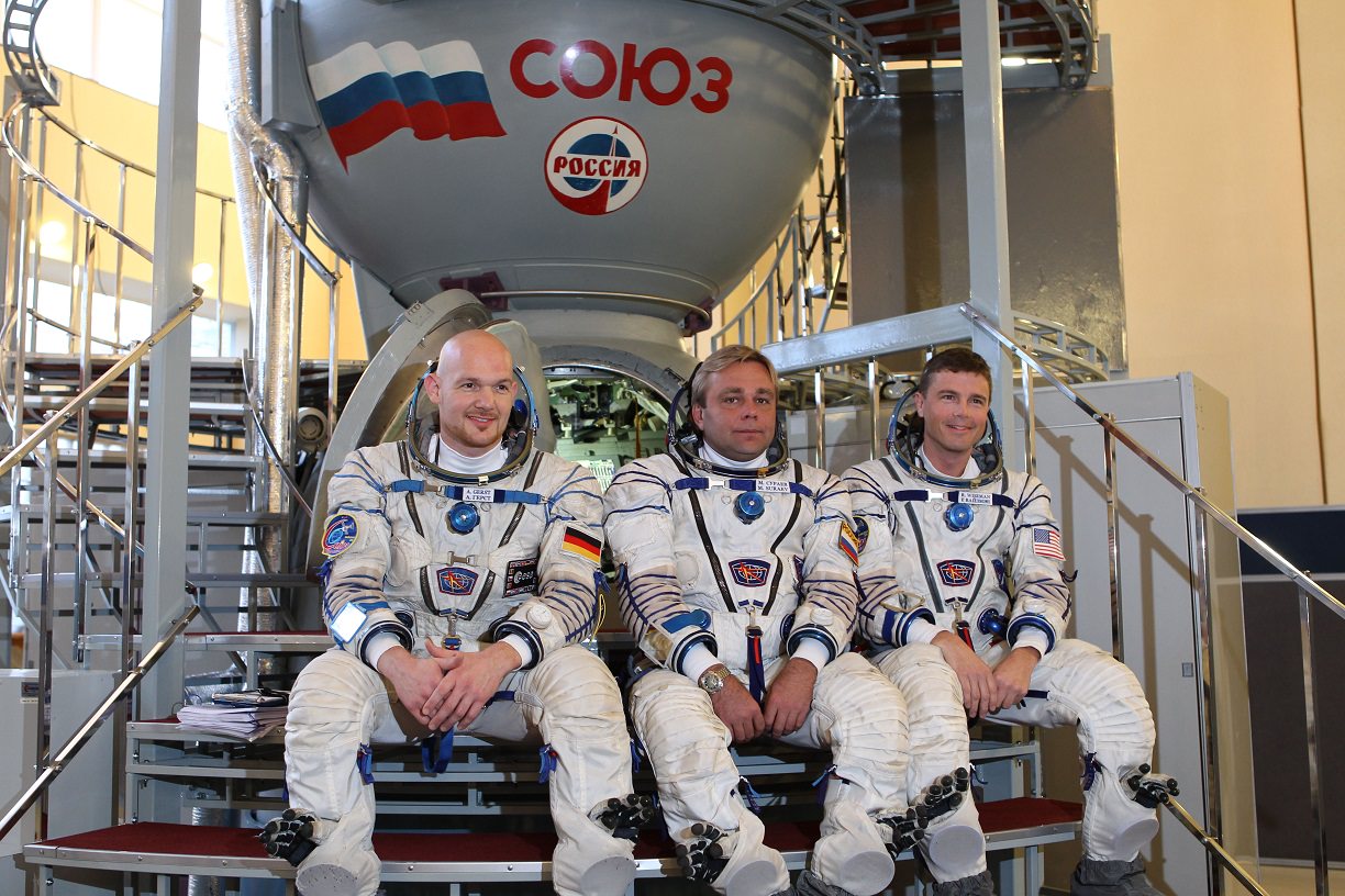
The crew members of Expedition 40/41 pose in front of a Soyuz spacecraft simulator in Star City, Russia. From left, Alex Gerst (European Space Agency), Max Suraev (Roscosmos) and Reid Wiseman (NASA). Credit: NASA
The human spaceflight relationship between NASA and Russia stretches back to the 1970s when Russia was then the Soviet Union. Their first joint mission was with the Apollo-Soyuz Test Project in 1975. That relationship expanded when several NASA shuttles visited the Russian space station Mir in the 1990s, laying the groundwork for the International Space Station agreement today.
NASA is working on a commercial crew program that right now is slated to bring U.S. astronauts into space from American soil again in 2017. There are several proposals being considered: a human-rated version of SpaceX’s Dragon, Blue Origin’s New Shepard, Sierra Nevada Corp.’s Dream Chaser and the Boeing Co.’s CST-100. NASA releases regular updates on how these companies — most of which receive money from the agency for development — are progressing, with the most recent update coming March 31.
It is unclear, however, how much money CCP will receive in the upcoming fiscal 2015 budget request before Congress. Historically, NASA receives less money for this program than what the agency requests (which has pushed back launches by a few years). The new tensions with Russia, however, could make things different this time around. This seems to be what NASA is counting on in the statement.
As far as what missions could be affected due to cooperation with Russia, planetary scientist Barbara Cohen said on Twitter that while it may appear the US may do little with Russia beyond the International Space Station, cooperation in planetary science is rather big. Russian scientists contribute to several ongoing and upcoming NASA robotic missions, and US scientists are contributing to the planning for ExoMars, which is an ESA-Roscosmos mission, and the US is contributing Elektra telecommunication radios to the orbiter and part of a mass spectrometer for the rover. Additionally, US scientists are working with the Verera-D mission, a strategic Venus mission sponsored by Roscosmos, with participation by NASA’s Planetary Science Division.
The news of the breach comes about a month after NASA administrator Charlie Bolden told reporters that the Russian diplomacy crisis, which erupted after troops went to Crimea a few weeks ago (to U.S. and other countries’ condemnation), would not affect Soyuz launches or other activities related to the space station.
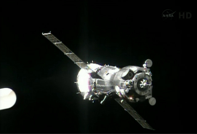
Screenshot from NASA TV of the Soyuz TMA-09M spacecraft arriving at the International Space Station.
“Everything is nominal right now in our relationship with the Russians. We continue to monitor the situation,” said NASA administrator Charles Bolden in a conference call with reporters March 4, following the release of NASA’s preliminary budget request.
“The safety of our crews and our assets that has not changed. Safety is the No. 1 of NASA’s core values, so we are constantly doing contingency planning on the International Space Station for emergencies that might arise,” Bolden added, citing an emergency ammonia pump replacement in December as one such example.
“Those are the kinds of things we are always planning for, and in terms of the situation on the ground, we will go into contingency planning for that as the situation dictates. But right now, we don’t see any reason to do so,” he added.
International Space Station operations were recently extended to at least 2024, and NASA officials have pointed out that it and similar agreements have weathered other world crises.
Wednesday’s news first came to light in a reported internal memo posted on SpaceRef’s website that morning. Jacobs did not confirm or deny the memo’s authenticity in the e-mail to Universe Today.
Universe Today will issue updates as circumstances warrant.
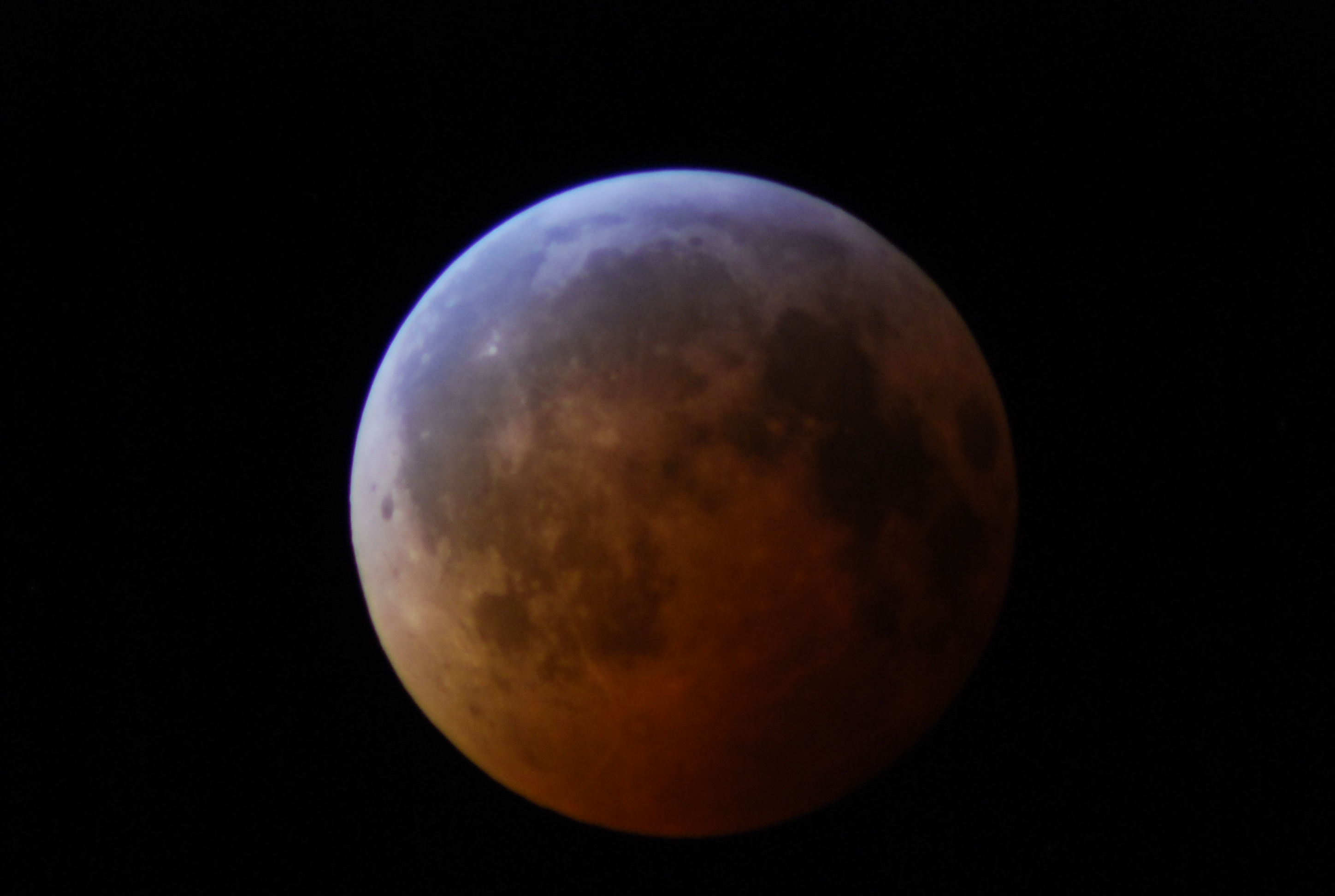
Totality! A seen during the "December solstice eclipse" of 2010. Photo by author.
April the 15th: In the United States, it’s a date dreaded by many, as the date to file taxes – or beg for an extension – looms large. But this year, Tax Day gives lovers of the sky something to look forward to, as the first of four total lunar eclipses for 2014 and 2015 occurs on the night of April 14th/15th favoring North and South America.
The circumstances for the April 15th, 2014 eclipse. The top chart shows the path of the Moon through the umbra, and the bottom chart shows the visibility region (light to shaded areas) Click here for a technical description. Credit: Eclipse Predictions by Fred Espenak, NASA/GSFC.
This marks the first total lunar eclipse visible from since December 10th 2011, which was visible at moonset from North America, and marks the start of the first of two eclipse seasons for 2014. Totality will last 1 hour, 17 minutes and 48 seconds, and will be visible in its entirety from the central Atlantic westward to eastern Australia. Unlike a total solar eclipse, which occurs along a narrow track, a total lunar eclipse can be viewed by the entire moonward facing hemisphere of the Earth.
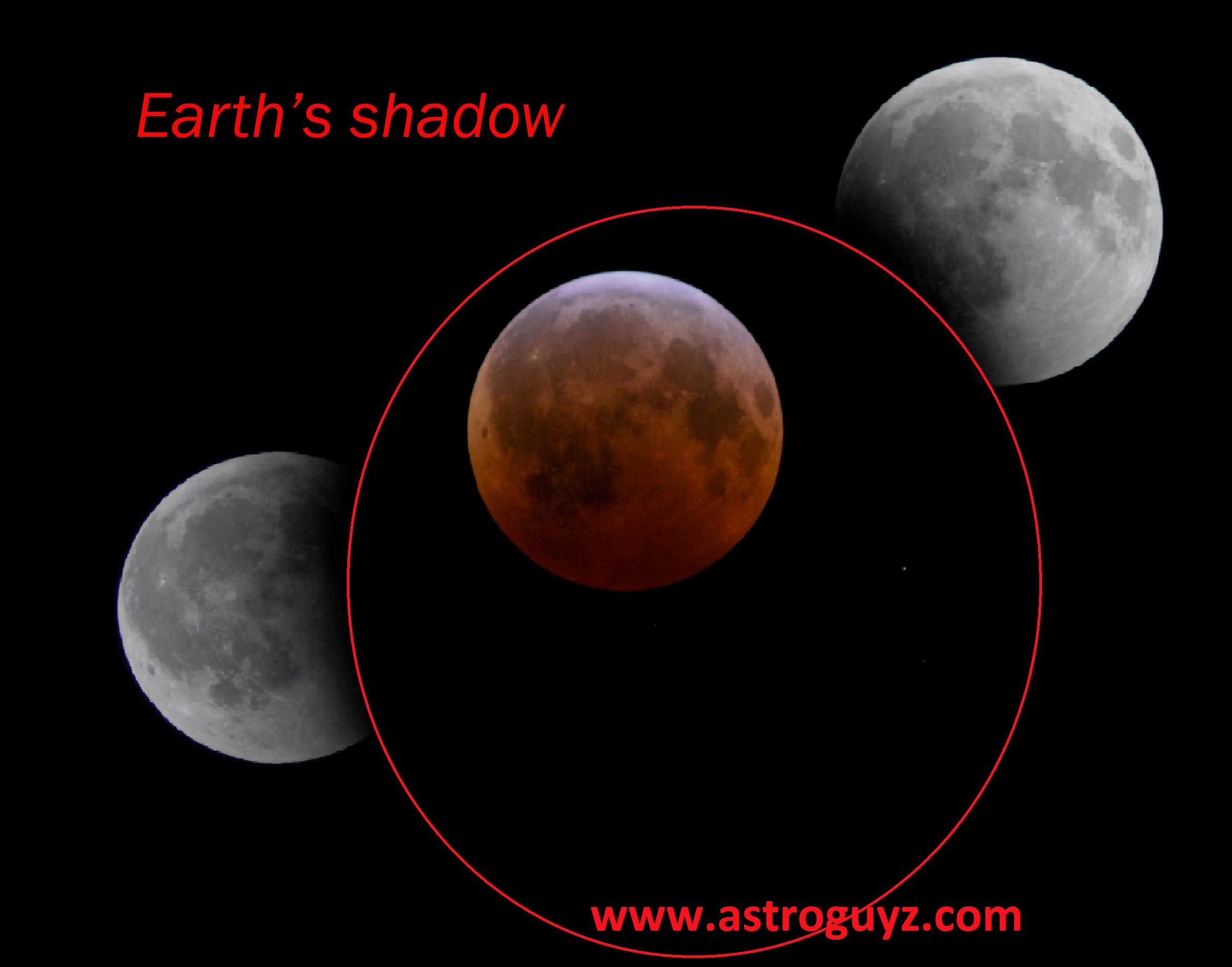
Tracing the umbra: a mosaic of the December 2010 eclipse. Photos by author.
The action begins at 4:37 Universal Time (UT)/12:37 AM EDT, when the Moon enters the western edge of the Earth’s shadow known as the penumbra. The Moon will be completely immersed in the penumbra by 5:58 UT/1:58 AM EDT, but don’t expect to see anything more than a faint tan shading that’s slightly darker on the Moon’s northeastern edge.
The real action begins moments later, as the Moon encounters the ragged edge of the umbra, or the inner core of the Earth’s shadow. When does the umbra first become apparent to you? Totality then begins at 7:06 UT/3:06 AM EDT and lasts until 8:24 UT/4:24 AM EDT, with mid-eclipse occurring just south of the center of the Earth’s shadow at 7:46 UT/3:46 AM EDT.
Finally, the eclipse ends as the Moon slides out of the penumbra at 10:37 UT/ 6:37 AM EDT. Michael Zeiler (@EclipseMaps) has complied a fine video guide to the eclipse:
This eclipse is also notable for being part of a series of four lunar eclipses in 2014 & 2015, known as a “tetrad.” NASA eclipse expert Fred Espenak notes that this series of eclipses is also notable in that all four are visible in part or in their entirety from the United States. We’re in a cycle of 9 sets of tetrads for the 21st century, which began with the first set in 2003. Before that, you have to go all the way back to the 16th century for the last set of eclipse tetrads!
The position of the Moon within the Earth’s umbra on the morning of April 15th at 4AM EDT/8UT. Credit: Starry Night Education software.
For saros buffs, the April 15th eclipse is Member 56 of 75 of saros 122, which began on August 14th 1022 A.D. and runs out until a final penumbral eclipse of the series on October 29th, 2338. There are only two total eclipses left in this particular saros, one in 2032 and 2050. If you caught the total lunar eclipse of April 4th, 1996, you saw the last lunar eclipse in this same saros series.
Lunar eclipses have turned up at some curious junctures in history. For example, a lunar eclipse preceded the fall of Constantinople in 1453. A 2004 lunar eclipse also fell on the night that the Red Sox won the World Series after an 86 year losing streak, though of course, lunar eclipses kept on occurring during those losing years as well. Christopher Columbus was known to evoke an eclipse on occasion to get him and his crew out of a jam, and also attempted to use a lunar eclipse to gauge his position at sea using a method first described by Ptolemy while studying the lunar eclipse of September 20th, 331 B.C.
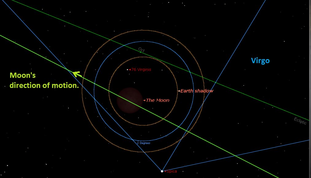
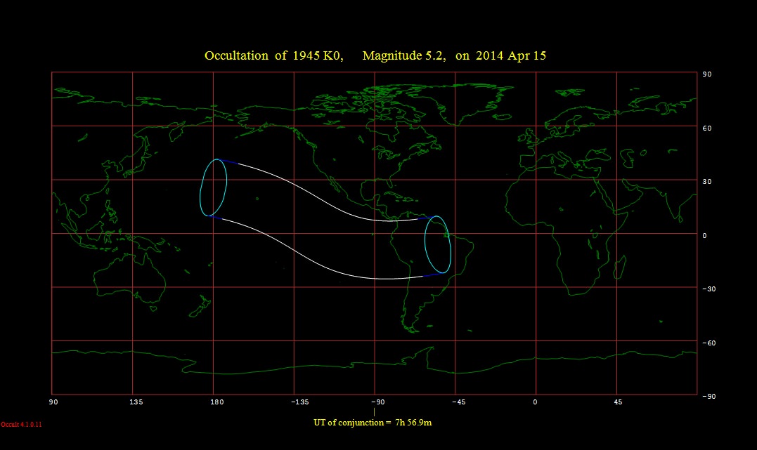
A handful of stars in the +8th to +12th magnitude range will be occulted by the eclipsed Moon as well. Brad Timerson of the International Occultation Timing Association (IOTA) has put together a list, along with graze line prospects across the United States. The brightest star to be occulted by the eclipsed Moon is +5th magnitude 76 Virginis across western South America and Hawaii:
The occultation footprint of 76 Virginis during the April 15th lunar eclipse. Credit: Occult 4.0
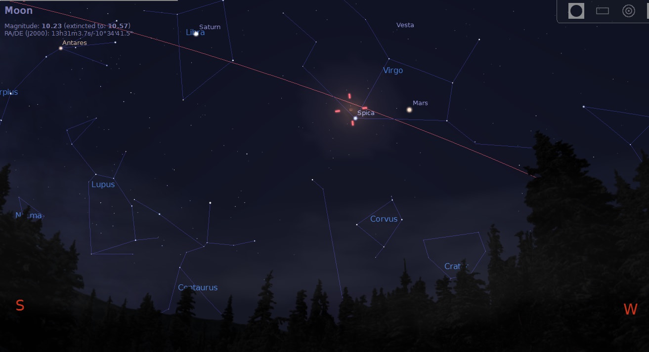
Note that the bright star Spica will be only just over a degree from the eclipsed Moon, and Mars will also be nearby, just a week past its 2014 opposition. And to top it off, Saturn is just one constellation to the east in Libra!
During the partial phases of the eclipse, watch for the Moon to take on a “Pacman-like” appearance. The Earth’s umbra is just under three times the size of the Moon, and the Greek astronomer Aristarchus of Samos used this fact and a little geometry to gauge the distance to our natural satellite in the 3rd century B.C.
As totality approaches, expect the innermost rim of the Moon to take on a ruddy hue. This is the famous “combination of all the sunrises and sunsets” currently underway worldwide as light is bent through the Earth’s atmosphere into its shadow. It’s happening every night, and during the totality of a lunar eclipse is the only chance that we get to see it.
Looking to the southwest at 4 AM EDT from latitude 30 degrees north on the morning of April 15th. Credit: Stellarium.
You don’t need anything more sophisticated than the naked eye or “Mark 1 eyeball” to enjoy a lunar eclipse, though it’s fun to watch through binoculars or a low-power telescope field of view. One interesting project that has been ongoing is to conduct timings for the moment when the umbra contacts various craters on the Moon. It’s a curious mystery that the Earth’s shadow varies by a small (1%) but perceptible amount from one eclipse to the next, and efforts by amateur observers may go a long way towards solving this riddle.
Said color of the fully eclipsed Moon can vary considerably as well: the Danjon scale describes the appearance of the eclipsed Moon, from bright and coppery red (Danjon 4) to so dark as to almost be invisible (Danjon 0). This is a product of the amount of dust, volcanic ash and aerosols currently aloft in the Earth’s atmosphere. During the lunar eclipse of December 9th, 1992 the Moon nearly disappeared all together, due largely to the eruption of Mount Pinatubo the year prior.
A lunar eclipse also presents a chance to nab what’s known as a Selenelion. This occurs when the Sun and the totally eclipsed Moon appear above the local horizon at the same time. This is possible mainly because the Earth’s shadow is larger than the Moon, allowing it to linger a bit inside the umbra after sunrise or before sunset. Gaining some altitude is key to making this unusual observation. During the April 15th eclipse, selenelion sightings favor the Mid-Atlantic and Greenland where totality is underway at sunrise and eastern Australia, where the reverse is true at sunset.
Want to have a go at measuring the brightness or magnitude of the eclipsed Moon? Here’s a bizarre but fun way to do it: take a pair of binoculars and compare the pinpoint Moon during totality to the magnitude of a known star, such as Antares or Spica.
Note that to do this, you’ll first need to gauge the magnitude extinction of your particular binoculars: NASA’s got a table for that, or you could field test the method days prior on Venus, currently shining at a brilliant -4.2 in the dawn. Hey, what’s a $1,000 pair of image-stabilized binocs for?
And of course, weather prospects are the big question mark for the event. Mid-April weather for North America is notoriously fickle. We’ll be watching the Clear Sky Chart and Skippy Sky for prospects days before the eclipse.
Photography during an eclipse is fun and easy to do, and you’ll have the waxing gibbous Moon available to practice on days prior to event. Keep in mind, you’ll need to slow down those shutter speeds as the Moon enters into totality, we’re talking going down from 1/60th of a second down to ¼” pretty quickly. In the event of a truly dark eclipse, the Moon may vanish in the view finder all together. Don’t be afraid to step exposures up to the 1 to 4 second range in this instance, as you’ve got over an hour to experiment.
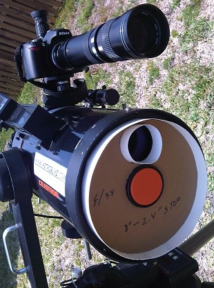
Our “eclipse hunting rig…” the DSLR is piggy-backed to shoot stills on the main scope, which will shoot video. Note that the “f/34 field stop” will most likely be removed! Photo by author
Thus far, only one webcast for the eclipse has surfaced, courtesy of the venerable Slooh. We’ll most likely be doing a follow up roundup of eclipse webcasts as they present themselves, as well as a look at prospects for things like a transit of the ISS in front of the eclipsed Moon and weather forecasts closer to show time.
And speaking of spacecraft, China’s Chang’e 3 lander and Yutu rover will have a fine view of a solar eclipse overhead from their Mare Imbrium vantage point, as will NASA’s LRO and LADEE orbiters overhead. In fact, NASA hinted last year that the April 15th eclipse might spell the end of LADEE entirely…
And thus marks the start of eclipse season one of two for 2014. Next up will be a curious non-central annular solar eclipse over Antarctica on April 29th, followed by another total lunar eclipse on October 8th, and a fourth and final partial solar eclipse of the year for North America of October 23rd.
Watch this space and follow us on Twitter as @Astroguyz, as we’ll be “all eclipses, all the time,” for April… no new taxes guaranteed!
Next up: Heard the one about the Blood Moon? Yeah, us too… join us as we debunk the latest lunacy surrounding the eclipse tetrad!
– Got pics of the lunar eclipse? Send ‘em in to Universe Today, as a post-eclipse photo round up is a very real possibility!
An image mosaic of ice breaking up in the Arctic Ocean's Canada Basin on March 28, 2014. Image taken by Operation IceBridge's Digital Mapping System. Credit: Digital Mapping System/NASA Ames
The Arctic melt season is averaging five days longer with each passing decade, a new study by NASA and the National Snow and Ice Data Center reveals. And with more ice-free days, the water (which is darker than the surrounding ice) is absorbing the sun’s heat and accelerating the process. This means the Arctic ice cap has shrank by as much as four feet.
The sobering news comes following a study of satellite data from 1979 to 2013. By the end of this century, scientists believe, there will be a fully melted Arctic Ocean during the entire summer. And the news also comes in the same week that the Intergovernmental Panel on Climate Change (IPCC) released its own report on global warming.
“The Arctic is warming and this is causing the melt season to last longer,” stated Julienne Stroeve, a senior scientist at NSIDC, Boulder and lead author of a new study. “The lengthening of the melt season is allowing for more of the sun’s energy to get stored in the ocean and increase ice melt during the summer, overall weakening the sea ice cover.”
The research further revealed that solar radiation absorption depends on when the melt season begins; this is particularly true since the sun rises higher during the spring, summer and fall than in the winter. It’s still hard to predict when things will melt or freeze, however, since this depends on weather.
“There is a trend for later freeze-up, but we can’t tell whether a particular year is going to have an earlier or later freeze-up,” Stroeve said. “There remains a lot of variability from year to year as to the exact timing of when the ice will reform, making it difficult for industry to plan when to stop operations in the Arctic.”
Data was collected with NASA’s (long deceased) Nimbus-7 Scanning Multichannel Microwave Radiometer and instruments aboard Defense Meteorological Satellite Program spacecraft.
“When ice and snow begin to melt, the presence of water causes spikes in the microwave radiation that the snow grains emit, which these sensors can detect,” NASA stated. “Once the melt season is in full force, the microwave emissivity of the ice and snow stabilizes, and it doesn’t change again until the onset of the freezing season causes another set of spikes.”
The research has been accepted for publication in Geophysical Research Letters.


![Locator image for Comanche outcrops in the Columbia Hill of Gusev Crater, Mars. Yellow line marks Spirit’s traverse. Pancam panoramic images were taken near the true summit of Husband Hill (Everest Pan) and at the location of the Seminole outcrop. Spirit is currently located on the left side of Home Plate. Image width is ~1000 m. Image courtesy of NASA/UA/HiRISE using PSP_001513_1655_red image. After Arvidson et al. [2008]](https://www.universetoday.com/wp-content/uploads/2010/06/spirit-location.jpg)