A New Satellite Is Going to Try to Maintain Low Earth Orbit Without Any Propellant

Staying afloat in space can be deceptively hard.  Just ask the characters from Gravity, or any number of the hundreds of small satellites that fall into the atmosphere in a given year.  Any object placed in low Earth orbit (LEO) must constantly fight against the drag caused by the small number of air molecules that make it up to that height.  

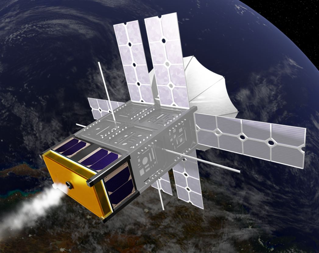
Usually they counteract this force by using small amounts of propellant.  However, smaller satellites don’t have the luxury of enough propellant to keep them afloat for any period of time. But now a team of students from the University of Michigan has launched a prototype satellite that attempts to stay afloat using a novel technique – magnetism.

Continue reading “A New Satellite Is Going to Try to Maintain Low Earth Orbit Without Any Propellant”
These Bizarre Cloud Patterns are von Kármán’s Vortices, Caused by the air Wrapping Around Tall Islands

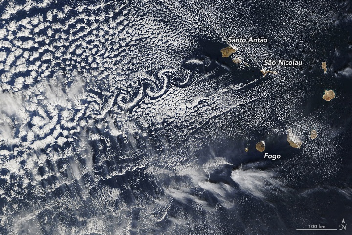
Three peaks in Cape Verde form von Kármán vortex streets when wind conditions are right. Image Credit: Lauren Dauphin, using MODIS data from NASA EOSDIS/LANCE and GIBS/Worldview.

This is an image of some of the islands that make up the nation of Cape Verde. While most in that group of ten islands are flat, some are very tall: Fogo, Santa Antão, and São Nicolau. Those three stand well above their compatriots, with Fogo reaching an altitude of 2,829 metres (9,281 feet).

The three tall volcanic islands sometimes interact with the wind to create von Kármán vortices, also called von Kármán vortex streets.

Continue reading “These Bizarre Cloud Patterns are von Kármán’s Vortices, Caused by the air Wrapping Around Tall Islands”

A Steampunk Engine to Solve Your Satellite Woes!

Credit: Howe Industries

In 1999, technicians from the California Polytechnic State University (Cal Poly) and Stanford University developed the specifications for CubeSat technology. In no time at all, academic institutions were launching CubeSats to conduct all manner of scientific research and validate new satellite technologies. Since 2013, the majority of launches have been conducted by commercial and private entities rather than academia.

Unfortunately, CubeSats have been held back until now because of a lack of good propulsion technology. In addition, there are concerns that with the proliferation of small satellites, Low Earth Orbit (LEO) will become overcrowded. Thanks to Howe Industries and a breakthrough engine design (known as the ThermaSat) that utilizes steam to generate propulsion, all of that could change very soon.

Continue reading “A Steampunk Engine to Solve Your Satellite Woes!”

The RAVN-X is a new Autonomous Aircraft Designed to Launch Small Satellites

Credit: Aevum

In the past twenty years, one of the biggest developments to take place in the realm of space exploration has been the growth of the commercial space industry (aka. NewSpace). As a result of growing demand and declining costs, more companies are coming to the fore to offer launch services that are making space more accessible and cost-effective.

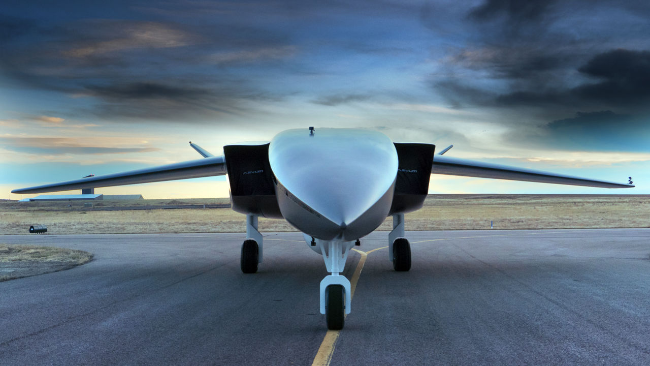
One such company is the space delivery services company Aevum, an Alabama-based startup specializing in Autonomous Launch Vehicles (AuLVs). On Dec. 3rd, 2020, Aevum unveiled their prototype vehicle, the RAVN-X. Once operational, this autonomous suborbital spaceplane will be able to send satellites and other small payloads to Low Earth Orbit (LEO) in just three hours.

Continue reading “The RAVN-X is a new Autonomous Aircraft Designed to Launch Small Satellites”

Iceberg A-68A is Turning. Will it Miss South Georgia Island After All?

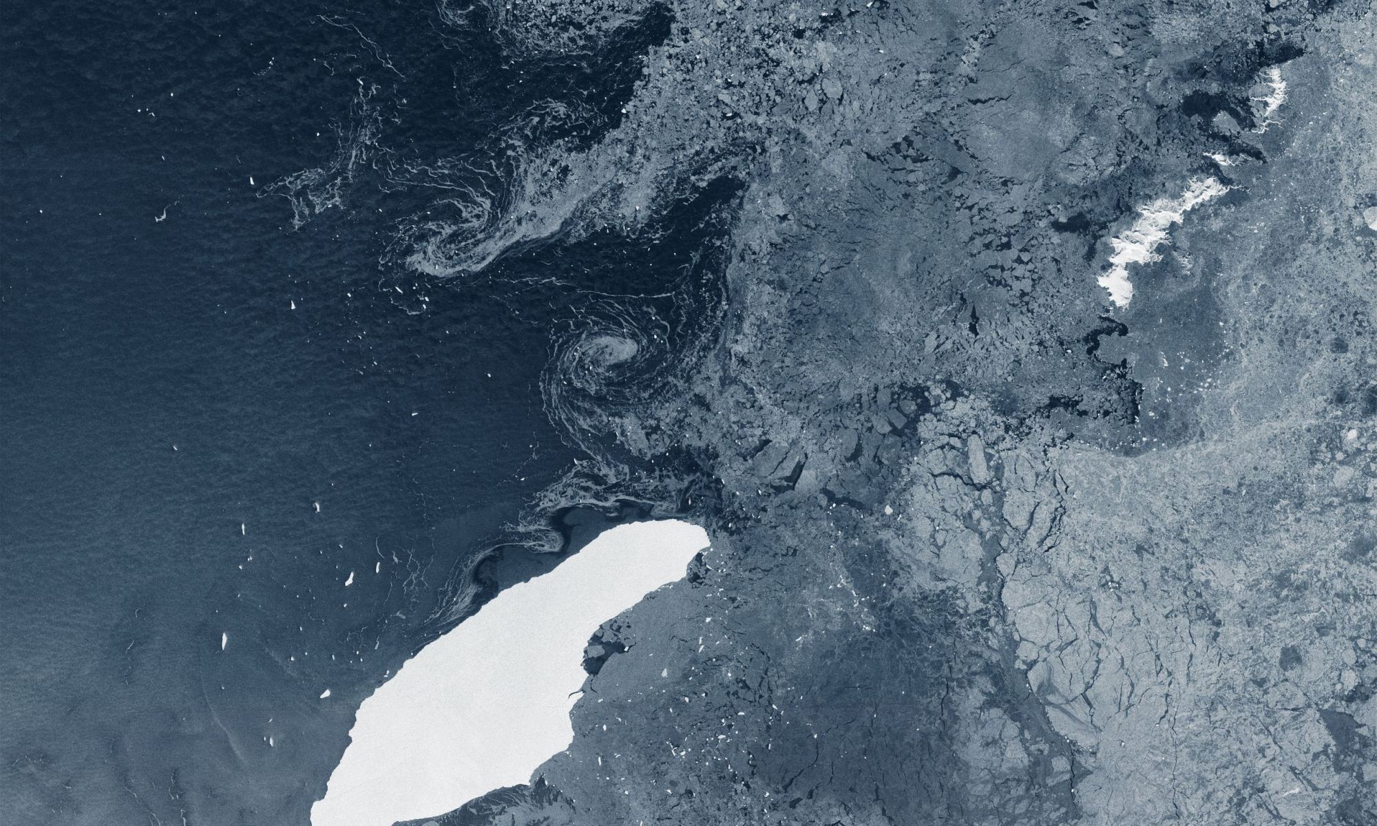
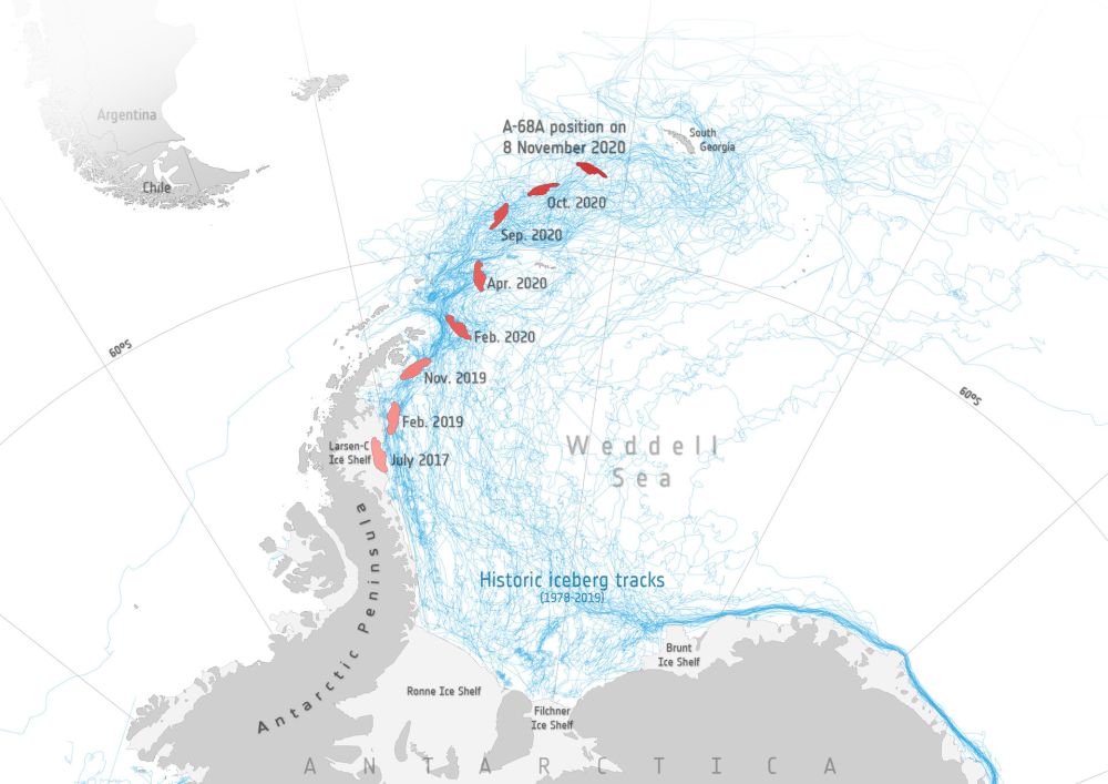
The iceberg A-68A floating in open waters about 1050 km from its birthplace. It's been floating for three years. Image Credit: contains modified Copernicus Sentinel data (2020), processed by ESA, CC BY-SA 3.0 IGO

A massive iceberg named A-68A is on a long journey through the seas near Antarctica. Though largely empty, those waters do host some islands, most notably South Georgia Island. In recent weeks satellite images showed the iceberg heading right for South Georgia.

That upcoming collision could have devastating consequences for wildlife that congregates on the island. But now, it looks like the collision might not happen.

Continue reading “Iceberg A-68A is Turning. Will it Miss South Georgia Island After All?”

Satellites can see the pollution trails from individual ships

All hands have to be on deck if the world is going to tackle degradation, and one of the biggest emitters is also one of the least well known – international shipping.  A 2018 study estimated that pollution emitted from cargo ships resulted in 400,000 annual premature deaths from lung cancer and heart disease.  Many of those deaths resulted from the sulfur dioxide the ships were belching into the air.  Since the beginning of the year, sulfur dioxide has been capped at .5% of emissions, compared to 3.5% previously.  While the long term benefits of that emissions cap will take some time to appear, there’s another pollutant that could potentially be tackled in the near future: nitrogen dioxide.

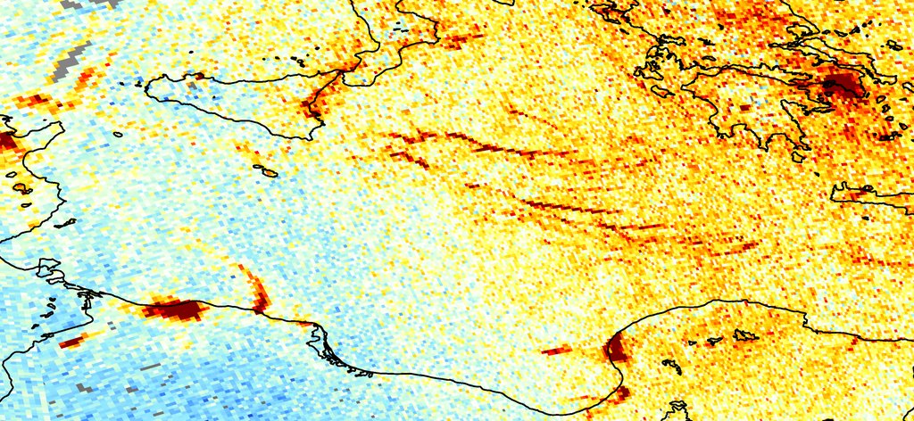
Nitrogen dioxide (NO2) is one of the emissions from diesel engines, and has been strictly capped in the automotive market for a number of years.  While the shipping industry so far has escaped regulation, there is a strong possibility that restrictions may be coming in the near future.  Regulations in themselves are great, but they are useless if not enforced, and the open ocean is a notoriously difficult place to enforce them.  That difficult task might have just gotten easier, as scientists at the European Space Agency realized they can use satellite data they are already collecting to track the nitrogen dioxide emissions of individual ships on the open ocean.

Continue reading “Satellites can see the pollution trails from individual ships”

An Iceberg the Size of South Georgia Island is on a Collision Course with… South Georgia Island

An iceberg the size of South Georgia Island is on a collision course with... South Georgia Island. Image Credit: contains modified Copernicus Sentinel data (2017–20), processed by ESA; Antarctic Iceberg Tracking Database

Back in July 2017, satellites watched as an enormous iceberg broke free from Antarctica’s Larsen C ice shelf on the Antarctic Peninsula. The trillion-ton behemoth has been drifting for over three years now. While it stayed close to its parent ice shelf for the first couple of years, it’s now heading directly for a collision with South Georgia Island.

It could be a slow-motion collision, but a collision nonetheless. If it does collide with the island and its shallow sea-floor, it won’t be the first iceberg to do so. And if the first one was any indication, wildlife could suffer.

Continue reading “An Iceberg the Size of South Georgia Island is on a Collision Course with… South Georgia Island”

How Will Starlink’s Packet Routing Work?

Depiction of how Starlink's constellation pattern will cover the world.

SpaceX’s Starlink satellite cluster has been receiving more and more headline space recently as it continues adding satellites at a breathtaking pace.  Much of this news coverage has focused on how it’s impacting amateur skygazers and how it could benefit people in far-flung regions.  But technical details do matter, and over on Casey Handmer’s blog there was a recent discussion of one of the most important aspects of how Starlink actually operates – what will it do with its data?

Continue reading “How Will Starlink’s Packet Routing Work?”

About 3% of Starlinks Have Failed So Far

Starlink
An artist's conception of Starlink in orbit. Credit: SpaceX

SpaceX has drawn plenty of praise and criticism with the creation of Starlink, a constellation that will one-day provide broadband internet access to the entire world. To date, the company has launched over 800 satellites and (as of this summer) is producing them at a rate of about 120 a month. There are even plans to have a constellation of 42,000 satellites in orbit before the decade is out.

However, there have been some problems along the way as well. Aside from the usual concerns about light pollution and Radio Frequency Interference (RFI), there is also the rate of failure these satellites have experienced. Specifically, about 3% of its satellites have proven to be unresponsive and are no longer maneuvering in orbit – which could prove hazardous to other satellites and spacecraft in orbit.

Continue reading “About 3% of Starlinks Have Failed So Far”

What Would a Realistic Space Battle Look Like?

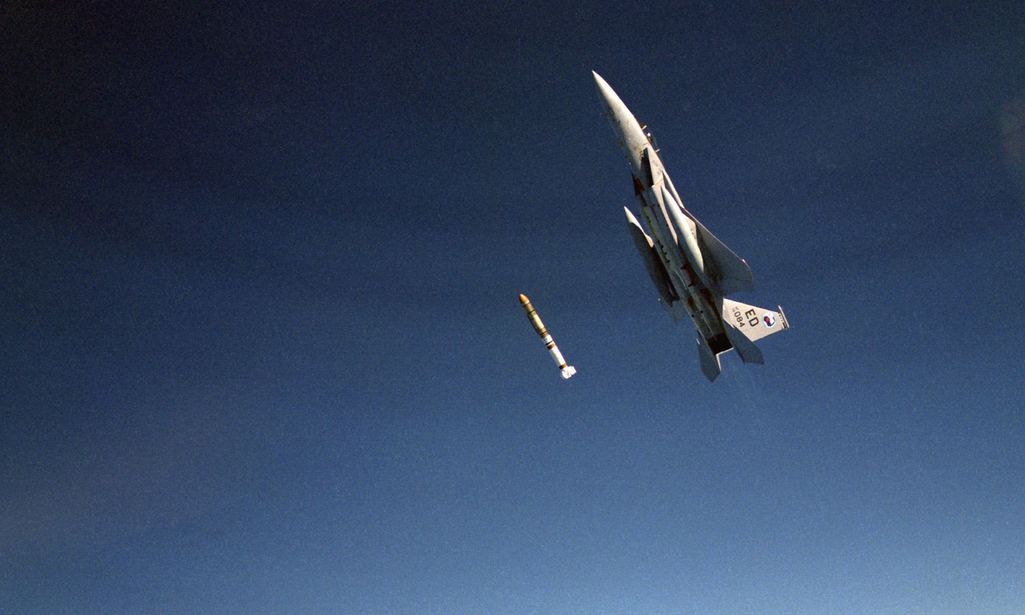
An air-to-air left side view of an F-15 Eagle aircraft releasing an anti-satellite (ASAT) missile during a test. Credit: USAF

Science fiction space movies can do a poor job of educating people about space. In the movies, hot-shot pilots direct their dueling space ships through space as if they’re flying through an atmosphere. They bank and turn and perform loops and rolls, maybe throw in a quick Immelman, as if they’re subject to Earth’s gravity. Is that realistic?

No.

In reality, a space battle is likely to look much different. With an increasing presence in space, and the potential for future conflict, is it time to think about what an actual space battle would look like?

Continue reading “What Would a Realistic Space Battle Look Like?”