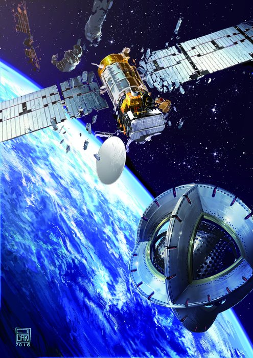
SpaceX Launches the First of Thousands of Space Internet Satellites, but Didn’t Quite Catch the Fairing

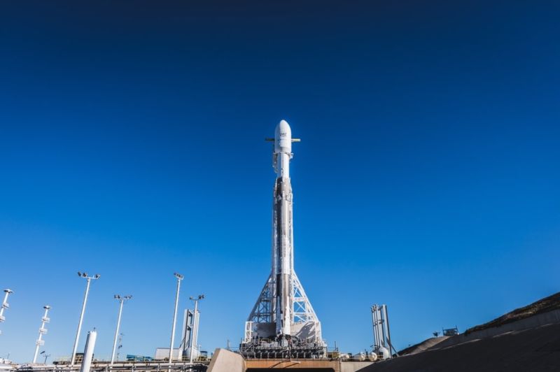
SpaceX Falcon 9 booster stationed at Launch Complex 4 East (SLC-4E) at the Vandenburg Air Force Base. Credit: SpaceX

After multiple delays, SpaceX’s PAZ mission launched from from Space Launch Complex 4 East (SLC-4E) at Vandenburg Air Force Base on the morning of Thursday, February 22nd. Shortly after it reached orbit, the rocket deployed its payload (the PAZ Earth Observing satellite) as well as and two Starlink demonstrations satellites that will test SpaceX’s ability to provide broadband internet service from orbit.

In addition, this launch was the first time that SpaceX would be attempting to “catch” the payload fairings from a Falcon 9 rocket using a retrieval ship. As part of their plan to make their rockets fully reusable, the rocket’s fairings were equipped with deployable chutes that would control their descent to the Pacific Ocean. Once there, the newly-commissioned “Mr. Steven” retrieval ship would be waiting to catch them in its net.

As noted, the primary mission for this launch was the deployment of the the PAZ satellite to low-Earth orbit. This  synthetic-aperture radar satellite was commisioned by Hisdesat, a Spanish commercial satellite company, for governmental and commercial use. Its purpose s to generate high-resolution images of the Earth’s surface, regardless of whether there are clouds covering the ground.

https://www.instagram.com/p/BfgHKDNAplx/

The secondary payload consisted of two experimental satellites  – Microsat-2a and 2b – which are the first phase in SpaceX’s plan to deliver broadband internet service to the entire world. The plan calls for the deployment of more satellites in phases, reaching a total of 4,000 by 2024. However, it was the attempted retrieval of the rocket’s payload fairings that was of particular interest during the launch.

To be fair, this would not be the first time that SpaceX’s attempted to retrieve payload fairings. In March of 2017, SpaceX successfully recovered the fairings for one of their Falcon 9s, which allowed them to recoup an estimated $6 million dollars from that launch. At present, SpaceX indicates that the cost of an individual Falcon 9 launch is estimated to be around $62 million.

If the payload fairings could be recovered regularly, that means that the company could stand to recoup an additional 10% from every individual Falcon 9 launch. These additional savings would not only make the company more competitive, but could allow for additional mission profiles that are currently considered too expensive.

On Thursday Morning, SpaceX founder Elon Musk posted a picture of Mr. Steven taking to sea on Instagram with the following statement:

“Going to try to catch the giant fairing (nosecone) of Falcon 9 as it falls back from space at about eight times the speed of sound. It has onboard thrusters and a guidance system to bring it through the atmosphere intact, then releases a parafoil and our ship with basically a giant catcher’s mitt welded on tries to catch it.”

The launch, which was covered via webcast, went as planned. After taking off amid clear skies, the Falcon 9 reached orbit and deployed the PAZ satellite without incident, and the two Starlink satellites were deployed shortly thereafter. However, the webcast ended without providing any information about the status of the retrieval of the payload fairings.

At 7:14 am, Musk tweeted an update about the attempted retrieval, indicating that the fairings had landed in the ocean a few hundred meters from where Mr. Steven was waiting to catch them. While unsuccessful, Musk was optimistic about future attempts to retrieve payload fairings, saying:

“Missed by a few hundred meters, but fairing landed intact in water. Should be able catch it with slightly bigger chutes to slow down descent.”

As always, Musks seems undeterred by a setback and the company is moving ahead with its plans for expanded reusability. If successful, future attempts at retrieval are likely to involve the second stages of the Falcon 9 and Falcon Heavy rockets. Given all the possibilities that this will allow for, there are many who want to see Musk’s latest venture to succeed.

In the meantime, check out this webcast of the launch:

Further Reading: ArsTechnica

Some of The Last Glaciers in The Tropics. They’ll be Gone in About a Decade

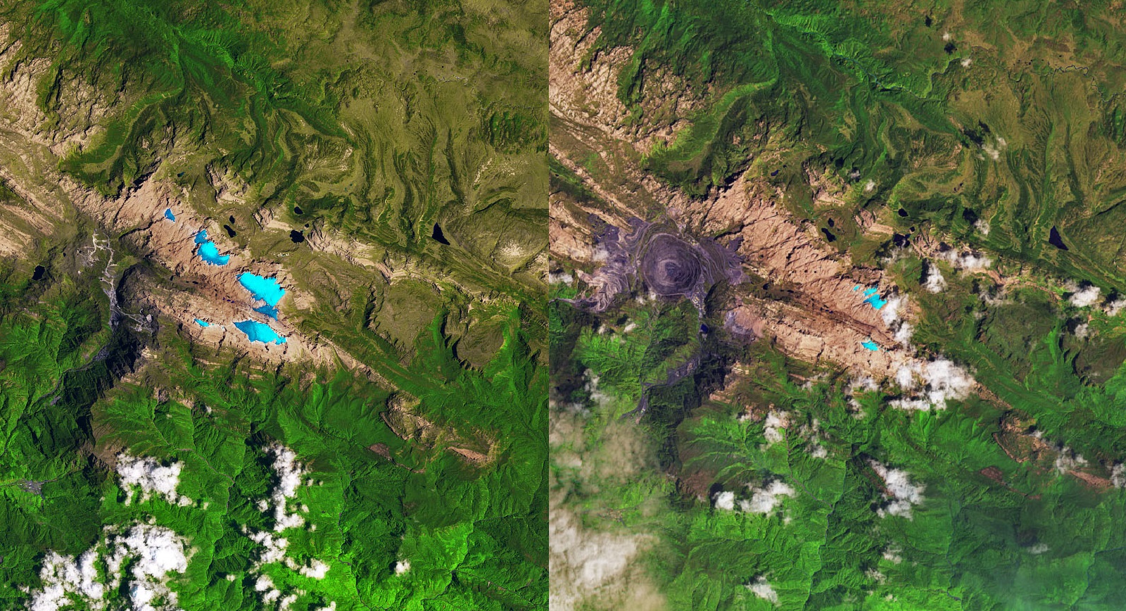
Side by side comparison of images taken of the Puncak Jaya icefields in New Guinea on Nov. 3rd, 1988 (left) and Dec. 5th, 2017 (right). Credit: NASA/EO

One of the most visible signs of Climate Change are the ways in which glaciers and ice sheets have been disappearing all over the world. This trend is not reserved to the Arctic ice cap or the Antarctic Basin, of course. On every part of the planet, scientists have been monitoring glaciers that have been shrinking in the past few decades to determine their rate of loss.

These activities are overseen by NASA’s Earth Observatory, which relies on instruments like the Landsat satellites to monitor seasonal ice losses from orbit. As these satellites demonstrated with a series of recently released images, the Puncak Jaya ice sheets on the south pacific island of Papua/New Guinea have been receding in the past three decades, and are at risk of disappearing in just a decade.

The Papau province of New Guinea has a very rugged landscape that consists of the mountains that make up Sudirman Range. The tallest peaks in this range are Puncak Jaya and Ngga Pulu, which stand 4,884 meters (16,020 feet) and 4,862 meters (15,950 feet) above sea level, respectively. Despite being located in the tropics, the natural elevation of these peaks allows them to sustain small fields of “permanent” ice.

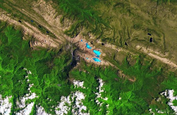
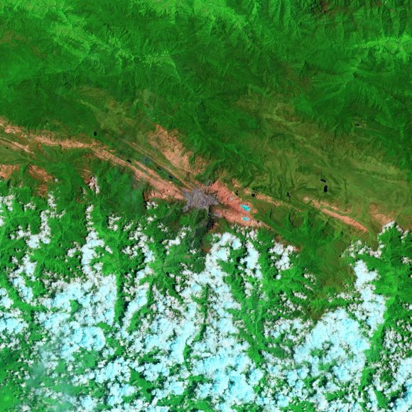
Image of the Puncak Jaya icefields, taken on Nov 3, 1988. Credit: NASA/EO

Given the geography, these ice fields are incredibly rare. In fact, within the tropics, the closest glacial ice is found 11,200 km (6,900 mi) away on Mount Kenya in Africa. Otherwise, one has to venture north for about 4,500 km (2,800 mi) to Mount Tate in central Japan, where glacial ice is more common since it is much farther away from the equator.

Sadly, these rare glaciers are becoming more threatened with every passing year. Like all tropical glaciers in the world today, the glaciers on the slopes around Puncak Jaya have been shrinking at a such a rate that scientists estimate that they could be gone within a decade. This was illustrated by a pair of Landsat images that show how the ice fields have shrunk over the past thirty years.

The first of these images (shown above) was acquired on November 3rd, 1988, by the Thematic Mapper instrument aboard the Landsat 5 satellite. The second image (shown below) was acquired on December 5th, 2017, by the Operational Land Imager (OLI) on the Landsat 8 satellite. These false-color images are a combination of shortwave infrared, infrared, near-infrared, and red light.

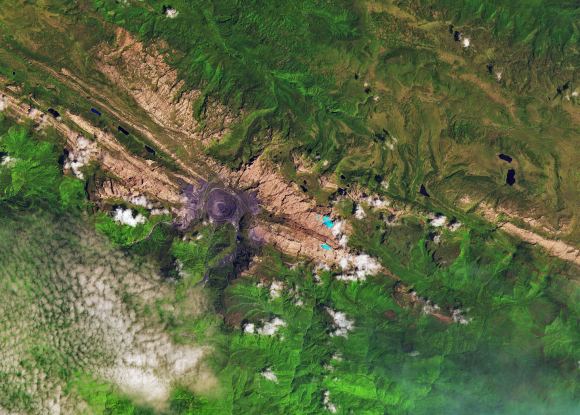
The extent of the ice fields are shown in light blue, whereas rocky areas are represented in brown, vegetation in green, and clouds in white. The gray circular area near the center of the 2017 image is the Grasberg mine, the largest gold and second-largest copper mine in the world. This mine expanded considerably between the 1980s and 2000s are a result of a boom in copper prices.

Image of the Puncak Jaya icefields in New Guinea, taken on December 5, 2017. Credit: NASA/EO

As the images show, in 1988, there were five masses of ice resting on the mountain slopes – the Meren, Southwall, Carstensz, East Northwall Firn and West Northwall Firn glaciers. However, by 2017, only the Carstensz and a small portion of the East Northwall Firn glaciers remained. As Christopher Shuman, a research professor at the University of Maryland Baltimore County and NASA’s Goddard Space Flight Center, explained:

“The ice area losses since the 1980s here are quite striking, visible in the contrast of the blue ice with the reddish bedrock. Even though the area still gets snowfalls, it is clearly not sustaining these glacial remnants.”

Similarly, in 2009, images taken by Landsat 5 of these same glaciers (see below) indicated that the Meren and Southwall glaciers had disappeared. Meanwhile, the Carstensz, East Northwall Firn and West Northwall Firn glaciers had retreated dramatically. Based on the rate of loss, scientists estimated at the time that all of Puncak Jaya’s glaciers would be gone within 20 years.

As these latest images demonstrate, their estimates were right on the money. At their current rate, what remains of the Carstensz and East Northwall Firn glaciers will be gone by the late 2020s. The primary cause of the ice loss is rising air temperatures, which leads to rapid sublimation. However, changes in humidity levels, precipitation patterns and cloudiness can also have an impact.

Image of the Puncak Jaya icefields in New Guinea, October 9, 2009. Credit: NASA/EO

Humidity is also important, since it affects how readily glaciers can lose mass directly to the atmosphere. Where the air is more moist, ice is able to make the transition to water more easily, and can be returned to the glacier in the form of precipitation. Where the air is predominately dry, ice makes the transition directly from a solid form to a gaseous form (aka. sublimation).

Temperature and precipitation are also closely linked to ice loss. Where temperatures are low enough, precipitation takes the form of snow, which can sustain glaciers and cause them to grow. Rainfall, on the other hand, will cause ice sheets to melt and recede. And of course, clouds affect how much sunlight reaches the glacier’s surface, which results in warming and sublimation.

For many tropical glaciers, scientists are still working out the relative importance of these factors and attempting to determine to what extent anthropogenic factors plays a role. In the meantime, tracking how these changes are leading to ice loss in the tropical regions provides scientists with a means of comparison when studying ice loss in other parts of the world.

As Andrew Klein, a geography professor at Texas A & M University who has studied the region, explained:

“Glacier recession continues in the tropics—these happen to be the last glaciers in the eastern tropics. Fortunately, the impact will be limited given their small size and the fact that they do not represent a significant water resource.”

Satellites continue to play an important role in the monitoring process, giving scientist the ability to map glacier ice loss, map seasonal changes, and draw comparisons between different parts on the planet. They also allow scientists to monitor remote and inaccessible areas of the planet to see how they too are being affected. Last, but not least, they allow scientists to estimate the timing of a glacier’s disappearance.

Click on the posted images to enlarge the ice fields, or follow these link to see image comparisons.

Further Reading: NASA Earth Observatory

Now That NASA’s Missing IMAGE Satellite Has Been Found, Talking To It Is Going To Be Difficult

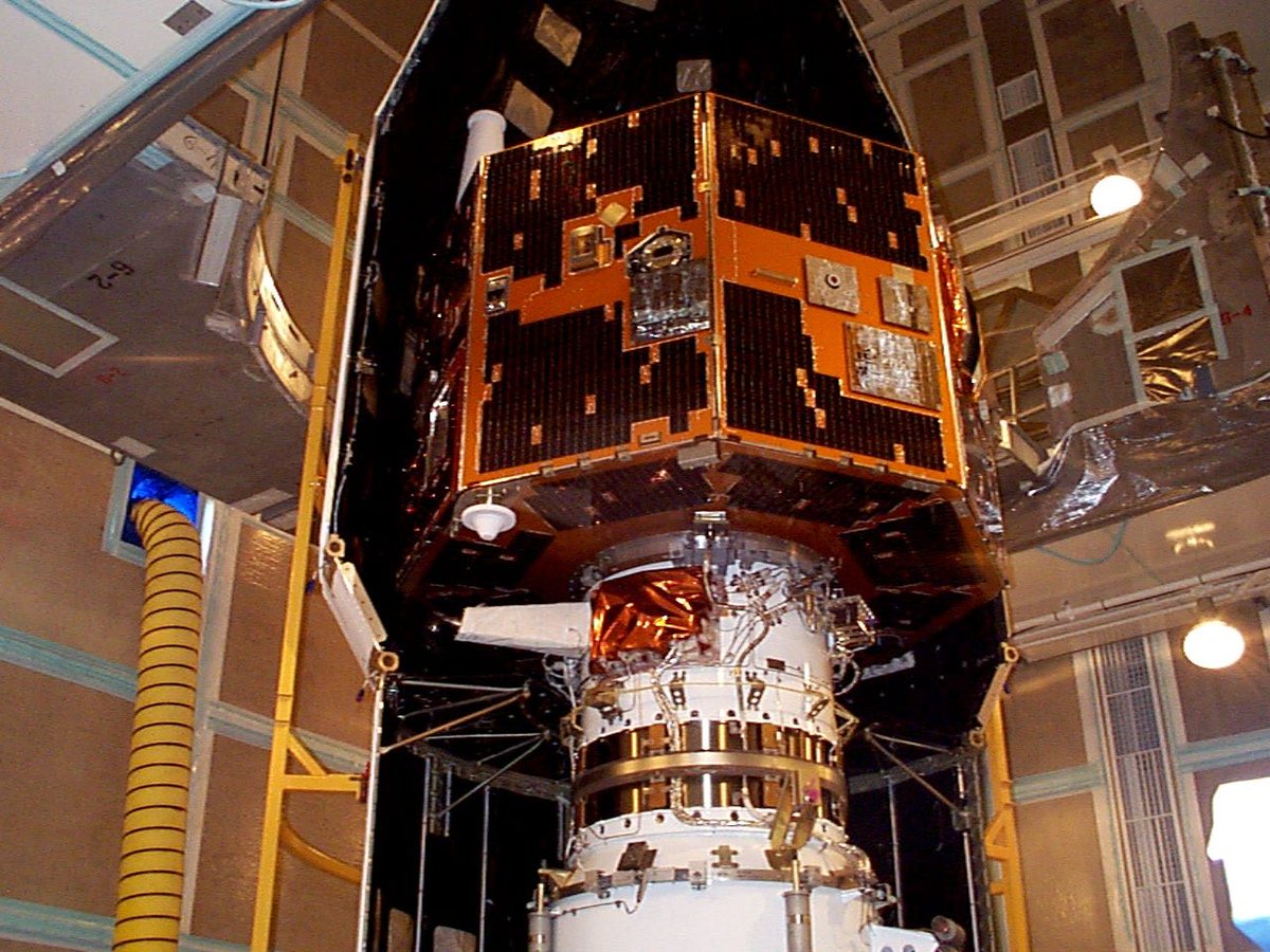
This picture shows NASA's IMAGE spacecraft undergoing launch preparations in early 2000. Credit: NASA

It’s easy to imagine the excitement NASA personnel must have felt when an amateur astronomer contacted NASA to tell them that he might have found their missing IMAGE satellite. After all, the satellite had been missing for 10 years.

IMAGE, which stands for Imager for Magnetopause-to-Aurora Global Exploration, was launched on March 25th, 2000. In Dec. 2005 the satellite failed to make routine contact, and in 2007 it failed to reboot. After that, the mission was declared over.

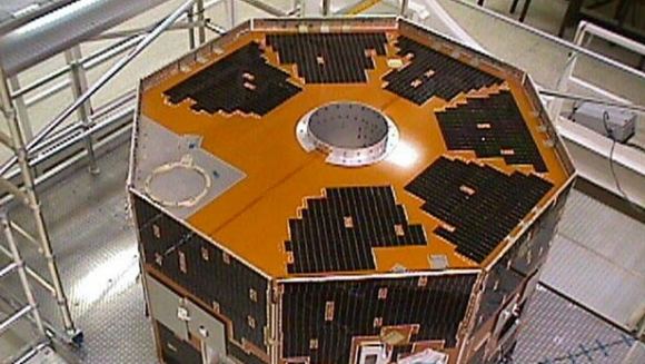
NASA’s IMAGE satellite. Credit: NASA

It’s astonishing that after 10 years, the satellite has been found. It’s even more astonishing that it was an amateur who found it. As if the story couldn’t get any more interesting, the amateur astronomer who found it—Scott Tilly of British Columbia, Canada—was actually looking for a different missing satellite: the secret ZUMA spy satellite launched by the US government on January 7, 2018. (If you’re prone to wearing a tin foil hat, now might be a good time to reach for one.)

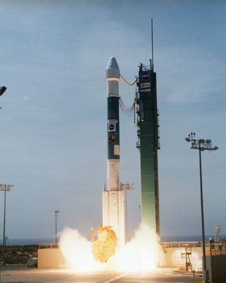
NASA’s half-ton IMAGE satellite being launched from Vandenberg Air Force Base on March 25th, 2000. IMAGE was the first satellite designed to actually “see” most of the major charged particle systems in the space surrounding Earth. Image: NASA

After Tilly contacted NASA, they hurried to confirm that it was indeed IMAGE that had been found. To do that, NASA employed 5 separate antennae to seek out any radio signals from the satellite. As of Monday, Jan. 29, signals received from all five sites were consistent with the radio frequency characteristics expected of IMAGE.

In a press release, NASA said, “Specifically, the radio frequency showed a spike at the expected center frequency, as well as side bands where they should be for IMAGE. Oscillation of the signal was also consistent with the last known spin rate for IMAGE.”

“…the radio frequency showed a spike at the expected center frequency…” – NASA Press Release confirming the discovery of IMAGE

Then, on January 30, the Johns Hopkins Applied Physics Lab (JHUAPL) reported that they had successfully collected telemetry data from the satellite. In that signal was the ID code 166, the code for IMAGE. There were probably some pretty happy people at NASA.

So, now what?

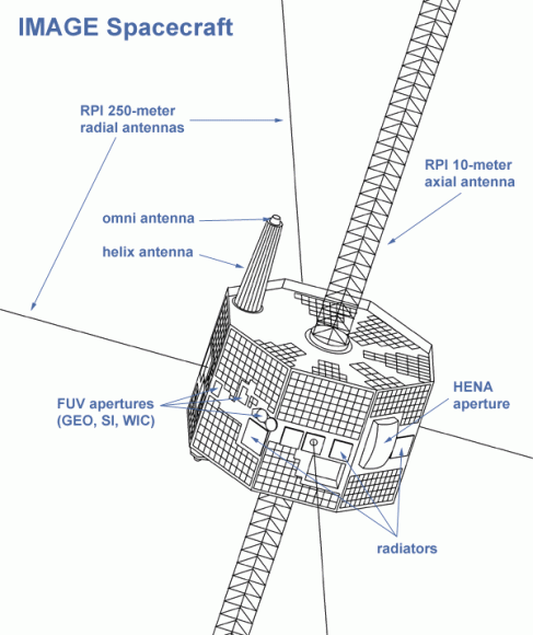
A diagram of NASA’s IMAGE satellite. Image: NASA

NASA’s next step is to confirm without a doubt that this is indeed IMAGE. That means capturing and analyzing the data in the signal. That will be a technical challenge, because the types of hardware and operating systems used in the IMAGE Mission Operations Center no longer exist. According to NASA, “other systems have been updated several versions beyond what they were at the time, requiring significant reverse-engineering.” But that should be no problem for NASA. After all, they got Apollo 13 home safely, didn’t they?

If NASA is successful at decoding the data in the signal, the next step is to attempt to turn on IMAGE’s science payload. NASA has yet to decide how to proceed if they’re successful.

IMAGE was the first spacecraft designed to “see the invisible,” as they put it back then. Prior to IMAGE, spacecraft examined Earth’s magnetosphere by detecting particles and fields they encountered as they passed through them. But this method had limited success. The magnetosphere is enormous, and simply sampling a small path—while better than nothing—did not give us an accurate understanding of it.

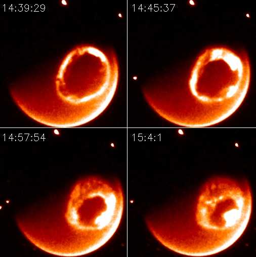
During its mission, IMAGE did a lot of great science. In July 2000, a spectacular solar storm caused auroras as far south as Mexico. IMAGE captured these images of those poweful auroras. Credit: NASA

IMAGE was going to do things differently. It used 3-dimensional imaging techniques to measure simultaneously the densities, energies and masses of charged particles throughout the inner magnetosphere. To do this, IMAGE carried a payload of 7 instruments:

  • High Energy Neutral Atom (HENA) imager
  • Medium Energy Neutral Atom (MENA) imager
  • Low Energy Neutral Atom (LENA) imager
  • Extreme Ultraviolet (EUV) imager
  • Far Ultraviolet (FUV) imager
  • Radio Plasma Imager (RPI)
  • Central Instrument Data Processor (CIDP)

These instruments allowed IMAGE to not only do great science, and to capture great images, but also to create some stunning never-seen-before movies of auroral activity.

This is a fascinating story, and it’ll be interesting to see if NASA can establish meaningful contact with IMAGE. Will it have a treasure trove of unexplored data on-board? Can it be re-booted and brought back into service? We’ll have to wait and see.

This story is also interesting culturally. IMAGE was in service at a time when the internet wasn’t as refined as it is currently. NASA has mastered the internet and public communications now, but back then? Not so much. For example, to build up interest around the mission, NASA gave IMAGE its own theme song, titled “To See The Invisible.” Yes, seriously.

But that’s just a side-note. IMAGE was all about great science, and it accomplished a lot. You can read all about IMAGE’s science achievements here.

Perhaps the Best Part of Electron’s Successful Launch was its Payload: the Humanity Star

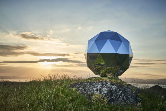
Peter Beck, founder of Rocket Lab, is shown with the Humanity Star. Credit: Rocket Lab

This past weekend, the New Zealand-based aerospace company Rocket Lab reached another milestone. On Sunday, January 21st, the company conducted the second launch – the first having taken place this past summer – of its Electron booster. This two-stage, lightweight rocket is central to the company’s vision of reducing the costs of individual launches by sending light payloads to orbit with regular frequency.

This mission was also important because it was the first time that the company sent payloads into orbit. In addition to several commercial payloads, the launch also sent a secret payload into orbit at the behest of the company’s founder (Peter Beck). It is known as the “Humanity Star“, a disco-like geodesic sphere that measures 1 meter (3.3 ft) in diameter and will form a bright spot in the sky that will be visible to people on Earth.

The Humanity Star is central to Beck’s vision of how space travel can improve the lives of people here on Earth. In addition to presenting extensive opportunities for scientific research, there is also the way it fosters a sense of unity between people and nations. This is certainly a defining feature of the modern space age, where cooperation has replaced competition as the main driving force.

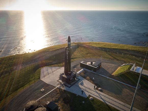
The Electron rocket prepping for its second launch last weekend. Credit: Rocket Lab

As Beck explained to ArsTechnica in an interview before the launch:

“The whole point of the program is to get everybody looking up at the star, but also past the star into the Universe, and reflect about the fact that we’re one species, on one planet. This is not necessarily part of the Rocket Lab program; it’s more of a personal program. It’s certainly consistent with our goal of trying to democratize space.”

Like the Electron rocket, the Humanity Sphere is made of carbon fiber materials and it’s surface consists of 65 highly-reflective panels. Once it reaches an orbit of 300 by 500 km (186 by 310 mi), it will spend the next nine months there reflecting the light of the Sun back to Earth. Whether or not it will be visible to the naked eye remains to be seen, but Rocket Lab is confident it will be.

According to Beck, the sphere will be more visible than a Iridium flare, which are easily spotted from the surface. These flares occur when the solar panels or antennae of an Iridium satellite reflect sunlight in orbit. “Most people will be familiar with the Iridium flares, and this has got much, much more surface area than an Iridium flare,” Beck said. “In theory, it will be easy to find.”

The payload will last for about nine months in orbit. Credit: Rocket Lab

Beck got the idea for the project from talking to people about where they live. In his experience, people tend to think of their locality or nationality when they think of home. Whereas many people he had spoken to were aware that they lived on planet Earth, they were oblivious to where the Earth resided in the Solar System or the Universe at large. In this respect, the Humanity Sphere is meant to encourage people to look and think beyond.

As he states on the website the company created for the Humanity Sphere:

“For millennia, humans have focused on their terrestrial lives and issues. Seldom do we as a species stop, look to the stars and realize our position in the universe as an achingly tiny speck of dust in the grandness of it all.

“Humanity is finite, and we won’t be here forever. Yet in the face of this almost inconceivable insignificance, humanity is capable of great and kind things when we recognize we are one species, responsible for the care of each other, and our planet, together. The Humanity Star is to remind us of this.

“No matter where you are in the world, rich or in poverty, in conflict or at peace, everyone will be able to see the bright, blinking Humanity Star orbiting Earth in the night sky. My hope is that everyone looking up at the Humanity Star will look past it to the expanse of the universe, feel a connection to our place in it and think a little differently about their lives, actions and what is important.

“Wait for when the Humanity Star is overhead and take your loved ones outside to look up and reflect. You may just feel a connection to the more than seven billion other people on this planet we share this ride with.”

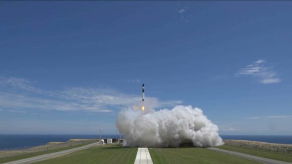
The Electron rocket launching on Sunday afternoon, 2:42pm, New Zealand time. Credit: Rocket Lab

The Humanity Star can also be tracked via the website. As of the penning of this article, it is moving south of the equator and should be visible to those living along the west coast of South America. So if you live in Colombia, Peru or Chile, look to the western skies and see if you can’t spot this moving star. After passing south over Antarctica, it will reemerge in the night skies over Central Asia.

Without a doubt, the Humanity Sphere is an inspired creation, and one which is in good company. Who can forget the “Blue Marble” picture snapped by the Apollo 17 astronauts, or Voyager 1‘s “pale blue dot” photo? And even for those who are too young to have witnessed it, the images of Neil Armstrong and Buzz Aldrin setting foot on the Moon still serve to remind us of how far we’ve come, and how much still awaits us out there.

Further Reading: ArsTechnica
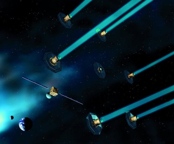
A New Kind of Propulsion System That Doesn’t Need Propellant. It Converts Electricity into Thrust and Vice Versa.

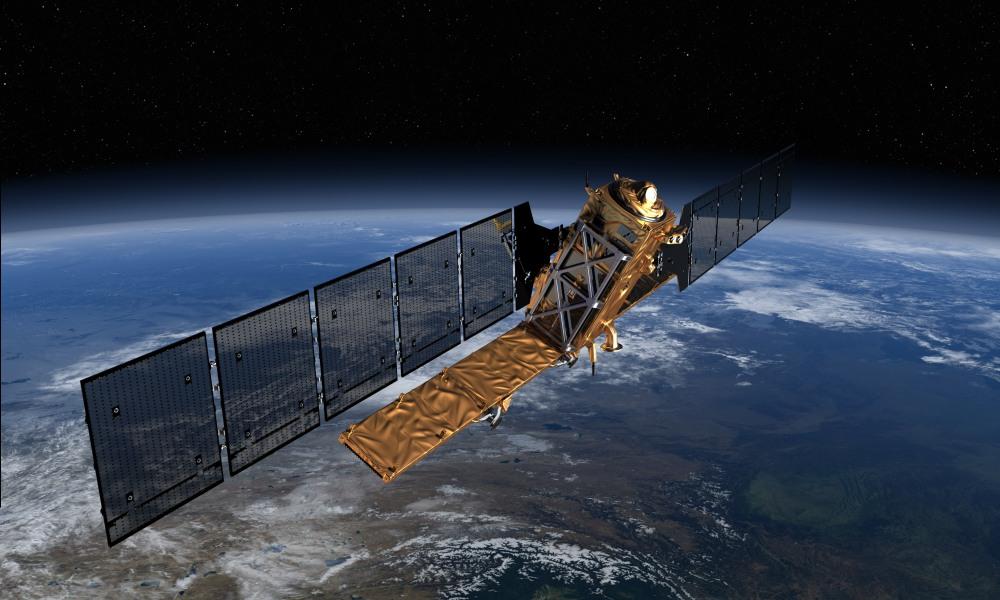
The proposed "space-tie" propulsion system being patented by Spanish scientists could be useful on Satellites like the ESA's Sentinel-1, pictured. Image: ESA/ATG

Some of the best things in science are elegant and simple. A new propulsion system being developed in Spain is both those things, and could help solve a growing problem with Earth’s satellites: the proliferation of space junk.

Researchers at Universidad Carlos III de Madrid (UC3M) and the Universidad Politécnica de Madrid (UPM) in Spain are patenting a new kind of propulsion system for orbiting satellites that doesn’t use any propellant or consumables. The system is basically a tether, in the form of an aluminum tape a couple kilometers long and a couple inches wide, that trails out from the satellite. The researchers call it a space tie.

“This is a disruptive technology because it allows one to transform orbital energy into electrical energy and vice versa without using any type of consumable”. – Gonzalo Sánchez Arriaga, UC3M.

The lightweight space tie is rolled up during launch, and once the satellite is in orbit, it’s deployed. Once deployed, the tape can either convert electricity into thrust, or thrust into electricity. The Spanish researchers behind this say that the space-ties will be used in pairs.

The system is based on what is called a “low-work-function” tether. A special coating on the tether has enhanced electron emission properties on receiving sunlight and heat. These special properties allow it to function in two ways. “This is a disruptive technology because it allows one to transform orbital energy into electrical energy and vice versa without using any type of consumable,” said Gonzalo Sánchez Arriaga, Ramón y Cajal researcher at the Bioengineering and Aerospace Engineering Department at UC3M.

As a satellite loses altitude and gets closer to Earth, the tether converts that thrust-caused-by-gravity into electricity for the spacecraft systems to use. When it comes to orbiting facilities like the International Space Station (ISS), this tether system could solve an annoying problem. Every year the ISS has to burn a significant amount of propellant to maintain its orbit. The tether can generate electricity as it moves closer to Earth, and this electricity could replace the propellant. “With a low- work function tether and the energy provided by the solar panel of the ISS, the atmospheric drag could be compensated without the use of propellant”, said Arriaga.

“Unlike current propulsion technologies, the low-work function tether needs no propellant and it uses natural resources from the space environment such as the geomagnetic field, the ionospheric plasma and the solar radiation.” – Gonzalo Sánchez Arriaga, UC3M.

For satellites with ample on-board power, the tether would operate in reverse. It would use electricity to provide thrust to the space craft. This is especially useful to satellites near the end of their operational life. Rather than languish in orbit for a long time as space junk, the derelict satellite could be forced to re-enter Earth’s atmosphere where it would burn up harmlessly.

The space-tie system is based on what’s called Lorentz drag. Lorentz drag is an electrodynamic effect. (Electrodynamics enthusiasts can read all about it here.) I won’t go too deeply into it because I’m not a physicist, but the Spanish researchers suggest that the Lorentz drag can be easily observed by watching a magnet fall through a copper tube. Here’s a video.

Space organizations have shown interest in the low-work-function tether, and the Spanish team is getting the word out to experts in the USA, Japan, and Europe. The next step is the manufacture of prototypes. “The biggest challenge is its manufacturing because the tether should gather very specific optical and electron emission properties,” says Sánchez Arriaga.

The Spanish Ministry of Economy, Industry and Competitiveness has awarded the Spanish team a grant to investigate materials for the system. The team has also submitted a proposal to the European Commission’s Future and Emerging Technologies (FET-Open) consortium for funding. “The FET-OPEN project would be foundational because it considers the manufacturing and characterization of the first low-work-function tether and the development of a deorbit kit based on this technology to be tested on a future space mission. If funded, it would be a stepping stone to the future of low-work-function tethers in space” Sanchez Arriaga concluded.

In this video, Gonzalo Sanchez Arriaga explains how the system works. If you don’t speak Spanish, just turn on subtitles.

SpaceX Stages Stunning Sunset Blastoff as Recycled Falcon 9 Soars to Orbit with SES/EchoStar HDTV Sat; Booster Re-Lands at Sea

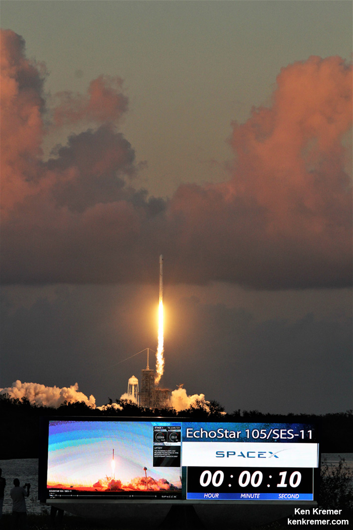
SpaceX's reusable rockets are bringing down the cost of launching things into space, but the cost is still prohibitive. Any weight savings contribute to missions feasibility, including a reduction in food supplies for long space journeys. In this image, a SpaceX Falcon 9 recycled rocket lifts off at sunset at 6:53 PM EDT on 11 Oct 2017. Credit: Ken Kremer/Kenkremer.com
SpaceX Falcon 9 recycled rocket lifts off at sunset at 6:53 PM EDT on 11 Oct 2017 carrying SES-11/EchoStar 105 HDTV commercial comsat to geosynchronous transfer orbit from Launch Complex 39A at NASA’s Kennedy Space Center, FL- as seen from the pad perimeter. Credit: Ken Kremer/Kenkremer.com

KENNEDY SPACE CENTER, FL – SpaceX staged a stunning sunset blastoff this evening Oct. 11, of the commercial SES-11/EchoStar 105 HDTV satellite that will serve the everyday needs of millions of customers across North America as it soared to geostationary orbit on a recycled Falcon 9 from the Florida Space Coast.
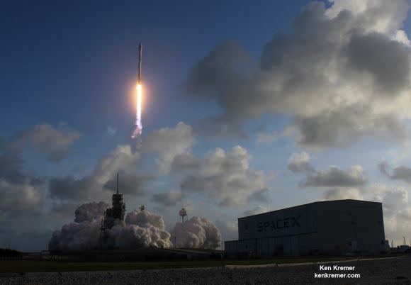
Minutes later the now doubly ‘flight-proven’ booster safely made its way back to Cape Canaveral after reigniting its engines to carry out another upright soft landing and recovery – that potentially sets the stage for an unprecedented third launch.

The private SES-11/EchoStar 105 communications satellite mission made an on time liftoff of the recycled first stage booster at dinnertime Wednesday Oct. 11 at 6:53 p.m. EDT from seaside Launch Complex 39A at NASA’s Kennedy Space Center in Florida.

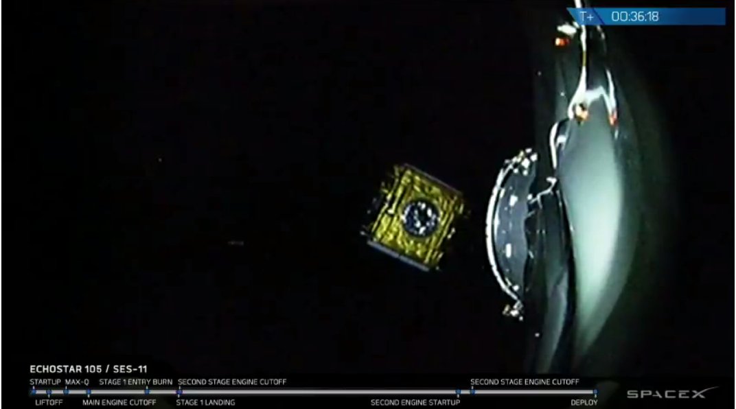
SpaceX successfully delivered the nearly six ton EchoStar 105/SES-11 joint mission satellite for SES and ExchoStar to geostationary transfer orbit some 22,000 miles (36,000 kilometers) above the equator.

“Successful deployment of EchoStar 105/SES-11 to geostationary transfer orbit confirmed,” said SpaceX.

Remarkably today’s launch was the second launch for SpaceX this week following Monday’s Falcon 9 launch from Vandenberg AFB, Ca., carrying 10 Iridium-NEXT satellites to orbit – and a record setting 15th of 2017!

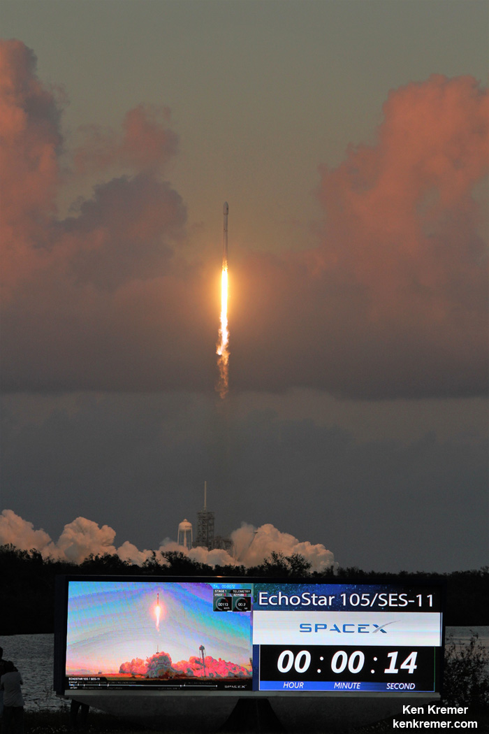
Sunset blastoff of SpaceX Falcon 9 recycled rocket at 6:53 PM EDT on 11 Oct 2017 carrying SES-11/EchoStar 105 HD TV commercial comsat to geosynchronous transfer orbit from Launch Complex 39A at NASA’s Kennedy Space Center, FL- as seen from the famous countdown clock. This launch counts as third reflight of a liquid fueled orbit class rocket. Credit: Ken Kremer/Kenkremer.com

The launch, landing and satellite deployment were broadcast live on a SpaceX hosted webcast.

The weather was near perfect and there was scarcely a cloud in the sky. Space enthusiasts who traveled far and wide from around the globe to witness a launch were richly rewarded with time and money well spent.

That’s in stark contrast to the horrible weather conditions existing just days ago that forced a part of weather scrubs for the ULA Atlas V. Launch of the NROL-52 spy satellite is currently rescheduled for Sat., Oct 14.

EchoStar 105/SES-11 is a high-powered hybrid Ku and C-band communications satellite launching as a dual-mission satellite for US-based operator EchoStar and Luxembourg-based operator SES.

The used two stage 229-foot-tall (70-meter) Falcon 9 rocket was rolled out to pad 39A Tuesday to ready it for today’s liftoff.

The EchoStar 105/SES-11 spacecraft was built by Airbus and shipped from the Airbus facilities in Toulouse, France to Cape Canaveral, FL for flight processing.

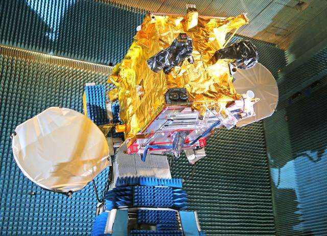
SES-11/EchoStar 105 communications satellite manufactured by Airbus. Credit: SES

The satellite was successfully deployed as planned approximately 36 minutes after liftoff.

“SES-11 is a high-powered communications satellite designed to especially accelerate the development of the US video neighbourhood, and the delivery of HD and UHD channels. Optimised for digital television delivery, SES-11 joins SES-1 and SES-3 at the centre of its robust North American orbital arc, which reaches more than 100 million TV homes. Together with SES-1 and SES-3, SES-11 will be utilised for the expansion of the North America Ultra HD platform,” according to SES.

“SES-11 offers comprehensive coverage over North America, including Hawaii, Mexico and the Caribbean, and will also empower businesses and governments to capture new opportunities and expand their reach across the region.”

The 5,200 kg (11,500 pounds) satellite was encapsulated inside the payload fairing and integrated with the Falcon 9 rocket.

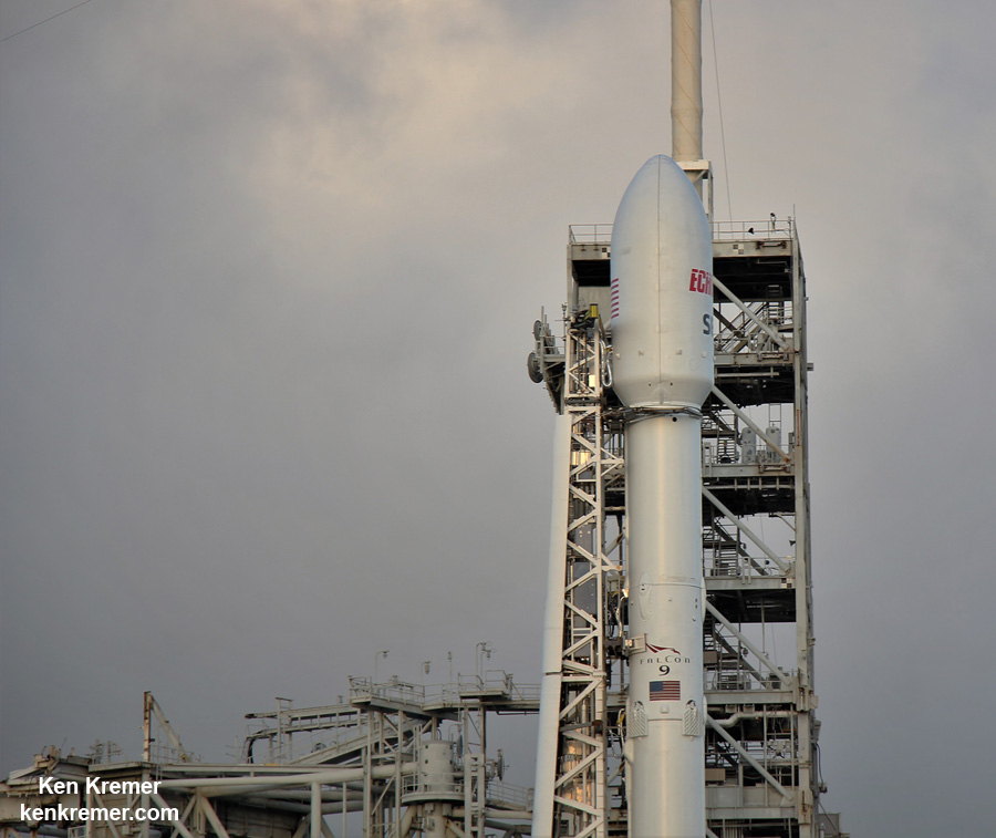
Up close view of payload fairing encapsulating SES-11/EchoStar 105 UHD TV commercial comsat atop ‘flight-proven’ SpaceX Falcon 9 rocket. Liftoff is slated for is 6:53 p.m. ET, Oct. 11, 2017 from Launch Complex 39A at the Kennedy Space Center, FL. Credit: Ken Kremer/kenkremer.com

This is only the third recycled SpaceX Falcon 9 ever to be launched from Pad 39A.

SpaceX Falcon 9 recycled rocket carrying SES-11/EchoStar 105 UHD TV commercial comsat raised erect atop Launch Complex 39A as flock of birds flies by at the Kennedy Space Center, FL, is poised for sunset liftoff on 11 Oct 2017 on world’s third reflight of a liquid fueled orbit class rocket. As seen from the pad perimeter. Credit: Ken Kremer/Kenkremer.com

SES was the first company to ever fly a payload on a ‘flight-proven’ Falcon 9. The SES-10 satellite lifted off successfully this spring on March 30, 2017.

The second reflown booster successfully launched the BulgariaSat-1 a few months later.

Pad 39A has been repurposed by SpaceX from its days as a NASA shuttle launch pad.

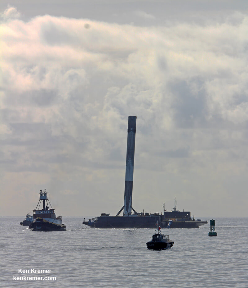
After the 156 foot tall first stage booster completed its primary mission task, SpaceX engineers guided it to a second landing on the tiny football field sized OCISLY drone ship for a soft touchdown some eight and a half minutes after liftoff.

“Falcon 9 first stage has landed on Of Course I Still Love You — third successful mission with a flight-proven orbital class rocket,” said SpaceX.

This marked the 18th successful landing of a recovered Falcon 9 first stage booster.

This booster originally flew on the NASA Dragon CRS-10 resupply mission to the International Space Station in February of this year.

OCISLY or “Of Course I Still Love You” left Port Canaveral several days ahead of the planned Oct. 11 launch and was prepositioned in the Atlantic Ocean some 400 miles (600 km) off the US East coast, just waiting for the boosters 2nd approach and pinpoint propulsive soft landing.

The booster was outfitted with four grid fins and four landing legs to accomplish the pinpoint touchdown on the barge at sea.

Sunset blastoff of SpaceX Falcon 9 recycled rocket at 6:53 PM EDT on 11 Oct 2017 carrying SES-11/EchoStar 105 HDTV commercial comsat to geosynchronous transfer orbit from Launch Complex 39A at NASA’s Kennedy Space Center, FL- as seen from the famous countdown clock. This launch counts as third reflight of a liquid fueled orbit class rocket. Credit: Ken Kremer/Kenkremer.com

The last SpaceX Falcon 9 launch from KSC took place on Sep. 7 carrying the USAF X-37B military space plane to orbit just ahead of Hurricane Irma.

Watch for Ken’s continuing onsite coverage of SpaceX SES-11, ULA NROL-52 and NASA and space mission reports direct from the Kennedy Space Center and Cape Canaveral Air Force Station, Florida.

To date SpaceX has successfully recovered 18 first stage boosters by land and sea.

The SES-11 stage is expected back in Port Canaveral in a few days if all goes well.

SpaceX Falcon 9 Booster leaning atop OCISLY droneship upon which it landed after 23 June launch from KSC floats into Port Canaveral, FL, on 29 June 2017, hauled by tugboat as seen from Jetty Park Pier. Credit: Ken Kremer/kenkremer.com

Stay tuned here for Ken’s continuing Earth and Planetary science and human spaceflight news.

Ken Kremer

Deployment of SES-11/EchoStar 105 communications satellite from SpaceX 2nd stage. Credit: SpaceX

NASA, NOAA Satellites Track Hurricane Irma’s Path

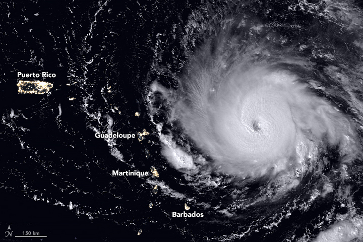
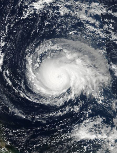
The Visible Infrared Imaging Radiometer Suite (VIIRS) on the Suomi NPP satellite captured this nighttime view of the Category 5 Hurricane Irma in the early hours of September 5, 2017. When the image was acquired, the storm’s center was moving due west. A National Hurricane Center forecast called for the hurricane to turn west-northwest toward the northern Leeward Islands. Credit: NASA, NOAA, Suomi NPP - VIIRS.

Record-setting Hurricane Irma barreled over the Caribbean islands of St. Martin, St. Barthelemy and Anguilla early Wednesday, destroying buildings with its sustained winds of 185 mph (297 kph), with rains and storm surges causing major flooding. The US National Hurricane Center listed the Category 5 Irma as the strongest Atlantic hurricane ever recorded north of the Caribbean and east of the Gulf of Mexico. The storm continues to roar on a path toward the U.S. and British Virgin Islands, Puerto Rico and possibly Florida, or along the southeast coast of the US.

This animation of NOAA’s GOES East satellite imagery from Sept. 3 at 8:15 a.m. EDT (1215 UTC) to Sept. 6 ending at 8:15 a.m. EDT (1215 UTC) shows Category 5 Hurricane Irma as it moved west and track over St. Martin by 8 a.m. EDT on Sept. 6:

Different models have Irma traveling on slightly different paths and officials from all the areas that might possibly be hit are telling people to prepare and follow evacuation orders. National Hurricane Center scientist Eric Blake said via twitter that some models had the storm going one way, and some another. But he cautioned everyone in a potential path should take precautions. “Model trends can be quite misleading- could just change right back. It is all probabilistic at this point. It could still miss [one particular area]. But chances of an extreme event is rising.”

The fleet of Earth-observing satellites are providing incredible views of this monster storm, and even astronauts on board the International Space Station are capturing views:

While satellite views provide the most comprehensive view of Irma’s potential track, there’s also a more ‘hands-on’ approach to getting data on hurricanes. NOAA hurricane hunter Nick Underwood posted this video while his plane flew into Hurricane Irma yesterday. The plane’s specialized instruments can take readings on the storm that forecasters can’t get anywhere else:

But Irma isn’t the only storm to keep an eye on. Tropical storms Katia and Jose are also on the horizon:

In the meantime, a launch is scheduled from Cape Canaveral on Thursday, September 7. SpaceX is hoping to launch the US Air Force’s X-37B reusable spaceplane, but current forecasts put only a 50% chance of weather suitable enough on Thursday, and only 40% on Friday. We’ll keep you posted.

For the latest satellite views, the Twitter accounts above are posting regular updates.

On Sept. 4 at 17:24 UTC, NASA-NOAA’s Suomi NPP satellite captured this view of Hurricane Irma as a Category 4 hurricane approaching the Leeward Islands.
Credits: NOAA/NASA Goddard MODIS Rapid Response Team.

This is the Strangest Idea Ever for a Spacecraft Propulsion System: Ferrofluids

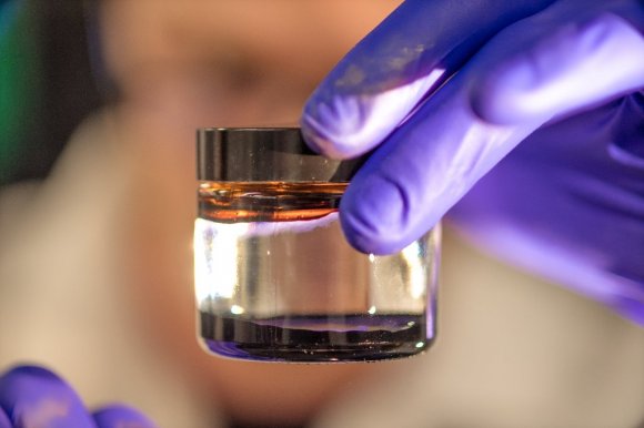
A ferrofluid is a magnetic liquid that turns spiky in a magnetic field. Add an electric field and each needle-like spike emits a jet of ions, which could solve micropropulsion for nanosatellites in space. Credit: MTU

When it comes to the future of space exploration, some truly interesting concepts are being developed. Hoping to reach farther and reduce associated costs, one of the overarching goals is to find more fuel-efficient and effective means of sending robotic spacecraft, satellites and even crewed missions to their destinations. Towards this end, ideas like nuclear propulsion, ion engines and even antimatter are all being considered.

But this idea has to be the strangest one to date! It’s known as a ferrofluid thruster, a new concept that relies on ionic fluids that become strongly magnetized and release ions when exposed to a magnetic field. According to a new study produced by researchers from the Ion Space Propulsion Laboratory at Michigan Tech, this concept could very well be the future of satellite propulsion.

This study, which was recently published in the journal Physics of Fluids, presents an entirely new method for creating microthrusters – tiny nozzles that are used by small satellites to maneuver in orbit. Thanks to improvements in technology, small satellites – which are typically defined as those that weight less than 500 km (1,100 lbs) – can perform tasks that were once reserved for larger ones.

As the magnetic field is applied, the ferrofluid forms “peaks”, which disappear once the field is removed. Click to animate. Credit: MTU

As such, they are making up an increasingly large share of the satellite market, and many more are expected to be launched in the near future. In fact, it is estimated that between 2015 and 2019, over 500 small satellites will be launched to LEO, with an estimated market value of $7.4 billion. Little wonder then why researchers are looking at various types of microthrusters to ensure that these satellites can maneuver effectively.

While there are no shortage of possibilities, finding the one that balances cost-effectiveness and reliability has been difficult. To address this, an MTU research team began conducting a study that considered ferrofluids as a possible solution. As noted, ferrofluids are ionic liquids that become active when exposed to a magnetic field, forming peaks that emit small amounts of ions.

These peaks then return to a natural state when the magnetic field is removed, a phenomena known as Rosenweig instability. Led by Brandon A. Jackson – a doctoral candidate in mechanical engineering at Michigan Technological University – the MTU research team began to consider how this could be turned into propulsion. Other members included fellow doctoral candidate Kurt Terhune and Professor Lyon B. King.

Prof. King, the Ron & Elaine Starr Professor in Space Systems at Michigan Tech, has been researching the physics of ferrofluids for many years, thanks to support provided by the Air Force Office of Scientific Research (AFOSR). In 2012, he proposed using such ionic fluids to create a microthruster for modern satellites, based on previous studies conducted by researchers at the University of Sydney.

Without a magnetic field, ferrofluids look like a tarry, oil-based fuel. With a magnetic field, the propellant self-assembles, raising into a spiky ball. Credit: MTU

As he explained in a MTU press release, this method offers a simple and effective way to create a reliable microthruster:

“We’re working with a unique material called an ionic liquid ferrofluid. When we put a magnet underneath a small pool of the ferrofluid, it turns into a beautiful hedgehog structure of aligned peaks. When we apply a strong electric field to that array of peaks, each one emits an individual micro-jet of ions.”

With King’s help, who oversees MTU’s Ion Space Propulsion Laboratory, Jackson and Tehrune began conducting an an experimental and computational study on the dynamics of the ferrofluid. From this, they created a computational model that taught them much about the relationships between magnetic, electric and surface tension stresses, and were even surprised by some of what they saw.

“We wanted to learn what led up to emission instability in one single peak of the ferrofluid microthruster,” said Jackson. “We learned that the magnetic field has a large effect in preconditioning the fluid electric stress.”

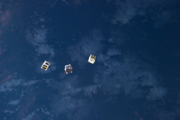
Cubesats being launched from the International Space Station. Credit: NASA

Ultimately, what they had created was a model for an electrospray ionic liquid ferrofluid thruster. Unlike conventional electrospray thrusters – which generate propulsion with electrical charges that send tiny jets of fluid through microscopic needles – a ferrofluid electrospray thruster would be able to do away with these needles, which are expensive to manufacture and vulnerable to damage.

Instead, the thruster they are proposing would be able to assemble itself out of its own propellant, would rely on no fragile parts, and would essentially be indestructible. It would also present advantages over conventional plasma thrusters, which are apparently unreliable when scaled down for small satellites. With the success of their model, the AFOSR recently decided to award King a second contract to continue studying ferrofluids.

With this funding secured, King is confident that they can put what they learned with this study to good use, and scale it up to examine what happens with multiple peaks. As he explained:

“Often in the lab we’ll have one peak working and 99 others loafing. Brandon’s model will be a vital tool for the team going forward. If we are successful, our thruster will enable small inexpensive satellites with their own propulsion to be mass produced. That could improve remote sensing for better climate modeling, or provide better internet connectivity, which three billion people in the world still do not have.”

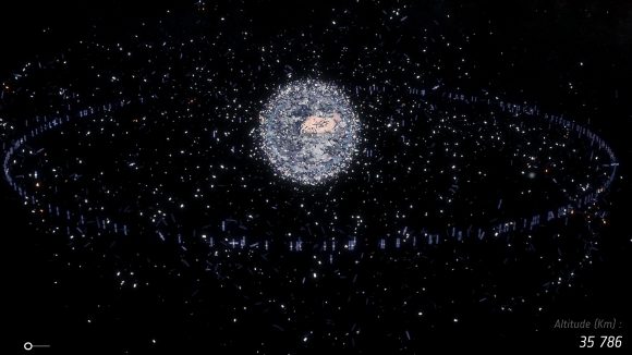
In the coming years, small satellites are expected to make up an ever-increasing portion of all artificial objects that are currently in Low Earth Orbit. Credit: ESA

Looking ahead, the team wants to conduct experiments on how an actual thruster might perform. The team has also begun working with Professor Juan Fernandez de la Mora of Yale University, one of the world’s leading experts on electrospray propulsion, to help bring their proposal to fruition. Naturally, it will take many years before a prototype is ready, and such a thruster would likely have to be able to execute about 100 peaks to be considered viable.

Nevertheless, the technology holds promise for a market that is expected to grow by leaps and bounds in the coming years and decades. Facilitating everything from worldwide internet access and telecommunications to scientific research, there is likely to be no shortage of smallsats, cubesats, nanosats, etc. taking to space very soon. They will all need to have reliable propulsion if they want to be able to stay clear of each other do their jobs!

Michigan Tech also has patents pending for the technology, which has applications that go beyond propulsion to include spectrometry, pharmaceuticals, and nanofabrication.

Further Reading: MTU, Physics of Fluids

Let’s Clean up the Space Junk with Magnetic Space Tugs

In the future, derelict satellites could be grappled and removed from key orbits around Earth with a space tug using magnetic forces. Credit: Philippe Ogaki

After 50 years of sending rockets, satellites, and payloads into orbit, humanity has created something of a “space junk” problem. Recent estimates indicate that there are more than 170 million pieces of debris up there, ranging in size from less than 1 cm (0.4 in) to a few meters in diameter. Not only does this junk threaten spacecraft and the ISS, but collisions between bits of debris can cause more to form, a phenomena known as the Kessler Effect.

And thanks to the growth of the commercial aerospace industry and the development of small satellites, things are not likely to get any less cluttered up there anytime soon. Hence why multiple strategies are being explored to clean up the space lanes, ranging from robotic arms and nets to harpoons. But in what may be the most ambitious plan to date, the ESA has proposed creating space tugs with powerful magnets to yank debris out of orbit.

The concept comes from Emilien Fabacher, a researcher from the Institut Supérieur de l’Aéronautique et de l’Espace at the University of Toulouse, France. His concept for a magnetic tug seeks to address one type of space debris in particular – inoperable satellites. These uncontrolled, rapidly spinning objects often weigh up to several tons, and are therefore one of the most significant collision hazards there is.

Illustration showing the problem of space debris. Credit: ESA

When applied to the problem of orbital debris, magnetic attraction is an attractive solutions for the safe deorbiting of spent satellites. For starters, it relies on technology that is standard issue aboard many low-orbiting satellites, which is known as magnetorquers. These electromagnets allow satellites to adjust their orientation using the Earth’s magnetic field. Hence, debris-chasing satellites would not need to be specially equipped in advance.

What’s more, this same magnetic attraction or repulsion technology is being considered as a safe method for allowing multiple satellites to maintain close formations in space. Such satellites – like NASA’s Magnetospheric Multiscale mission (MMS), the Landsat 7 and the Earth Observing-1 satellites, and the ESA’s upcoming LISA mission – are either operational or soon will be around Earth.

Because of this, this kind of magnetic attraction technology presents a safe and effective alternative for deorbiting space junk. As Fabacher explained in a recent ESA press release:

“With a satellite you want to deorbit, it’s much better if you can stay at a safe distance, without needing to come into direct contact and risking damage to both chaser and target satellites. So the idea I’m investigating is to apply magnetic forces either to attract or repel the target satellite, to shift its orbit or deorbit it entirely.”

Artist’s impression of the ESA’s proposed Darwin mission, six formation-flying satellites that would look for exoplanets. Credit: ESA/Medialab

The concept emerged out of a conversation Fabacher had with experts from the ESA’s technical center in the Netherlands. As part of his PhD research, he was looking into how magnetic guidance, navigation and control techniques would work in practice. This led to a discussion about how similar technology could allow swarms of satellites to attract and remove debris from orbit.

After making some calculations that combined a rendezvous simulator with magnetic interaction models, and also taking account the ever-changing state of Earth’s own magnetosphere, Fabacher and his colleagues realized they had a working concept. “The first surprise was that it was indeed possible, theoretically – initially we couldn’t be sure, but it turns out that the physics works fine,” he said.

To break it down, the chaser satellites would generate a strong magnetic field using superconducting wires that are cooled to cryogenic temperatures. These satellites would also rely on magnetic fields to maintain precise flying formations, thus allowing a swarm of chaser satellites the ability to deal with multiple pieces of debris, or to coordinate and guide debris to a specific location.

According to Finn Ankersen – an ESA expert in rendezvous and docking and formation flight – these magnetic tugs would also be able to remove space debris with a very high level of precision. “This kind of contactless magnetic influence would work from about 10–15 meters out, offering positioning precision within 10 cm with attitude precision [of] 1 – 2º,” he said.

Why Space Debris Mitigation is needed. Click for animation. Credit: ESA

The concept is being developed with support provided by the ESA’s Networking/Partnering Initiative, a program that offers support to universities and research institutes for the sake of developing space-related technologies. And it comes at a time when the issue of space debris is becoming increasingly worrisome.

Left unchecked, space debris is likely to become a very serious hazard in the coming years and decades. Already, it is estimated that the small satellite market will grow by $5.3 billion in the next decade (according to Space Works and Eurostat) and many private companies are looking to provide regular launch services to accommodate that growth.

If we intend to begin making a return to the Moon and mounting missions to Mars, we need to make sure the space lanes are clear! And given the importance of the International Space Station to scientific research and international collaboration, and with companies like Bigelow Aerospace looking to establish space habitats in orbit, something has to be done about this problem before it gets completely out of control!

Who knows? Maybe a small fleet or magnetic tugs is just what we need to clean up this mess!

Further Reading: ESA

High-Speed Space Broadband for Everyone. SpaceX Details their Plans to Launch 1000s of Internet Satellites

A number companies are deploying satellites this year to create space-based internet services. Credit: AMNH.

SpaeeX and Tesla-founder Elon Musk has made some rather bold promises over the years. In addition to building a fleet of reusable rockets, an Interplanetary Transport System, colonizing Mars, and revolutionizing transportation, he has also made it clear that he hopes to provide worldwide broadband access by deploying a “constellation” of internet-providing satellites.

In November of 2016, SpaceX filed an application with the Federal Communications Commission (FCC) for a license to operate this constellation of non-geostationary satellites (NGS). And earlier this week, the US Senate Committee on Commerce. Science, and Transportation convened a hearing to explore this proposal for next-generation telecommunications services.

The hearing was titled, “Investing in America’s Broadband Infrastructure: Exploring Ways to Reduce Barriers to Deployment”. In the course of things, the committee heard from representatives of government and industry who spoke about the best ways to offer streamlined broadband access (especially in rural areas), the necessary infrastructure, and how to encourage private investment.

SpaceX’s proposed satellite constellation – 4,425 broadband internet satellites – could provide the entire world with high-speed internet access. Credit: ESA

Of those the committee heard from, Ms. Patricia Cooper – VP of Satellite Government Affairs for SpaceX – was on hand to underscore the company’s vision. As she stated:

“SpaceX sees substantial demand for high-speed broad band in the United States and worldwide. As the Committee is aware, millions of Americans outside of limited urban areas lack basic, reliable access. Furthermore, even in urban areas, a majority of Americans lacks more than a single fixed broadband provider from which to choose and may seek additional competitive options for high-speed service.”

Cooper also cited recent FCC findings, which indicated that millions of Americans lag behind other developed nations in terms of broadband speed, access, and price competitiveness. Basically, thirty-four million American citizens do not have access to 25 megabits per second (“Mbps”) broadband service while 47% of students in the US lack the connectivity to meet the FCC’s short-term goal of 100 Mbps per 1,000 students and staff.

This is at at a time when global demand for broadband services and internet connectivity continue to grow at an unprecedented rate. According to a report prepared by Cisco in 2016 – titled “White paper: Cisco VNI Forecast and Methodology, 2015-2020” – global Internet Protocol (IP) traffic surpassed the zettabyte threshold. In other words, over 1,000 billion gigabytes of data were exchanged worldwide in a single year!

SpaceX plans to beginning launching their internet-providing satellites aboard their Falcon 9 rockets beginning next year. Credit: Ken Kremer/Kenkremer.com

By 2020, that figure is projected to double, global fixed broadband speeds are expected to nearly double, and the number of devices connected to IP networks is projected to outnumber the global population by a factor of about 3 to 1. To remedy this situation, and bring broadband access in the US up to the average for developed nations, SpaceX plans to launch 4,425 broadband satellites.

These will begin being launched in 2019 aboard the company’s fleet of Falcon 9 rockets. The launches will continue until they have reached full capacity, which is expected to be by 2024. As Cooper outlined it:

“Later this year, SpaceX will begin the process of testing the satellites themselves, launching one prototype before the end of the year and another during the early months of 2018. Following successful demonstration of the technology, SpaceX intends to begin the operational satellite launch campaign in 2019. The remaining satellites in the constellation will be launched in phases through 2024, when the system will reach full capacity with the Ka- and Ku-Band satellites. SpaceX intends to launch the system onboard our Falcon 9 rocket, leveraging significant launch cost savings afforded by the first stage reusability now demonstrated with the vehicle.”

Other details included the operational altitudes of the satellites – ranging from 1,110 to 1,325 km (690 to 823 mi) – as well as the necessary infrastructure on the ground, which would include “ground control facilities, gateway Earth stations, and end-user Earth stations.” SpaceX has also indicated that it plans to deploy an additional 7.500 satellites that will operate at lower altitudes in order to boost broadband capacity in large population centers.

Naturally, there have to be those people who hear words like “satellite constellation” and immediately think “space junk”. Certainly, the deployment of between 4,425 and 11,925 satellites in the coming years will lead to increasing concerns about “orbital clutter”. Especially when other telecommunications providers are seeking to get in on the trend – a good example being Google’s Project Loon.

Why Space Debris Mitigation is needed. Credit: ESA

And while the subject did not come up during the hearing, it will be unavoidable in the coming years and decades. But in the meantime, the idea of bringing internet access to the world – particularly the developing regions of the world where the infrastructure may not otherwise exist – has the potential of being a great social leveler. In the coming decades, it is expected that internet use will reach proportions unheard of a few decades ago.

By 2020 alone, it is estimated that the number of Internet users will reach almost 5 billion – or roughly half the world projected population of 10 billion. This represents an almost threefold increase from the number of internet users in 2010 (1.7 billion) and an almost 14 fold increase since 2000 (360 million). As such, any investment that will help ensure that this growth occurs more equally across geographic and social barriers is certainly a good one.

The committee also heard testimony from Larry Downes, the Project Director of the Georgetown Center for Business and Public Policy, and Brian Hendricks – the head of Technology Policy & Public Affairs for the Americas Region for Nokia. In addition to addressing the current sate of broadband internet in the US, they made multiple recommendations on how the non-geostationary internet satellite industry could be fostered and developed.

You can read the transcripts and check out the live webcast by going to the hearing page.

Further Reading: US SCCST