Here’s a Better Use for Fighter Jets: Launching Satellites

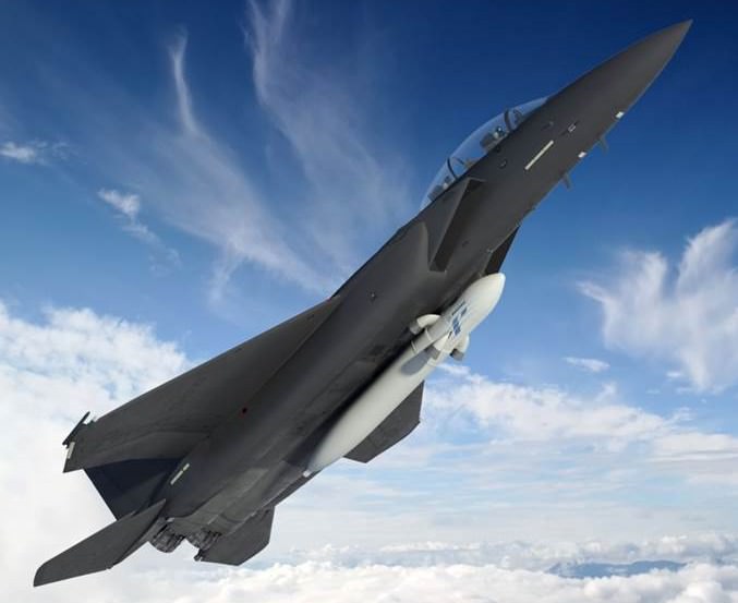
Artist's impression of the ALASA being deployed by a USAF fighter jet. Credit: DARPA

For decades, the human race has been deploying satellites into orbit. And in all that time, the method has remained the same – a satellite is placed aboard a booster rocket which is then launched from a limited number of fixed ground facilities with limited slots available. This process not only requires a month or more of preparation, it requires years of planning and costs upwards of millions of dollars.

On top of all that, fixed launch sites are limited in terms of the timing and direction of orbits they can establish, and launches can be delayed by things as simple as bad weather.  As such, DARPA has been working towards a new method of satellite deployment, one which eliminates rockets altogether. It’s known as the Airborne Launch Assist Space Access (ALASA), a concept which could turn any airstrip into a spaceport and significantly reduce the cost of deploying satellites.

What ALASA comes down to is a cheap, expendable dispatch launch vehicle that can be mounted onto the underside of an aircraft, flown to a high altitude, and then launched from the craft into low earth orbit. By using the aircraft as a first-stage, satellite deployment will not only become much cheaper, but much more flexible.

DARPA’s aim in creating ALASA was to ensure a three-fold decrease in launch costs, but also to create a system that could carry payloads of up to 45 kg (100 lbs) into orbit with as little as 24 hours’ notice. Currently, small satellite payloads cost roughly $66,000 a kilogram ($30,000 per pound) to launch, and payloads often must share a launcher. ALASA seeks to bring that down to a total of $1 million per launch, and to ensure that satellites can be deployed more precisely.
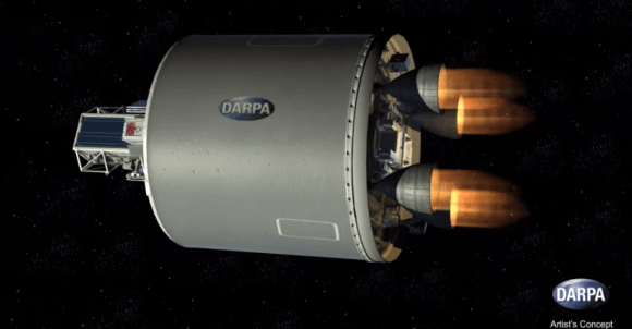
Artist's concept of the ALASA second stage firing (Credit: DARPA)
Artist’s concept of the ALASA second stage firing. Credit: DARPA

News of the agency’s progress towards this was made at the 18th Annual Commercial Space Transportation Conference (Feb 4th and 5th) in Washington, DC. Bradford Tousley, the director of DARPA’s Tactical Technology Office, reported on the progress of the agency’s program, claiming that they had successfully completed phase one, which resulted in three viable system designs.

Phase two – which began in March of 2014 when DARPA awarded Boeing the prime contract for development – will consist of DARPA incorporating commercial-grade avionics and advanced composites into the design. Once this is complete, it will involve launch tests that will gauge the launch vehicle’s ability to deploy satellites to desired locations.

“We’ve made good progress so far toward ALASA’s ambitious goal of propelling 100-pound satellites into low earth orbit (LEO) within 24 hours of call-up, all for less than $1 million per launch,” said Tousley in an official statement. “We’re moving ahead with rigorous testing of new technologies that we hope one day could enable revolutionary satellite launch systems that provide more affordable, routine and reliable access to space.”

These technologies include the use of a high-energy monopropellant, where fuel and oxidizer are combined into a single liquid. This technology, which is still largely experimental, will also cut the costs associated with satellite launches by both simplifying engine design and reducing the cost of engine manufacture and operation.
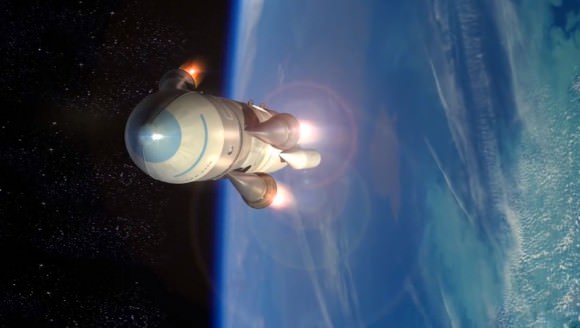
Artisti's concept of the ALASA deploying into orbit. Credit: DARPA
Artist’s concept of the ALASA vehicle deploying into orbit. Credit: DARPA

Also, the ability to launch satellites from runways instead of fixed launch sites presents all kinds of advantages. At present, the Department of Defense (DoD) and other government agencies require scheduling years in advance because the number of slots and locations are very limited. This slow, expensive process is causing a bottleneck when it comes to deploying essential space assets, and is also inhibiting the pace of scientific research and commercial interests in space.

“ALASA seeks to overcome the limitations of current launch systems by streamlining design and manufacturing and leveraging the flexibility and re-usability of an air-launched system,” said Mitchell Burnside Clapp, DARPA program manager for ALASA. “We envision an alternative to ride-sharing for satellites that enables satellite owners to launch payloads from any location into orbits of their choosing, on schedules of their choosing, on a launch vehicle designed specifically for small payloads.”

The program began in earnest in 2011, with the agency conducting initial trade studies and market/business case analysis. In November of that same year, development began with both system designs and the development of the engine and propellant technologies. Phase 2 is planned to last late into 2015, with the agency conducting tests of both the vehicle and the monopropellant.

Pending a successful run, the program plan includes 12 orbital launches to test the integrated ALASA prototype system – which is slated to take place in the first half of 2016. Depending on test results, the program would conduct up to 11 further demonstration launches through the summer of 2016. If all goes as planned, ALASA would provide convenient, cost-effective launch capabilities for the growing government and commercial markets for small satellites, which are currently the fastest-growing segment of the space launch industry.

And be sure to check out this concept video of the ALASA, courtesy of DARPA:

Further Reading: DARPA TTO, DARPA News

Space Weather Storm Monitoring Satellite Blasts off for Deep Space on SpaceX Rocket

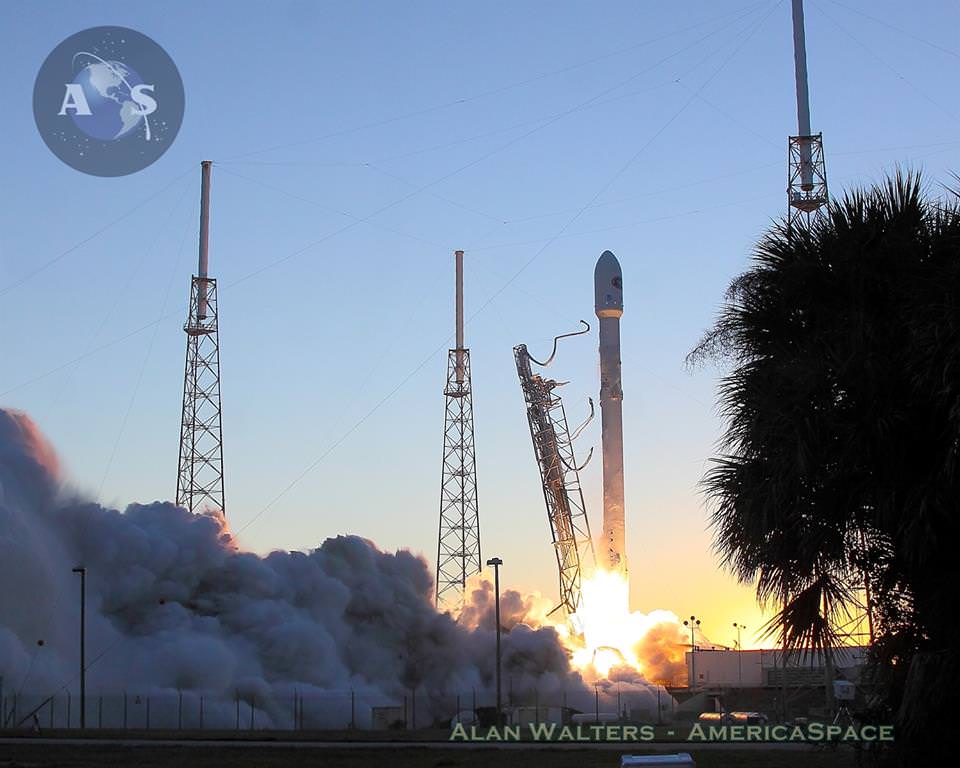
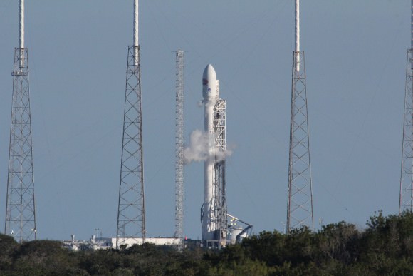
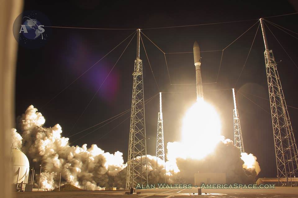
NOAA's DSCOVR satellite launches from Cape Canaveral Air Force Station on Feb. 11, 2015. DSCOVR will provide NOAA space weather forecasters more reliable measurements of solar wind conditions, improving their ability to monitor potentially harmful solar activity. Credit: Alan Walters/AmericaSpace

After a 17 year long wait, a new American mission to monitor intense solar storms and warn of impeding space weather disruptions to vital power grids, telecommunications satellites and public infrastructure was launched atop a SpaceX Falcon 9 on Wednesday, Feb. 11, from Cape Canaveral, Florida, to start a million mile journey to its deep space observation post.

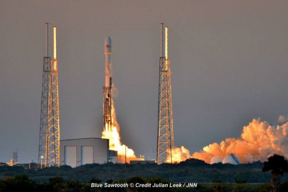
The third time proved to be the charm when the Deep Space Climate Observatory, or DSCOVR science satellite lifted off at 6:03 p.m. EST Wednesday from Space Launch Complex 40 at Cape Canaveral Air Force Station in Florida.

The spectacular sunset blastoff came after two scrubs this week forced by a technical problem with the Air Force tracking radar and adverse weather on Sunday and Tuesday.

The $340 million DSCOVR has a critical mission to monitor the solar wind and aid very important forecasts of space weather at Earth at an observation point nearly a million miles from Earth. It will also take full disk color images of the sunlit side of Earth at least six times per day that will be publicly available and “wow” viewers.

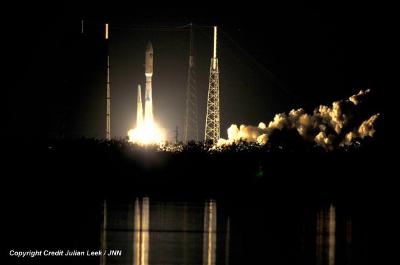
Launch of NOAA DSCOVR satellite from Cape Canaveral Air Force Station on Feb. 11, 2015 to monitor solar storms and space weather.   Credit:  Julian Leek
Launch of NOAA DSCOVR satellite from Cape Canaveral Air Force Station on Feb. 11, 2015 to monitor solar storms and space weather. Credit: Julian Leek

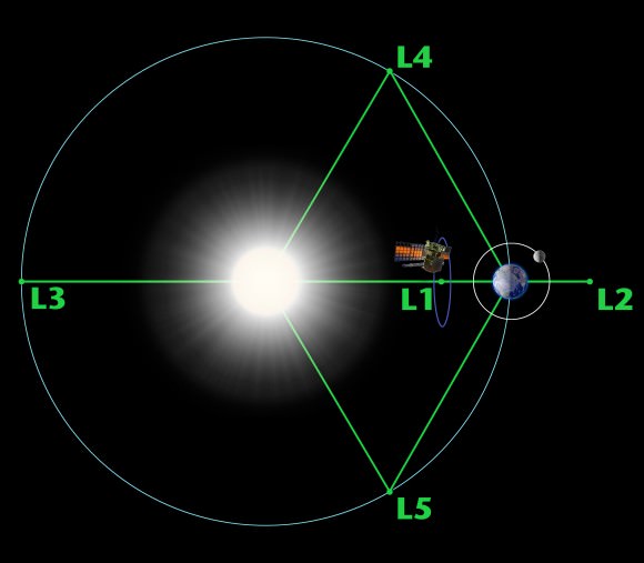
The couch sized probe was targeted to the L1 Lagrange Point, a neutral gravity point that lies on the direct line between Earth and the sun located 1.5 million kilometers (932,000 miles) sunward from Earth. At L1 the gravity between the sun and Earth is perfectly balanced and the satellite will orbit about that spot just like a planet.

L1 is a perfect place for the science because it lies outside Earth’s magnetic environment. The probe will measure the constant stream of solar wind particles from the sun as they pass by.

The DSCOVR spacecraft (3-axis stabilized, 570 kg) will be delivered to the Sun-Earth L1 point, 1.5 million km (1 million miles) from the Earth, directly in front of the Sun. A Halo (Lissajous) orbit will stabilize the craft's position around the L1 point while keeping it outside the radio noise emanating from the Sun. (Illustratin Credit: NASA)
The DSCOVR spacecraft (3-axis stabilized, 570 kg) will be delivered to the Sun-Earth L1 point, 1.5 million km (1 million miles) from the Earth, directly in front of the Sun. A Halo (Lissajous) orbit will stabilize the craft’s position around the L1 point while keeping it outside the radio noise emanating from the Sun. (Illustratin Credit: NASA)

DSCOVR is a joint mission between NOAA, NASA, and the U.S Air Force (USAF) that will be managed by NOAA. The satellite and science instruments are provided by NASA and NOAA. The rocket was funded by the USAF.

The mission is vital because its solar wind observations are crucial to maintaining accurate space weather forecasts to protect US infrastructure such as power grids, aviation, planes in flight, all types of Earth orbiting satellites for civilian and military needs, telecommunications, ISS astronauts and GPS systems.

It will take about 150 days to reach the L1 point and complete satellite and instrument checkouts.

DSCOVR will then become the first operational space weather mission to deep space and function as America’s primary warning system for solar magnetic storms.

It will replace NASA’s aging Advanced Composition Explorer (ACE) satellite which is nearly 20 years old and far beyond its original design lifetime.

“DSCOVR is the latest example of how NASA and NOAA work together to leverage the vantage point of space to both understand the science of space weather and provide direct practical benefits to us here on Earth,” said John Grunsfeld, associate administrator of NASA’s Science Mission Directorate in Washington.

DSCOVR was first proposed in 1998 by then US Vice President Al Gore as the low cost ‘Triana’ satellite to take near continuous views of the Earth’s entire globe to feed to the internet as a means of motivating students to study math and science. It was eventually built as a much more capable Earth science satellite that would also conduct the space weather observations.

But Triana was shelved for purely partisan political reasons and the satellite was placed into storage at NASA Goddard and the science was lost until now.

DSCOVR mission logo.  Credit: NOAA/NASA/U.S. Air Force
DSCOVR mission logo. Credit: NOAA/NASA/U.S. Air Force

DSCOVR is equipped with a suite of four continuously operating solar science and Earth science instruments from NASA and NOAA.

It will make simultaneous scientific observations of the solar wind and the entire sunlit side of Earth.

The 750-kilogram (1250 pound) DSCOVR probe measures 54 inches by 72 inches.

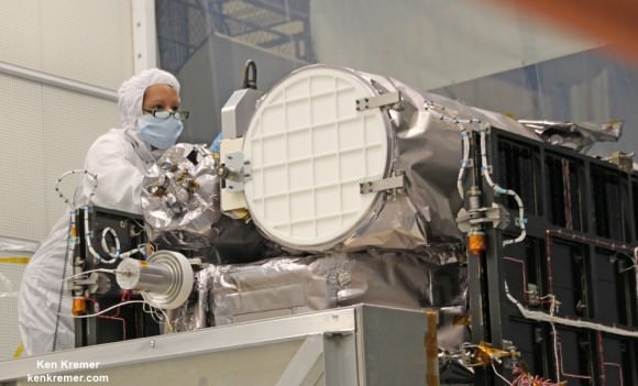
Technician works on NASA Earth science instruments and Earth imaging EPIC camera (white circle) housed on NOAA/NASA Deep Space Climate Observatory (DSCOVR) inside NASA Goddard Space Flight Center clean room in November 2014.  Credit: Ken Kremer/kenkremer.com/AmericaSpace
Technician works on NASA Earth science instruments and Earth imaging EPIC camera (white circle) housed on NOAA/NASA Deep Space Climate Observatory (DSCOVR) inside NASA Goddard Space Flight Center clean room in November 2014. Credit: Ken Kremer/kenkremer.com/AmericaSpace

The two Earth science instruments from NASA are the Earth Polychromatic Imaging Camera (EPIC) and the National Institute of Standards and Technology Advanced Radiometer (NISTAR).

EPIC will provide true color spectral images of the entire sunlit face of Earth at least six times per day, as viewed from an orbit around L1. They will be publically available within 24 hours via NASA Langley.

It will view the full disk of the entire sunlit Earth from sunrise to sunset and collect a variety of science measurements including on ozone, aerosols, dust and volcanic ash, vegetation properties, cloud heights and more.

Listen to my post launch interview with the BBC about DSCOVR and ESA’s successful IXV launch on Feb. 11.

A secondary objective by SpaceX to recover the Falcon 9 first stage booster on an ocean going barge had to be skipped due to very poor weather and very high waves in the Atlantic Ocean making a safe landing impossible. The stage did successfully complete a soft landing in the ocean.

Stay tuned here for Ken’s continuing Earth and planetary science and human spaceflight news.

Ken Kremer

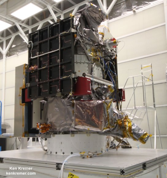
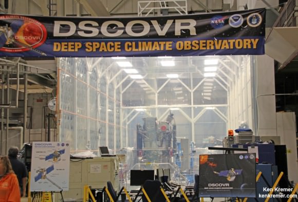
NOAA/NASA Deep Space Climate Observatory (DSCOVR) undergoes processing in NASA Goddard Space Flight Center clean room. Solar wind instruments at right. DSCOVER will launch in February 2015 atop SpaceX Falcon 9 rocket.  Credit: Ken Kremer/kenkremer.com/AmericaSpace
NOAA/NASA Deep Space Climate Observatory (DSCOVR) undergoes processing in NASA Goddard Space Flight Center clean room. Solar wind instruments at right. DSCOVER will launch in February 2015 atop SpaceX Falcon 9 rocket. Credit: Ken Kremer/kenkremer.com/AmericaSpace
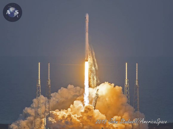
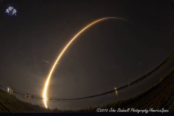
Launch of NOAA DSCOVR satellite from Cape Canaveral Air Force Station on Feb. 11, 2015 to monitor solar storms and space weather.   Credit:  John Studwell
Launch of NOAA DSCOVR satellite from Cape Canaveral Air Force Station on Feb. 11, 2015 to monitor solar storms and space weather. Credit: John Studwell
Prelaunch view of SpaceX rocket on Cape Canaveral launch pad taken from LC-39 at the Kennedy Space Center.  Credit: Chuck Higgins
Prelaunch view of SpaceX rocket on Cape Canaveral launch pad taken from LC-39 at the Kennedy Space Center. Credit: Chuck Higgins

NOAA/NASA/USAF Deep Space Climate Observatory (DSCOVR) Launching Feb. 8 to Monitor Solar Winds

DSCOVR mission logo. Credit: NOAA/NASA/U.S. Air Force

The long awaited Deep Space Climate Observatory, or DSCOVR science satellite is slated to blast off atop a SpaceX Falcon 9 on Sunday, Feb. 8, from Cape Canaveral, Florida on a mission to monitor the solar wind and aid very important forecasts of space weather at Earth.

DSCOVR is a joint mission between NOAA, NASA, and the U.S Air Force (USAF) that will be managed by NOAA. The satellite and science instruments are provided by NASA and NOAA.

Update Feb 8: Hold, Hold, Hold !!! 6:10 PM 2/8/15 Terminal Count aborted at T Minus 2 min 26 sec due to a tracking issue. NO launch of Falcon 9 today. rocket being safed now. next launch opportunity is Monday. Still TBD.

The rocket is provided by the USAF. SpaceX will try to recover the first stage via a guided descent to a floating barge in the Atlantic Ocean.

The weather outlook is currently very promising with a greater than 90 percent chance of favorable weather at launch time shortly after sunset on Sunday which could make for a spectacular viewing opportunity for spectators surrounding the Florida Space coast.

Liftoff atop the SpaceX Falcon 9 rocket is targeted for at 6:10:12 p.m. EST on Feb. 8, from Cape Canaveral Air Force Station Space Launch Complex 40.

There is an instantaneous launch window, meaning that any launch delay due to weather, technical or other factors will force a scrub to Monday.

The launch will be broadcast live on NASA TV: http://www.nasa.gov/nasatv

NASA’s DSCOVR launch blog coverage of countdown and liftoff will begin at 3:30 p.m. Sunday.

NOAA/NASA Deep Space Climate Observatory (DSCOVR) undergoes processing in NASA Goddard Space Flight Center clean room. Solar wind instruments at right. DSCOVER will launch in February 2015 atop SpaceX Falcon 9 rocket.  Credit: Ken Kremer/kenkremer.com/AmericaSpace
NOAA/NASA Deep Space Climate Observatory (DSCOVR) undergoes processing in NASA Goddard Space Flight Center clean room. Solar wind instruments at right. DSCOVER will launch in February 2015 atop SpaceX Falcon 9 rocket. Credit: Ken Kremer/kenkremer.com/AmericaSpace

“DSCOVR is NOAA’s first operational space weather mission to deep space,” said Stephen Volz, assistant administrator of the NOAA Satellite and Information Service in Silver Spring, Maryland, at the pre-launch briefing today (Feb. 7) at the Kennedy Space Center in Florida.

The mission of DSCOVR is vital because its solar wind observations are crucial to maintaining accurate space weather forecasts to protect US infrastructure from disruption by approaching solar storms.

“DSCOVR will maintain the nation’s solar wind observations, which are critical to the accuracy and lead time of NOAA’s space weather alerts, forecasts, and warnings,” according to a NASA description.

“Space weather events like geomagnetic storms caused by changes in solar wind can affect public infrastructure systems, including power grids, telecommunications systems, and aircraft avionics.”

DSCOVR will replace NASA’s aging Advanced Composition Explorer (ACE) satellite which is nearly 20 years old and far beyond its original design lifetime.

The couch sized probe is being targeted to the L1 Lagrange Point, a neutral gravity point that lies on the direct line between Earth and the sun located 1.5 million kilometers (932,000 miles) sunward from Earth. At L1 the gravity between the sun and Earth is perfectly balanced and the satellite will orbit about that spot just like a planet.

L1 is a perfect place for the science because it lies outside Earth’s magnetic environment. The probe will measure the constant stream of solar wind particles from the sun as they pass by.

Diagram of the five Lagrange points associated with the sun-Earth system, showing DSCOVR orbiting the L-1 point. Image is not to scale.  Credit:  NASA/WMAP Science Team
Diagram of the five Lagrange points associated with the sun-Earth system, showing DSCOVR orbiting the L-1 point. Image is not to scale. Credit: NASA/WMAP Science Team

This will enable forecasters to give a 15 to 60 minute warning of approaching geomagnetic storms that could damage valuable infrastructure.

DSCOVR is equipped with a suite of four continuously operating solar science and Earth science instruments from NASA and NOAA.

It will make simultaneous scientific observations of the solar wind and the entire sunlit side of Earth.

Three instruments will help measure the solar wind on the DSCOVR mission: (shown from left to right), the Faraday cup to monitor the speed and direction of positively-charged solar wind particles, the electron spectrometer to monitor electrons, and a magnetometer to measure magnetic fields.  Credit: NASA/DSCOVR
Three instruments will help measure the solar wind on the DSCOVR mission: (shown from left to right), the Faraday cup to monitor the speed and direction of positively-charged solar wind particles, the electron spectrometer to monitor electrons, and a magnetometer to measure magnetic fields. Credit: NASA/DSCOVR

The 750-kilogram DSCOVR probe measures 54 inches by 72 inches.

I saw the DSCOVR spacecraft up close at NASA Goddard Space Flight Center in Maryland last fall during processing in the clean room.

NOAA/NASA/USAF Deep Space Climate Observatory (DSCOVR) undergoes processing in NASA Goddard Space Flight Center clean room.  Probe will launch in February atop SpaceX Falcon 9 rocket.  Credit: Ken Kremer - kenkremer.com
NOAA/NASA/USAF Deep Space Climate Observatory (DSCOVR) undergoes processing in NASA Goddard Space Flight Center clean room. Probe will launch in February atop SpaceX Falcon 9 rocket. Credit: Ken Kremer – kenkremer.com

A secondary objective of the rocket launch for SpaceX is to conduct their second attempt to recover the Falcon 9 first stage booster on an ocean going barge. Read my articles about the first attempt in January 2015, starting here.

It was originally named ‘Triana’ (aka Goresat) and was conceived by then US Vice President Al Gore as a low cost satellite to take near continuous views of the Earth’s entire globe to feed to the internet as a means of motivating students to study math and science. It was eventually built as a much more capable Earth science satellite as well as to conduct the space weather observations.

But Triana was shelved for purely partisan political reasons and the satellite was placed into storage and the science was lost until now.

Stay tuned here for Ken’s continuing Earth and planetary science and human spaceflight news.

Ken Kremer

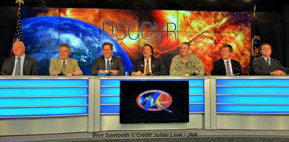
The team is ready for the launch of NASA's DSCOVR spacecraft aboard a SpaceX Falcon 9 rocket. L/R Mike Curie KSC NASA News Chief, Stephen Volz, assistant administrator NOAA, Tom Berger, director of NOAA Space Weather Prediction Center Boulder Colorado,Steven Clark, NASA Joint Agency Satellite Division, Col. D. Jason Cothern, Space Demonstration Division chief at Kirkland AFB NM. Hans Koenigsmann, VP of mission assurance at SpaceX in Hawthorne, California, Mike McAlaneen, launch weather officer 45th Space wing Cape Canaveral Air Force Station, Florida.  Credit: Julian Leek
The team is ready for the launch of NASA’s DSCOVR spacecraft aboard a SpaceX Falcon 9 rocket. L/R Mike Curie KSC NASA News Chief, Stephen Volz, assistant administrator NOAA, Tom Berger, director of NOAA Space Weather Prediction Center Boulder Colorado,Steven Clark, NASA Joint Agency Satellite Division, Col. D. Jason Cothern, Space Demonstration Division chief at Kirkland AFB NM. Hans Koenigsmann, VP of mission assurance at SpaceX in Hawthorne, California, Mike McAlaneen, launch weather officer 45th Space wing Cape Canaveral Air Force Station, Florida. Credit: Julian Leek

Most Powerful Atlas V Delivers a Most Spectacular Nighttime Sky Show Launch for US Navy

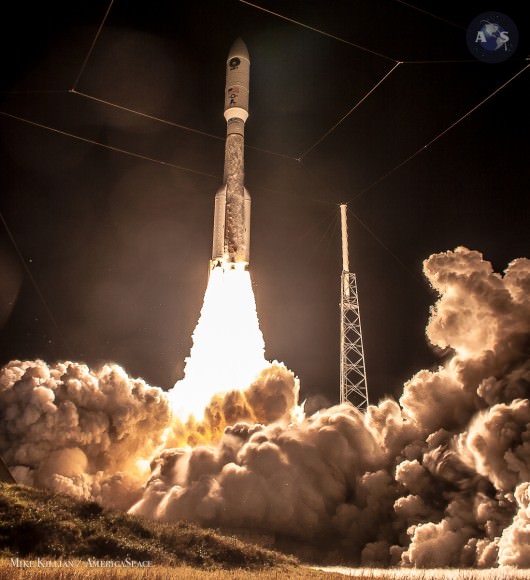
Blastoff of ULA Atlas V rocket lofting MUOS-3 to orbit for the US Navy from Space Launch Complex-41 at 8:04 p.m. EST on Jan. 20, 2015. Credit: Alan Walters/AmericaSpace

Blastoff of ULA Atlas V rocket lofting MUOS-3 to orbit for the US Navy from Space Launch Complex-41 at 8:04 p.m. EST on Jan. 20, 2015. Credit: Alan Walters/AmericaSpace
See launch gallery below![/caption]

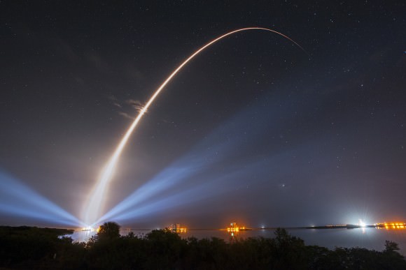
Launching on its milestone 200th mission, the most powerful version of the venerable Atlas-Centaur rocket put on a most spectacular nighttime sky show on Tuesday evening, (Jan. 20) that mesmerized spectators along the Florida Space Coast on a mission to deliver a powerful new next-generation communications satellite to orbit for the US Navy.

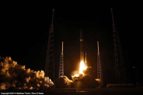
The United Launch Alliance (ULA) Atlas V rocket carrying the third Mobile User Objective System satellite (MUOS-3) for the United States Navy successfully launched to geostationary orbit from Space Launch Complex-41 at 8:04 p.m. EST from Cape Canaveral Air Force Station, Florida on Jan. 20, 2015.

The MUOS-3 launch opened ULA’s planned 13 mission manifest for 2015 with a boisterous bang as the Atlas V booster thundered off the seaside space coast pad.

Streak shot of United Launch Alliance (ULA) Atlas V rocket carrying the third Mobile User Objective System satellite to orbit for the United States Navy as it launched from Space Launch Complex-41 at 8:04 p.m. EST on Jan. 20, 2015. Credit: John Studwell/AmericaSpace

The MUOS constellation is a next-generation narrowband US Navy tactical satellite communications system designed to significantly improve ground communications to US forces on the move and around the globe.

“The ULA team is honored to deliver this critical mission into orbit for the U.S. Navy and U.S. Air Force with the support of our many mission partners,” said Jim Sponnick, ULA vice president, Atlas and Delta Programs.

This is the third satellite in the MUOS series and will provide military users 10 times more communications capability over existing systems, including simultaneous voice, video and data, leveraging 3G mobile communications technology. It was built by Lockheed Martin.

Launch of ULA  Atlas V rocket sending MUOS-3 satcom to orbit for the US Navy from Space Launch Complex-41 at 8:04 p.m. EST on Jan. 20, 2015. Credit: Julian Leek
Launch of ULA Atlas V rocket sending MUOS-3 satcom to orbit for the US Navy from Space Launch Complex-41 at 8:04 p.m. EST on Jan. 20, 2015. Credit: Julian Leek

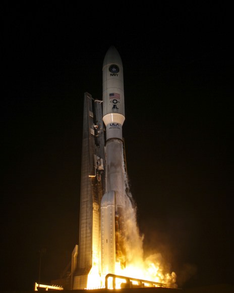
The unmanned Atlas V expendable rocket launched in its mightiest configuration known as the Atlas V 551.

The 206 foot-tall rocket features a 5-meter diameter payload fairing, five Aerojet Rocketdyne first stage strap on solid rocket motors and a single engine Centaur upper stage powered by the Aerojet Rocketdyne RL10C-1 engine.

The first stage is powered by the Russian-built dual nozzle RD AMROSS RD-180 engine. Combined with the five solid rocket motors, the Atlas V first stage generates over 2.5 million pounds of liftoff thrust.

The RD-180 burns RP-1 (Rocket Propellant-1 or highly purified kerosene) and liquid oxygen and delivers 860,200 lb of thrust at sea level.

And the rocket needed all that thrust because the huge MUOS-3 was the heftiest payload lofted by an Atlas V booster, weighing in at some 15,000 pounds.

“The MUOS-3 spacecraft is the heaviest payload to launch atop an Atlas V launch vehicle. The Atlas V generated more than two and half million pounds of thrust at liftoff to meet the demands of lifting this nearly 7.5-ton satellite,” noted Sponnick.

The Atlas V 551 rockets into the darkened Florida sky at 8:04 p.m. EST Tuesday, 20 January, to deliver MUOS-3 into orbit. Photo Credit: Mike Killian / AmericaSpace

The first Atlas rocket was first launched some 52 years ago.

“Today’s launch was the 200th Atlas-Centaur launch – a very sincere congratulations to the many women and men responsible for the incredible success of the Centaur upper stage over the last 5 decades!”

Overall this was the 52nd Atlas V mission and the fifth in the Atlas V 551 configuration.

The Atlas V 551 version has previously launched two prominent NASA planetary science missions including the New Horizons mission in 2006 that is about to reach Pluto and the Juno orbiter in 2011 that will arrive at Jupiter in July 2016. It was also used to launch MUOS-1 and MUOS-2.

United Launch Alliance successful MUOS-3 mission tonight! 20 Jan 2015.  Photo Credit: Matthew Travis / Zero-G News
United Launch Alliance successful MUOS-3 mission tonight! 20 Jan 2015. Photo Credit: Matthew Travis / Zero-G News

ULA’s second launch in 2015 thunders aloft from the US West Coast with NASA’s Soil Moisture Active Passive mission (SMAP) next week.

SMAP is the first US Earth-observing satellite designed to collect global observations of surface soil moisture.

SMAP will blastoff from Space Launch Complex 2 at Vandenberg AFB at 9:20 a.m. EST (6:20 a.m. PST) on ULA’s Delta II rocket.

A United Launch Alliance (ULA) Atlas V rocket carrying the third Mobile User Objective System satellite for the United States Navy launched from Space Launch Complex-41 at 8:04 p.m. EST on Jan. 20, 2015. Credit: United Launch Alliance

In another major milestone coming soon, the Atlas V is right now being man rated since it was chosen to launch the Boeing CST-100 space taxi, which NASA selected as one of two new commercial crew vehicles to launch US astronauts to the ISS as soon as 2017.

A United Launch Alliance (ULA) Atlas V rocket carrying the third Mobile User Objective System satellite for the United States Navy launched from Space Launch Complex-41 at 8:04 p.m. EST on Jan. 20, 2015. Credit: United Launch Alliance

The next Atlas launch involves NASA’s Magnetospheric Multiscale Mission (MMS) to study Earth’s magnetic reconnection. It is scheduled for launch on an Atlas V 421 booster on March 12 from Cape Canaveral. See my up close visit with MMS and NASA Administrator Charles Bolden at NASA Goddard Space Flight Center detailed in my story – here.

Stay tuned here for Ken’s continuing Earth and planetary science and human spaceflight news.

Ken Kremer

Having a Rough Winter? Here it is … From Space

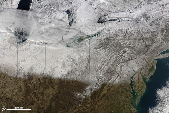
The northeastern US and southeastern Canada, as seen from space on January 13, 2015. Image is from the Moderate Resolution Imaging Spectroradiometer (MODIS) on NASA’s Terra satellite. acquired top image on January 13, 2015.

Yes, its been a snowy, icy winter in parts of the US, Canada and Europe and these satellite images look about as miserable as it’s felt for some of us. And no, those aren’t icicles hanging off the coast of Maine and Nova Scotia; those are called ‘cloud streets,’ which are long parallel bands of cumulus clouds that form when cold air blows over warmer waters (like the ocean) and a warmer air layer (temperature inversion) rests over the top of both.

But don’t let the recent cold weather and snow fool you. The Earth as a whole continues to warm, and NASA and NOAA announced today that their analysis puts 2014 as Earth’s warmest year since 1880. 2014 was the 38th straight year with above average global annual temperatures, and December 2014 was the hottest December on record. Additionally, 6 of the 12 months last year set heat records. Even though you might feel cold right now, the last time there was a monthly average global temperatures that set a record for cold was in 1916.

OK, now back to the regularly scheduled feeling sorry for ourselves for the recent cold, snowy weather… see more satellite images below.

Winter storms brought snow and ice to a large portion of the U.S. Midwest and Northeast. NASA’s Aqua satellite acquired this image on January 10, 2015. Credit: NASA.
Snow and 'cloud streets' over the Black Sea on January 8, 2015. Image is from  the Moderate Resolution Imaging Spectroradiometer (MODIS) on the Aqua satellite. Credit: NASA.
Snow and ‘cloud streets’ over the Black Sea on January 8, 2015. Image is from the Moderate Resolution Imaging Spectroradiometer (MODIS) on the Aqua satellite. Credit: NASA.

Here’s a video from NASA about the latest findings on Earth’s changing climate:

Sources: NASA Earth Observatory (US/Canada images), NASA Earth Observatory (Black Sea image), NASA, NOAA Find 2014 Warmest Year in Modern Record

New Mission: DSCOVR Satellite will Monitor the Solar Wind

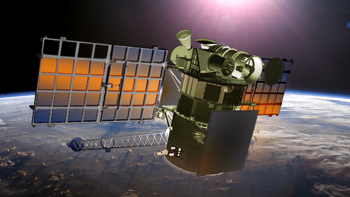
Artist's concept of the DSCOVR satellite in orbit. Credit: NOAA

Solar wind – that is, the stream of charged electrons and protons that are released from the upper atmosphere of the Sun – is a constant in our Solar System and generally not a concern for us Earthlings. However, on occasion a solar wind shock wave or Coronal Mass Ejection can occur, disrupting satellites, electronics systems, and even sending harmful radiation to the surface.

Little wonder then why NASA and the National Oceanic and Atmospheric Administration (NOAA) have made a point of keeping satellites in orbit that can maintain real-time monitoring capabilities. The newest mission, the Deep Space Climate Observatory (DSCOVR) is expected to launch later this month.

A collaborative effort between NASA, the NOAA, and the US Air Force, the DSCOVR mission was originally proposed in 1998 as a way of providing near-continuous monitoring of Earth. However, the $100 million satellite has since been re-purposed as a solar observatory.

In this capacity, it will provide support to the National Weather Service’s Space Weather Prediction Center, which is charged with providing advanced warning forecasts of approaching geomagnetic storms for people here on Earth.

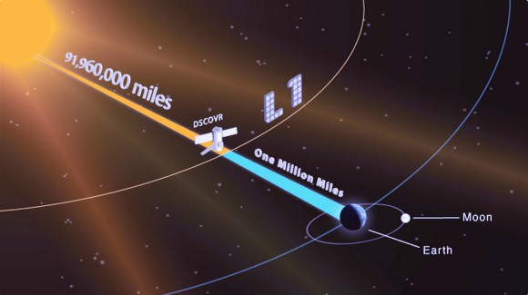
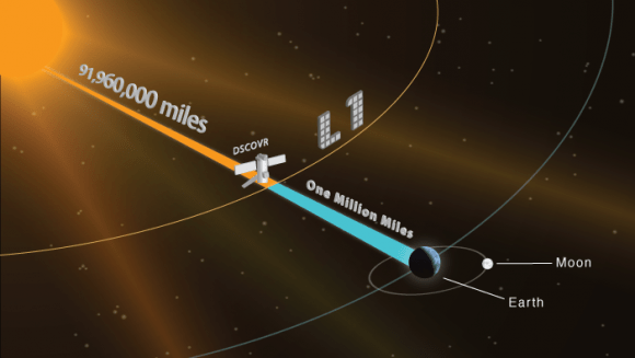
Illustration showing the DSCOVR satellite in orbit L1 orbit, located one million miles away from Earth. At this location, the satellite will be in the best position to monitor the constant stream of particles from the sun, known as solar wind, and provide warnings of approaching geomagnetic storms caused by solar wind about an hour before they reach Earth. Credit: NOAA
Illustration showing the DSCOVR satellite in L1 orbit, located 1.5 million km  (930,000 mi) away from Earth. Credit: NOAA

These storms, which are caused by large-scale fluctuations in solar wind, have the potential of disrupting radio signals and electronic systems, which means that everything from telecommunications, aviation, GPS systems, power grids, and every other major bit of infrastructure is vulnerable to them.

In fact, a report made by the National Research Council estimated that recovering from the most extreme geomagnetic storms could take up to a decade, and cost taxpayers in the vicinity of $1 to $2 trillion dollars. Add to the that the potential for radiation poisoning to human beings (at ground level and in orbit), as well as flora and fauna, and the need for alerts becomes clear.

Originally, the satellite was scheduled to be launched into space on Jan. 23rd from the Cape Canaveral Air Force Station, Florida. However, delays in the latest resupply mission to the International Space Station have apparently pushed the date of this launch back as well.

According to a source who spoke to SpaceNews, the delay of the ISS resupply mission caused scheduling pressure, as both launches are being serviced by SpaceX from Cape Canaveral. However, the same source indicated that there are no technical problems with the satellite or the Falcon 9 that will be carrying it into orbit. It is now expected to be launched on Jan. 29th at the latest.

Credit: NOAA
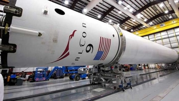
SpaceX will be providing the launch service for DSCOVR, which is now expected to be launched by the end of Jan aboard a Falcon 9 rocket (pictured here). Credit: NOAA

Once deployed, DSCOVR will eventually take over from NASA’s aging Advanced Composition Explorer (ACE) satellite, which has been in providing solar wind alerts since 1997 and is expected to remain in operation until 2024. Like ACE, the DSCOVER will orbit Earth at Lagrange 1 Point (L1), the neutral gravity point between the Earth and sun approximately 1.5 million km (930,000 mi) from Earth.

From this position, DSCOVR will be able to provide advanced warning, roughly 15 to 60 minutes before a solar wind shockwave or CME reaches Earth. This information will be essential to emergency preparedness efforts, and the data provided will also help improve predictions as to where a geomagnetic storm will impact the most.

These sorts of warnings are essential to maintaining the safety and integrity of infrastructure, but also the health and well-being of people here on Earth. Given our dependence on high-tech navigation systems, electricity, the internet, and telecommunications, a massive geomagnetic storm is not something we want to get caught off guard by!

And be sure to check out this video of the DSCOVR mission, courtesy of the NOAA:

Further Reading: NOAA

Photo Shoot Captures Classified Spy Satellite Engine Burn

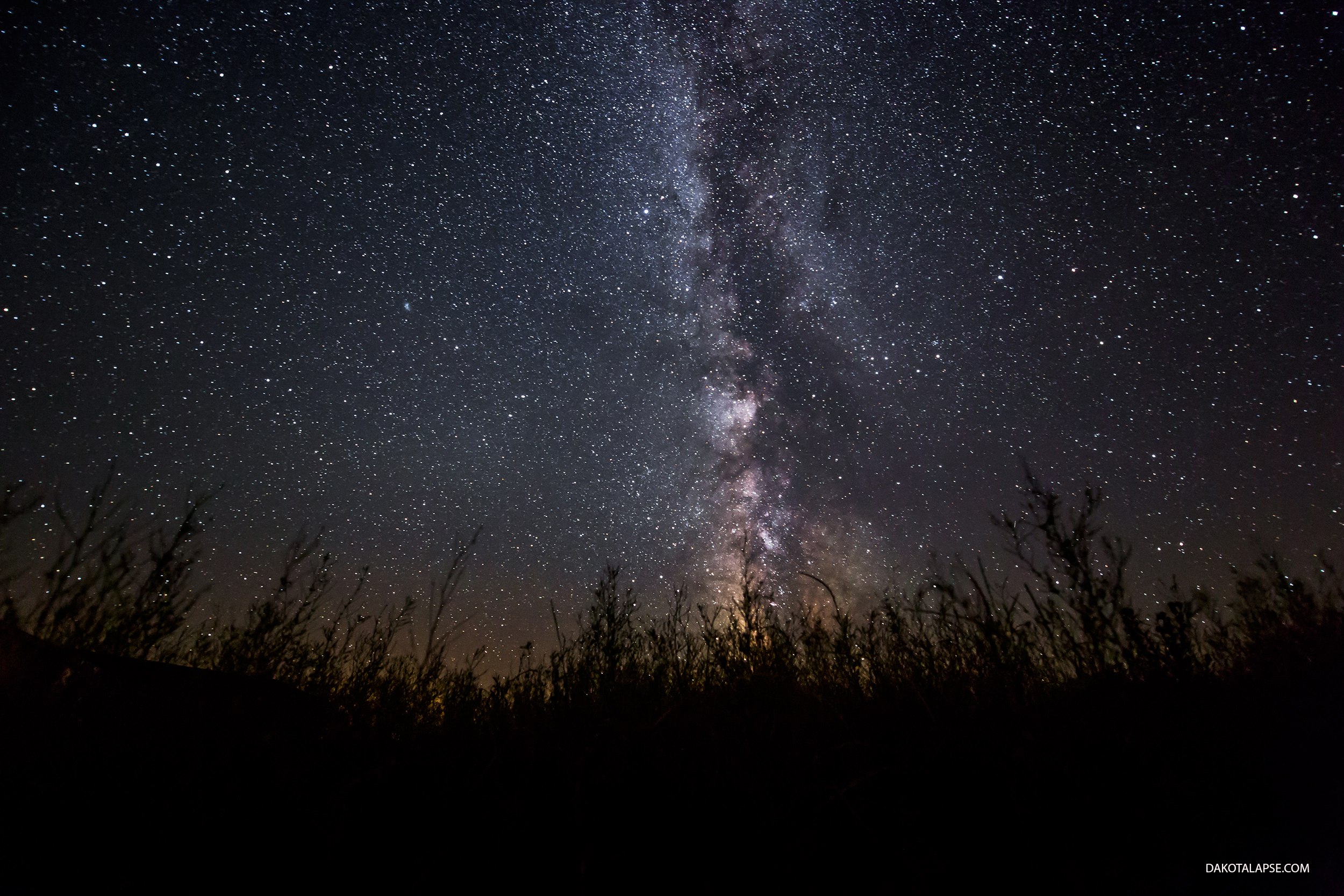
The small white flash in the upper left is the visible engine burn of the Air Force's ANGELS satellite firing it’s final boost stage. Credit and copyright: Randy Halverson.

Remember at the end of “Star Trek: First Contact” when Lily looks up to see the Enterprise enter the temporal vortex with a flash of light? Astrophotographer Randy Halverson captured a view very similar to that scene, albeit without time travel or Vulcans standing nearby.

“On July 28th, 2014, I was set up to shoot the Milky Way near Kennebec, South Dakota,” Halverson wrote on his website. “I had looked through some of the stills but didn’t notice anything unusual. [But] in December 2014 I was editing timelapse and when I got to the July 28th sequence I noticed something different on it. At first I thought it was another meteor with persistent train, but I had missed the meteor in between exposures. I had already caught several meteor with persistent trains on timelapse last year, so I was watching for them. Then I looked closer and noticed the flash was dimming and getting brighter. Also, when I zoomed in I could see a satellite or object right before the first flash.”

Halverson did a quick search of launches during that time and found the Air Force had launched a semi-classified trio of satellites into orbit earlier in the evening of July 28th (23:28 UTC, 7:28 EDT) on a Delta IV rocket from Cape Canaveral Air Force Station, and further research indicated he had captured the engine burn of one of the satellite’s final boost stage.

Just goes to show, you can never tell what you’ll see when you’re looking up!

See the timelapse below:

On board the Delta IV were two Geosynchronous Space Situational Awareness Program (GSSAP) spacecraft and the Autonomous Nanosatellite Guardian for Evaluating Local Space (ANGELS) NanoSatellite. Halverson conferred with a few NASA mission analysts and they all agreed the flash was coming from the ANGELS boost stage firing.

“The first flash you see on the timelapse happened at 1:09am July 29th (camera time) so that also seems to match up with the timing for the final burn the article mentions,” Halverson said.

According to the Spaceflight101 website, the ANGELS nanosatellite is a project of the U.S. Air Force Research Laboratory’s (AFRL) and was a secondary payload on Delta IV launched on July 28, 2014. Its purpose was to do a technical demonstration flight several hundred kilometers above the belt of geosynchronous orbit (35,786 kilometers (22,236 miles). The satellite was supposed to “perform an autonomous rendezvous demonstration with the Delta IV upper stage before testing a camera system for the inspection of satellites in high orbits.”

Halverson said he used a Canon 5D Mark III with a Nikon 14-24 lens on an eMotimo TB3 mounted on a Dynamic Perception Stage Zero Dolly.

See more of Randy’s great timelapse and night sky photography work at his website dakotalapse, or Twitter.

Japan’s Akatsuki Spacecraft to Make Second Attempt to Enter Orbit of Venus in December 2015

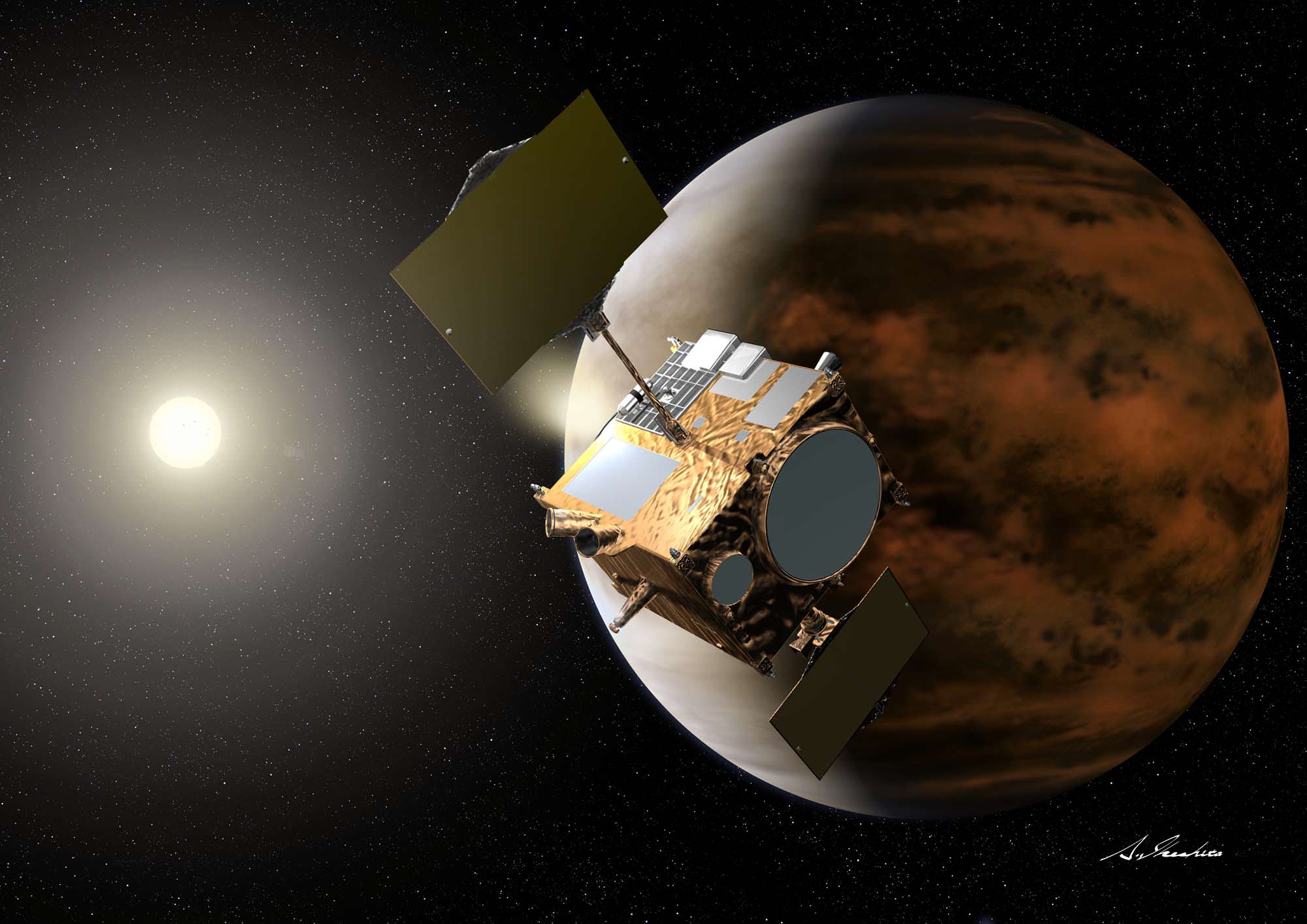
Artist’s impression of the Venus Climate Orbiter (aka. “Akatsuki”) by Akihiro Ikeshita. Image Credit: JAXA

Back in 2010, the Japanese Aerospace Exploration Agency (JAXA) launched the The Venus Climate Orbiter “Akatsuki” with the intention of learning more about the planet’s weather and surface conditions. Unfortunately, due to engine trouble, the probe failed to make it into the planet’s orbit.

Since that time, it has remained in a heliocentric orbit, some 134 million kilometers from Venus, conducting scientific studies on the solar wind. However, JAXA is going to make one more attempt to slip the probe into Venus’ orbit before its fuel runs out.

Since 2010, JAXA has been working to keep Akatsuki functioning so that they could give the spacecraft another try at entering Venus’ orbit.

After a thorough examination of all the possibilities for the failure, JAXA determined that the probe’s main engine burned out as it attempted to decelerate on approach to the planet. They claim this was likely due to a malfunctioning valve in the spacecraft’s fuel pressure system caused by salt deposits jamming the valve between the helium pressurization tank and the fuel tank. This resulted in high temperatures that damaged the engine’s combustion chamber throat and nozzle.

A radar view of Venus taken by the Magellan spacecraft, with some gaps filled in by the Pioneer Venus orbiter. Credit: NASA/JPL

JAXA adjusted the spacecraft’s orbit so that it would establish a heliocentric orbit, with the hopes that it would be able to swing by Venus again in the future. Initially, the plan was to make another orbit insertion attempt by the end 2016 when the spacecraft’s orbit would bring it back to Venus. But because the spacecraft’s speed has slowed more than expected, JAXA determined if they slowly decelerated Akatsuki even more, Venus would “catch up with it” even sooner. A quicker return to Venus would also be advantageous in terms of the lifespan of the spacecraft and its equipment.

But this second chance will likely be the final chance, depending on how much damage there is to the engines and other systems. The reasons for making this final attempt are quite obvious. In addition to providing vital information on Venus’ meteorological phenomena and surface conditions, the successful orbital insertion of Akatsuki would also be the first time that Japan deployed a satellite around a planet other than Earth.

If all goes well, Akatsuki will enter orbit around Venus at a distance of roughly 300,000 to 400,000 km from the surface, using the probe’s 12 smaller engines since the main engine remains non-functional. The original mission called for the probe to establish an elliptical orbit that would place it 300 to 80,000 km away from Venus’ surface.

This wide variation in distance was intended to provide the chance to study the planet’s meteorological phenomena and its surface in detail, while still being able to observe atmospheric particles escaping into space.

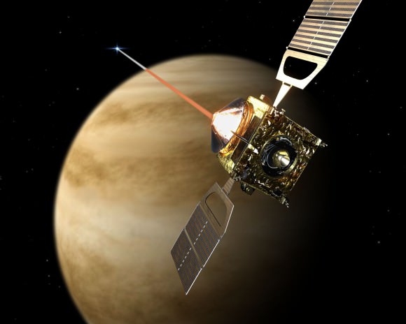
Artist's impression of Venus Express entering orbit in 2006. Credit: ESA - AOES Medialab
Artist’s impression of Venus Express entering orbit in 2006. Image Credit: ESA – AOES Medialab

At a distance of 400,000 km, the image quality and opportunities to capture them are expected to be diminished. However, JAXA is still confident that it will be able to accomplish most of the mission’s scientific goals.

In its original form, these goals included obtaining meteorological information on Venus using four cameras that capture images in the ultraviolet and infrared wavelengths. These would be responsible for globally mapping clouds and peering beneath the veil of the planet’s thick atmosphere.

Lightning would be detected with a high-speed imager, and radio-science monitors would observe the vertical structure of the atmosphere. In so doing, JAXA hopes to confirm the existence of surface volcanoes and lighting, both of which were first detected by the ESA’s Venus Express spacecraft. One of the original aims of Akatsuki was to complement the Venus Express mission. But Venus Express has now completed its mission, running out of gas and plunging into the planet’s atmosphere.

But most of all, it is hoped that Akatsuki can provide observational data on the greatest mystery of Venus, which has to do with its surface storms.

Artists impression of lightning storms on Venus. Credit: ESA

Previous observations of the planet have shown that winds that can reach up to 100 m/s (360 km/h or ~225 mph) circle the planet every four to five Earth days. This means that Venus experiences winds that are up to 60 times faster than the speed at which the planet turns, a phenomena known as “Super-rotation”.

Here on Earth, the fastest winds are only capable of reaching between 10 and 20 percent of the planet’s rotation. As such, our current meteorological understanding does not account for these super-high speed winds, and it is hoped that more information on the atmosphere will provide some clues as to how this can happen.

Between the extremely thick clouds, sulfuric rain storms, lightning, and high-speed winds, Venus’ atmosphere is certainly very interesting! Add to the fact that the volcanic, pockmarked surface cannot be surveyed without the help of sophisticated radar or IR imaging, and you begin to understand why JAXA is eager to get their probe into orbit while they still can.

And be sure to check out this video, courtesy of JAXA, detailing the Venus Climate Orbiter mission:

Further Reading: JAXA

Amazing Imagery Captures Plummeting Chinese Rocket Seen by Villagers

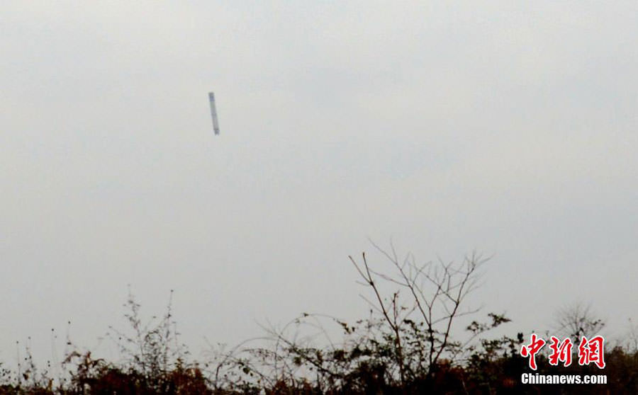
The debris of Long March 3A rocket carrier is falling above southwest China's Guizhou province on December 31, 2014. Photo: Chinanews.com

Amazing images of falling rocket debris from a spent Chinese booster were captured in the final moments of its plummet back to Earth outside a remote village located in southwest China.

The images were taken by a photo journalist during the final seconds of the descent of the first stage of the Long March 3A rocket carrier as it was crashing to the ground by the village of Gaopingsi in southwest China’s Guizhou province on December 31, 2014.

Local villagers soon gathered around the rocket crash debris.

The rocket incident and images were featured online by the state-run China New Service (CNS) website. Checkout the photo gallery herein.

First stage debris of Long March 3A rocket carrier crashes outside Gaopingsi village of southwest China's Guizhou province on December 31, 2014. Photo: Chinanews.com
First stage debris of Long March 3A rocket carrier crashes outside Gaopingsi village of southwest China’s Guizhou province on December 31, 2014. Photo: Chinanews.com

“A journalist captured the moment the debris was falling across the sky,” according to CNS.

No injuries or damage to the local village was reported.

“The landing did not influence the local villagers or bring any damages.”

The Long March 3A rocket debris stems from the successful launch of a Chinese meteorological satellite, some minutes earlier at 9:02 am local time on Wednesday, December 31, 2014.

Villagers gather around the debris of Long March 3A rocket carrier on December 31, 2014. Photo: Chinanews.com

The photographer and local villagers made their way to the crash site and captured spectacular up close photos of the first stage rocket, engine and related debris that had fallen in a heavily forested area.

Chinese security officials eventually arrived, evacuated the villagers and cordoned off the area.

Soldiers and police arrive at Gaopingsi village of southwest China's Guizhou province on December 31, 2014, to carry the debris of Long March 3A rocket carrier away. Photo: Chinanews.com
Soldiers and police arrive at Gaopingsi village of southwest China’s Guizhou province on December 31, 2014, to carry the debris of Long March 3A rocket carrier away. Photo: Chinanews.com

The rocket and Fengyun-II 08 satellite lifted off from the Xichang Satellite Launch Center in southwest China’s Sichuan province.

Photo: Chinanews.com

Fengyun-II 08 successfully achieved orbit. It will collect meteorological, maritime and hydrological data and transmit information that will be used for weather forecasting and environmental monitoring according to a CCTV report.

Since the Long March rockets blast off from China’s interior in Sichuan province, they flies over long swathes of land area and near some populated areas and occasional fall nearby and can occasionally cause damage.

Photo: Chinanews.com

The situation is similar with Russian rockets launching from Baikonur in Kazahzstan.

By contrast, US and European rockets take off from coastal areas towards oceans. They avoid most populated areas, but not all. The flight termination system is required to protect nearby coastal towns in case of wayward rockets like the Oct. 28 failure of the Orbital Sciences Antares rocket which exploded seconds after blastoff.

Stay tuned here for Ken’s continuing Earth and planetary science and human spaceflight news.

Ken Kremer

Holiday Lights So Bright You Can See ’em from Space

Christmas lighting displays like this one near Duluth, Minn. U.S. are visible from outer space. Credit: Bob King

Call it holiday light creep. A NASA satellite has been tracking the spread of Christmas lighting from 512 miles up for the past three years and according to the data, nighttime lights around many major U.S. cities shine 20 to 50 percent brighter during Christmas and New Year’s when compared to light output during the rest of the year. Not surprisingly, most it comes from suburban areas.

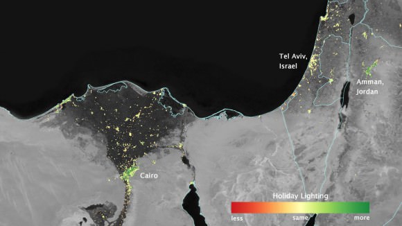
Christmas isn’t the only time holiday festivities spill into the cosmic night. In some Middle Eastern Cities nighttime lights shine more than 50 percent brighter during Ramadan than the rest of the year. Because snow reflects so much light, the researchers could only analyze snow-free cities lest they risk comparing apples to oranges. The team focused on the U.S. West Coast from San Francisco to Los Angeles and on cities south of a rough line from St. Louis to Washington, D.C.

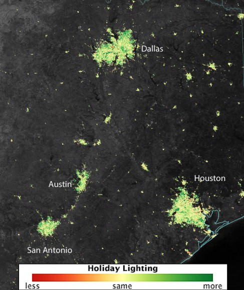
The map compares the nighttime light signals from December 2012 and 2013 to the average light output for the rest of 2012 to 2014 in and around several large cities in Texas. Dark green shadings indicates increased lighting in December, primarily from outdoor holiday lights. Credit: NASA’s Earth Observatory/Jesse Allen

As someone who has spent many winter nights observing I can attest to snow being a major factor in nighttime sky brightness. Even downward shielded lighting must necessarily reflect upward and into the heavens when it strikes the snow below. Summer is a far darker time of year than winter across much of the northern U.S.

Close-ups of three cities using the Suomi-NPP satellite. Credit: NASA/
Close-ups of three cities using the Suomi-NPP satellite data. Dark green pixels are areas where the lights are 50 percent brighter. Credit: NASA’s Earth Observatory/Jesse Allen

The orbital images were all taken by the Suomi NPP satellite, a joint NASA/National Oceanic and Atmospheric Administration mission, carries an instrument called the Visible Infrared Imaging Radiometer Suite (VIIRS) that detects light in a range of wavelengths from green to near-infrared as it flies over at roughly 1:30 a.m. and 1:30 p.m. each day. VIIRS has a low-light sensor that can distinguish night lights tens to hundreds of times better than previous satellites. In the U.S. the lights starting getting brighter the day after Thanksgiving and continued through News Year’s Day. Miguel Román, a scientist at NASA’s Goddard Space Flight Center and member of the Suomi NPP Land Discipline Team, made the discovery while researching urban energy use patterns in the context of greenhouse emissions. And you thought all those twinkly bulbs were just for fun.


NASA Sees Holiday Lights from Space

The science team found that light intensity increased by 30 to 50 percent in the suburbs and outskirts of major cities. Lights in the central urban areas didn’t increase as much as in the suburbs, but still brightened by 20 to 30 percent. This makes sense when you consider that folks in the ‘burbs not only decorate their homes but often extend Christmas displays across the yard and up into the trees.

In several cities in the Middle East, city lights brighten during the Muslim holy month of Ramadan, as seen using a new analysis of daily data from the NASA-NOAA Suomi NPP satellite. Dark green pixels are areas where the lights are 50 percent brighter, or more, during Ramadan. Image Credit: NASA's Earth Observatory/Jesse Allen
In several cities in the Middle East, city lights brighten during the Muslim holy month of Ramadan, as seen using a new analysis of daily data from the NASA-NOAA Suomi NPP satellite. Dark green pixels are areas where the lights are 50 percent brighter, or more, during Ramadan. Credit: NASA’s Earth Observatory/Jesse Allen

Holiday lighting – a simple joy of the season. Yet it reflects both the hopes and wishes of human culture and the mundane facts of energy use. Through satellites, we can step back and watch the world change in ways never thought possible.  We truly live in the Age of the Anthopocene, a newly designated era reflecting the profound effect our species has had and continues to have on the planet. To see all the holiday space photos, check out Goddard’s Flickr page.

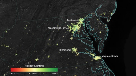
An overhead view of the Eastern U.S. Click for a Flick page showing all U.S. cities in the survey. Credit:
An overhead view of the Eastern U.S. Click for a Flick page showing all U.S. cities in the survey. Credit: NASA’s Earth Observatory / Jesse Allen