The USAF’s Super-Secret X-37B Approaches a Milestone

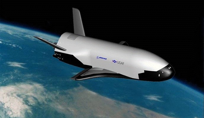
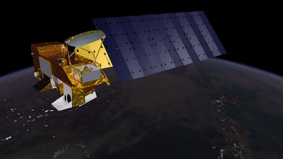
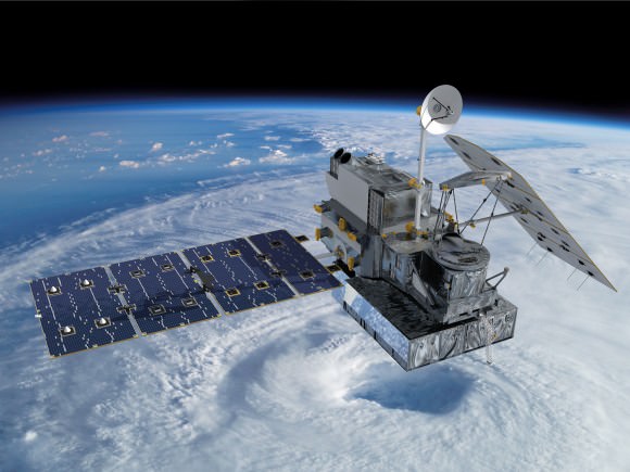
An artists' conception of the X-37B in Earth orbit. Credit: The U.S. Air Force.

A secretive mission will pass a quiet milestone at the end of this month when the U.S. Air Force’s unmanned spaceplane the X-37B surpasses 500 days in space.

Launched atop an Atlas V rocket flying in a 401 configuration from Cape Canaveral Florida after several delays on December 11th, 2012 on OTV-3, the X-37B has already surpassed its own record of 469 days in space set on OTV-2. Said milestone was crossed last month. If the current mission stays in space until April 25th of this year, it will have surpassed 500 days in space.

Two X-37Bs were built for the USAF, and the first test mission flew in 2010. NASA performed drop glide tests with an early variant of the X-37A in 2005 and 2006, and DARPA is thought to be a primary customer for the program as well.

Measuring just 8.8 metres in length, the X-37B is tiny compared to its more famous spaceplane cousin the U.S. Space Shuttle. The X-37B has a maximum weight at liftoff of 4,990 kilograms and features a payload bay 2.1 by 1.2 metres in size.

The spacecraft itself is solar powered, as it unfurls a panel — as depicted in many artists’ conceptions — once it’s in orbit. Of course, its mission profile is classified, and the X-37B could land unannounced at any time. The previous landings occurred at Vandenberg Air Force Base in California and were only announced shortly thereafter.

Not only is this the longest continuous mission for any spaceplane,  but the ATV-3 is also the smallest, lightest and only the second spaceplane to land autonomously, the first being the Russian space shuttle Buran that flew one mission and landed after one orbit at the Baikonur Cosmodrome on November 15th, 1988.
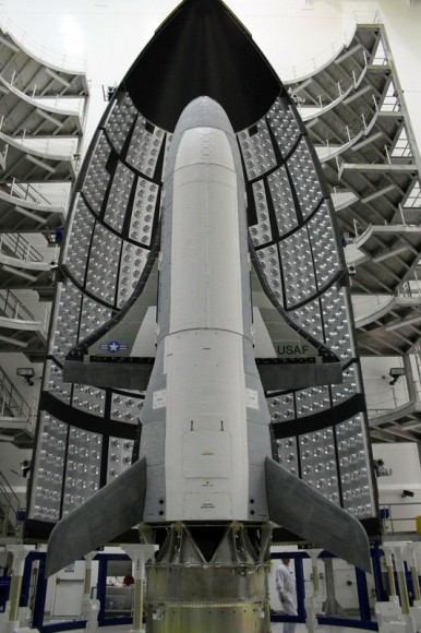
The X-37B awaiting encapsulation for launch. Credit: U.S. Air Force.

The idea of a reusable spaceplane has been around since the dawn of the Space Age. The U.S. Space Shuttle program was the most high profile of these, having flown 135 missions from 1981 to 2011. But even the space shuttle launch system wasn’t fully reusable, expending its large orange external fuel tank after every mission and requiring extensive refurbishment for the solid rocket motors and orbiter after each and every flight. The Soviets abandoned Buran in 1988, and other examples of spaceplanes such as North American’s X-15 surpassed the 100 kilometre in altitude Kármán line marking the boundary to space, but were suborbital only. And this year, customers may get a chance to make similar suborbital hops into space aboard Virgin Galactic’s SpaceShipTwo spaceplane at $250,000 dollars a ticket.

But the most ambitious design for a true spaceplane was conceived in the 1960’s: Boeing’s X-20 Dyna-Soar, which was never built.

Classified satellites such as the X-37B are part of a longstanding and fascinating “secret space race” that has paralleled and shadowed the more well known space programs of various nations over the decades. These include the Corona program which ran from 1959 to 1972 and was only declassified in 1995, and satellites such as Lacrosse 5, which is notorious among satellite sleuths for the orbital “vanishing act” it sometimes pulls.

And speaking of which, you can track the X-37B from your backyard, tonight. Ground spotters first pegged its position in low Earth orbit during OTV-1 on May 22nd 2010, and the spacecraft currently sits in a 392 x 296 kilometre (nearly circular) orbit in an 43.5 degree inclination, making it visible from latitudes 55 degrees north to south. On a favorable overhead pass, the X-37B is easily visible shining at greater than magnitude +1. OTV-3’s NORAD ID designation is 39025 or 2012-071A, and although – like most classified payloads – it’s not available to the public on Space-Track, Heavens-Above does list upcoming sighting opportunities. Be sure to start watching a bit early, as the X-37B has been known to maneuver a bit in its orbit on occasion.

Of course, just what the X-37B is doing in orbit is anybody’s guess. Speculation is that it’s serving as a test bed for new technologies. Certainly, the ability to place interchangeable payloads in orbit is immediately apparent. It’s also worth noting that the X-37B makes multiple daily passes on its northward apex over North Korea and China. There’s also been speculation that the X-37B was designed to keep tabs on the Chinese space station Tiangong-1, although this can easily be refuted as they both lie in different orbits. There’s no word as to what’s to become of Tiangong-1, though China had said it was set to deorbit the station at the end of 2013, and it is still in space.

Looking ahead into the future, there has been talk about a larger crewed variant known as the X-37C, which will undoubtedly fly much shorter missions. For now, we can watch and wonder what it’s up to, as the X-37B glides silently overhead. Perhaps one day, its mission will declassified, and its tale can be told.

-For more info sat-tracking, check out our how-to post and also read about the fascinating true role that amateurs played during the Cold War and Operation Moonwatch.


Adventures in (Radio) Amateur Astronomy

 Is there truly anything new under the Sun? Well, when it comes to amateur astronomy, many observers are branching out beyond the optical. And while it’s true that you can’t carry out infrared or X-ray astronomy from your backyard — or at least, not until amateurs begin launching their own space telescopes — you can join in the exciting world of amateur radio astronomy.

We’ll admit right out the gate that we’re a relative neophyte when it comes to the realm of radio astronomy. We have done radio observations of meteor showers in tandem with optical observations, and have delved into the trove of information on constructing radio telescopes over the years. Consider this post a primer of sorts, an intro into the world of radio amateur astronomy. If there’s enough interest, we’ll follow up with a multi-part saga, constructing and utilizing our own ad-hoc “redneck array” in our very own backyard with which to alarm the neighbors and probe the radio cosmos.

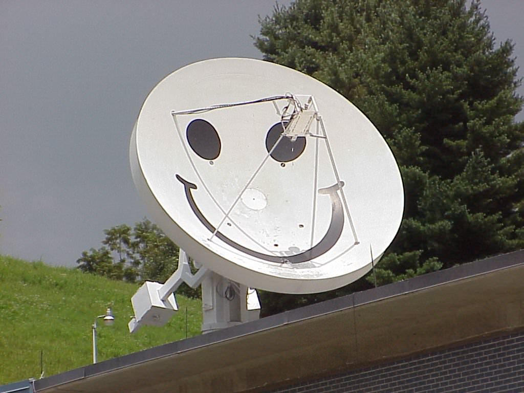
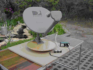
Repurposing a TV Dish for amatuater astronomy. Credit: NSF/NRAO/Assoc. Universities, Inc.
The “Itty-Bitty Array”- Re-purposing a TV Dish for amateur astronomy. Credit: NSF/NRAO/Assoc. Universities, Inc.

…And much like our exploits in planetary webcam imaging, we’ve discovered that you may have gear kicking around in the form of an old TV dish – remember satellite TV? – in your very own backyard. A simple radio telescope setup need not consist of anything more sophisticated than a dish (receiver), a signal strength detector (often standard for pointing a dish at a satellite during traditional installation) and a recorder. As you get into radio astronomy, you’ll want to include such essentials as mixers, oscillators, and amplifiers to boost your signal.

Frequency is the name of the game in amateur radio astronomy, and most scopes are geared towards the 18 megahertz to 10,000 megahertz range. A program known as Radio-SkyPipe makes a good graphic interface to turn your laptop into a recorder.

Radio astronomy was born in 1931, when Karl Jansky began researching the source of a faint background radio hiss with his dipole array while working for Bell Telephone. Jansky noticed the signal strength corresponded to the passage of the sidereal day, and correctly deduced that it was coming from the core of our Milky Way Galaxy located in the constellation Sagittarius. Just over a decade later, Australian radio astronomer Ruby Payne-Scott pioneered solar radio astronomy at the end of World War II, making the first ever observations of Type I and III solar bursts as well as conducting the first radio interferometry observations.

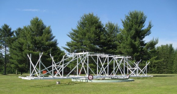
A replica of Jansky's first steerable antanta at Green Bank, West Virginia.
A replica of Jansky’s first steerable antenna at Green Bank, West Virginia. (Public Domain image)

What possible targets exist for the radio amateur astronomer? Well, just like those astronomers of yore, you’ll be able to detect the Sun, the Milky Way Galaxy, Geostationary and geosynchronous communication satellites and more. The simple dish system described above can also detect temperature changes on the surface of the Moon as it passes through its phases. Jupiter is also a fairly bright radio target for amateurs as well.

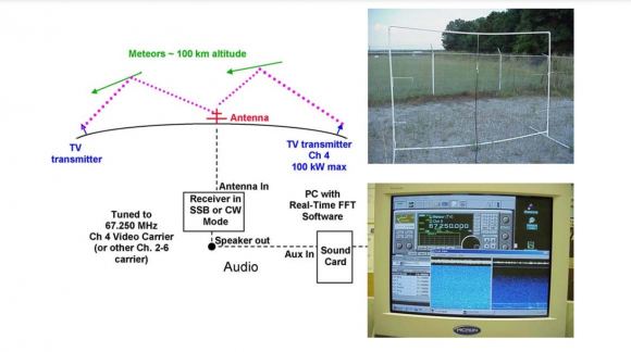
Radio meteors are also within the reach of your FM dial. If you’ve ever had your car radio on during a thunderstorm, you’ve probably heard the crackle across the radio spectrum caused by a nearby stroke of lightning. A directional antenna is preferred, but even a decent portable FM radio will pick up meteors on vacant bands outdoors. These are often heard as ‘pings’ or temporary reflections of distant radio stations off of the trail of ionized gas left in the wake of a meteor.  Like with visual observing, radio meteors peak in activity towards local sunrise as the observer is being rotated forward into the Earth’s orbit.

Amateur SETI is also taking off, and no, we’re not talking about your crazy uncle who sits out at the end of runways watching for UFOs. BAMBI is a serious amateur-led project. Robert Gray chronicled his hunt for the elusive Wow! signal in his book by the same name, and continues an ad hoc SETI campaign. With increasingly more complex rigs and lots of time on their hands, it’s not out of the question that an amateur SETI detection could be achieved.

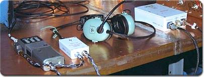
Another exciting possibility in radio astronomy is tracking satellites. HAM radio operators are able to listen in on the ISS on FM frequencies (click here for a list of uplink and downlink frequencies), and have even communicated with the ISS on occasion. AMSAT-UK maintains a great site that chronicles the world of amateur radio satellite tracking.

Amateur radio equipment that eventually made its way to to ISS aboard STS-106. (Credit: NASA).

Old TV dishes are being procured for professional use as well. One team in South Africa did just that back in 2011, scouring the continent for old defunct telecommunications dished to turn them into a low cost but effective radio array.

Several student projects exist out there as well. One fine example is NASA’s Radio JOVE project, which seeks student amateur radio observations of Jupiter and the Sun. A complete Radio Jove Kit, to include receiver and Radio-SkyPipe and Radio-Jupiter Pro software can be had for just under 300$ USD. You’d have a tough time putting together a high quality radio telescope for less than that! And that’s just in time for prime Jupiter observing as the giant planet approaches quadrature on April 1st (no fooling, we swear) and is favorably placed for evening observing, both radio and optical.

Fearing what the local homeowner’s association will say when you deploy your very own version of Jodrell Bank in your backyard?  There are several online radio astronomy projects to engage in as well. SETI@Home is the original crowd sourced search for ET online. The Zooniverse now hosts Radio Galaxy Zoo, hunting for erupting black holes in data provided by the Karl Jansky Very Large Array and the Australia Telescope Compact Array. PULSE@Parkes is another exciting student opportunity that lets users control an actual professional telescope. Or you can just listen for meteor pings online via NASA’s forward scatter meteor radar based out of the Marshall Space Flight Center in Huntsville, Alabama. Adrian West also hosts live radio meteor tracking on his outstanding Meteorwatch website during times of peak activity.

Forward Scatter
A diagram of a basic forward scatter radar system for meteor observing. Credit: NASA

Interested? Other possibilities exist for the advanced user, including monitoring radio aurorae, interferometry, catching the hiss of the cosmic microwave background and even receiving signals from more distant spacecraft, such as China’s Yutu rover on the Moon.

Think of this post as a primer to the exciting world of amateur radio astronomy. If there’s enough interest, we’ll do a follow up “how-to” article as we assemble and operate a functional amateur radio telescope. Or perhaps you’re an accomplished amateur radio astronomer, with some tips and tricks to share. There’s more to the universe than meets the eye!

-Also be sure to check out SARA, the Society of Amateur Radio Astronomers.

1st Images from New NASA/JAXA GPM Rainfall Measuring Satellite Capture Tropical Cyclone in 3D

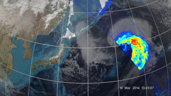
An extra-tropical cyclone seen off the coast of Japan, March 10, 2014, by the GPM Microwave Imager. The colors show the rain rate: red areas indicate heavy rainfall, while yellow and blue indicate less intense rainfall. The upper left blue areas indicate falling snow. Credit: NASA/JAXA

KENNEDY SPACE CENTER, FL – Weather researchers worldwide now have the ability to capture unprecedented three-dimensional images and detailed rainfall measurements of cyclones, hurricanes and other storms from space on a global basis thanks to the newest Earth observing weather satellite – jointly developed by the US and Japan.

NASA and the Japan Aerospace Exploration Agency (JAXA) have now released the first images captured by their Global Precipitation Measurement (GPM) Core Observatory satellite.

GPM soared to space on Feb. 27, exactly one month ago, during a spectacular night launch from the Japanese spaceport at the Tanegashima Space Center on Tanegashima Island off southern Japan.

The newly released series of images show precipitation falling inside a vast extra-tropical cyclone cascading over a vast swath of the northwest Pacific Ocean, approximately 1,000 miles off the coast of eastern Japan.

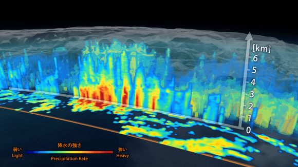
3D view inside an extra-tropical cyclone observed off the coast of Japan, March 10, 2014, by GPM's Dual-frequency Precipitation Radar. The vertical cross-section approx. 4.4 mi (7 km) high show rain rates: red areas indicate heavy rainfall while yellow and blue indicate less intense rainfall.   Credit:  JAXA/NASA
3D view inside an extra-tropical cyclone observed off the coast of Japan, March 10, 2014, by GPM’s Dual-frequency Precipitation Radar. The vertical cross-section approx. 4.4 mi (7 km) high show rain rates: red areas indicate heavy rainfall while yellow and blue indicate less intense rainfall. Credit: JAXA/NASA

“It was really exciting to see this high-quality GPM data for the first time,” said GPM project scientist Gail Skofronick-Jackson at NASA’s Goddard Spaceflight Center in Greenbelt, Md., in a NASA statement.

“I knew we had entered a new era in measuring precipitation from space. We now can measure global precipitation of all types, from light drizzle to heavy downpours to falling snow.”

The imagery was derived from measurements gathered by GPM’s two advanced instruments: JAXA’s high resolution dual-frequency precipitation (DPR) radar instrument (Ku and Ka band), which imaged a three-dimensional cross-section of the storm, and the GPM microwave imager (GMI) built by Ball Aerospace in the US which observed precipitation across a broad swath.
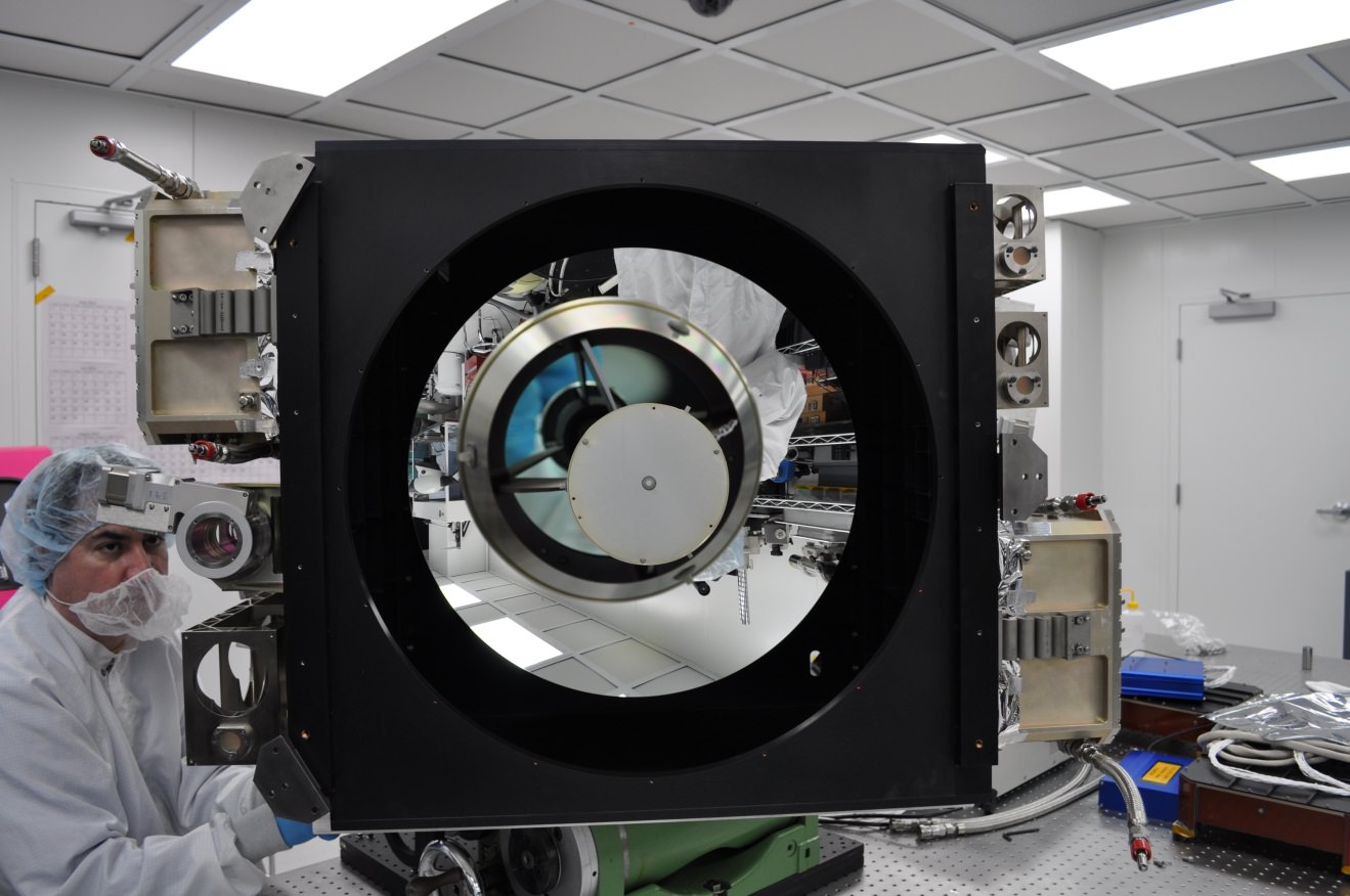
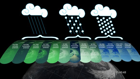
“The GMI instrument has 13 channels that measure natural energy radiated by Earth’s surface and also by precipitation itself. Liquid raindrops and ice particles affect the microwave energy differently, so each channel is sensitive to a different precipitation type,” according to a NASA statement.
On March 10, 2014 the Global Precipitation Measurement (GPM) Core Observatory passed over an extra-tropical cyclone about 1,055 miles (1,700 km) east of Japan's Honshu Island. Formed when a cold air mass wrapped around a warm air mass near Okinawa on March 8, it moved NE drawing cold air over Japan before weakening over the North Pacific.   Credit:  NASA/JAXA
On March 10, 2014 the Global Precipitation Measurement (GPM) Core Observatory passed over an extra-tropical cyclone about 1,055 miles (1,700 km) east of Japan’s Honshu Island. Formed when a cold air mass wrapped around a warm air mass near Okinawa on March 8, it moved NE drawing cold air over Japan before weakening over the North Pacific. Credit: NASA/JAXA

The 3850 kilogram GPM observatory is the first satellite designed to measure light rainfall and snow from space, in addition to heavy tropical rainfall.

The data were released following check out and activation of the satellites pair of instruments.

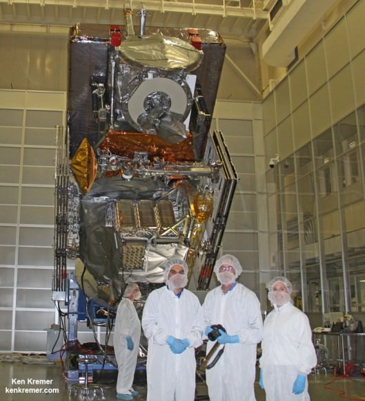
“GPM’s precipitation measurements will look like a CAT scan,” Dr. Dalia Kirschbaum, GPM research scientist, told me during a prelaunch interview with the GPM satellite in the cleanroom at NASA’s Goddard Space Flight Center in Greenbelt, Md.

“The radar can scan through clouds to create a three dimensional view of a clouds structure and evolution.”

The $933 Million GPM observatory will provide high resolution global measurements of rain and snow every 3 hours. It is a joint venture between NASA and JAXA.

It will collect a treasure trove of data enabling the most comprehensive measurements ever of global precipitation – and across a wide swath of the planet where virtually all of humanity lives from 65 N to 65 S latitudes.

The GMI instrument has 13 channels, each sensitive to different types of precipitation. Channels for heavy rain, mixed rain and snow, and snowfall are displayed of the extra-tropical cyclone observed March 10, off the coast of Japan. Multiple channels capture the full range of precipitation. Credit: NASA/JAXA

GPM orbits at an altitude of 253 miles (407 kilometers) above Earth – quite similar to the International Space Station (ISS).

GPM is the lead observatory of a constellation of nine highly advanced Earth orbiting weather research satellites contributed by the US, Japan, Europe and India.

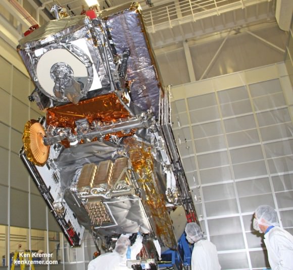
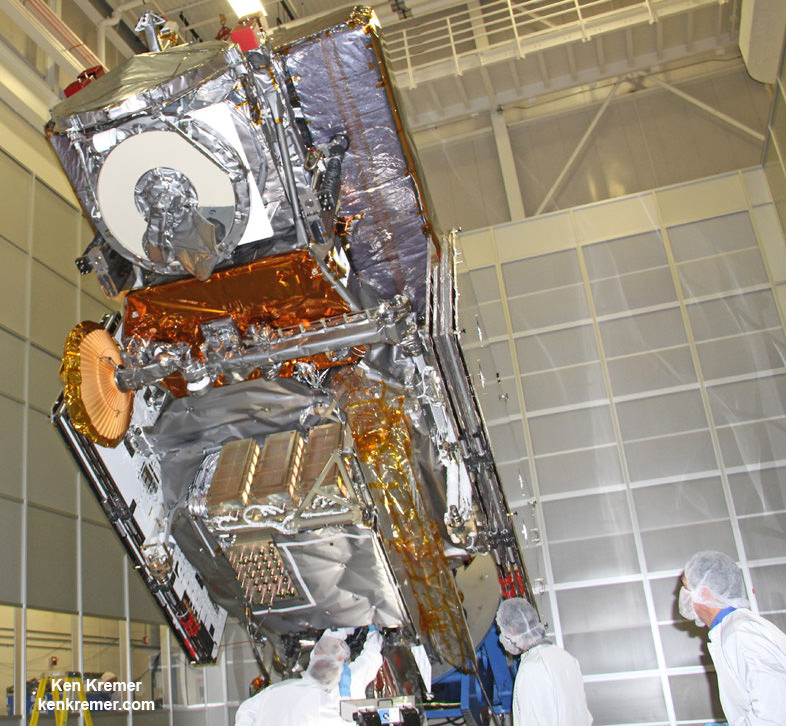
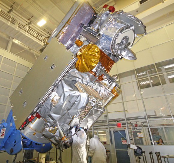
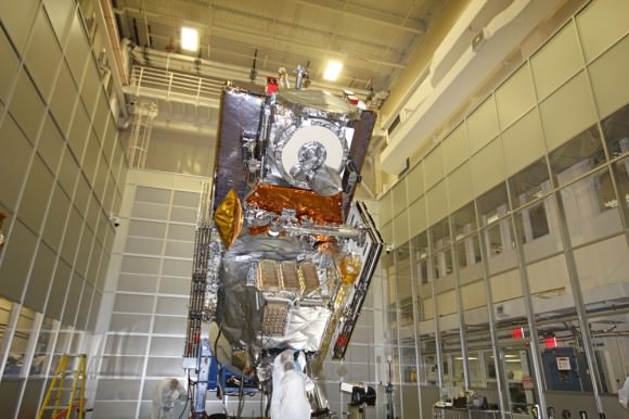
NASA’s next generation Global Precipitation Measurement (GPM) observatory inside the clean room at NASA Goddard Space Flight Center, MD. Technicians at work on final processing during exclusive up-close inspection tour by Universe Today.  GPM is slated to launch on February 27, 2014 and will provide global measurements of rain and snow every 3 hours. Credit: Ken Kremer/kenkremer.com
NASA’s next generation Global Precipitation Measurement (GPM) observatory inside the clean room at NASA Goddard Space Flight Center, MD. Technicians at work on final processing during exclusive up-close inspection tour by Universe Today. GPM launched on February 27, 2014 and will provide global measurements of rain and snow every 3 hours. Credit: Ken Kremer/kenkremer.com

Stay tuned here for Ken’s continuing GPM, Curiosity, Opportunity, Chang’e-3, SpaceX, Orbital Sciences, LADEE, MAVEN, MOM, Mars and more planetary and human spaceflight news.

Learn more at Ken’s upcoming presentations at the NEAF convention on April 12/13 and at Washington Crossing State Park, NJ on April 6. Also at the Quality Inn Kennedy Space Center, Titusville, FL, March 29.

Ken Kremer

NASA Targeting Earth Observing Satellites and ISS Sensors to Aid Missing Malaysian Airline Search

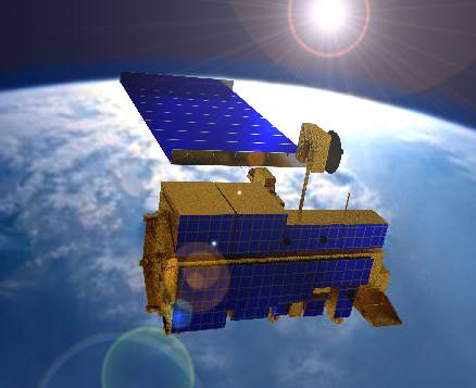
Sensors aboard NASA’s Terra satellite are aiding the search for MH 370. Credit: NASA

NASA has actively joined the hunt for the missing Malaysian Airline flight MH-370 that mysteriously disappeared without a trace more than two weeks ago on March 8, 2014.

Sensors aboard at least two of NASA’s unmanned Earth orbiting global observation satellites as well as others flying on the manned International Space Station (ISS) are looking for signs of the jetliner that could aid the investigators from a multitude of nations and provide some small measure of comfort to the grieving families and loved ones of the passengers aboard.

“Obviously NASA isn’t a lead agency in this effort. But we’re trying to support the search, if possible,” Allard Beutel, NASA Headquarters, Office of Communications director, told Universe Today this evening.

NASA’s airplane search assistance comes in two forms; mining existing space satellite observing data and retargeting space based assets for new data gathering since the incident.

The Malaysian Airline Boeing 777-2H6ER jetliner went missing on March 8 while cruising en route from Kuala Lampur, Malaysia to Beijing, China. See cockpit photo below.

Accurate facts on why MH-370 vanished with 239 passengers aboard have sadly been few and far between.

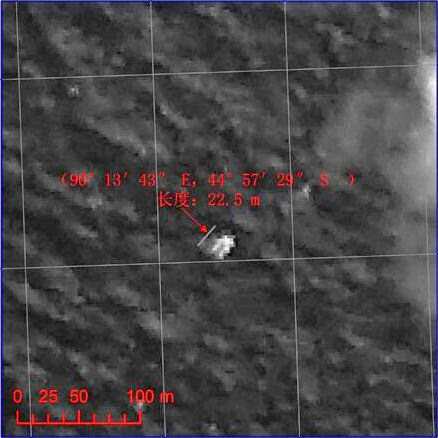
Chinese satellite image of possible debris of MH 370. Credit: China/SASTIND

Last week, the search area shifted to a wide swath in the southern Indian Ocean when potential aircraft debris was spotted in a new series of separate satellite images from Australia and China government officials.

A prior set of official Chinese government satellite images at a different location yielded absolutely nothing.

The area is now focused 2,500 km (1,600 mi) south west of Perth, a city on the western coast of Australia.

NASA’s search support was triggered upon activation of the International Charter on Space and Major Disasters.

Available data from NASA’s Terra and Aqua satellites has already been transmitted to the U.S. Geological Survey and new data are now being collected in the search area.

“In response to activation of the International Charter on Space and Major Disasters last week regarding the missing Malaysia Airlines jetliner, NASA sent relevant space-based data to the U.S. Geological Survey’s Earth Resources Observations and Science Hazard Data Distribution System that facilitates the distribution of data for Charter activations,” according to a NASA statement.

And it’s important to note that NASA satellites and space-based cameras are designed for long-term scientific data gathering and Earth observation.

“They’re really not meant to look for a missing aircraft,” Beutel stated.

“The archive of global Earth-observing satellite data is being mined for relevant images. These include broad-area views from the MODIS [instrument] on NASA’s Terra and Aqua satellites,” Beutel informed me.

The next step was to retarget both satellites and another high resolution camera aboard the ISS.

“In addition, two NASA high-resolution assets have been targeted to take images of designated search areas: the Earth Observing-1 satellite and the ISERV camera on the International Space Station,” Beutel explained.

Sensors aboard NASA’s Aqua satellite are aiding the search for MH 370. Credit: NASA

Aqua and Terra were already gathering new observations with the MODIS instrument in the search area off Australia last week. MODIS measures changes in Earth’s cloud cover.

Here are the satellite observation times and capabilities:

• MODIS on the Aqua satellite observed at about 1:30 p.m. local time as it passes overhead from pole-to-pole
• MODIS on the Terra satellite observed at about 10:30 a.m. local time
• The width (field of view) of a MODIS observation is 2,300 kilometers
• One pixel of a MODIS image – the limit of how small a feature it can see – is about 1 kilometer.

A new set of high resolution Earth imaging cameras are being sent to the ISS and are loaded aboard the SpaceX CRS-3 Dragon resupply capsule now slated for blastoff on March 30.

The newly launched NASA/JAXA GPM precipitation monitoring satellite which will cover this ocean area in the future is still in the midst of science instrument checkout.

The International Space Station (ISS) in low Earth orbit.  Credit: NASA
The International Space Station (ISS) in low Earth orbit. Credit: NASA

Ships and planes from at least 26 countries have been being dispatched to the new based on the new satellite imagery to search for debris and the black boxes recording all the critical engineering data and cockpit voices of the pilot and copilot and aid investigators as to what happened.

No one knows at this time why the Malaysia Airlines flight mysteriously disappeared.

Ken Kremer

Map of possible MH 370 debris locations published 1: 12 March (disproved), 2: 20–23 March 2014. Credit: Wikipedia

map

Flight deck view of the missing MH 370 aircraft, showing many of the communication systems now under investigation. Credit: Chris Finney
Photo of Malaysia Air Boeing 777-200

Europeans Aim To Avoid Battery Blasts (And Satellite Debris) In Space

Artist's impression of a satellite exploding. Credit: ESA

What happens to a battery in a dead satellite? Despite nearly 60 years of sending these machines into space, this is a “relative blind spot” among designers, the European Space Agency says. And that’s a big problem, because there’s a chance that these power sources can rupture and cause debris — adding to the growing problem in orbit.

With NASA estimating more than 500,000 dead satellites and other debris cluttering up the environment around Earth, the risk of something smashing into an important space thing — a spacecraft, a GPS satellite, a weather monitor — increases. So space policy-makers are doing what they can to reduce the problem (while also creating methods to clean it up.)

A few satellite breakups in the ’90s were linked to battery failures, but ESA notes these were older, non-lithium types. To figure out what’s happened more recently, the agency wants to learn more about battery behavior after the satellite shuts down, and how to prevent a breakup from happening.

“As a satellite drifts freely, could batteries endure the harsh environment of orbit – including wild temperature swings, degradation of thermal control and components as well as radiation exposure – without leakage or bursting?” ESA asks.

Artist's impression of debris in low Earth orbit. Credit: ESA
Artist’s impression of debris in low Earth orbit. Credit: ESA

For more information, go to the ESA tendering website and look for  solicitation AO7840, called “Spacecraft Power System Passivation At End Of Mission.” The tender is valued between 200,000 and 500,000 Euros and closes April 23.

“The goal of the activity is to study and implement the most adequate means to achieve this power system passivation,” the tender states.

“This may involve the discharge and disconnection of the batteries and the disconnection of the solar arrays. This passivation needs to be reliable enough to avoid to deactivate the power system before the end of the mission. The proposed concept should be universal enough to be compatible with most space applications (but in priority European institutional market).”

Source: European Space Agency

Chinese Satellites May Have Detected Debris from Missing Malaysia Airlines Flight

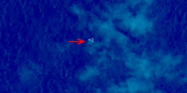
Satellite image of suspected floating objects from the missing Malaysia Airlines plane MH 370. Credit: China SASTIND/China Resources Satellite Application Center

Chinese satellite image of suspected floating objects from the missing Malaysia Airlines plane MH 370. Credit: China SASTIND/China Resources Satellite Application Center
See more satellite imagery below[/caption]

Chinese government satellites orbiting Earth may have detected floating, crash related debris from the missing Malaysian Airline flight MH-370 that disappeared without a trace last week – and which could be a key finding in spurring the ongoing and so far fruitless search efforts.

Today, Wednesday, March 12, Chinese space officials released a trio of images that were taken by Chinese satellites on Sunday, March 9, showing the possible crash debris in the ocean waters between Malaysia and Vietnam.

China’s State Administration of Science, Technology and Industry for National Defence (SASTIND) posted the images on its website today, although they were taken on Sunday at about 11 a.m. Beijing local time.

I found the images today directly on SASTIND’s Chinese language website and they are shown here in their full resolution – above and below.

The Boeing 777-200ER jetliner went missing on Saturday on a flight en route from Kuala Lampur, Malaysia to Beijing, China.

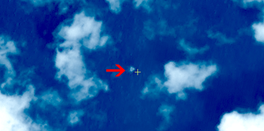
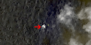
The images appear to show “three floating objects in the suspected site of missing Malaysian plane,” according to SASTIND.

Satellite image of suspected floating objects from the missing Malaysia Airlines plane MH 370.   Credit: China SASTIND/China Resources Satellite Application Center
Satellite image of suspected floating objects from the missing Malaysia Airlines plane MH 370. Credit: China SASTIND/China Resources Satellite Application Center

The plane carrying 227 passengers and 12 crew members mysteriously lost radio contact and vanished from radar while flying over the South China Sea. The transponder stopped sending signals.

And not a trace of the jetliner has been found despite days of searching by ships and planes combing a vast search area that expands every day.

Smaller versions of the satellites images and a video report have also been posted on China’s government run Xinhua and CCTV news agencies.

The three suspected floating objects measure 13 by 18 meters (43 by 59 feet), 14 by 19 meters (46 by 62 feet) and 24 by 22 meters (79 feet by 72 feet).

Chinese satellite image of suspected floating objects from the missing Malaysia Airlines plane MH 370.   Credit: China SASTIND/China Resources Satellite Application Center
Chinese satellite image of suspected floating objects from the missing Malaysia Airlines plane MH 370. Credit: China SASTIND/China Resources Satellite Application Center

These suspected debris are surprising large, about the size of the jetliners wing, according to commentators speaking tonight on NBC News and CNN.

SASTIND said that “the three suspected objects were monitored at 6.7 degrees north latitude and 105.63 degrees east longitude, spreading across an area with a radius of 20 kilometers, according to Xinhua.

These coordinates correspond with the ocean waters between Malaysia and Vietnam, near the expected flight path.

“Some 10 Chinese satellites have been used to help the search and rescue operation,” reported CCTV.

Photo of Malaysia Air Boeing 777-200

China, the US, Malaysia and more than a dozen counties are engaged in the continuing search and rescue effort that has yielded few clues and no answers for the loved ones of the missing passengers and crew on board. Our hearts and prayers go out to them.

The search area currently encompasses over 35,000 nautical square miles.

map

Ships and planes are being dispatched to the location shown by the new satellite imagery to help focus the search effort and find the black boxes recording all the critical engineering data and cockpit voices of the pilot and copilot and aid investigators as to what happened.

No one knows at this time why the Malaysia Airlines flight mysteriously disappeared.

Ken Kremer

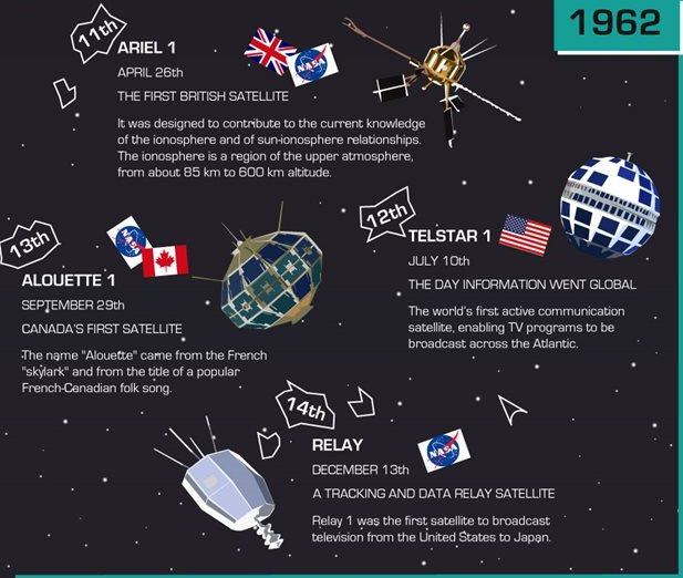
Infographic Shows The Quick-Changing Satellites Of The Early Space Age

Excerpt from the infographic "An Early History of Satellites." Credit: Broadband Wherever.

It’s not often that one associates a satellite with French folk songs, but this infographic does that and more. Below you will find the major launches of the early space age — from the Soviet Union’s Sputnik to the Czechoslovakian Magion 1 — showing how satellites quickly evolved between 1957 and 1978.

In two decades, satellites changed from simple transmitters and receivers to sophisticated machines that carried television signals and science instruments.

Another striking thing about this Broadband Wherever graphic: the number of participating countries. While we often think of the early Space Age as being dominated by the United States and Soviet Union, you can see other nations quickly rushing their own satellites into orbit: Canada, Italy, Australia, India and more.

Enjoy the sound bites and cute graphics below. Full sources for the information are listed at the bottom of the infographic.

Early History of Satellites

A Natural Planetary Defense Against Solar Storms

Click here for animation. Credit:

Planetary shields up: solar storms inbound…

Researchers at NASA’s Goddard Spaceflight Center and the Massachusetts Institute of Technology have identified a fascinating natural process by which the magnetosphere of our fair planet can — to use a sports analogy — “shot block,” or at least partially buffer an incoming solar event.

The study, released today in Science Express and titled “Feedback of the Magnetosphere” describes new process discovered in which our planet protects the near-Earth environment from the fluctuating effects of inbound space weather.

Our planet’s magnetic field, or magnetosphere, spans our world from the Earth’s core out into space. This sheath typically acts as a shield. We can be thankful that we inhabit a world with a robust magnetic field, unlike the other rocky planets in the inner solar system.

But when a magnetic reconnection event occurs, our magnetosphere merges with the magnetic field of the Sun, letting in powerful electric currents that wreak havoc.

Now, researchers from NASA and MIT have used ground and space-based assets to identify a process that buffers the magnetosphere, often keeping incoming solar energy at bay.

The results came from NASA’s Time History Events and Macroscale Interactions during Substorms (THEMIS) constellation of spacecraft and was backed up by data gathered over the past decade for MIT’s Haystack Observatory.

Observations confirm the existence of low-energy plasma plumes that travel along magnetic field lines, rising tens of thousands of kilometres above the Earth’s surface to meet incoming solar energy at a “merging point.”

“The Earth’s magnetic field protects life on the surface from the full impact of these solar outbursts,” said associate director of MIT’s Haystack Observatory John Foster in the recent press release. “Reconnection strips away some of our magnetic shield and lets energy leak in, giving us large, violent storms. These plasmas get pulled into space and slow down the reconnection process, so the impact of the Sun on the Earth is less violent.”

The study also utilized an interesting technique known as GPS Total Electron Content or GPS-TEC. This ground-based technique analyzes satellite transmitted GPS transmissions to thousands of ground based receivers, looking for tell-tale distortions that that signify clumps of moving plasma particles. This paints a two dimensional picture of atmospheric plasma activity, which can be extended into three dimensions using space based information gathered by THEMIS.

And scientists got their chance to put this network to the test during the moderate solar outburst of January 2013. Researchers realized that three of the THEMIS spacecraft were positioned at points in the magnetosphere that plasma plumes had been tracked along during ground-based observations. The spacecraft all observed the same cold dense plumes of rising plasma interacting with the incoming solar stream, matching predictions and verifying the technique.

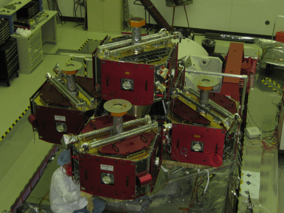
Launched in 2007, THEMIS consists of five spacecraft used to study substorms in the Earth’s magnetosphere. The Haystack Observatory is an astronomical radio observatory founded in 1960 located just 45 kilometres northwest of Boston, Massachusetts.

THEMIS in the lab.
THEMIS in the lab. Credit-NASA/Themis.

How will this study influence future predictions of the impact that solar storms have on the Earth space weather environment?

“This study opens new doors for future predictions,” NASA Goddard researcher Brian Walsh told Universe Today. “The work validates that the signatures of the plume far away from the Earth measured by spacecraft match signatures in the Earth’s upper atmosphere made from the surface of the Earth. Although we might not always have spacecraft in exactly the correct position to measure one of these plumes, we have almost continuous coverage from ground-based monitors probing the upper atmosphere. Future studies can now use these signatures as a proxy for when the plume has reached the edge of our magnetic shield (known as the magnetopause) which will help us predict how large a geomagnetic storm will occur from a given explosion from the Sun when it reaches the Earth.”

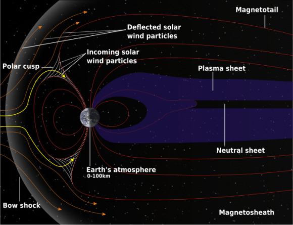
The structure of Earth's magnetosphere. Credit-
The structure of Earth’s magnetosphere. Credit-NASA graphic in the Public Domain.

Understanding how these plasma plumes essentially hinder or throttle incoming energy during magnetic reconnection events, as well as the triggering or source mechanism for these plumes is vital.

“The source of these plumes is an extension of the upper atmosphere, a region that space physicists call the plasmasphere,” Mr. Walsh told Universe Today. “The particles that make the plume are actually with us almost all of the time, but they normally reside relatively close to the Earth. During a solar storm, a large electric field forms and causes the upper layers of the plasmasphere to be stripped away and are sent streaming sunward towards the boundary of our magnetic field. This stream of particles is the ‘plume’ or ‘tail’”

Recognizing the impacts that these plumes have on space weather will lead to better predictions and forecasts for on- and off- the planet as well, including potential impacts on astronauts aboard the International Space Station. Flights over the poles are also periodically rerouted towards lower latitudes during geomagnetic storms.

“This study defines new tools for the toolbox we use to predict how large or how dangerous a given solar eruption will be for astronauts and satellites,” Walsh said. “This work offers valuable new insights and we hope these tools will improve prediction capabilities in the near future.”

Spaceweather is currently a hot topic, as we’ve recently seen an uptick in auroral activity last month.

And speaking of which, there’s a common misconception out there that we see reported every time auroral activity makes the news…   remember that aurorae aren’t actually caused by solar wind particles colliding with our atmosphere, but the acceleration of particles trapped in our magnetic field fueled by the solar wind.

And speaking of solar activity, there’s also an ongoing controversy in the world of solar heliophysics as to the lackluster solar maximum for this cycle, and what it means for concurrent cycles #25 and #26.

It’s exciting times indeed in the science of space weather forecasting…

and hey, we got to drop in sports analogy, a rarity in science writing!

Powerful New Next-Gen US/Japan GPM Satellite to Revolutionize Global Precipitation Observations and Climate Science Research

NASA’s next generation Global Precipitation Measurement (GPM) observatory inside the clean room at NASA Goddard Space Flight Center, MD. Technicians at work on final processing during exclusive up-close inspection tour by Universe Today. GPM is slated to launch on February 27, 2014 and will provide global measurements of rain and snow every 3 hours. Credit: Ken Kremer/kenkremer.com

NASA GODDARD SPACE FLIGHT CENTER, MARYLAND – Weather researchers and forecasters worldwide are gushing with excitement in the final days leading to blastoff of the powerful, new Global Precipitation Measurement (GPM) Core Observatory – built by NASA in a joint effort with Japan.

GPM is a next-generation satellite that will provide global, near real time observations of rain and snow from space and thereby open a new revolutionary era in global weather observing and climate science. Therefore it will have a direct impact on society and people’s daily lives worldwide.

The team is counting down to liftoff in less than 5 days, on Feb. 27 at 1:07 PM EST from the Tanegashima Space Center, on Tanegashima Island off southern Japan, atop the highly reliable Mitsubishi Heavy Industries H-IIA rocket.

The GPM launch to low Earth orbit was delayed by both natural and manmade disasters – namely the 2011 Fukushima earthquake in Japan as well as the ridiculous US government shutdown in Oct. 2013. That’s the same foolish shutdown that also delayed NASA’s new MAVEN Mars orbiter and numerous other US space & science projects.

Visualization of the GPM Core Observatory satellite orbiting the planet earth.  Credit: NASA Goddard
Visualization of the GPM Core Observatory satellite orbiting the planet earth. Credit: NASA Goddard

The $933 Million mission is a joint venture between NASA and the Japan Aerospace Exploration Agency (JAXA), Japan’s space agency.

The mission will significantly advance our understanding of Earth’s water and energy cycles and improve forecasting of extreme weather events.

It is equipped with an advanced, higher resolution dual -frequency precipitation (DPR) radar instrument (Ku and Ka band) built by JAXA in Japan and the GPM microwave imager (GMI) built by Ball Aerospace in the US.

“The GPM satellite was built in house at NASA’s Goddard Space Flight Center in Maryland,” Art Azarbarzin, GPM project manager, told Universe Today during my exclusive up-close clean room inspection tour of the huge satellite as final processing was underway.

Global Precipitation Management Measurement (GPM) observatory satellite inside the clean room at NASA Goddard Space Flight Center undergoes final processing - side view. Credit: Ken Kremer/kenkremer.com
Global Precipitation Measurement (GPM) observatory satellite inside the clean room at NASA Goddard Space Flight Center undergoes final processing – side view. Credit: Ken Kremer/kenkremer.com

Shortly after my tour of GPM, the 3850 kilogram satellite was carefully packed up for shipment to the Japanese launch site.

“GPM will join a worldwide constellation of current and planned satellites,” Azarbarzin told me during an interview in the Goddard cleanroom with GPM.

gpm-decal-smallAnd the imminent launch to augment the existing satellite constellation can’t come soon enough, he noted.

The GPM observatory will replace the aging NASA/JAXA Tropical Rainfall Measuring Mission (TRMM), satellite launched back in 1997.

“GPM is the direct follow-up to the currently orbiting TRMM satellite,” Azarbarzin explained.

“TRMM is reaching the end of its usable lifetime. GPM launches on February 27, 2014 and we hope it has some overlap with observations from TRMM.”

“The Global Precipitation Measurement (GPM) observatory will provide high resolution global measurements of rain and snow every 3 hours,” Dalia Kirschbaum, GPM research scientist, told me during an interview at Goddard.

NASA’s next generation Global Precipitation Measurement (GPM) observatory inside the clean room at NASA Goddard Space Flight Center, MD. Technicians at work on final processing during exclusive up-close inspection tour by Universe Today.  GPM is slated to launch on February 27, 2014 and will provide global measurements of rain and snow every 3 hours. Credit: Ken Kremer/kenkremer.com
NASA’s next generation Global Precipitation Measurement (GPM) observatory inside the clean room at NASA Goddard Space Flight Center, MD. Technicians at work on final processing during exclusive up-close inspection tour by Universe Today. GPM is slated to launch on February 27, 2014 and will provide global measurements of rain and snow every 3 hours. Credit: Ken Kremer/kenkremer.com

It is vital to continuing the TRMM measurements and will help provide improved forecasts and advance warning of extreme super storms like Hurricane Sandy and Super Typhoon Haiyan, Azarbarzin and Kirschbaum explained.

Researchers will use the GPM measurements to study climate change, freshwater resources, floods and droughts, and hurricane formation and tracking.

“The water-cycle, so familiar to all school-age young scientists, is one of the most interesting, dynamic, and important elements in our studies of the Earth’s weather and climate,” said John Grunsfeld, associate administrator for NASA’s Science Mission Directorate in Washington, in a statement.

“GPM will provide scientists and forecasters critical information to help us understand and cope with future extreme weather events and fresh water resources.”

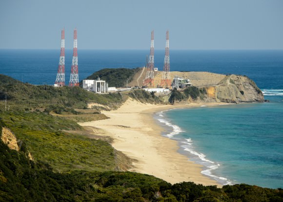
Tanegashima Space Center, on Tanegashima Island off southern Japan
GPM satellite launch site at Tanegashima Space Center, Tanegashima Island, Japan. Credit: NASA

NASA TV will carry the launch live with commentary starting at 12 Noon EST on Feb. 27.

Stay tuned here for Ken’s continuing GPM reports and onsite coverage at NASA Goddard Space Flight Center in Maryland.

And watch for Ken’s continuing planetary and human spaceflight news about Curiosity, Opportunity, Chang’e-3, SpaceX, Orbital Sciences, LADEE, MAVEN, MOM, Mars, Orion and more.

Ken Kremer

NASA/JAXA Global Precipitation Measurement (GPM) satellite inside the clean room at NASA Goddard Space Flight Center, MD, undergoes final processing during exclusive up-close inspection tour by Universe Today:   Dr. Art Azarbarzin/NASA GPM project manager, Dr. Ken Kremer/Universe Today and Dr. Dalia Kirschbaum/NASA GPM research scientist.    Credit: Ken Kremer/kenkremer.com
NASA/JAXA Global Precipitation Measurement (GPM) satellite inside the clean room at NASA Goddard Space Flight Center, MD, undergoes final processing during exclusive up-close inspection tour by Universe Today: Dr. Art Azarbarzin/NASA GPM project manager, Dr. Ken Kremer/Universe Today and Dr. Dalia Kirschbaum/NASA GPM research scientist. Credit: Ken Kremer/kenkremer.com

Space Station to Get a ‘Laser Cannon’

CATS in the laboratory. Credit: NASA/GSFC.

What’s a space station without a laser cannon?

The International Space Station will be getting its very own laser at the end of 2014. And unlike the planet-smashing capabilities of the Death Star of Star Wars fame, this laser will to be enlisted for the purpose of science.

It’s called CATS, and no, it isn’t the latest attempt to put feline astronauts in space. CATS stands for the Cloud Aerosol Transport System. The goal of CATS is to study the distribution of tiny particles of dust and air contaminants known as aerosols.

Developed by research scientist Matt McGill at NASA’s Goddard Space Flight Center in Greenbelt Maryland, CATS is slated to head to the International Space Station later this year on September 12th aboard SpaceX’s CRS-5 flight of the Dragon spacecraft. CATS will be installed on the Japanese Experiment Module-Exposed Facility (JEM-EF) and will demonstrate the utility of state-of-the-art multi-wavelength laser technology to study aerosol distribution and transport in the atmosphere.

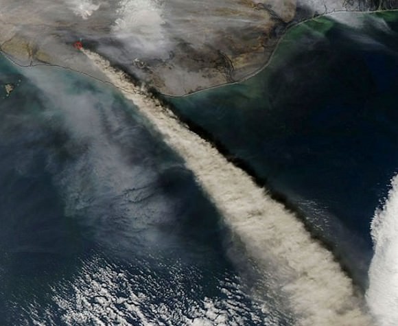
Such knowledge is critical in understanding the path and circulation of aerosols and pollutants worldwide. When the Eyjafjallajökull volcano erupted in Iceland back in 2010, many trans-Atlantic flights were grounded as a precaution. These measures are necessary as several flights have suffered engine failures in the past due to encounters with volcanic ash clouds, such as the four engine failure of KLM Fight 867 in 1989 and the British Airways Flight 9 incident over Southeast Asia in 1982. Knowing where these dangerous ash clouds are is crucial to the safety of air travel.

The expanding ash cloud spewing from Iceland's Eyjafjallajökull volcano as seen from space in 2010. Credit: NASA.
The expanding ash cloud spewing from Iceland’s Eyjafjallajökull volcano as seen from space in 2010. Credit: NASA.

To accomplish this, CATS will emit 5,000 1 milliJoule laser pulses a second at the 1064, 532 and 355 nanometer wavelengths.  This represents a vast improvement in power requirements and thermal capabilities over a similar instrument currently in service aboard the Cloud-Aerosol Lidar and Infrared Pathfinder Satellite Observations (CALIPSO) Earth remote sensing spacecraft.

And it’s that third 355 nanometer wavelength that will make CATS stand out from CALIPSO. This will also allow researchers to differentiate between particle size and measure the horizontal and vertical distribution of aerosol particles in the atmosphere. CATS will also be capable of measuring the number of individual photons being reflected back at it, which will provide a much better resolution and understanding of current atmospheric activity.

“You get better data quality because you make fewer assumptions, and you get, presumably, a more accurate determination of what kind of particles you’re seeing in the atmosphere,” McGill said in a recent press release.

The International Space Station also provides a unique vantage point for CATS. In a highly inclined 51.7 degree orbit, the station passes over a good swath of the planet on 16 orbits daily on a westward moving ground track that repeats roughly every three days. This will assure CATS has coverage over a large percentage of the planet, including known pollutant transport routes across the northern Pacific and down from Canada over the U.S. Great Lakes region.

While the first two lasers will operate in the infrared and visual wavelengths, said third laser will work in the ultraviolet. And while this will give CATS an enhanced capability, engineers also worry that it may also be susceptible to contamination.  “If you get contamination on any of your outgoing optics, they can self-destruct, and then your system is dead. You end up with a very limited instrument lifetime,” McGill said.

Still, if CATS is successful, it may pave the way for larger, free-flying versions that will monitor long-range atmospheric patterns and shifts in climate due to natural and man-made activity. And the ISS makes a good platform to test pathfinder missions like CATS at low cost. “In our current budget-constrained environment, we need to use what we already have, such as the [station], to do more with less,” McGill said.

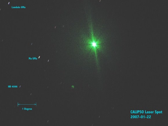
CALIPSO's LiDAR imaged from the ground by Gregg Hendry in 2008. Used with permission.
CALIPSO’s LiDAR imaged from the ground by Gregg Hendry in 2008. Used with permission.

The advent of a LiDAR system aboard the ISS has also generated a spirited discussion in the satellite tracking community concerning prospects for spotting CATS in operation from the ground. The CALIPSO LiDAR has been captured by ground spotters in the past. However, CALIPSO fires a much more powerful 110 milliJoule pulse at a rate of 20 times a second. Still, the lower power CATS system will be firing at a much faster rate, delivering a cumulative 5,000 milliJoules a second.  CATS won’t be bright enough to show up on an illuminated pass of the ISS, but it just might be visible during darkened passes of the ISS through the Earth’s shadow. And, unlike CALLIPSO — which is part of the difficult to observe A-Train of Earth-observing satellites — the ISS passes in view of a majority of humanity. At very least, activity from CATS will be worth watching out for, and may well be seen either visually or photographically.

We’ll soon be adding CATS to the long list of outstanding science experiments being conducted aboard the International Space Station, and the sight of this “fully armed and operational battle station” may soon be coming to a dark sky site near you!