Is Iran REALLY Planning on Sending a Cat Into Space?

Space Cat

“I’m going where?”

No, this isn’t The Onion… as a concerned consumer of all that is space news, you have indeed arrived at the cyber-doorstep of Universe Today.

I’ll admit though, that we did do a double take about a week back when a peculiar claim came our way via the Iranian Space Agency. Yes, there is an Iranian Space Agency, and it’s kind of frightening that they remain open for business while NASA is largely shutdown.

In mid-September, senior Iranian space program official Mohammad Ebrahimi issued a statement that Iran will attempt another bio-capsule launch “within 45 days”. The unwilling occupant: a Persian cat.

Apparently, a rabbit, a mouse, and another “Space Monkey” were also in the running. Iran’s space program is shrouded in secrecy, and most launches are only announced after they’ve been conducted. This is a convenient political strategy for hiding launch failures that harkens back to the early days of the Cold War. You’re right in guessing that the Iranian Space Agency probably won’t hold a Tweetup for this one. Many western analysts see the Iran’s space effort as a thinly veiled attempt to develop its long range ballistic missile technology. Along with Israel, Iran remains the only Middle Eastern country with the proven technology to conduct indigenous satellite launches.

Iran has stated that it hopes to put an astronaut in orbit by 2019.  The Pishgam (or “Pioneer” in Farsi) 2 bio-capsule launch could occur from a mobile launcher at Semnan Space Center as early as October 15th.  Satellite sleuths are also expecting activity at Semnan to pick up this month, with the possible launch of SharifSat atop a Safir 1-B rocket, and Iran’s Toulou satellite aboard a rumored new launch vehicle.

Iran successfully became a space-faring nation with the launch of its 27 kilogram Omid satellite on February 2nd, 2009. It isn’t immediately clear if the upcoming launch will be an orbital launch or a sub-orbital ballistic shot. If Pisgam-2 achieves orbit, said “Space Cat” would become the first feline to circle the Earth. If recovery is attempted —again, Iran is always nebulous as to their intentions— it would also be the first time they’ve achieved a return from orbit.

But is “Space Cat” even a reality?

Iran has been caught red-handed before playing a shell game with the media in terms of its space program. Earlier this year, “Monkey-gate” erupted, as before-and-after images from the Pisgam-1 bio-capsule suborbital launch clearly showed two different monkeys before and after the flight:

Monkey business? Iran displayed a decidedly different looking monkey before, during, and after launch earlier this year! (Credit: Iran News Agency).

Clearly, Iran and other ‘Axis of Evil’ countries definitely need to sharpen their Photoshop, or at least their monkey-switching skills. Either said monkey launch never actually occurred, or (more likely), the unwilling Iranian space primate never survived the flight.

Perhaps this is why Iran decided on a feline occupant this time around, for possible ease of replacement?

PETA, the People for the Ethical Treatment of Animals, have also issued a statement concerning the impending launch of “Space Cat” by Iran, calling the action an “archaic experiment, a throwback to the primitive techniques of the 1950’s.”

NASA did entertain the idea of "Catronauts" early in the space program. (Credit: NASA).
NASA did entertain the idea of “Catronauts” early in the space program. (Credit: NASA).

The U.S. and the Soviet Union launched animals into space as a prelude to human spaceflight. On November 3rd, 1957, Laika the dog became the first animal to orbit the Earth. Laika perished is space due to overheating, as did several unfortunate monkeys that were launched on the first US ballistic tests.

Russia still conducts the occasional launch of animals into space, including the Bion-1M “Space Zoo” mission earlier this year. The Bion missions allow for scientists to dissect the specimens afterwards to study the effects of a month in zero-g, something you can’t do with humans.

And the U.S. did once fly cats in zero-g aboard its Convair C-131 “Vomit Comet” aircraft, as can be seen in this bizarre video:

But the first cat in space was actually launched by France atop a Veronique AGI sub-orbital rocket 50 years ago this month on October 18th, 1963. It would be ironic if Iran conducted it launch this month on the anniversary! The story goes the Felix, the original cat slated for the flight, escaped just prior to launch from the Sahara desert Hammaguir test site in Algeria, and was replaced by the “backup crew,” a female cat named Felicette. Felicette survived the 15 minute flight, reaching an apogee of 217 kilometres. A follow-up launch of a second cat six days later wasn’t so lucky.

Felicette (left) and Felix in publicity shots prior to launch.  Note the cranial electrode (!) implants.
Felicette (left) and Felix in publicity shots prior to launch. Note the cranial electrode (!) implants. (Credit: Marjorie-art Voila.net)

As always, Iran’s intentions for the future of its space program remain hidden. Their current launch capabilities remain limited, and are a far cry from being able to hoist a human into orbit anytime soon. If the launch of “Space Cat” does come to pass this month, it’ll be over protests from animal rights groups and the general public. Hey, didn’t the former Iranian president Mahmoud Ahmadinejad  say earlier this year after “Monkey-Gate” that he was willing to be “The first Iranian to be sacrificed by the scientists of my country and go into space” as the first Iranian astronaut? Is he really going to let Space Cat upstage him?

Felix and Felicette where also commemorated on several African postage stamps. (Credit:
Felix and Felicette where also commemorated on several African postage stamps. (Credit: Majorie-art.voila.net).

Read a great synopsis of the history of felines in space from Heather Archulletta @Pillownaut.

What Does The Government Shutdown Mean For NASA?

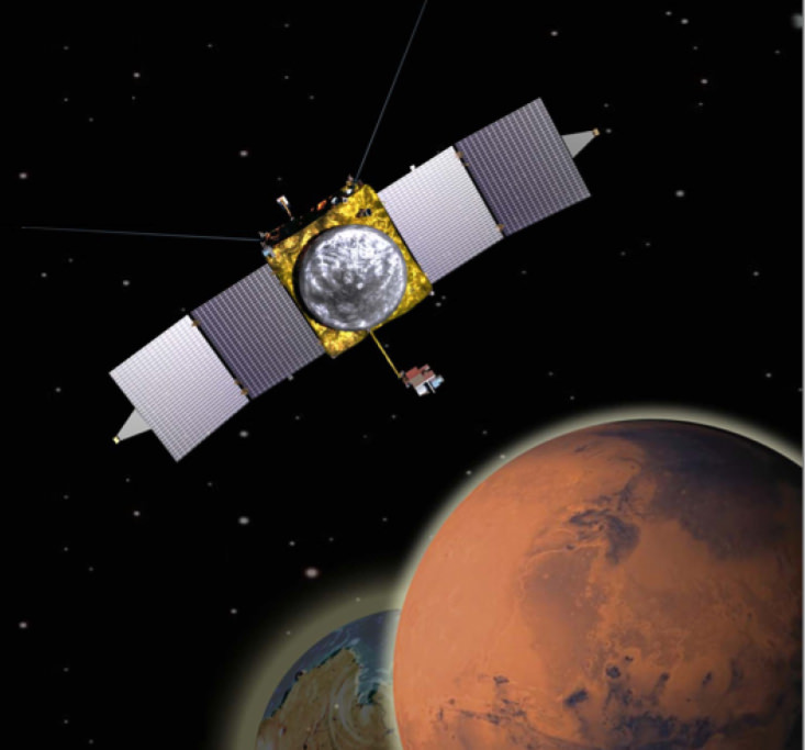
The MAVEN missions ‘Going to Mars’ campaign invites the public to submit names and poems which will be included on a special DVD. The DVD will be adhered to the MAVEN spacecraft and launched to Mars on Nov. 18, 2013. Credit: NASA/GSFC

A forthcoming NASA launch to Mars could be in danger of losing its launch window should a shutdown in the United States federal government that began today (Oct. 1) continue for a while. That’s just one of the ways in which NASA is affected amid a lapse of funding that is affecting all government agencies and an untold number of government contractors.

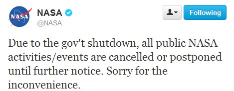
Around 97% of NASA’s 18,000 employees are off the job. Twitter, Facebook, Google Plus and other social media accounts are going dark. NASA’s website is being pulled offline. NASA Television has also ceased broadcasting.

Beyond the agency’s public face, activities ranging from certain commercial crew payouts, to conference attendance, to scientific work will cease. Awards and scholarship approvals will be delayed.

“NASA will shut down almost entirely,” said President Barack Obama in a speech late Monday (Sept. 30).

NASA_twitter1NASA_twitter2

In addition to the agency’s public relations activities, NASA is planning to launch the Mars Atmosphere and Volatile EvolutioN (MAVEN) spacecraft to Mars in November to examine the Red Planet’s atmosphere. There are all sorts of questions vexing scientists concerning that planet, with one of the most prominent ones being why the atmosphere thinned over the years.

Media reports indicate that if the shutdown is lengthy, MAVEN could miss the launch window and have to try again in 2016.

“A shutdown could delay the pre-launch processing currently under way with a possible impact to the scheduled Nov. 18 launch date,” Dwayne Brown, a NASA senior public affairs officer at NASA, told The Planetary Society in a story published yesterday (Sept. 30). The launch window extends for several weeks beyond that time, however.

The 3% of NASA employees who are deemed essential will work without pay until the situation is resolved. These are some of the things that will continue:

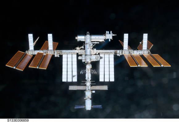
The International Space Station.  Credit: NASA
The International Space Station. Credit: NASA
  • International Space Station monitoring will be maintained, but with the bare minimum of ground crew. (NASA will cease regular updates of the astronauts’ activities during the furlough, although we presume if something urgent happened there would be an update.)
  • Robotic missions that are already in operation — think the Cassini spacecraft circling Saturn, or the Lunar Atmosphere and Dust Environment Explorer (LADEE) winging its way to the moon — will have small crews making sure that they are functioning properly. No scientific analysis will be conducted, though.
  • Certain other programs will continue if a shutdown would be detrimental to their performance. Space News reports that the much-delayed James Webb Space Telescope will be among them, as some of its instruments are undergoing cryogenic vacuum testing at the Goddard Space Flight Center.
  • Update, 1:09 p.m. EDT: Several missions run out of the Jet Propulsion Laboratory and Applied Physics Laboratory are running as usual for at least the next week because these facilities are running under contracted money from NASA and still have funds in the bank. According to the Planetary Society’s Emily Lakdawalla: “At JPL, that includes: Curiosity; Opportunity; Odyssey; Mars Reconnaissance Orbiter; Cassini; Dawn; Juno; Spitzer; the Voyagers; and WISE, among many others. At APL, that includes MESSENGER and New Horizons. It also includes the Deep Space Network.”
  • Additional Update, 2:09 p.m. EDT: The HiRISE twitter account just replied to inquiries from several space journalists that they will be “open for business” as usual, which is great news since the Mars Reconnaissance Orbiter made an audacious attempt to take images of Comet ISON during the comet’s closest approach to Mars today. We’ll provide any news and updates on images as they become available, but the HiRISE team said getting the images back to Earth and processing them may take a day or two.
  • Many observers noted that NASA is marking its 55th anniversary today by shutting down its activities. There’s no word yet on when the deadlock in Congress will be resolved. The last two shutdowns in 1995 and 1996 (which began in the middle of the STS-74 shuttle mission to Mir) lasted several weeks.

    amy_mainzer

    SEDS

    NASA_voyager

    Advanced Satellite Blasts Off from Cape Canaveral: Launch Gallery

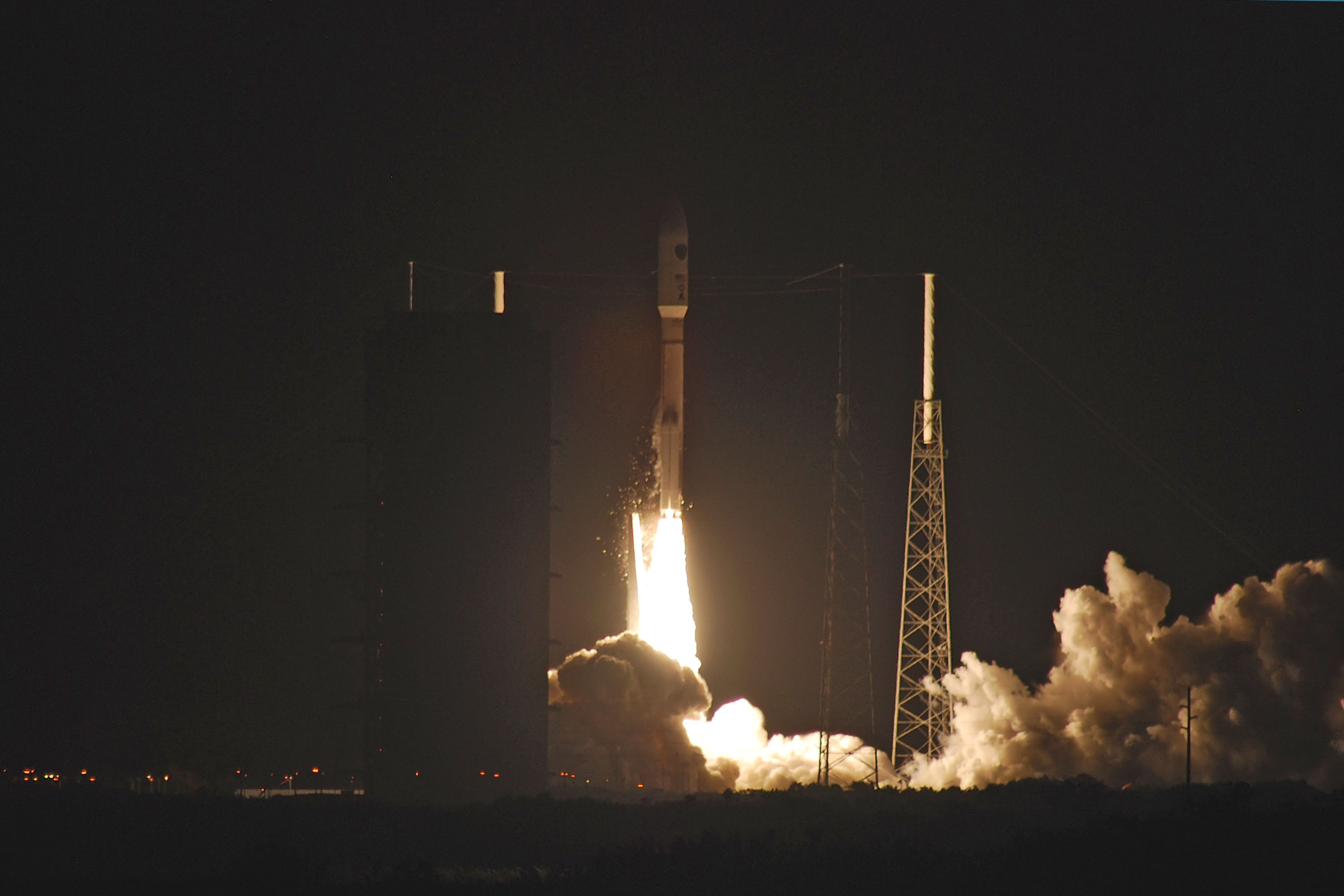
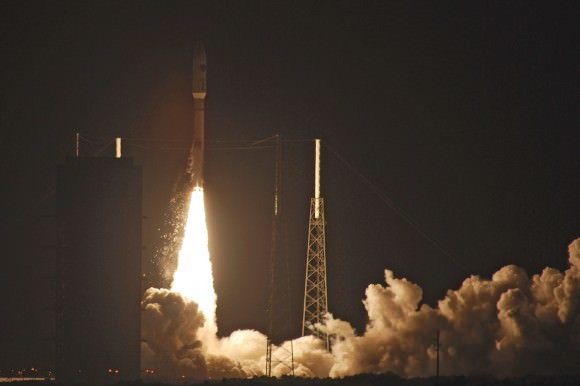
    A United Launch Alliancee Atlas V rocet lifts off with the US Air Force’s third Advanced EHF satellite. Credit and copyright: John O’Connor/nasatech.net.

    Early this morning a United Launch Alliance Atlas V rocket blasted off from Cape Canaveral in a gorgeous pre-dawn launch, sending the third Advanced Extremely High Frequency (AEHF-3) satellite for the United States Air Force to orbit. The rocket lifted off from Launch Complex-41 at 4:10 am EDT (08:10 UTC) on Wednesday, September 18, 2013. Thanks to John O’Connor from nasatech.net for sharing his beautiful launch images with Universe Today.

    This launch leads the way for a second launch today: the historic Orbital Sciences Antares commercial rocket carrying the first fully functional Cygnus commercial resupply vehicle to orbit from NASA’s Wallops Island Facility on a demonstration mission bound for the International Space Station.

    The AEHF-3 will provide a state-of-the-art communications system for the US military and Department of Defense.

    See more launches images below:

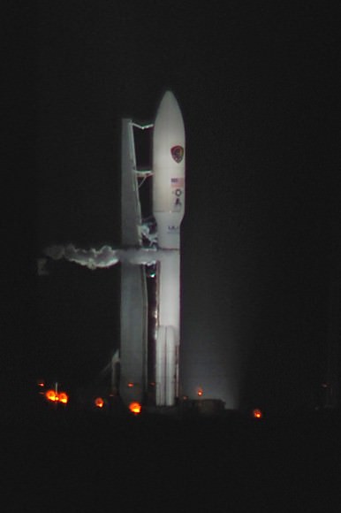
    Awaiting its mission on Space Launch Complex 41, the Atlas 5 - 531/AEHF-3 stands ready as the weather slowly cleared. Credit and copyright: John O'Connor/nasatech.net,
    Awaiting its mission on Space Launch Complex 41, the Atlas 5 – 531/AEHF-3 stands ready as the weather slowly cleared. Credit and copyright: John O’Connor/nasatech.net,
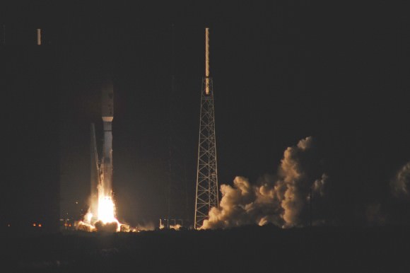
    As the furious vibrations shake cascades of ice off of the liquid oxygen tank the Atlas 5-531 reaches for the sky and its supersynchronous transfer orbit. Credit and copyright: John O'Connor/nasatech.net.
    As the furious vibrations shake cascades of ice off of the liquid oxygen tank the Atlas 5-531 reaches for the sky and its supersynchronous transfer orbit. Credit and copyright: John O’Connor/nasatech.net.
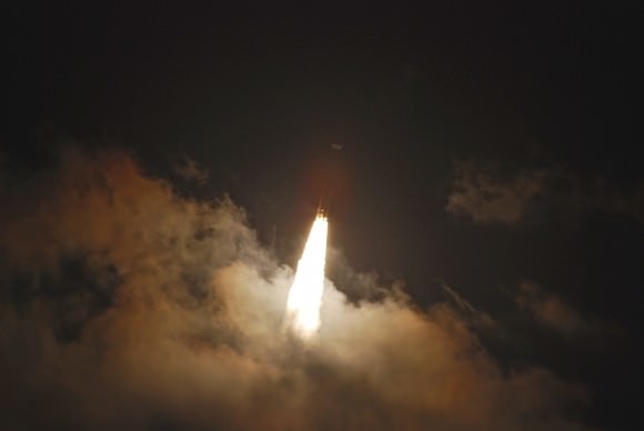
    Halfway through the lightning wires, the Atlas 5 accelerates to its rendezvous with a supersynchronous transfer orbit. Credit and copyright: John O'Connor/nasatech.net.
    Halfway through the lightning wires, the Atlas 5 accelerates to its rendezvous with a supersynchronous transfer orbit. Credit and copyright: John O’Connor/nasatech.net.
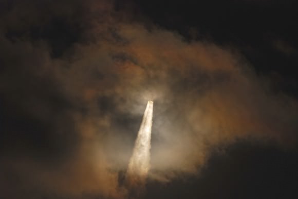
    Through a cloud on its way to orbit, the Atlas 5 - 531 vehicle and it AEHF-3 payload dapple the clouds with light....  Credit and copyright: John O'Connor/nasatech.net.
    Through a cloud on its way to orbit, the Atlas 5 – 531 vehicle and it AEHF-3 payload dapple the clouds with light…. Credit and copyright: John O’Connor/nasatech.net.
    ...and come out the top, amid the night, resplendent on a seething tower of dawn and thunder. Credit and copyright: John O'Connor/nasatech.net.
    …and come out the top, amid the night, resplendent on a seething tower of dawn and thunder. Credit and copyright: John O’Connor/nasatech.net.

    Spotting Juno: NASA’s Jupiter-bound Spacecraft Gets a Boost from Earth on October 9th, 2013

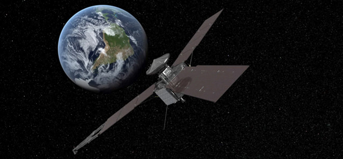
    An artist's conception of Juno's October 9th flyby of the Earth. (Credit: NASA/JPL -Caltech).

    Psst! Live in South Africa and read Universe Today? Then you might just get a peak at the Juno spacecraft as it receives a boost from our fair planet on the evening of October 9th, 2013.

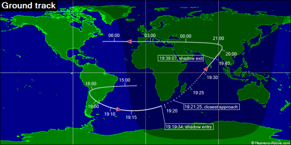
    Launched from Cape Canaveral Air Force Station on August 5th, 2011 atop an Atlas 5 rocket in a 551 configuration, Jupiter-bound Juno is approaching the Earth from interior to its orbit over the next month. Its closest approach to the Earth during its October 9th flyby will occur at 19:21 Universal Time (UT) which is 3:21 PM Eastern Daylight Saving Time. The spacecraft will pass 559 kilometres over the South Atlantic to a point 200 kilometres off of the southeastern coast of South Africa at latitude -34.2° south & longitude 34° east.

    For context, this is just about 25% higher than the International Space Station orbits at an average of 415 kilometres above the Earth. The ISS is 108.5 metres across on its longest dimension, and we wouldn’t be surprised if Juno were a naked eye object for well placed observers watching from a dark sky site around Cape Town, South Africa. Especially if one of its three enormous 8.9 metre long solar panels were to catch the Sun and flare Iridium-style!

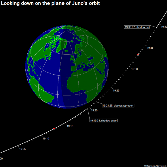
    Two minutes before closest approach, Juno will experience the only eclipse of its mission, passing into the umbra of Earth’s shadow for about 20 minutes. Chris Peat at Heavens-Above also told Universe Today that observers in India are also well-placed to catch sight of Juno with binoculars after it exits the Earth’s shadow.

    Juno passed its half-way mark to Jupiter last month on August 12th when the “odometer clicked over” to 9.464 astronomical units. Juno will enter orbit around Jupiter on July 4th, 2016. Juno will be the second spacecraft after Galileo to permanently orbit the largest planet in our solar system.

    The passage of Juno through the Earth's shadow on October 9th, 2013. (Credit and Copyright: Heavens-Above, used with permission).
    The passage of Juno through the Earth’s shadow on October 9th, 2013. (Credit and Copyright: Heavens-Above, used with permission).

    Catching a flyby of Juno will be a unique event. Unfortunately, the bulk of the world will miss out, although you can always vicariously fly along with Juno with Eyes on the Solar System. Juno is currently moving about 7 km/s relative to the Earth, and will move slightly faster than the ISS in its apparent motion across the sky from west to east before hitting Earth’s shadow. This slingshot will give Juno a 70% boost in velocity to just under 12km/s relative to Earth, just slower than Pioneer 10’s current motion relative to the Sun of 12.1km/s.

    At that speed, Juno will be back out past the Moon in about 10 hours after flyby. There’s a chance that dedicated imagers based along North American longitudes could still spy Juno later that evening.

    Juno approaches the Earth from the direction of the constellation Libra and will recede from us in the direction of the constellation Perseus on the night of October 9th.

    The ground track covered by Juno as it passes by the Earth. (Credit & Copyright: Heavens-Above, used with permission).
    The ground track covered by Juno as it passes by the Earth. (Credit & Copyright: Heavens-Above, used with permission).

    There’s also a precedent for spotting such flybys previous. On August 18th, 1999, NASA’s Cassini spacecraft made a flyby of the Earth at 1,171 kilometres distant, witnessed by observers based in the eastern Pacific region. Back then, a fuss had been raised about the dangers that a plutonium-powered spacecraft might posed to the Earth, should a mis-calculation occur. No such worries surround Juno, as it will be the first solar-powered spacecraft to visit the outer solar system.

    And NASA wants to hear about your efforts to find and track Juno during its historic 2013 flyby of the Earth. JPL Horizons lists an ephemeris for the Juno spacecraft, which is invaluable for dedicated sky hunters. You can tailor the output for your precise location, then aim a telescope at low power at the predicted right ascension and declination at the proper time, and watch. Precise timing is crucial; I use WWV shortwave radio broadcasting out of Fort Collins, Colorado for ultra-precise time when in the field.

    As of this writing, there are no plans to broadcast the passage of Juno live, though I wouldn’t be surprised if someone like Slooh decides to undertake the effort. Also, keep an eye on Heavens-Above, as they may post sighting opportunities as well. We’ll pass ‘em along if they surface!

    Late Breaking: And surface they have… a page dedicated to Juno’s flyby of Earth is now up on Heavens-Above.

    Juno is slated to perform a one year science mission studying the gravity and magnetic field of Jupiter as well as the polar magnetosphere of the giant planet. During this time, Juno will make 33 orbits of Jupiter to complete its primary science mission. Juno will study the environs of Jupiter from a highly inclined polar orbit, which will unfortunately preclude study of its large moons. Intense radiation is a primary hazard for spacecraft orbiting Jupiter, especially one equipped with solar panels. Juno’s core is shielded by one centimetre thick titanium walls, and it must thread Jupiter’s radiation belts while passing no closer than 4,300 kilometres above the poles on each pass. One run-in with the Io Plasma Torus would do the spacecraft in. Like Galileo, Juno will be purposely deorbited into Jupiter after its primary mission is completed in October 2017.

    If you live in the right location, be sure to check out Juno as it visits the Earth, one last time. We’ll keep you posted on any live broadcasts or any further info on sighting opportunities as October 9th draws near!

    – Got pics of Juno on its flyby of the Earth? Send ’em in to Universe Today!

    – You can also follow the mission on Twitter as @NASAJuno.

    Satellite Watches Dust from Chelyabinsk Meteor Spread Around the Northern Hemisphere

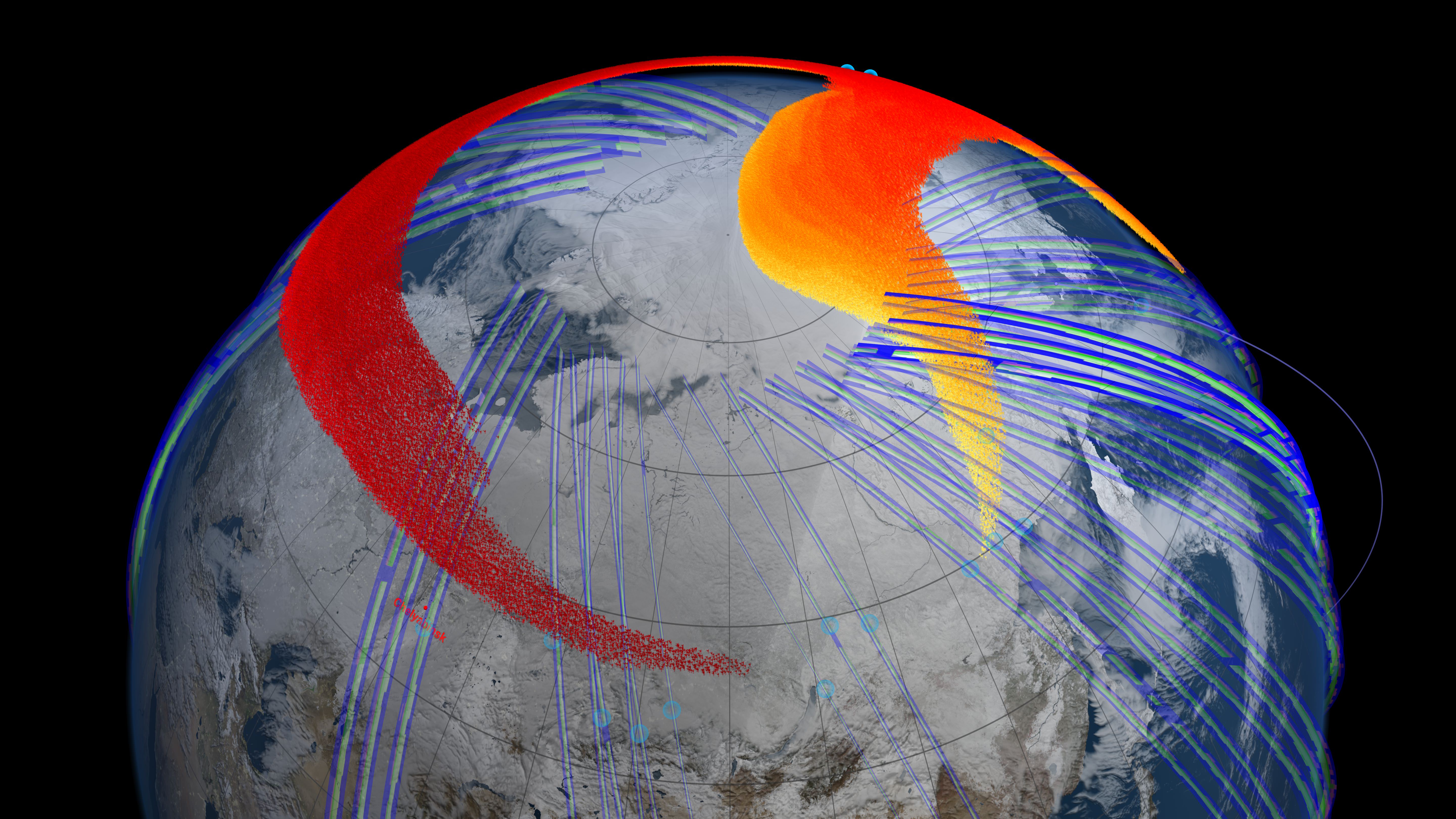
    Model and satellite data show that four days after the bolide explosion, the faster, higher portion of the plume (red) had snaked its way entirely around the northern hemisphere and back to Chelyabinsk, Russia. Image Credit: NASA's Goddard Space Flight Center Scientific Visualization

    When a meteor weighing 10,000 metric tons exploded 22.5 km (14 miles) above Chelyabinsk, Russia on Feb. 15, 2013, the news of the event spread quickly around the world. But that’s not all that circulated around the world. The explosion also deposited hundreds of tons of dust in Earth’s stratosphere, and NASA’s Suomi NPP satellite was in the right place to be able to track the meteor plume for several months. What it saw was that the plume from the explosion spread out and wound its way entirely around the northern hemisphere within four days.

    The bolide, measuring 59 feet (18 meters) across, slipped quietly into Earth’s atmosphere at 41,600 mph (18.6 kilometers per second). When the meteor hit the atmosphere, the air in front of it compressed quickly, heating up equally as quick so that it began to heat up the surface of the meteor. This created the tail of burning rock that was seen in the many videos that emerged of the event. Eventually, the space rock exploded, releasing more than 30 times the energy from the atom bomb that destroyed Hiroshima. For comparison, the ground-impacting meteor that triggered mass extinctions, including the dinosaurs, measured about 10 km (6 miles) across and released about 1 billion times the energy of the atom bomb.

    Atmospheric physicist Nick Gorkavyi from Goddard Space Flight Center, who works with the Suomi satellite, had more than just a scientific interest in the event. His hometown is Chelyabinsk.
    “We wanted to know if our satellite could detect the meteor dust,” said Gorkavyi, who led the study, which has been accepted for publication in the journal Geophysical Research Letters. “Indeed, we saw the formation of a new dust belt in Earth’s stratosphere, and achieved the first space-based observation of the long-term evolution of a bolide plume.”

    The team said they have now made unprecedented measurements of how the dust from the meteor explosion formed a thin but cohesive and persistent stratospheric dust belt.

    About 3.5 hours after the initial explosion, the Ozone Mapping Profiling Suite instrument’s Limb Profiler on the NASA-NOAA Suomi National Polar-orbiting Partnership satellite detected the plume high in the atmosphere at an altitude of about 40 km (25 miles), quickly moving east at about 300 km/h (190 mph).

    The day after the explosion, the satellite detected the plume continuing its eastward flow in the jet and reaching the Aleutian Islands. Larger, heavier particles began to lose altitude and speed, while their smaller, lighter counterparts stayed aloft and retained speed – consistent with wind speed variations at the different altitudes.

    By Feb. 19, four days after the explosion, the faster, higher portion of the plume had snaked its way entirely around the Northern Hemisphere and back to Chelyabinsk. But the plume’s evolution continued: At least three months later, a detectable belt of bolide dust persisted around the planet.

    Gorkavyi and colleagues combined a series of satellite measurements with atmospheric models to simulate how the plume from the bolide explosion evolved as the stratospheric jet stream carried it around the Northern Hemisphere.

    “Thirty years ago, we could only state that the plume was embedded in the stratospheric jet stream,” said Paul Newman, chief scientist for Goddard’s Atmospheric Science Lab. “Today, our models allow us to precisely trace the bolide and understand its evolution as it moves around the globe.”

    NASA says the full implications of the study remain to be seen. Scientists have estimated that every day, about 30 metric tons of small material from space encounters Earth and is suspended high in the atmosphere. Now with the satellite technology that’s capable of more precisely measuring small atmospheric particles, scientists should be able to provide better estimates of how much cosmic dust enters Earth’s atmosphere and how this debris might influence stratospheric and mesospheric clouds.

    It will also provide information on how common bolide events like the Chelyabinsk explosion might be, since many might occur over oceans or unpopulated areas.

    “Now in the space age, with all of this technology, we can achieve a very different level of understanding of injection and evolution of meteor dust in atmosphere,” Gorkavyi said. “Of course, the Chelyabinsk bolide is much smaller than the ‘dinosaurs killer,’ and this is good: We have the unique opportunity to safely study a potentially very dangerous type of event.”

    Source: NASA

    30 Years of City Growth Seen From Space

    China's now-industrialized Pearl River Delta, seen in October 1973 (top) and January 2003 (bottom)

    Since the launch of its first satellite in 1972, the eight NASA/USGS Landsat satellites have made the longest continuous observations of Earth’s surface, providing invaluable data for research in agriculture, geology, forestry, regional planning, education, mapping, global change research, as well as important emergency response and disaster relief information. In addition, having such a long span of data allows us to easily see the expansion of human development in many areas — unprecedented before-and-after views of city growth seen from space.

    These images, taken over the course of the Landsat program, illustrate the visible impact of over three decades of human development:

    Chandler, Arizona imaged in 1985 (top) and 2011 (bottom.)  As its economy shifted from agriculture to manufacturing and electronics, Chandler's population multiplied 8 times to over 236,000.
    Chandler, Arizona imaged in 1985 (top) and 2011 (bottom.) As its economy shifted from agriculture to manufacturing and electronics, Chandler’s population multiplied 8 times to over 236,000.
    The explosion of Istanbul's population from 2 to 3 million people is evident in these Landsat images, comparing 1975 to 2011. Vegetation appears red in the imaging wavelengths used here.
    The explosion of Istanbul’s population from 2 to 13 million people is evident in these Landsat images, comparing 1975 to 2011. Vegetation appears red in the imaging wavelengths used here.
    A few years ago one of the fastest-growing cities in the US, Las Vegas is seen here in images taken in 1984 (top) and 2011 (bottom.) The sprawling development -- as well as the decrease in water level of Lake Mead -- is evident.
    A few years ago one of the fastest-growing cities in the US, Las Vegas is seen here in images taken in 1984 (top) and 2011 (bottom.) The sprawling development — as well as the decrease in water level of Lake Mead — is evident.
    Some of the most dramatic -- and rapid --  changes have occurred in Dubai, whose artificial offshore islands suddenly appear between images taken in 2000 (top) and 2010 (bottom.) Once barely visible against the desert landscape, Dubai is now an international center of business, tourism, and oil production.
    Some of the most dramatic — and rapid — changes have occurred in Dubai, whose palm- and continent-shaped artificial islands suddenly appear between images taken in 2000 (top) and 2010 (bottom.) Once barely visible against the desert landscape, Dubai is now an international center of business, tourism, and oil production.

    See more of these images on NASA Goddard Space Flight Center’s Flickr album here.

    The Landsat Program is a series of Earth-observing satellite missions jointly managed by NASA and the U.S. Geological Survey. In 1972, the launch of ERTS-1 (Earth Resources Technology Satellite, later renamed Landsat 1) started the era of a series of satellites that have since continuously acquired space-based land remote sensing data.

    The latest satellite in the Landsat series, the Landsat Data Continuity Mission (LDCM) — now named Landsat 8 — was launched on February 11, 2013. Landsat 8 data is now available free to the public online here.

    Read more on the USGS Landsat mission page here.

    Image credits: USGS/NASA

    What Can You Do With a Cubesat?

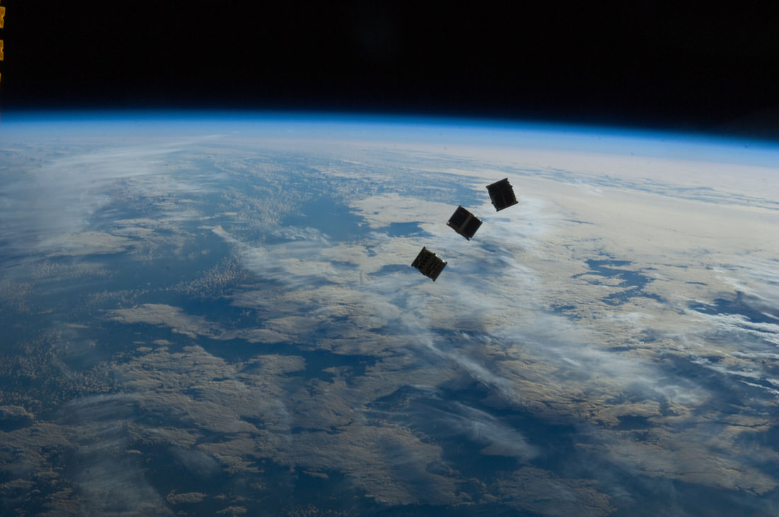
    Three small CubeSats are deployed from the International Space Station on October 4, 2012. Credit: NASA

    We’ve had several articles recently cubesats — low-cost satellites that seem to be the wave of the future. As technology becomes miniaturized, this allows for inexpensive and quick-to-build satellites. Additionally, they can tag along on launches already scheduled for other things. All this enables students and smaller companies to send equipment and experiments into space.

    But the people from DIY Space Exploration say don’t let the small size of a cubesat fool you. The types of missions Cubesats can perform may surprise you and they’re becoming the satellite of choice for anyone looking for a low cost quick response option.

    If you visit the DIY Space Exploration website, they have tutorials on how you can put your own cubesat together, and lots of other information. They’ve also put together a great infograhic about what all you can do with a cubesat:

    Space Debris: A Tale of Two Satellites

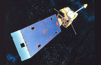
    Artist's concept of a GOES spacecraft in orbit. (Credit: NOAA.gov).

    It’s sometimes tough being a satellite in Earth orbit these days.

    An interesting commentary came our way recently via NASA’s Orbital Debris Program Office’s Orbital Debris Quarterly News. The article, entitled High-Speed Particle Impacts Suspected in Two Spacecraft Anomalies, highlights a growing trend in the local space environment.

    The tale begins with GOES 13 located in geostationary orbit over longitude 75° West. Launched on May 24th, 2006 atop a Delta IV rocket, GOES 13 is an integral part of the U.S. National Oceanic and Atmospheric Administration (NOAA’s) Geostationary Operational Environmental Satellite network.

    The problems began when GOES-13 began to suffer an “attitude disturbance of unknown origin” on May 22nd of this year, causing it to drift about two degrees per hour off of its required nadir (the opposite of zenith) pointing.

    The anomaly was similar to a problem encountered by the NOAA 17 spacecraft on November 20th, 2005. At the time, the anomaly was suspected to be due to a micrometeoroid impact. The Leonid meteors, which peak right around the middle of November, were a chief suspect. However, NOAA 17 suffered a second failure 18 days later, which was later traced down to a hydrazine leak from its errant thrusters.

    GOES-13 has weathered hard times before.  Back in December of 2006, GOES-13’s Solar X-Ray Imager suffered damage after being struck by a solar flare shortly after initial deployment.   GOES-13 also began returning degraded imagery in September 2012, forcing it into backup status for Hurricane Sandy.

    GOES-13 was restored to functionality last month. Current thinking is that the satellite was struck by a micrometeorite. No major meteor showers were active at the time.

    Loss of a GOES satellite would place a definite strain on our weather monitoring and Earth observing capability. Begun with the launch of GOES-1 in 1975, currently six GOES satellites are in operation, including one used to relay data for PeaceSat (GOES-7) and one used as a communications relay for the South Pole research station (GOES-3).

    The GOES program cost NOAA billions in cost overruns to execute. The next GOES launch is GOES-R scheduled in 2015.

    But the universe seems to love coincidences.

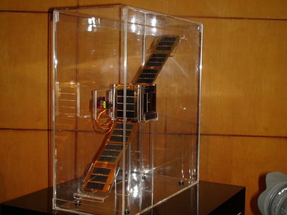
    NEE-01 Pegaso before deployment. (Credit:
    NEE-01 Pegaso before deployment. (Credit: Wikimedia Commons image in the Public Domain).

    Less than 26 hours after the GOES 13 anomaly, Ecuador’s first satellite, NEE-01 Pegaso began to have difficulties keeping a stable attitude. The event happened shortly after passage near an old Soviet rocket booster (NORAD designation 1986-058B) which launched Kosmos 1768 on August 2nd, 1986. The U.S. Joint Space Operations Center had warned the fledgling Ecuadorian Space Agency that conjunction was imminent, but of course, there’s not much that could’ve been done to save the tiny CubeSat.

    Although the main mass passed Pegaso at a safe distance, current thinking is that the discarded booster may have left a cloud of debris in its wake. Researchers have tracked small “debris clouds” around objects it orbit before- the collision of Iridium 33 and the defunct Kosmos 2251 on February 10th, 2009 left a ring of debris in its wake, and the Chinese anti-satellite test carried out on January 11th, 2007 showered low-Earth orbit with debris for years to come.

    The loss represents a blow to Ecuador and their first bid to become a space-faring nation. Launched less than a month prior atop a Long March 2D rocket, Pegaso was a small 10 centimetre nanosatellite equipped with solar panels and dual infrared and visible Earth imaging systems.

    A translation from the Ecuadorian Space Agencies site states that;

     “The NEE-01 survived the crash and remains in orbit; however it has entered uncontrolled rotation due to the event.

     Due to this rotation, (the satellite) cannot point its antenna correctly and stably to the Earth station and although still transmitting and running, the signal cannot be decoded. The Ecuadorian Civilian Space Agency is working tirelessly to stabilize the NEE-01 and recover the use of their signal.

    The PEGASUS aired for 7 days your signal to the world via EarthCam, millions could see the Earth seen from space in real time, many for the first time, the files in those 7 days have been published after transmission.”

    Ecuador plans to launch another CubeSat, NEE 02 Krysaor later in 2013. A carrier has not yet been named.

    While both events suffered by the GOES-13 and NEE-01 Pegaso satellites were unrelated, they underscore problems with space junk and space environmental hazards that are occurring with a higher frequency.

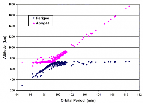
    Gabbard diagram displaying a sample disintegration of a Long March 4 booster in 2000. (Credit: the NASA Orbital Debris Office).
    Gabbard diagram displaying a sample disintegration of a Long March 4 booster in 2000. (Credit: the NASA Orbital Debris Office).

    Such is the modern hazardous environment of low Earth orbit that new satellites must face. With a growing amount of debris, impact threats are becoming more common. The International Space Station must perform frequent debris avoidance maneuvers to avoid hazards, and more than once, the crew has waited out a pass in their Soyuz escape modules should immediate evacuation become necessary.  Punctures from micro-meteoroids or space junk have even been seen recently on the ISS solar panel arrays.

    Plans are on the drawing board to deal with space junk, involving everything from “space nets” to lasers and even more exotic ideas. Probably the most immediate solution that can be implemented is to assure new payloads have a way to “self-terminate” via de-orbit at the end of their life span.  Solar sail technologies, such as NanoSailD2 launched in 2010 have already demonstrated this capability.

    Expect reentries also pick up as we approach the peak of solar cycle #24 at the end of 2013 and the beginning of 2014. Increased solar activity energizes the upper atmosphere and creates increased drag on low Earth satellites.

    It’s a brave new world “up there,” and hazards, both natural and man-made, are something that space faring nations will have to come to terms with.

    -Read and subscribe to the latest edition of NASA’s Orbital Debris Quarterly News for free here.


    A Heat Wave So Big You Can See It From Space

    Image taken by NOAA's GOES East satellite at 12:45 p.m. EDT on July 15, 2013. (NOAA/NASA GOES Project)

    Hot enough for ya? If you live anywhere on the eastern half of the United States (like me) you’ve probably been sweating it out over the past several days in what certainly feels like the warmest week yet for the season. The cause of the oppressive weather? A large mid-level ridge centered over the Ohio Valley — large enough to be easily visible from space.

    The image above was taken by the GOES East satellite at 12:45 p.m. EDT on July 15. The clear area over Ohio shows the center of the system, which has been driving temperatures up into the 90s for much of the eastern U.S. and is expected to expand into the plains by mid-week. Along with increased humidity, heat index values will exceed 100 ºF and even approach 110 ºF on Friday.

    From the NASA Image of the Day page:

    A very anomalous weather pattern is in place over the U.S. for mid-July. Trapped between an upper level ridge centered over the Ohio Valley and the closed upper level low over the Texas/Oklahoma border, atypical hot, muggy air is stifling a broad swath of the eastern U.S. The closed low is expected to drift west toward New Mexico bringing heavy, localized rain to some areas and temperatures running 10-20 degrees below mid-July averages. Across the east, temperatures will warm well into the 90s and stay there through the week. (NOAA)

    Rendering of a GOES satellite (NOAA)
    Rendering of a GOES satellite (NOAA)

    As of the time of this writing heat advisories are in place in many parts of Michigan, southern Minnesota, and southern New England, and excessive heat warnings are active in eastern Pennsylvania and west central New Jersey. (Source)

    Click here for summer heat safety tips.

    Meanwhile, a closed low — seen above as a large, moisture-laden spiraling cloud system — is moving west across Texas and New Mexico, and is expected to bring lower-than-average temperatures along with heavy rains and flash flooding.

    Keep up to date with weather alerts for your area at the NOAA’s National Weather Service site here, and see the latest GOES satellite images here.

    Image Credit: NOAA/NASA GOES Project

    At an altitude of 22,336 miles, the geosynchronous GOES satellites continuously provide observations of 60 percent of the Earth including the continental United States, providing weather monitoring and forecast operations as well as a continuous and reliable stream of environmental information and severe weather warnings.

    These Cubesats Could Use Plasma Thrusters to Leave Our Solar System

    Artist concept of a 5 kg CubeSat with CubeSat Ambipolar Thruster (CAT) firing in low Earth orbit. Via Kickstarter.

    Cubesats are all the rage these days: they’re usually inexpensive and quick to build and they can tag along on launches already scheduled for other things. We think of cubesats as being almost “disposable” satellites – tiny spacecraft that go into Earth orbit for a short time, do their science and then burn up harmlessly in Earth’s atmosphere. But a team of scientists have a more long-term, long-distance plan for their cubesats. Benjamin Longmier and James Cutler from the University of Michigan want to build cubesats that have tiny plasma thruster engines that could propel them into deep space, maybe even interstellar space.

    They have a vision of their plasma-thruster cubesat waving as it speeds past the Voyager spacecraft at the edge of our Solar System.


    They are working on what they call the CubeSat Ambipolar Thruster (CAT), a new plasma propulsion system. This thruster technology doesn’t exist all in one piece yet, but Longmeir and Cutler said they could put it together in months, with just a little funding. The CAT plasma thruster will propel a 5kg satellite into deep space, far beyond Earth orbit, at 1/1000th the cost of previous missions.

    They’ve begun a $200,000 Kickstarter campaign to help fund their project. Their ideas of what these thruster propelled cubesats could do are mind-bogglingly exciting: flying through the plumes of Enceladus to look for life, studying and tagging asteroids, formation flying through Earth’s magnetosphere to learn more about solar flares and the aurora or just an interplanetary message in a bottle lasting for hundreds of millions of years in orbit around the Sun.

    They think they can get a satellite up and flying within 18 months.

    “The traditional funding process starts with some seed data, a large government grant and a large number of milestones and gates to go through,” said Longmier in a press release from the University of Michigan. “We’d like to leverage Kickstarter funds to compress that timeline and go from initial seed data to flight in about 18 months, a much faster time scale than is possible with traditional grants.”

    The cubesats would be about as big as a loaf of bread and the thrusters – the first of its kind — would use superheated plasma directed through a magnetic field to propel the CubeSat. The duo says that with this technology, exploring interplanetary space and eventually other planets would become faster and cheaper than ever before.

    While plasma rockets have been used before, they’ve only been used on big spacecraft like Deep Space 1 and DAWN. Longmier and Cutler are miniaturizing the system. Most of the thruster components have been built and have been tested individually, but they need help through Kickstarter to assemble everything into one compact thruster unit for testing the integrated components in the lab, then in Earth orbit, and then interplanetary space.

    They’ve got more info on how the thrusters work on their Kickstarter page.

    I dare you to tell me this isn’t exciting!

    More info from the University of Michigan.