Tropical Storm Debby Douses the Gulf

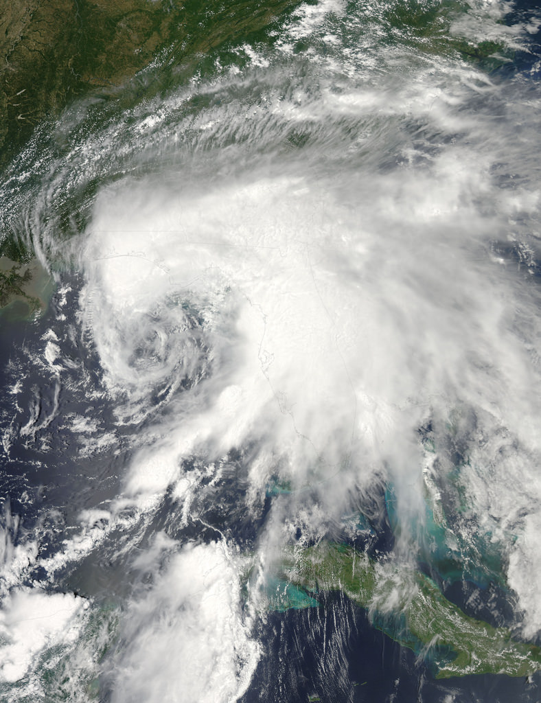
Satellite image of tropical storm "Debby" over the Gulf

The eastern Gulf of Mexico is getting lashed by tropical storm Debby, which whipped up tornado-spawning winds and dumped inches of rain across much of Florida, Mississippi, Alabama and southern Georgia over the weekend. NASA’s Aqua satellite acquired this image on June 23, just after the depression strengthened to full tropical storm status.

Born over the warm, moist air of the Gulf off the coast of Mississippi on Saturday afternoon, Debby quickly strengthened to storm status with sustained winds currently reported at over 60 mph. Slow-moving at a 6 mph crawl to the northeast, Debby continues to drench the Gulf state coasts with inches of rain — up to 10 to 20 inches projected for some areas. Major flooding has already become a problem and reports of tornadoes have been coming in since Sunday afternoon.

Debby will likely become a hurricane at some point, although her future path is still not entirely known.

Launched on May 4, 2002, NASA’s Aqua satellite specializes in keeping track of the movement of water around the planet in all its various forms. Find out more about the Aqua mission here.

Image: NASA/GSFC/Jeff Schmaltz/MODIS Land Rapid Response Team

Hush, Hush US Spy Satellite Blasts Off atop Milestone Atlas Rocket

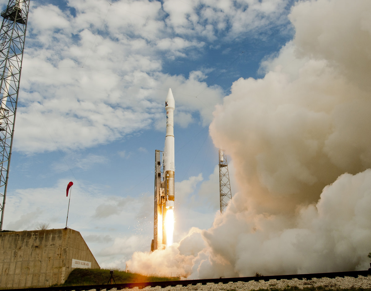
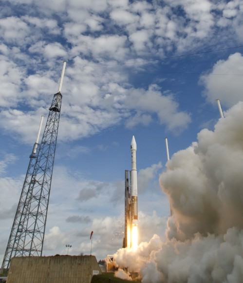
Image Caption: Spy Satellite for the U.S. National Reconnaissance Office blasts off atop Atlas V rocket from Cape Canaveral, Florida at 8:28 a.m. EDT. Credit: Jeff Seibert/wired4space.com

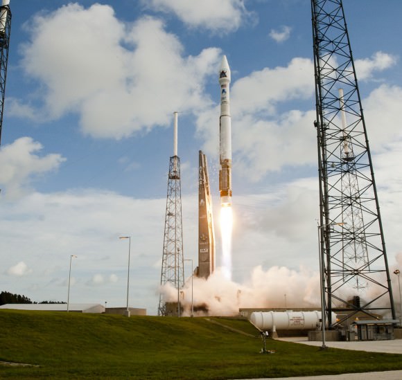
A top secret US national security Spy satellite for the National Reconnaissance Office (NRO) roared mightily to space this morning (June 20) through picturesque layers of broken clouds an Atlas V rocket at 8:28 a.m. EDT (1228 GMT) from Space Launch Complex-41 on Cape Canaveral Air Force Station, Fla.

Basically nothing is publicly known about the specifications or mission of the vital payload, dubbed NROL-38, launched in support of America’s national defense.

The classified mission entered a total news blackout and cutoff of the live webcast some five minutes after launch when the rocket’s first stage and upper stage engine separated successfully and before the secret satellite was deployed and reached orbit.

The flight marked a key milestone as the 50th successful launch of the combined Atlas V and Delta IV booster families collectively known as the Evolved Expendable Launch Vehicle (EELV) built by United Launch Alliance (ULA). The maiden launch took place in 2002.

Image Caption: NROL-38 Spy Satellite soars to space on an Atlas V rocket from Cape Canaveral, Florida at 8:28 a.m. EDT on Jun 20, 2012. Credit: Jeff Seibert/wired4space.com

ULA was formed in 2006 as a partnership between Boeing and Lockheed Martin who were originally in competition at the start of the EELV program.

“This morning’s flawless launch is the product of many months of hard work and collaboration of government and industry teams. We hit it out of the park again as we continue to deliver superior vigilance from above for the Nation,” remarked Col James D. Fisher, Director of Office of Space Launch.

Threatening clouds and gusting winds remained within acceptable levels and did not delay the launch.

The 19 story Atlas booster first stage was powered by the RD AMROSS RD-180 engine and the Centaur upper stage was powered by a single Pratt & Whitney Rocketdyne RL10A-4 engine.


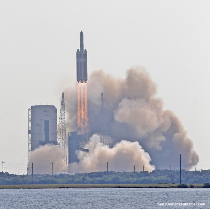
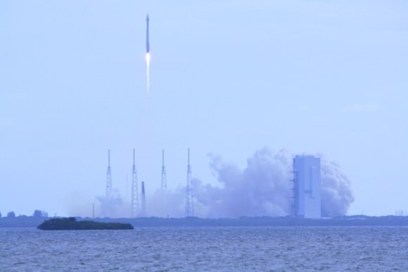
Image Caption: NROL-38 Spy Satellite liftoff on June 20, 2012 atop Atlas V rocket from Cape Canaveral, Florida. Credit: Ken Kremer/www.kenkremer.com

“Congratulations to the NRO and to all the mission partners involved in this critical national security launch,” said Jim Sponnick, ULA vice president, Mission Operations. “This launch marks an important milestone as we celebrate the 50th successful Evolved Expendable Launch Vehicle (EELV) mission, with 31 Atlas V and 19 Delta IV missions flown since August 2002.”

The NROL-38 spy satellite is the first of three critical NRO missions slated for launch by ULA over the next two months. The NRO is based in Chantilly, Va. and the U.S. Government agency responsible for designing, building, launching, and maintaining America’s intelligence satellites.

Indeed the next NRO satellite is currently scheduled for blastoff in the early morning hours of June 28 atop a Delta 4 Heavy booster rocket, now the most powerful rocket in the US arsenal following the forced retirement of NASA’s trio of Space Shuttle orbiters and which will surely put on a spectacular sky show !

The likewise classified NROL-15 mission will lift off next Thursday from Space Launch Complex-37 at Cape Canaveral.


Image Caption: NROL-38 Spy Satellite liftoff on June 20, 2012 atop Atlas V rocket from Cape Canaveral, Florida. Credit: Ken Kremer

The EELV Program was developed by the United States Air Force to provide assured access to space for Department of Defense and other government payloads, achieve significant cost savings and reliably meet launch schedule targets as older booster such as the Titan were phased out.

“Twelve of the 50 EELV launches have been NRO missions and these have been vital to our overall mission of delivering on commitments critical to our national security,” said Bruce Carlson, director, National Reconnaissance Office. “I thank and congratulate ULA and the EELV program for the tremendous performance and achievement of this very impressive and noteworthy milestone.”


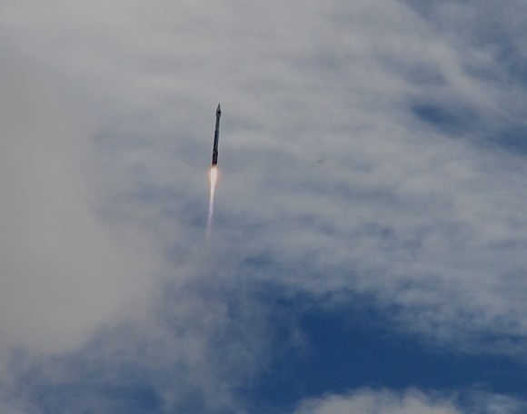
Image Caption: NROL-38 Spy Satellite atop Atlas V rocket pierces cloud layers after liftoff on June 20, 2012. Credit: Ken Kremer

ULA will be getting some competition. SpaceX Corporation – which recently dispatched the first private spacecraft (Dragon) to dock at the ISS – will compete in the bidding to launch future US national security payloads.

Ken Kremer

Blue Marble 2012: The Arctic Edition

This latest portrait of Earth from NASA’s Suomi NPP satellite puts the icy Arctic in the center, showing the ice and clouds that cover our planet’s northern pole. The image you see here was created from data acquired during fifteen orbits of Earth.

In January of this year Suomi NPP images of Earth were used to create an amazing “Blue Marble” image that spread like wildfire across the internet, becoming one of the latest “definitive” images of our planet. Subsequent images have been released by the team at Goddard Space Flight Center, each revealing a different perspective of Earth.

See a full-sized version of the image above here.

NASA launched the National Polar-orbiting Operational Environmental Satellite System Preparatory Project (or NPP) on October 28, 2011 from Vandenberg Air Force Base. On Jan. 24, NPP was renamed Suomi National Polar-orbiting Partnership, or Suomi NPP, in honor of the late Verner E. Suomi. It’s the first satellite designed to collect data to improve short-term weather forecasts and increase understanding of long-term climate change.

Suomi NPP orbits the Earth about 14 times each day and observes nearly the entire surface of the planet.

Image credit: NASA/GSFC/Suomi NPP


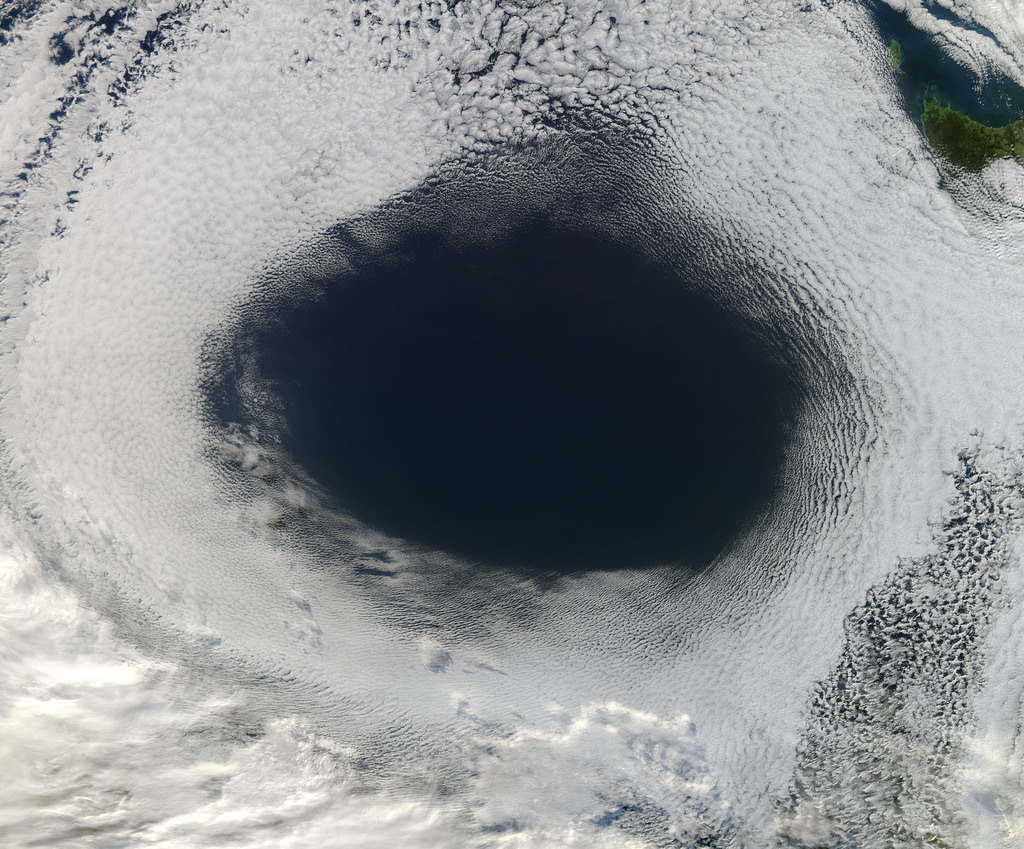
There’s a Hole in the Sky!

A vast hole in the cloud cover seen over the southern Pacific

[/caption]

Well, not the sky exactly, but definitely in the clouds!

This image, acquired by NASA’s Aqua satellite on June 5, shows an enormous oval hole in the clouds above the southern Pacific Ocean, approximately 500 miles (800 km) off the southwestern coast of Tasmania. The hole itself is several hundred miles across, and is the result of high pressure air in the upper atmosphere.

According to Rob Gutro of NASA’s Goddard Space Flight Center, “This is a good visible example of how upper-level atmospheric features affect the lower atmosphere, because the cloud hole is right under the center of a strong area of high pressure. High pressure forces air down to the surface blocking cloud formation. In addition, the altocumulus clouds are rotating counter-clockwise around the hole, which in the southern hemisphere indicates high pressure.”

The northwestern tip of Tasmania and King Island can be seen in the upper right of the image.

The Aqua mission is a part of the NASA-centered international Earth Observing System (EOS). Launched on May 4, 2002, Aqua has six Earth-observing instruments on board, collecting a variety of global data sets about the Earth’s water cycle. Read more about Aqua here.

A Twisting Tale of Space Solar Power

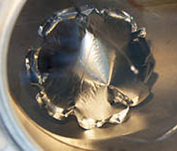
The University of Strathclyde's Dr. Massimiliano Vasile with a prototype of a SAM module

[/caption]

The dream of clean, consistent and renewable space solar power may become a reality, thanks to new research being done at The University of Strathclyde in Glasgow, Scotland.

The concept of space solar power — gathering solar energy with satellites in low-Earth orbit and “beaming” it down to collection stations on the ground — has been around for decades, but technology restrictions and prohibitive costs have kept it in the R&D phases, with some doubting that it will ever happen at all.

Now, researcher Dr. Massimiliano Vasile, of the University of Strathclyde’s Department of Mechanical and Aerospace Engineering, has announced his team’s development of modular devices that could be used to gather solar energy in orbit, working atop an experimental “space web” structure developed by graduate students at the university’s Department of Mechanical and Aerospace Engineering.

“By using either microwaves or lasers we would be able to beam the energy back down to earth, directly to specific areas. This would provide a reliable, quality source of energy and would remove the need for storing energy coming from renewable sources on ground as it would provide a constant delivery of solar energy.”

– Dr. Massimiliano Vasile, University of Strathclyde

The web structure, part of an experiment called Suaineadh — which means “twisting” in Scottish Gaelic (and I believe it’s pronounced soo-in-ade but correct me if I’m wrong) — is made of a central hub that would go into orbit and release a square web of material that’s weighted at the corners. The whole apparatus would spin, keeping its shape via centrifugal force and providing a firm structure that other devices could build upon and attach to.

The Suaineadh experiment was successfully launched on March 19 aboard a Swedish sounding rocket and while it appears that the components worked as expected, communication was lost after ejection. As a result the central hub — with all its data — couldn’t be located after landing. A recovery mission is planned for this summer.

Meanwhile, Dr. Vasile is still confident that his team’s space solar project, called SAM, can help provide space solar power to remote locations.

A single inflatable SAM cell (M. Vasile)

“The current project, called SAM (Self-inflating Adaptable Membrane) will test the deployment of an ultra light cellular structure that can change shape once deployed,” Dr. Vasile explains. “The structure is made of cells that are self-inflating in vacuum and can change their volume independently through nanopumps.

“The independent control of the cells would allow us to morph the structure into a solar concentrator to collect the sunlight and project it on solar arrays. The same structure can be used to build large space systems by assembling thousands of small individual units.”

By collecting solar energy in space, where the constraints of day and night or weather variability are nonexistent, the satellites could ultimately beam clean energy down to otherwise off-the-grid locales.

“In areas like the Sahara desert where quality solar power can be captured, it becomes very difficult to transport this energy to areas where it can be used,” says Dr. Vasile. “However, our research is focusing on how we can remove this obstacle and use space based solar power to target difficult to reach areas.

“By using either microwaves or lasers we would be able to beam the energy back down to earth, directly to specific areas. This would provide a reliable, quality source of energy and would remove the need for storing energy coming from renewable sources on ground as it would provide a constant delivery of solar energy.”

If successful, the Suaineadh/SAM project could develop into a source of renewable energy for not only small, remote locations but also neighborhoods, towns and perhaps even entire cities.

“Initially, smaller satellites will be able to generate enough energy for a small village but we have the aim, and indeed the technology available, to one day put a large enough structure in space that could gather energy that would be capable of powering a large city,” Dr. Vasile says.

Read more on the University of Strathclyde Glasgow’s site here.

Image credits: The University of Strathclyde. The project is part of a NASA Institute for Advanced Concepts (NIAC) study. 

The Other End of an Eclipse

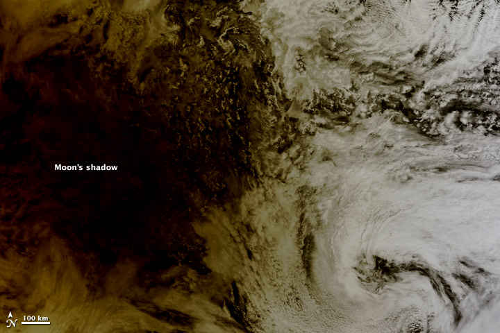
The Moon's shadow falling over the Pacific on May 20, 2012

[/caption]

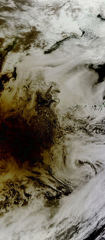
As the annular eclipse on May 20 sent skywatchers around the globe gazing upwards to see the Sun get darkened by the Moon’s silhouette, NASA’s Terra satellite caught the other side of the event: the Moon’s shadow striking the Earth!

Cast across 240,000 miles of space, the lunar shadow darkened a circular swatch 300 km (185 miles) wide over the northern Pacific Ocean in this image, acquired by the Earth-observing Terra satellite’s Moderate Resolution Imaging Spectroradiometer (MODIS) at 20:30 UT on Sunday, May 20.

From the NASA Earth Observatory site:

Where the Moon passed in front of the Sun, Earth’s surface appeared black (left half of image). Around the margins of the shadow, our planet’s surface appeared yellowish brown. The shadow cast by an eclipse consists of two parts, the completely shadowed umbra and the partially shadowed penumbra.

The eclipse was first visible over eastern Asia and moved across the globe, later becoming visible on the west coast of the US. Known as an annular eclipse, even in totality there was a bright ring of Sun visible around the Moon — a result of the Moon’s elliptical orbit. The effect was dramatic, and was captured in some amazing photos from viewers around the world (as well as by a few above the world!)

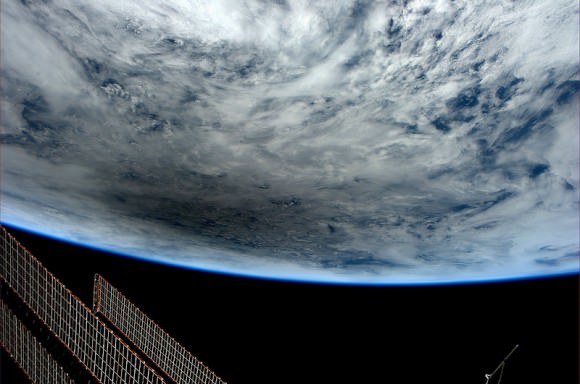
Looking at Earth during the Annular Solar Eclipse of May 20, 2012, photographed by Don Pettit from the International Space Station at 23:36 GMT. (NASA)

Although there were a few images being circulated online of the “eclipse” that were not actual photos, be assured that these are the real deal.

And the next eclipse event? That will occur on November 13 of this year, when a total eclipse will be visible from Australia, the South Pacific and South America. Watch an animation of the Nov. 13 eclipse visibility here.

Top image: NASA/Jeff Schmaltz, LANCE MODIS Rapid Response.

The May 2012 Annular Eclipse as Seen From Space

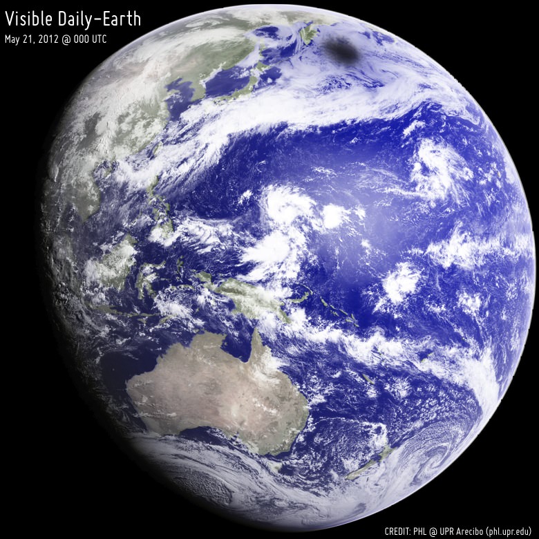
A shadow over Earth near the maximum during the Annular Solar Eclipse of May 20-21, 2012. Credit: Planetary Habitability Laboratory at UPR Arecibo, NASA, EUMETSAT, NERC Satellite Receiving Station, University of Dundee.

[/caption]

Here’s a few unique vantage points of seeing the annular solar eclipse on May 20/21 2012. Above, one of the geostationary satellites called MTSAT (Multi-Functional Transport Satellite) built by Japan was able to capture the shadow over Earth near the maximum of the eclipse of May 20-21, 2012. It’s rather amazing how small the shadow is! “This image was generated during a color test of our Visible Daily-Earth project,” wrote Abel Mendez Torres on the PHL@UPR Arecibo website “and was taken by the MTSAT on May 21, 2012 @ 000 UTC (May 20, 2012 @ 8:00 PM EDT). Color correction was based on NASA Visible Earth datasets.” The Planetary Habitability Laboratory (PHL) is a research and educational virtual laboratory that studies of the habitability of Earth, the Solar System, and extrasolar planets, and @ProfAbelMendez is a very interesting person to follow on Twitter.

Below are a couple of videos: even though you are not supposed to look directly at the Sun during an eclipse, the PROBA-2 satellite did with an awesome result, and astronaut Don Pettit’s exceptional view of the eclipse from the International Space Station, as well as a view from the Hinode and Terra satellites:

ESA’s space weather microsatellite Proba-2 observed the solar eclipse on the evening of May 20, 2012. It passed through the Moon’s shadow a total of four times, imaging a sequence of partial solar eclipses in the process. The first contact was made on Sunday May 20 at 21:09 GMT. The last contact finished at 03:04 GMT.

Don Pettit’s view:

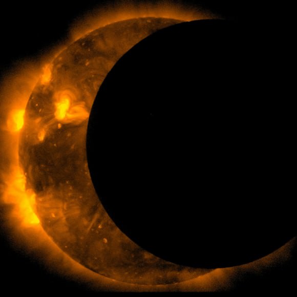
The joint JAXA/NASA Hinode mission captured this images of an annular eclipse of the Sun on May 20, 2012. Credit: Hinode/JAXA/NASA

Also, the JAXA/NASA Hinode mission captured this video of the eclipse.

Here’s a view of the eclipse over the North Pacific Ocean as see by the Terra satellite:

Credit: NASA/GSFC/Jeff Schmaltz/MODIS Land Rapid Response Team

The Moderate Resolution Imaging Spectroradiometer (MODIS) aboard the Terra satellite captured this true-color image of the annular solar eclipse over the North Pacific Ocean on May 20, 2012. Credit: NASA/GSFC/Jeff Schmaltz/MODIS Land Rapid Response Team

Make sure you check out our gallery of eclipse images from around the world, too!

Watch How Life Recovers from Devastation

If a portion of Earth underwent a major cataclysm, how long would it take for life to recover? The 1980 eruption of Mount St. Helens is giving scientists an unprecedented opportunity to witness a recovery from devastation, as the eruption leveled the surrounding forest, blasted away hundreds of meters of the mountain’s summit, and claimed 57 human lives. Landsat satellites have tracked the what has happened on the mountain, and how the forest was reclaimed — all on its own. This video shows a timelapse of the recovery, with annual images from 1979-2011 from the Landsat satellites, which acquired the images seen here between 1979 and 2011.
Continue reading “Watch How Life Recovers from Devastation”

The End Of Envisat

After ten years in orbit Envisat's mission has been declared over. (ESA)

[/caption]

Well, it’s official. After ten years of groundbreaking observation of our planet, ESA has declared the end of the Envisat mission after losing contact with the satellite on April 8, 2012. All attempts to re-establish communication with Envisat have so far been unsuccessful, and although recovery teams will continue to determine the cause of signal loss and try to regain a signal over the next several weeks, the mission — and the satellite — have been retired.

Having performed twice as long as originally planned, the hardworking Envisat has definitely earned its rest.

On April 8, the European Space Agency lost communication with the Earth-observation satellite, preventing reception of data as it passed over the Kiruna station in Sweden. Although later confirmed that the satellite is still in orbit, the recovery team has not been able to re-establish contact.

It’s thought that a loss of a power regulator could be blocking telemetry and telecommands from reaching Envisat, or else the satellite may have experienced a short-circuit and attempted to go into “safe mode” but experienced difficulties during the transition, leaving it in an unknown state.

Read: Is This the Last Image From Envisat?

ESA states that the chances of ever regaining communication with Envisat are extremely low.

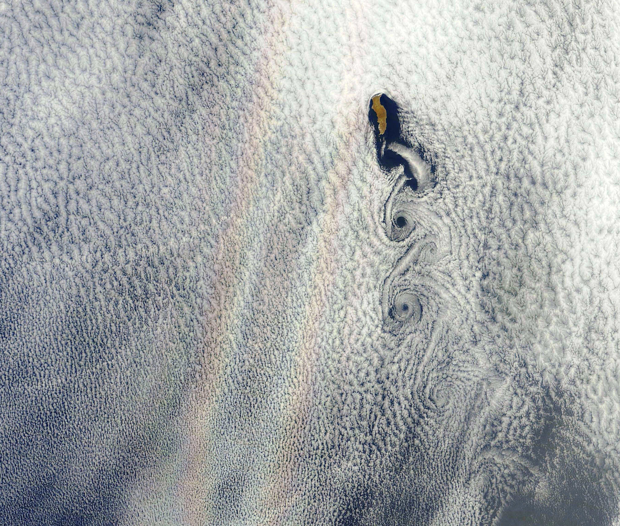
While we had reported before on the last image received before falling silent, the image below is actually the final image from Envisat, an X-band image of the Canary Islands.

The final image from Envisat, acquired on April 8, 2012. (ESA/Edisoft)

During its lifetime, Envisat completed 50,000 orbits of Earth and returned over a thousand terabytes of data, containing invaluable measurements of our planet’s surface and atmosphere that were used in more than 2500 science publications.

The video below gives a fitting eulogy for a satellite that’s definitely overachieved and over-performed, giving us a decade of crucial observations of our world from orbit.

Read more on the ESA news release here.

From Russia With Love: A Singularly Stunning Image of Earth

Full-disk image of Earth from Russia's Elektro-L satellite. (NTs OMZ)

[/caption]

Unlike most satellite images of Earth, this one was not assembled from multiple swath scans or digitally projected onto a globe model — it’s the full disk of our planet in captured as a single, enormous 121 megapixel image, acquired by Russia’s Elektro-L weather-forecasting satellite.

Like NASA’s GOES satellites, Elektro-L is parked in a geostationary orbit approximately 36,000 km (22,300 miles) above our planet. Unlike NASA’s satellites, however, Elektro-L captures images in near-infrared as well as visible wavelengths, providing detail about not only cloud movement but also vegetation variations. Its wide-angle Multichannel Scanning Unit (MSU) takes images every 15-30 minutes, showing the same viewpoint of Earth across progressive times of the day.

At a resolution of 0.62 miles per pixel, full-size Elektro-L images are some of the most detailed images of Earth acquired by a weather satellite.

Download the full-size image here (100+ megabytes).

Elektro-L diagram. © 2009 Anatoly Zak

Launched aboard a Zenit rocket on January 20, 2011, Elektro-L was the first major spacecraft to be developed in post-Soviet Russia. Parked over Earth at 76 degrees east longitude, Elektro-L provides local and global weather forecasting and analysis of ocean conditions, as well as “space weather” monitoring — measurements of solar radiation and how it interacts with Earth’s magnetic field. Its initial lifespan is projected to be ten years.

A second Elektro-L satellite is anticipated to launch in 2013.

Image credit: Russian Federal Space Agency / Research Center for Earth Operative Monitoring (NTS OMZ). See more images and video from Elektro-L on James Drake’s Planet Earth here. (Tip of the geostationary hat to Jesus Diaz at Gizmodo.)