Hoping Forward At The End Of The Shuttle Era

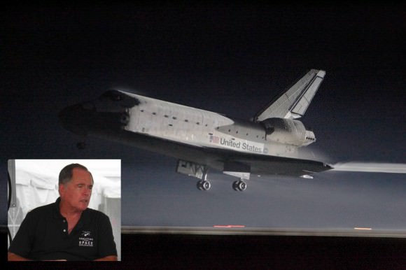
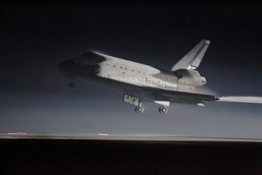
Space shuttle Atlantis wraps up the shuttle program with an early orning return to Kennedy Space Center in Florida. Photo Credit: Mike Deep for Universe Today

[/caption]

CAPE CANAVERAL Fla. — The last space shuttle mission, STS-135, ended with the landing of the shuttle Atlantis at Kennedy Space Center’s Shuttle Landing Facility at 5:57 a.m. EDT. The air was thick with both humidity and mosquitoes. It was also a day thick with loss. The United States, for the foreseeable future, has lost the ability to launch massive payloads, such as the International Space Station’s Kibo module, into orbit. Lost the capabilities that a manned spacecraft with a robot manipulator system or RMS affords. Lost the ability to chase down wayward satellites, repair them on-orbit or return them to Earth for more intensive work. Lost, at least for the time being, its leadership position in terms of space flight – that position now belongs to Russia with its human-rated Soyuz Spacecraft and unmanned Progress Cargo vessels.

NASA is working to put a positive spin on this new era. The space agency hopes that small, commercial space firms will provide the nation with the capacity to send men and material to orbit as it works to travel beyond low-Earth-orbit (LEO) once again. Only time will tell how successful this direction will be, but there are positive signs that NASA might be on the right path. Following the space program for decades – you learn to hedge your bets. Today’s SpaceX is tomorrow’s Constellation Program.

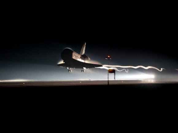
After 30 years, the shuttle program came to a close Thursday July 21, 2011 at 5:58 a.m. EDT. Photo Credit: NASA

Twin sonic booms shake me out of my revelry as the shuttle announces its return home. Then, a couple minutes later, there is the roar of the approaching orbiter. This sound comes not from shuttle, but rather from the sound of air being forcibly moved out of the shuttle’s path. I had set up two mini-camcorders to capture the landing, but had decided not to take any pictures. I took a moment, for myself, to watch as the shuttle roared past and landed.

There were a number of events held later in the day to commemorate the occasion. It struck me as odd that folks, some of whom would be in the unemployment line the following day, were celebrating. I decided to skip these events – I’ll celebrate when this nation regains the ability to launch astronauts into LEO. NASA Administrator Charlie Bolden worked to reassure everyone that all was well, given that he mistakenly said that the crew of STS-134 returned today – his words were not that reassuring.

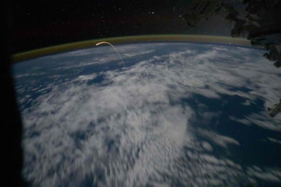
This image was taken from the International Space Station as shuttle Atlantis returned to Earth. Photo Credit: NASA

With luck, when the U.S. does return to space again, it will do so on a multitude of different craft, with a multitude of different abilities – and hopefully launch vehicles. If these spacecraft are as different from one another as Boeing’s CST-100 is from Sierra Nevada Corporation’s Dream Chaser – that will be a very good thing – it will mean that many of the capabilities lost today will be replaced, albeit on completely separate vehicles.

That said, we are now entering an undiscovered country, one that NASA has never delved into before. Near the end of Apollo, the shuttle program was approved. With the end of the shuttle program here – NASA has no established human space flight program, it has initiatives, but no umbrella program, no clear path. That said, there are some potentially amazing things on the horizon – but they exist primarily on paper or on PowerPoint. Until they are fleshed out, until they fulfill their promises – today was a day of loss. Like the shuttle program, today was a mixed bag. One filled with hope for what might come, but uncertainty with what the future holds.

These are my personal reflections on the end of the shuttle program. They do not represent the opinions of Universe Today. These thoughts come from following and covering the space program for the last two decades and are not in favor of any one group’s position. I do not work to tell people things I think they want to hear – but what I feel they need to hear. I appreciate and welcome a mature debate with respect given by all sides for everyone’s point of view.

ULA Delta IV Thunders Off Pad With GPS IIF-2 Satellite

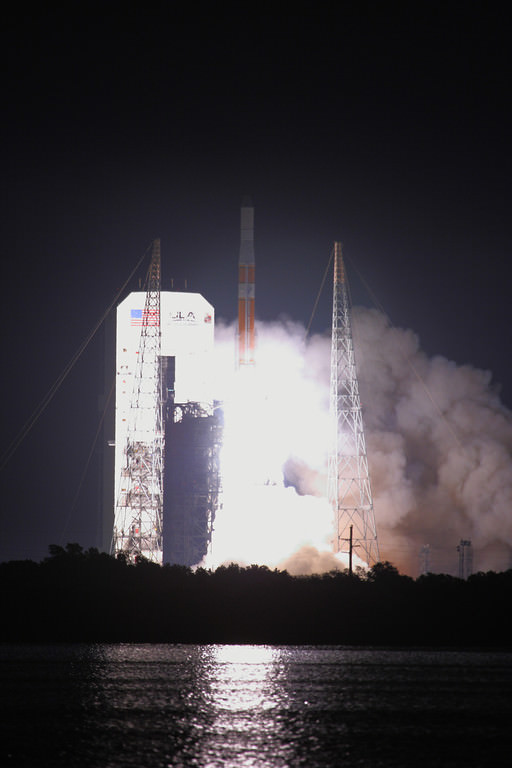
Delta IV Medium rocket thunders off of Cape Canaveral Air Force Stations Launch Complex 37B. Credit:: Alan Walters (awaltersphoto.com) for Universe Today.

[/caption]

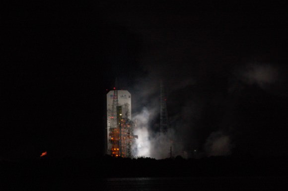
CAPE CANAVERAL, Fla. – The U.S. Air Force launched the GPS IIF-2 satellite into orbit Saturday (July 16) on a mission to enhance the country’s constellation of Global Positioning System satellites. The satellite was launched atop a Delta IV Medium 4, 2 rocket from Cape Canaveral Air Force Station’s Launch Complex 37B at 2:41 a.m. EDT. The Delta IV had been scheduled to launch two days prior but slipped one day due to a technical issue with the satellite and a second day when technicians were prevented from rolling the Mobile Service Tower or MST back because of weather.

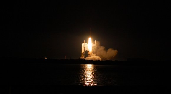
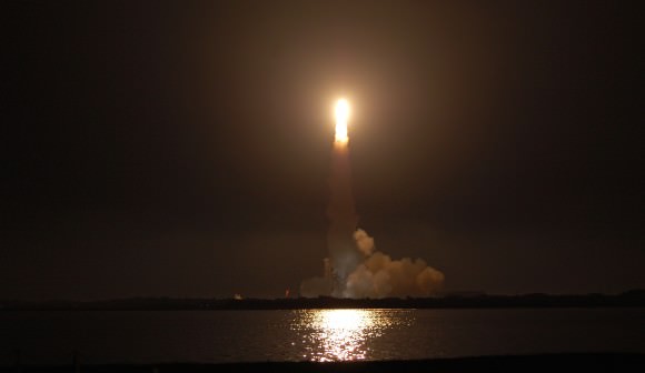
The early-morning launch lit up the skies for miles around Florida's Space Coast and saw the second of twelve planned IIF satellites placed into orbit. Photo Credit: Jason Rhian

This morning’s launch

The rocket was provided by United Launch Alliance (ULA) and the company oversaw the liftoff. This configuration of the Delta IV Medium has two solid rocket boosters which are provided by Utah’s Alliant Techsystems (ATK). The boosters are required to provide the extra boost required to send the spacecraft into the correct orbit.

A United Launch Alliance Delta IV Medium rocket thunders off of Cape Canaveral Air Force Station's Launch Complex 37B. Photo Credit: Jason Rhian

Weather was the biggest concern for the launch, but when the clock reached zero the launch vehicle thundered off of the pad in a spectacle of sound and light. The weather turned out to be a non-issue with mostly clear moonlit skies and almost no breeze. Lightning could still be seen lighting up the Florida sky off in the distance – but the summer light show only served as a backdrop for the launch.

“This is an exciting time for ULA, we are happy to have launched our 52nd mission,” said United Launch Alliance Spokesman Chris Chavez. “We’re happy to support the U.S. Air Force along with our customer and partner Boeing – it was a great launch and a great morning.”

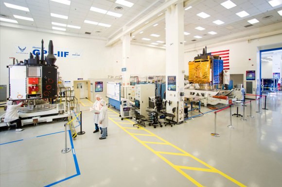
The pulse-line production method can be seen in this picture provided by Boeing. The satellite is moved through its various stations in a similar fashion as to how aircraft are produced. Photo Credit: Boeing

The satellite

Boeing is the prime contractor that provided the U.S. Air Force with the GPS satellite. The GPS IIF system is expected to provide next-generation performance to the GPS constellation of satellites. These abilities are considered to be vital to U.S. national security as well as maintaining the GPS constellation’s availability for civil, commercial and military requirements. The IIF is expected to provide enhanced capability and better performance.

The first GPS IIF satellite was launched in 2010. It is hoped that the pulse-line production method that is employed by Boeing will ensure that the IIF fleet is placed on orbit on schedule. This production method is very similar to how airplanes are developed. The process is named because satellites are moved from one work station to the next in a steady rhythm – similar to a pulse.

The GPS IIF-2 satellite will be utilized for both for civilian and military purposes. A new civilian L5 signal will assist with search and rescue missions, while the military will benefit from the satellite’s resistance to jamming. The satellite also has a reprogrammable processor that can receive uploads on-orbit. GPS IIF-2 has a design life of 12 years and it is hoped that it will provide long-term service will keeping operating costs low.

“The enhancements that the GPS IIF-2 satellite has should strengthen the constellation for many years to come,” said Boeing Spokesperson Angie Yoshimura.

Launch Complex 37B smolders after bearing the fury of the Delta IV Medium with its GPS payload. Photo Credit: Jason Rhian

Launch Complex 37B: Level by Level

The tour of this Delta IV Medium rocket, was extensive and highlighted how United Launch Alliance sends payloads to orbit. Photo Credit: Alan Walters/awaltersphoto.com

[/caption]
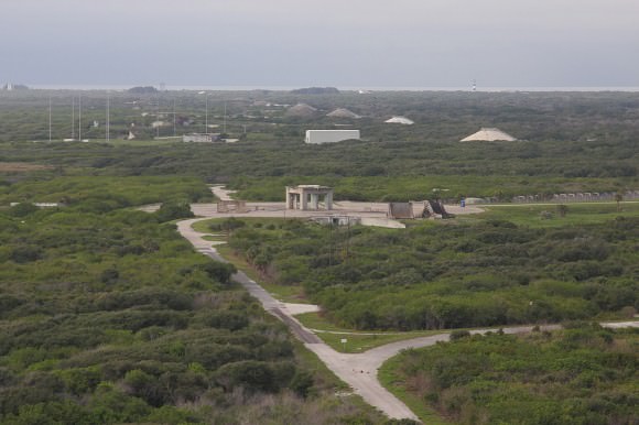
CAPE CANAVERAL Fla. – Space Launch Complex 37 is where United Launch Alliance (ULA) Delta IV rockets send their payloads into orbit. It is an expansive complex with all the prerequisite requirements to launch rockets as well as birds, alligators and mosquitoes – lots of mosquitoes.

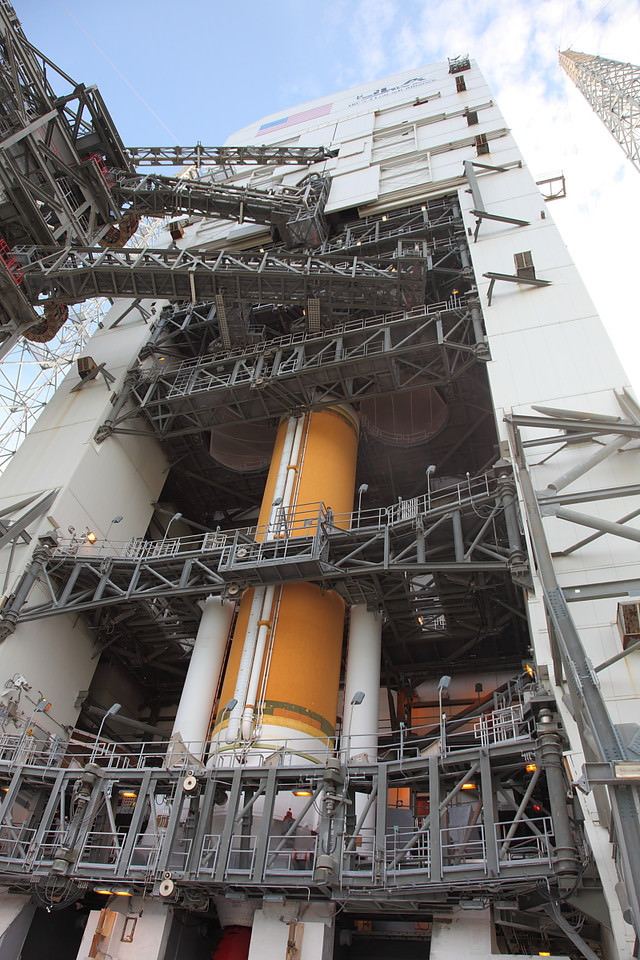
Universe Today was provided with a top to bottom tour of the Mobile Service Tower (MST) that is currently the home of the Delta IV medium rocket that will launch a GPS rocket to orbit on July 14. This structure in and of itself is impressive, standing as tall as a football field is long.

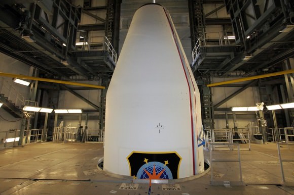
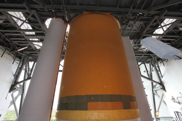
The very top of the Delta IV's payload fairing is visible in this image on Level 9 of the MST. This segment was added on June 27, after the Delta IV launch vehicle had been tested and verified ready for flight. Photo Credit: Alan Walters/awaltersphoto.com

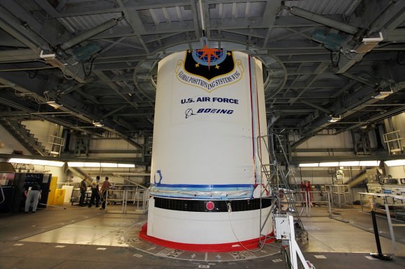
When one reaches the ninth level, the ‘tip of the spear’ juts out from the floor. At the base, just peeking out from the deck below is the U.S. Air Force logo for the Global Positioning Wing. We would have to go down another level to see the remainder of the logo – it was that large.

As we traveled deck by deck, more and more of the rocket became visible. The simple act of taking the stairs or an elevator added a layer of understanding to the sheer size of these vehicles. Photo Credit: Alan Walters/awaltersphoto.com

It is at this level that where the fairing section is mated to the top of the rocket is plainly visible. A Boeing logo is also visible on the rocket’s hull. It turns out that while some of the more specialized missions have large decals produced for them – for missions such as this one (this rocket will carry the GPS 2F-2 satellite) a series of stencils are used.

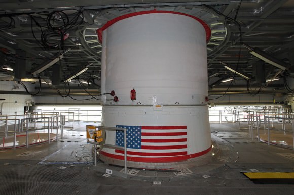
Old Glory meets us on Level Seven. To the left and right of the rocket are large openings that allow the Delta IV Heavy's triple-body design to fit inside the MST. Photo Credit: Alan Walters/awaltersphoto.com

On some of the lower decks it wasn’t actually the rocket itself that was interesting – but rather what was not there that intrigued us. Two large circular holes are positioned to either side of the Delta IV medium rocket – this is to accommodate the triple-body design of the rocket’s far-larger cousin – the Delta IV Heavy. For now these portals are covered in mesh and blocked off by railings.

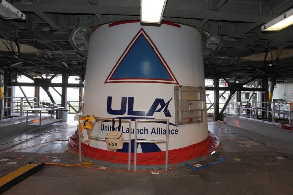
The view on Level Six was all about product-placement as ULA's logo was very visible on this deck. Photo Credit: Alan Walters/awaltersphoto.com

Nearer the base we come across products of Utah’s Alliant Techsystems (ATK) – two solid rocket motors are mounted to either side of the Delta IV and will provide the vehicle the extra needed push to get its payload out of Earth’s gravity well.

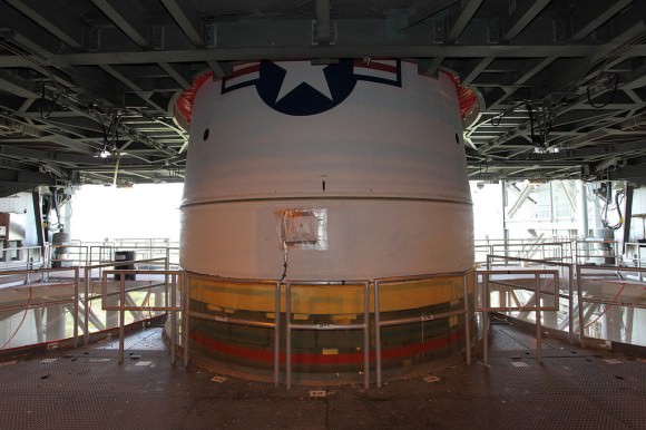
After descending several stories we were finally moving away from the white "top" section of the rocket. Photo Credit: Alan Walters/awaltersphoto.com

It is sometimes difficult to get experts that work on the machines to translate what they do into language that the general public can understand. It was obvious that the ULA representative that conducted the tour – was well aware of this. Making sure that we had the specific technical names and numbers of what we were looking at – but more accessible means of comprehending the numbers we were given.

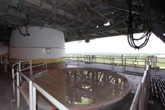
A different angle of the previous level shows the Florida coastline stretching out in the distance. Photo Credit: Alan Walters/awaltersphoto.com

“Room with a view”
Alan Walters, a professional photojournalist that has covered the space program for the past few years has a keen eye and suggested on one of the middle levels that I work my way around the rocket to take in the scenery. To say that it takes your breath away does not give the landscape that stretches out in front of you justice. Florida’s Space Coast arches out for miles in front of you. An early-morning storm was blowing into the region the day of the tour – adding to the spectacle.

The Delta IV 4, 2 has two strap-on solid rocket boosters which help carry the rocket and its payload to orbit. Photo Credit: Alan Walters/awaltersphoto.com
If one looks to the right of this picture one can see the famous Cape Canaveral Lighthouse off in the distance. Photo Credit: Alan Walters/awaltersphoto.com

Satellite Looks Down the Eye of Erupting Nabro Volcano

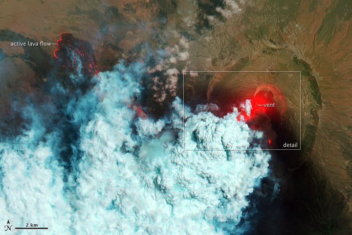
This false color satellite image shows active lava flows of the Nabro volcano in Eritrea on June 24, 2011. Credit: the Advanced Land Imager (ALI) aboard the Earth Observing-1 (EO-1) satellite.

[/caption]

Wow! What an amazing and detailed top-down view of an active volcano! This is the Nabro Volcano, which has been erupting since June 12, 2011. It sits in an isolated region on the border between Eritrea and Ethiopia and satellite remote sensing is currently the only reliable way to monitor the ongoing eruption, according to the NASA Earth Observatory website. The bright red portions of the false-color image (above) indicate hot surfaces. See below for a zoomed-in look. Both images were taken by the Advanced Land Imager (ALI) aboard the Earth Observing-1 (EO-1) satellite.


This natural-color image shows a close-up view of the volcanic plume and eruption site of the Nabro volcano. Credit: the Advanced Land Imager (ALI) aboard the Earth Observing-1 (EO-1) satellite

Robert Simmon of the NASA Earth Observatory website describes the scenes:

Hot volcanic ash glows above the vent, located in the center of Nabro’s caldera. To the west of the vent, portions of an active lava flow (particularly the front of the flow) are also hot. The speckled pattern on upstream portions of the flow are likely due to the cool, hardened crust splitting and exposing fluid lava as the flow advances. The bulbous blue-white cloud near the vent is likely composed largely of escaping water vapor that condensed as the plume rose and cooled. The whispy, cyan clouds above the lava flow are evidence of degassing from the lava.

The natural-color image (lower) shows a close-up view of the volcanic plume and eruption site. A dark ash plume rises directly above the vent, and a short, inactive (cool) lava flow partially fills the crater to the north. A gas plume, rich in water and sulfur dioxide (which contributes a blue tint to the edges of the plume) obscures the upper reaches of the active lava flow. Black ash covers the landscape south and west of Nabro.

Limited reports from the region say that at least 3,500 people and up to 9,000 that have been affected by the eruption, with at least 7 deaths caused by the erupting volcano. The ash plume has also disrupted flights in the region.

For more information see NASA’s Earth Observatory website, and BigThink

Spying on Spy Satellites with Thierry Legault

Ground-based images of three different classified satellites: the X-37B, USA-186 Keyhole, and the LaCrosse 3. Credit: Thierry Legault and Emmanuel Rietsch

[/caption]

Shhhh! Don’t tell anyone, but we’ve got pictures….. ground-based pictures of secret spy satellites in Earth orbit. We’re not revealing our sources, but … oh wait, I guess we might as well tell you. Even if we didn’t reveal our source, you’d probably guess that astrophotographer extraordinaire Thierry Legault — who has been sharing his wonderfully detailed ground-based images of the space shuttle and International Space Station with Universe Today – has been working on capturing other satellites in orbit as well. Legault and his partner in imaging crime, Emmanuel Rietsch have tackled the difficult task of tracking down spy satellites and then tracking them with a telescope. For imaging the shuttle and ISS, they developed their own design of a motorized mount outfitted with a computer program so it can slowly and precisely rotate in order to track and follow an object in Earth orbit with a telescope and video camera. Now they are able to image even smaller objects.
Above are images they were able to capture of three different spy satellites, including the X-37B spaceplane. More images and videos are available at Legault’s website.

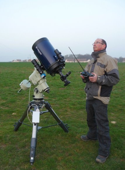
Thierry Legault with his customized satellite tracking system. Photo courtesy Thierry Legault.

Since October 2010, Legault has been using the autoguided mount, with the help of a DMK 31AF03 Firewire video camera mounted on the finder (FL 200 mm) and of the software Videos Sky, created by Rietsch, and then modified by Reitsch and Legault for fast tracking with the Takahashi EM400 mount.

The X-37B spaceplane now in orbit is the second of the two Orbital Test Vehicles launched by the US Air Force, launched on March 5, 2011. Reportedly, it will conduct experiments and tests for close to nine months and then autonomously de-orbit and land. Legault and Rietsch were able to image the spaceplane in late May of this year with fairly good results.

“I tried to get help to identify the real orientation of X-37B,” Legault told Universe Today via Skype today, “but on the contrary of the Keyhole and Lacrosse satellites, it’s not easy considering its complex shape with several wings.”

And the Air Force isn’t telling.

“Keyhole-class” (KH) reconnaissance satellites have been used for more than 30 years and are typically used to take overhead photos for military missions. Some of the keyhole satellites resemble the Hubble Space Telescope, but instead of looking out into space, it looks back at Earth. A similar type of spy satellites are the Lacrosse satellites, which are radar-imaging satellites.

But even with the tracking system, getting images of small satellites is not easy. “Despite this performing tracking system and hours of training on airplanes passing in the sky, keeping the space ship inside a sensor of a few millimeters at a focal length of 5000 mm and a speed over 1°/s needs a lot of concentration and training,” said Legault on his website.

The autoguiding and acquisition are done via a laptop with a double hard drive (one of which is a Solid State Drive – made with flash memory), enabling the precision of tracking of about one arc minute.

For security reasons, the sighting times for spy satellites are not published on an official website like NASA does for the shuttle and ISS. But with a bit of digging, Legault said others can try their luck at trying to spot these secret satellites.

“Orbital data are in the Calsky database,” Legault told UT, “therefore their passages are forecast as for the ISS. Generally, orbits are determined by amateurs, some of them are specialized in this activity, especially Kevin Fetter (and data are exchanged on the Seesat mailing list, owned by Ted Molczan).”

Legault is well-known for his images of the shuttle and ISS transiting the sun, but he said the accuracy of orbital data for the spy satellites is not sufficient for capturing a solar transit – and besides, these satellites are much smaller than the ISS and would appear as a small dark dot, at best.

“But for nighttime passages the data is sufficient,” Legault said. “Generally they are not visible with the naked eye or barely (except during flares), but they are easily visible with a finder.”

See more information, information and videos — including a view of what the tracker sees, on Legault’s website.

You can follow Universe Today senior editor Nancy Atkinson on Twitter: @Nancy_A. Follow Universe Today for the latest space and astronomy news on Twitter @universetoday and on Facebook.

June 21 ATV Re-Entry: A Man-Made Fireball In The Sky

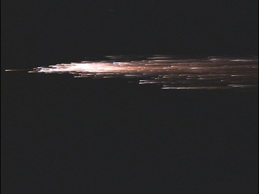
ATV re-entry. Credit: ESA

[/caption]

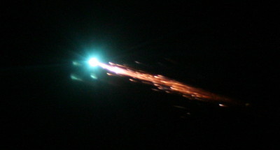
The Johannes Kepler ATV (Automated Transfer Vehicle) has undocked from the International Space station and will re- enter Earth’s atmosphere on June 21st ending its mission in fiery destruction.

The ATV has been docked with the ISS since February, where it delivered supplies, acted as a giant waste disposal and boosted the orbit of the International Space Station with its engines.

The X-wing ATV delivered approximately 7 tonnes of supplies to the station and will be leaving with 1,200kg of waste bags, including unwanted hardware.

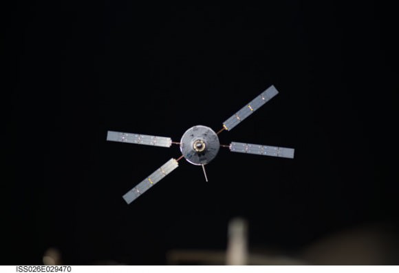
The Johannes Kepler ATV-2 approaches the International Space Station. Docking of the two spacecraft occurred on Feb. 24, 2011. Credit: NASA

On June 21st at 17:07 GMT the craft will fire its engines and begin its suicide mission, tumbling and burning up as a bright manmade fireball over the Pacific Ocean. Any leftover debris will strike the surface of the Pacific ocean at 20:50 GMT.

During the ATV’s re-entry and destruction there will be a prototype onboard flight recorder (Black Box) transmitting data to Iridium satellites, as some aspects of a controlled destructive entry are still not well known.

ESA says that this area is used for controlled reentries of spacecraft because it is uninhabited and outside shipping lanes and airplane routes. Extensive analysis by ESA specialists will ensure that the trajectory stays within safe limits.

There still are some chances to see the ISS and Johannes Kepler ATV passing over tonight, but if you in a location where you can see the south Pacific skies starting at about 20:00 GMT, keep an eye out for a glorious manmade fireball.
A shower of debris results as the ATV continues its plunge through the atmosphere. Credit: ESA

Read more about the re-entry at ESA.

Why Can We See Multiple ISS Passes Right Now?

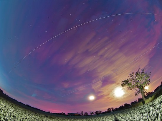
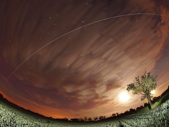
Four ISS passes over the UK last night. Credit: Mark Humpage

[/caption]
Last night in the UK, US and Europe, we were spoiled with multiple and bright ISS passes. Not just one or two, but up to six passes were able to be viewed throughout the evening in some locations.

This is quite rare as normally we get only one or maybe two visible passes in the evening or morning.

So why are we getting as many as four to six passes per night?

The ISS did receive an orbital boost and its altitude increased by around 20 kilometers. The orbital height of the ISS has an effect on how many visible passes there are at present in the Northern hemisphere. Another reason is because of the time of year.

We are only a week or so away from the Summer Solstice, the time of year when the Northern hemisphere receives the most hours of sunlight. Naturally this means we only have a few hours of darkness and the further North you go, the shorter the nights are and in some locations this time of year, it doesn’t ever get truly dark.

So why does this affect the ISS?

Basically the ISS visible passes have increased due to the station being illuminated much more by the Sun as there are more hours of sunlight right now, but the effect will wear off when we pass through Summer solstice and the nights get longer again.

Take advantage of this rare time and go outside and enjoy the ISS as much as you can in this series of visible passes.

Need to know how and when you can see the ISS? NASA has a Skywatch page where you can find your specific city to look for satellite sighting info.

Spaceweather.com, has a Satellite Tracker Tool. Just put in your zip code (good for the US and Canada) to find out what satellites will be flying over your house.

Heaven’s Above also has a city search, but also you can input your exact latitude and longitude for exact sighting information, helpful if you live out in the country.

Credit: Mark Humpage

Astounding Satellite Views of the Puyehue-Cordón Ash Plume

A gigantic plume of ash from the Puyehue-Cordón Volcano in Chile spreads across South America. This image was taken on June 13, 2011 by the Moderate Resolution Imaging Spectroradiometer (MODIS) on the Terra satellite. Credit: NASA and courtesy Jeff Schmaltz, MODIS Rapid Response Team at NASA GSFC.

[/caption]

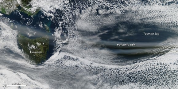
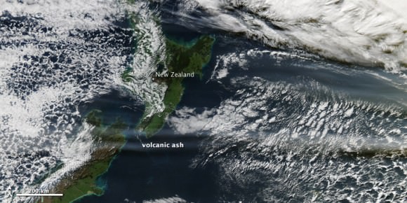
An incredible amount of ash is being spewed from the erupting Puyehue-Cordón Volcano Complex in Chile. This image, taken by the Moderate Resolution Imaging Spectroradiometer (MODIS) on the Terra satellite on June 13, 2011, shows a large plume of volcanic ash blowing about 780 kilometers east and then northeast over Argentina. A plume of volcanic ash from this eruption disrupted air traffic as far away as New Zealand on June 13. See images below of how far the ash has traveled in the atmosphere, a half a world away.


The Moderate Resolution Imaging Spectroradiometer (MODIS) on the Aqua satellite acquired the two images below of the Chilean ash plume on June 13, 2011 showing that a concentrated plume was visible more than half a world away. The first image shows the ash plume over southern Australia and the Tasman Sea, while the second image provides a view farther east over New Zealand and the South Pacific Ocean.

The Chilean ash plume over southern Australia and the Tasman Sea on June 13, 2011. Credit: NASA/MODIS on the Aqua Satellite.
The Chilean volcano ash plume over NewZealand and the South Pacific Ocean. Credit: NASA/MODIS on the Aqua satellite.

NASA’s Earth Observatory website says that although the intensity of the eruption has decreased since the initial eruption, the volcano’s activity is holding steady. The plume reached between 4 and 8 kilometers in altitude on June 13, its height varying with the intensity of the eruptive episode throughout the day.

Here’s how the volcano looked back on June 4, 2011 when it began spewing ash 45,000 feet (14,000 meters) into the air. The Moderate Resolution Imaging Spectroradiometer (MODIS) on the Aqua satellite captured this natural-color image shortly after the eruption began:

Chile’s Puyehue-Cordón Caulle volcano on June 4, 2011. Credit: NASA/Aqua - MODIS

See more images and data on this volcano at the NASA Earth Observatory Natural Hazards website.

You can follow Universe Today senior editor Nancy Atkinson on Twitter: @Nancy_A. Follow Universe Today for the latest space and astronomy news on Twitter @universetoday and on Facebook.

Proof! Bio Station Alpha is Just an Image Artifact

The streak on Google Mars misinterpreted as a secret Mars base.

[/caption]

It’s time for another episode of “Conspiracy Theory of the Week.” This one involves a supposed secret space station on Mars. The You Tube video showing “Bio Station Alpha” (below) went viral and was even reported on some mainstream media outlets. The station is supposedly a 700 ft x 150 ft structure on Mars and by some accounts is colored white with blue and red stripes. It was found on Google Mars by an “armchair astronaut” and breathless conspiracy bloggers have touted this as the most important discovery on Mars yet, and “proof!” that NASA is hiding their activities.

In reality, this is not a space station, a Mars base or any type of structure – created or natural — on the surface of the Red Planet. What shows up in this location on Google Mars is just a smattering of about 11 bad pixels from data dropout – a linear streak artifact likely caused by a cosmic ray hitting the Mars Express spacecraft while it was taking the image – and then that smudge has been badly distorted through image processing when it became part of Google Mars.

“This looks like a cosmic ray hit,” said Tanya Harrison, planetary scientist on the science operations team for the Mars Reconnaissance Orbiter Context Camera (CTX) and Mars Color Imager (MARCI) at Malin Space Science Systems. “We see these from time to time in the MARCI data from MRO.”

Here’s the image that is seen on Google Mars after processing, which includes very noticeable compression artifacts:

And now here’s the original image taken by the Mars Express High Resolution Stereo Camera image (H5620_0000_ND), taken on May 18, 2008 (and here’s the link to the original image):

Original Mars Express HRSC image of the location in question on Mars. Credit: ESA

This image really makes it clear this is an image artifact from a cosmic ray hit.

Here’s the same location taken by the MRO Context Camera (CTX) on January 25, 2010 (a crop of the same location as seen above from the original large CTX image, available here):

MRO's Context Camera (CTX) image MRO CTX B17_016407_2528_XN_72N029W of the same location. Credit: MSSS

In this image, each pixel represents a distance of about 6.25 meters, a higher resolution than what is available from the Mars Express spacecraft, which takes images at 10 meters per pixel. Obviously, there is no structure or anything unusual at that location, except for the northern polar sand dunes.

Harrison explained that the CTX acquires grayscale (black & white) images at 6 meters per pixel scale over a swath 30 kilometers wide and provides context images for the MRO HiRISE and CRISM cameras, which can take even higher resolution images. It is used to monitor changes occurring on the planet, and help the science team select critical science targets. The team at Malin Space Science Systems pores over the images looking for anything unusual. In this case, at this location, they found nothing.

“Every day, the images we acquired with CTX and MARCI the previous day are inspected by multiple sets of eyes,” Harrison told Universe Today. “We look at every single image for multiple reasons: checking the health of the instrument, monitoring weather conditions for future targeting of the cameras, and looking for anything geologically interesting.”

Harrison added that nearly all the operations folks on the team have Master’s degrees or Ph.D.s in geology or a related field.

“If we spot anything out of the ordinary, we look at previous images of the area, not just from CTX and MARCI, but from the Mars Global Survery’s Mars Orbiter Camera, the THEMIS VIS and IR on the Mars Odyssey spacecraft, the HRSC on Mars Express, and Viking,” Harrison said. “This lets us look at the features at different illumination angles, times of day, resolutions, etc. We know better than to speculate on something below the resolution of our cameras, so if we see something in CTX that’s worth following up on at a higher resolution, we ask HiRISE to shoot it. The same thing was true for MOC, following up on things observed in the low-resolution wide angle images with high-resolution narrow angle images.”

Clearly, this region has been imaged and examined previously, with absolutely nothing found by the top experts in the field. The region is so uninteresting that no one has requested for HiRISE — which can take images of 1-2 meters per pixel — to take any images of this area.

Harrison said CTX takes images of Mars that are up to 30 km wide and over 300 km long at a very high resolution. “This is a pretty big footprint with a relatively high resolution compared to previous cameras!” she said. “The size of that footprint has allowed us to cover over 60% of Mars at 6 meters per pixel in the 5 years MRO has been orbiting Mars. In addition to mapping, we use CTX to acquire stereo coverage of key areas, as well as to monitor hundreds of locations on Mars for changes such as new impact craters and dust activity.”

If there were something unusual on Mars, the people at NASA, ESA, MSSS and anyone monitoring Mars would have imaged this site repeatedly with the best cameras available. They would love to find something unusual, groundbreaking and front-page worthy, and if they did would be shouting it from the rooftops, not hiding it.

You can hear Harrison talk about how the images taken by the various Mars orbiters require meticulous planning, on the June 1, 2011 episode of 365 Days of Astronomy.

MSSS is comprised of several small groups which all contribute to designing, building, and operating cameras on orbiters and rovers at other planets.

If you want to see the image artifact on Google Mars, here are the coordinates: 71 49’19.73?N 29 33’06.53?W

And, if you must, here’s the video by David Martinez:

Aquarius Satellite Launches to Observe Earth’s Oceans

A picture-perfect launch on a Delta II rocket from Vandeberg Air Force Base in California sent the newest satellite into orbit. The Aquarius/SAC-D spacecraft lifted off June 10, 2011 at 7:20 a.m. PDT (1420 UTC) to gather global measurements of ocean surface salinity, leading to a better understanding of ocean circulation, climate and Earth’s water cycle. NASA’s Aquarius instrument is part of the SAC-D spacecraft built by CONAE, Argentina’s space agency.

Continue reading “Aquarius Satellite Launches to Observe Earth’s Oceans”