Proof! Bio Station Alpha is Just an Image Artifact

The streak on Google Mars misinterpreted as a secret Mars base.

[/caption]

It’s time for another episode of “Conspiracy Theory of the Week.” This one involves a supposed secret space station on Mars. The You Tube video showing “Bio Station Alpha” (below) went viral and was even reported on some mainstream media outlets. The station is supposedly a 700 ft x 150 ft structure on Mars and by some accounts is colored white with blue and red stripes. It was found on Google Mars by an “armchair astronaut” and breathless conspiracy bloggers have touted this as the most important discovery on Mars yet, and “proof!” that NASA is hiding their activities.

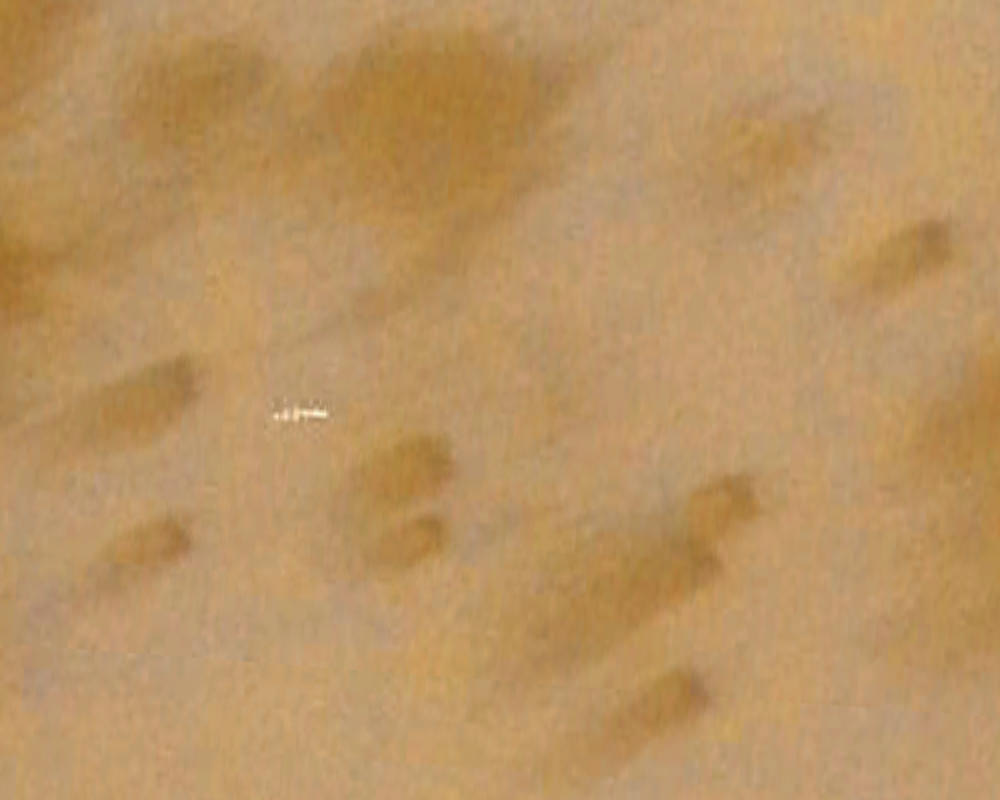
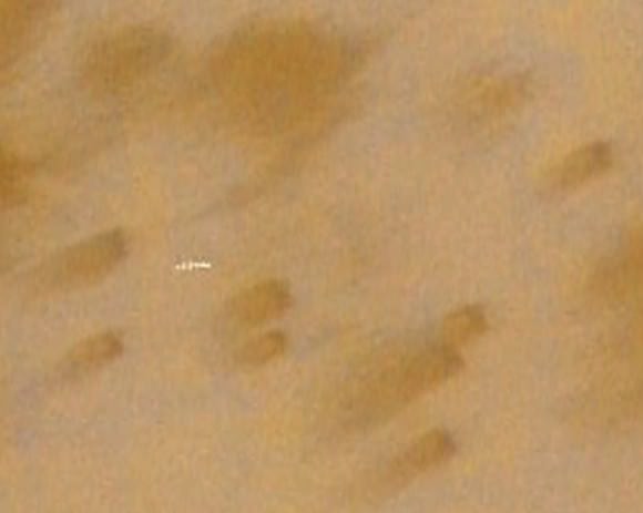
In reality, this is not a space station, a Mars base or any type of structure – created or natural — on the surface of the Red Planet. What shows up in this location on Google Mars is just a smattering of about 11 bad pixels from data dropout – a linear streak artifact likely caused by a cosmic ray hitting the Mars Express spacecraft while it was taking the image – and then that smudge has been badly distorted through image processing when it became part of Google Mars.

“This looks like a cosmic ray hit,” said Tanya Harrison, planetary scientist on the science operations team for the Mars Reconnaissance Orbiter Context Camera (CTX) and Mars Color Imager (MARCI) at Malin Space Science Systems. “We see these from time to time in the MARCI data from MRO.”

Here’s the image that is seen on Google Mars after processing, which includes very noticeable compression artifacts:

And now here’s the original image taken by the Mars Express High Resolution Stereo Camera image (H5620_0000_ND), taken on May 18, 2008 (and here’s the link to the original image):
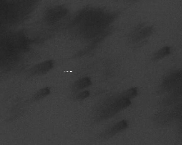
Original Mars Express HRSC image of the location in question on Mars. Credit: ESA

This image really makes it clear this is an image artifact from a cosmic ray hit.

Here’s the same location taken by the MRO Context Camera (CTX) on January 25, 2010 (a crop of the same location as seen above from the original large CTX image, available here):
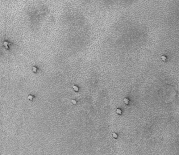
MRO's Context Camera (CTX) image MRO CTX B17_016407_2528_XN_72N029W of the same location. Credit: MSSS

In this image, each pixel represents a distance of about 6.25 meters, a higher resolution than what is available from the Mars Express spacecraft, which takes images at 10 meters per pixel. Obviously, there is no structure or anything unusual at that location, except for the northern polar sand dunes.

Harrison explained that the CTX acquires grayscale (black & white) images at 6 meters per pixel scale over a swath 30 kilometers wide and provides context images for the MRO HiRISE and CRISM cameras, which can take even higher resolution images. It is used to monitor changes occurring on the planet, and help the science team select critical science targets. The team at Malin Space Science Systems pores over the images looking for anything unusual. In this case, at this location, they found nothing.

“Every day, the images we acquired with CTX and MARCI the previous day are inspected by multiple sets of eyes,” Harrison told Universe Today. “We look at every single image for multiple reasons: checking the health of the instrument, monitoring weather conditions for future targeting of the cameras, and looking for anything geologically interesting.”

Harrison added that nearly all the operations folks on the team have Master’s degrees or Ph.D.s in geology or a related field.

“If we spot anything out of the ordinary, we look at previous images of the area, not just from CTX and MARCI, but from the Mars Global Survery’s Mars Orbiter Camera, the THEMIS VIS and IR on the Mars Odyssey spacecraft, the HRSC on Mars Express, and Viking,” Harrison said. “This lets us look at the features at different illumination angles, times of day, resolutions, etc. We know better than to speculate on something below the resolution of our cameras, so if we see something in CTX that’s worth following up on at a higher resolution, we ask HiRISE to shoot it. The same thing was true for MOC, following up on things observed in the low-resolution wide angle images with high-resolution narrow angle images.”

Clearly, this region has been imaged and examined previously, with absolutely nothing found by the top experts in the field. The region is so uninteresting that no one has requested for HiRISE — which can take images of 1-2 meters per pixel — to take any images of this area.

Harrison said CTX takes images of Mars that are up to 30 km wide and over 300 km long at a very high resolution. “This is a pretty big footprint with a relatively high resolution compared to previous cameras!” she said. “The size of that footprint has allowed us to cover over 60% of Mars at 6 meters per pixel in the 5 years MRO has been orbiting Mars. In addition to mapping, we use CTX to acquire stereo coverage of key areas, as well as to monitor hundreds of locations on Mars for changes such as new impact craters and dust activity.”

If there were something unusual on Mars, the people at NASA, ESA, MSSS and anyone monitoring Mars would have imaged this site repeatedly with the best cameras available. They would love to find something unusual, groundbreaking and front-page worthy, and if they did would be shouting it from the rooftops, not hiding it.

You can hear Harrison talk about how the images taken by the various Mars orbiters require meticulous planning, on the June 1, 2011 episode of 365 Days of Astronomy.

MSSS is comprised of several small groups which all contribute to designing, building, and operating cameras on orbiters and rovers at other planets.

If you want to see the image artifact on Google Mars, here are the coordinates: 71 49’19.73?N 29 33’06.53?W

And, if you must, here’s the video by David Martinez:

Aquarius Satellite Launches to Observe Earth’s Oceans

A picture-perfect launch on a Delta II rocket from Vandeberg Air Force Base in California sent the newest satellite into orbit. The Aquarius/SAC-D spacecraft lifted off June 10, 2011 at 7:20 a.m. PDT (1420 UTC) to gather global measurements of ocean surface salinity, leading to a better understanding of ocean circulation, climate and Earth’s water cycle. NASA’s Aquarius instrument is part of the SAC-D spacecraft built by CONAE, Argentina’s space agency.

Continue reading “Aquarius Satellite Launches to Observe Earth’s Oceans”

Joplin, Missouri Tornado Seen From Space

This video from NOAA’s GOES geostationary satellite shows the development of the supercell storm that produced the devastating tornado that struck Joplin, Missouri. Here you can see the storm develop over Missouri, Oklahoma, Kansas state lines on May 22, 2011 between 12:44pm to 7:15pm CDT. This was part of the great wave of severe storms that swept across the central United States, with tornado warnings from Minneapolis to Dallas. The most damaging storm struck Joplin at 5:30 pm local time (2230 UTC), killing at least 116 people.

Below is imagery from the Tropical Rainfall Measuring Mission satellite (TRMM).
Continue reading “Joplin, Missouri Tornado Seen From Space”

Friday Special: Two Rocket Launches in Less Than Two Hours

It was a busy launch day around the world on Friday. Above, the Ariane 5 rocket carrying the ST-2 and GSAT-8 communications satellites launched from Kourou, French Guiana, and below, about an hour and a half earlier, a Proton rocket blasted off from the Baikonur Cosmodrome in Kazakhstan bringing a Telstar 14R satellite to orbit. The Telstar satellite will provide communications services over the United States, Brazil and other parts of South America for Telesat of Canada, and the ST 2 will provide fixed and mobile voice and Internet to Asia and the Middle East.

Thanks to Chris Calubquib on Twitter for the updates and posting the launch videos on You Tube.

Continue reading “Friday Special: Two Rocket Launches in Less Than Two Hours”

New Satellite Will ‘Taste’ Earth’s Salty Seas from Orbit

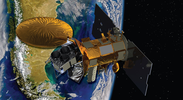
Artist's concept of the Aquarius/SAC-D spacecraft, a collaboration between NASA and Argentina's space agency, with participation from Brazil, Canada, France and Italy. Aquarius, the NASA-built primary instrument on the spacecraft, will take NASA's first space-based measurements of ocean surface salinity, a key missing variable in satellite observations of Earth that links ocean circulation, the global balance of freshwater and climate. The mission is scheduled to launch in June. Image credit: NASA

[/caption]

From a JPL press release:

Final preparations are under way for the June 9 launch of the international Aquarius/SAC-D observatory. The mission’s primary instrument, Aquarius, will study interactions between ocean circulation, the water cycle and climate by measuring ocean surface salinity.

Engineers at Vandenberg Air Force Base in California are performing final tests before mating Aquarius/SAC-D to its Delta II rocket. The mission is a collaboration between NASA and Argentina’s space agency, Comision Nacional de Actividades Espaciales (CONAE), with participation from Brazil, Canada, France and Italy. SAC stands for Satelite de Applicaciones Cientificas. Aquarius was built by NASA’s Jet Propulsion Laboratory in Pasadena, Calif., and the agency’s Goddard Space Flight Center in Greenbelt, Md.

In addition to Aquarius, the observatory carries seven other instruments that will collect environmental data for a wide range of applications, including studies of natural hazards, air quality, land processes and epidemiology.

The mission will make NASA’s first space observations of the concentration of dissolved salt at the ocean surface. Aquarius’ observations will reveal how salinity variations influence ocean circulation, trace the path of freshwater around our planet, and help drive Earth’s climate. The ocean surface constantly exchanges water and heat with Earth’s atmosphere. Approximately 80 percent of the global water cycle that moves freshwater from the ocean to the atmosphere to the land and back to the ocean happens over the ocean.

Salinity plays a key role in these exchanges. By tracking changes in ocean surface salinity, Aquarius will monitor variations in the water cycle caused by evaporation and precipitation over the ocean, river runoff, and the freezing and melting of sea ice.

Salinity also makes seawater denser, causing it to sink, where it becomes part of deep, interconnected ocean currents. This deep ocean “conveyor belt” moves water masses and heat from the tropics to the polar regions, helping to regulate Earth’s climate.

“Salinity is the glue that bonds two major components of Earth’s complex climate system: ocean circulation and the global water cycle,” said Aquarius Principal Investigator Gary Lagerloef of Earth & Space Research in Seattle. “Aquarius will map global variations in salinity in unprecedented detail, leading to new discoveries that will improve our ability to predict future climate.”

Aquarius will measure salinity by sensing microwave emissions from the water’s surface with a radiometer instrument. These emissions can be used to indicate the saltiness of the surface water, after accounting for other environmental factors. Salinity levels in the open ocean vary by only about five parts per thousand, and small changes are important. Aquarius uses advanced technologies to detect changes in salinity as small as about two parts per 10,000, equivalent to a pinch (about one-eighth of a teaspoon) of salt in a gallon of water.

Aquarius will map the entire open ocean every seven days for at least three years from 408 miles (657 kilometers) above Earth. Its measurements will produce monthly estimates of ocean surface salinity with a spatial resolution of 93 miles (150 kilometers). The data will reveal how salinity changes over time and from one part of the ocean to another.

The Aquarius/SAC-D mission continues NASA and CONAE’s 17-year partnership. NASA provided launch vehicles and operations for three SAC satellite missions and science instruments for two.

JPL will manage Aquarius through its commissioning phase and archive mission data. Goddard will manage Aquarius mission operations and process science data. NASA’s Launch Services Program at the agency’s Kennedy Space Center in Florida is managing the launch.

CONAE is providing the SAC-D spacecraft, an optical camera, a thermal camera in collaboration with Canada, a microwave radiometer,; sensors from various Argentine institutions and the mission operations center there. France and Italy are contributing instruments.

See the Aquarius/SAC-D website for more information. , visit:

Atlas Rocket Poised for Blast Off with Advanced Missile Early Warning Spy Satellite

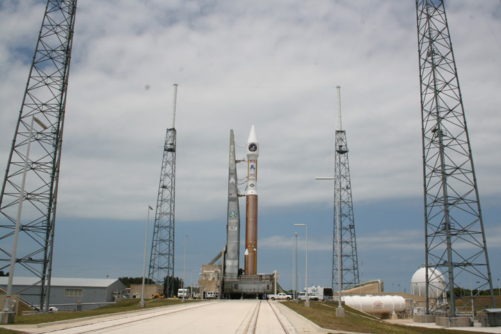
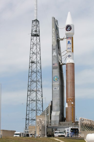
The Atlas V rocket was rolled to the launch pad in support of the Atlas V Space Based Infrared Systems (SBIRS) GEO-1 launch set for Friday at 2:14 p.m. EDT. Credit: Ken Kremer

[/caption]

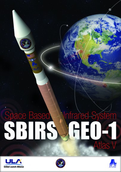
CAPE CANAVERAL – An Atlas V rocket is poised to blast off today, May 6 , with the inaugural version of a new and highly advanced series of US spy satellites which will provide early warning of missile launches to US military forces. The Space Based Infrared Systems (SBIRS) GEO-1 satellite is set to liftoff Friday afternoon at 2:14 p.m. The launch window extends until 2:54 p.m. EDT.

The new satellite for the US Air Force is considered to be one of the highest priority military space programs. Covert intelligence satellites played a key role in hunting down Al Qaida terrorist leader Osama Bin Laden in the recent military strike by US forces inside Pakistan.

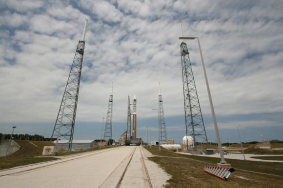
This Atlas V rocket will carry the Space Based Infrared Systems (SBIRS) GEO-1 secret spy satellite to orbit for the US Air Force on May 6, 2011. Credit: Ken Kremer

The Atlas V rocket with a Centaur upper stage was rolled out to the launch pad at Complex 41 on Wednesday morning and arrived at 11 a.m.

Twin track mobiles pushed the rocket and satellite combination about 1800 feet from the launch gantry – known as the Vertical Integration Facility – to the pad. Reporters and photojournalists including myself toured the pad for a photoshoot Wednesday afternoon.

The countdown has begun and clocks are ticking backwards for today’s planned liftoff.

Super-cold liquid oxygen and liquid hydrogen fuel begins to flow into the rocket shortly after noon.

The launch will be webcast by United Launch Alliance at this link:

Weather is the only concern and has deteriorated over the past few days. As of this morning the chances of acceptable weather has dropped to just 30% favorable due to the increasing threat of isolated clouds and rain showers. Weather conditions are currently overcast here in the vicinity of Cape Canaveral and are deteriorating with a good chance of thunderstorms. .

The SBIRS GEO-1 satellite will provide global , persistent, infrared surveillance capability to meet 21st century US military demands in four key areas including missile warning, missile defense, technical intelligence and battle space awareness.

Later this year, Atlas V rockets will launch two high profile NASA Planetary missions to space; the solar powered JUNO Jupiter Orbiter in August and the Mars Curiosity Rover in November.

Beautiful clouds over Launch Complex 41 ahead of SBIRS GEO-1 spy satellite launch. Credit: Ken Kremer

Gravity Probe B Confirms Two of Einstein’s Space-Time Theories

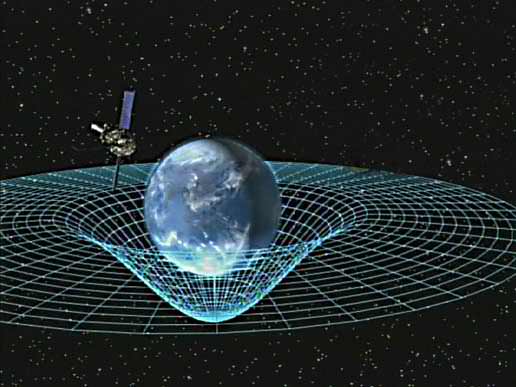
Einstein's predicted geodetic and frame-dragging effects, and the Schiff Equation for calculating them. Credit: Stanford University

[/caption]

Researchers have confirmed two predictions of Albert Einstein’s general theory of relativity, concluding one of NASA’s longest-running projects. The Gravity Probe B experiment used four ultra-precise gyroscopes housed in an Earth-orbiting satellite to measure two aspects of Einstein’s theory about gravity. The first is the geodetic effect, or the warping of space and time around a gravitational body. The second is frame-dragging, which is the amount a spinning object pulls space and time with it as it rotates.

Gravity Probe-B determined both effects with unprecedented precision by pointing at a single star, IM Pegasi, while in a polar orbit around Earth. If gravity did not affect space and time, GP-B’s gyroscopes would point in the same direction forever while in orbit. But in confirmation of Einstein’s theories, the gyroscopes experienced measurable, minute changes in the direction of their spin, while Earth’s gravity pulled at them.

The project as been in the works for 52 years.

The findings are online in the journal Physical Review Letters.

Artist concept of Gravity Probe B orbiting the Earth to measure space-time, a four-dimensional description of the universe including height, width, length, and time. Image credit: NASA

“Imagine the Earth as if it were immersed in honey,”.said Francis Everitt, Gravity Probe-B principal investigator at Stanford University. “As the planet rotates, the honey around it would swirl, and it’s the same with space and time,” “GP-B confirmed two of the most profound predictions of Einstein’s universe, having far-reaching implications across astrophysics research. Likewise, the decades of technological innovation behind the mission will have a lasting legacy on Earth and in space.”

NASA began development of this project starting in the fall of 1963 with initial funding to develop a relativity gyroscope experiment. Subsequent decades of development led to groundbreaking technologies to control environmental disturbances on spacecraft, such as aerodynamic drag, magnetic fields and thermal variations. The mission’s star tracker and gyroscopes were the most precise ever designed and produced.

GP-B completed its data collection operations and was decommissioned in December 2010.

“The mission results will have a long-term impact on the work of theoretical physicists,” said Bill Danchi, senior astrophysicist and program scientist at NASA Headquarters in Washington. “Every future challenge to Einstein’s theories of general relativity will have to seek more precise measurements than the remarkable work GP-B accomplished.”

Innovations enabled by GP-B have been used in GPS technologies that allow airplanes to land unaided. Additional GP-B technologies were applied to NASA’s Cosmic Background Explorer mission, which accurately determined the universe’s background radiation. That measurement is the underpinning of the big-bang theory, and led to the Nobel Prize for NASA physicist John Mather.

The drag-free satellite concept pioneered by GP-B made a number of Earth-observing satellites possible, including NASA’s Gravity Recovery and Climate Experiment and the European Space Agency’s Gravity field and steady-state Ocean Circulation Explorer. These satellites provide the most precise measurements of the shape of the Earth, critical for precise navigation on land and sea, and understanding the relationship between ocean circulation and climate patterns.

GP-B also advanced the frontiers of knowledge and provided a practical training ground for 100 doctoral students and 15 master’s degree candidates at universities across the United States. More than 350 undergraduates and more than four dozen high school students also worked on the project with leading scientists and aerospace engineers from industry and government. One undergraduate student who worked on GP-B became the first female astronaut in space, Sally Ride. Another was Eric Cornell who won the Nobel Prize in Physics in 2001.

“GP-B adds to the knowledge base on relativity in important ways and its positive impact will be felt in the careers of students whose educations were enriched by the project,” said Ed Weiler, associate administrator for the Science Mission Directorate at NASA Headquarters.

Sources: NASA, Stanford University

Satellite Imagery Shows How Tornadoes Slashed Across Alabama, Mississippi

This image shows the path of exposed ground left in the wake of an EF5 tornado in Mississippi. Credit: MODIS Rapid Response Team at NASA GSFC.

[/caption]

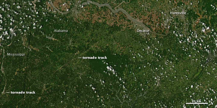
Some extraordinary satellite and radar imagery shows how the deadly tornado supercell slashed through Alabama and Mississippi last week, as in the image above, leaving a gash of exposed ground and destruction that is visible from space. The latest reports indicate fatalities from the outbreak now exceed 342 people, and according to the Washington Post, this is the most people killed by tornadoes in a two-day period since April 5-6, 1936 when 454 people died. The image was taken by the Moderate Resolution Imaging Spectroradiometer (MODIS) on NASA’s Aqua satellite on April 28. See more imagery below.

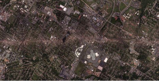
Part of the path of a 12-mile swath of destruction in Alabama from an EF4 tornado on April 27. Click to see the entire swath taken by a NOAA satellite. Credit: NOAA

The National Weather Service said an EF4, with winds around 175 miles per hour, created a 12-mile-long track of destruction. This tornado caused more than 20 deaths.

Radar sequence of tornado supercell thunderstorms that tracked from western Mississippi into southwest North Carolina. Credit: NCAR, Brian Tang.

This image is pretty amazing: it is a radar montage of the supercell showing some of the 150 tornadoes that were reported on April 27 and 28, 2011. This cell traveled about 450 miles and lasted over 8 hours.

This animation from the NASA Earth Observatory team starts on April 26 and runs through the morning of April 28. It shows a relatively stable mass of cold air—visible as a swirl of more-or-less continuous clouds—rotates in the north along the top of the image, and meanwhile, moist air pushes north and west from the Atlantic Ocean and Gulf of Mexico. The two air masses collide and generate severe weather, but the bad weather also was amplified by the jet stream on April 27, which helped generate the lines of intense thunderstorms and tornadoes.

Sources: NASA Earth Observatory, Washington Post, NOAA

Last & Best Chances to See NanoSail-D

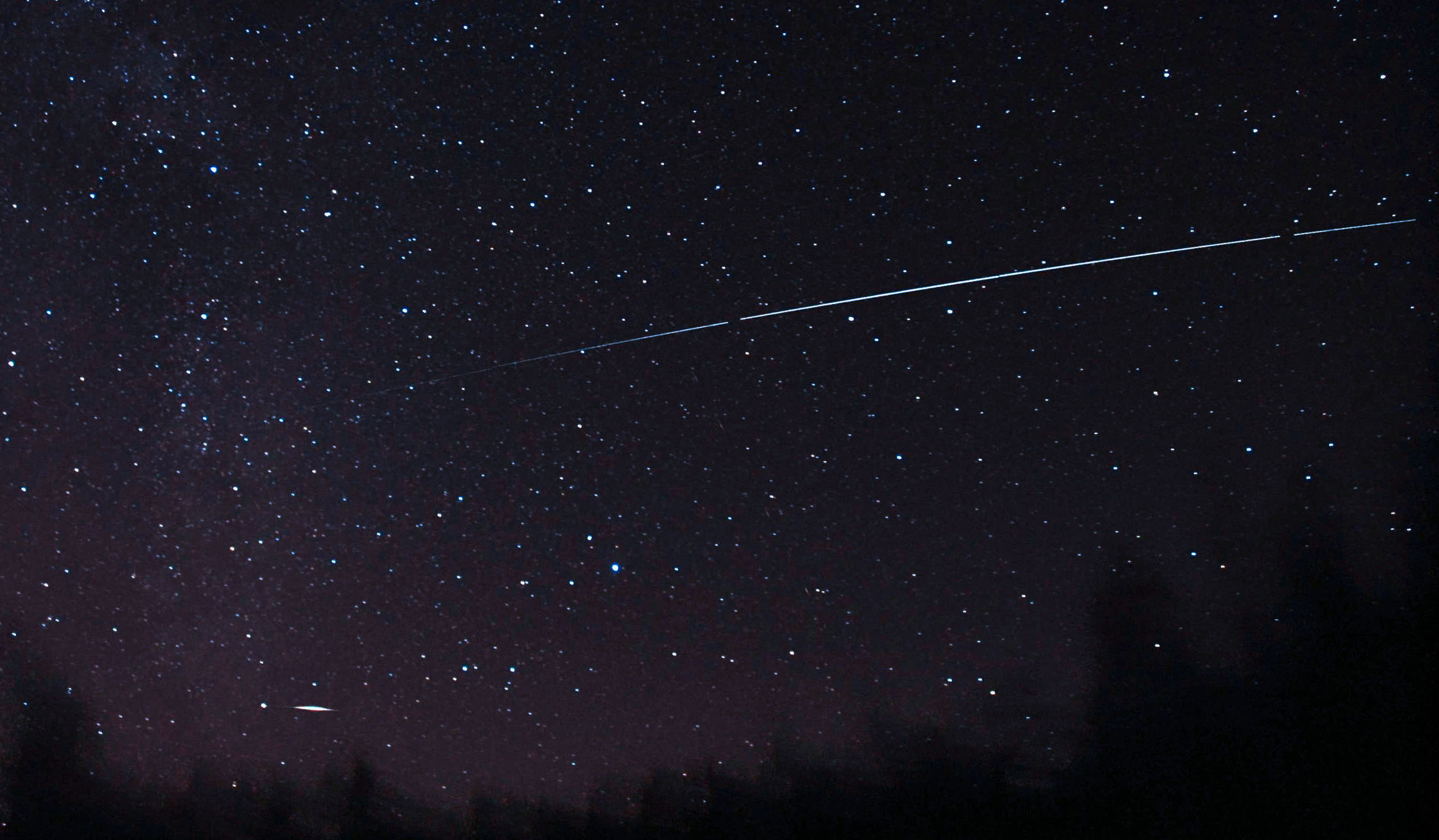
Nanosail-D Pass Credit: Vesa Vauhkonen, Spaceweather.com

[/caption]

Over the next few weeks, skywatchers will have excellent viewing opportunities for the NanoSail-D solar sail.

The satellite is coming to the end of its 95-day mission to test the viability of de-orbiting decommissioned satellites or space debris. NanoSail-D is now de-orbiting and slowly losing altitude in the Earths thin upper atmosphere.

As the satellite descends, viewing opportunities will improve.

To see NanoSail-D pass over, you will need to know exactly when it will be visible from your location. To do this, go to Heavens-above.com or Spaceweather.com where star charts with times and pass details will be displayed after you enter your observing site.

Once you know the time and location in the sky of the pass of the satellite, make sure you are able to get a good view of the part of the sky where the satellite due to appear. Give yourself plenty of time, go outside and get ready. I always set a 30 second reminder on my watch or cell phone, so I don’t have to fumble around or guess the time.

To enjoy the NanoSail-D passes:

• Make sure you know the right place in the sky and the time of the pass, by checking on the web.
• Make sure you will be able to get a clear view of it from your viewing location.
• Set an alarm or get ready for the pass as it only lasts a few seconds.
• NASA expects NanoSail-D to stay in orbit through May 2011.
• If you are an astrophotographer, don’t forget, NASA and SpaceWeather.com are having an imaging contest of NanoSail-D. Find out more here.
• Most of all, get your friends and family outside with you to watch NanoSail-D and enjoy!

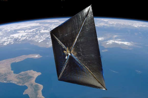
Artist concept of Nanosail-D in Earth orbit. Credit: NASA

Satellite Captures 3-D View of Violent Storms that Ravaged the US on April 27-28

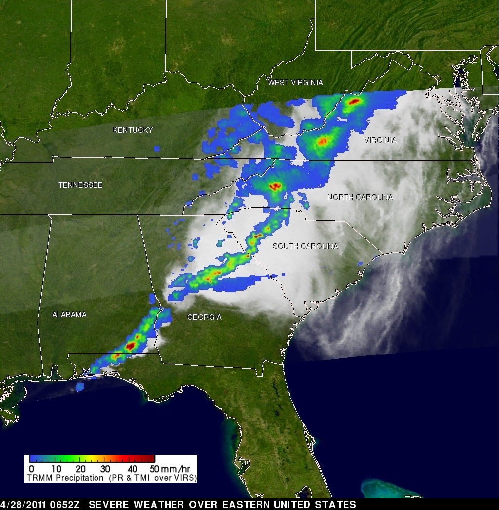
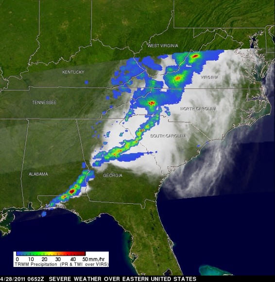
The Tropical Rainfall Measuring Mission satellite captured the rainfall rates occurring in the line of thunderstorms associated with a powerful cold front moving through the eastern U.S. on April 28, 2011. The yellow and green areas indicate moderate rainfall between .78 to 1.57 inches per hour. The very small red areas are heavy rainfall at almost 2 inches (50 mm) per hour. Credit: NASA/SSAI, Hal Pierce

[/caption]

NASA’s Tropical Rainfall Measuring Mission (TRMM) satellite captured 3-D images of severe thunderstorms that were spawning tornadoes over the eastern United States on April 28, detecting massive thunderstorms and very heavy rainfall. Tornadoes associated with this extremely unstable weather left at least 202 dead across the Eastern U.S, with injuries numbering over a thousand.

The Tropical Rainfall Measuring Mission satellite captured the rainfall rates occurring in the line of thunderstorms associated with a powerful cold front moving through the eastern U.S. on April 28, 2011. The yellow and green areas indicate moderate rainfall between .78 to 1.57 inches per hour. The very small red areas are heavy rainfall at almost 2 inches (50 mm) per hour. Credit: NASA/SSAI, Hal Pierce

TRMM flew over the strong cold front and captured data at 0652 UTC (2:52 AM EDT) on April 28, 2011. Most of the rainfall was occurring at moderate rates however, there were pockets of very heavy rainfall in Virginia, North Carolina, South Carolina, Georgia and Alabama where rain was falling at a rate of 2 inches (50 millimeters) per hour.

This TRMM radar vertical cross section shows that some of these violent storms reached to incredible heights of almost 17 km (~10.6 miles). Credit: NASA/SSAI, Hal Pierce

In the image above and the lead animation, TRMM data was used to generate a 3-D look at the storm. TRMM’s Precipitation Radar (PR) data was used by Hal Pierce of SSAI at NASA’s Goddard Space Flight Center in Greenbelt, Md. to create a 3-D structure of those storms. The image Pierce created is a TRMM radar vertical cross section that shows some of these violent storms reached to incredible heights of almost 17 km (~10.6 miles).

TRMM, is the Energizer Bunny of satellites as it keeps going and going. It was launched in 1997 and was scheduled at one time to be decommissioned in 2004. But its systems keep operating and it is has been able to keep gathering useful information on storms and climate. It now has operated well over a decade past its original life expectancy.

TRMM is managed by both NASA and the Japanese Space Agency.

Source: NASA