GOCE Data Close Up: Around the World in Lumpy, Geoidy 3-D

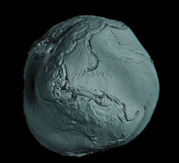
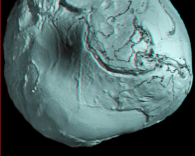
Australia and Asia region of Earth's geoid. Credits: ESA/HPF/DLR, anaglyph by Nathanial Burton-Bradford.

[/caption]

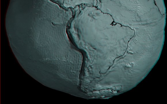
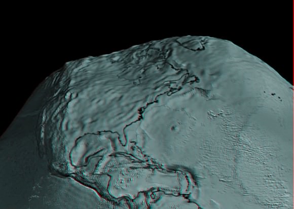
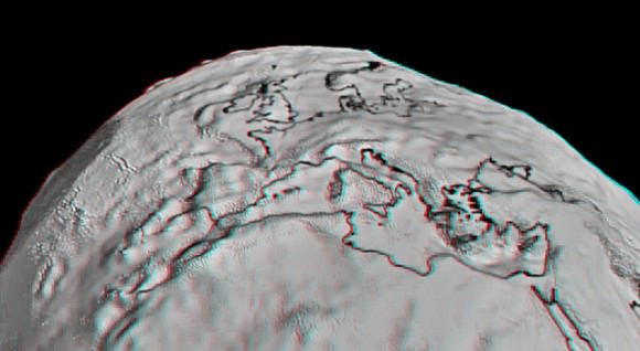
Grab your red/cyan 3-D glasses and take a look at these marvelous new anaglyphs created by Nathanial Burton-Bradford from the latest data from GOCE satellite, showing Earth’s gravity field – or geoid. The geoid is essentially a map of the shape our world would be its surface were covered by water and if gravity were the only thing shaping this global ocean’s surface. These exaggerated views (the surface in the images of the geoid is amplified by a factor 7,000) show the most accurate model of how gravity varies across the planet. Nathanial was able to obtain high-resolution video from Dr. Rune Floberghagen of the GOCE team from which he extracted appropriate frames in order to construct hi-res anaglyph images of numerous longitudes across the globe.

In our previous article about GOCE (Gravity Field and Steady-State Ocean Circulation Explorer), we showed the entire globe and how it looks like a spinning potato. Nathanial’s anaglyphs show close-ups of various parts of the globe. Above is Australia and Asia. Take a trip around the GOCE geoid 3-D world below. Remember, use the red/cyan 3-D glasses to get the full effect!


GOCE view of South America. Credits: ESA/HPF/DLR, anaglyph by Nathanial Burton-Bradford.

GOCE view of the US and Mexico. Credits: ESA/HPF/DLR, anaglyph by Nathanial Burton-Bradford.
GOCE view of Europe. Credits: ESA/HPF/DLR, anaglyph by Nathanial Burton-Bradford.
GOCE view of Africa.. Credits: ESA/HPF/DLR, anaglyph by Nathanial Burton-Bradford.
GOCE global view, 145 East Longitude. Credits: ESA/HPF/DLR, anaglyph by Nathanial Burton-Bradford.
GOCE global view, 140 West Longitude. Credits: ESA/HPF/DLR, anaglyph by Nathanial Burton-Bradford.

Thanks to Nathanial Burton-Bradford for sharing his images. See more at his Flickr page.

Iridium Next Prepares to Ride the Falcon

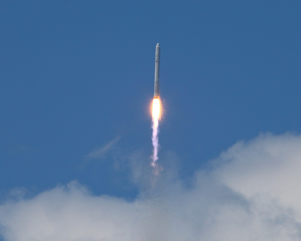
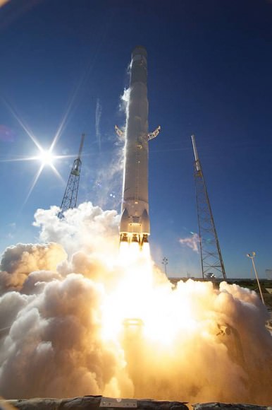
Iridium Next might have launched their last suite of satellites on Deltas, Protons and on the Long March - but the next wave will be all about the Falcon 9. Photo Credit: Alan Walters/awaltersphoto.com

[/caption]

To date, Iridium NEXT is the largest commercial space launch contract with any single entity. All total, the contract is worth an estimated $3 billion. As part of that Iridium Communications Inc. signed into a deal with Space Explorations Technologies (SpaceX) as its major launch provider of its communications satellites on SpaceX’s Falcon 9 rocket. The manner in which the Iridium NEXT family of satellites is launched will be a dramatic departure from how Iridium launched its first suite of satellites back in the 90s.

Iridium launched this first constellation of communications satellites within the time span of a single year, from 1997 until 1998. Iridium sent this constellation into orbit on multiple different launch vehicles. The original deployment was a distinctly international affair, with the U.S. Delta II, the Russian Proton and the Chinese Long March rockets all playing a role in putting the entire fleet of satellites into orbit.

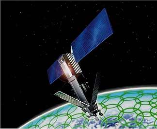
Iridium Communications plans to launch the 72 satellites of the Iridium Next constellation atop eight Falcon 9 rockets. Image Credit: Iridium Communications

This time, only a single launch provider, SpaceX, and their twice-flown Falcon 9 rocket have been given the nod to accomplish the job. They will also complete the planned 72 satellite fleet in only eight launches of nine satellites each. Sixty-six of these satellites will be fully operational; the remaining six will be on-orbit spares (in case there is a contingency with any of the operating satellites). Iridium will also have nine additional ground spares.

But Iridium has plans to further maximize the value of these satellites by selling space on them so that other firms can attach sensors or experiments.

“Every one of these satellites has a budget of about 110 pounds that can be used to fly extra payloads from different customers,” said Iridium’s CEO Matt Desch during a recent interview. “We will be hosting other people’s sensors on our satellites.”

The arrangement between Iridium and the NewSpace firm was just one in a string of successes as far as SpaceX is concerned. With the first two successful flights of the Falcon 9 rocket, the unspoken-but-obvious backing of the White House and the contract with Iridium, SpaceX is on a winning streak that shows little signs of abating. With the second launch of its Falcon 9 rocket, SpaceX became the first company to do what only nations had done before – send a spacecraft into orbit and have it return safely to Earth (the Dragon spacecraft splashed down in the Pacific Ocean a few hours after launch).

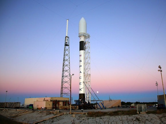
Every Falcon 9 rocket with an Iridium Next payload would carry nine satellites each. Photo Credit: SpaceX

The contract with Iridium Communications is set to see its first launch during the first quarter of 2015. With the system fully financed (as of this past fall) the company now has to build it on orbit. When the constellation of satellites is on orbit it is expected to be functioning for many years to come.

“It was an innovative system that broke all the rules, and now we’re going to do it again,” said Desch. “A lot of people don’t realize what a powerful system we are today. They probably only remember us from 10-15 years ago. We’re going to remind them of who we are and what we are capable of, the replacement system will last until 2030 and what we will do today will last for years to come.”

SpaceX has had two successful launches of its Falcon 9 rocket, the third test flight is currently scheduled to take place this summer. Photo Credit: SpaceX

New Results from GOCE: Earth is a Rotating Potato

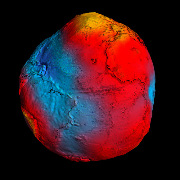
In this GOCE image, gravity is strongest in yellow areas; it is weakest in blue ones. Credit: ESA

Although they aren’t particularly fond of the comparison, scientists from the GOCE satellite team had to admit that new data showing Earth’s gravity field – or geoid — makes our planet look like a rotating potato. After just two years in orbit, ESA’s sleek and sexy GOCE satellite (Gravity Field and Steady-State Ocean Circulation Explorer) has gathered sufficient data to map Earth’s gravity with unrivalled precision. While our world certainly doesn’t look like a spinning tuber, this exaggerated view shows the most accurate model of how gravity varies across the planet.

The geoid is nothing more than how the oceans would vary if there were no other forces besides gravity acting on our planet.

“If we had an homogeneous sphere, it would be a boring sphere,” said GOCE scientist Roland Pail from Technical University in Munich, speaking at the press briefing today. “But due to rotation, you get a flattening of the Earth, and we have topography such as mountains, and irregular mass distribution in Earth’s interior. What we are showing you here, in principle, is the gravity field by any deviations due to inhomogeneous mass distributions on the Earth and the Earth’s interior.”

[/caption]

While a previous gravity satellite, the Gravity Recovery And Climate Experiment (GRACE) operated for 8 years, most of the new data from GOCE was gathered in about 14 months, and provides data where there was none before.

GOCE is able to sense tiny variations in the pull of gravity over Earth, and the data is used to construct an idealized surface, which traces gravity lumps and bumps, and is the shape the oceans would take without winds, currents, Earth’s rotation and other forces.

By comparing sea level and geoid data, GOCE is revealing data on ocean currents and circulation, sea-level change, ice dynamics, said Rory Bingham, from the University of Newcastle, which helps understand heat transport and the changing climate.

But also of interest is how GOCE data reveals shifting tectonic plates in earthquakes and magma movements under volcanoes. Following the earthquakes in Japan, scientists are looking closely, as the data should reveal a three-dimensional view of what was going on inside the Earth. Even though the motion cannot be observed directly from space, earthquakes create signatures in gravity data, which could be used to understand the processes leading to these natural disasters and ultimately help to predict them.

“Even though these quakes resulted from big movements in the Earth, at the altitude of the satellite the signals are very small. But we should still seem them in the data,” said Dr. Johannes Bouman from the German Geodetic Research Institute.

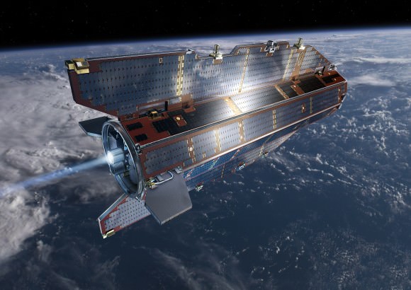
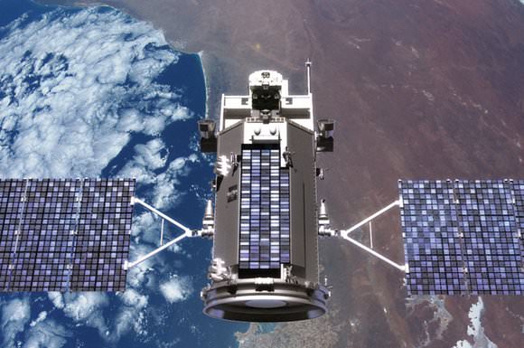
GOCE in orbit. Credit: ESA

“GOCE will give us dynamic topography and circulation patterns of the oceans with unprecedented quality and resolution,” said professor Reiner Rummel, former Head of the Institute for Astronomical and Physical Geodesy at the Technische Universität München. “I am confident that these results will help improve our understanding of the dynamics of world oceans.”

“You could say that, at its early conception, GOCE was more like science fiction,” said Volker Liebig, Director of ESA’s Earth Observation Program. “GOCE has now clearly demonstrated that it is a state-of-the-art mission.”

Sources: GOCE press briefing, ESA press release

From the Earth and Moon (and Russia) With Love

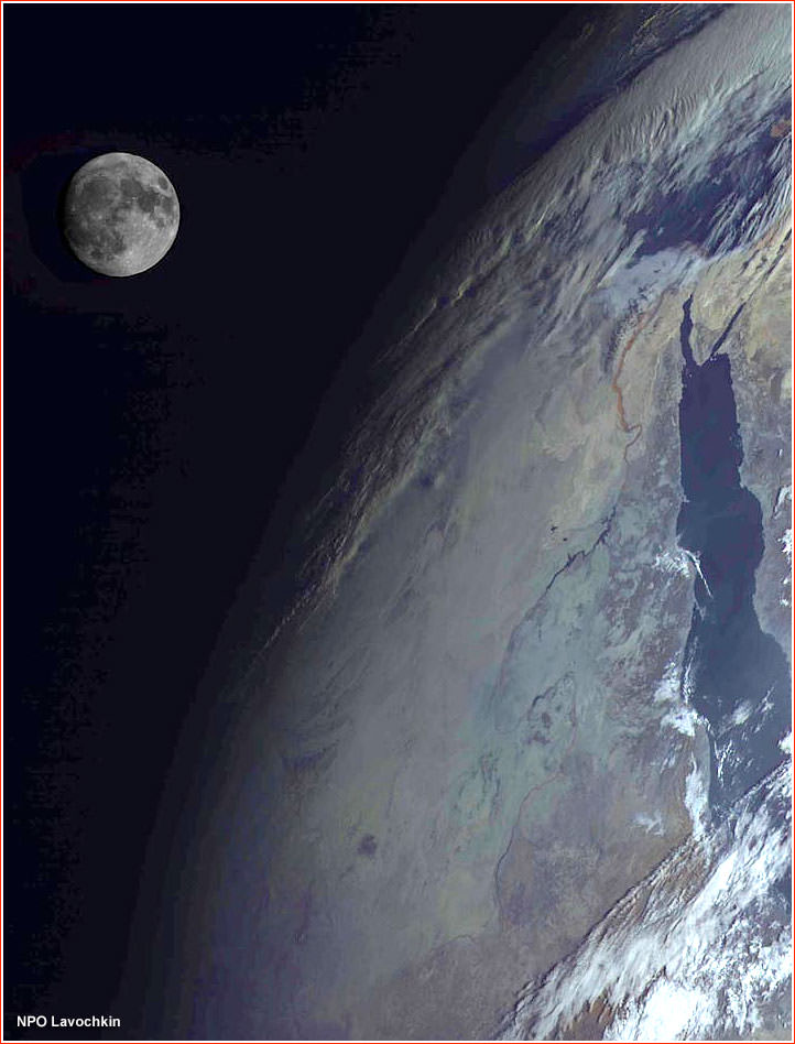
Russia's Elektro-L spacecraft captured this view of the Moon over the Red Sea region of the Earth. Credit: NPO Lavochkin

[/caption]

This stunning picture of the Moon and Earth was taken by Russia’s new Elektro-L spacecraft, a weather-forecasting satellite that launched in January 2011. This is the first major spacecraft developed in post-Soviet Russia, and it is designed to give Russian meteorologists the ability to watch the entire disk of the planet, thanks to the satellite’s position in the geostationary orbit 36,000 kilometers above the equator. The clarity of the images is fantastic, as you can see in another image of just the Earth, below. The Elektro-L is designed to last at least a decade, and will enable local and global weather forecasting, analysis of oceanic conditions, as well as space weather monitoring, such as measurements of solar radiation, properties of Earth’s ionosphere and magnetic field.

On Feb. 26, 2011, at 14:30 Moscow Time, the Elektro-L satellite produced its first breathtaking image of the home planet. Credit: NPO Lavochkin

Learn more about the Elektro-L mission at their website.

h/t: SDO Facebook page.

Spectacular Sunset Launch of new US Spy Satellite

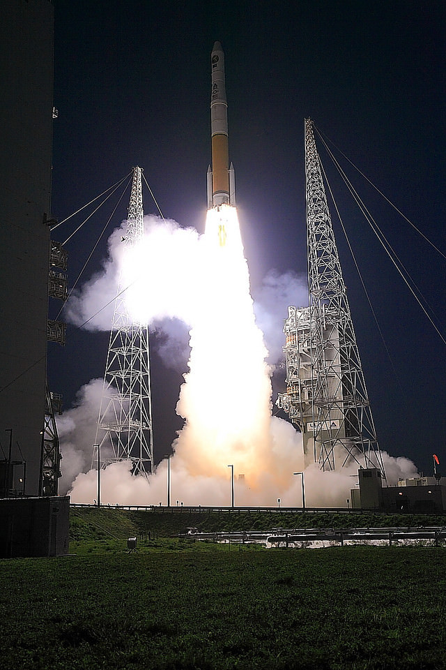
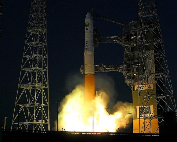
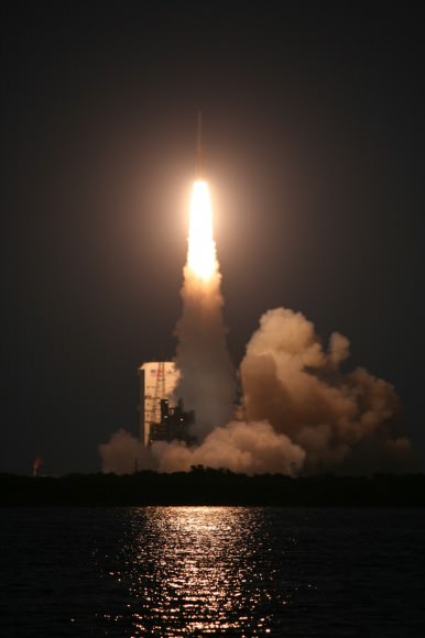
Delta IV blast off with NROL-27 clandestine military payload for the National Reconnaissance Office (NRO) on March 11, 2011 at 6:38 p.m. from Cape Canaveral at Space Launch Complex-37 in Florida. Credit: Alan Walters. awaltersphoto.com. See Delta launch photo gallery below.

[/caption]

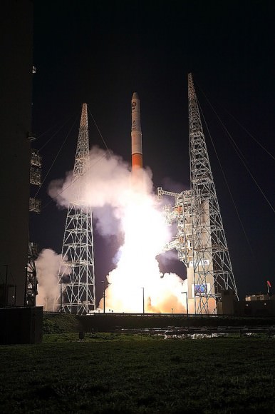
A Delta IV rocket carrying a top secret military payload for the National Reconnaissance Office (NRO) blasted off Friday evening (March 11) at 6:38 p.m. from Cape Canaveral at Space Launch Complex-37 in Florida.

The NROL-27 payload supports the national defense and all information about its mission and goals is a classified military secret. Some outside observers say NROL-27 may be a powerful military communications satellite for relay of vital national security data rather than a signals intelligence satellite.

See our launch photo gallery below from Alan Walters and Ken Kremer

Delta IV blast off with NROL-27 spy satellite on March 11, 2011 from Cape Canaveral launch pad 37. Credit: Alan Walters. awaltersphoto.com
The NRO is located in Chantilly, VA. and charged with the design, construction and operation of the US fleet of intelligence gathering reconnaissance satellites. Their goal is achieving information superiority for the U.S. Government and Armed Forces.

“This mission helps ensure that crucial NRO resources will continue to strengthen our national defense,” said Col James Ross, 45th Space Wing vice commander.
The sunset liftoff into a clear blue sky was visually stunning. With the winds whipping towards our viewing site along the NASA causeway, the roaring rocket thunder was especially loud. Upper level winds threatened to derail the launch. Liftoff was delayed by about 45 minutes due to strong wind gusts which finally calmed to fall within the launch criteria.

“This is the 50th anniversary year of the NRO. NROL-27 is the fifth of six launches for the NRO in the 2010-2011 time period and marks our most aggressive launch schedule in two decades,” said Loretta Desio, NRO spokesperson, in an interview for Universe Today at the viewing site.

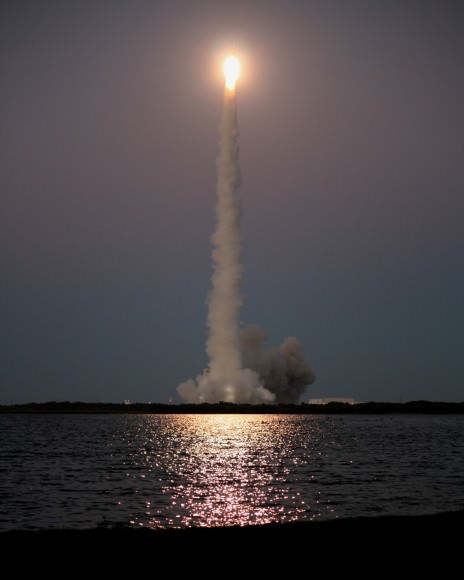
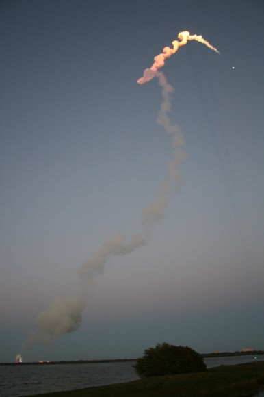
Sunset blastoff of Delta IV with NROL-27 spy satellite on March 11, 2011 from Cape Canaveral launch pad 37. View from the NASA Causeway about 2.7 miles away. Credit: Ken Kremer. kenkremer.com
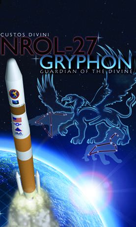
The NROL-27 satellite is named “Gryphon”.

Colors and works in the logo represent the United States Marine Corps, United States Navy, VA Tech, and fallen veterans. Logo symbols represent the United States Air Force, United States Army and two teammates killed on 9/11,” according to ULA spokesperson Chris Chavez.

The unmanned Delta IV rocket was built by United Launch Alliance (ULA) and launched by the 45th Space Wing stationed at Patrick Air Force Base. ULA is a partnership between Lockheed Martin and Boeing.

“The outstanding ULA, NRO and Air Force partnership made yet another successful mission,” said Lt. Col. William Heuck, 5th Space Launch Squadron commander.
NROL-27 was bolted atop the Delta IV rocket in the Medium + (4,2) configuration with a single liquid fueled booster and two small side mounted solid rocket boosters. The Delta IV stands 62.5 meters (205 feet) tall and can launch payloads up to 13.5 tons into low-Earth orbit and 6.6 tons into toward the geosynchronous orbits used by communications satellites.
The flight entered a news blackout after the successful separation of the payload fairing at about four and one half minutes after blastoff. No further information about the satellite will be forthcoming. The 4 meter diameter composite nose cone protects the satellite during ascent through the Earth’s atmosphere.

“I am extremely proud of the entire government and contractor team who supported this launch, said Col. Alan Davis, Director of the Office of Space Launch in the National Reconnaissance Office.

The Delta IV launch occurred just six days after the Atlas V launch of the second Orbital Test Vehicle (OTV-2) — the mini space shuttle on another secret mission. See my Atlas report here.

The Florida Space Coast has seen a surge of rocket launchings in the past month. The Delta IV launch is the last of three successful liftoffs in the past few weeks and follows closely on the heels of the Atlas and the final flight of Space Shuttle Discovery.

Delta IV blasts off with NROL-27 spy satellite on March 11, 2011 from Cape Canaveral launch pad 37. Credit: Alan Walters. awaltersphoto.com
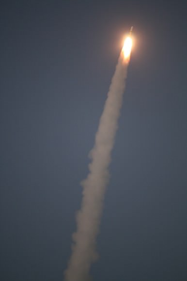
Delta IV arcs away to orbit with NROL-27 spy satellite on March 11, 2011 from Cape Canaveral launch pad 37. View from the NASA Causeway about 2.7 miles away. Credit: Ken Kremer
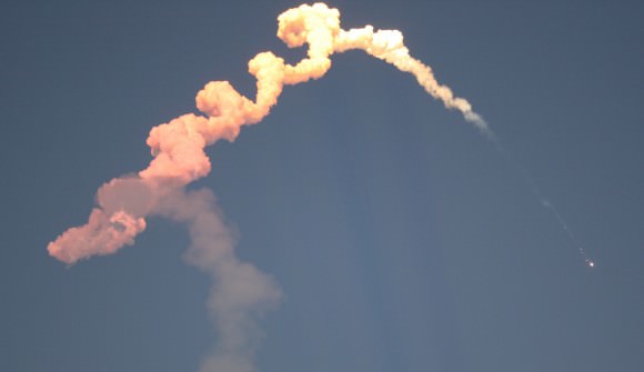
Twin Solid rocket booster separation from Delta rocket 1st Stage occurred at T+plus 1 minute, 42 seconds. Credit: Ken Kremer
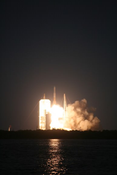
Delta IV blasts off with NROL-27 spy satellite on March 11, 2011 from Cape Canaveral launch pad 37. View from the NASA Causeway. Credit: Ken Kremer
Delta IV blasts off with NROL-27 spy satellite on March 11, 2011 from Cape Canaveral launch pad 37. View from the NASA Causeway about 2.7 miles away. Credit: Ken Kremer
Delta 4 and NROL 27 streak to space. Credit: Ken Kremer
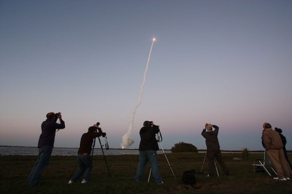
Space Photographers in action including this author, captured at the Delta 4 launch by Spaceflight Now. Photo Credit: Stephen Clark/Spaceflight Now
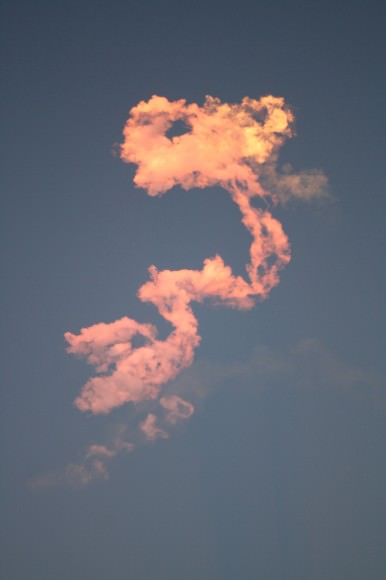
Colorful vapor exhaust trails from Delta 4 launch. Credit: Ken Kremer
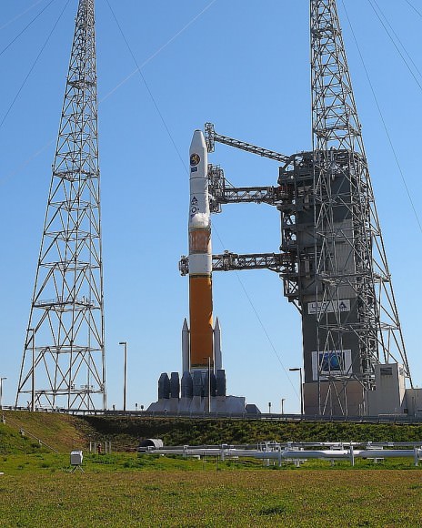
Delta IV prior to launch from Space Launch Complex-37 at Cape Canaveral. Credit: Alan Walters. awaltersphoto.com
Delta 4 NROL-27 mission patch.
Gryphon logo: Colors and works represent the United States Marine Corps, United States Navy, VA Tech, and fallen veterans. Logo symbols represent the United States Air Force, United States Army and two teammates killed on 9/11.
The patch may contain hidden clues about the mission

New Spy Satellite Launches on Covert Mission

A Delta IV rocket blasted off Friday evening from Cape Canaveral launch Complex-37 carrying a secret payload for the National Reconnaissance Office. Called NROL-27, the mission was said to be in support of national defense. This marks the fourth NRO launch accomplished by ULA since Sept. 20, 2010 and occurred just six days after the Atlas V launch of the second Orbital Test Vehicle (OTV-2) — the mini space shuttle on another secret mission.
Continue reading “New Spy Satellite Launches on Covert Mission”

X-37B thunders off the pad on its way to orbit

The United Launch Alliance Atlas V carries the second OTV to orbit. Photo Credit: NASAtech.net

[/caption]
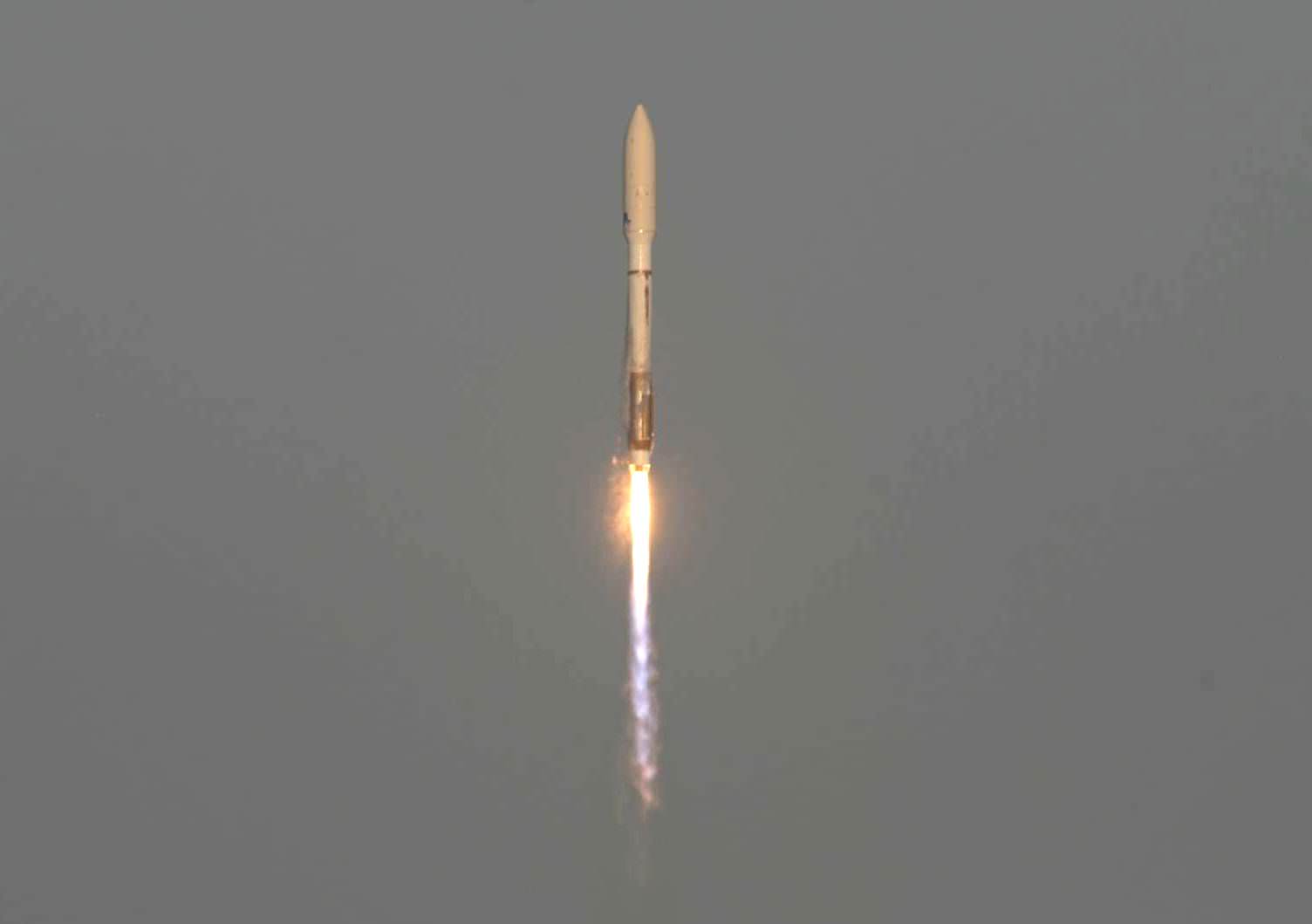
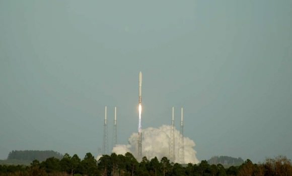
CAPE CANAVERAL – Much has been made about the secretive nature of the Orbital Test Vehicle (OTV). Better known as the X-37B, the second of the U.S. Air Force’s OTVs roared off Cape Canaveral Air Force Station’s Launch Complex 41 at 5: 46 p.m. EDT. The Atlas V 501 thundered off of the launch pad carrying the second of the two OTVs into orbit.

The launch was to take place on Mar. 4, but looming cumulus clouds, high winds and rain pushed the launch back a day. The first launch window today opened at 4:09 p.m. EDT, however technical issues required minor work out on the launch pad and it was decided to try for launch during the second launch window’s opening.

This is the second launch of the mini unmanned X-37B space planes. Photo Credit: Jason Rhian

The first OTV, USA-212 lifted off from the exact same launch pad on 22 April 2010 and returned to Earth on Dec. 3, 2010. The return to earth tested out the space planes heat shield as well as the vehicle’s hypersonic aerodynamic aspects. The space plane is small enough to be carried within the U.S. space shuttle’s payload bay, it landed at Vandenberg Air Force Base in California. The craft suffered a tire blowout upon landing, but landed safely.

“The X-37B is a scientific achievement as well as a tremendous step in space operations. By itself, the ability to put a vehicle in space, conduct experiments and tests for close to nine months and then have that vehicle autonomously de-orbit and land is an important accomplishment,” said Major Tracy Bunko an Air Force spokeswoman. “This gives the Air Force the ability to examine how state-of-the-art, highly complex technologies will perform in space before they are made operational is an important cost-saving, risk-reducing capability.”

U.S. Air Force officials stated that the X-37B program has the potential of making space experiments much more affordable. This would allow future experiment designers to focus their resources and funds on technology and innovation rather than on what they currently are forced to expend them on – basic services, redundancy and ground operations.

X-37B launch delayed due to weather

Poor weather dealyed the launch of the Air Force's Orbital Test Vehicle. Photo Credit: Jason Rhian

[/caption]

CAPE CANAVERAL – Weather delayed the launch of the second of the United States Air Force’s Orbital Test Vehicles (OTV). The X-37B, as it is more commonly known, sate encapsulated within its fairing on top of the Atlas V 501 launch vehicle at Cape Canaveral Air Force Station (CCAFS).

It appeared that the launch might occur at the first launch window, which opened at 3:50 p.m. EDT. However high-level ground winds forced a delay. The second launch window was for 5:27 p.m. EDT, but by this time the winds had increased, Cumulous Clouds had moved into the area – bringing heavy rains in with them, forcing a scrub for the day. The plans are now for a 24-hour recycle of the launch, however tomorrow does not look much better with similar weather threatening the launch.

The first OTV, USA-212 lifted off from the exact same launch pad on 22 April 2010 and returned to Earth on Dec. 3, 2010. The return to earth tested out the space planes heat shield as well as the vehicle’s hypersonic aerodynamic aspects. The space plane is small enough to be carried within the U.S. space shuttle’s payload bay, it landed at Vandenberg Air Force Base in California.

Looming clouds, high winds and eventually rain stopped the launch of the second of the Air Force's OTVs. Photo Credit: Jason Rhian

Weather a concern for second OTV launch

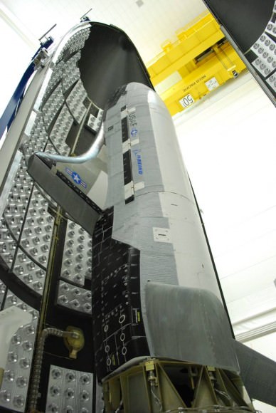
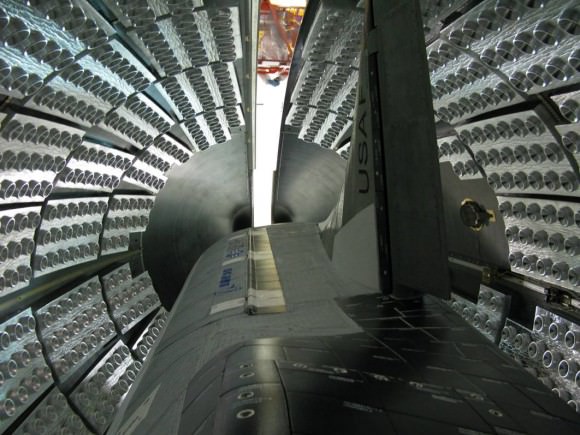
The X-37B (OTV) sits safely cocooned inside its fairing at Cape Canaveral Air Force Station in Florida. Photo Credit: USAF

[/caption]
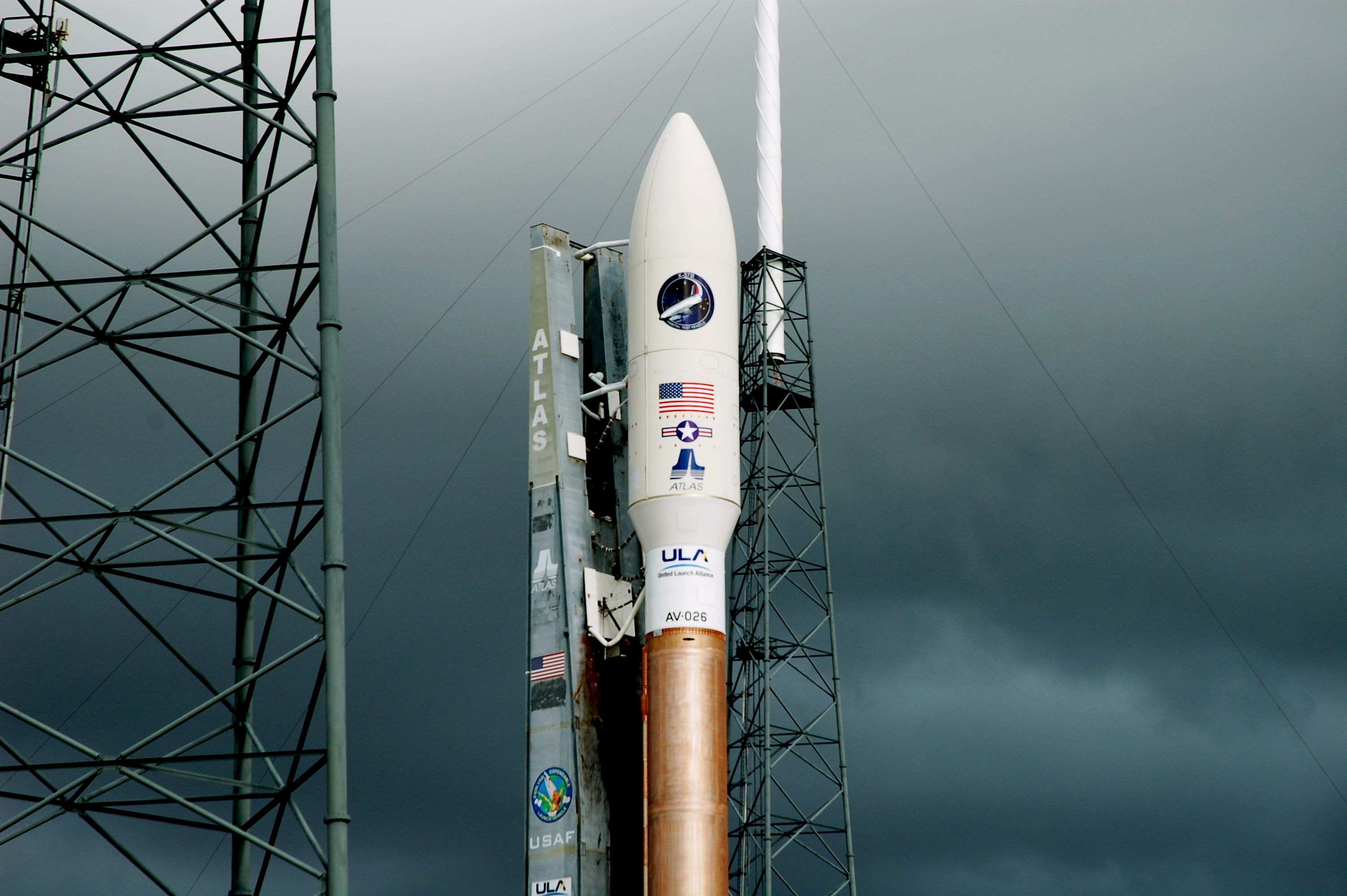
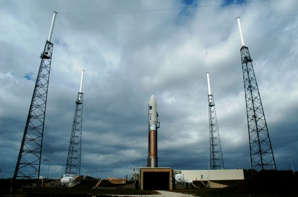
CAPE CANAVERAL – In preparation for the launch of the second of the U.S. Air Force’s Orbital Test Vehicles (OTV), the Air Force has released images of the OTV being encapsulated within the fairing that goes on top of the Atlas V AV-026 launch vehicle. Currently, the launch is scheduled to take place on Friday, March 4. The launch window is between 3:39 p.m. EDT and 5:39 p.m. EDT.

UPDATE: Due to weather concerns, the launch has been postponed until Saturday, March 5. Weather is predicted to improve to 40% favorable for launch.

The X-37B OTV is carefully sealed within its fairing. This then is hoisted to the top of the Atlas launch vehicle. Photo Credit: USAF

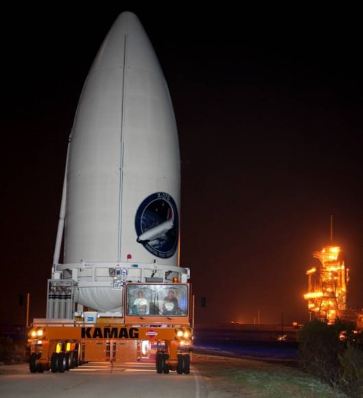
The tiny X-37B space plane is better known as the X-37B. The small spacecraft was designed to fit within the payload bay of the space shuttle. It currently is inside the Atlas’ 5-meter fairing. This is what is known as the X-37B Orbital Test Vehicle encapsulated assembly or EA. The EA being hoisted to the top of the rocket is one of the last major assembly endeavors before launch.

The X-37B, its nose pointed skyward is sealed inside its fairing. Photo Credit: USAF

The EA arrived at Cape Canaveral Air Force Station’s Space Launch Complex 41 (SLC-41) on Feb. 21. Currently weather conditions provide for a 70 percent chance of unfavorable conditions for launch. The primary causes for concern are gusty winds and Cumulus Clouds.

With the lights from a distant launch pad providing illumination the X-37B's EA trundles to its launch pad. Photo Credit: USAF

‘Climate Change Satellite’ Gets its Day in the Sun — Finally

Artist concept of the Glory spacecraft in Earth orbit. Credit: NASA Goddard Space Flight Center

[/caption]

NASA is launching an Earth-orbiting satellite called Glory tomorrow that will tackle a highly charged question: How much can the sun contribute to climate change?

The lull in solar activity between solar cycles 23 and 24 lasted for two years, twice as long as expected. By mid-2009, well into the second year, predictions of global cooling — another Little Ice Age — dominated global warming skeptic blogs. Now Solar Cycle 24 is safely underway, but aside from the dramatic flare and rash of sunspots that erupted last week, it’s been wimpy. Tom Woods, a solar physicist at the Boulder, Colo.-based Laboratory for Atmospheric and Space Physics, says he expects a subdued maximum for Solar Cycle 24 (around 2013) and generally, weak solar cycles come in threes. Each known set of sluggish solar cycles in the past has coincided with bitterly cold winters in parts of the globe — especially Europe and North America.

The question is, with the level of greenhouse gases in the atmosphere from the burning of fossil fuels, would we even feel an extended solar minimum? That’s exactly what Glory will aim to find out.

Glory will launch shortly after 2 a.m. local time on Wednesday, Feb. 23 from the Vandenberg Air Force Base north of Santa Barbara, Calif. The six-foot (1.9 meter), 1,100-pound (525 kg) satellite will orbit for at least three years in Earth’s upper atmosphere, where it will monitor both the total solar energy that’s reaching Earth, and the airborne aerosols greeting the energy it when it gets here.

Aerosols include salt, mineral dust, soot, and smoke and come from a variety of sources – such as vehicle exhaust, campfires, volcanoes and even desert winds and sea spray. They can influence climate by absorbing and scattering light, and NASA scientists have said the range of uncertainty about their role in climate change is far greater than any doubt about greenhouse gases from fossil fuels. Raytheon’s Aerosol Polarimetry Sensor, an instrument mounted on the Earth-facing side of the spacecraft, will observe the movement of aerosols through the atmosphere over time, especially on a seasonal scale.

Glory’s sun-facing side will sport the Total Irradiance Monitor, which will measure the intensity of solar radiation at the top of Earth’s atmosphere, adding to a 32-year data set, to record the solar radiation reaching Earth.

Watch a short video on the data: Solar Variability and Total Solar Irradiance (LASP)

Four solar irradiance instruments are currently flying, including VIRGO, launched in 1995, and SORCE, sent into orbit in 2003. Three of those, though, have long exceeded their designed mission lifetimes and are deteriorating. The European PICARD mission, launched in 2010, and NASA’s Glory mission are the new guard.

Greg Kopp, a researcher also at the Laboratory for Atmospheric and Space Physics, is principal investigator on the Glory mission. He says the existing data has already helped researchers understand variations on the scale of the sun’s 11-year activity cycles. But in order to capture longer trends, observations must continue. And solar researchers are increasingly eager to quantify the sun’s role, given the global importance of the question.

“I’m fond of saying we should get closer to the votersphere,” says Daniel Baker, director of Boulder’s Laboratory for Atmospheric and Space Physics. “I can think of no problem that is more significant to humanity than understanding climate change.”

Follow the mission:

On Feb. 23, NASA TV coverage of the countdown will begin at 3:30 a.m. EST (12:30 a.m. PST). Liftoff is targeted for 5:09:43 a.m. EST (2:09:43 a.m. PST). Spacecraft separation from the Taurus occurs 13 minutes after launch. The briefings and launch coverage also will be streamed online.

Launch coverage of Glory countdown activities will appear on NASA’s launch blog starting at 3:30 a.m. EST (12:30 a.m. PST). Real-time updates of countdown milestones as well as streaming video clips highlighting launch preparations and liftoff will also be available.

See also NASA’s Glory page and the Laboratory for Atmospheric and Space Physics, at the University of Colorado at Boulder.