The Methane Released From the Damaged Nord Stream Pipeline is Visible From Space

On September 20, 2022 a GHGSat satellite observed the area of the Nordstream pipeline break, and saw an estimated emission rate of methane of 79,000 kg per hour – making it the largest methane leak ever detected by GHGSat from a single point-source. Credit: GHGSat and ESA.

On September 26, 2022, leaks were discovered in the underwater Nord Stream 1 and 2 gas pipelines, located near Denmark and Sweden. Both pipelines are owned by Russia and were built to transport natural gas from Russia to Germany through the Baltic Sea. Officials have said the leaks were caused by deliberate action, not accidents, and were likely intentional sabotage. While accusations have abounded, the motives behind the damage are not yet known.

Seismic disturbances in the Baltic Sea were detected, and officials said that while neither pipeline was transporting gas at the time of the blasts, they still contained pressurized methane, which is the main component of natural gas. The methane has now spewed out, producing a wide stream of bubbles on the sea surface which are visible from various satellites in Earth orbit.

Continue reading “The Methane Released From the Damaged Nord Stream Pipeline is Visible From Space”

Gaze Down Into the eye of Hurricane Ian, Seen From Orbit

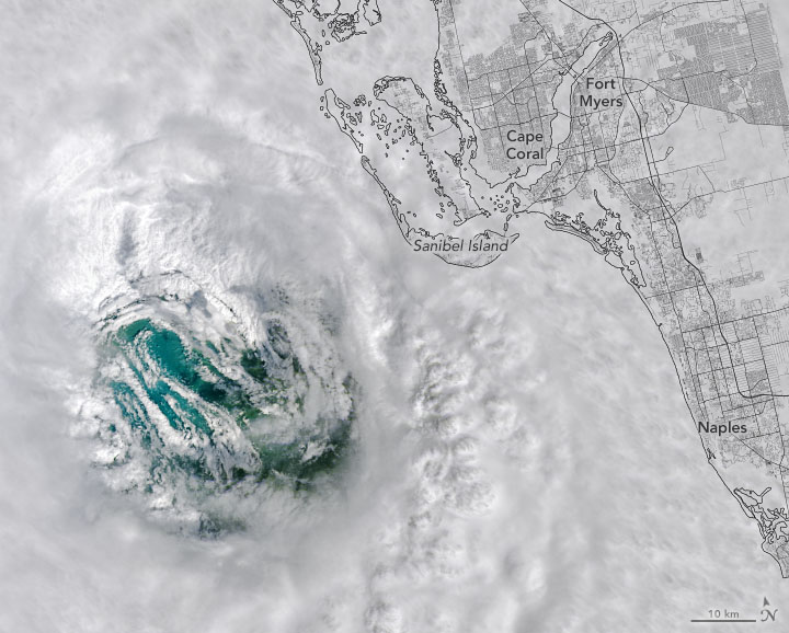
On September 28, the Landsat 8 satellite passed directly over Ian’s eye as the storm approached southwest Florida. Credit: US Geological Survey.

NASA and NOAA satellites — as well as astronauts on the ISS — captured some stunning imagery of Hurricane Ian, as seen from orbit. Our lead image shows an eerie view of the hurricane’s eye on September 28. The Landsat 8 satellite passed directly over Ian’s eye as the storm approached southwest Florida.

Continue reading “Gaze Down Into the eye of Hurricane Ian, Seen From Orbit”

Companies Will Have Five Years to Dispose of Their Dead Satellites

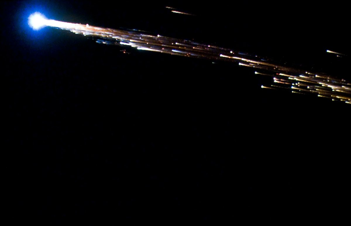
Kessler syndrome seems to be a growing fear for those interested in space exploration. The condition where numerous non-functional pieces of junk block access to orbit appears to be inching closer to reality, spurred on by weekly news reports of dozens of more satellites launching that will eventually become precisely that kind of obsolete space junk. But that won’t happen if the US’s Federal Communications Commission (FCC) has anything to do with it – a new rule the commission adopted will require companies to deorbit their unused satellites in less than five years after decommissioning.

Continue reading “Companies Will Have Five Years to Dispose of Their Dead Satellites”

NASA is Building a Mission That Will Refuel and Repair Satellites in Orbit

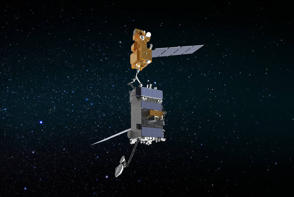
Illustration of OSAM-1 (bottom) grappling Landsat 7. This servicing mission concept was discontinued by NASA, but remains a good example of what's needed to perform repairs and refuelling to orbiting spacecraft. Credits: NASA

NASA is planning a mission to demonstrate the ability to repair and upgrade satellites in Earth orbit. The mission, called OSAM-1 (On-orbit Servicing, Assembly, and Manufacturing-1), will send a robotic spacecraft equipped with robotic arms and all the tools and equipment needed to fix, refuel or extend satellites’ lifespans, even if those satellites were not designed to be serviced on orbit.

Continue reading “NASA is Building a Mission That Will Refuel and Repair Satellites in Orbit”

Antarctica Lost an Ice Shelf, but Gained an Island

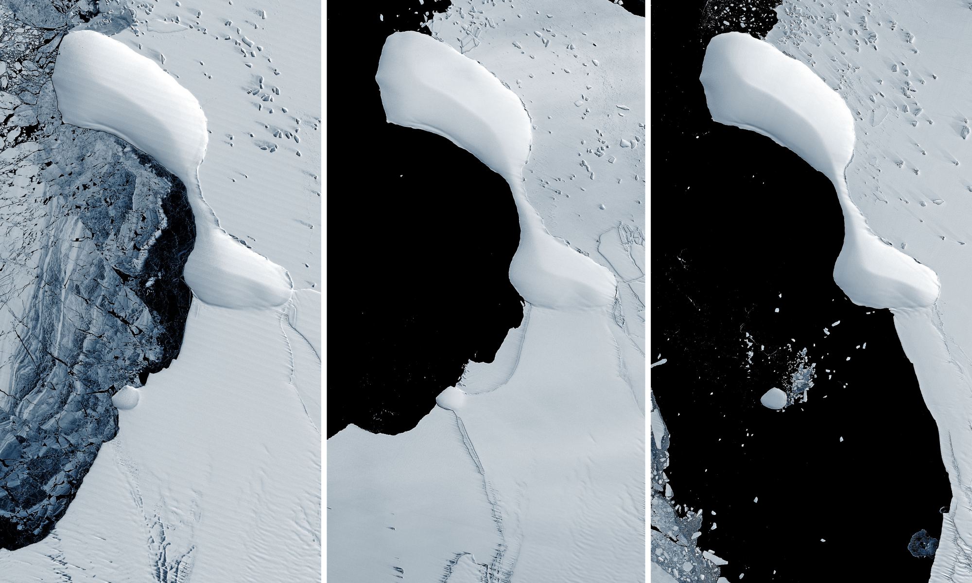
The eastern coast of Antarctica has lost most of the Glenzer and Conger ice shelves, as seen in these satellite images taken between November 15, 1989 - January 9, 2022. Credit: NASA GSFC/UMBC JCET.

Collapsing ice shelves on the eastern coast of Antarctica has revealed something never seen before: a landform that might be an island. But this is not the first newly revealed island off the Antarctic coast. A series of islands have appeared as the ice shelves along the continent’s coastline has disintegrated over the past few years.

Continue reading “Antarctica Lost an Ice Shelf, but Gained an Island”

Starlink is the Only Communications Link for Some Ukrainian Towns, but the Terminals Could Also be a Target

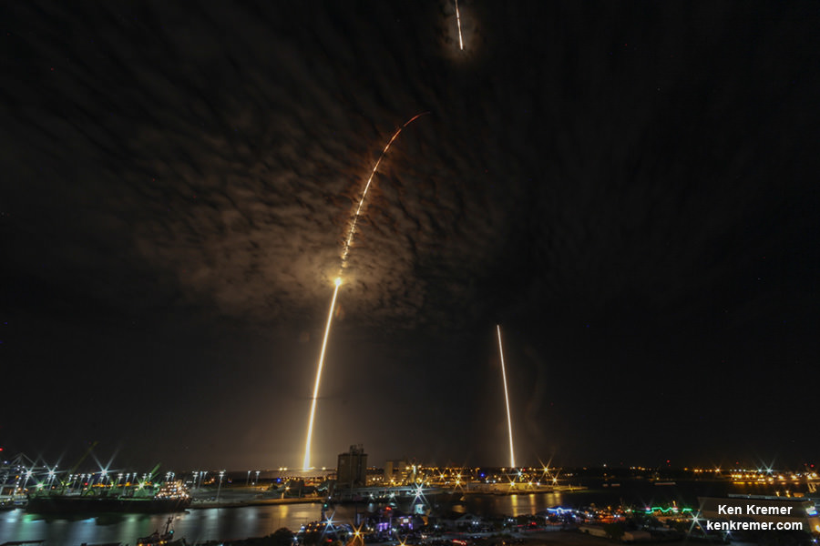
A team of engineers from the University of Glasgow and the Ukraine have created an engine that could cut costs by "eating itself". Credit: Ken Kremer/kenkremer.com

Russia’s invasion of Ukraine has led to an outpouring of support and material aid from the international community. For his part, Elon Musk obliged Ukrainian Vice Prime Minister Mykhailo Fedorov‘s request for assistance by sending free Starlink terminals to Ukraine. For some besieged communities, like the city of Mariupol, this service constitutes the only means of getting up-to-date information, communicating with family members, or sharing their stories from the front lines of the war.

Mykhailo Fedorov, Ukraine’s Vice Prime Minister and its Minister of Digital Transformation, thanked Musk on Twitter for the devices. However, there is also the possibility that as the fighting continues, Starlink transmissions could become beacons for Russian airstrikes. John Scott-Railton, a senior researcher with The Citizen Lab (University of Toronto), pointed out this potential danger via Twitter and even recommended strategies for how this can be avoided.

Continue reading “Starlink is the Only Communications Link for Some Ukrainian Towns, but the Terminals Could Also be a Target”

What Would a Sustainable Space Environment Look Like?

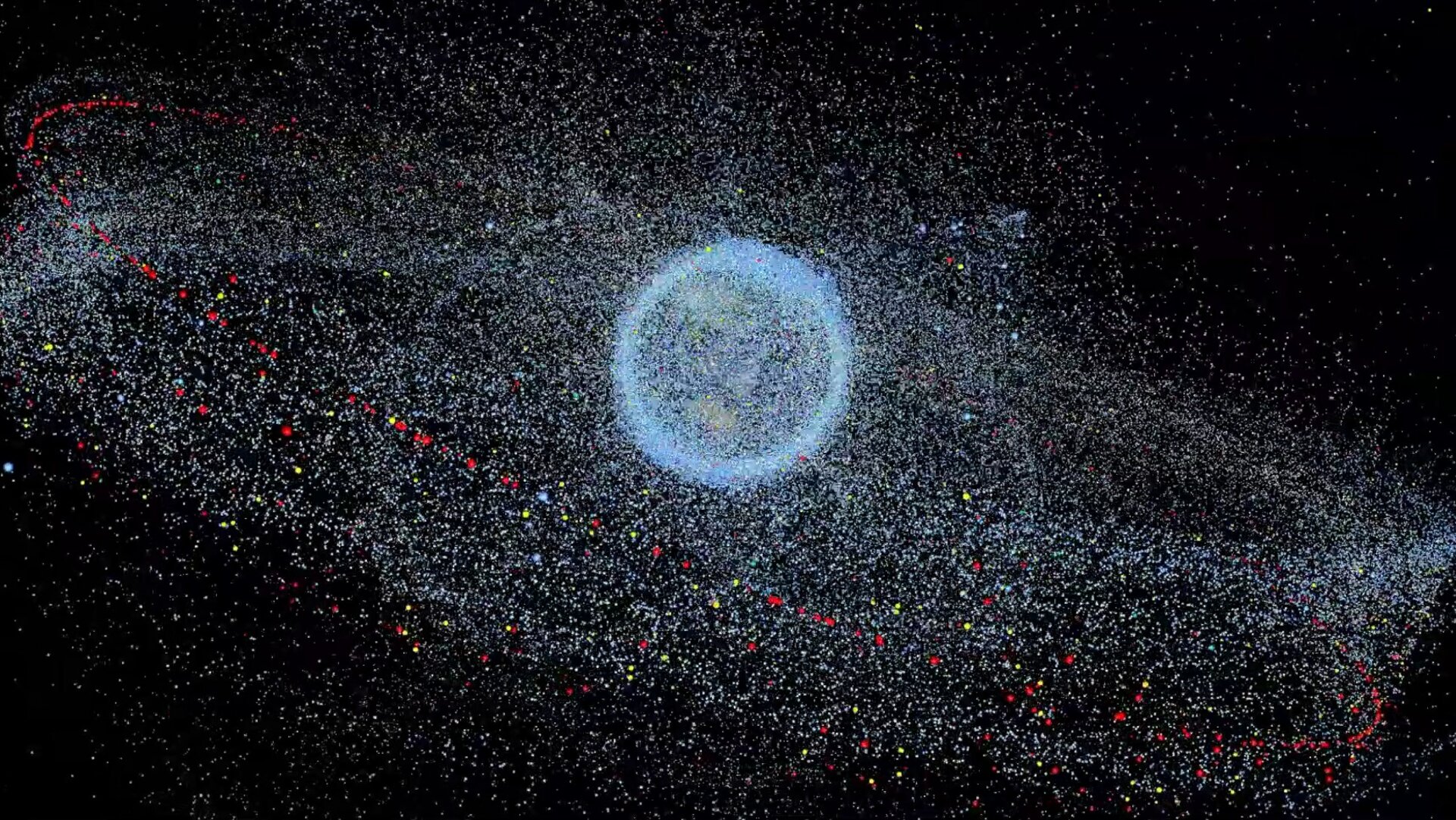
A map of space debris orbiting Earth. Credit: European Space Agency

October 4th, 2022, will be an auspicious day as humanity celebrates the 65th anniversary of the beginning of the Space Age. It all began in 1957 with the launch of the Soviet satellite Sputnik-1, the first artificial satellite ever sent to orbit. Since that time, about 8,900 satellites have been launched from more than 40 countries worldwide. This has led to growing concerns about space debris and the hazard it represents to future constellations, spacecraft, and even habitats in Low Earth Orbit (LEO).

This has led to many proposed solutions for cleaning up “space junk,” as well as satellite designs that would allow them to deorbit and burn up. Alas, there are still questions about whether a planet surrounded by mega-constellations is sustainable over the long term. A recent study by James A. Blake, a research fellow with the University of Warwick, examined the evolution of the debris environment in LEO and assessed if future space operations can be conducted sustainably.

Continue reading “What Would a Sustainable Space Environment Look Like?”

Ukrainians urge satellites to publicly share real-time images of the Russian invasion

On the morning of February 24th, after years of proxy conflict in the border region, Russia invaded the neighboring country of Ukraine. This invasion was the culmination of eight years of conflict that began with the removal of Ukrainian President Viktor Yanukovych (a long-time ally of Russian President Vladimir Putin) and Russia’s subsequent annexation of Crimea. This invasion has prompted the global community to mobilize and find ways to support Ukraine!

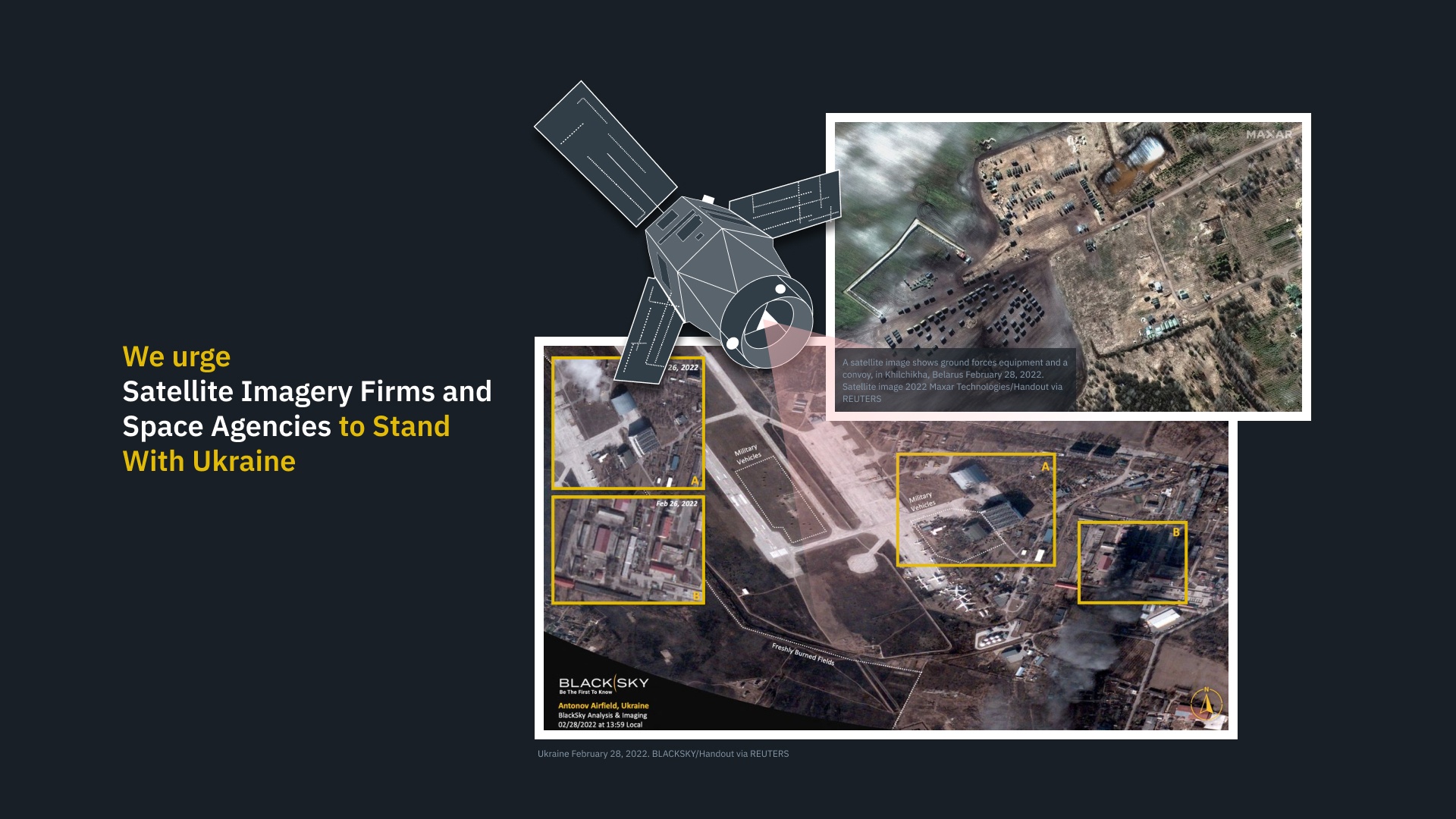
For instance, you have Earth Observatory System Data Analytics (EOSDA), a California-based “all-in-one cloud workspace” for Earth observation solutions. In a recent statement, EOSDA CEO Max Polyakov appealed to satellite imagery firms and space agencies worldwide to share their recent and real-time high-to-medium resolution optical and radar satellite imagery with EOSDA to assist military and humanitarian aid efforts in the region.

Continue reading “Ukrainians urge satellites to publicly share real-time images of the Russian invasion”

Stunning Photos from Air, Space and Ground of the Atlas V GOES-T Launch

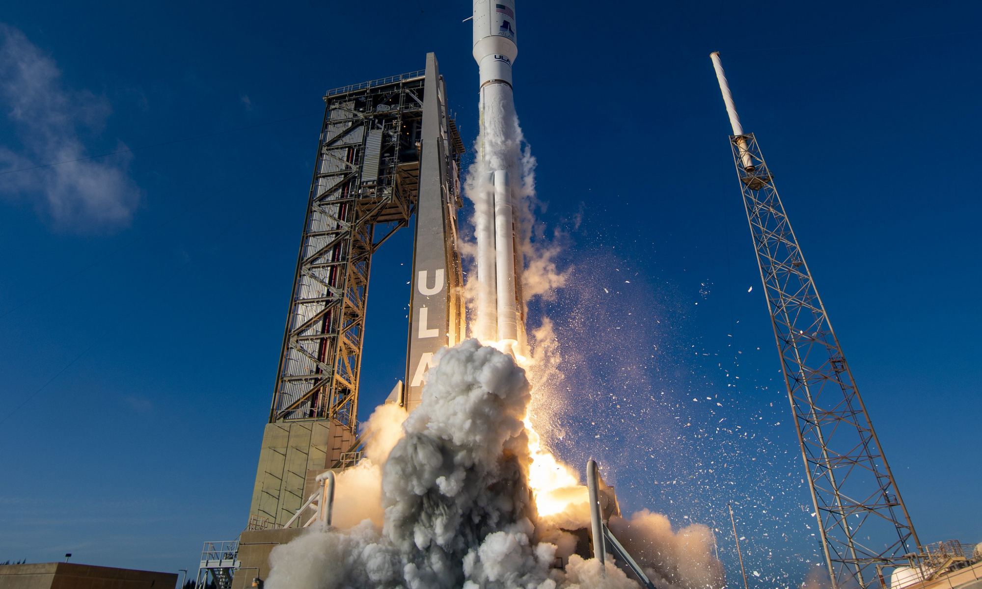
A United Launch Alliance (ULA) Atlas V rocket carrying NOAA's GOES-T satellite, launching for NASA's Launch Services Program, lifts off from from Space Launch Complex-41 at 4:38 p.m. EST on March 1, 2022. Photo Credit: United Launch Alliance

NASA and NOAA now have a sophisticated new weather satellite in space. The GOES-T satellite launched on the powerful United Launch Alliance (ULA) Atlas V rocket on March 1, and it will provide forecasters with high resolution weather imagery. It will also provide real-time monitoring of events on the ground like wildfires, floods and landslides, while monitoring atmospheric and climate dynamics over the Western US and Pacific Ocean.

The liftoff from Cape Canaveral Space Force Station of GOES-T (Geostationary Operational Environmental Satellite-T) provided stunning views, and incredibly, other satellites looked down and captured the launch of the new satellite from space, such as this shot from its older sibling, GOES-16:

Continue reading “Stunning Photos from Air, Space and Ground of the Atlas V GOES-T Launch”

Europe’s ExoMars Rover Will Likely Miss This Year’s Launch Window Because of Russia’s Invasion of Ukraine

Artist's impression of ESA’s ExoMars rover (foreground) and Russia’s stationary surface science platform (background) on the surface of Mars. Artist's impression of ESA’s ExoMars rover (foreground) and Russia’s stationary surface science platform (background) on the surface of Mars. Credit: ESA/ATG medialab

As countries around the world respond to Russia’s invasion of Ukraine with sanctions aimed at crippling Moscow and Vladimir Putin, the global cooperation in space exploration that has been forged over the past 30-plus years will certainly be impacted.

Continue reading “Europe’s ExoMars Rover Will Likely Miss This Year’s Launch Window Because of Russia’s Invasion of Ukraine”