ESA’s CryoSat is Ready for Launch

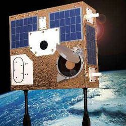
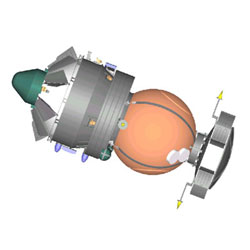
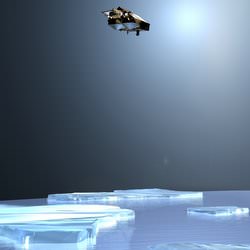
Artist’s illustration of Cryosat. Image credit: ESA. Click to enlarge.
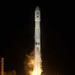
The expectations of ice researchers across Europe are currently focused on a region of taiga woodland in Russia’s far north. Located in a forest clearing is Pad LC133 of Plesetsk Cosmodrome, where above the tree-line on a Rockot launcher stands ESA’s CryoSat satellite, due to start its flight into orbit this Saturday at 17:02 CEST.

The first of ESA’s Earth Explorer series – missions tailored to respond to particular needs of the Earth science community – CryoSat will use a specialised radar altimeter to measure changes in land and sea ice thickness over a three-year period, to provide a precise picture of how the Polar Regions are responding to climate change.

The generation of radar altimeters currently flying on satellites including ERS-2 and Envisat have made a large contribution to our knowledge of the mass balance of Greenland and Antarctic ice sheets, but they cannot return reliable data from the ice edge, where the rate of change is greatest. Similarly, over the ocean their resolution is insufficient to detect the majority of individual pack ice pieces. The design of CryoSat’s new SAR Interferometric Radar Altimeter (SIRAL) has been optimised to close these data gaps.

Many European ice specialists have played a part in the preparation for the mission, either through participation in the CryoSat Science Advisory Group, taking part in extensive in-situ calibration and validation activities in the Arctic and Antarctic, or preparing processing algorithms to turn raw altimetry results into usable information products. And whether or not they have made such direct contributions, researchers are eagerly awaiting the unique results CryoSat will return.

“Summer Arctic sea ice is shrinking ? but is it thinning?”
Dr Seymour Laxon of the Centre for Polar Modelling (CPOM) at University College London has been part of the mission with the start ? working closely with Lead Investigator Professor Duncan Wingham from the original mission proposal to ESA onwards.

“At that time we had just managed to extract the first plausible sea ice thickness maps from the radar altimeter on ESA’s ERS,” Dr. Laxon remembers. “Coupled with Duncan’s experience in mapping the ice sheets, ESA’s Earth Explorer Opportunity programme seemed like a great chance for us to build on what we had learned from the earlier ESA missions to design a mission that was really focused on altimetry over ice.”

A period of concentrated effort followed, as findings from past exploratory studies, and the latest results from ERS, were converted into a proposal for a new mission that could better those results.

“I vividly remember the selection procedure, with Duncan reporting back at each selection stage that CryoSat was still in the running,” Dr. Laxon adds. “I don’t think either of us were quite ready to hear the news that CryoSat was the first to be selected.

“At that point we both realised that the real work, to build a complete mission scenario from scratch, had started. Now everything is in place, the satellite sitting on top of its launcher, the processing system for the data, and plans for the post-launch validation campaign. Now we are just looking forward to seeing the very first data.”

In terms of his own area of interest, it is the sea ice data that Dr. Laxon is most looking forward to: “The most exciting thing for me is the prospect of seeing the first maps of sea ice thickness from CryoSat. We have not seen estimates of Arctic sea ice thickness around the North Pole since the last submarine data from 1999 were declassified.”

“Back then, analysis of this data suggested that a significant ? up to 40% – thinning had occurred since the 1960s, with the largest thinning around the pole. The big question is whether that thinning has reversed or continued as we have entered the new century.”

“That question has gained even more impetus since the news that the extent of summer ice in the Arctic has reached a record minimum this year. But has it also thinned? That’s the crucial question to which CryoSat will provide the answer.”

Opening a new window on the Poles
Professor Chris Rapley is Director of the Cambridge-based British Antarctic Survey and is also Chair of the Planning Group for the forthcoming International Polar Year, which will take place in 2007-8, during the time CryoSat will be carrying out its ice thickness survey. He has had a long involvement with radar altimetry over ice.

Prof. Rapley states: “I was deeply involved in the preparations for the ESA ERS and Envisat altimeters, and led or contributed to a substantial series of studies commissioned by ESA to explore the use of satellite radar altimeters over polar land ice and sea ice, and the technical advances required in instruments, data processing and analysis software to achieve useful scientific results.”

That activity included work on designing and implementing the UK-based ERS processing and archiving facility and the ESA altimeter data processing chain and associated software. Prof. Rapley also worked on design studies for more advanced altimeters along CryoSat’s lines.

A past member of ESA’s Earth Observation Advisory Committee (ESAC), Prof. Rapley was also involved in reviewing the CryoSat proposal and its adoption as an ESA Earth Explorer.

“What I am looking forward to is the best measure yet of the Antarctic and Greenland ice sheet mass balance,” Prof. Rapley adds. “CryoSat should also open a new window on the nature, geographic distribution and the seasonal/systematic behaviour of Antarctic and Arctic sea ice.”

“We can add ice thickness to our models”
Direct in-situ observations of land and sea ice have been necessary to establish that the CryoSat sensor will indeed ‘see’ as anticipated, and quantify residual geophysical uncertainties. As a member of ESA’s CryoSat Cal/Val Team, Dr. Christian Haas of the Alfred Wegener Institute in Bremerhaven coordinates German activities in this area.

“I lead the German CryoSat office,” says Dr. Haas. “It is the main interface between German users and scientists involved in Cryosat and ESA. We are also raising money in Germany for work with CryoSat.

“I am also coordinating the sea ice validation work in the Arctic and Antarctic. We at the Alfred Wegener Institute are the only group able to measure sea ice thickness directly, by helicopter-borne electromagnetic measurements with our EM-bird sensor. We have conducted the CryoVex (CryoSat Validation Exercise) campaign in 2003 and this year’s Bay of Bothnia campaign.”

As a geophysicist, Dr. Haas has been working with sophisticated software models of sea ice. Results from CryoSat will be used to first to check these models, then later be directly ingested within them to bring them closer to reality. The satellite’s ice thickness data in particular should literally add a new dimension to their representation of polar sea ice.

“As a scientist I am interested in using CryoSat data for validating our sea ice models, and combining the data with other met-ocean data to better understand the variability of sea ice thickness,” Haas explains. “We also want to assimilate sea ice thickness into our models.”

After CryoSat’s launch comes a further validation campaign, to compare the results from space to the reality on ground, as Haas adds: “I am looking forward to the validation of the satellite, and the opportunity of extending our airborne measurements laterally by means of the satellite.

Is Antarctic land ice growing or shrinking?
Other researchers, such as Dr. Massimo Frezzotti of Italy’s National Agency for New Technologies, Energy and the Environment (ENEA) in Rome hope to use the new satellite’s results to improve their knowledge of ice sheets on land.

Dr. Frezzotti has carried out in-situ studies of the Antarctic ice sheet between the Italian base of Terra Nova Bay on the shores of the Ross Sea and the new Franco-Italian Concordia base high on the Antarctic Plateau some 1200 kilometres inland. He also makes use of altimetry results in his research.

“I already use ERS altimeter data to study the influence of wind erosion on surface mass balance,” Dr. Frezzotti explains. “Previous altimeters are not able to provide a detailed model of the coastal areas, which are a very crucial area for mass balance studies. CryoSat will partially cover this gap.”

Satellite altimetry observations over the ocean have established a steady rise in global sea level of an average 0.3 millimetres a year. What is not known ? yet ? is how changes in polar ice thickness may be contributing to this trend.

“The Antarctic ice sheet contains sufficient ice to raise worldwide sea level by more than 60 metres if melted completely,” Dr. Frezzotti adds. “The amount of snow deposited annually on its surface is equivalent to five or six millimetres of global sea level. Thus the ice sheet could be a major source of water for the present-day rise in sea level, but the uncertainty is still large.

“Despite all available measurements of snow accumulation, ice velocity, surface and basal melting and iceberg discharge, it is still not known for certain even whether the ice sheet is growing or shrinking.” CryoSat should remedy this state of affairs.

Determining CryoSat’s orbit will improve its results
The Department of Earth Observation and Space Systems (DEOS) of the Delft University of Technology has an interest in the precise orbit determination (POD) of radar altimeter satellites. Because altimetry is based on the principle that time equals distance ? measuring how long it takes for a radar pulse to travel back from the Earth’s surface to the spacecraft – more exact knowledge of the satellite’s location at any one time greatly improves the quality and accuracy of the final data.

CryoSat has two onboard instruments for sharpening orbital estimates from a matter of metres down to a maximum three centimetres ? the Doppler Orbitography and Radiopositioning Integrated by Satellite (DORIS) radio receiver and a Laser Retro-reflector (LRR). Both these devices are found on a number of different satellites, and work based on global networks of radio transmitters and laser stations.

In addition a satellite trajectory prediction model will be created by DEOS to forecast how CryoSat’s orbit will be perturbed by the slight pressure of sunlight and the drag of the upper atmosphere as well as gravitational tugs from terrestrial gravity field anomalies as well as the influence of the tides, other planets and our Sun.

“We will determine CryoSat’s orbit, but in addition we will also perform cal/val activities for its SIRAL instrument, particularly in the Low-Rate Mode (LRM) over the open ocean and inland ice sheets,” said Dr. Ernst Schrama. “Comparing LRM sea surface results to in-situ buoys and tidal gauges should enable a means of externally validating LRM results.?

“We will also add CryoSat data to our Radar Altimeter Database System (RADS) compiled from other current as well as past altimeter missions. The database will be used to inter-compare the performance of SIRAL against other altimeters.”

Beyond improving the quality of CryoSat results, RADS also represents a scientific resource in its own right, which provides a continuous set of sea level measurements of constant quality. RADS can be used for scientific and operational oceanography as well as detecting slight variations in the Earth’s gravity field to infer its interior structure.

Original Source: ESA News Release

Delta Launches New GPS Satellite

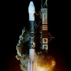
Boeing Delta II rocket launching new GPS satellite. Image credit: Boeing. Click to enlarge.
A Boeing [NYSE: BA] Delta II launch vehicle today successfully delivered the first of the modernized Block IIR Global Positioning System (GPS) satellites to space for the U.S. Air Force.

The Delta II rocket carrying the GPS IIR-14 (M) spacecraft lifted off from Space Launch Complex 17A at Cape Canaveral Air Force Station, Fla., yesterday at 11:37 p.m. EDT. Following a nominal 24-minute flight, the rocket deployed the satellite to a transfer orbit.

“We are honored to be the United States Air Force’s choice to launch the GPS satellites and proud to have delivered the first modernized spacecraft to its targeted orbit. Tonight’s success is a direct result of the hard work and dedication of Boeing’s Delta team,” said Dan Collins, vice president, Boeing Expendable Launch Systems.

The Boeing Delta II 7925-9.5 configuration vehicle used for this mission featured a Boeing first stage booster powered by a Pratt & Whitney Rocketdyne RS-27A main engine and nine Alliant Techsystems (ATK) solid rocket boosters. An Aerojet AJ10-118K engine powered the storable propellant restartable second stage. A Thiokol Star-48B solid rocket motor propelled the third stage prior to spacecraft deployment. The rocket also flew with a nine-and-a-half-foot diameter Boeing payload fairing.

A redundant inertial flight control assembly built by L3 Communications Space & Navigation provided guidance and control for the rocket that enabled a precise deployment of the satellite.

The GPS IIR-14 (M) mission also marked the 100th flight of the Delta II using the ATK 40-inch diameter version solid rocket motors.

Boeing provides launches for the GPS program aboard Delta II vehicles and has a planned GPS manifest through at least 2007.

The GPS network supports U.S. military operations conducted from aircraft, ships, land vehicles and by ground personnel. Additional use includes mapping, aerial refueling and rendezvous, geodetic surveys, and search and rescue operations.

GPS provides military and civilian users three-dimensional position location data in longitude, latitude and elevation as well as precise time and velocity. The satellites orbit the earth every 12 hours, emitting continuous navigation signals. The signals are so accurate, time can be figured to within one millionth of a second, velocity within a fraction of a mile-per-second and location to within 100 feet.

The new GPS IIR-14 (M) is the first of the modernized GPS satellites that incorporates various improvements to provide greater accuracy, increased resistance to interference and enhanced performance for users.

A unit of The Boeing Company, Boeing Integrated Defense Systems is one of the world’s largest space and defense businesses. Headquartered in St. Louis, Boeing Integrated Defense Systems is a $30.5 billion business. It provides network-centric system solutions to its global military, government and commercial customers. It is a leading provider of intelligence, surveillance and reconnaissance systems; the world’s largest military aircraft manufacturer; the world’s largest satellite manufacturer and a leading provider of space-based communications; the primary systems integrator for U.S. missile defense; NASA’s largest contractor; and a global leader in sustainment solutions and launch services.

Original Source: Boeing News Release

Tiny Satellite Could Make a Big Difference

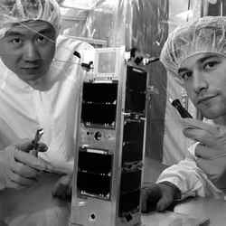
Prof. Robert Zee and Eric Caillibot put final touches on CanX-2. Image credit: U of T Click to enlarge
A 3.5- kilogram satellite that could revolutionize the space industry was unveiled Aug. 31 at U of T?s Institute for Aerospace Studies (UTIAS).

The Canadian Advanced Nanospace eXperiment 2 (CanX-2) satellite, which appears as unassuming as a shoebox, will pave the way for a wave of mini-satellites that are more effective and less expensive.

CanX-2 is the brainchild of graduate students and staff. Professor Robert Zee, manager of the institute?s space flight laboratory (SFL) and the CanX-2 team leader, said the point of the satellite mission is two-fold.

?The first is to provide complete development cycle training for students through a mission that has to be complete in two years,? Zee said. ?The second is to launch a tiny research platform into space to test innovative, revolutionary technologies in a rapid, risk-taking manner and also to perform important science missions that are now benefiting from the availability of smaller and smaller instrumentation.?

Set to launch next year, CanX-2 will test small, low-power devices such as a mini-spectrometer designed to measure greenhouse gases. Its primary goal is to lay the groundwork for flying formations of two similar but more advanced satellites.

These satellites, CanX-4 and CanX-5, will demonstrate technology that could eventually find large, expensive satellites replaced by groups of smaller, cheaper collaborating satellites. CanX-4 and CanX-5 are scheduled for launch in 2008.

?What we?re trying to prove here is that spacecraft don?t have to be huge and clunky to achieve the best results,? said Zee, who added that the price tag for the CanX-2 and two following missions is only $1 million, compared with hundreds of millions of dollars for a traditional satellite mission.

?These nanosatellites and the tiny technologies that we?re launching into space represent a paradigm shift in the way we think about and execute space missions.?

For students such as Daniel Kekez the chance to work on a real space mission is priceless. ?I?ve spent the past two years going from designs and calculations to building and testing hardware and software that will fly and operate in space,? Kekez said. ?This kind of experience would take years to obtain for an engineer starting out in industry. It?s simply fantastic!?

CanX-2 is the second nanosatellite mission at UTIAS/SFL. CanX-1, Canada?s first nanosatellite and one of the smallest satellites ever built, was launched with the MOST microsatellite in 2003 by Eurockot Launch Services from Plesetsk, Russia

Original Sourse: U of T News Release

Largest Communications Satellite Launched

Ariane 5G launcher lifting off. Image credit: ESA/CNES/Arianespace Click to enlarge
This morning an Ariane 5G launcher lifted off from Europe?s Spaceport in French Guiana. On board was the largest telecommunications satellite ever to be placed into geostationary transfer orbit.

The mission was initially delayed during the two-hour-long launch window to verify telemetry readings from Ariane 5’s mobile launch table, and the countdown subsequently resumed for an early morning takeoff from the ELA-3 launch zone.
The heavyweight THAICOM 4 (IPSTAR) satellite had a lift-off mass of almost 6500 kg. Before this morning?s launch, the record for the heaviest telecommunications satellite to be placed into orbit belonged to the Anik F2 satellite, launched by an Ariane 5 launcher in July 2004.

THAICOM 4, built for Shin Satellite Plc of Thailand, will provide businesses and consumers throughout Asia, Australia and New Zealand with various levels of Internet access services. The satellite has a total data throughput capacity of over 45 Gbps. This is the fourth Shin Satellite to be launched by an Ariane vehicle. An Ariane 4 vehicle launched the first satellite in 1993.

The next launch to take place from Europe?s Spaceport will be Flight 168, an Ariane 5G dual launch mission scheduled for 29 September

Original Source: ESA Portal

Canada’s Humble Space Telescope

Artist illustration of Canada’s Most Telescope. Image credit: MOST. Click to enlarge.
Canada’s first space telescope, MOST, looks for minute variations in the brightness of nearby stars. As Jaymie Matthews, of the University of British Columbia, explains in this talk given at a recent symposium on extrasolar planets, MOST can provide scientists with a unique perspective on how distant worlds interact with their host stars.

I’d like to describe a powerful new small instrument in space called MOST, which stands for Microvariability and Oscillations of Stars (and because it’s Canadian, it stands for Microvariabilit? et Oscillations Stellaire as well). MOST is Canada’s first space telescope. It is literally a suitcase in space: 60 by 60 by 30 centimeters (24 by 24 by 12 inches), 54 kilos, about 124 pounds. I weigh more than the MOST satellite; I think I’m the only mission scientists that out-masses his space satellite. And you can check it on the plane; they can lose it for you.

MOST was actually designed to do seismology of stars, to probe the interiors and histories of stars. That’s relevant to the exoplanets search, because the more we know about parent stars, the more we know about their planetary systems. But we realized, once MOST was underway, that we could actually do some additional exciting things in the exoplanet field. One of the things that MOST can do that nobody else can do at the moment is to stare at stars for up to 2 months at a time, putting stars on a stakeout, to detect variations in the brightnesses of stars or the brightnesses of the planets orbiting those stars, down to a level of 1 part per million, 1 ten-thousandth of a percent.

Just to emphasize to you how small that is, if you were to go to New York City and look at the Empire State Building at night, all the lights were on, all the office window blinds were open and you wanted to make the Empire State Building darker by 1 part per million, you would lower one shade by 3 centimeters, by a little more than an inch. That’s the level of signal that we are looking for in stars. And there is no other instrument on Earth or in space right now that’s capable of doing this. And I should point out that this whole mission has an end-to-end budget of $10 million Canadian, or $7 million US. So we’re the Wal-Mart of space telescopes.

MOST has a unique vantage point in space. It has a very different orbit from the Hubble Space Telescope, or from Spitzer, a pole-to-pole orbit. We communicate with it with our own little custom ground-station network in Toronto, Vancouver and Vienna, and we got into that orbit on the top of a former Soviet Intercontinental Ballistic Missile. A honest-to-goodness weapon of mass destruction. So not only did we put up a scientific instrument, but we destroyed a weapon of mass destruction in the bargain. MOST launched from northern Russia on June 30, 2003, so we’re approaching our second anniversary in space.

Being able to give a star that kind of intense long-term coverage is really important for astronomers to understand what’s going on in systems that have exoplanets. To give an analogy, we’re trying to read the messages that stars and exoplanets are telling us, but from the ground, we only get part of that message. If you have a network of telescopes on the ground, spread in a longitude, you can start to fill in some of the gaps, you can start to recognize some things that look like words. If you have some theories and expectations ahead of time, you might be able to infer a bit of the story, but you could very well get the completely wrong story if you’ve made the wrong assumptions. Having this kind of continuous coverage of a star allows us to really see what stars are doing, and in the case of exoplanets systems, what the exoplanets around them are doing.

MOST is primarily intended to study very tiny variations in stars’ output light. We’re trying to put our own Sun in context by looking at other sunlike stars, looking at some of the senior citizens our galactic city, trying to put some limits on the age of the universe. But the point that’s most important for us today is the fact that MOST also does exoplanet science. What we are looking for is reflected light, the same kind of wavelengths that you see with your eye, from close-in giant planets that have become known as hot Jupiters.

We’re not an exoplanets hunter. We’re too small a telescope to have a statistical chance of finding new planets. We would have to be very lucky. But we are an exoplanet explorer. We take advantage of the work of Drs. Mayor and Brown, and Geoff Marcy, and other groups, who find the planets with their Doppler surveys, and then we can go in and take a closer look. We’ve examined 3 known exoplanet systems already, Tau Bootis, HD 209458 – the telephone-book numbers that astronomers love for stars – and 51 Pegasi, the very first exoplanet around a normal star, which Dr. Mayor and his colleague, Didier Queloz, discovered 10 years ago.

When we looked at Tau Bootis, in a trial run last year, for 11 days, continuously, we saw a signal that very closely matched the planet’s orbital period. But it was far too large to be associated with the planet. It’s about .25 percent, and this is almost certainly originating in the star itself. Tau Bootis, the star, is far more active and variable than we imagined. And we’ve now been able to combine the Doppler data with the data from MOST and the light cures line up, beautifully. The star’s brightness is varying with exactly the same period as the planet orbiting around it.

We’re accustomed to bodies tidally locking each other through their gravitational influence if they’re close enough. The Earth has locked the Moon into a rotation period related to its orbit, so the Moon always keeps the same face to us. We’re convinced that these exoplanets close to their parent stars are tidally locked, so that they always keep one face to the star. But it’s almost counter-intuitive, like the tail wagging the dog, that a planet should be able to tidally lock the star. Now, in this case, it’s probably not locking the entire star, but rather its outer envelope, but there may be a kind of a spot complex, like a super-sunspot, on the surface of Tau Bootis, which has been somehow triggered by the influence of the planet, Tau Bootis b, and tracks it in its orbit. This was suspected by some of the ground-based data, but MOST has been able to confirm that these things are in perfect lockstep.

The good news is that we’re learning a lot about the star that we didn’t know before, and maybe about the interactions between the planet and the star. Possibly their magnetic fields are interacting. Usually rapidly rotating stars are young, but we don’t really know anything about the age of Tau Bootis other than information based on its rotation rate and its activity. It’s hard for us to tell: Is it genuinely young, or maybe it’s an older star, and when the planet migrated in the star was spun up and rejuvenated, kind of going through a second childhood. The bad news is that this stellar activity is going to make it hard to see reflected light from the planet, although we’re not going to give up on that, and we’re going to continue to observe Tau Bootis.

Original Source: NASA Astrobiology

Cluster Spacecraft Give Each Other Some Room

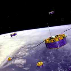
An artist’s impression of the Cluster quartet. Image credit: ESA. Click to enlarge
The four spacecraft of ESA?s Cluster fleet have reached their greatest distance from each other in the course of their mission to study Earth?s magnetosphere in three dimensions.

This operation, marking the fifth anniversary of Cluster in space, transforms Cluster in the first ?multi-scale? mission ever.
In one of the most complex manoeuvres ever conducted by ESA spacecraft, three of the spacecraft were separated to 10 000 kilometres from each other, with the fourth spacecraft at 1000 kilometres from the third one.

This new fleet formation for Cluster was achieved in two months of operations. The repositioning of the satellites was started by mission controllers at ESA’s European Space Operations Centre (ESOC), in Darmstadt, Germany, on 26 May, and was run until 14 July.

During the course of the mission, the distance between the Cluster satellites had already changed five times, in a range between 100 and 5000 kilometres. Varying the size – but not the shape – of the Cluster ?constellation? had allowed Cluster to examine Earth?s magnetosphere at different scales.

But now this new ?asymmetric? flying formation is allowing the Cluster spacecraft to make measurements of medium- and large-scale phenomena simultaneously, transforming Cluster in the first ever ?multi-scale? mission.

With this, it is possible to study at the same time the link between small-scale kinetic processes of the plasma around Earth and the large-scale morphology of the magnetosphere.

The knowledge gained by Cluster about the magnetosphere ? the natural magnetic shield that surrounds and protects our planet ? has already helped advance our understanding of how the solar wind affects Earth?s natural space environment.

This is also important in our daily life as, for instance, intense solar activity can disrupt terrestrial communication networks, power grids and data lines.

Original Source: ESA Portal

Sloan Digital Sky Survey, Part II

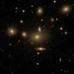
NGC 5919 is a member of a galaxy cluster Abel 2063. Image credit: SDSS. Click to enlarge.
Dr. Richard Kron, director of the Sloan Digital Sky Survey, announced a new undertaking that will complete the largest survey of the universe. This survey will add new partners and undertake new research missions, and will run through summer 2008.

Late last month the funding package for a new, three-year venture called the Sloan Digital Sky Survey II (SDSS-II) was completed, led by the Alfred P. Sloan Foundation of New York City, the National Science Foundation (NSF), the U.S. Department of Energy and the member institutions.

The SDSS has been carrying out a massive survey of the sky using a dedicated 2.5-m telescope at Apache Point Observatory near Sunspot, New Mexico. SDSS-II will complete observations of a huge contiguous region of the Northern skies and will study the structure and origins of the Milky Way Galaxy and the nature of dark energy.

The Sloan Digital Sky Survey is the most ambitious astronomical survey project ever undertaken, already having measured precise brightnesses and positions for hundreds of millions of galaxies, stars and quasars during the last five years. The consortium of more than 300 scientists and engineers at 23 institutions around the world — and hundreds of other scientists working in collaboration — are using these data to address fascinating and fundamental questions about the universe.

The exciting results from the SDSS data to date include the discovery of distant quasars seen when the universe was just 900 million years old; the definitive measurement of the large-scale distribution of galaxies, confirming the role of gravity in growing structures in the universe; and evidence that the Milky Way Galaxy grew by cannibalizing smaller companion galaxies.

“We are very excited with the funding agencies’ decision to support this important mission,” said Kron of the University of Chicago. “The dedicated scientists and engineers of the Sloan Digital Sky Survey have worked tirelessly to open new ways of seeing the Universe.

“We believe the SDSS II discoveries that lie ahead will further scientific discoveries and lay the groundwork for future astronomical exploration. We are sure that the data released to the public will yield discoveries for years to come.”

In the last five years, the SDSS has released data for almost 200 million objects to the public. These data have been used by hundreds of researchers around the world for scientific projects ranging from studies of nearby stars to explorations of the nature of galaxies.

“We are proud of the landmark contributions made by the Sloan Digital Sky Survey to our understanding of the evolution and structure of the universe and enthusiastically support this next phase of research,” said Doron Weber, program director of the Alfred P. Sloan Foundation. “The findings of the Sloan Digital Sky Survey have already produced the most accurate picture of the skies that has ever existed and we expect new discoveries that will continue to transform our knowledge of the universe.”

Eileen D. Friel, Executive Officer of the Division of Astronomical Sciences at the National Science Foundation, said the Sloan Digital Sky Survey “has enabled a remarkable array of scientific results, sometimes in unexpected areas. The completion of the original survey and its extension to address issues in galactic and stellar astronomy promises to strengthen the legacy of the survey and to make it an even more valuable resource for astronomers and educators.”

And Robin Staffin, Associate Director of Science for High Energy Physics in the Department of Energy’s Office of Science, said the agency was “delighted to see the Sloan Digital Sky Survey entering this new phase. SDSS has already contributed a great deal to our understanding of the fundamental structure of the universe, and has helped pioneer the connections between particle physics and cosmology. We expect that great science will come out of SDSS-II over the next few years.”

With the formation of SDSS-II, eight new institutions join the collaboration: American Museum of Natural History in New York City, the University of Basel (Switzerland), Cambridge University (UK), Case Western Reserve University in Cleveland, Ohio, the Joint Institute for Nuclear Astrophysics (University of Notre Dame, Michigan State University, and The University of Chicago), The Kavli Institute for Particle Astrophysics and Cosmology at Stanford, Ohio State University, and the Astrophysical Institute Potsdam (Germany). (A complete list of SDSS-I and SDSS-II partners can be found below).

SDSS-II has three components. The first, called LEGACY, will complete the SDSS survey of the extragalactic universe, obtaining images and distances of nearly a million galaxies and quasars over a continuous swath of sky in the Northern Hemisphere.

The new funding also inaugurates the second part of SDSS-II, the Sloan Extension for Galactic Understanding and Exploration (SEGUE), mapping the structure and stellar makeup of the Milky Way Galaxy, and gathering data on how the Milky Way formed and evolved.

“The SEGUE project will allow us for the first time to get a ‘big picture’ of the structure of our own Milky Way,” explained consortium member Heidi Newberg of Rensselaer Polytechnic Institute. “The mapping of the Milky Way is more than an exercise in cartography. Ages, chemical compositions, and space distribution of stars are major clues to understanding how our own Galaxy formed, and, by example, how galaxies, in general. formed.

“Identifying the oldest stars will help us understand how the elements of the periodic table were formed long ago inside of stars,” Newberg said.

The final piece of SDSS-II includes an intensive study of supernovae, sweeping the sky to find these remnants of gigantic explosions from dying stars. Astronomers can precisely measure the distances of distant supernovae, using them to map the rate of expansion of the universe.

“This study will help to verify and quantify one of the most important discoveries of modern science – the existence of the cosmological dark energy,” explained consortium member Andy Becker of the University of Washington.

Becker explained that the SDSS telescope is uniquely positioned to both discover, and follow up on, a wealth of supernovae at distances at which other surveys have found very few objects. This allows a direct measurement of the effects of dark energy on the geometry of the universe as a whole.

Original Source: SDSS News Release

Japanese Astro-E2 Satellite Launched

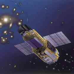
Artist illuatration of Astro-E2. Image credit: JAXA. Click to enlarge.
The M-V Launch Vehicle No. 6 (M-V-6) with the 23rd scientific satellite (ASTRO-EII) onboard was launched at 12:30 p.m. on July 10, 2005 (Japan Standard Time, JST) from the Uchinoura Space Center (USC). The launcher was set to a vertical angle of 80.2 degrees, and the flight azimuth was 87.6 degrees.

The launch vehicle flew smoothly, and the third stage motor was ignited at 205 seconds after liftoff. The third stage flight was also smooth, and after its motor burnout, it was confirmed to be safely injected into its scheduled orbit of an apogee altitude of approximately 247 km and a perigee altitude of approximately 560 km with an inclination of approximately 31.4 degrees.

JAXA received signals from the ASTRO-EII at the Santiago tracking station and the USC, and from those signals we verified that the ASTRO-EII had successfully separated.

The in-orbit ASTRO-EII was given the International Designator of 2005-025A and a nickname of “Suzaku.”

The weather at the time of the launch was slightly cloudy with a wind speed of 7m/s from the west-south-west, and the temperature was 31.7 degrees Celsius.

Original Source: JAXA News Release

Sea Launch Launches Americas-8 Satellite

Zenit-3SL rocket blasting off with Intelsat Americas-8 satellite. Image credit: Boeing. Click to enlarge.
Sea Launch Company today successfully delivered the Intelsat Americas?-8 (IA-8) communications satellite to geosynchronous transfer orbit. Early data indicate the spacecraft is in excellent condition.

A Zenit-3SL vehicle lifted off at 7:03 am PDT ( 14:03 GMT), from the Odyssey Launch Platform, positioned at 154 degrees West Longitude. All systems performed nominally throughout the flight. The Block DM-SL upper stage inserted the 5,500 kg (12,125 lbs.) satellite to geosynchronous transfer orbit, on its way to a final orbital position of 89 degrees West Longitude. A ground station in Fucino, Italy, acquired the spacecraft?s first signal less than an hour after liftoff, as planned.

This mission is Sea Launch?s fifth launch for Space Systems/Loral (SS/L), the spacecraft?s manufacturer, and the first for Intelsat. The IA-8 satellite is designed to provide expanded coverage over the Americas, the Caribbean, Hawaii and Alaska with voice, video and data transmission and distribution services. SS/L?s 1300 bus carries 28 C-band and 36 Ku-band transponders, as well as 24 Ka-band spot beams and has a total end-of-life power of 16 Kw. IA-8 is the fifth Intelsat satellite in the North American arc and the 28 th satellite in Intelsat?s global fleet.

Following acquisition of the spacecraft?s signal, Jim Maser, president and general manager of Sea Launch, congratulated Space Systems/Loral and Intelsat. ?We are thrilled to welcome Intelsat into our growing family of satisfied customers,? Maser said. ?We look forward to future missions with Intelsat as well as with our long-time colleagues at Space Systems/Loral. The Sea Launch team has successfully met our commitments once again and I want to personally thank them for their unwavering commitment and hard work.?

Sea Launch Company, LLC, headquartered in Long Beach, Calif., and marketed through Boeing Launch Services (www.boeing.com/launch), is the world?s most reliable heavy-lift commercial launch service. This international partnership offers the most direct and cost-effective route to geostationary orbit. With the advantage of a launch site on the Equator, the reliable Zenit-3SL rocket can lift a heavier spacecraft mass or provide longer life on orbit, offering best value plus schedule assurance. For additional information and images of this successfully completed mission, visit the Sea Launch website at: www.sea-launch.com

Original Source: Boeing News Release

Foton-M2 Mission Returns to Earth

Computer illustration of the Foton-M2 satellite. Image credit: ESA. Click to enlarge.
The re-entry module of the Foton-M2 spacecraft, which has been in low-Earth orbit for the last 16 days made a successful landing today in an uninhabited area 140 km south-east of the town of Kostanay in Kazakhstan, close to the Russian border at 09:37 Central European Time, 13:37 local time.

The unmanned Foton-M spacecraft, which was launched on 31 May from the Baikonur Cosmodrome in Kazakhstan, carried a European payload of 385 kg covering 39 experiments in fluid physics, biology, crystal growth, meteoritics, radiation dosimetry and exobiology.

All de-orbit to landing procedures went according to plan beginning with the jettison of the Foton-M2 battery module three hours prior to landing. At an altitude of about 300 kilometres, travelling at 7.8 km/s and 30 minutes prior to landing, the retro-rocket situated on the Foton service module was fired for 45 seconds slowing the spacecraft down to reduce its altitude. The Foton-M2 service module was hereafter separated from the re-entry module and, as planned, burnt up in Earth?s atmosphere.

Twenty minutes prior to landing the spherical re-entry module entered the stratosphere, experiencing temperatures up to 2000?C and an acceleration of up to 9g. At 8.5 minutes before landing, the drogue parachute was deployed, which in turn opened the brake parachute, reducing the descent speed from supersonic to subsonic. The main parachute was deployed thirty seconds later, at an altitude of 2.5 km, reducing the speed of the re-entry module to 10 m/s. Brake rockets finally reduced the speed of the re-entry module to 3 m/s, 0.35 seconds before landing impact.

ESA representatives were on hand at the landing site to undertake initial procedures related to European experiments. This included immediate retrieval of the Biopan, Stone and Autonomous Experiments. The same team removed the FluidPac experiment facility?s digital tape recorder and configured FluidPac for safe transport to the TsSKB-Progress factory in Samara. The Foton capsule is currently being transported to Samara where the FluidPac facility and the Telescience Support Unit will be removed from the capsule and shipped to ESA/ESTEC in Noordwijk, the Netherlands.

?I am extremely pleased that the majority of experiments have performed well.? said ESA?s Project Manager for Foton missions, Antonio Verga. ?My thanks to the ESA Operations Team who has closely followed the mission from the Payload Operations Centre at Esrange in Kiruna, Sweden and our Russian counterparts at Roskosmos, TsSKB-Progress and the Barmin Design Bureau for General Engineering. The hard work and dedication of everyone involved has been crucial in making this mission a success and optimising the scientific returns from the mission?.

The Foton-M2 staff at Esrange, consisted of a team of 30 scientists, engineers and operators who worked in close coordination with the Mission Operation Centre at TsSKB, Samara, and with the Flight Control Centre in Moscow, which continuously reported and informed about the orbital phases of Foton-M2, via a powerful and effective data network operated and maintained by ESA?s European Space Operations Centre (ESOC) in Darmstadt, Germany.

Fluid physics experiments were conducted in the FluidPac and SCCO experiment facilities. The data return from these was nearly complete and most of the scientific objectives were achieved. The BAMBI experiment produced some excellent images, a substantial role in which was played by the on-line processing capability of TeleSupport Unit.

The Agat furnace performed flawlessly as well. The processed samples should provide the material science community with good specimens to analyse. Unfortunately, the Russian Polizon furnace suffered a failure due to as yet unknown reasons, which prevented the processing of the semiconductor alloys stored in its drum at the required high temperatures.

The very successful technology experiment MiniTherm was performed during the mission, which deals with the performance of a new design of heat pipes. This experiment was controlled from Esrange, during its 5 days-long execution.

Also numerous experiments attached to the outside of the Foton satellite were performed, which deal with space exposure and technology aspects.

The European Space Agency has been participating in this type of scientific mission for 18 years and with a total of 385 kg of European experiments and equipment, this mission constituted the largest European payload that has been put into orbit.

“The Foton-M2 mission has been a resounding success and I look forward to seeing the positive impact the results of the experiments will have in the future,? said Daniel Sacotte, ESA?s Director of Human Spaceflight, Microgravity and Exploration Programmes. ?I also look forward to building on this success with the Foton-M3 mission, which is planned to be launched in 2007.?

For more information on the Foton-M2 mission and the status of the ESA experiments: http://www.spaceflight.esa.int/foton

Original Source: ESA News Release