A Russian-built Proton M rocket launched a Canadian Nimiq2 rocket on Sunday evening. The rocket lifted off from the Baikonur Cosmodrome in Kazakhstan at 2317 GMT (6:17pm EST), and released the satellite into a transfer orbit 6 hours, 53 minutes later. Nimiq 2 will provide direct broadcasting services across Canada.
Japanese H-IIA Launches
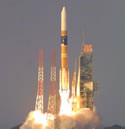
Image credit: NASDA
A Japanese H-2A rocket successfully launched from Tanegashima Space Center today, carrying two experimental satellites. It launched the Unmanned Space Experiment Recovery System (USERS) spacecraft and the Data Relay Test Satellite (DRTS). This is the third successful launch of the H-2A; an upgrade over the H-2 rocket program which suffered a string of launch failures in the 1990s.
The National Space Development Agency of Japan (NASDA) launched the Advanced Earth Observing Satellite-II (ADEOS-II) by H-IIA Launch Vehicle No. 4 (H-IIA F4) at 10:31 a.m. on December 14, 2002 (Japan Standard Time) from the Tanegashima Space Center. The initial azimuth of H-IIA F4 was 122 degrees. H-IIA F4 flight went normally, and it was confirmed that ADEOS-II was successfully separated in 16 minutes and 31 seconds after liftoff.
Original Source: NASDA News Release
Proton Rocket Lofts Russian Satellite
Image credit: ILS
A Russian Proton-K lifted off from the Baikonur Cosmodrome Thursday, carrying a Kosmos 2392 satellite into an elliptical orbit. Although the satellite is believed to be an Arkon-class military satellite, space officials told the Russian press that it would also be used to collect data on the land and oceans.
A Proton launch vehicle successfully launched the Cosmos-3292 satellite today at 7:13 p.m. Moscow time. This was the fourth launch of a Proton this year, including two missions carried under International Launch Services.
The Cosmos-3292 satellite was launched within the framework of the Federal program and will provide remote sensing and environmental monitoring of the Earth.
Original Source: ILS News Release
Ariane 5 Rocket Launches Two Satellites
A powerful Ariane 5 rocket lifted off late Friday from the European Space Agency (ESA) launch center in Kourou, French Guiana. It was carrying two satellites: the STELLAT 5 which will provide Internet and video transmission to Europe, Africa and the Middle East; and the N-STAR C which will support mobile phones in Japan. This is the 12th launch of an Ariane 5.
Sea Launch Delivers PanAmSat to Orbit
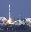
Image credit: Sea Launch
A Zenit-3SL successfully carried a PanAmSat’s Galaxy IIIC satellite into orbit on Saturday, marking the seventh launch from the floating Sea Launch platform. The three-stage rocket lifted off from the platform on Saturday at 2239 GMT (6:39pm EDT), and the spacecraft’s signal was detected a few minutes later, indicating a successful launch. The satellite will move to a geostationary orbit, where it will provide Internet, video, audio and data services to North America.
A Sea Launch rocket today successfully launched PanAmSat’s Galaxy IIIC satellite into orbit. Marking Sea Launch’s seventh successful mission, the three-stage rocket lifted off at 3:39:30 P.M. PDT from the Odyssey Launch Platform, positioned on the Equator. As planned, the spacecraft’s first signal was acquired shortly after spacecraft separation, at 4:47:00 p.m. PDT.
Built by Boeing Satellite Systems, the 10,692 lb. (4850 kg) 702 model spacecraft is designed for a 15 year lifespan in Geostationary Orbit. The satellite will provide Internet, video, audio and data services to the United States and Latin America.
“The launch of Galaxy IIIC commemorates the second time Sea Launch has successfully placed a PanAmSat satellite in orbit,” said Jim Maser, president of Sea Launch. “Our international team has recognized PanAmSat’s continued confidence in our launch performance and we look forward to working with them again in the near future.”
The Zenit-3SL vehicle lifted off from the Odyssey Launch Platform on schedule from the equatorial launch site at 154 degrees West Longitude. All systems performed nominally throughout the flight. The Block DM upper stage separated from the spacecraft about 1,385 miles above the Indian Ocean, 61 minutes after liftoff. Operators acquired a signal from Galaxy IIIC from a ground station in Western Australia. Galaxy IIIC will have a final position in Geostationary Orbit at 95 degrees West Longitude.
PanAmSat is a leading provider of global video and data broadcasting services via satellite. The company builds, owns and operates networks that deliver entertainment and information to cable television systems, TV broadcast affiliates, direct-to-home TV operators, telecommunications companies and corporations. Based in Wilton, Conn., PanAmSat has one of the world’s largest commercial geostationary satellite networks.
Sea Launch Company, LLC, based in Long Beach, Calif., provides reliable, cost-effective, heavy lift launch services for commercial satellite customers. The international members include Boeing (U.S.), Kvaerner (Norway), RSC Energia (Russia) and SDO Yuzhnoye / PO Yuzhmash (Ukraine). Established in 1995, Sea Launch has a current backlog of 17 firm launch contracts. As the world’s only services provider launching from the Equator, Sea Launch offers the optimal starting point for spacecraft heading to Geostationary Orbit. For additional information, visit the Sea Launch website at www.sea-launch.com.
Original Source: Boeing News Release
Ariane Rocket Launches Intelsat Bird
An Ariane 44L rocket successfully launched an Intelsat 905 telecommunications satellite into orbit on Wednesday – liftoff was at 0644 GMT (2:44am EDT) from Kourou, French Guiana. Once in its final position, the Intelsat 905 will provide Ku-band coverage for much of North America and Western Europe. This was the seventh launch of the year for Arianespace.
SPOT 5 Launched on Board Ariane Rocket
An Ariane 4 rocket blasted off from Kourou, French Guiana Saturday morning at 0131 GMT (9:31 pm EDT Friday), carrying a French-built SPOT 5 remote sensing satellite. The spacecraft separated from the booster 19 minutes after launch and was placed into an 810-km Sun-synchronous orbit. The satellite will provide high-resolution images of the Earth’s surface at a resolution of 2.5 metres. This was Arianespace’s 200th rocket launch.
Delta Launches Aqua Satellite
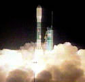
Image credit: NASA
NASA’s newest Earth observation satellite launched Saturday aboard a Boeing Delta II rocket. Called Aqua, the satellite will gather data about global precipitation, evaporation and the cycling of water to help scientists understand if there’s any acceleration of the Earth’s water cycle and due to changing climate. The infrared sounder on board will measure the Earth’s atmosphere and help improve weather prediction.
NASA’s latest Earth observing satellite, Aqua, carrying the NASA Jet Propulsion Laboratory-managed Atmospheric Infrared Sounder instrument, successfully launched this morning at 2:55 a.m. Pacific Time. Aqua is dedicated to advancing our understanding of Earth’s water cycle and our environment. Launching the Aqua spacecraft marks a major milestone in support of NASA’s mission to help us better understand and protect our planet.
The Aqua spacecraft lifted off from the Western Test Range of Vandenberg Air Force Base, Calif., aboard a Delta II rocket. Spacecraft separation occurred at 3:54 a.m. Pacific Time, inserting Aqua into a 705-kilometer (438-mile) orbit.
“The Aqua project has truly been a team effort and we are very excited this morning,” said Aqua project manager Phil Sabelhaus at NASA’s Goddard Space Flight Center, Greenbelt, Md.
The primary goal of Aqua, as the name implies, is to gather information about water in Earth’s system. Equipped with six state-of-the-art instruments, Aqua will collect data on global precipitation, evaporation and the cycling of water. This information will help scientists all over the world to better understand Earth’s water cycle and determine if the water cycle is accelerating as a result of climate change.
JPL’s Atmospheric Infrared Sounder will measure Earth’s atmosphere and surface, allowing scientists to improve weather prediction and observe changes in Earth’s climate.
Aqua is the latest in a series of Earth Observing System spacecraft, following the Terra satellite launched in December 1999. Aqua will cross the equator daily at 1:30 p.m. as it heads north. The early afternoon observation time contrasts with the Terra satellite, which crosses the equator between 10:30 and 10:45 a.m. daily. Aqua’s afternoon observations, combined with Terra’s morning observations, will provide important insights into the daily cycling of key scientific parameters such as precipitation and ocean circulation.
Aqua is a joint project among the United States, Japan and Brazil. The United States provided the spacecraft and four of the six scientific instruments. In addition to the JPL-provided Atmospheric Infrared Sounder, the other U.S. instruments include the Moderate Resolution Imaging Spectroradiometer and the Advanced Microwave Sounding Unit, both provided by the Goddard center, and the Clouds and the Earth’s Radiant Energy System, provided by NASA’s Langley Research Center, Hampton, Va.
Japan’s National Space Development Agency provided the Advanced Microwave Scanning Radiometer, while the Instituto Nacional de Pesquisas Espaciais (the Brazilian Institute for Space Research) provided the Humidity Sounder for Brazil.
Aqua is part of NASA’s Earth Science Enterprise, a long-term research effort dedicated to understanding and protecting our home planet. Through the study of Earth, NASA will help to provide sound science to policy and economic decision makers so as to better life here, while developing the technologies needed to explore the universe and search for life beyond our home planet.
Original Source: NASA/JPL News Release
Ariane Launches Communications Satellite
An Ariane 44L rocket lifted off from the Guiana Space Center in Kourou on Tuesday evening at 2302 GMT (7:02 EDT). Twenty one minutes later the rocket deployed a Lockheed Martin-built NSS-7 telecommunications satellite which will provide Internet and data relay services to the Americas, Europe and Africa.
Ariane 5 Launches Envisat Successfully
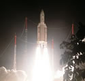
Image credit: Arianespace
After much anticipation, an Ariane 5 rocket blasted off from Kourou, French Guiana last night, carrying the European Space Agency’s Envisat environmental monitoring satellite into an 800km orbit. Once it reaches its final orbit, the 8000 kg Envisat will observe the Earth’s environment using ten instruments which measure the state of the land, ocean, ice cover and atmosphere. This is the first launch of an Ariane 5 since a problem last July that placed two satellites into incorrect orbits.
The eagerly awaited launch of ESA?s Envisat environmental monitoring satellite took place in Kourou, French Guiana, today at 22:07:59 hrs Kourou time (02:07:59 hrs CET). Envisat?s spectacular night-time launch also marked the return to business for Europe?s Ariane 5 launcher.
Lift-off was witnessed by dozens of cheering engineers, scientists and project members at the launch site and at ESA centres across Europe. Rising into a clear sky, the Ariane 5 propelled the Envisat towards a lofty vantage point some 800 km above the Earth?s surface.
Envisat ? the most ambitious Earth observation satellite ? follows in the footsteps of ESA?s successful ERS-1 and ERS-2 missions launched in the 1990s. It will boost Europe?s capacity to take part in the study of the Earth and its environment by supporting critical research programmes on global warming and climate change issues, as well as performing crucial tasks such as pollution and disaster monitoring .
After a flawless lift-off, the Ariane 5 placed Envisat into sun-synchronous orbit, allowing ESA ground controllers at the space operations centre in Darmstadt, Germany, to take full control for the first time of the most complex satellite ever built in Europe.
?This has been a particularly exciting day for ESA and the European space community as a whole,? said Jos? Achache, ESA?s Director of Earth Observation. ?Europe is taking an important lead in global observations for worldwide environmental needs and Envisat is going to make a significant impact on the future of remote sensing of the Earth?.
?The ten instruments on board Envisat, more than on any other satellite, cover a wide spectrum of phenomena, delivering evidence of the interactions between the atmosphere, the ocean, the polar ice caps, the vegetation as well as human activity at the surface of the Earth. We will be able to trace the smallest changes to the Earth?s surface anywhere on the globe. The importance of this mission has triggered great interest in the Earth-science community, both at a European level and worldwide.?
Commenting from Europe?s spaceport in French Guiana, Jacques Louet, ESA?s Envisat Programme Manager, admitted that there was a certain risk to pack so much know-how into just one satellite. ?However, if we want to have a comprehensive understanding, we must follow this path?, he said.
Given its sheer size, Envisat has involved almost all of Europe?s space industries in the development of numerous advanced technologies, particularly for the payload.
Envisat is expected to be declared operational after just a few weeks, once its payload has been checked out and the various data-recovery links set up. Then the satellite?s six-month long commissioning phase will begin, ensuring that the ten instruments are operating as specified and that we can start delivering validated products to our users.
?Now Envisat is in orbit, the culmination of many years? work really begins and we are looking forward to the environmental benefits the satellite is going to bring to Europe,? added Mr Achache.
The successful launch of Envisat also marked a return to service for the Ariane 5 launcher. It?s upper stage has undergone over 300 tests since last summer, following the failure of flight Ariane 510 to insert two satellites, including ESA?s Artemis, in the correct orbits. However, thanks to ion propulsion, the Artemis mission is turning into a success story, as the satellite is making its way to geostationary orbit, and nominal operations could start this summer.
Original Source: ESA News Release
