
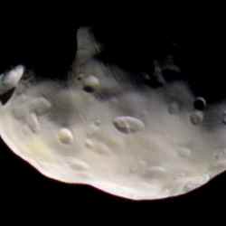
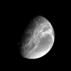
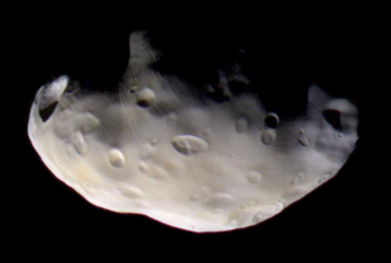
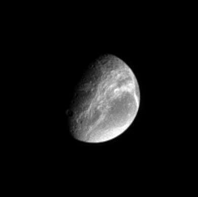
Cassini’s best close-up view of Pandora. Image credit: NASA/JPL/SSI Click to enlarge
Cassini’s best close-up view of Saturn’s F ring shepherd moon, Pandora, shows that this small ring-moon is coated in fine dust-sized icy material.
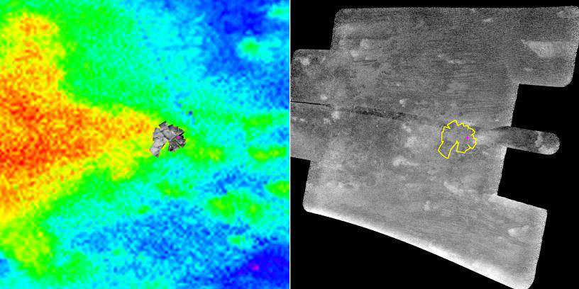
Craters formed on this object by impacts appear to be covered by debris, a process that probably happens rapidly in a geologic sense. The grooves and small ridges on Pandora (84 kilometers, or 52 miles across) suggest that fractures affect the overlying smooth material.
The crisp craters on another Saturn moon, Hyperion, provide a contrasting example of craters on a small object (see Odd World).
Cassini acquired infrared, green and ultraviolet images on Sept. 5, 2005, which were combined to create this false-color view. The image was taken with the Cassini spacecraft narrow-angle camera at a distance of approximately 52,000 kilometers (32,000 miles) from Pandora and at a Sun-Pandora-spacecraft, or phase, angle of 54 degrees. Resolution in the original image was about 300 meters (1,000 feet) per pixel. The image has been magnified by a factor of two to aid visibility.
The Cassini-Huygens mission is a cooperative project of NASA, the European Space Agency and the Italian Space Agency. The Jet Propulsion Laboratory, a division of the California Institute of Technology in Pasadena, manages the mission for NASA’s Science Mission Directorate, Washington, D.C. The Cassini orbiter and its two onboard cameras were designed, developed and assembled at JPL. The imaging operations center is based at the Space Science Institute in Boulder, Colo.
For more information about the Cassini-Huygens mission visit http://saturn.jpl.nasa.gov . The Cassini imaging team homepage is at http://ciclops.org .
Original Source: NASA/JPL/SSI News Release

