Student Science Thunders to Space from NASA Wallops

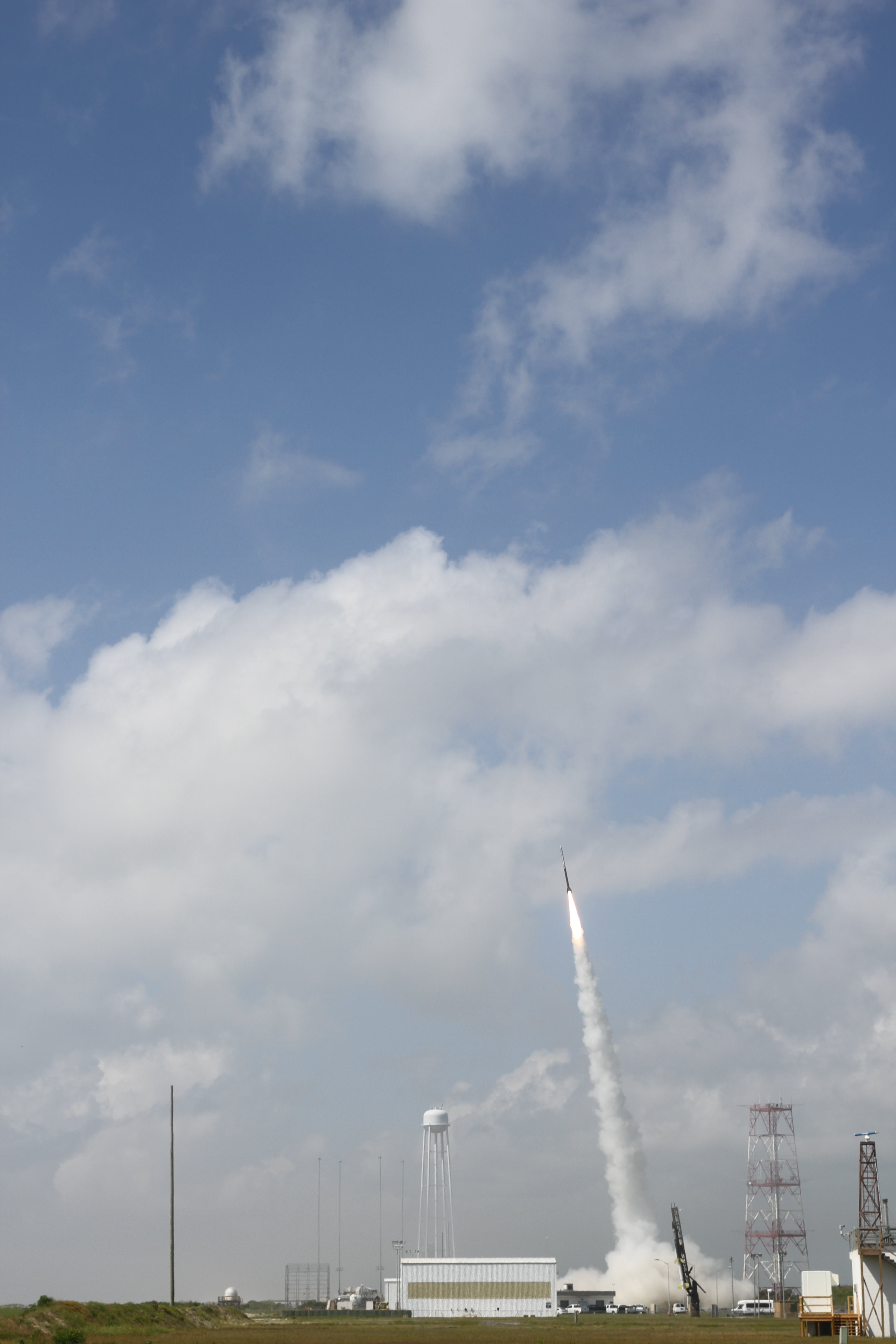
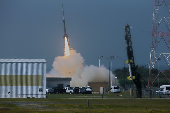
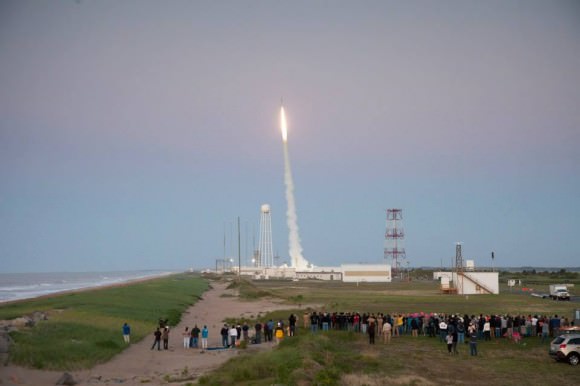
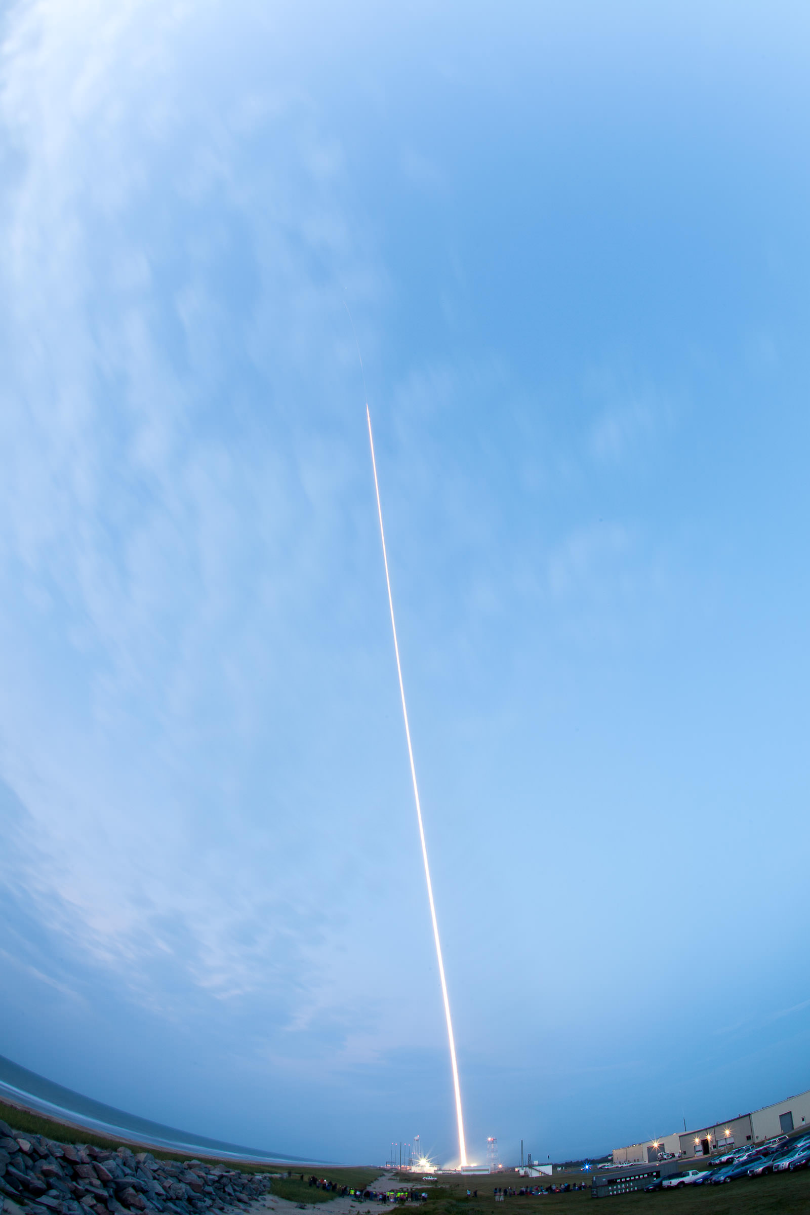
A Terrier-Improved Malemute suborbital rocket carrying experiments developed by university students nationwide in the RockSat-X program was successfully launched at 6 a.m. EDT August 13. Credit: NASA

A Terrier-Improved Malemute suborbital rocket carrying experiments developed by university students nationwide in the RockSat-X program was successfully launched at 6 a.m. EDT August 13. Credit: NASA/Allison Stancil
Watch the cool Video below
[/caption]

WALLOPS ISLAND, VA – A nearly 900 pound complex payload integrated with dozens of science experiments created by talented university students in a wide range of disciplines and from all across America streaked to space from NASA’s beachside Wallops launch complex in Virginia on August 13 – just before the crack of dawn.

The RockSat-X science payload blasted off atop a Terrier-Improved Malemute suborbital sounding rocket at 6 a.m. from NASA’s Wallops Flight Facility along the Eastern Shore of Virginia.

As a research scientist myself it was thrilling to witness the thunderous liftoff standing alongside more than 40 budding aerospace students brimming with enthusiasm for the chance to participate in a real research program that shot to space like a speeding bullet.

“It’s a hands on, real world learning experience,” Chris Koehler told Universe Today at the Wallops launch pad. Koehler is Director of the Colorado Space Grant Consortium that manages the RockSat-X program in a joint educational partnership with NASA.

The hopes and dreams of everyone was flying along.

Here’s a cool NASA video of the RockSat-X Aug. 13 launch:

The students are responsible for conceiving, managing, assembling and testing the experiments, Koehler told me. Professors and industrial partners mentor and guide the students.

RockSat-X is the third of three practical STEM educational programs where the students master increasingly difficult skills that ultimately result in a series of sounding rocket launches.

“Not everything works as planned,” said Koehler. “And that’s by design. Some experiments fail but the students learn valuable lessons and apply them on the next flight.”

“The RockSat program started in 2008. And it’s getting bigger and growing in popularity every year,” Koehler explained.
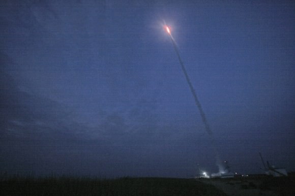
August 13 launch of RockSat-X student science payload atop a Terrier-Improved Malemute suborbital at 6 a.m. EDT from NASA Wallops.   Credit: Ken Kremer/kenkremer.com
August 13 launch of RockSat-X student science payload atop a Terrier-Improved Malemute suborbital at 6 a.m. EDT from NASA Wallops. Credit: Ken Kremer/kenkremer.com

The 2013 RockSat-X launch program included participants from seven universities, including the University of Colorado at Boulder; the University of Puerto Rico at San Juan; the University of Maryland, College Park; Johns Hopkins University, Baltimore, Md.; West Virginia University, Morgantown; University of Minnesota, Twin Cities; and Northwest Nazarene University, Nampa, Idaho.

We all watched as a group and counted down the final 10 seconds to blastoff just a few hundred yards (meters) away from the launch pad – Whooping and hollering as the first stage ignited with a thunderous roar. Then the second stage flash – and more yelling and screams of joy! – – listen to the video.

Moments later we saw the first stage plummeting and heard a loud thud as it crashed into the ocean just 10 miles or so offshore.
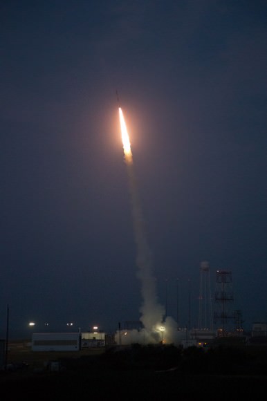
A Terrier-Improved Malemute suborbital rocket carrying experiments developed by university students nationwide in the RockSat-X program was successfully launched at 6 a.m. EDT August 13.  Credit: NASA/Brea Reeves
A Terrier-Improved Malemute suborbital rocket carrying experiments developed by university students nationwide in the RockSat-X program was successfully launched at 6 a.m. EDT August 13. Credit: NASA/Brea Reeves

For most of the students -ranging from freshman to seniors – it was their first time seeing a rocket launch.

“I’m so excited to be here at NASA Wallops and see my teams experiment reach space!” said Hector, one of a dozen aerospace students who journeyed to Wallops from Puerto Rico.

Local Wallops area spectators and tourists told me they could hear the rocket booming from viewing sites more than 10 miles away.

Others who ‘overslept’ were awoken by the rocket thunder and houses shaking.

Suborbital rockets still make for big bangs!

The Puerto Rican students very cool experiment aimed at capturing meteorite particles in space using 6 cubes of aerogel that were extended out from the rocket as it descended back to Earth, said Oscar Resto, Science Instrument specialist and leader of the Puerto Rican team during an interview at the launch complex.

“Seeing this rocket launch was the best experience of my life,” Hector told me. “This was my first time visiting the mainland. I hope to come back again!”

Another team of 7 students from Northwest Nazarene University (NNU), Idaho aimed to investigate the durability of the world’s first physically flexible integrated chips.

“Our experiment tested the flexibility of integrated circuit chips in the cryogenic environment of space,” Prof Stephen Parke of NNU, Idaho, told Universe Today in an interview at the launch pad.

“The two year project is a collaboration with chipmaker American Semiconductor, Inc based in Boise, Idaho.”

“The chips were mechanically and electrically exercised, or moved, during the flight under the extremely cold conditions in space – of below Minus 50 C – to test whether they would survive,” Parke told me.

The 44 foot long, two stage rocket flew on a parabolic arc and a southeasterly trajectory. The 20 foot RockSat-X payload soared to an altitude of approximately 94 miles above the Atlantic Ocean.
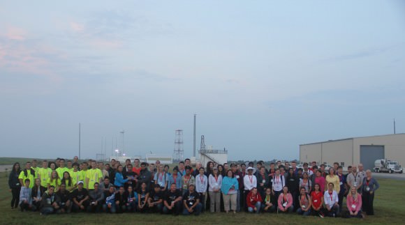
More than 40 University students and mentors participating in the Aug. 13 RockSat-X science payload pose for post launch photo op at NASA Wallops Island, VA, launch complex that launched their own developed experiments to space.  Credit: Ken Kremer/kenkremer.com
More than 40 University students and mentors participating in the Aug. 13 RockSat-X science payload pose for post launch photo op at NASA Wallops Island, VA, launch complex that launched their own developed experiments to space. Credit: Ken Kremer/kenkremer.com

Telemetry and science data was successfully transmitted and received from the rocket during the flight.

The payload then descended back to Earth, deployed a 24 foot wide parachute and splashed down in the Atlantic Ocean some 90 miles offshore from Wallops Flight Facility. Overall the mission lasted about 20 minutes.

A commercial fishing boat hauled in the payload and brought it back to Wallops about 7 hours later.

By 2 p.m. the RockSat-X payload was back onsite at the Wallops ‘Rocket Factory’.
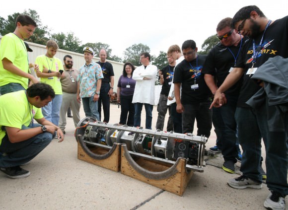
Rocket science university students get ready to tear apart the RockSat-X science payload after recovery from Atlantic Ocean splashdown following Aug. 13 rocket blastoff from NASA Wallops Flight Facility, VA.  Credit: Ken Kremer/kenkremer.com
Rocket science university students get ready to tear apart the RockSat-X science payload after recovery from Atlantic Ocean splashdown following Aug. 13 rocket blastoff from NASA Wallops Flight Facility, VA. Credit: Ken Kremer/kenkremer.com

And I was on-hand as the gleeful students began tearing it apart to disengage their individual experiments to begin a week’s long process of assessing the outcome, analyzing the data and evaluating what worked and what failed. See my photos.
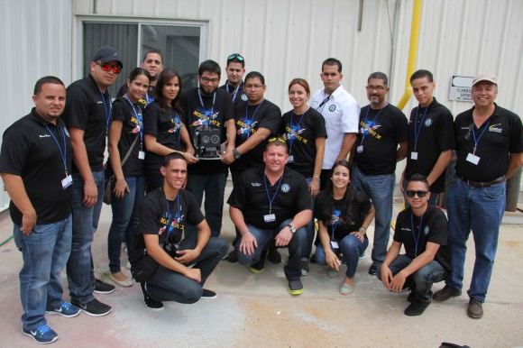
Rocket science university students from Puerto Rico pose for post flight photo op with their disengaged science experiment seeking to capture meteorite particles from space aboard Terrier-Improved Malemute sounding rocket that launched  on Aug. 13 at 6 a.m. from NASA Wallops Flight Facility, VA.  Credit: Ken Kremer/kenkremer.com
Rocket science university students from Puerto Rico pose for post flight photo op with their disengaged science experiment seeking to capture meteorite particles from space aboard Terrier-Improved Malemute sounding rocket that launched on Aug. 13 at 6 a.m. from NASA Wallops Flight Facility, VA. Credit: Ken Kremer/kenkremer.com

Included among the dozens of custom built student experiments were HD cameras, investigations into crystal growth and ferro fluids in microgravity, measuring the electron density in the E region (90-120km), aerogel dust collection on an exposed telescoping arm from the rockets side, effects of radiation damage on various electrical components, determining the durability of flexible electronics in the cryogenic environment of space and creating a despun video of the flight.

Indeed we already know that not every experiment worked. But that’s the normal scientific method – ‘Build a little, fly a little’.

New students are already applying to the 2014 RockSat program. And some of these students will return next year with thoughtful upgrades and new ideas!

The launch was dedicated in memory of another extremely bright young student named Brad Mason, who tragically passed away two weeks ago. Brad was a beloved intern at NASA Wallops this summer and a friend. Brad’s name was inscribed on the side of the rocket. Read about Brad at the NASA Wallops website.

Ken Kremer

…………….
Learn more about Suborbital science, Cygnus, Antares, LADEE, MAVEN and Mars rovers and more at Ken’s upcoming presentations

Sep 5/6/16/17: LADEE Lunar & Antares/Cygnus ISS Rocket Launches from Virginia”; Rodeway Inn, Chincoteague, VA, 8 PM

Oct 3: “Curiosity, MAVEN and the Search for Life on Mars – (3-D)”, STAR Astronomy Club, Brookdale Community College & Monmouth Museum, Lincroft, NJ, 8 PM

The USAF’s ‘Space Fence’ Surveillance System: Another Victim of Sequestration

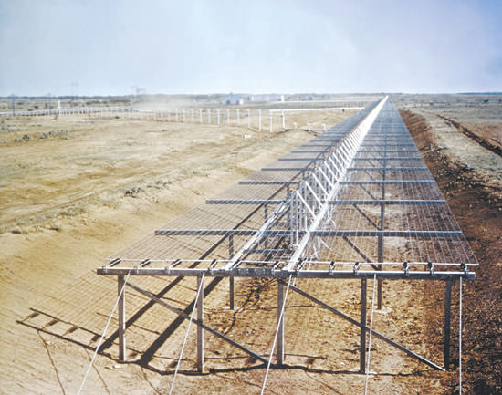
Space fence... Credit:

Times are getting tougher in the battle to track space debris. A key asset in the fight to follow and monitor space junk is getting the axe on October 1st of this year. United States Air Force General and commander of Air Force Space Command William Shelton has ordered that the Air Force Space Surveillance System, informally known as Space Fence will be deactivated. The General also directed all related sites across the southern United States to prepare for closure.

This shutdown will be automatically triggered due to the U.S. Air Force electing not to renew its fifth year contract with Five Rivers Services, the Colorado Springs-based LLC that was awarded the contract for the day-to-day management of the Space Fence surveillance system in 2009.

To be sure, the Space Fence system was an aging one and is overdue for an upgrade and replacement.

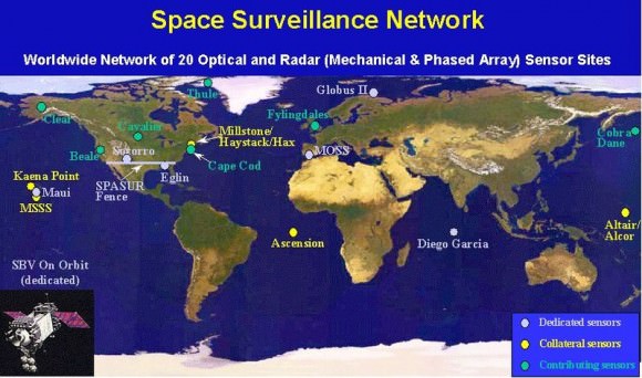
The Space Fence system was first brought on line in the early days of the Space Age in the 1961. Space Fence was originally known as the Naval Space Surveillance (NAVSPASUR) system until passing into the custody of the U.S. Air Force’s 20th Space Control Squadron in late 2004. Space Fence is a series of multi-static VHF receiving and transmitting sites strung out across the continental United States at latitude 33° north ranging from California to Georgia.

The Worldwide Space Surveillance Network, including Space Fence across the southern United States. (Credit: the U.S. Department of Defense).

Space Fence is part of the greater Space Surveillance Network, and comprises about 40% of the overall observations of space debris and hardware in orbit carried out by the U.S. Air Force. Space Fence is also a unique asset in the battle to track space junk and dangerous debris, as it gives users an “uncued” tracking ability. This means that it’s constantly “on” and tracking objects that pass overhead without being specifically assigned to do so.

Space Fence also has the unique capability to track objects down to 10 centimeters in size out to a distance of 30,000 kilometres. For contrast, the average CubeSat is 10 centimetres on a side, and the tracking capability is out to about 67% of the distance to geosynchronous orbit.

Exact capabilities of the Space Fence have always been classified, but the master transmitter based at Lake Kickapoo, Texas is believed to be the most powerful continuous wave facility in the world, projecting at 768 kilowatts on a frequency of 216.97927 MHz. The original design plans may have called for a setup twice as powerful.

A replacement for Space Fence that will utilize a new and upgraded S-Band radar system is in the works, but ironically, that too is being held up pending review due to the sequestration. Right now, the Department of Defense is preparing for various scenarios that may see its budget slashed by 150 to 500 billion dollars over the next 10 years.

The control center display of the prototype for the next generation Space Fence. (Credit: Lockheed Martin).

The U.S. Air Force has already spent $500 million to design the next generation Space Fence, and awarded contracts to Raytheon, Northrop Grumman and Lockheed Martin in 2009 for its eventual construction.

The eventual $3 billion dollar construction contract is on hold, like so many DoD programs, pending assessment by the Strategic Choices and Management Review, ordered by Secretary of Defense Chuck Hagel earlier this year.

“The AFSSS is much less capable than the space fence radar planned for Kwajalein Island in the Republic of the Marshall Islands,” stated General Shelton in a recent U.S. Air Force press release. “In fact, it’s apples and oranges in trying to compare the two systems.”

One thing’s for certain. There will be a definite capability gap when it comes to tracking space debris starting on October 1st until the next generation Space Fence comes online, which may be years in the future.

In the near term, Air Force Space Command officials have stated that a “solid space situational awareness” will be maintained by utilizing the space surveillance radar at Eglin Air Force Base in the Florida panhandle and the Perimeter Acquisition Radar Characterization System at Cavalier Air Force Station in North Dakota.

We’ve written about the mounting hazards posed by space debris before. Just earlier this year, two satellites were partially damaged due to space debris. Space junk poses a grave risk to the residents of the International Space Station, which must perform periodic Debris Avoidance Maneuvers (DAMs) to avoid collisions. Astronauts have spotted damage on solar arrays and handrails on the ISS due to micro-meteoroids and space junk. And on more than one occasion, the ISS crew has sat out a debris conjunction that was too close to call in their Soyuz spacecraft, ready to evacuate if necessary.

In 2009, a collision between Iridium 33 and the defunct Cosmos 2251 satellite spread debris across low Earth orbit. In 2007, a Chinese anti-satellite missile test also showered low Earth orbit with more of the same. Ironically, Space Fence was crucial in characterizing both events.

Satellites, such as NanoSail-D2, have demonstrated the capability to use solar sails to hasten reentry at the end of a satellites’ useful life, but we’re a long ways from seeing this capability standard on every satellite.

Amateurs will be affected by the closure of Space Fence as well. Space Weather Radio relies on ham radio operators, who listen for the “pings” generated by the Space Fence radar off of meteors, satellites and spacecraft.

“When combined with the new Joint Space Operations Center’s high-performance computing environment, the new fence will truly represent a quantum leap forward in space situational awareness for the nation,” General Shelton said.

But for now, it’s a brave and uncertain world, as Congress searches for the funds to bring this new resource online. Perhaps the old system will be rescued at the 11th hour, or perhaps the hazards of space junk will expedite the implementation of the new system. Should we pass the hat around to “Save Space Fence?”

Aerospace Students Shoot for the Stars and Space Flight Dreams

Rocket science university students from Puerto Rico pose for photo op with the Terrier-Improved Malemute sounding rocket that will launch their own developed RockSat-X science experiments to space on Aug. 13 at 6 a.m. from NASA Wallops Flight Facility, VA. Credit: Ken Kremer/kenkremer.com

Rocket science university students from Puerto Rico pose for photo op with the Terrier-Improved Malemute sounding rocket that will launch their own developed RockSat-X science experiments to space on Aug. 13 at 6 a.m. from NASA Wallops Flight Facility, VA.
Credit: Ken Kremer/kenkremer.com[/caption]

WALLOPS ISLAND, VA – How many of you have dreamed of flying yourselves or your breakthrough experiments to the High Frontier? Well if you are a talented student, NASA may have a ticket for you.

A diverse group of highly motivated aerospace students from seven universities spread across the United States have descended on NASA’s Wallops Flight Facility along the Eastern Shore of Virginia to fulfill the dream of their lifetimes – launching their very own science experiments aboard a rocket bound for space.

I met the thrilled students and professors today beside their rocket at the Wallops Island launch pad.

On Aug 13, after years of hard work, an impressive array of research experiments developed by more than 40 university students will soar to space on the RockSat-X payload atop a 44-foot tall Terrier-Improved Malemute suborbital sounding rocket at 6 a.m. EDT.

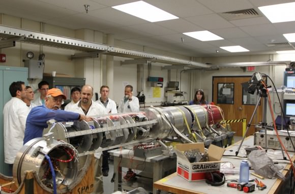
Students from Northwest Nazarene University observe the pre-integration of their experiment into the RockSat-X payload at the NASA Wallops Flight Facility in June. Students from seven universities are participating in the program and will attend the launch on August 13.  Credit: NASA/K. Koehler
Students from Northwest Nazarene University observe the pre-integration of their experiment into the RockSat-X payload at the NASA Wallops Flight Facility in June. Students from seven universities are participating in the program and will attend the launch on August 13. Credit: NASA/K. Koehler

The two stage rocket will rapidly ascend on a southeasterly trajectory to an altitude of some 97 miles and transmit valuable data in-flight during the 12-minute mission.

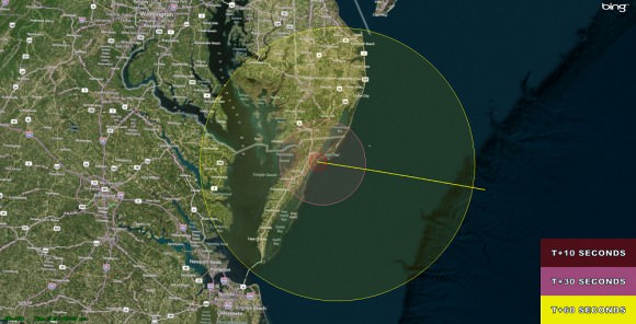
The launch will be visible to spectators in parts of Virginia, Maryland and Delaware, and perhaps a bit beyond. Check out the visibility map below.

The RockSat-X flight profile and visibility map. RockSat-X is scheduled to launch from NASA's Wallops Flight Facility, VA on Aug. 13 at 6.a.m. EDT  Credit: NASA
The RockSat-X flight profile and visibility map. RockSat-X is scheduled to launch from NASA’s Wallops Flight Facility, VA on Aug. 13 at 6.a.m. EDT Credit: NASA

If you’re available, try venturing out to watch it. The available window lasts until 10 a.m. EDT if needed.

The students will put their classroom learning to the test with experiments and instruments built by their own hands and installed on the 20 foot long RockSat-X payload. The integrated payload accounts for nearly half the length of the Terrier Malamute suborbital rocket. It’s an out of this world application of the scientific method.

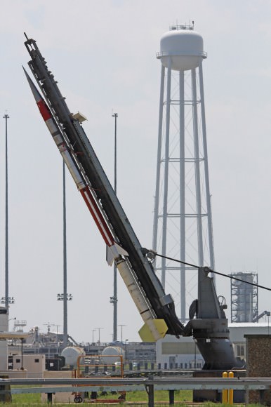
Terrier-Improved Malemute sounding rocket erected for launch of student experiments  on RockSat-X payload on Aug. 13 at 6 a.m. from NASA Wallops Flight Facility, VA.  Credit: Ken Kremer/kenkremer.com
Terrier-Improved Malemute sounding rocket erected for launch of student experiments on RockSat-X payload on Aug. 13 at 6 a.m. from NASA Wallops Flight Facility, VA. Credit: Ken Kremer/kenkremer.com
Included among the dozens of custom built student experiments are HD cameras, investigations into crystal growth and ferro fluids in microgravity, measuring the electron density in the E region (90-120km), aerogel dust collection on an exposed telescoping arm from the rockets side, effects of radiation damage on various electrical components, determining the durability of flexible electronics in the cryogenic environment of space and creating a despun video of the flight.

At the conclusion of the flight, the payload will descend to Earth via a parachute and splash down in the Atlantic Ocean approximately 86 miles offshore from Wallops.

Commercial fishing ships under contract to NASA will then recover the RockSat-X payload and return it to the students a few hours later, NASA spokesman Keith Koehler told Universe Today.

They will tear apart the payload, disengage their experiments and begin analyzing the data to see how well their instruments performed compared to the preflight hypotheses’.

RockSat-X is a joint educational activity between NASA and the Colorado Space Grant Consortium. It is the third of three practical STEM educational programs where the students must master increasingly difficult skill level requirements leading to a series of sounding rocket liftoffs.

In mid-June, some 50 new students participated in the successful ‘RockOn’ introductory level payload launch from Wallops using a smaller Terrier-Improved Orion rocket.

“The goal of the RockSat-X program is to provide students a hands-on experience in developing experiments for space flight,” said Chris Koehler, Director of the Colorado Space Grant Consortium.

“This experience allows these students to apply what they have learned in the classroom to a real world hands-on project.”

The students participating in this year’s RockSat-X launch program hail from the University of Colorado at Boulder; the University of Puerto Rico at San Juan; the University of Maryland, College Park; Johns Hopkins University, Baltimore, Md.; West Virginia University, Morgantown; University of Minnesota, Twin Cities; and Northwest Nazarene University, Nampa, Idaho.

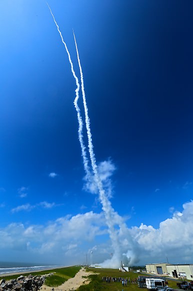
Panoramic view of the NASA Wallops Flight Facility launch range at Virginia’s Eastern Shore during prior launch of two suborbital sounding rockets as part of the Daytime Dynamo mission. RockSat-X payload will launch on a Terrier-Improved Malemute sounding rocket.   Credit: Ken Kremer/kenkremer.com
Panoramic view of the NASA Wallops Flight Facility launch range at Virginia’s Eastern Shore during prior launch of two suborbital sounding rockets as part of the Daytime Dynamo mission. RockSat-X payload will launch on a Terrier-Improved Malemute sounding rocket. Credit: Ken Kremer/kenkremer.com

Some of these students today could well become the pioneering aerospace industry leaders of tomorrow!

In the event of a delay forced by weather or technical glitches, August 14 is the backup launch day.

A great place to witness the blastoff is from the NASA Wallops Visitor Center, offering a clear view to the NASA launch range.

It opens at 5 a.m. on launch day and is a wonderful place to learn about NASA missions – especially the pair of exciting and unprecedented upcoming launches of the LADEE lunar science probe to the moon and the Cygnus cargo carrier to the ISS in September.

Both LADEE and Cygnus are historic first of their kind flights from NASA Wallops.

Live coverage of the launch is available via UStream beginning at 5 a.m. on launch day at:
http://www.ustream.tv/channel/nasa-tv-wallops

Ken Kremer

…………….
Learn more about Suborbital Science, Cygnus, Antares, LADEE, MAVEN and Mars rovers and more at Ken’s upcoming presentations

Aug 12/13: “RockSat-X Suborbital Launch, LADEE Lunar & Antares Rocket Launches from Virginia”; Rodeway Inn, Chincoteague, VA, 8 PM

Sep 5/6/16/17: LADEE Lunar & Antares/Cygnus ISS Rocket Launches from Virginia”; Rodeway Inn, Chincoteague, VA, 8 PM

Oct 3: “Curiosity, MAVEN and the Search for Life on Mars – (3-D)”, STAR Astronomy Club, Brookdale Community College & Monmouth Museum, Lincroft, NJ, 8 PM
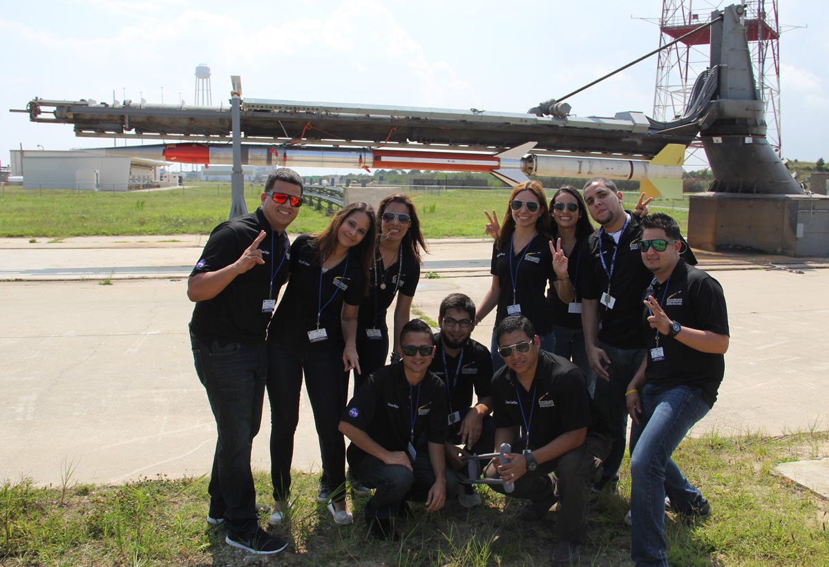
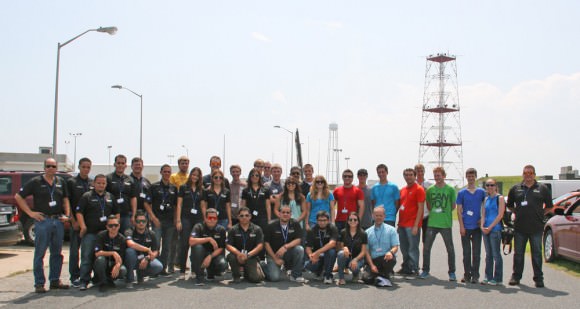
More than 40 University students participating in the Aug. 13 RockSat-X science payload pose for photo op with the Terrier-Improved Malemute sounding rocket that will launch their own experiments to space from NASA Wallops Flight Facility, VA.  Credit: Ken Kremer/kenkremer.com
More than 40 University students participating in the Aug. 13 RockSat-X science payload pose for photo op with the Terrier-Improved Malemute sounding rocket that will launch their own experiments to space from NASA Wallops Flight Facility, VA. Credit: Ken Kremer/kenkremer.com

Ancient Astronomical Calendar Discovered in Scotland Predates Stonehenge by 6,000 Years

A wintertime rising gibbous Moon. (Image credit: Art Explosion).

A team from the University of Birmingham recently announced an astronomical discovery in Scotland marking the beginnings of recorded time.

Announced last month in the Journal of Internet Archaeology, the Mesolithic monument consists of a series of pits near Aberdeenshire, Scotland. Estimated to date from 8,000 B.C., this 10,000 year old structure would pre-date calendars discovered in the Fertile Crescent region of the Middle East by over 5,000 years.

But this is no ordinary wall calendar.

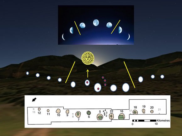
Originally unearthed by the National Trust for Scotland in 2004, the site is designated as Warren Field near the town of Crathes. It consists of 12 pits in an arc 54 metres long that seem to correspond with 12 lunar months, plus an added correction to bring the calendar back into sync with the solar year on the date of the winter solstice.

Diagram...
A diagram of the Warren Field site, showing the 12 pits (below) and the alignment with the phases of the Moon plus the rising of the winter solstice Sun. Note: the scale should read “0-10  metres.” (Credit: The University of Birmingham).

“The evidence suggests that hunter-gatherer societies in Scotland had both the need and sophistication to track time across the years, to correct for seasonal drift of the lunar year” said team leader and professor of Landscape Archaeology at the University of Birmingham Vince Gaffney.

We talked last week about the necessity of timekeeping as cultures moved from a hunter-gatherer to agrarian lifestyle. Such abilities as marking the passage of the lunar cycles or the heliacal rising of the star Sirius gave cultures the edge needed to dominate in their day.

For context, the pyramids on the plains of Giza date from around 2500 B.C., The Ice Man on display in Bolzano Italy dates from 3,300 B.C., and the end of the last Ice Age was around 20,000 to 10,000 years ago, about the time that the calendar was constructed.

“We have been taking photographs of the Scottish landscape for nearly 40 years, recording thousands of archaeological sites that would never have been detected from the ground,” said manager of Aerial projects of the Royal Commission of Aerial Survey Projects Dave Cowley. “It’s remarkable to think that our aerial survey may have helped to find the place where time was invented.”

The site at Warren Field was initially discovered during an aerial survey of the region.

Vince Gaffney professor of Landscape and Archaeology at University of Birmingham in Warren Field, Crathes, Aberdeenshire where the discovery was made.
Vince Gaffney, professor of Landscape and Archaeology at University of Birmingham in Warren Field, Crathes, Aberdeenshire where the discovery was made. (Credit: The University of Birmingham).

The use of such a complex calendar by an ancient society also came as a revelation to researchers. Emeritus Professor of Archaeoastronomy at the University of Leicester Clive Ruggles notes that the site “represents a combination of several different cycles which can be used to track time symbolically and practically.”

The lunar synodic period, or the span of time that it takes for the Moon to return to the same phase (i.e., New-to-New, Full-to-Full, etc) is approximately 29.5 days. Many cultures used a strictly lunar-based calendar composed of 12 synodic months. The Islamic calendar is an example of this sort of timekeeping still in use today.

However, a 12 month lunar calendar also falls out of sync with our modern Gregorian calendar by 11 days (12 on leap years) per year.

The familiar Gregorian calendar is at the other extreme, a calendar that is strictly solar-based.  The Gregorian calendar was introduced in 1582 and is still in use today. This reconciled the 11 minute per year difference between the Julian calendar and the mean solar year, which by the time of Pope Gregory’s reform had already caused the calendar to “drift” by 10 days since the 1st Council of Nicaea 325 AD.

Artist’s conception of the Warren Field site during the winter solstice. (Credit: The University of Birmingham). Credit: The University of Birmingham

Surprisingly, the calendar discovered at Warren Field may be of a third and more complex variety, a luni-solar calendar. This employs the use of intercalary periods, also known as embolismic months to bring the lunar and solar calendar back into sync.

The modern Jewish calendar is an example of a luni-solar hybrid, which adds an extra month (known as the 2nd Adar or Adar Sheni) every 2-3 years. This will next occur in March 2014.

The Greek astronomer Meton of Athens noted in 5th century B.C. that 235 synodic periods very nearly add up to 19 years, to within a few hours. Today, this period bears his name, and is known as a metonic cycle. The Babylonian astronomers were aware of this as well, and with the discovery at Warren Field, it seems that ancient astronomers in Scotland may have been moving in this direction of advanced understanding as well.

It’s interesting to note that the site at Warren Field also predates Stonehenge, the most famous ancient structure in the United Kingdom by about 6,000 years. 10,000 years ago would have also seen the Earth’s rotational north celestial pole pointed near the +3.9th magnitude star Rukbalgethi Shemali (Tau Herculis) in the modern day constellation of Hercules. This is due to the 26,000 year wobble of our planet’s axis known as the precession of the equinoxes.

The precession of the north celestial pole over millenia. (Credit: Wikimedia Commons graphic under a Creative Commons Attribution 2.5 Generic license. Author: Tau'olunga).
The precession of the north celestial pole over millennia. (Credit: Wikimedia Commons graphic under a Creative Commons Attribution 2.5 Generic license. Author: Tau’olunga).

The Full Moon nearest the winter solstice also marks the “Long Nights Moon,” when the Full Moon occupies a space where the Sun resides during the summer months and  rides high above the horizon for northern observers all night. The ancients knew of the five degree tilt that our Moon has in relation to the ecliptic and how it can ride exceptionally high in the sky every 18.6 years. We’re currently headed towards a ‘shallow year’ in 2015, where the Moon rides low in relation to the ecliptic. From there, the Moon’s path in the sky will get progressively higher each year, peaking again in 2024.

Who built the Warren Field ruins along the scenic Dee Valley of Scotland? What other surprises are in store as researchers excavate the site? One thing is for certain: the ancients were astute students of the sky. It’s fascinating to realize how much of our own history has yet to be told!


Super-Moon Monday: The 3rd (& Final?) Act

The gibbous Moon rising rising over the Andes Mountains in Chile. (Credit: @WladimirPulgarG/Flickr).

“Once more into the breach, my dear friends…”

Such a quip may be deemed appropriate as we endured the media onslaught this past weekend for the third and final perigee Full Moon of 2013.

Tonight, on Monday, July 22nd, the Moon reaches Full at 18:15 Universal Time (UT)/4:15 PM EDT. This is only 21.9 hours after reaching perigee, or the closest point in its orbit at 358,401 kilometres from the Earth on the Sunday evening at 20:28 UT. Continue reading “Super-Moon Monday: The 3rd (& Final?) Act”

How to Enjoy a Cuppa Joe in Zero Gravity

Pettit and the Zero G Coffee Cup. Credit: NASA TV

Seriously, for all you coffee addicts, this is science. You may recall how astronaut Don Pettit (known as Mr. Fixit in space) invented a Zero-G coffee cup. But there’s an experiment on board the International Space Station called the Capillary Flow Experiment that is delving even further into how liquids behave in space.

Coffee is not the only liquid that behaves quite differently in space as opposed to on Earth. There are things like cryogenic fuels, thermal coolants, water and urine, too. As NASA says, “The behavior of fluids is one of the most un-intuitive things in all of space flight.”

This poses a challenge for engineers designing spacecraft systems that use fluids. “Our intuition is all wrong,” said physics professor Mark Weislogel of Portland State University, who working with the Capillary Flow Experiment. “When it comes to guessing what fluids will do in new systems, we are often in the dark.”

Weislogel and his colleagues are now looking at interior corners on containers and how that affects liquid flow. Just like on Pettit’s Zero-G coffe cup (see video below), if two solid surfaces meet at a narrow-enough angle, fluids in microgravity naturally flow along the joint —no pumping required.

NASA says this capillary effect could be used to guide all kinds of fluids through spacecraft, from cryogenic fuel to recycled waste water. The phenomenon is difficult to study on Earth, where it is damped by gravity, but on the space station large scale corner flows are easy to create and observe.

Who says coffee isn’t like your morning rocket fuel!

See more at Science@NASA.

Opportunity rover marks Magic Moment on 10th Year since Launch with Mountain Goal in View

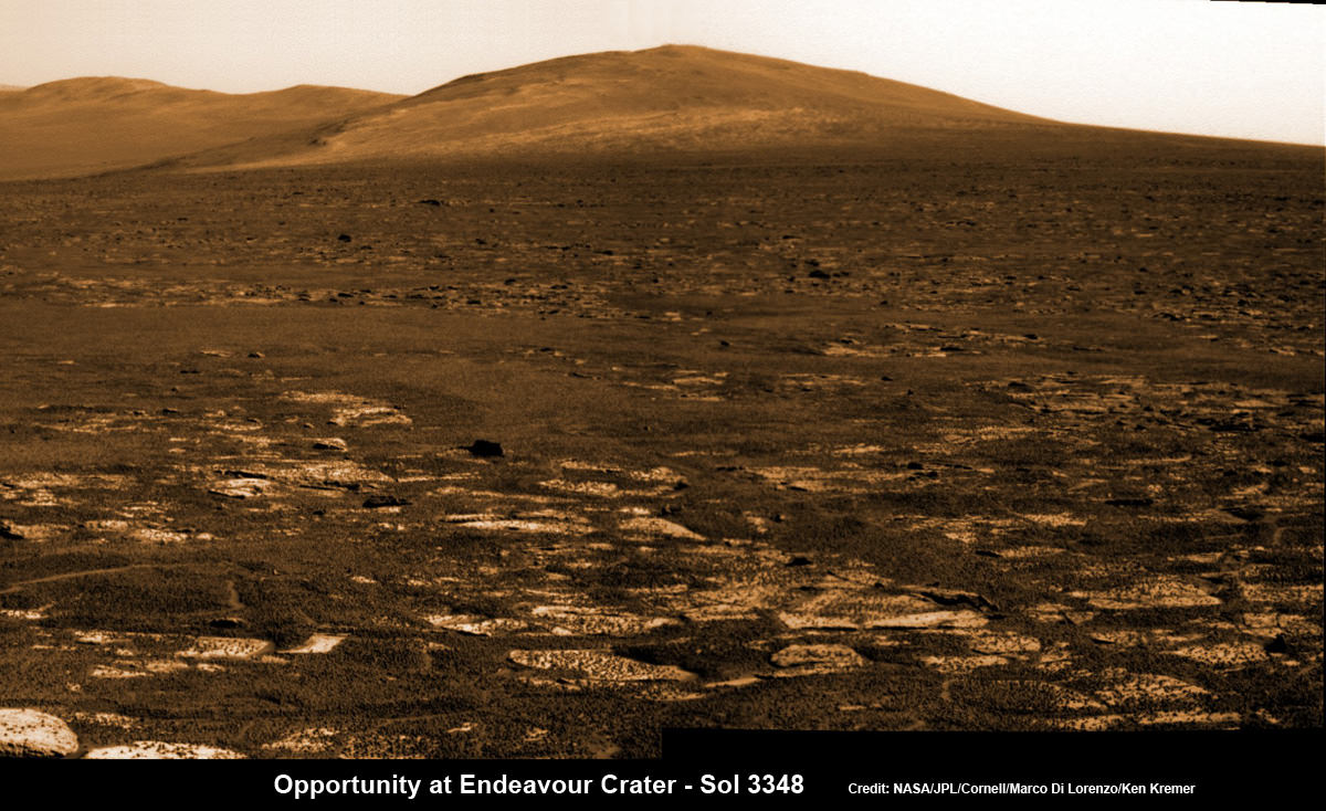
Opportunity rover’s view across Botany Bay to Solander Point - her next destination - as NASA celebrates 10 Years since blastoff for Mars on July 7, 2003. The rover will climb up Solander Point because it which may harbor clay minerals indicative of a past Martian habitable environment. This pancam mosaic was assembled from raw images taken on Sol 3348 (June 24, 2013. Credit: NASA/JPL/Cornell/ASU/Marco Di Lorenzo/Ken Kremer (kenkremer.com)

Opportunity rover’s view across Botany Bay to Solander Point – her next destination – as NASA celebrates 10 Years since blastoff for Mars on July 7, 2003. The rover will climb up Solander Point because it which may harbor clay minerals indicative of a past Martian habitable environment. This pancam mosaic was assembled from raw images taken on Sol 3348 (June 24, 2013.
Credit: NASA/JPL/Cornell/ASU/Marco Di Lorenzo/Ken Kremer (kenkremer.com)[/caption]

Today, NASA’s Opportunity rover marks a magical moment celebrating 10 years since launching to Mars on July 7, 2003 and with her impending Mountain destination filling the camera’s eye view.

The now legendary robot has vastly exceeded everyone’s expectations. Back in 2003 the science team promised us a mere 90 day ‘warranty’ following the suspenseful airbag landing on Jan. 24, 2004 at Meridiani Planum.

Today is Martian Day (or Sol) 3360. That amounts to a life expectancy and exploration ‘bonus’ of more than 37 times beyond the design lifetime.

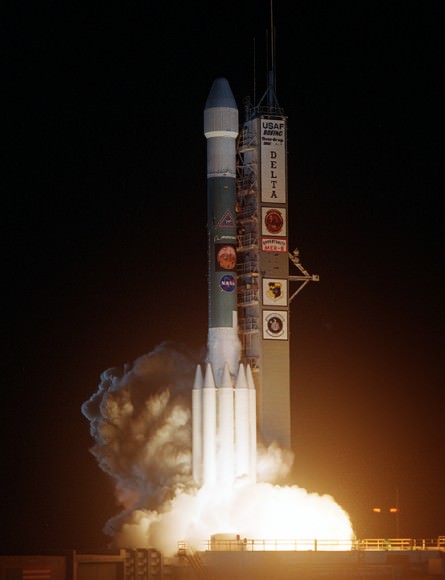
Launch of NASA’s 2nd Mars Exploration Rover, Opportunity, aboard a Delta II Heavy rocket to Mars on July 7, 2003 at 11:18 p.m. EDT from Pad 17-B at Cape Canaveral Air Force Station, Fla.  Credit: NASA
Launch of NASA’s 2nd Mars Exploration Rover, Opportunity, aboard a Delta II Heavy rocket to Mars on July 7, 2003 at 11:18 p.m. EDT from Pad 17-B at Cape Canaveral Air Force Station, Fla. Credit: NASA

Opportunity’s twin sister Spirit blasted off three weeks earlier in June 2003 and continued functioning until 2010.

“I never thought we’d achieve nine months!” Principal Investigator Prof. Steve Squyres of Cornell University told me recently on the occasion of the rovers 9th anniversary on Mars in January 2013.

As you read this, the now decade old rover Opportunity is blazing a trail toward’s the oldest geological deposits she has ever explored – at a place called Solander Point, a raised ridge along the eroded rim of huge Endeavour Crater.

Opportunity has surpassed the halfway point in the traverse from the rim segment she has explored the past 22 months at ‘Cape York’ to her next rim segment destination at Solander.

From tip to tip, Cape York and Solander Point lie 1.2-mile (2-kilometer) apart along the western rim of Endeavour Crater. Both are raised portions of 14-mile-wide (22-kilometer-wide) Endeavour.

The rover has less than half a mile (800 meters) to go to finish the Martian dash from one rim segment to the next across an area called ‘Botany Bay’.

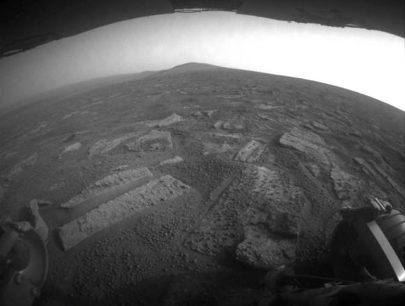
This view from July 2, 2013 (Sol 3355) shows the terrain that NASA's Mars Exploration Rover Opportunity is crossing  in a flat area called "Botany Bay" on the way toward "Solander Point," which is visible on the horizon. Credit: NASA/JPL-Caltech
This view from July 2, 2013 (Sol 3355) shows the terrain that NASA’s Mars Exploration Rover Opportunity is crossing in a flat area called “Botany Bay” on the way toward “Solander Point,” which is visible on the horizon. Credit: NASA/JPL-Caltech

“We are making very good progress crossing ‘Botany Bay,’ said John Callas of NASA’s Jet Propulsion Laboratory, Pasadena, Calif., who is project manager for the mission now entering its 2nd decade.

The flat terrain of fractured, light-toned bedrock is devoid of treacherous dunes and is easy to drive across, almost like a highway, which simplifies the daily planning by the rovers Earthly handlers.

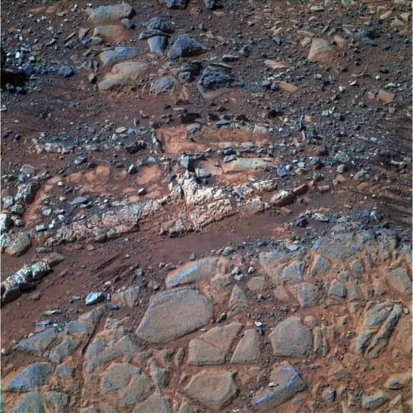
“The surface that Opportunity is driving across in Botany Bay is polygonally fractured outcrop that is remarkably good for driving,” said Brad Joliff, an Opportunity science team member and long-term planner at Washington University in St. Louis. “The plates of outcrop, like a tiled mosaic pavement, have a thin covering of soil, not enough to form the wind-blown ripples we’ve had to deal with during some other long treks. The outcrop plates are light-toned, and the cracks between them are filled with dark, basaltic soil and our old friends the ‘blueberries.”

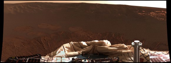
The “blueberries” are hematite-rich, erosion-resistant concretions about the size of BB’s that Opportunity discovered when she first opened her eyes at her Eagle crater landing site. During the multi year crater hopping tour that ensued, the rover continued finding patches of blueberries all the way to Endeavour crater.

1st color panorama taken by Opportunity after landing inside Eagle Crater on Jan. 24, 2004. Credit:  NASA/JPL/Cornell
1st color panorama taken by Opportunity after landing inside Eagle Crater on Jan. 24, 2004. Credit: NASA/JPL/Cornell

Opportunity is expected to arrive at Solander’s foothills sometime in August – before the onset of the next southern hemisphere Martian winter, her 6th altogether.

Opportunity will scale Solander to continue the science quest in search of additional evidence of habitable environments with the chemical ingredients necessary to sustain Martian microbial life.

“Right now the rover team is discussing the best way to approach and drive up Solander,” Ray Arvidson told Universe Today. Arvidson is the mission’s deputy principal scientific investigator from Washington University in St. Louis, Mo.

‘Solander Point’ offers roughly about a 10 times taller stack of geological layering compared to ‘Cape York.’

Solander also offers north facing slopes where Opportunity’s solar wings can more effectively soak up the sun’s rays to generate life giving electrical power.

The robot remains in excellent health.

The total driving distance exceeds 23 miles (37 kilometers). She has snapped over 181,000 images.

Meanwhile on the opposite side of Mars at Gale Crater, Opportunity’s younger sister rover Curiosity also discovered a habitable environment originating from a time when the Red Planet was far warmer and wetter billions of years ago.

And like Opportunity, Curiosity is also trekking towards a mountain rich in sedimentary layers, hoping to unveil the mysteries of Mars past.

Ken Kremer

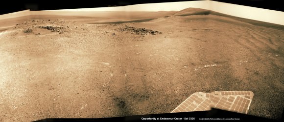
Opportunity captures spectacular panoramic view ahead to her upcoming mountain climbing goal, the raised rim of “Solander Point” at right, located along the western edge of Endeavour Crater. It may harbor clay minerals indicative of a habitable zone.  The rise at left is "Nobbys Head" which the rover just passed on its southward drive to Solander Point from Cape York.  This pancam photo mosaic was taken on Sol 3335, June 11, 2013 shows vast expanse of the central crater mound and distant Endeavour crater rim.   Credit: NASA/JPL/Cornell/ASU/Marco Di Lorenzo/Ken Kremer (kenkremer.com) See full panoramic scene below
Opportunity captures spectacular panoramic view ahead to her upcoming mountain climbing goal, the raised rim of “Solander Point” at right, located along the western edge of Endeavour Crater. It may harbor clay minerals indicative of a habitable zone. The rise at left is “Nobbys Head” which the rover just passed on its southward drive to Solander Point from Cape York. This pancam photo mosaic was taken on Sol 3335, June 11, 2013 shows vast expanse of the central crater mound and distant Endeavour crater rim. Credit: NASA/JPL/Cornell/ASU/Marco Di Lorenzo/Ken Kremer (kenkremer.com)
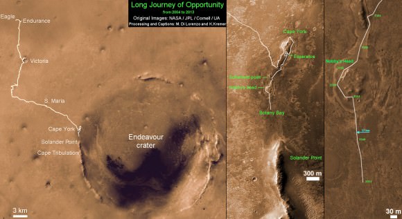
Traverse Map for NASA’s Opportunity rover from 2004 to 2013.  This map shows the entire path the rover has driven during more than 9 years and over 3360 Sols, or Martian days, since landing inside Eagle Crater on Jan 24, 2004 to current location heading south to Solander Point from  Cape York ridge at the western rim of Endeavour Crater.  Credit: NASA/JPL/Cornell/ASU/Marco Di Lorenzo/Ken Kremer
Traverse Map for NASA’s Opportunity rover from 2004 to 2013
This map shows the entire path the rover has driven during more than 9 years and over 3360 Sols, or Martian days, since landing inside Eagle Crater on Jan 24, 2004 to current location heading south to Solander Point from Cape York ridge at the western rim of Endeavour Crater. Credit: NASA/JPL/Cornell/ASU/Marco Di Lorenzo/Ken Kremer

NASA’s Independence Day Fireworks from Wallops Investigates Earth’s Global Daytime Dynamo Current

July 4 Morning Fireworks from NASA. A NASA Black Brant V Sounding Rocket launches in support of the Daytime Dynamo Mission on July 4, 2013 from NASA Wallops Flight Facility, VA, Credit NASA/J. Eggers

July 4 Morning Fireworks from NASA!
A NASA Black Brant V Sounding Rocket launches in support of the Daytime Dynamo Mission on July 4, 2013 from NASA Wallops Flight Facility, VA. Credit: NASA/J. Eggers[/caption]

WALLOPS ISLAND, VA – Today, July 4, NASA celebrated America’s Independence Day with a spectacular fireworks display of a dynamic duo of sounding rockets – blasting off barely 15 seconds apart this morning from the agencies NASA Wallops Island facility on the Eastern Shore of Virginia on a science experiment to study the ionosphere.

The goal of the two rocket salvo was an in depth investigation of the electrical currents in Earth’s ionosphere – called the Daytime Dynamo.

The Dynamo electrical current sweeps through the ionosphere, a layer of charged particles that extends from about 30 to 600 miles above Earth.

Disruptions in the ionosphere can scramble radio wave signals for critical communications and navigations transmissions that can impact our every day lives.

The launches suffered multiple delays over the past 2 weeks due to weather, winds, errant boats and unacceptable science conditions in the upper atmosphere.

A Black Brant V launches first in support of Daytime Dynamo. Terroer improved Orion (at right) followed 15 seconds later from NASA Wallops on July 4, 2013. Credit:  NASA/P. Black
A Black Brant V launches first in support of Daytime Dynamo. Terroer improved Orion (at right) followed 15 seconds later from NASA Wallops on July 4, 2013. Credit: NASA/P. Black

At last, the Fourth of July was the irresistible charm.

The liftoff times were 10:31:25 a.m. for the Black Brant V and 10:31:40 a.m. (EDT) for the Terrier-Improved Orion.

The experiment involved launching two suborbital rockets and also dispatching a NASA King Air airplane to collect a stream of airborne science measurements.

Daytime Dynamo is a joint project between NASA and the Japanese Space Agency, or Japan Aerospace Exploration Agency, or JAXA, said Robert Pfaff to Universe Today in an exclusive interview inside Mission Control at Wallops. Pfaff is the principle investigator for the Dynamo sounding rocket at NASA’s Goddard Space Flight Center in Greenbelt, Md.

“The dynamo changes during the day and varies with the season,” Pfaff told me.

But they only have one chance to launch. So the science team has to pick the best time to meet the science objectives.

“We would launch every month if we could and had the funding, in order to even more fully characterize the Dynamo.”

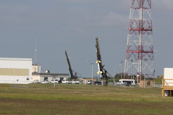
Two rocket salvo comprising a Black Brant V (left) and a Terrier-Improved Orion (right) sit ready to launch as part of the Daytime Dynamo mission in this panoramic view from NASA Wallops Flight Facility at Virginia’s Eastern Shore.  Credit:  Ken Kremer
Two rocket salvo comprising a Black Brant V (left) and a Terrier-Improved Orion (right) sit ready to launch as part of the Daytime Dynamo mission in this panoramic view from NASA Wallops Flight Facility at Virginia’s Eastern Shore. Credit: Ken Kremer/kenkremer.com

The 35 foot tall single-stage Black Brant V launched first. It carried a 600 pound payload to collect the baseline data to characterize the neutral and charged ionospheric particles as it blasted skyward.

The 33 foot tall two-stage Terrier-Improved Orion took off just 15 seconds later in the wake of the exhaust of the Black Brant V.

Exhaust trails from Black Brant V and a Terrier-Improved Orion launched in support of Daytime Dynamo mission on July 4, 2013. Credit: NASA P. Black
Exhaust trails from Black Brant V and a Terrier-Improved Orion launched in support of Daytime Dynamo mission on July 4, 2013. Credit: NASA/P. Black

The Terrier-Improved Orion successfully deployed a lengthy trail of lithium gas from a pressurized canister that created a chemical tracer to track how the upper atmospheric winds vary with altitude. These winds are believed to be the drivers of the dynamo currents.

Both rockets fly for about five minutes to an altitude of some 100 miles up in the ionosphere. They both splashed down in the ocean after about 15 minutes.

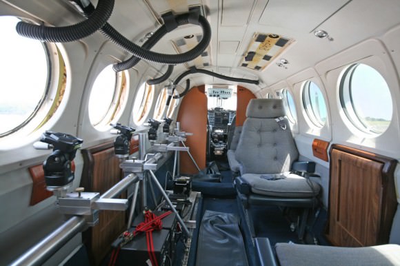
NASA’s King Air aircraft was essential to the mission. I toured the airplane on the Wallops runway for an up-close look inside. It is outfitted with a bank of precisely aimed analytical instruments peering through the aircraft windows to capture the critical science data – see my photos herein.

“The King Air launches about an hour before the scheduled liftoff time,” Pfaff told me.

“It uses special cameras and filters to collect visible and infrared spectroscopic data from the lithium tracer to characterize the daytime dynamo.”

The science instruments are newly developed technology to make the daytime measurements of the lithium tracer and were jointly created by NASA, JAXA and scientists at Clemson University.

“Everything worked as planned,” Pfaff announced from Wallops Mission Control soon after the magnificent Fourth of July fireworks show this morning.

Ken Kremer

Black Brant V (left) and a Terrier-Improved Orion (right) rockets sit on launch pads as part of the Daytime Dynamo mission in this up close  view from NASA Wallops Flight Facility at Virginia’s Eastern Shore.  Credit: Ken Kremer/kenkremer.com
Black Brant V (left) and Terrier-Improved Orion (right) rockets sit on launch pads as part of the Daytime Dynamo mission in this up close view from NASA Wallops Flight Facility at Virginia’s Eastern Shore. Credit: Ken Kremer/kenkremer.com
Inside cabin view of NASA King Air aircraft outfitted with science instrument mounts to support a of cameras to capture visible and infrared spectroscopic measurements in support of Daytime Dynamic launches on July 4, 2013.  Credit: Ken Kremer/kenkremer.com
Inside cabin view of NASA King Air aircraft outfitted with science instrument mounts to support a bank of cameras to capture visible and infrared spectroscopic measurements in support of Daytime Dynamic launches on July 4, 2013. Credit: Ken Kremer/kenkremer.com
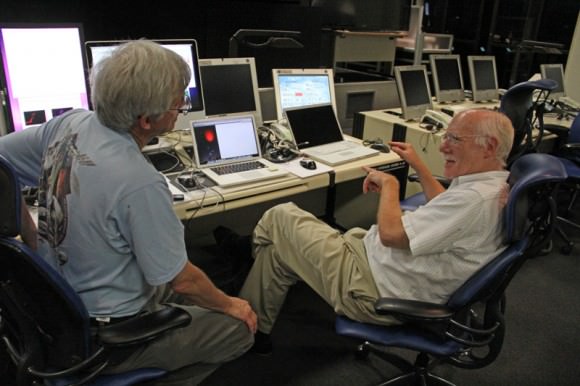
Robert Pfaff (right), Science Principle Investigator and Ken Kremer of Universe Today (left) discuss NASA’s Daytime Dynamo mission inside NASA Wallop’s Mission Control.  Credit: Ken Kremer/kenkremer.com
Robert Pfaff (right), Science Principle Investigator and Ken Kremer of Universe Today (left) discuss NASA’s Daytime Dynamo mission inside NASA Wallop’s Mission Control. Credit: Ken Kremer/kenkremer.com

Opportunity Approaching Mountain Climbing Goal and Signs of Habitable Martian Environment

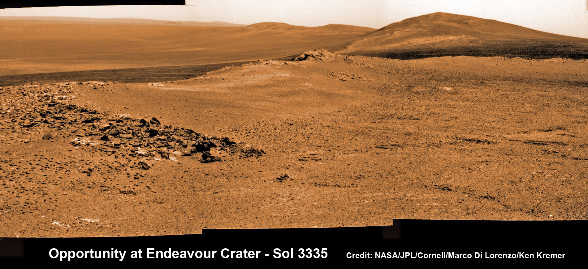
Opportunity rover captures spectacular view ahead to her upcoming mountain climbing goal, the raised rim of “Solander Point” at right, located along the western edge of Endeavour Crater. It may harbor clay minerals indicative of a habitable zone. This pancam photo mosaic was taken on Sol 3335, June 11, 2013. Credit: NASA/JPL/Cornell/ASU/Marco Di Lorenzo/Ken Kremer (kenkremer.com) See full panoramic scene below

Opportunity rover captures spectacular view ahead to her upcoming mountain climbing goal, the raised rim of “Solander Point” at right, located along the western edge of Endeavour Crater. It may harbor clay minerals indicative of a habitable zone. This pancam photo mosaic was taken on Sol 3335, June 11, 2013. Credit: NASA/JPL/Cornell/ASU/Marco Di Lorenzo/Ken Kremer (kenkremer.com)
See full panoramic scene – below
Your last chance to “Send Your Name to Mars aboard NASA’s MAVEN orbiter” – below[/caption]

NASA’s nearly decade old Opportunity Mars rover is sailing swiftly on a southerly course towards her first true mountain climbing destination – named “Solander Point” – in search of further evidence of habitable environments with the chemical ingredients necessary to sustain Martian life forms.

At Solander Point, researchers have already spotted deep stacks of ancient rocks transformed by flowing liquid water eons ago. It is located along the western rim of huge Endeavour Crater.

“Right now the rover team is discussing the best way to approach and drive up Solander,” Ray Arvidson told Universe Today. Arvidson is the mission’s deputy principal scientific investigator from Washington University in St. Louis, Mo.

Solander Point may harbor clay minerals in the rock stacks indicative of a past Martian habitable zone.

“One idea is to drive part way up Solander from the west side of the rim, turn left and then drive down the steeper north facing slopes with the stratographic sections,” Arvidson told me.

“That way we don’t have to drive up the relatively steeper slopes. The rover can drive up rocky surfaces inclined about 12 to 15 degrees.”

“We want to go through the stratographic sections on the north facing sections.”

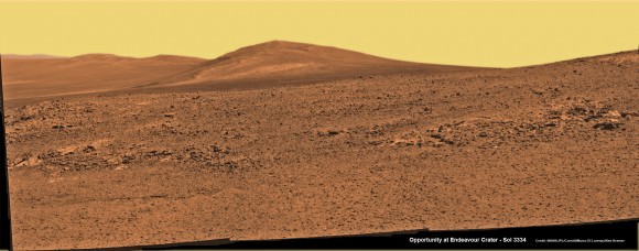
Solander Point mosaic captured by high resolution pancam camera on Sol 3334, June 10, 2013.  Opportunity will scale Solander after arriving in August 2013 in search of chemical ingredients to sustain Martian microbes  Credit: NASA/JPL/Cornell/ASU/Marco Di Lorenzo/Ken Kremer (kenkremer.com)
Solander Point mosaic captured by high resolution pancam camera on Sol 3334, June 10, 2013. Opportunity will scale Solander after arriving in August 2013 in search of chemical ingredients to sustain Martian microbes Credit: NASA/JPL/Cornell/ASU/Marco Di Lorenzo/Ken Kremer (kenkremer.com)

The science team hopes that by scaling Solander, Opportunity will build on her recent historic discovery of a habitable environment at a rock called “Esperance” that possesses a cache of phyllosilicate clay minerals.

These aluminum rich clay minerals typically form in neutral, drinkable water that is not extremely acidic or basic and therefore could support a path to potential Martian microbes.

“Esperance ranks as one of my personal Top 5 discoveries of the mission,” said Steve Squyres of Cornell University, Ithaca, N.Y., principal investigator for NASA’s rover mission at a recent media briefing.

'Esperance' Target Examined by Opportunity in May 2013.  The  pale rock called "Esperance," has a high concentration of clay minerals formed in near neutral water indcating a spot favorable for life. Credit: NASA/JPL-Caltech/Cornell Univ./Arizona State Univ.
‘Esperance’ Target Examined by Opportunity in May 2013. The pale rock called “Esperance,” has a high concentration of clay minerals formed in near neutral water indcating a spot favorable for life. Credit: NASA/JPL-Caltech/Cornell Univ./Arizona State Univ.

Using high resolution CRISM spectral data collected from Mars orbit, the rover was specifically directed to Esperance, Arvidson explained. The rock was found about a kilometer back on Matijevic Hill at ‘Cape York’, a rather low hilly segment of the western rim of giant Endeavour crater which spans 14 miles (22 km) across.

‘Solander Point’ offers roughly about a 10 times taller stack of geological layering compared to ‘Cape York.’ Both areas are raised segments of the western rim of Endeavour Crater.

The team is working now to obtain the same type of high resolution spectral evidence for phyllosilicate clay minerals at Solander as they had at Cape York to aid in targeting Opportunity to the most promising outcrops, Arvidson explained.

Opportunity is snapping ever more spectacular imagery of Solander Point and the eroded rim of Endeavour Crater as she approaches closer every passing Sol, or Martian Day. See our original photo mosaics herein by Marco Di Lorenzo and Ken Kremer.

Opportunity captures spectacular panoramic view ahead to her upcoming mountain climbing goal, the raised rim of “Solander Point” at right, located along the western edge of Endeavour Crater. It may harbor clay minerals indicative of a habitable zone.  The rise at left is "Nobbys Head" which the rover just passed on its southward drive to Solander Point from Cape York.  This pancam photo mosaic was taken on Sol 3335, June 11, 2013 shows vast expanse of the central crater mound and distant Endeavour crater rim.   Credit: NASA/JPL/Cornell/ASU/Marco Di Lorenzo/Ken Kremer (kenkremer.com) See full panoramic scene below
Opportunity captures spectacular panoramic view ahead to her upcoming mountain climbing goal, the raised rim of “Solander Point” at right, located along the western edge of Endeavour Crater. It may harbor clay minerals indicative of a habitable zone. The rise at left is “Nobbys Head” which the rover just passed on its southward drive to Solander Point from Cape York. This pancam photo mosaic was taken on Sol 3335, June 11, 2013 shows vast expanse of the central crater mound and distant Endeavour crater rim.
Credit: NASA/JPL/Cornell/ASU/Marco Di Lorenzo/Ken Kremer (kenkremer.com)

The long lived robot arrived at the edge of Endeavour crater in mid-2011 and will spend her remaining life driving around the scientifically rich crater rim segments.

On June 21, 2013, Opportunity marked five Martian years on Mars since landing on Jan 24, 2004 with a mere 90 day (Sol) ‘warranty’.

This week Opportunity’s total driving distance exceeded 23 miles (37 kilometers).

The solar powered robot remains in excellent health and the life giving solar arrays are producing plenty of electrical power at the moment.

Solander Point also offers northerly tilled slopes that will maximize the power generation during Opportunity’s upcoming 6th Martian winter .

The rover handlers want Opportunity to reach Solander’s slopes by August, before winter’s onset.

As ot today (tosol) Opportunity has trekked about halfway from Cape York to Solander Point – tip to tip.

On the opposite side of Mars at Gale Crater, Opportunity’s younger sister rover Curiosity also discovered clay minerals and a habitable environment originating from a time when the Red Planet was far warmer and wetter billions of years ago.

And this is your last chance to “Send Your Name to Mars” aboard NASA’s MAVEN orbiter- details here. Deadline: July 1, 2013. Launch: Nov. 18, 2013

Ken Kremer

Wide angle view of Endeavour Crater showing Solander Point and Cape Tribulation in this photo mosaic captured by navcam camera on Sol 3335, June 11, 2013.  Opportunity will scale Solander after arriving in August 2013 in search of chemical ingredients to sustain Martian microbes.  Credit: NASA/JPL/Cornell/Marco Di Lorenzo/Ken Kremer (kenkremer.com)
Wide angle view of Endeavour Crater showing Solander Point and Cape Tribulation in this photo mosaic captured by navcam camera on Sol 3335, June 11, 2013. Opportunity will scale Solander after arriving in August 2013 in search of chemical ingredients to sustain Martian microbes. Credit: NASA/JPL/Cornell/Marco Di Lorenzo/Ken Kremer (kenkremer.com)
Traverse Map for NASA’s Opportunity rover from 2004 to 2013.  This map shows the entire path the rover has driven during more than 9 years and over 3351 Sols, or Martian days, since landing inside Eagle Crater on Jan 24, 2004 to current location heading south to Solander Point from  Cape York ridge at the western rim of Endeavour Crater.  Credit: NASA/JPL/Cornell/ASU/Marco Di Lorenzo/Ken Kremer
Traverse Map for NASA’s Opportunity rover from 2004 to 2013. This map shows the entire path the rover has driven during more than 9 years and over 3351 Sols, or Martian days, since landing inside Eagle Crater on Jan 24, 2004 to current location heading south to Solander Point from Cape York ridge at the western rim of Endeavour Crater. Credit: NASA/JPL/Cornell/ASU/Marco Di Lorenzo/Ken Kremer

NASA’s Daytime Dynamo Experiment Deploys Lithium to Study Global Ionospheric Communications Disruptions

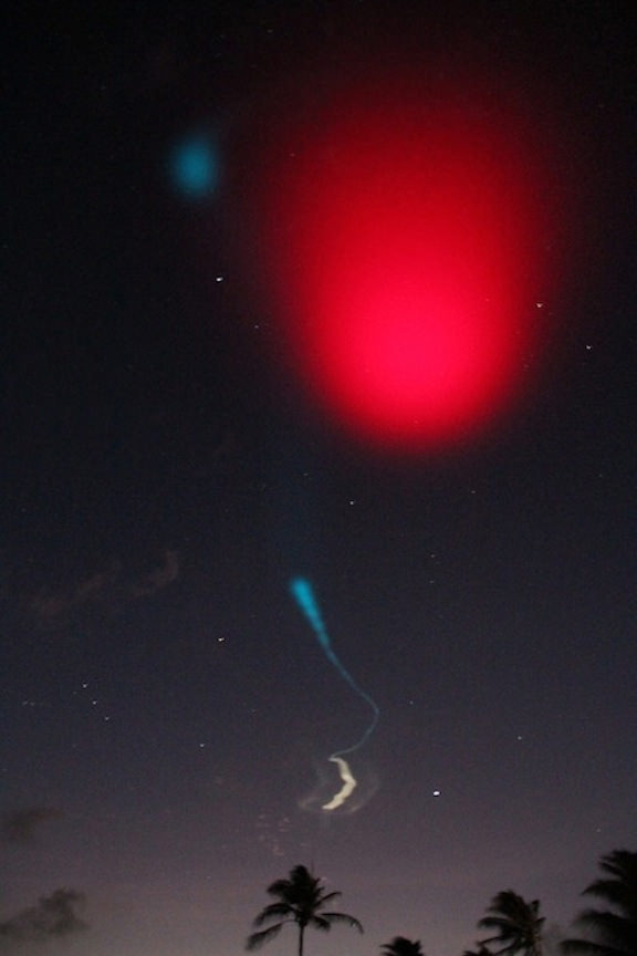
On June 24, 2013 a pair of daytime sounding rockets will launch from NASA Wallops Flight Facility (WFF) and deploy a chemical trail like the one deployed here from a sounding rocket at night. The chemical trail will help researchers track wind movement to determine how it affects the movement of charged particles in the atmosphere. All the colors in the sky shown here, the white and blue streaks, and the larger red blob overhead, are from the chemical trails. Credit: NASA

On June 24, 2013 a pair of daytime sounding rockets will launch from NASA Wallops Flight Facility (WFF) and deploy a chemical trail like the one deployed here from a sounding rocket at night. The chemical trail will help researchers track wind movement to determine how it affects the movement of charged particles in the atmosphere. All the colors in the sky shown here, the white and blue streaks, and the larger red blob overhead, are from the chemical trails. Credit: NASA
See Rocket Visibility Maps below[/caption]

NASA WALLOPS, VA – Science and space aficionados are in for rare treat on June 24 when NASA launches a two-rocket salvo from the NASA Wallops Flight Facility, Va. on a mission to study how charged particles in the ionosphere can disrupt communication signals that impact our day to day lives.

It’s a joint project between NASA and the Japanese Space Agency, or Japan Aerospace Exploration Agency, or JAXA.

The suborbital sounding rockets will blast off merely 15 seconds apart from a beach-side launch complex directly on Virginia’s Eastern shore on a science mission named the Daytime Dynamo.

An electric current called the dynamo, illustrated here, sweeps through Earth’s upper atmosphere. A sounding rocket called Dynamo will launch in the summer of 2013 to study the current, which can disrupt Earth’s communication and navigation signals. Credit: USGS
An electric current called the dynamo, illustrated here, sweeps through Earth’s upper atmosphere.A pair of sounding rockets called Dynamo will launch on June 24, to study the current, which can disrupt Earth’s communication and navigation signals. Credit: USGS
Lithium gas will be deployed from one of the rockets to create a chemical trail that can be used to track upper atmospheric winds that drive the dynamo currents.

The goal is to study the global electrical current called the dynamo, which sweeps through the ionosphere, a layer of charged particles that extends from about 30 to 600 miles above Earth.

Why should you care?

Because disruptions in the ionosphere can scramble radio wave signals for communications and navigations transmissions from senders to receivers – and that can impact our every day lives.

The experiment involves launching a duo of suborbital rockets and also dispatching an airplane to collect airborne science measurements.

Mission control and the science team will have their hands full coordinating the near simultaneous liftoffs of two different rockets with two different payloads while watching the weather to make sure its optimal to collect the right kind of data that will answer the research proposal.

A single-stage Black Brant V will launch first. The 35 foot long rocket will carry a 600 pound payload to collect the baseline data to characterize the neutral and charged particles as it swiftly travels through the ionosphere.

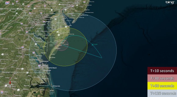
Visibility map for Black Brant V rocket launch on June 24 at 9:30 a.m.  Credit: NASA Wallops
Visibility map for Black Brant V rocket launch on June 24 at 9:30 a.m. Credit: NASA Wallops

A two-stage Terrier-Improved Orion blasts off just 15 seconds later. The 33 foot long rocket carries a canister of lithium gas. It will shoot out a long trail of lithium gas that creates a chemical trail that will be tracked to determine how the upper atmospheric wind varies with altitude. These winds are believed to be the drivers of the dynamo currents.

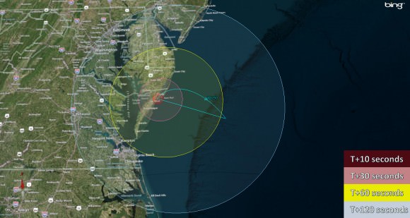
Visibility map for Terrier-Improved Orion rocket launch on June 24 at 9:30 a.m.  Credit: NASA Wallops
Visibility map for Terrier-Improved Orion rocket launch on June 24 at 9:30 a.m. Credit: NASA Wallops

Both rockets will fly for about five minutes to an altitude of some 100 miles up in the ionosphere.

Since its daytime the lithium trails will be very hard to discern with the naked eye. That’s why NASA is also using a uniquely equipped NASA King Air airplane outfitted with cameras with special new filters optimized to detect the lithium gas and how it is moved by the winds that generate the global electrical current.

The new technology to make the daytime measurements was jointly developed by NASA, JAXA and scientists at Clemson University.

RockOn 2013 University student payload blasts off on June 20,2013 atop a NASA Terrier-Improved Orion suborbital rocket from NASA Wallops at Virginia’s eastern shore. Credit: NASA/Chris Perry

Sounding rockets are better suited to conduct these studies of the ionosphere compared to orbiting satellites which fly to high.

“The manner in which neutral and ionized gases interact is a fundamental part of nature,” said Robert Pfaff, the principle investigator for the Dynamo sounding rocket at NASA’s Goddard Space Flight Center in Greenbelt, Md.

“There could very well be a dynamo on other planets. Jupiter, Saturn, Uranus and Neptune are all huge planets with huge atmospheres and huge magnetic fields. They could be setting up dynamo currents galore.”

The launch window opens at 9:30 a.m. and extends until 11:30 a.m. Back up opportunities are available on June 25 and from June 28 to July 8.

The rockets will be visible to residents in the Wallops region – and also beyond to the US East Coast from parts of North Carolina to New Jersey.

The NASA Wallops Visitor Center will open at 8 a.m. on launch day for viewing the launches.

Live coverage of the June 24 launch is available via NASA Wallops UStream beginning at 8:30 a.m. at: http://www.ustream.tv/channel/nasa-tv-wallops

I will be onsite at Wallops for Universe Today.

And don’t forget to “Send Your Name to Mars” aboard NASA’s MAVEN orbiter- details here. Deadline: July 1, 2013. Launch: Nov. 18, 2013

Ken Kremer

…………….
Learn more about Earth, Mars, Curiosity, Opportunity, MAVEN, LADEE, Sounding rockets and NASA missions at Ken’s upcoming presentation

June 23: “Send your Name to Mars on MAVEN” and “CIBER Astro Sat, LADEE Lunar & Antares Rocket Launches from Virginia”; Rodeway Inn, Chincoteague, VA, 8 PM
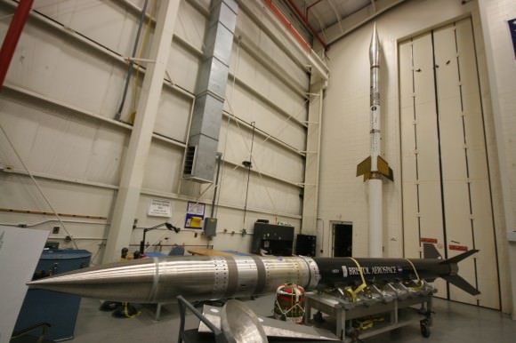
Show here are the two types of sounding rockets that will launch on June 24, 2013 from NASA Wallops Island, VA., on the Daytime Dynamo mission. Black Brant V rocket is horizontal. Terrier-Improved Orion rocket is vertical. Credit: Ken Kremer
Show here are the two types of sounding rockets that will launch on June 24, 2013 from NASA Wallops Island, VA., on the Daytime Dynamo mission. Black Brant V rocket is horizontal. Terrier-Improved Orion rocket is vertical. Credit: Ken Kremer – kenkremer.com
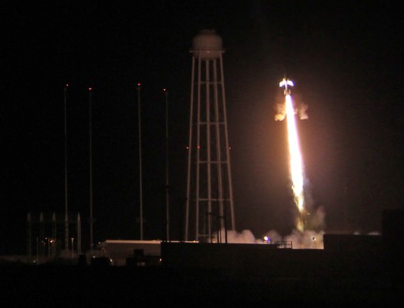
Night time launch of NASA Black Brant XII suborbital rocket at 11:05 p.m. EDT on June 5, 2013 from the NASA Wallops Flight Facility carrying the CIBER astronomy payload. Credit: Ken Kremer- kenkremer.com