Will the March 20th Total Solar Eclipse Impact Europe’s Solar Energy Grid?

The first eclipse of 2015 is coming right up on Friday, March 20th, and may provide a unique challenge for solar energy production across Europe.

Sure, we’ve been skeptical about many of the websites touting a ‘blackout’ and Y2K-like doom pertaining to the March 20th total solar eclipse as of late. And while it’s true that comets and eclipses really do bring out the ‘End of the World of the Week’ -types across ye ole web, there’s actually a fascinating story of science at the core of next week’s eclipse and the challenge it poses to energy production.

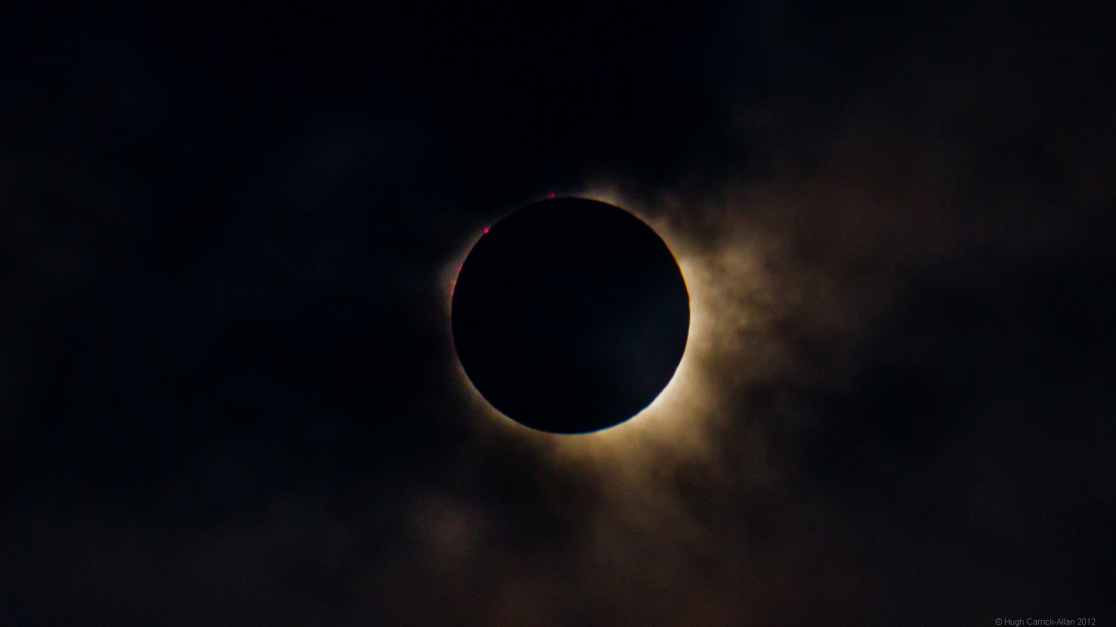
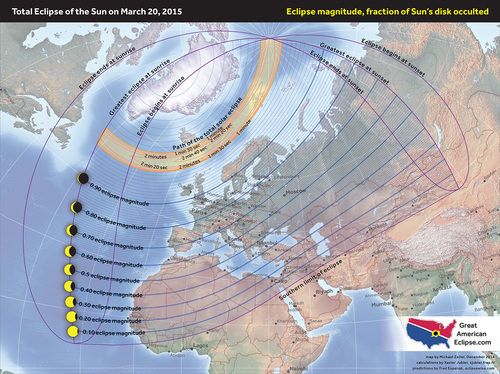
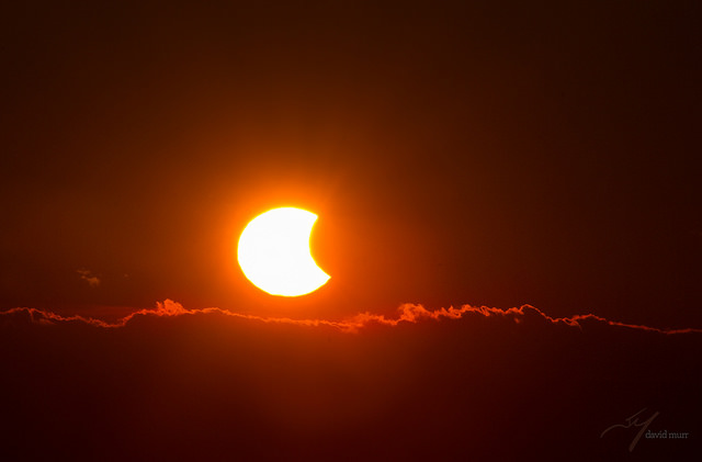
But first, a brief recap of the eclipse itself. Dubbed the “Equinox Eclipse,” totality only occurs over a swath of the North Atlantic and passes over distant Faroe and Svalbard Islands. Germany and central Europe can expect an approximately 80% partially obscured Sun at the eclipse’s maximum.
Credit
The magnitude of the March 20th solar eclipse across Europe. Credit: Michael Zeiler/GreatAmericanEclipse.com

We wrote a full guide with the specifics for observing this eclipse yesterday. But is there a cause for concern when it comes to energy production?

A power grid is a huge balancing act.  As power production decreases from one source, other sources must be brought online to compensate. This is a major challenge — especially in terms of solar energy production.

Residential solar panels in Germany. Credit: Wikimedia Commons/ Sideka Solartechnik.

Germany currently stands at the forefront of solar energy technology, representing a whopping quarter of all solar energy capacity installed worldwide. Germany now relies of solar power for almost 7% of its annual electricity production, and during the sunniest hours, has used solar panels to satisfy up to 50% of the country’s power demand.

We recently caught up with Barry Fischer to discuss the issue. Fischer is the Head Writer at Opower, a software company that uses data to help electric and gas utilities improve their customer experience. Based on Opower’s partnerships with nearly 100 utilities worldwide, the company has amassed  the world’s largest energy dataset of its kind which documents energy consumption patterns across more than 55 million households around the globe.

A study published last week by Opower highlights data from the partial solar eclipse last October over the western United States. There’s little historical precedent for the impact that an eclipse could have on the solar energy grid. For example, during the August 11th, 1999 total solar eclipse which crossed directly over Europe, less than 0.1% of utility electricity was generated using solar power.
Credit:
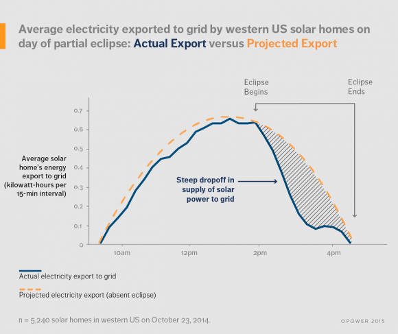
Looking at the drop in power production during the October 2014 solar eclipse. Credit: Opower.

What they found was intriguing. Although the 2014 partial solar eclipse only obscured 30 to 50% of the Sun, solar electric production dropped over an afternoon span of nearly three hours before returning to a normal pattern.

Examining data from 5,000 solar-powered homes in the western United States, Opower found that during the eclipse those homes sent 41% less electricity back to the grid than normal. Along with a nearly 1,000 megawatt decline in utility-scale solar power production, these drop-offs were compensated for by grid operators ramping up traditional thermal power plants that were most likely fueled by natural gas.

No serious problems were experienced during the October 23rd, 2014 partial solar eclipse in terms of solar electricity production in the southwestern United States, though it is interesting to note that the impact of the eclipse on solar energy production could be readily detected and measured.
Credit
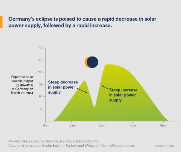
The projected effect of the March 20th eclipse on solar power production. Credit: Opower.

How does the drop and surge in solar power output anticipated for the March 20th eclipse differ from, say, the kind presented by the onset of night, or a cloudy day? “The impact of an eclipse can register broadly – and unusually rapidly – across an entire region,” Fischer told Universe Today. On a small scale, one area many be cloudy, while on a larger regional scale, other areas of clear or partly sunny skies can compensate. An eclipse — even a partial one — is fundamentally different, because the sudden onset and the conclusion are relatively uniform over a large region.

The March 20th event offers an unprecedented chance to study the effects of an eclipse on large-scale solar production up close. A study (in German) by the University of Applied Sciences in Berlin suggests that solar power production will fall at a rate 2.7 times faster than usual as the eclipse progresses over a span of 75 minutes. This is the equivalent of switching off one medium-sized power plant per minute.

The anticipated slingshot might be just as challenging, as  18 gigawatts of power comes back online at the conclusion of the eclipse in just over an hour. And as opposed to the 2014 eclipse over the U.S. which ended towards sunset, the key rebound period for the March 20th eclipse will be around local noon and during a peak production time.

Fischer also noted that “the second half of the partial solar eclipse will also pose a notable challenge” for the grid, as it is flooded with solar power production 3.5 times faster than normal. This phenomenon could also serve as a great model for what could occur daily on a grid that’s increasingly solar power reliant in the future, as energy production ramps up daily at sunrise. Such a reality may be only 15 years away, as Germany projects installed solar capacity to top 66 gigawatts by 2030.
Credit:
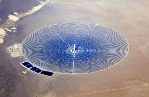
The Crescent Dunes Solar Energy Project outside of Tonopah, Nevada. Credit:  Wikimedia Commons/Amble. Licensed under a CC BY-SA 4.0 license.

What’s the anticipated impact projected for a future eclipse such as, say, the 2017 and 2024 total solar eclipses over the U.S.?

This eclipse may serve as a great dry run for modeling what could occur as reliance on solar energy production grows.

Such is the modern technical society we live in. It’s fascinating to think that eclipses aren’t only a marvelous celestial spectacle, but their effects on power production may actually serve as a model for the smart grids of tomorrow.



A Complete Guide to the March 20th Total Solar Eclipse

Credit

The first of two eclipse seasons for the year is upon us this month, and kicks off with the only total solar eclipse for 2015 on Friday, March 20th.

And what a bizarre eclipse it is. Not only does this eclipse begin just 15 hours prior to the March equinox marking the beginning of astronomical spring in the northern hemisphere, but the shadow of totality also beats path through the high Arctic and ends over the North Pole.

Credit:
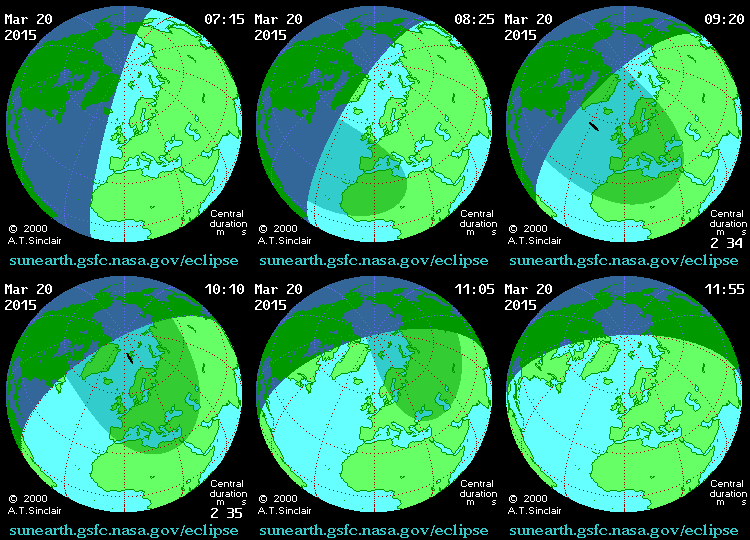
An animation of the March 20th eclipse. Credit: NASA/GSFC/AT Sinclair.

Already, umbraphiles — those who chase eclipses — are converging on the two small tracts of terra firma where the umbra of the Moon makes landfall: the Faroe and Svalbard islands. All of Europe, the northern swath of the African continent, north-central Asia and the Middle East will see a partial solar eclipse, and the eclipse will be deeper percentage-wise the farther north you are .

2015 features four eclipses in all: two total lunars and two solars, with one total solar and one partial solar eclipse. Four is the minimum number of eclipses that can occur in a calendar year, and although North America misses out on the solar eclipse action this time ’round, most of the continent gets a front row seat to the two final total lunar eclipses of the ongoing tetrad on April 4th and September 28th.

How rare is a total solar eclipse on the vernal equinox? Well, the last total solar eclipse on the March equinox occurred back in 1662 on March 20th. There was also a hybrid eclipse — an eclipse which was annular along a portion of the track, and total along another — on March 20th, 1681. But you won’t have to wait that long for the next, as another eclipse falls on the northward equinox on March 20th, 2034.

Credit
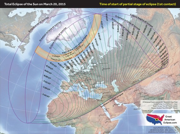
The path of the March 20th eclipse across Europe, including start times for the partial phases, and the path of totality, click to enlarge. For more maps showing the percentage of occlusion, elevation, and more, click here. Credit: Michael Zeiler/GreatAmercianEclipse.com.

Note that in the 21st century, the March equinox falls on March 20th, and will start occasionally falling on March 19th in 2044. We’re also in that wacky time of year where North America has shifted back to ye ‘ole Daylight Saving (or Summer) Time, while Europe makes the change after the eclipse on March 29th. It really can wreak havoc with those cross-time zone plans, we know…

The March 20th eclipse also occurs only a day after lunar perigee, which falls on March 19th at 19:39 UT. This is also one of the closer lunar perigees for 2015 at 357,583 kilometres distant, though the maximum duration of totality for this eclipse is only 2 minutes and 47 seconds just northeast of the Faroe Islands.

Credit:
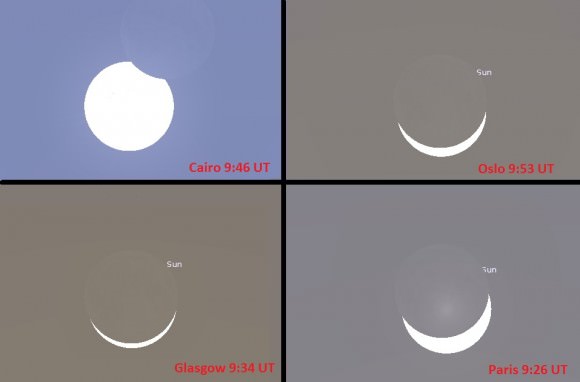
Views from selected locales in Europe and Africa. Credit: Stellarium.

This eclipse is number 61 of 71 in solar saros series 120, which runs from 933 to 2754 AD. It’s also the second to last total in the series, with the final total solar eclipse for the saros cycle occurring one saros later on March 30th, 2033.

And speaking of obscure eclipse terminology, check out this neat compendium we came across in research. What’s an Exeligmos? How many Heptons are in a Gregoriana?

The 462 kilometre wide path of the eclipse touches down south of Greenland at 9:13 UT at sunrise, before racing across the North Atlantic towards the pole and departing the Earth at 10:21 UT. The sedate partial phases for the eclipse worldwide start at 7:40 UT, and run out to 11:51 UT.

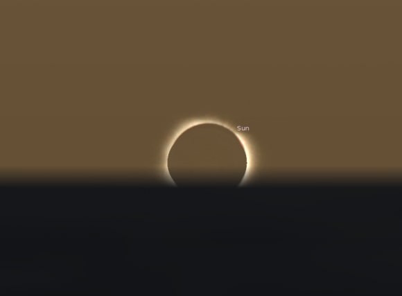
What would it look like to sit at the North Pole and watch a total solar eclipse on the first day of Spring? It would be a remarkable sight, as the disk of the Sun skims just above the horizon for the first time since the September 2014 equinox. Does this eclipse occur at sunrise or sunset as seen from the pole? It would be a rare spectacle indeed!

Credit
An equinoctal eclipse as simulated from the North Pole. Credit: Stellarium.

Alas, this unique view from the pole will more than likely go undocumented. A similar eclipse was caught in 2003 from the Antarctic, and a few intrepid eclipse chasers, including author David Levy did manage to make the journey down under to witness totality from the polar continent.

Credit
Practicing eclipse safety in Africa. Credit: Michael Zeiler/GreatAmericanEclipse.com

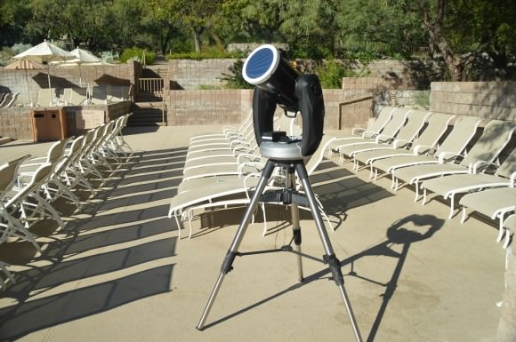
Safety is paramount when observing the Sun and a solar eclipse. Eye protection is mandatory during all partial phases across Europe, northern Asia, North Africa and the Middle East. A proper solar filter mask constructed of Baader safety film is easy to construct, and should fit snugly over the front aperture of a telescope. No. 14 welder’s goggles are also dense enough to look at the Sun, as are safety glasses specifically designed for eclipse viewing. Observing the Sun via projection or by using a pinhole projector is safe and easy to do.

Credit
A solar filtered scope ready to go in Tucson, Arizona. Credit: photo by author.

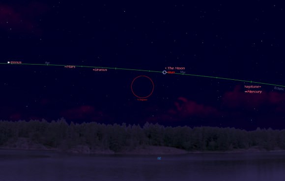
Weather is always the big variable in the days leading up to any eclipse. Unfortunately, March in the North Atlantic typically hosts stormy skies, and the low elevation of the eclipse in the sky may hamper observations as well. From the Faroe Islands, the Sun sits 18 degrees above the horizon during totality, while from the Svalbard Islands it’s even lower at 12 degrees in elevation. Much of Svalbard is also mountainous, making for sunless pockets of terrain that will be masked in shadow on eclipse day. Mean cloud amounts for both locales run in the 70% range, and the Eclipser website hosts a great in-depth climatology discussion for this and every eclipse.

Credit
The view of totality and the planets as seen from the Faroe Islands. Credit: Starry Night.

But don’t despair: you only need a clear view of the Sun to witness an eclipse!

Solar activity is also another big variable. Witnesses to the October 23rd, 2014 partial solar eclipse over the U.S. southwest will recall that we had a massive and very photogenic sunspot turned Earthward at the time. The Sun has been remarkably calm as of late, though active sunspot region 2297 is developing nicely. It will have rotated to the solar limb come eclipse day, and we should have a good grasp on what solar activity during the eclipse will look like come early next week.

And speaking of which: could an auroral display be in the cards for those brief few minutes of totality? It’s not out of the question, assuming the Sun cooperates.  Of course, the pearly white corona of the Sun still gives off a considerable amount of light during totality, equal to about half the brightness of a Full Moon. Still, witnessing two of nature’s grandest spectacles — a total solar eclipse and the aurora borealis — simultaneously would be an unforgettable sight, and to our knowledge, has never been documented!

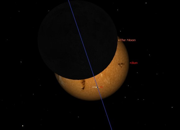
We also put together some simulations of the eclipse as seen from Earth and space:

Note that an area of southern Spain may witness a transit of the International Space Station during the partial phase of the eclipse. This projection is tentative, as the orbit of the ISS evolves over time. Be sure to check CALSky for accurate predictions in the days leading up to the eclipse.

Credit
The ISS transits the Sun during the eclipse around 9:05 UT as seen from southern Spain. Credit: Starry Night.

Can’t make it to the eclipse? Live in the wrong hemisphere? There are already a few planned webcasts for the March 20th eclipse:

Astronomia Practica plans to post photos in near real time of the eclipse from northern Scotland.

-Slooh has plans to broadcast the eclipse from the Faroe Islands.

-And here’s another webcast from the Faroe Islands and the path of totality courtesy of Kringvarp Føroya:

-Here’s another broadcast planned of the partial stages of the eclipse as seen from the UK.

-And our friends over at the Virtual Telescope Project also plans on webcasting the solar eclipse:

… and speaking of which, there’s also an exciting new Kickstarter project entitled Chasing Shadows which is headed to the Arctic to follow veteran eclipse chaser Geoff Sims (@beyond_beneath of Twitter):

And stay tuned, as North America and the Pacific region will witness another total lunar eclipse on April 4th 2015. And we’ve only got one more total solar eclipse across Southeast Asia in 2016 before the total solar eclipse of August 21st 2017 spanning the U.S.

Let the first eclipse season of 2015 begin!

Next… how will the solar eclipse affect the European solar grid? Expect an article on just that soon!

Space Weather Storm Monitoring Satellite Blasts off for Deep Space on SpaceX Rocket

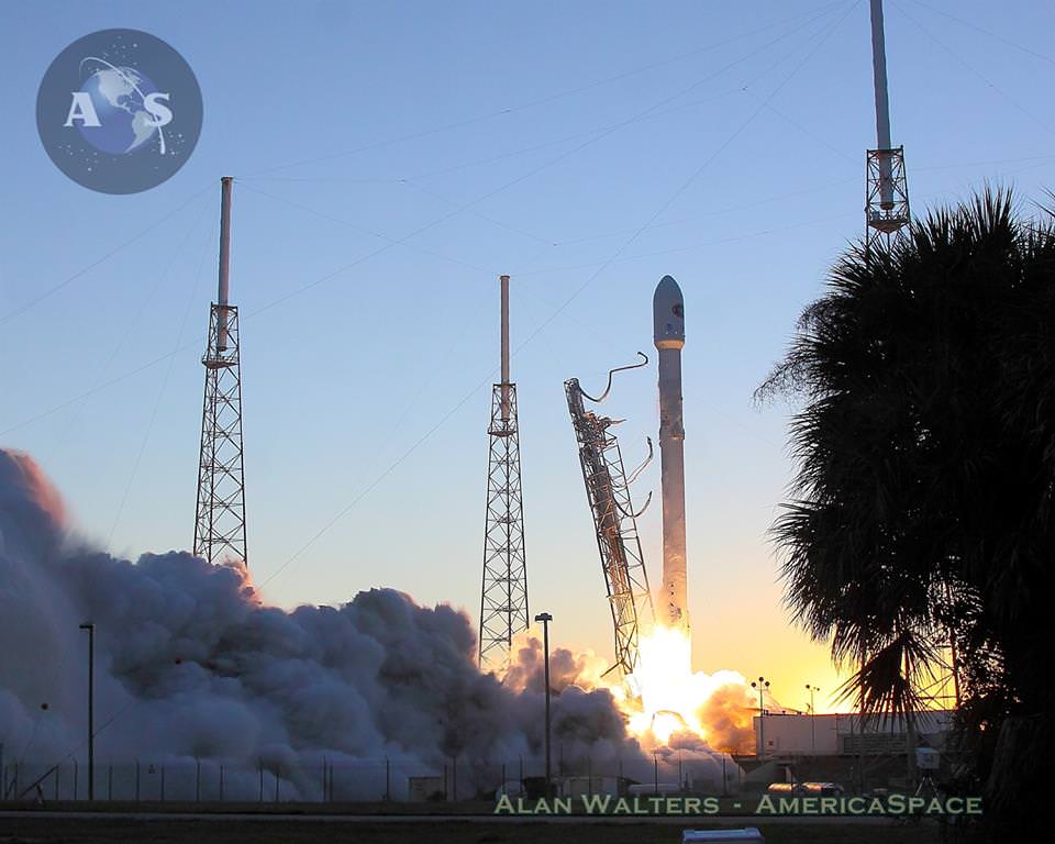
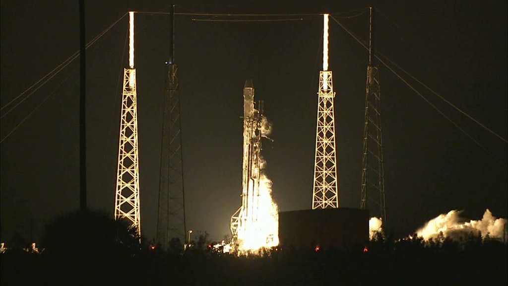
NOAA's DSCOVR satellite launches from Cape Canaveral Air Force Station on Feb. 11, 2015. DSCOVR will provide NOAA space weather forecasters more reliable measurements of solar wind conditions, improving their ability to monitor potentially harmful solar activity. Credit: Alan Walters/AmericaSpace

After a 17 year long wait, a new American mission to monitor intense solar storms and warn of impeding space weather disruptions to vital power grids, telecommunications satellites and public infrastructure was launched atop a SpaceX Falcon 9 on Wednesday, Feb. 11, from Cape Canaveral, Florida, to start a million mile journey to its deep space observation post.

The third time proved to be the charm when the Deep Space Climate Observatory, or DSCOVR science satellite lifted off at 6:03 p.m. EST Wednesday from Space Launch Complex 40 at Cape Canaveral Air Force Station in Florida.

The spectacular sunset blastoff came after two scrubs this week forced by a technical problem with the Air Force tracking radar and adverse weather on Sunday and Tuesday.

The $340 million DSCOVR has a critical mission to monitor the solar wind and aid very important forecasts of space weather at Earth at an observation point nearly a million miles from Earth. It will also take full disk color images of the sunlit side of Earth at least six times per day that will be publicly available and “wow” viewers.

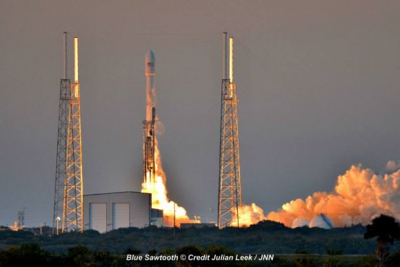
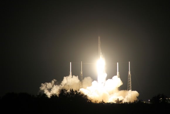
Launch of NOAA DSCOVR satellite from Cape Canaveral Air Force Station on Feb. 11, 2015 to monitor solar storms and space weather.   Credit:  Julian Leek
Launch of NOAA DSCOVR satellite from Cape Canaveral Air Force Station on Feb. 11, 2015 to monitor solar storms and space weather. Credit: Julian Leek

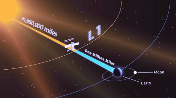
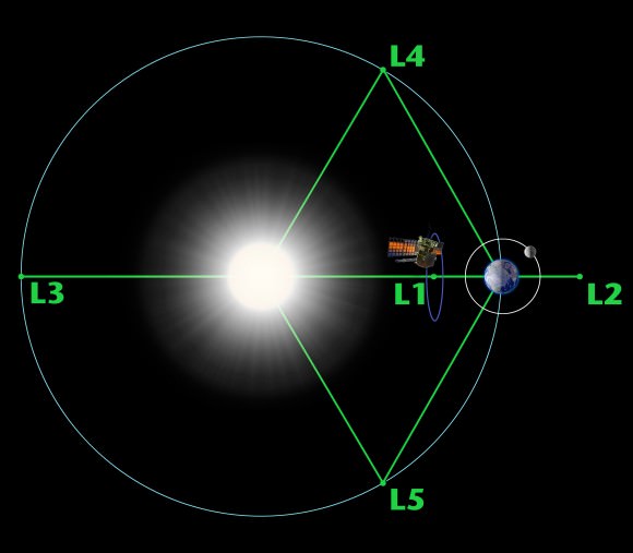
The couch sized probe was targeted to the L1 Lagrange Point, a neutral gravity point that lies on the direct line between Earth and the sun located 1.5 million kilometers (932,000 miles) sunward from Earth. At L1 the gravity between the sun and Earth is perfectly balanced and the satellite will orbit about that spot just like a planet.

L1 is a perfect place for the science because it lies outside Earth’s magnetic environment. The probe will measure the constant stream of solar wind particles from the sun as they pass by.

The DSCOVR spacecraft (3-axis stabilized, 570 kg) will be delivered to the Sun-Earth L1 point, 1.5 million km (1 million miles) from the Earth, directly in front of the Sun. A Halo (Lissajous) orbit will stabilize the craft's position around the L1 point while keeping it outside the radio noise emanating from the Sun. (Illustratin Credit: NASA)
The DSCOVR spacecraft (3-axis stabilized, 570 kg) will be delivered to the Sun-Earth L1 point, 1.5 million km (1 million miles) from the Earth, directly in front of the Sun. A Halo (Lissajous) orbit will stabilize the craft’s position around the L1 point while keeping it outside the radio noise emanating from the Sun. (Illustratin Credit: NASA)

DSCOVR is a joint mission between NOAA, NASA, and the U.S Air Force (USAF) that will be managed by NOAA. The satellite and science instruments are provided by NASA and NOAA. The rocket was funded by the USAF.

The mission is vital because its solar wind observations are crucial to maintaining accurate space weather forecasts to protect US infrastructure such as power grids, aviation, planes in flight, all types of Earth orbiting satellites for civilian and military needs, telecommunications, ISS astronauts and GPS systems.

It will take about 150 days to reach the L1 point and complete satellite and instrument checkouts.

DSCOVR will then become the first operational space weather mission to deep space and function as America’s primary warning system for solar magnetic storms.

It will replace NASA’s aging Advanced Composition Explorer (ACE) satellite which is nearly 20 years old and far beyond its original design lifetime.

“DSCOVR is the latest example of how NASA and NOAA work together to leverage the vantage point of space to both understand the science of space weather and provide direct practical benefits to us here on Earth,” said John Grunsfeld, associate administrator of NASA’s Science Mission Directorate in Washington.

DSCOVR was first proposed in 1998 by then US Vice President Al Gore as the low cost ‘Triana’ satellite to take near continuous views of the Earth’s entire globe to feed to the internet as a means of motivating students to study math and science. It was eventually built as a much more capable Earth science satellite that would also conduct the space weather observations.

But Triana was shelved for purely partisan political reasons and the satellite was placed into storage at NASA Goddard and the science was lost until now.
DSCOVR mission logo.  Credit: NOAA/NASA/U.S. Air Force
DSCOVR mission logo. Credit: NOAA/NASA/U.S. Air Force

DSCOVR is equipped with a suite of four continuously operating solar science and Earth science instruments from NASA and NOAA.

It will make simultaneous scientific observations of the solar wind and the entire sunlit side of Earth.

The 750-kilogram (1250 pound) DSCOVR probe measures 54 inches by 72 inches.

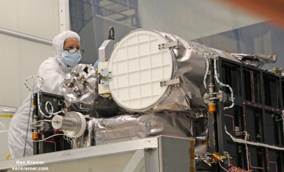
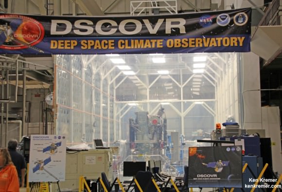
Technician works on NASA Earth science instruments and Earth imaging EPIC camera (white circle) housed on NOAA/NASA Deep Space Climate Observatory (DSCOVR) inside NASA Goddard Space Flight Center clean room in November 2014.  Credit: Ken Kremer/kenkremer.com/AmericaSpace
Technician works on NASA Earth science instruments and Earth imaging EPIC camera (white circle) housed on NOAA/NASA Deep Space Climate Observatory (DSCOVR) inside NASA Goddard Space Flight Center clean room in November 2014. Credit: Ken Kremer/kenkremer.com/AmericaSpace

The two Earth science instruments from NASA are the Earth Polychromatic Imaging Camera (EPIC) and the National Institute of Standards and Technology Advanced Radiometer (NISTAR).

EPIC will provide true color spectral images of the entire sunlit face of Earth at least six times per day, as viewed from an orbit around L1. They will be publically available within 24 hours via NASA Langley.

It will view the full disk of the entire sunlit Earth from sunrise to sunset and collect a variety of science measurements including on ozone, aerosols, dust and volcanic ash, vegetation properties, cloud heights and more.

Listen to my post launch interview with the BBC about DSCOVR and ESA’s successful IXV launch on Feb. 11.

A secondary objective by SpaceX to recover the Falcon 9 first stage booster on an ocean going barge had to be skipped due to very poor weather and very high waves in the Atlantic Ocean making a safe landing impossible. The stage did successfully complete a soft landing in the ocean.

Stay tuned here for Ken’s continuing Earth and planetary science and human spaceflight news.

Ken Kremer

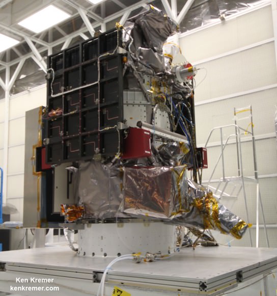
NOAA/NASA Deep Space Climate Observatory (DSCOVR) undergoes processing in NASA Goddard Space Flight Center clean room. Solar wind instruments at right. DSCOVER will launch in February 2015 atop SpaceX Falcon 9 rocket.  Credit: Ken Kremer/kenkremer.com/AmericaSpace
NOAA/NASA Deep Space Climate Observatory (DSCOVR) undergoes processing in NASA Goddard Space Flight Center clean room. Solar wind instruments at right. DSCOVER will launch in February 2015 atop SpaceX Falcon 9 rocket. Credit: Ken Kremer/kenkremer.com/AmericaSpace
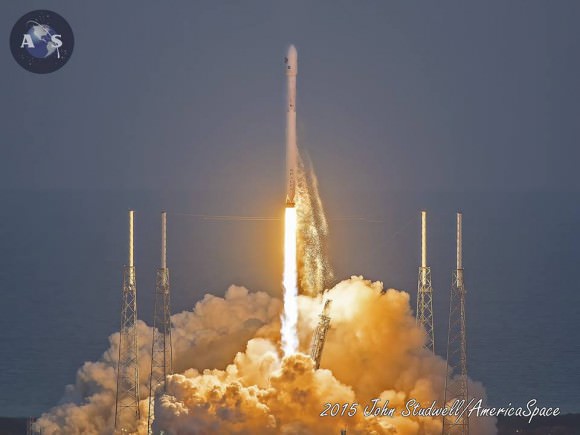
Launch of NOAA DSCOVR satellite from Cape Canaveral Air Force Station on Feb. 11, 2015 to monitor solar storms and space weather.   Credit:  John Studwell
Launch of NOAA DSCOVR satellite from Cape Canaveral Air Force Station on Feb. 11, 2015 to monitor solar storms and space weather. Credit: John Studwell
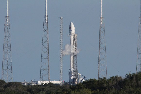
Prelaunch view of SpaceX rocket on Cape Canaveral launch pad taken from LC-39 at the Kennedy Space Center.  Credit: Chuck Higgins
Prelaunch view of SpaceX rocket on Cape Canaveral launch pad taken from LC-39 at the Kennedy Space Center. Credit: Chuck Higgins

NOAA/NASA/USAF Deep Space Climate Observatory (DSCOVR) Launching Feb. 8 to Monitor Solar Winds

DSCOVR mission logo. Credit: NOAA/NASA/U.S. Air Force

The long awaited Deep Space Climate Observatory, or DSCOVR science satellite is slated to blast off atop a SpaceX Falcon 9 on Sunday, Feb. 8, from Cape Canaveral, Florida on a mission to monitor the solar wind and aid very important forecasts of space weather at Earth.

DSCOVR is a joint mission between NOAA, NASA, and the U.S Air Force (USAF) that will be managed by NOAA. The satellite and science instruments are provided by NASA and NOAA.

Update Feb 8: Hold, Hold, Hold !!! 6:10 PM 2/8/15 Terminal Count aborted at T Minus 2 min 26 sec due to a tracking issue. NO launch of Falcon 9 today. rocket being safed now. next launch opportunity is Monday. Still TBD.
The rocket is provided by the USAF. SpaceX will try to recover the first stage via a guided descent to a floating barge in the Atlantic Ocean.

The weather outlook is currently very promising with a greater than 90 percent chance of favorable weather at launch time shortly after sunset on Sunday which could make for a spectacular viewing opportunity for spectators surrounding the Florida Space coast.

Liftoff atop the SpaceX Falcon 9 rocket is targeted for at 6:10:12 p.m. EST on Feb. 8, from Cape Canaveral Air Force Station Space Launch Complex 40.

There is an instantaneous launch window, meaning that any launch delay due to weather, technical or other factors will force a scrub to Monday.

The launch will be broadcast live on NASA TV: http://www.nasa.gov/nasatv

NASA’s DSCOVR launch blog coverage of countdown and liftoff will begin at 3:30 p.m. Sunday.

NOAA/NASA Deep Space Climate Observatory (DSCOVR) undergoes processing in NASA Goddard Space Flight Center clean room. Solar wind instruments at right. DSCOVER will launch in February 2015 atop SpaceX Falcon 9 rocket.  Credit: Ken Kremer/kenkremer.com/AmericaSpace
NOAA/NASA Deep Space Climate Observatory (DSCOVR) undergoes processing in NASA Goddard Space Flight Center clean room. Solar wind instruments at right. DSCOVER will launch in February 2015 atop SpaceX Falcon 9 rocket. Credit: Ken Kremer/kenkremer.com/AmericaSpace

“DSCOVR is NOAA’s first operational space weather mission to deep space,” said Stephen Volz, assistant administrator of the NOAA Satellite and Information Service in Silver Spring, Maryland, at the pre-launch briefing today (Feb. 7) at the Kennedy Space Center in Florida.

The mission of DSCOVR is vital because its solar wind observations are crucial to maintaining accurate space weather forecasts to protect US infrastructure from disruption by approaching solar storms.

“DSCOVR will maintain the nation’s solar wind observations, which are critical to the accuracy and lead time of NOAA’s space weather alerts, forecasts, and warnings,” according to a NASA description.

“Space weather events like geomagnetic storms caused by changes in solar wind can affect public infrastructure systems, including power grids, telecommunications systems, and aircraft avionics.”

DSCOVR will replace NASA’s aging Advanced Composition Explorer (ACE) satellite which is nearly 20 years old and far beyond its original design lifetime.

The couch sized probe is being targeted to the L1 Lagrange Point, a neutral gravity point that lies on the direct line between Earth and the sun located 1.5 million kilometers (932,000 miles) sunward from Earth. At L1 the gravity between the sun and Earth is perfectly balanced and the satellite will orbit about that spot just like a planet.

L1 is a perfect place for the science because it lies outside Earth’s magnetic environment. The probe will measure the constant stream of solar wind particles from the sun as they pass by.

Diagram of the five Lagrange points associated with the sun-Earth system, showing DSCOVR orbiting the L-1 point. Image is not to scale.  Credit:  NASA/WMAP Science Team
Diagram of the five Lagrange points associated with the sun-Earth system, showing DSCOVR orbiting the L-1 point. Image is not to scale. Credit: NASA/WMAP Science Team

This will enable forecasters to give a 15 to 60 minute warning of approaching geomagnetic storms that could damage valuable infrastructure.

DSCOVR is equipped with a suite of four continuously operating solar science and Earth science instruments from NASA and NOAA.

It will make simultaneous scientific observations of the solar wind and the entire sunlit side of Earth.

Three instruments will help measure the solar wind on the DSCOVR mission: (shown from left to right), the Faraday cup to monitor the speed and direction of positively-charged solar wind particles, the electron spectrometer to monitor electrons, and a magnetometer to measure magnetic fields.  Credit: NASA/DSCOVR
Three instruments will help measure the solar wind on the DSCOVR mission: (shown from left to right), the Faraday cup to monitor the speed and direction of positively-charged solar wind particles, the electron spectrometer to monitor electrons, and a magnetometer to measure magnetic fields. Credit: NASA/DSCOVR

The 750-kilogram DSCOVR probe measures 54 inches by 72 inches.

I saw the DSCOVR spacecraft up close at NASA Goddard Space Flight Center in Maryland last fall during processing in the clean room.

NOAA/NASA/USAF Deep Space Climate Observatory (DSCOVR) undergoes processing in NASA Goddard Space Flight Center clean room.  Probe will launch in February atop SpaceX Falcon 9 rocket.  Credit: Ken Kremer - kenkremer.com
NOAA/NASA/USAF Deep Space Climate Observatory (DSCOVR) undergoes processing in NASA Goddard Space Flight Center clean room. Probe will launch in February atop SpaceX Falcon 9 rocket. Credit: Ken Kremer – kenkremer.com

A secondary objective of the rocket launch for SpaceX is to conduct their second attempt to recover the Falcon 9 first stage booster on an ocean going barge. Read my articles about the first attempt in January 2015, starting here.

It was originally named ‘Triana’ (aka Goresat) and was conceived by then US Vice President Al Gore as a low cost satellite to take near continuous views of the Earth’s entire globe to feed to the internet as a means of motivating students to study math and science. It was eventually built as a much more capable Earth science satellite as well as to conduct the space weather observations.

But Triana was shelved for purely partisan political reasons and the satellite was placed into storage and the science was lost until now.

Stay tuned here for Ken’s continuing Earth and planetary science and human spaceflight news.

Ken Kremer

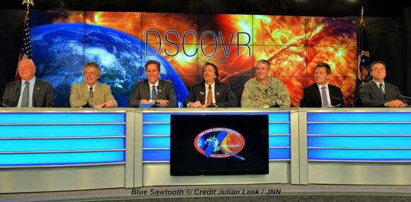
The team is ready for the launch of NASA's DSCOVR spacecraft aboard a SpaceX Falcon 9 rocket. L/R Mike Curie KSC NASA News Chief, Stephen Volz, assistant administrator NOAA, Tom Berger, director of NOAA Space Weather Prediction Center Boulder Colorado,Steven Clark, NASA Joint Agency Satellite Division, Col. D. Jason Cothern, Space Demonstration Division chief at Kirkland AFB NM. Hans Koenigsmann, VP of mission assurance at SpaceX in Hawthorne, California, Mike McAlaneen, launch weather officer 45th Space wing Cape Canaveral Air Force Station, Florida.  Credit: Julian Leek
The team is ready for the launch of NASA’s DSCOVR spacecraft aboard a SpaceX Falcon 9 rocket. L/R Mike Curie KSC NASA News Chief, Stephen Volz, assistant administrator NOAA, Tom Berger, director of NOAA Space Weather Prediction Center Boulder Colorado,Steven Clark, NASA Joint Agency Satellite Division, Col. D. Jason Cothern, Space Demonstration Division chief at Kirkland AFB NM. Hans Koenigsmann, VP of mission assurance at SpaceX in Hawthorne, California, Mike McAlaneen, launch weather officer 45th Space wing Cape Canaveral Air Force Station, Florida. Credit: Julian Leek

SpaceX Successfully Launches Cargo Ship to Station and Hard Lands Rocket on “Drone Ship”

The SpaceX Falcon 9 rocket is thundering away from Cape Canaveral Air Force Station on its way to a Monday-morning rendezvous with the International Space Station. The booster’s nine Merlin engines are generating 1.3 million pounds of thrust as the vehicle begins its climb to orbit. Credit: NASA

SpaceX successfully launched their commercial Falcon 9 rocket and Dragon cargo ship on a critical mission for NASA bound for the space station this morning, Jan. 10, while simultaneously accomplishing a hard landing of the boosters first stage on an ocean-floating “drone ship” platform in a very good first step towards the bold company goal of recovery and re-usability in the future.

The spectacular night time launch of the private SpaceX Falcon 9 rocket lit up the skies all around the Florida Space Coast and beyond following a flawless on time liftoff at 4:47 a.m. EST from Cape Canaveral Air Force Station.

The nine Merlin 1D engines of the 208 foot-tall Falcon 9 generated 1.3 million pounds of liftoff thrust as the rocket climbed to orbit on the first SpaceX launch of 2015.

The Dragon CRS-5 mission is on its way to a Monday-morning rendezvous with the International Space Station (ISS).

It is loaded with more than two tons of supplies and NASA science investigations for the six person crew aboard the massive orbiting outpost.

A secondary goal of SpaceX was to conduct a history-making attempt at recovering the 14 story tall Falcon 9 first stage via a precision landing on an ocean-going landing platform known as the “autonomous spaceport drone ship.”

SpaceX CEO Elon Musk quickly tweeted that good progress was made, and as expected, more work needs to be done.

This was an experiment involving re-lighting one of the first stage Merlin engines three times to act as a retro rocket to slow the stages descent and aim for the drone ship.

“Rocket made it to drone spaceport ship, but landed hard. Close, but no cigar this time. Bodes well for the future tho,” Musk tweeted soon after the launch and recovery attempt.

“Ship itself is fine. Some of the support equipment on the deck will need to be replaced…”

“Didn’t get good landing/impact video. Pitch dark and foggy. Will piece it together from telemetry and … actual pieces.”

Musk’s daring vision is to recover, refurbish and reuse the first stage and dramatically reduce the high cost of access to space, by introducing airline like operational concepts.

The ‘autonomous spaceport drone ship’ was positioned some 200 to 250 miles offshore of the launch site in the Atlantic Ocean along the rockets flight path, flying along the US Northeast coast to match that of the ISS.

The autonomous spaceport drone ship measure only 300 by 100 feet, with wings that extend its width to 170 feet. That’s tiny compared to the Atlantic Ocean.

Therefore the SpaceX team was successful in accomplishing a rocket assisted descent and pinpoint landing in the middle of a vast ocean, albeit not as slow as hoped.

No one has ever tried such a landing attempt before in the ocean says SpaceX. The company has conducted numerous successful soft landing tests on land. And several soft touchdowns on the ocean’s surface. But never before on a barge in the ocean.

So they will learn and move forward to the next experimental landing.

SpaceX rocket lifts off from Space Launch Complex 40 at Cape Canaveral Air Force Station carrying the Dragon resupply spacecraft to the International Space Station.   Credit: NASA/Jim Grossmann
SpaceX rocket lifts off from Space Launch Complex 40 at Cape Canaveral Air Force Station carrying the Dragon resupply spacecraft to the International Space Station. Credit: NASA/Jim Grossmann

CRS-5 marks the company’s fifth resupply mission to the ISS under a $1.6 Billion contract with NASA to deliver 20,000 kg (44,000 pounds) of cargo to the station during a dozen Dragon cargo spacecraft flights through 2016 under NASA’s Commercial Resupply Services (CRS) contract.

“We are delighted to kick off 2015 with our first commercial cargo launch of the year,” said NASA Administrator Charles Bolden in a statement.

“Thanks to our private sector partners, we’ve returned space station resupply launches to U.S. soil and are poised to do the same with the transport of our astronauts in the very near future.”

“Today’s launch not only resupplies the station, but also delivers important science experiments and increases the station’s unique capabilities as a platform for Earth science with delivery of the Cloud-Aerosol Transport System, or CATS instrument. I congratulate the SpaceX and NASA teams who have made today’s success possible. We look forward to extending our efforts in commercial space to include commercial crew by 2017 and to more significant milestones this year on our journey to Mars.”

The Dragon CRS-5 spacecraft is loaded with over 5108 pounds (2317 kg) of scientific experiments, technology demonstrations, crew supplies, spare parts, food, water, clothing, and assorted research gear for the six person crew serving aboard the ISS.

The launch marked the first US commercial resupply launch since the catastrophic destruction of an Orbital Sciences Antares rocket and Cygnus Orb-3 spacecraft bound for the ISS exploded unexpectedly after launch from NASA Wallops, VA, on Oct. 28, 2014.

The US supply train to the ISS is now wholly dependent on SpaceX until Cygnus flights are resumed hopefully by late 2015 on an alternate rocket, the Atlas V.

Stay tuned here for Ken’s continuing Earth and planetary science and human spaceflight news.

Ken Kremer

Probing Pluto’s Paltry Atmosphere Using A Solar Eclipse And Spacecraft

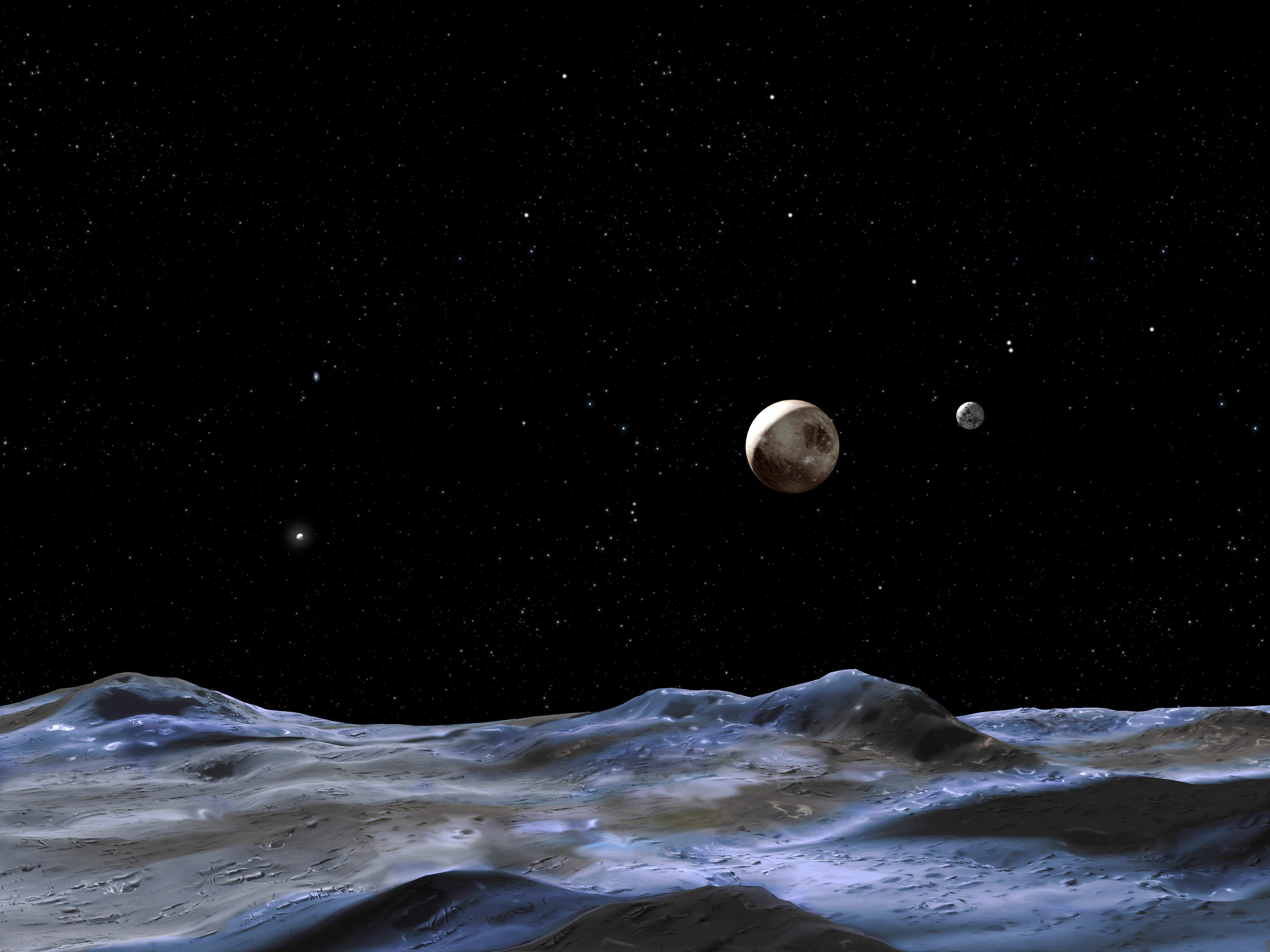
Artist's conception of the Pluto system from the surface of one of its moons. Credit: NASA, ESA and G. Bacon (STScI)

Pluto is so far away from us and so tiny that it’s hard to glean even basic facts about it. What is its tenuous atmosphere made of? And how to observe it during NASA’s New Horizons very brief flyby next July? A recent Johns Hopkins blog post explains how a careful maneuver post-Pluto will let investigators use the Sun to examine the dwarf planet’s true nature.

Investigators will use an instrument called Alice, an ultraviolet spectrometer, to look at the atmosphere around Pluto and its largest moon, Charon. Alice is capable of examining the gases in the atmosphere using a large “airglow” aperture (4 by 4 centimeters) and also using the Sun for observation with a smaller, 1-mm solar occultation channel.

“Once New Horizons flies past Pluto, the trajectory will conveniently (meaning, carefully planned for many years) fly the spacecraft through Pluto’s shadow, creating an effect just like a solar eclipse here on Earth,” wrote Joel Parker, New Horizons co-investigator, in a blog post.

New Horizons
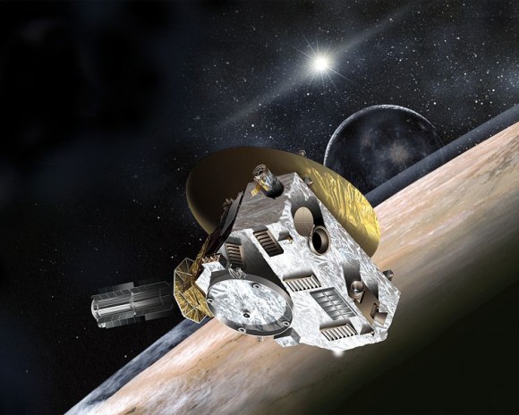
New Horizons spacecraft. Image Credit: NASA

“So we can (and will) just turn the spacecraft around and stare at the Sun, using Alice as it goes behind Pluto to measure how the Sun’s ultraviolet light changes as that light passes through deeper and deeper parts of Pluto’s atmosphere. This technique lets us measure the composition of Pluto’s atmosphere as a function of altitude.”

And guess where the technique was used not too long ago? Titan! That’s a moon of Saturn full of hydrocarbons and what could be a precursor chemistry to life. The moon is completely socked in with this orange haze that is intriguing. Scientists are still trying to figure out what it is made of — and also, to use our understanding of it to apply to planets outside our solar system.

When a huge exoplanet passes in front of its star, and it’s close enough to Earth, scientists are starting to learn how to ferret out information about its chemistry. This shows them what temperature the atmosphere is like and what it is made of, although it should be emphasized scientists are only starting on this work.

A composite image of Titan's atmosphere, created using blue, green and red spectral filters to create an enhanced-color view.  Image Credit: NASA/JPL/Space Science Institute
A composite image of Titan’s atmosphere, created using blue, green and red spectral filters to create an enhanced-color view. Image Credit: NASA/JPL/Space Science Institute

The goal of performing these transit observations of Titan was to understand how haze on an exoplanet might blur the observations. From four passes with the Cassini spacecraft, the team (led by Tyler Robinson at NASA’s Ames Research Center) found that haze would make it difficult to get information from all but the upper atmosphere.

“An additional finding from the study is that Titan’s hazes more strongly affect shorter wavelengths, or bluer, colors of light,” NASA stated at the time. “Studies of exoplanet spectra have commonly assumed that hazes would affect all colors of light in similar ways. Studying sunsets through Titan’s hazes has revealed that this is not the case.”

The nature of Pluto will better come to light when New Horizons makes its pass by the planet in July 2015. Meanwhile, controllers are counting down the days until the spacecraft emerges from its last hibernation on Saturday (Dec. 6).

Source: Johns Hopkins Applied Physics Laboratory

Uranus Bland? Nope, It’s A Stormy Planet With Interesting Insides

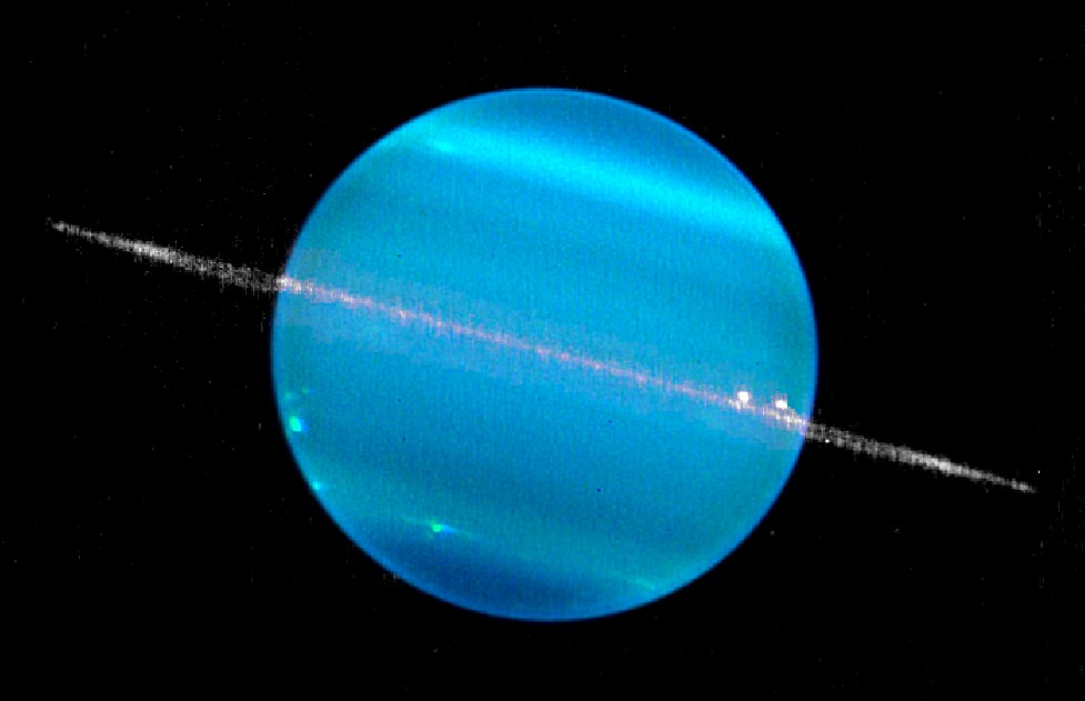
A composite image of Uranus in two infrared bands, showing the planet and its ring system. Picture taken by the Keck II telescope and released in 2007. Credit: W. M. Keck Observatory (Marcos van Dam)

Sometimes first impressions are poor ones. When the Voyager 2 spacecraft whizzed by Uranus in 1986, the close-up view of the gas giant revealed what appeared to a be a relatively featureless ball. By that point, scientists were used to seeing bright colors and bands on Jupiter and Saturn. Uranus wasn’t quite deemed uninteresting, but the lack of activity was something that was usually remarked upon when describing the planet.

Fast-forward 28 years and we are learning that Uranus is a more complex world than imagined at the time. Two new studies, discussed at an American Astronomical Society meeting today, show that Uranus is a stormy place and also that the images from Voyager 2 had more interesting information than previously believed.

Showing the value of going over old data, University of Arizona astronomer Erich Karkoschka reprocessed old images of Voyager 2 data — including stacking 1,600 pictures on top of each other.

He found elements of Uranus’ atmosphere that reveals the southern hemisphere moves differently than other regions in fellow gas giants. Since only the top 1% of the atmosphere is easily observable from orbit, scientists try to make inferences about the 99% that lie underneath by looking at how the upper atmosphere behaves.

“Some of these features probably are convective clouds caused by updraft and condensation. Some of the brighter features look like clouds that extend over hundreds of kilometers,” he stated in a press release.

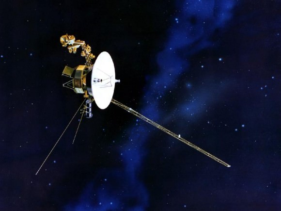
Voyager 2. Credit: NASA

“The unusual rotation of high southern latitudes of Uranus is probably due to an unusual feature in the interior of Uranus,” he added. “While the nature of the feature and its interaction with the atmosphere are not yet known, the fact that I found this unusual rotation offers new possibilities to learn about the interior of a giant planet.”

It’s difficult to get more information about the inner atmosphere without sending down a probe, but other methods of getting a bit of information include using radio (which shows magnetic field rotation) or gravitational fields. The university stated that Karkoschka’s work could help improve models of Uranus’ interior.

So that was Uranus three decades ago. What about today? Turns out that storms are popping up on Uranus that are so large that for the first time, amateur astronomers can track them from Earth. A separate study on Uranus shows the planet is “incredibly active”, and what’s more, it took place at an unexpected time.

Summer happened in 2007 when the Sun shone on its equator, which should have produced more heat and stormy weather at the time. (Uranus has no internal heat source, so the Sun is believed to be the primary driver of energy on the planet.) However, a team led by Imke de Pater, chair of astronomy at the University of California, Berkeley, spotted eight big storms in the northern hemisphere while looking at the planet with the Keck Telescope on Aug. 5 and 6.

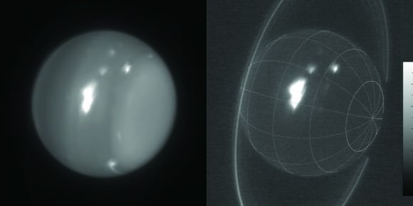
Infrared images of Uranus showing storms at 1.6 and 2.2 microns obtained Aug. 6, 2014 by the 10-meter Keck telescope. Credit: Imke de Pater (UC Berkeley) & Keck Observatory images.

Keck’s eye revealed a big, bright storm that represented 30% of light reflected by the planet at a wavelength of 2.2 microns, which provides information about clouds below the tropopause. Amateurs, meanwhile, spotted a storm of a different sort. Between September and October, several observations were reported of a storm at 1.6 microns, deeper in the atmosphere.

“The colors and morphology of this [latter] cloud complex suggests that the storm may be tied to a vortex in the deeper atmosphere similar to two large cloud complexes seen during the equinox,” stated Larry Sromovsky, a planetary scientist at the University of Wisconsin, Madison.

What is causing the storms now is still unknown, but the team continues to watch the Uranian weather to see what will happen next. Results from both studies were presented at the Division for Planetary Sciences meeting of the American Astronomical Society in Tucson, Arizona today. Plans for publication and whether the research was peer-reviewed were not disclosed in press releases concerning the findings.

‘Not All Hope Is Lost’: NASA Sun Probe Silent Now For Six Weeks

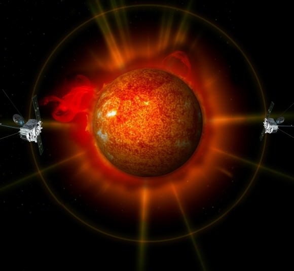
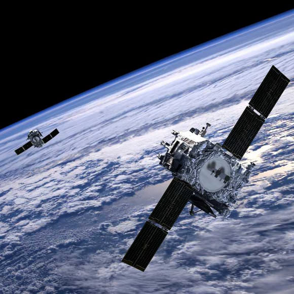
Artist's conception of one of the Solar TErrestrial RElations Observatory (STEREO) spacecraft. Credit: NASA

No one knows exactly why a NASA solar probe stopped talking to Earth six weeks ago, but it’s possible the spacecraft is out of power and is drifting without a way of calling for help, the agency said in an update.

On Oct. 1, NASA suddenly lost contact with one of the two Solar TErrestrial RElations Observatory (STEREO) spacecraft, which are currently examining the far side of the Sun. The probes are considered crucial for solar forecasting, so the loss is a blow. While the STEREO-Behind probe has been mute since then, the agency says “not all hope is lost” for a recovery.

STEREO-Behind went silent after NASA deliberately reset the spacecraft. Along with its twin, STEREO-Ahead, in the coming years the spacecraft will need to reposition its antenna to avoid getting fried by the Sun. Also, there is a period where each spacecraft will need to work autonomously, because the Sun’s radio interference will make it difficult or impossible for communications to get through.

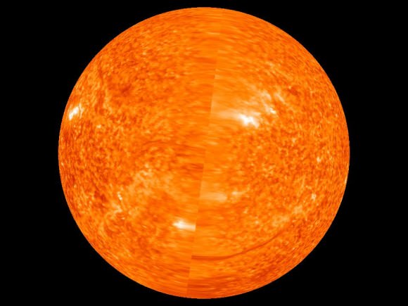
First complete image of the far side of the sun taken on June 1, 2011. Click image for larger version. Credit: NASA/STEREO.

To prepare the spacecraft, NASA has been testing them out ahead of these events, which are called “solar conjunction operations.” STEREO-Ahead passed the tests and entered these operations in August, where it will remain until 2016. STEREO-Behind was supposed to go into this phase on Dec. 1. Preparations started Sept. 27, when STEREO-Behind was put into the same safe mode test that was used on STEREO-Ahead.

“One part of this test was to observe the firing of the spacecraft hard command loss timer, which resets the spacecraft if no commands are received after three days,” NASA wrote in an update. “The purpose of this is to correct any problems that might be preventing the spacecraft from receiving commands from the ground. While the spacecraft is out of contact on the far side of the Sun, this reset will occur every three days.”

The timer did fire as planned on Oct. 1, and the spacecraft reset as expected. However, the radio signal coming from STEREO-Behind wasn’t as strong as expected. Then, it disappeared altogether.

An artist's concept shows both STEREO surrounding the sun on opposite sides. Credit: NASA
An artist’s concept shows both STEREO surrounding the sun on opposite sides. Credit: NASA

While there’s not much information to work with, NASA says it does know a few things. Before the reset, information or telemetry from the spacecraft showed it was working fine. After the reset, though, they could tell the inertial measurement unit (IMU) was turned on. This is unusual, and shows that the guidance system’s star tracker hadn’t picked up its guide stars as expected.

“This is not unexpected—there have been other occasions when it took the star tracker several minutes, or even a few days, to start determining the spacecraft orientation based on star images,” NASA said.

“In fact, on Sept. 28, as part of the same test sequence, the spacecraft was reset, and it took 12 minutes for the star tracker to start providing an attitude solution. When the star tracker is ofline, the spacecraft will automatically turn on the IMU to provide rotational rate information.”

Deployment of STEREO Spacecraft Panels. Credit: 2002-Johns Hopkins University Applied Physics Laboratory. Credit: Dr C.J.Eyles, University of Birmingham

NASA thinks the star tracker’s struggles would explain why the radio signal wasn’t as strong as expected, because the spacecraft’s high-gain antenna wasn’t aimed at Earth properly. But there’s more — it appears one of the IMU’s laser gyroscopes isn’t working and is giving “bad data to the attitude control system”, NASA said. So now the spacecraft was facing two failures, which is tough for it to deal with, the agency added.

Did the spacecraft recognize the problem? If it did, it would have used the last backup system — five solar aspect sensors — which should have made sure the solar panels were pointed in the right direction to provide power. If not, the spacecraft might have thought it was in a roll, turned on its thrusters, and then spun itself in such a way that it could have lost sunlight power.

NASA is trying to send out commands to address all of these failure possibilities, and it emphasizes that a recovery is still possible. The Solar and Heliospheric Observatory (SOHO), for example, also lost power in 1998 when a spin put its solar panels out of reach of the Sun. However, as its orbit changed, the Sun’s light eventually fell across the panels and power was restored. The spacecraft was recovered and still works today.

Source: NASA

Orbiting Solar Observatory Sees It Burn, Burn, Burn: The Ring of Fire

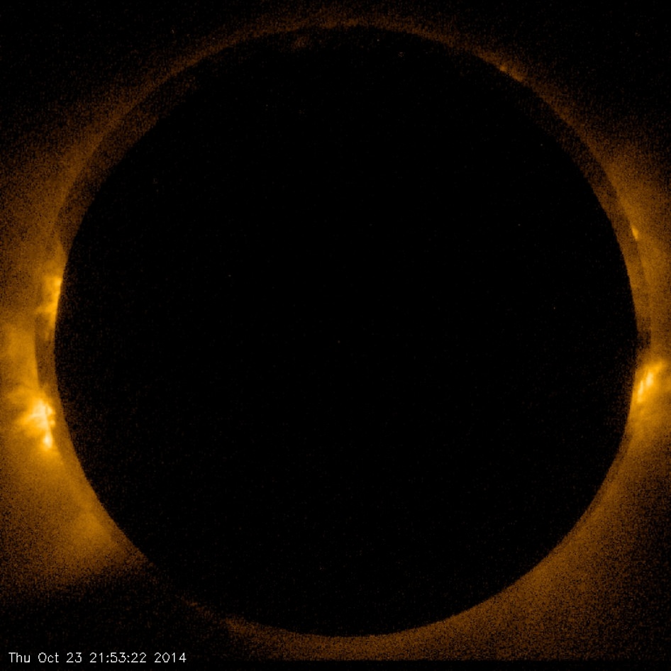
Image of the Oct. 23, 2014 eclipse acquired with the Hinode spacecraft's X-ray telescope. (NASA/JAXA/SAO)

Did you catch the solar eclipse on October 23? If so, you saw the Moon “take a bite” out of the Sun (to various extents, depending on your location) during what was a partial eclipse for viewers on Earth. But for the Hinode (pronunciation alert: that’s “HEE-no-day”) solar observatory satellite, in its Sun-synchronous orbit around Earth at an altitude of 600 km (373 miles), the eclipse was annular – a “ring of fire.”

The image above was captured with Hinode’s X-ray Telescope at the moment of maximum annularity. Want to watch it burn, burn, burn like Hinode did? Check out a video below:

Not to be confused with “annual,” meaning yearly, an annular eclipse occurs when the Moon passes directly in front of the Sun but at such a distance from Earth to not quite manage to fully cover the Sun’s disk. The bright ring of visible Sun around the Moon’s silhouette gives the event its name: annular is from the Latin word anulus, meaning ring.

The next annular eclipse to be visible from Earth will occur on Sept. 1, 2016.

Led by the Japan Aerospace Exploration Agency (JAXA), the Hinode mission is a collaboration between the space agencies of Japan, the United States, the United Kingdom, and Europe, and is now in its eighth year. NASA helped in the development, funding, and assembly of the spacecraft’s three science instruments. Learn more about the mission here.

Image and video credits: NASA/JAXA/SAO

Making Cubesats do Astronomy

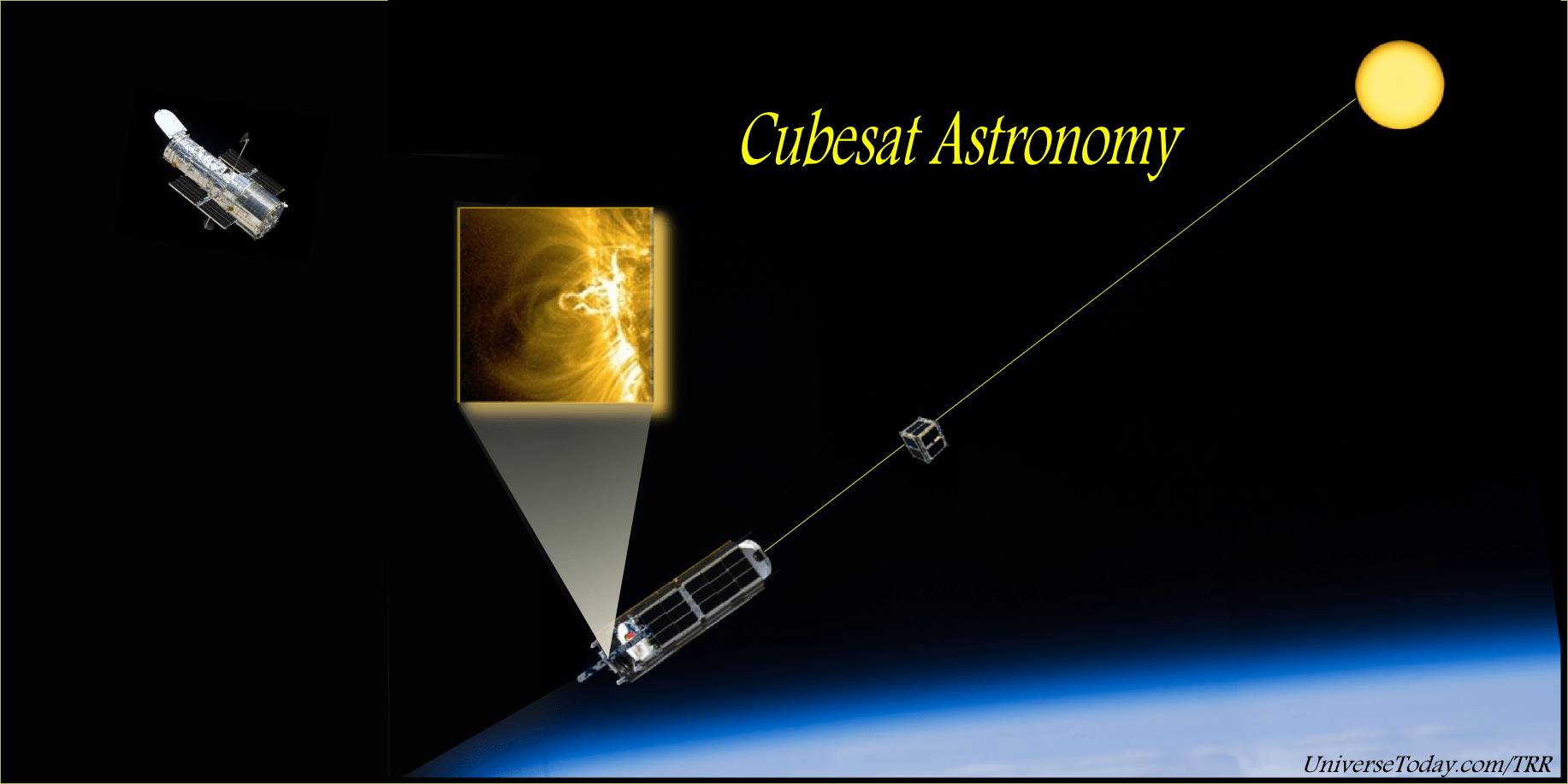
Will cubesats develop a new technological branch of astronomy? Goddard engineers are taking the necessary steps to make cubesat sized telescopes a reality. (Credit: NASA, UniverseToday/TRR)

One doesn’t take two cubesats and rub them together to make static electricity. Rather, you send them on a brief space voyage to low-earth orbit (LEO) and space them apart some distance and voilà, you have a telescope. That is the plan of NASA’s Goddard Space Flight Center engineers and also what has been imagined by several others.

Cubesats are one of the big crazes in the new space industry. But nearly all that have flown to-date are simple rudderless cubes taking photos when they are oriented correctly. The GSFC engineers are planning to give two cubes substantial control of their positions relative to each other and to the Universe surrounding them. With one holding a telescope and the other a disk to blot out the bright sun, their cubesat telescope will do what not even the Hubble Space Telescope is capable of and for far less money.

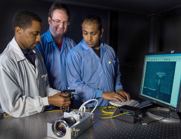
Semper (left), Calhoun, and Shah are advancing the technologies needed to create a virtual telescope that they plan to demonstrate on two CubeSats. (Image/Caption Credit: NASA/W. Hrybyk)

The 1U, the 3U, the 9U – these are all cubesats of different sizes. They all have in common the unit size of 1. A 1U cubesat is 10 x 10 x 10 centimeters cubed. A cube of this size will hold one liter of water (about one quart) which is one kilogram by weight. Or replace that water with hydrazine and you have very close to 1 kilogram of mono-propellent rocket fuel which can take a cubestat places.

GSFC aerospace engineers, led by Neerav Shah, don’t want to go far, they just want to look at things far away using two cubesats. Their design will use one as a telescope – some optics and a good detector –and the other cubesat will stand off about 20 meters, as they plan, and function as a coronagraph. The coronagraph cubesat will function as a sun mask, an occulting disk to block out the bright rays from the surface of the Sun so that the cubesat telescope can look with high resolution at the corona and the edge of the Sun. To these engineers, the challenge is keeping the two cubesats accurately aligned and pointing at their target.

Only dedicated Sun observing space telescopes such as SDO, STEREO and SOHO are capable of blocking out the Sun, but their coronagraphs are limited. Separating the coronagraph farther from the optics markedly improves how closely one can look at the edge of a bright object. With the corongraph mask closer to the optics, more bright light will still reach the optics and detectors and flood out what you really want to see. The technology Shah and his colleagues develop can be a pathfinder for future space telescopes that will search for distant planets around other stars – also using a coronagraph to reveal the otherwise hidden planets.

The engineers have received a $8.6-million investment from the Defense Advanced Research Project Agency (DARPA) and are working in collaboration with the Maryland-based Emergent Space Technologies.

An example of a 3U cubesat - 3 1U cubes stacked. This cubesat size  could function as the telescope of a two cubesat telescope system. It could be a simple 10 cm diameter optic system or use fancier folding optics to improve its resolving power. (Credit: LLNL)
An example of a 3U cubesat – 3 1U cubes stacked. This cubesat size could function as the telescope of a two cubesat telescope system. It could be a simple 10 cm diameter optic system or use fancier folding optics to improve its resolving power. (Credit: LLNL)

The challenge of GSFC engineers is giving two small cubesats guidance, navigation, and control (GN&C) as good as any standard spacecraft that has flown. They plan on using off-the-shelf technology and there are many small and even large companies developing and selling cubesat parts.

This is a sorting out period for the cubesat sector, if you will, of the new space industry. Sorting through the off-the-shelf components, the GSFC engineers led by Shah will pick the best in class. The parts they need are things like tiny sun sensors and star sensors, laser beams and tiny detectors of those beams, accelerometers, tiny gyroscopes or momentum wheels and also small propulsion systems. The cubesat industry is pretty close to having all these ready as standard issue. The question then is what do you do with tiny satellites in low-Earth orbit (LEO). Telescopes for earth-observing are already making headway and scopes for astronomy are next. There are also plans to venture out to interplanetary space with tiny and capable cubesat space probes.

Whether one can sustain a profit for a company built on cubesats remains a big question. Right now those building cubesats to customer specs are making a profit and those making the tiny picks and shovels for cubesats are making profits. The little industry may be overbuilt which in economic parlance might be only natural. Many small startups will fail. However, for researchers at universities and research organizations like NASA, cubesats have staying power because they reduce cost by their low mass and size, and the low cost of the components to make them function. The GSFC effort will determine how quickly cubesats begin to do real work in the field of astronomy. Controlling attitude and adding propulsion is the next big thing in cubesat development.

References:

NASA Press Release