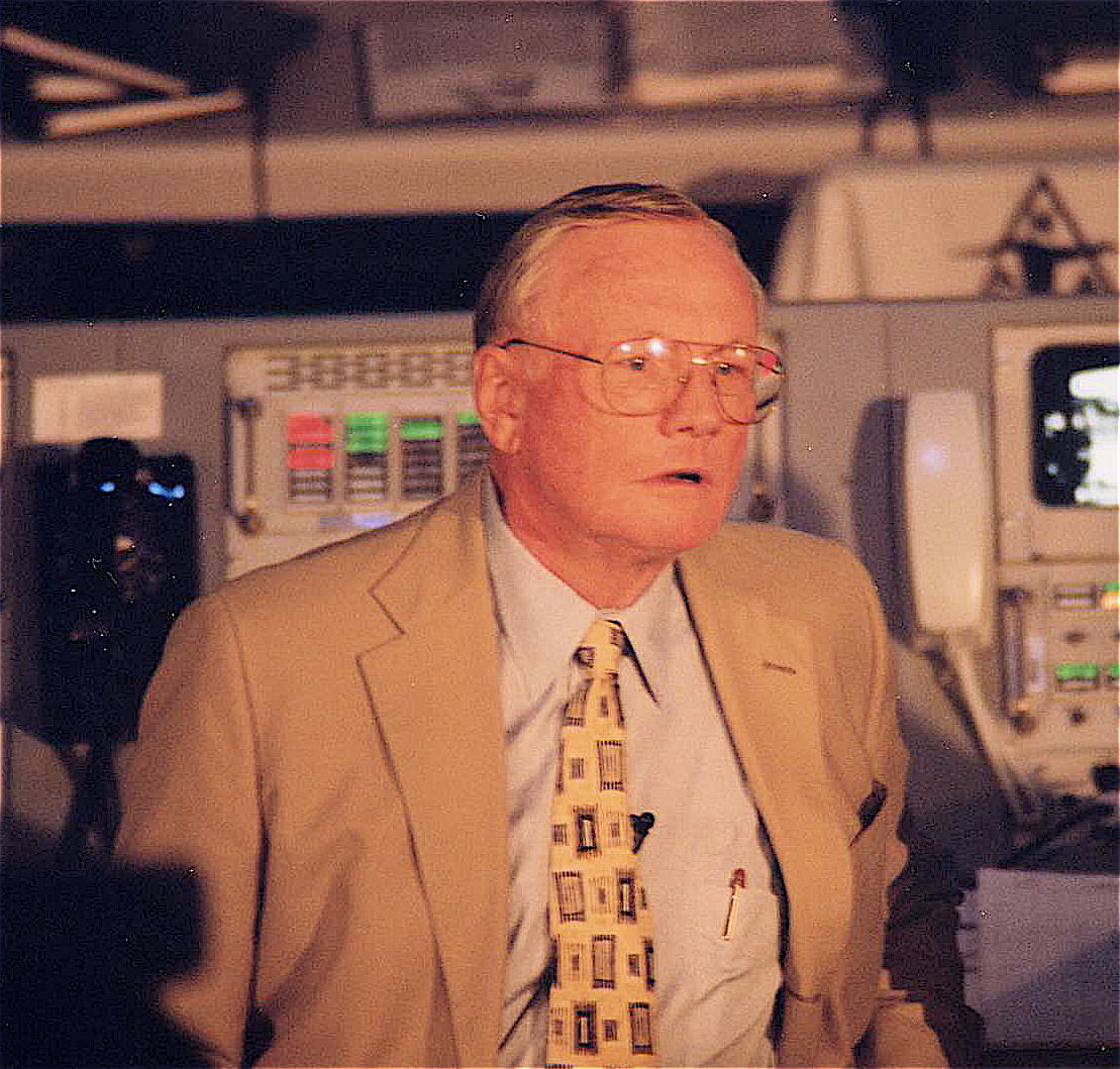
Sweeping Panoramic Vista of Mount Sharp and Gale Crater from Curiosity

Image Caption: Panoramic Vista of Mount Sharp (at right) and Gale Crater from NASA’s Curiosity rover on Mars. Curiosity will eventually climb 3.4 mile high Mount Sharp in search of hydrated minerals. This colorized panoramic mosaic shows more than half of the landing site surrounding Curiosity in the distance to the visible peak of Mount Sharp and a portion of the stowed robotic arm (at left) and the shadow of the camera mast (center) in the foreground. The mosaic was assembled from new navigation camera (Navcam) images snapped by Curiosity on Sol 2 and Sol 12 and colorized based on Mastcam imagery from Curiosity. Image stitching and processing by Ken Kremer and Marco Di Lorenzo. See black and white version below. Credit: NASA/JPL-Caltech/Ken Kremer/Marco Di Lorenzo

At last the Curiosity mega rover is beaming back the first higher resolution panoramic images that many of us have longed to see – a complete view to the visible summit of towering Mount Sharp, the mountain she will scale, surrounded by the sweeping vistas of the tall eroded rim of Gale Crater, her touchdown site barely 2 weeks ago.

See our panoramic mosaics above and below incorporating the best available raw images to date. Curiosity’s stowed robotic arm and the shadow cast by the camera mast are visible in the foreground.

The new images from Curiosity’s mast mounted navigation cameras (Navcam) show the huge mountains peak to as far up as the rover can see from her vantage point some 7 kilometers (4 miles) from the base of the 18,000 foot (5.5 km) high Mount Sharp which is taller than Mount Rainier, the tallest peak in the contiguous United States.

By stitching together the newly received full resolution Navcam images from Sols 2 and 12, we (Ken Kremer and Marco Di Lorenzo) have created a panoramic mosaic showing the breathtaking expanse to the top of Mount Sharp combined with the perspective of Gale Crater from the rover’s eye view on the crater’s gravelly surface.

Image Caption: Panoramic Vista of Mount Sharp (at right) and Gale Crater from NASA’s Curiosity rover on Mars. Curiosity will eventually climb 3.4 mile high Mount Sharp in search of hydrated minerals. This panoramic mosaic shows more than half of the landing site surrounding Curiosity in the distance to the peak of Mount Sharp and a portion of the stowed robotic arm (at left) and the shadow of the camera mast (center) in the foreground. The mosaic was assembled from new navigation camera (Navcam) images snapped by Curiosity on Sol 2 and Sol 12. Image stitching and processing by Ken Kremer and Marco Di Lorenzo. Credit: NASA/JPL-Caltech/Ken Kremer/Marco Di Lorenzo – www.kenkremer.com

In coming weeks, Curiosity will take aim at Mount Sharp with the pair of high resolution Mastcam cameras (34 mm and 100) mounted on the rover’s mast and eventually provide much clearer images to the peak resulting in the most spectacular pictures imaginable of the mysterious mountain that holds the mother lode of hydrated mineral deposits that the robot was sent to investigate by NASA. So far the Mastcam cameras have only imaged the lower reaches of Mount Sharp.

The nuclear powered, car sized Curiosity rover was specifically engineered to accomplish a pinpoint landing inside the 96 mile (154 km) wide Gale Crater beside Mount Sharp so she could scale the mountain and take soil and rock samples of the clays and hydrated sulfated minerals that scientists believe formed in liquid water that flowed billions of years ago.

Mount Sharp is a gigantic mound that covers the entire central portion of Gale Crater and learning how it formed is one of the many mysteries researchers seek to unveil with the highly sophisticated 1 ton robot.

John Grotzinger, the project scientist for NASA’s Curiosity Mars Science Lab (MSL) rover, says that the hydrated minerals are all located in about the first 400 meters or so of Mount Sharp’s vertical elevation, based on spectral data collected by NASA and ESA spacecraft orbiting Mars. He says Curiosity will spend about a year traversing and investigating targets on the crater floor before reaching the foothills of Mount Sharp.

Curiosity will eventually spend years climbing Mount Sharp in the valleys between the 1 to 3 story tall mesas and buttes at the giant mountain’s base and lower elevations in search of sedimentary layers of the clay and hydrated sulfate mineral deposits.

The powerful ChemCam laser that Curiosity successfully test fired today will be absolutely key to finding the best targets for detailed analysis by her 10 state of the art science instruments.

The mission goal is to ascertain whether the Red Planet was ever capable of supporting microbial life, past or present and to search for the signs of life in the form of organic molecules during the 2 year primary mission phase.

Ken Kremer

Image Caption: Gale Crater and Mount Sharp from orbit with Curiosity landing site ellipse

Curiosity Blasts 1st Mars Rock with Powerful Laser Zapper

Image Caption: PewPew !! – First Laser Zapped rock on Mars. This composite image, with magnified insets, depicts the first laser test by the Chemistry and Camera, or ChemCam, instrument aboard NASA’s Curiosity Mars rover. The composite incorporates a Navigation Camera image taken prior to the test, with insets taken by the camera in ChemCam. The circular insert highlights the rock before the laser test. The square inset is further magnified and processed to show the difference between images taken before and after the laser interrogation of the fist-sized rock, called “Coronation.” It is the first rock on any extraterrestrial planet to be investigated with such a laser test. ChemCam inaugurated use of its laser when it used the beam to investigate Coronation during Curiosity’s 13th day after landing. Credit: NASA/JPL-Caltech/LANL/CNES/IRAP

NASA’s Curiosity rover successfully blasted a Mars rock with a powerful laser beam, for the first time in history, today Aug. 19, inaugurating a revolutionary new era in planetary science with a new type of instrument that will deliver bountiful discoveries. The fist sized Martian rock zapped during the maiden laser target practice shots was appropriately dubbed “Coronation”.

The ChemCam instrument mounted at the top of Curiosity’s mast fired a total of 30 one-million watt pulses over a 10 second period at the 3 inch wide rock that vaporized a pinhead sized spot into an ionized, glowing plasma.

Each pulse lasted about five one-billionths of a second and was sufficient in energy to generate a spark of plasma to be observed with the ChemCam telescope and trio of spectrometers below deck in order to identify the elemental composition.

“Yes, I’ve got a laser beam attached to my head. I’m not ill tempered; I zapped a rock for science. PewPew,” tweeted Curiosity.

The NASA composite image above shows Coronation before and after the laser shots – watch out little Martians !

“We got a great spectrum of Coronation — lots of signal,” said ChemCam Principal Investigator Roger Wiens of Los Alamos National Laboratory, N.M. “Our team is both thrilled and working hard, looking at the results. After eight years building the instrument, it’s payoff time!”

Image caption: This mosaic shows the first target Curiosity zapped with the ChemCam laser, before being blasted on Aug. 19. The 3 inch wide rock was provisionally named N165 and is now called “Coronation”. Credit: NASA/JPL-Caltech/MSSS/LANL

ChemCam recorded spectra from the laser-induced spark during all 30 pulses at 6,144 different wavelengths of ultraviolet, visible and infrared light. The purpose of this test was target practice to make sure the laser could be precisely aimed and to characterize the instrument.

Ultimately the goal is use the laser to penetrate below the dusty surface and reveal the interior composition of the targeted rocks using the telescopic camera and spectrometers.

ChemCam, which stands for Chemistry and Camera, is a joint project between the US and France said Wiens at a news briefing on Aug. 17. “The science team is half French and half US.”

“It’s surprising that the data are even better than we ever had during tests on Earth, in signal-to-noise ratio,” said ChemCam Deputy Project Scientist Sylvestre Maurice of the Institut de Recherche en Astrophysique et Planetologie (IRAP) in Toulouse, France. “It’s so rich, we can expect great science from investigating what might be thousands of targets with ChemCam in the next two years.”

ChemCam is a remote sensing instrument and will get the most use of any of Curiosity’s instruments. It will be analyzing about 14,000 samples and help winnow down the targets and guide Curiosity to the most interesting samples for more detailed analysis, Wiens explained.

ChemCam uses a technique called laser-induced breakdown spectroscopy that has precedent in determining the composition of targets in other extreme environments such as inside nuclear reactors and on the sea floor, but is unprecedented in interplanetary exploration.

NASA’s 1 ton mega rover Curiosity is the biggest and most complex robot ever sent to the surface of another planet, sporting a payload of 10 state of the art science instruments weighing 15 times more than any prior roving vehicle. Curiosity’s goal is to determine if Mars was ever capable of supporting microbial life, past or present and to search for the signs of life in the form of organic molecules during the 2 year primary mission phase.

Ken Kremer

1st Laser Firing and 1st Motion Imminent for Curiosity

Image Caption: This self-portrait shows the deck of NASA’s Curiosity rover from the rover’s Navigation camera. The image is distorted because of the wide field of view. The back of the rover can be seen at the top left of the image, and two of the rover’s right side wheels can be seen on the left. The undulating rim of Gale Crater forms the lighter color strip in the background. Bits of gravel, about 0.4 inches (1 centimeter) in size, are visible on the deck of the rover. Credit: NASA/JPL-Caltech

The 1st firing of Curiosity’s rock zapping laser and 1st motion of her six wheels is imminent and likely to take place within the next 24 to 72 hours said mission scientists at Friday’s (Aug 17) media briefing at NASA’s Jet Propulsion Lab (JPL) in Pasadena, Calif., home to mission control for the nuclear-powered, car-sized robot.

Furthermore the team has decided on the target of her 1st Martian Trek, a science hot spot dubbed Glenelg because it lies at the natural intersection of three different types of geologic formations (see graphic below), including layered bedrock and an alluvial fan through which liquid water flowed eons ago. Glenelg is about 400 meters (1300 feet) east of the rover’s landing site.

With each passing Sol, or Martian day, NASA biggest, best and most daring mobile lab becomes ever more capable, like a growing child, as engineers energize and successfully test more and more of her highly advanced systems to accomplish feats of exploration and discovery never before possible.

“Everything is going really well,” said John Grotzinger, project scientist for NASA’s Curiosity Mars Science Lab (MSL) rover. “The excitement from the point of view of the science team is all the instruments continue to check out.”

Image Caption: Martian Treasure Map -This image shows the landing site of NASA’s Curiosity rover and destinations scientists want to investigate. Curiosity landed inside Gale Crater on Mars on Aug. 5 PDT (Aug. 6 EDT) at the green dot, within the Yellowknife quadrangle. The team has chosen for it to move toward the region marked by a blue dot that is nicknamed Glenelg. That area marks the intersection of three kinds of terrain. The science team thought the name Glenelg was appropriate because, if Curiosity traveled there, it would visit it twice — both coming and going — and the word Glenelg is a palindrome. Then, the rover will aim to drive to the blue spot marked “Base of Mt. Sharp”, which is a natural break in the dunes that will allow Curiosity to begin scaling the lower reaches of Mount Sharp. At the base of Mt. Sharp are layered buttes and mesas that scientists hope will reveal the area’s geological history. The image was acquired by the High Resolution Imaging Science Experiment (HiRISE) camera on NASA’s Mars Reconnaissance Orbiter. Credit: NASA/JPL-Caltech/Univ. of Arizona

Curiosity will blast her first rock, dubbed N165, in the history of planetary science as early as Saturday night, Aug. 18, with the powerful mast-mounted laser and telescope on the Chemistry and Camera instrument, or ChemCam that includes spectrometers inside the rover.

ChemCam is a remote sensing instrument. It will get the most use by analyzing about 14,000 samples and help winnow down the targets and guide Curiosity to the most interesting samples for detailed analysis, Wiens explained.

“Rock N165 looks like your typical Mars rock, about three inches wide. It’s about 10 feet away,” said Roger Wiens, principal investigator of the ChemCam instrument from the Los Alamos National Laboratory in New Mexico. “We are going to hit it with 14 millijoules of energy 30 times in 10 seconds. It is not only going to be an excellent test of our system, it should be pretty cool too.”

ChemCam has a range of about 23 feet (7 meters). It fires with a million watts of power for 5 billionths of a second, sufficient energy to excite a pinhead sized spot to a glowing plasma that the instrument observes with the spectrometer below deck to identify the chemical composition.

Image caption: This mosaic image shows the first target NASA’s Curiosity rover aims to zap with a laser on its Chemistry and Camera (ChemCam) instrument, a rock provisionally named N165. Credit: NASA/JPL-Caltech/MSSS/LANL

“We are very excited. Our team has waited eight long years to get to this date and we’re happy that everything is looking good so far,” said Wiens. “Hopefully we’ll be back early next week and be able to talk about how Curiosity’s first laser shots went.”

We will take images of Rock N165 before and after the laser firing. The camera has the same resolution as the Mastcam and can take images that resolve to the width of a human hair from 7 feet away.

Engineers plan to turn the rover’s wheels over the next few days and execute a short test drive and turns of about 10 feet (3 meters).

Grotzinger indicated the drive to Glenelg could take a month or more.

“We will drive efficiently to Glenelg and it will take about 3 to 4 weeks. Along the way we may do scooping to take some soil samples if we find fine grained materials”

Glenelg, a palindrome, is also the 1st location where Curiosity will actually drill into rocks. Then it will deliver sifted samples into the two analytical chemistry instruments, SAM (Sample Analysis at Mars) and CheMin (Chemistry and Minerology), which will determine the chemical and mineralogical composition and search for signs of organic molecules – the carbon based molecules that are the building blocks of life.

“We’ll stay and do about a month or more of science at Glenelg”

“With such a great landing spot in Gale Crater, we literally had every degree of the compass to choose from for our first drive,” Grotzinger said. “We had a bunch of strong contenders. It is the kind of dilemma planetary scientists dream of, but you can only go one place for the first drilling for a rock sample on Mars. That first drilling will be a huge moment in the history of Mars exploration.”

After thoroughly investigating Glenelg until around the end of this calendar year, then it’s off to Mount Sharp, an 18,000 foot tall mound (5.5 km) that’s the missions ultimate destination because it preserves millions to billions of years of Martian history, stretching from the wet water era of billions of years ago to the more recent desiccated era. It could take a year or so to reach the base.
Mount Sharp is about 7 kilometers (4.4 miles) distant from the current location of Curiosity.

“What’s really cool about this topography is that the crater rim kind of looks like the Mojave Desert and now what you see here kind of looks like the Four Corners area of the western U.S., or maybe around Sedona, Ariz., where you’ve got these buttes and mesas made out of these layered, kind of light-toned reddish-colored outcrops. There’s just a rich diversity over there,” Grotzinger said at the briefing.

Curiosity will spend years climbing Mount Sharp in search of sedimentary layers of clays and sulfates, the hydrated minerals that form in flowing liquid water and could hold the ingredients of life.

New high resolution images of the foothills of Mount Sharp from Curiosity show the giant mountain’s base is littered with mesas and buttes ranging in height from 1 to 3 story tall buildings, with valleys in between.

Curiosity’s goal is to search for signs of Martian microbial habitats, past or present, with the most sophisticated suite of 10 state of the art science instruments ever sent to the surface of another planet.

Ken Kremer

Image Caption: Curiosity’s Wheels on Mars set to Rove soon inside Gale Crater. This colorized mosaic shows Curiosity wheels, UHF antenna, nuclear power source and pointy low gain antenna (LGA) in the foreground looking to the eroded northern rim of Gale Crater in the background. The mosaic was assembled from full resolution Navcam images snapped by Curiosity on Sol 2 on Aug. 8. Image stitching and processing by Ken Kremer and Marco Di Lorenzo. Credit: NASA/JPL-Caltech/Ken Kremer/Marco Di Lorenzo

Curiosity Wheels Initial Rove in a Week on Heels of Science and Surgery Success

Image Caption: Curiosity’s Wheels Set to Rove soon Mars inside Gale Crater after ‘brain transplant’. This colorized mosaic shows Curiosity wheels, nuclear power source and pointy low gain antennea (LGA) in the foreground looking to the eroded northern rim of Gale Crater in the background. The mosaic was assembled from full resolution Navcam images snapped by Curiosity on Sol 2 on Aug. 8. Image stitching and processing by Ken Kremer and Marco Di Lorenzo. see black & white version below. Credit: NASA/JPL-Caltech/Ken Kremer/Marco Di Lorenzo

Curiosity’s weekend “Brain transplant” proceeded perfectly and she’ll be ready to drive across the floor of Gale Crater in about a week, said the projects mission managers at a NASA news briefing on Tuesday, Aug. 14. And the team can’t wait to get Curiosity’s 6 wheels mobile on the heels of a plethora of science successes after just a week on Mars.

Over the past 4 sols, or Martian days, engineers at NASA’s Jet Propulsion Lab (JPL) successfully uploaded the new “R10” flight software that is required to carry out science operations on the Red Planet’s surface and transform the car-sized Curiosity from a landing vehicle into a fully fledged rover.

The step by step flight software transition onto both the primary and backup computers “went off without a hitch”, said mission manager Mike Watkins of JPL at the news briefing. “We are ‘Go’ to continue our checkout activities on Sol 9 (today).”
Watkins added that the electronic checkouts of all the additional science instruments tested so far, including the APXS, DAN and Chemin, has gone well. Actual use tests are still upcoming.

“With the new flight software, we’re now going to test the steering actuators on Sol 13, and then we are going to take it out for a test drive here probably around Sol 15,” said Watkins . “We’re going to do a short drive of a couple of meters and then maybe turn and back up.”

See our rover wheel mosaic above, backdropped by the rim of Gale Crater some 15 miles away.

Image Caption: Curiosity landed within Gale Crater near the center of the landing ellipse. The crater is approximately the size of Connecticut and Rhode Island combined. This oblique view of Gale, and Mount Sharp in the center, is derived from a combination of elevation and imaging data from three Mars orbiters. The view is looking toward the southeast. Mount Sharp rises about 3.4 miles (5.5 kilometers) above the floor of Gale Crater. Credit: NASA/JPL-Caltech/ESA/DLR/FU Berlin/MSSS

Curiosity made an unprecedented pinpoint landing inside Gale Crater using the rocket powered “Sky Crane” descent stage just a week ago on Aug. 5/6 and the team is now eager to get the huge rover rolling across the Martian plains towards the foothills of Mount Sharp, about 6 miles (10 km) away as the Martian crow flies.

“We have a fully healthy rover and payload,” said Ashwin Vasavada, Mars Science Laboratory (MSL) deputy project scientist. “We couldn’t be happier with the success of the mission so far. We’ve never had a vista like this on another planet before.”

“In just a week we’ve done a lot. We’ve taken our 1st stunning panorama of Gale crater with focusable cameras, 1st ever high energy radiation measurement from the surface, the 1st ever movie of a spacecraft landing on another planet and the 1st ground images of an ancient Martian river channel.”

A high priority is to snap high resolution images of all of Mount Sharp, beyond just the base of the 3.4 mile (5.5 km) tall mountain photographed so far and to decide on the best traverse route to get there.

“We will target Mount Sharp directly with the mastcam cameras in the next few days,” said Watkins.

Climbing the layered mountain and exploring the embedded water related clays and sulfate minerals is the ultimate goal of Curiosity’s mission. Scientists are searching for evidence of habitats that could have supported microbial life.

Curiosity will search for the signs of life in the form of organic molecules by scooping up soil and rock samples and sifting them into analytical chemistry labs on the mobile rovers’ deck.

Vasavada said the team is exhaustively discussing which terrain to visit and analyze along the way that will deliver key science results. He expects it will take about a year or so before Curiosity arrives at the base of Mount Sharp and begins the ascent in between the breathtaking mesas and buttes lining the path upwards to the sedimentary materials.

Watkins and Vasavada told me they are confident they will find a safe path though the dunes and multistory tall buttes and mesas that line the approach to and base of Mount Sharp.

“Curiosity can traverse slopes of 20 degrees and drive over 1 meter sized rocks. The team has already mapped out 6 potential paths uphill from orbital imagery.”

“The science team and our rover drivers and really everybody are kind of itching to move at this point,” said Vasavada. “The science and operations teams are working together to evaluate a few different routes that will take us eventually to Mount Sharp, maybe with a few waypoints in between to look at some of this diversity that we see in these images. We’ll take 2 or 3 samples along the way. That’s a few weeks work each time.”

Caption: Destination Mount Sharp. This image from NASA’s Curiosity rover looks south of the rover’s landing site on Mars towards Mount Sharp. Colors have been modified as if the scene were transported to Earth and illuminated by terrestrial sunlight. This processing, called “white balancing,” is useful for scientists to be able to recognize and distinguish rocks by color in more familiar lighting. Credit: NASA/JPL-Caltech/MSSS

“We estimate we can drive something like a football field a day once we get going and test out all our driving capabilities. And if we’re talking about a hundred football fields away, in terms of 10 kilometers or so, to those lower slopes of Mount Sharp, that already is a hundred days plus.”

“It’s going to take a good part of a year to finally make it to these sediments on Mount Sharp and do science along the way,” Vasavada estimated.

The 1 ton mega rover Curiosity is the biggest and most complex robot ever dispatched to the surface of another planet and is outfitted with a payload of 10 state of the art science instruments weighing 15 times more than any prior roving vehicle.

Ken Kremer

Image Caption: Curiosity’s Wheels Set to Rove soon Mars inside Gale Crater. This mosaic shows Curiosity wheels, nuclear power source and pointy low gain antennea (LGA) in the foreground looking to the eroded northern rim of Gale Crater in the background. The mosaic was assembled from full resolution Navcam images snapped by Curiosity on Sol 2 on Aug. 8. Image stitching and processing by Ken Kremer and Marco Di Lorenzo. Credit: NASA/JPL-Caltech/Ken Kremer/Marco Di Lorenzo – www.kenkremer.com

Image Caption: Mosaic of Mount Sharp inside Curiosity’s Gale Crater landing site. Gravelly rocks are strewn in the foreground, dark dune field lies beyond and then the first detailed view of the layered buttes and mesas of the sedimentary rock of Mount Sharp. Topsoil at right was excavated by the ‘sky crane’ landing thrusters. Gale Crater in the hazy distance. This mosaic was stitched from three full resolution Navcam images returned by Curiosity on Sol 2 (Aug 8) and colorized based on Mastcam images from the 34 millimeter camera. Processing by Ken Kremer and Marco Di Lorenzo. Credit: NASA/JPL-Caltech/Ken Kremer/Marco Di Lorenzo

“The Hobbit” Author Gets a Crater on Mercury

Here’s a little something to please fans of space, art and fantasy alike (and those who enjoy all three): on August 6 the International Astronomical Union approved names for 9 craters on Mercury, one of which is named for J.R.R. Tolkien, revered author of The Hobbit and The Lord of the Rings (among other seminal fantasy works.)

The crater Tolkien is approximately 30 miles (48 km) in diameter. All 9 newly-named craters are located in Mercury’s north polar region and exhibit radar evidence of water ice hidden in their shadowy pocketses.

IAU procedure for craters on Mercury has them named after “deceased artists, musicians, painters, and authors who have made outstanding or fundamental contributions to their field and have been recognized as art historically significant figures for more than 50 years.” Find out who all 9 new craters are named for after the jump:

Egonu, for Uzo Egonu (1931-1996), a Nigerian-born painter who at 13 was sent to England to study art, first at a private school in Norfolk and later at the Camberwell School of Arts and Crafts. Exile, alienation, and the pain of displaced peoples were recurrent themes in his work.

Gaudí­, after Antoni Gaudí­ (1852-1926), a Spanish architect whose work concentrated largely on the Catalan capital of Barcelona. He was very skilled with ceramics, stained glass, wrought-iron forging, and carpentry and integrated these crafts into his architecture.

Kandinsky, for Wassily Kandinsky (1866-1944), a Russian painter and art theorist credited with painting the first purely abstract works.

Petronius, for Titus Petronius (c. AD 27-66), a Roman courtier during the reign of Nero. He is generally believed to be the author of the Satyricon, a satirical novel believed to have been written during the Neronian era.

Prokofiev, for Sergei Prokofiev (1891-1953), a Russian composer, pianist, and conductor who is considered one of the major composers of the 20th century. His best-known works include the ballet Romeo and Juliet — from which “Dance of the Knights” is taken — and Peter and the Wolf.

Tolkien, for John Ronald Reuel (J. R. R.) Tolkien (1892-1973), an English writer, poet, philologist, and university professor, best known as the author of the classic fantasy novels The Hobbit and The Lord of the Rings.

Tryggvadóttir, for Nina Tryggvadóttir (1913-1968), one of Iceland’s most important abstract expressionist artists and one of very few Icelandic female artists of her generation. She primarily worked in painting, but she also created collages, stained glass work, and mosaics.

Qiu Ying, for Shifu Qiu Ying (1494-1552), a Chinese painter who specialized in the gongbi brush technique, a careful realist method in Chinese painting. He is regarded as one of the Four Great Masters of the Ming Dynasty.

Yoshikawa, for Eiji Yoshikawa (1892-1962), a Japanese historical novelist best known for his revisions of older classics including The Tale of the Heike, Tale of Genji, Outlaws of the Marsh, and Romance of the Three Kingdoms.

“These designations expand the opportunities to recognize the contributions to the arts by the most creative individuals from many cultures and eras. The names of those individuals are now linked in perpetuity to the innermost planet.”

– Sean Solomon, MESSENGER Principal Investigator

The craters were imaged by NASA’s MESSENGER spacecraft, currently in extended mission around Mercury. Learn more about the preciousss MESSENGER mission here. (Gollum! Gollum!)

Image credit: NASA/Johns Hopkins University Applied Physics Laboratory/Carnegie Institution of Washington 

Curiosity sees Mount Sharp Up Close and gets ‘Brain Transplant’

Image Caption: Mosaic of Mount Sharp inside Curiosity’s Gale Crater landing site. Gravelly rocks are strewn in the foreground, dark dune field lies beyond and then the first detailed view of the layered buttes and mesas of the sedimentary rock of Mount Sharp. Topsoil at right was excavated by the ‘sky crane’ landing thrusters. Gale Crater in the hazy distance. This mosaic was stitched from three full resolution Navcam images returned by Curiosity on Sol 2 (Aug 8) and colorized based on Mastcam images from the 34 millimeter camera. Processing by Ken Kremer and Marco Di Lorenzo. Credit: NASA/JPL-Caltech/Ken Kremer/Marco Di Lorenzo

The Curiosity rover has beamed back the first detailed images of Mount Sharp, offering a stupendous initial view of her ultimate driving goal, and is now in the midst of a crucial “brain transplant” this weekend that will transform her into a fully operational rover.

The science team will direct the six-wheeled Curiosity to begin climbing Mount Sharp at some later date during the rovers’ two year primary mission after traversing and extensively investigating the floor of her landing site inside Gale Crater.

See our mosaic focusing on the base of Mount Sharp using three full resolution images snapped by the Navcam navigation camera located on the newly erected camera and instrument mast with colorization based on the 34 millimeter Mastcam color camera.

Curiosity came to rest almost flat on the martian surface, but with a slight 3 degree tilt down in the front and the images thus far are taken from that preprogrammed viewpoint, roughly some six miles or so from the base of Mount Sharp.

The terrain is strewn with small pebbles that may stem from a nearby alluvial fan through which liquid water flowed long ago, scientist think. Observations from orbit with NASA’s Mars Reconnaissance Orbiter have identified clay and sulfate minerals in the lower layers of Mount Sharp, indicating a wet history. At higher elevations, scientists hope to discover a boundary layer and indications of what led to the “Great Dessication Event” and loss of liquid water on the ancient Martian surface.

This weekend Curiosity has also begun transmitting spectacular hi res Mastcam images that will far exceed anything else thus far. Here is the Mastcam 360 pano as assembled by NASA so far:

Image Caption: First Hi-Res Color Mosaic of Curiosity’s Mastcam Images. NASA/JPL-Caltech/MSSS

But before the car-sized robot can actually rove around, reach out with her 7 foot (2 meter) long instrument loaded arm and scoop up samples for analysis by the on board chemistry labs she needs the software smarts to accomplish the science tasks.

With all the initial post landing objectives accomplished, engineers at NASA’s Jet Propulsion Lab in Pasadena, Calif., are spending 4 Sols, or Martian days, bracketing this weekend to upload a new software package named “R10” that is optimized for surface operations and will replace the current “R9” package.

“We designed the mission from the start to be able to upgrade the software as needed for different phases of the mission,” said Ben Cichy of NASA’s Jet Propulsion Laboratory in Pasadena, Calif., chief software engineer for the Mars Science Laboratory mission. “The flight software version Curiosity currently is using [R9] was really focused on landing the vehicle. It includes many capabilities we just don’t need any more. It gives us basic capabilities for operating the rover on the surface, but we have planned all along to switch over after landing to a version of flight software that is really optimized for surface operations.”

Software on both the primary and backup computers is being carefully upgraded in step by step stages. He said an initial “toe dip” on Friday to test the upgrade was the first step.

“R10 is optimized for surface operations and has what the science team wants. It’s being downloaded over the next four Sols to enable this fantastic mission,” Cichy said at a JPL news briefing on August 10. They will stand down on science for the next four Sols during the installation.

“Right now, we have the capability in our basic surface software to check out the health of the instruments, but we don’t really have the capability to go and make the full use of all this great hardware we shipped to Mars.”

“So the R10 software gives us the capability to use the robotic arm fully, to use the drill, to use the dust removal tool, to use the whole sampling chain and injest the samples and analyze them, all this exciting stuff this mission will do.”

“Curiosity is a Martian mega rover and born to drive ! R10 gives us the ability to drive autonomously and use images to detect hazards and drive safely.”

So far, the software upgrade is going as planned this weekend.

Curiosity made an unprecedented pinpoint landing inside Gale Crater on Aug. 5/6 using the rocket powered “Sky Crane” descent stage that lowered Curiosity by cables onto the Red Planet’s surface exactly as planned on the plains astride Mount Sharp just a few miles from the base of the gigantic mountain.

Mount Sharp covers much of the interior of the 96 mile wide (154 km) Gale Crater. The peak of the 3.4 mile (5.5 km) high layered mountain is taller than Mount Whitney in California.

For comparison, see Curiosity’s initial wider field post-landing shots of Mount Sharp in 2 D and 3 D from the lower resolution fish-eye Hazcam cameras, here

NASA’s 1 ton mega rover Curiosity is the biggest and most complex robot ever sent to the surface of another planet, sporting a payload of 10 state of the art science instruments weighing 15 times more than any prior roving vehicle. Curiosity’s goal is to determine if Mars was ever capable of supporting microbial life, past or present and to search for the signs of life in the form of organic molecules.

Ken Kremer

Curiosity and the Mojave Desert of Mars – Panorama from Gale Crater

Image Caption: Curiosity and the Mojave Desert of Mars at Gale Crater North Rim, False Color Mosaic. This false color panoramic mosaic shows Curiosity in the foreground looking to the eroded rim of Gale Crater in the background. Visible at left is a portion of the RTG nuclear power source, low gain antenna pointing up, then the deployed High Gain antenna and other components of the rover deck. This mosaic was assembled from the three new full resolution Navcam images returned by Curiosity overnight and snapped on Sol 2 on Aug. 8. Image stitching by Ken Kremer and Marco Di Lorenzo. Topsoil at right foreground has been excavated by the descent landing thrusters to expose what the team believes is bedrock. See black and white version below. Credit: NASA/JPL-Caltech/Ken Kremer/Marco Di Lorenzo

Curiosity lead scientist John Grotzinger calls this place “The Mojave Desert” of Mars– that’s the sweet spot where NASA’s huge new Curiosity rover landed only 3 Sols, or days ago, and looks so “Earth-like”.

See above and below our new 3 frame panoramic mosaic showing Curiosity with a dramatic “Mojave Desert” backdrop – in false color and black and white – assembled from new pictures received overnight at JPL.

With her camera mast erected, Curiosity is beginning to beam back a flood of spectacular images and giving us the first detailed view of her new surroundings from her touchdown point inside Gale Crater on Mars beside a 3.4 mile (5.5 km) high layered mountain nicknamed Mount Sharp.

Overnight, Curiosity sent back many more full frame pictures from her Navcam navigation camera, including exquisite high resolution views of herself with the eroded rim of Gale Crater over her shoulder.

At Wednesday’s briefing, Grotzinger has ecstatic with the initial set of high resolution images showing Gale crater in the distance, saying;

“The thing that really struck the science team about this image, you would really be forgiven for thinking that NASA was trying to pull a fast one on you and we actually put a rover out in the Mojave Desert and took a picture.

“That’s the part of the rim that’s lowest in elevation, facing the northern lowlands of Mars.”

“The thing that’s amazing about this is to a certain extent the first impression you get is how earth-like this seems, looking at that landscape.”

The terrain is strewn with small pebbles that the team hypothesizes may stem from a nearby alluvial fan through which liquid water flowed long ago and is exactly why they chose Gale Crater as Curiosity’s landing site.

“The sedimentary materials, all those materials are derived from erosion of those mountains there, that’s the source region for this material,” Grotzinger said. “It’s really kind of fantastic.”

The first 360 color panorama from the Mastcam cameras are expected soon.

Ken Kremer

Image Caption: Curiosity and the Mojave Desert of Mars at Gale Crater North Rim. This false color panoramic mosaic shows Curiosity in the foreground looking to the eroded rim of Gale Crater in the background. Visible at left is a portion of the RTG nuclear power source, low gain antenna pointing up, then the deployed High Gain antenna and other components of the rover deck. This mosaic was assembled from the three new full resolution Navcam images returned by Curiosity overnight. Processing by Ken Kremer and Marco Di Lorenzo. Topsoil at right foreground has been excavated by the descent landing thrusters to expose what the team believes is bedrock. Credit: NASA/JPL-Caltech/Ken Kremer/Marco Di Lorenzo

Image Caption: Looking to Martian bedrock and Gale Crater North Rim, False Color- This two frame mosaic was assembled from the first two full resolution Navcam images returned by Curiosity on Sol 2 (Aug 8) and enhanced and colorized to bring out further details. Image sticthing and processing by Ken Kremer and Marco Di Lorenzo. Topsoil in the foreground has been excavated by the Sky crane descent landing thrusters to expose what the team believes is bedrock. Credit: NASA/JPL-Caltech/Ken Kremer/Marco Di Lorenzo – www.kenkremer.com

Curiosity raises Mast and snaps 1st Self Portrait and 1st 360 Panorama

Image Caption: Rover’s Self Portrait -This Picasso-like self portrait of NASA’s Curiosity rover was taken by its Navigation cameras, located on the now-upright mast. The camera snapped pictures 360-degrees around the rover, while pointing down at the rover deck, up and straight ahead. Those images are shown here in a polar projection. Most of the tiles are thumbnails, or small copies of the full-resolution images that have not been sent back to Earth yet. Two of the tiles are full-resolution. Credit: NASA/JPL-Caltech.
See below the 1st 360 degree panorama from Curiosity and an enhanced Sol 2 mosaic of the full resolution view of the north rim of Gale Crater by this author

The rover Curiosity continues her marathon run of milestone achievements – snapping her 1st self portrait and 1st 360 degree panorama since touchdown inside Gale Crater barely over 2 sols, or Martian days ago.

To take all these new images, Curiosity used a new camera, the just-activated higher resolution navigation cameras (Navcam) positioned on the mast. Several of the new images provide the best taste yet of the stupendous vistas coming soon. See our enhanced Sol 2 mosaic below.

The 3.6 foot-tall (1.1 meter) camera mast on the rover deck was just raised and activated earlier today, Wednesday, Aug. 8.

The mast deployment is absolutely crucial to Curiosity’s science mission. It is also loaded with the high resolution MastCam cameras and the ChemCam instrument with the laser rock zapper.

Most of the images Navcam images beamed back today were lower-resolution thumbnails. But 2 high-resolution Navcams from the panorama and the self portrait were also downlinked and provide the clearest view yet of the breathtaking terrain surrounding Curiosity in every direction.

“The full frame navcams show the north rim of Gale Crater,” said Justin Maki, MSL navcam lead, at a briefing today at JPL. “The Navcam’s are identical to the MER Navcam’s.”

The hi res images also show how the descent thruster excavated the topsoil like Phoenix.

Image Caption: Curiosity Looks Away from the Sun – This is the first 360-degree panoramic view from NASA’s Curiosity rover, taken with the Navigation cameras. Most of the tiles are thumbnails, or small copies of the full-resolution images that have not been sent back to Earth yet. Two of the tiles near the center are full-resolution. Mount Sharp is to the right, and the north Gale Crater rim can be seen at center. The rover’s body is in the foreground, with the shadow of its head, or mast, poking up to the right. These images were acquired at 3:30 pm on Mars, or the night of Aug. 7 PDT (early morning Aug. 8 EDT). Thumbnails are 64 by 64 pixels in size; and full-resolution images are 1024 by 1024 pixels. Credit: NASA/JPL-Caltech

Image Caption: Looking to Martian bedrock and Gale Carter North Rim, Enhanced Mosaic- This mosaic was assembled from the first two full resolution Navcam images returned by Curiosity on Sol 2 (Aug 8) and enhanced to bring out further details. Processing by Ken Kremer and Marco Di Lorenzo. Topsoil in the foreground has been excavated by the descent landing thrusters to expose what the team believes is bedrock. Credit: NASA/JPL-Caltech/Ken Kremer/Marco di Lorenzo

“These Navcam images indicate that our powered descent stage did more than give us a great ride, it gave our science team an amazing freebie,” said John Grotzinger, project scientist for the mission from the California Institute of Technology in Pasadena. “The thrust from the rockets actually dug a one-and-a-half-foot-long [0.5-meter] trench in the surface. It appears we can see Martian bedrock on the bottom. Its depth below the surface is valuable data we can use going forward.”

Gale Crater is unlike anything we’ve seen before on Mars.

It also distinctly reminded Grotzinger of Earth and looked to him like the rover set down in the Mojave desert. “The thing that’s amazing about this is to a certain extent the first impression you get is how earth-like this seems, looking at that landscape.”

Curiosity carries 10 science instruments with a total mass 15 times as large as the science payloads on NASA’s Mars rovers Spirit and Opportunity. Some of the tools, such as a laser-firing instrument for checking rocks’ elemental composition from a distance, are the first of their kind on Mars. Curiosity will use a drill and scoop, which are located at the end of its robotic arm, to gather soil and powdered samples of rock interiors, then sieve and parcel out these samples into the rover’s analytical laboratory instruments.

So far everything is going very well with Curiosity’s mechanical and instrument checkout. And there is even more power than expected from the RTG nuclear power source.

“We have more power than we expected and that’s going to be fantastic for being able to keep the rover awake longer,” said Mission manager Jennifer Trosper of JPL.

Ken Kremer

Looking to Martian bedrock and Gale Carter North Rim, Enhanced Mosaic with False Color- This mosaic was assembled from the first two full resolution Navcam images returned by Curiosity on Sol 2 (Aug 8) and enhanced and colorized to bring out further details. Processing by Ken Kremer and Marco Di Lorenzo. Topsoil in the foreground has been excavated by the descent landing thrusters to expose what the team believes is bedrock. Credit: NASA/JPL-Caltech/Ken Kremer/Marco di Lorenzo

Mount Sharp on Mars: 1st 2-D and 3-D Views of Curiosity’s Ultimate Mountain Goal

Image Caption: Clear View on Mars – This image comparison shows a view through a Hazard-Avoidance camera on NASA’s Curiosity rover before and after the clear dust cover was removed. Both images were taken by a camera at the front of the rover. Mount Sharp, the mission’s ultimate destination, looms ahead. See the first 3 D and 2 D full res images with no dust cover, below. Image credit: NASA/JPL-Caltech

Curiosity, NASA’s new car sized rover on Mars has sent back her first breathtaking views of Mount Sharp, the huge nearby mountain that enticed scientists to set Gale Crater as her touchdown goal.

And already within the first 2 Sols, or martian days, the rover has beamed back magnificent 2D and 3 D vistas of the landscape surrounding her.

The unprecedented rocket powered “Sky Crane” descent maneuver that lowered Curiosity by cables upon the Red Planet’s surface rover with pinpoint accuracy, set her down in a position inside Gale Crater that fortuitously pointed her front Hazard Avoidance (Hazcam) cameras towards a stupendous panoramic view of Mount Sharp.

The terrain is strewn with small pebbles that may stem from a nearby alluvial fan through which liquid water flowed long ago, scientist think.

The top image set shows the spectacular side by side views of Mount Sharp before and after the protective dust covers were popped off.

Mount Sharp is taller than Mount Ranier, the tallest mountain in the US in the lower 48 states. It’s about 3.5 miles (5.5 km) high.

Curiosity is roughly 6 km distant from Mount Sharp, as the martian crow flies.

The image below is the first full resolution Hazcam version of Mount Sharp.

Curiosity’s Early Views of Mars. This full-resolution image shows one of the first views from NASA’s Curiosity rover, which landed on Mars the evening of Aug. 5 PDT (early morning hours Aug. 6 EDT). It was taken through a “fisheye” wide-angle lens on one of the rover’s front Hazard-Avoidance cameras. These engineering cameras are located at the rover’s base. Image credit: NASA/JPL-Caltech

Here’s the first 3D version of Mount Sharp assembled from both front cameras.

Image Caption: 3-D View from the Front of Curiosity. This image is a 3-D view in front of NASA’s Curiosity rover, which landed on Mars on Aug. 5 PDT (Aug. 6 EDT). The anaglyph was made from a stereo pair of Hazard-Avoidance Cameras on the front of the rover. Mount Sharp, a peak that is about 5.5 kilometers (3.4 miles) high, is visible rising above the terrain, though in one “eye” a box on the rover holding the drill bits obscures the view. This image was captured by Hazard-Avoidance cameras on the front of the rover at full resolution shortly after the rover landed. It has been linearized to remove the distorted appearance that results from its fisheye lens. Credit: NASA/JPL-Caltech

Ken Kremer

Winds of Change at the Edge of the Solar System

As the venerable Voyager 1 spacecraft hurtles ever outward, breaking through the very borders of our solar system at staggering speeds upwards of 35,000 mph, it’s sending back information about the curious region of space where the Sun’s outward flow of energetic particles meets the more intense cosmic radiation beyond — a boundary called the heliosheath.

Voyager 1 has been traveling through this region for the past seven years, all the while its instruments registering gradually increasing levels of cosmic ray particles. But recently the levels have been jumping up and down, indicating something new is going on… perhaps Voyager 1 is finally busting through the breakers of our Sun’s cosmic bay into the open ocean of interstellar space?

Data sent from Voyager 1 — a trip that currently takes the information nearly 17 hours to make — have shown steadily increasing levels of cosmic radiation as the spacecraft moves farther from the Sun. But on July 28, the levels of high-energy cosmic particles detected by Voyager jumped by 5 percent, with levels of lower-energy radiation from the Sun dropping by nearly half later the same day. Within three days both levels had returned to their previous states.

The last time such a jump in levels occurred was in May — and that spike took a week to happen.

“The increase and the decrease are sharper than we’ve seen before, but that’s also what we said about the May data,” said Edward Stone, the Voyager project scientist based at the California Institute of Technology. “The data are changing in ways that we didn’t expect, but Voyager has always surprised us with new discoveries.”

The graph below shows the jump in cosmic particles detected starting May 2012.

Over 11 billion miles (18 billion km) from home, Voyager 1 has been cruising through space since its launch on September 5, 1977. Its twin, Voyager 2, was launched two weeks earlier and is currently 9.3 billion miles (15 billion km) away. Both spacecraft are healthy and continue to communicate with Earth, and will both eventually break through the borders of our solar system and enter true interstellar space. If they are still operational when that happens — and there’s no reason that they shouldn’t be — we will finally get a sense of what conditions are like “out there”.

Although Voyager 1 is registering intriguing fluctuations in radiation from both inside and outside the Solar System, it’s not quite there yet.

“Our two veteran Voyager spacecraft are hale and healthy as they near the 35th anniversary of their launch,” said Suzanne Dodd, Voyager project manager based at JPL in Pasadena. “We know they will cross into interstellar space. It’s just a question of when.”

Read more about Voyager’s ongoing breakout here.

“We are certainly in a new region at the edge of the solar system where things are changing rapidly. But we are not yet able to say that Voyager 1 has entered interstellar space.”

–  Edward Stone, Voyager project scientist, Caltech

Images: NASA/JPL-Caltech