Titan Shaping Up to Look a Lot Like Pre-Life Earth

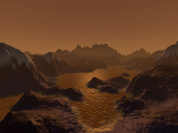
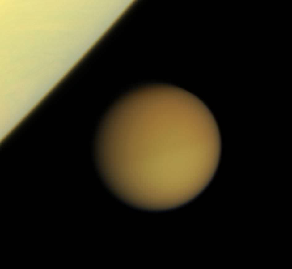
An artist's imagination of hydrocarbon pools, icy and rocky terrain on the surface of Saturn's largest moon Titan. Image credit: Steven Hobbs (Brisbane, Queensland, Australia)

[/caption]

It’s more than a billion kilometers (759 million miles) away, but the more astronomers learn about Titan, the more it looks like Earth.

That’s the theme of two talks happening this week at the International Astronomical Union meeting in Rio de Janeiro, Brazil. Two NASA researchers, Rosaly Lopes and Robert M. Nelson of the Jet Propulsion Laboratory in Pasadena, California, are reporting that weather and geology have very similar actions on Earth and Titan — even though Saturn’s moon is, on average, 100 degrees C (212 degrees F) colder than Antarctica (and certainly much more frigid than either California or Brazil; lucky astronomers).

The researchers are also reporting a tantalizing clue in the search for life: Titan hosts chemistry much like pre-biotic conditions on Earth.

Wind, rain, volcanoes, tectonics and other Earth-like processes all sculpt features on Titan’s complex and varied surface — except, according to additional research being presented at the meeting,  scientists think the “cryovolcanoes” on Titan eject cold slurries of water-ice and ammonia instead of scorching hot magma.

“It is really surprising how closely Titan’s surface resembles Earth’s,” Lopes said. “In fact, Titan looks more like the Earth than any other body in the Solar System, despite the huge differences in temperature and other environmental conditions.”

The joint NASA/ESA/ASI Cassini-Huygens mission has revealed details of Titan’s geologically young surface, showing few impact craters, and featuring mountain chains, dunes and even “lakes.” The RADAR instrument on the Cassini orbiter has now allowed scientists to image a third of Titan’s surface using radar beams that pierce the giant moon’s thick, smoggy atmosphere. There is still much terrain to cover, as the aptly named Titan is one of the biggest moons in the Solar System, larger than the planet Mercury and approaching Mars in size.
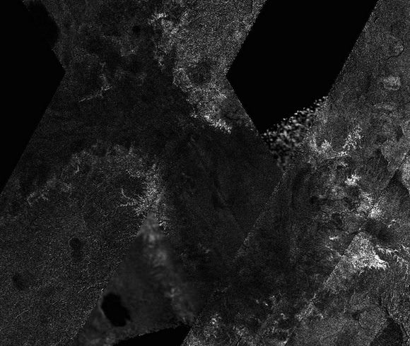
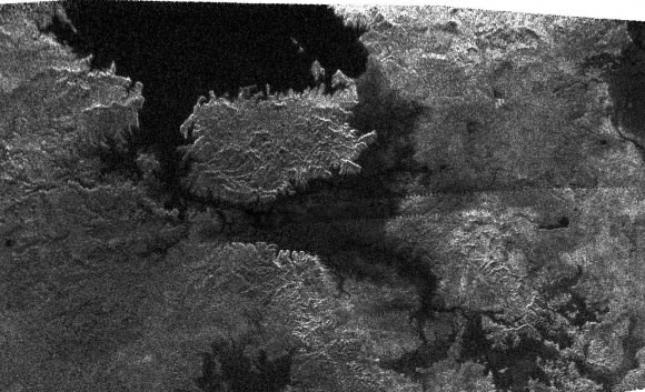
New Cassini mosaic showing a dried-out lake at Titan's south pole.

Titan has long fascinated astronomers as the only moon known to possess a thick atmosphere, and as the only celestial body other than Earth to have stable pools of liquid on its surface. The many lakes that pepper the northern polar latitudes, with a scattering appearing in the south as well, are thought to be filled with liquid hydrocarbons, such as methane and ethane.

On Titan, methane takes water’s place in the hydrological cycle of evaporation and precipitation (rain or snow) and can appear as a gas, a liquid and a solid. Methane rain cuts channels and forms lakes on the surface and causes erosion, helping to erase the meteorite impact craters that pockmark most other rocky worlds, such as our own Moon and the planet Mercury.

Another Cassini instrument called the Visual and Infrared Mapping Spectrometer (VIMS) had previously detected an area, called Hotei Regio, with a varying infrared signature, suggesting the temporary presence of ammonia frosts that subsequently dissipated or were covered over. Although the ammonia does not stay exposed for long, models show that it exists in Titan’s interior, indicating that a process is at work delivering ammonia to the surface. RADAR imaging has indeed found structures that resemble terrestrial volcanoes near the site of suspected ammonia deposition.

Nelson said new infrared images of the region, also presented at the IAU, “provide further evidence suggesting that cryovolcanism  has deposited ammonia onto Titan’s surface. It has not escaped our attention that ammonia, in association with methane and nitrogen, the principal species of Titan’s atmosphere, closely replicates the environment at the time that life first emerged on Earth. One exciting question is whether Titan’s chemical processes today support a prebiotic chemistry similar to that under which life evolved on Earth?”

Many Titan researchers hope to observe Titan with Cassini for long enough to follow a change in seasons. Lopes thinks that the hydrocarbons there likely evaporated because this hemisphere is experiencing summer. When the seasons change in several years and summer returns to the northern latitudes, the lakes so common there may evaporate and end up pooling in the south.

Lead image caption: Artist’s impression of hydrocarbon pools, icy and rocky terrain on the surface of Saturn’s largest moon Titan. Image credit: Steven Hobbs (Brisbane, Queensland, Australia)

Source: International Astronomical Union (IAU)

Heat-Shocked Diamonds Provide New Clue of Horse-Killing Impact

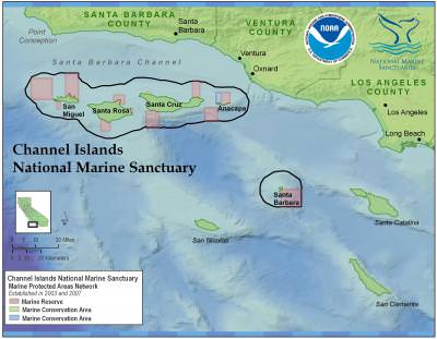
California's Channel Islands, where heat-shocked soot and diamonds are suggesting a killing comsic impact. Courtesy NOAA and UC Santa Barbara

[/caption]

Archeologists have been divided about whether an extraterrestiral impact blasted North America about 12,900 years ago, wreaking havoc on Earth’s surface and sending scores of species — including a pygmy mammoth and the horse — into oblivion.

New clues from California’s Channel Islands should put any doubt to rest, says an international team of researchers.

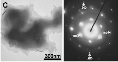
This transmission electron microscopy close-up shows a single lonsdaleite crystal, left, and associated diffraction pattern. Credit: University of Oregon

The 17-member team, led by University of Oregon archaeologist Douglas J. Kennett, has found what may be the smoking gun.

The team has found shock-synthesized hexagonal diamonds in 12,900-year-old sediments on the Northern Channel Islands off the southern California coast.

The tiny diamonds and diamond clusters were buried deeply below four meters (13 feet) of sediment. They date to the end of Clovis — a Paleoindian culture long thought to be North America’s first human inhabitants. The nano-sized diamonds were pulled from Arlington Canyon on the island of Santa Rosa, which had once been joined with three other Northern Channel Islands in a landmass known as Santarosae.

The diamonds were found in association with soot that forms in extremely hot fires, and they suggest associated regional wildfires, based on nearby environmental records.

Such soot and diamonds are rare in the geological record. They were found in sediment dating to massive asteroid impacts 65 million years ago in a layer widely known as the K-T Boundary. The thin layer of iridium-and-quartz-rich sediment dates to the transition of the Cretaceous and Tertiary periods, which mark the end of the Mesozoic Era and the beginning of the Cenozoic Era.

“The type of diamond we have found — Lonsdaleite — is a shock-synthesized mineral defined by its hexagonal crystalline structure. It forms under very high temperatures and pressures consistent with a cosmic impact,” Kennett said. “These diamonds have only been found thus far in meteorites and impact craters on Earth and appear to be the strongest indicator yet of a significant cosmic impact [during Clovis].”

The age of this event also matches the extinction of the pygmy mammoth on the Northern Channel Islands, as well as numerous other North American mammals, including the horse, which Europeans later reintroduced. In all, an estimated 35 mammal and 19 bird genera became extinct near the end of the Pleistocene with some of them occurring very close in time to the proposed cosmic impact, first reported in October 2007 in PNAS.

Source: University of Oregon, via Eurekalert. The results appear in a paper online ahead of print in the Proceedings of the National Academy of Sciences.

Solar Cycle Triggers La Nina, El Nino-like Climate Shifts

[/caption]

Researchers have discovered a link between the 11-year solar cycle and tropical Pacific weather patterns that resemble La Niña and El Niño events.

When it comes to influencing Earth’s climate, the Sun’s variability pales in recent decades compared to greehouse gases — but the new research shows it still plays a distinguishable part.

The total energy reaching Earth from the sun varies by only 0.1 percent across the solar cycle. Scientists have sought for decades to link these ups and downs to natural weather and climate variations and distinguish their subtle effects from the larger pattern of human-caused global warming.

Co-authors Gerald Meehl and Julie Arblaster, both affiliated with the National Center for Atmospheric Research in Boulder, Colorado, analyzed computer models of global climate and more than a century of ocean temperature records. Arblaster is also affiliated with the Australian Bureau of Meteorology.

In the new paper and a previous one with additional colleagues, the researchers have been able to show that, as the sun’s output reaches a peak, the small amount of extra sunshine over several years causes a slight increase in local atmospheric heating, especially across parts of the tropical and subtropical Pacific where Sun-blocking clouds are normally scarce.

That small amount of extra heat leads to more evaporation, producing extra water vapor. In turn, the moisture is carried by trade winds to the normally rainy areas of the western tropical Pacific, fueling heavier rains.

As this climatic loop intensifies, the trade winds strengthen. That keeps the eastern Pacific even cooler and drier than usual, producing La Niña-like conditions.

“We have fleshed out the effects of a new mechanism to understand what happens in the tropical Pacific when there is a maximum of solar activity,” Meehl said. “When the sun’s output peaks, it has far-ranging and often subtle impacts on tropical precipitation and on weather systems around much of the world.”

The result of this chain of events is similar to a La Niña event, although the cooling of about 1-2 degrees Fahrenheit is focused further east and is only about half as strong as for a typical La Niña.

True La Niña and El Nino events are associated with changes in the temperatures of surface waters of the eastern Pacific Ocean. They can affect weather patterns worldwide.

Although the Pacific pattern in the new paper is produced by the solar maximum, the authors found that its switch to an El Niño-like state is likely triggered by the same kind of processes that normally lead from La Niña to El Niño.

The transition starts when the changes of the strength of the trade winds produce slow-moving off-equatorial pulses known as Rossby waves in the upper ocean, which take about a year to travel back west across the Pacific.

The energy then reflects from the western boundary of the tropical Pacific and ricochets eastward along the equator, deepening the upper layer of water and warming the ocean surface.

As a result, the Pacific experiences an El Niño-like event about two years after solar maximum — also about half as strong as a true El Niño. The event settles down after about a year, and the system returns to a neutral state.

“El Niño and La Niña seem to have their own separate mechanisms,” Meehl said, “but the solar maximum can come along and tilt the probabilities toward a weak La Niña. If the system was heading toward a La Niña anyway,” he adds, “it would presumably be a larger one.”

The study authors say the new research may pave the way toward predictions of temperature and precipitation patterns at certain times during the approximately 11-year solar cycle.

In an email, Meehl noted that previous work by his team and other research groups has shown that “most of the warming trend in the first half of the 20th Century was due to an increasing trend of solar output, while most of the warming trend in the last half of the 20th Century and ever since has been due to ever-increasing GHG (greenhouse gas) concentrations in the atmosphere from the burning of fossil fuels.”

The new paper appears this month in the Journal of Climate, a publication of the American Meteorological Society. (Sorry, it’s not yet available online.)

Source: Eurekalert

NASA IBEX Spacecraft Detects Neutral Hydrogen Bouncing Off Moon

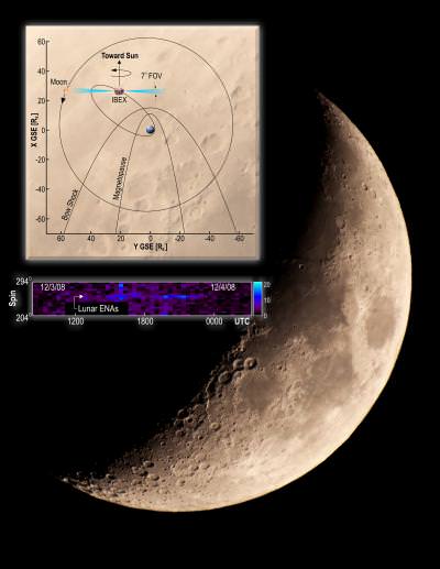
NASA's Interstellar Boundary Explorer has made the first detection of neutral atoms coming from the Moon (background image). The color-coded data toward the bottom shows the neutral particles and geometry measured at the Moon on Dec. 3, 2008.

[/caption]

NASA’s Interstellar Boundary Explorer (IBEX) spacecraft has made the first observations of fast hydrogen atoms coming from the moon, following decades of speculation and searching for their existence.   Launched last October, the IBEX has a mission to image and map the dynamic interactions caused by the hot solar wind slamming into the cold expanse of space.  But as the IBEX team commissioned the spacecraft, they discovered the stream of neutral hydrogen atoms which are caused by the solar wind scattering off the moon’s surface.


The detector which made the discovery, called IBEX-Hi, was designed and built by the Southwest Research Institute and Los Alamos National Labs to measure particles moving at speeds of 0.5 million to 2.5 million miles an hour.

“Just after we got IBEX-Hi turned on, the moon happened to pass right through its field of view, and there they were,” says Dr. David J. McComas, IBEX principal investigator and assistant vice president of the SwRI Space Science and Engineering Division, where the IBEX-Hi particle detector was primarily built. “The instrument lit up with a clear signal of the neutral atoms being detected as they backscattered from the moon.”

The solar wind, the supersonic stream of charged particles that flows out from the sun, moves out into space in every direction at speeds of about a million mph. The Earth’s strong magnetic field shields our planet from the solar wind. The moon, with its relatively weak magnetic field, has no such protection, causing the solar wind to slam onto the moon’s sunward side.

From its vantage point in high earth orbit, IBEX sees about half of the moon — one quarter of it is dark and faces the nightside (away from the sun), while the other quarter faces the dayside (toward the sun). Solar wind particles impact only the dayside, where most of them are embedded in the lunar surface, while some scatter off in different directions. The scattered ones mostly become neutral atoms in this reflection process by picking up electrons from the lunar surface.

The IBEX team estimates that only about 10 percent of the solar wind ions reflect off the sunward side of the moon as neutral atoms, while the remaining 90 percent are embedded in the lunar surface. Characteristics of the lunar surface, such as dust, craters and rocks, play a role in determining the percentage of particles that become embedded and the percentage of neutral particles, as well as their direction of travel, that scatter.

McComas says the results also shed light on the “recycling” process undertaken by particles throughout the solar system and beyond. The solar wind and other charged particles impact dust and larger objects as they travel through space, where they backscatter and are reprocessed as neutral atoms. These atoms can travel long distances before they are stripped of their electrons and become ions and the complicated process begins again.

The combined scattering and neutralization processes now observed at the moon have implications for interactions with objects across the solar system, such as asteroids, Kuiper Belt objects and other moons. The plasma-surface interactions occurring within protostellar nebula, the region of space that forms around planets and stars — as well as exoplanets, planets around other stars — also can be inferred.

IBEX’s primary mission is to observe and map the complex interactions occurring at the edge of the solar system, where the million miles per hour solar wind runs into the interstellar material from the rest of the galaxy. The spacecraft carries the most sensitive neutral atom detectors ever flown in space, enabling researchers to not only measure particle energy, but also to make precise images of where they are coming from.

And the spacecraft is just getting started.  Towards the end of the summer, the team will release the spacecraft’s first all-sky map showing the energetic processes occurring at the edge of the solar system. The team will not comment until the image is complete, but McComas hints, “It doesn’t look like any of the models.”

The research was published recently in the journal Geophysical Research Letters.

Source: Southwest Research Institute

Wild Little Mercury to Cause Interplanetary Smashup? Maybe.

Artistic design : J Vidal-Madjar; planet textures from NASA; copyright: IMCCE-CNRS

[/caption]

The chaotic evolution of the planetary orbits in the Solar System could cause a close approach or even a collision within the next 5 billion years, according to a paper in this week’s issue of Nature.

The odds are small, but that didn’t stop NASA from releasing a series of really fun “what-if” images (below) …

Mercury is the wild card, according to co-authors Jacques Laskar and Mickael Gastineau of the Paris Observatory. If its orbit elongates, our puniest neighbor could throw the whole block in peril.

Because its orbit resonates with that of Jupiter, Mercury could become the planet gone wild (eccentric in astronomy speak), colliding with Venus.

The chance is slim, the authors point out — around 1 percent. But the finding — revealed through thousands of computer simulations — was a surpise.

“More surprisingly, in one of these high-eccentricity solutions, a subsequent decrease in Mercury’s eccentricity induces a transfer of angular momentum from the giant planets that destabilizes all the terrestrial planets,” the authors write, “with possible collisions of Mercury, Mars or Venus with the Earth.”

Gregory Laughlin, an astronomer at the University of California Santa Cruz who wrote an accompanying editorial about the new paper, couched it as “a note of definite cheer” in the midst of “a seemingly endless torrent of baleful economic and environmental news.” Indeed, there’s a 99 percent chance that the planets will not engage in a destructive round of planetary billiards, and that’s a good thing.

“With 99 percent certainty, we can rely on the clockwork of the celestial rhythm — but with the remaining 1 percent we are afforded a vicarious thrill of danger,” he writes.

Presumably inspired by that vicarious thrill, NASA teamed up with space artist J. Vidal-Madjar to craft the following smash-up images, which were provided by Nature. Enjoy!

Artistic design : J Vidal-Madjar; planet textures from NASA; copyright: IMCCE-CNRS

How Magnetic Tornadoes Might Regenerate Mercury’s Atmosphere

[/caption]

Compared to Earth, Mercury doesn’t have much of an atmosphere.  The smallest rocky planet has weak surface gravity, only 38% that of Earth.  And the scorching-hot daytime surface temperatures of 800 degrees Fahrenheit (approximately 450 degrees Celsius) should have boiled away any trace of Mercury’s atmosphere long ago.  Yet recent flybys of the MESSENGER spacecraft clearly revealed Mercury somehow retains a thin layer of gas near its surface.   Where does this atmosphere come from?

“Mercury’s atmosphere is so thin, it would have vanished long ago unless something was replenishing it,” says Dr. James A. Slavin of NASA’s Goddard Space Flight Center, Greenbelt, Md., a co-investigator on NASA’s MESSENGER mission to Mercury.

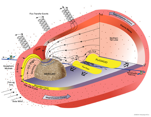
The solar wind may well be the culprit.  A thin gas of electrically charged particles called a plasma, the solar wind blows constantly from the surface of the sun at some 250 to 370 miles per second (about 400 to 600 kilometers/second).  According to Slavin, that’s fast enough to blast off the surface of Mercury through a process called “sputtering”, according to Slavin.  Some sputtered atoms stay close enough to the surface to serve as a tenuous yet measurable atmosphere.

But there’s a catch – Mercury’s magnetic field gets in the way. MESSENGER’s first flyby on January 14, 2008, confirmed that the planet has a global magnetic field, as first discovered by the Mariner 10 spacecraft during its flybys of the planet in 1974 and 1975.  Just as on Earth, the magnetic field should deflect charged particles away from the planet’s surface.  However, global magnetic fields are leaky shields and, under the right conditions, they are known to develop holes through which the solar wind can hit the surface.

During its second flyby of the planet on October 6, 2008, MESSENGER discovered that Mercury’s magnetic field can be extremely leaky indeed. The spacecraft encountered magnetic “tornadoes” – twisted bundles of magnetic fields connecting the planetary magnetic field to interplanetary space – that were up to 500 miles wide or a third of the radius of the planet.

“These ‘tornadoes’ form when magnetic fields carried by the solar wind connect to Mercury’s magnetic field,” said Slavin. “As the solar wind blows past Mercury’s field, these joined magnetic fields are carried with it and twist up into vortex-like structures. These twisted magnetic flux tubes, technically known as flux transfer events, form open windows in the planet’s magnetic shield through which the solar wind may enter and directly impact Mercury’s surface.”

Venus, Earth, and even Mars have thick atmospheres compared to Mercury, so the solar wind never makes it to the surface of these planets, even if there is no global magnetic field in the way, as is the case for Venus and Mars. Instead, it hits the upper atmosphere of these worlds, where it has the opposite effect to that on Mercury, gradually stripping away atmospheric gas as it blows by.

The process of linking interplanetary and planetary magnetic fields, called magnetic reconnection, is common throughout the cosmos. It occurs in Earth’s magnetic field, where it generates magnetic tornadoes as well. However, the MESSENGER observations show the reconnection rate is ten times higher at Mercury.

“Mercury’s proximity to the sun only accounts for about a third of the reconnection rate we see,” said Slavin. “It will be exciting to see what’s special about Mercury to explain the rest. We’ll get more clues from MESSENGER’s third flyby on September 29, 2009, and when we get into orbit in March 2011.”

Slavin’s MESSENGER research was funded by NASA and is the subject of a paper that appeared in the journal Science on May 1, 2009.

MESSENGER (MErcury Surface, Space ENvironment, GEochemistry, and Ranging) is a NASA-sponsored scientific investigation of the planet Mercury and the first space mission designed to orbit the planet closest to the Sun. The MESSENGER spacecraft launched on August 3, 2004, and after flybys of Earth, Venus, and Mercury will start a yearlong study of its target planet in March 2011. Dr. Sean C. Solomon, of the Carnegie Institution of Washington, leads the mission as Principal Investigator. The Johns Hopkins University Applied Physics Laboratory, Laurel, Md., built and operates the MESSENGER spacecraft and manages this Discovery-class mission for NASA.

Source:  NASA

Titan (Weirdness) is More Than Meets The Eye

[/caption]

Think Titan looks pretty round?

Not quite, according to new data released today by the Cassini radar team — and slight irregularities in the shape of the bizarre moon may account for the concentration of lakes at the highest latitudes, among other perplexing features. 

titan-lakes
NASA/JPL

The radar image above, obtained by Cassini’s radar instrument during a near-polar flyby in 2007, shows a big island smack in the middle of one of the larger lakes imaged on Saturn’s moon Titan. The island is about 90 kilometers (62 miles) by 150 kilometers (93 miles) across, about the size of Kodiak Island in Alaska or the Big Island of Hawaii.  The image is centered at about 79 north degrees north (north is left) and 310 degrees west, adding weight to the theory that most of Titan’s lakes occur near the poles. 

Titan is an intriguing object partly because its climate cycles are reminiscent of Earth’s, but tend to rely on hydrocarbons like methane and ethane instead of water — which couldn’t exist in a liquid state at temperatures hundreds of degrees below zero. Methane and ethane fill the air with a smoggy haze that rains down as ash. Sometimes it’s washed away by hydrocarbons that flow like gasoline and collect in black lakes with surfaces as smooth as glass.

Cassini has been orbiting Saturn for four years, observing Titan periodically with multiple radar instruments. A research team led by Howard Zebker, a geophysicist at Stanford University, has been using the radar data to estimate the surface elevation. Combined, two instruments — a nadir-pointing radar altimeter and a multiple-beam synthetic aperture radar (SAR) imaging system  — measure the time delay of the altimeter echoes and the precise radar beam angles to points on the surface.

“These techniques show that the poles of Titan lie at lower elevations than the equator, and that the topography also varies longitudinally,” the authors report in today’s Science Express..

“If we posit that the lakes are surface expressions of a more or less continuous liquid organic ‘water table,’ then the lower elevations of the poles could lead to the observed preponderance of lakes at high latitudes,” they add. In other words, the lower elevations of poles may make them the only places where any continuous, liquid “water table” would be close enough to the moon’s surface to appear as lakes. 

Titan’s overall shape, they suggest, might be that a sphere slightly flattened at the top and bottom. The exact mechanisms behind the oblate shape are unclear. Titan is also elongated toward Saturn, due to the tides raised by Saturn’s gravity. 

Source: The paper appears online at the Science Express website. More Titan images are available at the Cassini website.

Fresh Mars Impact Craters Blast Ice Onto Surface

Martian ejecta

[/caption]

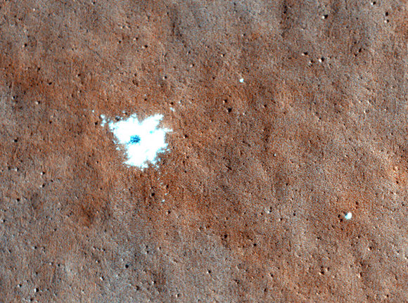
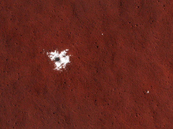
Fresh impact craters on Mars have revealed more evidence of stable ice that’s been hiding just beneath the surface all along, say scientists working on images sent back by the HiRISE camera aboard NASA’s Mars Reconnaissance Orbiter.

The craters appeared sometime between January and September of last year, in areas that had been previously imaged without them prior to January 2008. The impacts served as “natural probes” to excavate evidence that gets to a long-standing question about ice on Mars: where is it stable, and where is it residual, in the process of sublimating away?

Study leader Shane Byrne, of the University of Arizona’s Lunar and Planetary Laboratory, presented the new set of images last week, at the Lunar and Planetary Science Conference in Texas. 

Computer models agree that Mars contains stable high-latitude ice, but researchers have encountered difficulty deciding the quantity and geographical boundary of the ice, partly because they can’t see it beneath the surface and partly because pinning down an indirect measure of sub-surface ice — a long-term, global average water vapor concentration in the atmosphere — has proved challenging. 

mars-ejecta2
Credit: NASA/JPL/University of Arizona

The new craters are a significant clue, because they hit not in the high latitudes where planetary scientists are fairly certain about stable ice, but in the mid-latitudes where the ice’s reach is unclear.

“Here we report on natural probes of the Martian subsurface which have ‘detected’ ice in this critical mid-latitude zone,” wrote Byrne and his co-authors.

“In five such cases (with latitudes spanning 43.3° to 55.6° N), these impacts have excavated bright material which in High Resolution Imaging Science Experiment (HiRISE) data have a brightness and color consistent with water ice.”

Each of the five new craters is a few meters in diameter, several decimeters deep and with associated bright material a few meters across, the authors report. Four of them showed no spectral evidence of water ice. But one proved a jackpot. 

“Spectra from this site show clear water ice absorption features at 1.25, 1.5 and 2 ?m,” the team reported. Exposed surface ice is not expected to be stable at the latitudes, and the team has already noticed shrinkage and fading.

Based on atmospheric water vapor data, even stable underground ice isn’t expected to be widespread at the mid-latitudes where the reservoir was found: “Thus the ground ice exposed here is probably in the process of retreat from a previously larger extent,” the authors wrote.

Source: LPSC proceedings

New Views of Spring on Mars

[/caption]

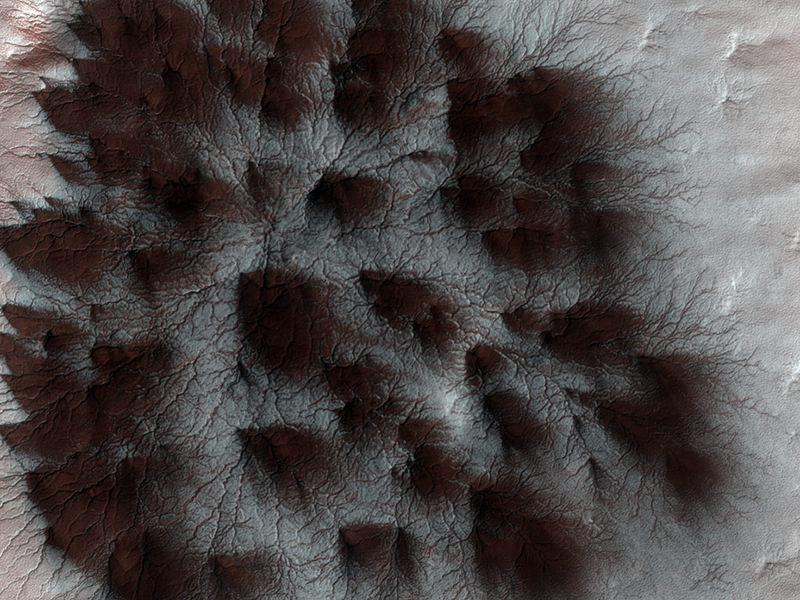
New high-resolution images taken last month of Mars’ south polar region are revealing signs of spring that are decidedly Martian.

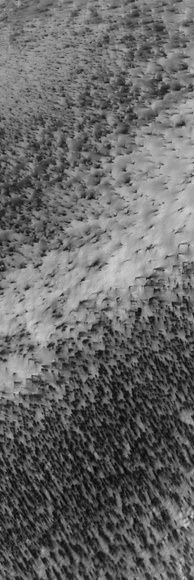
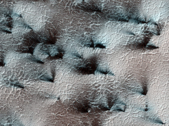
The image above features a spider trough network left behind as seasonal dry ice caps have sublimated away in the warmer temperatures. It’s part of a new series of images released this week by the University of Arizona’s High Resolution Imaging Experiment, or HiRISE, aboard NASA’s Mars Reconnaissance Orbiter.

See more information and photos below.

The gas beneath the ice cap can flow in the same places year after year, eroding troughs in the surface of the planet. 

“What happens on Mars, we think, is that as the seasonal ice cap thins from the bottom, gas underneath the cap builds up pressure,” said HiRISE deputy principal investigator Candice J. Hansen-Koharcheck of the NASA Jet Propulsion Laboratory in Pasadena, California.

“And where gas under the ice finds a weak spot or a crack, it will flow out of the opening, often carrying a little dust from the surface below.”

The next HiRISE image shows how dust that has been carried to the surface by gas jetting through the ice cap is blown about by prevailing winds before settling in fan-shaped deposits atop the ice cap. Varying orientations suggest that as the ice layer thins, a set of gas jets becomes active, they die down, then further away another set starts up at a later time with a different prevailing wind direction.

co2-jets
NASA/JPL/University of Arizona


Many jets appear to be active at the same time since numerous fans are all deposited in the same direction: this next, closer image is an example of such an occurrence. 

co2-jets-closeup
Credit: NASA/JPL/University of Arizona

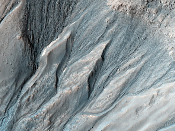
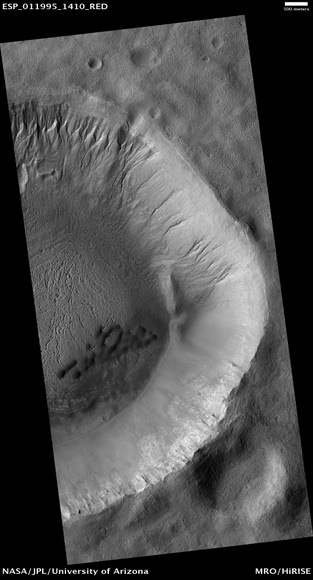
This southern hemisphere crater has gullies on its north and northeast walls. Gullies are proposed to be carved by liquid water originating from the subsurface or melting ice/snow on the surface.


Credit: NASA/JPL/University of Arizona

Dark dunes are visible on the crater floor. Lighter, smaller dunes rim the south side of the crater floor. The entire scene, pictured below, has a pitted texture, suggesting that ground ice was once present in this region. When ground ice sublimates (goes from a solid directly to a gas), it leaves behind empty spaces in the soil that turn into pits as the remaining overlying soil collapses to fill them.


Credit: NASA/JPL/University of Arizona


The full set of new HiRISE Mars images is here. Check out all the downloadable formats and sizes, with some even designed to fit an iPhone screen!

Source: Lori Stiles, at the University of Arizona

Moonshadows on Saturn’s Rings Are Harbingers of Spring

[/caption]

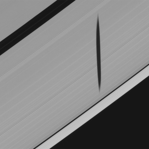
Moonshadows on Saturn’s rings are foretelling the planet’s equinox, when the sun will be exactly aligned with the planet’s equator and rings — and then will shift north from the southern hemisphere, kickstarting northern spring. 

NASA’s Cassini spacecraft has captured, for the first time, the tell-tale moonshadows  – sort of like groundhogs on Earth.

moonshadow2
Click to play the short movie. Credit: NASA/JPL/Space Science Institute


The image above is a still from a movie, from Cassini’s hour-long observation of the shadow of the small moon Epimetheus. 

Like Earth and most of the other planets, Saturn’s spin axis is tilted relative to its motion around the sun. So the sun, seen from Saturn, cycles from the southern hemisphere to the north and back again. A full sweep of seasonal changes on Saturn and its rings and moons takes a Saturnian year, equal to 29.5 Earth years. Thus, about every 15 Earth years, or half-Saturn-year, the sun passes through the plane containing the planet’s rings.

During these times, the shadows of the planet’s rings fall in the equatorial region on the planet. And the shadows of Saturn’s moons external to the rings, especially those whose orbits are inclined with respect to the equator, begin to intersect the planet’s rings. When this occurs, the equinox period has essentially begun, and any vertical protuberances within the rings, including small embedded moons and narrow vertical warps in the rings, will also cast shadows on the rings. At exactly the moment of equinox, the shadows of the rings on the planet will be confined to a thin line around Saturn’s equator and the rings themselves will go dark, being illuminated only on their edge. The next equinox on Saturn, when the sun will pass from south to north, is Aug. 11, 2009.

Because of these unique illumination circumstances, Cassini imaging scientists have been eager to observe the planet and its rings around the time of equinox. Cassini’s first extended mission, which began on July 1, 2008, was intended to gather observations during this time. Hence its name: Cassini Equinox Mission.  

More than just pretty pictures, the observations could reveal any deviations across the rings from a perfectly flat wafer-like disk. Saturn’s ring system is wide, spanning hundreds of thousands of miles or kilometers. But the main inner rings (called A, B and C) are perhaps only 10 meters (30 feet) thick, and they are sometimes obscured from view inside thicker outer rings.

“We hope that such images will help us measure any vertical warping in the A and B rings,” said John Weiss, an imaging team associate from the Space Science Institute in Boulder, Colorado. “Because we know how big the moons are, and where they are in their orbits around Saturn when they cast these shadows, we have all the information we need to infer any substantial vertical structure that might be present.”

On Jan. 8, Epimetheus, a small moon 113 kilometers (70 miles) across, was the first moon observed casting a shadow onto the outer edge of the A ring. Next Pan, 30 kilometers (20 miles) across and orbiting within the rings, was caught casting a shadow on the A ring on Feb. 12.  Eventually, more moons will cast shadows on the rings and all shadows will grow longer as exact equinox approaches. 

Source: Cassini Imaging Central Laboratory for Operations (CICLOPS)