Jupiter Bound Juno snaps Dazzling Gallery of Planet Earth Portraits

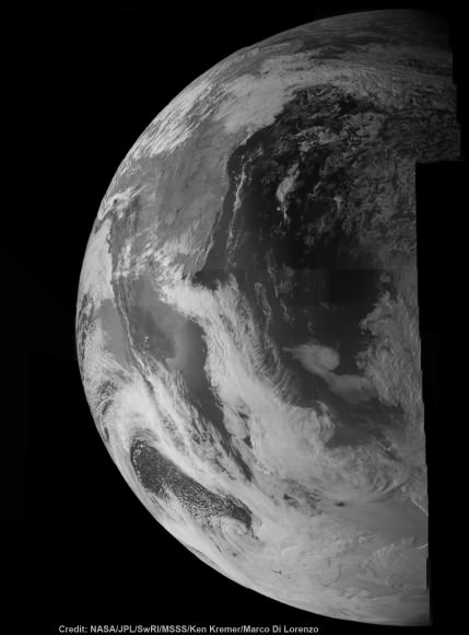
This colorized composite shows more than half of Earth’s disk over the coast of Argentina and the South Atlantic Ocean as the Juno probe slingshotted by on Oct. 9, 2013 for a gravity assisted acceleration to Jupiter. The mosaic was assembled from raw images taken by the Junocam imager. Credit: NASA/JPL/SwRI/MSSS/Ken Kremer/Marco Di Lorenzo

Juno Portrait of Earth
This false color composite shows more than half of Earth’s disk over the coast of Argentina and the South Atlantic Ocean as the Juno probe slingshotted by on Oct. 9, 2013 for a gravity assisted acceleration to Jupiter. The mosaic was assembled from raw images taken by the Junocam imager. Credit: NASA/JPL/SwRI/MSSS/Ken Kremer/Marco Di Lorenzo
See below a gallery of Earth from Juno[/caption]

During a crucial speed boosting slingshot maneuver around Earth on Oct. 9, NASA’s Jupiter-bound Juno probe snapped a dazzling gallery of portraits of our Home Planet over the South American coastline and the Atlantic Ocean. See our mosaics of land, sea and swirling clouds above and below, including several shown in false color.

But an unexpected glitch during the do or die swing-by sent the spacecraft into ‘safe mode’ and delayed the transmission of most of the raw imagery and other science observations while mission controllers worked hastily to analyze the problem and successfully restore Juno to full operation on Oct. 12 – but only temporarily!

Because less than 48 hours later, Juno tripped back into safe mode for a second time. Five days later engineers finally recouped Juno and it’s been smooth sailing ever since, the top scientist told Universe Today.

“Juno is now fully operational and on its way to Jupiter,” Juno principal investigator Scott Bolton told me today. Bolton is from the Southwest Research Institute (SwRI), San Antonio, Texas.

“We are completely out of safe mode!”

NASA's Juno probe captured the image data for this composite picture during its Earth flyby on Oct. 9 over Argentina,  South America and the southern Atlantic Ocean. Raw imagery was reconstructed and aligned by Ken Kremer and Marco Di Lorenzo, and false-color blue has been added to the view taken by a near-infrared filter that is typically used to detect methane. Credit: NASA/JPL/SwRI/MSSS/Ken Kremer/Marco Di Lorenzo
NASA’s Juno probe captured the image data for this composite picture during its Earth flyby on Oct. 9 over Argentina, South America and the southern Atlantic Ocean. Raw imagery was reconstructed and aligned by Ken Kremer and Marco Di Lorenzo, and false-color blue has been added to the view taken by a near-infrared filter that is typically used to detect methane. Credit: NASA/JPL/SwRI/MSSS/Ken Kremer/Marco Di Lorenzo

With the $1.1 Billion Juno probe completely healthy once again and the nail-biting drama past at last, engineers found the time to send the stored photos and research data back to ground station receivers.

“The science team is busy analyzing data from the Earth flyby,” Bolton informed me.

The amateur image processing team of Ken Kremer and Marco Di Lorenzo has stitched together several portraits from raw images captured as Juno sped over Argentina, South America and the South Atlantic Ocean and within 347 miles (560 kilometers) of the surface. We’ve collected the gallery here for all to enjoy.

Several portraits showing the swirling clouds and land masses of the Earth’s globe have already been kindly featured this week by Alan Boyle at NBC News and at the Daily Mail online.

NASA's Juno probe captured the image data for this composite picture during its Earth flyby on Oct. 9 over Argentina,  South America and the southern Atlantic Ocean. Raw imagery was stitched by Ken Kremer and Marco Di Lorenzo in this view taken by a near-infrared filter that is typically used to detect methane. Credit: NASA/JPL/SwRI/MSSS/Ken Kremer/Marco Di Lorenzo
NASA’s Juno probe captured the image data for this composite picture during its Earth flyby on Oct. 9 over Argentina, South America and the southern Atlantic Ocean. Raw imagery was stitched by Ken Kremer and Marco Di Lorenzo in this view taken by a near-infrared filter that is typically used to detect methane. Credit: NASA/JPL/SwRI/MSSS/Ken Kremer/Marco Di Lorenzo

Raw images from the Junocam camera are collected in strips – like a push broom. So they have to be carefully reconstructed and realigned to match up. But it can’t be perfect because the spacecraft is constantly rotating and its speeding past Earth at over 78,000 mph.

So the perspective of Earth’s surface features seen by Junocam is changing during the imaging.

And that’s what is fascinating – to see the sequential view of Earth’s beautiful surface changing as the spacecraft flew over the coast of South America and the South Atlantic towards Africa – from the dayside to the nightside.

This composite shows more than half of Earth’s disk over the coast of Argentina and the South Atlantic Ocean as the Juno probe slingshotted by on Oct. 9, 2013 for a gravity assisted acceleration to Jupiter. The mosaic was assembled from raw images taken by the Junocam imager. Credit: NASA/JPL/SwRI/MSSS/Ken Kremer/Marco Di Lorenzo

It’s rare to get such views since only a few spacecraft have swung by Earth in this manner – for example Galileo and MESSENGER – on their way to distant destinations.

Coincidentally this week, the Cygnus cargo carrier departed the ISS over South America.

Fortunately, the Juno team knew right from the start that the flyby of Earth did accomplish its primary goal of precisely targeting Juno towards Jupiter – to within 2 kilometers of the aim point, despite going into safe mode.

“We are on our way to Jupiter as planned,” Juno Project manager Rick Nybakken, told me in a phone interview soon after the flyby of Earth. Nybakken is from NASA’s Jet Propulsion Lab in Pasadena, CA.

“None of this affected our trajectory or the gravity assist maneuver – which is what the Earth flyby is,” he said.

Juno swoops over Argentina  This reconstructed day side image of Earth is one of the 1st snapshots transmitted back home by NASA’s Jupiter-bound Juno spacecraft during its speed boosting flyby on Oct. 9, 2013. It was taken by the probes Junocam imager and methane filter at 12:06:30 PDT and an exposure time of 3.2 milliseconds. Juno was flying over South America and the southern Atlantic Ocean. The coastline of Argentina is visible at top right. Credit: NASA/JPL/SwRI/MSSS/Ken Kremer
Juno swoops over Argentina
This reconstructed day side image of Earth is one of the 1st snapshots transmitted back home by NASA’s Jupiter-bound Juno spacecraft during its speed boosting flyby on Oct. 9, 2013. It was taken by the probes Junocam imager and methane filter at 12:06:30 PDT and an exposure time of 3.2 milliseconds. Juno was flying over South America and the southern Atlantic Ocean. The coastline of Argentina is visible at top right. Credit: NASA/JPL/SwRI/MSSS/Ken Kremer

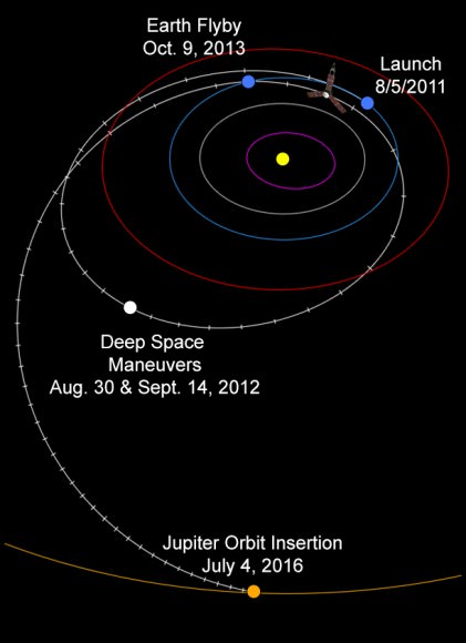
It also accelerated the ships velocity by 16,330 mph (26,280 km/h) – thereby enabling Juno to be captured into polar orbit about Jupiter on July 4, 2016.

Dayside view of a sliver of Earth snapped by Juno during flyby on Oct. 9, 2013.  This mosaic has stitched from raw image data captured by methane near-infrared filter on Junocam imager at 11:57:30 PDT.  Credit: NASA/JPL/SwRI/MSSS/Ken Kremer/Marco Di Lorenzo
Dayside view of a sliver of Earth snapped by Juno during flyby on Oct. 9, 2013. This mosaic is stitched from raw image data captured by methane near-infrared filter on Junocam imager at 11:57:30 PDT. Credit: NASA/JPL/SwRI/MSSS/Ken Kremer/Marco Di Lorenzo

The safe mode did not impact the spacecraft’s trajectory one smidgeon!

It was likely initiated by an incorrect setting for a fault protection trigger for the spacecraft’s battery when Juno was briefly in an eclipse during the flyby.

Nybakken also said that the probe was “power positive and we have full command ability,” while it was in safe mode.

Safe mode is a designated fault protective state that is preprogrammed into spacecraft software in case something goes amiss. It also aims the craft sunwards thereby enabling the solar arrays to keep the vehicle powered.

False-color composite of a sliver of Earth snapped by Juno during flyby on Oct. 9, 2013.  This mosaic is stitched from raw image data captured by methane near-infrared filter on Junocam imager at 11:57:30 PDT.  Credit: NASA/JPL/SwRI/MSSS/Ken Kremer/Marco Di Lorenzo
False-color composite of a sliver of Earth snapped by Juno during flyby on Oct. 9, 2013. This mosaic is stitched from raw image data captured by methane near-infrared filter on Junocam imager at 11:57:30 PDT. Credit: NASA/JPL/SwRI/MSSS/Ken Kremer/Marco Di Lorenzo

The Earth flyby maneuver was necessary because the initial Atlas V rocket launch on Aug. 5, 2011 from Cape Canaveral Air Force Station, FL was not powerful enough to place Juno on a direct trajectory flight to Jupiter.

As of today, Juno is more than was 6.7 million miles (10.8 million kilometers) from Earth and 739 million miles (7.95 astronomical units) from Jupiter. It has traveled 1.01 billion miles (1.63 billion kilometers, or 10.9 AU) since launch.

With Juno now on course for our solar system’s largest planet, there won’t be no any new planetary images taken until it arrives at the Jovian system in 2016. Juno will then capture the first ever images of Jupiter’s north and south poles.

We have never seen Jupiter’s poles imaged from the prior space missions, and it’s not possible from Earth.

During a year long mission at Jupiter, Juno will use its nine science instruments to probe deep inside the planet to reveal its origin and evolution.

“Jupiter is the Rosetta Stone of our solar system,” says Bolton. “It is by far the oldest planet, contains more material than all the other planets, asteroids and comets combined and carries deep inside it the story of not only the solar system but of us. Juno is going there as our emissary — to interpret what Jupiter has to say.”

Based on what we’ve seen so far, Junocam is sure to provide spectacular views of the gas giants poles and cloud tops.

Only 982 days to go !

Ken Kremer

Credit: NASA/JPL
Credit: NASA/JPL

What If Earth Was Threatened by An Asteroid Strike? Astronaut Panel Brings Up Ideas To Search, Deflect These Threats

Computer generated simulation of an asteroid strike on the Earth. Credit: Don Davis/AFP/Getty Images

“If we get hit 20 years from now, that’s not bad luck. That’s stupidity.”

That’s what former NASA astronaut Ed Lu has to say about asteroids and our efforts to search for them. He delivered those comments at a panel discussion today at New York’s American Museum of Natural History. He and several other astronauts spoke on behalf of the Association of Space Explorers (which, as the name implies, consists of astronauts, cosmonauts and the like.)

We guess that as astute readers of our publication, you know that a planetary threat from asteroids (and comets) exists. And there’s certainly more we can do; when that 17-meter asteroid blasted Russia earlier this year, Lu said most space agencies learned about it from social media!

So what’s being done about these threats? Here’s a roundup of the panel discussion’s information and some related information.

Asteroid searching and deflection:
  • Since Lu is the CEO of the B612 Foundation, there was a heavy emphasis on the agency’s proposed Sentinel telescope. Intended to launch in 2018, it would survey the solar system in infrared and seek out potential hazards.
  • To date, NASA’s NEO Observations Program has found 95 per cent of near-Earth objects larger than one kilometer, Jet Propulsion Laboratory scientist Amy Mainzer told Universe Today in a separate conversation today.
  • Mainzer also brought us up to speed on the Near-Earth Object Camera (NEOCam) proposal, which she’s been working on since 2005. Her group received technology development funding in 2010 to improve their infrared detectors, which succeeded in passing recent tests. Their group will seek more funding for NASA in the next opportunity.
  • The WISE spacecraft’s NEOWISE mission, meanwhile, is going to restart early next year, Mainzer added. “While NEOWISE is not nearly as capable as NEOCam will be, it will improve our knowledge of the diameters and albedos of  about 2,000 NEOs and tens of thousands of main belt asteroids,” Mainzer wrote. “With the NEOWISE prime mission, we discovered more than 34,000 new asteroids and observed >158,000 in total. We have used our data from NEOWISE to set constraints on the number of NEOs and potentially hazardous asteroids.”
Former NASA astronaut Tom Jones shared this slide concerning ideas for asteroid defense. Credit: Tom Jones/Association for Space Explorers/AMNH/Ustream (screenshot)

Getting the United Nations involved:


  • This week, the United Nations Committee on the Peaceful Uses of Outer Space adopted several steps related to asteroids. It’s planning an International Asteroid Warning Group (to share detections and warn of potential impacts), an Impact Disaster Planning Advisory Group, and a Space Missions Planning and Advisory Group (which would look at deflection missions, options, costs, etc.)
  • Why go with the United Nations? In the panel, NASA Apollo astronaut Rusty Schweickart explained it this way: deciding how to deflect an asteroid posts risks. You might be moving the impact path past a country that would not have been at risk before the deflection. It’s best to make such moves internationally, rather than having (say) the United States make a decision that could increase Russia’s risk to an asteroid.
  • The problem? Working by committee is slow, says former Romanian astronaut Dumitru-Dorin Prunariu: “You would think with the United Nations that we started to think about asteroids only in 2007, 8 or 9, but the first input was done by 1999 at the Unispace conference, the United Nations International Conference in Space.” People have been working hard, to be sure, but making a good, inclusive plan just takes time. An action team was formed in 2001, a working group was in place by 2007, and the adoptions by UNCOPUOS (as we stated earlier) took place this week.
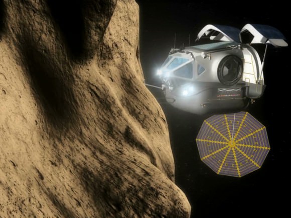
An artist's conception of a space exploration vehicle approaching an asteroid. Credit: NASA
An artist’s conception of a space exploration vehicle approaching an asteroid. Credit: NASA
 Cost of all of this:
  • Schweickart: “Money is hardly an issue in this. This is a very inexpensive thing to do. It’s organizational setting the actual criteria, thresholds whatever.” It would only cost 1% of the NASA budget for the next 10 years, and less than 0.5% after that. (The NASA budget request for 2014 was $17.7 billion, so 1% of that is $177 million.)
  • The panel members emphasized that it’s best to start the search early and find the threatening asteroids before things become an emergency. If a moderate-sized asteroid was discovered only a few months out, it might be better just to evacuate the affected area rather than try to pull together a last-minute mission to stop the asteroid.

What Caused The Spacesuit Leak? Astronauts Are Working To Hunt That Down

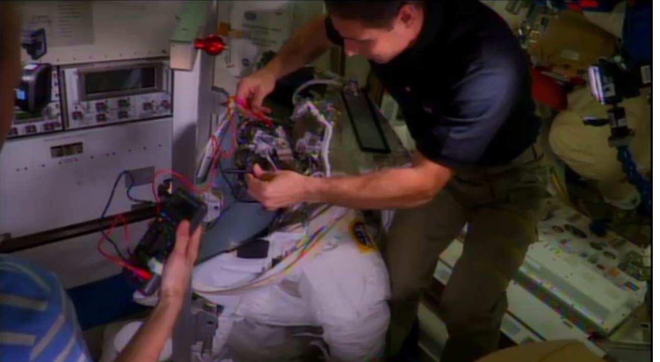
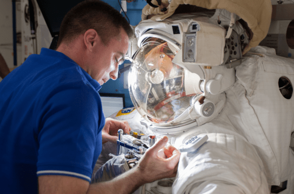
NASA astronauts Mike Hopkins and Karen Nyberg (edge of picture, at left) examine a faulty spacesuit aboard the International Space Station during Expedition 37 in October 2013. In July 2013, Italian astronaut Luca Parmitano had to abort a spacewalk after a water leak arose while wearing the spacesuit. The cause is still under investigation. Credit: NASA/YouTube (screenshot)

Here’s the latest attempt to hunt down the water leak that aborted Luca Parmitano’s spacewalk in July: two astronauts aboard the International Space Station removed and replaced a fan pump and water separator inside the spacesuit earlier this week.

All spacewalks with NASA suits are on hold while the agency investigates the leak, and they have been trying mightily. In late July, then on-station NASA astronaut Chris Cassidy demonstrated how the pool of water spread within the helmet (as you can see in these YouTube videos).

This week, on-orbit NASA astronauts Mike Hopkins and Karen Nyberg delved further. While the astronauts are trained before their missions on some suit repairs, this particular type was not something that was covered before they left Earth. After Mission Control walked them through what to do, the astronauts proceeded cautiously as they did the work, NASA said.

“Our engineering teams have identified several different components of the suit, designing a big fault tree, and this is just one of the components that we think could have contributed to the leak in the suit,” said Alex Kanelakos, an extra-vehicular activity flight controller and astronaut instructor, in a new YouTube video.

“Specifically, the water separator is what we’re concentrating our efforts on today.”

As Kanelakos explained, a motor inside the suit drives the fan pump and water separator. The fan circulates oxygen, and the pump pumps the coolant fluid. The water separator, meanwhile, takes out moisture (water) from the ventilation loop and gas that could be trapped inside the water coolant loop. The dried-out air is then returned to the crew member for breathing, and the cycle continues.

Astronaut Chris Cassidy works with Luca Parmitano's spacesuit, which had a water leak on July 16, 2013. Credit: NASA
Astronaut Chris Cassidy works with Luca Parmitano’s spacesuit, which had a water leak on July 16, 2013. Credit: NASA

In September, Cassidy told Universe Today that the spacesuit is expected to come back to Earth during a future SpaceX Dragon cargo flight. That type of spacecraft is (unusually among space trucks) designed to survive re-entry in the atmosphere, allowing engineers on the ground to examine the spacesuit after it comes back.

Cassidy added that the situation was serious, and he supported NASA’s decision to end the spacewalk (which he was also participating in.) He didn’t think, however, that Parmitano was in immediate danger of drowning. For his part, Parmitano wrote a blog post on the European Space Agency website after his spacewalk, saying that space is an “inhospitable” arena.

Italian astronaut Luca Parmitano during a spacesuit fit check before his mission. Credit: NASA

As any astronaut is trained to do, Parmitano did consider other contingencies while the leak was happening, he wrote:

“The only idea I can think of is to open the safety valve by my left ear: if I create controlled depressurisation, I should manage to let out some of the water, at least until it freezes through sublimation, which would stop the flow. But making a ‘hole’ in my spacesuit really would be a last resort,” he wrote.

That fix, however, was not implemented as Parmitano and Cassidy made their way back to the station in time for their crewmates to repressurize the hatch and bring their Italian crewmate safely inside.

Besides investigating the spacesuit, NASA has an ongoing parallel investigation to look at “lessons learned” from the mishap and ways of implementing procedures to stop such an incident from happening again.

Japanese ‘Space Cannon’ On Track For Aiming At An Asteroid: Reports

Painting of Asteroid 2012 DA14. © David A. Hardy/www.astroart.org

Watch out, asteroid 1999 JU3: you’re being targeted. As several media reports reminded us, the Japan Aerospace Exploration Agency (JAXA)’s Hayabusa-2 asteroid exploration mission will carry a ‘space cannon’ on board — media-speak for the “collision device” that will create an artificial crater on the asteroid’s surface.

“An artificial crater that can be created by the device is expected to be a small one with a few meters in diameter, but still, by acquiring samples from the surface that is exposed by a collision, we can get fresh samples that are less weathered by the space environment or heat,” JAXA states on its website.

Reports indicate JAXA is on schedule to, er, shoot this thing into space for a 2018 rendezvous with an asteroid. The spacecraft will stick around the asteroid for about a year before heading back to Earth in 2020. The overall aim is to learn more about the origin of the solar system by looking at a C-type asteroid, considered to be a “primordial body” that gives us clues as to the early solar system’s makeup.

Check out more on Hayabusa-2 on JAXA’s website.

Space Trucks! A Pictorial History Of These Mighty Machines

A view of Orbital Sciences' Cygnus spacecraft while it was being released from the International Space Station on Oct. 22. Credit: NASA/Karen Nyberg

Cargo resupply ships are vital for space exploration. These days they bring food, experiments and equipment to astronauts on the International Space Station. And in recent years, it hasn’t just been government agencies sending these things up; SpaceX’s Dragon spacecraft and (just this week) Orbital Sciences’ Cygnus spacecraft brought up cargo of their own to station in recent months.

NASA just published a brief timeline of (real-life) cargo spacecraft, so we thought we’d adapt that information in pictorial form. Here are some of the prominent members of that elite group. Did we miss anything? Let us know in the comments.

Dragon in orbit during the CRS-2 mission. Credit: NASA/CSA/Chris Hadfield
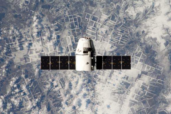
SpaceX’s Dragon in orbit during the CRS-2 mission. It was the first commercial spacecraft to resupply the space station, and since 2012 has completed resupply missions. Credit: NASA/CSA/Chris Hadfield
Thrust
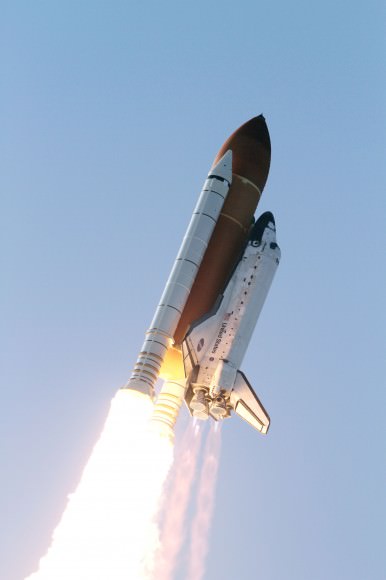
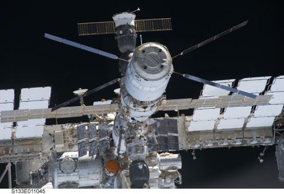
Space shuttle Discovery heads to space after lifting off from Launch Pad 39A at NASA’s Kennedy Space Center in Florida to begin its final flight to the International Space Station on the STS-133 mission. The shuttle was NASA’s main human spacecraft between 1981 and 2011. Credit: NASA
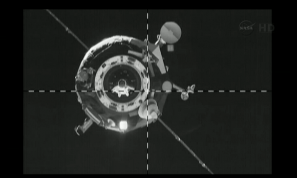
Progress 51 on final approach to the International Space Station. The stuck antenna is visible below the crosshairs. Credit: NASA TV (screencap)
Progress 51 on final approach to the International Space Station. The Russians have been flying versions of this cargo spacecraft since 1978. Credit: NASA TV (screencap)
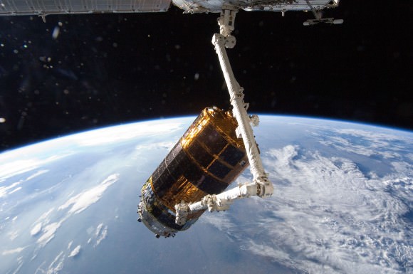
JAXA's H-II Transfer Vehicle during a mission in July 2012. The first demonstration flight took place in 2009. Credit: NASA
JAXA’s H-II Transfer Vehicle (HTV) during a mission in July 2012. The first demonstration flight took place in 2009. Credit: NASA


The ATV Johannes Kepler docked at the International Space Station. Credit: NASA
The ATV Johannes Kepler docked at the International Space Station. Versions of this spacecraft have flown since 2008. Credit: NASA
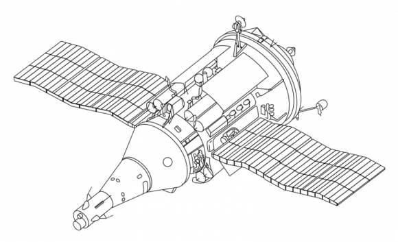
A line drawing of the TKS (Transportnyi Korabl’ Snabzheniia, or Transport Supply Spacecraft). It was intended to send crew and cargo together in one flight, but delays and a change in program priorities never allowed it to achieve that. According to NASA, versions of TKS (under the Cosmos designation) flew to the Salyut 6 and Salyut 7 space station. The cargo part of the spacecraft was also used for Russian base modules in the Mir space station and International Space Station. Credit: NASA/Wikimedia Commons

NASA’s Resilient Opportunity Rover Starts Martian Mountaineering

Opportunity starts Martian Mountaineering. NASA’s Opportunity rover captured this southward uphill panoramic mosaic on Oct. 21, 2013 (Sol 3463) after beginning to ascend the northwestern slope of "Solander Point" on the western rim of Endeavour Crater - her 1st mountain climbing adventure. The northward-facing slope will tilt the rover's solar panels toward the sun in the southern-hemisphere winter sky, providing an important energy advantage for continuing mobile operations through the upcoming winter. Assembled from Sol 3463 navcam raw images by Marco Di Lorenzo and Ken Kremer. Credit: NASA/JPL/Cornell/Marco Di Lorenzo/Ken Kremer

Opportunity starts Martian Mountaineering
NASA’s Opportunity rover captured this southward uphill panoramic mosaic on Oct. 21, 2013 (Sol 3463) after beginning to ascend the northwestern slope of “Solander Point” on the western rim of Endeavour Crater – her 1st mountain climbing adventure. The northward-facing slope will tilt the rover’s solar panels toward the sun in the southern-hemisphere winter sky, providing an important energy advantage for continuing mobile operations through the upcoming winter. Assembled from Sol 3463 navcam raw images by Marco Di Lorenzo and Ken Kremer.
Credit: NASA/JPL/Cornell/Marco Di Lorenzo/Ken Kremer
Story and imagery updated[/caption]

NASA’s super resilient Opportunity robot has begun a new phase in her life on the Red Planet – Martian Mountaineer!

“This is our first real Martian mountaineering with Opportunity,” said the principal investigator for the rover, Steve Squyres of Cornell University, Ithaca, N.Y.

And it happened right in the middle of the utterly chaotic US government shutdown ! – that seriously harmed some US science endeavors. And at a spot destined to become a science bonanza in the months and years ahead – so long as she stays alive to explore ever more new frontiers.

On Oct. 8, mission controllers on Earth directed the nearly decade old robot to start the ascent of Solander Point – the northern tip of the tallest hill she has encountered after nearly 10 Earth years on Mars.

Opportunity starts scaling Solander Point - her1st mountain climbing goal. See the tilted terrain and rover tracks in this mosaic view from Solander Point peering across the vast expanse of huge Endeavour Crater.  Opportunity will ascend the mountain looking for clues indicative of a Martian habitable environment.  This navcam camera mosaic was assembled from raw images taken on Sol 3431 (Sept.18, 2013).  Credit: NASA/JPL/Cornell/Marco Di Lorenzo/Ken Kremer (kenkremer.com). See the complete panoramic view below
Opportunity starts scaling Solander Point – her1st mountain climbing goal. See the tilted terrain and rover tracks in this mosaic view from Solander Point peering across the vast expanse of huge Endeavour Crater. Opportunity will ascend the mountain looking for clues indicative of a Martian habitable environment. This navcam camera mosaic was assembled from raw images taken on Sol 3431 (Sept.18, 2013). Credit: NASA/JPL/Cornell/Marco Di Lorenzo/Ken Kremer (kenkremer.com). See the complete panoramic view below

The northward-facing slopes at Solander also afford another major advantage. They will tilt the rover’s solar panels toward the sun in the southern-hemisphere winter sky, providing an important energy boost enabling continued mobile operations through the upcoming frigidly harsh winter- her 6th since landing in 2004.

Opportunity will first explore outcrops on the northwestern slopes of Solander Point in search of the chemical ingredients required to sustain life before gradually climbing further uphill to investigate intriguing deposits distributed amongst its stratographic layers.

The rover will initially focus on outcrops located in the lower 20 feet (6 meters) above the surrounding plains on slopes as steep as 15 to 20 degrees.

Opportunity starts scaling Solander Point - her 1st mountain climbing goal. See the tilted terrain and rover tracks in this panoramic view from Solander Point peering across the vast expanse of huge Endeavour Crater.  Opportunity will ascend the mountain looking for clues indicative of a Martian habitable environment.  This navcam camera mosaic was assembled from raw images taken on Sol 3431 (Sept.18, 2013).  Credit: NASA/JPL/Cornell/Marco Di Lorenzo/Ken Kremer (kenkremer.com).
Opportunity starts scaling Solander Point – her 1st mountain climbing goal. See the tilted terrain and rover tracks in this panoramic view from Solander Point peering across the vast expanse of huge Endeavour Crater. Opportunity will ascend the mountain looking for clues indicative of a Martian habitable environment. This navcam camera mosaic was assembled from raw images taken on Sol 3431 (Sept.18, 2013). Credit: NASA/JPL/Cornell/Marco Di Lorenzo/Ken Kremer (kenkremer.com).

At some later time, Opportunity may ascend Solander farther upward, which peaks about 130 feet (40 meters) above the crater plains.

“We expect we will reach some of the oldest rocks we have seen with this rover — a glimpse back into the ancient past of Mars,” says Squyres.

NASA’s powerful Mars Reconnaissance Orbiter (MRO) circling overhead recently succeeded in identifying clay-bearing rocks during new high resolution survey scans of Solander Point!

As I reported previously, the specially collected high resolution observations by the orbiters Compact Reconnaissance Imaging Spectrometer for Mars (CRISM) were collected in August and being analyzed by the science team. They will be used to direct Opportunity to the most productive targets of interest

“CRISM data were collected,” Ray Arvidson told Universe Today. Arvidson is the mission’s deputy principal scientific investigator from Washington University in St. Louis, Mo.
“They show really interesting spectral features in the [Solander Point] rim materials.”

NASA’s Opportunity rover captured this southward uphill view on Oct. 21, 2013 after beginning to ascend the northwestern slope of "Solander Point" on the western rim of Endeavour Crater. The northward-facing slope will tilt the rover's solar panels toward the sun in the southern-hemisphere winter sky, providing an important energy advantage for continuing mobile operations through the upcoming winter.  Credit: NASA/JPL
NASA’s Opportunity rover captured this southward uphill view on Oct. 21, 2013 after beginning to ascend the northwestern slope of “Solander Point” on the western rim of Endeavour Crater. The northward-facing slope will tilt the rover’s solar panels toward the sun in the southern-hemisphere winter sky, providing an important energy advantage for continuing mobile operations through the upcoming winter. Credit: NASA/JPL

The new CRISM survey from Mars orbit yielded mineral maps which vastly improves the spectral resolution – from 18 meters per pixel down to 5 meters per pixel.

This past spring and summer, Opportunity drove several months from the Cape York rim segment to Solander Point.

“At Cape York, we found fantastic things,” Squyres said. “Gypsum veins, clay-rich terrain, the spherules we call newberries. We know there are even larger exposures of clay-rich materials where we’re headed. They might look like what we found at Cape York or they might be completely different.”

The summit of Solander Point.  Opportunity rover captured mosaic on Oct. 21, 2013 (Sol 3463) after beginning to ascend the northwestern slope of "Solander Point" on the western rim of Endeavour Crater - her 1st mountain climbing adventure.  Assembled from Sol 3463 pancam high resolution raw images by Marco Di Lorenzo and Ken Kremer.  Credit: NASA/JPL/Cornell/Marco Di Lorenzo/Ken Kremer
The summit of Solander Point
Opportunity rover captured mosaic on Oct. 21, 2013 (Sol 3463) after beginning to ascend the northwestern slope of “Solander Point” on the western rim of Endeavour Crater – her 1st mountain climbing adventure. Assembled from Sol 3463 pancam high resolution raw images by Marco Di Lorenzo and Ken Kremer. Credit: NASA/JPL/Cornell/Marco Di Lorenzo/Ken Kremer

Clay minerals, or phyllosilicates, form in neutral water that is more conducive to life.

At the base of Solander, the six wheeled rover discovered a transition zone between a sulfate-rich geological formation and an older formation. Sulfate-rich rocks form in a wet environment that was very acidic and less favorable to life.

Solander Point is located at the western rim of the vast expanse of Endeavour crater – some 22 kilometers (14 miles) in diameter.

Today marks Opportunity’s 3466th Sol or Martian Day roving Mars – for what was expected to be only a 90 Sol mission.

So far she has snapped over 185,200 amazing images on the first overland expedition across the Red Planet.

Her total odometry stands at over 23.89 miles (38.45 kilometers) since touchdown on Jan. 24, 2004 at Meridiani Planum.

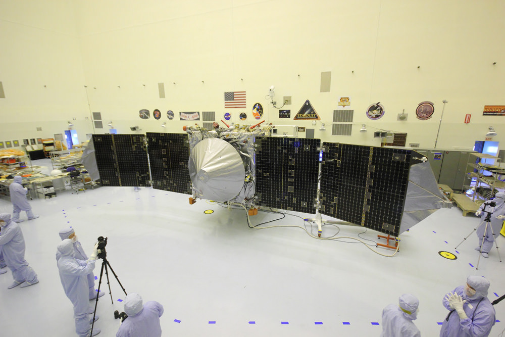
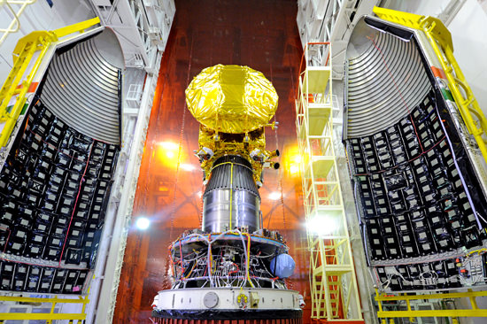
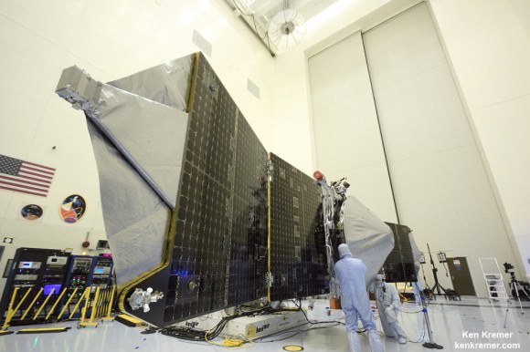
Meanwhile, NASA is in the final stages of processing of MAVEN, the agencies next orbiter.

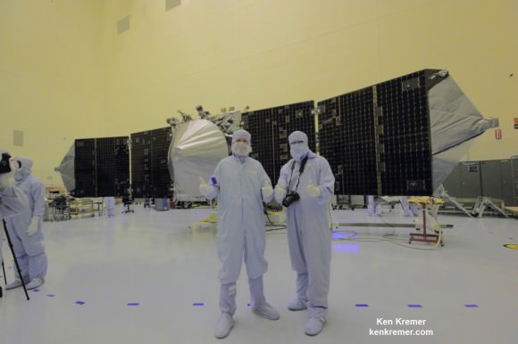
It is still scheduled to blast off from Cape Canaveral on Nov.18 – see my photos from inside the clean room at the Kennedy Space Center.

MAVEN’s launch was briefly threatened by the government shutdown.

On the opposite side of Mars, Opportunity’s younger sister rover Curiosity is trekking towards gigantic Mount Sharp and recently discovered a patch of pebbles formed by flowing liquid water.

Ken Kremer

Traverse Map for NASA’s Opportunity rover from 2004 to 2013.  This map shows the entire path the rover has driven during nearly 10 years and over 3460 Sols, or Martian days, since landing inside Eagle Crater on Jan 24, 2004 to current location ascending her 1st Martian Mountain - Solander Point - at the western rim of Endeavour Crater.  Opportunity discovered clay minerals at Esperance - indicative of a habitable zone and seeks clay minerals now at Solander. Credit: NASA/JPL/Cornell/ASU/Marco Di Lorenzo/Ken Kremer
Traverse Map for NASA’s Opportunity rover from 2004 to 2013
This map shows the entire path the rover has driven during nearly 10 years and over 3460 Sols, or Martian days, since landing inside Eagle Crater on Jan 24, 2004 to current location ascending her 1st Martian Mountain – Solander Point – at the western rim of Endeavour Crater. Opportunity discovered clay minerals at Esperance – indicative of a habitable zone and seeks clay minerals now at Solander. Credit: NASA/JPL/Cornell/ASU/Marco Di Lorenzo/Ken Kremer

Incredible Vertical-Landing Grasshopper Rocket Has Retired

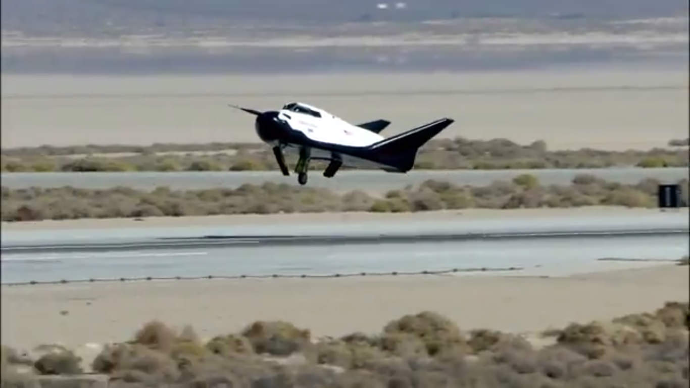
The SpaceX Grasshopper during its test flight on March 7, 2013. Credit: SpaceX.

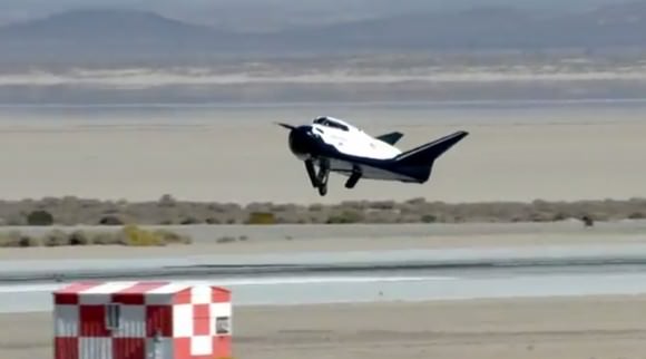
Did you take a moment to look at that August video of the Grasshopper rocket deliberately going sideways and then appearing to hover for a bit before returning to Earth? For more video fodder, there’s also this high-flying test the rocket took in October.

We hope you enjoyed these views, because Grasshopper is being retired. SpaceX now wants to focus its energy and resources on to the larger Falcon 9-R first stage, which should see its first test flight in New Mexico this December.

It sounds like SpaceX would have loved to go further, in a sense. “In some ways we’ve kind of failed on the Grasshopper program because we haven’t pushed it to its limit,” SpaceX president Gwynne Shotwell said at the International Symposium for Personal and Commercial Spaceflight (ISPCS) in New Mexico last week, as reported in the NewSpace Journal. “We haven’t broken it.”

Grasshopper took eight test flights during its flight history, which spanned about a year between September 2012 and October 2013. It was intended to test Vertical Takeoff Vertical Landing technology (VTVL). The strange appearance of a rocket leaving Earth and gently, deliberately touching back down again turned heads — even in the general public.

We have coverage — and videos! — of most of its past test flights here (the dates below are flight dates, not publication dates)

Most rockets are single-use only and are discarded either in orbit or (better yet, for space debris concerns) are put in a path to burn up in Earth’s atmosphere. SpaceX, however, wants its next-generation Falcon 9 rocket to have a reusable first stage to cut down on launch costs. (Grasshopper was about 10 storeys high, while the Falcon 9 will be about 14 storeys tall when carrying a Dragon spacecraft on board.)

The Falcon 9-R during a 10-second test in June 2013. Credit: Elon Musk on Twitter

As for the Falcon 9 series, a rocket flight in September delivered its payload (which included the Canadian Cassiope satellite) to space successfully, but faced some technical problems with the upper stage — and the first stage, as the rocket was supposed to be slowed down for splashdown.

As Space News reported, two burns were planned. The first worked, but the second burn took place while the rocket was spinning, which affected the flow of fuel. A picture shown by SpaceX demonstrated the rocket was intact three meters above the ocean, although it did not survive after it hit.

“Between the flights we’ve been doing with Grasshopper and this demonstration that we brought that stage back, we’re really close to full and rapid reuse of stages,” Shotwell said in the report.

What New Horizons Sounds Like (Sort Of) When It Phones Home

New Horizons
Artist's impression of the New Horizons spacecraft. Image Credit: NASA

Now that’s a tune for a space geek’s ears. This is a highly modified sound bite of ranging signals between the Pluto-bound New Horizons spacecraft with NASA’s Deep Space Network (DSN) receiving stations.

What are the changes? The frequency has been altered to something that human ears can hear, explained a scientist in a New Horizons blog post this week:

“The ranging technique is just like seeing how much time it takes to hear the echo of your voice reflected off some object to measure how far away you are,” stated Chris DeBoy, New Horizons telecommunications system lead engineer who is with the Johns Hopkins Applied Physics Laboratory.

The ranging code first emanated from the DSN, which sent it to New Horizons. The spacecraft demodulated (or processed) the signal and sent it back to Earth. The DSN then calculated the delay (in seconds) between when it sent the signal, and when the answer was received.

“The DSN’s ‘voice’ is a million or more times higher in frequency than your voice, travels almost a million times faster than the speed of sound, and the round-trip distance is more than four billion miles,” DeBoy added.

In this case, the signals were sent June 29, 2012 from a DSN station in Goldstone, California. The answer arrived at a fellow DSN station in Canberra, Australia and yielded a round trip time of six hours, 14 minutes and 29 seconds.

Despite its great distance away, New Horizons is still almost two years from its brief encounter with Pluto and its moons in July 2015. Some interesting trivia about the mission: some Plutonian moons were discovered while the spacecraft was en route. Shows how quickly science changes in a few years.

Source: Johns Hopkins Applied Physics Laboratory

Cygnus Commercial Cargo Craft Completes Historic First Flight to Space Station

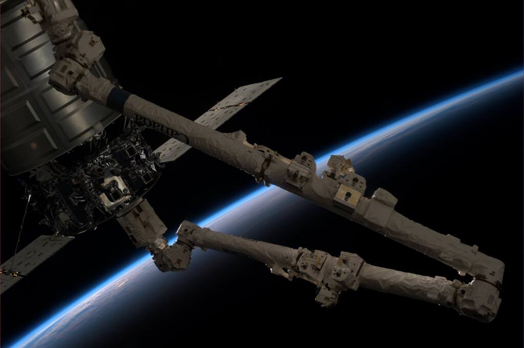
The Cygnus commercial resupply craft departed the ISS this morning (Oct. 22) to complete its maiden voyage after being released from Canadarm2 by station astronauts. Credit: NASA TV

Commercial space took another major leap forward this morning, Oct 22., when the privately developed Cygnus cargo vehicle undocked from the International Space Station on its historic maiden flight and successfully completed a highly productive month long stay during its demonstration mission – mostly amidst the US government shutdown.

The Cygnus was maneuvered about 10 meters (30 feet) away from the station and held in the steady grip of the stations fully extended robotic arm when astronauts Karen Nyberg and Luca Parmitano unlatched the arm and released the ship into free space at 7:31 a.m. EDT today – signifying an end to joint flight operations.

The next Cygnus resupply vessel is due to blast off in mid-December and is already loaded with new science experiments for microgravity research and assorted gear and provisions.

After the Expedition 37 crew members quickly pulled the arm back to a distance 1.5 meters away from Cygnus, ground controllers issued a planned “abort” command to fire the ships thrusters and safely depart from the massive orbiting lab complex.

Space Station robotic arm releases Cygnus after detachment from the ISS Harmony node. Credit: NASA TV

“It’s been a great mission. Nice work today!” radioed Houston Mission Control at NASA’s Johnson Space Center.

The vehicles were flying over the Atlantic Ocean and off the east coast of Argentina as Cygnus left the station some 250 miles (400 km) overhead in low Earth orbit.

The event was carried live on NASA TV and Cygnus was seen moving rapidly away.

Barely five minutes later Cygnus was already 200 meters away, appeared very small in the cameras view and exited the imaginary “Keep Out Sphere” – a strictly designated safety zone around the million pound station.

Cygnus commercial cargo craft rapidly departed the ISS this morning (Oct. 22) after release from the Canadarm2 robotic arm. Station modules visible at bottom. Credit: NASA TV

The Cygnus resupply ship delivered about 1,300 pounds (589 kilograms) of cargo, including food, clothing, water, science experiments, spare parts and gear to the six person Expedition 37 crew.

After the crew unloaded all that cargo, they packed the ship with 2,850 pounds of no longer needed trash.

On Wednesday (Oct. 23), a pair of deorbit burns with target Cygnus for a destructive reentry back into the Earth’s atmosphere at 2:18 p.m. EDT, to plummet harmlessly into the Pacific Ocean.

Cygnus was developed by Orbital Sciences Corp. with seed money from NASA in a public-private partnership between NASA and Orbital Sciences under NASA’s COTS commercial transportation initiative.

SpaceX Corp. was also awarded a COTS contract to develop the Dragon cargo carrier so that NASA would have a dual capability to stock up the station.

COTS was aimed at fostering the development of America’s commercial space industry to deliver critical and essential supplies to the ISS following the retirement of the Space Shuttle program.

“Congratulations to the teams at Orbital Sciences and NASA who worked hard to make this demonstration mission to the International Space Station an overwhelming success,” NASA Administrator Charles Bolden said in a statement.

Antares rocket lifts off at 10:58 a.m. EDT Sept 18 with commercial Cygnus cargo resupply ship bound for the International Space Station (ISS) from Mid-Atlantic Regional Spaceport Pad-0A at NASA’s Wallops Flight Facility in Virginia.  Credit: Ken Kremer (kenkremer.com)
Antares rocket lifts off at 10:58 a.m. EDT Sept 18 with commercial Cygnus cargo resupply ship bound for the International Space Station (ISS) from Mid-Atlantic Regional Spaceport Pad-0A at NASA’s Wallops Flight Facility in Virginia. Credit: Ken Kremer (kenkremer.com)

“We are delighted to now have two American companies able to resupply the station. U.S. innovation and inspiration have once again shown their great strength in the design and operation of a new generation of vehicles to carry cargo to our laboratory in space. Orbital’s success today is helping make NASA’s future exploration to farther destinations possible.”

America completely lost its capability to send humans and cargo to the ISS when NASA’s space shuttles were forcibly retired in 2011. Orbital Sciences and SpaceX were awarded NASA contracts worth over $3 Billion to restore the unmanned cargo resupply capability over 20 flights totally.

Cygnus was launched to orbit on its inaugural flight on Sept. 18 atop Orbital’s commercial Antares rocket from NASA’s Wallops Flight Facility on the Eastern shore of Virginia.

The initially planned Sept. 22 berthing of the spacecraft at a port on the Earth facing Harmony node was delayed a week to Sept. 29 due to an easily fixed communications glitch. It was no worse for the wear and performed admirably.

“Antares next flight is scheduled for mid December,” according to Frank Culbertson, former astronaut and now Orbital’s executive Vice President responsible for the Antares and Cygnus programs.

Ken Kremer

After launching to orbit atop the Antares rocket on Sept. 18, the first ever Cygnus cargo spacecraft is chasing the ISS and set to dock on Sept 22. Until then you may be able to track it in the night skies. Here is full scale, high fidelity mockup of Cygnus to give a feel for its size being similar to a small room. Credit: Ken Kremer (kenkremer.com)
After launching to orbit atop the Antares rocket on Sept. 18, the first ever Cygnus cargo spacecraft chased the ISS and docked on Sept 29. Here is full scale, high fidelity mockup of Cygnus to give a feel for its size being similar to a small room. Credit: Ken Kremer (kenkremer.com)

Skeleton Crew gets LADEE in Orbit, Checked Out and Fires Revolutionary Laser During Gov’t Shutdown

An artist's concept of NASA's Lunar Atmosphere and Dust Environment Explorer (LADEE) spacecraft seen orbiting near the surface of the moon after successfully entering lunar orbit on Oct. 6, 2013. Credit: NASA Ames / Dana Berry

NASA’s new LADEE spacecraft successfully entered lunar orbit, is operating beautifully and has begun shooting its radical laser communications experiment despite having to accomplish a series of absolutely critical do-or-die orbital insertion engine firings with a “skeleton crew ” – all this amidst the NASA and US government shutdown, NASA Ames Research Center Director Pete Worden told Universe Today in a LADEE mission exclusive.

During the two and a half week long NASA shutdown, engineers had to fire LADEE’s maneuvering thrusters three times over six days – first to brake into elliptical orbit about the Moon and then lower it significantly and safely into a circular commissioning orbit.

“All burns went super well,” Ames Center Director Worden told me exclusivly. And he is extremely proud of the entire team of “dedicated” professional men and women who made it possible during the shutdown.

“It says a lot about our people’s dedication and capability when a skeleton crew can get a new spacecraft into lunar orbit and fully commissioned in the face of a shutdown!” Worden said to Universe Today.

“I’m really happy that everyone’s back.”

After achieving orbit, a pair of additional engine burns reduced LADEE’s altitude and period into its initial commissioning orbit and teams began the month long activation and instrument checkout phase.

“We are at the commissioning orbit of 250 km,” said Worden.

And to top all that off, LADEE’s quartet of science instruments are checked out and the ground – breaking laser communications experiment that will bring about a quantum leap in transmitting space science data has already begun its work!

“All instruments are fully checked out with covers deployed.”

“We’ve begun the Lunar Laser Communications Demonstration (LLCD) tests and its working very well,” Worden explained.

NASA’s LADEE lunar orbiter will firing its main engine on Oct. 6 to enter lunar orbit in the midst of the US government shutdown. Credit: NASA
NASA’s LADEE lunar orbiter fired its main engine on Oct. 6 to enter lunar orbit in the midst of the US government shutdown. Credit: NASA

And that’s the whole point of the LADEE mission in the first place.

97% of NASA’s employees were furloughed during the utterly chaotic and wasteful partial shutdown of the US government that lasted from Oct. 1 to Oct. 17 and also temporarily threatened the upcoming launch of NASA’s next mission to Mars – the MAVEN orbiter.

However, orbital mechanics follows the natural laws of the Universe, continues unabated and waits for no one in Washington, D.C.

NASA’s Jupiter-bound Juno orbiter also flew by Earth amidst the DC shutdown showdown on Oct. 9 for a similarly critical do-or-die gravity assisted speed boost and trajectory targeting maneuver.

The stakes were extremely high for NASA’s Lunar Atmosphere and Dust Environment Explorer (LADEE) mission because the spacecraft was on course for the Moon and absolutely had to ignite its main engine on the Sunday morning of Oct. 6.

There were no second chances. If anything failed, LADEE would simply sail past the Moon with no hope of returning later.

So, mission controllers at NASA Ames commanded LADEE to ignite its main engine and enter lunar orbit on Oct. 6 following the spectacular Sept. 6 night launch from NASA’s Wallops Island spaceport in Virginia.

Launch of NASA’s LADEE lunar orbiter on Friday night Sept. 6, at 11:27 p.m. EDT on the maiden flight of the Minotaur V rocket from NASA Wallops, Virginia, viewing site 2 miles away. Antares rocket launch pad at left.  Credit: Ken Kremer/kenkremer.com
Launch of NASA’s LADEE lunar orbiter on Friday night Sept. 6, at 11:27 p.m. EDT on the maiden flight of the Minotaur V rocket from NASA Wallops, Virginia, viewing site 2 miles away. Antares rocket launch pad at left. Credit: Ken Kremer/kenkremer.com

The approximately four minute long burn know as Lunar Orbit Insertion burn 1 (LOI-1) began with LADEE’s arrival at the Moon following three and a half long looping orbits of the Earth.

LOI-1 changed the spacecrafts velocity by 329.8 meters/sec so that the couch sized probe could be captured by the Moon’s gravity and be placed into a 24 hour polar elliptical orbit.

The LOI-2 maneuver on Oct. 9 put LADEE into a 4-hour elliptic lunar orbit. The third and final LOI-3 burn occurred on Oct. 12, and put the spacecraft into the 2-hour commissioning orbit (roughly 235 Km x 250 Km), according to a NASA statement.

The 844 pound (383 kg) robot explorer was assembled at NASA’s Ames Research Center, Moffett Field, Calif., and is a cooperative project with NASA Goddard Spaceflight Center in Maryland.

“LADEE is the first NASA mission with a dedicated laser communications experiment,” said Don Cornwell, mission manager for the Lunar Laser Communications Demonstration (LLCD), NASA’s Goddard Space Flight Center, Greenbelt, Md, during an interview with Universe Today at the LADEE launch.

“With the LLCD experiment, we’ll use laser communications to demonstrate at least six times more data rate from the moon than what we can do with a radio system with half the weight and 25 percent less power,” said Cornwell.

The LADEE satellite in lunar orbit.   The revolutionary modular science probe is equipped with a Lunar Laser Communication Demonstration (LLCD) that will attempt to show two-way laser communication beyond Earth is possible, expanding the possibility of transmitting huge amounts of data. This new ability could one day allow for 3-D High Definition video transmissions in deep space to become routine.  Credit: NASA
The LADEE satellite in lunar orbit. The revolutionary modular science probe is equipped with a Lunar Laser Communication Demonstration (LLCD) that will attempt to show two-way laser communication beyond Earth is possible, expanding the possibility of transmitting huge amounts of data. This new ability could one day allow for 3-D High Definition video transmissions in deep space to become routine. Credit: NASA

The LLCD will be operated for about 30 days during the time of the commissioning orbit period.

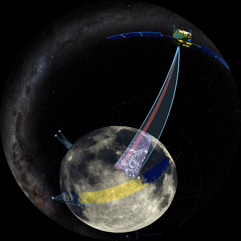
The purpose of LADEE is to collect data that will inform scientists in unprecedented detail about the ultra thin lunar atmosphere, environmental influences on lunar dust and conditions near the surface. In turn this will lead to a better understanding of other planetary bodies in our solar system and beyond.

The $280 million probe is built on a revolutionary ‘modular common spacecraft bus’, or body, that could dramatically cut the cost of exploring space and also be utilized on space probes to explore a wide variety of inviting targets in the solar system.

“LADEE is the first in a new class of interplanetary exploration missions,” NASA Ames Director Worden told Universe Today. “It will study the pristine moon to study significant questions.”

“This is probably our last best chance to study the pristine Moon before there is a lot of human activity there changing things.”

Stay tuned here for continuing LADEE news

Ken Kremer

LADEE_Poster_01