How to See the Historic Antares/Cygnus Launch to Space Station on Sept. 18

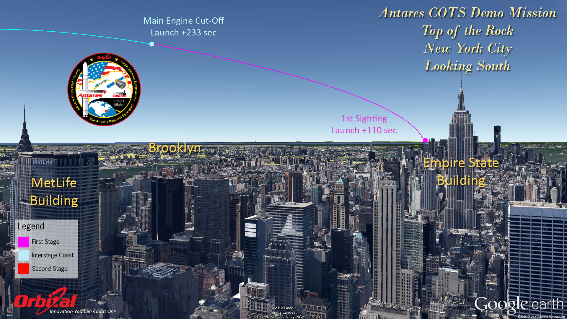
Top of the Rock - New York City. Antares rocket and Cygnus cargo spacecraft approximate launch trajectory view as should be seen from atop Rockefeller Center, NYC, on Sept. 18, 2013 at 10:50 a.m. EDT - weather permitting - after blastoff from NASA Wallops, VA. Credit: Orbital Sciences See more Antares launch trajectory viewing graphics below

Top of the Rock – New York City
Antares rocket and Cygnus cargo spacecraft approximate launch trajectory view as should be seen from atop Rockefeller Center, NYC, on Sept. 18, 2013 at 10:50 a.m. EDT – weather permitting – after blastoff from NASA Wallops, VA. Credit: Orbital Sciences
See more Antares launch trajectory viewing graphics below[/caption]

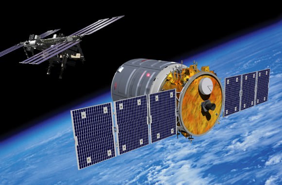
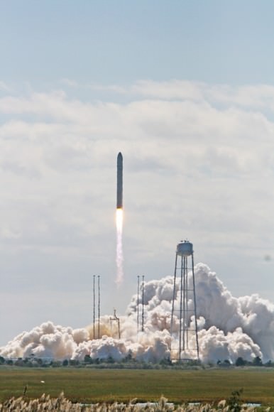
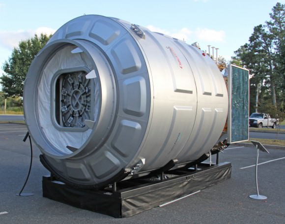
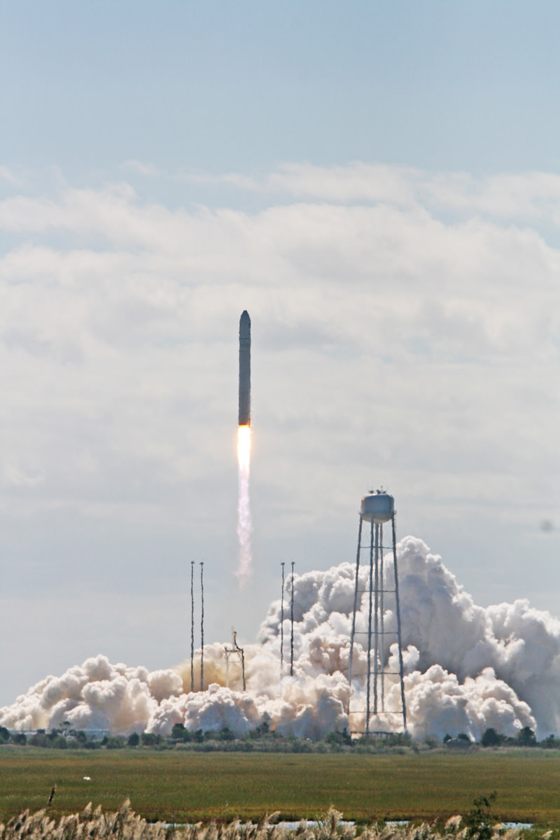
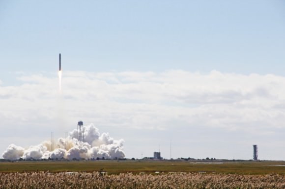
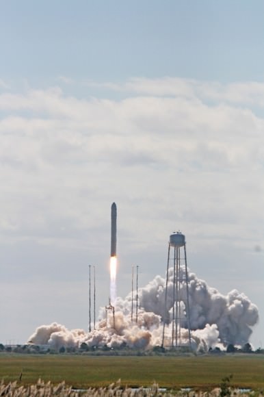
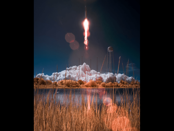
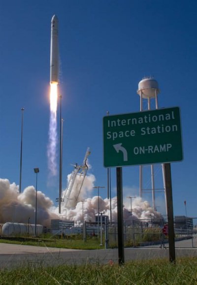
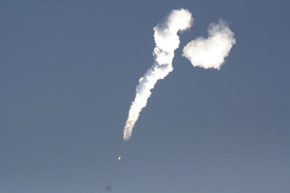
WALLOPS ISLAND, VA – “All Systems Are GO” for the Sept. 18 launch of Orbital Sciences Antares commercial rocket carrying the first ever fully functional Cygnus commercial resupply vehicle to orbit on the history making first flight blasting off from NASA’s Wallops Island Facility– along the eastern shore of Virginia and bound for the International Space Station (ISS).

Here’s our guide on “How to See the Antares/Cygnus Launch” – complete with viewing maps and trajectory graphics from a variety of prime viewing locations courtesy of Orbital Sciences, the private company that developed both the Antares rocket and Cygnus spaceship aimed at keeping the ISS fully operational for science research.

And although the launch is slated for late morning it should still be visible to millions of spectators along a lengthy swath of the US East Coast from North Carolina to Connecticut – weather permitting – who may have never before witnessed such a mighty rocket launch.

The daylight liftoff of the powerful two stage Antares rocket is scheduled for Wednesday, Sept 18 at 10:50 a.m. EDT from Launch Pad 0A at the Mid-Atlantic Regional Spaceport at NASA Wallops Island, Virginia. The launch window extends 15 minutes to 11:05 a.m.

Up top is the view as anticipated from “The Top of the Rock” or Rockefeller Center in New York City. See below the extraordinary image of LADEE’s launch from “Top of the Rock” by Ben Cooper to compare the day and night time sighting delights.

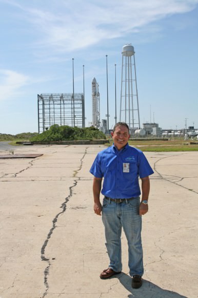
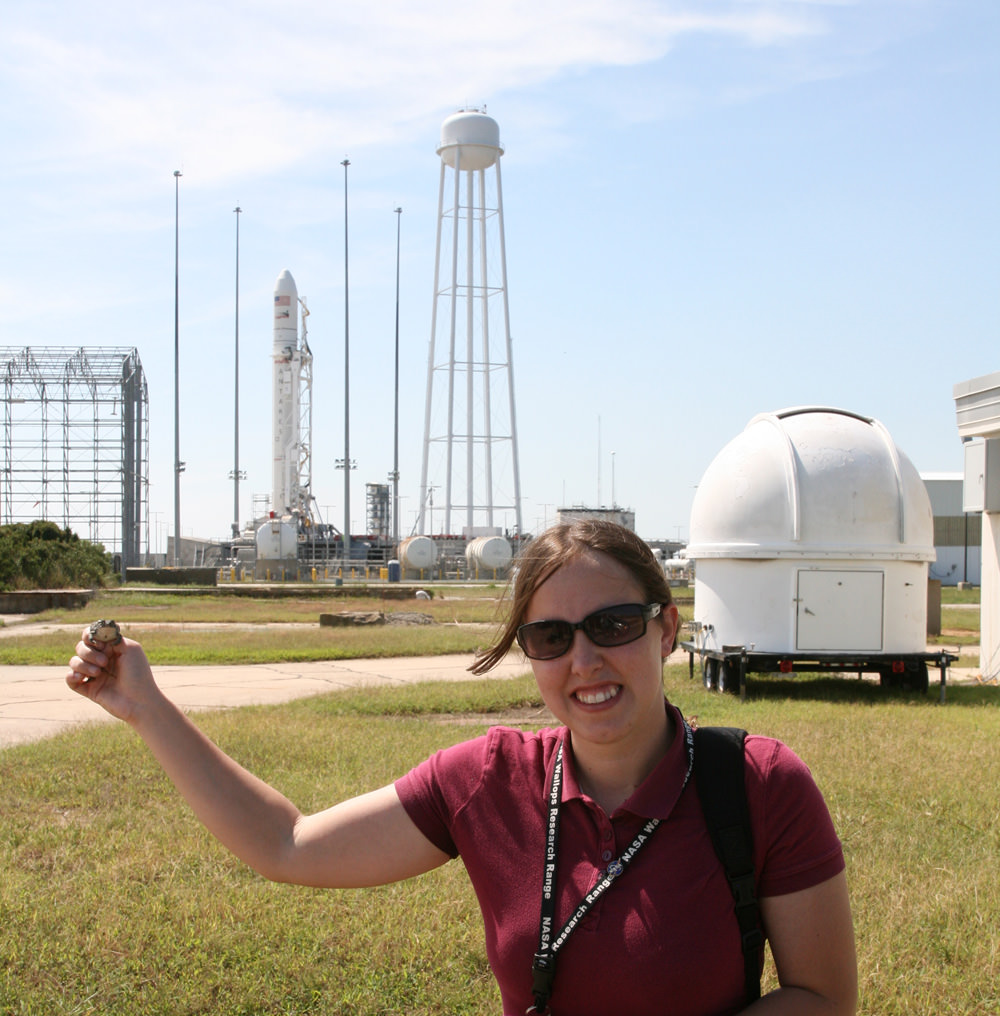
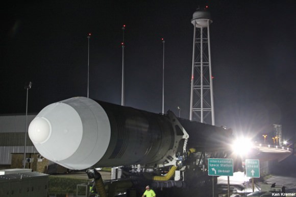
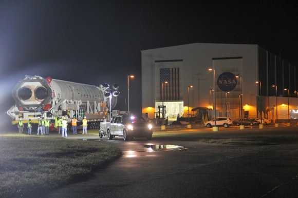
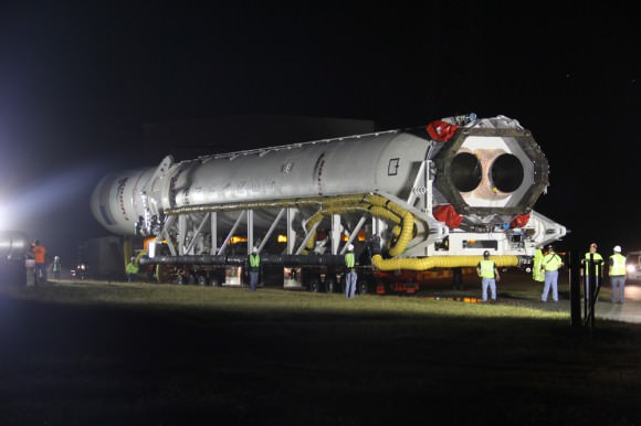
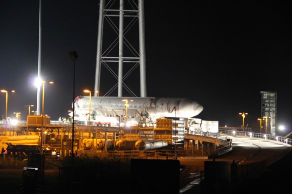
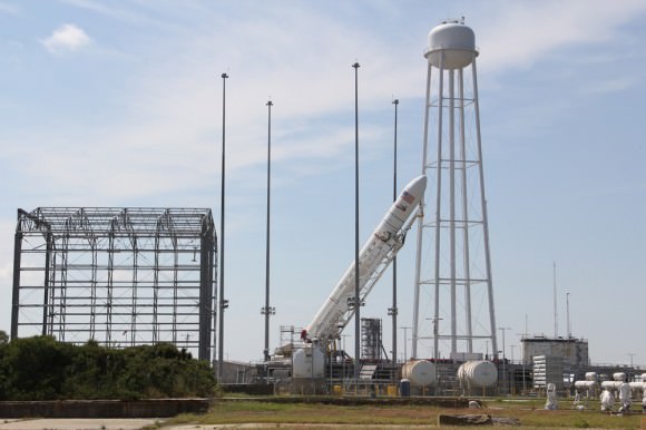
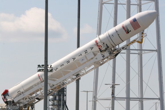
In anticipation of liftoff, the Antares rocket was rolled out to Pad 0A on Friday morning Sept. 13 and I was on hand for the entire event – see my rollout photos here and upcoming.

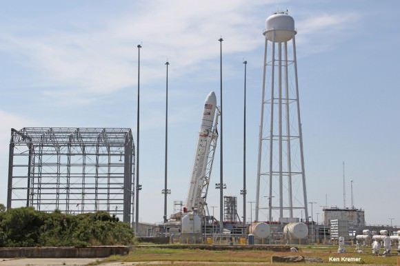
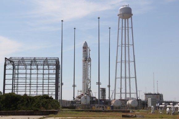
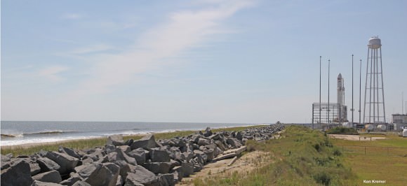
Seaside panoramic view of Antares rocket and Cygnus spacecraft after rollout to Launch Pad 0A at NASA Wallops at the Virginia Eastern Shore  on Sept. 13, 2013. Blastoff for the ISS is slated for Sept. 18, 2013 at 10:50 a.m. EDT Credit: Ken Kremer (kenkremer.com)
Seaside panoramic view of Antares rocket and Cygnus spacecraft after rollout to Launch Pad 0A at NASA Wallops at the Virginia Eastern Shore on Sept. 13, 2013. Blastoff for the ISS is slated for Sept. 18, 2013 at 10:50 a.m. EDT. LADEE launch pad 0B stands adjacent to right of Antares.
Credit: Ken Kremer (kenkremer.com)

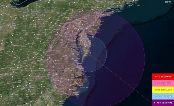
Here’s a hi res version of the viewing map courtesy of NASA Wallops Flight Facility:

Antares/Cygnus Launch - Hi Res Visibility map The Antares/Cygnus daylight rocket launch on Sept. 18, 2013 at 10:50 a.m. EDT from NASA Wallops, VA.  will potentially be visible to millions of spectators along the Eastern US coast from Connecticut to North Carolina -weather permitting. This high resolution map shows the regions of visibility over time in the seconds after the rocket launch on a demonstration cargo resupply mission to the International Space Station.  Credit: NASA Wallops Flight Facility
Antares/Cygnus Launch – Hi Res Visibility map
The Antares/Cygnus daylight rocket launch on Sept. 18, 2013 at 10:50 a.m. EDT from NASA Wallops, VA. will potentially be visible to millions of spectators along the Eastern US coast from Connecticut to North Carolina -weather permitting. This high resolution map shows the regions of visibility over time in the seconds after the rocket launch on a demonstration cargo resupply mission to the International Space Station. Credit: NASA Wallops Flight Facility

The Antares launch follows closely on the heels of the spectacularly bright Sept. 6 nighttime Moon shot blastoff of the Minotaur V rocket that successfully injected NASA’s LADEE lunar orbiter into its translunar trajectory.

And just as was the case with the Minotaur V and LADEE, you don’t have to be watching locally to join in and experience all the fun and excitement. As with any NASA launch, you can also follow along with up to the minute play by play by watching the NASA TV webcast online or on smartphones, iPods or laptops.

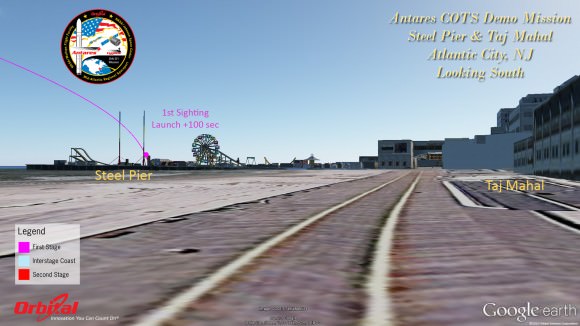
Atlantic City
Atlantic City

It’s hard to say exactly how long and how bright the rockets flames and exhaust trail will be visible since it depends on the constantly changing lighting, prevailing clouds and overall weather conditions.

But one thing is for sure. If you don’t go outside and watch you’re giving up a great opportunity.

And keep in mind that Antares will be moving significantly slower than the Minotaur V.

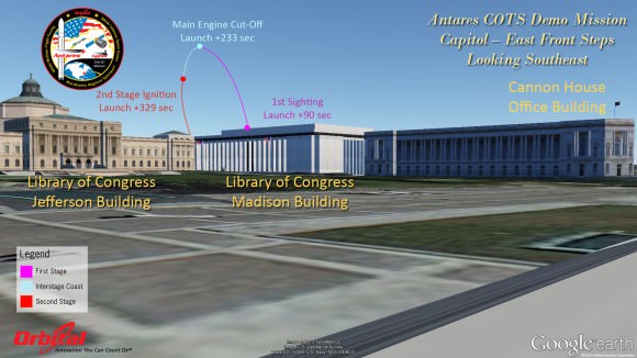
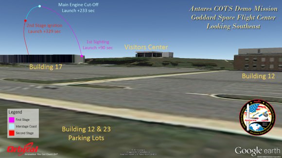
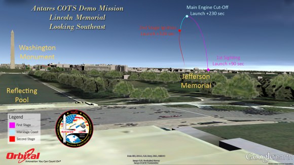
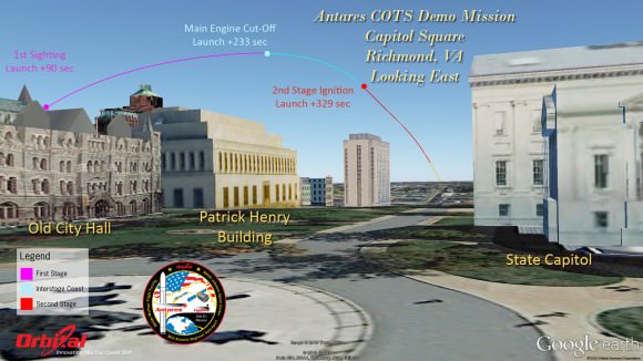
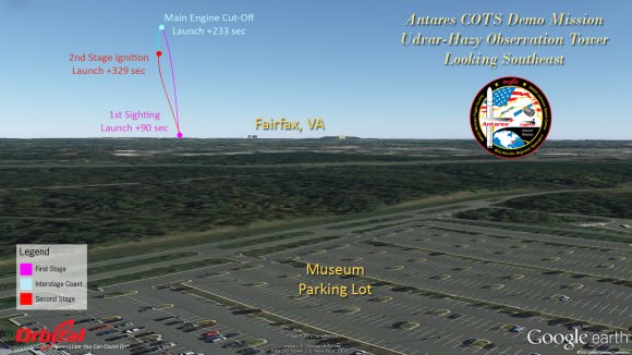
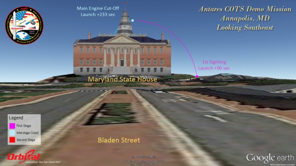
Herein are a series of graphics showing the Antares trajectory and what you should see during firings of both stages from the perspective of standing on the ground or skyscrapers at a variety of popular destinations including Annapolis, the US Capitol, Lincoln Memorial, National Air and Space Museum, Atlantic City, NJ, New York City and more.

Capitol East-Front Steps
Goddard Space Flight Center - GSFC
Goddard Space Flight Center – GSFC
Antares rocket and Cygnus spacecraft after rollout to Launch Pad 0A at NASA Wallops Flight Facility Facility, VA.,on Sept. 13, 2013. Blastoff is slated for Sept. 18, 2013 at 10:50 a.m. EDT.  LADEE launch pad 0B stands adjacent to right of Antares.  Credit: Ken Kremer (kenkremer.com)
Antares rocket and Cygnus spacecraft after rollout to Launch Pad 0A at NASA Wallops Flight Facility Facility, VA.,on Sept. 13, 2013. Blastoff is slated for Sept. 18, 2013 at 10:50 a.m. EDT. LADEE launch pad 0B stands adjacent to right of Antares. Credit: Ken Kremer (kenkremer.com)

The goal of the mission is to demonstrate the safe and successful launch, rendezvous and docking of the privately developed Cygnus cargo carrier with the International Space Station (ISS) and delivery of 1300 pounds of essential supplies, food, clothing, spare parts and science gear to the six person resident human crews – currently Expedition 37.

Although it’s the 2nd launch of Antares following the maiden flight in April, this is the first flight of the Cygnus commercial delivery system. The demonstration and testing will be the same as what SpaceX accomplished in 2012 with their competing Falcon 9/Dragon architecture.

The mission is designated Orb-D1 and is funded with seed money by NASA’s COTS program to replace the cargo delivery duties of NASA’s now retired Space Shuttle orbiters.

Lincoln Memorial
Lincoln Memorial
Richmond
Richmond

For those who are traveling to witness the launch locally in the Chincoteague, Va., area, there will be two public viewing sites said Jeremy Eggers, NASA Wallops Public Affairs Officer in an interview with Universe Today.

“There will be are two local sites open to the public,” Eggers told me. “Folks can watch at either the NASA Wallops Flight facility Visitors Center (http://sites.wff.nasa.gov/wvc) or the beach at Assateague National Seashore (http://www.nps.gov/asis/index.htm).”

“There will be loudspeakers to follow the progress of the countdown, but no TV screens as done with the LADEE launch.”

National Air & Space Udvar-Hazy Museum
Annapolis
Annapolis

So far the weather outlook is promising with a 75% chance of “GO” with favorable conditions at launch time.

NASA Television coverage of the Antares launch will begin at 10:15 a.m. on Sept 18 – (www.nasa.gov/ntv).

Be sure to watch for my continuing Antares and LADEE mission reports from on site at NASA’s Wallops Launch Pads in sunny Virginia – reporting for Universe Today.

Ken Kremer

…………….

Learn more about Cygnus, Antares, LADEE, Curiosity, Mars rovers, MAVEN, Orion and more at Ken’s upcoming presentations

Sep 17/18: LADEE Lunar & Antares/Cygnus ISS Rocket Launches from Virginia”; Rodeway Inn, Chincoteague, VA

Oct 3: “Curiosity, MAVEN and the Search for Life on Mars – (3-D)”, STAR Astronomy Club, Brookdale Community College & Monmouth Museum, Lincroft, NJ, 8 PM

Oct 8: LADEE Lunar & Antares/Cygnus ISS Rocket Launches from Virginia”; Princeton University, Amateur Astronomers Assoc of Princeton (AAAP), Princeton, NJ, 8 PM
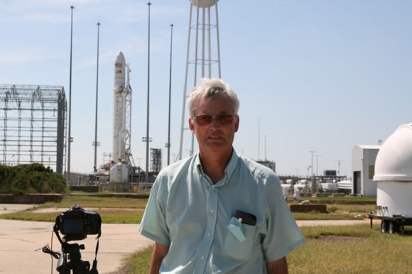
This magnificent view of NASA’s LADEE lunar orbiter launched on Friday night Sept 6, on the maiden flight of the Minotaur V rocket from Virginia was captured by space photographer Ben Cooper perched atop Rockefeller Center in New York City. Credit: Ben Cooper/Launchphotography.com
This magnificent view of NASA’s LADEE lunar orbiter launched on Friday night Sept 6, on the maiden flight of the Minotaur V rocket from Virginia was captured by space photographer Ben Cooper perched atop Rockefeller Center in New York City. Compare this actual launch view to the graphic calculated for Antares (above) as seen from the exact same location atop Rockefeller Center. Credit: Ben Cooper/Launchphotography.com

Curiosity Rolls into Intriguing ‘Darwin’ at ‘Waypoint 1’ on Long Trek to Mount Sharp

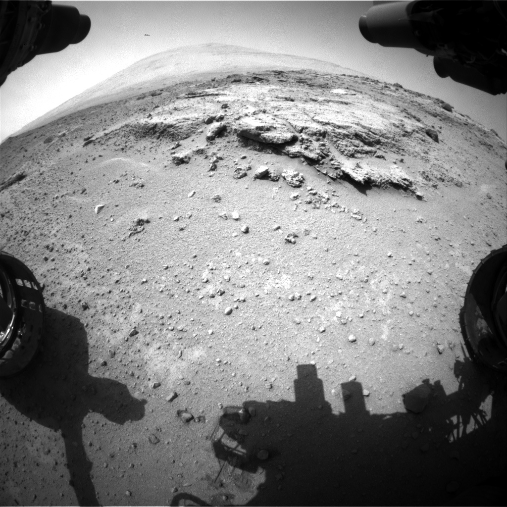
Curiosity’s views a rock outcrop after arriving for a short stay at ‘Waypoint 1’- dramatically back dropped by her primary destination, Mount Sharp. Front hazcam camera image from Sol 393 (Sept 13, 2013). Credit: NASA/JPL-Caltech

Curiosity’s views a rock outcrop at ‘Darwin’ after arriving for a short stay at ‘Waypoint 1’ on Sept 12 (Sol 392) – dramatically back dropped by her primary destination, Mount Sharp. Front hazcam camera image from Sol 393 (Sept 13, 2013). Credit: NASA/JPL-Caltech
Story updated – see close up mosaic views of Darwin outcrop below[/caption]

NASA’s Curiosity Mars rover has just rolled into an intriguing site called ‘Darwin’ at ‘Waypoint 1’- having quickly picked up the driving pace since embarking at last on her epic trek to mysterious Mount Sharp more than two months ago. Did life giving water once flow here on the Red Planet?

Because the long journey to Mount Sharp – the robots primary destination – was certain to last nearly a year, the science team carefully choose a few stopping points for study along the way to help characterize the local terrain. And Curiosity has just pulled into the first of these so called ‘Waypoints’ on Sept 12 (Sol 392), the lead scientist confirmed to Universe Today.

Curiosity has arrived at Waypoint 1,” project scientist John Grotzinger, of the California Institute of Technology in Pasadena, told Universe Today.

“Darwin is named after a geologic formation of rocks from Antarctica.”

She has now driven nearly 20% of the way towards the base of the giant layered Martian mountain she will eventually scale in search of life’s ingredients.

Altogether, the team selected five ‘Waypoints’ to investigate for a few days each as Curiosity travels in a southwestward direction on the road from the first major science destination in the ‘Glenelg’ area to the foothills of Mount Sharp, says Grotzinger.

“We’ll stay just a couple of sols at Waypoint 1 and then we hit the road again,” Grotzinger told me.

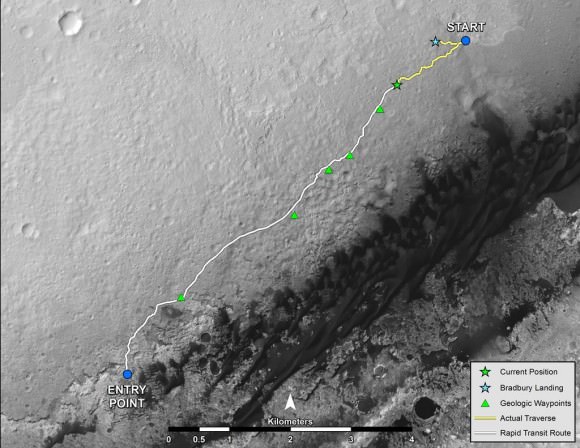
Curiosity's Progress on Rapid Transit Route from 'Glenelg' to Mount Sharp.  Triangles indicate geologic ‘Waypoint’ stopping points along the way.  Curiosity arrived at Waypoint 1 on Sol 392 (Sept 12, 2013). Credit: NASA
Curiosity’s Progress on Rapid Transit Route from ‘Glenelg’ (start at top) to Mount Sharp entry point (bottom). Triangles indicate geologic ‘Waypoint’ stopping points along the way. Curiosity arrived at Waypoint 1 on Sol 392 (Sept 12, 2013). Credit: NASA

‘Waypoint 1’ is an area of intriguing outcrops that was chosen based on high resolution orbital imagery taken by NASA’s Mars Reconnaissance Orbiter (MRO) circling some 200 miles overhead. See route map herein.

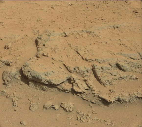
In fact the team is rather excited about ‘Waypoint 1’ that’s dominated by the tantalizing rocky outcrop discovered there nicknamed ‘Darwin’.

Although Curiosity will only stay a short time at each of the stops, the measurements collected at each ‘Waypoint’ will provide essential clues to the overall geologic and environmental history of the six wheeled rover’s touchdown zone.

“Waypoint 1 was chosen to help break up the drive,” Grotzinger explained to Universe Today.

“It’s a chance to study outcrops along the way.”

The images from MRO are invaluable in aiding the rover handlers planning activities, selecting Curiosity’s driving route and targeting of the most fruitful science forays during the long trek to Mount Sharp – besides being absolutely crucial for the selection of Gale Crater as the robots landing site in August 2012.

The ‘Darwin’ outcrop may provide more data on the flow of liquid water across the crater floor.

Evolving Excitement Over 'Darwin' Rock Outcrop at 'Waypoint 1'.   For at least a couple of days, the science team of NASA's Mars rover Curiosity is focused on a full-bore science campaign at a tantalizing, rocky site informally called "Darwin."   This view of Darwin was taken with the Mast Camera (Mastcam) on Sol 390 (Sept. 10, 2013). Credit: NASA/JPL-Caltech/Malin Space Science Systems
Evolving Excitement Over ‘Darwin’ Rock Outcrop at ‘Waypoint 1’. For at least a couple of days, the science team of NASA’s Mars rover Curiosity is focused on a full-bore science campaign at a tantalizing, rocky site informally called “Darwin.” This view of Darwin was taken with the Mast Camera (Mastcam) on Sol 390 (Sept. 10, 2013). Credit: NASA/JPL-Caltech/Malin Space Science Systems

The scientists goal is to compare the floor of Gale Crater to the sedimentary layers of 3 mile high (5 kilometer high) Mount Sharp.

Waypoint 1 is just over 1 mile along the approximately 5.3-mile (8.6-kilometer) route from ‘Glenelg’ to the entry point at the base of Mount Sharp.

Curiosity spent over six months investigating the ‘Yellowknife Bay’ area inside Glenelg before departing on July 4, 2013.

What’s the origin of Darwin’s name?

“Darwin comes from a list of 100 names the team put together to designate rocks in the Mawson Quadrangle – Mawson is the name of a geologist who studied Antarctic geology,” Grotzinger told me.

“Recently we left the Yellowknife Quadrangle, so instead of naming rocks after geological formations in Canada’s north, we now turn to formation names of rocks from Antarctica, and Darwin is one of them.

“That will be the theme until we cross into the next quad,” Grotzinger explained.

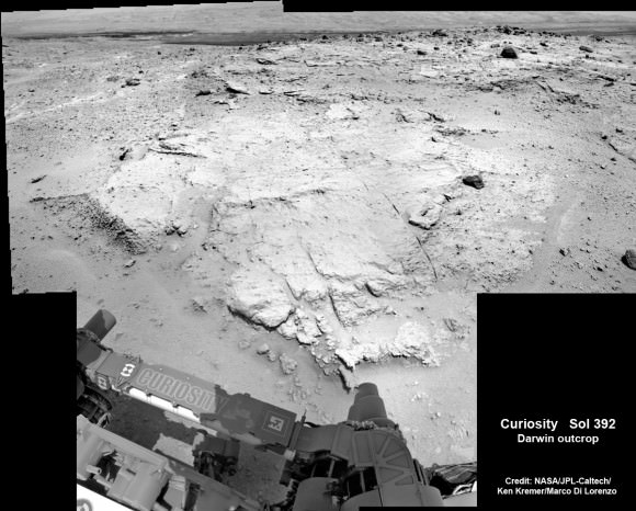
Curiosity investigates the ‘Darwin’ rock outcrop up close after arriving for a short stay at ‘Waypoint 1’ on Sept 12 (Sol 392). This photo mosaic was assembled from navcam images taken on Sept 12, 2013.   Credit: NASA/JPL-Caltech/Ken Kremer/Marco Di Lorenzo
Curiosity investigates the ‘Darwin’ rock outcrop up close after arriving for a short stay at ‘Waypoint 1’ on Sept 12 (Sol 392). This photo mosaic was assembled from navcam images taken on Sept 12, 2013. Credit: NASA/JPL-Caltech/Ken Kremer/Marco Di Lorenzo

Inside Yellowknife Bay, Curiosity conducted the historic first interplanetary drilling into Red Planet rocks and subsequent sample analysis with her duo of state of the art chemistry labs – SAM and CheMin.

At Yellowknife Bay, the 1 ton robot discovered a habitable environment containing the chemical ingredients that could sustain Martian microbes- thereby already accomplishing the primary goal of NASA’s flagship mission to Mars.

“We want to know how the rocks at Yellowknife Bay are related to what we’ll see at Mount Sharp,” Grotzinger elaborated in a NASA statement. “That’s what we intend to get from the waypoints between them. We’ll use them to stitch together a timeline — which layers are older, which are younger.”

On Sept. 5, Curiosity set a new one-day distance driving record for the longest drive yet by advancing 464 feet (141.5 meters) on her 13th month on the Red Planet.

As Curiosity neared Waypoint 1 she stopped at a rise called ‘Panorama Point’ on Sept. 7, spotted an outcrop of light toned streaks informally dubbed ‘Darwin and used her MastCam telephoto camera to collect high resolution imagery.

Curiosity will use her cameras, spectrometers and robotic arm for contact science and a “full bore science campaign” involving in-depth mineral and chemical composition analysis of Darwin and Waypoint 1 for the next few Sols, or Martian days, before resuming the trek to Mount Sharp that dominates the center of Gale Crater.

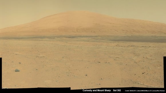
Curiosity Spies Mount Sharp - her primary destination. Curiosity will ascend mysterious Mount Sharp and investigate the sedimentary layers searching for clues to the history and habitability o the Red Planet of billions of years.  This mosaic was assembled from Mastcam camera images taken on Sol 352 (Aug 2, 2013. Credit: NASA/JPL-Caltech/MSSS/ Marco Di Lorenzo/Ken Kremer
Curiosity Spies Mount Sharp – her primary destination. Curiosity will ascend mysterious Mount Sharp and investigate the sedimentary layers searching for clues to the history and habitability o the Red Planet of billions of years. This mosaic was assembled from Mastcam camera images taken on Sol 352 (Aug 2, 2013). Credit: NASA/JPL-Caltech/MSSS/ Marco Di Lorenzo/Ken Kremer

She will not conduct any drilling here or at the other waypoints, several team members have told me, unless there is some truly remarkable ‘Mars-shattering’ discovery.

Why is Curiosity now able to drive longer than ever before?

“We have put some new software – called autonav, or autonomous navigation – on the vehicle right after the conjunction period back in March 2013,” Jim Erickson, Curiosity Project Manager of NASA’s Jet Propulsion Laboratory (JPL), told Universe Today.

“This will increase our ability to drive. But how much it helps really depends on the terrain.”

And so far the terrain has cooperated.

“We are on a general heading of southwest to Mount Sharp,” said Erickson. See the NASA JPL route map.

“We have been going through various options of different planned routes.”

As of today (Sol 394), Curiosity remains healthy, has traveled 2.9 kilometers and snapped over 82,000 images.

If all goes well Curiosity could reach the entry point to Mount Sharp sometime during Spring 2014, at her current driving pace.

Ken Kremer

…………….

Learn more about Curiosity, Mars rovers,LADEE, Cygnus, Antares, MAVEN, Orion and more at Ken’s upcoming presentations

Sep 17/18: LADEE Lunar & Antares/Cygnus ISS Rocket Launches from Virginia”; Rodeway Inn, Chincoteague, VA

Oct 3: “Curiosity, MAVEN and the Search for Life on Mars – (3-D)”, STAR Astronomy Club, Brookdale Community College & Monmouth Museum, Lincroft, NJ, 8 PM

Oct 8: LADEE Lunar & Antares/Cygnus ISS Rocket Launches from Virginia”; Princeton University, Amateur Astronomers Assoc of Princeton (AAAP), Princeton, NJ, 8 PM

10 Historic Moments in Voyager’s Journey to Interstellar Space

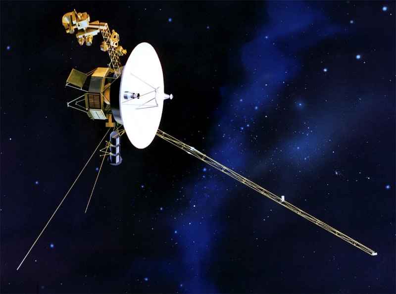
The Voyager spacecraft have been on an extensive mission of discovery that has lasted some 36 years. Image Credit: NASA/JPL

Yesterday, NASA announced that as of August 2012, Voyager 1 is in a new frontier to humanity: interstellar space. Our most distant spacecraft is now in a region where the plasma (really hot gas) environment comes more from between the stars than from the sun itself. (There’s still debate as to whether it’s in or out of the solar system, as this article explains.)

The plucky spacecraft is close to 12 billion miles (19 million kilometers) from home, and in its 36 years of voyaging has taught us a lot about the planets, their moons and other parts of space. Here are 10 of some of its most historic moments. Did we miss any? Let us know in the comments.

10. The launch: Aug. 20, 1977

Voyager 1 launches from the Kennedy Space Center on Sept. 5, 1977. Credit: NASA

Voyager 1 blasted off from Cape Canaveral on Sept. 5, 1977. Its twin, Voyager 2, departed Earth 16 days earlier. Each spacecraft carried various scientific instruments on board as well as a “Golden Record” that had sounds of Earth on it, as well as a diagram showing where Earth is in the universe.

9. Capturing the Earth and Moon together for the first time

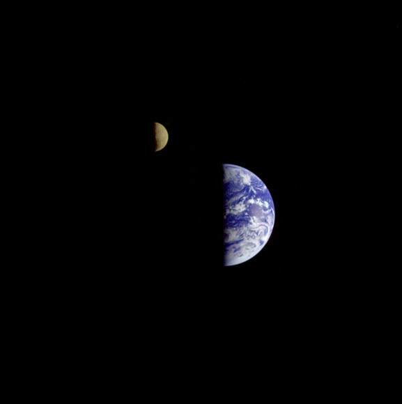
On Sept. 18, 1977, Voyager 1 took three images of the Earth and Moon that were combined into this one image. The moon is artificially brightened to make it show up better. Credit: NASA

About two weeks after launching, Voyager 1 turned back towards Earth and took three images, which were combined into this single view of the Earth and Moon together in space. This was the first time both bodies were pictured together, NASA said.

8. The ‘Pale Blue Dot’ image

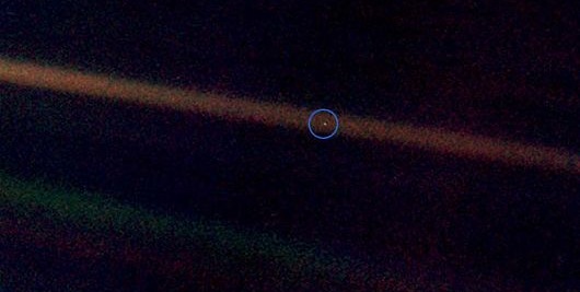
Voyager 1 pale blue dot. Image credit: NASA/JPL

On February 14, 1990, Voyager 1 was about 3.7 billion miles (6 billion kilometers) away from Earth. Scientists commanded the spacecraft to turn its face towards the solar system and snap some pictures of the planets. Among them was this famous image of Earth, which astronomer Carl Sagan called the Pale Blue Dot. “Look again at that dot. That’s here. That’s home. That’s us,” wrote Sagan in his 1997 book of the same name. In 2013, the spacecraft Cassini also took a picture of Earth, and NASA encouraged everyone to wave back.

7. Finding moons “shepherding” Saturn’s F ring

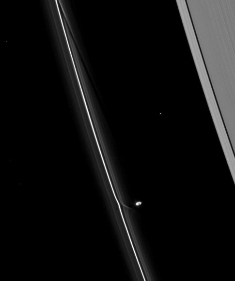
Prometheus, a small potato-shaped moon of Saturn, shown in this Voyager 1 picture interacting with the planet's F ring. Credit: NASA/JPL/SSI
Prometheus, a small potato-shaped moon of Saturn, shown in this Voyager 1 picture interacting with the planet’s F ring. Credit: NASA/JPL/SSI

Voyager 1 spotted Prometheus and Pandora, two moons of Saturn that keep the F ring separate from the rest of the debris, as well as Atlas, which “shepherds” the A ring. More recently, astronomers have found even more interesting things in Saturn’s rings — such as rain.

6. Spotting what appeared to be a LOT of water ice on Saturn’s moons

Encaladus, a moon of Saturn, as shown in this Voyager 1 image. Credit: NASA

After many years of seeing Saturn’s moons as mere points of light, Voyager 1 buzzed several of them in its quick flyby through the system: Dione, Enceladus, Mimas, Rhea, Tethys and Titan among them. Many of these moons appeared to be icy, which was a surprising find since astronomers previously thought water was pretty rare in the Solar System. We know better now.

5. Imaging Titan’s orange haze

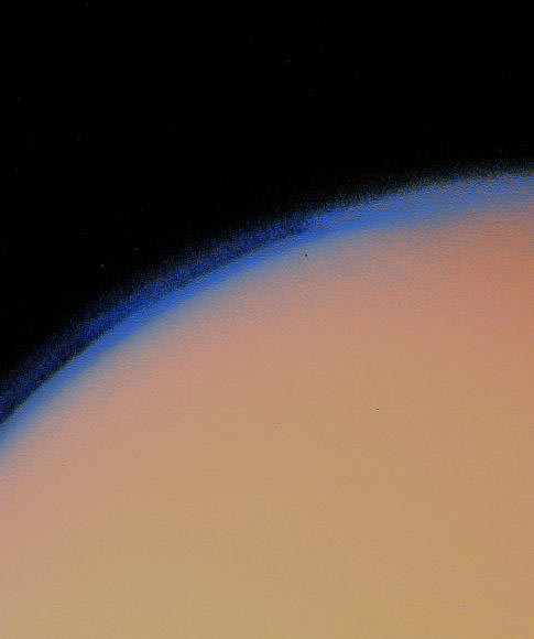
Saturn's moon Titan lies under a thick blanket of orange haze in this Voyager 1 picture. Credit: NASA
Saturn’s moon Titan lies under a thick blanket of orange haze in this Voyager 1 picture. Credit: NASA

Voyager 1 pictures such as this tortured astronomers for decades — what lies beneath this mysterious haze surrounding Titan, Saturn’s moon? That mystery, in fact, inspired the European Space Agency to send a lander to the moon, called Huygens, which successfully reached the surface in 2005.

4. Finding active volcanoes on Io

Io's blotchy volcanoes are clearly visible in this image from Voyager 1. Credit: NASA
Io’s blotchy volcanoes are clearly visible in this image from Voyager 1. Credit: NASA

Voyager 1 helped show us that the Solar System is full of very interesting moons. At Io — a moon of Jupiter — it turns out the moon flexes during its 42-hour orbit of massive Jupiter, which powers a lot of volcanic activity.

3. Voyager 1 becomes the most distant human object

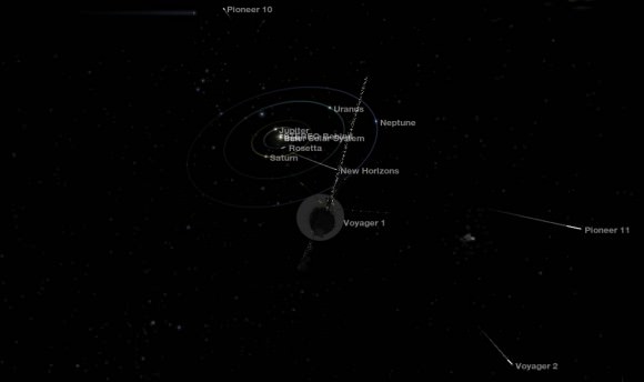
A 2013 snapshot riding along with Voyager 1's looking back at the Sun and inner solar system. The positions of Voyager 2 and Pioneers 10 and 11 show within the viewport as well.
A 2013 computer-generated snapshot riding along with Voyager 1’s looking back at the Sun and inner solar system. The positions of Voyager 2 and Pioneers 10 and 11 show within the viewport as well.

On Feb. 17, 1998, Voyager 1’s distance surpassed that of another long-flying probe, Pioneer 10. This made Voyager 1 the farthest-flung human object in space.

2. Riding the “magnetic highway”

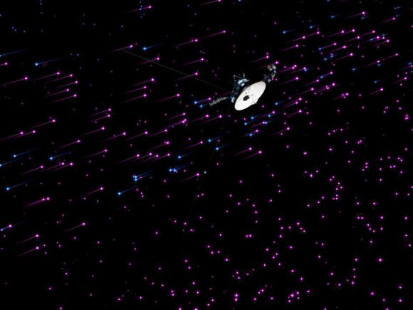
Artist concept of NASA’s Voyager 1 spacecraft exploring a new region in our solar system called the “magnetic highway.” Credit: NASA/JPL-Caltech

In December, NASA said Voyager 1 had reached an area (as of July 28, 2012) where high-energy magnetic particles were starting to bleed through the bubble of lower-energy particles from our sun. “Voyager’s discovered a new region of the heliosphere that we had not realized was there. It’s a magnetic highway where the magnetic field of the Sun is connected to the outside. So it’s like a highway, letting particles in and out,” said project scientist Ed Stone at the time. After that point, as more measurements were analyzed by different teams, there was a lot of debate as to whether Voyager had reached interstellar space.

1. Reaching interstellar space

This graphic shows the main evidence that Voyager 1 has reached interstellar space. The blue line shows particle density, which dropped as Voyager 1 moved away from the sun, and then jumped again after it crossed the "termination shock" that is where the sun's solar wind (particles streaming from the sun) slows down. Credit: NASA/JPL-Caltech
This graphic shows the main evidence that Voyager 1 has reached interstellar space. The blue line shows particle density, which dropped as Voyager 1 moved away from the sun, and then jumped again after it crossed the “termination shock” that is where the sun’s solar wind (particles streaming from the sun) slows down. Credit: NASA/JPL-Caltech

With Voyager 1 now known to be in interstellar space, we’re lucky enough to have a few years left to communicate with it before it runs out of power. All of the instruments will be turned off by 2025, and then engineering data will be available for about 10 years beyond that. The silent emissary from humanity will then come within 1.7 light years of an obscure star in the constellation Ursa Minor (the Little Bear) called AC+79 3888 in the year 40,272 AD and then orbit the center of the Milky Way for millions of years.

This Is What It Looks Like Hovering Above An Asteroid

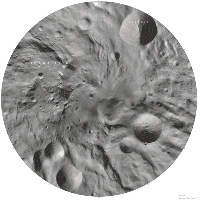
An atlas of the asteroid, Vesta, created from mosaics of 10 000 images from Dawn’s framing camera (FC) instrument, taken during the Dawn Mission’s Low Altitude Mapping Orbit (LAMO) an altitude of around 135 miles (210 kilometres). Credit: European Space Agency

Now’s your big chance to get up close and personal with Vesta, one of the largest asteroids in the solar system.

A new atlas has been released based on 10,000 images from the Dawn mission‘s framing camera instrument, which took the pictures from an average altitude of about 131 miles (210 kilometers). Each map has a scale of 1 centimetre to 2 kilometres (roughly a scale of 0.4 inches : 1.2 miles).

“Creating the atlas has been a painstaking task – each map sheet of this series has used about 400 images,” stated Thomas Roatsch, who is with the German Aerospace Center (DLR) Institute of Planetary Research and led the work.

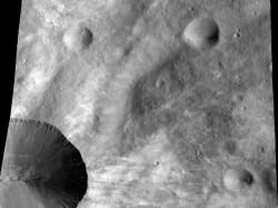
This image from NASA’s Dawn spacecraft shows a close up of part of the rim around the crater Canuleia on the giant asteroid Vesta. Canuleia, about 6 miles (10 kilometers) in diameter, is the large crater at the bottom-left of this image. Image credit: NASA/JPL-Caltech/UCLA/MPS/DLR/PSI/Brown
This image from NASA’s Dawn spacecraft shows a close up of part of the rim around the crater Canuleia on the giant asteroid Vesta. Credit: NASA/JPL-Caltech/UCLA/MPS/DLR/PSI/Brown

“The atlas shows how extreme the terrain is on such a small body as Vesta. In the south pole projection alone, the Severina crater contours reaches a depth of 18 kilometres [11 miles]; just over 100 kilometres [62 miles] away the mountain peak towers 7 kilometres [4.3 miles] above the … reference level.”

You can check out the raw atlas images at this website. The research was presented at the European Planetary Science Conference and also published Sept. 1 at Planetary and Space Science.

Interested in getting involved in Vesta asteroid mapping yourself? A initiative called AsteroidMappers is open to amateur enthusiasts; check out more details in this past Universe Today story.

Source: European Planetary Science Conference

A Mercurial Milestone: 1,000 Featured Images from MESSENGER!

The MESSENGER team celebrates 1,000 featured images of the innermost planet!

It’s been nearly two and a half years since the NASA-sponsored MESSENGER mission entered orbit around Mercury — the first spacecraft ever to do so — and today the MESSENGER team celebrated the 1,000th featured image on the mission site with a mosaic of discovery highlights, seen above.

“I thought it sensible to produce a collage for the 1,000th web image because of the sheer volume of images the team has already posted, as no single picture could encompass the enormous breadth of Mercury science covered in these postings,” explained MESSENGER Fellow Paul Byrne, of the Carnegie Institution of Washington. “Some of the images represent aspects of Mercury’s geological characteristics, and others are fun extras, such as the U.S. Postal Service’s Mercury stamp. The ‘1,000’ superimposed on the collage is a reminder of the major milestone the team has reached in posting 1,000 featured images — and even a motivation to post 1,000 more.”

See the very first image MESSENGER obtained from orbit below:

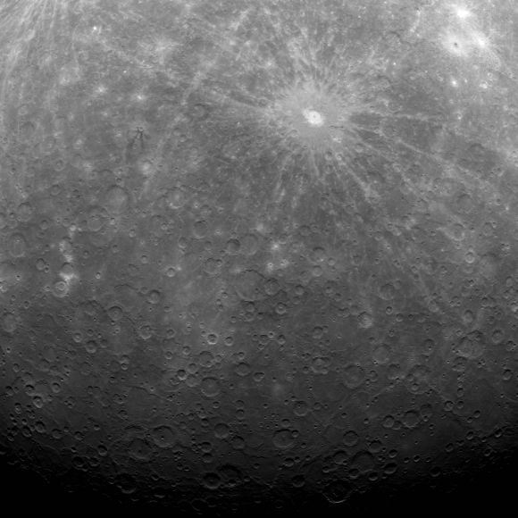
The Mercury Dual Imaging System (MDIS) team has posted a new image to the MESSENGER website approximately once per business day since March 29, 2011, when this first image of Mercury's surface obtained from orbit was made public.
The Mercury Dual Imaging System (MDIS) team has posted a new image to the MESSENGER website approximately once per business day since March 29, 2011, when this first image of Mercury’s surface obtained from orbit was made public.

“During this two-year period, MESSENGER’s daily web image has been a successful mechanism for sharing results from the mission with the public at large,” said Nancy Chabot, MDIS Instrument Scientist at the Johns Hopkins University Applied Physics Laboratory (APL). Chabot has been leading the release of web images since MESSENGER’s first flyby of Mercury in January 2008.

Read more: 5 Mercury Secrets Revealed by MESSENGER

“The first image I released was this one, as MESSENGER approached Mercury for the mission’s first Mercury flyby,” said Chabot. “Mercury was just a small crescent in the image, but it was still very exciting for me. We were obtaining the first spacecraft images of Mercury since Mariner 10 transmitted its final image in 1975, and this was just the beginning of the flood of images that followed.”

One of the first spacecraft images of Mercury since Mariner 10 transmitted its final image in 1975

The herculean effort involved in posting a new image every business day was made possible by a small team of scientists in addition to Chabot and Byrne, including APL’s David Blewett, Brett Denevi, Carolyn Ernst, Rachel Klima, Nori Laslo, and Heather Meyer.

“Creating images and captions for the MESSENGER Image Gallery has been fun and interesting,” Blewett said. “Working on a Gallery release gives me a chance take a break from my regular research and look all around Mercury’s surface for an image that the general public might find to be engaging from a scientific, artistic, or humorous perspective (and sometimes all three!).”

Watch: Take a Spin Around Mercury

“The posting of the 1,000th image of Mercury on our web gallery is a wonderful benchmark, but there’s much more to come,” adds MESSENGER Principal Investigator Sean Solomon of Columbia University’s Lamont-Doherty Earth Observatory. “MESSENGER’s altitude at closest approach is steadily decreasing, and in a little more than six months our spacecraft will be able to view Mercury at closer range than ever before with each orbit. Stay tuned!”

Source: MESSENGER news release

Image credits: NASA/Johns Hopkins University Applied Physics Laboratory/Carnegie Institution of Washington

MESSENGER (MErcury Surface, Space ENvironment, GEochemistry, and Ranging) is a NASA-sponsored scientific investigation of the planet Mercury and the first space mission designed to orbit the planet closest to the Sun. The MESSENGER spacecraft launched on August 3, 2004, and entered orbit about Mercury on March 17, 2011 (March 18, 2011 UTC).

This Black Stain On Mars Could Be Volcanic Leftovers

The dark material in Becquerel crater on Mars might have come from a volcanic eruption. Credit: ESA/DLR/FU Berlin (G. Neukum)

At first glance, it looks like somebody dropped a huge paint can on Mars, spilling black stuff all over Becquerel crater. That dark material, however, is likely blown from another location on the Red Planet. It could even be volcanic eruption remnants, the European Space Agency says.

A set of stunning new images of the spot in the Arabia Terra region — which straddles the so-called “transition zone” between the north and south regions of the planet — reveal a combination of probable effects from wind, water and perhaps even the tilt of the axis of Mars. These pictures came courtesy of ESA’s Mars Express, which is orbiting the planet.

The crater — named after French physicist Antoine Henri Becquerel, a co-discoverer of radioactivity — is 103 miles (167 kilometers) in diameter and sinks 2.2 miles (3.5 km) below the rest of the area. This depression might have held water at some point.

“The mound rises about 1 km [0.62 miles] above the crater floor and comprises hundreds of layers of light-toned sediments, each just a few metres thick, made of sulphate-bearing rocks,” ESA stated. “On Earth, sulphates are most often formed via the evaporation of water, so the presence of these minerals in Becquerel crater suggests that water may once have pooled here in a vast crater lake, before evaporating away.”

This view of Becquerel Crater on Mars shows the effects of wind on the Red Planet. Credit: ESA/DLR/FU Berlin (G. Neukum)

The mystery of Mars’ missing water is one that is still puzzling scientists — NASA’s Spirit, Curiosity and Opportunity rovers all found rocks that likely formed in the presence of water, and several spacecraft have spotted features that appear to be similar to riverbeds or perhaps even oceans.

“One popular theory is that large changes in the tilt of the rotational axis of Mars leads to significant changes in its climate, reflected in the thickness and repeating patterns found in the layers of sediment,” ESA added. “A change in the environmental conditions would affect the way in which the sediments were initially deposited, as well as their subsequent resistance to erosion.”

Speaking of sediments, the image above shows the dark material extending far beyond the crater walls, a sign of powerful winds on the Red Planet. Now who’s tempted to go down there with a shovel to see what’s underneath?

As a point of trivia, another spot in Arabia Terra (Vernal Crater) was once considered a possible landing site for Mars Curiosity because scientists found evidence of ancient hot springs on the Red Planet. On Earth, these locations are usually filled with bacterial life.

The topography of Becquerel crater on Mars. Credit: ESA/DLR/FU Berlin (G. Neukum)

How to See the Historic LADEE Nighttime Moon Shot on Sept. 6

Minotaur V rocket launch view as should be seen from atop the Empire State Building, NY, on Sept. 6, 2013 at 11:12 p.m. EDT - weather permitting.

Minotaur V rocket and LADEE spacecraft launch trajectory view as should be seen from atop the Empire State Building, NY, on Sept. 6, 2013 at 11:27 p.m. EDT – weather permitting.
See more launch trajectory viewing graphics below[/caption]

WALLOPS ISLAND, VA – An unprecedented spectacle is set to light up the skies this Friday night, Sept. 6, courtesy of NASA when America returns to the Moon with the history making nighttime launch of the LADEE lunar orbiter atop a retired and specially converted intercontinental ballistic missile (ICBM) from NASA’s Wallops Island facility on the Virginia shoreline.

Blastoff of NASA’s Lunar Atmosphere and Dust Environment Explorer (LADEE) Observatory atop the maiden flight of the powerful new Minotaur V rocket is slated for 11:27 p.m. EDT Sept. 6 from Launch Pad 0B along the Eastern Shore of Virginia at NASA Wallops.

Because it’s at night and lifting off from the most densely populated region of the United States, the flames spewing from the tail of Minotaur could be visible to tens of millions of distant spectators – weather permitting – who have never before witnessed such a rocket launch.

So you don’t have to be watching locally to join in the fun and excitement. And you can always watch the NASA TV webcast online on a smartphone or laptop.

Minotaur V rocket launch view as should be seen from Wright Brothers Memorial, Kitty Hawk, NC

The LADEE (pronounced ‘laddie’ not ‘lady’) launch is historic in many ways.

No space satellite has ever been launched to beyond Earth orbit from NASA’s Wallops’s launch base in Virginia, it’s the first flight to the Moon from Wallops, the first Minotaur V rocket launch based on the Peacekeeper missile, and it’s the first flight of the revolutionary new modular spacecraft design aimed at significantly cutting the cost of exploring space.

So although the very best views are available from local areas in Virginia, Maryland and Delaware just tens of miles away from the Wallops Island launch pad, magnificent viewing opportunities are available from a broad region up and down the East Coast and into the interior.

LADEE_Poster_01

Let’s look at some viewing maps courtesy of Orbital Sciences, the company responsible for assembling the Minotaur V and integrating it with the LADEE spacecraft – built by NASA’s Ames Research Center.

First up is the Maximum elevation map showing how high the rocket will be visible in degrees from the heavily populated US East Coast stretching from Maine to both Carolinas and into the industrial Midwest.

LADEE Minotaur V Launch – Maximum Elevation Map  The LADEE nighttime launch will be visible to millions of spectators across a wide area of the Eastern US -weather permitting. This map shows the maximum elevation (degrees above the horizon) that the Minotaur V rocket will reach during the Sep. 6, 2013 launch depending on your location along the US east coast. Credit: Orbital Sciences
LADEE Minotaur V Launch – Maximum Elevation Map
The LADEE nighttime launch will be visible to millions of spectators across a wide area of the Eastern US -weather permitting. This map shows the maximum elevation (degrees above the horizon) that the Minotaur V rocket will reach during the Sep. 6, 2013 launch depending on your location along the US east coast. Credit: Orbital Sciences

Herein are a series of graphics showing the Minotaur V trajectory and what you should see – during firings of the first three stages – from the perspective of standing on the ground or skyscrapers at a variety of popular destinations including the US Capitol, Lincoln Memorial, Kitty Hawk, NC, Atlantic City, NJ, New York City, Cape Cod and more.

US Capitol
US Capitol
Cape Cod, MA
Cape Cod, MA
Lincoln Memorial
Lincoln Memorial
New York City (Battery Park)

The five stage Minotaur V rocket stands 80.6 feet (24.6 meters) tall, is 7.6 feet (2.3 m) in diameter and weighs 197,034 pounds (89,373 kilograms.

The first three stages of the Minotaur V are based on the nuclear armed Peacekeeper ICBM intercontinental ballistic missile built during the Cold War – now retired and refurbished by Orbital for peaceful uses. It’s literally beating swords into plowshares.

The 5th stage is a new addition and what makes this Minotaur a new rocket class. The added thrust is precisely what enables shooting for the Moon.

Minotaur V rocket launch view as should be seen from Atlantic City, NJ

For anyone coming to the Wallops area for an eyewitness view of the launch, NASA worked with local officials to establish several viewing locations just 10 miles or so from the launch pad at the Mid-Atlantic Regional Spaceport, at NASA’s Wallops Flight Facility, Wallops Island, Va.

Visitors to the area may view the launch from Robert Reed Park on Chincoteague or Beach Road spanning the area between Chincoteague and Assateague Islands.

Both sites will feature a live countdown and broadcast and NASA personnel will be on hand to discuss the LADEE launch and goals of the mission.

A big-screen projector will broadcast live in Robert Reed Park beginning at 9:30 p.m.

“We’re excited about this partnership with the community in providing an enhanced launch experience to members of the public,” said Jeremy Eggers, public information officer for NASA Wallops in a statement. “The live countdown and launch broadcast will place people in mission control on launch night for what is already a historic mission for Wallops and the Eastern Shore.”

NASA TV starts a live broadcast of the launch at 9:30 p.m. on Sept 6 – available here: http://www.nasa.gov/ntv

Minotaur V rocket with NASA’s LADEE lunar orbiter unveiled at NASA Wallops launch pad.  Credit: NASA EDGE/Franklin Fitzgerald
Minotaur V rocket with NASA’s LADEE lunar orbiter unveiled at NASA Wallops launch pad. Credit: NASA EDGE/Franklin Fitzgerald

The couch sized 844 pound (383 kg) robotic explorer is equipped with 3 science instruments and a laser technology demonstrator.

These include an ultraviolet and visible light spectrometer that will gather detailed information about the composition of the tenuous lunar atmosphere; a neutral mass spectrometer to measure variations in the lunar atmosphere over time; a laser dust experiment that will collect and analyze dust particle samples; and a laser communications experiment that will test the use of lasers in place of radio waves for high speed data communications with Earth.

Be sure to watch for my continuing LADEE and Antares launch reports from on site at NASA’s Wallops Launch Pads in sunny Virginia – reporting for Universe Today.

Ken Kremer

…………….
Learn more about LADEE, Cygnus, Antares, MAVEN, Orion, Mars rovers and more at Ken’s upcoming presentations

Sep 5/6/16/17: “LADEE Lunar & Antares/Cygnus ISS Rocket Launches from Virginia”; Rodeway Inn, Chincoteague, VA

Oct 3: “Curiosity, MAVEN and the Search for Life on Mars – (3-D)”, STAR Astronomy Club, Brookdale Community College & Monmouth Museum, Lincroft, NJ, 8 PM

Oct 8: “LADEE Lunar & Antares/Cygnus ISS Rocket Launches from Virginia”; Princeton University, Amateur Astronomers Assoc of Princeton (AAAP), Princeton, NJ, 8 PM
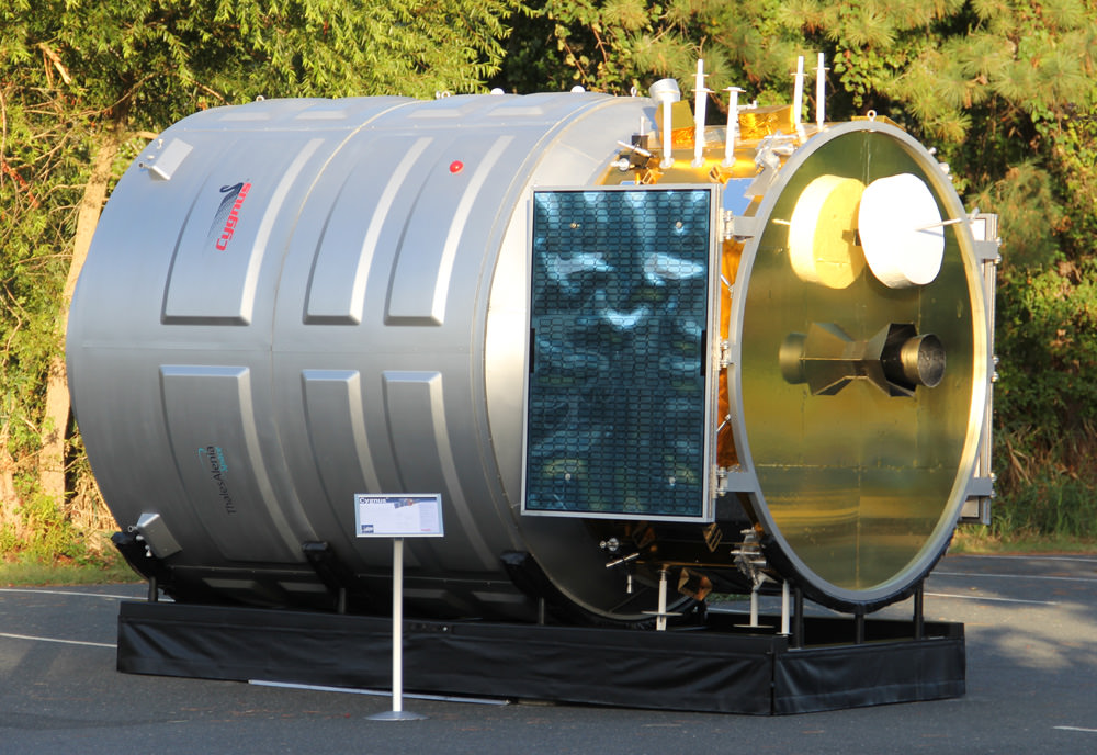
Close-up view of STAR 37FM 5th stage solid fuel motor of Minotaur V rocket at NASA Wallops rocket facility will propel LADEE into its lunar transfer orbit. Credit: Ken Kremer/kenkremer.com
LADEE’s Ticket to the Moon – 5th Stage of new Minotaur V rocket
Close-up view of STAR 37 5th stage solid fuel motor for inaugural Minotaur V rocket launch at NASA Wallops rocket facility will propel LADEE into its lunar transfer orbit. LADEE will be mounted on top and surrounded by the payload fairing attached at bottom ring. Credit: Ken Kremer/kenkremer.com

Historic Sept. 6 Virginia Moon Shot Heralds Revolutionary New Paradigm for Fundamental Science Query- NASA Director Interview

The LADEE satellite in lunar orbit. The revolutionary modular science probe is equipped with a Lunar Laser Communication Demonstration (LLCD) that will attempt to show two-way laser communication beyond Earth is possible, expanding the possibility of transmitting huge amounts of data. This new ability could one day allow for 3-D High Definition video transmissions in deep space to become routine. Credit: NASA

In an exclusive new interview with Universe Today, NASA’s Ames Research Center Director Pete Worden was “very excited” to discuss the historic Moon Shot set to launch NASA’s LADEE lunar orbiter from the Virginia coast and the NASA Wallops Island facility on Friday night, Sept. 6, that boasts “a new modular design” that can revolutionize how we explore our solar system “with robotic orbiters, landers and rovers” – and is aimed at “answering fundamental science questions.”

LADEE is the first in a new class of interplanetary exploration missions,” NASA Ames Director Worden told Universe Today. NASA Ames leads the LADEE mission. “It will study the pristine moon to study significant questions.”

“And it will demonstrate a new modular approach that will give us science at a lower cost. We are very excited.”

“It will tell us a lot about the moon,” Worden told me.

When America returns to the Moon with the LADEE spacecraft blasting off shortly before midnight Sept. 6, it could potentially be watched by many tens of millions of spectators – weather permitting – along the US East Coast stretching from Maine to the Carolina’s and into parts of the Midwest. See launch visibility map below.

LADEE Minotaur V Launch - Maximum Elevation Map This map shows the maximum elevation (degrees above the horizon) that the Minotaur V rocket will reach during the Sep. 6, 2013 launch depending on your location along the US east coast. Credit: Orbital Sciences
LADEE Minotaur V Launch – Maximum Elevation Map
The LADEE nighttime launch will be visible to millions of spectators across a wide area of the Eastern US -weather permitting. This map shows the maximum elevation (degrees above the horizon) that the Minotaur V rocket will reach during the Sep. 6, 2013 launch depending on your location along the US east coast. Credit: Orbital Sciences

And the science timing for LADEE’s lunar mission is just perfect as well since several countries and corporations are gearing up to dispatch a batch of new orbiters and landers to Earth’s nearest neighbor that could change its character forever.

“This is probably our last best chance to study the pristine Moon before there is a lot of human activity there changing things.”

The purpose of LADEE’s trio of science instruments is to collect data that will inform scientists in unprecedented detail about the ultra thin lunar atmosphere, environmental influences on lunar dust and conditions near the surface.

Engineers from NASA's Ames Research Center have successfully completed launch preparation activities for blastoff of NASA's Lunar Atmosphere and Dust Environment Explorer (LADEE) observatory on Sept. 6. The revolutionary modular science probe has been encapsulated into the nose-cone of the maiden Minotaur V rocket at NASA's Wallops Flight Facility.  Credit:  NASA Ames
Engineers from NASA’s Ames Research Center have successfully completed launch preparation activities for blastoff of NASA’s Lunar Atmosphere and Dust Environment Explorer (LADEE) observatory on Sept. 6. The revolutionary modular science probe has been encapsulated into the nose-cone of the maiden Minotaur V rocket at NASA’s Wallops Flight Facility. Credit: NASA Ames

The couch sized probe is built on a ‘modular common spacecraft bus’, or body, that could be implemented on space probes to explore a wide variety of targets in the solar system.

“We think the modular bus is a winner,” Worden explained to Universe Today.

“LADEE could lead to other low cost missions to orbit and even land on the Moon, near Earth asteroids, Mercury and also the moons of Mars.”

“The LADEE bus is a strong contender for future NASA planetary missions, especially landers on bodies with a tenuous atmosphere. And small micro-rovers are possible too. We are really proud of it!”

A computer-generated model of the LADEE spacecraft based on the modular common spacecraft bus. Credit: NASA/Ames

LADEE is NASA’s first ever planetary mission to launch from the Eastern Shore of Virginia at NASA’s Wallops Flight Facility on Wallops Island. The blastoff is expected to draw large crowds. Some local hotels are already sold out.

The Lunar Atmosphere and Dust Environment Explorer (LADEE) Observatory is NASA’s next mission to the Moon.

It thunder’s to space at 11:27 p.m. Friday, Sept. 6, from launch complex 0B at NASA’s Wallops Island facility and the Mid-Atlantic Regional Spaceport (MARS) atop the maiden flight of the new, solid fueled Minotaur V rocket developed by Orbital Sciences Corp.

Close-up view of STAR 37FM 5th stage solid fuel motor of Minotaur V rocket at NASA Wallops rocket facility will propel LADEE into its lunar transfer orbit. Credit: Ken Kremer/kenkremer.com
LADEE’s Ticket to the Moon – 5th Stage of new Minotaur V rocket
Close-up view of STAR 37 5th stage solid fuel motor for inaugural Minotaur V rocket launch at NASA Wallops rocket facility will propel LADEE into its lunar transfer orbit. LADEE will be mounted on top and surrounded by the payload fairing attached at bottom ring. Credit: Ken Kremer/kenkremer.com

The goal of the $280 Million mission is to gain a thorough understanding of long-standing unknowns about the tenuous atmosphere, dust and surface interactions that will help scientists understand other planetary bodies as well.

“After Apollo, the amazing thing is that we opened as many questions as we answered,” said Worden. “One of the key issues is – What is the environment on the Moon’s surface from the lunar day to the lunar night?”

“And what are the limitations that would place on our activities there?”

“Although the moon has a tenuous atmosphere it’s actually very active and interacts very strongly with the solar wind. It may produce something that on Earth we would call a ‘dust storm’.”

“We also wish to have the ‘ground truth’ [measurements] of the Moon’s environment before humans change things.”

And change is inexorably coming to the Moon rather soon.

“The Chinese plan to land on the Moon by year’s end,” Worden elaborated.

“What we found during Apollo is that an artificial disturbance very considerably changes the Moon’s atmosphere – or exosphere.”

“So we really want to known the pristine state of the lunar exosphere before its changed by human activity.”

“The data we have from Apollo surface measurements shows that it took many months for the lunar exosphere to go back to its pristine state.”

“Now there are probably a half dozen to a dozen programs planning to land on the Moon in the next decade. So we may never see the Moon’s pristine state again!”

“So these are pretty significant questions that we will have an opportunity to answer with LADEE.”

LADEE Science Instrument locations

LADEE is the first spacecraft of any kind that’s been designed, developed, built, integrated and tested at NASA’s Ames Research Center in Moffett Field, Calif.

“This is our first complete mission built out at Ames,” Worden explained.

“It’s also the first of a new paradigm where we are trying to develop a low cost modular bus design.

The approach on LADEE was to make it a mix and match modular bus – rather than a singular modular bus.

“So we have modular slices that use a propulsion stage, lander stage, communications stage, science payload stage, bus housekeeping stage and more,” Worden told me.

“In the past many others tried to build a ‘one size fits all’ modular bus. But it turns out that one size does NOT fit all needs.”

“So we took a page from how you build desktop computers.”

“We put in different modules that you can expand or subtract much more easily without changing the whole fundamental architecture or design.”

“So assuming this works well, I think you will see a lot more missions. And that makes it really exciting as our first mission.”

And the Ames modular bus has definitely sparked entrepreneurial interest.

“The bus is already an approach being used by at least one of the Google Lunar X-Prize competitors! The Moon Express team has looked at it a lot to transition that capability to them,” Worden explained.

How about future NASA missions?

“The LADEE bus is also a key part of several of our Ames proposals for future planetary missions,” Worden replied.

“The original design concept about seven years ago was for a small lunar lander. The lander propulsion would likely be a solid fueled stage.”

“Ultimately, NASA decided to go with the orbiter instead. And that showed the strength of the modular bus design – that it was very easy to change it from a lunar lander to the LADEE mission orbiter studying the lunar exosphere.”

I asked if it could deploy a small rover too?

“Yes- a small, micro rover is possible, perhaps 10 to 20 inches in size. And you could pack a lot of science on the small rover using today’s technology!

The Modular Common Spacecraft Bus lander configuration in a hover test in 2008. The lander could be used to deploy micro-rovers. Credit: NASA

Thus there are numerous exploration possibilities – all dependent on the Federal budget for NASA in this extremely difficult fiscal environment.

NASA Ames had “built parts and spacecraft components and science instruments before, but not a spacecraft in the entirety and in house,” Worden told Universe Today.

For example, a few years back Ames built the LCROSS lunar impacting spacecraft that smashed into the Moon’s south pole and discovered a treasure trove of water ice.

LCROSS piggybacked as a secondary science mission payload onto NASA’ s Lunar Reconnaisannce Orbiter (LRO) when the duo launched from Cape Canaveral, Florida atop an Atlas V rocket.

NASA Ames has now taken the next step – having designed and built the whole LADEE spacecraft from beginning to end.

“This is our first real baby. It’s very exciting,” beamed Worden.

“LADEE is a pretty phenomenal mission.”

They say “Virginia is for Lovers’

Well coming this Friday, “Virginia is for Space Lovers too!”

Chris Angulo, LADEE Program Engineering manager of Orbital Sciences, and Ken Kremer of Universe Today inspect the 4th and 5th stages of maiden Minotaur V rocket propelling NASA’s LADEE spacecraft to the Moon on Sept. 6 from NASA Wallops in Virginia. Credit: Ken Kremer/kenkremer.com

And remember that NASA has a 2nd historic launch from Wallops slated for Sep. 17 – with blastoff of the Orbital Sciences Antares rocket and Cygnus cargo carrier bound for its 1st flight to the International Space Station (ISS).

Be sure to watch for my continuing LADEE and Antares mission reports from on site at NASA’s Wallops Launch Pads in sunny Virginia – reporting for Universe Today.

Ken Kremer

…………….
Learn more about LADEE, Cygnus, Antares, MAVEN, Orion, Mars rovers and more at Ken’s upcoming presentations

Sep 5/6/16/17: “LADEE Lunar & Antares/Cygnus ISS Rocket Launches from Virginia”; Rodeway Inn, Chincoteague, VA, 8 PM

Oct 3: “Curiosity, MAVEN and the Search for Life on Mars – (3-D)”, STAR Astronomy Club, Brookdale Community College & Monmouth Museum, Lincroft, NJ, 8 PM

Oct 9: “LADEE Lunar & Antares/Cygnus ISS Rocket Launches from Virginia”; Princeton University, Amateur Astronomers Assoc of Princeton (AAAP), Princeton, NJ, 8 PM
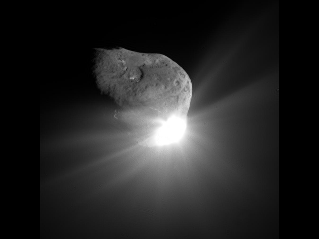
Close Up Side view of NASA Ames built LCROSS lunar impactor. NASA Ames LADEE orbiter is equipped with the UVS science instrument  based on LCROSS heritage.  Credit: Ken Kremer/kenkremer.com
Close Up Side view of NASA Ames built LCROSS lunar impactor. NASA Ames LADEE orbiter is equipped with the UVS science instrument based on LCROSS heritage. Credit: Ken Kremer/kenkremer.com

Are We Martians? Chemist’s New Claim Sparks Debate

Are Earthlings really Martians ? Did life arise on Mars first and then journey on meteors to our planet and populate Earth billions of years ago? Earth and Mars are compared in size as they look today.

Are Earthlings really Martians ?
Did life arise on Mars first and then journey on rocks to our planet and populate Earth billions of years ago? Earth and Mars are compared in size as they look today. NASA’s upcoming MAVEN Mars orbiter is aimed at answering key questions related to the habitability of Mars, its ancient atmosphere and where did all the water go.
Story updated[/caption]

Are Earthlings really Martians?

That’s the controversial theory proposed today (Aug. 29) by respected American chemist Professor Steven Benner during a presentation at the annual Goldschmidt Conference of geochemists being held in Florence, Italy. It’s based on new evidence uncovered by his research team and is sure to spark heated debate on the origin of life question.

Benner said the new scientific evidence “supports the long-debated theory that life on Earth may have started on Mars,” in a statement. Universe Today contacted Benner for further details and enlightenment.

“We have chemistry that (at least at the level of hypothesis) makes RNA prebiotically,” Benner told Universe Today. “AND IF you think that life began with RNA, THEN you place life’s origins on Mars.” Benner said he has experimental data as well.

First- How did ancient Mars life, if it ever even existed, reach Earth?

On rocks violently flung up from the Red Planet’s surface during mammoth collisions with asteroids or comets that then traveled millions of miles (kilometers) across interplanetary space to Earth – melting, heating and exploding violently before the remnants crashed into the solid or liquid surface.

An asteroid impacts ancient Mars and send rocks hurtling to space - some reach Earth
An asteroid impacts ancient Mars and send rocks hurtling to space – some reach Earth. Did they transport Mars life to Earth? Or minerals that could catalyze the origin of life on Earth?

“The evidence seems to be building that we are actually all Martians; that life started on Mars and came to Earth on a rock,” says Benner, of The Westheimer Institute of Science and Technology in Florida. That theory is generally known as panspermia.

To date, about 120 Martian meteorites have been discovered on Earth.

And Benner explained that one needs to distinguish between habitability and the origin of life.

“The distinction is being made between habitability (where can life live) and origins (where might life have originated).”

NASA’s new Curiosity Mars rover was expressly dispatched to search for environmental conditions favorable to life and has already discovered a habitable zone on the Red Planet’s surface rocks barely half a year after touchdown inside Gale Crater.

Furthermore, NASA’s next Mars orbiter- named MAVEN – launches later this year and seeks to determine when Mars lost its atmosphere and water- key questions in the Origin of Life debate.

Curiosity accomplished Historic 1st drilling into Martian rock at John Klein outcrop on Feb 8, 2013 (Sol 182) and discovered a habitable zone, shown in this context mosaic view of the Yellowknife Bay basin taken on Jan. 26 (Sol 169). The robotic arm is pressing down on the surface at John Klein outcrop of veined hydrated minerals – dramatically back dropped with her ultimate destination; Mount Sharp. Credit: NASA/JPL-Caltech/Ken Kremer-kenkremer.com/Marco Di Lorenzo

Of course the proposed chemistry leading to life is exceedingly complex and life has never been created from non-life in the lab.

The key new points here are that Benner believes the origin of life involves “deserts” and oxidized forms of the elements Boron (B) and Molybdenum (Mo), namely “borate and molybdate,” Benner told me.

“Life originated some 4 billion years ago ± 0.5 billon,” Benner stated.

He says that there are two paradoxes which make it difficult for scientists to understand how life could have started on Earth – involving organic tars and water.

Life as we know it is based on organic molecules, the chemistry of carbon and its compounds.

But just discovering the presence of organic compounds is not the equivalent of finding life. Nor is it sufficient for the creation of life.

And simply mixing organic compounds aimlessly in the lab and heating them leads to globs of useless tars, as every organic chemist and lab student knows.

Benner dubs that the ‘tar paradox’.

Although Curiosity has not yet discovered organic molecules on Mars, she is now speeding towards a towering 3 mile (5 km) high Martian mountain known as Mount Sharp.

Curiosity Spies Mount Sharp - her primary destination. Curiosity will ascend mysterious Mount Sharp and investigate the sedimentary layers searching for clues to the history and habitability of the Red Planet over billions of years.  This mosaic was assembled from over 3 dozen Mastcam camera images taken on Sol 352 (Aug 2, 2013. Credit: NASA/JPL-Caltech/MSSS/ Marco Di Lorenzo/Ken Kremer
Curiosity Spies Mount Sharp – her primary destination
Curiosity will ascend mysterious Mount Sharp and investigate the sedimentary layers searching for clues to the history and habitability of the Red Planet over billions of years. This mosaic was assembled from over 3 dozen Mastcam camera images taken on Sol 352 (Aug 2, 2013. Credit: NASA/JPL-Caltech/MSSS/ Marco Di Lorenzo/Ken Kremer-kenkremer.com

Upon arrival sometime next spring or summer, scientists will target the state of the art robot to investigate the lower sedimentary layers of Mount Sharp in search of clues to habitability and preserved organics that could shed light on the origin of life question and the presence of borates and molybdates.

It’s clear that many different catalysts were required for the origin of life. How much and their identity is a big part of Benner’s research focus.

“Certain elements seem able to control the propensity of organic materials to turn into tar, particularly boron and molybdenum, so we believe that minerals containing both were fundamental to life first starting,” says Benner in a statement. “Analysis of a Martian meteorite recently showed that there was boron on Mars; we now believe that the oxidized form of molybdenum was there too.”

The second paradox relates to water. He says that there was too much water covering the early Earth’s surface, thereby causing a struggle for life to survive. Not exactly the conventional wisdom.

“Not only would this have prevented sufficient concentrations of boron forming – it’s currently only found in very dry places like Death Valley – but water is corrosive to RNA, which scientists believe was the first genetic molecule to appear. Although there was water on Mars, it covered much smaller areas than on early Earth.”

Parts of ancient Mars were covered by oceans, lakes and streams of liquid water in this artists concept, unlike the arid and bone dry Martian surface of today. Subsurface water ice is what remains of Martian water.

I asked Benner to add some context on the beneficial effects of deserts and oxidized boron and molybdenum.

“We have chemistry that (at least at the level of hypothesis) makes RNA prebiotically,” Benner explained to Universe Today.

“We require mineral species like borate (to capture organic species before they devolve to tar), molybdate (to arrange that material to give ribose), and deserts (to dry things out, to avoid the water problem).”

“Various geologists will not let us have these [borates and molybdates] on early Earth, but they will let us have them on Mars.”

“So IF you believe what the geologists are telling you about the structure of early Earth, AND you think that you need our chemistry to get RNA, AND IF you think that life began with RNA, THEN you place life’s origins on Mars,” Benner elaborated.

“The assembly of RNA building blocks is thermodynamically disfavored in water. We want a desert to get rid of the water intermittently.”

I asked Benner whether his lab has run experiments in support of his hypothesis and how much borate and molybdate are required.

“Yes, we have run many lab experiments. The borate is stoichiometric [meaning roughly equivalent to organics on a molar basis]; The molybdate is catalytic,” Benner responded.

“And borate has now been found in meteorites from Mars, that was reported about three months ago.

At his talk, Benner outlined some of the chemical reactions involved.

Although some scientists have invoked water, minerals and organics brought to ancient Earth by comets as a potential pathway to the origin of life, Benner thinks differently about the role of comets.

“Not comets, because comets do not have deserts, borate and molybdate,” Benner told Universe Today.

The solar panels on the MAVEN spacecraft are deployed as part of environmental testing procedures at Lockheed Martin Space Systems in Littleton, Colorado, before shipment to Florida 0on Aug. 2 and blastoff for Mars on Nov. 18, 213. Credit: Lockheed Martin
MAVEN is NASA’s next Mars orbiter and seeks to determine when Mars lost its atmosphere and water- key questions in the Origin of Life debate. MAVEN is slated to blastoff for Mars on Nov. 18, 2013. It is shown here with solar panels deployed as part of environmental testing procedures at Lockheed Martin Space Systems in Waterton, Colorado, before shipment to Florida in early August. Credit: Lockheed Martin

Benner has developed a logic tree outlining his proposal that life on Earth may have started on Mars.

“It explains how you get to the conclusion that life originated on Mars. As you can see from the tree, you can escape that conclusion by diverging from the logic path.”

Finally, Benner is not one who blindly accepts controversial proposals himself.

He was an early skeptic of the claims concerning arsenic based life announced a few years back at a NASA sponsored press conference, and also of the claims of Mars life discovered in the famous Mars meteorite known as ALH 84001.

“I am afraid that what we thought were fossils in ALH 84001 are not.”

The debate on whether Earthlings are really Martians will continue as science research progresses and until definitive proof is discovered and accepted by a consensus of the science community of Earthlings – whatever our origin.

On Nov. 18, NASA will launch its next mission to Mars – the MAVEN orbiter. Its aimed at studying the upper Martian atmosphere for the first time.

“MAVENS’s goal is determining the composition of the ancient Martian atmosphere and when it was lost, where did all the water go and how and when was it lost,” said Bruce Jakosky to Universe Today at a MAVEN conference at the University of Colorado- Boulder. Jakosky, of CU-Boulder, is the MAVEN Principal Investigator.

MAVEN will shed light on the habitability of Mars billions of years ago and provide insight on the origin of life questions and chemistry raised by Benner and others.

Ken Kremer

…………….
Learn more about Mars, the Origin of Life, LADEE, Cygnus, Antares, MAVEN, Orion, Mars rovers and more at Ken’s upcoming presentations

Sep 5/6/16/17: “LADEE Lunar & Antares/Cygnus ISS Rocket Launches from Virginia”; Rodeway Inn, Chincoteague, VA, 8 PM

Oct 3: “Curiosity, MAVEN and the Search for Life on Mars – (3-D)”, STAR Astronomy Club, Brookdale Community College & Monmouth Museum, Lincroft, NJ, 8 PM

Oct 9: “LADEE Lunar & Antares/Cygnus ISS Rocket Launches from Virginia”; Princeton University, Amateur Astronomers Assoc of Princeton (AAAP), Princeton, NJ, 8 PM
Iran Releases Plans for Manned Spacecraft

An graphic released of an Iranian space capsule capable of carrying humans to space. Via ISNA.

After Iran launched a monkey in a suborbital rocket earlier this year, they are now setting their sights on sending humans to orbit, according to the Iranian news agency ISNA. The news release says researchers at the University of Haj Nasir “have designed and built a manned spacecraft,” but only images of basic designs were released.

The spacecraft appears to be a classic capsule design, and is capable of carrying “one to three people to lower orbits for several hours. This type of aircraft is made up of several modules.”

The researchers, Leila Khalajzadeh and Mehran Shams, were reported as saying in their presentation that the capsule design is the most economical type of spacecraft.

The Israeli news site Hayadan reports that Tal Inbar, head of the Space and UAV Research Center at Fisher Institute for Air and Space Strategic Studies in Israel, says that no technical data was released from Iran on the new spacecraft designs, nor have they provided information about the launch vehicle required to send the capsule to space.

According to details released earlier by the Iranian space agency, they want to launch the first sub-orbital spaceflight with an Iranian on board by 2016 at an altitude below 200 kilometers as preparation for the eventual orbital spaceflight.

Iranian participation in the future Chinese space station program has also been discussed.

Reportedly, much of Iran’s technological equipment derives from modified Chinese and North Korean technology. In 2008, Iran successfully launched a two-stage all solid-fuel sub-orbital sounding rocket called the Kavoshgar-1 (Explorer-1), for the first sub-orbital test flight from the Shahroud space launch complex. Later, in 2010-2013, at least three animal flight tests were sent on suborbital launches, some flights with outright failures, others with varying degrees of success.

Sources: ISNA, Hayadan