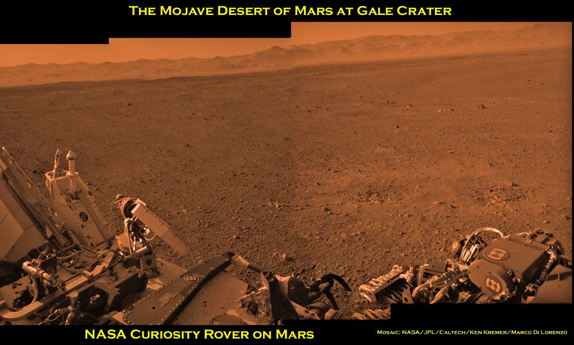
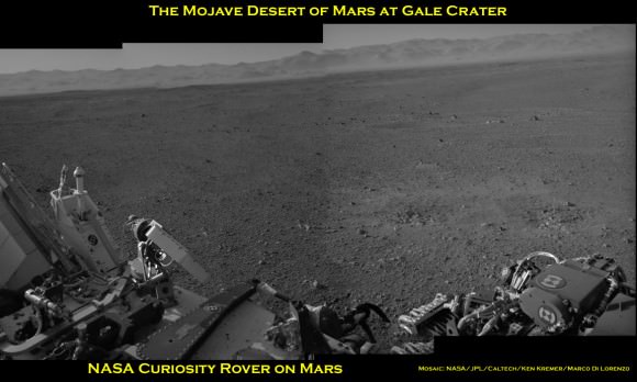
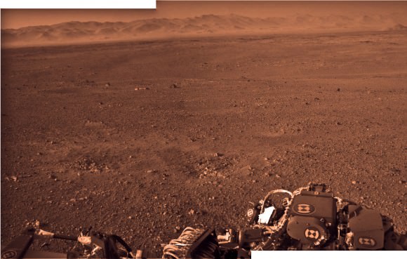
Image Caption: Curiosity and the Mojave Desert of Mars at Gale Crater North Rim, False Color Mosaic. This false color panoramic mosaic shows Curiosity in the foreground looking to the eroded rim of Gale Crater in the background. Visible at left is a portion of the RTG nuclear power source, low gain antenna pointing up, then the deployed High Gain antenna and other components of the rover deck. This mosaic was assembled from the three new full resolution Navcam images returned by Curiosity overnight and snapped on Sol 2 on Aug. 8. Image stitching by Ken Kremer and Marco Di Lorenzo. Topsoil at right foreground has been excavated by the descent landing thrusters to expose what the team believes is bedrock. See black and white version below. Credit: NASA/JPL-Caltech/Ken Kremer/Marco Di Lorenzo
Curiosity lead scientist John Grotzinger calls this place “The Mojave Desert” of Mars– that’s the sweet spot where NASA’s huge new Curiosity rover landed only 3 Sols, or days ago, and looks so “Earth-like”.
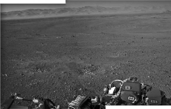
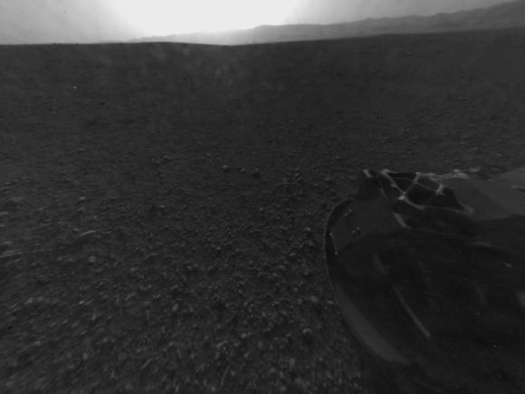
See above and below our new 3 frame panoramic mosaic showing Curiosity with a dramatic “Mojave Desert” backdrop – in false color and black and white – assembled from new pictures received overnight at JPL.
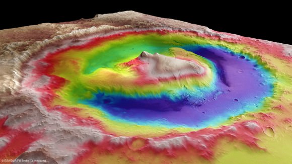
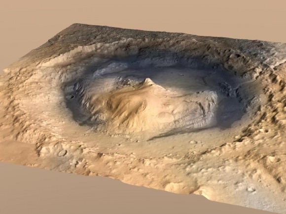
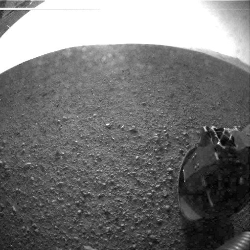
With her camera mast erected, Curiosity is beginning to beam back a flood of spectacular images and giving us the first detailed view of her new surroundings from her touchdown point inside Gale Crater on Mars beside a 3.4 mile (5.5 km) high layered mountain nicknamed Mount Sharp.
Overnight, Curiosity sent back many more full frame pictures from her Navcam navigation camera, including exquisite high resolution views of herself with the eroded rim of Gale Crater over her shoulder.
At Wednesday’s briefing, Grotzinger has ecstatic with the initial set of high resolution images showing Gale crater in the distance, saying;
“The thing that really struck the science team about this image, you would really be forgiven for thinking that NASA was trying to pull a fast one on you and we actually put a rover out in the Mojave Desert and took a picture.
“That’s the part of the rim that’s lowest in elevation, facing the northern lowlands of Mars.”
“The thing that’s amazing about this is to a certain extent the first impression you get is how earth-like this seems, looking at that landscape.”
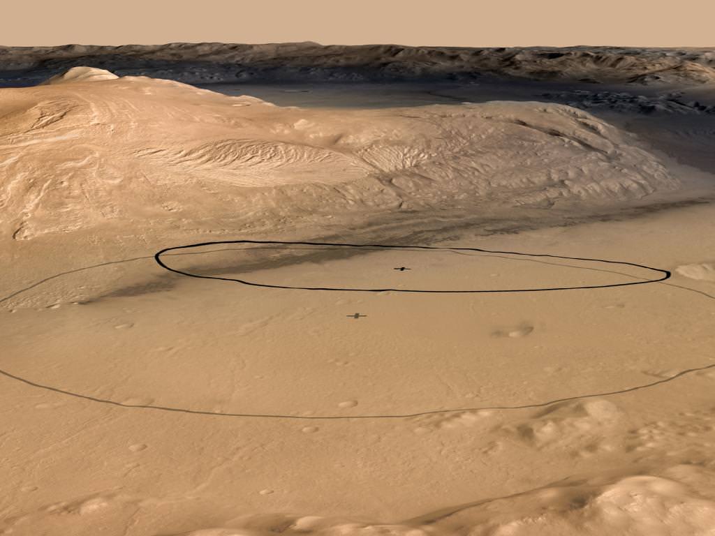
The terrain is strewn with small pebbles that the team hypothesizes may stem from a nearby alluvial fan through which liquid water flowed long ago and is exactly why they chose Gale Crater as Curiosity’s landing site.
“The sedimentary materials, all those materials are derived from erosion of those mountains there, that’s the source region for this material,” Grotzinger said. “It’s really kind of fantastic.”
The first 360 color panorama from the Mastcam cameras are expected soon.
Image Caption: Curiosity and the Mojave Desert of Mars at Gale Crater North Rim. This false color panoramic mosaic shows Curiosity in the foreground looking to the eroded rim of Gale Crater in the background. Visible at left is a portion of the RTG nuclear power source, low gain antenna pointing up, then the deployed High Gain antenna and other components of the rover deck. This mosaic was assembled from the three new full resolution Navcam images returned by Curiosity overnight. Processing by Ken Kremer and Marco Di Lorenzo. Topsoil at right foreground has been excavated by the descent landing thrusters to expose what the team believes is bedrock. Credit: NASA/JPL-Caltech/Ken Kremer/Marco Di Lorenzo
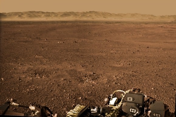
Image Caption: Looking to Martian bedrock and Gale Crater North Rim, False Color- This two frame mosaic was assembled from the first two full resolution Navcam images returned by Curiosity on Sol 2 (Aug 8) and enhanced and colorized to bring out further details. Image sticthing and processing by Ken Kremer and Marco Di Lorenzo. Topsoil in the foreground has been excavated by the Sky crane descent landing thrusters to expose what the team believes is bedrock. Credit: NASA/JPL-Caltech/Ken Kremer/Marco Di Lorenzo – www.kenkremer.com

![PIA16011[1]](https://www.universetoday.com/wp-content/uploads/2012/08/PIA160111-580x74.jpg)
![673969main_PIA15993-43_full[1]](https://www.universetoday.com/wp-content/uploads/2012/08/673969main_PIA15993-43_full1-580x435.jpg)
![PIA14294_Sumner1_curiosity_landing_site[1]](https://www.universetoday.com/wp-content/uploads/2012/08/PIA14294_Sumner1_curiosity_landing_site1-580x326.jpg)
