Opportunity Rover Heads for Spirit Point to Honor Dead Martian Sister; Science Team Tributes

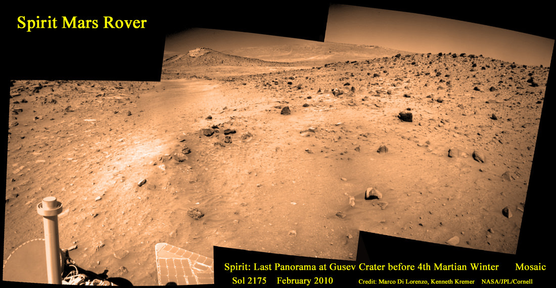
Spirit’s last panoramic from Mars was taken during February 2010 before her death. Featured on Astronomy Picture of the Day (APOD) on 30 May 2011. Spirit’s final panoramic picture show from Mars was snapped on Sol 2175 in February 2010 before entering hibernation mode in March 2010 just prior to the onset of her 4th Martian winter. Spirit was just 500 feet from her next science target - dubbed Von Braun – center of the mosaic. The Columbia Hills form the backdrop to the mosaic from Spirits final resting place. Spirit never awoke. NASA ceased all communications attempts with Spirit on May 25, 2011. Credit: Mosaic by Marco De Lorenzo and Ken Kremer, images NASA/JPL/Cornell University.

[/caption]

Scientists leading NASA’s Mars rover team have selected “Spirit Point” as the name for the spot where the “Opportunity” Mars rover will arrive at her next destination – Endeavour Crater. The site was named in honor of the death of the “Spirit” Mars Exploration Rover, which NASA recently declared has ceased all communications with Earth.

Spirit’s passing comes after more than six highly productive years roving the surface of the red planet as humankind’s surrogate. NASA concluded the last attempt to communicate with Spirit in a transmission on May 25, 2011.

“First landfall at Endeavour will be at the southern end of Cape York [at Spirit Point],” Steve Squyres told me. Squyres of Cornell University, Ithaca, N.Y., is principal investigator for the rovers.
Read tributes from the Spirit rover science team below.

In memory of Spirit, the last panorama she snapped on Sol 2175 in February 2010 was featured on Astronomy Picture of the Day (APOD) on May 30, 2011 and is the lead image here. The photo mosaic was created by Marco Di Lorenzo and Ken Kremer and shows some of the last scenes that Spirit ever photographed.
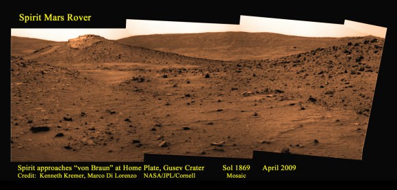
Spirit approaches von Braun mound in April 2009
This mosaic of images was collected on Sol 1869 in April 2009 as Spirit approached a mysterious circular volcanic mound known as Von Braun, at left. Foreground at center, left ahead shows where Spirit became stuck in a concealed sand trap of slippery, water related sulfate minerals lying adjacent to the eroded volcanic plateau named Home Plate. Columbia Hills in the background.
Mosaic Credit: Kenneth Kremer/Marco Di Lorenzo/NASA/JPL/Cornell

Endeavour’s massive rim consists of a series of ridges. Cape York is a 400 foot wide (120 meters) rim fragment at the western edge of Endeavour. Opportunity should reach “Spirit Point” before the end of this year, 2011.

“Spirit Point” was chosen as the site at Endeavour to commemorate the scientific achievements of Opportunity’s twin sister “Spirit”. Endeavour Crater was determined to be Opportunity’s long term destination nearly three ago after she departed the environs of Victoria crater.

“The Initial exploration plan will be decided when we get closer. The [science] priorities will depend on what we find,” Squyres added.

Since August 2008, the blistering pace of Opportunity’s long overland trek of about 11 miles (18 kilometers) has brought the golf cart sized robot to within about 2 miles (3 kilometers) of the rim of the humongous Endeavour crater – some 14 miles (22 kilometers) in diameter. Endeavour is more than 20 times wider than Victoria crater and by far the largest feature the Opportunity will ever explore – see route maps below.
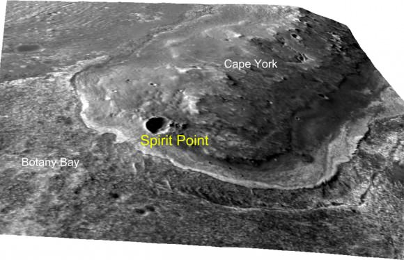
This oblique view with moderate vertical exaggeration shows the portion of the rim of Endeavour crater given the informal name "Spirit Point." This is the location where the team operating NASA's Mars Exploration Rover Opportunity plans to drive the rover to its arrival at the Endeavour rim. As of mid-June 2011, Opportunity was about 2 miles away from the rim of Endeavour. Credit: NASA/JPL-Caltech/Univ. of Arizona

“Spirit achieved far more than we ever could have hoped when we designed her,” according to Squyres in a NASA statement. “This name will be a reminder that we need to keep pushing as hard as we can to make new discoveries with Opportunity. The exploration of Spirit Point is the next major goal for us to strive for.”

The imaging team of Marco Di Lorenzo and Ken Kremer created a series of Spirit photomosaics from publically available images to illustrate the location and hazardous nature of Spirits final resting place – which fortuitously turned out to be a scientific goldmine revealing new insights into the flow of liquid water on Mars billions of years ago.

Mosaic of microscopic images of Spirit’s underbelly on Sol 1925 in June 2009
Mosaic shows predicament of being stuck at Troy with wheels buried in the sulfate-rich Martian soil. This false color mosaic has been enhanced and stretched to bring out additional details about the surrounding terrain and embedded wheels and distinctly shows a pointy rock perhaps in contact with the underbelly.
Mosaic Credit: Marco Di Lorenzo/ Kenneth Kremer/NASA/JPL/Cornell

The western rim of Endeavour possesses geological deposits far older than any Opportunity has investigated before and which may feature environmental conditions that were more conducive to the potential formation of ancient Martian life forms.

Spirits last transmissions to Earth took place in March 2010, before she entered hibernation mode due to ebbing solar power and succumbed to the likely damaging effects of her 4th Martian winter.

Spirit was closing in on her next science target, a mysterious volcanic feature named Von Braun, when she became mired in a sand trap named “Troy” on the outskirts of the eroded volcano named “Home Plate, just about 500 feet away. See our mosaics.
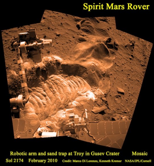
Spirit embedded at sand trap in February 2010 on Sol 2174
Numerous attempts by the rover team failed to extricate Spirit from the sand trap at Troy in which she became mired in May 2009 on the western edge of Home Plate. Mosaic shows last robotic arm maneuver before hibernation and above bright toned soil containing hydrated sulfates. Mosaic Credit: Marco Di Lorenzo/ Kenneth Kremer/ NASA/JPL/Cornell

Unable to escape and absent of sufficient power to run critical survival heaters, Spirit experienced temperatures colder than ever before that probably crippled fragile electronics components and connections and prevented further communications – although no one knows for sure.

NASA’s twin rovers Spirit and Opportunity have been exploring the Martian terrain on opposite sides of the red planet since the dynamic duo successfully landed over 7 years ago in January 2004.

Both robots were expected to last just three months but have accumulated a vast bonus time of exploration and discovery in numerous extended mission phases.

*** Several top members of the rover science team kindly provided me some comments (below) to sum up Spirits achievements and legacy and what’s ahead for Opportunity at Endeavour.

Ray Arvidson of Washington University, St Louis, Deputy Principal Investigator for the rovers:

“Spirit’s last communication with Earth was in March 2010 as the southern hemisphere winter season began to set in, the sun was low on the horizon, and the rover presumably stopped communicating to use all available solar power to charge the batteries.

Von Braun was one of the two destinations Spirit was traveling to when the rover became embedded in soft sands in the valley to the west of Home Plate.

Von Braun is a conically-shaped hill to the south of Home Plate, Inner Basin, Columbia Hills. Goddard is an oval-shaped shallow depression to the west of von Braun and was the second area to be visited by Spirit. Both von Braun and Goddard are suspected to be volcanic features.
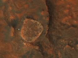
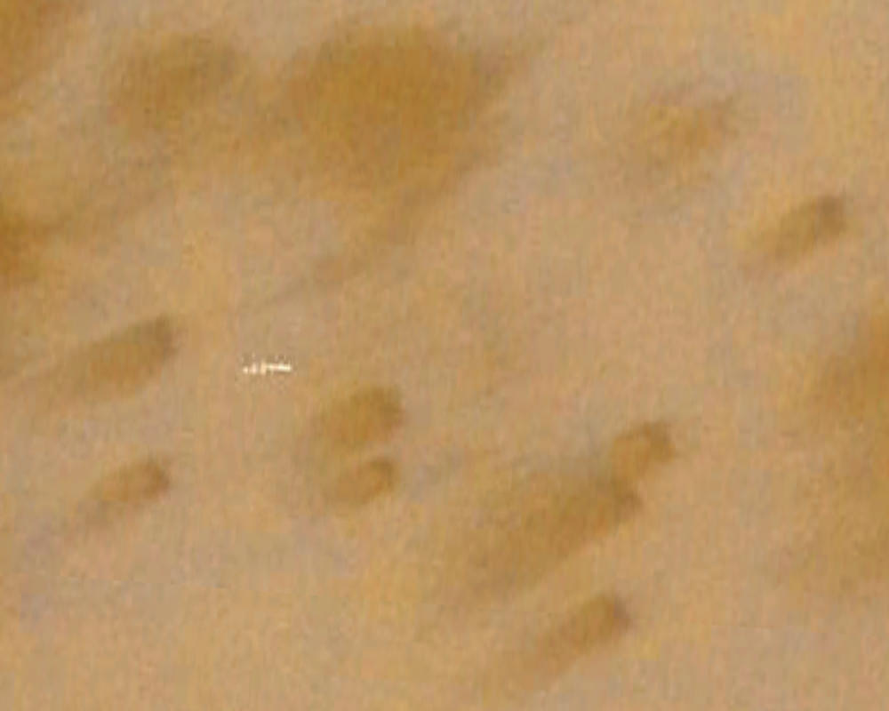
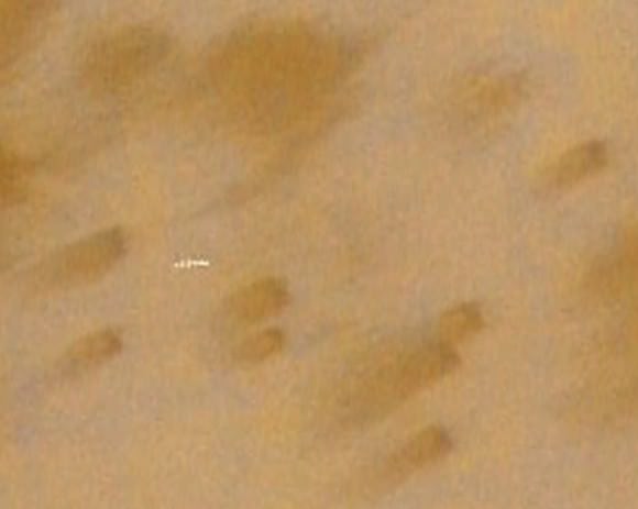
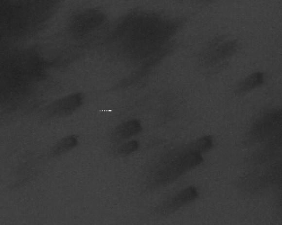
Spirit is the brightest spot in this image taken on 31 March 2011 from Mars orbit. Spirit is gleaming in the sun beside Home Plate inside Gusev Crater. The solar panels are not covered by an optically thick layer of dust. Spirit last communicated on 22 March 2010. Credit: NASA/JPL/UA

During Spirit’s six year and two month mission the vehicle acquired remote sensing and in-situ observations that conclusively demonstrated that the ancient Columbia Hills in Gusev Crater expose materials that have been altered in water-related environments, including ground water corrosion and generation of sulfate and opaline minerals in volcanic steam vents and perhaps hydrothermal pools.

Together with its sister rover, Opportunity, the Mars Exploration Rover Mission, was designed to “follow the water” and return data that would allow us to test the hypothesis that water was at and near the surface during previous epochs.

Opportunity is still exploring the evidence in Meridiani for ancient shallow lakes and is on the way to outcrops on the rim of Endeavour crater, a ~20 km wide crater that exposes the old Noachian crust that shows evidence from orbital data for hydrated clay minerals.

These two rovers have performed far beyond expectations, unveiled the early, wet history of Mars, and have made an enormous scientific return on investment.”

Steve Squyres of Cornell University, Ithaca, N.Y., Principal Investigator for the rovers:
“Our best hope for hearing from Spirit was last fall. When that didn’t happen, we began a long, careful process of trying every possible approach to re-establishing contact. But it slowly became clear that it was unlikely, and I personally got used to the idea that Spirit’s mission was probably over several months ago.

Once that right front wheel failed, Spirit’s days were numbered in that kind of terrain. It wouldn’t have made any difference if we had tried to move Spirit sooner. We were very lucky to have survived as long as we did.

One of the lessons learned is to try to keep the wheels from failing.

It’s very sad to lose Spirit. But two things have softened the blow. First we’ve had a long time to get used to the idea. Second, even though Spirit is dead, she died an honorable death. If we’d lost her early in the mission, before she accomplished so much, it would have been much harder. But she accomplished so much more than any of us expected, the sadness is very much tempered with satisfaction and pride.

The big scientific accomplishments are the silica deposits at Home Plate, the carbonates at Comanche, and all the evidence for hydrothermal systems and explosive volcanism. What we’ve learned is that early Mars at Spirit’s site was a hot, violent place, with hot springs, steam vents, and volcanic explosions. It was extraordinarily different from the Mars of today.

Opportunity is heading at high speed for the rim of Endeavour Crater. First landfall will be at the southern end of Cape York. She should be there in not too many more months.

It hasn’t yet been decided where Opportunity will attempt to climb up Endeavour… we’ll see when we get there.

The phyllosilicates are a high priority, but the top priority depends on what we find.
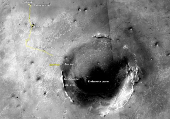
The yellow line on this map shows where NASA's Mars Rover Opportunity has driven from the place where it landed in January 2004 -- inside Eagle crater, at the upper left end of the track -- to a point about 2.2 miles (3.5 kilometers) away from reaching the rim of Endeavour crater. Credit: NASA/JPL-Caltech/MSSS

I hope Spirits legacy will be the inspiration that people, especially kids, will take away from Spirit’s mission. I have had long, thoughtful conversations about Spirit with kids who have had a rover on Mars as long as they can remember. And my fondest hope for Spirit is that somewhere there are kids who will look at what we did with her, and say to themselves “well, that’s pretty cool… but I bet when I grow up I can do better. That’s what we need for the future of space exploration.

Spirit existed, and did what she did, because of the extraordinary team of engineers and scientists who worked so hard to make it possible. It’s a team that I’m incredibly proud to have been a small part of. Working with them has been quite literally the adventure of a lifetime.”

Jim Bell of Arizona State University, lead scientist for the rovers Pancam stereo panoramic camera:

“It is with a bittersweet sense of both sadness and pride that NASA announced the official end of the mission for the Mars Exploration Rover Spirit.

The Spirit team has seen the end coming since communications were lost with the rover in March 2010. Mission engineers made heroic efforts to reestablish contact. In the end Spirit was conquered by the extremely cold Martian winter and its two broken wheels, which prevented its dusty solar panels from pointing toward the Sun.

But what a mission! Designed to last 90 days, Spirit kept going for more than six years, with the team driving the rover almost 5 miles (8 km) across rocky volcanic plains, climbing rugged ancient hills, and scurrying past giant sand-dune fields. It eventually spent most of the mission near the region known as Home Plate, which is full of layered, hydrated minerals.

Data from the rover enabled dozens of scientific discoveries, but three stand out to me as most important:

Hydrated sulfate and high-silica soils in the Columbia Hills and around Home Plate.
These minerals, and the environment in which they occur (Home Plate is a circular-shaped, finely layered plateau that may be the eroded remains of a volcanic cone or other hydrothermal deposit), tell us that at some point in the past history of Gusev there was liquid water and there were heat sources — two key ingredients needed to consider the area habitable for life as we know it.

Carbonate minerals in some of the rocks within the Columbia Hills.
Carbonates were expected on Mars, if indeed the climate was warmer and wetter in the past. However, their detection has been elusive so far. Indeed, the Spirit team had to work hard to uncover the signature of carbonates years after the rover made the measurements. As the analysis continues the results for Mars in general could be profound.

An incredible diversity of rock types, from all over Mars, that Spirit was able to sample in Gusev crater.
Some of the rocks appear to be from local volcanic lava flows or ash deposits. But others have likely been flung in to the area over time by distant impacts or volcanoes, and a few even appear to be meteorites, flung in from outer space. Spirit’s instruments provided the team with the ability to recognize this amazing diversity, and thus to learn much more about Mars in general, not just Gusev in particular.

Spirit also helped us test an experiment: If we put all the rover’s images out on the Web for everyone in the world to see, in near real-time, would people follow along? They did!

I wonder if, maybe 10 or 15 years from now, I’ll meet some young colleagues who were turned on to space exploration by being able to check out the latest Spirit images from Mars from their classroom, or living room, every day when they were a kid. That would be extremely satisfying — and a great testament to the power of openly sharing data from space exploration missions like Spirit’s.

Meanwhile, Opportunity continues to rove on to city-size Endeavour crater, where orbital measurements have identified, for the first time in either rover’s mission, the signatures of clay minerals in the crater’s rim. Clays are also formed in water, but in less acidic, perhaps more life-friendly water than the sulfates that Opportunity has been mapping thus far.”

Rob Manning, Jet Propulsion laboratory, Pasadena, CA., Mars Rover Spacecraft System Engineering team lead
“Although Opportunity has proven her endurance, Spirit was the one we struggled with the hardest to get what she earned. Suffering from late repair and modification, a blown fuse in her power system and with possibly damaged circuits, she was very late getting out the door and onto the pad in Florida.

Unlike Opportunity, whose Hematite-laden Meridiani destination had been established long before launch, Spirit was launched with a great deal of uncertainty on where she would find herself on Mars. Would it be the flat and safe plains of Elysium? Would the intriguing but rough ancient Gusev crater with what appears to have been an ancient river flowing into a giant but now dry lake?

If Opportunity failed to get on her way to Mars, would her destination become Meridiani? Would Spirit have also been as lucky to find herself bouncing into a tiny rock-outcropped crater as Opportunity had?

Only after the successful launch of Opportunity followed by further successful rocket and airbag tests to confirm that the landing system design would work in the rougher terrain inside Gusev crater allowed us to seal her fate and her permanent home.

She would go Gusev and test the Gusev lake hypothesis. Sadly the surface of Gusev where she came to rest revealed a meteor impact-tilled lake of ancient lava. Any signs of ancient water lake beds and other fantastic discoveries would have to wait until she surmounted many more obstacles including summiting a formidable hill her designers never intended her to attempt.

Spirit, her designers, her builders, her testers, her handlers and I have a lot to be thankful for.

That NASA, the congress and the public were willing to trust us with this daunting feat is perhaps a statement about the persistent spirit of discovery that remains in all of us.

I think that Spirit is alive and well.”
Map mosaic shows 7 Year and 30 Kilometer Long Journey of Opportunity approaching Endeavour Crater. Opportunity is being targeted to Spirit Point on the rim of Endeavour Crater, to honor her now dead sister. Photo mosaic of Santa Maria crater at top right was featured on Astronomy Picture of the Day on 29 January 2011. Mosaic shows Opportunity self portrait at the rim of Santa Maria where she investigated signatures of hydrated mineral deposits.
Mosaic Credit: NASA/JPL/Cornell/Marco Di Lorenzo/Kenneth Kremer

Proof! Bio Station Alpha is Just an Image Artifact

The streak on Google Mars misinterpreted as a secret Mars base.

[/caption]

It’s time for another episode of “Conspiracy Theory of the Week.” This one involves a supposed secret space station on Mars. The You Tube video showing “Bio Station Alpha” (below) went viral and was even reported on some mainstream media outlets. The station is supposedly a 700 ft x 150 ft structure on Mars and by some accounts is colored white with blue and red stripes. It was found on Google Mars by an “armchair astronaut” and breathless conspiracy bloggers have touted this as the most important discovery on Mars yet, and “proof!” that NASA is hiding their activities.

In reality, this is not a space station, a Mars base or any type of structure – created or natural — on the surface of the Red Planet. What shows up in this location on Google Mars is just a smattering of about 11 bad pixels from data dropout – a linear streak artifact likely caused by a cosmic ray hitting the Mars Express spacecraft while it was taking the image – and then that smudge has been badly distorted through image processing when it became part of Google Mars.

“This looks like a cosmic ray hit,” said Tanya Harrison, planetary scientist on the science operations team for the Mars Reconnaissance Orbiter Context Camera (CTX) and Mars Color Imager (MARCI) at Malin Space Science Systems. “We see these from time to time in the MARCI data from MRO.”

Here’s the image that is seen on Google Mars after processing, which includes very noticeable compression artifacts:

And now here’s the original image taken by the Mars Express High Resolution Stereo Camera image (H5620_0000_ND), taken on May 18, 2008 (and here’s the link to the original image):

Original Mars Express HRSC image of the location in question on Mars. Credit: ESA

This image really makes it clear this is an image artifact from a cosmic ray hit.

Here’s the same location taken by the MRO Context Camera (CTX) on January 25, 2010 (a crop of the same location as seen above from the original large CTX image, available here):

MRO's Context Camera (CTX) image MRO CTX B17_016407_2528_XN_72N029W of the same location. Credit: MSSS

In this image, each pixel represents a distance of about 6.25 meters, a higher resolution than what is available from the Mars Express spacecraft, which takes images at 10 meters per pixel. Obviously, there is no structure or anything unusual at that location, except for the northern polar sand dunes.

Harrison explained that the CTX acquires grayscale (black & white) images at 6 meters per pixel scale over a swath 30 kilometers wide and provides context images for the MRO HiRISE and CRISM cameras, which can take even higher resolution images. It is used to monitor changes occurring on the planet, and help the science team select critical science targets. The team at Malin Space Science Systems pores over the images looking for anything unusual. In this case, at this location, they found nothing.

“Every day, the images we acquired with CTX and MARCI the previous day are inspected by multiple sets of eyes,” Harrison told Universe Today. “We look at every single image for multiple reasons: checking the health of the instrument, monitoring weather conditions for future targeting of the cameras, and looking for anything geologically interesting.”

Harrison added that nearly all the operations folks on the team have Master’s degrees or Ph.D.s in geology or a related field.

“If we spot anything out of the ordinary, we look at previous images of the area, not just from CTX and MARCI, but from the Mars Global Survery’s Mars Orbiter Camera, the THEMIS VIS and IR on the Mars Odyssey spacecraft, the HRSC on Mars Express, and Viking,” Harrison said. “This lets us look at the features at different illumination angles, times of day, resolutions, etc. We know better than to speculate on something below the resolution of our cameras, so if we see something in CTX that’s worth following up on at a higher resolution, we ask HiRISE to shoot it. The same thing was true for MOC, following up on things observed in the low-resolution wide angle images with high-resolution narrow angle images.”

Clearly, this region has been imaged and examined previously, with absolutely nothing found by the top experts in the field. The region is so uninteresting that no one has requested for HiRISE — which can take images of 1-2 meters per pixel — to take any images of this area.

Harrison said CTX takes images of Mars that are up to 30 km wide and over 300 km long at a very high resolution. “This is a pretty big footprint with a relatively high resolution compared to previous cameras!” she said. “The size of that footprint has allowed us to cover over 60% of Mars at 6 meters per pixel in the 5 years MRO has been orbiting Mars. In addition to mapping, we use CTX to acquire stereo coverage of key areas, as well as to monitor hundreds of locations on Mars for changes such as new impact craters and dust activity.”

If there were something unusual on Mars, the people at NASA, ESA, MSSS and anyone monitoring Mars would have imaged this site repeatedly with the best cameras available. They would love to find something unusual, groundbreaking and front-page worthy, and if they did would be shouting it from the rooftops, not hiding it.

You can hear Harrison talk about how the images taken by the various Mars orbiters require meticulous planning, on the June 1, 2011 episode of 365 Days of Astronomy.

MSSS is comprised of several small groups which all contribute to designing, building, and operating cameras on orbiters and rovers at other planets.

If you want to see the image artifact on Google Mars, here are the coordinates: 71 49’19.73?N 29 33’06.53?W

And, if you must, here’s the video by David Martinez:

A Chang’e-2 Space…

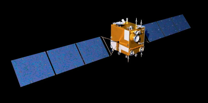
Chang'e 2 satellite artist realization

[/caption]

On June 9, Chang’e-2, China’s second Moon orbiter, left our nearest astronomical neighborhood and headed out into the solar system. It had successfully completed its missions by April 1 and, thanks to its longevity, had enough fuel in reserve to continue exploring. According to China’s State Administration of Science,Technology and Industry for National Defence (SASTIND), making the trip into outer space from the Moon’s orbit is the major step from five remaining tasks assigned to the diminutive satellite.

“It’s the first time in the world for a satellite to be set off from the Moon in remote outer space,” said Zhou Jianliang, deputy chief engineer of the Chang’e-2 measure and control system of the Beijing Aerospace Control Center (BACC).

China’s technological developments are leaping ahead. While controlling a mission to the Moon 400,000 km away from the Earth is challenging enough, attempting to command a spacecraft from 1.5 million km presents a huge milestone in measure and control, telecommunications, data transaction and orbit design.

Before flying away, Chang’e-2 finished two additional tasks as of May 23. Its first was to take snapshots of the lunar northern and southern pole and the second was to descend into perilune orbit, about 15 km away from the surface. This time to take high-resolution images of the Sinus Iridum – the proposed landing ground for future Moon missions. The completion of satellite’s tasks has Chinese scientists smiling and hoping things continue well towards the end of next year.

“We are developing outer space measure and control stations in outer space and they will be capable to carry out tasks by the end of the second half next year,” said an SASTIND scientist, who declined to be named. “At that time, the satellite can be used to test the two stations’ functions.”

But the road ahead for Chang’e-2 isn’t going to be an easy one, simply because the satellite wasn’t designed to do what it is now doing. Extended distances mean unexpected problems with communication and control, but the little “Moon Goddess” just may be up to the task.

Original Story Source: China News.

NASA Releases Spectacular Portrait Photos of Endeavour Docked at the ISS from Soyuz and Paolo Nespoli

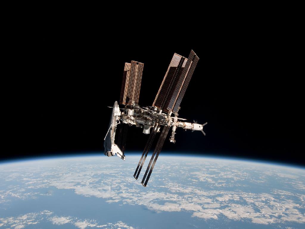
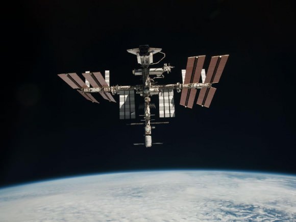
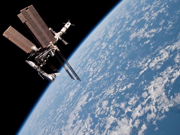
First Ever Portrait of the International Space Station and docked Shuttle Endeavour from Soyuz capsule. This image of the International Space Station and the docked Space Shuttle Endeavour, flying at an altitude of 220 miles was taken by Expedition 27 crew member Paolo Nespoli from the Soyuz TMA-20 following its undocking on May 23, 2011. It is the first-ever image of a space shuttle docked to the International Space Station. Endeavour at left. European ATV cargo carrier at right. Credit: NASA/Paolo Nespoli

[/caption]

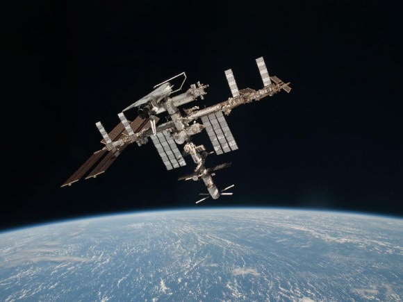
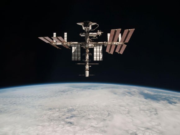
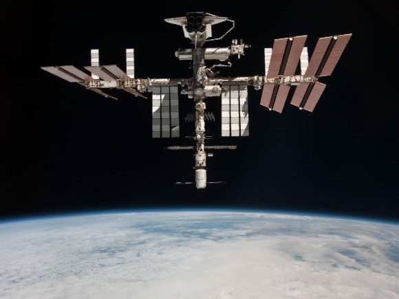
NASA has at last today (June 7) released the spectacular portrait photos of Endeavour docked at the International Space Station (ISS). These are are the first ever images taken of a space shuttle while still attached to the orbiting lab complex from the perspective of a crewed Russian Soyuz spacecraft.

The breathtaking digital images were captured by Italian astronaut Paolo Nespoli on May 23 through a window inside the Soyuz TMA-20 vehicle as he and two crewmates were departing the ISS for their return trip to Earth.

Story Update: Check out the expanded photo gallery of more awesome images released by NASA later today

The ISS/Shuttle stack and Soyuz were flying at an altitude of 220 miles as the Soyuz undocked with Nespoli, Russian cosmonaut Dmitry Kondratyev and NASA astronaut Cady Coleman. After they were about 600 feet away, Mission Control Moscow commanded the ISS to rotate 130 degrees to give a full view of the entire complex from the side.

Nespoli then had about 30 minutes to capture high resolution digital photos and videos of Space Shuttle Endeavour docked to the orbiting lab for the very last time in the midst of her 16 day long final mission; STS-134.

The Soyuz trio landed safely in Kazakhstan later that day.

The imagery was to have been made public a day or two after the landing. But Nespoli accidentally left the SD data cards behind in the Soyuz vehicle, causing them to processed more slowly as part of routine post flight analysis.

Space Shuttle Endeavour and ISS Portrait Photo Gallery

First Ever Portrait of the International Space Station and docked Shuttle Endeavour from Soyuz capsule
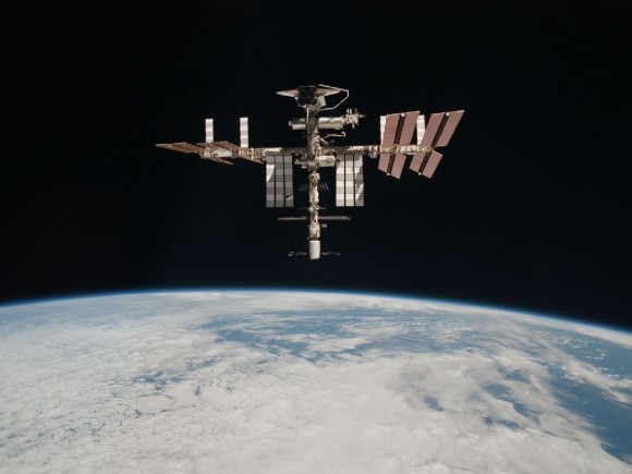
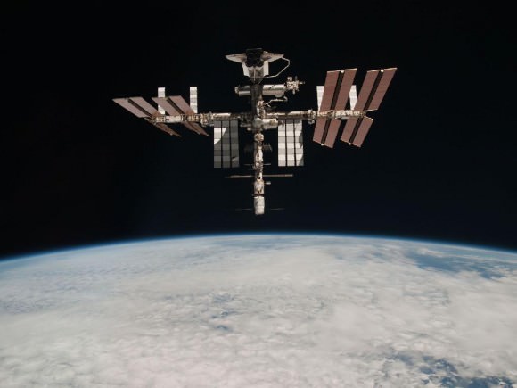
This image of the International Space Station and the docked Space Shuttle Endeavour, flying at an altitude of 220 miles was taken by Expedition 27 crew member Paolo Nespoli from the Soyuz TMA-20 following its undocking on May 23, 2011 (USA time). It is the first-ever image of a space shuttle docked to the International Space Station. Endeavour at top. European ATV cargo carrier at bottom. Credit: NASA/Paolo Nespoli

First ever images of docked Shuttle Endeavour and the ISS from perspective of a Soyuz spacecraft. Credit: NASA/Paolo Nespoli

NASA’s expanding photo gallery here:

Read my earlier features about the portrait photos of Endeavour and the ISS here:
Spectacular Soyuz Photo Gallery shows Unprecedented View Of Shuttle Docked at Station
Ultimate ISS + Shuttle + Earth Photo Op Coming on May 23 from Soyuz and Paolo Nespoli

Read my features about the final mission of Endeavour, STS 134, starting here
STS-134 Shuttle Commander Mark Kelly appears at U2360° Concert in Seattle: Music Video
Era of Space Shuttle Endeavour Ends with June 1 landing at the Kennedy Space Center

STS-134 Shuttle Commander Mark Kelly appears at U2360° Concert in Seattle: Music Video

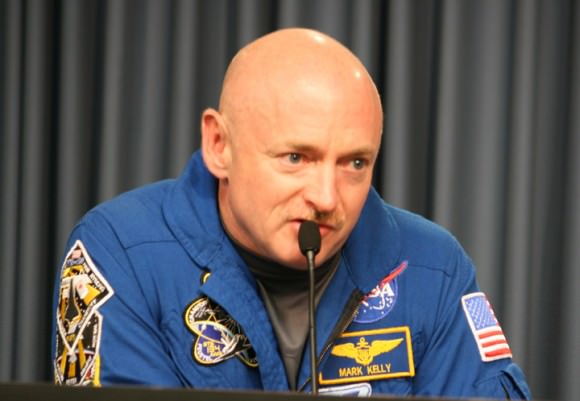
STS-134 Space Shuttle Commander Mark Kelly inside the Cupola dome at the International Space Station. Kelly places a special message for the U2360° concert crowd, floating at will in the weightlessness of space. Credit: NASA

Check out this out-of-this-world surprise delivered by the rock band U2 to their concert audience at Quest Field, Seattle U2 on the night of June 4;

A video message from STS-134 Shuttle Commander Mark E. Kelly – From the Official U2 YouTube Website

According to the website, “Bono dedicated ‘Beautiful Day’ to Gabby Giffords, before asking, “Imagine a man looking down on us from 200 miles up. Looking down at our beautiful crowded planet… What would he say to us…? What is on your mind Commander Kelly?”

Kelly recorded a special message for his wife, Gabby Giffords, while he was floating inside the Cupola Observation Dome aboard the International Space Station during the STS-134 mission which landed safely on June 1 at the Kennedy Space Center.

“Hello Seattle… from the International Space Station.”

Before finishing on a line from David Bowie’s ‘Space Oddity’ : “I’m looking forward to coming home. Tell my wife I love her very much… she knows,” said Kelly

[/caption]

U2 has collaborated with NASA since their 2009 world tour to “include a dialogue between the band and the crew of the International Space Station.”

U2360° has worked with NASA and the International Space Station throughout this tour – having previously linked up with Belgian astronaut Commander Frank De Winne, Michael Barratt of NASA, Bob Thirsk of the Canadian Space Agency, Koichi Wakata of the Japan Aerospace Exploration Agency, and Gennady Padalka and Roman Romanenko of the Russian Federal Space Agency as well as Cirque du Soleil founder Guy Laliberte during his visit to the International Space Station.

“Working with U2 is atypical for NASA,” said Bill Gerstenmaier, NASA’s associate administrator for Space Operations in a NASA statement. “By combining their world tour with the space station’s out-of-this-world mission, more people — and different people than our normal target audiences — learned about the International Space Station and the important work we are doing in orbit.”

Be sure to check out this longer video version – and listen to the cheering crowd

Bono Intro to Beautiful Day with Commander Mark Kelly – U2 – Seattle, WA – June 4, 2011

STS-134 Space Shuttle Commander Mark Kelly. Credit: Ken Kremer

Read my features about the final mission of Endeavour, STS 134, starting here
Era of Space Shuttle Endeavour Ends with June 1 landing at the Kennedy Space Center

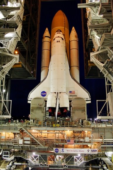
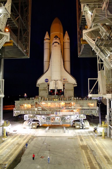
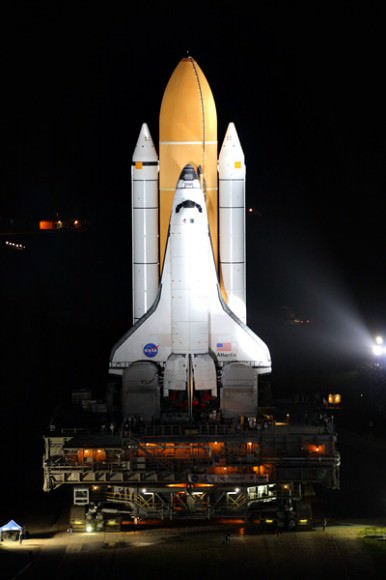
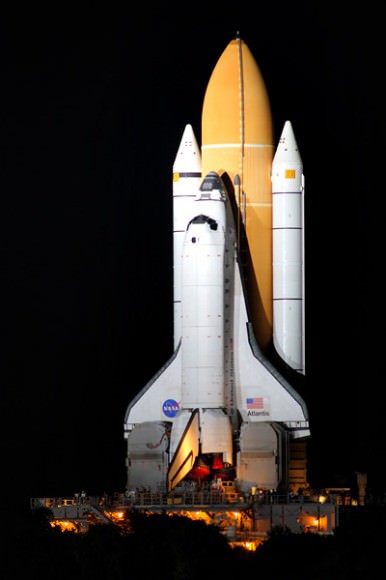
Last Ever Shuttle Journeys out to the Launch Pad; Photo Gallery

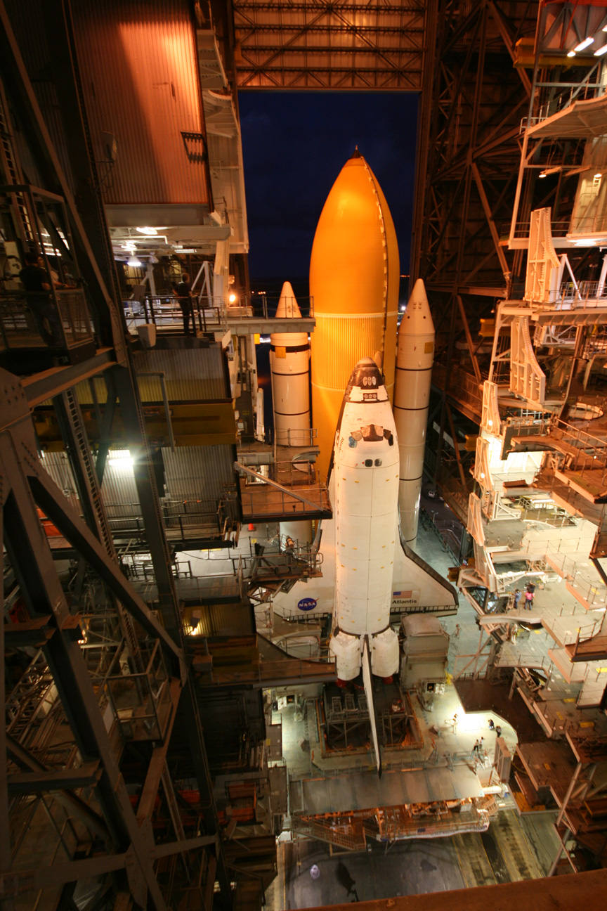
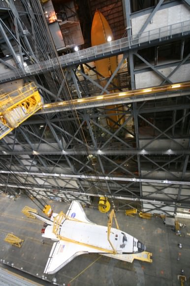
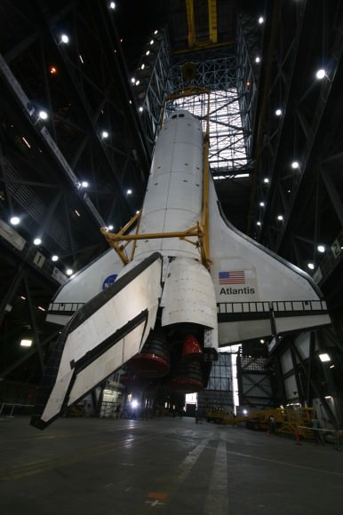
Atlantis begins final Journey from the VAB to Launch Pad 39A for July 8 blastoff. Credit: Ken Kremer

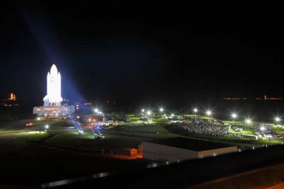
[/caption]KENNEDY SPACE CENTER – The last shuttle that will ever blast to space has journeyed from the cavernous Vehicle Assembly Building out to the launch pad at NASA’s Kennedy Space Center (KSC) in Florida in anticipation of liftoff on July 8 at 11:38 a.m.

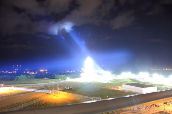
It was a proud and bittersweet moment for all the shuttle team members from top to bottom as Space Shuttle Atlantis was rolling out overnight to Launch Pad 39 A, at the same time that Space Shuttle Endeavour was plunging into Earth’s atmosphere for the scorching reentry and landing back at the shuttle landing strip at KSC.

Thousands of NASA and contractor employees and their families had been given special passes to witness the dramatic nighttime sojourn of Atlantis in a morale booster event as she emerged from inside the VAB on her way to the pad for what will be the grand finale of the 30 year long Space Shuttle Program.

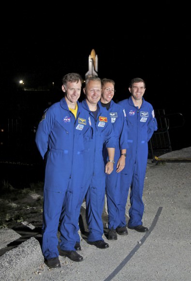
STS-135 Crew during final rollout of Shuttle Atlantis to Launch Pad 39 A at the Kennedy Space Center
STS-135 Commander Chris Ferguson, left, Pilot Doug Hurley, and Mission Specialists Sandy Magnus and Rex Walheim talk to media as their vehicle, space shuttle Atlantis, makes its final journey from the Vehicle Assembly Building to Launch Pad 39A at KSC in Florida.
Credit: Chase Clark
I was privileged to watch and photograph Atlantis final journey from inside the VAB and the roof of the Launch Control Center (LCC). The LCC is the brain which commands and controls every aspect of Shuttle Launch operations.

The 12 day STS-135 mission will deliver the Raffaello logistic module to the International Space Station (ISS) which is loaded with critical spare parts, crew supplies and science gear that will be transferred to the massive orbiting outpost. Raffaello is a multipurpose logistics module built in Italy.

The STS-135 mission is a bonus for the shuttle program and was only officially added to the manifest in January 2011 as NASA sought funding from the Obama Administration and the US Congress.

The all veteran four person crew is led by Shuttle Commander Christopher Ferguson. He is joined by Pilot Doug Hurley and Mission Specialists Sandy Magnus and Rex Walheim.

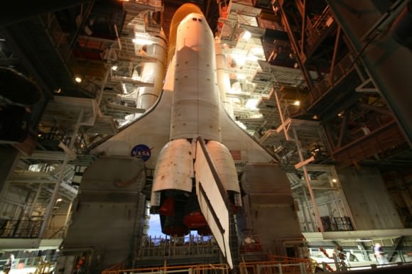
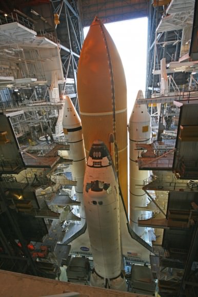
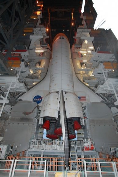
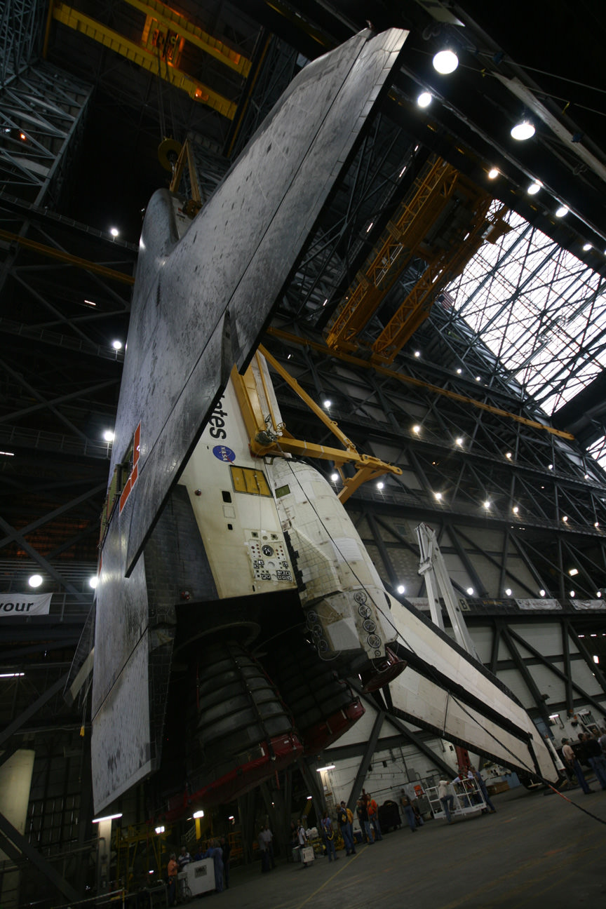
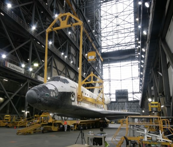
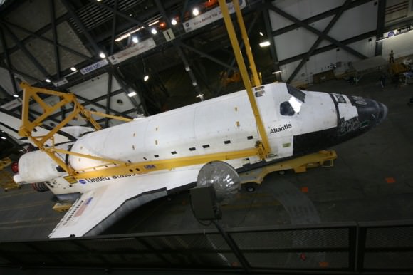
Atlantis in High Bay 1 inside the Vehicle Assembly Building. Credit: Ken Kremer
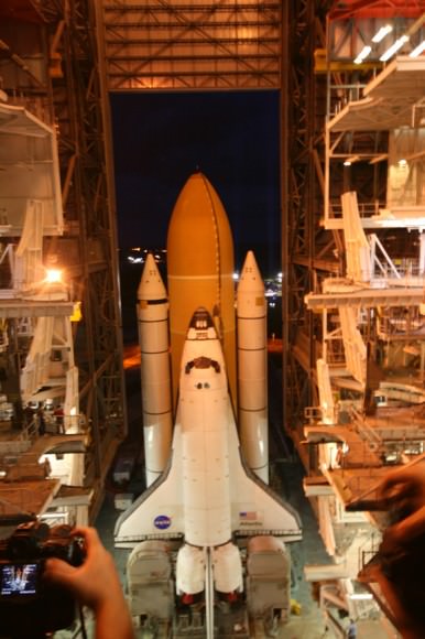
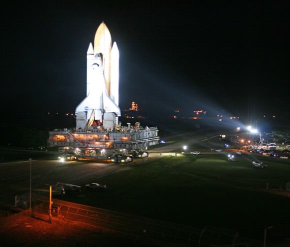
Atlantis final journey to Launch Pad 39A. Credit: Ken Kremer
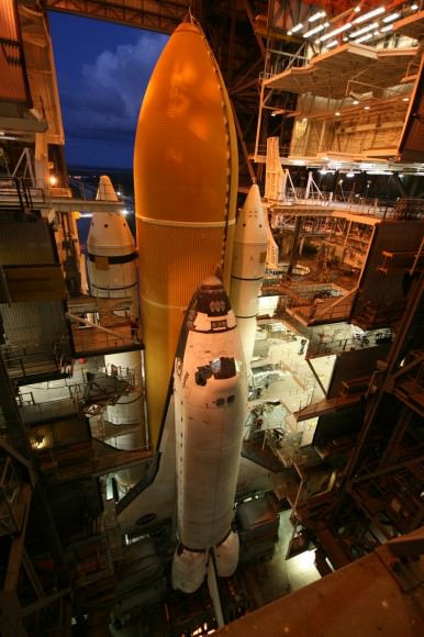
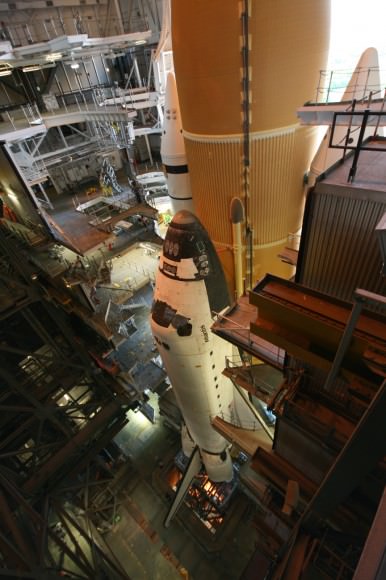
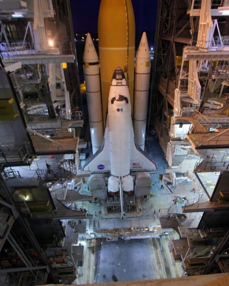
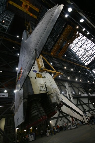
Atlantis mated to External Tank and Solid Rocket Boosters inside the VAB. Credit: Ken Kremer
Atlantis Ready for Final Journey to Launch Pad 39A for STS-135 flight. Credit: Ken Kremer
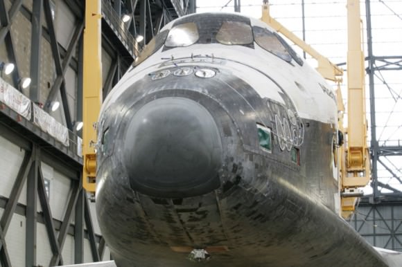
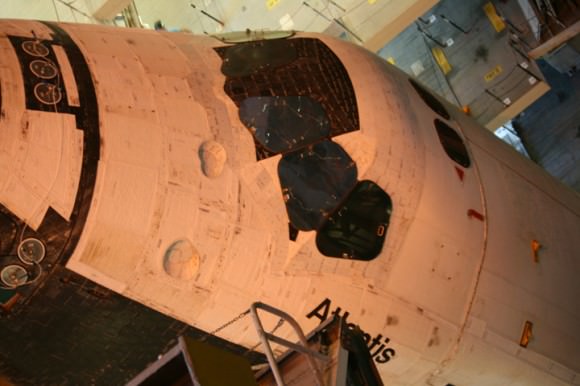
Close up of the Atlantis Crew cabin. Credit: Ken Kremer

Atlantis exits the VAB on the crawler pathway to Pad 39 A. Thousands of KSC employees witness Atlantis final journey to the shuttle launch pad. Credit: Ken Kremer

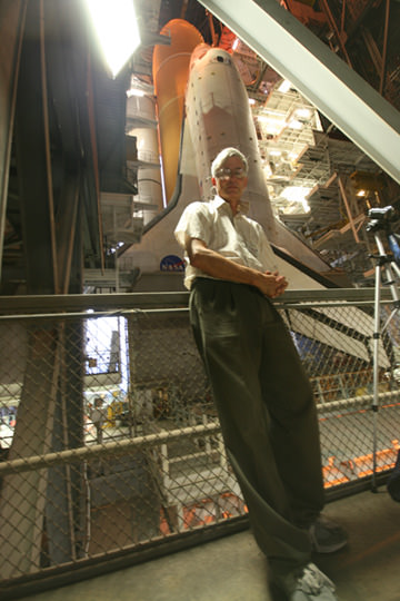
Ken Kremer with Space Shuttle Atlantis inside VAB High Bay 1. Credit: Ken Kremer

Photos from Alan Walters for Universe Today: awaltersphoto.com

Photos from Mike Deep for Universe Today

Read my prior features about the Final Shuttle mission, STS-135, here:
Atlantis Goes Vertical for the Last Time
Atlantis Rolls to Vehicle Assembly Building with Final Space Shuttle Crew for July 8 Blastoff

Read my features about the final mission of Endeavour, STS 134, starting here
Era of Space Shuttle Endeavour Ends with June 1 landing at the Kennedy Space Center

Opportunity Surpasses 30 KM Driving and Snaps Skylab Crater in 3 D

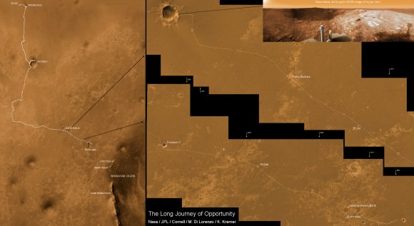
The 7 Year and 30 Kilometer Long Journey of Opportunity to June 1, 2011. This collage of martian surface mosaics and orbital maps shows the entire route traversed by NASA’s Opportunity Mars Rover from landing on Jan 24, 2004 to surpassing the 30 kilometer driving mark on June 1, 2011(see map notation). Opportunity is on an overland expedition driving to Endeavour Crater, some 22 km in diameter. Photo mosaic of Santa Maria crater at bottom shows one of the last spots investigated by Opportunity on Sol 2519, Feb. 23, 2011 before departing for Endeavour in March 2011. The exposed rock named Ruiz Garcia showed signatures of hydrated mineral deposits located at southeast portion of Santa Maria crater. Credit: NASA/JPL/Cornell Marco Di Lorenzo, Kenneth Kremer
[/caption]
With her most recent drive of 482 feet (146.8 meters) on June 1, 2011 (Sol 2614), NASA’s Opportunity Mars Rover has zoomed past the unimaginable 30 kilometer (18,64 miles) mark in total odometry since safely landing on Mars nearly seven and one half years ago on Jan 24, 2004. That’s 50 times beyond the roughly quarter mile of roving distance initially forseen.

Opportunity is now 88 months into the original 3 month mission “warranty” planned by NASA and the rover team. That’s over 29 times beyond the original design lifetime and an achievement that no one on the rover teams ever expected to observe.

And Opportunity is still going strong, in good health and has abundant solar power as she continues driving on her ambitious overland trek across the martian plains of Meridiani Planum. She is heading to the giant Endeavour crater, some 22 km (14 miles) in diameter.

Opportunity snaps Skylab Crater in 3 D during approach to Endeavour Crater
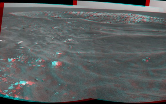
This stereo view of Skylab Crater was captured by Opportunity on Mars on Sol 2594, or May 12, 2011, along the rovers route to giant Endeavour Crater. This young crater is about 30 feet (9 meters) in diameter.and was likely formed within the past 100,000 years. Credit: NASA/JPL-Caltech

At this point Endeavour is barely 2 miles (3.5 km) away since Opportunity departed from Santa Maria Crater in March 2011. Landfall at Endeavour is expected sometime later this year.

Endeavour is a long awaited and long sought science target because it is loaded with phyllosilicate clay minerals. These clays have never before been studied and analyzed first hand on the red planets surface.

Opportunity snaps Skylab Crater in 2 D during approach to Endeavour Crater
This view of Skylab Crater was captured by Opportunity’s navigation camera on Mars on Sol 2594, or May 12, 2011, along the rovers route to giant Endeavour Crater. This young crater is about 30 feet (9 meters) in diameter. The blocks of material ejected from the crater-digging impact sit on top of the sand ripples near the crater. This suggests, from the estimated age of the area's sand ripples, that the crater was formed within the past 100,000 years. The dark sand inside the crater attests to the mobility of fine sand in the recent era in this Meridiani Planum region of Mars. The rover view spans 216 degrees from northwest on the right to south on the right. Credit: NASA/JPL-Caltech

Phyllosilicate clays formed in neutral watery environments, which are much more conducive to the formation of life compared to the highly acidic environments studied up to now by Spirit and Opportunity. NASA’s Curiosity rover is due to land on Mars in 2012 at a site the science team believes is rich in Phyllosilicates.

In recent weeks, Opportunity has passed by a series and small young craters as she speeds to Endeavour as fast as possible. One such crater is named “Skylab”, in honor of America’s first manned Space Station, launched in 1973.

Now whip out your 3 D glasses and check out NASA’s newly released stereo images of “Skylab” and another named “Freedom 7” in honor of Alan Shepard’s flight as the first American in space. Be sure to also view Opportunity’s dance steps in 3 D performed to aid backwards driving maneuvers on the Red planet

Freedom 7 Crater on Mars 50 Years after Freedom 7 Flight
Opportunity recorded this stereo view of a crater informally named Freedom 7 shortly before the 50th anniversary of the first American in space: astronaut Alan Shepard's flight in the Freedom 7 spacecraft on May 5, 1961. Opportunity took this image on Sol 2585 on Mars on May 2, 2011. The crater is about 25 meters (82 feet) in diameter. It is the largest of a cluster of about eight craters all formed just after an impactor broke apart in the Martian atmosphere perhaps 200,000 years ago. Credit: NASA/JPL-Caltech

“Skylab” is about 9 meters (30 feet) in diameter. The positions of the scattered rocks relative to sand ripples suggest that Skylab is young for a Martian crater. Researchers estimate it was excavated by an impact within the past 100,000 years.

“Freedom 7” crater is about 25 meters (82 feet) in diameter. During her long overland expedition, Opportunity is examining many craters of diverse ages at distant locales to learn more about the past history of Mars and how impact craters have changed over time.

Opportunity was just positioned at a newly found rock outcrop named “Valdivia” and analyzing it with the robotic arm instruments including the Microscopic Imager and the Alpha Particle X-ray Spectrometer (APXS).

Opportunity leaves dance step on Mars
A dance-step pattern is visible in the wheel tracks near the left edge of this scene recorded in stereo by the navigation camera during Sol 2554 on Mars (April 1, 2011). The pattern comes from use of a new technique for Opportunity to autonomously check for hazards in its way while driving backwards. For scale, the distance between the parallel tracks of the left and right wheels is about 1 meter (about 40 inches). Credit: NASA/JPL-Caltech
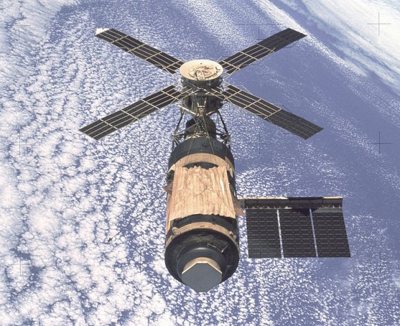
Skylab, America’s First manned Space Station
Photo taken by departing Skylab 4 crew in Feb. 1974. Credit: NASA

Era of Space Shuttle Endeavour Ends with June 1 landing at the Kennedy Space Center

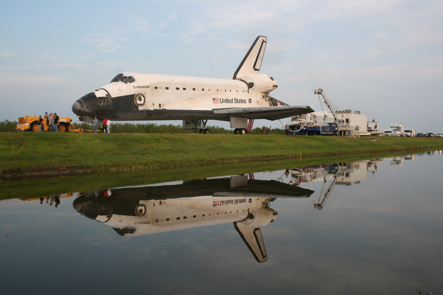
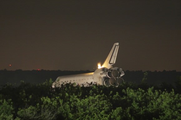
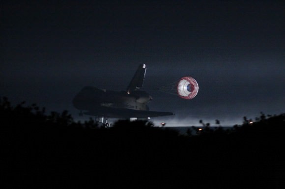
Space Shuttle Endeavour landed safely at the Kennedy Space Center on June 1, 2011 at 2:35 a.m. EDT. During the 16 day STS-134 mission, Endeavour delivered the $2 Billion Alpha Magnetic Spectrometer to the International Space Station and journeyed more than sixteen million miles. Endeavour was towed back to the Orbiter Processing Facility in preparation for display at her new retirement home at the California Science Center. Credit: Ken Kremer
[/caption]

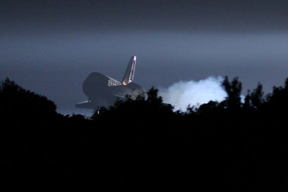
KENNEDY SPACE CENTER – Space Shuttle Endeavour and her six man crew landed safely today at the Kennedy Space Center in Florida at 2:35 a.m. EDT following a 16 day journey of more than sixteen million miles.

The STS-134 mission marked the end of Endeavour’s space exploration career. It was the 25th and last space mission by NASA’s youngest orbiter. Altogether, Endeavour has logged 299 days in space, orbited Earth 4,671 times and traveled 122,883,151 miles.

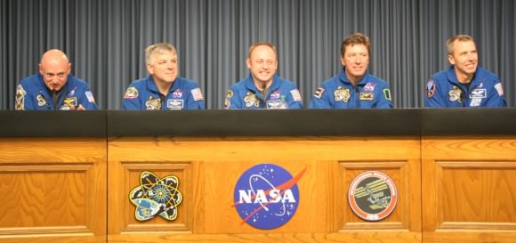
The crew was led by Shuttle Commander Mark Kelly. Also aboard were Pilot Greg H. Johnson and Mission Specialists Mike Fincke, Drew Feustel, Greg Chamitoff and the European Space Agency’s Roberto Vittori. Vittori is the last non NASA astronaut to fly on a shuttle mission.

The night landing capped a highly productive flight highlighted by the delivery of the $2 Billion Alpha Magnetic Spectrometer (AMS) to the International Space Station. AMS is a cosmic ray detector that seeks to unveil the invisible universe and search for evidence of dark matter, strange matter and antimatter.

5 of 6 crew members of STS-134 mission of Space Shuttle Endeavour at post landing press briefing. Credit: Ken Kremer
“What a great ending to this really wonderful mission,” said Bill Gerstenmaier, associate administrator for Space Operation at a briefing today for reporters “They’re getting great data from their instrument on board the space station. It couldn’t have gone any better for this mission.”

Mike Leinbach, the Space Shuttle Launch Director, said, “It’s been a great morning at the Kennedy Space Center. Commander Kelly and his crew are in great spirits.”

Four members of the crew conducted 4 spacewalks during the flight, which were the last by shuttle crew members during the space shuttle era. Simultaneously they completed the construction of the US portion of the ISS.

During the flight, Mike Fincke established a new record of 382 days for time a U.S. astronaut has spent in space. He broke the record on May 27, his 377th day on May 27, by surpassing previous record holder Peggy Whitson.

STS-134 was the 134th space shuttle mission and the 36th shuttle mission dedicated to ISS assembly and maintenance.

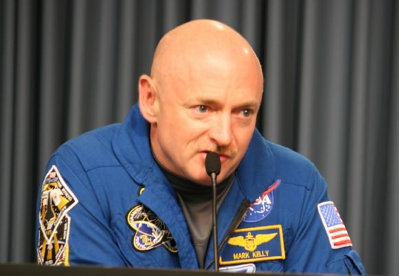
“You know, the space shuttle is an amazing vehicle, to fly through the atmosphere, hit it at Mach 25, steer through the atmosphere like an airplane, land on a runway, it is really, really an incredible ship,” said Kelly.

“On behalf of my entire crew, I want to thank every person who’s worked to get this mission going and every person who’s worked on Endeavour. It’s sad to see her land for the last time, but she really has a great legacy.”

After the landing at the Shuttle Landing Facility (SLF) , Endeavour was towed back into the Orbiter Processing Facility (OPF) where she will be cleaned and “safed” in preparation for her final resting place – Retirement and public display at the California Science Center in Los Angelos, California.

With the successful conclusion of Endeavour’s mission, the stage is now set for blastoff of the STS-135 mission on July 8, the very final flight of the three decade long shuttle Era.

“We’ve had a lot going on here,” said Mike Moses, space shuttle launch integration manager, “Being able to send Atlantis out to the pad and then go out and land Endeavour was really a combination I never expected to have.

It’s been a heck of a month in the last 4 hours !”

Shuttle Endeavour Landing Photos by Mike Deep for Universe Today

STS-134 Space Shuttle Commander Mark Kelly. Credit: Ken Kremer
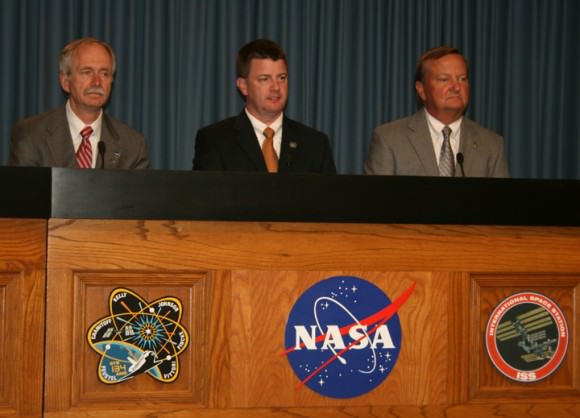
STS-134 Endeavour Post Landing Press Briefing.
Bill Gerstenmaier, NASA Associate Administrator for Space Operations, Mike Moses, Space Shuttle launch integration manager at NASA KSC, Mike Leinbach, Space Shuttle Launch Director at NASA KSC, laud the hard work and dedication of everyone working on the Space Shuttle program. Credit: Ken Kremer
Read my related stories about the STS-134 mission here:

Amazing Photos and Milestone Tributes Mark Last Space Shuttle Spacewalk
Awesome Hi Def Launch Videos from Endeavour
Spectacular Soyuz Photo Gallery shows Unprecedented View Of Shuttle Docked at Station
Ultimate ISS + Shuttle + Earth Photo Op Coming on May 23 from Soyuz and Paolo Nespoli
Endeavour Blasts Off on Her 25th and Final Mission
Endeavour Unveiled for Historic Final Blastoff
Looking to the Heavens with Endeavour; Launch Pad Photo Special
Endeavour Astronauts Arrive at Cape for May 16 Launch
NASA Sets May 16 for Last Launch of Endeavour; Atlantis Slips to July
Endeavour’s Final Launch further delayed another Week or more
On the Cusp of Endeavour’s Final Flight
Brush Fires Erupt at Kennedy Space Center during Endeavour’s Last Countdown
Commander Mark Kelly and STS-134 Crew Arrive at Kennedy for Endeavour’s Final Flight
President Obama to Attend Endeavour’s Last Launch on April 29
Shuttle Endeavour Photo Special: On Top of Pad 39A for Final Flight
Endeavour Mated to Rockets for Last Flight Photo Album
Endeavour Rolls to Vehicle Assembly Building for Final Flight

Atlantis Goes Vertical for the Last Time

Credit: Ken Kremer

[/caption]

KENNEDY SPACE CENTER – For the last time in history, Atlantis and the shuttle program have literally gone vertical. Following the rollover of Atlantis into the Vehicle Assembly Building (VAB), the orbiter was attached to a massive crane and then hoisted and mated to the External Tank and twin Solid Rocket boosters that will power her 25th and last climb to orbit.

Myself and a small band of lucky photo journalists were privileged to witness this milestone on the way to blastoff of the STS-135 mission, the last one of the three decade long shuttle era. Check out a selection of my images in this photo album for Universe Today readers. I’ll post a few now and more later as Atlantis prepares to rollout to Launch Pad 39 A.

The STS-135 mission remains on target for liftoff on July 8 at about 11:40 a.m. EDT on a 12 day flight to deliver critical parts, science experiments, gear, crew supplies and provisions to the International Space Station (ISS).

Credit: Ken Kremer
Credit: Ken Kremer
Credit: Ken Kremer
Credit: Ken Kremer
Credit: Ken Kremer
Credit: Ken Kremer
Credit: Ken Kremer

Read my prior story about the Final Shuttle mission, STS-135, here:
Atlantis Rolls to Vehicle Assembly Building with Final Space Shuttle Crew for July 8 Blastoff

Voyager 1 Measures Magnetic Mayhem

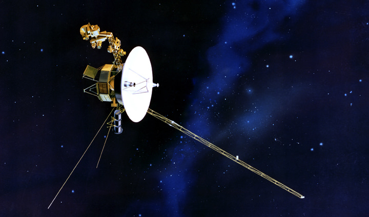
Artist's Conception of Voyager - Credit: NASA

[/caption]

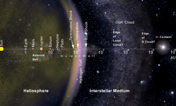
When Voyager 1 passed into the heliosheath in 2004, it became the first man-made object to explore the remote edge of the Sun’s magnetic influence. Launched by NASA on September 5, 1977, the probe was designed to study the outer Solar System and eventually interstellar space. One of its missions was to look for the heliopause – the boundary at which the solar wind transitions into the interstellar medium. What it found was mayhem…

According to NASA, Voyager 1 has crossed into an area where the velocity of the hot ionized gas, or plasma, emanating directly outward from the sun has slowed to zero. Scientists suspect the solar wind has been turned sideways by the pressure from the interstellar wind in the region between stars. “The solar wind has turned the corner,” said Ed Stone, Voyager project scientist based at the California Institute of Technology in Pasadena, Calif. “Voyager 1 is getting close to interstellar space.”

Now it has entered the heliosheath, an area ranging from 1.5 to 15 billion kilometers thick (930 million to 9.3 billion miles) and starting roughly 14 billion km (8.7 billion mi) from the Sun. But there’s nothing quiet here. This is the area where outgoing flows of solar wind begin to be repelled by interstellar particles and magnetic fields pushing towards the solar system. While passing through the heliosheath, Voyager 1 experienced many sudden and drastic changes in the surrounding magnetic field driven by structures called current sheets.

Illustration Courtesy of NASA

The team of L. F. Burlaga: Geospace Physics Laboratory, NASA Goddard Space Flight Center and N. F. Ness of the Institute for Astrophysics and Computational Sciences have been studying the ongoing results sent back by Voyager and have come to a new conclusion – there are three distinct types of current sheets.

“The structures, appearing as proton boundary layers (PBLs), magnetic holes or humps, or sector boundaries, were identified by characteristic fluctuations in either magnetic field strength or direction as the spacecraft crossed nearly 500 million km (310 million mi) of heliosheath in 2009. PBLs are defined by a rapid jump in magnetic field strength, with one observed event resulting in a doubling of the field strength in just half an hour.” said the team. “Passing through a sector boundary led to a sudden change in direction of the magnetic field. Magnetic holes saw the field strength drop to near zero before returning to the original background strength. Magnetic humps consisted of a sudden spike in strength and then a return to initial levels.”

But this isn’t the first time the Voyager has returned zero readings. In December 2004 the intrepid probe broke the barrier of the termination shock and data from Voyager 1’s Low-Energy Charged Particle Instrument was used to deduce the solar wind’s velocity. When the speed of the particles matched the speed of the spacecraft, scientists knew they had a null number on their records. “When I realized that we were getting solid zeroes, I was amazed,” said Rob Decker, a Voyager Low-Energy Charged Particle Instrument co-investigator and senior staff scientist at the Johns Hopkins University Applied Physics Laboratory in Laurel, Md. “Here was Voyager, a spacecraft that has been a workhorse for 33 years, showing us something completely new again.”

And new is what we need to continue our understanding of what lay at the furthest reaches of our now explorable space. Says Burlaga, “The firsthand detections made by Voyager 1 are likely to be extremely important for researchers trying to decide between current leading theories for the source and structure of current sheets.”

Story source: Journal of Geophysical Research – Space Physics.