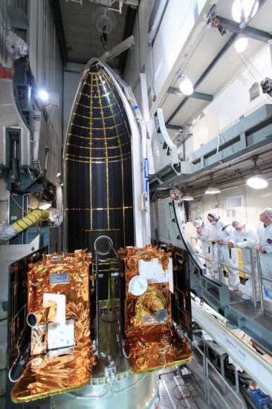
NASAs Lunar Mapping Duo Encapsulated and Ready for Sept. 8 Liftoff

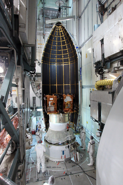
Twin GRAIL Lunar Mappers being enclosed with payload fairing atop Delta II rocket. Spacecraft technicians monitor the movement of a section of the clamshell-shaped Delta payload fairing as it encloses NASA's twin Gravity Recovery and Interior Laboratory spacecraft at Space Launch Complex 17B on Cape Canaveral Air Force Station in Florida. Liftoff is slated for Sept. 8 at 8:37 a.m. EDT. Credit: NASA/Jim Grossmann

[/caption]

NASA’s powerful lunar mapping duo of GRAIL spacecraft are now poised for liftoff in just one weeks time on Thursday, Sept. 8.

Mission managers held a Flight Readiness Review on Wednesday (Aug.31) and gave a tentative approval to begin fueling the Delta II rockets second stage on Sept. 2 and 3 after evaluating all issues related to the rocket, launch pad and payloads.

Launch preparations are proceeding on schedule towards an early morning lift off from the seaside Space Launch Complex 17B (SLC-17B) at Cape Canaveral Air Force Station, Florida. There are two instantaneous launch windows at 8:37:06 a.m. and 9:16:12 a.m. EDT lasting one second each.

“Launch vehicle and spacecraft closeouts will begin on Tuesday, and the Launch Readiness Review is also scheduled for Tuesday morning,” NASA KSC spokesman George Diller told Universe Today.

“This morning’s launch countdown dress rehearsal went fine.”

“Delta II 2nd stage fueling has been rescheduled for Friday and Saturday [Sept. 2 and 3]. Last evening a software error was found in the launch processing system data base. ULA (United Launch Alliance) decided they would like to look for any additional errors before the fueling begins. There is no impact to the launch date and currently no work is scheduled on Sunday or on Labor Day,” said Diller.

The launch period extends through Oct. 19, with liftoff occurring approximately four minutes earlier each day in case of a delay. The flight plan was designed to avoid a pair of lunar eclipses occurring on December 10th, 2011 and June 4th 2012 which would interfere with the missions operations and science.

The team is keeping a close watch on the weather as the season’s next Atlantic Ocean storm heads westwards. Katia has just been upgraded to Hurricane status and follows closely on the heels of the continuing vast destruction, misery and deaths caused by Hurricane Irene earlier this week.

“The preliminary weather forecast is favorable for launch day as long as the wind remains out of the west as is currently forecast for that time of the morning,” Diller told me.
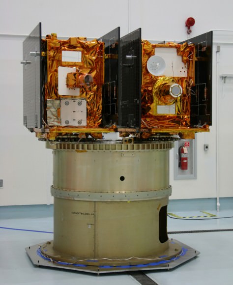
Twin GRAIL Lunar Mappers are secured atop Delta II rocket and await enclose in the Delta payload fairing. The fairing will protect the spacecraft from the impact of aerodynamic pressure and heating during ascent and will be jettisoned once the spacecraft is outside the Earth's atmosphere. Credit: NASA/Jim Grossmann

The twin probes known as GRAIL-A and GRAIL-B (Gravity Recovery and Interior Laboratory) were encapsulated inside the clamshell like payload fairing on Aug. 23 The nearly identical spacecraft are mounted side by side and sit atop the Centaur upper stage.

The fairing shields the spacecraft from aerodynamic pressures, friction and extreme heating for the first few minutes of flight during ascent through the Earth atmosphere.

This Delta II Heavy booster rocket is the most powerful version of the Delta II family built by ULA. The booster’s first stage is augmented with larger diameter solid rocket motors.

GRAIL was processed for launch inside at the Astrotech payload processing facility in Titusville, Fla. See my GRAIL spacecraft photos from inside the Astrotech clean room facilities here.

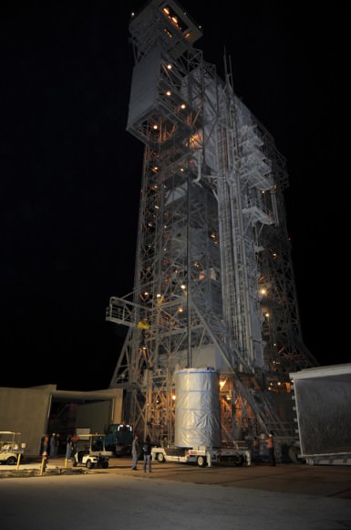
“The GRAIL spacecraft inside the handling can departed Astrotech and arrived at the launch pad, SLC-17B on Aug. 18” said Tim Dunn, NASA’s Delta II Launch Director in an interview with Universe Today. “The spacecraft was then hoisted by crane onto the Delta II launch vehicle and the spacecraft mate operation was flawlessly executed by the combined ULA and NASA Delta II Team.”

An Integrated Systems Test (IST) of the mated booster and payload was completed on Aug. 22
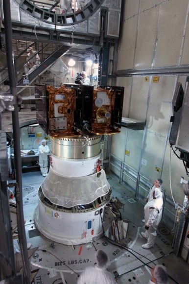
Technicians prepare twin GRAIL spacecraft for enclosure in the Delta payload fairing. Credit: NASA/Jim Grossmann

The dynamic duo will orbit the moon in a tandam formation just 50 kilometers above the lunar surface with an average separation of 200 km. During the 90 day science phase the goal is to determine the structure of the lunar interior from crust to core and to advance understanding of the thermal evolution of the moon.

GRAIL-A & GRAIL-B will measure the lunar gravity field with unprecedented resolution up to 100 times improvement on the near side and 1000 times improvement for the far side.
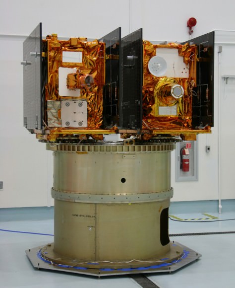
NASA’s twin GRAIL Science Probes ready for Lunar Expedition
GRAIL B (left) and GRAIL A (right) spacecraft are mounted side by side on top of a payload adapter inside the clean room at Astrotech Space Operations facility. The spacecraft await lunar launch on Sept. 8, 2011. Credit: Ken Kremer

Read Ken’s continuing features about GRAIL

GRAIL Lunar Twins Mated to Delta Rocket at Launch Pad
GRAIL Twins ready for NASA Science Expedition to the Moon: Photo Gallery

ISS Crew Provides Light-Hearted Look at Current Space Flight Plight

What does the International Space Station crew think about the situation they face since the Progress cargo ship mishap? Astronaut Ron Garan wanted to do something light-hearted to let everyone know that “we are all in this together,” so he and his crewmates created a video. Garan said “Despite the seriousness of the possibilities, and while we are all in this period of uncertainty, it doesn’t mean we can’t still have a little fun.”

This video also provides an impromptu tour of the ISS and shows how big the space station is, as it takes fellow astronaut Mike Fossum a long time to find Garan.

It should be noted that they made this video before they got the news of the potential of having the ISS unmanned. “This would have serious implications, and we all hope that it does not come to that,” Garan wrote on his Fragil Oasis blog. You can read Garan’s entire commentary about the video at that link, and take a look around at his other postings, as well. Garan is doing a great job of sharing his experiences in space.

First Image Captured by NASAs Jupiter bound Juno; Earth – Moon Portrait

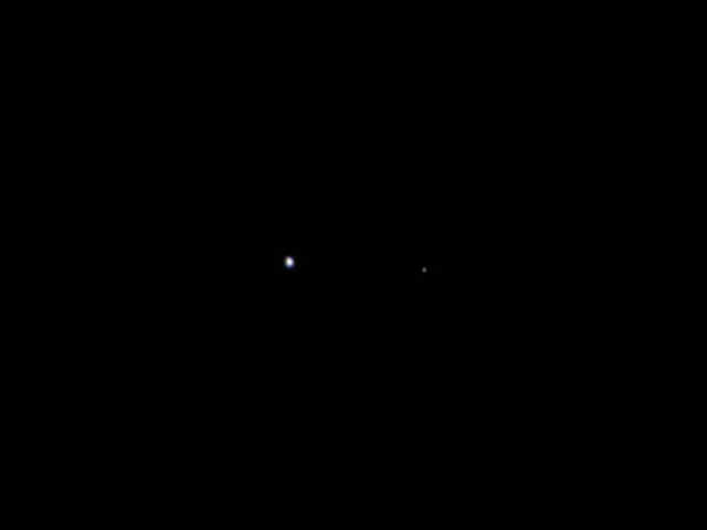
Earth & Moon Portrait - First Photo transmitted from Jupiter Bound Juno. This image of Earth (on the left) and the moon (on the right) was taken by NASA's Juno spacecraft on Aug. 26, 2011, when the spacecraft was about 6 million miles (9.66 million kilometers) away. It was taken by the spacecraft's onboard camera, JunoCam. Credit: NASA/JPL-Caltech

[/caption]

NASA’s solar powered Jupiter bound Juno orbiter has captured her first image – a beautiful portrait of the Earth & Moon – since the probe blasted off from the home planet.

Juno lifted off 25 days ago at 12: 25 p.m. on August 5 from Space Launch Complex 41 at Cape Canaveral Air Force Station in Florida. The spacecraft snapped the portrait with the onboard JunoCam camera on August 26 after journeying some 6 million miles (9.66 million km) from Earth and while traveling at a velocity of 77,600 miles per hour (124,900 kilometers per hour) relative to the sun.

“The image of the Earth Moon system is a rather unique perspective that we can get only by stepping outside of our home planet,” said Scott Bolton, Juno principal investigator, in an exclusive interview with Universe Today. Bolton is from the Southwest Research Institute in San Antonio.

“On our way to Jupiter, we’ve looked back at home and managed to take this amazing image.”

“Earth looking much like any other planet or star from a distance is glorious as this somewhat average looking “star” is home to all of humanity. Our companion, the moon, so beautiful and important to us, stands out even less.”

“We appear almost average and inconspicuous, yet all of our history originates here. It makes one wonder just how many other planets or solar systems might contain life like ours,” Bolton told me.

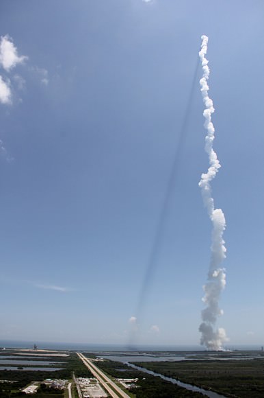
Juno casts a shadow back toward Earth and Space Shuttle Launch Pad 39A and the shuttle crawler way (at left) seconds after liftoff from adjacent Launch Pad 41 at Cape Canaveral, Florida. View from the VAB Roof. Credit: Ken Kremer

The Juno team commanded the probe to take the image as part of the checkout phase of the vehicles instruments and subsystems.

“The JunoCam instrument turn on and check out were planned activities. The instrument is working great and in fact, all the instruments that we’ve turned on thus far have been working great,” Bolton added.

So far the spacecraft is in excellent health and the team has completed the checkout of the Waves instrument and its two Flux Gate Magnetometer sensors and deployment of its V-shaped electric dipole antenna.

“We have a couple more instruments still to do,” Bolton noted.

The team reports that Juno also performed its first precession, or reorientation maneuver, using its thrusters and that the first trajectory control maneuver (TCM-1) was cancelled as unnecessary because of the extremely accurate targeting provided by the Atlas V rocket.

The portrait shot is actually not Juno’s last photo of her home.

The 8000 pound (3,600 kilogram) probe will fly by Earth once more on October 9, 2013 for a gravity assisted speed boost of 16,330 MPH (7.3 km/sec) to accelerate Juno past the asteroid belt on its long journey to the Jovian system.

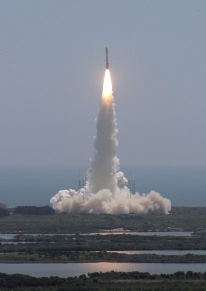
Juno soars skyward to Jupiter on Aug. 5 from launch pad 41 at Cape Canaveral Air Force Station at 12:25 p.m. EDT. View from the VAB roof. Credit: Ken Kremer

JunoCam will collect new photos and the other science instruments will make measurements as Juno cartwheels past Earth during the slingshot to Jupiter.

Juno is on a 5 year and 1.7 Billion mile (2.8 Billion km) trek to the largest planet in our solar system. When she arrives at Jupiter on July 4, 2016, Juno will become the first polar orbiting spacecraft at the gas giant.

During a one year science mission – entailing 33 orbits lasting 11 days each – the probe will plunge to within about 3000 miles (5000 km) of the turbulent cloud tops and collect unprecedented new data that will unveil the hidden inner secrets of Jupiter’s genesis and evolution.

The goal is to find out more about the planets origins, interior structure and atmosphere, observe the aurora, map the intense magnetic field and investigate the existence of a solid planetary core.

“This is a remarkable sight people get to see all too rarely,” said Bolton in a NASA statement about the Earth-Moon photo. “This view of our planet shows how Earth looks from the outside, illustrating a special perspective of our role and place in the universe. We see a humbling yet beautiful view of ourselves.”

NASA’s Jet Propulsion Laboratory manages the Juno mission. The spacecraft was designed and built by Lockheed Martin Space Systems, Denver.

Juno and Booster Streak Across the Stars
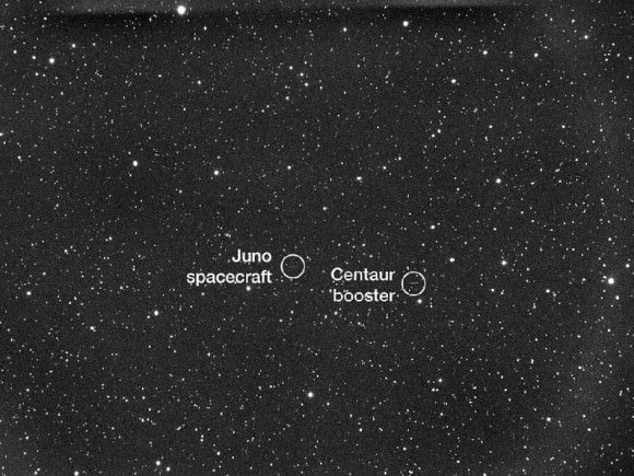
NASA's Juno spacecraft and its spent Centaur upper rocket stage are captured in this telescope view as they move across the field of stars. The five-minute, timed exposure was acquired on Aug. 5 11:18pm Eastern time (Aug. 6 at 3:18 UTC) when Juno was at a distance of about 195,000 miles (314,000 kilometers) from Earth. The images were taken remotely by amateur astronomer Scott Ferguson using Global Rent-a-Scope's GRAS-016 Takahashi Widefield Refractor, which is located in Nerpio, Spain. Credit: Scott Ferguson
Juno Spacecraft Cruise Trajectory to Jupiter
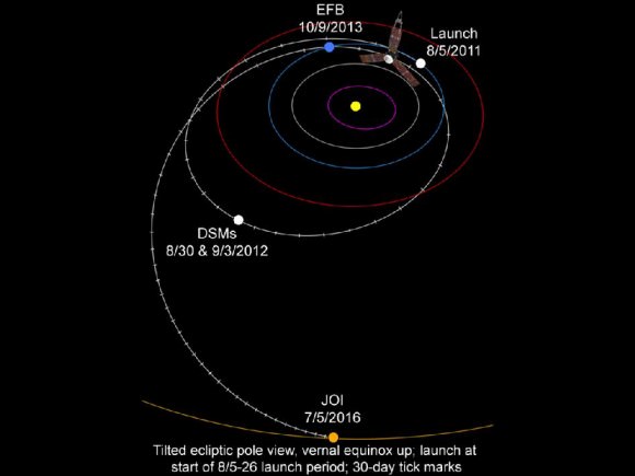
This graphic shows Juno's trajectory, or flight path, from Earth to Jupiter. The spacecraft travels around the Sun, to a point beyond the orbit of Mars where it fires its main engine a couple of times. These deep space maneuvers set up the Earth flyby maneuver that occurs approximately two years after launch. The Earth flyby gives Juno the boost in velocity it needs to coast all the way to Jupiter. Juno arrives at Jupiter in July 2016. Credit: NASA/JPL-Caltech
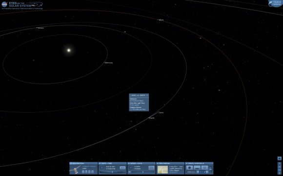
View of Juno’s position on Aug. 24, 2011 nearly 6 million miles distant from Earth visualized by NASA’s Eyes on the Solar System website.

Read my continuing features about Juno
Juno Blasts off on Science Trek to Discover Jupiter’s Genesis
Juno Jupiter Orbiter poised at Launch Pad for Aug. 5 Blastoff
JUNO Orbiter Mated to Mightiest Atlas rocket for Aug. 5 Blastoff to Jupiter
Solar Powered Jupiter bound JUNO lands at Kennedy Space Center

Deadly and Destructive Path of Hurricane Irene seen in NASA Videos and Images

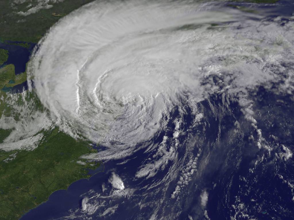
Irene Makes Landfall Over New York. This GOES-13 satellite image is of Hurricane Irene just 28 minutes before the storm made landfall in New York City. The image shows Irene's huge cloud cover blanketing New England, New York and over Toronto, Canada. Shadows in Irene's clouds indicate the bands of thunderstorms that surrounded the storm. Credit: NASA/NOAA GOES Project

NASA Video Caption: The Life of Hurricane Irene from the Caribbean to Canada from August 21 through August 29 seen by NASA/NOAA satellites. Credit: NASA/NOAA/GOES/MODIS

The new NASA animation above shows the birth and subsequent destructive and deadly path followed by Hurricane Irene from August 21 through August 29, 2011 starting in the Caribbean, and then tracking along the US East Cost and up into Canada. The observations combine images taken by NASA and NOAA Earth orbiting satellites.

The cloud images were captured by the NASA/NOAA GOES-13 satellite and overlaid on a true-color NASA MODIS map. Irene followed a lengthy course over Puerto Rico, Hispaniola, the Bahamas, and then along the entire US East with landfalls over North Carolina, New Jersey and New York.

NASA ISS astronaut Ron Garan and cameras flying overhead aboard the International Space Station (ISS) also photographed vivid images showing the magnitude of Irene slamming into the US East coast.

Irene caused widespread property damage. Massive and raging flooding in several US states destroyed houses, crushed businesses and washed away bridges and roads and more. The worst flooding is yet to come to some inland portions of Vermont, New Jersey, New York, Pennsylvania and elsewhere as uncontrollable waters continue to rise at numerous rivers, lakes and even ponds, threatening even more misery in their wake.

[/caption]

So far 41 fatalities in 12 states have been attributed to Irene and more may be expected as searches continue. Some communities have been entirely cut off due to washed out access. Airlifts of food and water have begun. More people are being evacuated from New Jersey towns today, Aug 30.

Brave emergency rescue workers have put their own lives at peril and saved the lives of countless others of all ages from babies to the elderly. Some 8 million customers, including my area, lost power due to extensive flooding, downed trees and electrical wires, and devastated infrastructure.

Hurricane Irene twitpic from the International Space Station on 8/27/11 by NASA Astronaut Ron Garan
Irene From Space and the ISS as it crossed the coast on August 27, 2011 at 3:32pm EST. Hope everyone is OK wrote NASA Astronaut Ron Garan with his twitpic from the ISS. Credit: NASA/Ron Garan aboard the ISS

Emergency crews are hard at work to restore power as quickly as possible, but many thousands of homes and businesses could be without power for up to a week or more. About 3.3 million customers are still without power today.

NASA’s GOES-13 satellite captured a dramatic view of Hurricane Irene just 28 minutes prior to making landfall over New York City. Today’s NASA Image of the day shows the humongous cloud cover spanning the US East coast from the Mid-Atlantic States up to New Jersey, New York, Pennsylvania, and New England and into Toronto, Canada.

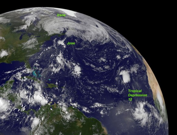
This GOES-13 image from Monday, August 29 at 7:45 a.m. EDT shows an active Atlantic Ocean with the remnants of Hurricane Irene moving into Quebec and Newfoundland (left), Tropical Storm Jose (center) and newly formed Tropical Depression 12 (right). Credit: NASA/NOAA GOES Project
Irene slams into North Carolina. The GOES-13 satellite saw Hurricane Irene on August 27, 2011 at 10:10 a.m. EDT after it made landfall at 8 a.m. in Cape Lookout, North Carolina. Irene's outer bands had already extended into New England. Credit: NASA/NOAA GOES Project

Many transit systems and airports in Irene’s path were shutdown ahead of the storm.

Send me your photos of Irene’s destruction to post at Universe Today.

Cause of Progress Crash May Have Been Determined

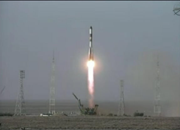
Progress M-12M cargo vehicle launches on August 24, 2011. The rocket eventually failed and the rocket and ship crashed. Credit: NASA TV.

[/caption]

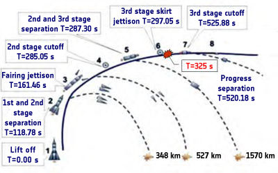
The Russian news agency Itar-Tass is reporting that the cause of the August 24 failure and crash of the Progress re-supply ship that was supposed to bring supplies to the International Space Station may have already been determined. “Members of the emergency commission have determined the cause of the failure of the Soyuz carrier rocket’s third stage engine,” Roscosmos spokesman Alexei Kuznetsov was quoted. “It is a malfunction in the engine’s gas generator.”

If the cause has indeed been found and if the anomaly can be resolved to the satisfaction of both Roscosmos and NASA, it might prevent a worst-case scenario of having to de-crew the International Space Station by mid-November, which NASA Space Station Program Manager Mike Suffredini said was a potential outcome.

The Soyuz launch sequence, showing the time of the anomaly. Credit: ESA

The emergency commission to study the problem was only formed on August 26, and that a cause has already been found comes as a bit of a surprise. The commission is lead by Anatoly Koroteev, head of the Russian Keldysh science research institute on rockets.

“He is a man with quite a bit of experience in this field for our Russian colleagues, and indeed the world,” Suffredini said during a press briefing on Monday morning. But Suffredini also said that it would likely take the commission awhile to sort out the cause and its implications to future flights.

“The team is just getting going,” Suffredini commented. “They are trying to work quickly to resolve the anomaly but they don’t want to leave any stone unturned.”

What actions will be taken to resolve the problem now that a cause may be established are not yet known. Suffredini said that two Soyuz-family unmanned rockets are scheduled to launch soon, which may provide a chance to test any fixes on unmanned launches before attempting a manned launch. A commercial Soyuz to launch a mobile communications satellites is scheduled on Oct. 8, and the Russians may launch the Progress resupply ship that is currently scheduled for October 26 a few weeks earlier in order to have another unmanned launch to study the problem.

The Progress cargo ships launch on a Soyuz-U rocket, while the Soyuz crew capsules, the Soyuz TMA launches on a Soyuz-FG. The third stages of the two rockets are virtually identical. The Soyuz-U rocket has had 745 successful launches and just 21 failures over nearly four decades. The Soyuz-FG has had 25 launches, all successful.

International Space Station Could be De-Crewed by November

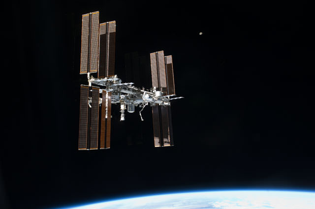
A view of the International Space Station as seen by the last departing space shuttle crew, STS-135. Credit: NASA

[/caption]

For personal reasons I had to miss the NASA press conference this morning which gave an update on International Space Station operations following the failure and crash of a Progress resupply vehicle last week. When I returned home and saw the headlines about the briefing from other news sites, I thought, “Wow, everyone is really overreacting about how this might affect the space station.” But then I watched a replay of the briefing and realized no news site was being overly melodramatic. NASA’s Space Station Manager Mike Suffredini laid out a fairly bleak picture of how quickly the ISS will have to be de-manned if the anomaly with the Soyuz-family of rockets isn’t figured out soon. The problem is not logistics or supplies; it all hinges on the Soyuz capsules themselves and their limited lifespan. If the anomaly is not figured out soon and the Soyuz rockets aren’t flying by mid-November, the space station will have to be de-crewed and be operated unmanned, remotely from the ground.

UPDATE: Please read our update on the situation, where the Russian space agency says they may have found the cause of the anomaly.

“If we don’t have the Soyuz flying by mid-November, then we would have to de-man the ISS at that time,” Suffredini said. “We are focusing on keeping the crew safe. The next focus is trying to keep the ISS manned. If it takes us awhile to resolve the anomaly and we have to de-man the ISS, we certainly have a safe way to do that. But we will try to avoid that if we can because we would like to continue operations. “

Suffredini said the focus of the entire program and in particular the focus of the Russian space agency is to determine the cause of the anomaly and to resolve it and then get back to flying safely.

This first post-shuttle era launch of a Progress cargo ship abruptly ended at about six minutes into the flight on August 24 when an engine anomaly prompted a computer to shutdown an engine, just before the third stage of the Soyuz rocket ignited. The rocket and ship crashed to Earth in eastern Russia, in a heavily wooded, mountainous, sparsely populated area in the Choisk region of the Republic of Altai.

“They believe it broke apart and they would like to find it, but as of this morning they had not located anything yet,” Suffredini.

The loss of supplies on board the Progress cargo ship is trivial, and not an issue at all. The space station is well-supplied into next summer, thanks to the additional space shuttle flight, STS-135 which brought up a filled-to-the-brim cargo container. The issue is the 200-day lifespan of a Soyuz capsule on orbit, particularly the perioxide thruster system which is not certified to last past 200 days.

Life aboard the ISS: Ron Garan trims astronaut Mike Fossum's hair in the Tranquility node of the International Space Station. Credit: NASA

Expedition 28 commander Andrey Borisenko, Alexander Samokutyaev and Ron Garan were scheduled to return to Earth on September 8, with another crew of Expedition 29 (Anton Shkaplerov, Anatoly Ivanishin and Dan Burbank) heading to the ISS on the Soyuz TMA-22 spacecraft on September 22 to return the crew back to a compliment of six.

Suffredini said they now plan to keep the three Exp. 28 crewmembers on board until mid-September or perhaps another week or so, but they can’t really go beyond that. The opportunities for landing during the daylight (required for safety reasons) in Kazakhstan end around September 19 and do not become available again until around October 26. But by that time, however, the crew’s Soyuz TMA-21 spacecraft will have been in orbit about 10 days beyond its certified 200-day limit.

“In general, we will probably end up bringing the crew home in the middle of September, to not endanger the crew getting home safely,” Suffredini said. He added later that they have talked about the possibility of recertifying the Soyuz to study whether it could last longer, but that would require a lot of work.

“The general theory is when you’ve already been handed one significant challenge you shouldn’t try to do another,” he said.

Originally the schedule called for another unmanned Progress launching on October 26, and then the remainder of Exp. 28 ( Fossum, Volkov and Furukawa) to return to Earth on November 16, with their replacements (Oleg Kononenko, Don Pettit and Andre Kuipers) coming to the station on Soyuz TMA-03M on Nov. 30.

The first of those threesomes can’t stay on orbit much longer than November 16, again because of daylight issues at landing and it’s not until the end of December when the daylight landing times align, which again, pushes the limit on the Soyuz lifespan.

So if the anomaly isn’t figured out by mid- November, the station will become unmanned. Suffredini said having an unmanned ISS isn’t really a problem logistically: They would configure the station that all systems were running redundantly, such as cooling and heating, and they would isolate each module by closing all hatches.

“Assuming no significant anamolies, which would be two system failures in a redundant system, we can operate indefinitely,” Suffredini said. He added that, of course, they prefer not to operate without crew for an extended time, mostly because of the loss of science opportunities. But they can do things like avoidance maneuvers or reboosts remotely from the ground.

In the meantime, a group of Russian rocket engineers are studying the problem, and we can assume NASA is giving whatever assistance they can. Two Soyuz-family of unmanned rockets are scheduled to launch, which may be a good thing: a commercial Soyuz to launch mobile communications satellites is scheduled on Oct. 8, and the Russians may launch the October 26 Progress resupply ship earlier in order to have another unmanned launch to study the problem.

When asked about the bad PR this situation must be presenting for NASA, especially in this time of tight budgets and the perceived lack of a mission for NASA, Suffredini paused before answering.

“Right now we are focusing on flying the space station safely,” he said. “I haven’t worried about the PR associated with it. For us, given this, what we see is an anomaly of a vehicle that maybe — if you think about it – was sort of a gift, to tell us about a potential problem without putting humans on a similar vehicle. This is a great opportunity to learn about an anomaly and resolve it without putting a crew at risk. Flying safely is much more important than anything else I can think about right at this instant.”

“I’m sure we’ll have the opportunity to discuss any political implications,” Suffredini continued, “if we spend a lot of time on the ground, but we’ll have to deal with them because we’re going to do what is right for the crew and the space station. It is a very big investment for our government and our job is to be good stewards to protect that investment. My goal is to get flying safely and get on with research and protect the crew and that investment along the way.”

Stay tuned.

Opportunity Arrives at Huge Martian Crater with Superb Science and Scenic Outlook

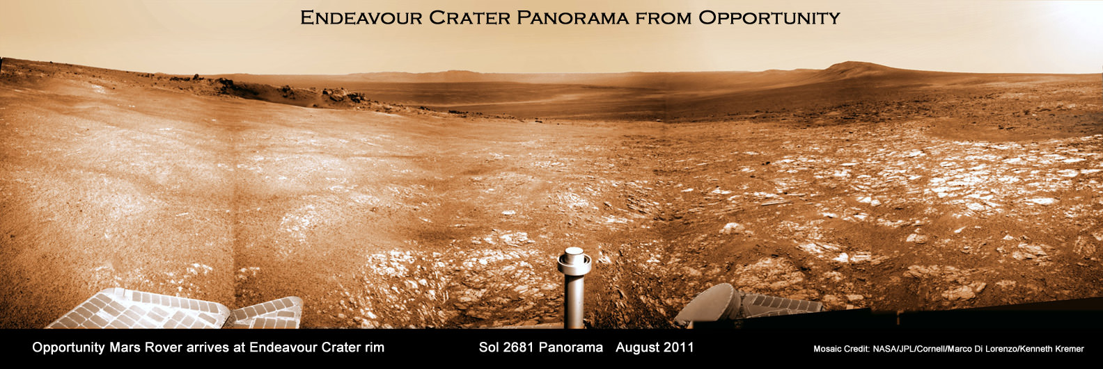
Endeavour Crater Panorama from Opportunity, Sol 2681, August 2011. NASA’s Opportunity Mars rover arrived at the rim of huge Endeavour crater on Sol 2681, August 9, 2011 and climbed up the ridge known as Cape York. A small crater dubbed ‘Odyssey’ is visible in the foreground at left. The rover has now driven to the outskirts of Odyssey to investigate the ejecta blocks which may stem from an ancient and wetter Martian Epoch. Opportunity snapped this soaring panorama showing distant portions of Endeavour’s rim - as far as 13 miles away - in the background. This photo mosaic was stitched together from raw images taken by Opportunity on Sol 2681. Mosaic Credit: NASA/JPL/Cornell/Marco Di Lorenzo/Kenneth Kremer

[/caption]NASA’s Mars Opportunity rover has finally arrived at the huge Martian crater named Endeavour that simultaneously offers a mother lode of superb scenery and potentially the “Mother of all Martian Science”. The epic journey took nearly three years.

The intrepid robogirl is now climbing uphill on a Scientific quest that may well produce bountiful results towards the most important findings ever related to the search for life on Mars. Opportunity arrived at the western rim of the 13 mile (21 km) wide Endeavour crater on the 2681st Sol , or Martian day, of a mission only warrantied to last 90 Sols.

See our new Opportunity panoramic mosaics (Marco Di Lorenzo & Ken Kremer) illustrating the magnificent scenery and science targets now at hand on the surface of the Red Planet, thanks to the diligent work of the science and engineering teams who created the twin Mars Exploration Rover (MER) vehicles – Spirit & Opportunity.

Opportunity made landfall at Endeavour at a ridge of the discontinuous crater rim named Cape York and at a spot dubbed “Spirit Point” – in honor or her twin sister Spirit which stopped communicating with Earth about a year ago following more than six years of active science duty. See traverse map mosaic.

The martian robot quickly started driving northwards up the gnetle slopes of Cape York and has reached a small crater named “Odyssey” – the first science target, Dr. Matt Golembek told Universe Today. Golembek is a Senior Research Scientist with the Mars Exploration Program at the Jet Propulsion Laboratory (JPL) in Pasadena, Calif.

“Large ejecta blocks are clearly visible on the rim of Odyssey crater,” said Golembek. The crater is about 66 feet (20 m) in diameter.

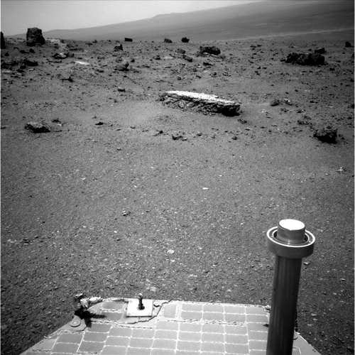
Odyssey is a small impact crater of interest to the team because it features exposed material from Mars ancient Noachian era that was ejected when the crater was excavated long ago. Opportunity carefully drove over several days to one of those ejecta blocks – a flat topped rock nicknamed Tisdale 2.

Endeavour Crater Panorama from Opportunity, Sol 2685, August 2011
NASA’s Opportunity Mars rover arrived at the rim of huge Endeavour crater on Sol 2681, August 9, 2011 and is climbed up the ridge known as Cape York. She drove to the flat topped Tisdale 2 rock at upper left to analyze it with the science instruments on the robotic arm. Opportunity snapped this soaring panorama showing distant portions of Endeavour’s rim - as far as 13 miles away - in the background. This photo mosaic was stitched together from raw images taken by Opportunity on Sol 2685.
Mosaic Credit: NASA/JPL/Cornell/Marco Di Lorenzo/Kenneth Kremer

“Opportunity is at a block of Odyssey crater ejecta called Tisdale 2 and the rock appears different from anything else we have seen,” Golembek explained.

Starting on Sol 2688 (Aug. 16) the rover began a science campaign time to investigate the rock with the instruments at the terminus of its robotic arm or IDD (Instrument Deployment Device) that will continue for some period of time.

“We are about to start an IDD campaign,” Golembek stated.

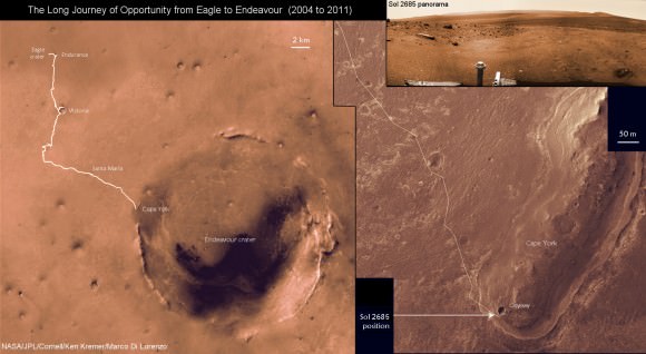
The Long Journey of Opportunity form Eagle to Endeavour Crater (2004 to 2011).
This map mosaic shows Opportunity’s epic trek of nearly eight years from landing at Eagle crater on January 24, 2004 to arrival at the giant 13 mile (21 km) diameter Endeavour crater in August 2011. Opportunity arrived the Endeavour’s rim and then drove up a ridge named Cape York. The photomosaic at top right show the outlook from Cape York on Sol 2685 (August 2011).
Mosaic Credit: NASA/JPL/Cornell/Kenneth Kremer/Marco Di Lorenzo

The team reports that the soil at Cape York is also of a different texture than any that Opportunity has seen so far on her incredible 20 mile (33 km) trek across the Meridiani Planum region of Mars. So far they haven’t seen of the iron-rich concretions, nicknamed “blueberries,” which have been plentiful on the surface along the way at numerous locations Opportunity has stopped at and investigated over the past 90 months. Initially the prime mission was projected to last 3 months – the remainder has been a huge bonus.

The science team is directing Opportunity to hunt for clay minerals, also known as phyllosilicates, that could unlock the secrets of an ancient Epoch on Mars stretching back billions and billions of years ago that was far wetter and very likely more habitable and welcoming to life’s genesis.

Phyllosilicate minerals form in neutral water that would be vastly more friendly to any potential Martian life forms – if they ever existed in the past or present. Signatures for phyllosilicates were detected by the CRISM instrument aboard NASA’s powerful Mars Reconnaissance Orbiter (MRO) spacecraft circling Mars

Flat-topped Tisdale 2 rock. Credit: NASA/JPL-Caltech
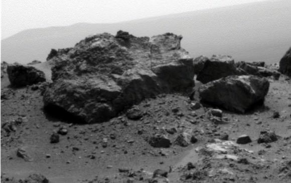
'Ridout' Rock on Rim of Odyssey Crater. Opportunity looked across small Odyssey crater on the rim of much larger Endeavour crater to capture this raw image from its panoramic camera during the rover's 2,685th Martian day, or sol, of work on Mars (Aug. 13, 2011). From a position south of Odyssey, this view is dominated by a rock informally named "Ridout" on the northeastern rim of Odyssey. The rock is roughly the same size as the rover, which is 4.9 feet (1.5 meters) long. Credit: NASA/JPL-Caltech/Cornell/ASU

Read my continuing features about Mars starting here
Opportunity Snaps Gorgeous Vistas nearing the Foothills of Giant Endeavour Crater
Dramatic New NASA Animation Depicts Next Mars Rover in Action
Opportunity Rover Heads for Spirit Point to Honor Dead Martian Sister; Science Team Tributes
Opportunity Rover Completes Exploration of fascinating Santa Maria Crater
Opportunity Surpasses 30 KM Driving and Snaps Skylab Crater in 3 D

GRAIL Lunar Twins Mated to Delta Rocket at Launch Pad

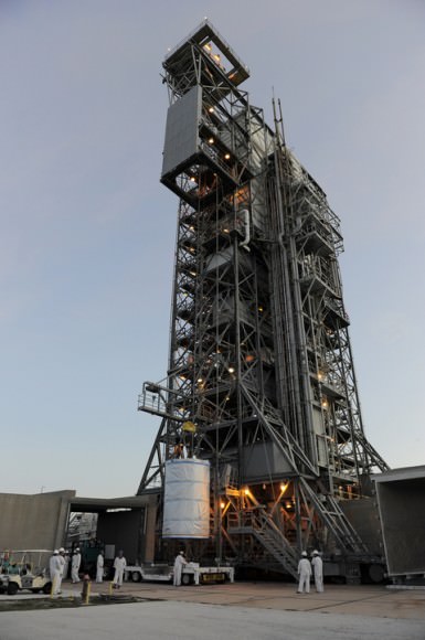
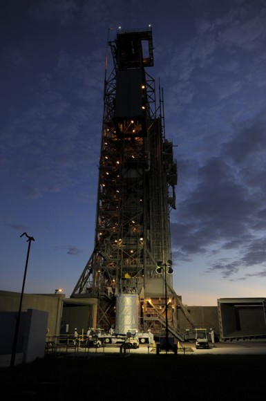
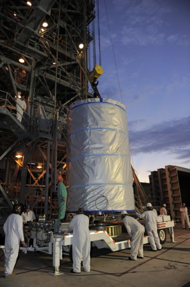
GRAIL Lunar Twins hoisted to top of Launch Pad 17B at Cape Canaveral. NASA's twin Gravity Recovery and Interior Laboratory (GRAIL) spacecraft are lifted to the top of their launch pad at Space Launch Complex 17B at Cape Canaveral Air Force Station in Florida and were mated to their Delta II Heavy Booster Rocket. They are wrapped in plastic to prevent contamination outside the clean room. Launch is scheduled for Sept. 8. Credit: NASA/Kim Shiflett

[/caption]

With blastoff just 2 ½ weeks away, NASA’s GRAIL lunar twins completed a major milestone towards launch today (Aug. 18) when they were mated to the top of the Delta II Heavy rocket that will boost them to the moon. Launch is slated for Sept. 8 at 8:37 a.m. EDT.

This morning the tightly wrapped $496 Million duo took their last trip on Earth before beginning their nearly four month journey to the Moon. GRAIL A & GRAIL B were carefully transported 15 miles (25 km) from the clean room processing facility at the Astrotech Space Operation’s payload processing facility in Titusville, Fla to Space Launch Complex 17B (SLC-17B) at Cape Canaveral Air Force Station in Florida.

“The GRAIL spacecraft transportation convoy to SLC-17B departed Astrotech at 11:55 p.m. EDT on Wednesday, Aug. 17, “ said Tim Dunn, NASA’s Delta II Launch Director in an interview with Universe Today. “The spacecraft, inside the handling can, arrived at the launch pad, SLC-17B, at 4:00 a.m. this morning.”

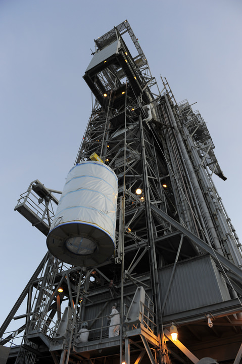
“The spacecraft was then hoisted by the Mobile Service Tower crane onto the Delta II launch vehicle and the spacecraft mate was complete at 9:30 a.m.”

Crane lifts GRAIL A & B to the top of the Mobile Service Tower on Aug. 18. The probes are wrapped in protective plastic sheeting inside the handling can. Credit: NASA/Kim Shiflett

Technicians joined the nearly identical and side by side mounted spacecraft onto the top of the guidance section adapter of the Delta’s second stage. The Delta II was built by United Launch Alliance (ULA).

“Tomorrow, the GRAIL spacecraft team will perform functional testing on both the GRAIL A and GRAIL B spacecraft,” Dunn told me.

“The next major milestone will be performance of the Integrated Systems Test (IST) on Monday, (8/22/11).

“Today’s spacecraft mate operation was flawlessly executed by the combined ULA and NASA Delta II Team,” said Dunn.

These tests will confirm that the spacecraft is healthy after the fueling and transport operations. After further reviews of the rocket and spacecraft systems the GRAIL team will install the payload fairing around the lunar probes.

NASA’s twin GRAIL Science Probes ready for Lunar Expedition
GRAIL B (left) and GRAIL A (right) spacecraft are mounted side by side on top of a payload adapter inside the clean room at Astrotech Space Operations facility. The spacecraft await lunar launch on Sept. 8, 2011. Credit: Ken Kremer

NASA’s dynamic duo will orbit the moon to determine the structure of the lunar interior from crust to core and to advance understanding of the thermal evolution of the moon.

“We are about to finish one chapter in the GRAIL story and open another,” said Maria Zuber, GRAIL’s principal investigator, based at the Massachusetts Institute of Technology in Cambridge in a statement. “Let me assure you this one is a real page-turner. GRAIL will rewrite the book on the formation of the moon and the beginning of us.”

The GRAIL launch will be the last for a Delta II in Florida.

GRAIL A & B lunar twins arrive at Pad 17B. Credit: NASA/Kim Shiflett

Technicians hoist GRAIL A & B lunar twins inside the handling can at Pad 17B. Credit: NASA/Kim Shiflett

Read my prior features about GRAIL
GRAIL Twins ready for NASA Science Expedition to the Moon: Photo Gallery
3 D Alien Snowman Graces Vesta

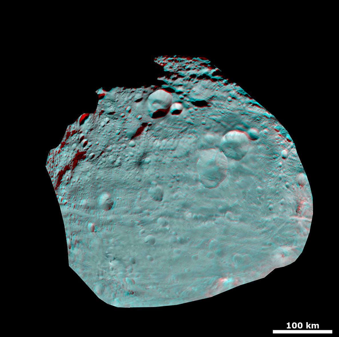
3D Snowman craters and Vesta’s Equatorial Region from Dawn. This anaglyph image of Vesta's equator with the crater feature named “snowman” (center, right) was put together from two clear filter images, taken on July 24, 2011 by the framing camera instrument aboard NASA's Dawn spacecraft. The anaglyph image shows hills, troughs, ridges and steep craters. The framing camera has a resolution of about 524 yards (480 meters) per pixel. Use red-green (or red-blue) glasses to view in 3-D (left eye: red; right eye: green [or blue]). Credit: NASA/JPL-Caltech/UCLA/MPS/DLR/IDA

[/caption]

An alien ‘Snowman’ on an alien World.

The ‘Snowman’ is a string of three craters and is among the most strange and prominent features discovered on a newly unveiled world in our solar system – the giant asteroid Vesta. It reminded team members of the jolly wintertime figure – hence its name – and is a major stand out in the 3 D image above and more snapshots below.

Until a few weeks ago, we had no idea the ‘Snowman’ even existed or what the rest of Vesta’s surface actually looked like. That is until NASA’s Dawn spacecraft approached close enough and entered orbit around Vesta on July 16 and photographed the Snowman – and other fascinating Vestan landforms.

“Each observation of Vesta is producing incredible views more exciting than the last”, says Dawn’s Chief Engineer, Dr. Marc Rayman of the Jet Propulsion Laboratory. “Every image revealed new and exotic landscapes. Vesta is unlike any other place humankind’s robotic ambassadors have visited.”

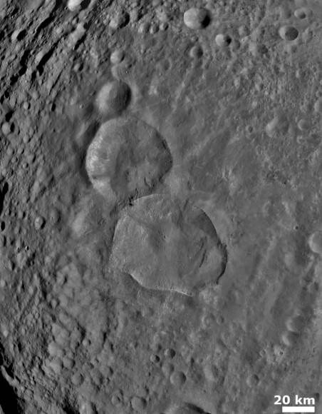
‘Snowman’ craters on Vesta. What is the origin of the ‘Snowman’?
The science team is working to determine how the ‘Snowman’ formed. This set of three craters is nicknamed ‘Snowman” and is located in the northern hemisphere of Vesta. NASA’s Dawn spacecraft obtained this image with its framing camera on August 6, 2011. This image was taken through the framing camera’s clear filter aboard the spacecraft. The framing camera has a resolution of about 280 yards (260 meters). Credit: NASA/JPL-Caltech/UCLA/MPS/DLR/IDA

The Snowman is located in the pockmarked northern hemisphere of Vesta – see the full frame image below. The largest of the three craters is some 70 km in diameter. Altogether the trio spans roughly 120 km in length. See Image at Left

“Craters, Craters, Craters Everywhere” – that’s one thing we can now say for sure about Vesta.

And soon we’ll known a lot more about the mineralogical composition of the craters and Vesta because spectral data is now pouring in from Dawn’s spectrometers.

After being captured by Vesta, the probe “used its ion propulsion system to spiral around Vesta, gradually descending to its present altitude of 2700 kilometers (1700 miles),” says Chief Engineer Rayman. “As of Aug.11, Dawn is in its survey orbit around Vesta.”

Dawn has now begun its official science campaign. Each orbit currently last 3 days.

Dawn’s scientific Principal Investigator, Prof. Chris Russell of UCLA, fondly calls Vesta the smallest terrestrial Planet !

I asked Russell for some insight into the Snowman and how it might have formed. He outlined a few possibilities in an exclusive interview with Universe Today.

“Since there are craters, craters, craters everywhere on Vesta it is always possible that these craters struck Vesta in a nearly straight line but many years apart,” Russell replied.

“On the other hand when we see ‘coincidences’ like this, we are suspicious that it is really not a coincidence at all but that an asteroid that was a gravitational agglomerate [sometimes called a rubble pile] struck Vesta.”

“As the loosely glued together material entered Vesta’s gravity field it broke apart with the parts moving on slightly different paths. Three big pieces landed close together and made adjacent craters.”

So, which scenario is it ?

“Our science team is trying to figure this out,” Russell told me.

“They are examining the rims of the three craters to see if the rims are equally degraded, suggesting they are of similar age. They will try to see if the ejecta blankets interacted or fell separately”

“The survey data are great but maybe we will have to wait until the high altitude mapping orbit [HAMO] to get higher resolution data on the rim degradation.”

Dawn will descend to the HAMO mapping orbit in September.

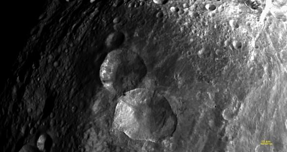
Close-up View of 'Snowman' craters.
This image of the set of three craters informally nicknamed ‘Snowman’ was taken by Dawn’s framing camera on July 24, 2011 after the probe entered Vesta’s orbit. Snowman is located in the northern hemisphere of Vesta. The image was taken from a distance of about of about 3,200 miles (5,200 kilometers). The framing camera was provided by Germany. Credit: NASA/JPL-Caltech/UCLA/MPS/DLR/IDA

Russell and the Dawn team are elated with the fabulous results so far, some of which have been a total surprise.

How old is the Snowman ?

“We date the age of the surface by counting the number of craters on it as a function of size and compare with a model that predicts the number of craters as a function of size and as a function of time from the present,” Russell responded.

“However this does not tell us the age of a crater. If the crater destroyed all small craters in its bowland and left a smooth layer [melt] then the small crater counts would be reset at the impact.”

“Then you could deduce the age from the crater counts. You can also check the degradation of the rim but that is not as quantitative as the small crater counts in the larger crater. The team is doing these checks but they may have to defer the final answer until they obtain the much higher resolution HAMO data,” said Russell.

Besides images, the Dawn team is also collecting spectral data as Dawn flies overhead.

“The team is mapping the surface with VIR- the Visible and Infrared Mapping Spectrometer – and will have mineral data shortly !”, Russell told me.

At the moment there is a wealth of new science data arriving from space and new missions from NASA’s Planetary Science Division are liftoff soon. Juno just launched to Jupiter, GRAIL is heading to the launch pad and lunar orbit and the Curiosity Mars Science Laboratory (MSL) is undergoing final preflight testing for blastoff to the Red Planet.

Russell had these words of encouragement to say to his fellow space explorers;

“Dawn wishes GRAIL and MSL successful launches and hopes its sister missions join her in the exploration of our solar system very shortly.”

“This year has been and continues to be a great one for Planetary Science,” Russell concluded.

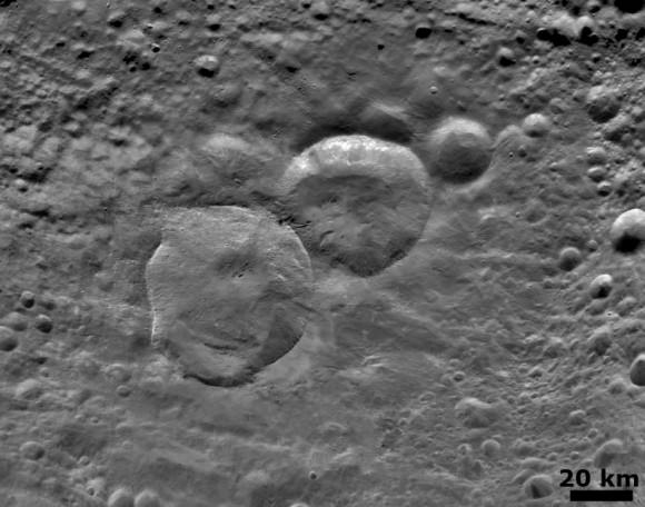
Detailed 'Snowman' Crater
Dawn obtained this image with its framing camera on August 6, 2011. This image was taken through the camera’s clear filter. The camera has a resolution of about 260 meters per pixel. This image shows a detailed view of three craters, informally nicknamed 'Snowman' by the camera’s team members. Credit: NASA/JPL-Caltech/UCLA/MPS/DLR/IDA
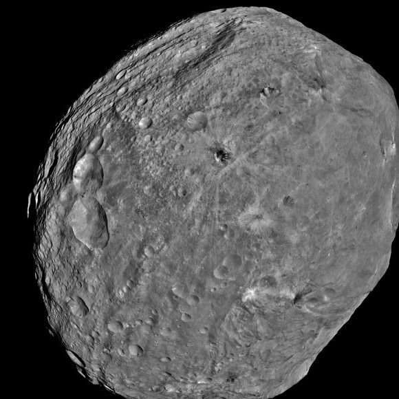
Dawn snaps First Full-Frame Image of Asteroid Vesta – Snowman at Left
NASA's Dawn spacecraft obtained this image of the giant asteroid Vesta with its framing camera on July 24, 2011. It was taken from a distance of about 3,200 miles (5,200 kilometers). Dawn entered orbit around Vesta on July 15, and will spend a year orbiting the body. The Dawn mission to Vesta and Ceres is managed by NASA's Jet Propulsion Laboratory, Pasadena, Calif. The framing cameras were built by the Max Planck Institute for Solar System Research, Katlenburg-Lindau, Germany, and the German Aerospace Center (DLR) Institute of Planetary Research, Berlin. Credit: NASA/JPL-Caltech/UCLA/MPS/DLR/IDA

Read my prior features about Dawn
NASA Unveils Thrilling First Full Frame Images of Vesta from Dawn
Dawn Spirals Down Closer to Vesta’s South Pole Impact Basin
First Ever Vesta Vistas from Orbit – in 2D and 3D
Dawn Exceeds Wildest Expectations as First Ever Spacecraft to Orbit a Protoplanet – Vesta
Dawn Closing in on Asteroid Vesta as Views Exceed Hubble
Dawn Begins Approach to Asteroid Vesta and Snaps First Images
Revolutionary Dawn Closing in on Asteroid Vesta with Opened Eyes