Fog on Titan? Help Review Mike Brown’s Paper

Fog on Titan. Credit: Mike Brown, et al.

[/caption]
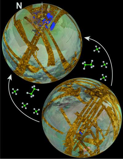
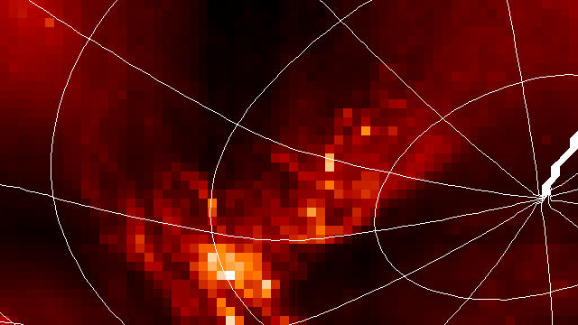
Titan is the only place in the solar system other than the earth that appears to have large quantities of liquid sitting on the surface. Granted, conditions on Titan are quite different than on Earth. For one thing, it’s a lot colder on Titan and the liquids there are various types of hydrocarbons. “Methane is to Titan what water is to the earth,” says astronomer Mike Brown (yes, that guy, of Pluto, Eris and Makemake fame.) But now Brown and his colleagues have discovered another similarity. Titan has fog. “All of those bright sparkly reddish white patches (shown in the image here) are fog banks hanging out at the surface in Titan’s late southern summer,” Brown wrote in his blog.

Wow.

But how does this happen? Fog only usually appears when 1.) there is liquid in the atmosphere (i.e., that means it must be “humid” on Titan) and 2.) the air temperature cools drastically. But Titan’s atmosphere is extremely thick, so it cools slowly. Plus the atmosphere is already really cold and making it colder would be difficult.

“If you were to turn the sun totally off,” said Brown, “Titan’s atmosphere would still take something like 100 years to cool down. And even the coldest parts of the surface are much too warm to ever cause fog to condense.”

So what is going on there?

To get the humidity in Titan’s atmosphere, Brown said the liquid methane must be evaporating.
“Evaporating methane means it must have rained,” he wrote. “Rain means streams and pools and erosion and geology. Fog means that Titan has a currently active methane hydrological cycle doing who knows what on Titan.”

Plus, the only one way to make the fog stick around on the ground for any amount of time is have both humidity and cool air. And the only way to cool the air on Titan is have it in contact with something cold: like a pool of evaporating liquid methane.

Brown said the fog doesn’t appear to be around the just the dark areas near the south pole that likely are hydrocarbon lakes. “It looks like it might be more or less everywhere at the south pole. My guess is that the southern summer polar rainy season that we have witnessed over the past few years has deposited small pools of liquid methane all over the pole. It’s slowly evaporating back into the atmosphere where it will eventually drift to the northern pole where, I think, we can expect another stormy summer season. Stay tuned. Northern summer solstice is in 2016.”

And here comes the fun part (as if fog on Titan wasn’t fun enough!) Brown is looking for a little citizen science help. You can read the paper on this by Brown and his colleagues here. Most peer review is done by one person, and brown would like a few more eyes to see this paper to look for any flaws, and to see if their arguments make sense and are convincing.

Brown says: “I thought I would try an experiment of my own here. It goes like this: feel free to provide a review of my paper! I know this is not for everyone. Send it directly to me or comment here (at his blog). I will take serious comments as seriously as those of the official reviewer and will incorporate changes into the final version of the paper before it is published.

Please, though, serious reviewers only.

Source: Mike Brown’s Blog

Titan’s Desert Sports a Surprising, Powerful Storm

CREDIT: Gemini Observatory/AURA/Henry Roe, Lowell Observatory/Emily Schaller, Insitute for Astronomy, University of Hawai‘i

[/caption]

Titan is just fun. Seems like every other week, another fascinating tidbit emerges about how interesting Saturn’s famous moon really is — and how compellingly similar to Earth.

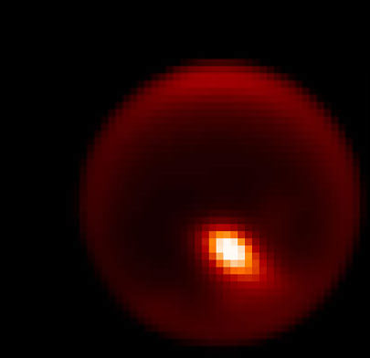
A United States team of astronomers is releasing this image today in Nature. It’s an adaptive optics peek at a storm over the wild object’s parched, dry desert.

The new research, to be published in the August 13 issue of the journal, announces the discovery of significant cloud formation (about three million square kilometers, or 1.16 million square miles) within the moon’s tropical zone near its equator. Prior to this event (in April 2008) it was not known whether significant cloud formation was possible in Titan’s tropical regions. This activity in Titan’s tropics and mid-latitudes also seems to have triggered subsequent cloud development at the moon’s south pole where it was considered improbable due to the Sun’s seasonal angle relative to Titan.

The evidence comes from astronomers using the Gemini North telescope and NASA’s Infrared Telescope Facility (IRTF), both on Hawaii’s Mauna Kea.

“We obtain frequent observations with IRTF giving us a ‘weather report’ of sorts for Titan. When the IRTF observations indicate that cloud activity has increased, we are able to trigger the next night on the Gemini telescope to determine where on Titan the clouds are located,” said team member Emily Schaller, who was at the University of Hawai‘i Institute for Astronomy when this work was done.

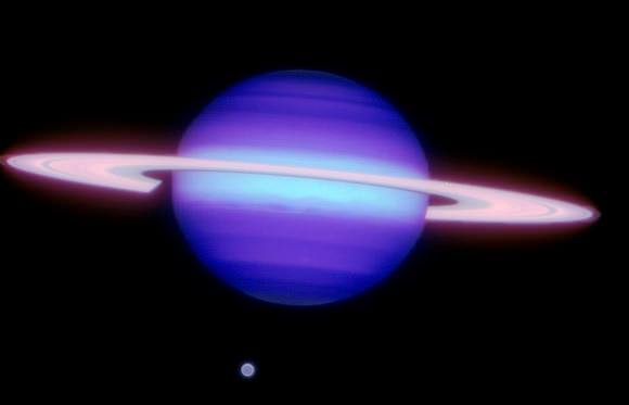
Saturn and Titan (six o'clock). CREDIT: Gemini Observatory/AURA/Henry Roe, Lowell Observatory/Emily Schaller, Insitute for Astronomy, University of Hawai‘i

Titan, the solar system’s second largest moon, has received considerable attention by scientists since NASA’s Cassini mission deployed the Huygens probe that descended through the moon’s atmosphere in January 2005. During its descent, the probe’s cameras revealed small-scale channels and what appear to be stream beds in the equatorial regions that seemed to contradict atmospheric models predicting extremely dry desert-like conditions near the equator. Until now these erosional (fluvial) features have been explained by the possibility of liquid methane seeping out of the ground.

“In April 2008 we observed what was a global event that shows how storm activity in one region can trigger clouds, and probably rainfall, over arid regions, such as the tropics where Huygens landed,” said team member Henry Roe, an astronomer at Lowell Observatory. “Of course these rain showers are not liquid water like here on Earth, but are instead made of liquid methane. Just like the streambeds and channels that are carved by liquid water on Earth, we see features on Titan that have been created by flowing liquid methane.”

Unlike the Earth, on Titan, where the temperature is hundreds of degrees below freezing, methane (or natural gas) is a liquid and it the dominant driver of the moon’s weather and surface erosion. Any water on Titan is frozen on or below the moon’s surface and resemble rocks or boulders on Titan’s surface.

Mid-latitude and polar cloud formations have been bserved for many years (by this team and others) but the combination of extensive monitoring at the IRTF with rapid follow-up using Gemini allowed the team to capture the process as it unfolded near the equator. The team monitored Titan on 138 nights over 2.2 years and during that time cloud cover was well under one percent. Then, mid-April of 2008, just after team member and Ph.D. candidate Schaller had handed in her doctoral dissertation focusing on Titan’s minimal cloud cover she noticed the dramatic increase in cloud cover.

During this three-week episode clouds forming at about 30 degrees south latitude were observed, followed several days later by clouds closer to the equator and at the moon’s south pole. The apparent connection between the cloud formations leads to the possibility that cloud formation in one area of the moon can instigate clouds in other areas by a process known as atmospheric teleconnections. This same phenomena occurs in the Earth’s atmosphere and is caused by what are called planetary Rossby waves which are well understood.

The high-resolution Gemini images of Titan were all obtained with adaptive optics technology which uses a deformable mirror to remove distortions to light caused by the Earth’s atmosphere and produce images showing remarkable detail in the tiny disk of the moon.

“Without this technology this discovery would be impossible from the surface of the Earth,” said Schaller. Currently the Cassini spacecraft is orbiting Saturn but only flies by Titan once every 6 weeks or so. This makes continuous ground-based monitoring important for studying features like these with shorter periods on the order of 3-weeks like this storm.

Further detail about the lead image: Gemini North adaptive optics image of Titan showing storm feature (bright area). Titan is about 0.8 arcsecond across in this 2.12 micron near-infrared image obtained on April 14, 2008 (UTC). CREDIT: Gemini Observatory/AURA/Henry Roe, Lowell Observatory/Emily Schaller, Insitute for Astronomy, University of Hawai‘i

Source: Gemini. Other information available through the University of Hawaii, the National Science Foundation (NSF), Lowell Observatory in Flagstaff, Arizona and, of course, Nature.

Titan Shaping Up to Look a Lot Like Pre-Life Earth

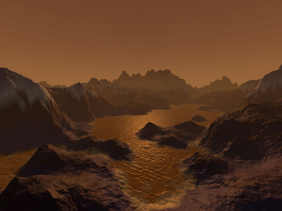
An artist's imagination of hydrocarbon pools, icy and rocky terrain on the surface of Saturn's largest moon Titan. Image credit: Steven Hobbs (Brisbane, Queensland, Australia)

[/caption]

It’s more than a billion kilometers (759 million miles) away, but the more astronomers learn about Titan, the more it looks like Earth.

That’s the theme of two talks happening this week at the International Astronomical Union meeting in Rio de Janeiro, Brazil. Two NASA researchers, Rosaly Lopes and Robert M. Nelson of the Jet Propulsion Laboratory in Pasadena, California, are reporting that weather and geology have very similar actions on Earth and Titan — even though Saturn’s moon is, on average, 100 degrees C (212 degrees F) colder than Antarctica (and certainly much more frigid than either California or Brazil; lucky astronomers).

The researchers are also reporting a tantalizing clue in the search for life: Titan hosts chemistry much like pre-biotic conditions on Earth.

Wind, rain, volcanoes, tectonics and other Earth-like processes all sculpt features on Titan’s complex and varied surface — except, according to additional research being presented at the meeting,  scientists think the “cryovolcanoes” on Titan eject cold slurries of water-ice and ammonia instead of scorching hot magma.

“It is really surprising how closely Titan’s surface resembles Earth’s,” Lopes said. “In fact, Titan looks more like the Earth than any other body in the Solar System, despite the huge differences in temperature and other environmental conditions.”

The joint NASA/ESA/ASI Cassini-Huygens mission has revealed details of Titan’s geologically young surface, showing few impact craters, and featuring mountain chains, dunes and even “lakes.” The RADAR instrument on the Cassini orbiter has now allowed scientists to image a third of Titan’s surface using radar beams that pierce the giant moon’s thick, smoggy atmosphere. There is still much terrain to cover, as the aptly named Titan is one of the biggest moons in the Solar System, larger than the planet Mercury and approaching Mars in size.

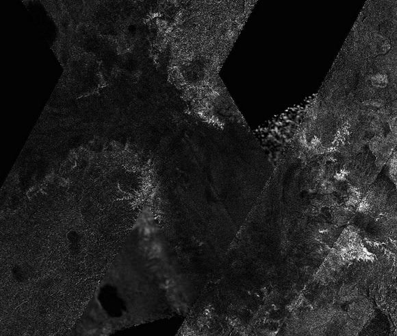
New Cassini mosaic showing a dried-out lake at Titan's south pole.

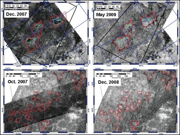
Titan has long fascinated astronomers as the only moon known to possess a thick atmosphere, and as the only celestial body other than Earth to have stable pools of liquid on its surface. The many lakes that pepper the northern polar latitudes, with a scattering appearing in the south as well, are thought to be filled with liquid hydrocarbons, such as methane and ethane.

On Titan, methane takes water’s place in the hydrological cycle of evaporation and precipitation (rain or snow) and can appear as a gas, a liquid and a solid. Methane rain cuts channels and forms lakes on the surface and causes erosion, helping to erase the meteorite impact craters that pockmark most other rocky worlds, such as our own Moon and the planet Mercury.

Another Cassini instrument called the Visual and Infrared Mapping Spectrometer (VIMS) had previously detected an area, called Hotei Regio, with a varying infrared signature, suggesting the temporary presence of ammonia frosts that subsequently dissipated or were covered over. Although the ammonia does not stay exposed for long, models show that it exists in Titan’s interior, indicating that a process is at work delivering ammonia to the surface. RADAR imaging has indeed found structures that resemble terrestrial volcanoes near the site of suspected ammonia deposition.

Nelson said new infrared images of the region, also presented at the IAU, “provide further evidence suggesting that cryovolcanism  has deposited ammonia onto Titan’s surface. It has not escaped our attention that ammonia, in association with methane and nitrogen, the principal species of Titan’s atmosphere, closely replicates the environment at the time that life first emerged on Earth. One exciting question is whether Titan’s chemical processes today support a prebiotic chemistry similar to that under which life evolved on Earth?”

Many Titan researchers hope to observe Titan with Cassini for long enough to follow a change in seasons. Lopes thinks that the hydrocarbons there likely evaporated because this hemisphere is experiencing summer. When the seasons change in several years and summer returns to the northern latitudes, the lakes so common there may evaporate and end up pooling in the south.

Lead image caption: Artist’s impression of hydrocarbon pools, icy and rocky terrain on the surface of Saturn’s largest moon Titan. Image credit: Steven Hobbs (Brisbane, Queensland, Australia)

Source: International Astronomical Union (IAU)

Plains of Titan to be Named for “Dune” Novels

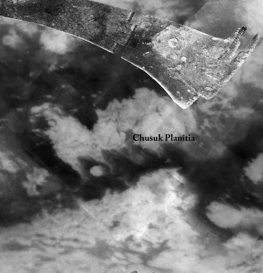
Chusuk Planitia on Titan. Credit: USGS

[/caption]

Titan’s mysterious dark plains will be named after planets in the series of “Dune” science fiction novels by author Frank Herbert. The US Geological Survey Astrogeology Science Center announced the first plain or “planitia” given a name will be designated as Chusuk Planitia. Chusuk was a planet from the Dune series, known for its musical instruments. Chusuk Planitia on Titan is located at 5.0S, 23.5W, and in the picture here is the small, dark area next to the “C” of Chusuk.

Download a large map of Titan with the named features (pdf file).

The Cassini spacecraft has enabled us to finally see these dark plains on Titan. This moon is enveloped by an orange haze of naturally produced photochemical smog that frustratingly obscured its surface prior to Cassini’s arrival. Since 2004, the spacecraft’s observations have taken the study of this unique world into a whole new dimension.

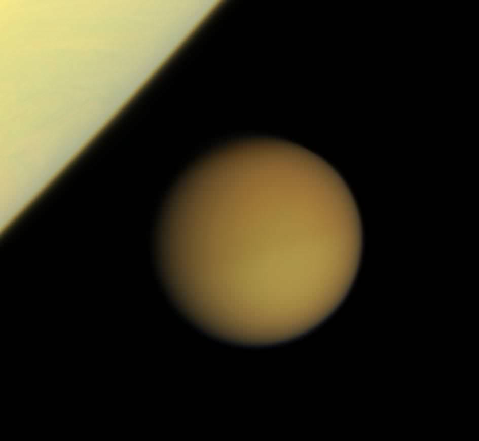
Crescent Titan. Credit: NASA/JPL/Space Science Institute


One of Cassini’s latest images of Titan looks down on the north pole of Titan, showing night and day in the northern hemisphere of Saturn’s largest moon.

This view is centered on terrain at 49 degrees north latitude, 243 degrees west longitude. The north pole of Titan is rotated about 23 degrees to the left and it lies on the terminator above and to the left of the center of the image. Titan is 5,150 kilometers, or 3,200 miles across.

This natural color image was created by combining images taken with red, green and blue spectral filters. The images were obtained with the Cassini spacecraft wide-angle camera on June 6, 2009 at a distance of approximately 194,000 kilometers (121,000 miles) from Titan. Image scale is 11 kilometers (7 miles) per pixel.

Titan is one of the most Earth-like world we have found in our solar system. With its thick atmosphere and organic-rich chemistry, Titan resembles a frozen version of Earth, several billion years ago, before life began pumping oxygen into our atmosphere.

Cassini has revealed that Titan’s surface is shaped by rivers and lakes of liquid ethane and methane which forms clouds and occasionally rains from the sky as water does on Earth. Winds sculpt vast regions of dark, hydrocarbon-rich dunes and plains around Titan’s equator and low latitudes.

Source: USGS, Cassini website.

Hat tip to Emily Lakdawalla!

Book Your Tours of Titan and Enceladus Today!

Now's the time to book your Cassini tour!

[/caption]
Looking to go somewhere far-flung and exotic? Now is the time to book your excursion, and the Cassini spacecraft has several flyby tours of the moons Titan and Enceladus scheduled for the next few months. Major tour operators say the cost of long-haul flights and summer holidays prices are at an all time low. But with Cassini, you can travel for FREE! just by following the along with Universe Today and the Cassini website. Thrill with some of the closest flybys ever of the mystery moon Titan, and delight in explorations of the geyser plumes of Enceladus. As a special bonus, if you book today, you can experience Saturn’s solar equinox, as in August the sun crosses from the southern hemisphere to the north. Wonderful worlds are beckoning – come away starting June 6 with Cassini! It’s a worry free vacation. See below for available tour dates! Destination fees do not apply.

Seriously now, here are the upcoming dates scheduled for Cassini flybys of Titan and Enceladus:

Dates listed in Spacecraft Event Time (SCET) — the time the event happens at the spacecraft based on Coordinated Universal Time (UTC).
Click here for details about time conversions.

June 6 — Titan flyby (965 kilometers) — T-56: This is the only dusk side observation at mid Southern latitudes, and the Ion and Neutral Mass Spectrometer (INMS) will be taking advantage of that, riding along with Cassini’s RADAR at closest approach. It’s the only time in the mission the spacecraft will get simultaneous coverage of the dusk side while in the wake magnetospheric interaction region. The Visual and Infrared Mapping Spectrometer (VIMS) and the Imaging Science Subsystem ISS will observe eastern Tsegihi, a bright region in Titan’s southern mid-latitudes.

June 22 –– Titan flyby (955.5) kilometers — T-57: RADAR and INMS again share prime opportunities near closest approach. The RADAR synthetic aperture radar (SAR) imager observation runs parallel to observations in the T-55 and T-56 flybys in the southern hemisphere mapping sequence. Earlier, RSS observes an occultation on the inbound leg. T-57 is another flank-out, post-dusk flyby, with a minimum altitude of about 1000 kilometers. As in T-55 and T-56 flybys, magnetometer measurements will provide a description of the draping and the pileup of the external magnetic field around Titan on the nightside hemisphere. The flyby will also be a good complement to previous flybys in order to characterize the background field for a similar local time with respect to Saturn and different SKR (Saturn kilometric radiation) longitudes.

July 8 — Titan flyby (965 kilometers) — T-58: The Ultraviolet Imaging Spectrograph UVIS observes a solar occultation while inbound towards Titan, and then a stellar occultation on the spacecraft’s outbound trajectory. RADAR’s SAR swath runs along the western edge of Xanadu to study its boundary with Shangri-La, a large equatorial dark region. The swath runs parallel to the T-55/56/57 mapping sequence and covers Ontario Lacus, a methane-ethane lake near the south pole of Titan.

July 24 — Titan flyby (955 kilometers) — T-59: The spacecraft’s instruments sample Titan’s southern mid-latitudes, with the Cassini Plasma Spectrometer (CAPS) controlling pointing at closest approach.

Aug. 9 –– Titan flyby (970) kilometers — T-60: RADAR takes a South pole pass. The resulting swath links up with the T-13 flyby swath at the edge of Xanadu, an Australia-sized, bright region on Titan. ISS will acquire high-resolution, low-phase-angle imaging of western Senkyo, a wide dark region near the equator.

Aug. 11 –– Saturn will go through the solar Equinox as the Sun crosses from the southern hemisphere to the north. For about two months on either side of that date rings scientists will be running an Equinox campaign to observe the rings in this season change.

The Cassini team will be watching for topographic features in the rings that can only be seen in this special geometry. Any features in the rings that are not exactly in the ‘ring plane’ will be seen to cast shadows.

Cassini scientists will also be looking at the thermal properties of the rings in this season change. Most rings have seen heating on the north side over the past 14.5 years, but the B ring’s densest portions have remained cold with no solar heat penetrating that ring for the past 14.5 years.

This Rings Equinox campaign is a unique opportunity provided by the long duration of the Cassini Mission.

Aug. 25 — Titan flyby (970 kilometers) — T-61: RADAR gathers a SAR swath over the Huygens landing site. The swath is near-equatorial, covering Dilmun, Adiri and Belet. As the SAR parallels and overlaps the T-8 flyby, this should provide a good stereo opportunity over the Belet sand dunes. T-61 is the only southern equatorial wake observation in the mission, so the Magnetosphere and Plasma Science (MAPS) instruments take advantage of the opportunity.

Oct. 12 — Titan flyby (1,300 kilometers) — T-62: This flyby offers excellent VIMS and UVIS observing opportunities, including a UVIS solar occultation that reaches down to Titan’s surface. CIRS takes observations while Titan is in eclipse, measuring the temperature, aerosol density and composition near 75 South. This is the only low altitude in nose side magnetospheric interaction pass in the extended mission.

Nov. 2 — Enceladus flyby (99 kilometers) — 120EN: This is the seventh targeted Enceladus flyby of the Cassini mission and will take the spacecraft to the lowest altitude above the active south pole region. This will also be the deepest plume passage of the tour, allowing for sensitive measurements of the geyser-like plume composition and density.

Nov. 21 — Enceladus flyby (1,603 kilometers) — 121EN: The eighth targeted Enceladus flyby, this is an approximate 1600 kilometer pass over the south pole enabling imaging of the warm, active tiger stripes.

Dec. 12 — Titan flyby (4,850 kilometers) — T-63: CAPS takes advantage of the T-63 flyby being the best wake passage in the extended mission to direct pointing at closest approach.

Dec. 28 — Titan flyby (955 kilometers) — T-64: RADAR captures HiSAR SAR over the North polar lakes to perform stereo and/or seasonal change detection. This is the only north polar SAR in the extended mission. Due to the location of the point of closest approach, this is a potentially important flyby in the effort to detect an intrinsic magnetic field within Titan. This is also an opportunity to sample the high northern atmosphere.

Source: Cassini website

Titan (Weirdness) is More Than Meets The Eye

[/caption]

Think Titan looks pretty round?

Not quite, according to new data released today by the Cassini radar team — and slight irregularities in the shape of the bizarre moon may account for the concentration of lakes at the highest latitudes, among other perplexing features. 

titan-lakes
NASA/JPL

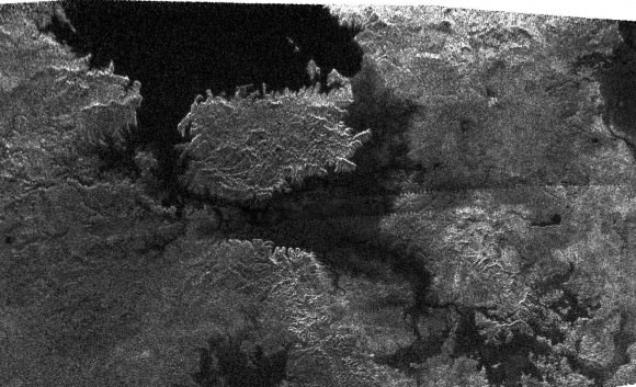
The radar image above, obtained by Cassini’s radar instrument during a near-polar flyby in 2007, shows a big island smack in the middle of one of the larger lakes imaged on Saturn’s moon Titan. The island is about 90 kilometers (62 miles) by 150 kilometers (93 miles) across, about the size of Kodiak Island in Alaska or the Big Island of Hawaii.  The image is centered at about 79 north degrees north (north is left) and 310 degrees west, adding weight to the theory that most of Titan’s lakes occur near the poles. 

Titan is an intriguing object partly because its climate cycles are reminiscent of Earth’s, but tend to rely on hydrocarbons like methane and ethane instead of water — which couldn’t exist in a liquid state at temperatures hundreds of degrees below zero. Methane and ethane fill the air with a smoggy haze that rains down as ash. Sometimes it’s washed away by hydrocarbons that flow like gasoline and collect in black lakes with surfaces as smooth as glass.

Cassini has been orbiting Saturn for four years, observing Titan periodically with multiple radar instruments. A research team led by Howard Zebker, a geophysicist at Stanford University, has been using the radar data to estimate the surface elevation. Combined, two instruments — a nadir-pointing radar altimeter and a multiple-beam synthetic aperture radar (SAR) imaging system  — measure the time delay of the altimeter echoes and the precise radar beam angles to points on the surface.

“These techniques show that the poles of Titan lie at lower elevations than the equator, and that the topography also varies longitudinally,” the authors report in today’s Science Express..

“If we posit that the lakes are surface expressions of a more or less continuous liquid organic ‘water table,’ then the lower elevations of the poles could lead to the observed preponderance of lakes at high latitudes,” they add. In other words, the lower elevations of poles may make them the only places where any continuous, liquid “water table” would be close enough to the moon’s surface to appear as lakes. 

Titan’s overall shape, they suggest, might be that a sphere slightly flattened at the top and bottom. The exact mechanisms behind the oblate shape are unclear. Titan is also elongated toward Saturn, due to the tides raised by Saturn’s gravity. 

Source: The paper appears online at the Science Express website. More Titan images are available at the Cassini website.

Virtual Fly-Over of Titan

Cassini's radar mapper has obtained stereo views of close to 2 percent of Titan's surface during 19 flybys over the last five years. Image credit: NASA/JPL/USGS

[/caption]
Hang on, and enjoy a virtual flyover of Saturn’s moon Titan! Data from Cassini’s radar instrument have been used to create new flyover maps of Saturn’s largest moon. The maps show the topography of Titan in 3-D, and illustrating the height of the 1,200-meter (4,000-foot) mountain tops, the north polar lake country, the vast dunes more than 100 meters (300 feet) high that crisscross the moon, and the thick flows that may have oozed from possible ice volcanoes. “These flyovers let you take in the bird’s-eye sweeping views of Titan, the next best thing to being there,” said Randy Kirk, from the Science Center at the U.S. Geological Survey, who created the maps.. “We’ve mapped many kinds of features, and some of them remind me of Earth. Big seas, small lakes, rivers, dry river channels, mountains and sand dunes with hills poking out of them, lava flows.” Click the image above to see one of the movies.

During its mission, Cassini plans to map more than three percent of Titan’s surface in 3-D. About 38 percent of Titan’s surface has been mapped with radar so far. On March 27, Cassini will complete its 52nd targeted flyby of Titan.

Kirk used some of the 20 or so areas where two or more overlapping radar measurements were obtained during 19 Titan flybys to create the 3. These stereo overlaps cover close to two percent of Titan’s surface. The process of making topographic maps from them is just beginning, but the results already reveal some of the diversity of Titan’s geologic features.

Click here for another flyover movie in color, showing a strip of Titan’s surface in 3-D.

High and low features are shown in unprecedented detail at about 2.4-kilometer (1.5-mile) resolution. The maps show some features that may be volcanic flows. These flows meander across a shallow basin in the mountains. One area suspected to be an ice volcano, Ganesa Macula, does not appear to be a volcanic dome. It may still have originated as a volcano, but it’s too soon to know for sure. “It could be a volcanic feature, a crater, or something else that has just been heavily eroded,” added Kirk.

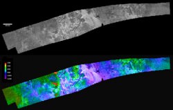
A strip of Titan in both black & white and color. Credit: NASA/JPL/USGS

The stereo coverage includes a large portion of Titan’s north polar lakes of liquid ethane and methane, which in previous images has shown changes in lake size over time. Based on these topographical models, scientists are better able to determine the depth of lakes. The highest areas surrounding the lakes are some 1,200 meters (about 4,000 feet) above the shoreline. By comparing terrain around Earth to the Titan lakes, scientists estimate their depth is likely about 100 meters (300 feet) or less.

More 3-D mapping of these lakes will help refine these depth estimates and determine the volume of liquid hydrocarbons that exist on Titan. This information is important because these liquids evaporate and create Titan’s atmosphere. Understanding this methane cycle can provide clues to Titan’s weather and climate.

Source: JPL

Hubble Snaps Rare Moon Parade Across Saturn

[/caption]

Once every 15 years, Saturn flashes its paper-thin rings in edge-on formation relative to Earth. 

Because the orbits of Saturn’s major satellites are in the ring plane, too, this alignment gives astronomers a rare opportunity to capture a spectacular parade of celestial bodies crossing Saturn’s surface.

Leading this moon train is Titan – larger than the planet Mercury. The frigid moon’s thick nitrogen atmosphere is tinted orange with the smoggy byproducts of sunlight interacting with methane and nitrogen. Several of the much smaller icy moons that are closer in to the planet line up along the upper edge of the rings. 

In the image, snapped by the Hubble Space Telescope on February 24, the giant orange moon Titan casts a large shadow onto Saturn’s north polar hood. Below Titan, near the ring plane and to the left is the moon Mimas, casting a much smaller shadow onto Saturn’s equatorial cloud tops. Farther to the left, and off Saturn’s disk, are the bright moon Dione and the fainter moon Enceladus.

Hubble’s exquisite sharpness also reveals Saturn’s banded cloud structure, which is similar to Jupiter’s.

hs-2009-12-b-print
The top frame captures the giant moon Titan and its shadow near Saturn's northern polar hood. Dione, the brightest of the icy moons in this view – which are closer in to Saturn – can easily be traced crossing the disk from far left to image center. In the center frame, the smaller moon Enceladus can be seen near the western limb of Saturn. Credit: NASA, ESA, and the Hubble Heritage Team (STScI/AURA)

At the time, Saturn was at a distance of roughly 775 million miles (1.25 billion kilometers) from Earth. Hubble can see details as small as 190 miles (300 km) across on Saturn. The dark band running across the face of the planet slightly above the rings is the shadow of the rings cast on the planet.

Early 2009 was a favorable time for viewers with small telescopes to watch moon and shadow transits crossing the face of Saturn. Titan, Saturn’s largest moon, crossed Saturn on four separate occasions: January 24, February 9, February 24, and March 12, although not all events were visible from all locations on Earth.

 This “ring plane crossing” occurs every 14-15 years. In 1995-96 Hubble witnessed the ring plane crossing event, as well as many moon transits, and even helped discover several new moons of Saturn.

Source (and more images!): HubbleSite

Titan Dunes Turn Climate Models Upside Down

Map of dunes on Titan, with arrows indicating the general wind direction. Dark areas without arrows might have dunes but have not yet been imaged with radar. Credit: NASA/JPL/Space Science Institute (Boulder, Colorado)

Scientists have mapped vast dune fields on Titan that may align with the wind on Saturn’s biggest moon — flowing opposite the way climate models had predicted.

The maps, as above, represent four years of radar data collected by the Cassini spacecraft. They reveal rippled dunes that are generally oriented east-west, which means Titan’s winds probably blow toward the east instead of the west. If so, Titan’s surface winds blow opposite the direction suggested by previous global circulation models. On the example above, the arrows indicate the general wind direction. The dark areas without arrows might have dunes but have not yet been imaged. 

“At Titan there are very few clouds, so determining which way the wind blows is not an easy thing, but by tracking the direction in which Titan’s sand dunes form, we get some insight into the global wind pattern,” says Ralph Lorenz, Cassini radar scientist at Johns Hopkins University in Maryland. “Think of the dunes sort of like a weather vane, pointing us to the direction the winds are blowing.”

Titan’s dunes are believed to be made up of hydrocarbon sand grains likely derived from organic chemicals in Titan’s smoggy skies. The dunes wrap around high terrain, which provides some idea of their height. They accumulate near the equator, and may pile up there because drier conditions allow for easy transport of the particles by the wind. Titan’s higher latitudes contain lakes and may be “wetter” with more liquid hydrocarbons, not ideal conditions for creating dunes.

“Titan’s dunes are young, dynamic features that interact with topographic obstacles and give us clues about the wind regimes,” said Jani Radebaugh, from Brigham Young University in Utah. “Winds come at these dunes from at least a couple of different directions, but then combine to create the overall dune orientation.”

Researchers say the wind pattern is important for planning future Titan explorations that might involve balloon-borne experiments. Some 16,000 dune segments were mapped out from about 20 radar images, digitized and combined to produce the new map, which is available at http://saturn.jpl.nasa.gov and http://www.nasa.gov/cassini. A paper based on the new findings appeared in the Feb. 11 issue of Geophysical Research Letters.

Cassini, which launched in 1997 and is now in extended mission operations, continues to blaze its trail around the Saturn system and will visit Titan again on March 27. Seventeen Titan flybys are planned this year.

The Cassini-Huygens mission is a cooperative project of NASA, the European Space Agency and the Italian Space Agency. NASA’s Jet propulsion Laboratory (JPL) in Pasadena, California manages the Cassini-Huygens mission. The Cassini orbiter was designed, developed and assembled at JPL. The radar instrument was built by JPL and the Italian Space Agency, working with team members from the United States and several European countries. The imaging operations center is based at the Space Science Institute in Boulder, Colorado.

LEAD IMAGE CREDIT: NASA/JPL/Space Science Institute (Boulder, Colorado)

Source: NASA

Next Big Planetary Mission: To Jupiter and Its Moons

Artist concept of proposed missions to the Jupiter system (left) and the Saturn system (right). Image credit: NASA/JPL

[/caption]
At a meeting last week between NASA and ESA, the two space agencies narrowed down the choices for the next big flagship planetary missons, which will be joint efforts between the US and Europe. A mission to Jupiter and its four largest moons will be the primary mission the two space agencies will focus on, while they continue to plan for another potential mission to visit Saturn’s largest moon Titan and Enceladus. The two missions, the Jupiter System Mission and the Titan Saturn System Mission, are the result of NASA and ESA merging their separate mission concepts.

“This joint endeavour is a wonderful new exploration challenge and will be a landmark of 21st Century planetary science,” said David Southwood, ESA Director of Science and Robotic Exploration. “What I am especially sure of is that the cooperation across the Atlantic that we have had so far and we see in the future, between America and Europe, NASA and ESA, and in our respective science communities is absolutely right. Let’s get to work.”

The Europa Jupiter System Mission would use two robotic orbiters to conduct detailed studies of the giant gaseous planet Jupiter and its moons Io, Europa, Ganymede and Callisto. NASA would build one orbiter, initially named Jupiter Europa. ESA would build the other orbiter, initially named Jupiter Ganymede. The probes would launch in 2020 on two separate launch vehicles from different launch sites. The orbiters would reach the Jupiter system in 2026 and spend at least three years conducting research.

Europa.  Credit: NASA
Europa. Credit: NASA

Europa has a surface of ice, and scientists theorize it has an ocean of water beneath that could provide a home for living things. Ganymede, the largest moon in the solar system, is the only moon known to have its own internally generated magnetic field and is suspected to have a deep undersurface water ocean. Scientists long have sought to understand the causes of the magnetic field. Callisto’s surface is extremely heavily cratered and ancient, providing a clear indication of a record of events from the early history of the Solar System. Finally, Io is the most volcanically active body in the solar system.

“The decision means a win, win situation for all parties involved,” said Ed Weiler, associate administrator for NASA’s Science Mission Directorate in Washington. “Although the Jupiter system mission has been chosen to proceed to an earlier flight opportunity, a Saturn system mission clearly remains a high priority for the science community.”

The future Titan Saturn System Mission would consist of a NASA orbiter and an ESA lander and research balloon.

Both of these proposed missions will set the stage for future planetary science research. These outer planet flagship missions could eventually answer questions about how our solar system formed and whether life exists elsewhere in the universe.

Source: JPL