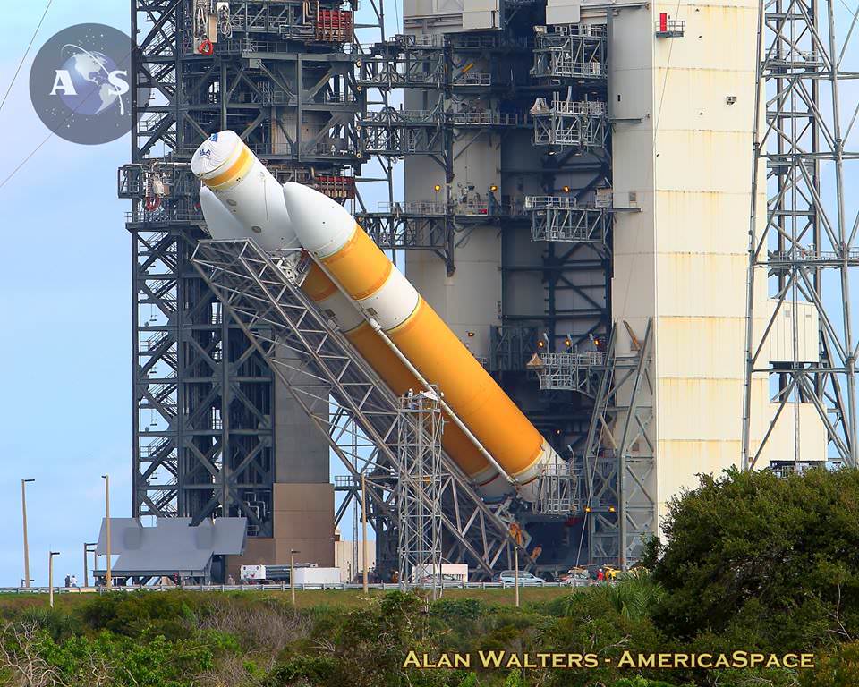
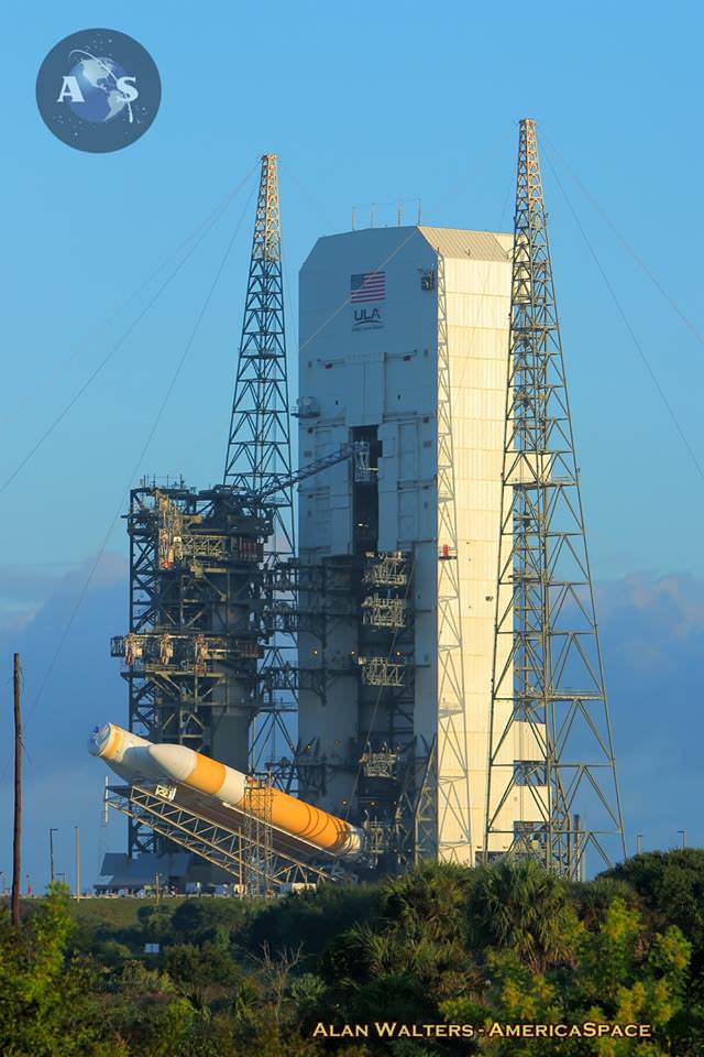
The United Launch Alliance Delta-IV Heavy rocket tasked with launching NASA’s Orion EFT-1 mission being hoisted vertical atop Space Launch Complex-37B at Cape Canaveral Air Force Station in Florida on the morning of Oct. 1, 2014. Photo Credit: Alan Walters / AmericaSpace
The march towards first launch of NASA’s next generation Orion crew vehicle is accelerating rapidly.
The world’s most powerful rocket – the United Launch Alliance Delta IV Heavy – was moved to its Cape Canaveral launch pad overnight and raised at the pad today, Oct. 1, thereby setting in motion the final steps to prepare for blastoff of NASA’s new Orion capsule on its first test flight in just over two months.
All the pieces are ready and now it’s just a matter of attaching all those components together for the inaugural uncrewed liftoff of the state-of-the-art Orion spacecraft on its maiden mission dubbed Exploration Flight Test-1 (EFT-1) in December.
“We’ve been working toward this launch for months, and we’re in the final stretch,” said Kennedy Director Bob Cabana, in a NASA statement.
“Orion is almost complete and the rocket that will send it into space is on the launch pad. We’re 64 days away from taking the next step in deep space exploration.”
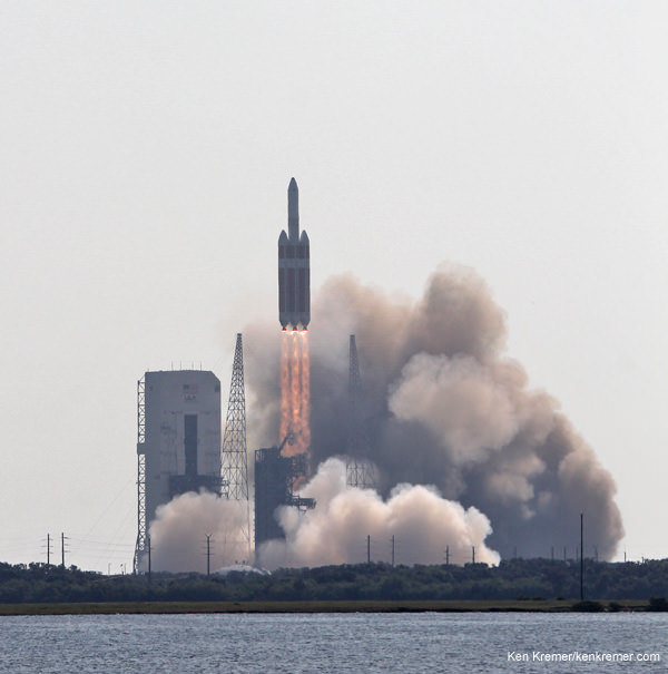
The triple barreled Delta IV Heavy topped by the Orion EFT-1 capsule is slated to blastoff on December 4, 2014, from Space Launch Complex 37 (SLC-37) at Cape Canaveral Air Force Station in Florida.
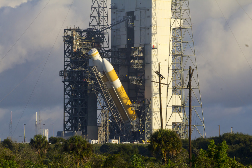
United Launch Alliance Delta IV Heavy rocket launching NASA’s Orion’s EFT-1 in Dec. 2014 being hoisted vertical at SLC-37B on the morning of Oct. 1, 2014. Photo Credit: Alan Walters / AmericaSpace
After a nearly two day delay due to drenching rain storms, the Delta IV Heavy integrated first and second stages were transported horizontally overnight Wednesday starting around 10 p.m. from the processing hanger inside ULA’s Horizontal Integration Facility (HIF) to the nearby launch complex and servicing gantry at Pad 37.
Early this morning, the rocket was hoisted up into its launch configuration. Several of my space photo-journalist colleagues were on hand. See their photos herein.
From now until launch technicians will conduct the final processing, testing and checkout of the Delta IV Heavy booster. They will also carry out “a high fidelity rehearsal to include fully powering up the booster and loading the tanks with fuel and oxidizer,” according to ULA.
“This is a tremendous milestone and gets us one step closer to our launch later this year,” said Tony Taliancich, ULA’s director of East Coast Launch Operations, in a ULA statement.
“The team has worked extremely hard to ensure this vehicle is processed with the utmost attention to detail and focus on mission success.”
“The Delta IV Heavy is the world’s most powerful launch vehicle flying today, and we are excited to be supporting our customer for this critical flight test to collect data and reduce overall mission risks and costs for the program,” said Taliancich.
ULA Delta IV Heavy rocket launching NASA’s Orion’s EFT-1 in Dec. 2014 being hoisted vertical at SLC-37B on the morning of Oct. 1, 2014. Credit: Jeff Seibert/Wired4Space
NASA’s Orion Program manager Mark Geyer told me in a recent interview that the Orion spacecraft, built by prime contractor Lockheed Martin, will be transported to the pad around November 10 or 11. Then the Orion will be hoisted and attached to the top of the Delta IV Heavy rocket at the base of its service module.
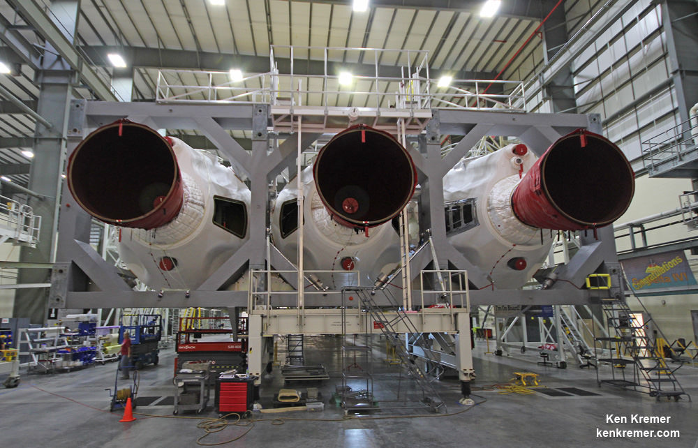
The Delta IV Heavy first stage is comprised of a trio of three Common Booster Cores (CBCs).
These three RS-68 engines will power each of the attached Delta IV Heavy Common Booster Cores (CBCs) that will launch NASA’s maiden Orion on the EFT-1 mission in December 2014. Credit: Ken Kremer/kenkremer.com
Each CBC measures 134 feet in length and 17 feet in diameter. They are equipped with an RS-68 engine powered by liquid hydrogen and liquid oxygen propellants producing 656,000 pounds of thrust. Together they generate 1.96 million pounds of thrust.
The Delta IV Heavy became the world’s most powerful rocket upon the retirement of NASA’s Space Shuttle program and is the only vehicle that is sufficiently powerful to launch the Orion EFT-1 spacecraft.
The first CBC booster was attached to the center booster in June. The second one was attached in early August.
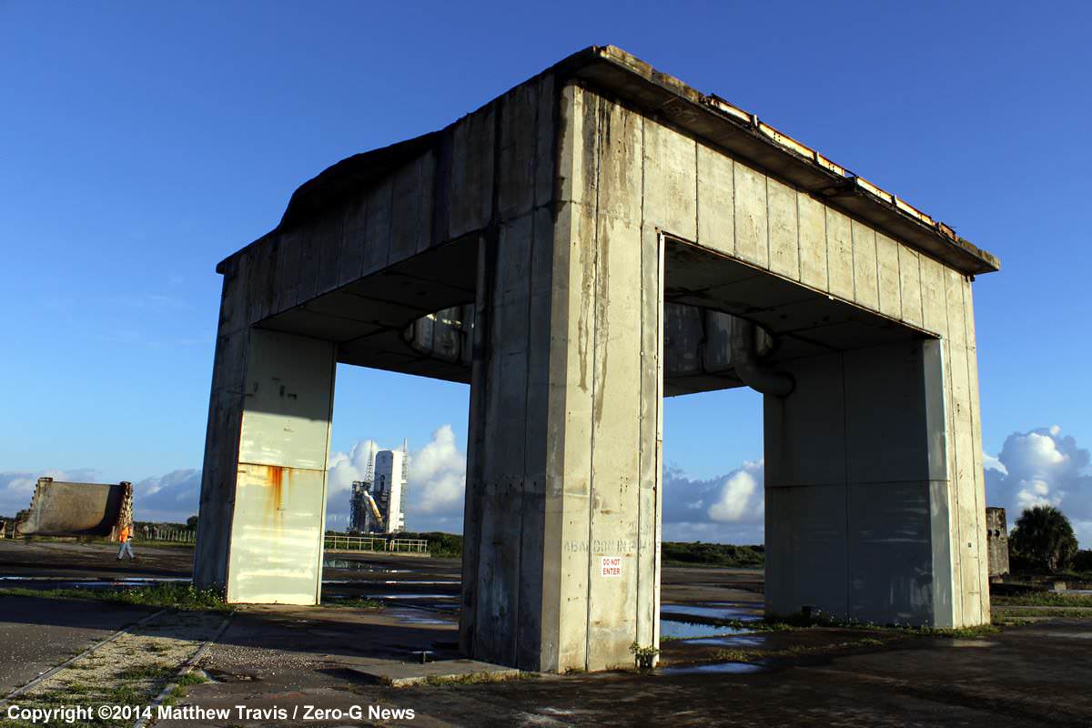
Beyond the ruins of Launch Complex 34, where three astronauts died in the Apollo 1 fire, NASA looks to the future as workers raise a United Launch Alliance Delta 4 rocket on the pad at Space Launch Complex 37. This Delta vehicle will power the first test flight of NASA’s Orion spacecraft, the first human spacecraft designed to travel beyond low Earth orbit since the Apollo program. Launch of Exploration Flight Test 1 (EFT-1) is targeted for the morning of December 4. Photo Credit:Matthew Travis / Zero-G News
I recently visited the HIF during a media tour after the three CBCs had been joined together as well as earlier this year after the first two CBCs arrived by barge from their ULA assembly plant in Decatur, Alabama, located about 20 miles west of Huntsville. See my photos herein.
I was also on hand at KSC when the Orion crew module/service module (CM/SM) stack was rolled out on Sept. 11, 2014, on a 36 wheeled transporter from its high bay assembly facility in the Neil Armstrong Operations and Checkout Building.
It was moved about 1 mile to the KSC fueling facility named the Payload Hazardous Servicing Facility (PHFS). Read my Orion move story – here.
Fueling of Orion was completed over the weekend and it has now been moved to the Launch Abort System Facility (LASF) for the installation of its last component – the Launch Abort System (LAS).
Orion’s next stop is SLC-37.
The two-orbit, four and a half hour EFT-1 flight will lift the Orion spacecraft and its attached second stage to an orbital altitude of 3,600 miles, about 15 times higher than the International Space Station (ISS) – and farther than any human spacecraft has journeyed in 40 years.
NASA is simultaneously developing a monster heavy lift rocket known as the Space Launch System or SLS, that will eventually launch Orion on its deep space missions.
The maiden SLS/Orion launch on the Exploration Mission-1 (EM-1) unmanned test flight is now scheduled for no later than November 2018 – read my story here.
SLS will be the world’s most powerful rocket ever built and the assembly of its core stage has begun at NASA’s Michoud Assembly Facility in New Orleans. Read my story – here.
Stay tuned here for Ken’s continuing Orion, SLS, Boeing, Sierra Nevada, Orbital Sciences, SpaceX, commercial space, Curiosity, Mars rover, MAVEN, MOM and more Earth and planetary science and human spaceflight news.
Orion’s EFT-1 launch vehicle being hoisted vertical at SLC-37B on the morning of Oct. 1, 2014. Photo Credit: Alan Walters / AmericaSpaceNASA’s completed Orion EFT 1 crew module loaded on wheeled transporter during move to the Payload Hazardous Servicing Facility (PHFS) on Sept. 11, 2014, at the Kennedy Space Center, FL. Credit: Ken Kremer – kenkremer.comDelta 4 Heavy rocket and super secret US spy satellite roar off Pad 37 on June 29, 2012, from Cape Canaveral, Florida. NASA’s Orion EFT-1 capsule will blastoff atop a similar Delta 4 Heavy Booster in December 2014. Credit: Ken Kremer- kenkremer.com
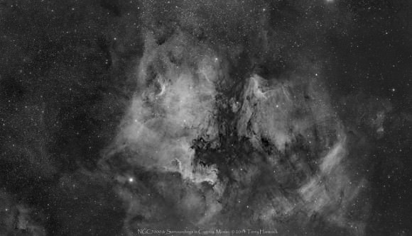
A colorful, wide view of the North American Nebula (NGC 7000 or Caldwell 20) in Cygnus. This three-panel mosaic spanning an area approximately 2.5 x 5.5 degrees, captured using QHY11/TAK E180 presented here in H-Alpha, Hubble Palette and RGB with H-Alpha. Credit and copyright: Terry Hancock.
A perfect set of astrophotos for #WideAngleWednesday! Here are not one but three views of the North America Nebula taken by Terry Hancock. Terry said this is his widest view yet of this region. Also known as NGC 7000 or Caldwell 20, this is an emission nebula in the constellation Cygnus that resembles the shape of North America and The Gulf Of Mexico. It lies at a distance of approximately 1800 light years away from Earth.
Terry presents a “trilogy” of three different color processes (see below). He took imagery in both July and September 2014 with a total exposure time of 13.9 hours from his Down Under Observatory in Fremont, Michigan.
For more details about the processing for each image, click on the images. To see more of Terry’s great work, see his website,Facebook, Flickr, or G+.
A wide, three-panel mosaic spanning an area approximately 2.5 x 5.5 degrees of the North America Nebula (NGC 7000 or Caldwell 20), in H-Alpha, Hubble Palette and RGB with H-Alpha. Credit and copyright: Terry Hancock.Another version of the 3-panel, wide angle view of the North America Nebula. Credit and copyright: Terry Hancock.
Want to get your astrophoto featured on Universe Today? Join our Flickr group or send us your images by email (this means you’re giving us permission to post them). Please explain what’s in the picture, when you took it, the equipment you used, etc.
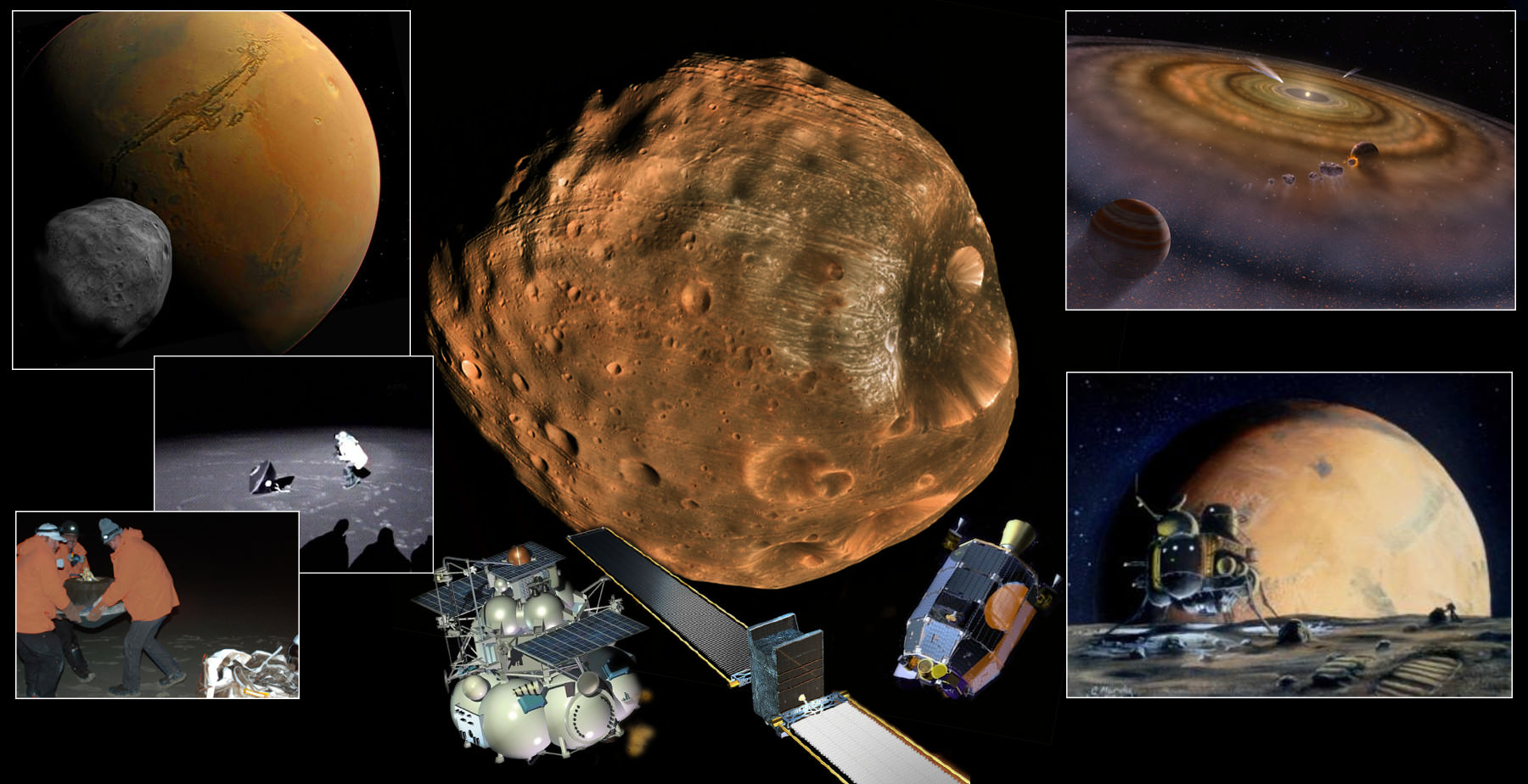
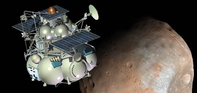
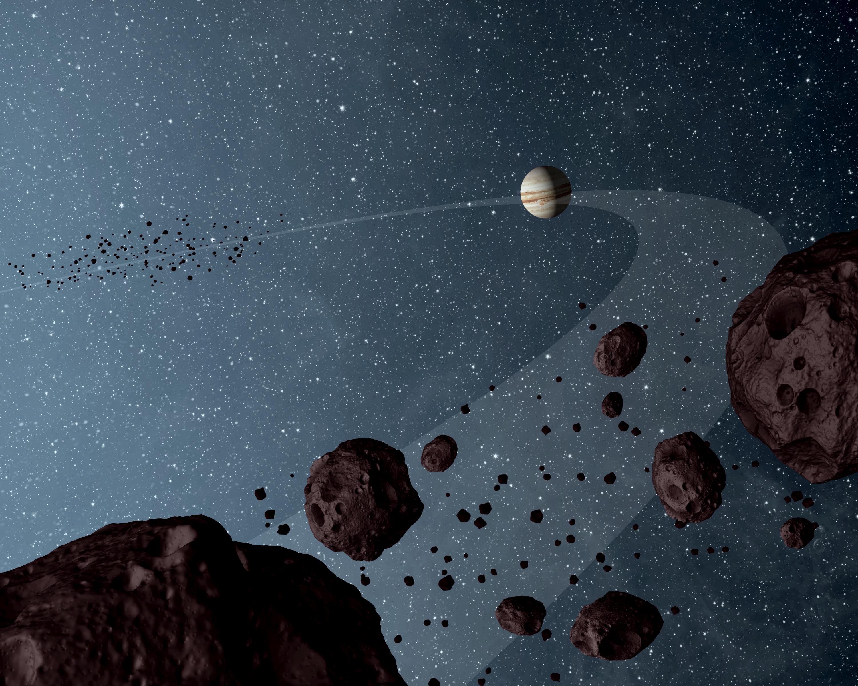
Phobos. From where did it arise or arrive? Is it dry or wet? Should we flyby or sample and return? Should it be Boots or Bots? (Photos: NASA, Illus.:T.Reyes)
Ask any space enthusiast, and almost anyone will say humankind’s ultimate destination is Mars. But NASA is currently gearing up to go to an asteroid. While the space agency says its Asteroid Initiative will help in the eventual goal of putting people on Mars, what if instead of going to an asteroid, we went to Mars’ moon Phobos?
Three prominent planetary scientists have joined forces in a new paper in the journal Planetary and Space Science to explain the case for a mission to the moons of Mars, particularly Phobos.
“Phobos occupies a unique position physically, scientifically, and programmatically on the road to exploration of the solar system,” say the scientists. In addition, the moons may possibly be a source of in situ resources that could support future human exploration in circum-Mars space or on the Martian surface. But a sample return mission first could provide details on the moons’ origins and makeup.
The Martian moons are riddles, wrapped in a mystery, inside an enigma.Phobos and its sibling Deimos seem like just two asteroids which were captured by the planet Mars, and they remain the last objects of the inner solar system not yet studied with a dedicated mission. But should the moons be explored with flybys or sample-return? Should we consider “boots or bots”?
The publications and mission concepts for Phobos and Deimos are numerous and go back decades. The authors of “The Value of a Phobos Sample Return,” Murchie, Britt, and Pieters, explore the full breadth of questions of why and how to explore Phobos and Deimos.
Dr. Murchie is the principal investigator of the Mars Reconnaissance Orbiter’s CRISM instrument, a visible/infrared imaging spectrometer. He is a planetary scientist from John Hopkins’ Applied Physics Lab (APL) which has been at the forefront of efforts to develop a Phobos mission. Likewise, authors Dr. Britt, from the University of Central Florida, and Dr. Pieters, from Brown University, have partnered with APL and JPL in Phobos/Deimos mission proposals.
An MRO HiRise image of the Martian moon Phobos. Taken on March 23, 2008. Phobos has dimensions of 27 × 22 × 18 km, while Deimos is 15 × 12.2 × 11 km. Both were discovered in 1877 at the US Naval Observatory in Washington, D.C. (Photo: NASA/MRO/HiRISE)
APL scientists are not the only ones interested in Phobos or Deimos. The Jet Propulsion Laboratory, Ames Research Center and the SETI Institute have also proposed several missions to the small moons. Every NASA center has been involved at some level.
But the only mission to actually get off the ground is the Russian Space Agency’s Phobos-GRUNT[ref]. The Russian mission was launched November 9, 2011, and two months later took a bath in the Pacific Ocean. The propulsion system failed to execute the burns necessary to escape the Earth’s gravity and instead, its orbit decayed despite weeks of attempts to activate the spacecraft. But that’s a whole other story.
The Russian-led mission Phobos-Grunt did not end well; under Pacific swells to be exact. Undaunted Russian scientists are pressing for Phobos-Grunt 2 (illus.), an improved lander with sample-return. Proposed for 2020s (Credit: CNES)
“The Value of a Phobos Sample Return” first discusses the origins of the moons of Mars. There is no certainty. There is a strong consensus that Earth’s Moon was born from the collision of a Mars-sized object with Earth not long after Earth’s formation. This is just one possibility for the Martian moons. Murchie explains that the impacts that created the large basins and craters on Mars could have spawned Phobos and Deimos: ejecta that achieved orbit, formed a ring and then coalesced into the small bodies. Alternative theories claim that the moons were captured by Mars from either the inner or outer solar system. Or they could have co-accreted with Mars from the Solar Nebula. Murchie and the co-authors describe the difficulties and implications of each scenario. For example, if captured by Mars, then it is difficult to explain how their orbits came to be “near-circular and near-equatorial with synchronous rotational periods.”
To answer the question of origins, the paper turns to the questions of their nature. Murchie explains that the limited compositional knowledge leaves several possibilities for their origins. They seem like D-type asteroids of the outer asteroid belt. However, the moons of Mars are very dry, void of water, at least on their surfaces as the paper discusses in detail. The flybys of Phobos and Deimos by NASA and ESA spacecraft are simply insufficient for drawing any clear picture of their composition or structure, let alone their origins, Murchie and co-authors explain.
If the moons were captured then they have compositions different from Mars; however if they accreted with or from Mars, then they share similar compositions with the early Mars when forming, or from Martian crustal material, respectively.
The paper describes in some detail the problem that billions of years of Martian dust accumulation presents. Every time Mars has been hit by a large asteroid, a cloud of debris is launched into space. Some falls back to the planet but much ends up in orbit. Each time, some of the debris collided with Phobos and Deimos; Murchie uses the term “Witness plate” to describe what the two moons are to Mars. There is an accumulation of Martian material and also material from the impactors covering the surfaces of the moons. Flyby images of Phobos show a reddish surface similar to Mars, and numerous tracks along the surface as if passing objects struck, plowed or rolled along. However, the reddish hue could be weathering from Solar flux over billions of years.
The paper continues with questions of the composition and how rendezvous missions could go further to understanding the moons makeup and origins, however, it is sample return that would deliver, the pay dirt. Despite how well NASA and ESA engineers have worked to shrink and lighten the instruments that fly, orbit, and land on Mars, returning a sample of Phobos to labs on Earth would permit far more detailed analysis.
SpaceX and Elon Musk claim that they will mount human flight to Mars before 2030. Many others remain less optimistic with hopes of human flights before 2040. (Illustrations: Total Recall, 1990, early artist illustration c.1950s )
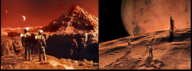
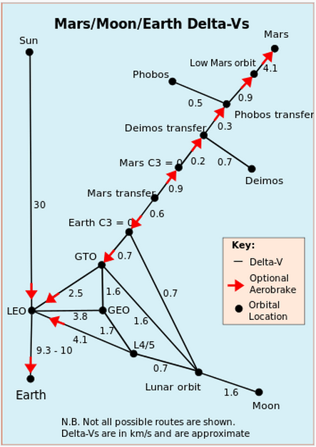
Science Fiction writers and mission designers have imagined Phobos, in particular, as a starting point for the human exploration and colonization of Mars. A notable contemporary work is “Red Mars” by Kim Stanley Robinson; however, the story line is dated due to the retirement of the Space Shuttle and the external tanks Robinson clustered to form the colonization vessel. While this paper by Murchie et al. is purely scientific, fiction writers have used the understanding that Phobos is far easier to reach from Earth than is the surface of Mars (see Delta-V chart below).
A diagram showing the stair-step energy needed to travel to places beyond the Earth. Delta-V is the speed in km/sec required to reach a destination. As shown, the Delta-Vs are cumulative. Note that it takes an extra 5 km/sec beyond Phobos to reach the Martian surface; a prime reason for making the journey to the moons of Mars. (Credit: Wikipedia, Delta-V)
Phobos, orbiting at 9,400 kilometers (5,840 miles), and Deimos, at 23,500 km (14,600 miles), above Mars avoids the need for the 7-odd minutes of EDL terror – Entry, Descent, and Landing — and pulling oneself out of the Martian gravity well to return to Earth. Furthermore, there is the interest in using Phobos as a material resource – water, material for rocket fuel or building materials. “The Value of a Phobos Sample Return” discusses the potential of Phobos as a resource for space travelers – “In Situ Resource Utilization” (ISRU), in the context of its composition, how the solar flux may have purged the moons of water or how Martian impact debris covers materials of greater interest and value to explorers.
With so many questions and interests, what missions have been proposed and explored? The Murchie paper describes a half dozen missions but there are several others that have been conceived and proposed to some level over several decades.
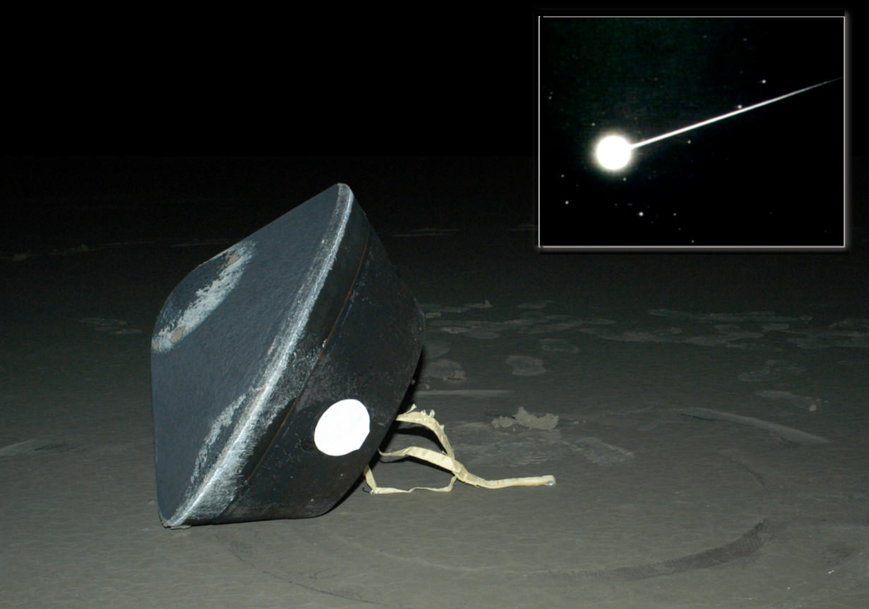
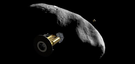
At present, there is at least one mission actively pursuing funds. The SETI and Ames proposed “Phobos and Deimos & Mars Environment” (PADME) mission led by Dr. Pascal Lee is competing for Discovery program funding. Such projects must limit cost to $425 million or less and be capable of launching in less than 3 years. They are proposing a launch date of 2018 on a SpaceX Falcon 9. The PADME mission design would reuse Ames LADEE hardware and expertise, however, it does not go so far as what Murchie and co-authors argue – returning a sample from Phobos. PADME would maintain in a synchronized orbit with Phobos and then Deimos foe repeated flybys. The mission is likely to cost in the range of $300 million. Stardust, a relevant mission due to its sample return capsule, launched in 1999 and had costs which likely reached a similar level by end of mission in 2012.
The Russian Space Agency is attempting to gain funding for Phobos-Grunt 2 but possible launch dates continue to be moved back – 2020, 2022, and now possibly 2024.
Return of the Stardust sample inside the Lockheed-Martin developed sample-return capsule. Seen here upon successful landing in the Utah desert. (Credit: NASA/Stardust)
Additionally, each of this papers’ authors has mission proposals described. Dr. Pieters, JPL, and Lockheed-Martin proposed the Aladdin mission; Dr. Britt at APL, also with Lockheed-Martin, proposed the mission Gulliver; both would re-use the Stardust sample-return capsule (photo, above). Dr. Murchie also describes his APL/JPL mission concept called MERLIN (Mars–Moon Exploration, Reconnaissance and Landed Investigation).
Phobos and Deimos are the last two of what one would call major objects of the inner Solar System that have not had dedicated missions of exploration. Several bodies of the Asteroid Belt have been targeted with flybys and Dawn is nearing its second target, the largest of the Asteroids, Ceres.
So sooner rather than later, a spacecraft from some nation (not necessarily the United States) will target the moons of Mars. Targeted Phobos/Deimos missions are also likely to include both flyby missions and one or more sample-return missions. A US-led mission with sample-return in the Discovery program will be strained to meet both criteria – $425 million cost cap and 3 year development period.
Those utilizing the Lockheed-Martin (LM) Stardust design have a proven return capsule and spacecraft buses (structure, mechanisms and avionics) for re-use for cost and time savings. This includes five generations of the LM flight software that holds an incredible legacy of mission successes starting with Mars Odyssey/Genesis/Spitzer to now Maven.
All three proposals by this paper’s authors could be re-vamped and proposed again and compete against each other. All three could use Lockheed-Martin past designs. Cooperation in writing this paper may be an indicator that they will join forces, combine concepts, and share investigator positions on a single NASA-led project. The struggle for federal dollars remains a tough, tight battle and with the human spaceflight program struggling to gain a new footing after Space Shuttle, dollars for inter-planetary missions are likely to remain very competitive. However, it appears a Phobos-Deimos mission is likely within the next ten years.
Virgin Galactic's SpaceShipTwo soars in a powered flight test on Sept. 5, 2013. Credit: MarsScientific.com and Clay Center Observatory
TORONTO, CANADA – There’s a big difference in thinking between governments and the private companies that participate in space. While entities such as NASA can work on understanding basic human health or exploring the universe for the sake of a greater understanding, companies have a limitation: they need to eventually make a profit.
This was brought up in a human spaceflight discussion at the International Astronautical Congress today (Oct. 1), which included participants from agencies and companies alike. Below are some concepts for how private companies in the space world today are making their money.
“We have in space a movement towards more privatization … and also for more use of space activities in general and human space activity in the future by individual private persons,” said Johann Dietrich Worner, chairman of the executive board of DLR (Germany’s space agency), in the panel.
“You can imagine that even for the upcoming 10 to 20 to 30 years, the public funding is the basic funding for [space] activities while in other areas, we are already seeing that private money is doing its work if you look to communication and if you look to other activities, like for instance, research in space.”
But commercial spaceflight is already taking place, as some of these examples show.
Commercial crew
Would you ‘Enter the Dragon’? First look inside SpaceX Dragon V2 next generation astronaut spacecraft unveiled by CEO Elon Musk on May 29, 2014. Credit: Robert Fisher/AmericaSpace
The two successful companies in NASA’s latest round of commercial contracts — SpaceX (Dragon) and Boeing (CST-100) — are each receiving government money to develop their private space taxis. The companies are responsible for meeting certain milestones to receive funds. There is quite the element of risk involved because the commercial contracts are only given out in stages; you could be partway through developing the spacecraft and then discover you will not be awarded one for the next round. This is what happened to Sierra Nevada Corp., whose Dream Chaser concept did not receive more money in the announcement last month. The company has filed a legal challenge in response.
Private space travel
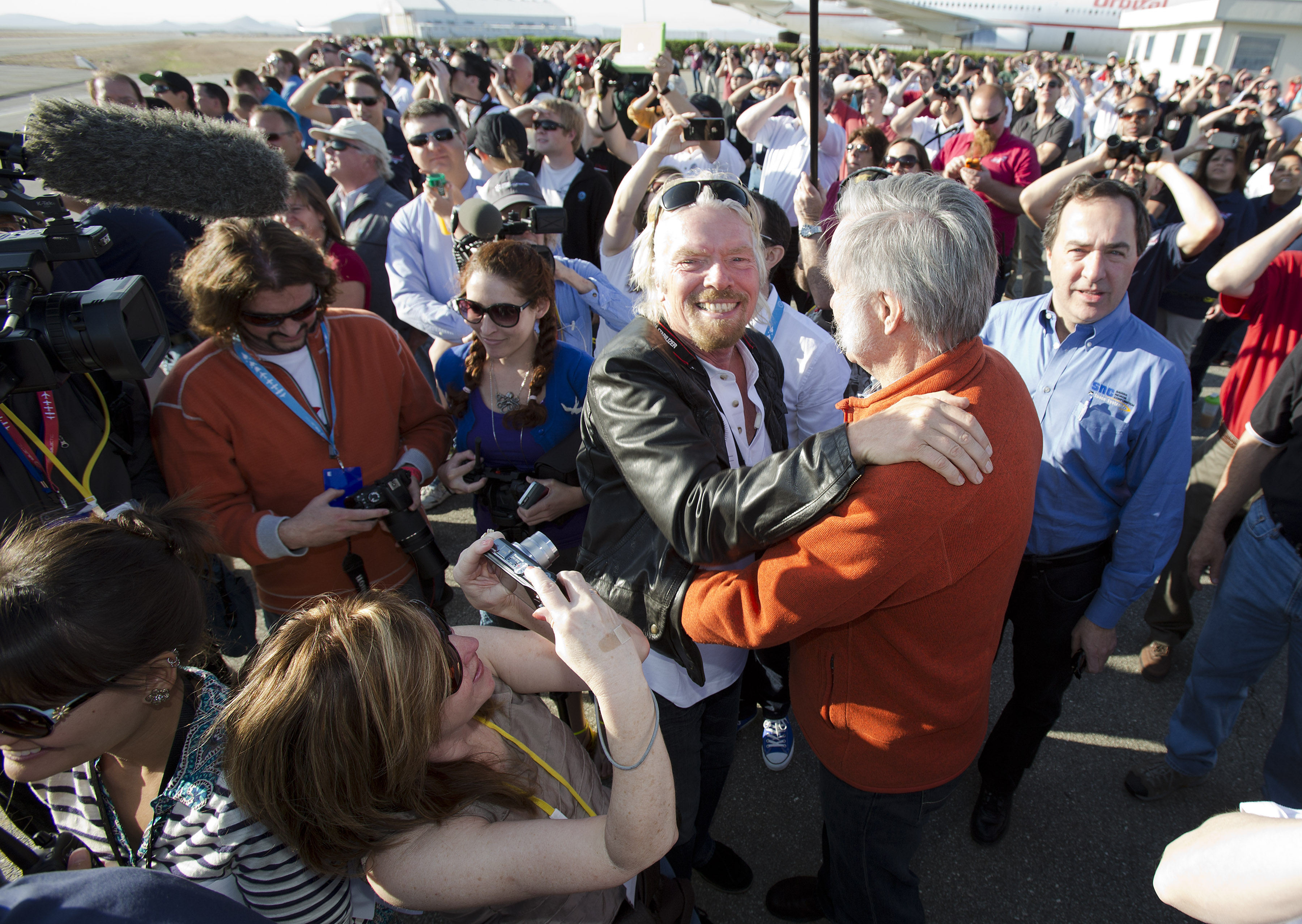
Sir Richard Branson hugs designer Burt Rutan, surrounded by employees of Virgin Galactic, The SpaceShip Company, and Scaled Composites, and watch as Virgin Galactic’s SpaceShip2 streaks across the sky under rocket power, its first ever since the program began in 2005. Burt’s wife Tonya Rutan is at right taking their photo. The spacecraft was dropped from its “mothership,” WhiteKnight2, over the Mojave CA area on April 29, 2013, at high altitude before firing its hybrid power motor. Virgin Galactic hopes to become the first commercial space venture to bring multiple passengers into space on a regular basis.
Virgin Galactic and its founder, Richard Branson, are perhaps the most visible of the companies that are looking to bring private citizens into space — as long as they can pay $250,000 for a ride. The first flight of Virgin into space is expected in the next year. Customers must pay a deposit upfront upon registering and then the balance before they head into suborbit. In the case of Virgin, Branson has a portfolio of companies that can take on the financial risk during the startup phase, but eventually the company will look to turn a profit through the customer payments.
Asteroid mining
Artist concept of the ARKYD spacecraft by an asteroid. Credit: Planetary Resources.
The business case for Planetary Resources and Deep Space Industries, the two self-proclaimed asteroid mining companies, hasn’t fully been released yet. We assume that the companies would look to make a profit through selling whatever resources they manage to dig up on asteroids, but bear in mind it would cost quite a bit of money to get a spacecraft there and back. Meanwhile, Planetary Resources is diversifying its income somewhat by initiatives such as the Arkyd-100 telescope, which will look for asteroids from Earth orbit. They raised money for the project through crowdsourcing.
Space station research
The International Space Station in March 2009 as seen from the departing STS-119 space shuttle Discovery crew. Credit: NASA/ESA
NanoRacks is a company that has research slots available on the International Space Station that it sells to entities looking to do research in microgravity. The company has places inside the station and can also deploy small satellites through a Japanese system. While the company’s website makes it clear that they are focused on ISS utilization, officials also express an interest in doing research in geocentric orbit, the moon or even Mars.
Looking to the future of space exploration, NASA and TopCoder have launched the "High Performance Fast Computing Challenge" to improve the performance of their Pleiades supercomputer. Credit: NASA/MSFC
TORONTO, CANADA – Could NASA’s new rocket bring a probe to sample the geysers of Saturn’s moon Enceladus, or ferry human explorers to the surface of Mars? Representatives of contractor Boeing think so.
They’ve put together some ideas for sending their Space Launch System to these far-flung destinations, which they presented at the International Astronautical Congress today (Oct. 1).
Bear in mind that the SLS hasn’t yet flown — it’s slated for 2018 if funding lasts and the schedule holds — and the destinations below are just in the conceptual stage. The gallery below summarizes some of the destinations SLS could visit. For more information, check out this brochure by Boeing.
Enceladus
Artist’s conception of the Cassini spacecraft flying amid geysers on Enceladus, a moon of Saturn. Credit: Karl Kofoed / NASA
The icy moon of Saturn is known as a hotspot for geysers; earlier this year, scientists found 101 gushers using data from the prolific Cassini probe. Using the SLS could bring a satellite there in four years, as opposed to about seven with rockets on the market today, according to Boeing. It also could carry a heavier spacecraft.
Europa
Artist’s conception of Europa’s surface, backdropped by planet Jupiter. Credit: NASA/JPL-Caltech
Europa is known to have a subterranean ocean, and it also is capable of spewing water plumes — as researchers using the Hubble Space Telescope discovered earlier this year. The SLS could get to Europa a lot faster than a launch with an Atlas, according to Boeing — it would only take two years to fly there directly as opposed to more than six years with the Atlas, which would need to fly by Venus first to pick up some speed.
Trojan asteroids
Artist’s diagram of Jupiter and some Trojan asteroids nearby the gas giant. Credit: NASA/JPL-Caltech
Trailing before and after Jupiter are more than a million asteroids that are called Trojans. This means any probe in the area would have no lack of targets to study, providing it had enough fuel on board. A mission profile from Boeing suggests the SLS could bring a spacecraft out there that could swing by a target at least half a dozen times.
Mars
Artist’s impression of astronauts exploring Mars. Credit: NASA/Pat Rawlings, SAIC
One of the largest challenges of getting to Mars is figuring out how to send all the life-support equipment and food that humans require — on top of the humans themselves! Since SLS is a heavy-lift rocket, Boeing is trying to position its rocket as the ideal one to get humans to Mars. But it remains to be seen what concept works best to get people out there.
The Moon
Artist’s impression of astronauts on the moon. This image was used to illustrate a landing concept of NASA’s now defunct Constellation program. Credit: John Frassanito and Associates / NASA
Boeing has an idea to bring a lander down to the Moon that could then lift off multiple times in search of other destinations. Such a concept would require a hefty amount of fuel and equipment. If it works, Boeing says the SLS could assist with plans for lunar mining and other exploration ideas.
And if you’re interested in looking back, here’s an archive to all the past Carnivals of Space. If you’ve got a space-related blog, you should really join the carnival. Just email an entry to [email protected], and the next host will link to it. It will help get awareness out there about your writing, help you meet others in the space community – and community is what blogging is all about. And if you really want to help out, sign up to be a host. Send an email to the above address.
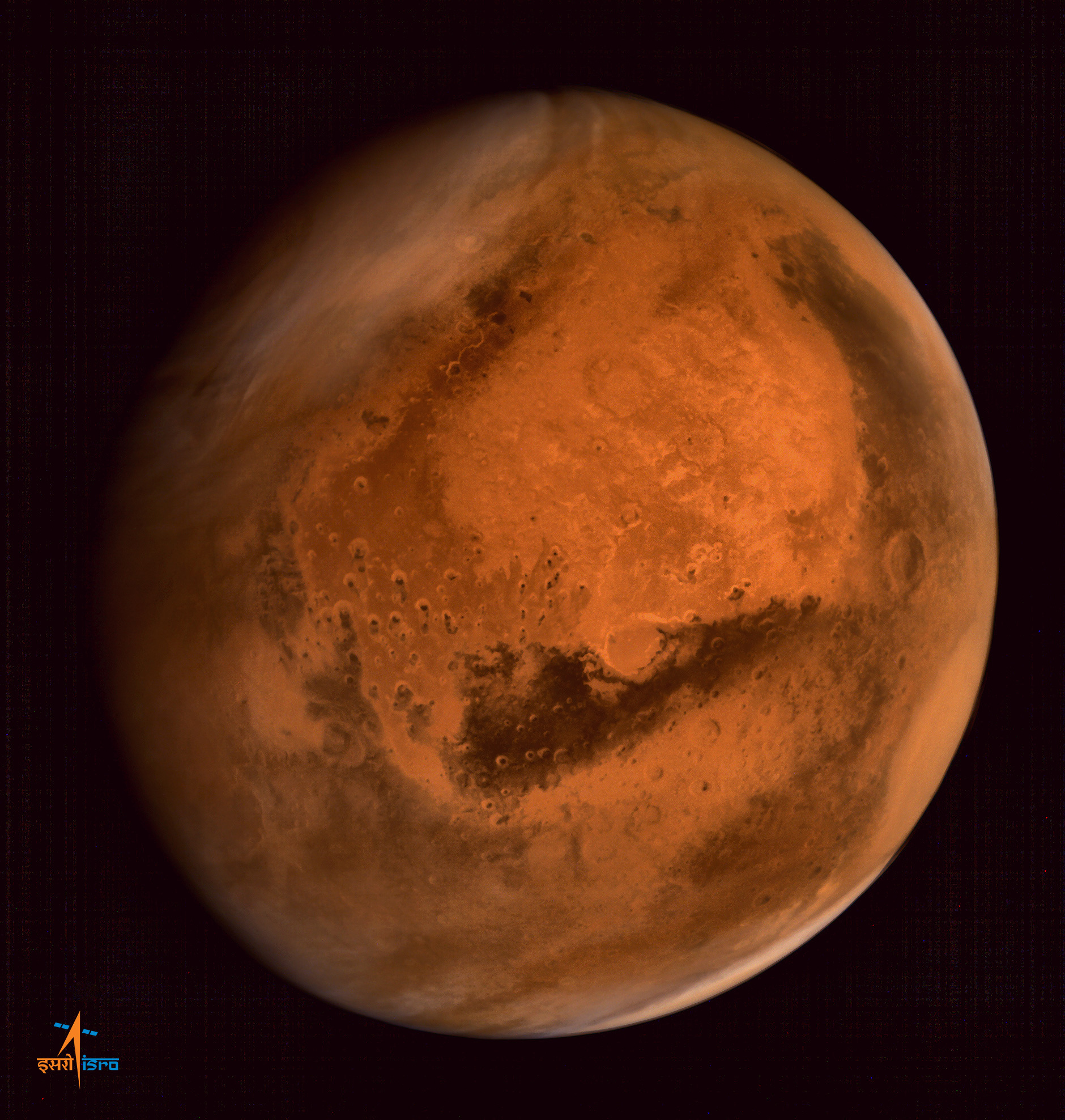
ISRO's Mars Orbiter Mission captures spectacular portrait of the Red Planet and swirling dust storms with the on-board Mars Color Camera from an altitude of 74500 km on Sept. 28, 2014. Credit: ISRO
The MOM orbiter was designed and developed by the Indian Space Research Organization (ISRO), India’s space agency, which released the image on Sept. 29.
Even more impressive is that MOM’s Martian portrait shows a dramatic view of a huge dust storm swirling over a large patch of the planet’s Northern Hemisphere against the blackness of space. Luckily, NASA’s Opportunity and Curiosity surface rovers are nowhere nearby.
“Something’s brewing here!” ISRO tweeted.
The southern polar ice cap is also clearly visible.
It was taken by the probe’s on-board Mars Color Camera from a very high altitude of 74,500 kilometers.
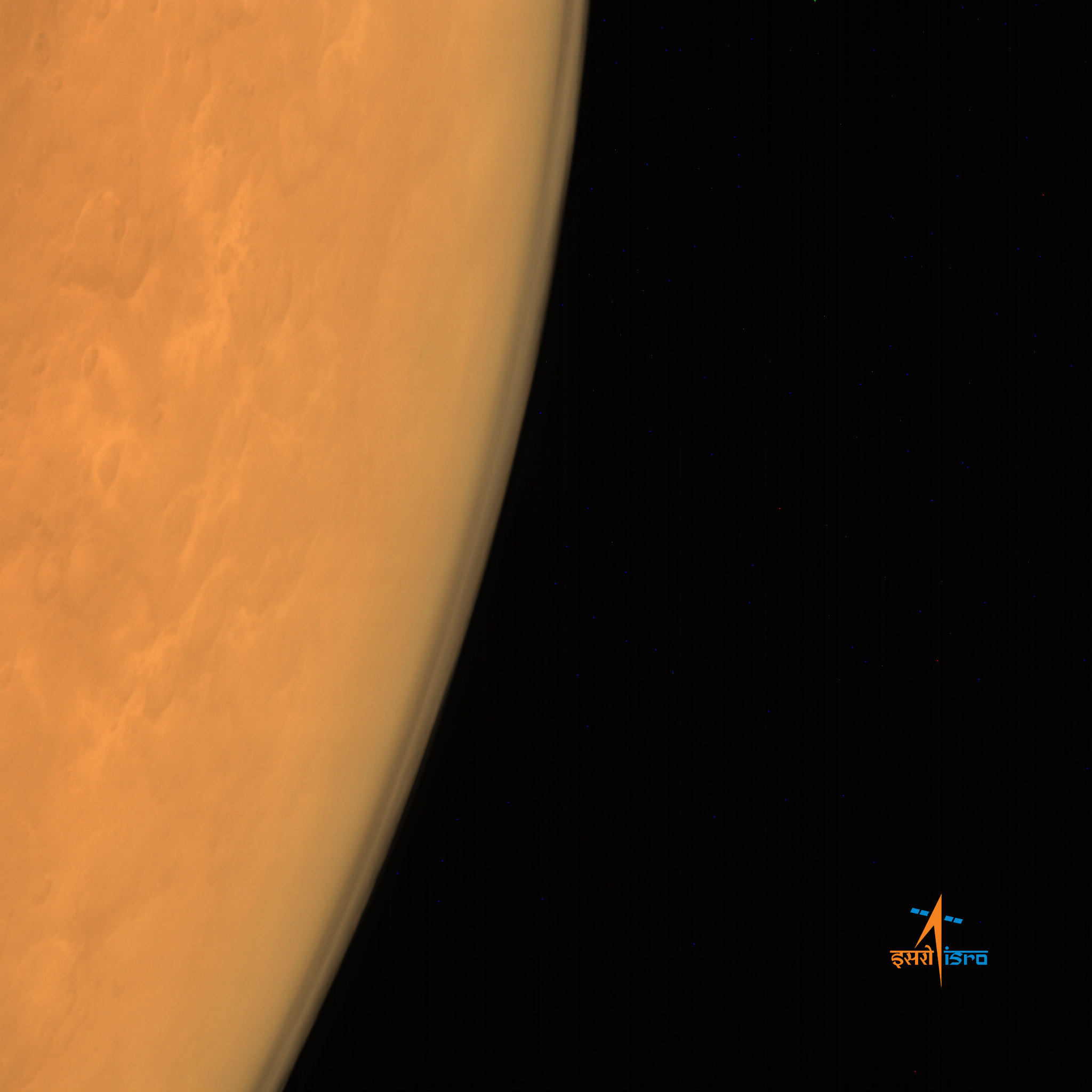
ISRO’s Mars Orbiter Mission captures the limb of Mars with the Mars Color Camera from an altitude of 8449 km soon after achieving orbit on Sept. 23/24, 2014. Credit: ISRO
When MOM met Mars, the thrusters placed the probe into a highly elliptical orbit whose nearest point to Mars (periapsis) is at 421.7 km and farthest point (apoapsis) at 76,993.6 km. The inclination of the orbit with respect to the equatorial plane of Mars is 150 degrees, as intended, ISRO reported.
So the Red Planet portrait was captured nearly at apoapsis.
This is the third MOM image released by ISRO thus far, and my personal favorite. And its very reminiscent of whole globe Mars shots taken by Hubble.
MOM’s goal is to study Mars’ atmosphere, surface environments, morphology, and mineralogy with a 15 kg (33 lb) suite of five indigenously built science instruments. It will also sniff for methane, a potential marker for biological activity.
The $73 million mission is expected to last at least six months.
MOM’s success follows closely on the heels of NASA’s MAVEN orbiter which also successfully achieved orbit barely two days earlier on Sept. 21 and could last 10 years or more.
With MOM’s arrival, India became the newest member of an elite club of only four entities who have launched probes that successfully investigated Mars – following the Soviet Union, the United States and the European Space Agency (ESA).
Stay tuned here for Ken’s continuing Earth and planetary science and human spaceflight news.
Canadarm2 is backdropped by Earth and the HTV-3 vehicle in this shot from the International Space Station. Credit: NASA
TORONTO, CANADA – Canada’s robotic Canadarm2 will install the next two Urthecast cameras on the International Space Station, removing the need for astronauts to go outside to do the work themselves, the company announced today (Sept. 30).
Urthecast plans to place two Earth-facing cameras on the United States side of the station (on Node 3) to add to the two they already have on the Russian Zvezda module. Technical problems with the cameras forced the Russians to do an extra spacewalk to complete the work earlier this year.
The company plans to make images and streaming video of its imagery available to the general public and interested paying customers. One of the Russian-side cameras is facing technical difficulties with pointing, but more equipment is scheduled to blast up to fix it on a Soyuz flight this fall. The camera should be ready by December, Urthecast said.
The International Space Station seen by a departing space shuttle in 2009. Credit: NASA
The U.S.-side cameras will be an improvement over the Russian-side ones, as they will be able to take imagery in radar and multiple other wavelengths simultaneously – a first in space, the company said.
The suite will include a medium-resolution camera perpetually pointing down, and a high-resolution video camera that can focus on a target ahead of the station and swivel for 60 to 90 seconds to keep it in the frame as the station moves.
Urthecast made the announcement at the International Astronautical Congress, which is being held in Toronto this week. The company is working in association with NanoRacks, which is shipping the payload to the station and handling the installation.
Once the cameras are working fully, the company expects revenues will flow from customers willing to pay for the imagery. So far they have been funded by private investment and also by a $57 million initial public offering on the Toronto Stock Exchange in 2013.
Three images – spanning more than seven years – of Titan’s Ligeia Mare in which an elusive, radar-bright feature has been spotted. Images were created from data collected by Cassini’s Synthetic Aperture Radar (SAR). Image credit: NASA/JPL-Caltech/ASI/Cornell
Earlier this year, we reported on a mysterious “ghost” object that had suddenly appeared and then disappeared on Saturn’s largest moon, Titan. Now, new observations by the Cassini team show this elusive feature is back again.
You may recall that a so-called “transient feature,” nicknamed “Magic Island” by the Cassini team, was first observed by Cassini in July 2013 during a Titan flyby. Magic Island has continued to puzzle scientists because shortly after its initial appearance, it disappeared and has been in hiding ever since. That is, until it just-as-suddenly reappeared in images created using SAR data collected in mid-August, 2014.
However, with its reemergence comes additional questions for scientists since its physical appearance has changed rather significantly, having roughly doubled in size during its 13 months in hiding, growing from 30 square miles [75 square km] in 2013 to almost 60 square miles [160 square km], as seen in the latest images, above.
Although scientists initially considered that this had been a transient feature, they now suspect that its appearance and disappearance may be the result of Titan’s changing seasons. (Titan is currently entering summer in its northern hemisphere.) There has also been some speculation that the feature may be rising gas bubbles, surface waves, or solid material at (or just below) the surface of Ligeia Mare.
Titan’s seas are made of liquid methane and ethane, organic compounds which are gases on Earth but liquids in Titan’s incredibly chilly -290º F (-180º C) environment.
“Science loves a mystery, and with this enigmatic feature, we have a thrilling example of ongoing change on Titan,” said Stephen Wall, the deputy team lead of Cassini’s radar team, based at NASA’s Jet Propulsion Laboratory in Pasadena, California. “We’re hopeful that we’ll be able to continue watching the changes unfold and gain insights about what’s going on in that alien sea.”
The monitoring of Titan’s changing climate and surface features is a primary goal of Cassini’s ongoing, and twice-extended, mission. Further studies may confirm or eliminate explanations that have been presented to date – or they may lead to completely new hypotheses about mysteries held within and below Titan’s seas.
Titan’s Ligeia Mare. Credit: NASA/JPL/USGS
In addition to its original primary mission, Cassini, which was launched in October 1997 and entered Saturn’s orbit on July 1, 2004, has been extended two times – the Extended Equinox Mission in July 2008, and the Solstice Mission in November, 2010. In September, 2014, NASA announced that it had fully funded Cassini through its planned completion in 2017.
For more information about Cassini and its ongoing mission, visit: