NASA’s Carbon Observatory Blasts off on Workhorse Delta II to Measure Carbon Dioxide Greenhouse Gas and Watch Earth Breathe

The Orbiting Carbon Observatory-2, NASA's first mission dedicated to studying carbon dioxide in Earth's atmosphere, lifts off from Vandenberg Air Force Base, California, at 2:56 a.m. Pacific Time, July 2, 2014 on a Delta II rocket. The two-year mission will help scientists unravel key mysteries about carbon dioxide. Credit: NASA/Bill Ingalls

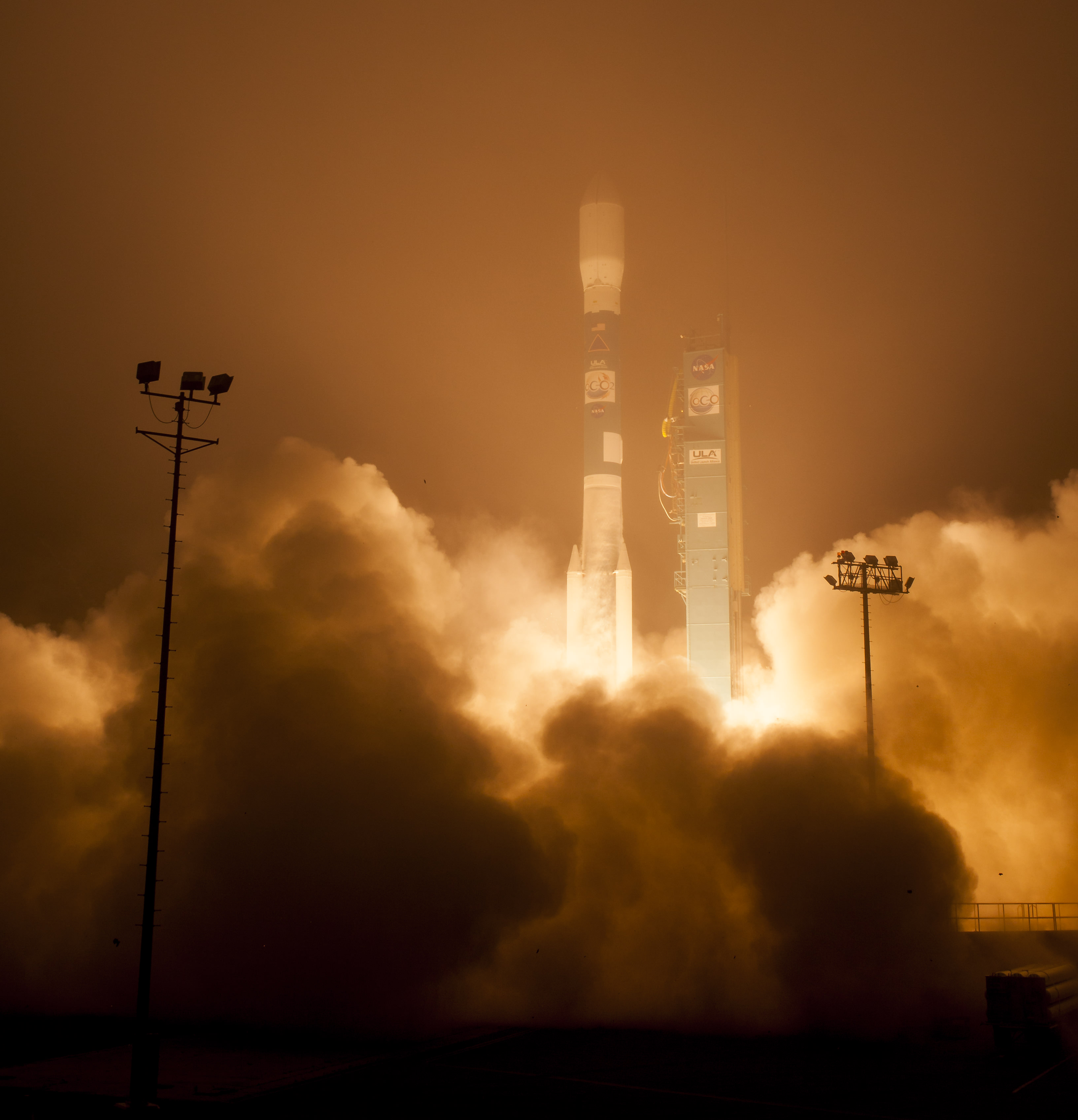
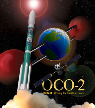
The Orbiting Carbon Observatory-2, NASA’s first mission dedicated to studying carbon dioxide in Earth’s atmosphere, lifts off from Vandenberg Air Force Base, California, at 2:56 a.m. Pacific Time, July 2, 2014 on a Delta II rocket. The two-year mission will help scientists unravel key mysteries about carbon dioxide. Credit: NASA/Bill Ingalls
Story updated[/caption]

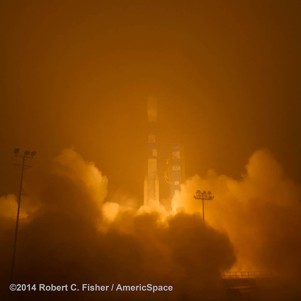
Following a nearly three-year long hiatus, the workhorse Delta II rocket successfully launched NASA’s first spacecraft dedicated to watching Earth breathe by studying Earth’s atmospheric carbon dioxide (CO2) – the leading human-produced greenhouse gas and the principal human-produced driver of climate change.

The Orbiting Carbon Observatory-2 (OCO-2) raced to orbit earlier this morning, during a spectacular nighttime blastoff at 2:56 a.m. PDT (5:56 a.m. EDT), Tuesday, July 2, 2014, from Vandenberg Air Force Base, California, atop a United Launch Alliance Delta II rocket.

The flawless launch marked the ‘return to flight’ of the venerable Delta II and was broadcast live on NASA TV.

Blastoff of NASA’s Orbiting Carbon Observatory-2 dedicated to studying carbon dioxide in Earth's atmosphere, from Vandenberg Air Force Base, California, at 2:56 a.m. Pacific Time, July 2, 2014. Credit: Robert Fisher/America/Space
Blastoff of NASA’s Orbiting Carbon Observatory-2 dedicated to studying carbon dioxide in Earth’s atmosphere, from Vandenberg Air Force Base, California, at 2:56 a.m. Pacific Time, July 2, 2014. Credit: Robert Fisher/America/Space

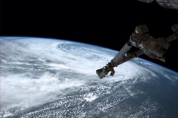
A camera mounted on the Delta II’s second stage captured a breathtaking live view of the OCO-2 spacecraft during separation from the upper stage, which propelled it into an initial 429-mile (690-kilometer) orbit.

The life giving solar arrays were unfurled soon thereafter and NASA reports that the observatory is in excellent health.

“Climate change is the challenge of our generation,” said NASA Administrator Charles Bolden in a statement.

“With OCO-2 and our existing fleet of satellites, NASA is uniquely qualified to take on the challenge of documenting and understanding these changes, predicting the ramifications, and sharing information about these changes for the benefit of society.”

NASA's Orbiting Carbon Observatory-2, or OCO-2, inside the payload fairing in the mobile service tower at Space Launch Complex 2 on Vandenberg Air Force Base in California. The fairing will protect OCO-2 during launch aboard a United Launch Alliance Delta II rocket, scheduled for 5:56 a.m. EDT on July 1. OCO-2 is NASA’s first mission dedicated to studying atmospheric carbon dioxide, the leading human-produced greenhouse gas driving changes in Earth’s climate.   Credit: NASA/30th Space Wing USAF
NASA’s Orbiting Carbon Observatory-2, or OCO-2, inside the payload fairing in the mobile service tower at Space Launch Complex 2 on Vandenberg Air Force Base in California. The fairing will protect OCO-2 during launch aboard a United Launch Alliance Delta II rocket, which occurred at 5:56 a.m. EDT on July 2. OCO-2 is NASA’s first mission dedicated to studying atmospheric carbon dioxide, the leading human-produced greenhouse gas driving changes in Earth’s climate. Credit: NASA/30th Space Wing USAF

Over the next three weeks the OCO-2 probe will undergo a thorough checkout and calibration process. It will also be maneuvered into a 438-mile (705-kilometer) altitude, near-polar orbit where it will become the lead science probe at the head of the international Afternoon Constellation, or “A-Train,” of Earth-observing satellites.

“The A-Train, the first multi-satellite, formation flying “super observatory” to record the health of Earth’s atmosphere and surface environment, collects an unprecedented quantity of nearly simultaneous climate and weather measurements,” says NASA.

Science operations begin in about 45 days.

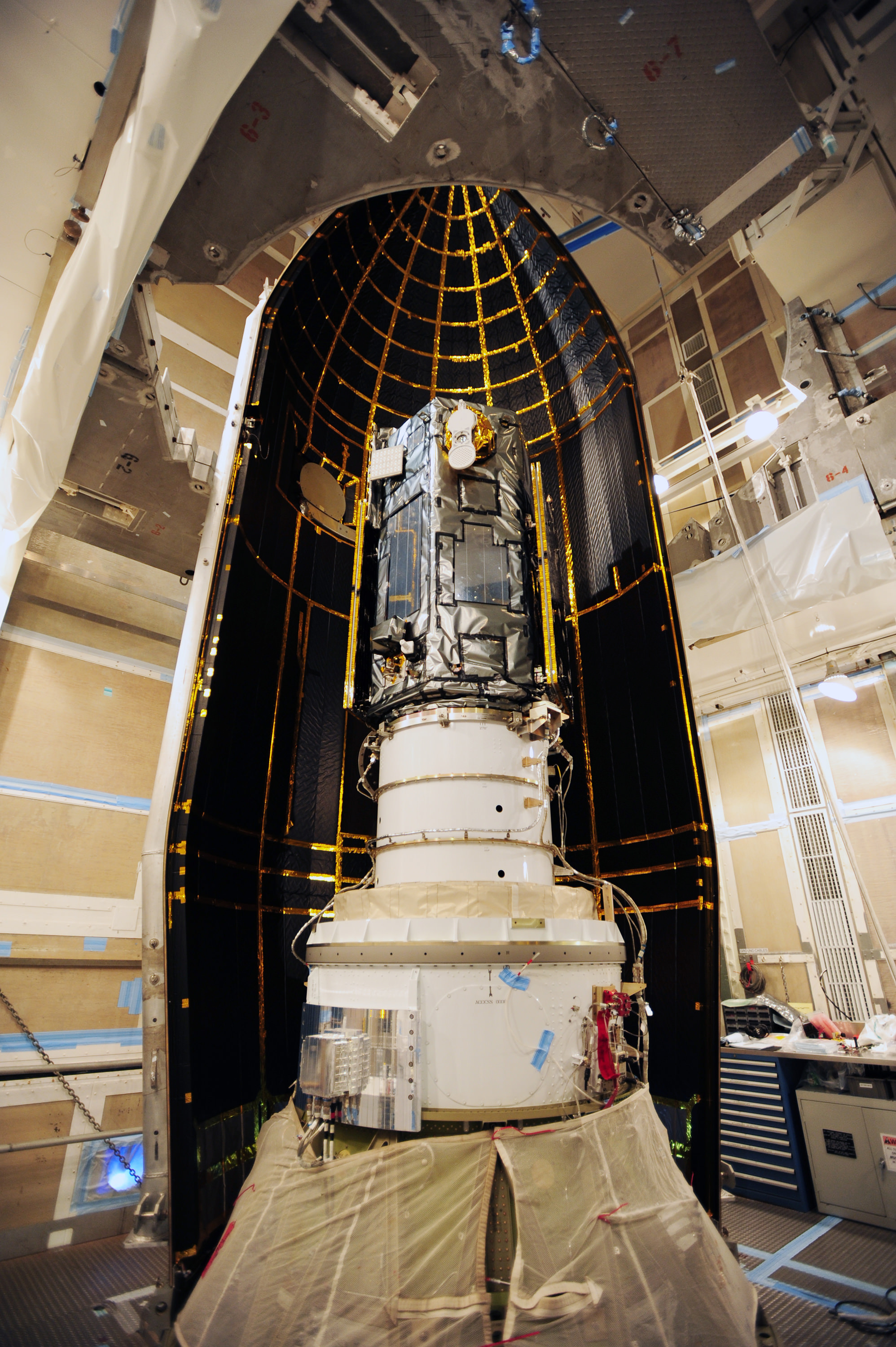
The 999 pound (454 kilogram) observatory is the size of a phone booth.

OCO-2 is equipped with a single science instrument consisting of three high-resolution, near-infrared spec¬trometers fed by a common telescope. It will collect global measurements of atmospheric CO2 to provide scientists with a better idea of how CO2 impacts climate change and is responsible for Earth’s warming.

OCO-2 poster. Credit: ULA/NASA

During a minimum two-year mission the $467.7 million OCO-2 will take near global measurements to locate the sources and storage places, or ‘sinks’, for atmospheric carbon dioxide, which is a critical component of the planet’s carbon cycle.

OCO-2 was built by Orbital Sciences as a replacement for the original OCO which was destroyed during the failed launch of a Taurus XL rocket from Vandenberg back in February 2009 when the payload fairing failed to open properly and the spacecraft plunged into the ocean.

The OCO-2 mission will provide a global picture of the human and natural sources of carbon dioxide, as well as their “sinks,” the natural ocean and land processes by which carbon dioxide is pulled out of Earth’s atmosphere and stored, according to NASA.

“This challenging mission is both timely and important,” said Michael Freilich, director of the Earth Science Division of NASA’s Science Mission Directorate in Washington.

“OCO-2 will produce exquisitely precise measurements of atmospheric carbon dioxide concentrations near Earth’s surface, laying the foundation for informed policy decisions on how to adapt to and reduce future climate change.”

It will record around 100,000 precise individual CO2 measurements around the worlds entire sunlit hemisphere every day and help determine its source and fate in an effort to understand how human activities impact climate change and how we can mitigate its effects.

At the dawn of the Industrial Revolution, there were about 280 parts per million (ppm) of carbon dioxide in Earth’s atmosphere. As of today the CO2 level has risen to about 400 parts per million.

“Scientists currently don’t know exactly where and how Earth’s oceans and plants have absorbed more than half the carbon dioxide that human activities have emitted into our atmosphere since the beginning of the industrial era,” said David Crisp, OCO-2 science team leader at NASA’s Jet Propulsion Laboratory in Pasadena, California, in a statement.

“Because of this, we cannot predict precisely how these processes will operate in the future as climate changes. For society to better manage carbon dioxide levels in our atmosphere, we need to be able to measure the natural source and sink processes.”

OCO-2 is the second of NASA’s five new Earth science missions planned to launch in 2014 and is designed to operate for at least two years during its primary mission. It follows the successful blastoff of the joint NASA/JAXA Global Precipitation Measurement (GPM) Core Observatory satellite on Feb 27.

Prelaunch view of NASA’s Orbiting Carbon Observatory-2 and United Launch Alliance Delta II rocket unveiled at  Space Launch Complex 2 at Vandenberg Air Force Base in California. Credit: Robert Fisher/America/Space
Prelaunch view of NASA’s Orbiting Carbon Observatory-2 and United Launch Alliance Delta II rocket unveiled at Space Launch Complex 2 at Vandenberg Air Force Base in California. Credit: Robert Fisher/America/Space

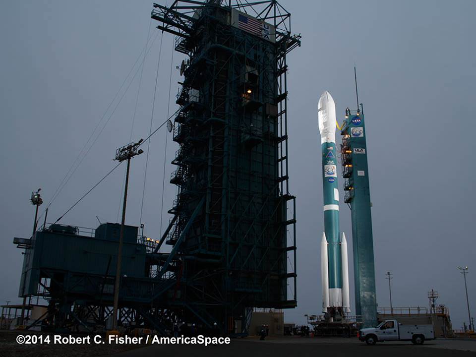
The two stage Delta II 7320-10 launch vehicle is 8 ft in diameter and approximately 128 ft tall and was equipped with a trio of first stage strap on solid rocket motors. This marked the 152nd Delta II launch overall and the 51st for NASA since 1989.

The last time a Delta II rocket flew was nearly three years ago in October 2011 from Vandenberg for the Suomi National Polar-Orbiting Partnership (NPP) weather satellite.

The final Delta II launch from Cape Canaveral on Sept. 10, 2011 boosted NASA’s twin GRAIL gravity mapping probes to the Moon.

The next Delta II launch later this year from Vandenberg involves NASA’s Soil Moisture Active Passive (SMAP) mission and counts as another of NASA’s five Earth science missions launching in 2014.

Stay tuned here for Ken’s continuing OCO-2, GPM, Curiosity, Opportunity, Orion, SpaceX, Boeing, Orbital Sciences, MAVEN, MOM, Mars and more Earth & Planetary science and human spaceflight news.

Ken Kremer

How Big is Rosetta’s Comet?

Diagram of Comet 67P/C-G compared to terrestrial landmarks (ESA)

Pretty darn big, I’d say.

The illustration above shows the relative scale of the comet that ESA’s Rosetta and Philae spacecraft will explore “up-close and personal” later this year. And while it’s one thing to say that the nucleus of Comet 67P/Churyumov-Gerasimenko is about three by five kilometers in diameter, it’s quite another to see it in context with more familiar objects. Think about it — a comet as tall as Mt Fuji!

Artist's impression (not to scale) of the Rosetta orbiter deploying the Philae lander to comet 67P/Churyumov–Gerasimenko. Credit: ESA–C. Carreau/ATG medialab.
Artist’s impression (not to scale) of the Rosetta orbiter deploying the Philae lander to comet 67P/Churyumov–Gerasimenko. Credit: ESA–C. Carreau/ATG medialab.

At the time of this writing Rosetta is 35 days out on approach to Comet 67P/C-G, at a distance of about 51,000 km (31,700 miles) and closing. Three “big burn” maneuvers have already been performed between May 7 and June 4 to adjust the spacecraft’s course toward the incoming comet, and after smaller ones on June 18 and July 2 there are a total of five more to go. See details of Rosetta’s burn maneuvers here.

As incredibly sensitive as they are, Rosetta’s instruments — which were able to detect the water vapor coming from Comet 67P/C-G from a distance of over 360,000 km — have even sniffed the hydrazine exhaust from its own thruster burns.

Luckily the remaining burns are relatively small compared to the first three, with the final being very brief, so any data contamination by Rosetta’s own exhaust shouldn’t become an issue once the spacecraft has established orbit in August.

Read more: Rosetta’s Comet Already Sweating the Small Stuff

Launched in March 2004, ESA’s Rosetta mission will be the first to orbit and land a probe on a comet, observing its composition and behavior as it makes its close approach to the Sun in 2015. Click here to see where Rosetta is right now.

Source: ESA’s Rosetta blog

Note: While 3-5 km seems pretty big (especially when stood on end) comet nuclei can be much larger, 10 to 20 km in diameter up to the enormous 40+ km size of Hale-Bopp. As comets go, 67P/C-G is fairly average. (Except that, come August, it will be the only comet with an Earthly spacecraft in tow!)

Incredible View: Camping Under the Milky Way

A 10 panel panorama of the Milkyway, as seen from the top of the Amphitheatre mountain range in the Drakensberg, South Africa. Credit and copyright: Tanja Sund.

During the summer months, many of us hit the trails and do a little camping. But how often do you get a view like this?

Wow! Click on the image above to see larger versions on Flickr.

Astrophotographer Tanja Sund and a companion pitched their tent in the Drakensberg Mountains of South Africa, a 200-kilometer-long mountainous range in the province of KwaZulu-Natal, with the tent sitting just 10 meters from a 1 kilometer-high vertical drop. “This is the home of the Tugela Waterfall, second highest waterfall in the world,” Tanja wrote on Flickr.

“The hike up to the top of the Amphitheatre took about 3 hours from the Sentinel car park, using the chain ladders to reach the summit,” Tanja said. “This is the only day hiking trail which leads to the top of the Drakensberg escarpment. We overnighted next to the Tugela falls to catch the Milkyway, which rises to the east over the local settlements.”

The image was taken on June 29, 2014.

According to the website about Drakensberg, the Zulu people named it ‘Ukhahlamba’ and the Dutch Voortrekkers ‘The Dragon Mountain.’ The Drakensberg Mountains are known for the hiking trails, areas for rock or ice-climbing, abseiling, white water rafting or helicopter rides to view the “awe-inspiring basalt cliffs, snowcapped in winter, that tower over riverine bush, lush yellowwood forests and cascading waterfalls.” At the top of Sani Pass is the highest pub in Africa, at 3,000 meters above sea level. Something for everyone!

Here’s the specs:
Canon 5D Mark III
24-70mm LII f/2.8
Shot at 24mm, F/3.2
20sec single exposures
10x image panorama
Processed in LightRoom & Photoshop.

Check out more of Tanja’s work on Flickr.

Want to get your astrophoto featured on Universe Today? Join our Flickr group or send us your images by email (this means you’re giving us permission to post them). Please explain what’s in the picture, when you took it, the equipment you used, etc.

Eureka! Kola Fireball Meteorites Found in Russia

Amateur astronomer and physics teacher Asko Aikkila managed to catch the Kola fireball on videotape in Kuusamo, Finland on April 19, 2014. The picture has been processed to enhance the details. Credit: Asko Aikkila / Finnish Fireball Network

A spectacular fireball that crackled across the sky near the Russia-Finnish border on April 19th this year left more than a bright flash. A team of meteor researchers from Finland, Russia and the Czech Republic scoured the predicted impact zone and recently discovered extraterrestrial booty.

A 120 gram fragment of the Annama meteorite. Streamlines of molten material heated during atmospheric entry can be seen on the crust. Credit: Jakub Haloda
A 120 gram fragment (left) of the Annama meteorite found on May 29, 2014. Streamlines of molten material heated during atmospheric entry can be seen on the crust. At right, a 48g fragment found on the following day. Credit: Jakub Haloda (left) and Grigory Yakovlev

There’s a lot of excitement about the fall because it’s the first time a meteorite was found based on coordinated all-sky camera network observations by the Ursa Finnish Fireball Network.  Esko Lyytinen of the network with help from Jarmo Moilanen and Steinar Midtskogen reconstructed the meteoroid’s trajectory and dark flight (when it’s no longer luminous but yet to strike the ground) using simulations based on photos, videos and eyewitness reports. 

Kola fireball meteors ended up near the Russian-Norwegian border. The fireball trajectory Esko Lyytinen of Ursa modeling of Heaven, watch videos on the findings and Murmansk.
Kola fireball meteors fell near the Russian-Norwegian border. The
fireball trajectory was modeled  byEsko Lyytinen of the Ursa Finnish Fireball Network. Credit: Kuva Mikko Suominen / Celestia with info boxes translated by the author

The initial mass of meteoroid is estimated at about 1,100 pounds (500 kg). Much of that broke apart in the atmosphere and fell harmlessly as smaller stones. An international team of scientists mounted a 5-day expedition in late May after snow melt and before green up to uncover potential space rocks in the strewnfield, the name given to the oval-shaped zone where surviving fragments pepper the ground. 

Russian amateur astronomer Nikolai Kruglikov discovered the first fragment of Annama meteorite on May 29, 2014 in the middle of a dirt road. Credit: Tomas Kohout
Russian amateur astronomer Nikolai Kruglikov discovered the first meteorite fragment in the middle of a dirt road. Credit: Tomas Kohout

On May 29, 2014, first 120 gram (4.2 ounce) meteorite fragment was found by Nikolai Kruglikov of Russia’s Ural Federal University on a forest road within the predicted impact area. The crew had been searching 1o hours a day when Kruglikov stopped the car to check out a suspect rock:

 “Suddenly he started dancing and yelling. At first I could hardly believe it was a true discovery, but then I checked the composition of the rock using my instrument”, said Tomas Kohout, University of Helsinki physicist who participated in the hunt. The fusion-crusted stone displayed classic flow features from melting rock during high-speed atmospheric entry.

The very next day a second 48 gram crusted meteorite popped up. More are undoubtedly out there but the heavy brush numerous lakes make the finding challenging. 

The crew is calling the new arrival the ‘Annama meteorite’ as it fell near the Annama River in Russia about 62 miles west of Murmansk.  The Czech Geological Survey examined the space rocks and determined them to be ordinary chondrites representing the outer crust of an asteroid that got busted to bits in a long-ago collision. More than 95% of stony meteorites fall into this category including the 2013 fireball of Chelyabinsk, Russia. 


Dashcam video of the brilliant fireball that dropped the ‘Annama meteorites’

“The Kola fireball is a rarity – it is one of only 22 cases where it was possible to determine its pre-impact solar system orbit before the impact with Earth’s atmosphere,” says Maria Gritsevich of the Finnish Geodetic Institute. “Knowing where the meteorite originates will help us better understand the formation and evolution of the solar system.” Congratulations Ursa!

Awesome Aurora Vine Video from the Space Station

The Aurora Borealis seen from the International Space Station on June 28, 2014, taken by astronaut Reid Wiseman. Credit: Reid Wiseman/NASA.

Here’s the latest Vine video from astronaut Reid Wiseman on board the International Space Station, showing the Aurora Borealis shimmering in the sky as the stars of Orion rise in the sky. Modules of the ISS smoothly move through the top portion of the video.

In viewing the aurora from space earlier, Wiseman said, “It felt like I could reach out and touch it…moving like a snake through the sky.

Below is an image of aurora seen from the ISS.

Astronauts Say Happy Canada Day!

A view of the St. Lawrence Seaway and Canada under the clouds seen from the International Space Station by ESA astronaut Alexander Gerst. Credit: ESA/NASA.

On 1 July, Canadians celebrate Canada Day, which honors the day the nation was officially born when the Constitution Act united three colonies into a single country. Astronauts both past and present send their greetings today: ESA astronaut Alexander Gerst took this image, above, from the International Space Station and sent the message from space: “Canada is beautiful! Happy Canada Day!”

Below, NASA astronaut Reid Wiseman took a beautiful image showing storms swirling near Winnipeg, Manitoba.

And then, there’s a very special new video featuring former Canadian astronaut Chris Hadfield and his brother Dave singing an original song by Dave titled, “In Canada.” It’s pretty great, and it gives you an inside look at the Hadfield family (they do family rocket launches!) and what it’s like to live in Canada. If you think Chris has a great singing voice, you’ll love Dave’s voice (they sound almost exactly the same!) and when they harmonize, it’s golden because they blend perfectly as only sibling voices can.

Storm begins to swirl near Winnipeg, Canada, as seen from the International Space Station on June 29, 2014. Image taken by astronaut Reid Wiseman. Credit: NASA.

Find out more about the song and Dave’s various endeavor’s at his website.

We send special Canada Day greetings to the Canadians at Universe Today, our publisher Fraser Cain, and journalists Elizabeth Howell and Daniel Majaess.

Trekking Mars – Curiosity Roves Outside Landing Ellipse!

Curiosity treks across Martian dunes and drives outside landing ellipse here, in this photo mosaic view captured on Sol 672, June 27, 2014. Navcam camera raw images stitched and colorized. Credit: NASA/JPL-Caltech/Marco Di Lorenzo/Ken Kremer – kenkremer.com

Trekking Mars – NASA’s intrepid robot Curiosity is roving rapidly across the sandy ripples of the Red Planet in her quest to reach mysterious Mount Sharp and just drove outside her landing ellipse!

The six wheeled rover marked a major milestone on Sol 672, June 27, 2014, by traversing beyond her targeted landing ellipse for the first time since touchdown on Mars nearly two years ago on August 5, 2012.

“On yestersol’s drive [June 27], I left my landing ellipse—the 20×25 km area I targeted for landing,” Curiosity tweeted across interplanetary space.

See our new Sol 672 photo mosaic above showing Curiosity’s glorious view marking this major achievement just days ago.

Since switching paths to smoother, sandier terrain with less sharp edged rocks, Curiosity continues rolling across the floor of her Gale Crater landing site, pausing occasionally for potentially dicey dunes.

“After traversing 82 meters the rover stopped because it determined that it was slipping too much,” wrote mission scientist Ken Herkenhoff in an update.

“Coincidentally, the rover stopped right on the landing ellipse, a major mission milestone!”

Curiosity treks to Mount Sharp in this photo mosaic view captured on Sol 669, June 24, 2014.    Navcam camera raw images stitched and colorized.   Credit: NASA/JPL-Caltech/Marco Di Lorenzo/Ken Kremer – kenkremer.com
1 Martian Year on Mars!
Curiosity treks to Mount Sharp in this photo mosaic view captured on Sol 669, June 24, 2014. Navcam camera raw images stitched and colorized. Credit: NASA/JPL-Caltech/Marco Di Lorenzo/Ken Kremer – kenkremer.com

“The vehicle was designed to be able to traverse far enough to drive out of the region defined by the uncertainty in the landing location, and has now achieved that laudable goal,” Herkenhoff confirmed.

The SUV sized rover automatically stopped when it encountered soft sand and sensed that it wasn’t making enough progress. It’s been programmed with this built in safety check to avoid being trapped in a quagmire of quicksand.

Curiosity crosses landing ellipse on Sol 672. Credit: NASA/JPL

Earlier last week, Curiosity celebrated another milestone anniversary on June 24 (Sol 669) – 1 Martian Year on Mars!

A Martian year is equivalent to 687 Earth days, or nearly two Earth years.

See our Sol 669 photo mosaic marking 1 Mars Year on Mars – above.

During Year 1 on Mars, Earth’s emissary has already accomplished her primary objective of discovering a habitable zone on the Red Planet that contains the minerals necessary to support microbial life in the ancient past.

So there’s no stopping Curiosity on her way to Mount Sharp, which dominates the center of Gale Crater and reaches 3.4 miles (5.5 km) into the Martian sky – taller than Mount Rainier.

Driving, Driving, Driving – that’s Curiosity’s number one priority as she traverses across the surface of Gale Crater towards towering Mount Sharp on an expedition in search of the chemical ingredients of life that could support Martian microbes if they ever existed.

Curiosity still has about another 2.4 miles (3.9 kilometers) to go to reach the entry way at a gap in the dunes at the foothills of Mount Sharp sometime later this year.

Curiosity rover panorama of Mount Sharp captured on June 6, 2014 (Sol 651) during traverse inside Gale Crater.  Note rover wheel tracks at left.  She will eventually ascend the mountain at the ‘Murray Buttes’ at right later this year. Assembled from Mastcam color camera raw images and stitched by Marco Di Lorenzo and Ken Kremer.   Credit:   NASA/JPL/MSSS/Marco Di Lorenzo/Ken Kremer-kenkremer.com
Curiosity rover panorama of Mount Sharp captured on June 6, 2014 (Sol 651) during traverse inside Gale Crater. Note rover wheel tracks at left. She will eventually ascend the mountain at the ‘Murray Buttes’ at right later this year. Assembled from Mastcam color camera raw images and stitched by Marco Di Lorenzo and Ken Kremer. Credit: NASA/JPL/MSSS/Marco Di Lorenzo/Ken Kremer-kenkremer.com

To date, Curiosity’s odometer totals over 5.1 miles (8.4 kilometers) since landing inside Gale Crater on Mars in August 2012. She has taken over 162,000 images.

Stay tuned here for Ken’s continuing Curiosity, Opportunity, Orion, SpaceX, Boeing, Orbital Sciences, commercial space, MAVEN, MOM, Mars and more planetary and human spaceflight news.

Ken Kremer

How to See Pluto at Opposition as New Horizons Crosses the One Year Out Mark

Pluto passing near the star cluster M25 in late 2013. Credit: Dave Walker.

Are you ready for 2015? On July 14th, 2015 — just a little over a year from now — NASA’s New Horizons spacecraft with perform its historic flyby of Pluto and its retinue of moons. Flying just 10,000 kilometres from the surface of Pluto — just 2.5% the distance from Earth to the Moon on closest approach — New Horizons is expected to revolutionize our understanding of these distant worlds.

And whether you see Pluto as a much maligned planetary member of the solar system, an archetypal Plutoid, or the “King of the Kuiper Belt,” you can spy this denizen of the outer solar system using a decent sized backyard telescope and a little patience.

New Horizon in the clean room having its plutonium-fueled MMRTG installed. (Credit: NASA).
New Horizons in the clean room having its plutonium-fueled MMRTG installed. (Credit: NASA).

Pluto reaches opposition for 2014 later this week on Friday, July 4th at 3:00 Universal Time (UT), or 11:00 PM EDT on July 3rd. This means that Pluto will rise to the east as the Sun sits opposite to it in the west at sunset and transits the local meridian high to the south at local midnight. This is typically the point of closest approach to Earth for any outer solar system object and the time it is brightest.

Dusk July 4th Credit
The location of Pluto at dusk on July 4th, the night of opposition. Credit: Stellarium.

But even under the best of circumstances, finding Pluto isn’t easy. Pluto never shows a resolvable disk in even the largest backyard telescope, and instead, always appears like a tiny star-like point. When opposition occurs near perihelion — as it last did in 1989 — Pluto can reach a maximum “brilliancy” of magnitude +13.6. However, Pluto has an extremely elliptical orbit ranging from 30 to 49 Astronomical Units (A.U.s) from the Sun. In 2014, Pluto has dropped below +14th magnitude at opposition as it heads back out towards aphelion one century from now in 2114.

Pluto from July-Dec
The path of Pluto from July to December 2014. Created using Starry Night Education Software.

Another factor that makes finding Pluto challenging this decade is the fact that it’s crossing through the star-rich plane of the galaxy in the direction of the constellation Sagittarius until 2023. A good finder chart and accurate pointing is essential to identifying Pluto as it moves 1’ 30” a day against the starry background from one night to the next.

In fact, scouring this star-cluttered field is just one of the challenges faced by the New Horizons team as they hunt for a potential target for the spacecraft post-Pluto encounter. But this has also meant that Pluto has crossed some pretty photogenic regions of the sky, traversing dark Bok globules and skirting near star clusters.

Pluto (marked) imaged by Jim Hendrickson on the morning of June 29th.
Pluto (marked) imaged by Jim Hendrickson @SkyscraperJim on the morning of June 28th.

You can use this fact to your advantage, as nearby bright stars make great “guideposts” to aid in your Pluto-quest. Pluto passes less than 30” from the +7th magnitude pair BB Sagittarii on July 7th and 8th and less than 3’ from the +5.2 magnitude star 25 Sagittarii on July 21st… this could also make for an interesting animation sequence.

Though Pluto has been reliably spotted in telescopes as small as 6” in diameter, you’ll most likely need a scope 10” or larger to spot it. We’ve managed to catch Pluto from the Flandrau observatory situated in downtown Tucson using its venerable 14” reflector.

June 28th-August 8th (inverted)
The path of Pluto June 28th-August 8th. (click here for an inverted white background view). Created using Starry Night Education Software.

Pluto was discovered by Clyde Tombaugh from the Lowell Observatory in 1930 while it was crossing the constellation Gemini. It’s sobering to think that it has only worked its way over to Sagittarius in the intervening 84 years. It was also relatively high in the northern hemisphere sky and headed towards perihelion decades later during discovery. 2014 finds Pluto at a southern declination of around -20 degrees, favoring the southern hemisphere. Had circumstances been reversed, or Pluto had been near aphelion, it could have easily escaped detection in the 20th century.

We’re also fortunate that Pluto is currently relatively close to the ecliptic plane, crossing it on October 24th, 2018. Its orbit is inclined 17 degrees relative to the ecliptic and had it been high above or below the plane of the solar system, sending a spacecraft to it in 2015 might have been out of the question due to fuel constraints.

The current location of New Horizons. (Credit: NASA/JPL).

And speaking of spacecraft, New Horizons now sits less than one degree from Pluto as seen from our Earthly vantage point. And although you won’t be able to spy this Earthly ambassador with a telescope, you can wave in its general direction on July 11th and 12th, using the nearby waxing gibbous Moon as a guide:

The Moon, Pluto and New Horizons as seen on July 11th. (Created Using Starry Night Education Software).

All eyes will be on Pluto and New Horizons in the coming year, as it heads towards a date with destiny… and we’ll bet that the “is Pluto a planet?” debate will rear its head once more as we get a good look at these far-flung worlds.

And hey, if nothing else, us science writers will at last have some decent pics of Pluto to illustrate articles with, as opposed to the same half-dozen blurry images and artist’s renditions…

Saturn’s Sailor: 20 Cassini Pictures Marking A Decade At The Ringed Planet

Saturn's northern storm marches through the planet's atmosphere in the top right of this false-color mosaic from NASA's Cassini spacecraft. Credit: NASA/JPL-Caltech/Space Science Institute

We’re spoiled, don’t you know? It was 10 years ago today that the Cassini spacecraft entered Saturn’s system, and it has been busily beaming back pictures of the ringed planet and its (many) moons ever since. We’ve learned more about seasons on Titan, investigated plumes on Enceladus, and examined phenomena such as auroras on Saturn.

Embedded in this story are 20 of our favourite pictures from Universe Today’s archive of Cassini discoveries, which you can check out below the jump.

It’s only a fraction of the more than 332,000 images received from the spacecraft, which is in excellent health and has seen its mission extended three times past its original 2008 expiry date. Additionally, more than 3,000 scientific papers have been generated. More cool stats in this NASA infographic.

And by the way, we’re not the only ones assembling memorable images to mark the anniversary. Check out NASA’s favourite Cassini pictures of the past decade, or our friend Phil Plait’s Bad Astronomy list. Also, here is NASA’s opinion of the top 10 discoveries at the ringed planet.

While thinking about Cassini, also don’t forget Huygens, the lander that descended to the surface of Titan in 2005. More on that in this past Universe Today anniversary story.

The full mosaic from the Cassini imaging team of Saturn on July 19, 2013… the “Day the Earth Smiled”
In this unique mosaic image combining high-resolution data from the imaging science subsystem and composite infrared spectrometer aboard NASA's Cassini spacecraft, pockets of heat appear along one of the mysterious fractures in the south polar region of Saturn's moon Enceladus. Image credit: NASA/JPL/GSFC/SWRI/SSI
In this unique mosaic image combining high-resolution data from the imaging science subsystem and composite infrared spectrometer aboard NASA’s Cassini spacecraft, pockets of heat appear along one of the mysterious fractures in the south polar region of Saturn’s moon Enceladus. Image credit: NASA/JPL/GSFC/SWRI/SSI
Saturn, imaged by Cassini on approach. Credit: CICLOPS
Titan and Dione as seen by Cassini. Credit: NASA/JPL/Space Science Institute
Which Planets Have Rings?
This image taken by the Cassini orbiter on Oct. 15, 2007, shows Saturn’s A and F rings, the small moon Epimetheus and smog-enshrouded Titan, the planet’s largest moon. The image is colorized to approximate the scene as it might appear to human eyes. (Credit: NASA/JPL/Space Science Institute)
Cassini imaging scientists used views like this one to help them identify the source locations for individual jets spurting ice particles, water vapor and trace organic compounds from the surface of Saturn's moon Enceladus. Credit: NASA
Cassini imaging scientists used views like this one to help them identify the source locations for individual jets spurting ice particles, water vapor and trace organic compounds from the surface of Saturn’s moon Enceladus. Credit: NASA
Raw image from Cassini on May 18.  Credit: NASA/JPL/SSI
Raw image from Cassini on May 18. Credit: NASA/JPL/SSI
Hemispheric color differences on Saturn's moon Rhea are apparent in this false-color view from NASA's Cassini spacecraft. This image shows the side of the moon that always faces the planet. Image Credit: NASA/JPL/SSI
Hemispheric color differences on Saturn’s moon Rhea are apparent in this false-color view from NASA’s Cassini spacecraft. This image shows the side of the moon that always faces the planet. Image Credit: NASA/JPL/SSI
Three of Saturn's moons bunch together in this image by Cassini.  Credit: NASA/JPL/Space Science Institute.  Click for larger image.
Three of Saturn’s moons bunch together in this image by Cassini. Credit: NASA/JPL/Space Science Institute. Click for larger image.
This mosaic of Titan was created from the first flyby of the moon by Cassini in 2004. Credit: NASA/JPL/SS
Phoebe
Phoebe imaged by the Cassini spacecraft. Image Credit: NASA
Cassini VIMS image of specular reflections in one of Titan's lakes from a flyby on July 24, 2012 (NASA/JPL-Caltech/SSI/Jason W. Barnes et al.)
Cassini VIMS image of specular reflections in one of Titan’s lakes from a flyby on July 24, 2012 (NASA/JPL-Caltech/SSI/Jason W. Barnes et al.)
A crescent Dione was seen by Cassini on January 29, 2011 from approximately 767,922 kilometers away. Credit: NASA/JPL/SSI
Rhea, as seen by Cassini. Credit: NASA
Cassini captured this startling image of Saturn's moon Hyperion. Photo Credit: NASA/JPL
Cassini captured this startling image of Saturn’s moon Hyperion. Photo Credit: NASA/JPL
ets of water ice particles spew from Saturn's moon Enceladus in this image obtained by NASA's Cassini spacecraft on Aug. 13, 2010. Image credit: NASA/JPL/SSI
ets of water ice particles spew from Saturn’s moon Enceladus in this image obtained by NASA’s Cassini spacecraft on Aug. 13, 2010. Image credit: NASA/JPL/SSI
This false-color composite image shows Saturn’s rings and southern hemisphere. The composite image was made from 65 individual observations by Cassini’s visual and infrared mapping spectrometer in the near-infrared portion of the light spectrum on Nov. 1, 2008.  Credit: NASA/JPL/University of Arizona
This false-color composite image shows Saturn’s rings and southern hemisphere. The composite image was made from 65 individual observations by Cassini’s visual and infrared mapping spectrometer in the near-infrared portion of the light spectrum on Nov. 1, 2008. Credit: NASA/JPL/University of Arizona
This mosaic of images from NASA's Cassini spacecraft shows three fan-like structures in Saturn's tenuous F ring. Such "fans" suggest the existence of additional objects in the F ring. Image credit: NASA/JPL/SSI
This mosaic of images from NASA’s Cassini spacecraft shows three fan-like structures in Saturn’s tenuous F ring. Such “fans” suggest the existence of additional objects in the F ring. Image credit: NASA/JPL/SSI
Cassini came within 25 kilometers (15.6 miles) of the surface of Enceladus on Oct. 5, 2008.  Image credit: NASA/JPL/Space Science Institute
Cassini came within 25 kilometers (15.6 miles) of the surface of Enceladus on Oct. 5, 2008. Image credit: NASA/JPL/Space Science Institute

Astronauts Shave Their Heads Bald After U.S. Loses FIFA Match To Germany

NASA astronaut Reid Wiseman reacts mid-shave as fellow Expediton 40 crew member Alexander Gerst looks on. Wiseman and fellow NASA astronaut Steve Swanson both were shaved bald after the U.S. lost 1-0 to Germany in the 2014 FIFA World Cup. Credit: NASA / YouTube (screenshot)

Lose a soccer game and lose your hair. That’s apparently the deal that American astronauts made on the International Space Station last week, as commander Steve Swanson and Reid Wiseman both were shaved bald after the U.S. lost to Germany 1-0 June 26 in the FIFA World Cup. Gleefully wielding the shaver was Alexander Gerst, who happens to be from Germany.

Despite their busy science schedule, the astronauts have been enthusiastically following (and tweeting about!) the games. Not to mention they did a couple of improvised soccer matches in zero gravity, complete with awesome celebratory dances. You can check out all the video action below.