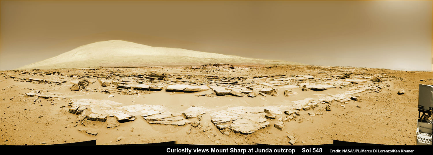
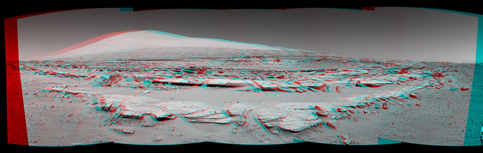
Mars rock rows and Spectacular Mount Sharp
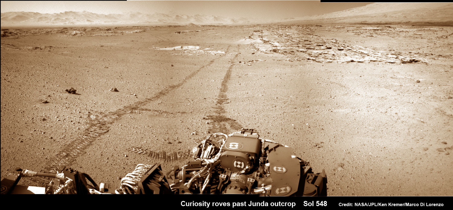
Martian landscape scene with rows of striated rocks in the foreground and spectacular Mount Sharp on the horizon. NASA’s Curiosity Mars rover paused mid drive at the Junda outcrop to snap the component images for this colorized navcam camera photomosaic on Sol 548 (Feb. 19, 2014) and then continued traveling southwards towards mountain base. UHF Antenna at right.
Credit: NASA/JPL-Caltech/Marco Di Lorenzo/Ken Kremer-kenkremer.com
See stereo 3-D and look back views below[/caption]
Like any good tourist, NASA’s rover Curiosity apparently couldn’t resist the photobug urge from a gorgeous Martian mountain scene she happened by recently and decided to pull over and enjoy the view.
So she stopped the dune buggy mid-drive on the sandy road to her daily destination one Sol last week on Feb. 19, powered up the camera suite and excitedly snapped a spectacular landscape view of a striated rock field dramatically back dropped by towering Mount Sharp on the horizon.
See our Mars rocks and Mount Sharp photomosaic above and a 3-D stereoscopic view from NASA below.
The sedimentary foothills of Mount Sharp, which reaches 3.4 miles (5.5 km) into the Martian sky, is the 1 ton robots ultimate destination inside Gale Crater because it holds caches of water altered minerals.
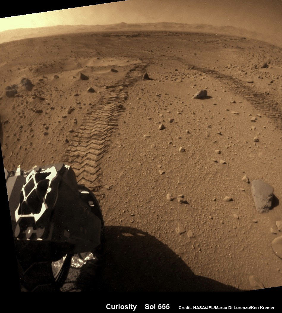
And just for good measure, Curiosity also snapped a series of breathtaking look back photos showing her tracks in the dune filled terrain from whence she came since straddling through the Dingo Gap gateway. See our mosaics below.
The panoramic mountain view taken on Sol 548 shows rows of striated rocks all oriented in a similar direction in the foreground with Mount Sharp in the background.
Scientists directed Curiosity to drive by the rock rows nicknamed “Junda” after their interest was piqued by orbital images taken by the powerful telescopic camera on NASA’s Mars Reconnaissance Orbiter (MRO) circling overhead.
The six wheeled rover paused during the planned Feb. 19 drive of 328 feet (100 meters) to capture the imagery.
She then pushed forward to finish the day’s drive and snapped another fabulous look back view – see our mosaic below.
And the next day on Feb. 20 (Sol 549), she also completed her second 100 meter drive in reverse.
Her handlers are occasionally commanding Curiosity to drive backwards in a newly tested bid to minimize serious damage to the six 20 inch diameter wheels in the form of rips and tears caused by rough edged Red Planet rocks – see our wheel mosaic below.
Curiosity is well on the way to her next near term goal, which is a science waypoint, named Kimberly (formerly called KMS-9), which lies about half a mile ahead.
Kimberly is of interest to the science team because it sits at an the intersection of different rock layers and also features ground with striations like those at “Junda”.
So, after the rover reaches Kimberly, researchers plan to temporarily halt driving for awhile to investigate the location and direct the robot to drill into another rock to collect samples for analysis by the two state- of-the -art chemistry labs.
If drilling is warranted, Kimberly would be the site of Curiosity’s first drilling operation since the Cumberland outcrop target was bored into during the spring of 2013 at Yellowknife Bay.
Curiosity departed the Yellowknife Bay region in July 2013 where she discovered a habitable zone and thereby accomplished the primary goal of the mission.
To date Curiosity’s odometer stands at 5.3 kilometers and she has taken over 125,000 images.
The robot has somewhat less than another 5 km to go to reach the base of Mount Sharp.
She perhaps may arrive sometime in mid 2014.
Arrival time at Mount Sharp depends on driving speed and whether the upcoming terrain is smoother or strewn with sharp edged rocks that have hindered progress due to accumulating wear and tear on the aluminum wheels.

Meanwhile, NASA’s sister Opportunity rover is exploring clay mineral outcrops by the summit of Solander Point on the opposite side of Mars at the start of her 2nd Decade investigating the Red Planet’s mysteries.
A pair of new orbiters are streaking to the Red Planet to fortify Earth’s invasion fleet- NASA’s MAVEN and India’s MOM.
Stay tuned here for Ken’s continuing Curiosity, Opportunity, Chang’e-3, GPM, SpaceX, Orbital Sciences, LADEE, MAVEN, MOM, Mars and more planetary and human spaceflight news. Learn more at Ken’s upcoming presentations at the NEAF convention on April 12/13.

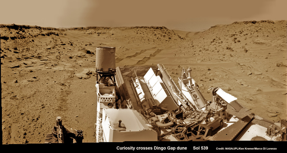
This photomosaic from Curiosity’s Navigation Camera (Navcam) taken at the edge of the entrance to the Dingo Gap shows a 3 foot (1 meter) tall dune and valley terrain beyond to the west, all dramatically back dropped by eroded rim of Gale Crater. View from the rover’s current position on Sol 528 (Jan. 30, 2014). The rover team may decide soon whether Curiosity will bridge the dune gap as a smoother path to next science destination. Credit: NASA/JPL-Caltech/Marco Di Lorenzo/Ken Kremer- kenkremer.com