Just where has the Curiosity rover traveled so far and where is it going? This new video, narrated by John Grotzinger, the principal investigator for the Mars Science Laboratory mission, provides an aerial tour of the rover’s past, present and future traverses on the Red Planet.
Curosity landed in a flat, “hummocky” area in Gale Crater and is heading towards the Aeolis Mons, also known as Mount Sharp, a mountain 5 kilometers (3 miles) high. Right now the rover is among a cluster of small, steep-sided knobs, or buttes that are quite large — up to about the size of a football field and the height of a goal post. They sit in a gap in a band of dark sand dunes that lie at the foot of the mountain. Deep sand could present a hazard for driving, so this break in the dunes is the access path to the mountain.
These buttes have been named the Murray Buttes in honor of influential planetary scientist Bruce Murray (1931-2013).
“Bruce Murray contributed both scientific insight and leadership that laid the groundwork for interplanetary missions such as robotic missions to Mars, including the Mars rovers, part of America’s inspirational accomplishments,” said NASA Mars Exploration Program Manager Fuk Li from JPL. “It is fitting that the rover teams have chosen his name for significant landmarks on their expeditions.”
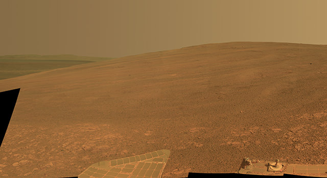
Meanwhile at Endeavour Crater, where the Opportunity is still exploring, nearly a decade on, and is now preparing for winter. A feature there has also been named for Bruce Murray, Murray Ridge, part of an uplifted crater rim.
“Murray Ridge is the highest hill we’ve ever tried to climb with Opportunity,” said the mission’s principal investigator, Steve Squyres of Cornell University, Ithaca, N.Y. The ridge has outcrops with clay minerals detected from orbit. It also provides a favorable slope for Martian winter sunshine to hit the rover’s solar panels, an advantage for keeping Opportunity mobile through the winter.
“Bruce Murray is best known for having been the director of JPL, and JPL is where our rovers were built,” Squyres said. “He led JPL during a time when the planetary exploration budget was under pressure and the future for planetary missions was not clear. His leadership brought us through that period with a strong exploration program. He was also a towering figure in Mars research. His papers are still cited abundantly today.”
Back to the video, interestingly, the “fly-through” data comes from a variety of missions representing some of the history of Mars exploration. Doug Ellison, who works with JPL’s Eyes on the Solar System – which uses spacecraft data to create realistic simulated views of spacecraft, planets and other features within our solar system – said on Twitter that the video uses data from Viking to narrow down the color, Mars Express High Resolution Stereo Camera (MEX-HRSC_ and the Mars Reconnassaince Oribiter’s HiRISE camera for topography, and the MRO Context camera (MRO-CTX) and HiRISE for imagery.
Source: JPL

