SpaceX Dragon Departs Station for Pacific Splashdown with Valuable Science Cargo

SpaceX Dragon was released from ISS at 6:56am ET and now begins its return trip to Earth. Credit: NASA

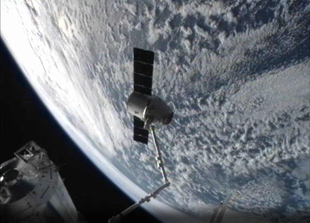
The SpaceX Dragon commercially developed cargo craft loaded with thousands of pounds of precious science samples has departed from the International Space Station at 6:56 a.m EDT this morning (March 26) and is heading back to Earth today for a splashdown in the Pacific Ocean at around 12:34 p.m EDT.

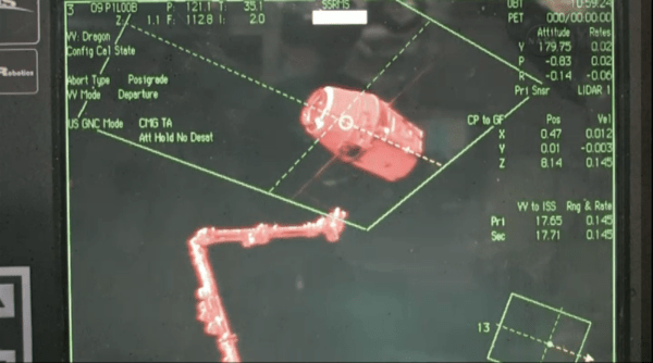
The ISS crew commanded the Dragon’s release by a trigger at the robotic work station inside the Cupola as they were soaring some 250 miles over the northeast coast of Australia after Mission Control gave the “GO for release”.
A video of the unberthing is below:

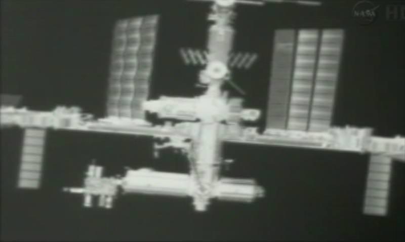
Cameras aboard both the ISS and Dragon transmitted breathtaking views of the departure maneuver. The entire ISS filled the video screen as Dragon slowly pulled away.

SpaceX Dragon capsule grappled by ISS robotic arm prior to today’s  departure and  return to Earth and Pacific Ocean splashdown. Credit: NASA
SpaceX Dragon capsule grappled by ISS robotic arm prior to today’s departure and return to Earth and Pacific Ocean splashdown. Credit: NASA

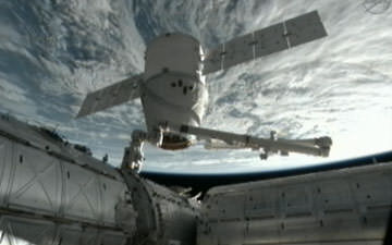
The private Dragon was unberthed from a docking port on the Harmony node at 4:10 a.m. EDT in anticipation of today’s return to Earth.

The capsule had been docked at the orbiting outpost for three weeks since arriving on March 3.

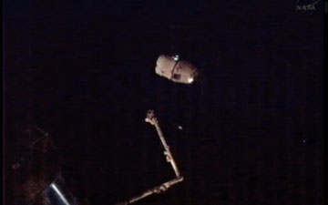
NASA astronaut Tom Marshburn and station commander Chris Hadfield from Canada opened the snares on the stations Canadian built robotic arm – Canadarm2 – firmly grasping the Dragon.

ISS imaged be cameras on departing Dragon. Credit: SpaceX/NASA
ISS imaged by cameras on departing Dragon. Credit: SpaceX/NASA

A series of three short departure burns executed in rapid succession took Dragon safely away from the ISS and beyond the imaginary 656-foot (200-meter) “Keep Out Sphere” around the station for the journey back to Earth.

Everything with Dragon happened as expected said NASA.

“All looks beautiful and nominal as expected,” radioed the ISS crew.

The Dragon capsule is the first private ship ever to dock at the ISS.

Dragon conducts departure burns from the ISS on March 26, 2013. Credit: NASA

Dragon will fire its engines for the last time for the 10 minute long deorbit burn at 11:42 a.m. EDT sending it through the Earth’s atmosphere for a fiery reentry and splashdown in the Pacific Ocean around 12:34 p.m.

“Sad to see the Dragon go,” said Marshburn. “She performed her job beautifully and is heading back to her lair. Wish her all the best for the splashdown today.”

A team of SpaceX engineers, technicians and divers will recover the vehicle after splashdown about 214 miles off the coast of Baja, California.

SpaceX recovery crews will pluck the capsule from the Pacific Ocean for the journey back to shore which will take about 30 hours.

Dragon had been scheduled to return yesterday on Monday, March 25, but was postponed due to inclement weather developing near its targeted splashdown site in the Pacific Ocean.

There was no affect on the return of the science samples and gear weighing a hefty 2668 pounds. Dragon is the only vehicle that can safely return significant amounts of science cargo and gear from the ISS following the retirement of NASA’s space shuttle orbiters.

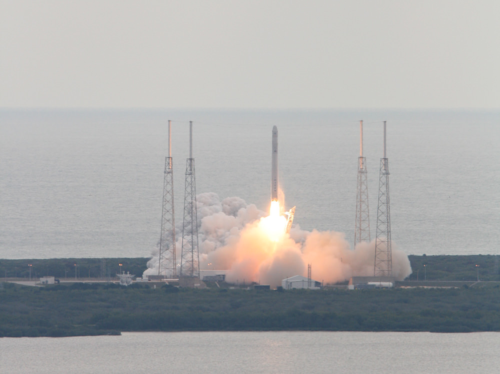
The SpaceX Dragon CRS-2 capsule blasted off on March 1 atop a SpaceX Falcon 9 rocket from Cape Canaveral Air Force Station in Florida.

A thruster failure shortly after liftoff nearly doomed the mission. But fast acting SpaceX engineers saved the day and restarted the engines a few hours later – read my earlier story here.

Falcon 9 SpaceX CRS-2 launch on March 1, 2013 to the ISS – shot from the roof of the Vehicle Assembly Building. Credit: Ken Kremer/www.kenkremer.com

The resupply mission carried aloft some 1200 pounds of food, water and science experiments for the station crew.

After a two day flight, Marshburn captured the Dragon just 32 feet away from the station with the Canadarm2 on March 3. Ground controllers then took over Canadarm2 operations and berthed Dragon to the Harmony node.

SpaceX is under contract to NASA to deliver about 44,000 pounds of cargo to the ISS during a dozen flights over the next few years at a cost of about $1.6 Billion.

SpaceX and Orbital Sciences Corp are partnered with NASA’s Commercial Resupply Services program to replace the cargo up mass capability the US lost following the retirement of NASA’s space shuttle orbiters in 2011.

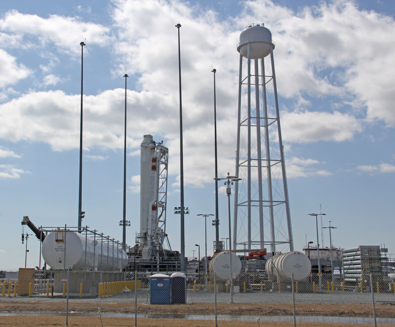
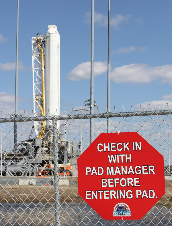
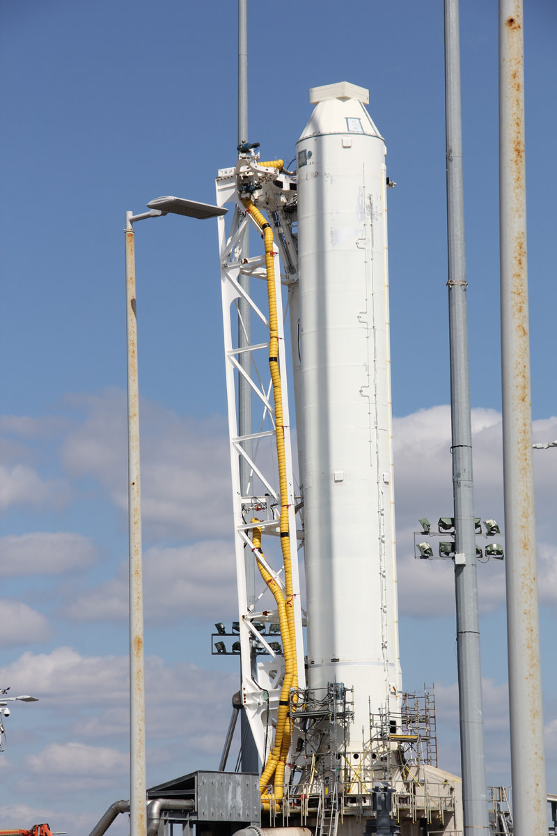
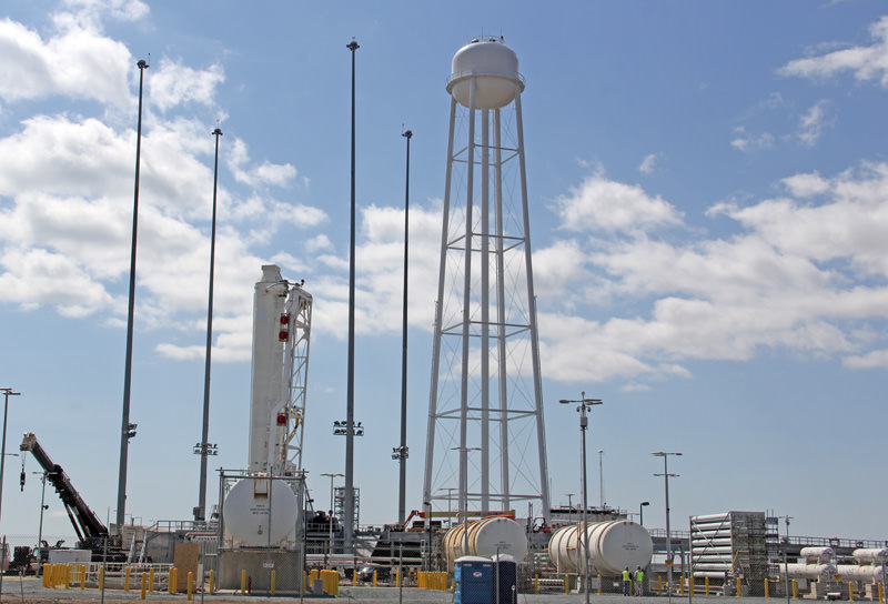
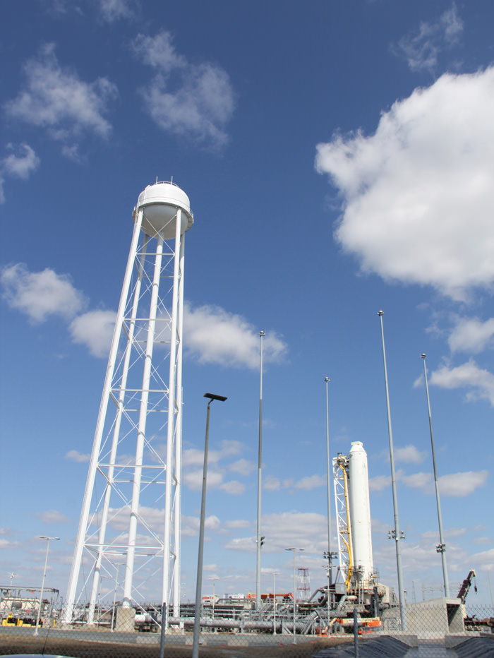
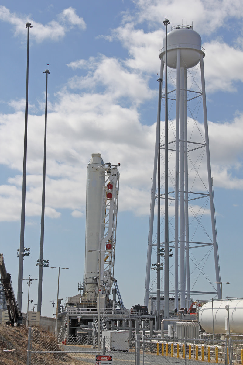
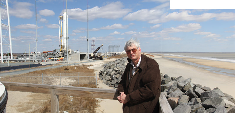
The maiden launch of Orbital’s Antares/Cygnus ISS cargo resupply program is now slated to occur on April 16-18 from NASA Wallops Flight Facility in Virginia – read my onsite photo report here.

The inaugural Antares launch will be a test flight with a simulated Cygnus.

The next SpaceX Dragon flight – dubbed CRS-3 – is slated to blast off in late November 2013.

Ken Kremer

Dragon and Earth from the ISS. Credit: NASA

NASA’s Operation IceBridge Surveys Greenland and Earth’s Polar Ice Sheets

NASA P-3B waits outside the hangar at Thule Air Base with the Greenland Ice sheet in the background. The aircraft is set to begin the 2013 season of NASA’s Operation IceBridge mission to survey Earth's polar ice sheets in unprecedented three-dimensional detail. The plane just arrived from NASA Wallops Flight Facility in Virginia - see my P-3B photos below. Credit: NASA/Goddard/Michael Studinger

NASA’s Operation IceBridge has begun the 2013 research season of Ice Science flights in Greenland and the Arctic to survey the regions ice sheets and land and sea ice using a specially equipped P-3B research aircraft from NASA’s Wallops Flight Facility in Wallops Island, Va.

Operation IceBridge began in 2009 as part of NASA’s six-year long effort to conduct the largest airborne survey of Earth’s polar ice ever flown.

The goal is to obtain an unprecedented three-dimensional, multi-instrument view of the behavior of Greenland, Arctic and Antarctic ice sheets, ice shelves and sea ice which have been undergoing rapid and dramatic changes and reductions.

“We’re starting to see how the whole ice sheet is changing,” said Michael Studinger, IceBridge project scientist at NASA’s Goddard Space Flight Center in Greenbelt, Md. “Thinning at the margins is now propagating to the interior.”

The P-3 exiting the hanger pre-flight in Thule. Credit: NASA

The airborne campaign was started in order to maintain a continuous record of measurements in changes in polar ice after NASA’s Earth orbiting ICESat (Ice, Cloud and Land Elevation Satellite) probe stopped collecting data in 2009.

ICESat-2 won’t be launched until 2016, so NASA’s IceBridge project and yearly P-3 airborne campaigns will fill in the science data gap in the interval.

The P-3B Orion just arrived from NASA’s Wallops Flight Facility in Virginia where I visited it before departure – see my P-3B photos herein.

NASA IceBridge P-3B research aircraft prepares for departure from runway at NASA Wallops Flight Facility in Virginia to Thule Air Base in Greenland.  Credit: Ken Kremer (kenkremer.com)
NASA IceBridge P-3B research aircraft prepares for departure from runway at NASA Wallops Flight Facility in Virginia to Thule Air Base in Greenland. Credit: Ken Kremer (kenkremer.com)

IceBridge is operating out of airfields in Thule and Kangerlussuaq, Greenland, and Fairbanks, Alaska.

The P-3B survey flights over Greenland and the Arctic will continue until May. They are conducted over Antarctica during October and November.

A sunny view of the ramp at Thule Air Base, Greenland, shortly after the NASA P-3B research aircraft arrived on Mar. 18, 2013. Credit: NASA / Jim Yungel

The measurements collected by IceBridge instruments will characterize the annual changes in thickness of sea ice, glaciers, and ice sheets. The data are used to help predict how climate change affects Earth’s polar ice and the resulting rise in sea-levels.

Researchers with the U.S. Army Corps of Engineers are collaborating with the IceBridge project to collect snow depth measurements near Barrow , Alaska. High school science teachers from the US, Denmark and Greenland will fly along on the P-3B survey flights to learn about polar science.

NASA Wallops has a wide ranging research and development mission and is home to the Virginia launch pad for the new Antares/Cygnus commercial ISS resupply rocket set for its maiden launch in mid April 2013; detailed in see my new story – here.

Ken Kremer

Sea ice in the southern Beaufort Sea. Credit: NASA
IceBridge departing to Fairbanks to start their sea ice flights that will cover the Beauford and Chukchi seas - via the Laxon sea ice route for the transit. Credit: NASA
IceBridge departing to Fairbanks to start their sea ice flights that will cover the Beauford and Chukchi seas – via the Laxon sea ice route for the transit. Credit: NASA

See Mercury at its Greatest Elongation for 2013

Mercury gives a clue to Super-Mercuries
Astronomers have found a star system with two planets like Mercury, but bigger. Our own Mercury could supply clues to their composition and formation. (Credit: NASA/Johns Hopkins University/Applied Physics Laboratory.Carnegie Institution of Washington).

A fine apparition of the planet Mercury graces the dawn skies this week, leading up to its greatest elongation from the Sun for 2013.

It seems that nearly every appearance of the planet Mercury is touted as the “best” these days. Such was the case with the inner-most world’s dusk showing early last month. Truth is, all elongations of Mercury (and Venus, for that matter) are not created equal, and visibility of each apparition isn’t the same for observers worldwide. We’ll show you why.

Mercury orbits the Sun once every 88 days. With an orbit interior to our own, it never strays far from the Sun in the sky and thus can only appear low in the dawn or dusk. Its orbit is also elliptical, with an eccentricity of 0.206, the greatest of any planet in our solar system. This means that greatest elongations can vary considerably, from 17.9° away from the Sun in the sky near perihelion of the planet to 28.7° near aphelion. And although reaching greatest elongation near aphelion means the tiny world is above the muck of the horizon, it also means it’s also intrinsically a bit fainter; Mercury can vary in brightness from magnitude -0.2 at a perihelic-elongation to half a magnitude fainter at +0.3 for an aphelic-elongation.

A comparison of elongations of Mercury as seen from the Earth at perihelion  versus aphelion. (Created by the author).
A comparison of elongations of Mercury as seen from the Earth at perihelion versus aphelion. (Created by the author).

But there’s more. Compounding this situation is the angle of the ecliptic, or the imaginary plane of the orbit of the Earth. Near the March equinox the ecliptic rides high in the dusk to the west and low in the dawn to the east for northern hemisphere observers. In the southern hemisphere, the reverse is true. It’s a strange sight for a northerner to head “Down Under” and watch the Sun rise in the east, transit to the north and set to the west!

The path of Mercury looking east ~45 minutes prior to sunrise from latitude 30 degrees north from March 26th through April 30th, (Created by the author using Starry Night).

Thus what may be a terrible apparition of Mercury for one hemisphere may be a grand one for another, as is the case this week. Yes, northern observers can catch the fleeting world, if they know exactly where to look for it. For observers based at longitude 40° north, Mercury will never peak above an altitude of 10° in the dawn sky. Observers based near 35° south will however see the planet reach its maximum possible elevation of over 25° degrees above the horizon.

We would qualify this as “The best dawn appearance of Mercury for 2013… as seen from the southern hemisphere.” Greatest elongations of Mercury occur in pairs, with dusk-to-dawn apparitions about 45 days apart as the planet passes between us and the Sun, followed by a longer period of about 70 days as the world loops back around behind the Sun. The orbit of Mercury is tilted about 7° with respect to our own. Otherwise, we would see a transit of the planet every inferior conjunction, as last occurred on November 8th, 2006 and will happen next on May 9th, 2016.

The path of Mercury from March 26th through April 26th looking east from latitude 35 degrees south ~45 minutes prior to sunrise. (Created by the author using Starry Night).

Mercury will show a maximum illumination area of 38.5” square arc seconds as seen from the Earth March 30th on just before reaching its greatest elongation west of the Sun on March 31st on Easter Day at 22:00 UT/18:00EDT. Through a telescope, Mercury will display a 7.7” diameter disk with a 50% illuminated “half-Moon” phase. Mercury reaches greatest elongation just 28 hours prior to aphelion which occurs on April 2nd, the closest this has occurred date-wise since April 8th, 2006. This won’t be matched again until March 24th, 2020. Shining at magnitude +0.3, Mercury will then race ahead of the Earth on its inside track and will begin to gradually sink lower on successive mornings in early April. The morning of April 8th may well offer the last good chance to spy the tiny world when the old crescent Moon passes just 8° degrees north of the planet within two days of reaching New phase on April 10th. Mercury reaches superior conjunction opposite to the Earth and on the far side of the Sun on May 11th, 2013, and will again head into the dusk skies for its next greatest eastern elongation on June 12th.

From our Earthly vantage point, Mercury completes 3.15 orbits of the Sun a year. This means that we see 6 greatest elongations on average most years, 3 westerns (dawn) and 3 easterns (dusk). The most elongations of Mercury that you can have in a calendar year are 7, which occurred in 2011 and will happen again in 2015. It’s fascinating to think that until the advent of the Space Age, the orbit and the rough size of Mercury was all we knew about the planet. It would take the first flyby of the Mariner 10 spacecraft to give us a close up view of Mercury in 1974. The precession of the orbit of Mercury was a mystery until explained by Einsteinian physics, and still stands as one of the great proofs of general relativity. Today, we have a permanent ambassador around Mercury, NASA’s MESSENGER spacecraft. MESSENGER has mapped to world in detail, sampled its tenuous exosphere, and observed hints of ancient volcanic activity. MESSENGER will be followed by the joint European Space Agency/Japan Aerospace Exploration Agency mission BepiColombo set to launch in 2015 which will arrive at Mercury in 2022. All fascinating things to ponder as you search for the diminutive world low in the dawn skies this coming Easter weekend!

Curiosity is Back! Snapping Fresh Martian Vistas

Curiosity's raised robotic arm and drill are staring at you in this new panoramic vista of Yellowknife Bay basin snapped on March 23, Sol 223 by the rover's navigation camera system. The raw images were stitched by Marco Di Lorenzo and Ken Kremer and colorized. Credit: NASA/JPL-Caltech/Marco Di Lorenzo/KenKremer (kenkremer.com)

Curiosity is back! After a multi-week hiatus forced by a computer memory glitch, NASA’s mega rover is back to full operation.

And the proof is crystal clear in the beautiful new panoramic view (above) snapped by Curiosity this weekend from Yellowknife Bay, showing the robot’s arm and drill elevated and aiming straight at you – raring to go and ready to feast on something deliciously Martian.

“That drill is hungry, looking for something tasty to eat, and ‘you’ (loaded with water and organics) are it,” I thought with a chuckle as Curiosity seeks additional habitats and ingredients friendly to life.

So my imaging partner Marco Di Lorenzo and I celebrated the great news by quickly creating the new panoramic mosaic assembled from images taken on Saturday, March 23, or Sol 223, by the robot’s navigation cameras. Our new Curiosity mosaic was first featured on Saturday at NBC News Cosmic Log by Alan Boyle – while I was hunting for Comet Pan-STARRS.

So the fact that Curiosity is again snapping images and transmitting fresh alien vistas and new science data is a relief to eagerly waiting scientists and engineers here on Earth.

Drilling goes to the heart of the mission. It was absolutely essential to the key finding of Curiosity’s Martian foray thus far – that Mars possesses an environment where alien microbes could once have thrived in the distant past when the Red Planet was warmer and wetter.

Curiosity accomplished Historic 1st drilling into Martian rock at John Klein outcrop on Feb 8, 2013 (Sol 182), shown in this context mosaic view of the Yellowknife Bay basin taken on Jan. 26 (Sol 169) where the robot is currently working. The robotic arm is pressing down on the surface at John Klein outcrop of veined hydrated minerals – dramatically back dropped with her ultimate destination; Mount Sharp. Credit: NASA/JPL-Caltech/Ken Kremer/Marco Di Lorenzo

Curiosity has found widespread evidence for repeated episodes of flowing liquid water on the floor of her Gale Crater landing site – an essential prerequisite to life as we know it.

After coring and analyzing the first powder ever drilled from the interior of a Martian rock in February 2013, NASA’s Curiosity robot discovered some of the key chemical ingredients necessary to support life on early Mars billions of years ago.

Curiosity found that the fine-grained, sedimentary mudstone rock at the rovers current worksite inside the Yellowknife Bay basin possesses significant amounts of phyllosilicate clay minerals; indicating the flow of nearly neutral liquid water and a habitat friendly to the possible origin of simple Martian life forms eons ago.

Curiosity's First Sample Drilling hole is shown at the center of this image in a rock called "John Klein" on Feb. 8, 2013, or Sol 182 operations. The image was obtained by Curiosity’s Mars Hand Lens Imager (MAHLI). The sample-collection hole is 0.63 inch (1.6 centimeters) in diameter and 2.5 inches (6.4 centimeters) deep. The “mini drill” test hole near it is the same diameter, with a depth of 0.8 inch (2 centimeters). Credit: NASA/JPL-Caltech/MSSS
Curiosity’s First Sample Drilling hole is shown at the center of this image in a rock called “John Klein” on Feb. 8, 2013, or Sol 182 operations. The image was obtained by Curiosity’s Mars Hand Lens Imager (MAHLI). The sample-collection hole is 0.63 inch (1.6 centimeters) in diameter and 2.5 inches (6.4 centimeters) deep. The “mini drill” test hole near it is the same diameter, with a depth of 0.8 inch (2 centimeters). Credit: NASA/JPL-Caltech/MSSS

The rovers 7 foot (2.1 meter) long robotic arm fed aspirin sized samples of the gray, pulverized powder into the miniaturized CheMin and SAM analytical instruments on Feb. 22 and 23, or Sols 195 and 196. The samples were analyzed on Sol 200 and then the rover experienced her first significant problems since landing on Aug. 5, 2012.

The Chemistry and Mineralogy (CheMin) instrument and Sample Analysis at Mars (SAM) instruments test the Martian soil and rock samples to determine their chemical composition and search for traces of organic molecules – the building blocks of life

No organics have been found thus far.

The rover’s science mission has been on hold for nearly a month since “a memory glitch on the A-side computer on Feb. 27, which prompted controllers to command a swap from the A-side computer to the B-side computer,” according to a NASA statement.

“That operator-commanded swap put Curiosity into safe mode for two days. The rover team restored the availability of the A-side as a backup and prepared the B-side to resume full operations.”

The memory issue may have been caused by a cosmic ray strike. The rover suffered another minor setback last week, briefly reentering ‘safe mode’. And in between, a solar storm forced the team to shut Curiosity down for a few more days.

All appears well now.

The next step is to reanalyze those 1st gray rock tailings to continue the hunt for traces of organic molecules.

But the next solar conjunction will interrupt communications starting around April 4 for several weeks. More on that shortly.

After conjunction, Curiosity will resume her drilling campaign

Ken Kremer

…………….

Learn more about Curiosity’s groundbreaking discoveries and NASA missions at Ken’s upcoming lecture presentations:

April 20/21 : “Curiosity and the Search for Life on Mars – (in 3-D)”. Plus Orion, SpaceX, Antares, the Space Shuttle and more! NEAF Astronomy Forum, Suffern, NY

April 28: “Curiosity and the Search for Life on Mars – (in 3-D)”. Washington Crossing State Park, Titusville, NJ, 130 PM

Rover self portrait MAHLI mosaic taken this week has Curiosity sitting on the flat rocks of the “John Klein” drilling target area within the Yellowknife Bay depression. Note gradual rise behind rover. Credit: NASA/JPL-Caltech/MSSS/Marco Di Lorenzo/www.KenKremer.com.
Rover self portrait MAHLI mosaic taken this week has Curiosity sitting on the flat rocks of the “John Klein” drilling target area within the Yellowknife Bay depression. Note gradual rise behind rover. Credit: NASA/JPL-Caltech/MSSS/Marco Di Lorenzo/Ken Kremer (kenkremer.com)

This is What Can Happen When a CME Hits Earth

The size of Earth compared to sunspot AR1692 on March 15, 2013. Screenshot from the video by Göran Strand.

This video taken by Göran Strand from Östersund, Sweden shows what happened on March 17, 2013 when a Coronal Mass Ejection hit Earth’s magnetic field. Two days earlier, sunspot AR1692 had produced a M1-class solar flare that resulted in the CME that hit Earth.

This time lapse from an all-sky camera captures the magnificent sky show between 19:20 and 23:35 UT on the 17th.

Strand said via email that this time lapse consists of 2464 raw images for a total data amount of 30Gb from the 17th. The stunning photo of the Sun is a hydrogen alpha mosaic he made from 10 images that was captured on March 16.

Beautiful!

Extreme Telescopes: Unique Observatories Around the World

A time exposure of the Allen Telescope Array. (Credit: Seth Shostak/The SETI Institute used with perimssion).

In 1888, astronomer Simon Newcomb uttered now infamous words, stating that “We are probably nearing the limit of all we can know about astronomy.” This was an age just prior to identifying faint nebulae as separate galaxies, Einstein’s theory of special and general relativity, and an era when a hypothetical substance called the aether was said to permeate the cosmos.

Newcomb would scarcely recognize astronomy today. Modern observatories span the electromagnetic spectrum and are unlocking the secrets of a universe both weird and wonderful. Modern day astronomers rarely peer through an eyepiece, were it even possible to do so with such bizarre instruments. What follows are some of the most unique professional ground-based observatories in operation today that are pushing back our understanding of the universe we inhabit.

The four gamma-ray telescopes in the VERITAS array. (Credit: VERITAS/The National Science Foundation).

VERITAS: Based at the Fred Lawrence Whipple Observatory in southern Arizona, the Very Energetic Radiation Imaging Telescope Array System (VERITAS) is an observatory designed to observe high energy gamma-rays. Its array consists of four 12-metre aperture reflectors each comprised of 350 mirror scintillators. Each VERITAS array has a 3.5° degree field of view and the array has been fully operational since 2007. VERITAS has been used to study active galactic nuclei, gamma-ray bursts, and the Crab Nebula pulsar.

Looking down one of IceCube's detector bore holes. (Credit: IceCube Collaboration/NSF).
Looking down one of IceCube’s detector bore holes. (Credit: IceCube Collaboration/NSF).

IceCube: Not the rapper, IceCube is a neutrino detector in based at the Amundsen-Scott South Pole Station in Antarctica. IceCube watches for neutrino interactions by use of thousands of photomultipliers suspended up to 2.45 kilometres down into the Antarctic ice sheet. With a total of 86 detector strings completed in 2011, IceCube is currently the world’s largest neutrino observatory and is part of the worldwide Supernova Early Warning System. IceCube will also complement WMAP and Planck data and can actually “see” the shadowing effect of the Moon blocking cosmic ray muons.

The Liquid Mirror Telescope used at the NASA Orbital Debris Observatory. (Credit: NASA Orbital Debris Program Office)

Liquid Mirror Telescopes: One of the more bizarre optical designs out there in the world of astronomy, liquid mirror telescopes employ a large rotating dish of mercury to form a parabolic mirror. The design is cost effective but does have the slight drawback of having to aim directly at the zenith while a swath of sky passes over head. NASA employed a 3-metre liquid mirror telescope as part of its Orbital Debris observatory based near Cloudcroft, New Mexico from 1995-2002. The largest one in the world (and the 18th largest optical telescope overall) is the 6-metre Large Zenith Telescope in the University of British Columbia’s Malcolm Knapp Research Forest.

An aerial view of LIGO Hanford. (Credit:  Gary White/Mark Coles/California Institue of Technology/LIGO/NSF).
An aerial view of LIGO Hanford. (Credit: Gary White/Mark Coles/California Institute of Technology/LIGO/NSF).

LIGO: Designed to detect incoming gravity waves caused by pulsar-black hole mergers, the Laser Interferometer Gravitational-Wave Observatory (LIGO) is comprised of a pair of facilities with one based in Hanford, Washington and another in Livingston, Louisiana. Each detector is consists of a pair of 2 kilometre Fabry-Pérot arms and measures a laser beam shot through them with ultra-high precision.  Two geographically separate interferometers are needed to isolate out terrestrial interference as well as give a direction of an incoming gravity wave on the celestial sphere. To date, no gravity waves have been detected by LIGO, but said detection is expected to open up a whole new field of astronomy.

The VLBA antanna located at St. Croix in the Virgin Islands. (Credit: Image courtesy of the NRAO/AUI/NSF).
The VLBA antenna located at St. Croix in the Virgin Islands. (Credit: Image courtesy of the NRAO/AUI/NSF).

The Very Long Baseline Array: A series of 10 radio telescopes with a resolution the size of a continent, the Very Long Baseline Array (VLBA) employs observatories across the continental United States, Saint Croix in the U.S. Virgin Islands, and Mauna Kea, Hawaii. This is effectively the longest radio interferometer in the world with a baseline of over 8,600 kilometres and a resolution of under one milliarcseconds at 4 to 0.7 centimetre wavelengths. The VLBA has been used to study H2O megamasers in Active Galactic Nuclei and measure ultra-precise positions and proper motions of stars and galaxies.

LOFAR: Located just north of the town of Exloo in the Netherlands,  The LOw Frequency Radio Array is a phased array 25,000 antennas with an effective collection area of 300,000 square metres. This makes LOFAR one of the largest single connected radio telescopes in existence. LOFAR is also a proof on concept for its eventual successor, the Square Kilometre Array to be built jointly in South Africa, Australia & New Zealand. Key projects involving LOFAR include extragalactic surveys, research into the nature of cosmic rays and studies of space weather.

One of the water tank detectors in Pierre Auger observatory. (Wikimedia Image in the Public Domain).

The Pierre Auger Observatory: A cosmic ray observatory located in Malargüe, Argentina, the Pierre Auger Observatory was completed in 2008. This unique instrument consists of 1600 water tank Cherenkov radiation detectors spaced out over 3,000 square kilometres along with four complimenting fluorescence detectors.  Results from Pierre Auger have thus far included discovery of a possible link between some of the highest energy events observed and active galactic nuclei.

The GONG installation at the Cerro Tololo Interamerican observatory in Chile. (Credit: GONG/NSO/AURA/NSF).

GONG: Keeping an eye on the Sun is the goal of the Global Oscillation Network Group, a worldwide network of six solar telescopes. Established from an initial survey of 15 sites in 1991, GONG provides real-time data that compliments space-based efforts to monitor the Sun by the SDO, SHO, and STEREO A & B spacecraft. GONG scientists can even monitor the solar farside by use of helioseismology!

A portion of the Allen Telescope Array. (Credit: Seth Shostak/The SETI Institute. Used with permission).

The Allen Telescope Array: Located at Hat Creek 470 kilometres northeast of San Francisco, this array will eventually consist of 350 Gregorian focus radio antennas that will support SETI’s search for extraterrestrial intelligence. 42 antennas were made operational in 2007, and a 2011 budget shortfall put the status of the array in limbo until a preliminary financing goal of $200,000 was met in August 2011.

The YBJ Cosmic Ray Observatory: Located high on the Tibetan plateau, Yangbajing International Cosmic Ray Observatory is a joint Japanese-Chinese effort. Much like Pierre-Auger, the YBJ Cosmic Ray Observatory employs scintillators spread out along with high speed cameras to watch for cosmic ray interactions. YBJ observes the sky in cosmic rays continuously and has captured sources from the Crab nebula pulsar and found a correlation between solar & interplanetary magnetic fields and the Sun’s own “cosmic ray shadow”. The KOSMA 3-metre radio telescope is also being moved from Switzerland to the YBJ observatory in Tibet.

Friday Night Lights: Fireball Lights Up the U.S. East Coast

Visibility map of the Manhattan meteor (American Meteor Society)

Last night a bright meteor was spotted up and down the northern mid-Atlantic United States from Maryland to Manhattan to Massachusetts. Streaking across the sky just before 8 p.m. EDT, the fireball was witnessed by thousands — the American Meteor Society alone has so far received over 630 reports on its website from the event. (Update 3/25: The AMS has received now over 1170 reports of the meteor.)

While many false images of the meteor quickly began circulating online, the video above is real — captured from a security camera in Thurmont, MD and uploaded to YouTube by Kim Fox (courtesy of Alan Boyle’s article on NBC News’ Cosmic Log.)

So what’s up with all these meteors lately?

According to NASA meteor specialist Bill Cooke, Friday’s fireball — which has become known as the “Manhattan meteor” — was likely caused by a boulder-sized asteroid about 3 feet (0.9 meters) wide entering Earth’s atmosphere. While bolides of this size sometimes result in meteorites that land on the ground, the last reports of the Manhattan meteor have it miles over the Atlantic… any pieces that survived entry and disintegration probably ended up in the ocean.

Here’s another video of the event from a Massachusetts news station.

And if you’re concerned about an apparent increase in the rate of meteors being spotted around the world, don’t be alarmed. Remember — spring is fireball season, after all.

“We’ve known about this phenomenon for more than 30 years. It’s not only fireballs that are affected. Meteorite falls–space rocks that actually hit the ground–are more common in spring as well.”

– Bill Cooke,  NASA’s Meteoroid Environment Center

So keep an eye on the sky over the next few weeks — you never know when we’ll be treated to another show!

The Story of Earth (in 2 Minutes and 20 Seconds)

How old is the Earth, how long did it take for life to appear, and how long would it take for your hair to grow to the Moon? Find out in this video from MinuteEarth (a new project by MinutePhysics’ Henry Reich):

(Because you always wanted to know how long it would take for your hair to grow to the Moon — admit it.)

And be sure to check out MinuteEarth’s newest video Why Are Leaves Green? Part 1 and Part 2.

Powerful Private Rocket Crucial to ISS Set for Maiden April Blast Off from Virginia – Launch Pad Gallery

The first stage of the privately developed Antares rocket stands on the pad at NASA's Wallops Flight Facility. Credit: Ken Kremer (kenkremer.com)

The first stage of the privately developed Antares rocket stands erect at newly constructed Launch Pad 0-A at NASA’s Wallops Flight Facility during exclusive launch complex tour by Universe Today. Maiden Antares test launch is scheduled for mid-April 2013. Later operational flights are critical to resupply the ISS.
Credit: Ken Kremer (kenkremer.com)
See Antares photo gallery below[/caption]

The most powerful rocket ever to ascend near major American East Coast population centers is slated to blast off soon from the eastern Virginia shore on its inaugural test flight in mid April.

And Universe Today took an exclusive inspection tour around the privately developed Antares rocket and NASA Wallops Island launch complex just days ago.

NASA announced that the maiden flight of the commercial Antares rocket from Orbital Sciences is slated to soar to space between April 16 to 18 from the newly constructed seaside launch pad dubbed 0-A at the Mid-Atlantic Regional Spaceport (MARS) at NASA’s Wallops Flight Facility in Virginia.

The two stage Antares rocket is absolutely pivotal to NASA’s plans to ship essential cargo to the International Space Station (ISS) in the wake of the shutdown of the Space Shuttle program in July 2011.

No admittance to the Orbital Sciences Corp. Antares rocket without permission from the pad manager! Credit: Ken Kremer (kenkremer.com)
No admittance to the Orbital Sciences Corp. Antares rocket without permission from the pad manager. Credit: Ken Kremer (kenkremer.com)

Antares stands 131 feet tall and serves as the launcher for the unmanned commercial Cygnus cargo spacecraft.

Both Antares and Cygnus were developed by Orbital Sciences Corp under NASA’s Commercial Orbital Transportation Services (COTS) program to replace the ISS cargo resupply capability previously tasked to NASA’s now retired Space Shuttle’s. The goal is to achieve safe, reliable and cost-effective transportation to and from the ISS and low-Earth orbit (LEO).

I visited NASA Wallops for an up close personal tour of the impressive Antares 1st stage rocket erected at the launch pad following the successful 29 second hot fire engine test that cleared the last hurdle to approve the maiden flight of Antares. Umbilical lines were still connected to the rocket.

Antares rocket 1st stage and umbilicals at NASA Wallops Flight Facility.  Credit: Ken Kremer (kenkremer.com)
Antares rocket 1st stage and umbilical lines at NASA Wallops Flight Facility. Credit: Ken Kremer (kenkremer.com)

The pads protective seawall was rebuilt following significant damage from Hurricane Sandy, NASA Wallops spokesman Keith Koehler told me.

Launch Complex 0-A sits just a few hundred yards (meters) from Virginia’s eastern shore line on the Atlantic Ocean. It’s hard to believe just how close the low lying pad complex is to the beach and potentially destructive tidal surges.

Barely 400 meters (1300 feet) away lies the adjacent Launch Pad 0-B – from which Orbital’s new and unflown solid fueled Minotaur 5 rocket will boost NASA’s LADEE lunar science probe to the Moon in August 2013 – see my upcoming article.

The maiden Antares test flight is called the A-One Test Launch Mission. It will validate the medium class rocket for the actual follow-on flights to the ISS topped with the Cygnus cargo carrier starting later this year with a demonstration docking mission to the orbiting lab complex.

The first stage of the privately developed Antares rocket stands on the pad at NASA's Wallops Flight Facility. Credit: Ken Kremer (kenkremer.com)
1st stage of private Antares rocket erect at new Launch Pad 0-A at NASA’s Wallops Flight Facility. This rocket will be rolled back to the hanger to make way for the complete Antares booster due to blast off in mid-April 2013. Credit: Ken Kremer (kenkremer.com)

The Antares first stage is powered by dual liquid fueled AJ26 first stage rocket engines that generate a combined total thrust of some 680,000 lbs. The upper stage features a Castor 30 solid rocket motor with thrust vectoring. Antares can loft payloads weighing over 5000 kg to LEO.

The launch window opens at 3 p.m. and extends for a period of time since this initial test flight is not docking at the ISS, Orbital spokesman Barry Boneski told Universe Today.

Antares will boost a simulated version of the Cygnus carrier – known as a mass simulator – into a target orbit of 250 x 300 kilometers and inclined 51.6 degrees.

Antares A-One will fly on a southeast trajectory and the Cygnus dummy will be instrumented to collect flight and payload data.

The simulated Cygnus will separate from the upper stage 10 minutes after liftoff for orbital insertion.

“All launches are to the south away from population centers. Wildlife areas are nearby,” said Koehler.

The goal of the ambitious A-One mission is to fully demonstrate every aspect of the operational Antares rocket system starting from rollout of the rocket and all required functions of an operational pad from range operation to fueling to liftoff to payload delivery to orbit.

Orbital Sciences Antares rocket and Launch Complex 0-A at the edge of Virginia’s shore at NASA Wallops are crucial to resupply the International Space Station (ISS). Credit: Ken Kremer (kenkremer.com)
Orbital Sciences Antares rocket and Launch Complex 0-A at the edge of Virginia’s shore at NASA Wallops are crucial to resupply the International Space Station (ISS). . Credit: Ken Kremer (kenkremer.com)

Antares/Cygnus will provide a cargo up mass service similar to the Falcon 9/Dragon system developed by SpaceX Corporation – which has already docked three times to the ISS during historic linkups in 2012 and earlier this month following the tension filled March 1 liftoff of the SpaceX CRS-2 mission.

The Dragon is still docked to the ISS and is due to make a parachute assisted return to Earth on March 26.

The first stage of the privately developed Antares rocket stands on the pad at NASA's Wallops Flight Facility. Credit: Ken Kremer (kenkremer.com)
Antares rocket 1st stage and huge water tower at NASA’s Wallops Flight Facility. Credit: Ken Kremer (kenkremer.com)

Orbital has eight commercial resupply missions manifested under a $1.9 Billion contact with NASA to deliver approximately 20,000 kilograms of supplies and equipment to the ISS, Orbital spokesman Barry Boneski told me.

Tens of millions of American East Coast residents in the Mid-Atlantic and Northeast regions have never before had the opportunity to witness anything as powerful as an Antares rocket launch in their neighborhood.

Watch for my continuing reports through liftoff of the Antares A-One Test flight.

Ken Kremer

NASA Wallops Launch Control Center. Credit: Ken Kremer (kenkremer.com)
Ken Kremer & Antares rocket at NASA Wallops launch pad at the Virginia Eastern Shore.  Only a few hundred feet separate the pad from the Atlantic Ocean. Credit: Ken Kremer (kenkremer.com)
Ken Kremer & Antares rocket at NASA Wallops launch pad at the Virginia Eastern Shore. Only a few hundred feet of beach sand and a low sea wall separate the pad from the Atlantic Ocean and Mother Nature. Credit: Ken Kremer (kenkremer.com)

Sequester Cancels NASA Outreach


Well, it looks like it’s finally happened: the U.S. sequester — a “series of across-the-board cuts to government agencies totaling $1.2 trillion over 10 years” (CNN) — has finally hit NASA… right where it hurts, too: in public outreach and STEM programs. (UPDATE: some clarifications as to what this means — namely, that nothing’s actually been “canceled” but rather subject to review and possibly suspension — can be found at the end of this article. –JM)

In an internal memo issued on the evening of Friday, March 22, the Administration notes that “effective immediately, all education and public outreach activities should be suspended, pending further review. In terms of scope, this includes all public engagement and outreach events, programs, activities, and products developed and implemented by Headquarters, Mission Directorates, and Centers across the Agency, including all education and public outreach efforts conducted by programs and projects.”

Bummer.

Read the full memo from NASA Public Affairs below:

Subject: Guidance for Education and Public Outreach Activities Under Sequestration

As you know, we have taken the first steps in addressing the mandatory spending cuts called for in the Budget Control Act of 2011. The law mandates a series of indiscriminate and significant across-the-board spending reductions totaling $1.2 trillion over 10 years.

As a result, we are forced to implement a number of new cost-saving measures, policies, and reviews in order to minimize impacts to the mission-critical activities of the Agency. We have already provided new guidance regarding conferences, travel, and training that reflect the new fiscal reality in which we find ourselves. Some have asked for more specific guidance at it relates to public outreach and engagement activities. That guidance is provided below.

Effective immediately, all education and public outreach activities should be suspended, pending further review. In terms of scope, this includes all public engagement and outreach events, programs, activities, and products developed and implemented by Headquarters, Mission Directorates, and Centers across the Agency, including all education and public outreach efforts conducted by programs and projects.

The scope comprises activities intended to communicate, connect with, and engage a wide and diverse set of audiences to raise awareness and involvement in NASA, its goals, missions and programs, and to develop an appreciation for, exposure to, and involvement in STEM. Audiences include employees, partners, educators, students, and members of the general public. The scope encompasses, but is not limited to:

– Programs, events, and workshops.
– Permanent and traveling exhibits, signage, and other materials.
– Speeches, presentations, and appearances, with the exception of technical presentations by researchers at scientific and technical symposia.
– Video and multimedia products in development (and renewal of existing products).
– Web and social media sites in development (excludes operational sites).
– External and internal publications, with the exception of Scientific and Technical Information as defined by NPD 2200.1B.
– Any other activity whose goal is to reach out to external and internal stakeholders and the public concerning NASA, its programs, and activities.

Additional information regarding the waiver and review process will be issued by the Associate Administrators for Communications and Education. The Agency has already made tough choices about conferences and travel. For those activities planned to be held between the date of this memorandum through April 30, 2013, that your organization deems to be Agency mission-critical, the Headquarters Offices of Communications and Education will conduct a waiver process to promptly evaluate those specific efforts.

For future activities, the Offices of Communications and Education have established a process to assess and determine, in light of the current budget situation, what education and public outreach activities should be determined Agency mission critical and thereby be continued or implemented. We are requesting Mission Directorates and Headquarters organizations submit a summary of activities, including those planned by their respective programs and projects. We are also requesting that Centers submit a summary of Center-sponsored or supported activities. For public outreach activities, these should be submitted to David Weaver, Associate Administrator for Communications, no later than April 15, 2013. For education activities, these should be submitted to Leland Melvin, Associate Administrator for Education, also no later than April 15, 2013. Required summary and waiver documentation is being provided for distribution to Mission Directorates, Centers, programs, and projects through the Communications and Education Coordinating Councils. The Headquarters Office of Communications, working in conjunction with the Office of Education, will review the requested data and will make a timely and appropriate determination regarding what activities will go forward as planned.

This guidance is to be applied to all NASA employees, civil servants, and contractors (working through their contract officers). Leadership in our Centers, Mission Directorates, as well as individual program and project managers are responsible for ensuring that all public engagement activities, including the education and public outreach efforts conducted by programs and projects, are suspended and submitted to the review process. This guidance applies to existing and future efforts at least through the end of FY2013.

As our budgetary situation evolves over the coming months, NASA senior managers will continue to review this guidance and adjust, as appropriate. We appreciate your cooperation during this challenging fiscal period. Any questions on this guidance should be directed to David Weaver, Associate Administrator for Communications, Leland Melvin, Associate Administrator for Education. Dr. Elizabeth Robinson, Chief Financial Officer, or David Radzanowski, Chief of Staff.

Source: SpaceRef.com and NASA Watch

Note: hopefully this is more a sign of the formation of an internal review process than an all-out moratorium on programs… stay tuned for more news regarding this. Updates to be posted below.

Update: SpaceRef has posted an additional memo regarding exemptions from immediate suspension, notably “mission announcement media events and products, breaking news activities, and responses to media inquiries.” See the full memo here.

Update #2: According to an article on AmericaSpace, the Administration’s popular NASA Socials will still be held — events where select social media followers of various NASA accounts are invited to participate in public events and behind-the-scenes VIP tours — plus other social activities will still be taking place. (Although neither the article above nor the original one on SpaceRef specifically mentioned cancellation of the Socials, the memo’s bullet list does seem to imply as much.) This according to Deputy Associate Administrator for Communications Bob Jacobs. Read the full article here.

Also, Scott Lewis has an article up regarding this and the importance of NASA’s outreach programs to the public… check it out on his site KnowTheCosmos.com.

Update #3 3/23: After discussing this online today with Bob Jacobs, Deputy Associate Administrator for Communications, I learned that while most expenditures will now be critically reviewed first, it’s not like NASA is simply canceling all their programs wholesale.

“There’s a waiver process in place and there will be exemptions for mission activities…most activities will continue, I am confident of that,” Bob said. “But there are always things you can do better or more efficient, and these cuts are going to force the entire government to reduce services.”

“The more money saved the more likely you can avoid furloughs and maintain safe mission operations, which is the agency’s priority,” Bob added.