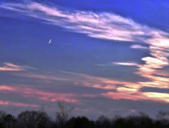
Comet PANSTARRS seen over Venice, California on March 11, 2013. Credit and copyright: Thad Szabo.
NASA scientist Fred Espenak captured this wonderful timelapse video of Comet PANSTARRS as it set over the Dos Cabezas Mountains in Arizona. The photos were taken from San Simon, AZ using a Nikon D90 and Nikkor 18-200 VR zoom lens at 200mm. All exposures were 2 seconds at F/5.6 (ISO 800).
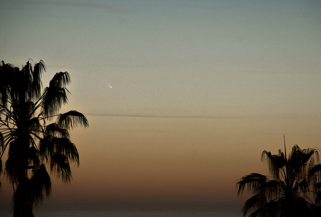
I’m now seriously jealous, as my location has been socked in with clouds all week so far. If you’re in the same boat, enjoy some more images of Comet PANSTARRS from Universe Today readers:
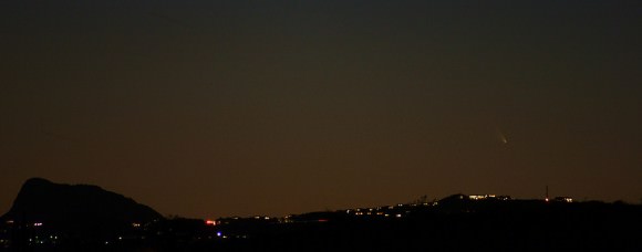
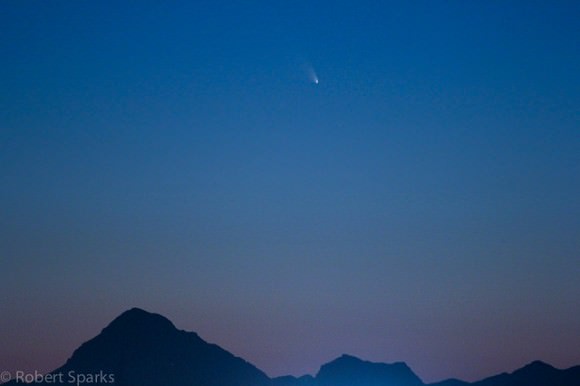
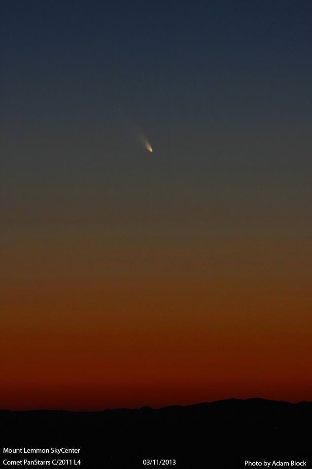
Comet PANSTARRS as seen over Fountain Hills, Arizona. Credit and copyright: Nice Leister,Comet PANSTARRS from Tucson, Arizona on March 11, 2013. Credit and copyright: Rob Sparks.Comet PANSTARRS on March 11, 2013. Credit: Adam Block/Mount Lemmon Sky Center.Comet PANSTARRS over Alabama USA. Credit an copyright: Kristen Lyles..
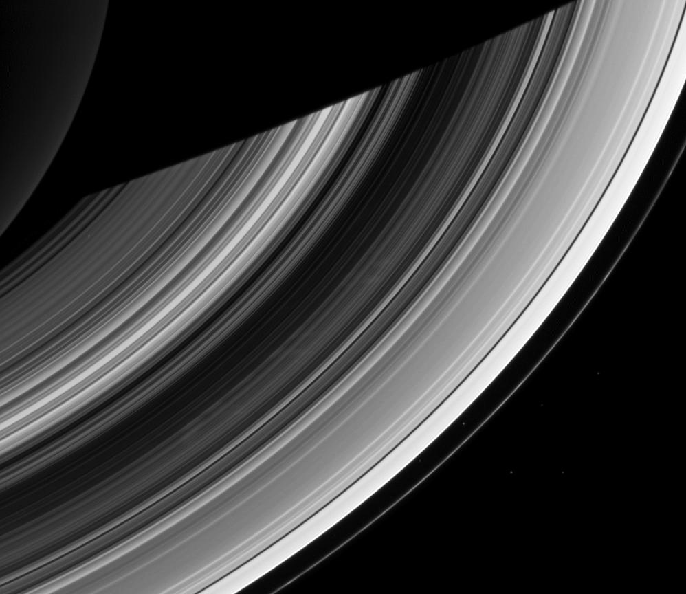
Cassini image of Saturn's rings from Dec. 20, 2012 (NASA/JPL-Caltech/SSI)
As Saturn steadily moves along its 29.7-year-long orbit toward summertime in its northern hemisphere NASA’s Cassini spacecraft is along for the ride, giving astronomers a front-row seat to seasonal changes taking place on the ringed planet.
One of these fluctuations is the anticipated disappearance of the “spokes” found in the rings, a few of which can be seen above in an image captured on Dec. 20 of last year.
First identified by Voyager in 1980, spokes are ghostly streaks of varying size and brightness that stretch radially across Saturn’s ring system. They orbit around the planet with the ring particles and can last for hours before fading away.
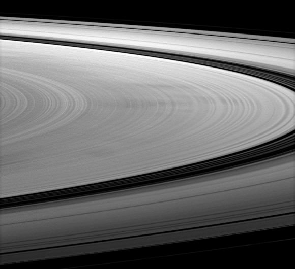
Under the right lighting conditions spokes can appear dark, as seen in this image from Jan. 2010 (NASA/JPL/SSI)
One of the most elusive and transient of features found on Saturn, spokes are thought to be made up of larger microscopic particles of ice — each at least a micron or more — although exactly what makes them gather together isn’t yet known.
They are believed to be associated with interactions between ring particles and Saturn’s electromagnetic field.
“The spokes are most prominent at a point in the rings where the ring particles are moving at the same speed as Saturn’s electromagnetic field,” said Brad Wallis, Cassini rings discipline scientist. “That idea and variations of it are still the most prominent theories about the spokes.”
Other researchers have suggested that they may be caused by electron beams issuing outwards along magnetic field lines from lightning storms in Saturn’s atmosphere.
Regardless of how they are created, spokes are more often observed when sunlight is striking the rings edge-on — that is, during the spring and autumn equinoxes. Perhaps the increased solar radiation along Saturn’s equator increases the formation of lightning-generating storms, in turn creating more spokes? It’s only a guess, but Cassini — and astronomers — will be watching to see if these furtive features do in fact fail to appear during Saturn’s northern summer, the height of which arrives in 2016.
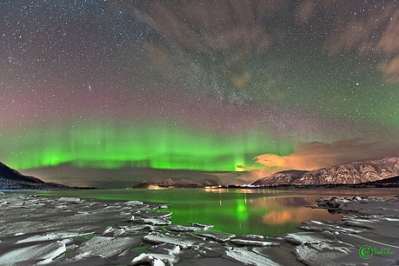
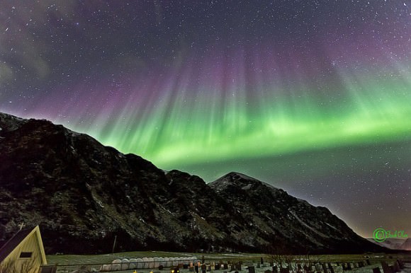
Aurora seen from Nøss, Nordland in Norway, on March 4, 2013. Credit and copyright: Frank Olsen.
Photographer Frank Olsen from Norway heads out almost nightly this time of year to regularly see and photograph what many of us can only dream about seeing: beautiful, shimmering aurorae. These beautiful sights must be payback for enduring the long winters in northern Norway. You can see more of Frank’s beautiful imagery of aurora, the night sky and more at his Flickr page, his website (he has prints for sale) or his Facebook page.
More below:
Aurora seen in Roksøy, Norway. March 2013. Credit and copyright: Frank Olsen.Aurora as seen over Nøss, Nordland in Norway, on March 4, 2013. Credit and copyright: Frank Olsen.
Want to get your astrophoto featured on Universe Today? Join our Flickr group or send us your images by email (this means you’re giving us permission to post them). Please explain what’s in the picture, when you took it, the equipment you used, etc.
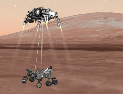
Curiosity's risky landing built on lessons learned from the mistakes of past missions, according to NASA. Credit: NASA
Mars is a graveyard; a spot where many a spacecraft slammed into the surface or perhaps, burned up in the atmosphere. This added drama to the Mars Curiosity rover landing last August.
Roger Gibbs, deputy manager for NASA’s Mars Exploration Program at the Jet Propulsion Laboratory, shared how NASA implemented “lessons learned” from Mars 6 (which died on this day in 1974) and other failed Mars missions when creating Curiosity’s game plan. We’ll get more into Curiosity in a moment, but here are the basic principles NASA uses.
Vigorous peer review. NASA wants its Mars teams to be close-knit. From working together and designing a challenging mission together, they form a common language that will serve them well during the challenging landing and mission. But that same closeness can lead to blind spots, so NASA undertakes regular peer reviews with scientists outside of the mission and sometimes even outside of the country. “The peers will come in. They are not vested in this. They haven’t become too engaged in that culture. They will ask pressing questions, and sometimes obnoxious and challenging questions,” Gibbs said.
Building for unknown dangers. Mars is an alien environment to NASA, not just because it’s outside of Earth but also because it has risks we may not know of. In the early days, some spacecraft miscalculated and grazed the atmosphere because we didn’t understand how much the thin gases expand in space, Gibbs said. So the engineers need to recalibrate the computer models with the latest information. “We model the atmosphere of Mars and say, what’s the density, what are the winds and speeds, how fast to change if a dust storm happens and the atmosphere warms up, and how much the atmosphere rises or”blooms.”
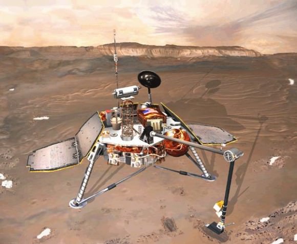
The Mars Polar Lander, which crashed and failed on Mars. Credit: NASA
Verifying and validating. Those words sound similar, but in NASA parlance they have entirely different meanings. Verification means they are making sure the design is meeting what they intend to meet. If NASA wants a change in velocity of 1,000 meters per second, for example, as the spacecraft inserts itself into orbit, it designs a system that can meet those specifications with fuel, thrusters and mass. The validation comes next. “It’s asking if 1,000 meters is the right number,” Gibbs said. “It’s a distinction that is sometimes lost on people, but it’s important.”
So how did this process help Curiosity? Well, this especially came to play when the team was designing the so-called “seven minutes of terror” — those final moments before the rover touched the ground. The team not only used parachutes, but also a device called a “sky crane” that used rockets and a sort of cable that lowered the rover carefully to the surface.
Imagine the measurements that must have taken, taking into account how different the Mars environment is from Earth. To gain understanding, the team reviewed again all the past mishap reports from failed Mars missions, such as the Mars Polar Lander and the European Space Agency’s Beagle 2.
Then, according to Gibbs, they spent “a lot of effort” on doing the verification and validation. Curiosity’s landing would be extremely difficult to model, but the team threw every bit of data they had in there.
The NASA team threw in every bit of data they could to model the Mars Curiosity landing. Credit: NASA
They created an atmospheric model of Mars, modelled the trajectory of the incoming spacecraft, and tried to figure out how the various systems would respond to the environment. Next, they tried to tweak the variables to see how far they could change without posing a danger to the mission.
“There’s a paranoia where the folks will ask, did we do it to the best of our knowledge,” Gibbs acknowledged. “What is it that we’re missing?”
If Curiosity had failed, NASA would have opened an inquiry board to figure out what had happened. These boards produce final reports that can be downloaded by anyone. Then, the agency would have tried to prevent the same situation from happening the next time a rover landed.
“It’s a lot easier to learn from someone else’s bad experience, by reading the report understanding the root cause,” Gibbs said.
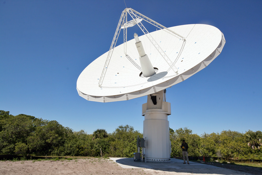
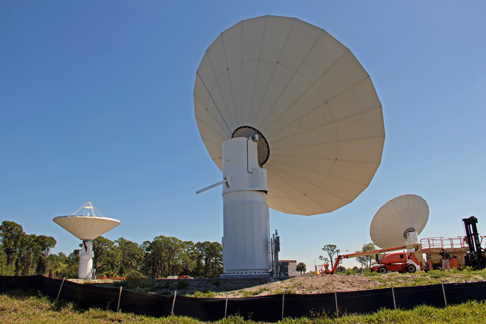
Installation of new KaBOOM asteroid detection radar dish antenna system at the Kennedy Space Center, Florida. Credit: Ken Kremer (kenkremer.com)
Over the past month, about a half dozen rather large asteroids have careened nearby our home planet and in one case caused significant injury and property damage with no forewarning – showcasing the hidden lurking dangers from lackluster attitudes towards Asteroid Detection & Planetary Defense.
Now in a prescient coincidence of timing, NASA is funding an experimental asteroid radar detection array called ‘KaBOOM’ that may one day help thwart Earth’s untimely Ka-boom – and which I inspected first-hand this past week at the Kennedy Space Center (KSC),following the SpaceXFalcon 9 blastoff for the ISS.
“KaBOOM takes evolutionary steps towards a revolutionary capability,” said Dr. Barry Geldzahler, KaBOOM Chief Scientist of NASA Headquarters, in an exclusive interview with Universe Today.
If successful, KaBOOM will serve as a prelude to a US National Radar Facility and help contribute to an eventual Near Earth Object (NEO) Planetary Defense System to avert Earth’s demise.
“It will enable us to reach the goal of tracking asteroids farther out than we can today.”
First some background – This weekend a space rock the size of a city block whizzed past Earth at a distance of just 2.5 times the distance to our Moon. The asteroid – dubbed 2013 ET – is noteworthy because it went completely undetected until a few days beforehand on March 3 and measures about 460 feet (140 meters) in diameter.
KaBOOM experimental asteroid radar array at KSC consists of three 12 meter wide dish antennas mounted on pedestals at the Kennedy Space Center in Florida. Credit: Ken Kremer (kenkremer.com)
2013 ET follows close on the heels of the Feb. 15 Russian meteor that exploded violently with no prior warning and injured over 1200 people on the same day as Asteroid 2012 DA 14 zoomed past Earth barely 17,000 miles above the surface – scarcely a whisker astronomically speaking.
Had any of these chunky asteroids actually impacted cities or other populated areas, the death toll and devastation would have been absolutely catastrophic – potentially hundreds of billions of dollars !
Taken together, this rash of uncomfortably close asteroid flybys is a wake-up call for a significantly improved asteroid detection and early warning system. KaBOOM takes a key step along the path to those asteroid warning goals.
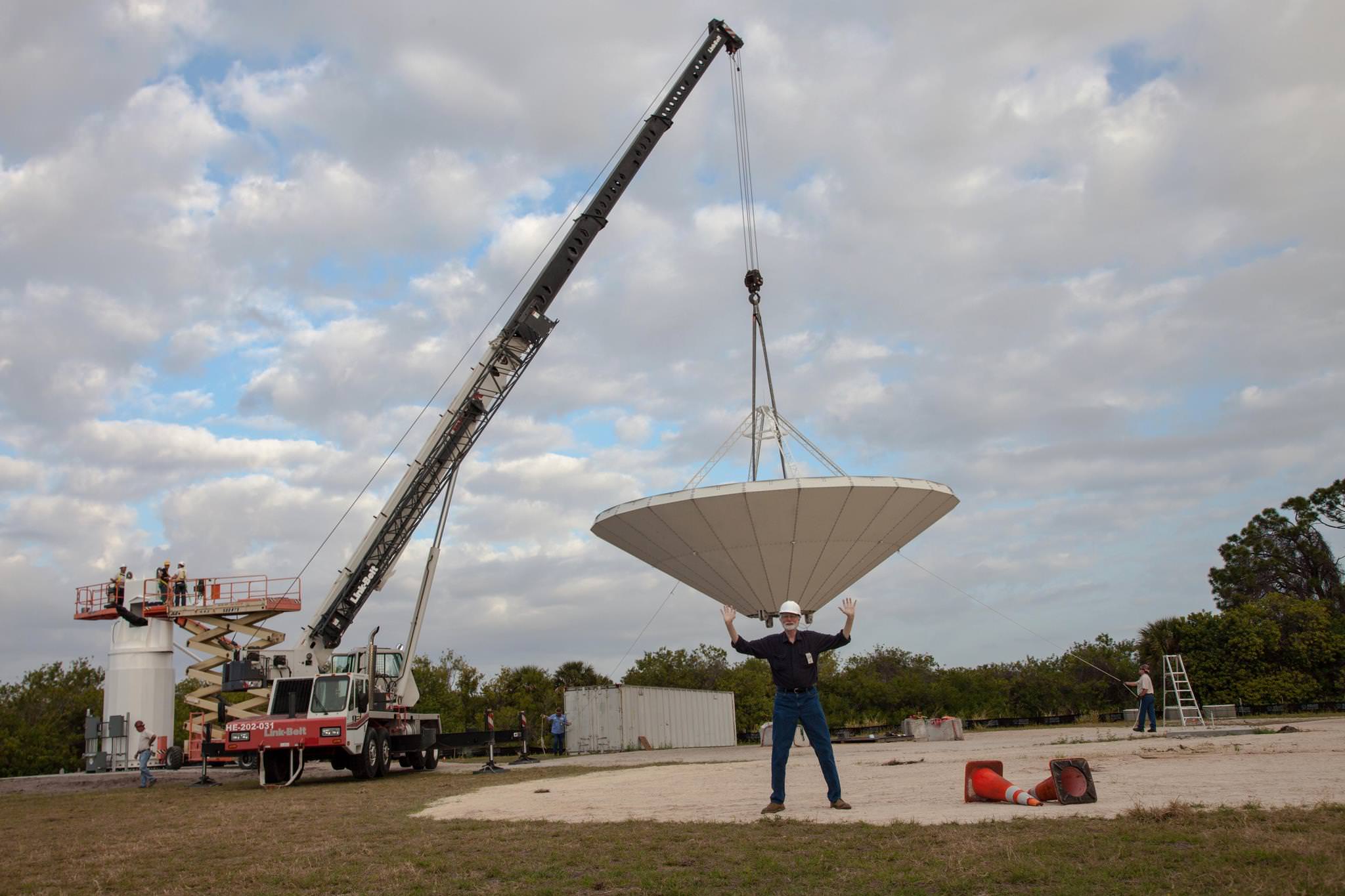
KaBOOM asteroid radar under construction near alligator infested swamps at the Kennedy Space Center in Florida. Credit: Ken Kremer (kenkremer.com)
‘KaBOOM’ – the acronym stands for ‘Ka-Band Objects Observation and Monitoring Project’ – is a new test bed demonstration radar array aimed at developing the techniques required for tracking and characterizing Near Earth Objects (NEO’s) at much further distances and far higher resolution than currently available.
“The purpose of KaBOOM is to be a ‘proof of concept’ using coherent uplink arraying of three widely spaced antennas at a high frequency; Ka band- 30 GHz,” KaBOOM Chief Scientist Geldzahler told me.
Currently the KaBOOM array consists of a trio of 12 meter wide radar antennas spaced 60 meters apart – whose installation was just completed in late February at a remote site at KSC near an alligator infested swamp.
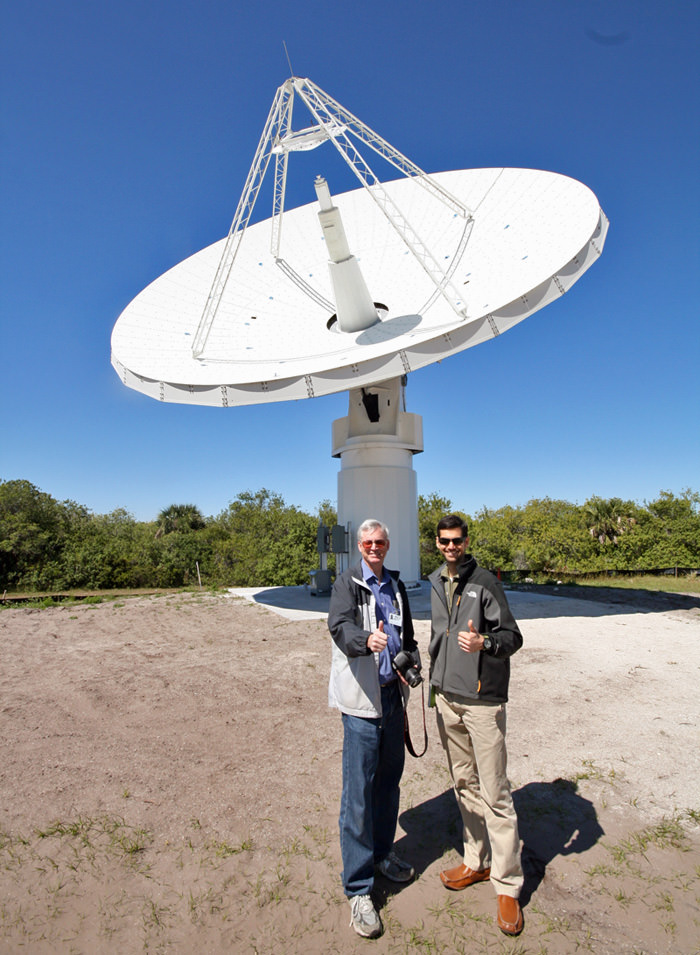
I visited the array just days after the reflectors were assembled and erected, with Michael Miller, KaBOOM project manager of the Kennedy Space Center. “Ka Band offers greater resolution with shorter wavelengths to image smaller space objects such as NEO’s and space debris.”
“The more you learn about the NEO’s the more you can react.”
“This is a small test bed demonstration to prove out the concept, first in X-band and then in Ka band,” Miller explained. “The experiment will run about two to three years.”
Miller showed how the dish antennae’s are movable and can be easily slewed to different directions as desired.
“The KaBOOM concept is similar to that of normal phased arrays, but in this case, instead of the antenna elements being separated by ~ 1 wavelength [1 cm], they are separated by ~ 6000 wavelengths. In addition, we want to correct for the atmospheric twinkling in real time,” Geldzahler told me.
Why are big antennae’s needed?
“The reason we are using large antennas is to send more powerful radar signals to track and characterize asteroids farther out than we can today. We want to determine their size, shape, spin and surface porosity; is it a loose agglomeration of pebbles? composed of solid iron? etc.”
Such physical characterization data would be absolutely invaluable in determining the forces required for implementing an asteroid deflection strategy in case the urgent need arises.
How does KaBOOM compare with and improve upon existing NEO radars in terms of distance and resolution?
“Currently at NASA¹s Goldstone 70 meter antenna in California, we can track an object that is about 0.1 AU away [1 astronomical unit is the average distance between the Earth and the sun, 93 million miles, so 0.1 AU is ~ 9 million miles]. We would like to track objects 0.5 AU or more away, perhaps 1 AU.”
“In addition, the resolution achievable with Goldstone is at best 400 cm in the direction along the line of sight to the object. At Ka band, we should be able to reduce that to 5 cm – that’s 80 times better !”
“In the end, we want a high power, high resolution radar system,” Geldzahler explained.
Thumbs Up for Science & Planetary Defense !
Ken Kremer; Universe Today and Mike Miller; NASA KSC KaBOOM project manager. Credit: Ken Kremer (kenkremer.com)
Another significant advantage compared to Goldstone, is that the Ka radar array would be dedicated 24/7 to tracking and characterizing NEO’s and orbital debris, explained Miller.
Goldstone is only available about 2 to 3% of the time since it’s heavily involved in numerous other applications including deep space planetary missions like Curiosity, Cassini, Deep Impact, Voyager, etc.
‘Time is precious’ at Goldstone – which communicates with some 100 spacecraft per day, says Miller.
“If/when the proof of concept is successful, then we can envision an array of many more elements that will enable us to reach the goal of tracking asteroids farther out than we can today,” Geldzahler elaborated.
A high power, high resolution radar system can determine the NEO orbits about 100,000 times more precisely than can be done optically.
Lead KaBOOM scientist Barry Geldzahler ‘assists’ with dish antenna installation at the Kennedy Space Center; – ‘I’m from Headquarters and I’m here to help’ – is Barry’s mantra. Credit: NASA/KSC
So – what are the implications for Planetary Defense ?
“If we can track asteroids that are up to 0.5 AU rather than 0.1 AU distant, we can track many more than we can track today.”
“This will give us a better chance of finding potentially hazardous asteroids.”
“If we were to find that a NEO might hit the Earth, NASA and others are exploring ways of mitigating the potential danger,” Geldzahler told me.
Kaboom’s ‘First light’ is on schedule for late March 2013.
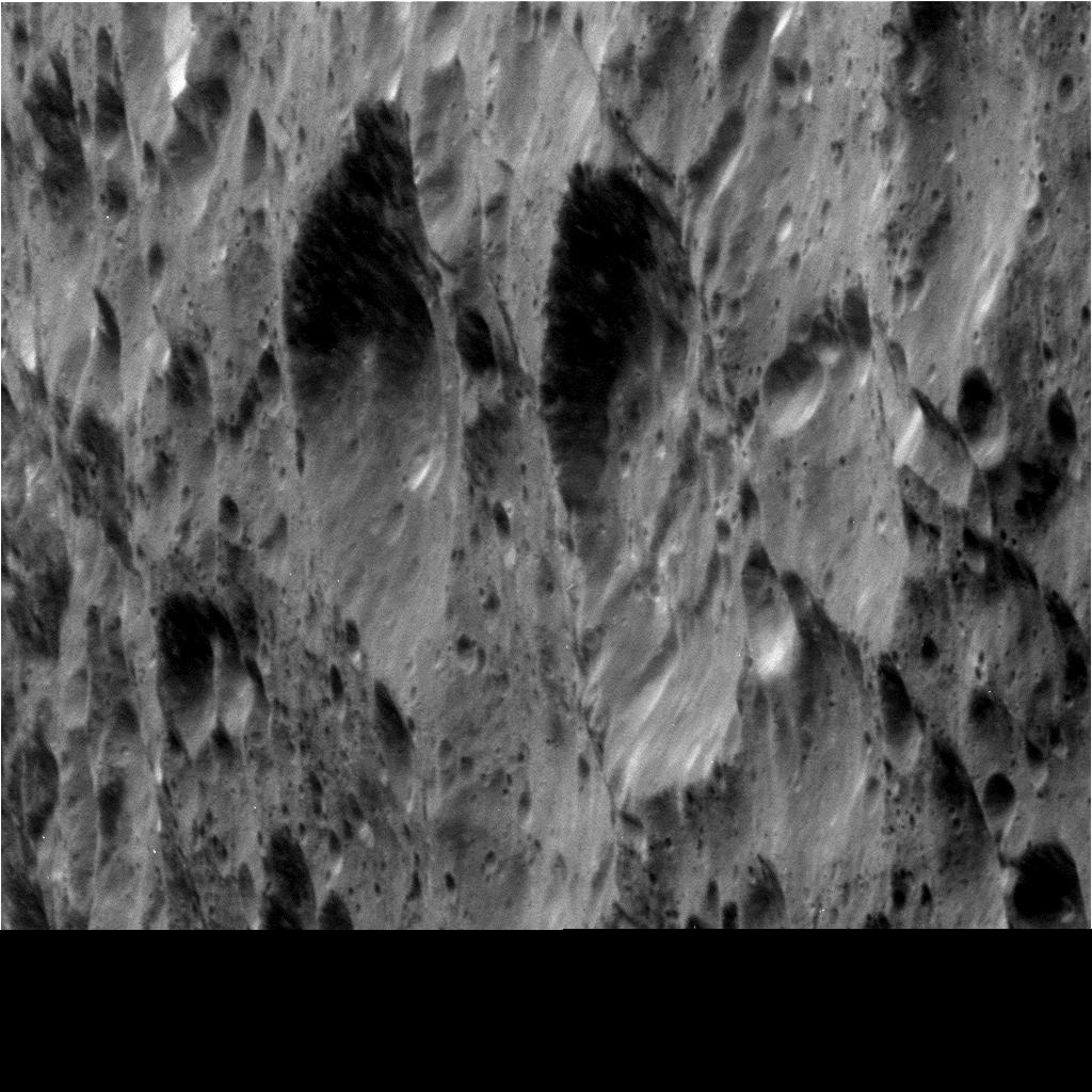
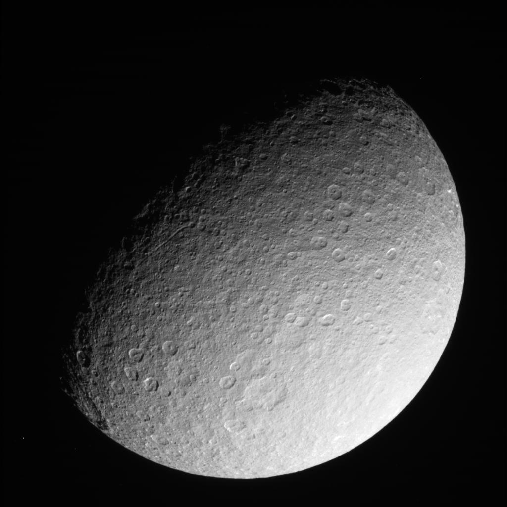
Cassini looks over the heavily cratered surface of Rhea during the spacecraft's flyby of the moon on March 10, 2012. Credit: NASA/JPL-Caltech/SSI.
“Take a good, long, luxurious look at these sights from another world,” said Cassini Imaging Team Leader Carolyn Porco, “as they will be the last close-ups you’ll ever see of this particular moon.”
On Saturday, March 9, 2013 Cassini made the last close flyby of Rhea during its mission, coming within 620 miles (997km) of the surface of the moon. Cassini’s mission is slated to end in 2017 with a controlled fall into Saturn’s atmosphere. Cassini has been in orbit around Saturn since 2004 and is in its second mission extension.
“Our mission at Saturn has been ongoing for nearly 9 years and is slated to continue for another 4,” Porco said in an email message. “Targeted flybys of the moons Dione, in June and August of 2015, and Enceladus, in October and December of 2015, are all that remains on the docket for detailed exploration of Saturn’s medium-sized moons.”
See more below:
This raw, unprocessed image of Rhea was taken on March 9, 2013. Credit: NASA/JPL-Caltech/Space Science Institute
Besides these great final shots, NASA said the primary purpose of this last close flyby of Rhea was to probe the internal structure of the moon by measuring the gravitational pull of Rhea against the spacecraft’s steady radio link to NASA’s Deep Space Network here on Earth. The results will help scientists understand whether the moon is homogeneous all the way through or whether it has differentiated into the layers of core, mantle and crust.
In addition, Cassini’s imaging cameras will take ultraviolet, infrared and visible-light data from Rhea’s surface. The cosmic dust analyzer will try to detect any dusty debris flying off the surface from tiny meteoroid bombardments to further scientists’ understanding of the rate at which “foreign” objects are raining into the Saturn system.
“We’re nearing the end of this historic expedition,” Porco said. “Let’s enjoy the finale while we can.”
This raw, unprocessed image of Rhea was taken on March 10, 2013 and received on Earth March 10, 2013. The camera was pointing toward Rhea at approximately 280,317 kilometers away, and the image was taken using the CL1 and CL2 filters. Credit: NASA/JPL-Caltech/SSI
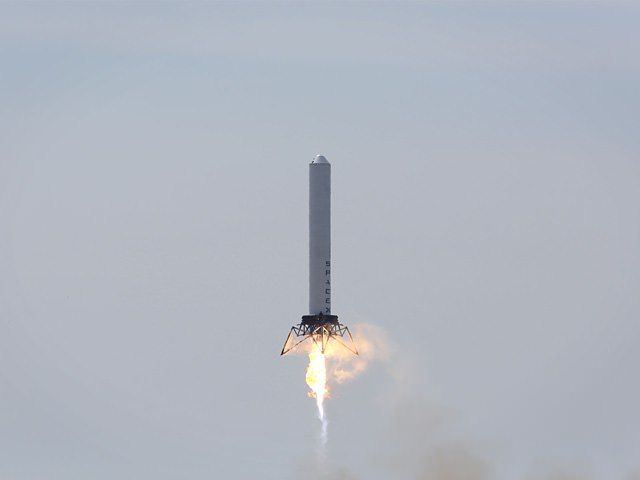
The SpaceX Grasshopper during its test flight on March 7, 2013. Credit: SpaceX.
Last week, SpaceX’s Grasshopper took its highest leap ever, doubling its past flights. On March 7, 2013, the vertical and takeoff and landing (VTVL) vehicle, rose 24 stories or 80.1 meters (262.8 feet), hovered for approximately 34 seconds and then landed safely – and more accurately than ever before. The goal of Grasshopper is to eventually create a reusable first stage for SpaceX’s Falcon 9 rocket, which would be able to land safely instead of falling back into the ocean and not being usable again.
SpaceX CEO Elon Musk revealed this video this weekend during the South by Southwest (SXSW) festival in Austin, Texas, calling the Grasshopper’s flight a “Johnny Cash Hover Slam,” since the video includes Cash’s iconic song, “Ring of Fire.” A cowboy dummy was strapped to the side of the rocket for good measure (and perhaps good luck, since the previous test fight included the cowboy).
The test was completed at SpaceX’s rocket development facility in McGregor, Texas.
This is Grasshopper’s fourth in a series of test flights, with each test demonstrating exponential increases in altitude. Last September, Grasshopper flew to 2.5 meters (8.2 feet), in November, it flew to 5.4 meters (17.7 feet) and in December, it flew to 40 meters (131 feet).
Grasshopper stands 10 stories tall and consists of a Falcon 9 rocket first stage tank, Merlin 1D engine, four steel and aluminum landing legs with hydraulic dampers, and a steel support structure.
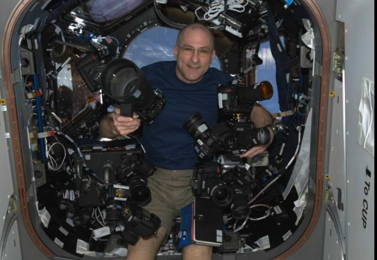
Astronaut Don Pettit with some of his cameras on board the International Space Station. Credit: NASA
Don Pettit has always been one of our favorite astronauts. From his “Saturday Morning Science” and “Science Off the Sphere” to his Zero-G coffee cup, he offered a take on living and working in space that was always just a bit different from the rest of the astronaut corps. During his last stay on the International Space Station, he took photography to a new level, and fellow astrophotographer Christoph Malin has paid a fitting tribute to Pettit with this wonderful new video, which not only showcases Pettit’s work (and Malin’s too!), but allows him to explain the challenges of astrophotography aboard the ISS.
“It can not be emphasized enough, how Dr. Pettits innovative photographic work and his passion has changed the way we see earth from space,” Malin wrote on his Vimeo page. You can read about the genesis of this project at Malin’s website.
A conception of an ancient and/or future Mars, flush with oceans, clouds and life. Credit: Kevin Gill.
Back in January we posted some intriguing images showing concepts of what a terraformed “living Mars” might look like from orbit. With a bit of creative license, software engineer Kevin Gill turned the Red Planet into its own version of the Blue Marble. He’s now created an animation showing a rotating Mars and compressed 24 hours to one minute.
Kevin explains how he did the animation:
The base two dimensional elevation model was generated using data from the Mars Orbiter Laser Altimeter aboard the Mars Global Surveyor spacecraft and satellite imagery from the Blue Marble Next Generation project. Sea level was set non-scientifically, but such that it would flood much of Valles Marineris as well as provide shoreline near the cliffs on the outer edges of Olympus Mons. The clouds are straight from NASA’s Blue Marble NG project and height mapped (rather arbitrarily, but looks good) by relative opacity (The more opaque a point, the higher up in the atmosphere I put it). This was rendered using a digital elevation modeling program I am writing, jDem846, with some extras baked in through its scripting interface, and encoded to video with ffmpeg. Because I defaulted to Earth-based time, each frame is about one minute in time over twenty-four hours.
Kevin told us that this project was “something that I did both out of curiosity of what it would look like and to improve the software I was rendering this in,” he said via email. “I am a software engineer by trade and certainly no planetary scientist, so with the exception of any parts derived from actual data, most of it is assumptions I made based on simply comparing the Mars terrain to similar features here on Earth (e.g. elevation, proximity to bodies of water, physical features, geographical position, etc) and then using the corresponding textures from the Blue Marble images to paint the flat image layer in a graphics program.”
This is a fun and thought-provoking look at what Mars may have looked in the past … or if things had worked out just a little differently in our Solar System!
How does the mind work? What is reality? Self-professed wonder junkie Jason Silva has a new video, which debuted this weekend at the South by Southwest (SXSW) festival. Hit ‘play’ and get ready for a fast ride!