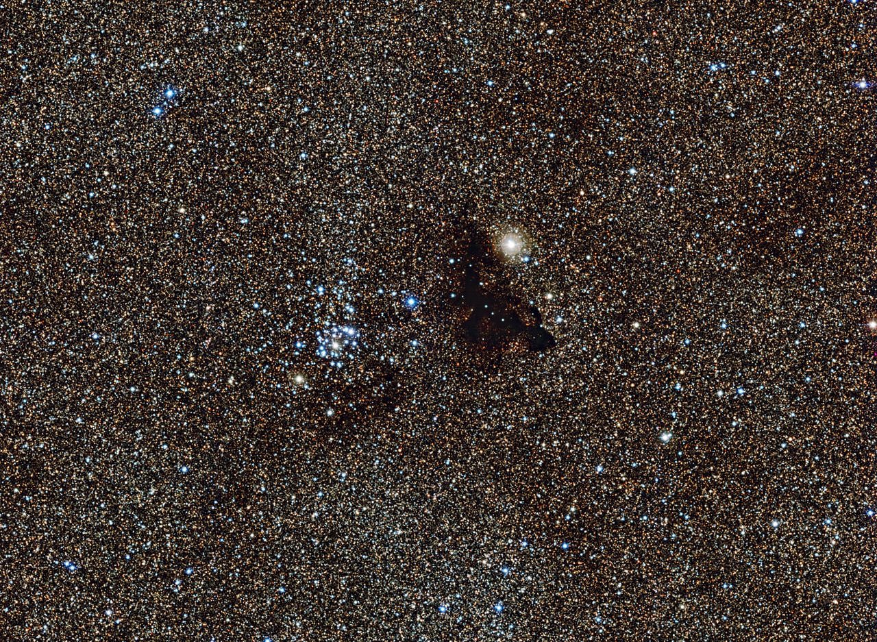
Millions of glowing stars from the brightest part of the Milky Way — a region so dense with stars that barely any dark sky is seen across the picture. Credit: ESO
A small, isolated dark nebula known as a Bok globule was described as “a drop of ink on the luminous sky” by its discoverer, astronomer Edward Emerson Barnard. Through a small telescope, the object seen here, Barnard 86, does appear as though someone may have dropped a blob of dark ink on the telescope lens. Or perhaps it appears as a spot where there are no stars, or a window into a patch of distant, clearer sky. However, this object is actually in the foreground of the star field — a cold, dark, dense cloud made up of small dust grains that block starlight and make the region appear opaque. It is thought to have formed from the remnants of a molecular cloud that collapsed to form the nearby star cluster NGC 6520, seen just to the left of Barnard 86 in this image.
Some say Barnard 86 looks like a gecko … can you see the resemblance?
This image was taken with the Wide Field Imager on the MPG/ESO 2.2-meter telescope at ESO’s La Silla Observatory in Chile. This cosmic pair is set against millions of glowing stars from the brightest part of the Milky Way — a region so dense with stars that barely any dark sky is seen across the picture.
It is located in the constellation of Sagittarius in one of the richest star fields in the whole sky, the Large Sagittarius Star Cloud. The huge number of stars that light up this region dramatically emphasize the blackness of dark clouds like Barnard 86.
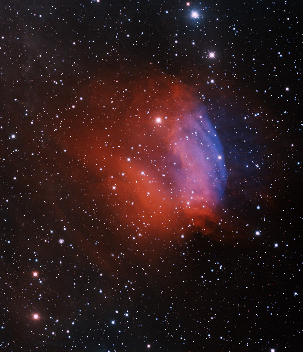
A beautiful planetary nebula, Sh2-174. Credit: T.A. Rector (University of Alaska Anchorage) and H. Schweiker (WIYN and NOAO/AURA/NSF)
We space-nerds like to express our amorous feelings, just like the rest of the population (although admittedly some of need more help/prodding in this area than others). And so just in time for Valentine’s Day comes this new image of a planetary nebula, which looks like a rose — or even a tulip – to share with your very spacey valentine.
The name of this planetary nebula, however, is not so romantic: Sh2-174. We need some suggestions for a better name!
And the way this object was created is not so romantic, either, as planetary nebulae come about in violent events. Sh2-174 was created when a low-mass star blew off its outer layers at the end of its life. The core of the star remains and is called a white dwarf. Usually the white dwarf can be found very near the center of the planetary nebula. But in the case of Sh2-174 it is off to the right. (It is the very blue star near the center of the blue gas). This asymmetry is due to the planetary nebula’s interaction with the interstellar medium that surrounds it.
This image was obtained with the wide-field view of the National Optical Astronomy Observatory (NOAO) Mosaic 1 camera on the Mayall 4-meter telescope at Kitt Peak National Observatory. Travis Rector from the University of Alaska Anchorage made the observations for this image, taken through four different filters which are assigned colors that approximate what the human eye can see: B (blue), I (orange), Hydrogen-alpha (red) and Oxygen [OIII] (blue) filters. In this image, North is up, East is to the left.
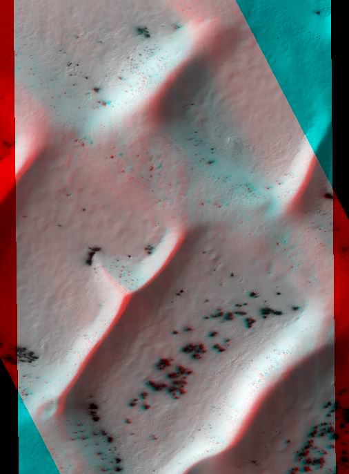
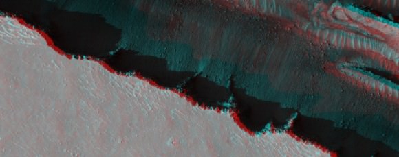
The Dunes of 'Inca City.' Credit: NASA/JPL/University of Arizona.
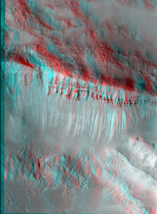
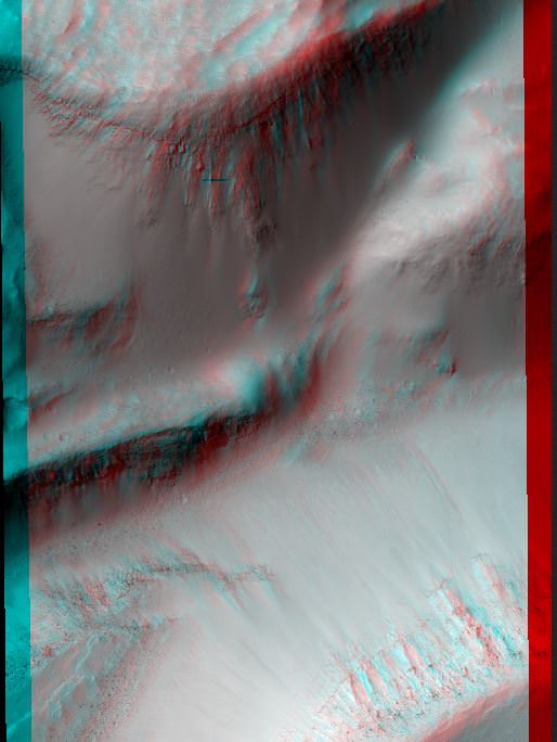
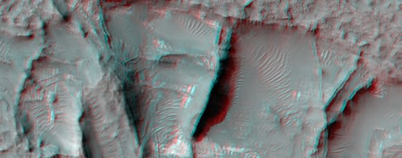
These pictures require you to grab the 3-D glasses you have handy by your desk (if you don’t have a pair, here’s some great options for buying some) and get a “you-are-there” experience from the HiRISE camera on the Mars Reconnaissance Orbiter. Here, you can virtually tumble down crater walls, hover over steep cliffs, and see how layered bedrock appears from above.
Our lead image is of an area referred to as “Inca City,” the informal name given by Mariner 9 scientists in 1972 to a set of intersecting, rectilinear ridges, which some people thought looked like structures or streets. Even back then scientists thought they might be dunes, but that didn’t keep people from going off the deep end about this region. But the power of HiRISE has revealed these truly are dunes, and in this image you can see some of the seasonal processes as the region goes from winter to spring. As the carbon dioxide frost and ice on the dunes warms, small areas warm and sublimate (turn from solid to gas) faster, creating a speckled surface.
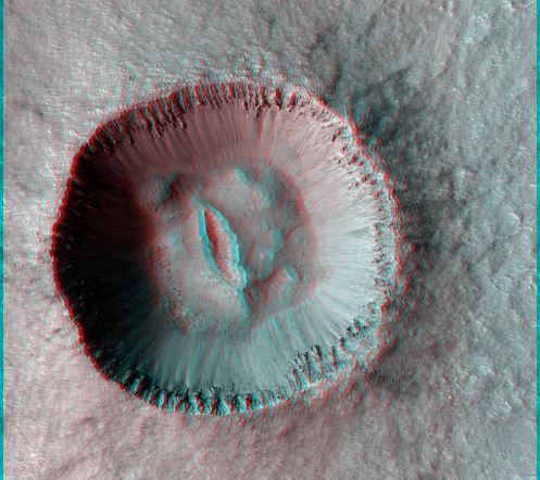
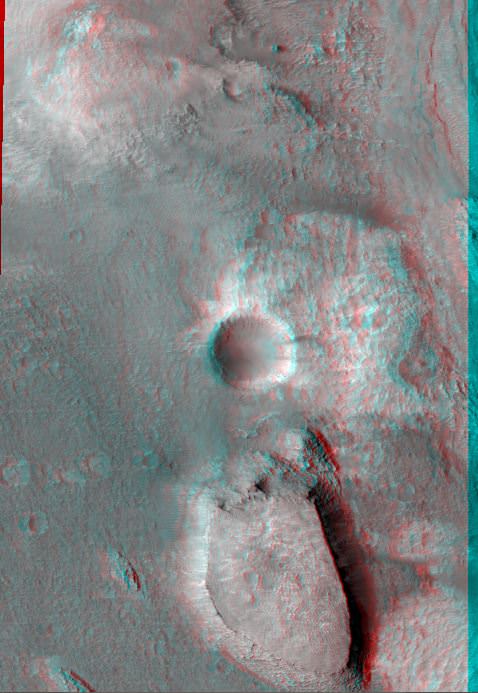
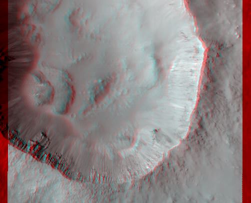
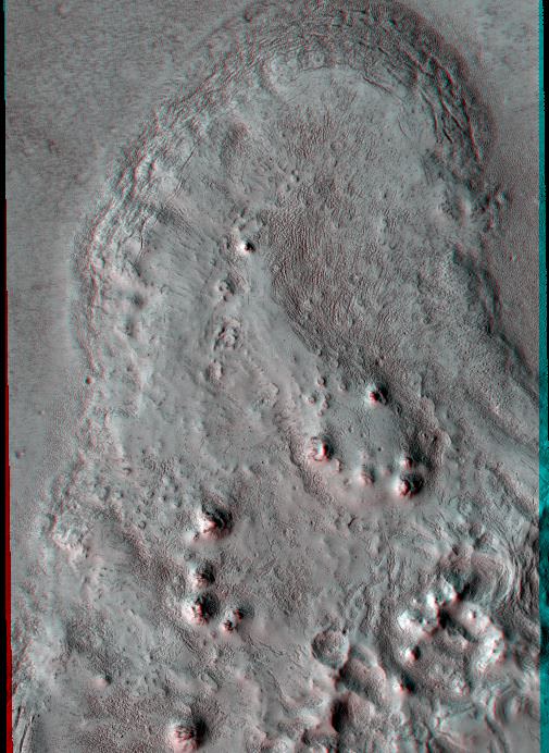
Fresh 4-Kilometer Rayed Crater Northeast of Chimbote Crater. Credit: NASA/JPL/University of Arizona.Cliff with Columnar Jointing. Credit: NASA/JPL/University of Arizona.Central Uplift of a Large Impact Crater. Credit: NASA/JPL/University of Arizona.Buttes and craters: Compositional Diversity in Northern Hellas Region. Credit: NASA/JPL/University of Arizona.Well-Preserved 4-Kilometer impact Crater. Credit: NASA/JPL/University of Arizona.Flow Boundary in Elysium Planitia. Credit: NASA/JPL/University of Arizona.A fissure on Mars named Cerberus Fossae. Credit: NASA/JPL/University of Arizona.Possible Gullies in Graben. Credit: NASA/JPL/University of Arizona.Layered Bedrock on Crater Floor. Credit: NASA/JPL/University of Arizona.
And if you’re interested in looking back, here’s an archive to all the past Carnivals of Space. If you’ve got a space-related blog, you should really join the carnival. Just email an entry to [email protected], and the next host will link to it. It will help get awareness out there about your writing, help you meet others in the space community – and community is what blogging is all about. And if you really want to help out, sign up to be a host. Send an email to the above address.
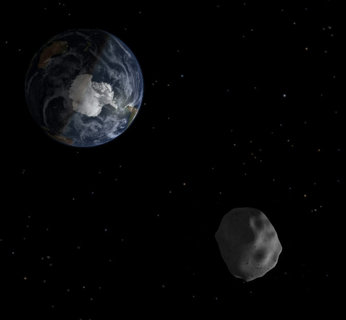
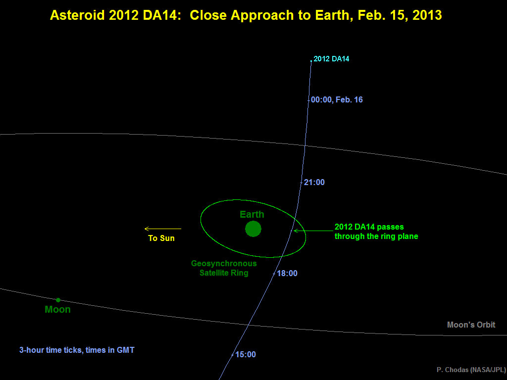
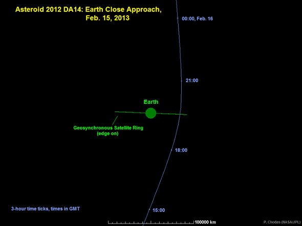
Asteroid 2012 DA14 Zooms just 17,200 miles above Earth on Feb. 13 in this artist’s concept. Credit; NASA
Our home planet is due for a record setting space encounter on Friday (Feb. 15) of this week, when a space rock roughly half a football field wide skirts very close by Earth at break neck speed and well inside the plethora of hugely expensive communications and weather satellites that ring around us in geosynchronous orbit.
“There is no possibility of an Earth impact” by the Near Earth Asteroid (NEO) known as 2012 DA 14, said Don Yeomans, NASA’s foremost asteroid expert at a media briefing. Well that’s good news for us – but a little late for the dinosaurs.
At its closest approach in less than 4 days, the 45 meter (150 feet) wide Asteroid 2012 DA14 will zoom by within an altitude of 27,700 kilometers (17,200 miles). That is some 8000 km (5000 miles) inside the ring of geosynchronous satellites, but far above most Earth orbiting satellites, including the 6 person crew currently working aboard the International Space Station.
Although the likelihood of a satellite collision is extremely remote, NASA is actively working with satellite providers to inform them of the space rocks path.
The razor thin close shave takes place at about 2:24 p.m. EST (11:24 a.m. PST and 1924 UTC) as the asteroid passes swiftly by at a speed of about 7.8 kilometers per second (17,400 MPH)- or about 8 times the speed of a rifle bullet. For some perspective, it will be only about 1/13th of the distance to the moon at its closest.
“Asteroid 2012 DA14 will make a very close Earth approach, traveling rapidly from South to North and be moving at about two full moons per minute,” said Yeomans, who manages NASA’s Near-Earth Object Program Office at the Jet Propulsion Laboratory in Pasadena, Calif. “That’s very fast for a celestial object.”
Diagram depicting the passage of asteroid 2012 DA14 through the Earth-moon system on Feb. 15, 2013. Credit: NASA/JPL-Caltech
No known asteroid has ever passed so near to Earth.
“This is a record predicted close approach for a known object this size,” stated Yeomans. “Such close flybys happen every 40 years on average. An actual Earth collision would happen about every 1200 years.”
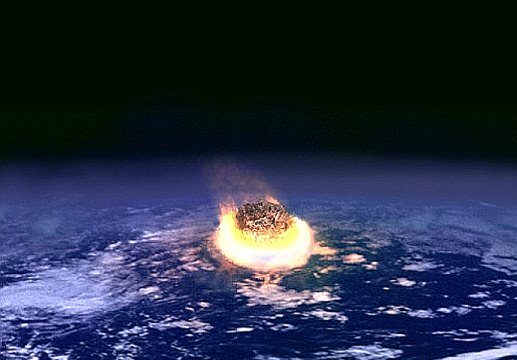
Yeomans said that if an asteroid the size of 2012 DA14 fell to Earth, the impact effect would be similar to the 1908 Tunguska event in Siberia. That was an air blast event that leveled trees over an area greater than about 800 square miles.
So the local effect on human cities for example of a 50 meter wide asteroid impact would be deadly and utterly devastating. But it would not be catastrophic to all life on Earth. Nevertheless, at this moment, Earth has no defenses against asteroids other than talk.
By comparison, the K-T event that caused the mass extinction of the dinosaurs some 65 million years ago was caused by an asteroid about 10 km (6 mi) in diameter. About 2/3 of all species went extinct. If 2012 DA14 impacted Earth the force would be equivalent to about 2.4 megatons of energy (2.4 million tons of TNT), said Yeomans.
Artists concept of meteoroide impact event
There is no danger to the ISS crew and apparently they won’t have any chance to observe it.
“The ISS is not positioned right for observations,” Lindley Johnson, program executive, Near Earth Object Observations Program, NASA Headquarters, Washington, told Universe Today.
“No NASA space-based assets will be making measurements,” Lindley told me. “The asteroid is moving to fast.”
However, radar astronomers do plan to take images around eight hours after the flyby using the Goldstone antenna in California’s Mojave Desert, which is part of NASA’s Deep Space Network.
Some skilful and knowledgeable Earthlings might have a chance to see the asteroid hurtling by with binoculars or a small telescope.
“The asteroid will be observable in the dark sky in Eastern Europe, Asia and Australia, achieving about 7.5 magnitude, somewhat fainter than naked eye visibility,” explained Yeomans. “Closest approach will be over Indonesia.”
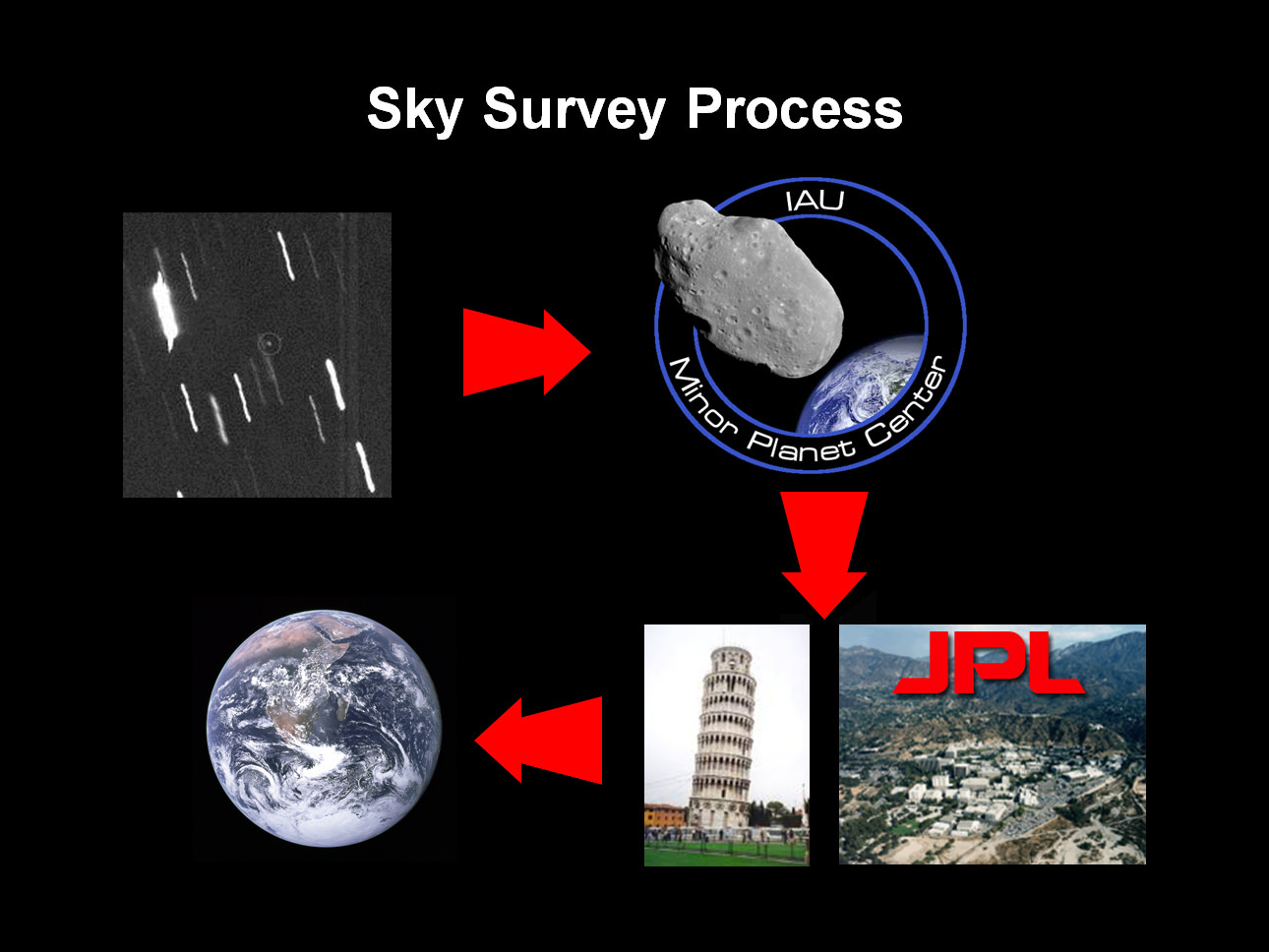
Astronomers at the La Sagra Sky Survey program in southern Spain discovered the asteroid in February 2012 just after its last Earth flyby, at a fairly distant 7 Earth-Moon distances. They reported the finding to the Minor Planet Center.
NASA’s NEO group and collaborators in Pisa, Italy then use such data to predict future flight paths and look into past trajectories as well.
Yeomans said that the Feb 15 flyby will be the closest for the next 100 years and its orbit will be perturbed so that it comes back less frequently – changing its orbital class from Apollo to Aten.
Due to its small size and recent discovery, not much is known about the composition of 2012 DA14. It might be silicate rock.
Small space rocks hit Earth on a daily basis amounting to about 100 tons. Car sized rocks hit weekly.
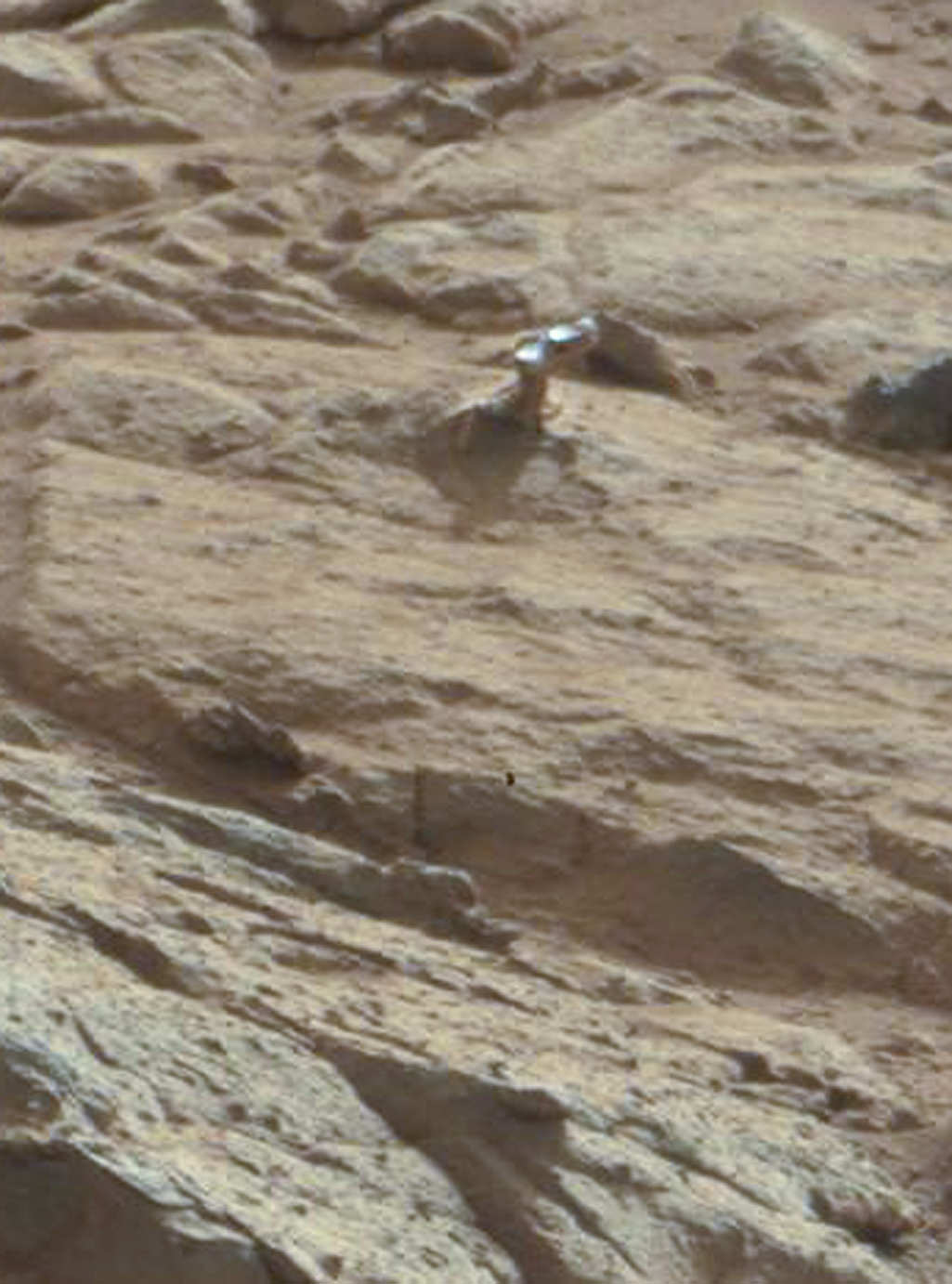
A zoomed-in view of the shiny protuberance. Credit: NASA/JPL-Caltech/Malin Space Science Systems. Image via 2di7 & titanio44 on Flickr.
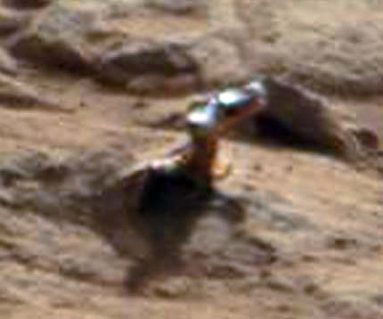
As we reported last week, images from the Curiosity rover showed what looked like a piece of shiny metal sticking out from a rock. Some of our readers suggested that it might be a handle or knob of some kind. It’s a knob, yes, says Ronald Sletten from the Mars Science Laboratory team, but a completely natural formation. Sletten, from the University of Washington, explained that, not surprisingly, it is actually a part of the rock that is different — harder and more resistant to erosion — than the rest of the rock it’s embedded in.
On Earth, as on Mars, “often you can see knobs or projections on surfaces eroded by the wind, particularly when a harder, less erodible rock is on top,” Sletten said, via an email to Universe Today from the Jet Propulsion Laboratory media relations office. “The rock on top of the projection is likely more resistant to wind erosion and protects the underlying rock from being eroded.”
As far as why it appears shiny, Sletten said, “The shiny surface suggests that this rock has a fine grain and is relatively hard. Hard, fine grained rocks can be polished by the wind to form very smooth surfaces.”
It also may be shiny because it is wind-blasted and therefore dust-free, Sletten said, “while the surfaces not directly being eroded by wind may have a fine layer of reddish dust or rock-weathering rind. The sandblasted surfaces may reveal the inherent rock color and texture.”
He added that the object is an interesting study in how wind and the natural elements cause erosion and other effects on various types of rocks.
A closeup of the shiny protuberance. Credit: NASA/JPL/Malin Space Science Systems.
In looking at a zoomed-in close-up of the “knob” or protuberance from the rock, Sletten said, “This knob has a different type of rock on the end of the projection. This rock may vary in composition or the rock grain size may be smaller.”
A shiny-looking Martian rock is visible in this image taken by NASA’s Mars rover Curiosity’s Mast Camera (Mastcam) during the mission’s 173rd Martian day, or sol (Jan. 30, 2013). Image Credit: NASA/JPL-Caltech/Malin Space Science Systems.
Because of the winds on Mars, there is quite a bit of erosion of rock, visible in the image above, as well as in many images from all the Mars rovers and landers. These type of surfaces are called “ventifacted” — wind-eroded surfaces caused by many fine particles of dust or sand impacting the surface over time. Areas of rocks may appear sculpted, as softer parts erode more easily or they may reflect small scale wind patterns, Sletten said.
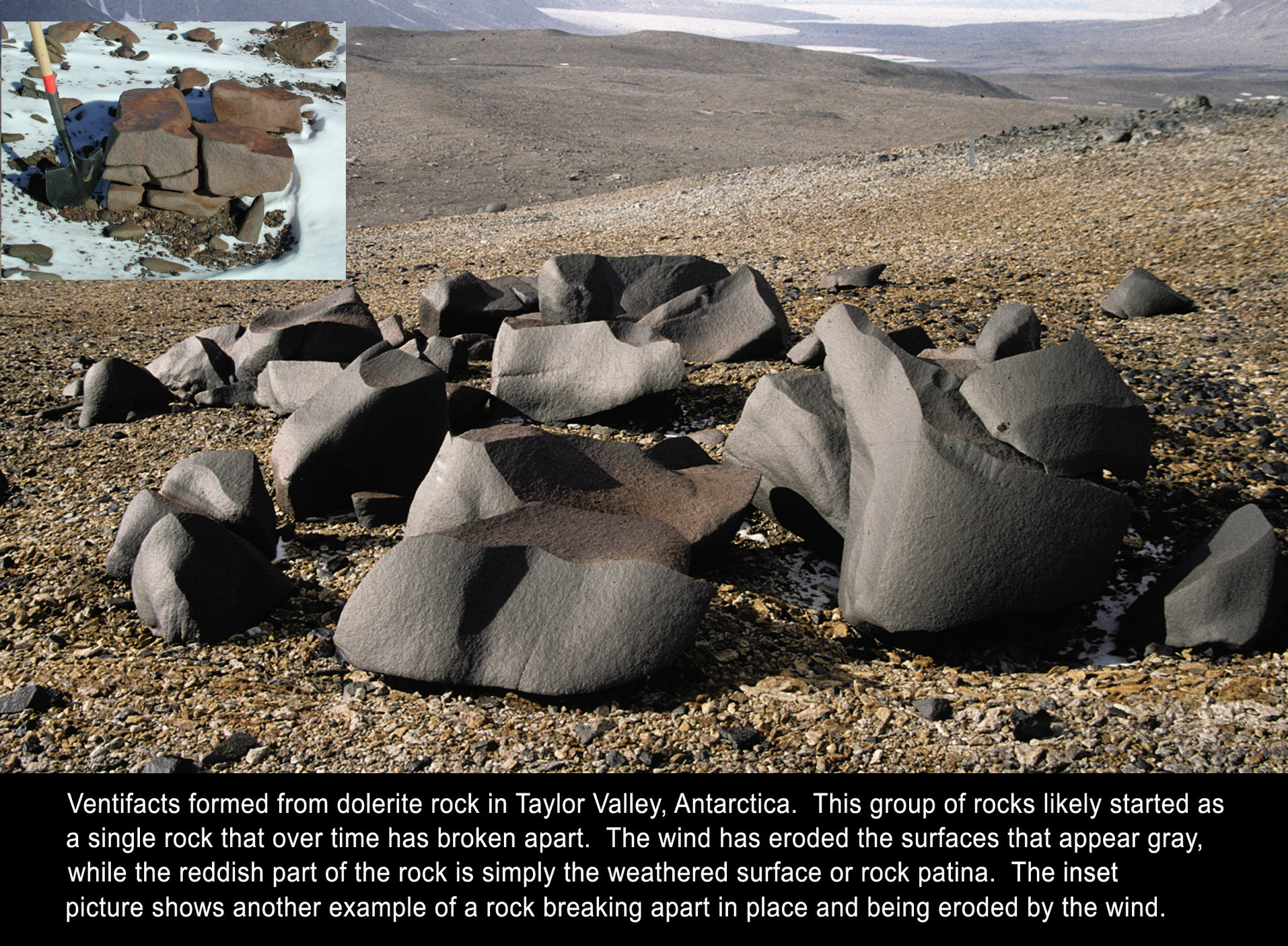
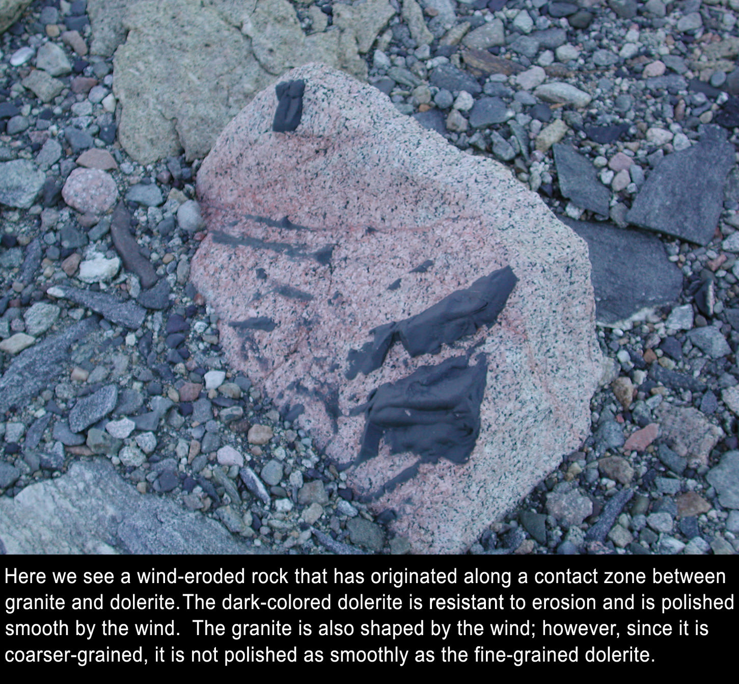
In some ways, he added, it’s a lot like what happens to rocks in Antarctica. See the annotated images he provided below:
Annotated image supplied by Ronald Sletten, MSL science team.Annotated image supplied by Ronald Sletten, MSL science team.
So, this weird shiny thing on Mars is nothing too out of the ordinary — not a door handle, hood ornament or not even Richard Hoagland’s bicycle, as was suggested by readers on our previous article.
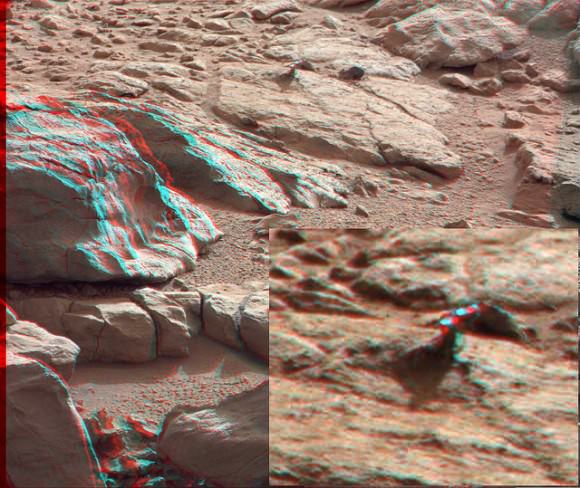
But for one more look, here’s the 3-D version(make sure you use the red-green 3-D glasses):
3-D anaglyph from the right and left Mastcam from Curiosity showing the metal-looking protuberance. Credit: NASA/JPL/Caltech/Malin Space Science Systems. Anaglyph by by 2di7 & titanio44 on Flickr.
The original raw image from the Curiosity rover can be seen here, and our thanks to Elisabetta Bonora, an image editing enthusiast from Italy, who originally pointed this image out to us.
Magnificent eruption from the Sun, shown in 304 and 171 Angstrom wavelength light, on August 31, 2012. Credit: NASA
Three years ago today, (February 11, 2010) I was standing at Kennedy Space Center watching the launch of the Solar Dynamics Observatory. The launch was spectacular, and included a unique effect as the Atlas rocket flew close to a sundog just as the spacecraft reached Max-Q, creating a ripple effect around the spacecraft. And so, SDO started off with a bang and she’s been producing incredible data ever since. The folks at Goddard Spaceflight Center’s Scientific Visualiation Studio have put together a highlight reel for the third year of SDO operations. You’ll see morphing sunspots, fountains of solar plasma, sun-grazing comets and more. Throughout its mission, SDO has not only studied the Sun, but also opened up several new, unexpected doors to scientific inquiry. Enjoy this “greatest hits” video of SDO’s third year.
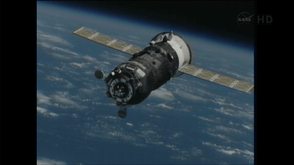
Progress 50 approaching the International Space Station on Feb. 11, 2013. Via NASA TV.
The Progress 50 resupply ship has now arrived at the International Space Station, just hours after it launched from the Baikonur Cosmodrome in Kazakhstan. Launch took place at 9:41 a.m. EST, (14:40 UTC) today (February 11, 2013) and it took only a four-orbit journey to rendezvous with the ISS, docking at 3:34 pm EST (20:35 UTC).
“Progress 50 just docked to our Space Station!” Tweeted astronaut Chris Hadfield (@Cmdr_Hadfield) “I was right at the hatch, it made a quick sliding scraping noise & then a solid thud. Success!”
This is third successful execution of the new, modified launch and docking profile for the Russion Progress ships, and its success is paving the way for its first use on a manned mission – possibly as early as March 2013 for Soyuz TMA-08, Roscosmos said via Facebook. Russian cosmonaut Gennady Padalka has been quoted as saying it is every cosmonaut’s dream to only have a 6-hour flight in the cramped Soyuz.
Watch the launch and docking video below:
Normally, Progress supply ships –and manned Soyuz capsules — are launched on trajectories that require about two days, or 34 orbits, to reach the ISS. The new fast-track trajectory has the rocket launching shortly after the ISS passes overhead — today, the space station was just 1,400 kilometers (870 miles) downrange from the launch site at the time of liftoff. Then additional firings of the Progress engines early in its mission expedites the time required for a Russian vehicle to reach the complex.
That also give the ISS crew the chance to actually see the launch from orbit. Today, NASA-TV commentator Kyle Herring said that ISS commander Kevin Ford reported he was able to see the first stage separation, which occurred about two minutes after launch. Herring said the cameras on the International Space Station were pointed to try and observe the launch. We’ll add any images here, if the cameras were able to capture anything.
Progress 50 is carrying 2.9 tons of supplies and equipment, including 800 kg (1,764 pounds) of space station propellant, 50 kg (110 lbs)of oxygen and air, 420 kg (926lbs) of water and 1,360 kg (3,000 lbs) of spare parts, science gear and other dry cargo. Right now, this Progress is scheduled to remain docked at the ISS until late April. The previous Progress cargo ship undocked from the Pirs module of the International Space Station at 13:15 GMT on Saturday February 9 and re-entered Earth’s atmosphere over the Pacific Ocean, burning up during re-entry.
Earlier this month, NASA’s Space Station Program Manager Mike Suffradini said the space station partners have tentatively agreed to try a the fast-track trajectory with a manned mission “at least once or twice to show we have the capability in case we need to get to ISS quick for any reason.”
He added that the decision to fly like this long-term is still to be determined.
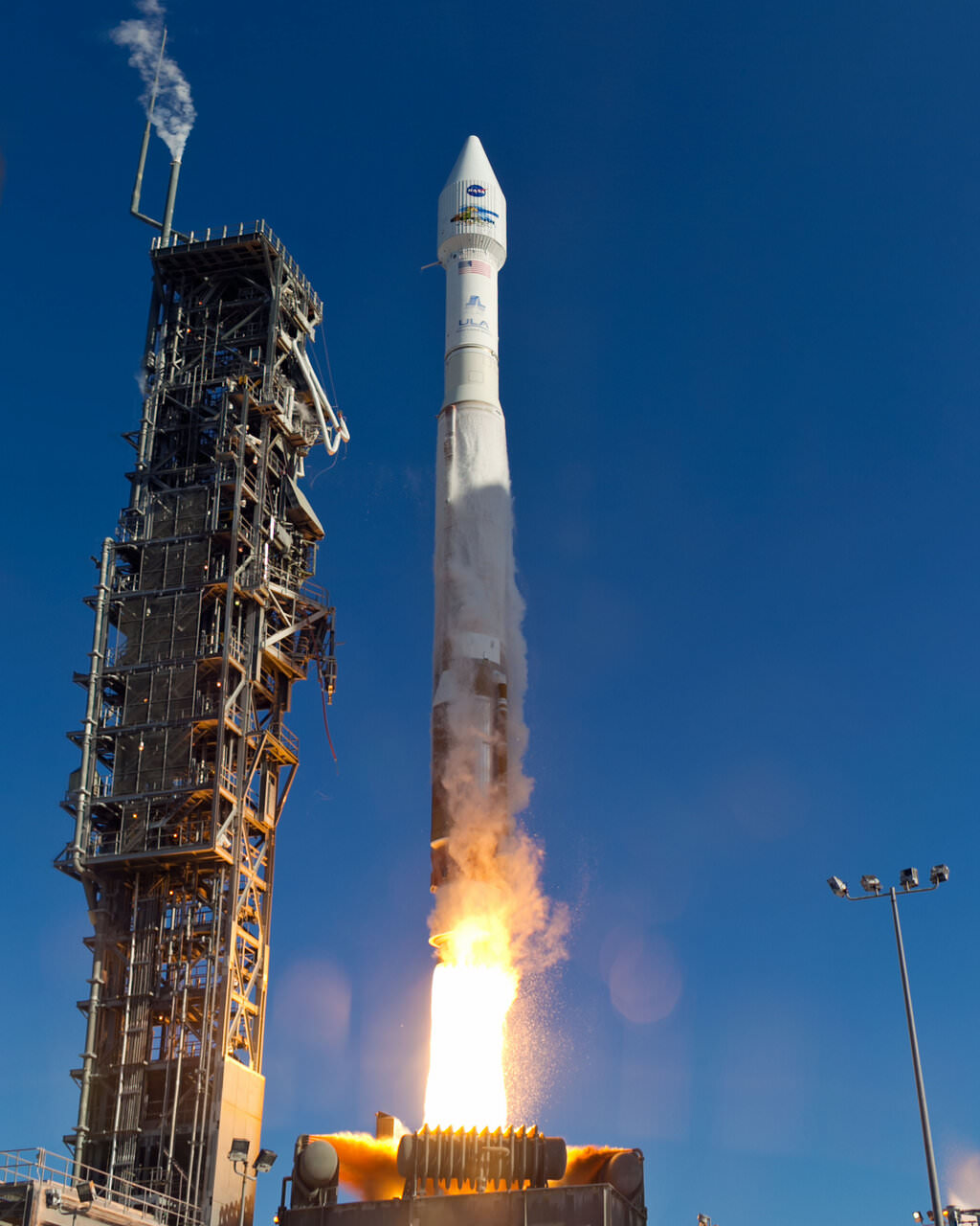
An Atlas-V rocket with the Landsat Data Continuity Mission (LDCM) spacecraft onboard is seen as it launches on Monday, Feb. 11, 2013 at Vandenberg Air Force Base, California. Credit: NASA
NASA launched a successor to the long-time Landsat satellite Earth-observing program today, sending the Landsat Data Continuity Mission satellite to orbit via an Atlas V rocket from Vandenberg Air Force Base at 1:02 EST (10:02 PST, 18:02 UTC). The new LDCM carries two new instruments, the Operational Land Imager and the Thermal Infrared Sensor, which will collect data that are compatible with data from previous Landsat mission, 5 and 7, and improve upon it with advanced instrument designs that are more sensitive to changes to the land surface, NASA said. This is the eighth Landsat satellite, and after extensive on-orbit testing and certified for its mission, it will be renamed Landsat 8.
See the launch video, below:
LDCM will continue the Landsat program’s 40-year data record of monitoring Earth from space, making critical observations to help with energy and water management, forest monitoring, human and environmental health, urban planning, disaster recovery and agriculture.
The new satellite is about the size of a large SUV, weighing 2,780 kg (6,133-pounds). The two instruments will monitor Earth’s surface in visible and multiple infrared wavelengths, resolving large-scale surface features and collecting some 400 images per day. The satellite is equipped with a 3.14-terabyte solid-state recorder to store data between downlink sessions.
“This will be the best Landsat satellite launched to date,” said Jim Irons, LDCM project scientist at Goddard Spaceflight Center, “the best Landsat satellite ever in terms of the quality and quantity of the data collected by the LDCM sensors.”
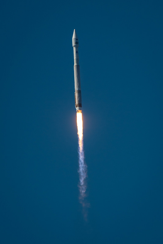
The United Launch Alliance (ULA) Atlas-V rocket with the Landsat Data Continuity Mission (LDCM) spacecraft onboard is seen as it launches on Monday, Feb. 11, 2013 at Vandenberg Air Force Base, California. Credit: NASA
Irons said the Landsat program is a critical and extremely valuable national asset.
“Since the launch of Landsat 1, we have seen — and we have caused — dramatic changes to the global land surface that continue today at rates unprecedented in human history,” he said. “These changes are due to an increasing population, advancing technologies and climate change. LDCM will extend and improve upon the Landsat record of landscape change. The resulting observations and information will be critical to managing increasing demands on land resources and preparing for inevitable changes to the global land surface.”
Recently, Landsat 5 successfully set the new Guinness World Records title for ‘Longest-operating Earth observation satellite.’ It was launched on March 1, 1984, and outlived its three-year design life. It delivered high-quality, global data of Earth’s land surface for 28 years and 10 months, completing over 150,000 orbits and sending back more than 2.5 million images of Earth’s surface. On Dec. 21, 2012 the USGS announced Landsat 5 would be decommissioned in the coming months after the failure of a redundant gyroscope. The satellite carries three gyroscopes for attitude control and needs two to maintain control.
The Landsat Program is managed by the U.S. Geological Survey (USGS).
Mark your calendars: this Friday, February 15, 2013, is the close flyby of Near Earth Asteroid 2012 DA14, passing just 27,630 kilometers (17,168 miles) from the surface of the Earth. About 50 meters (164 feet) in size, 2012 DA14 and its close shave marks the the first time there has been passage of an asteroid this close that we’ve known a year beforehand. Yes, it passes within the ring of geosynchronous satellites girdling the Earth. No, there’s no danger, either to said satellites or the Earth, so Bruce Willis can stay home for this one. But right behind those inquiries, the question we most frequently get is… how can I see it?
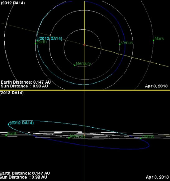
The orbital path of asteroid 2012 DA14 as seen face on (top) & near edge on (bottom). (Credit: JPL Small Body Database Browser).
The great news is that an advanced observer can indeed catch 2012 DA14 on its close pass the night of February 15th… with a little skill and luck. Now for the bad news; the asteroid won’t be visible without binoculars or a telescope, and North America will largely miss out.
2012 DA14 will be really moving across the sky on closest approach, covering 0.8° per minute, or the diameter of a Full Moon every 45 seconds! With its passage closer to the Earth than the ring of geosynchronous satellites, it’s worth treating the passage of the asteroid as a satellite and hunting it down accordingly. Catching and watching such a pass can be an unforgettable experience; not many objects in the sky show such swift motion in real time. In fact, 2012 DA14 will span the celestial sphere from declination -60° to +60° in just 4 hours! Needless to say, its passage through the Earth’s gravity well will alter its orbit considerably; most planetarium software programs do not account for this and thus will introduce a large error for a heliocentric object. Compounding the dilemma is the large amount of parallactic shift of such a nearby object. As viewed from the span of the Earth, 2012 DA14 will have a parallax of ~20° at greatest approach!
The path of asteroid 2012 DA14 through the celestial sphere on February 15th. (Created by Author).
But two sites on the web can help you with the search. One is Heavens-Above, which currently has a link on its main page to custom generate sky charts for specific locations for 2012 DA14 (make sure you’re logged in as a registered user and your observing location is set correctly). Another option is to generate an ephemeris customized for your location from the JPL Solar System Dynamics Horizons Web-Interface.
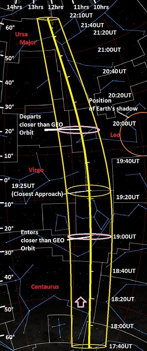
Asteroid 2012 DA14 is approaching the planet Earth from “down under,” and moving almost exactly parallel to the 12 hour line in right ascension. In fact, it’ll cross very near the equinoctial point in Virgo (one of the two points where the celestial equator and the ecliptic cross) shortly after its closest approach on Friday, February 15th at 19:25UT. The asteroid will be at the local zenith (straight overhead) for observers in the pre-dawn hours located in western Indonesia at closest approach. Australia and eastern Asia will have a shot at seeing the asteroid as it whizzes through the sky in the early morning hours of February 16th local. Observers in western Asia, Africa and Europe will see the asteroid lower to the east on the night of the 15th. Note that 2012 DA14 juuuuuust misses Earth’s shadow (see strip chart) at closest approach. The shadow of our fair planet is ~20° across at the distance of the geosynchronous satellites; had it passed about a month later, we would have seen an “asteroid eclipse!” In fact, “eclipse season” for geosynchronous satellites occurs right around the equinoxes and is only a month away.
The “banana strip chart” shows the path of 2012 DA14 from the time it reaches a magnitude brighter than +10 at 17:40UT until it dips back down below it at 22:10UT on the same night. It also shows the width of uncertainty for its position due to the aforementioned 20° of parallax, and the points that it enters and departs the distance sphere of the geosynchronous satellites. Keep in mind, these satellites still orbit roughly hundred times higher than the International Space Station!
A good search strategy to catch 2012 DA14 is to actually to treat it like you’re hunting for a faint satellite. Find the time that it’s crossing a set declination and begin scanning with binoculars in right ascension back and forth until you “ambush” your astronomical prey moving slowly against the starry background. If using a telescope, use the lowest power and widest field of view that the instrument will allow. We’ve used this technique in the past to sweep up Near Earth Asteroids 2005 YU55 and 99942 Apophis and routinely use it to hunt for satellites fainter than naked eye visibility. At closest approach, asteroid 2012 DA14 will shine at around +8th magnitude as it crosses the Bowl of Virgo northward past Denebola in the constellation Leo.
Recent measurements early this month conducted by astronomers at the Las Campanas observatory in Chile refined the orbit of 2012 DA14, placing its February 15th passage just 45 kilometres closer to Earth than previously calculated but still well outside the threat zone. Campaigns are underway to refine measurements of its orbit even further on this pass. We won’t get another close pass of 2012 DA14 until February 16th, 2046 when the asteroid misses us at about twice the distance of the Moon. An impact has been ruled out for this century. Predictions get less certain the further you project them into time, and 2012 DA14 will definitely be a space rock worth keeping tabs on!