Weekly SkyWatcher’s Forecast: October 1-7, 2012

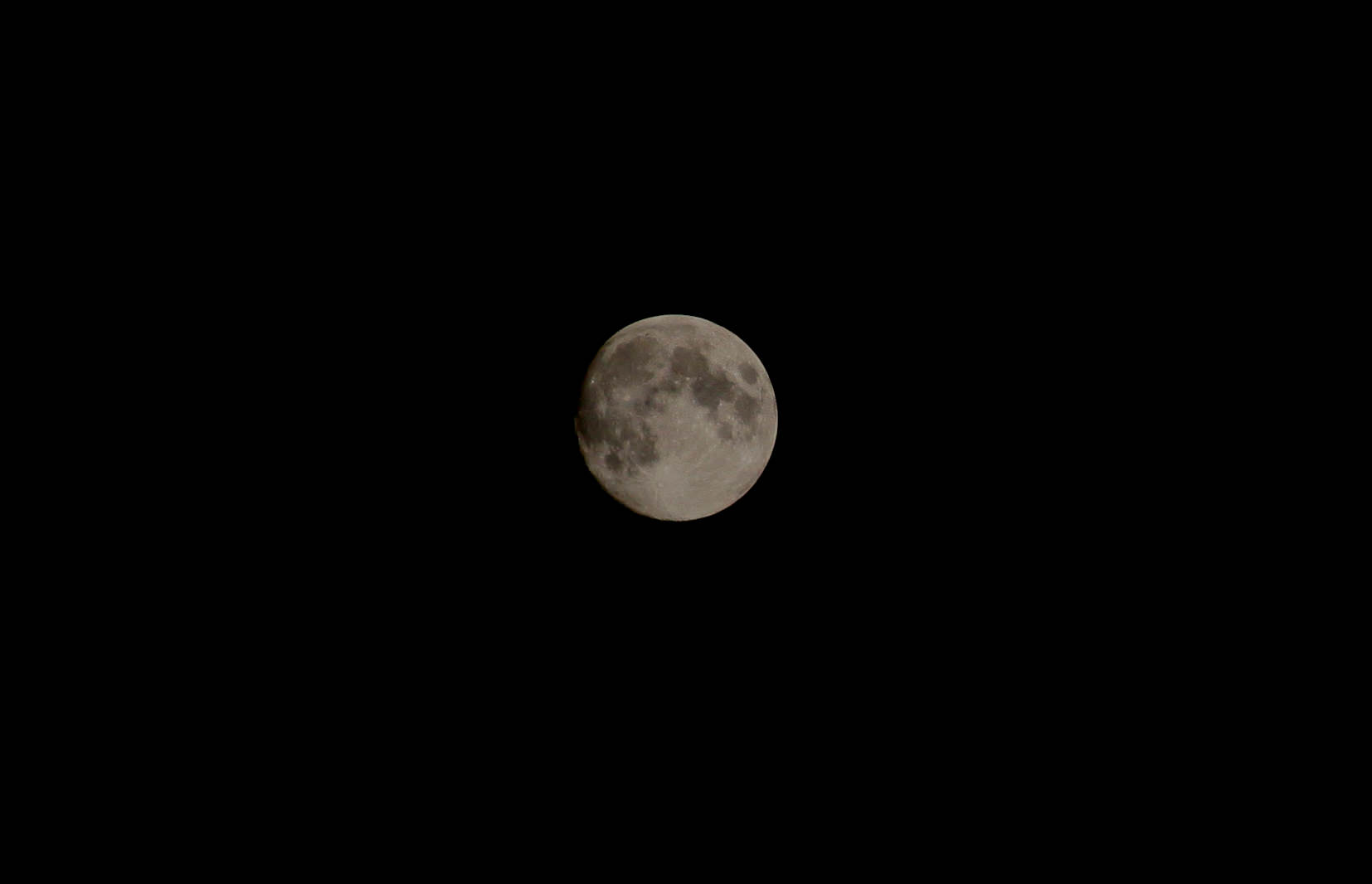
Greetings, fellow SkyWatchers! Normally we don’t pay much attention to the waning Moon, but this week will be a bit different. Why not enjoy some alternative studies by viewing familiar features in a different light?! Of course, we might just pick up a galaxy or catch a snowball! When you’re ready, just meet me in the back yard…

Monday, October 1 – In 1897, the world’s largest refractor (40?) debuted at the dedication of the University of Chicago’s Yerkes Observatory. The immense telescope was 64 feet long and weighed 6 tons. Also today in 1958, NASA was established by an act of Congress. More? In 1962, the 300 foot radio telescope of the National Radio Astronomy Observatory (NRAO) went live at Green Bank, West Virginia. It held its place as the world’s second largest radio scope until it collapsed in 1988. (It was rebuilt as a 100 meter dish in 2000.) Although first light for the 40? was Jupiter, E. E. Barnard later discovered the third companion star to Vega using the Yerkes refractor and first “light” studies at Green Bank were a radio source galaxy and pulsar for NRAO.

Tonight let’s begin our adventures by talking about Luna 9, also known as Lunik 9. In 1966, the unmanned Soviet lunar probe became the first to achieve a soft landing on the Moon’s surface and successfully transmit photographs back to Earth. The lander weighed in at 99 kg, and the four petals, which formed the spacecraft, opened outward. Within five minutes of landing, antennae sprang to life and the television cameras began broadcasting back the first panoramic images of the surface of another world, proving that a landing would not simply sink into the lunar dust. Last contact with the spacecraft occurred just before midnight on February 6, 1966.

Tonight you can view the area of the first successful landing on the Moon by turning your binoculars or telescopes copes towards the Oceanus Procellarum—the Ocean of Storms. While the area will be brightly lit and it will be difficult to pick out small features, Procellarum is the long, dark expanse that runs from lunar north to south. On its western edge, you can easily identify the dark oval of landmark crater Grimaldi. About one Grimaldi-length northward and on the western shore of Procellarum is where you would find the remains of Luna 9.

Tuesday, October 2 – Tonight before the skies get bright we’ll a have look at an incredible southern galaxy in Sculptor – NGC 253 (Right Ascension: 0 : 47.6 – Declination: -25 : 17).

Located about one third the way between Alpha Sculptor and Beta Ceti, NGC 253 was discovered by Caroline Herschel in 1783 during a comet search. As the brightest member of the “Sculptor Group”, this large and beautiful galaxy is also one of the closest outside our “Local Group” and will be readily apparent in binoculars for southern observers. Mid-to-large telescopes will be delighted with its many bright knots and dark obscured areas. For more northern observers, wait until the constellation is at its highest to catch a glimpse of this awesome 7th magnitude southern study.

Now, let’s wait for the Moon to rise!

For a telescope challenge, continue south to relocate previous study Petavius on the southern terminator. Just beyond its east wall, look for a bright ridge that extends from north to south separated by darkness from Petavius. This is Palitzsch, a very strange, gorge-like formation that looks as if it was caused by a meteor plowing through the Moon’s surface. Palitzsch’s true nature wasn’t known until 1954 when Patrick Moore resolved it as a “crater chain” using the 25″ Newall refractor at Cambridge University Observatory. While you’re admiring Petavius and its branching rima, keep in mind this 80 kilometer long crack is a buckle in the lava flow across the crater floor. Now look along the terminator for the long, dark runnel which is often considered to be the Petavius Wall but is actually the fascinating crater Palitzsch. This 41 kilometer wide crater is confluent with a 110 kilometer long valley that is outstanding at this phase!

Wednesday, October 3 – Tonight let’s go hunting for the “Blue Snowball”. It’s proper name is the NGC 7662 (Right Ascension: 23 : 25.9 – Declination: +42 : 33) and you find it around five degrees due east of Omicron Andromedae. At magnitude 9, this one challenges binocular users and presents the same problems as locating the M57 – low power will show you something – but not what it is. In a telescope, the “Blue Snowball” is almost as large as the “Ring” nebula.

Are you ready for the Moon to rise? Then let’s continue our waning studies…

As Mare Crisium slowly disappears into the shadows, let’s take a look for a lunar challenge crater – Macrobius. You’ll find it just northwest of the Crisium shore. Spanning 64 kilometers in diameter, this Class I impact crater drops to a depth of nearly 3600 meters – about the same as many of our earthly mines. Its central peak rises back up, and at 1100 meters may be visible as a small speck inside the crater’s interior. Power up and look at how steep its crater slopes are. Can you spot the smaller impact crater Macrobius O to the southeast and conjoining crater Tisserand to the east? Check out how the sunlight highlights the the west and southwest walls. In this particular light you can see how high and terraced they really are! Look for the impact of Macrobius C to the southwest.

In binoculars, look for the junction of Mare Fecunditatis and the edge of Mare Tranquillitatis. Here stands ancient Taruntius. Like a “lighthouse” guarding the shores, it stands on a mountainous peninsula overlooking the mare and shooting its brilliant beams across the desolate landscape nearly 175 kilometers.. Tonight it appears as a bright ring, but watch in the days ahead as it turns into just another crater.

Thursday, October 4 – Today in 1957, the USSR’s Sputnik 1 made space history as it became the first manmade object to orbit the earth. The Earth’s first artificial satellite was tiny, roughly the size of a basketball, and weighed no more than the average man. Every 98 minutes it swung around Earth in its elliptical orbit and changed everything. It was the beginning of the “Space Race.” Many of us old enough to remember Sputnik’s grand passes will also recall just how inspiring it was. Take the time with your children or grandchildren to check heavens-above.com for visible passes of the ISS and think about how much our world has changed in just 50 years!

Tonight we’re headed towards the southwest corner star of the Great Square of Pegasus – Alpha. Our goal will be 11th magnitude NGC 7479 located about 3 degrees south (RA 23:04.9 Dec +12:19).

Discovered by Sir William Herschel in 1784 and cataloged as H I.55, this barred spiral galaxy can be spotted in average telescopes and comes to beautiful life with larger aperture. Also known as Caldwell 44 on Sir Patrick Moore’s observing list, what makes this galaxy special is its delicate “S” shape. Smaller scopes will easily see the central bar structure of this 105 million light-year distant island universe, and as aperture increases, the western arm will become more dominant. This arm itself is a wonderful mystery – containing more mass than it should and a turbulent structure. It is believed that perhaps a minor merger may have at one time occurred, yet no evidence of a companion galaxy can be found.

On July 27, 1990, a supernova occurred near NGC 7479?s nucleus and reached a magnitude of 16. When observed in the radio band, there is a polarized jet near the bright nucleus that is unlike any other structure known. If at first you do not see a great deal of detail, relax… Allow your mind and eye time to look carefully. Even with telescopes as small as 8-10? structure can easily be seen. The central bar becomes “clumpy” and this well-studied Seyfert region is home to an abundance of molecular gas and forming stars.

Enjoy this incredible galaxy…

Friday, October 5 – Today marks the birthdate of Robert Goddard. Born 1882, Goddard is known as the father of modern rocketry – and with good reason.

In 1907, Goddard came into the public eye as a cloud of smoke erupted from the basement of the physics building in Worcester Polytechnic Institute where he had just fired a powder rocket. By 1914, he had patented the use of liquid rocket fuel and two- or three-stage solid fuel rockets. His work continued as he sought methods of putting equipment ever higher, and by 1920 he had envisioned his rockets reaching the Moon. Among his many achievements, he proved that a rocket would work in a vacuum, and by 1926 the first scientific equipment went along for the ride. By 1932, Goddard was guiding those flights and by 1937 had the motors pivoting on gimbals and controlled gyroscopically. His lifetime of work went pretty much unnoticed until the dawn of the Space Age, but in 1959 (14 years after his death) he received his acclaim at last as NASA’s Goddard Space Flight Center was established in his memory.

Today in 1923, Edwin Hubble was also busy as he discovered the first Cepheid variable in M31 – the Andromeda Galaxy. Hubble’s discovery was crucial in proving that objects once classed as “spiral nebulae” were actually independent and external stellar systems like our own Milky Way.

Tonight let’s look at a Cepheid variable as we head towards Eta Aquilae, almost a fistwidth due south of bright Altair.

Discovered by Edward Pigott in 1784, Eta is a Cepheid variable star around 1200 light-years away, but its beauty can be followed easily with the unaided eye. Ranging almost a full magnitude in a period of slightly over 7 days, this yellow supergiant is 3000 times brighter than our own Sun and around 60 times larger. Watch over the days as it takes about 48 hours to achieve maximum brightness and rivals nearby Beta – then falls slowly over the next 5 days.

If you’re still out when the Moon rises, look for a conjunction with the bright planet, Jupiter! For a handful of viewers in the south-western regions of Australia, this is the universal date of an occultation event, so be sure to check resources for websites like IOTA, which will give you précises times and locations for your area.

Saturday, October 6 – Have you been watching planetary motion? On this universal date, Mars leaves the constellation of Libra and enters Scorpius. For observers in the southern hemisphere, look for a conjunction of Mercury and Saturn at dusk. While time and the stars appear to stand still and astronomical twilight begins earlier each night, let’s take one last look at Antares. It’s a relatively old, massive star – very bright and destined to end brilliantly. Or Markab – an aging blue dwarf soon to become a red giant. Now look at Deneb. It’s a supermassive blue giant shining as brightly as some globular clusters – yet fated to create another supernova remnant in Cygnus within 100 thousand years… Take a look at Enif – a spectral class K orange supergiant radiating with as much light as 7000 suns – yet it burns fast and is cooler than Sol. How about Polaris? Hotter than Sol, it’s another star about to enter a glorious retirement. Thankfully, our Sun is right in the middle of the wonderful H-R diagram!

Now wait for the Moon to rise…

Tonight it is possible to see another landing area – that of Apollo 15. Locate previous northern study crater Plato and look due south past the isolated Spitzbergen Mountains to comparably-sized Archimedes. Spend a few moments enjoying Archimedes’ well-etched terraced walls and textured bright floor. Then look east look for the twin punctuations of Aristillus and the more northern Autolycus. South of Aristillus note the heart-shape of Paulus Putredinus. There you will see Mons Hadley very well highlighted and alone on its northeastern bank. Power up to see that the Mons Hadley area includes a cove known as the Hadley Delta, and there on that plain just north of the brilliant mountain peak is where Apollo 15 touched down. Enjoy it in sunset hues!

Your first challenge for the evening will be a telescopic one known as the Hadley Rille. Using our past knowledge of Mare Serenitatis, look for the break along its western shoreline that divides the Caucasus and Apennine mountain ranges. Just south of this break is the bright peak of Mons Hadley. You’ll find this area of highest interest for several reasons, so power up as much as possible.

Impressive Mons Hadley measures about 24 by 48 kilometers at its base and reaches up an incredible 4572 meters. If this mountain was indeed caused by volcanic activity on the lunar surface, this would make it comparable to some of the very highest volcanically caused peaks on Earth, such as Mount Shasta or Mount Rainer. To its south is the secondary peak Mons Hadley Delta—the home of the Apollo 15 landing site just a breath north of where it extends into the cove created by Palus Putredinus.

Along this ridgeline and smooth floor, look for a major fault line known as the Hadley Rille, winding its way across 120 kilometers of lunar surface. In places, the rille spans 1500 meters in width and drops to a depth of 300 meters below the surface. Believed to have been formed by volcanic activity some 3.3 billion years ago, we can see the impact that lower gravity has had on this type of formation, since earthly lava channels are less than 10 kilometers long and only around 100 meters wide. During the Apollo 15 mission, Hadley Rille was visited at a point where it was only 1.6 kilometers wide—still a considerable distance as seen in respect to astronaut James Irwin and the lunar rover. Over a period of time, its lava may have continued to flow through this area, yet it remains forever buried beneath years of regolith.

Sunday, October 7 – Today celebrates the birthday of Niels Bohr. Born 1885, Bohr was a pioneer Danish atomic physicist. Why not get up early – or stay up late – to enjoy more waning Moon studies?

Journey south of landmark Eratosthenes for an area known as Sinus Aestuum – the “Bay of Billows”. Its very smooth floor is curiously riddled to the north and east by dark stains. At one time Sinus Aestuum may have been completely submerged in basaltic lava across its 290 kilometer expanse. Later the molten rock sank to the Moon’s interior before it could do much more than melt away outer layers and older surface features. However, recent studies have shown mixing in the dark mantle terrain, as well as some areas which are spectrally different – dominated by what could be crystallized beads.

While at lower powers Sinus Aestuum seems to have very little to keep your interest, try magnifying and really take a look. Just to the southwest of Eratosthenes are the wonderful ruins of crater Stadius. This one is a real ghost! Stadius was form in the lower Imbrian period, so it’s not really that old, but the lava flow of Mare Insularum has pretty much taken it over. Very little remains that can be measured of its wall, but there are enough to throw some shadows to the northeast, and you can see the vague outline of companion crater Stadius A to the west. Look for all kinds of little craterlets dotting the floor; especially resolvable is Stadius K to the south and Stadius L, which appears lengthened to the southwest.

While you travel across the plains of Sinus Aestuum, look for the Rimae Bode and area which may be lighter because it contains a mixing of volcanic glasses and black beads. Crater Bode is nothing more than the tiny dark well along the eastern shore! The long rille in the center has no name, but if the shadows allow you to follow it south, you will end in several lava dome regions that belong to crater Gambart. This is just north of the Fra Mauro region and also home to the Surveyor 2 landing area! Just a bit more south will bring you to Fra Mauro and – as craters go – 3.9 billion year old Fra Mauro is on the shallow side and spans 95 kilometers. At some 730 meters deep, standing at the foot of one of its walls would be like standing at the bottom of the Grand Canyon… Yet, time has so eroded this crater that its west wall is completely missing and its floor is covered with fissures. Even though ruined Fra Mauro seems like a forbidding place to land a manned mission, it remained high on the priority list because it is geologically rich. Ill-fated Apollo 13 was to land in a formation north of the crater which was formed by ejecta belonging to the Imbrium Basin – material which had already been mapped telescopically. By returning samples of this material from deep within the Moon’s crust, scientists would have been able to determine the exact time these changes came about. As you view Fra Mauro tonight, picture yourself in a lunar rover traversing this barren landscape and viewing the rocks thrown out from a long-ago impact. How willing would you be to take on the vision of others and travel to another world?

Until next week? Ask for the Moon, but keep on reaching for the stars!

Lunar Image Courtesy of Mike Romine.

Pictures From T-86: Cassini’s Latest Flyby of Titan

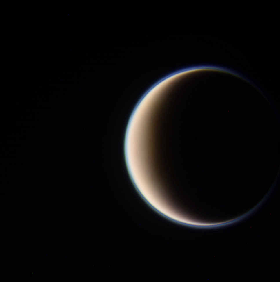
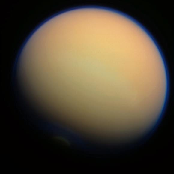
On September 26-27 Cassini executed its latest flyby of Titan, T-86, coming within 594 miles (956 km) of the cloud-covered moon in order to measure the effects of the Sun’s energy on its dense atmosphere and determine its variations at different altitudes.

The image above was captured as Cassini approached Titan from its night side, traveling about 13,000 mph (5.9 km/s). It’s a color-composite made from three separate raw images acquired in red, green and blue visible light filters.

Titan’s upper-level hydrocarbon haze is easily visible as a blue-green “shell” above its orange-colored clouds.

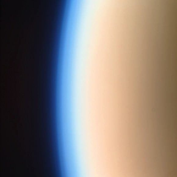
Cassini captured this image as it approached Titan’s sunlit limb, grabbing a better view of the upper haze. Some banding can be seen in its highest reaches.

The haze is the result of UV light from the Sun breaking down nitrogen and methane in Titan’s atmosphere, forming hydrocarbons that rise up and collect at altitudes of 300-400 kilometers. The sea-green coloration is a denser photochemical layer that extends upwards from about 200 km altitude.

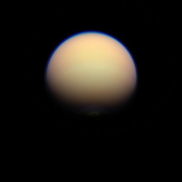
In this image, made from data acquired on Sept. 27, Titan’s south polar vortex can be made out just within the southern terminator. The vortex is a relatively new feature in Titan’s atmosphere, first spotted earlier this year. It’s thought that it’s a region of open-cell convection forming above the moon’s pole, a result of the approach of winter to Titan’s southern half.

Read: Cassini Spots Surprising Swirls Above Titan’s South Pole

This T-86 flyby was was one of a handful of opportunities to profile Titan’s ionosphere from the outermost edge of Titan’s atmosphere. In addition Cassini was able to look for any changes to Ligeia Mare, a methane lake last observed in spring of 2007.

Now that Titan has been under scrutiny for a full year of Saturn’s seasons — which lasts 29.7 Earth-years — astronomers now know that varying amounts of solar radiation can drastically change situations both within Saturn’s atmosphere and on its surface.

“As with Earth, conditions on Titan change with its seasons. We can see differences in atmospheric temperatures, chemical composition and circulation patterns, especially at the poles,” said Dr. Athena Coustenis from the Paris-Meudon Observatory in France. “For example, hydrocarbon lakes form around the north polar region during winter due to colder temperatures and condensation. Also, a haze layer surrounding Titan at the northern pole is significantly reduced during the equinox because of the atmospheric circulation patterns. This is all very surprising because we didn’t expect to find any such rapid changes, especially in the deeper layers of the atmosphere.”

“It’s amazing to think that the Sun still dominates over other energy sources even as far out as Titan, over 1.5 billion kilometres from us.”
– Dr. Athena Coustenis, Paris-Meudon Observatory

The image above, acquired on Sept. 28, was added to this post on Oct. 1. It was taken from a distance of  649,825 miles (1,045,792 kilometers.)

Cassini’s next targeted approach to Titan — T-87 — will occur on November 13.

Get more news from the Cassini mission here.

Image credits: NASA/JPL/Space Science Institute. All color composites by Jason Major. Images have not been validated or calibrated by the SSI team.


(Do you love the Cassini mission as much as we do? Vote on your favorite Cassini “Shining Moment” here, in honor of the 15th anniversary of Cassini’s launch on October 15! Amazing to think it’s already been 15 years — 8 of those in orbit around Saturn!)

Roving Curiosity at Work on Mars Searching for Ingredients of Life

Image Caption: Curiosity at work on Mars inside Gale Crater. Panoramic mosaic showing Curiosity in action with her wheel tracks and the surrounding terrain snapped from the location the rover drove to on Sol 29 (Sept 4). The time lapse imagery highlights post drive wheel tracks at left, movement of the robotic arm from the stowed to deployed position with pointing instrument turret at right with Mt Sharp and a self portrait of Curiosity’s instrument packed deck top at center. This colorized mosaic was assembled from navigation camera (Navcam) images taken over multiple Martian days while stationary beginning on Sol 29. Click to Enlarge. Credit: NASA/JPL-Caltech/Ken Kremer/Marco Di Lorenzo

NASA’s Mega Martian Rover Curiosity is swiftly trekking across the Red Planet’s science rich terrain inside Gale Crater as she approaches the two month anniversary since the daring atmospheric plunge and pinpoint touchdown on Aug. 5/6 beside her eventual destination of the richly layered mountainside of Mount Sharp.

In this ultra short span of time, Curiosity has already fulfilled on her stated goal of seeking the signs of life and potentially habitable environments by discovering evidence for an ancient Martian stream bed at three different locations – at the landing site and stops along her traverse route – where hip deep liquid water once vigorously flowed billions of years ago. Liquid water is a prerequisite for the origin of life.

Curiosity discovered a trio of outcrops of stones cemented into a layer of conglomerate rock – initially at “Goulburn” scour as exposed by the landing thrusters and later at the “Link” and “Hottah” outcrops during the first 40 sols of the mission.

If they find another water related outcrop, Curiosity Mars Science Laboratory (MSL) Project Manager John Grotzinger told me that the robotic arm will be deployed to examine it.

“We would do all the arm-based contact science first, and then make the decision on whether to drill. If we’re still uncertain, then we still have time to deliberate,” Grotzinger told me.

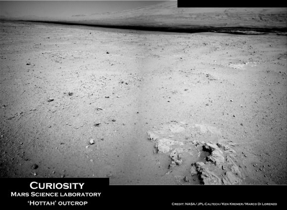
Image caption: Remnants of Ancient Streambed on Mars. NASA’s Curiosity rover found evidence for an ancient, flowing stream on Mars at a few sites, including the rock outcrop pictured here, which the science team has named “Hottah” after Hottah Lake in Canada’s Northwest Territories. It may look like a broken sidewalk, but this geological feature on Mars is actually exposed bedrock made up of smaller fragments cemented together, or what geologists call a sedimentary conglomerate. Scientists theorize that the bedrock was disrupted in the past, giving it the titled angle, most likely via impacts from meteorites. This image mosaic was taken by the 100-millimeter Mastcam telephoto lens on Sol 39 (Sept. 14, 2012). Credit: NASA/JPL-Caltech/MSSS

“This is the first time we’re actually seeing water-transported gravel on Mars. This is a transition from speculation about the size of streambed material to direct observation of it,” said Curiosity science co-investigator William Dietrich of the University of California, Berkeley.

Image Caption: Curiosity conducts 1st contact science experiment at “Jake” rock on Mars. This 360 degree panoramic mosaic of images from Sols 44 to 47 (Sept 20-23) shows Curiosity arriving near Jake rock on Sol 44. The robot then drove closer. Inset image from Sol 47 shows the robotic arm extended to place the science instruments on the rock and carry out the first detailed contact science examination of a Martian rock with the equipment positioned on the turret at the arms terminus. Jake rock is named in honor of recently deceased team member Jake Matijevic. This mosaic was created in tribute to Jake and his outstanding contributions. Click to Enlarge. Credit: NASA/JPL-Caltech/Ken Kremer/Marco Di Lorenzo

The one-ton robot soon departed from her touchdown vicinity at “Bradbury Landing” and set off on a multi-week eastwards traverse to her first science target which the team has dubbed “Glenelg”.

See our panoramic Curiosity mosaics herein showing the rovers movements on various Sols as created by Ken Kremer and Marco Di Lorenzo from NASA raw images.

Curiosity is also now closing in on the spot from which she will reach out with the advanced 7 foot long (2.1 meter) robotic arm to scoop up her very first Martian soil material and deliver samples to the on board chemistry labs.

At a Sept. 27 briefing for reporters, Grotzinger, of Caltech in Pasadena, Calif., said the team hopes to find a suitable location to collect loose, gravelly Martian soil within the next few sols that can be easily sifted into the analytical labs. Curiosity will then spend about 2 or 3 weeks investigating the precious material and her surroundings, before continuing on to Glenelg.

The science team chose Glenelg as the first target for detailed investigation because it sits at the intersection of three distinct types of geologic terrain, affording the researchers the opportunity to comprehensively explore the diverse geology inside the Gale Crater landing site long before arriving at the base of Mount Sharp. That’s important because the rover team estimates it will take a year or more before Curiosity reaches Mount Sharp, which lies some 10 kilometers (6 miles) away as the Martian crow flies.

As of today, Sol 53, Curiosity has driven a total distance of 0.28 mile (0.45 kilometer) or more than ¾ of the way towards Glenelg. Yestersol (Sol 52), the six wheeled robot drove about 122 feet (37.3 meters) toward the Glenelg area and is using visual odometry to assess her progress and adjust for any wheel slippage that could hint at sand traps or other dangerous obstacles.

The longest drive to date just occurred on Sol 50 with the robot rolling about 160 feet (48.9 meters).

Curiosity recently conducted her first detailed rock contact science investigation with the robotic arm at a rock named “Jake”, in honor of Jake Matijevic, a recently deceased MSL team member who played a key and leading role on all 3 generations of NASA’s Mars rovers. See our 360 degree panoramic “Jake rock” mosaic created in tribute to Jake Matijevic.

Curiosity is searching for hydrated minerals, organic molecules and signs of habitats favorable for past or present microbial life on Mars.

Ken Kremer

Image Caption: “Hottah” water related outcrop. Context mosaic shows location of Hottah” outcrop (bottom right) sticking out from the floor of Gale Crater as imaged by Curiosity Navcam on Sol 38 with Mount Sharp in the background. The Glenelg science target lies in the terrain towards Mt Sharp. This is what an astronaut geologist would see on Mars. Credit: NASA/JPL-Caltech/Ken Kremer/Marco Di Lorenzo

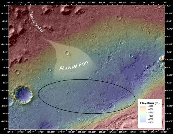
Alluvial Fan Where Water Flowed Downslope. This image shows the topography, with shading added, around the area where NASA’s Curiosity rover landed on Aug. 5 PDT (Aug. 6 EDT). The black oval indicates the targeted landing area for the rover known as the “landing ellipse,” and the cross shows where the rover actually landed.An alluvial fan, or fan-shaped deposit where debris spreads out downslope, has been highlighted in lighter colors for better viewing. On Earth, alluvial fans often are formed by water flowing downslope. New observations from Curiosity of rounded pebbles embedded with rocky outcrops provide concrete evidence that water did flow in this region on Mars, creating the alluvial fan. Credit: NASA/JPL-Caltech/UofA

ESA’s Big Cargo Ship Departs from the Space Station

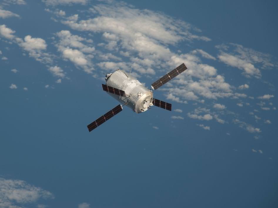
The view when ATV-3 approached the ISS in 2012. Credit: NASA.

After a three-day delay, the European Space Agency’s “Edoardo Amaldi” Automated Transfer Vehicle (ATV-3) undocked from the aft port of the International Space Station’s Zvezda service module at 21:44 UTC (5:44 p.m. EDT) on Friday.

Tuesday’s initial attempt to undock the European cargo ship was called off due to a communications error between the Zvezda module’s proximity communications equipment and computers on the ATV. Russian flight controllers resolved the problem, but then an additional delay occurred because of the possibility of two pieces of space debris coming close to the ISS, and the ATV would have been used to perform an avoidance maneuver; however, it was later deemed the debris posed no threat.

Image of the ATV-3 when it reached the International Space Station on March 28, 2012. Credit: NASA TV

Expedition 33 Flight Engineers Yuri Malenchenko and Aki Hoshide, who together closed up the hatches to ATV-3 Monday, monitored its automated departure from a control panel inside Zvezda. Meanwhile, Commander Suni Williams photographed the departing space freighter to document the condition of its docking assembly.

ATV-3, now filled with trash and unneeded items, backed away to a safe distance from the orbiting complex after undocking. Once it reaches distance about 4,500 miles in front of the station, the European cargo craft will fire its engines twice on Tuesday, Oct. 2, to send it into the Earth’s atmosphere for a planned destructive re-entry that evening. As the ATV-3 plunges back to the Earth, the Re-Entry Breakup Recorder that Hoshide installed inside the vehicle will collect and transmit engineering data to enhance the efficiency of spacecraft designs and minimize the hazards to people and property on the ground even in the case of an uncontrolled re-entry for future cargo ships.

“Edoardo Amaldi,” named for the 20th-century Italian physicist regarded as one of the fathers of European spaceflight, delivered 7.2 tons of food, fuel and supplies to the orbiting complex after docking to the station March 28. The fourth ATV, named “Albert Einstein,” is slated to launch in April 2013. More than 32 feet long — about the size of a traditional London double-decker bus – the ATV is the largest and heaviest vehicle that provides cargo resupply for the station.

Peekaboo Sun: SDO’s Eclipse Season

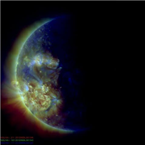
Now you see it, now you don’t! Around the solstices, the Solar Dynamics Observatory ends up having an “eclipse season,” where the Sun, Earth, and the SDO line up, and some of the images and video sent down from the spacecraft appear as though the Sun disappears for a while or just part of the Sun is visible. This is a normal part of life with a geosynchronous observatory, the SDO team says.

They explain it this way:

“Twice a year, SDO enters an eclipse season where the spacecraft slips behind Earth for up to 72 minutes a day. Unlike the crisp shadow one sees on the sun during a lunar eclipse, Earth’s shadow has a variegated edge due to its atmosphere, which blocks the sun light to different degrees depending on its density. Also, light from brighter spots on the sun may make it through, which is why some solar features extend low into Earth’s shadow.”

There’s no way to avoid the loss of images, but the continuous contact with the ground station SDO’s orbit allows was judged to outweigh the loss of some images.

This eclipse season started September 6, and it ends tomorrow, on September 29, 2012, so see it while you can!

A River Ran Through It: Why Do They Think There Was Once Water on Mars?

Why is everyone so excited about these dusty Mars rocks?

This week’s big news was the announcement of evidence for flowing water on Mars, based on images of what appear to be smooth river rock-type pebbles found by Curiosity. Of course that’s a big statement to make, and for good reason — identifying water, whether present or past, is one step closer to determining whether Mars was ever a suitable place for life to develop. Yet here we are, not even two months into the mission and Curiosity is already sending us solid clues that Mars was once a much wetter place than it is now.

JPL released a video today providing a brief-but-informative overview of what Curiosity has discovered in Gale Crater and why it’s gotten everyone so excited.

Check it out so you’ll have something to talk about over the weekend:

MSL Long Term Planner Sanjeev Gupta reviews Curiosity’s latest discovery

Video: JPLNews. Images: NASA/JPL-Caltech

Weekly Space Hangout – Sept. 27, 2012

This was an action-packed episode of the Weekly Space Hangout. Lots of stories, very little time.

Participants: Mike Wall, Alan Boyle, Ian O’Neill, Nancy Atkinson, Jason Major

Host: Fraser Cain

Want to watch us record the show live? Point your browser at next week’s event page to put the recording right into your calendar.

Astrophoto: The Crescent Nebula & Wolf Rayet Star by John Chumack

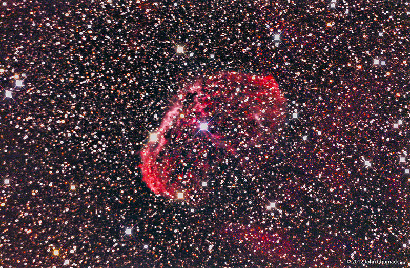
NGC6888 The Crescent Nebula & Wolf Rayet Star (WR136). Credit: John Chumack.

Here’s an impressive shot of NGC 6888, also known as the Crescent Nebula, which is a cosmic bubble about 25 light-years across. It is part of the massive Gamma Cygni Nebula region, and in the center is a powerful, bright and massive Wolf-Rayet star. “The very energetic Wolf-Rayet star is shedding its outer envelope in a strong stellar wind, ejecting the equivalent of the Sun’s mass every 10,000 years,” explains prolific and talented astrophotographer John Chumack. “This cosmic bubble is located in this very rich star studded field, which is about 3,000 light years away.”

To capture this image, John used a QHY8 cooled Color CCD Camera and his homemade 16″ Newtonian Scope, with a 90 minute exposure, taken on August 24, 2012 at his observatory in Yellow Springs, Ohio. See more of his work at his website, Galactic Images.

Want to get your astrophoto featured on Universe Today? Join our Flickr group or send us your images by email (this means you’re giving us permission to post them). Please explain what’s in the picture, when you took it, the equipment you used, etc.

Parallax Effect Charted in the 2012 Transit of Venus

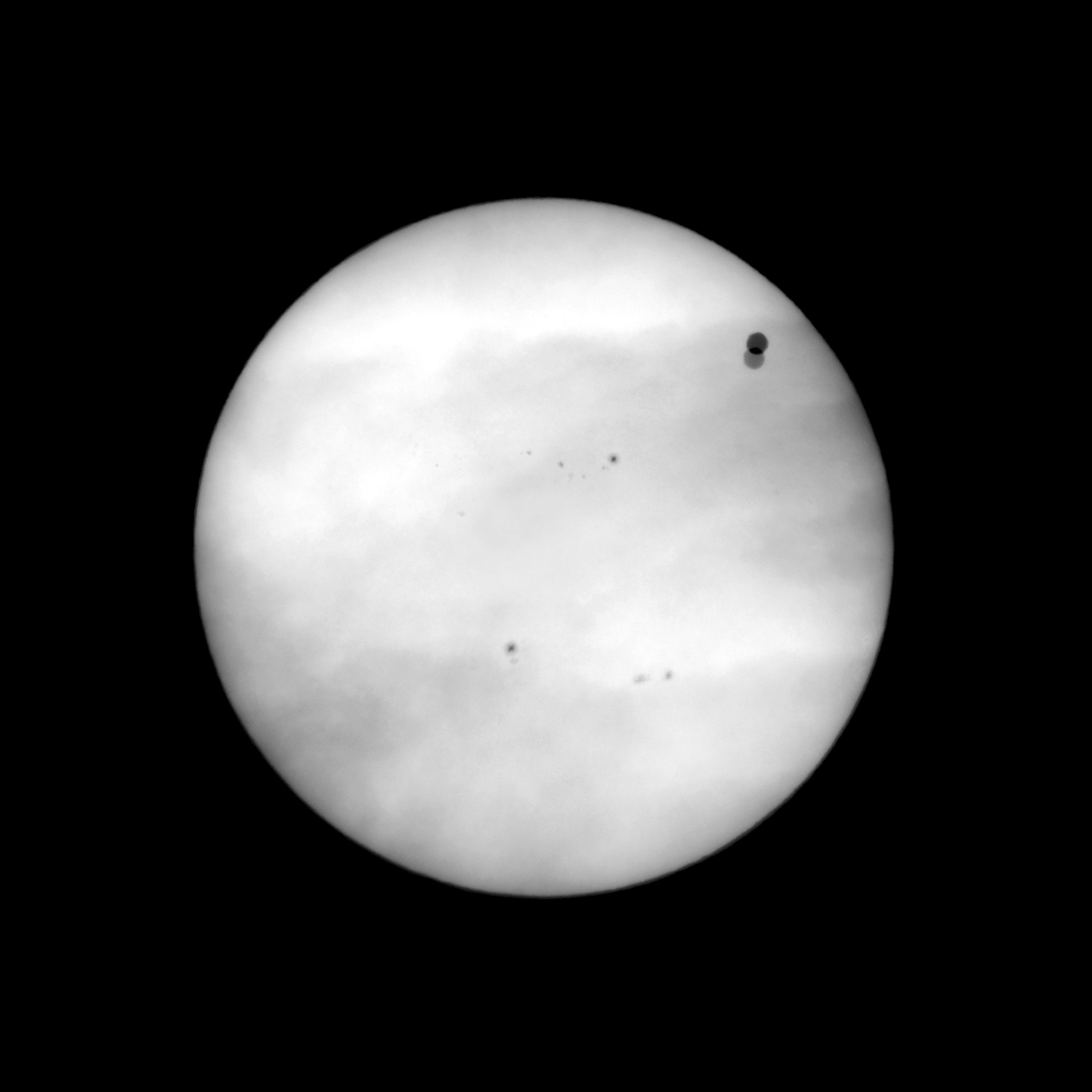
Combined images taken simultaneously (06 June 2012, 03:46:18 UTC) from Svalbard and Canberra, showing the Venus parallax effect from 2 different locations on Earth, separated by 11600km. Credit: Pérez Ayúcar/Breitfellner

Back in the 18th century, astronomers were trying to determine the distance from the Earth to the Sun. They used the parallax method during the Transits of Venus the 1760s to help answer that question, and their results provided a cosmic measuring stick that has allowed astronomers to measure distances in the Universe.

How did that method work? New images and movies of the transit of Venus on June 6, 2012 which compare event from two different locations on Earth clearly show the parallax effects that have made Venus transits so important historically.


The movies compress 6 hours of observations and 5,000 individual images taken by optical and solar telescopes into a 40 second video. Data gaps due to cloudy conditions produce jumps in the otherwise smooth Venus motion across the Sun disk. The observations were taken from Svalbard in Norway and Canberra in Australia, which are separated by 11,600 km (7,200 miles).

When the images from the two locations are compared, the parallax effect is obvious.

By knowing the distance between two observers on Earth and comparing the differences in their observations, astronomers were able to work out the distance from the Earth to Venus. And because of Johannes Kepler’s calculations, 18th century astronomers already knew Venus’ orbit is about 70 percent that of Earth’s. So by knowing the distance between the Earth and Venus, they were also able to figure out the value for the Astronomical Unit.

The images used in the movies were obtained by members of the European Space Astronomy Centre, which is located outside Madrid. Two of the observers, Miguel Pérez Ayúcar and Michel Breitfellner are on the science operations planning team for the Venus Express satellite, which has been orbiting Venus since 2006.

“During the hours of the transit we were delighted by the slow, delicate, gracious passage of Venus in front of the Sun,” Ayúcar said. “A perfect black circle, containing a world in it, moving in front of its looming parent star. How thankful we were to witness it. Now with these movies, we can share a sense of that experience.”

Breitfellner said, “In the 18th century people realized that transits of Venus could be used to measure the distance from the Earth to the Sun. Teams of astronomers were sent all across the world to measure this effect. The 2012 transit has its own historical importance – it is the first that has occurred when a spacecraft is in orbit at Venus. Science teams are now working to compare observations of the Venus transit from Earth with simultaneous observations from Venus Express.”

Colin Wilson, Operations Scientist for Venus Express, said, “Planetary transits are not just of historical interest, they have acquired a new importance in the study of newly discovered planets around other stars. Because we cannot image exoplanets directly, it is only by studying their transits that we can discover whether they harbour liquid water or other potential ‘biomarker’ molecules like methane or ozone. The Venus transit is an example much closer to home, offering us a chance to test our understanding of how to interpret transit data. This certainly added extra interest as we watched the Venus transit in June – particularly knowing it was our last chance that we’d have to wait until 2117 to see the next one!”

Transit of Venus 2012 from Svalbard and Canberra from Lightcurve Films on Vimeo.

Source: EPSC

Vesta’s Deep Grooves Could Be “Stretch Marks” From Impact

Dawn image of Vesta showing its nearly circumferential equatorial grooves (NASA/JPL-Caltech/UCLA/MPS/DLR/IDA)

Even though NASA’s Dawn spacecraft has departed Vesta the trove of data it’s gathered about this fascinating little world continues to fuel new discoveries. Most recently, some researchers are suggesting that Vesta’s curious grooves — long, deep troughs that wrap around its equator, noticed immediately after Dawn came within close proximity — are actually features called graben, the results of surface expansion along fault lines.

In Vesta’s case, the faults likely may have come from whatever major collision created the enormous central peak that rises almost three times the height of Mt. Everest from its south pole… and the expansion could be the result of differentiation of its interior — a separation of core, mantle and crust that’s much more planet-like than anything asteroidish.


On smaller asteroids and moons, stress fractures tend to have a “V” shape, cutting inwards to a sharp point. But the troughs on Vesta are more rounded, with a “U” shape that results from surface material slumping downwards as the surface pulls apart. Found on larger worlds like Earth, the Moon, Mars, Mercury — and now possibly Vesta as well — graben are shaped by motions below the crust and not just the splitting of the surface.

The biggest of Vesta’s troughs, Divalia Fossa, is 465 kilometers (289 miles) long, 22 km (13.6 mi) wide and 5 km (3 mi) deep… longer and three times deeper than the Grand Canyon.

Animation of Vesta rotating made from Dawn images and assembled by The Planetary Society’s Emily Lakdawalla

If the researchers are correct and these are indeed graben, rather than just fractures or grooves carved into the surface by another process, Vesta probably had a lot more going on inside it than does your typical asteroid.

“By saying it’s differentiated, we’re basically saying Vesta was a little planet trying to happen,” said Debra Buczkowski of the Johns Hopkins University Applied Physics Laboratory (JHUAPL), lead author of a new paper titled “Large-scale troughs on Vesta: A signature of planetary tectonics” scheduled to be published by the AGU on Sept. 29.

Read more: Is Vesta a Planet Among Asteroids?

Unlike its big sister Ceres, the largest world among the asteroids and Dawn’s next destination, Vesta isn’t officially classified as a dwarf planet because its shape isn’t spherical enough — a flagrant violation of IAU Planetary Code Regulation No. 2. Rather it’s more flattened, like a walnut. This of course is also likely the result of the impact Vesta sustained at its south pole (which also may be responsible for its rapid 5.35-hour rotation rate, helping to bulge out the equatorial region and possibly even provide an alternate source for the trough “stretch marks”) and so begs the question, was Vesta once a dwarf planet? And if so, does severe reconstruction by an impact event “reclassify” it as something else? What, then? Ex-dwarf planet? A planet-formerly-known-as-dwarf?An undwarf?

I’m sure the IAU is already anticipating the contretemps.

“We have been calling Vesta the smallest terrestrial planet. The latest imagery provides much justification for our expectations. They show that a variety of processes were once at work on the surface of Vesta and provide extensive evidence for Vesta’s planetary aspirations.”

– Chris Russell, Dawn mission principal investigator at UCLA

Read more on the American Geophysical Union’s press release here, and follow the latest from NASA’s Dawn mission here.