Vesta’s Deep Grooves Could Be “Stretch Marks” From Impact

Dawn image of Vesta showing its nearly circumferential equatorial grooves (NASA/JPL-Caltech/UCLA/MPS/DLR/IDA)

Even though NASA’s Dawn spacecraft has departed Vesta the trove of data it’s gathered about this fascinating little world continues to fuel new discoveries. Most recently, some researchers are suggesting that Vesta’s curious grooves — long, deep troughs that wrap around its equator, noticed immediately after Dawn came within close proximity — are actually features called graben, the results of surface expansion along fault lines.

In Vesta’s case, the faults likely may have come from whatever major collision created the enormous central peak that rises almost three times the height of Mt. Everest from its south pole… and the expansion could be the result of differentiation of its interior — a separation of core, mantle and crust that’s much more planet-like than anything asteroidish.


On smaller asteroids and moons, stress fractures tend to have a “V” shape, cutting inwards to a sharp point. But the troughs on Vesta are more rounded, with a “U” shape that results from surface material slumping downwards as the surface pulls apart. Found on larger worlds like Earth, the Moon, Mars, Mercury — and now possibly Vesta as well — graben are shaped by motions below the crust and not just the splitting of the surface.

The biggest of Vesta’s troughs, Divalia Fossa, is 465 kilometers (289 miles) long, 22 km (13.6 mi) wide and 5 km (3 mi) deep… longer and three times deeper than the Grand Canyon.

Animation of Vesta rotating made from Dawn images and assembled by The Planetary Society’s Emily Lakdawalla

If the researchers are correct and these are indeed graben, rather than just fractures or grooves carved into the surface by another process, Vesta probably had a lot more going on inside it than does your typical asteroid.

“By saying it’s differentiated, we’re basically saying Vesta was a little planet trying to happen,” said Debra Buczkowski of the Johns Hopkins University Applied Physics Laboratory (JHUAPL), lead author of a new paper titled “Large-scale troughs on Vesta: A signature of planetary tectonics” scheduled to be published by the AGU on Sept. 29.

Read more: Is Vesta a Planet Among Asteroids?

Unlike its big sister Ceres, the largest world among the asteroids and Dawn’s next destination, Vesta isn’t officially classified as a dwarf planet because its shape isn’t spherical enough — a flagrant violation of IAU Planetary Code Regulation No. 2. Rather it’s more flattened, like a walnut. This of course is also likely the result of the impact Vesta sustained at its south pole (which also may be responsible for its rapid 5.35-hour rotation rate, helping to bulge out the equatorial region and possibly even provide an alternate source for the trough “stretch marks”) and so begs the question, was Vesta once a dwarf planet? And if so, does severe reconstruction by an impact event “reclassify” it as something else? What, then? Ex-dwarf planet? A planet-formerly-known-as-dwarf?An undwarf?

I’m sure the IAU is already anticipating the contretemps.

“We have been calling Vesta the smallest terrestrial planet. The latest imagery provides much justification for our expectations. They show that a variety of processes were once at work on the surface of Vesta and provide extensive evidence for Vesta’s planetary aspirations.”

– Chris Russell, Dawn mission principal investigator at UCLA

Read more on the American Geophysical Union’s press release here, and follow the latest from NASA’s Dawn mission here.

Curiosity Finds Evidence of An Ancient Streambed on Mars

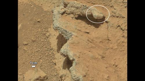
NASA’s Curiosity rover found evidence for an ancient, flowing stream on Mars at a few sites, including the rock outcrop pictured here, which the science team has named “Hottah” after Hottah Lake in Canada’s Northwest Territories. Credit: NASA/JPL/Caltech

The Curiosity rover has come across a place in Gale Crater where ankle-to-hip-deep water once vigorously flowed: an ancient streambed containing evidence of gravel that has been worn by water. At a press briefing today, members of the Mars Science Laboratory team said the rover has found “surprising” outcrops and gravel near the rover landing site that indicate water once flowed in this region, and likely flowed for a long time.

“Too many things that point away from a single burst event,” said Curiosity science co-investigator William Dietrich of the University of California, Berkeley. “I’m comfortable to argue that it is beyond the 1,000 year timescales, even though this is very early on in our findings.”

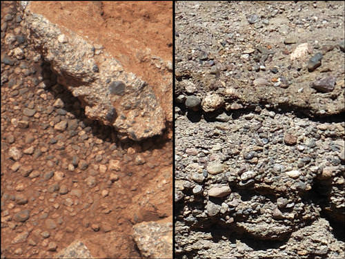
This set of images compares the Link outcrop of rocks on Mars (left) with similar rocks seen on Earth (right). Credit: NASA/JPL/Caltech

From the size of gravel found by the rover, the science team can interpret the water was moving about 1 meter (3 feet) per second, with a depth somewhere between ankle and hip deep.

“Plenty of papers have been written about channels on Mars with many different hypotheses about the flows in them,” said Dietrich. “This is the first time we’re actually seeing water-transported gravel on Mars. This is a transition from speculation about the size of streambed material to direct observation of it.”

What Curiosity found on Mars was described as conglomerate rock made up of water-transported gravels, meaning the gravel is now cemented into a layers of rock, and the sizes and shapes of stones offer clues to the speed and distance of a long-ago stream’s flow.

“The shapes tell you they were transported and the sizes tell you they couldn’t be transported by wind. They were transported by water flow,” said Curiosity science co-investigator Rebecca Williams of the Planetary Science Institute.

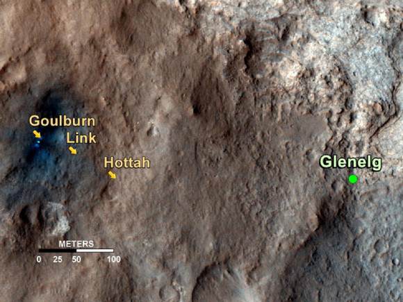
The discovery comes from examining two outcrops, called “Hottah” and “Link,” with the telephoto capability of Curiosity’s mast camera during the first 40 days after landing. Those observations followed up on earlier hints from another outcrop, named Goulburn, which was exposed by thruster exhaust as Curiosity touched down.

“Hottah looks like someone jack-hammered up a slab of city sidewalk, but it’s really a tilted block of an ancient streambed,” said Mars Science Laboratory Project Scientist John Grotzinger of the California Institute of Technology.

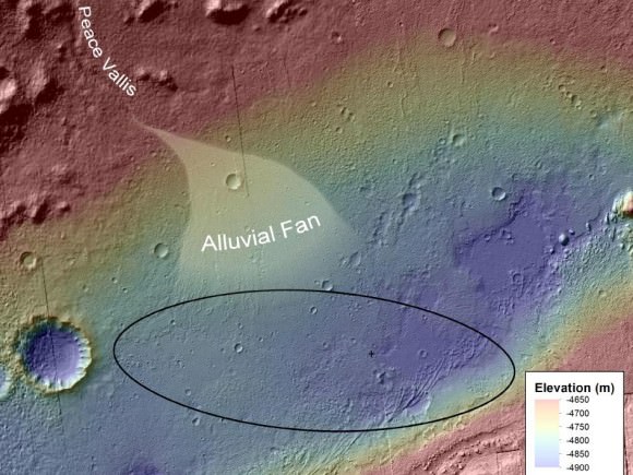
An alluvial fan, or fan-shaped deposit where debris spreads out downslope are usually formed by water, and new observations from Curiosity of rounded pebbles embedded with rocky outcrops provide concrete evidence that water did flow in this region on Mars. Elevation data were obtained from stereo processing of images from the High Resolution Imaging Science Experiment (HiRISE) camera on NASA’s Mars Reconnaissance Orbiter. Image credit: NASA/JPL-Caltech/UofA

Even though the team classified the finding as “surprising,” they later said they actually weren’t too surprised at what they found so early in the mission – just 51 sols, or Martian days, in.

“We are getting better about integrating the orbital data,” said Grotzinger. “We see an alluvial fan and debris flow from orbit, and then see these water-transported pebbles from the ground. This is not rocket science, but shows exactly the reason we chose this landing site, and you build on those foundations you think you are mostly likely to establish. Now we’ll look at more rocks and get more context to recreate the environment in greater detail along with understanding the chemistry of the time to see if this is a place that could be habitable.”

Asked if it was hard to come to consensus on this long-term, quickly flowing water statement, given the large number of scientists involved with the mission, Grotziner said, “Given the evidence we have from orbit that has been analyzed, when we arrive with a robot we can test the hypothesis pretty quickly. If the geological signal for this process is large enough, it is easy to achieve a consensus pretty quickly.”

The finding site lies between the north rim of Gale Crater and the base of Aeolis Mons, or Mount Sharp, a mountain inside the crater. To the north of the crater, a channel named Peace Vallis feeds into the alluvial fan. The abundance of channels in the fan between the rim and conglomerate suggests flows continued or repeated over a long time, not just once or for a few years, the science team said.

But interestingly, the rover has already moved on from this spot, and yesterday took the longest drive yet, of between 52-53 meters, heading towards the Glenelg region where they want to do their first scooping and tests soil samples in Curiosity’s two instruments, SAM (Sample Analysis at Mars) and ChemMin (Chemistry & Mineralogy X-Ray Diffraction/X-Ray Fluorescence Instrument). These two experiments will study powdered rock and soil samples scooped up by the robotic arm.

The Glenelg area marks the intersection of three kinds of terrain: bedrock for drilling, several small craters that may represent an older or harder surface, and also terrain similar to where Curiosity landed, so the science team can do comparisons.

“A long-flowing stream can be a habitable environment,” said Grotzinger. “But it is not our top choice as there might be other places that have preserved organic carbon better than this, and we need to assess the potential for preservation of organics. We’re still going to Mount Sharp, but this is insurance that we have already found our first potentially habitable environment.”

The slope of Aeolis Mons contains clay and sulfate minerals, which have been detected from orbit. This can be good preservers of carbon-based organic chemicals that are potential ingredients for life.

As for what’s next for Curiosity, Grotzinger said they have a couple of targets in the next 2-4 sols, and then they will park for a long period of time, about 2-3 weeks to prepare for reaching Glenelg. “This is such a complex set of processes that have never been done on Mars before, so we are going to be conservative and go slowly to make sure everything is working as it should. Then we’ll go to Glenelg and choose first candidate for drilling.”

This map shows the path on Mars of NASA’s Curiosity rover toward Glenelg. Credit: NASA/JPL/Caltech/University of Arizona

Sources: Press briefing, NASA press release

Amateur Astronomer Creates Detailed Map of Ganymede

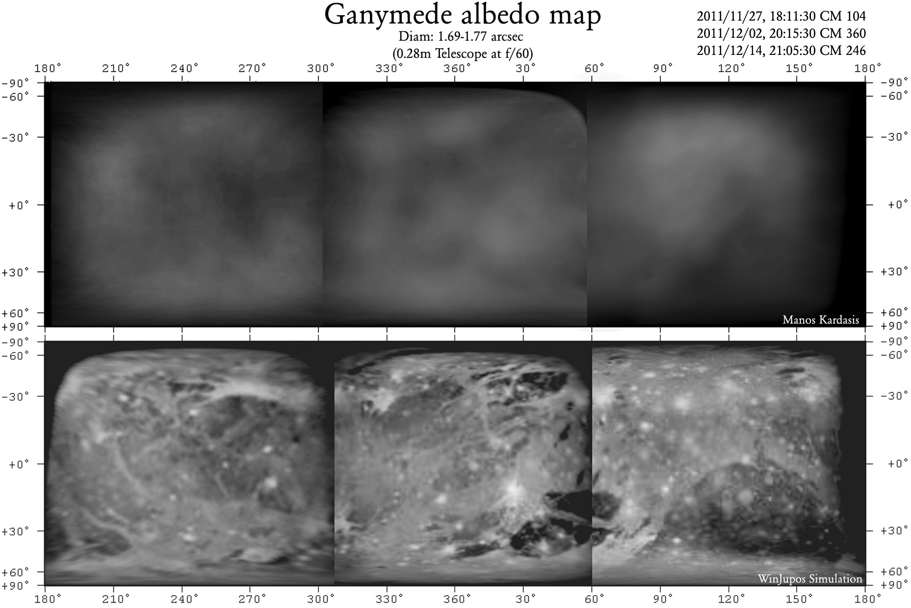
The original observations (top) and interpretations (bottom) of the first ever amateur albedo map of Ganymede. Credit: Manos Kardasis.

As our frequent “Astrophoto” posts from amateur astronomers and photographers attest – as well as the rise of citizen science — , the latest technology allows amatuers to make significant contributions to the field of astronomy. Case in point: Emmanuel I. Kardasis of the Hellenic Amateur Astronomy Association has produced the first amateur albedo map of Jupiter’s moon Ganymede. He used an off-the-shelf telescope, camera and computer equipment, but put his experienced observing skills to the test.

“Ganymede has a tiny disk as seen from Earth so was a good test for my techniques,” said Kardasis. “If the same methods were applied to other worlds, perhaps the volcanic moon Io, we could capture surface fluctuations. Professional observatories may create better images but they cannot monitor our rapidly and ever-changing Universe.”

Albedo maps of Ganymede (left) and how they relate to known surface features (right). Credit: Manos Kardasis.

Like many amateurs, Kardasis attached a camera to his telescope and recorded a video of Ganymede. Selecting only the sharpest frames of the video allowed him to obtain a series of images when the atmospheric conditions – known as ‘seeing’ – were most favorable. These best images were then stacked and aligned, before being enhanced through photo-editing software.

An albedo map details higher areas of reflectivity on an object’s surface recording where material is brighter or darker. Kardasis’ albedo map closely aligns with professional images of Ganymede’s surface, indicating features such as Phrygia Sulcus (furrows and ridges 3,700 km across) and the Nicholson region (a low-lying darker area).

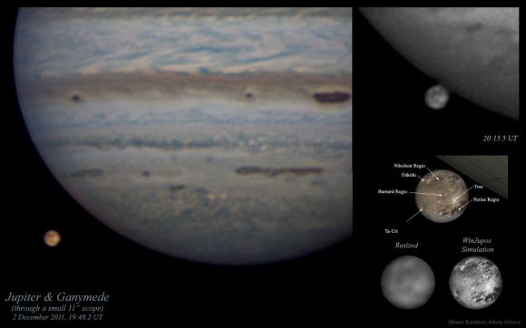
Amateur photographs of Jupiter and Ganymede, accompanied with a professionally-obtained labeled map (bottom right). Credit: Manos Kardasis.

“Creating useful images of planets requires a telescope with a diameter of at least eight inches, said Kardasis. “For tiny discs, such as the moons of Jupiter, bigger is definitely better. My Ganymede images were made using an 11-inch telescope. You also need a good motor drive on your tripod, a sensitive camera, some freely-available software, and lots of patience!”

Kardasis presented his images at the European Planetary Science Congress this week in Madrid, Spain. He suggests that future amateur programs could monitor both surface and atmospheric changes on worlds as varied as Uranus, Neptune and Titan, complementing more detailed but far less regular observations made by professionals. Kardasis says, “I hope my work will inspire anyone interested in astronomy to use whatever equipment they have to make useful observations.”

Source: EPSC

Planets in our Solar System May Have Formed in Fits and Starts

Solar shockwaves would have produced proto-planetary rings at different times, meaning the planets did not form simultaneously (artist concept). Credit: ESO.

Did all the planets in our Solar System form at about the same time? Conventional thinking says the components of our Solar System all formed at the same time, and formed rather quickly. But new research indicates that a series of shockwaves emitted from our very young Sun may have caused the planets to form at different times over millions of years.

“The planets formed in intervals – not altogether, as was previously thought,” said Dr. Tagir Abdylmyanov, Associate Professor from Kazan State Power Engineering University in Russia.

Abdylmyanov’s research, which models the movements of particles in fluids and gasses and in the gas cloud from which our Sun accreted, indicates that the first series of shockwaves during short but very rapid changes in solar activity would have created the proto-planetary rings for Uranus, Neptune, and dwarf planet Pluto first. Jupiter, Saturn, and the asteroid belt would have come next during a series of less powerful shockwaves. Mercury, Venus, Earth, and Mars would have formed last, when the Sun was far calmer. This means that our own planet is one of the youngest in the Solar System.

“It is difficult to say exactly how much time would have separated these groups,” Abdylmyanov said, “but the proto-planetary rings for Uranus, Neptune and Pluto would have likely formed very close to the Sun’s birth. 3 million years later and we would see the debris ring destined to form Saturn. Half a million years after this we would see something similar but for Jupiter. The asteroid belt would have begun to form about a million years after that, and another half a million years on we would see the very early stages of Mercury, Venus, Earth and Mars.”

The shockwaves emitted from the new-born Sun would have rippled out material at different times, creating a series of debris rings around the Sun from which the planets formed.

Abdylmayanov hopes that this research will help us understand the development of planets around distant stars. “Studying the brightness of stars that are in the process of forming could give indications as to the intensity of stellar shockwaves. In this way we may be able to predict the location of planets around far-flung stars millions of years before they have formed.”

His work was part of the European Planetary Science Congress taking place this week in Madrid, Spain.

Paddleboat Mission to Titan Proposed

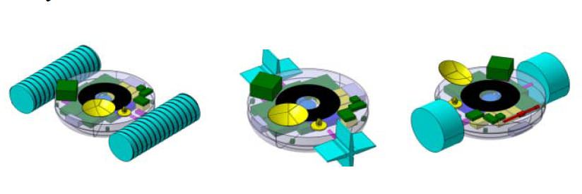
Three concepts for the TALISE boat mission to Titan: screw propelled (left), paddle wheels (center) and inflatable wheels (right). Credit: Urdampilleta, et al.

Is sending a boat to Titan an outlandish idea? Maybe, said a group of European scientists and engineers, but they’re working on a plan. The Titan Lake In-situ Sampling Propelled Explorer (TALISE) proposes a sending an instrument-laden boat-probe to Saturn’s largest moon that could be propelled by paddles, inflatable wheels or screws. The probe would land in the middle of Ligeia Mare – Titan’s biggest lake, near the moon’s north pole — then set sail for the coast, taking scientific measurements along the way.

“The main innovation in TALISE is the propulsion system,” says Igone Urdampilleta from SENER, an engineering company in Spain and a member of the TALISE team. “This allows the probe to move, under control, from the landing site in the lake, to the closest shore. The displacement capability would achieve the obtaining of liquid and solid samples from several scientific interesting locations on Titan’s surface such as the landing place, along the route towards the shore and finally at the shoreline.”

In a presentation at the European Planetary Science Congress on September 27, 2012, the TALISE team says that since Titan has a thick atmosphere, a diameter between that of Earth and the planet Mercury, and a network of seas, lakes and rivers, it is in many respects more like a planet than a moon.

And it’s time to go there and do a little in-situ science. The principle objective of the mission would be to characterize Titan’s environment and the chemical composition of the lakes and terrain.

While the Cassini-Huygens mission landed the Huygens probe on Titan in 2005, it transmitted data for only about 90 minutes after touchdown. The TALISE mission would last six months to a year.

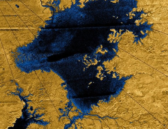
Images from the Cassini mission show river networks draining into the lakes in Titan’s north polar region. Credit: NASA/JPL/USGS

The Cassini orbiter has confirmed that lakes, seas and rivers of liquid hydrocarbons cover much of the Titan’s northern hemisphere, and these hydrocarbons may rain down on the surface, forming the frigid liquid bodies. With surface temperature at -178 degrees Celsius (-289 degrees Fahrenheit), Titan’s environment is too cold for life as we may know it, but its environment, rich in the building blocks of life, is of great interest to astrobiologists, the team said.

“The chemical composition of the lakes of Titan is still not well determined,” the TALISE team wrote in their abstract. “The detection of other compounds and the investigation of influence of both, photochemistry and the atmosphere on the chemical composition of liquids of Titan lakes remain challenging in the absence of in situ measurements. Therefore, it is next step to understand the Titan lakes environment, its relationship with the climate behavior, the surrounding solid substrate and analyze the organic inventory including the possibility of prebiotic compounds.”

The actual configuration of the boat is still under consideration, and they are considering various in-situ propulsion methods through the liquid hydrocarbon seas. In addition to paddle wheels, screw propulsion and inflatable wheels, they are also looking at tank wheels, air propeller, liquid propeller and a hovercraft design.

The TALISE concept is being developed as a partnership between SENER and the Centro de Astrobiología in Madrid, Spain, and the mission is still in the very early stages of feasibility studies and preliminary mission architecture design, but they are hoping to be ready for a future space science mission call for proposals.

Sources: EPSC, TALISE team abstract

Researchers Present the Sharpest Image of Pluto Ever Taken from Earth

A “speckle image” reconstruction of Pluto and its largest moon, Charon (Gemini Observatory/NSF/NASA/AURA)

Real planet, dwarf planet, KBO, who cares? What matters here is that astronomers have created the sharpest image of Pluto ever made with ground-based observations — and developed a new way to verify potential Earth-like exoplanets at the same time.

Here’s how they did it:


After taking a series of quick “snapshots” of Pluto and Charon using a recently-developed camera called the Differential Speckle Survey Instrument (DSSI), which was mounted on the Gemini Observatory’s 8-meter telescope in Hawaii, researchers combined them into a single image while canceling out the noise caused by turbulence and optical aberrations. This “speckle imaging” technique resulted in an incredibly clear, crisp image of the distant pair of worlds — especially considering that 1. it was made with images taken from the ground, 2. Pluto is small, and 3. Pluto is very, very far away.

Read: Why Pluto is No Longer a Planet

Less than 3/4 the diameter of our Moon, Pluto (and Charon, which is about half that size) are currently circling each other about 3 billion miles from Earth — 32.245 AU to be exact. That’s a long way off, and there’s still much more that we don’t know than we do about the dwarf planet’s system. New Horizons will fill in a lot of the blanks when it passes close by Pluto in July 2015, and images like this can be a big help to mission scientists who want to make sure the spacecraft is on a safe path.

“The Pluto-Charon result is of timely interest to those of us wanting to understand the orbital dynamics of this pair for the 2015 encounter by NASA’s New Horizons spacecraft,” said Steve Howell of the NASA Ames Research Center, who led the Gemini imaging study.

See images of Pluto taken by Hubble here.

In addition, the high resolution achievable through the team’s speckle imaging technique may also be used to confirm the presence of exoplanet candidates discovered by Kepler. With an estimated 3- to 4-magnitude increase in imaging sensitivity, astronomers may be able to use it to pick out the optical light reflected by a distant Earth-like world around another star.

Speckle imaging has been used previously to identify binary star systems, and with the comparative ability to “separate a pair of automobile headlights in Providence, RI, from San Francisco, CA” there’s a good chance that it can help separate an exoplanet from the glare of its star as well.

The research was funded in part by the National Science Foundation and NASA’s Kepler discovery mission, and will be published in the journal Publications of the Astronomical Society of the Pacific in October 2012. Read more here.

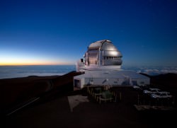
Main image: the first speckle reconstructed image for Pluto and Charon from which astronomers obtained not only the separation and position angle for Charon, but also the diameters of the two bodies. North is up, east is to the left, and the image section shown is 1.39 arcseconds across. Resolution of the image is about 20 milliarcseconds rms. Credit: Gemini Observatory/NSF/NASA/AURA. Inset: the Gemini North telescope on the summit of Mauna Kea. (Gemini Observatory)

Space Debris Threat May Require Avoidance Maneuver for Space Station

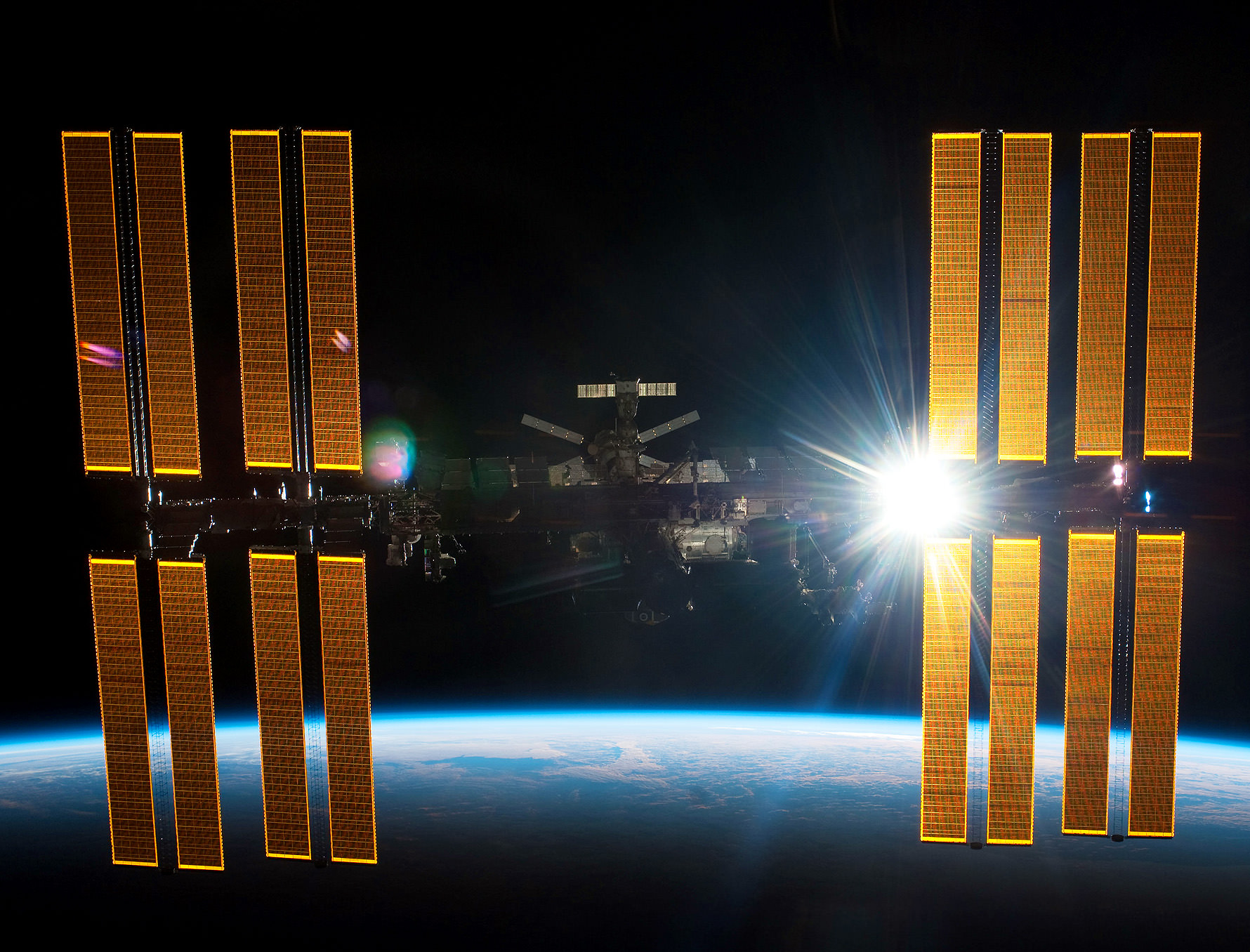
The International Space Station. Credit: NASA

UPDATE (9/27/2012, 13:00 UTC) NASA now says that with additional tracking, they have determined the two pieces of space debris do not pose a threat to the ISS, and a debris avoidance maneuver scheduled for Thursday morning was cancelled by the flight control team at Mission Control. The ATV undocking time on Friday is still being decided at the time of this posting. See additional info at NASA’s website. (End of update)

International Space Station officials are keeping a watchful eye on two different pieces of space junk that may require the ISS to steer away from potential impact threats. Debris from the Russian COSMOS satellite and a fragment of a rocket from India may come close enough to the space station to require a debris avoidance maneuver. If needed, the maneuver would be done using the ESA’s Automated Transfer Vehicle (ATV) “Edoardo Amadi.” The ATV was supposed to undock last night, but a communications glitch forced engineers to call off the departure.

Both pieces of debris are edging just inside the so-called “red zone” of miss distance to the station with a time of closest approach calculated to occur Thursday at 14:42 UTC (10:42 a.m. Eastern time.) It is not known how large the object is.

An approach of debris is considered close only when it enters an imaginary “pizza box” shaped region around the station, measuring 1.5 x 50 x 50 kilometers (about a mile deep by 30 miles across by 30 miles long) with the vehicle in the center.

NASA says the three-person Expedition 33 crew is in no danger and continues its work on scientific research and routine maintenance. The current crew includes NASA astronaut Sunita Williams, Japanese astronaut Akihiko Hoshide and Russian cosmonaut Yuri Malenchenko.

If the maneuver is required – and NASA said it could be called off any time — it would occur at 12:12 UTC (8:12 a.m. EDT) Thursday, using the engines on the ATV, which remains docked to the aft port of the Zvezda Service Module. It usually takes about 30 hours to plan for and verify the need for an avoidance maneuver.

Debris avoidance maneuvers are conducted when the probability of collision is greater than 1 in 100,000, if it will not result in significant impact to mission objectives. If it is greater than 1 in 10,000, a maneuver will be conducted unless it will result in additional risk to the crew.

Only three times during the nearly 12 years of continual human presence on the ISS has a collision threat been so great that the crew has taken shelter in the Soyuz vehicles. (Those events occured on March 12, 2009, June 28, 2011 and March 24, 2012.) During those events, the station was not impacted. While the ISS likely receives small micrometeoroid hits frequently (based on experiments left outside the ISS and visual inspections of the station’s hull) no large debris impacts have occurred that have caused depressurization or other problems on the ISS.

Tuesday’s initial attempt to undock the ATV was called off due to a communications error between the Zvezda module’s proximity communications equipment and computers on the ATV. Russian engineers told mission managers that they fully understand the nature of the error and are prepared to proceed to a second undocking attempt, which has been postponed to Friday at the earliest, due to the potential space debris threat.

Once it is undocked, the ATV will move to a safe distance away from the station for a pair of engine firings that will send the cargo ship back into the Earth’s atmosphere to burn up over the Pacific Ocean.

The ATV still has extra fuel on board, and so the decision was made that if need, that available resource would be used.

Here’s the info on NASA’s criteria for performing debris avoidance maneuvers.

Source: NASA

*this article has been updated

The Dust “Windshield Wiper” That Didn’t Go to Mars

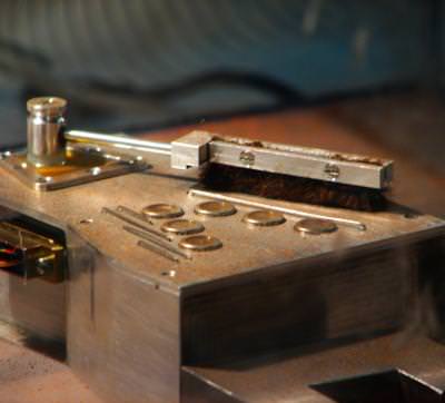
A device that works as a windshield wiper to eliminate Mars dust from the sensors on Mars spacecraft. Credit: UC3M

In the past when we’ve discussed how dust accumulates on the solar panels of the Mars Exploration Rovers, Spirit and Opportunity, the most-often posted comments on those articles usually said something like, “They should have developed a windshield-wiper-like device to get rid of the dust!” Our readers will be happy to know such a device has now been invented. A team of researchers created extremely lightweight wipers that could be used to remove dust on Mars spacecraft. In fact, the researchers from Universidad Carlos III in Madrid, Spain developed the device for the Curiosity rover, but unfortunately, it wasn’t used for the MSL mission. But it’s ready to go for future Mars landers and rovers

While Curiosity doesn’t have solar panels, (it instead uses a longer-lasting RTG for power – a Thermoelectric Generator, which is a power system that produce electricity from the natural decay of plutonium-238) it does have sensors that can be affected by the accumulation of dust, such as the meteorological station, the Rover Environmental Monitoring Station (REMS).

The UC3M team created a brush made up of Teflon fibers, designed to clean the ultraviolet sensors on REMS.

“In our laboratories, we demonstrated that it worked correctly in the extreme conditions that it would have to endure on Mars,” said Luis Enrique Moreno, a professor who was head of the project, “with temperatures ranging between zero degrees and eighty below zero Celsius, and an atmospheric pressure one hundred times lower than that of the earth.”

Because weight is an issue when launching objects to other worlds, they used a very lightweight material for the wiper actuators, made from shape memory alloys (SMA), a very light nickel and titanium alloy that allows movement when the composite is heated.

“The main advantage is that these alloys produce a material that is very strong as related to its weight, that is, a thread of less than one millimeter can lift a weight of 4 or 5 kilograms,” said Moreno. “The problem presented by these mechanisms is that, because they are based on thermal effects, they are not as efficient as motor technology, although they are much lighter, which is a very important consideration in space missions.”

This group and other research groups at UC3M are currently working on a second, more elaborate prototype based on SMA technology. It will be used to clean dust from fixed meteorological stations that would be part of the MEIGA-METNET mission, a proposed Mars lander developed by Finnish Meteorological Institute, along with groups from Russia and Spain to do atmospheric observations, but which is not yet part of an official mission yet.

Here’s a look at the proposed unique landing proposed for METNET:

“We are also using this technology to develop the exoskeletons used to aid people with mobility problems, trying to substitute motors with these materials, in order to reduce the devices’ weight and increase agility in their use,” said Moreno, adding that this new product could even be used in the future to improve the joints on the gloves used by astronauts during EVAs.

Source: Universidad Carlos III

Take a Gander at a Cosmic Gull

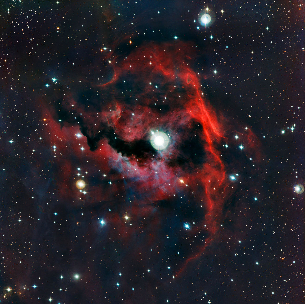
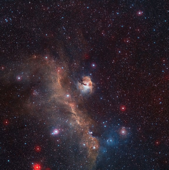
The head and “eye” of the Seagull Nebula (ESO)

This colorful new image from ESO’s La Silla Observatory highlights the heart of a shining stellar nursery located between the constellations Monoceros and Canis Major. Officially named Sharpless 2-292, the cloud of gas and dust forms the “head” of the Seagull Nebula (IC 2177) and gets its glow from the energy emitted by the young, bright star within its “eye”.


A wide-angle image of the Seagull Nebula shows the soaring birdlike shape that gives it its nickname. The cloud seen above forms the gull’s head.

A wide-field view of the Seagull Nebula from the ESO’s Digitized Sky Survey 2 (ESO/Digitized Sky Survey 2. Acknowledgement: Davide De Martin)

The wings of this gull span an impressive 100 light-years from tip to tip. A birthplace for new stars, the nebula is located within our galaxy about 3,700 light-years away.

For an idea of how far that is, if the distance between the Sun and Earth were scaled down to 1 inch (2.5 cm) and you were standing in New York City, the stars in the Seagull Nebula would be in Paris, France (considering the most direct flight route.)

Powerful radiation from young stars causes the surrounding hydrogen gas to glow with a red color. Light from the hot blue-white stars also gets scattered off tiny dust particles in the nebula to create a blue haze.

Read more on the ESO website here.

2012 marks the 50th anniversary of the founding of the European Southern Observatory (ESO). ESO is the foremost intergovernmental astronomy organization in Europe and the world’s most productive ground-based astronomical observatory. It is supported by 15 countries: Austria, Belgium, Brazil, the Czech Republic, Denmark, France, Finland, Germany, Italy, the Netherlands, Portugal, Spain, Sweden, Switzerland and the United Kingdom.

A Crescent Moon in the Martian Sky

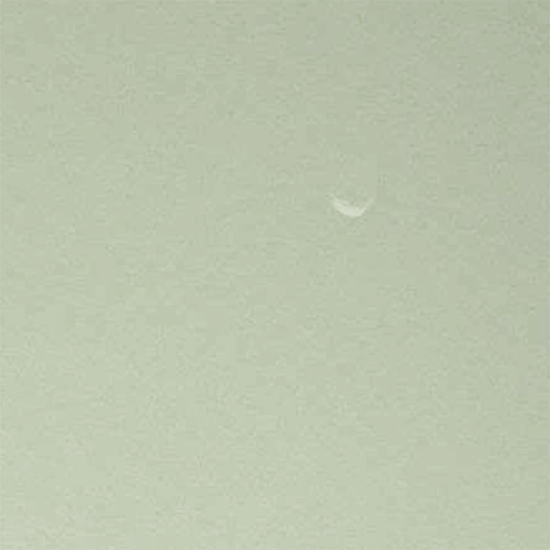
Raw image of Phobos above Mars, taken by Curiosity's Mastcam in September 2012. Credit: NASA/JPL-Caltech

Mars’ moon Phobos is captured in a daytime image by Curiosity (NASA/JPL-Caltech/MSSS)

A raw image taken on September 21 by Curiosity’s right Mastcam shows a daytime view of the Martian sky with a crescent-lit Phobos in the frame… barely visible, yes, but most certainly there. Very cool!

The image above is a crop of the original, contrast-enhanced and sharpened to bring out as much detail as possible.

The 13-km-wide Phobos has been spotted several times before by Mars rovers, most recently during a solar transit on September 13 (sol 37) but I’m not sure if it’s ever been clearly captured on camera during the day before (i.e., not passing in front of the Sun.) If not, this will be a first!

See the latest news from the Curiosity mission here.

Added 9/28: According to Universe Today publisher Fraser Cain, this is “the most dramatic space picture of the year”… whether you agree or not, hear what he had to say on this and other recent news during the September 27 episode of the Weekly Space Hangout.