Was Last Night’s Moon Blue for You?

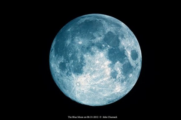
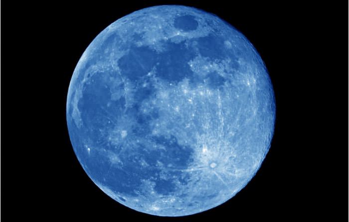
A blue-tinted Moon on August 31, 2012. Credit (and tinting): joeys-astro-gallery on Flickr

Last night’s full Moon was a “Blue Moon” — where the Moon isn’t really blue, but is the name for when there is a second full Moon in a month. Normally, we only get one full Moon a month, but every 2 1/2 years or so, the calendar lines up just right, since the time between full moons is 29.5 days while most months are 30 or 31 days. Since we had a full Moon on August 2 and a second one last night on August 31,

Of course the Moon has reason to be “blue” (if we want to anthropomorphize a little) with the recent death of the first Moonwalker, Neil Armstrong. And sometimes the Moon can actually appear to be blue if volcanic ash or forest fire ash are in the atmosphere in your location, since ash particles can scatter away all the warm colors in Moonlight, leaving a pale blue tint to the Moon.

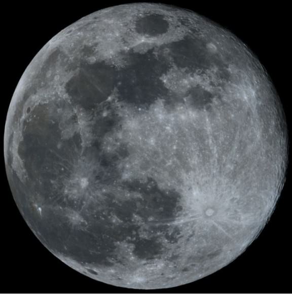
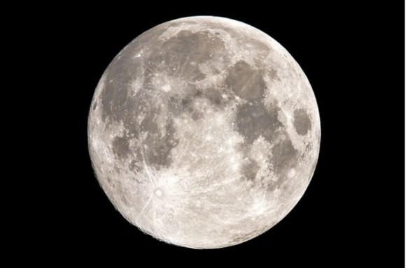
Our readers sent in their Blue Moon images from last night, and some, like the one above, used a little image editing magic to make the Moon appear blue, but most are just gorgeous images of our closest neighbor and constant companion in space.

Feast your eyes, below:

Clouds and lighting give the Moon a blue tint, too, in Paris, France. Credit: VegaStarCarpentier on Flick.

The Blue Moon on 08-31-2012, from Dayton, Ohio. Equipment: Modified Canon Rebel Xsi & 6″ F8 Cave reflector Scope, 1200mm, ISO 400 1/640 second exposure. Credit: John Chumack.

A tribute to Neil Armstrong on August 31, 2012 taken the day of his funeral. “The Moon’s own salute to its first great explorer.” Credit: Barry Q. Arnold, Alvaton, Kentucky, USA

The Moon on August 31, 2012 from Uberaba, Curitiba – Paraná, Brazil. Credit: Glauco Hass on Flickr.

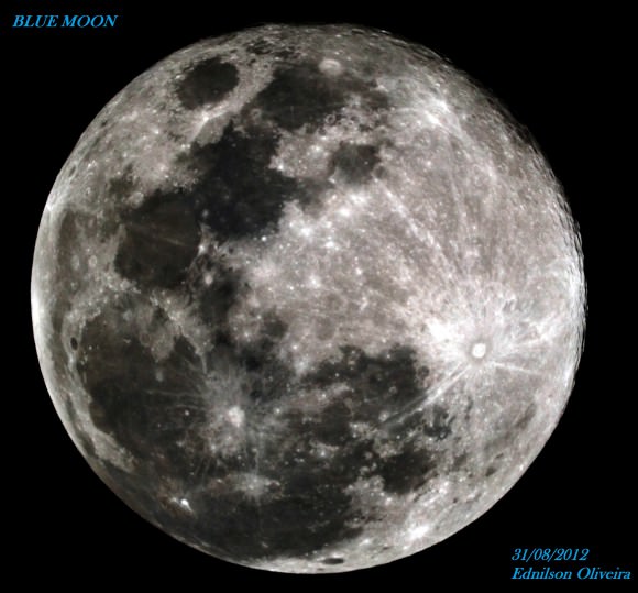
The Moon on 31/08/2012 – 23:15 TL – from São Paulo, Brazil. Equipment: Maksutov Cassegrain Vixen 110 mm – F = 1035 mm – F/9.4 – Plano Focal – Nikon D3100 – 1/200 – ISO 100. Credit: Ednilson Oliveira.

August’s Other Full – “Blue” – Moon (on the 31st) as seen from Lowell, Michigan. Credit: Kevin’s Stuff on Flickr.

And here are a few notable images from August 30, the “almost” full Moon:

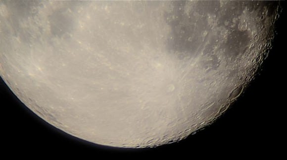
Great close-up (and not a crop) of the Moon on August 30, 2012 from Kopreinitz Koprivnicko-Krizevacka, Croatia. Credit: Eddie MacGraw on Flickr.

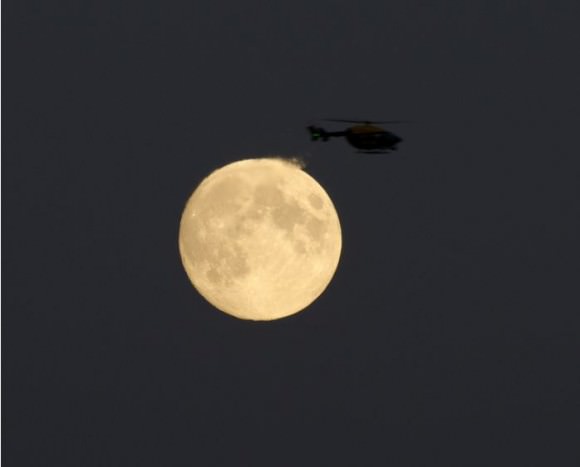
A helicopter by the Moon on August 30, 2012 as seen from London, England. The exhaust heat from the chopper distorts the light from the Moon. Credit: Sculptor Lil on Flickr.
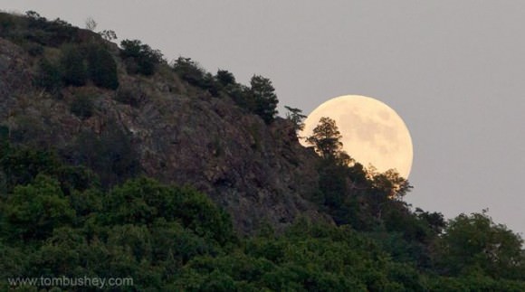

Sugar Loaf, New York – The almost full moon rises behind Sugar Loaf Mountain on August 30, 2012. Credit: Tom Bushey on Flickr.

When are the next Blue Moons?
July 31, 2015
Two in 2018 — January 31 and March 31, meaning there is no February full Moon
October 31, 2020
August 31, 2023
May 31, 2026
December 31, 2028
September 30, 2031

Want to get your astrophoto featured on Universe Today? Join our Flickr group or send us your images by email (this means you’re giving us permission to post them). Please explain what’s in the picture, when you took it, the equipment you used, etc.

On to Ceres: Dawn Spacecraft Ready to Say Farewell to Asteroid Vesta

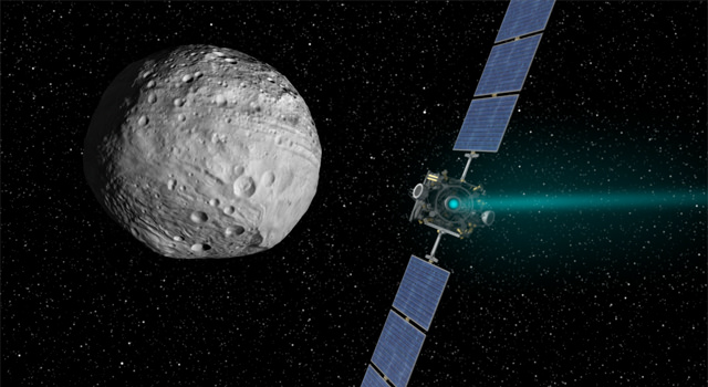
Artist's conception of the Dawn mission. Credit: NASA

The feat has never been accomplished before and next week’s departure for the Dawn spacecraft from Vesta will be monumental. Dawn is on track to become the first probe to orbit and study two distant solar system destinations. The spacecraft is scheduled to leave the giant asteroid Vesta on Sept. 4 PDT (Sept. 5 EDT) to start its two-and-a-half-year journey to the dwarf planet Ceres.

“Thrust is engaged, and we are now climbing away from Vesta atop a blue-green pillar of xenon ions,” said Marc Rayman, Dawn’s chief engineer and mission director. “We are feeling somewhat wistful about concluding a fantastically productive and exciting exploration of Vesta, but now have our sights set on dwarf planet Ceres.

In the video above, the Dawn team looks back at the highlights of the year-plus stay in orbit around Vesta. Dawn’s orbit provided close-up views of Vesta, revealing unprecedented detail about the giant asteroid. The mission revealed that Vesta completely melted in the past, forming a layered body with an iron core. The spacecraft also revealed the scarring from titanic collisions Vesta suffered in its southern hemisphere, surviving not one but two colossal impacts in the last two billion years. Without Dawn, scientists would not have known about the dramatic troughs sculpted around Vesta, which are ripples from the two south polar impacts.

“We went to Vesta to fill in the blanks of our knowledge about the early history of our solar system,” said Christopher Russell, Dawn’s principal investigator, based at the University of California Los Angeles (UCLA). “Dawn has filled in those pages, and more, revealing to us how special Vesta is as a survivor from the earliest days of the solar system. We can now say with certainty that Vesta resembles a small planet more closely than a typical asteroid.”

Dawn arrived at Vesta in July 2011 and will reach Ceres in early 2015. Dawn’s targets represent two icons of the asteroid belt that have been witness to much of our solar system’s history.

NASA’s Dawn spacecraft arrived at the giant asteroid Vesta on July 15, 2011 PDT (July 16, 2011 EDT) and is set to depart on Sept. 4, 2012 PDT (Sept. 5 EDT). Image credit: NASA/JPL-Caltech

To make its escape from Vesta, the spacecraft will spiral away as gently as it arrived, using a special, hyper-efficient system called ion propulsion. Dawn’s ion propulsion system uses electricity to ionize xenon to generate thrust. The 12-inch-wide ion thrusters provide less power than conventional engines, but can maintain thrust for months at a time.

For a second time, we wish Dawn Bon Voyage!

Source: JPL

Dramatic New Video Brings You to the Dazzling Lunar Surface

This video has been in production for a while and was not originally meant to honor Neil Armstrong, but it very well could memorialize the first human explorer to set foot on the Moon. This short video titled “From the Earth to the Moon” provides a stunning and inspirational view of the lunar surface, and “highlights vast portions of the lunar surface that have yet to be explored, and demonstrates how new images are revealing dramatic details of future landing sites suitable for both robotic and human missions,” writes lunar scientist David Kring, one of the researchers behind creating this video.

All of the footage is from actual images and data from the Lunar Reconnaissance Orbiter; there are no artist renditions or animations.

“The scenes in the video are so dramatic that you may find yourself reaching out to pick up a rock and becoming restless to walk among the lunar peaks,” writes Kring.

As stunning as the video is, it also reminds us that humans have not visited its surface since 1972, even though it is one of the best and most accessible place in the solar system to explore the fundamental principles of our origins, Kring says.

Most of the images and topographical data were obtained in particular by the NASA Lunar Reconnaissance Orbiter Camera (LROC) and Lunar Orbiter Laser Altimeter (LOLA) teams, and rendered by Kring’s team and the Goddard Space Flight Center Scientific Visualization Studio.

Here’s what you are seeing in the video:

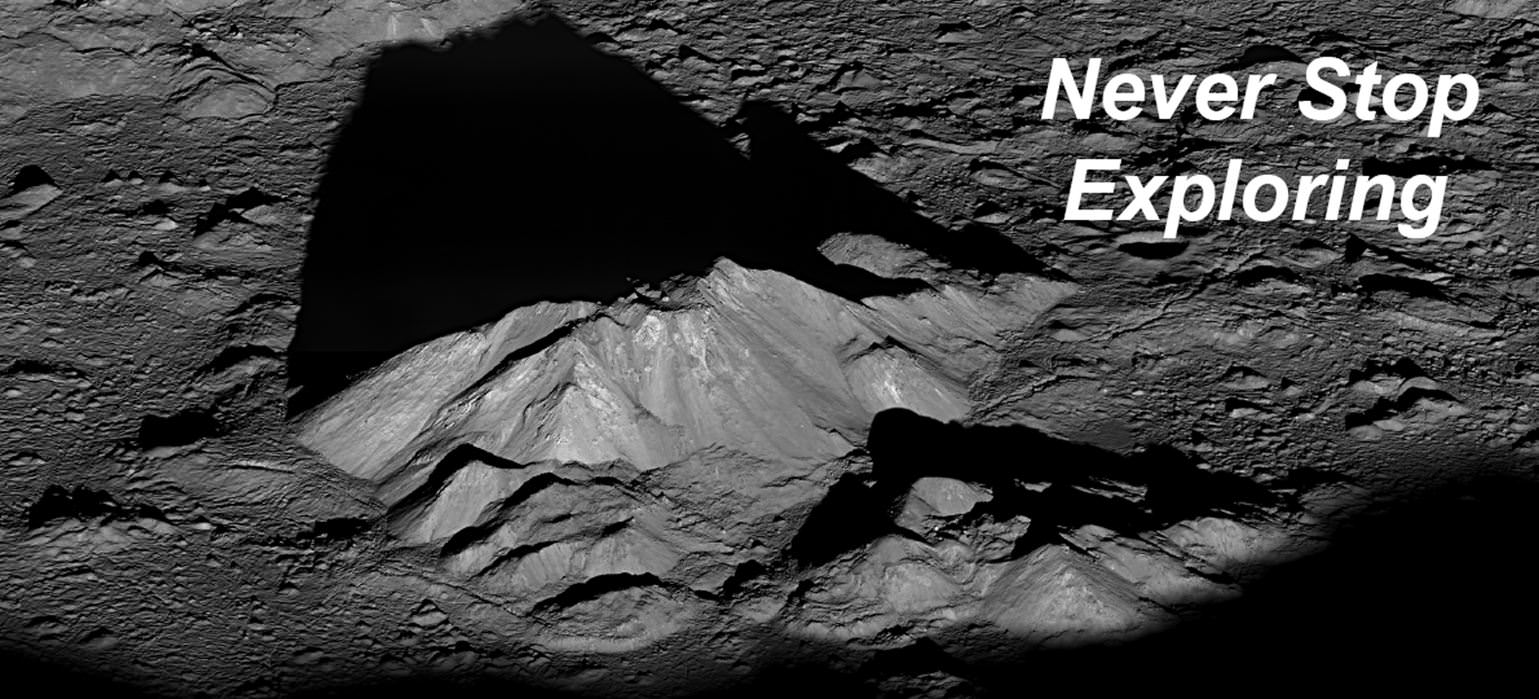
The video provides views of (i) the lunar nearside, (ii) a flyover of the heavily cratered lunar highlands, (iii) Oceanus Procellarum, (iv) a zoomed-in perspective of Aristarchus crater, (v) a flight down Vallis Schröteri, (vi) an oblique perspective of Aristarchus crater, (vii) crater walls within Aristarchus, (viii) a pull away perspective of Aristarchus crater, (ix) a zoomed-in rotating view of Tycho crater, (x) flybys of five central peak features within Tycho crater, (xi) a pull away perspective of Tycho crater with distinct panels of images to illustrate a variety of spatial resolutions and albedo, (xii) a rotating view of Tycho crater from a position slightly above its rim, (xiii) a pull away perspective of Tycho crater, (xiv) rotating perspective of Orientale basin, (xv) rotating and pull away perspective from Orientale basin, (xvi) dawn rising over Tsiolkovsky crater, and (xvii) Earth rising over the lunar surface.

Kring leads the Center for Lunar Science and Exploration, and is also well known for another discovery: he was part of the team that discovered the Chicxulub impact crater, and helped link the crater and its ejecta to the K-T boundary mass extinction of dinosaurs and over half of the plants and animals that existed on Earth 65 million years ago.

Source: NLSI

Opportunity Rover Tops 35 Kilometers of Driving

The Opportunity Mars rover looks back at the tracks left along the rim of Endeavour Crater. Credit: NASA/JPL-Caltech

Meanwhile, back in Meridiani Planum … the Opportunity rover keeps on trucking, and has now exceeded over 35 kilometers (21.75 miles) of driving on its odometer! Quite an accomplishment for the Energizer Bunny of Mars rovers, now operating for 3,057 Martian sols. As the MER team says, “Not bad for a vehicle designed for only about 1 kilometer (.6 miles) of distance and 90 sols (days) of lifetime.”

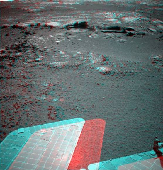
Oppy is now moving south along the inboard edge of Cape York on the rim of Endeavour Crater surveying exposed outcrop in search of phyllosilicate clay minerals that have been detected from orbit. These outcrops are quite interesting and attention-grabbing; here’s a look in color from Stuart Atkinson:

and in 3-D:

Wow!

As Stu writes in his Road to Endeavour blog, “What are those rocks made of? How did this feature form? What do the diferent colours and textures mean? These are all questions which the MER team will be hoping to answer over the next few days, I’m sure. I think we’ll see Oppy driving closer to this outcrop and studying it in a lot of detail.”

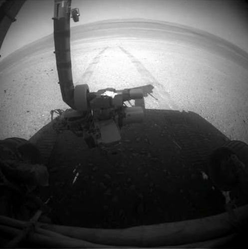
The MER team reports that on Sol 3055 (Aug. 27, 2012), the Rock Abrasion Tool (RAT) on the end of the robotic arm was imaged (top image) to re-confirm the available bit for future grinding and the Alpha Particle X-ray Spectrometer (APXS) collected a measurement of atmospheric argon.

Opportunity’s solar array energy production is good, producing about 568 watt-hours.

So, even though the Curiosity rover is grabbing the headlines, don’t forget that Opportunity is still keepin’ on, working hard on Mars.

Sources: NASA/JPL, Road to Endeavour

Researchers Send Mars Some Radar Love

A radar map of Mars’ major volcanic regions created by the Arecibo Observatory in Puerto Rico (John Harmon et al., NAIC)

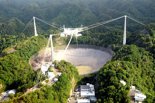
Even though we currently have several missions exploring Mars both from orbit and on the ground, there’s no reason that robots should be having all the fun; recently a team of radio astronomers aimed the enormous 305-meter dish at Puerto Rico’s Arecibo Observatory at Mars, creating radar maps of the Red Planet’s volcanic regions and capturing a surprising level of detail for Earth-based observations.

The team, led by John Harmon of the National Astronomy and Ionosphere Center, bounced radar waves off Mars from Arecibo’s incredibly-sensitive dish, targeting the volcanic Tharsis, Elysium, and Amazonis regions. Depolarized radar imagery best reveals surface textures; the rougher and less uniform a surface is, the brighter it appears to radar while smooth, flat surfaces appear dark.

What the radar maps portray are very bright — and therefore rough — areas on most of the major volcanoes, although some regions do appear dark, such as the summit of Pavonis Mons.

This likely indicates a covering by smoother, softer material, such as dust or soil. This is actually in line with previous observations of the summit of Pavonis Mons made with the HiRISE camera aboard NASA’s Mars Reconnaissance Orbiter, which showed the summit to appear curiously soft-edged and “out-of-focus”, creating a blurry optical illusion of sorts.

It’s thought that the effect is the result of the build-up of dust over millennia, carried across the planet by dust storms but remaining in place once settled because the Martian wind is just so extremely thin — especially at higher altitudes.

The team also found bright areas located away from the volcanoes, indicating rough flows elsewhere, while some smaller volcanoes appeared entirely dark — again, indicating a possible coating of smooth material like dust or solidified lava flows.

The resolution of the radar maps corresponds to the wavelength of the signals emitted from Arecibo; the 12.6 centimeter signal allows for surface resolution of Mars of about 3 km.

The team’s paper was published in the journal Icarus on July 25. Read more on the Red Planet Report here.

The iconic 305-meter radar telescope at Arecibo Observatory in Puerto Rico


Curiosity’s Laser Leaves Its Mark

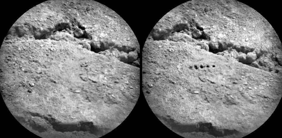
Before-and-after images from Curiosity’s ChemCam  micro-imager show holes left by its million-watt laser (NASA/JPL-Caltech/LANL/CNES/IRAP/LPGN/CNRS)

PEWPEWPEWPEWPEW! Curiosity’s head-mounted ChemCam did a little target practice on August 25, blasting millimeter-sized holes in a soil sample named “Beechey” in order to acquire spectrographic data from the resulting plasma glow. The neat line of holes is called a five-by-one raster, and was made from a distance of about 11.5 feet (3.5 meters).

Sorry Obi-Wan, but Curiosity’s blaster is neither clumsy nor random!

Mounted to Curiosity’s “head”, just above its Mastcam camera “eyes”, ChemCam combines a powerful laser with a telescope and spectrometer that can analyze the light emitted by zapped materials, thereby determining with unprecedented precision what Mars is really made of.

Read: Take a Look Through Curiosity’s ChemCam

For five billionths of a second the laser focuses a million watts of energy onto a specific point. Each of the 5 holes seen on Beechey are the result of 50 laser hits. 2 to 4 millimeters in diameter, the holes are much larger than the laser point itself, which is only .43 millimeters wide at that distance.

ChemCam’s laser allows Curiosity to zap and examine targets up to 23 feet (7 meters) away. Credit: J-L. Lacour/CEA/French Space Agency (CNES)

“ChemCam is designed to look for lighter elements such as carbon, nitrogen, and oxygen, all of which are crucial for life,” said Roger Wiens, principal investigator of the ChemCam team. “The system can provide immediate, unambiguous detection of water from frost or other sources on the surface as well as carbon – a basic building block of life as well as a possible byproduct of life. This makes the ChemCam a vital component of Curiosity’s mission.”

Visit the official ChemCam site for more information.

Changing Hues Signal Transition of Seasons at Saturn

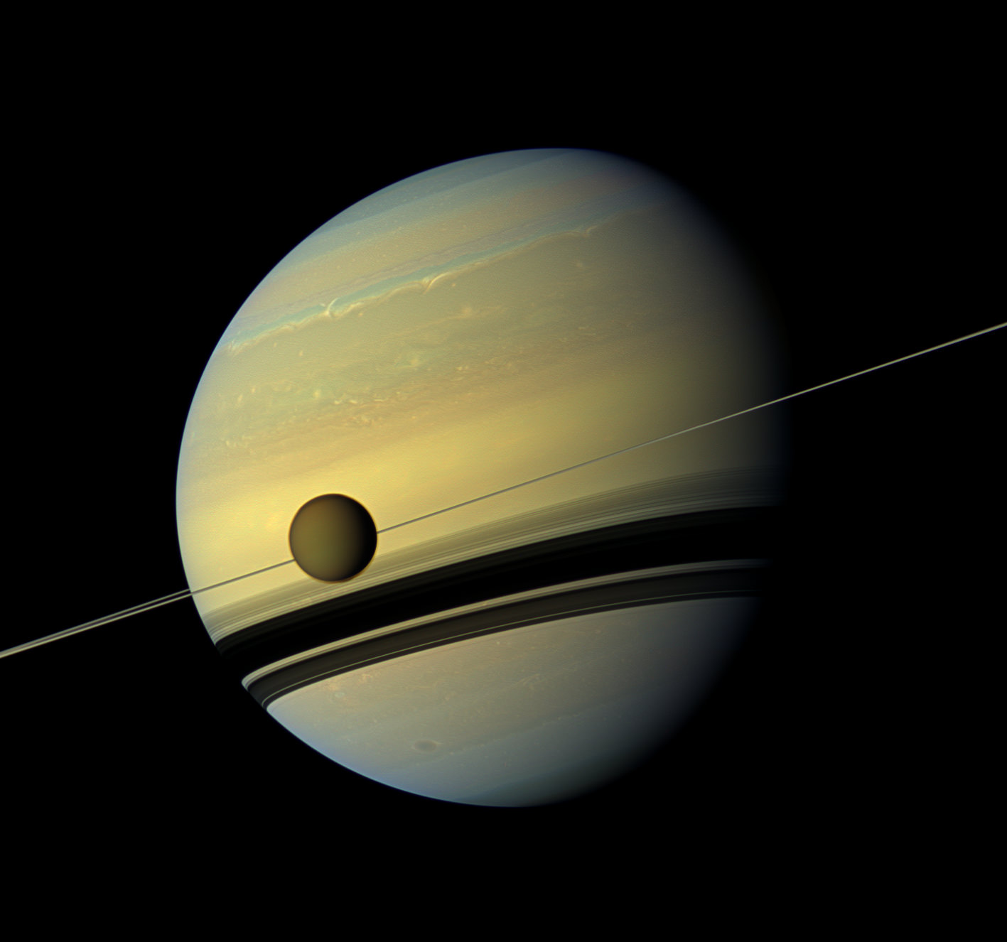
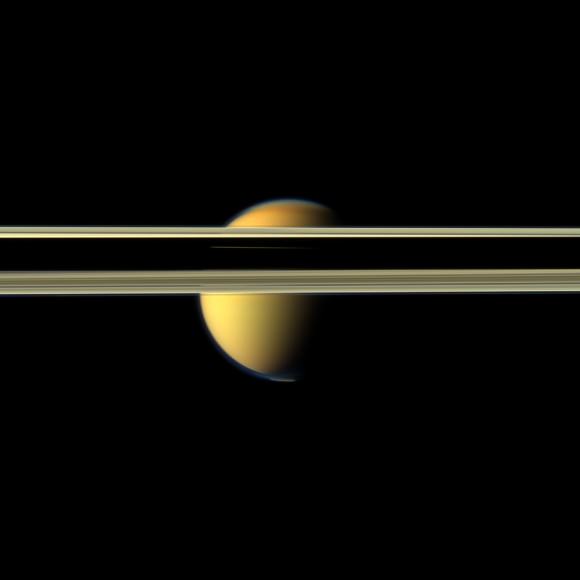
The giant moon Titan passes in front of Saturn in this natural-color, wide-angle view from NASA’s Cassini spacecraft. Image Credit: NASA/JPL-Caltech/SSI

[SPOILER ALERT: Viewing these images will force you to change your computer wallpaper]

Here on Earth, it’s almost time for the burst of fall color that signals the change of seasons in the Northern Hemisphere. Saturn’s color too is transforming subtly as the gas giant slips into a Saturnian spring and autumn as seen in this series of true-color images from NASA’s Cassini spacecraft.

Titan, a moon larger than the planet Mercury, hangs before the rings and changing colors of Saturn in the first of four spectacular images release by NASA and the Cassini Imaging Central Laboratory for Operations (CICLOPS).

“For no other reason than that they are gorgeous, the Cassini imaging team is releasing today a set of fabulous images of Saturn and Titan…in living color…for your day-dreaming enjoyment,” said Carolyn Porco, Cassini imaging team lead based at the Space Science Institute in Boulder, Colordo, in an email blast.

When Cassini arrived at Saturn eight years ago, the planet’s northern hemisphere, locked in winter, showed azure blue. Now as winter passes to the southern hemisphere, the colors are reversing as the blue fades from the north and rises in the south.

“Note that our presence at Saturn for the last eight years has made possible the sighting of subtle changes with time, and one such change is obvious here,” Porco said. “As the seasons have advanced, and spring has come to the north and autumn to the south throughout the Saturn system, the azure blue in the northern winter Saturnian hemisphere that greeted Cassini upon its arrival in 2004 is now fading; and it is now the southern hemisphere, in its approach to winter, that is taking on a bluish hue.”

Scientists believe that the increasing blue color in the south likely is due to the increasing intensity of ultraviolet light from the Sun which produces the haze. Methane in the atmosphere also absorbs light toward the red end of the spectrum while reflecting blue light. This view looks from just above the ring plane with the Sun shining from above casting broad shadows on the colorful clouds of Saturn. The image was taken on May 6, 2012 from about 778,000 kilometers (483,000 miles) from Titan.

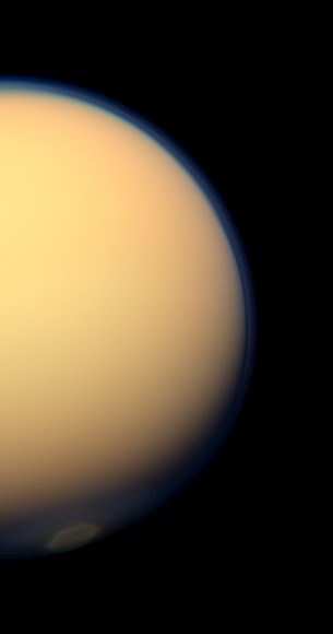
Some of the views, including this image of a vortex at Titan’s south pole are only possible because of a newly tilted, or inclined, orbit that takes Cassini high over the poles of Saturn and its moons. Scientists first noticed the detached mass of clouds over the south pole in March. The swirling mass of the vortex stands out clearly against the golden cloud deck surrounding Titan.

The recently formed south polar vortex stands out against Titan in this natural-color view from NASA’s Cassini spacecraft. Image Credit: NASA/JPL-Caltech/SSI

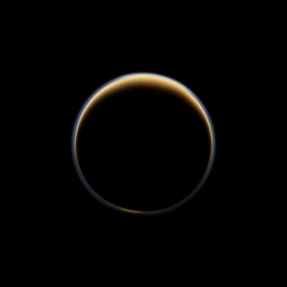
Sunlight scattering through Titan’s atmosphere forms a ring of color as NASA’s Cassini spacecraft cruises along the night side of Saturn’s largest moon. Image Credit: NASA/JPL-Caltech/SSI

A glowing hint of the polar vortex shows in this image looking toward the night-time, Saturn-facing side of Titan. Sunlight scattering through Titan’s atmosphere forms the ring of color in this image taken about 216,000 kilometers (134,000 miles) from Titan.

Saturn’s rings cut colorful Titan in half in this image from NASA’s Cassini spacecraft. Image Credit: NASA/JPL-Caltech/SSI

The rings obscure Titan in the final image of the quartet. The image is taken from just above the northern, sunlit side of the ring plane. Saturn’s shadow cast along the rings create the dark swath in the center of the image but if you look close, you can see a tiny sliver of Titan through the Cassini Division, the largest gap in Saturn’s wide rings.

“Cassini has been in orbit now for the last eight years, and despite the fact that we can’t know exactly what the next five years will show us, we can be certain that whatever it is will be wondrous,” said Porco.

About the author: John Williams is owner of TerraZoom, a Colorado-based web development shop specializing in web mapping and online image zooms. He also writes the award-winning blog, StarryCritters, an interactive site devoted to looking at images from NASA’s Great Observatories and other sources in a different way. A former contributing editor for Final Frontier, his work has appeared in the Planetary Society Blog, Air & Space Smithsonian, Astronomy, Earth, MX Developer’s Journal, The Kansas City Star and many other newspapers and magazines.

What Has the Kuiper Belt Taught Us About The Solar System?

Over 4 billion miles (6.7 billion km) from the Sun, the Kuiper Belt is a vast zone of frozen worlds we still know very little about. Image: Johns Hopkins University Applied Physics Laboratory/Southwest Research Institute (JHUAPL/SwRI)

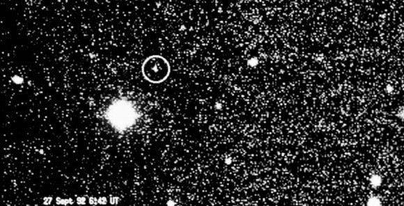
Today marks the 20th anniversary of the discovery of the first Kuiper Belt Object, 1992QB1. KBOs are distant and mostly tiny worlds made up of ice and rock that orbit the Sun at incredible distances, yet are still very much members of our Solar System. Since 1992 over 1,300 KBOs have been found, and with NASA’s New Horizons spacecraft speeding along to its July 2015 rendezvous with Pluto and Charon (which one could argue are technically the first KBOs ever found) and then onwards into the Belt, we will soon know much more about these far-flung denizens of deep space.

But how has the discovery of the Kuiper Belt — first proposed by Gerard Kuiper in 1951 (and in a fashion even earlier by Kenneth Edgeworth) — impacted our current understanding of the Solar System? New Horizons Principal Investigator Alan Stern from the Southwest Research Institute recently discussed this on his mission blog, “The PI’s Perspective.”

First, Stern lists some of the surprisingly diverse physical aspects of KBOs that have been discovered so far:

  • Some are red and some are gray;
  • The surfaces of some are covered in water ice, but others (like Pluto) have exotic volatile ices like methane and nitrogen;
  • Many have moons, though none with more known moons than Pluto;
  • Some are highly reflective (like Pluto), others have much darker surfaces;
  • Some have much lower densities than Pluto, meaning they are primarily made of ice. Pluto’s density is so high that we know its interior is about 70% rock in its interior; a few known KBOs are more dense than Pluto, and even rockier!

But although these features are fascinating in themselves, just begging for further exploration, Stern notes that there are three very important lessons that the Kuiper Belt has taught us about the Solar System:

1. Our planetary system is much larger than we had ever thought.

“In fact, we were largely unaware of the Kuiper Belt — the largest structure in our solar system — until it was discovered 20 years ago,”  Stern writes. “It’s akin to not having maps of the Earth that included the Pacific Ocean as recently as 1992!”

2. Planetary locations and orbits can change over time.

“This even creates whole flocks of migration of planets in some cases. We have firm evidence that many KBOs (including some large ones like Pluto), were born much closer to the Sun, in the region where the giant planets now orbit.”

3. Our solar system, and likely others as well, was very good at making small planets.

“Today we know of more than a dozen dwarf planets in the solar system, and those dwarfs already outnumber the number of gas giants and terrestrial planets combined. But it is estimated that the ultimate number of dwarf planets we will discover in the Kuiper Belt and beyond may well exceed 10,000. Who knew?”

And with a little jab at the whole Pluto-isn’t-a-planet topic, Stern asks: “And which class of planet is the misfit now?”

Read: Was Pluto Ever REALLY a Planet?

The discovery of the Kuiper Belt has shown us that our solar system — and very likely planetary systems across the galaxy, even the Universe — aren’t neat and tidy things that can be easily summed up with grade-school models or chalkboard diagrams. Instead they are incredibly diverse and dynamic, continually evolving and consisting of countless, varied worlds spanning enormous distances… yet still connected through the ever-present effects of gravity (not to mention the occasional-yet-unavoidable collision.)

“What an amazing set of paradigm shifts in our knowledge the Kuiper Belt has brought so far. Our quaint 1990s and earlier view of the solar system missed its largest structure!”

– Alan Stern, New Horizons Principal Investigator

Read more about the New Horizons mission here.

 The first KBO identified, 1992 QB1 (European Southern Observatory)

NASA Launches Twin Probes to Study Earth’s Radiation Belts

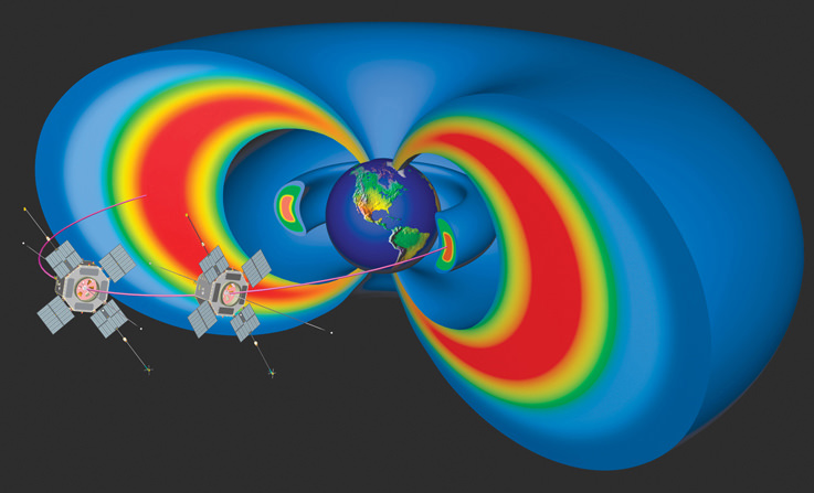
After nearly a week of weather and technical delays, NASA’s Radiation Belt Storm Probes (RBSP) launched in the early morning skies from the Cape Canaveral Air Force Station in Florida at 4:05a.m. EDT (08:05 GMT) on Thursday, August 30, 2012. This will be the first twin-spacecraft mission designed to explore our planet’s radiation belts.

“Scientists will learn in unprecedented detail how the radiation belts are populated with charged particles, what causes them to change and how these processes affect the upper reaches of the atmosphere around Earth,” said John Grunsfeld, associate administrator for NASA’s Science Mission Directorate at Headquarters in Washington. “The information collected from these probes will benefit the public by allowing us to better protect our satellites and understand how space weather affects communications and technology on Earth.”

The two satellites, launched from an Atlas V rocket from Space Launch Complex-41, each weigh just under 680 kg (1,500 pounds) and comprise the first dual-spacecraft mission specifically created to investigate this hazardous regions of near-Earth space, known as the radiation belts. These two belts, named for their discoverer, James Van Allen, encircle the planet like donuts and are filled with highly charged particles. The belts are affected by solar storms and coronal mass ejections and sometimes swell dramatically. When this occurs, they can pose dangers to communications, GPS satellites and human spaceflight

Artist’s conception of RBSP satellite. Image courtesy of Johns Hopkins University Applied Physics Laboratory

“We have never before sent such comprehensive and high-quality instruments to study high radiation regions of space,” said Barry Mauk, RBSP project scientist at the Johns Hopkins University’s Applied Physics Laboratory (APL) in Laurel, Md. “RBSP was crafted to help us learn more about, and ultimately predict, the response of the radiation belts to solar inputs.”

The hardy RBSP satellites will spend the next 2 years looping through every part of both Van Allen belts. By having two spacecraft in different regions of the belts at the same time, scientists finally will be able to gather data from within the belts themselves, learning how they change over space and time. Designers fortified RBSP with special protective plating and rugged electronics to operate and survive within this punishing region of space that other spacecraft avoid. In addition, a space weather broadcast will transmit selected data from those instruments around the clock, giving researchers a check on current conditions near Earth.

“The excitement of seeing the spacecraft in orbit and beginning to perform science measurements is like no other thrill,” said Richard Fitzgerald, RBSP project manager at APL. “The entire RBSP team, from across every organization, worked together to produce an amazing pair of spacecraft.”

The first RBSP spacecraft separated from the Atlas rocket’s Centaur booster 1 hour, 18 minutes, 52 seconds after launch. The second RBSP spacecraft followed 12 minutes, 14 seconds later.

During the next 60 days, operators will power up all flight systems and science instruments and deploy long antenna booms, two of which are more than 54 yards long. Data about the particles that swirl through the belts, and the fields and waves that transport them, will be gathered by five instrument suites designed and operated by teams at the New Jersey Institute of Technology in Newark; the University of Iowa in Iowa City; University of Minnesota in Minneapolis; and the University of New Hampshire in Durham; and the National Reconnaissance Office in Chantilly, Va. The data will be analyzed by scientists across the nation almost immediately.

Mars Trek begins for Curiosity

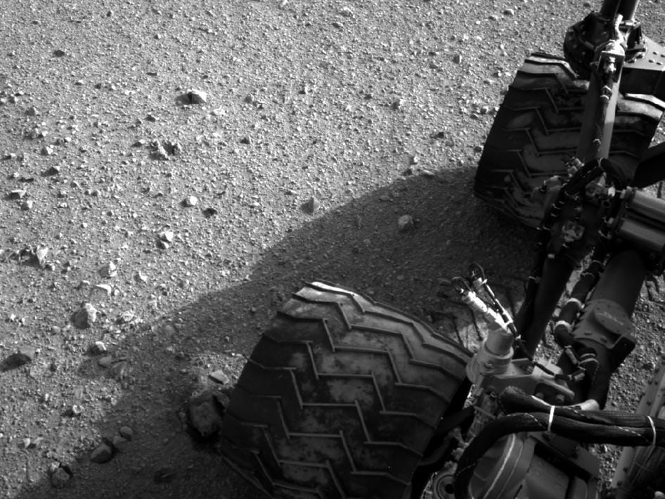
Image Caption: Martian Soil caked on Curiosity’s right middle and rear wheels after Sol 22 Drive. Credit: NASA/JPL-Caltech

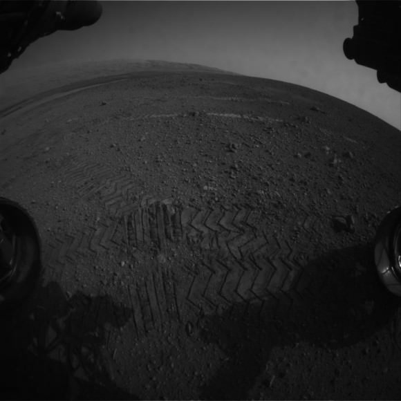
Mars Trek has begun for NASA’s Curiosity rover. The mega rover has departed from her touchdown vicinity at “Bradbury Landing” and set off on a multi-week eastwards traverse to her first science target which the team has dubbed “Glenelg”

Glenelg lies about a quarter mile (400 meters) away and the car-sized rover drove about 52 feet (16 meters) on Tuesday, Aug 28 or Sol 22 of the mission.

The science team selected Glenelg as the first target for detailed investigation because it sits at the intersection of three types of geologic terrain, affording the researchers the chance to get a much more comprehensive look at the diversity of geology inside the Gale Crater landing site.

The Sol 22 drive was the third overall for Curiosity and the farthest so far. At this new location, some 33 feet ( 10 m) from Bradbury Landing , the Mastcam color camera is collecting high resolution images to create a 3 D map of features off in the distance that will aid the rover drivers in planning a safe traverse route.

“This drive really begins our journey toward the first major driving destination, Glenelg, and it’s nice to see some Martian soil on our wheels,” said mission manager Arthur Amador of NASA’s Jet Propulsion Laboratory in Pasadena, Calif. “The drive went beautifully, just as our rover planners designed it.”

In about a week, the science team plans to deploy the 7 ft (2.1 meter) long robotic arm and test the science instruments in the turret positioned at the terminus of the arm.

“We are on our way, though Glenelg is still many weeks away,” said Curiosity Project Scientist John Grotzinger of the California Institute of Technology in Pasadena. “We plan to stop for just a day at the location we just reached, but in the next week or so we will make a longer stop.”

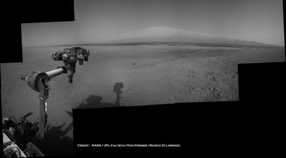
Perhaps in about a year or so, Curiosity will reach the base of Mount Sharp, her ultimate destination, and begin climbing up the side of the 3.6 mile (5.5 km) high mound in search of hydrated minerals that will shed light on the duration of Mars watery past.

The goal is to determine if Mars ever had habitats capable of supporting microbial life in the past or present during the 2 year long primary mission phase. Curiosity is equipped with a sophisticated array of 10 state of the art science instruments far beyond any prior rover.

Ken Kremer

Image Caption: Curiosity Points to her ultimate drive destination – Mount Sharp – with unstowed robotic arm on Aug. 20. This navigation camera (Navcam) mosaic was assembled from images on multiple Sols. Curiosity will search for hydrated minerals using the robotic arm and a neutron detector on the body. Image stitching and processing by Ken Kremer and Marco Di Lorenzo. Featured at APOD on 27 Aug 2012. Credit: NASA/JPL-Caltech/Ken Kremer/Marco Di Lorenzo