Neil Armstrong Recovering from Heart Surgery

Neil Armstrong

Iconic Apollo astronaut and Moon walker Neil Armstrong is recovering from heart surgery, but is doing well. Reports say that Armstrong, 82, underwent quadruple bypass heart surgery Tuesday after failing a stress test. His wife, Carol, says “He’s doing great.”

“NASA wishes Neil Armstrong the very best for a quick recovery from surgery,” said NASA Administrator Charles Bolden in a statement. “Neil’s pioneering spirit will surely serve him well in this challenging time and the entire NASA Family is holding the Armstrong family in our thoughts and prayers. I know countless well-wishers around the world join us in sending get well wishes to this true American hero.”


Armstrong’s spirits are reportedly high, and even though surgeons had to bypass four blockages in his coronary arteries, the doctors expect no complications with his recovery.

The first man to walk on the Moon celebrated his 82nd birthday on August 5.

Armstrong made history on July 20, 1969 when he walked on the Moon. Previously he flew on Gemini 8 in 1966 with Dave Scott, and he also flew to the edge of space during his time with NASA’s X-15 program.

Armstrong kept a low public after the Apollo 11 mission, but has recently testified at congressional hearings on the future of NASA human spaceflight. He was awarded the Congressional Gold Medal last November.

Source: Cosmic Log

See the “Martian Triangle” in the Sky Tonight!

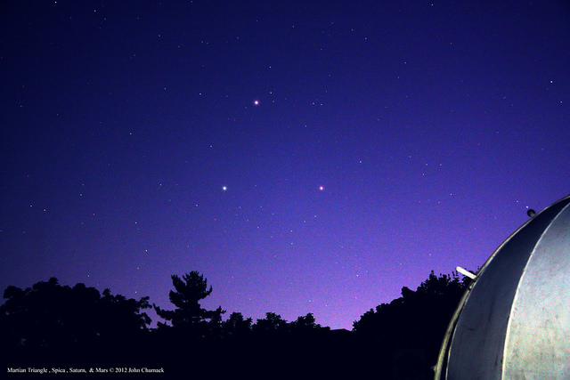
If — like me — you’ve been focusing on all the great images and news coming from the Mars Science Laboratory, perhaps you’ve missed the great view of the “Martian Triangle,” now visible in the night sky at twilight! Astrophotographer John Chumack hasn’t missed the view. This image is from August 6, 2012 from his observatory in Yellow Springs, Ohio.

The Martian Triangle show starts at twilight, and you can find it by looking low in the southwestern sky. The star at the top is actually the planet Saturn, the star on the bottom left is Spica, and the bright spot on bottom right is the planet Mars. And remember, somewhere in your field of view, there’s a few spacecraft on and around Mars and another orbiting Saturn.

John took this image with a modified Canon Rebel Xsi DSLR and a 47mm Lens, at F5.6, ISO 800, 10 second exposure. See more of John’s wonderful astrophotos at his Flickr page or at his website, Galactic Images.

Want to get your astrophoto featured on Universe Today? Join our Flickr group or send us your images by email (this means you’re giving us permission to post them). Please explain what’s in the picture, when you took it, the equipment you used, etc.

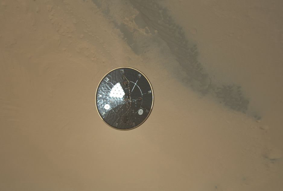
Ironic Science Reality: Flying Saucers on Mars from Earth

“Irony: The first real flying saucer is from Earth. And it landed on Mars.”

That’s a quote we saw via UT writer Ray Sanders, from a great graphic making its way around the internet. But amazingly, it’s true. Above is a high resolution image from the Mars Science Laboratory’s MARDI instrument showing the heat shield falling away from the spacecraft and heading towards Mars, looking like a classic flying saucer UFO. This image shows the 4.5-meter (15-foot) diameter heat shield when it was about 16 meters (50 feet) from the spacecraft.

The image shows so much detail that “You can actually see the stitching in the thermal blanket and some wiring” said Mike Malin during a press conference at JPL today.

Here’s a new, higher resolution video of the heat shield’s descent from what was previously available:

This image shows the inside surface of the heat shield, with its protective multi-layered insulation. The bright patches are calibration targets for MARDI. Also visible is the Mars Science Laboratory Entry, Descent, and Landing Instrument (MEDLI) hardware attached to the inside surface.

Malin said that at this range, the image has a spatial scale of 0.4 inches (1 cm) per pixel. It is the 36th MARDI image, obtained about three seconds after heat shield separation and about two and one-half minutes before touchdown.

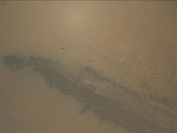
Emily Lakdawalla has another image that she “tweaked” that shows another look at the heat shield when it is farther away from MSL:


Caption: MSL’s heat shield falling towards Mars. Credit: NASA/JPL/MSSS/Emily Lakdawalla

“It is still mind-blowing to think that this snapshot was taken by a spacecraft flying in the air above a different planet,” Emily wrote on the Planetary Blog.

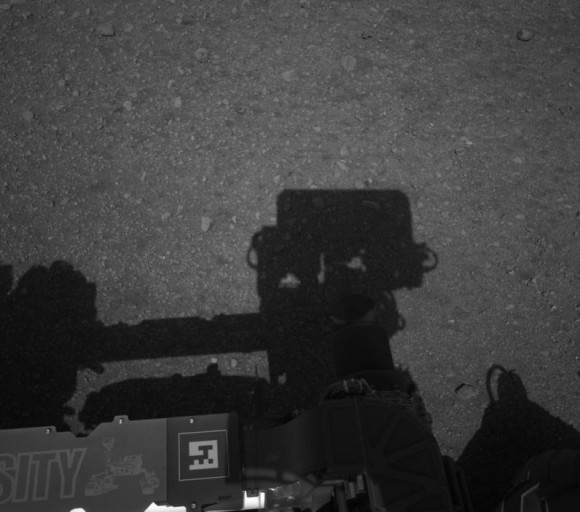
In other MSL news, Curiosity’s mast is deployed, evidenced by this shadow self-portrait:

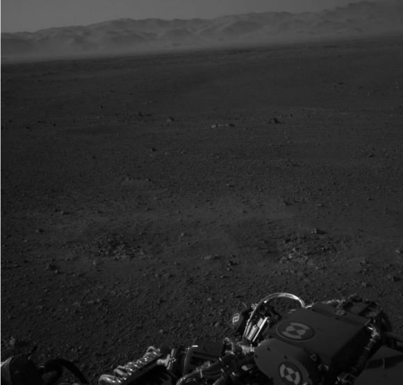
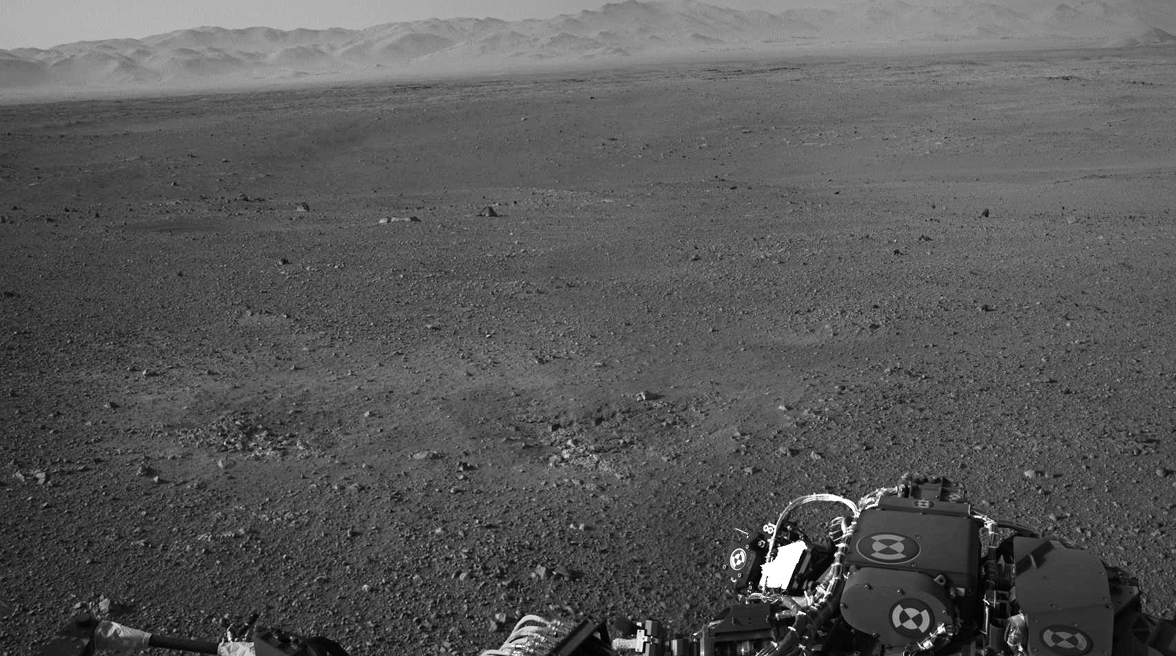
And also from the images from the Navigation Cameras on the mast:

At the press conference, Curiosity’s Chief Scientist John Grotzinger said the view reminded him of the Mojave Desert, and remarked on the striking familiarity of an almost “Earth-like” plain with the crater rim in the distance. There also appears to be a little haze in the air that Grotzinger likened to “LA smog.”

Jason Major also posted a panoramic view of Curiosity’s surroundings by combining a couple of shots from the Navigation cameras.

And here’s that great graphic by Ken Watson:

Here’s where you can find more of the latest images from MSL.

A Panorama of Curiosity’s Surroundings

Taken this morning (mission Sol 2) with the rover’s left Navcam, here’s a high-res panorama of Curiosity’s view at its landing site within Gale crater. The wide-angle view was assembled from two separate raw images, so while the mountainous rim of the crater is lined up horizontally there’s some distortion in alignment of objects closer to the rover due to the angle of the Navcam lens. Still, it’s a very cool view of Curiosity’s surroundings!

See the latest images from the MSL mission here, and check out 3D anaglyph images from Curiosity here.

Image: NASA/JPL-Caltech. Edited by J. Major.

(Image updated to link to full-size version.)

Mount Sharp on Mars: 1st 2-D and 3-D Views of Curiosity’s Ultimate Mountain Goal

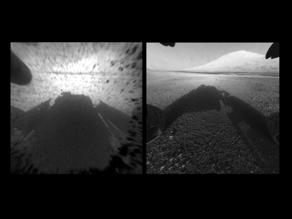
Image Caption: Clear View on Mars – This image comparison shows a view through a Hazard-Avoidance camera on NASA’s Curiosity rover before and after the clear dust cover was removed. Both images were taken by a camera at the front of the rover. Mount Sharp, the mission’s ultimate destination, looms ahead. See the first 3 D and 2 D full res images with no dust cover, below. Image credit: NASA/JPL-Caltech

Curiosity, NASA’s new car sized rover on Mars has sent back her first breathtaking views of Mount Sharp, the huge nearby mountain that enticed scientists to set Gale Crater as her touchdown goal.

And already within the first 2 Sols, or martian days, the rover has beamed back magnificent 2D and 3 D vistas of the landscape surrounding her.

The unprecedented rocket powered “Sky Crane” descent maneuver that lowered Curiosity by cables upon the Red Planet’s surface rover with pinpoint accuracy, set her down in a position inside Gale Crater that fortuitously pointed her front Hazard Avoidance (Hazcam) cameras towards a stupendous panoramic view of Mount Sharp.

The terrain is strewn with small pebbles that may stem from a nearby alluvial fan through which liquid water flowed long ago, scientist think.

The top image set shows the spectacular side by side views of Mount Sharp before and after the protective dust covers were popped off.

Mount Sharp is taller than Mount Ranier, the tallest mountain in the US in the lower 48 states. It’s about 3.5 miles (5.5 km) high.

Curiosity is roughly 6 km distant from Mount Sharp, as the martian crow flies.

The image below is the first full resolution Hazcam version of Mount Sharp.

Curiosity’s Early Views of Mars. This full-resolution image shows one of the first views from NASA’s Curiosity rover, which landed on Mars the evening of Aug. 5 PDT (early morning hours Aug. 6 EDT). It was taken through a “fisheye” wide-angle lens on one of the rover’s front Hazard-Avoidance cameras. These engineering cameras are located at the rover’s base. Image credit: NASA/JPL-Caltech

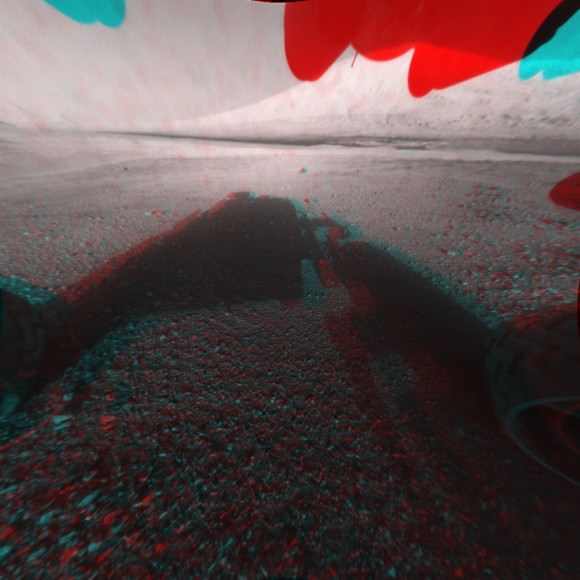
Here’s the first 3D version of Mount Sharp assembled from both front cameras.

Image Caption: 3-D View from the Front of Curiosity. This image is a 3-D view in front of NASA’s Curiosity rover, which landed on Mars on Aug. 5 PDT (Aug. 6 EDT). The anaglyph was made from a stereo pair of Hazard-Avoidance Cameras on the front of the rover. Mount Sharp, a peak that is about 5.5 kilometers (3.4 miles) high, is visible rising above the terrain, though in one “eye” a box on the rover holding the drill bits obscures the view. This image was captured by Hazard-Avoidance cameras on the front of the rover at full resolution shortly after the rover landed. It has been linearized to remove the distorted appearance that results from its fisheye lens. Credit: NASA/JPL-Caltech

Ken Kremer

A Glimpse of Old Cape Kennedy

I’m a child of the shuttle era, but I grew up reading the tales of Mercury, Gemini and Apollo. That heady time in the 1960s was so foreign to a teenager growing up in the age of personal computers and Internet access: people glued to television sets watching space shots. Newspapers carrying pages upon pages of space content, rather than small mentions.

My favourite book symbolizing what this era was like – at least, from the starry-eyed optimist’s point of view – was This Is Cape Canaveral, a children’s book first published in 1963 and subsequently republished under the names This Is Cape Kennedy and This Is The Way To The Moon.

Writer and illustrator Miroslav Sasek portrays the crowds, era and missile-obsessed businesses with a taste of humour and a keen eye for detail. It’s attention that his audience demanded: “Detail is very important to children,” he said in a 1969 interview. “If I paint 53 windows instead of 54 in a building, a deluge of letters pours in upon me!”

I cracked open my dog-eared copy the other day to play a mini where-are-they-now game with some of the mentioned landmarks and people:

The times change in 50 years, but the good thing is there is no lack of chronicles to tell us what it was like at the time.

Lead image caption: In This Is Cape Canaveral, Miroslav Sasek wasn’t afraid to poke fun at the excitement of the early days of the space program.

Elizabeth Howell (M.Sc. Space Studies ’12) is a contributing editor for SpaceRef and award-winning space freelance journalist living in Ottawa, Canada. Her work has appeared in publications such as SPACE.com, Air & Space Smithsonian, Physics Today, the Globe and Mail, the Canadian Broadcasting Corp.,  CTV and the Ottawa Business Journal.

A Brand New “Blue Marble” View of Earth

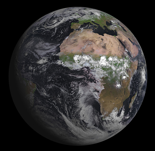
Europe’s latest geostationary weather satellite has captured its first image of Earth, and it’s a beauty! The Spinning Enhanced Visible and Infrared Imager (SEVIRI) instrument on the Meteosat Second Generation-3 (MSG-3) satellite was launched on July 5, 2012, and has since been in the commission stage. ESA says it will still be a couple of months before it is ready for operations.

SEVIRI provides enhanced weather coverage for Europe and Africa in order to improve very short range forecasts, in particular for rapidly developing thunder storms or fog. It scans Earth’s surface and atmosphere every 15 minutes in 12 different wavelengths, to track cloud development. SEVIRI can pick out features as small as a kilometer across in the visible bands, and three kilometers in the infrared.

MSG-3 is the third in a series of four satellites. In addition to its weather-watching mission and collection of climate records, MSG-3 has two secondary payloads.

The Geostationary Earth Radiation Budget sensor measures both the amount of solar energy that is reflected back into space and the infrared energy radiated by the Earth system, to better understand climate processes.

A Search & Rescue transponder will turn the satellite into a relay for distress signals from emergency beacons.

You can see a high resolution version of the image from ESA here.

Rover, Sky Crane, Heat Shield and Parachute Located from Orbit by HiRISE

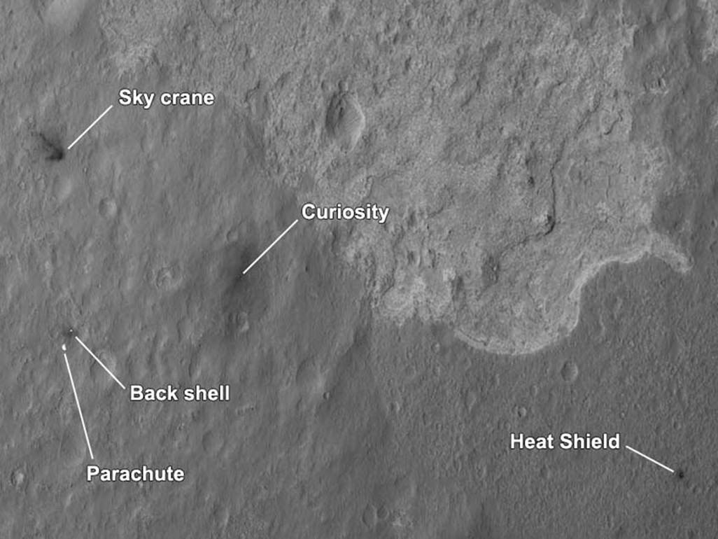
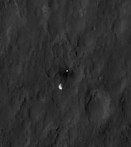
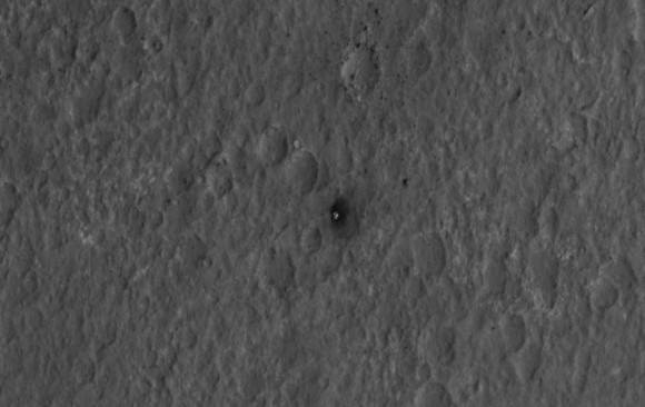
More awesomeness from HiRISE! A new orbital image shows the Curiosity rover sitting on Mars’ surface, along with all the accoutrements needed to get it there safely: the heat shield, backshell, parachute, and the Sky Crane. The High-Resolution Imaging Science Experiment (HiRISE) camera captured this image just 24 hours after MSL’s landing.

“This is like the crime scene photo here,” HiRISE team member Sarah Milkovich said during a press conference on Aug. 7.

Of course, yesterday the HiRISE team revealed they had captured MSL in the act of landing.

In re-inacting the scene of the crime, er… incredible landing, the heat shield, lower right, was the first piece to hit the ground, followed by the back shell attached to the parachute, then the rover itself touched down. Then, and finally, after cables were cut, the sky crane flew away to the northwest and crashed.
The heat shield is about 1,220 meters (4,000 feet) from Curiosity, the backshell and parachute are about 610 meters (2,000 feet) away from the rover, and the Sky Crane is about 620 meters (2,100 feet) away.

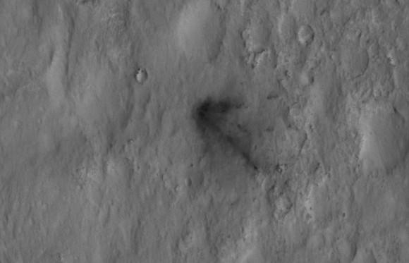
The relatively dark areas in all four spots are from disturbances of the bright surface dust, revealing darker soil underneath. If you look closely, even visible are the black streaks where the sky crane thrusters kicked up dust. Malkovich said scientists have looked at the streak patterns to verify Curiosity’s orientation — which confirms the information from the rover’s first pictures from surface.


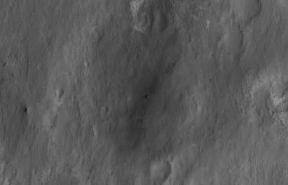
Close-up of Curiosity sitting on Mars’ surface. Credit: NASA/JPL/University of Arizona

The darkened radial jets from the sky crane are downrange from the point of oblique impact, much like the oblique impacts of asteroids. In fact, NASA said, they make an arrow pointing to Curiosity.


Close-up of the Sky Crane. Credit: NASA/JPL/University of Arizona

HiRISE’s image of MSL’s landing site shows the rover and the hardware doing their jobs exactly as they were designed to do.

The image was acquired from a special 41-degree roll of MRO, larger than the normal 30-degree limit. It rolled towards the west and towards the Sun, which increases visible scattering by atmospheric dust as well as the amount of atmosphere the orbiter has to look through, thereby reducing the contrast of surface features. Malkovich said that future images taken from a higher angle will show the hardware in greater detail.


Close-up of the parachute and backshell. Credit: NASA/JPL/University of Arizona


Close-up of the heat shield. Credit: NASA/JPL/University of Arizona

See larger versions and additional info at the HiRISE website.

Winds of Change at the Edge of the Solar System

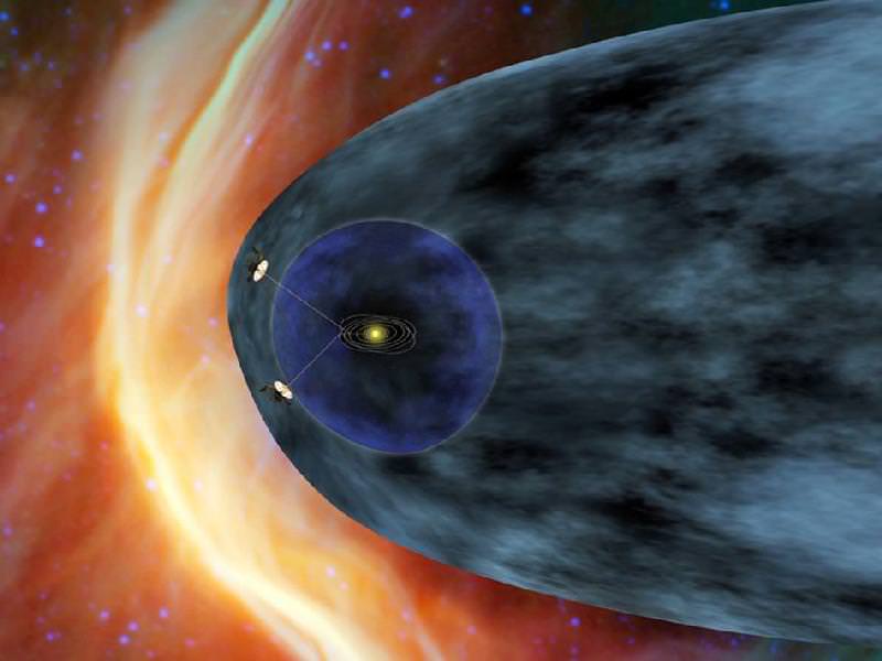
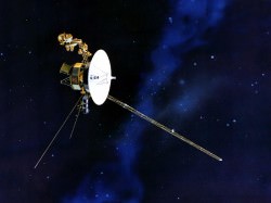
As the venerable Voyager 1 spacecraft hurtles ever outward, breaking through the very borders of our solar system at staggering speeds upwards of 35,000 mph, it’s sending back information about the curious region of space where the Sun’s outward flow of energetic particles meets the more intense cosmic radiation beyond — a boundary called the heliosheath.

Voyager 1 has been traveling through this region for the past seven years, all the while its instruments registering gradually increasing levels of cosmic ray particles. But recently the levels have been jumping up and down, indicating something new is going on… perhaps Voyager 1 is finally busting through the breakers of our Sun’s cosmic bay into the open ocean of interstellar space?

Data sent from Voyager 1 — a trip that currently takes the information nearly 17 hours to make — have shown steadily increasing levels of cosmic radiation as the spacecraft moves farther from the Sun. But on July 28, the levels of high-energy cosmic particles detected by Voyager jumped by 5 percent, with levels of lower-energy radiation from the Sun dropping by nearly half later the same day. Within three days both levels had returned to their previous states.
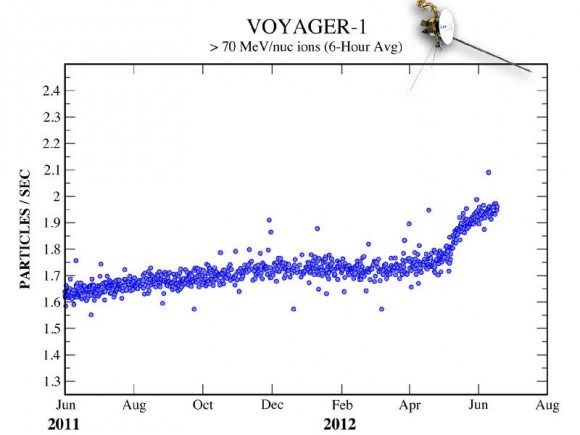
The last time such a jump in levels occurred was in May — and that spike took a week to happen.

“The increase and the decrease are sharper than we’ve seen before, but that’s also what we said about the May data,” said Edward Stone, the Voyager project scientist based at the California Institute of Technology. “The data are changing in ways that we didn’t expect, but Voyager has always surprised us with new discoveries.”

The graph below shows the jump in cosmic particles detected starting May 2012.

Over 11 billion miles (18 billion km) from home, Voyager 1 has been cruising through space since its launch on September 5, 1977. Its twin, Voyager 2, was launched two weeks earlier and is currently 9.3 billion miles (15 billion km) away. Both spacecraft are healthy and continue to communicate with Earth, and will both eventually break through the borders of our solar system and enter true interstellar space. If they are still operational when that happens — and there’s no reason that they shouldn’t be — we will finally get a sense of what conditions are like “out there”.

Although Voyager 1 is registering intriguing fluctuations in radiation from both inside and outside the Solar System, it’s not quite there yet.

“Our two veteran Voyager spacecraft are hale and healthy as they near the 35th anniversary of their launch,” said Suzanne Dodd, Voyager project manager based at JPL in Pasadena. “We know they will cross into interstellar space. It’s just a question of when.”

Read more about Voyager’s ongoing breakout here.

“We are certainly in a new region at the edge of the solar system where things are changing rapidly. But we are not yet able to say that Voyager 1 has entered interstellar space.”

–  Edward Stone, Voyager project scientist, Caltech

Images: NASA/JPL-Caltech

Curiosity Beams 1st Color Image from Mars

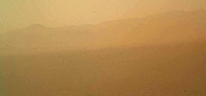
Image caption: This murky view from Curiosity shows the martian landscape looking north to the rim from inside the Gale Crater landing site and is her first color image beamed back to Earth. It’s murky because the dust cover is still attached. See full MAHLI image below. Also see below full res Hazcam image of crater rim. Credit: NASA/JPL-Caltech/Malin Space Science Systems

NASA’s Curiosity Mars rover has beamed back her first color view since touchdown, showing a view of the alien landscape pointing northward towards the eroded rim of Gale crater.

The picture was snapped by the rovers Mars Hand Lens Imager (MAHLI) camera on the afternoon of the first day after the pinpoint landing – signified as Sol 1 on Aug. 6, 2012.

The MAHLI image looks murky because the protective dust cover is still in place and is coated with a film of martian dust sprayed up by the descent retrorockets during the terminal phase of the hair-raising landing on Aug 5/6.

The camera’s dust cover is intentionally transparent so that initial images can still be snapped through the cover before it’s popped off in about a week.

MAHLI is located on the turret at the end of the rover’s 8 foot long robot arm which has been stowed in place on the front left side of Curiosity since long before the Nov. 26 liftoff from Cape Canaveral, Florida.

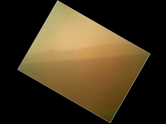
In the stowed position, MAHLI is rotated about 30 degrees as seen in the image below. The top image has been rotated to correct for the tilt and shows the sky “up” as Curiosity is actually sitting on the Martian surface.


Image caption: This full frame view from Curiosity shows the martian landscape looking north to the rim from inside the Gale Crater landing site and is her first color image beamed back to Earth. It’s murky because the dust cover is still attached. The image is from the MAHLI camera on the robot arm and currently in the stowed position. It has been rotated 30 degress. Credit: NASA/JPL-Caltech/Malin Space Science Systems

During her 2 year prime mission, Curiosity’s goal is to determine if Mars was ever capable of supporting microbial life, past or present and to search for the signs of life in the form of organic molecules with a payload of 10 science instruments weighing 15 times more than any prior roving vehicle.

Curiosity is the 3rd generation of NASA rover’s delivered to the Red Planet

Ken Kremer

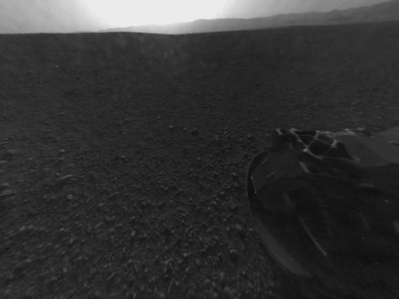
Image Caption: Looking Back at the Crater Rim – This is the full-resolution version of one of the first images taken by a rear Hazard-Avoidance camera on NASA’s Curiosity rover, which landed on Mars the evening of Aug. 5 PDT (morning of Aug. 6 EDT). The image was originally taken through the “fisheye” wide-angle lens, but has been “linearized” so that the horizon looks flat rather than curved. The image has also been cropped. A Hazard-avoidance camera on the rear-left side of Curiosity obtained this image. Part of the rim of Gale Crater, which is a feature the size of Connecticut and Rhode Island combined, stretches from the top middle to the top right of the image. One of the rover’s 20 inch wide wheels can be seen at bottom right. Image credit: NASA/JPL-Caltech