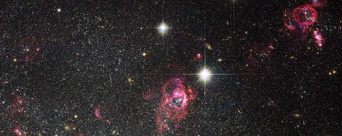
[/caption]
What is World Space Week?
Founded in 1981, World Space Week Association is one of the world’s oldest space education organizations. As a partner of the United Nations in the global coordination of World Space Week, WSWA recruits and supports a worldwide network of coordinators and participants. WSWA is a non-government, nonprofit, international organization, based in the United States.
World Space Week is an international celebration of science and technology, and how each benefits the human condition. In 1999 The United Nations General Assembly declared that World Space Week will be held each year from October 4-10, commemorating two notable space-related events:
The annual kick-off date of October 4th corresponds with the October 4th 1957 launch of the first human-made Earth satellite, Sputnik 1.
The end date of October 10th corresponds with the October 10th 1967 signing of the Treaty on Principles Governing the Activites of States in the Exploration and Peaceful Uses of Outer Space, including the Moon and Other Celestial Bodies.
Here’s some information from their F.A.Q on how you can participate in World Space Week, either by volunteering or by attending an event.
Where and how is World Space Week celebrated?
World Space Week is open to everyone – government agencies, industry, non-profit organizations, teachers, or even individuals can organize events to celebrate space. WSW is coordinated by the United Nations with the support of WSWA and local coordinators in many countries.
What are the benefits of World Space Week?
WSW educates people around the world about the benefits they receive from space and encourages greater use of space for sustainable economic development. WSW also demonstrates public support for space programs and excites children about learning and their future.
Some of the other benefits include promoting institutions around the world that are involved in space and fostering a sense of international cooperation in space outreach and education.
How can schools participate?
This event is ideal for teachers to promote student interest in science and math. To encourage participation, World Space Week Association gives various educational awards each year.
What can I do for World Space Week?
If you’d like to become involved with WSW you can:
If you hold an event, be sure to add your event to the World Space Week calendar and tell the media and your regional WSW coordinator about your planned event. You can also order World Space Week posters and display them in your community.
If you’d like to find a World Space Week event in your area, visit:http://www.worldspaceweek.org/calendar_2011.php
You can learn more about World Space Week at: http://www.worldspaceweek.org
Source: World Space Week Association
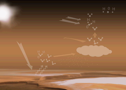 The animated sequence to the left shows the water cycle of the Martian atmosphere in action: