Discoverys Last Launch and Landing Captured in Exquisite Amateur Videos

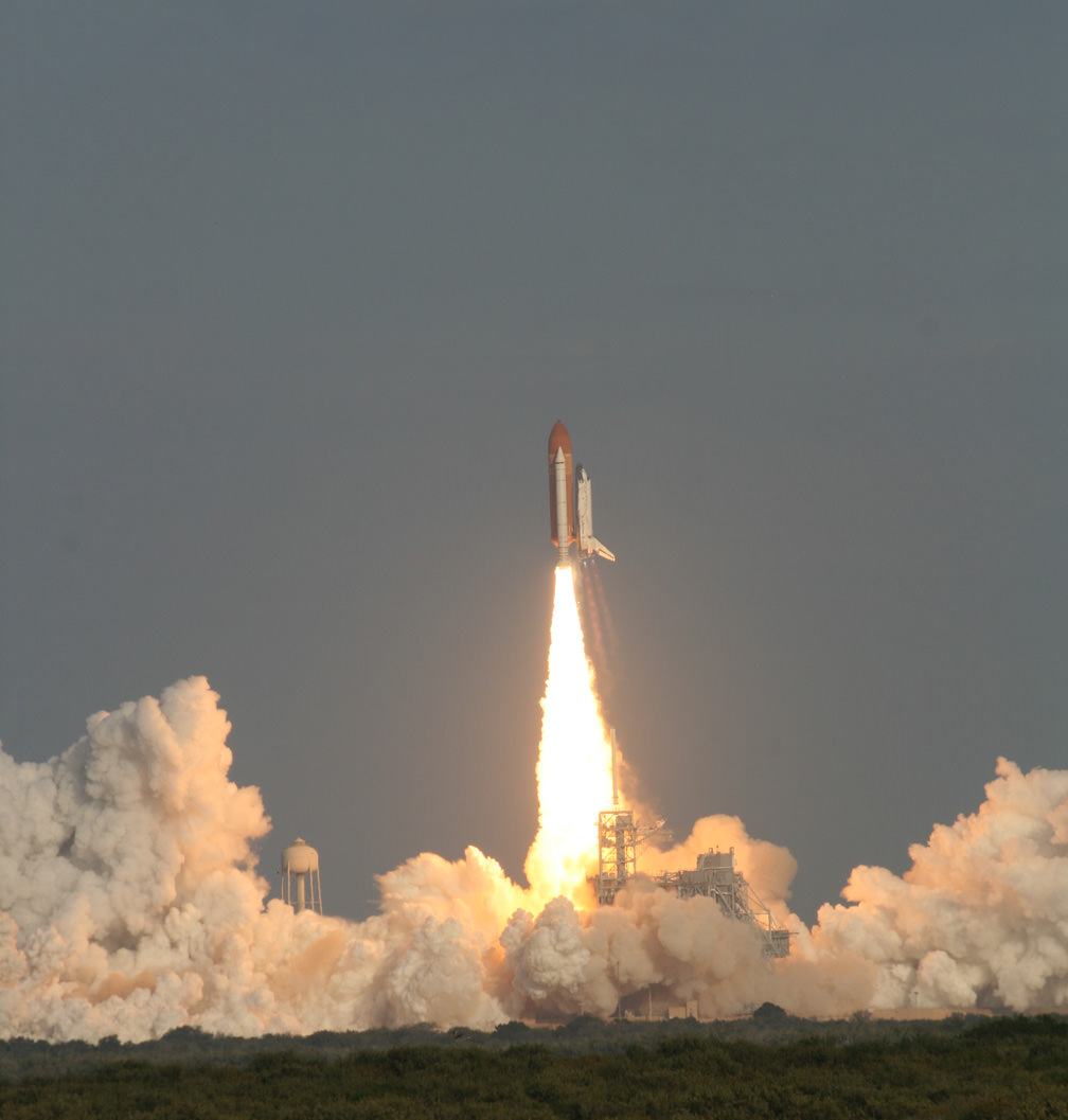
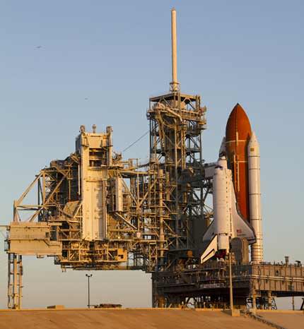
Launch of Space Shuttle Discovery on Feb. 24 at 4:53 p.m. from launch pad 39 A at the Kennedy Space Center. Credit: Ken Kremer


Watch the HD version. More photos below

Imagine ….. “You Are There ! ”

… in the middle of the whooping, cheering crowd at the Kennedy Space Center (KSC) for the historic final launch of Space Shuttle Discovery on the STS-133 mission to the International Space Station.

That’s the feeling you’ll get from this exquisite and exciting piece from amateur videographer Anton Janssen from the Netherlands. Anton has captured the sights and sounds of excitement of the giant crowd in the thick of the action in this amazingly sharp video of Discovery’s last blast to space.

Anton’s vantage point from the NASA Causeway enabled him to film the liftoff with a birds eye view of the entire orbiter to the base of the launch pad – not blocked by the launch gantry at all. And to top that off, the video shows panoramic reaction shots of the large and exuberant crowd. What’s more is you can hear the cheering multitudes at multiple milestones as Discovery ascends with a deafening roar and spewing intense scorching flames out her rear like a gigantic blowtorch burning an indelible hole in the sky.

I happened to meet Anton at Port Canaveral a few days after the launch as Discovery’s powerful Solid Rocket Boosters (SRB’s) were being towed along the canal following their retrieval from the Atlantic Ocean.

[/caption]

Anton told me he bought the camera new and especially for the STS-133 launch after he purchased one of the very hard to get VIP Tickets from the KSC Visitor Complex. He arrived at the viewing site several hours early, along with tens of thousands of other onlookers along the Florida Space Coast beaches and roadways.

“The NASA Causeway was a great viewing site because you could see the shuttle right from the start,” Anton explained.

Check out this amazing close up video view of the final moments of Discovery’s final landing and the finale of her space career as record by Matt Travis, of Spacearium, taken at the Shuttle Landing Facility where I was also stationed.

This timelapse of Discovery’s launch was shot from the Kennedy Space Center Causeway Viewing Site, by David Gonzales of Project Soar. (See our previous article about them.) Here, approximately 12 minutes is condensed into 27 seconds, so about 27 times as fast. Replayed at 15 fps. See the launch and smokey plume change over time as it is tugged on by wind.

Only 1 or 2 flight remain for the Space Shuttle Program until they are forcibly retired for lack of money.

Next up is the launch of Endeavour on April 19 at dusk. Should make for some extremely cool videos and snapshots! Get your gear ready!
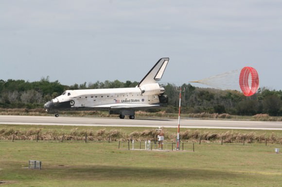
Space Shuttle Discovery concluded her magnificent final journey with a safe landing on March 9, 2011 at the Kennedy Space Center in Florida at 11:57 a.m. EST. Credit: Ken Kremer

Satellite Photos Before and After of Japan’s Earthquake, Tsunami

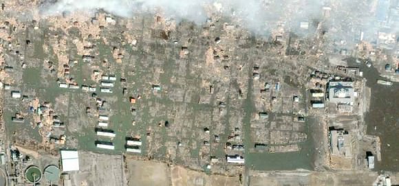
Sendai, Japan after the disaster. Satellite image courtesy of GeoEye.

[/caption]

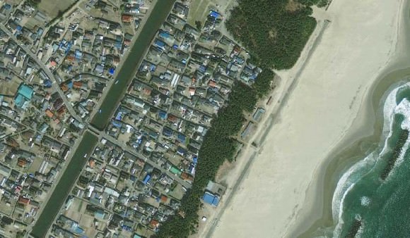
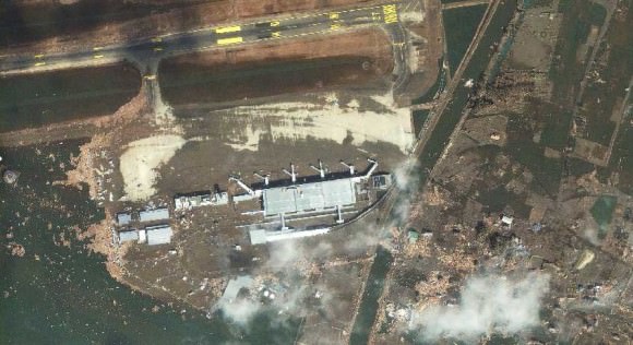
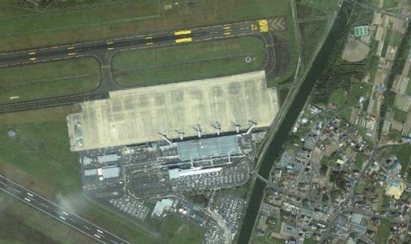
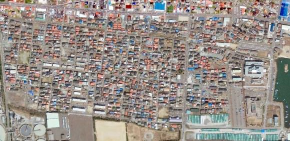
Photos from the GeoEye satellite imaging company from before and after the March 11 earthquake and tsunami in Japan show sobering views from above of the disaster. Above is the town of Sendai, Japan after the quake, below is how it looked before catastrophe struck.

Arahama, Japan before the disaster. Satellite image courtesy of GeoEye.

See more below.

The Sendai Airport after the disaster. Satellite image courtesy of GeoEye.
The Sendai Airport in August of 2010. Satellite image courtesy of GeoEye.
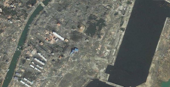
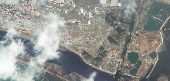
Yuriage, Japan on March 12, 2011. Satellite image courtesy of GeoEye.
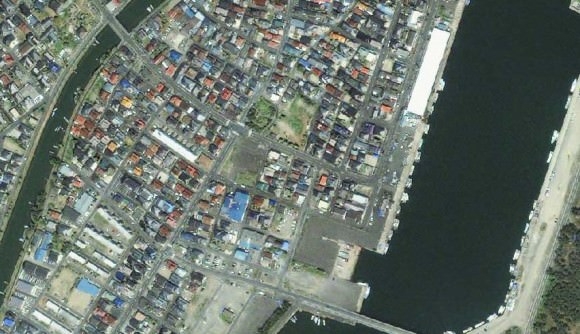
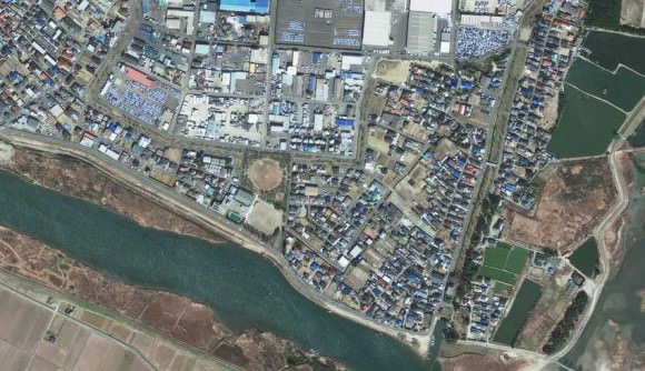
Yuriage, Japan on April 4, 2010. Satellite image courtesy of GeoEye.
Sendai, Japan on March 12, 2011. Satellite image courtesy of GeoEye.
Sendai, Japan on April 4, 2010. Satellite image courtesy of GeoEye.
Ishinomaki, Japan on March 12, 2011. Satellite image courtesy of GeoEye.
Ishinomaki, Japan on April 4, 2010. Satellite image courtesy of GeoEye.

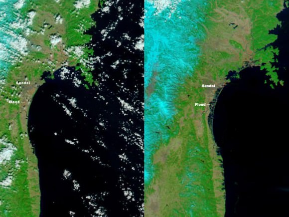
Below is an images from the MODIS Rapid Response System, which is producing twice-daily images of Japan in response to the disaster.

The Moderate Resolution Imaging Spectroradiometer (MODIS) on NASA’s Aqua satellite took the right image on Mar. 13, 2011, while the MODIS sensor on NASA’s Terra satellite took the left image on Feb 26, 2011. NASA images courtesy the MODIS Rapid Response Team at NASA GSFC.

These two images, from the MODIS instrument on NASA’s Aqua satellite from Mar. 13, 2011 on the right, and the the MODIS sensor on NASA’s Terra satellite from Feb. 26, 2011 on the left before the earthquake and tsunami. Both images were made with infrared and visible light to highlight the presence of water on the ground. Plant-covered land is bright green, bare earth is tan-pink, and snow is blue. The city of Sendai is brown.

At this level of detail, the flooding along the coastline is the most obvious sign of the destructive earthquake and tsunami that struck Japan on March 11. A bright orange-red spot near the city of Sendai is the thermal signature from a fire, also likely caused by the earthquake. The photo-like true-color version of the image shows a plume of black smoke extending east over the ocean.

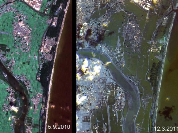
The German Aerospace Center (Deutsches Zentrum fur Luft- und Raumfahrt; DLR) is responding through its Center for Satellite Based Crisis Information (Zentrum fur Satellitengestutzte Kriseninformation; ZKI), based at its site in Oberpfaffenhofen, and provided the image below.

Japan's Coastline Before and After the Tsunami These images show the effects of the tsunami on Japan's coastline. The image on the left was taken on Sept. 5, 2010; the image on the right was taken on March 12, 2011, one day after an earthquake and resulting tsunami struck the island nation. Image Credit: German Aerospace Center (DLR)/Rapid Eye

Sources: GeoEye, New York Times, NASA, Space Daily

KSC Launch Pad Worker Falls, Dies

Shuttle Endeavour at launch pad 39 A. Credit: NASA

[/caption]

A worker at the space shuttle launch pad at Kennedy Space Center, pad 39A, fell to his death early Monday morning, according to reports. An employee of United Launch Alliance fell from the launch pad tower near space shuttle Endeavour. NASA released the following statement:

“At about 7:40 a.m. EDT this morning, a United Space Alliance worker fell at NASA Kennedy Space Center’s Launch Pad 39A. NASA emergency medical personnel responded, but they were unable to revive the man. Because of medical privacy, currently we’re not able to release any additional details about this fatality. Family members are being notified. All work at Launch Pad 39A has been suspended for the rest of the day, and counseling and other employee assistance are being provided to workers. Right now our focus is on our workers and for the family of the USA employee. The incident is under investigation.”

Our condolences to the man’s family and his United Launch Alliance co-workers.

UPDATE:

USA has now released the name of the person involved in the accident at the launch pad as engineer James D. Vanover.

“Our heartfelt sympathy goes out to the family of Mr. Vanover,” United Space Alliance Chief Executive Officer Virginia Barnes said in a statement. “Our focus right now is on providing support for the family, and for his coworkers. We are also providing our full support to investigating officials in order to determine the cause of the incident as quickly as possible. Until that investigation is complete, it would be inappropriate to provide further comment on the details.”

Astronomy Without A Telescope – Black Hole Entropy

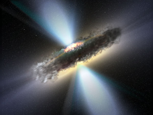
Black holes - throw something in them and that's the end of the story, right? Well, some physicists can't leave it at that.

[/caption]

An easy way to think about the entropy of black holes is to consider that entropy represents the loss of free energy – that is, energy that is available to do work – from a system. Needless to say, anything you throw into a black hole is no longer available to do any work in the wider universe.

An easy way to think about the second law of thermodynamics (which is the one about entropy) is to consider that heat can’t flow from a colder location to a hotter location – it only flows the other way. As a result, any isolated system should eventually achieve a state of thermal equilibrium. Or if you like, the entropy of an isolated system will tend to increase over time – achieving a maximum value when that system achieves thermal equilibrium.

If you express entropy mathematically – it is a calculable value and one that tends to increase over time. In the seventies, Jacob Bekenstein expressed black hole entropy as a problem for physics. No doubt he could explain it much better than I could, but I think the idea is that if you suddenly transfer a system with a known entropy value past the event horizon of a black hole, it becomes immeasurable – as though its entropy vanishes. This represents a violation of the second law of thermodynamics – since the entropy of a system should at best stay constant – or more often increase – it can’t suddenly plummet like that.

So the best way to handle that is to acknowledge that whatever entropy a system possesses is transferred to the black hole when the system goes into it. This is another reason why black holes can be considered to have a very high entropy.

Then we come to the issue of information. The sentence The quick brown fox jumped over the lazy dog is a highly engineered system with a low level of entropy – while drawing out 26 tiles from a scrabble set and laying them down however they come delivers an randomly ordered object with a high level of entropy and uncertainty (to the extent that it could be any of a billion possible variations).

Throw your scrabble tiles into a black hole – they will carry with them whatever entropy value they began with – which is likely to increase further within the black hole. Indeed it’s likely that the tiles will not only become more disorganized but actually crushed to bits within the black hole.

Now there is fundamental principle in quantum mechanics which requires that information cannot be destroyed or lost. It’s more about wave functions than about scrabble tiles – but let’s stick with the analogy.

You won’t violate the conservation of information principle by filling a black hole with scrabble tiles. Their information is just transfered to the black hole rather than being lost – and even if the tiles are crushed to bits, the information is still there in some form. This is OK.

But, there is a problem if in a googol or so years, the black hole evaporates via Hawking radiation, which arises from quantum fluctuations at the event horizon and has no apparent causal connection with the contents of the black hole.

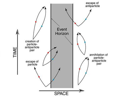
The Hawking radiation story. A quantum fluctuation proximal to a black hole's event horizon produces a particle and an antiparticle. The antiparticle enters the black hole and annihilates when it collides with a particle in there. The remaining particle is free to join the rest of the universe outside the event horizon. To an external observer, the black hole appears to have lost mass and radiated a particle. Over time this process would result in the black hole evaporating. To date - good story, evidence nil, but watch this space. Credit: NAU.

A currently favored solution to this problem is the holographic principle – which suggests that whatever enters the black hole leaves an imprint on its event horizon – such that information about the entire contents of the black hole can be derived from just the event horizon ‘surface’ – and any subsequent Hawking radiation is influenced at a quantum level by that information – such that Hawking radiation does succeed in carrying information out of the black hole as the black hole evaporates.

Zhang et al offer another approach of suggesting that Hawking radiation, via quantum tunneling, carries entropy out of the black hole – and since reduced entropy means reduced uncertainty – this represents a nett gain of information drawn out from the black hole. So Hawking radiation carries not only entropy, but also information, out of the black hole.
But is this more or less convincing than the hologram idea? Well, that’s uncertain…

Further reading: Zhang et al. An interpretation for the entropy of a black hole.

Spectacular Sunset Launch of new US Spy Satellite

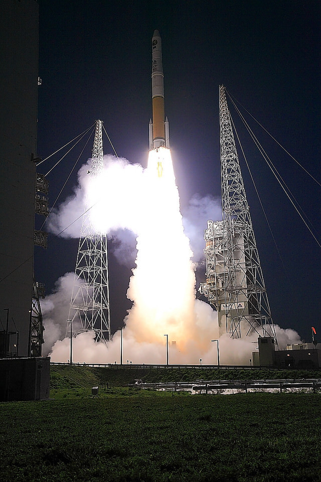
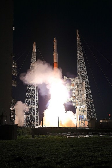
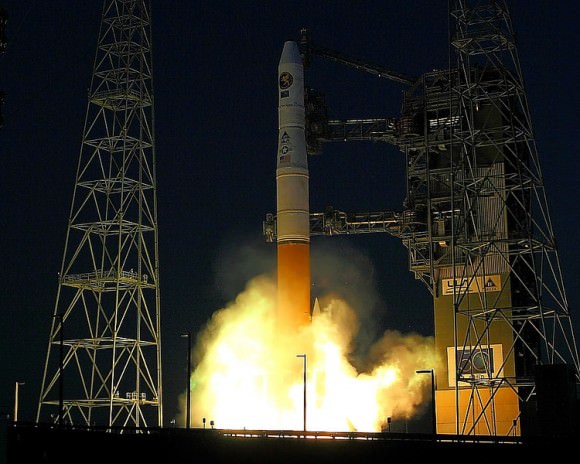
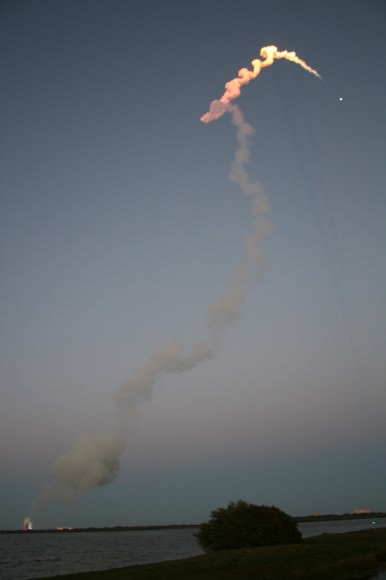
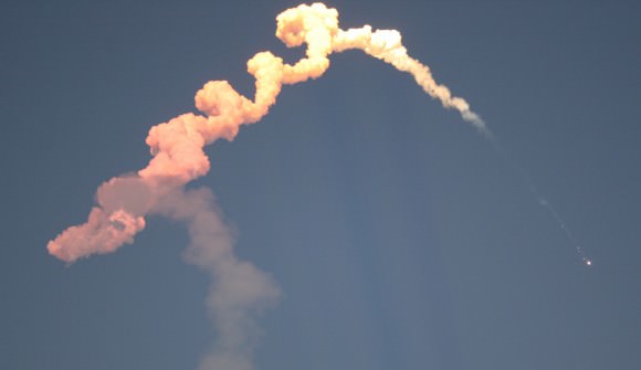
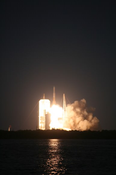
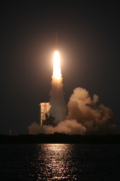
Delta IV blast off with NROL-27 clandestine military payload for the National Reconnaissance Office (NRO) on March 11, 2011 at 6:38 p.m. from Cape Canaveral at Space Launch Complex-37 in Florida. Credit: Alan Walters. awaltersphoto.com. See Delta launch photo gallery below.

[/caption]

A Delta IV rocket carrying a top secret military payload for the National Reconnaissance Office (NRO) blasted off Friday evening (March 11) at 6:38 p.m. from Cape Canaveral at Space Launch Complex-37 in Florida.

The NROL-27 payload supports the national defense and all information about its mission and goals is a classified military secret. Some outside observers say NROL-27 may be a powerful military communications satellite for relay of vital national security data rather than a signals intelligence satellite.

See our launch photo gallery below from Alan Walters and Ken Kremer

Delta IV blast off with NROL-27 spy satellite on March 11, 2011 from Cape Canaveral launch pad 37. Credit: Alan Walters. awaltersphoto.com
The NRO is located in Chantilly, VA. and charged with the design, construction and operation of the US fleet of intelligence gathering reconnaissance satellites. Their goal is achieving information superiority for the U.S. Government and Armed Forces.

“This mission helps ensure that crucial NRO resources will continue to strengthen our national defense,” said Col James Ross, 45th Space Wing vice commander.

The sunset liftoff into a clear blue sky was visually stunning. With the winds whipping towards our viewing site along the NASA causeway, the roaring rocket thunder was especially loud. Upper level winds threatened to derail the launch. Liftoff was delayed by about 45 minutes due to strong wind gusts which finally calmed to fall within the launch criteria.

“This is the 50th anniversary year of the NRO. NROL-27 is the fifth of six launches for the NRO in the 2010-2011 time period and marks our most aggressive launch schedule in two decades,” said Loretta Desio, NRO spokesperson, in an interview for Universe Today at the viewing site.

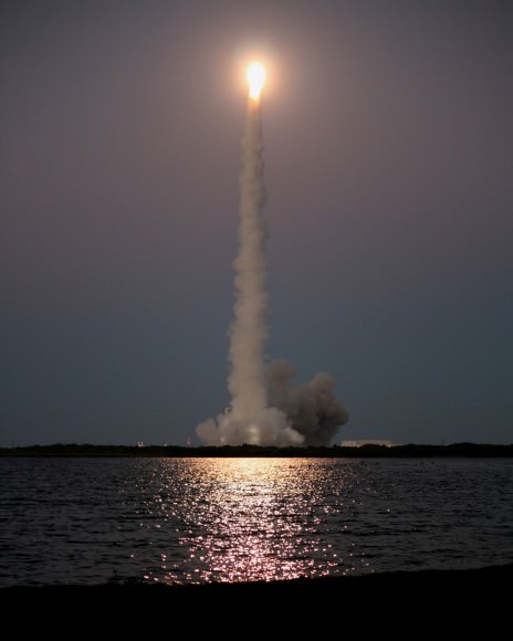
Sunset blastoff of Delta IV with NROL-27 spy satellite on March 11, 2011 from Cape Canaveral launch pad 37. View from the NASA Causeway about 2.7 miles away. Credit: Ken Kremer. kenkremer.com
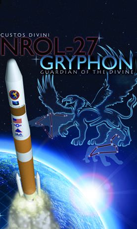
The NROL-27 satellite is named “Gryphon”.

Colors and works in the logo represent the United States Marine Corps, United States Navy, VA Tech, and fallen veterans. Logo symbols represent the United States Air Force, United States Army and two teammates killed on 9/11,” according to ULA spokesperson Chris Chavez.

The unmanned Delta IV rocket was built by United Launch Alliance (ULA) and launched by the 45th Space Wing stationed at Patrick Air Force Base. ULA is a partnership between Lockheed Martin and Boeing.

“The outstanding ULA, NRO and Air Force partnership made yet another successful mission,” said Lt. Col. William Heuck, 5th Space Launch Squadron commander.

NROL-27 was bolted atop the Delta IV rocket in the Medium + (4,2) configuration with a single liquid fueled booster and two small side mounted solid rocket boosters. The Delta IV stands 62.5 meters (205 feet) tall and can launch payloads up to 13.5 tons into low-Earth orbit and 6.6 tons into toward the geosynchronous orbits used by communications satellites.

The flight entered a news blackout after the successful separation of the payload fairing at about four and one half minutes after blastoff. No further information about the satellite will be forthcoming. The 4 meter diameter composite nose cone protects the satellite during ascent through the Earth’s atmosphere.

“I am extremely proud of the entire government and contractor team who supported this launch, said Col. Alan Davis, Director of the Office of Space Launch in the National Reconnaissance Office.

The Delta IV launch occurred just six days after the Atlas V launch of the second Orbital Test Vehicle (OTV-2) — the mini space shuttle on another secret mission. See my Atlas report here.

The Florida Space Coast has seen a surge of rocket launchings in the past month. The Delta IV launch is the last of three successful liftoffs in the past few weeks and follows closely on the heels of the Atlas and the final flight of Space Shuttle Discovery.

Delta IV blasts off with NROL-27 spy satellite on March 11, 2011 from Cape Canaveral launch pad 37. Credit: Alan Walters. awaltersphoto.com
Delta IV arcs away to orbit with NROL-27 spy satellite on March 11, 2011 from Cape Canaveral launch pad 37. View from the NASA Causeway about 2.7 miles away. Credit: Ken Kremer
Twin Solid rocket booster separation from Delta rocket 1st Stage occurred at T+plus 1 minute, 42 seconds. Credit: Ken Kremer
Delta IV blasts off with NROL-27 spy satellite on March 11, 2011 from Cape Canaveral launch pad 37. View from the NASA Causeway. Credit: Ken Kremer
Delta IV blasts off with NROL-27 spy satellite on March 11, 2011 from Cape Canaveral launch pad 37. View from the NASA Causeway about 2.7 miles away. Credit: Ken Kremer
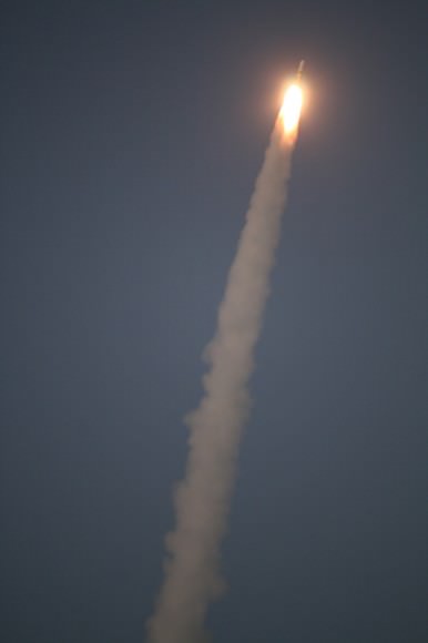
Delta 4 and NROL 27 streak to space. Credit: Ken Kremer
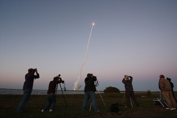
Space Photographers in action including this author, captured at the Delta 4 launch by Spaceflight Now. Photo Credit: Stephen Clark/Spaceflight Now
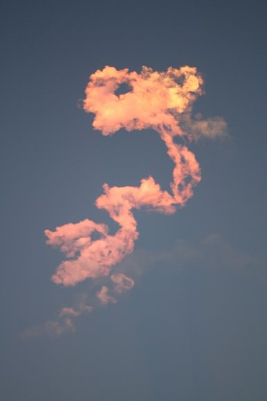
Colorful vapor exhaust trails from Delta 4 launch. Credit: Ken Kremer
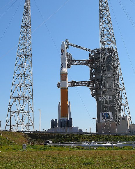
Delta IV prior to launch from Space Launch Complex-37 at Cape Canaveral. Credit: Alan Walters. awaltersphoto.com
Delta 4 NROL-27 mission patch.
Gryphon logo: Colors and works represent the United States Marine Corps, United States Navy, VA Tech, and fallen veterans. Logo symbols represent the United States Air Force, United States Army and two teammates killed on 9/11.
The patch may contain hidden clues about the mission

Carnival of Space #188

This week’s Carnival of Space is hosted by Peter Lake over at The AartScope Blog.

Click here to read the Carnival of Space #188.

And if you’re interested in looking back, here’s an archive to all the past Carnivals of Space. If you’ve got a space-related blog, you should really join the carnival. Just email an entry to [email protected], and the next host will link to it. It will help get awareness out there about your writing, help you meet others in the space community – and community is what blogging is all about. And if you really want to help out, sign up to be a host. Send an email to the above address.

The Science Behind a Tsunami

Model projections of wave heights from the Japan quake on Friday. Image from NOAA. Click image for higher resolution.

The massive magnitude 8.9 earthquake that struck off the east coast Japan’s main island on March 11, 2011 set in motion a fierce tsunami that may have claimed thousands of lives, and sent tsunami warnings all across the Pacific basin, thousands of kilometers away from the quake’s epicenter. How do earthquakes trigger such enormous tsunami events, and how can scientists predict where these massive waves might travel? Universe Today talked with Anne Sheehan, who is a professor of geological sciences at University of Colorado at Boulder, and is also affiliated with the Cooperative Institute for Research in Environmental Sciences, as well as getting input from David Admiraal, an associate professor of Engineering at the University of Nebraska Lincoln.

Universe Today: How does an earthquake trigger a tsunami?
Continue reading “The Science Behind a Tsunami”

New Spy Satellite Launches on Covert Mission

A Delta IV rocket blasted off Friday evening from Cape Canaveral launch Complex-37 carrying a secret payload for the National Reconnaissance Office. Called NROL-27, the mission was said to be in support of national defense. This marks the fourth NRO launch accomplished by ULA since Sept. 20, 2010 and occurred just six days after the Atlas V launch of the second Orbital Test Vehicle (OTV-2) — the mini space shuttle on another secret mission.
Continue reading “New Spy Satellite Launches on Covert Mission”

Just to be Clear: The Moon Did Not Cause the Earthquake in Japan

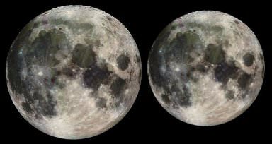
Apparrent size difference at Perigee and Apogee

[/caption]

We’re getting a lot of visitors to our site today, many searching for information about earthquakes, tsunamis, and the ‘SuperMoon’ phenomenon. Just to be clear, the Moon did not cause the earthquake in Japan. Several scientists have posted articles online today clarifying the topic, and all of them, in no uncertain terms, agree that the the upcoming perigee of the Moon — where it is closer than usual in its orbit to Earth — had nothing to do with the earthquake and ensuing tsunami. Tammy discussed this yesterday, but as we often do, we’ll also point you in the direction of an article by astronomer Phil Plait about this topic, and another by Ben Goldacre, who completely debunks an article that appeared in the Daily Mail about the possibility of a connection between the two events.

In addition, Dr. Jim Garvin, chief scientist at NASA’s Goddard Space Flight Center, has provided some answers to questions about the ‘supermoon’ phenomenon, below:

Question: What is the definition of a supermoon and why is it called that?

Garvin: ‘Supermoon’ is a situation when the moon is slightly closer to Earth in its orbit than on average, and this effect is most noticeable when it occurs at the same time as a full moon. So, the moon may seem bigger although the difference in its distance from Earth is only a few percent at such times.

It is called a supermoon because this is a very noticeable alignment that at first glance would seem to have an effect. The ‘super’ in supermoon is really just the appearance of being closer, but unless we were measuring the Earth-Moon distance by laser rangefinders (as we do to track the LRO [Lunar Reconnaissance Orbiter] spacecraft in low lunar orbit and to watch the Earth-Moon distance over years), there is really no difference. The supermoon really attests to the wonderful new wealth of data NASA’s LRO mission has returned for the Moon, making several key science questions about our nearest neighbor all the more important.

Question: Are there any adverse effects on Earth because of the close proximity of the moon?

Garvin: The effects on Earth from a supermoon are minor, and according to the most detailed studies by terrestrial seismologists and volcanologists, the combination of the moon being at its closest to Earth in its orbit, and being in its ‘full moon’ configuration (relative to the Earth and sun), should not affect the internal energy balance of the Earth since there are lunar tides every day. The Earth has stored a tremendous amount of internal energy within its thin outer shell or crust, and the small differences in the tidal forces exerted by the moon (and sun) are not enough to fundamentally overcome the much larger forces within the planet due to convection (and other aspects of the internal energy balance that drives plate tectonics). Nonetheless, these supermoon times remind us of the effect of our ‘Africa-sized’ nearest neighbor on our lives, affecting ocean tides and contributing to many cultural aspects of our lives (as a visible aspect of how our planet is part of the solar system and space).

Did Mars’ Missing Carbon Go Underground in a Wetter Age?

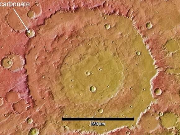
Image credit: NASA/JPL-Caltech/Arizona State Univ. North is toward the top of the image, which is centered at 14 degrees south latitude, 304.4 degrees west longitude.

[/caption]

A close look at the Wisconsin-sized Huygens Crater, above, in Mars’ southern highlands gave NASA and Arizona State University scientists some clues to announce this week as to a possible source of the carbon that’s mysteriously missing from the red planet’s thin atmosphere.

It might be buried underground.

The impact that formed the crater lifted material from far underground and piled some of it at the crater’s rim, where, at about 10 o’clock on the photo, an unnamed crater later exposed rocks containing carbonate minerals. The minerals were identified by observations with the mineral-mapping Compact Reconnaissance Imaging Spectrometer for Mars (CRISM) on NASA’s Mars Reconnaissance Orbiter.

Carbon dioxide makes up nearly all of today’s Martian air and likely was most of a thicker early atmosphere, too. In today’s thin, cold atmosphere, liquid water quickly freezes or boils away.

Carbonates found in rocks elsewhere on Mars, from orbit and by NASA’s Spirit rover, are rich in magnesium. Those could form from reactions of volcanic deposits with moisture, said James Wray of Cornell University in Ithaca, N.Y. “The broader compositional range we’re seeing that includes iron-rich and calcium-rich carbonates couldn’t form as easily from just a little bit of water reacting with igneous rocks. Calcium carbonate is what you typically find on Earth’s ocean and lake floors.”

He said the carbonates at Huygens and Leighton “fit what would be expected from atmospheric carbon dioxide interacting with ancient bodies of water on Mars.” Key additional evidence would be to find similar deposits in other Martian regions. A hunting guide for that search is the CRISM low-resolution mapping, which has covered about three-fourths of the planet and revealed clay-mineral deposits at thousands of locations.

“A dramatic change in atmospheric density remains one of the most intriguing possibilities about early Mars,” added Mars Reconnaissance Orbiter Project Scientist Richard Zurek, of NASA’s Jet Propulsion Laboratory in Pasadena, Calif. “Increasing evidence for liquid water on the surface of ancient Mars for extended periods continues to suggest that the atmosphere used to be much thicker.”

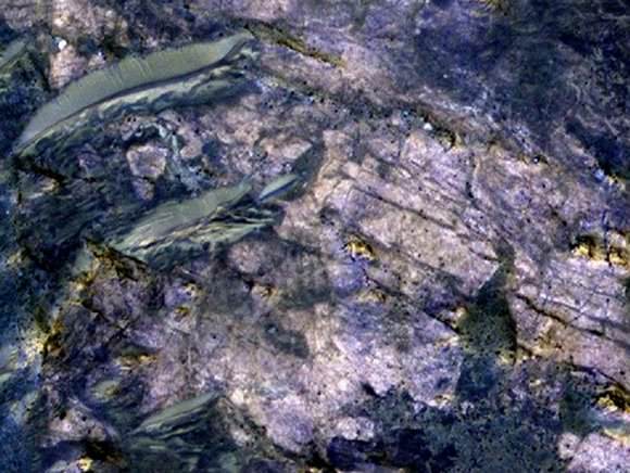
Credit: NASA/JPL-Caltech/Univ. of Arizona

The HiRISE image above covers an area about 460 meters (1,500 feet) across in which carbonate minerals have been identified. It combines information collected separately in red, blue-green, and near-infrared wavelengths. It’s from HiRISE observation ESP_012897_168, made on April 27, 2009, and centered at 11.6 degrees south latitude, 51.9 degrees east longitude.

“We’re looking at a pretty lucky location in terms of exposing something that was deep beneath the surface,” Wray said. He reported the latest carbonate findings on Tuesday at the Lunar and Planetary Science Conference near Houston.

Observations in CRISM’s high-resolution mode show spectral characteristics of calcium or iron carbonate at this site. Detections of clay minerals in lower-resolution mapping mode by CRISM had prompted closer examination with the spectrometer, and the carbonates are found near the clay minerals. Both types of minerals typically form in wet environments.

The occurrence of this type of carbonate in association with the largest impact features suggests that it was buried by a few kilometers (or miles) of younger rocks, possibly including volcanic flows and fragmented material ejected from other, nearby impacts.

The new findings reinforce a report by other researchers five months ago identifying the same types of carbonate and clay minerals from CRISM observation of a site about 1,000 kilometers (600 miles) away. At that site, a meteor impact has exposed rocks from deep underground, inside Leighton crater. In their report of that discovery, Joseph Michalski of the Planetary Science Institute in Tucson, Ariz., and Paul Niles of NASA Johnson Space Center in Houston, proposed that the carbonates at Leighton “might be only a small part of a much more extensive ancient sedimentary record that has been buried by volcanic resurfacing and impact ejecta.”

NASA will launch the Mars Atmosphere and Volatile Evolution Mission (MAVEN) in 2013 to investigate processes that could have stripped the gas from the top of the atmosphere into interplanetary space. Meanwhile, CRISM and other instruments now in orbit continue to look for evidence that some of the carbon dioxide in that ancient atmosphere was removed, in the presence of liquid water, by formation of carbonate minerals now buried far beneath the present surface.

Source: NASA news release. See also NASA’s Mars Reconnaissance Orbiter page.