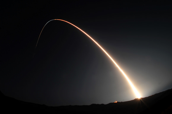
A Minotaur IV rocket launched the Space-Based Space Surveillance satellite. Image: U.S. Air Force/Senior Airman Andrew Lee
[/caption]
The U.S. Air Force successfully launched the Space Based Space Surveillance spacecraft, a first-of-its-kind satellite that can detect and track orbiting space objects from space. The new satellite was blasted into orbit by a Minotaur IV rocket at 9:41 p.m. PDT, September 25th, from Vandenberg Air Force Base in California.
“SBSS will greatly enhance our existing space situational awareness capability, a capability vital to protecting our space-based assets,” said Colonel Richard Boltz from Vandenberg.
SBSS spacecraft. Image courtesy of Boeing.
There are about 500,000 known pieces of space junk – such as spent rocket boosters, failed satellites, and pieces of satellites – in Earth orbit. Of those, about 21,000 objects are larger than 10.1 cm (4 inches) in diameter. These are being tracked by the Department of Defense, as part of the Space Surveillance Network.
“This satellite is going to revolutionize the way we track objects in space by not being constrained by weather, the atmosphere or the time of day,” said Col. J.R. Jordan, vice-commander of the Space Superiority Systems Wing at the U.S. Air Force Space and Missile Systems Center, in a prelaunch briefing. “This capability will be essential to our space situational awareness architecture for the near future and beyond.”
The satellite will be fully operational and handed over to the Air Force Space Command in about 210 days. The SBSS will be able to detect, identify and tracking man-made space objects from deep space to low-earth orbit. The SBSS space vehicle uses a two-axis gimbal in order to observe in all directions. The spacecraft’s on-board mission data processor performs image processing to extract moving targets and reference star pixels to reduce the downlink data size.
This was the third launch in eight days from Vandenberg.
Artist's impression of The Milky Way Galaxy. Based on current estimates and exoplanet data, it is believed that there could be tens of billions of habitable planets out there. Credit: NASA
If you are not an astronomy enthusiast you not have thought much about what galaxy do we live in. So depending on that the answer may surprise you. If you know anything about galaxies you know that they are groupings of stars that number in the hundreds of billions. The most famous is the Milky Way. It is from this galaxy that we even have the term. The simple point is that the Earth is part of the Milky Way even though if we see it in the sky it looks like we are observing it from the outside. Why is that? To understand you need to know exactly where we live in neighborhood of the Milky Way Galaxy.
As we are part of the solar system Earth pretty much follows the path of the sun as it goes through its own orbit around the galaxy. The Milky Way is a spiral galaxy type so it has arms sort of like an octopus. The Sun is located near the outward tip of the Sagittarius arm of the Milky Way. This makes Earth about 28,000 light years from the galactic core of our home galaxy.
The Solar System also has a galactic year that it follows. It takes around 200 million to 250 million years for the solar system to orbit the Sun. Another indicator of our position is where the galactic equator. While our star system is considered to be on the outskirts of the Milky Way this is only an estimate. It is believed that the Milky Way is larger than first estimated. There is also suspicion that our galaxy is in the process of absorbing other smaller galaxies. However, there is not enough empirical evidence available to support the claim.
So what would be so important about knowing what part of the galaxy we live in? One reason is space exploration. Some time in the future mankind may find a way to achieve faster than light space travel. This can provide a new set of challenges for engineers and astronomers to tackle. For example how would an astronaut keep from getting lost in space? Detailed mapping and computer programming in the future could help galactic wayfarers know where they are going and more importantly how to get home.
The other reason is that it never hurts to know our place in the scheme of things. Just thinking of the challenge of finding earth if we were so far way helps us to understand how truly vast the universe is.
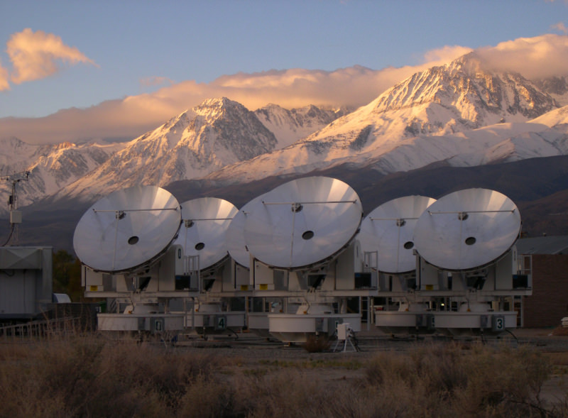
The University of Chicago's Sunyaev-Zeldovich Array - searching for the point in time when dark energy became an important force in the evolution of the universe. Credit: Erik Leitch, University of Chicago.
[/caption]
A recent cosmological model seeks to get around the sticky issue of dark energy by jury-rigging the Einstein field equation so that the universe naturally expands in an accelerated fashion. In doing so, the model also eliminates the sticky issue of singularities – although this includes eliminating the singularity from which the Big Bang originated. Instead the model proposes that we just live in an eternal universe that kind of oscillates geometrically.
As other commentators have noted, this model hence fails to account for the cosmic microwave background. But hey, apart from that, the model is presented in a very readable paper that tells a good story. I am taking the writer’s word for it that the math works – and even then, as the good Professor Einstein allegedly stated: As far as the laws of mathematics refer to reality, they are not certain, and as far as they are certain, they do not refer to reality.
Like a number of alternate cosmological models, this one also requires the speed of light in a vacuum to vary over the evolution of the universe. It is argued that time is a product of universe expansion – and hence time and distance are mutually derivable – the conversion factor between the two being c – the speed of light. So, an accelerating expansion of the universe is just the result of a change in c – such that a unit of time converts to an increasing greater distance in space.
Yes, but…
The speed of light in a vacuum is the closest thing there is to an absolute in general relativity – and is really just a way of saying that electromagnetic and gravitational forces act instantaneously – at least from the frame of reference of a photon (and perhaps a graviton, if such a hypothetical particle exists).
It’s only from subluminal (non-photon) frames of reference that it becomes possible to sit back and observe, indeed even time with a stopwatch, the passage of a photon from point A to point B. Such subluminal frames of reference have only become possible as a consequence of the expansion of the universe, which has left in its wake an intriguingly strange space-time continuum in which we live out our fleetingly brief existences.
As far as a photon is concerned the passage from point A to point B is instantaneous – and it always has been. It was instantaneous around 13.7 billion years ago when the entire universe was much smaller than a breadbox – and it still is now.
But once you decide that the speed of light is variable, this whole schema unravels. Without an absolute and intrinsic speed for relatively instantaneous information transfer, the actions of fundamental forces must be intimately linked to the particular point of evolution that the universe happens to be at.
For this to work, information about the evolutionary status of the universe must be constantly relayed to all the constituents of the universe – or otherwise those constituents must have their own internal clock that refers to some absolute cosmic time – or those constituents must be influenced by a change in state of an all-pervading luminiferous ether.
In a nutshell, once you start giving up the fundamental constants of general relativity – you really have to give it all up.
The basic Einstein field equation. The left hand side of the equation describes space-time geometry (of the observable universe, for example) and the right hand side describes the associated mass-energy responsible for that curvature. If you want to add lambda (which these days we call dark energy) - you add it to the left hand side components.
The cosmological constant, lambda – which these days we call dark energy – was always Einstein’s fudge factor. He introduced it into his nicely balanced field equation to allow the modeling of a static universe – and when it became apparent the universe wasn’t static, he realized it had been a blunder. So, if you don’t like dark energy and you can do the math, this might be a better place to start.
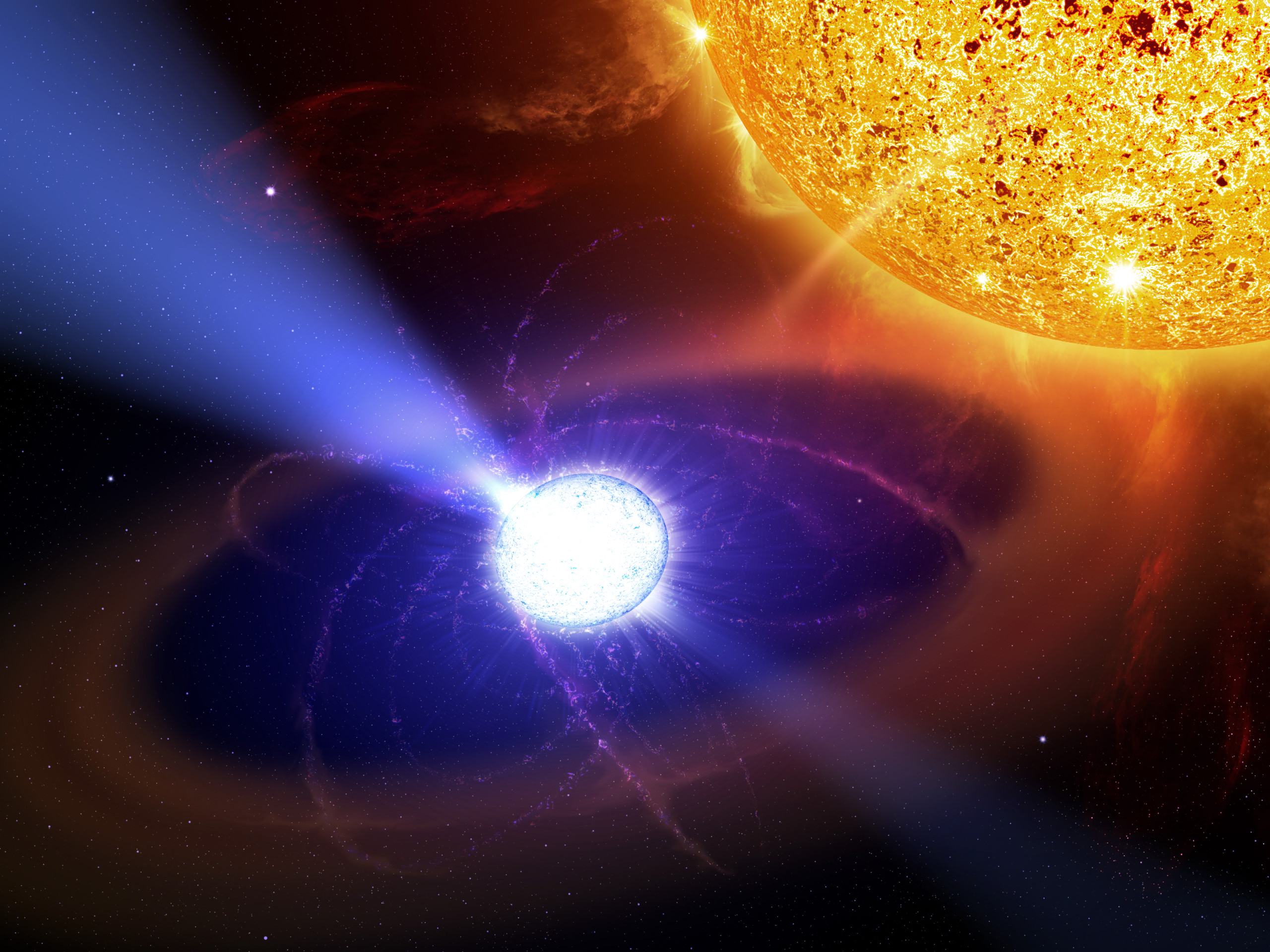
The white dwarf in the AE Aquarii system is the first star of its type known to give off pulsar-like pulsations that are powered by its rotation and particle acceleration.
[/caption]
Some satellites get all the glory. While Hubble, Chandra, and Spitzer frequently make headlines with their stunning images, many other space based observatories silently toil away. One of them, known as the Payload for Antimatter Matter Exploration and Light-nuclei Astrophysics (PAMELA) has been in orbit since 2006, but rarely receives media attention although a stunning discovery has led to the publication of over 300 papers within a single year. A new paper in that onslaught has proposed an interesting new object: pulsars powered by white dwarfs.
PAMELA isn’t a satellite in its own right. It piggybacks on another satellite. Its mission is to observe high energy cosmic rays. Cosmic rays are particles, whether they be protons, electrons, nuclei of entire atoms, or other pieces, that are accelerated to high velocities, often from exotic sources and cosmological distances.
Among the types of particles PAMELA detects is the elusive positron. This anti-particle of the electron is quite rare due to the scarcity of anti-matter in general in our universe. However, much to the surprise of astronomers, in the range of 10 – 100 GeV, PAMELA has reported an abundance of positrons. In even higher ranges (100 GeV – 1 TeV) astronomers have found that there is a rise in both electrons and positrons. The conclusion from this is that something is able to actually create these particles in these energy ranges.
A flurry of papers went to publication to explain this unexpected finding. Explanations ranged from showers of particles created by even higher energy cosmic rays striking the interstellar medium, to the decay of dark matter, to neutron stars, pulsars, supernovae, and gamma ray bursts. Indeed, many events that produce high energies are sufficient to spontaneously produce matter from energy through the process of pair production. However, the range of these ejected particles would be limited. Effects, such as synchrotron and inverse Compton emission would drain their energy over large distances and as such, by the time they reached PAMELA’s detectors would be too low energy to account for the excesses in the observed energy ranges. From this, astronomers are presuming the culprits are in the local universe.
Joining the long list of candidates, a new paper has proposed a mundane object could be responsible for the high energy necessary to create these energetic particles, albeit with an unusual twist. Neutron stars, one of the potential objects formed in a supernova, are known to release large amounts of energies when spinning quickly while creating a strong magnetic field in the form of pulsars, but the authors propose that white dwarfs, the products of the slow death from stars not massive enough to result in a supernova, may be able to do the same thing. The difficulty in creating such a white dwarf pulsar is that, since white dwarfs don’t collapse to such a small size, they don’t “spin up” as much as they conserve angular momentum and shouldn’t have the sufficient angular velocity necessary.
The authors, led by Kazumi Kashiyama at Kyoto University propose that a white dwarf may reach the necessary rotational speed if they undergo a merger or accrete a sufficient amount of mass. This idea is not unheard of since white dwarf mergers and accretion are already implicated in Type Ia Supernovae. The combination of this with the expectation that around 10% of white dwarfs are expected to have magnetic fields of 106 Gauss, the steps necessary to produce a pulsar from a white dwarf seem to be in place. They note that since white dwarfs tend to have weaker magnetic fields, they shed their angular momentum more slowly and would last longer. Although this duration is still far longer than humans can possibly watch, this may indicate that many of the pulsars observed in our own galaxy are white dwarfs.
Next, the authors hope to conclusively identify such a star. The creation of each of these types of pulsars may provide a clue: Since neutron stars form from supernovae, they are surrounded by a shell of gas that contains a shock front from the supernova itself, which is more dense than the interstellar medium in general. As particles pass through this shock front, some of them would be lost. The same would not be said for white dwarfs which formed from a more gentle release and aren’t impeded by the relatively high density area. This shift in energy distributions may be one distinguishing characteristic.
Some stars have even been tentatively proposed as candidates for white dwarf pulsars. AE Aquarii was seen to give off some pulsar-like signals. EUVE J0317-855 is another white dwarf that appears to meet the qualifications, although no signals have been detected from this star. This new class of stars would be able to explain the excess signal in the higher energy range detected by PAMELA and will likely be the target of further observational searches in the future.
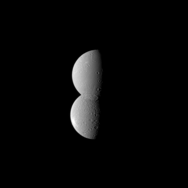
Saturn's moons Dione and Rhea appear conjoined in this optical illusion-like image taken by the Cassini spacecraft. Credit: NASA/JPL/Space Science Institute
[/caption]
This latest image from the Cassini spacecraft will make you do a double-take! It is an optical illusion, but the two moons appear like conjoined, identical twins! The two moons are fairly close in size, but Dione, the smaller of the two at the top in the image, is actually closer to the spacecraft, making the two look almost identical. And because of the similar albedo, or reflectivity, of the two moons and because of the location of a particularly large crater near the south polar region of Dione, the moon appears blended seamlessly with Rhea. Double your pleasure!
Dione is 1123 kilometers (698 miles) across and Rhea is 1528 kilometers (949 miles) across.
The image was taken in visible light with the Cassini spacecraft narrow-angle camera on July 27, 2010.
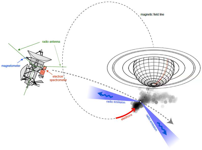
Cassini crossed the radio aurora of Saturn on 17 October 2008, at a distance of 4 Saturn's radii above the atmosphere. These radio emissions, generated by fast electrons, are strongly beamed. They were characterised by simultaneous observations of three different experiments. Credit: NASA/JPL/University of Iowa/CNES/Observatoire de Paris
Saturn’s mysterious aurora has fascinated astronomers and space enthusiasts since it was first observed back in 1979. Now, the Cassini spacecraft has made the first observations from within the giant radio aurora of Saturn. The spacecraft flew through an active auroral region in 2008, and scientists say there are both similarities and contrasts between the radio auroral emissions generated at Saturn and those at Earth. Additionally, Cassini’s visual and infrared mapping spectrometer instrument (VIMS) took data to create a new movie (above) showing Saturn’s shimmering aurora over a two-day period. All this new data are helping scientists understand what drives some of the solar system’s most impressive light shows.
[/caption]
“So far, this is a unique event,” said Dr. Laurent Lamy at the European Planetary Science Congress in Rome this week. “Whereas the source region of Earth’s radio aurora has been studied by many missions, this is our first opportunity to observe the equivalent region at Saturn from the inside. From this single encounter, we have been able to build up a detailed snapshot of auroral activity using three of Cassini’s instruments. This gives us a fascinating insight into the processes that are generating Saturn’s radio aurora.”
See an animation created from the radio instrument on Cassini at this link. On the left hand side are the radio sources as seen from Cassini. The right hand side shows the projection of the radio sources down onto the southern pole of the planet. Credit: NASA/JPL/University of Iowa/CNES/Observatoire de Paris
Separately, Tom Stallard, lead scientist on a joint VIMS and Cassini magnetometer collaboration, presented the VIMS movie at the conference.
In the movie, the aurora phenomenon clearly varies significantly over the course of a Saturnian day, which lasts around 10 hours 47 minutes. On the noon and midnight sides (left and right sides of the images, respectively), the aurora can be seen to brighten significantly for periods of several hours, suggesting the brightening is connected with the angle of the sun. Other features can be seen to rotate with the planet, reappearing at the same time and the same place on the second day, suggesting that these are directly controlled by the orientation of Saturn’s magnetic field.
Image of Saturn’s aurora seen at ultraviolet wavelengths. The spiral shape seen here is similar to the distorted radio aurora visualised by the team and also indicates enhanced auroral activity. Credit: ESA/NASA/Hubble
“Saturn’s auroras are very complex and we are only just beginning to understand all the factors involved,” Stallard said. “This study will provide a broader view of the wide variety of different auroral features that can be seen, and will allow us to better understand what controls these changes in appearance.”
Auroras on Saturn occur in a process similar to Earth’s northern and southern lights. Particles from the solar wind are channeled by Saturn’s magnetic field toward the planet’s poles, where they interact with electrically charged gas (plasma) in the upper atmosphere and emit light. At Saturn, however, auroral features can also be caused by electromagnetic waves generated when the planet’s moons move through the plasma that fills Saturn’s magnetosphere.
This false-color composite image shows Saturn’s rings and southern hemisphere. The composite image was made from 65 individual observations by Cassini’s visual and infrared mapping spectrometer in the near-infrared portion of the light spectrum on Nov. 1, 2008. Credit: NASA/JPL/University of Arizona
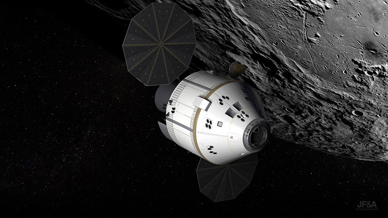
The Orion spacecraft is depicted here circling Earth's nearest celestial neighbor, the moon. Image Credit: NASA
[/caption]
Lockheed Martin has been working overtime to get the Orion spacecraft ready for its first mission, which officials say could be as early as 2013, depending on Congress’ final decision for NASA’s future and budget. Tools and procedures are being checked out to see that they work as advertised for both the spacecraft as well as assembly procedures and manufacturing for building future capsules.
The Orion spacecraft will be assembled and integrated on site in the Operations & Checkout (O & C) building at NASA’s Kennedy Space Center (KSC) in Florida. By doing this, both time and money can be saved as it will cut down on transportation costs and logistical issues.
“The unique benefit of this complete on-site operation is that we will build the spacecraft and then move it directly onto the launch vehicle at KSC, which saves the government transportation costs associated with tests and checkout prior to launch,” said Lockheed Martin Orion Deputy Program Manager for production operations Richard Harris. “This capability also facilitates the KSC workforce transition efforts by providing new job opportunities for those employees completing their shuttle program assignments.”
The current plan calls for Orion to serve to transport astronauts to the International Space Station and perhaps an eventual mission beyond low-Earth-orbit (LEO), but Orion’s future rests with Congress’ upcoming decision on NASA’s future budget. The House Science and Technology Committee announced Thursday a compromise between the House and Senate versions of NASA’s budget, but it is unclear when a final vote may take place.
In the meantime, the O & C building has been transformed in the past couple years into what is being called “the space factory of the future.” This was accomplished by the combined effort of both Lockheed Martin as well as Space Florida, the state’s aerospace development organization. The work was done to create a state-of-the-art facility for spacecraft production and innovation.
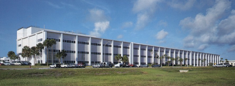
NASA's Operations and Checkout (O&C) Building has recently been refurbished to accomocate the Orion spacecraft. Photo Credit: NASA
Changes made to the O&C include 90,000 square feet of air-bearing floor space, paperless work stations, a portable clean room system, and specialized lifting/lowering/ support tools designed by United Space Alliance (USA). Specially designed air-bearing pallets will allow a small crew to maneuver hardware across the floor. The building renovation also incorporates energy-saving electrical systems which will help to further lower costs.
Lockheed Martin is the prime contractor for the Orion Project and heads the team that includes numerous subcontractors and small businesses working at facilities in 28 states. Additionally, the program works with more than 500 small businesses across the U.S. to provide the needed supplies that make the Orion Project a reality.
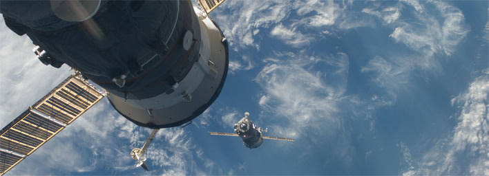
A previous Soyuz spacecraft leaving the ISS. Credit: NASA
[/caption]
Two Russian cosmonauts and an American astronaut were forced to call off their scheduled departure from the International Space Station because of a failure of the undocking system. Hooks on the space station’s Poisk module docking interface failed to release for the scheduled departure at 9:35 p.m. EDT Thursday, sending astronaut Tracy Caldwell-Dyson and Russia’s Alexander Skvortsov and Mikhail Kornienko back inside the ISS from the Soyuz, where they were strapped in, ready to return to Earth. NASA and the Russian Space Agency are hoping to try again, with the hatch closing at 6:45 pm EDT on Friday; undocking at 10:02 pm and landing in Kazakhstan at 1:22 am.
“The preliminary analysis, according to the technical commission, showed that a false signal appeared in the onboard computer system about the lack of a hermetic junction after closing the hatch on the station,” said Roscosmos head Anatoly Perminov.
This type of undocking problem has never happened before and comes three months after a Russian Progress resupply vehicle had problems docking to the ISS when a transmitter for the manual rendezvous system accidently activated, overriding the usually reliable automated system.
In trouble shooting the problem, Expedition 25 flight engineer Fyodor Yurchikhin on board the station removed a cover from the docking mechanism and found a small gear floating away. But the station crew couldn’t confirm the object came from the docking system or had anything to do with the failure.
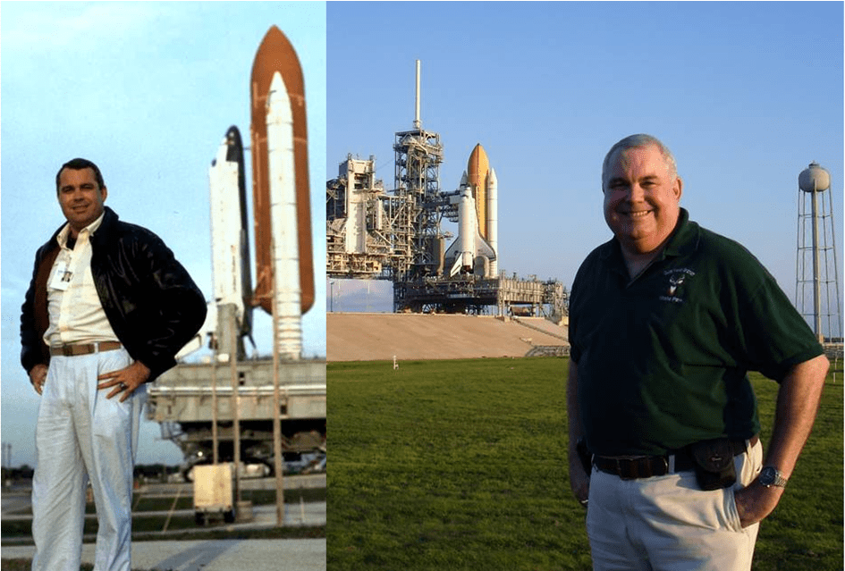
Nick THomas has worked at Kennedy Space Center for 23 years and has a unique perspective about the end of the shuttle era. Image courtesy of Nick Thomas.
[/caption]
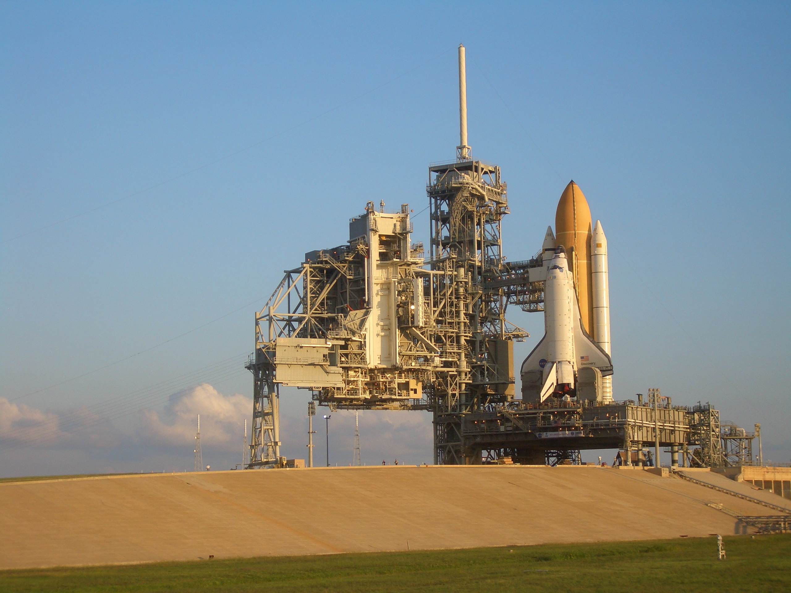
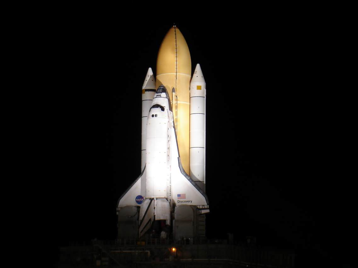
CAPE CANAVERAL, Fla. – They work tirelessly, behind the scenes, some work to ensure that the shuttle fleet is ready for the next mission; others work to ensure that the history is recorded and the shuttle program’s story is told. On Monday night one of their wards was rolled out to the launch pad for the final time.
Discovery began her final trip to the pad at 7:24 p.m. EDT. Along the 3.4 miles were many of the employees that have made the shuttle program possible along with their families. The time these folks have spent watching over Discovery vary from a few years to a couple decades and longer.
Discovery greets the dawn of its twilight. Photo Credit: Jason Rhian
Stephanie Stilson, Discovery’s Flow Director has been working on OV-103 since 2000.
Everyone has been very professional, very focused so I try not to think about it being the last one,” Stilson said. “I started with Discovery in 2000, so this is my eleventh processing flow with Discovery; I’m very honored to represent the team.”
Discovery's Flow Director, Stephanie Stilson, has been through 11 processing flows with this orbiter. Photo Credit: NASA/George Shelton
Stilson like so many of the employees at Kennedy Space Center have strong feeling regarding Discovery in particular as it was the orbiter that got NASA back on its feet after both the Challenger and Columbia disasters.
“Just the emotion behind Return-To-Flight, it had been such a long processing flow, so much had happened, so much was out there for us to think about, with the accident happening our hearts were very low at that point, so, STS-114 was able to really lift the NASA family up.” Stilson stated as Discovery rolled past her in the distance.
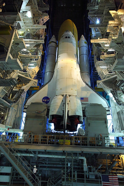
In this image space shuttle Discovery ventures out of the Vehicle Assembly Building for her last trip to the launch pad. Photo Credit: Alan Wlaters/Universe Today
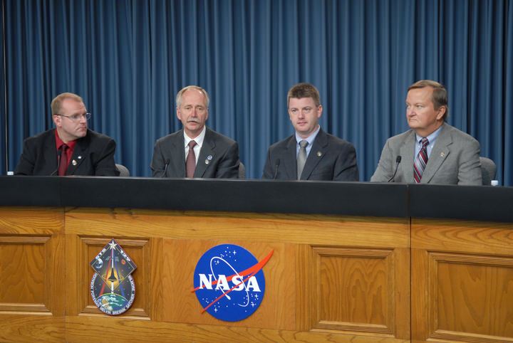
For Kennedy Space Center’s News Chief, Allard Beutel the final mission of Discovery helped to punctuate the eight years he has spent with NASA.
“Discovery was the first shuttle that I did my first commentary-countdown, my first 3-2-1-liftoff was with Discovery,” Beutel said. “There’s a little place right here in my heart for Discovery and all the missions that it has done.”
Beutel (far left) has provided launch commentary for numerous missions. Photo Credit: NASA/Jim Grossman
For one person that attended the rollout and the photo op at launch complex 39A the following day however, this was a bittersweet moment. He had followed Discovery for the 23 years that he had worked at the Kennedy Space Center Visitor Complex (KSCVC).
“Discovery is my vehicle, everyone out here as their personal favorite orbiter,” said Nick Thomas who works with the astronauts at the KSCVC during their daily presentations. “She is the first vehicle I saw with my own eyes back on July. 4, 1988, she was the first vehicle I ever visited out on the launch pad, she was the first vehicle I stuck my head into and she launched on my 40th birthday.”
Nick Thomas captured this image of Discovery as the orbiter slowly made her way to LC39A past the throngs of Discovery's workers and their families. Photo Courtesy of Nick Thomas
Thomas had a broad smile on his face throughout the interview as he talked about all the good memories he had working in the space industry. However he, like many, acknowledge that there are mixed emotions at seeing the shuttle program come to a close.
“She has seen her time, she deserves a rest and she’s going to go out with a fine mission I am sure of that.” Thomas said. It’s also sad to see her lining up for one last flight, you look out there and you wish her calm winds and smooth seas.”
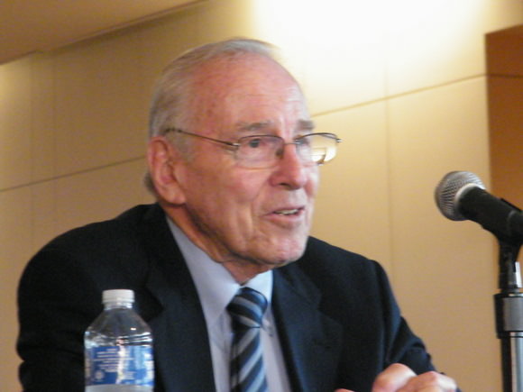
Apollo astronaut Jim Lovell at the Abraham Lincoln Presidential Library in Springfield, IL. Credit: Nancy Atkinson
[/caption]
Springfield, Illinois is a quiet, historic town that clings fervently to its association with Abraham Lincoln. If you want Civil War era history and desire to know anything about Lincoln, you can find it in Springfield, especially at the outstanding new Abraham Lincoln Presidential Library and Musuem.
So, it’s not often that an astronaut shows up, especially a former astronaut with his own unique kind of history such as Apollo 13’s Jim Lovell. But Lovell is in town this week, as he was awarded the Lincoln Leadership Prize, an honor given by the museum’s foundation to “exceptional men and women for a lifetime of service in the Lincoln tradition.” Still a commanding figure at age 82, Lovell chatted eloquently and easily with members of the press yesterday, and since I live in Springfield and am a member of the press, you can bet I was there. It was an honor to be able to talk with him.
Lovell toured the museum earlier in the day, and said, “It is a magnificent museum and library dedicated to one of our greatest presidents, and every American should have the chance to come here in order to get a good idea of what our country stands for and what the people in the past, like Abraham Lincoln, have done to make it a great country.”
Lovell said he was very honored and humbled to be the recipient of the Lincoln Prize and said what he has learned from Lincoln over the years is commitment. “Commitment is necessary if you are going to do anything great, like Lincoln, who committed himself to stand fast,” he said. “I enjoy the aspects of what the Lincoln Prize recognizes, and to be a recipient, well, it has a very special place in my heart.”
Of course, readers of Universe Today are familiar with Lovell’s history: a test pilot in the Navy who applied to become one of the original seven Mercury astronauts (“back when boosters were blowing up every other day at Cape Canaveral,” Lovell said). He didn’t make initial selection, but two years later when NASA needed more astronauts, Lovell was chosen. He flew two missions for Gemini, then Apollo 8 and Apollo 13.
Lovell called Apollo 8 the pinnacle of his career. “I am really proud to be one of three people that flew and circled the Moon on Christmas Eve in 1968,” he said, “and we were able to relay back — not to just the people of the United States, but the whole world — something positive after a rather dismal year.”
At the museum Lovell found out that the person who portrayed him in the movie “Apollo 13” – Tom Hanks – is a distance relative of Abraham Lincoln, “so I guess he had a bit of Lincoln in him too, and he was a great character to work with.”
Nancy Atkinson with Jim Lovell.
Following is part of the conversation with Lovell:
On the topic of commitment, do you think the United States is committed to human spaceflight?
Lovell: My personal opinion is that I believe the US has a very strong committment to continue our space exploration. Unfortunately, our present administration doesn’t believe that. The proposed NASA budget for 2011 eliminates the forward efforts of manned spaceflight. It goes for general research and other things. I don’t think they actually remember that NASA was formed to explore space. Consequently there is a possibility that we might be number three or four in space exploration in the future. As you know there about 2 or 3 shuttle flights left. After that the US has no access to the International Space Station, which all our taxpayers have put a lot of money into. If this plan goes forward, the only access in the future will be the Russians and they have indicated that the cost per astronaut per flight is about 60 million dollars, which is a pretty high ticket price to get there.
I think Congress sees the danger of the present proposal of NASA’s 2011 budget and based on that they are now in session both in the House and Senate to try and modify the President’s proposal to continue in some aspect manned space efforts to design vehicles to get up to the International Space Station, sometime in the near future. Hopefully Congress will get together and come up with a compromise. I personally feel the President has so many things weighing on his mind right now that he will go along with Congress’ proposal and it will be better than the initial budget that he proposed to the American people some months ago.
Universe Today: Do you have confidence in the commercial space companies that could bring people to space?
That’s a good question, because part of the new proposal is putting efforts and money into developing commercial spaceflight. Now, you have to look at what the definition of commercial is. In my mind, commercial is when an entrepreneur sees an enterprise to develop a launch system and spacecraft to get into space. He gets his own resources, does the development to build and test his system, makes it man- rated and then proposes his vehicle and system to NASA, or to the FAA if he wants to use it for tourism to space. This is what I consider commercial.
Now, a government program is where the government puts all the money into it and develops and builds it. Within the government, we have the free enterprise system, the private sector where we have contractors to do that. Boeing, Lockheed, General Dyamics, and so on. These people have 40 or 50 years in the development of space artifacts, launch systems, spacecraft. To put government money into a new system for unproven vehicles is today, a waste of money.
Jim Lovell. Credit: Nancy Atkinson
Boeing is now thinking of going into commercial work. They have the expertise to do that. But not some of the newer people like SpaceX, although they did build a nice booster that made one flight. But if they could build it on their own and make it man-rated and have a suitable launch to system to go the ISS, more power to them. I’m sure NASA would contract with them. But we have limited amount of money to spend for space activities, and it seems to me the best place to put it would be with the people who have the knowledge and expertise and the history of what it takes to build a launch system.
There are a few companies that are looking at suborbital flights, such as Richard Branson’s company (Virgin Galactic) who wants to expand what Burt Rutan has done to give people 5 or 6 minutes of weightlessness. Jeff Bezos of Amazon.com is another (Blue Origin). They are really entrepreneurs. If they can build their vehicles and systems and they think there is a market for tourism, then that is the way to go.
I’m all for commercialization. A lot of times people compare this to the work that the NACA did to help the airline industry – to develop wing designs and things like that—but the aviation industry in the early days saw a good market, because they knew either commercial flights or military vehicles would provide a market, so there was an opening there.
If you look at commercial space companies, as far as orbital, you have to ask what can people do there? There’s only one place to go in orbit, that’s the ISS. The Russians are already there. The Chinese are talking about building a space station, but there is no other manned market for commercial orbital spaceflight. Now there are a lot of unmanned commercial operations: satellites for the military, GPS, communications, weather – there’s a lot that can happen there and can happen in the future. I think the Boeing vehicles have made over 80 commercial flights putting satellites in orbit.
But low Earth orbit for people – where do you want to go? Unless you have tourists that want to go around the Earth or go to the ISS, there really is not a market, except for the market of the government to put astronauts up in the ISS.
What is the benefit to be gained from manned spaceflight that would outweigh the costs in these tough economic times?
Lovell: That answer is the same as it was back in the days of Mercury, Gemini and Apollo.
One, is the technologies developed. It used to be the only way there was technology development was if there was a war. When NASA came along the technology it developed spilled over in the public sector and you can see what has happened today, especially in the information industry.
The second thing you have to remember is that there was a spur of education. When Russia put up Sputnik, everyone asked how they did it and why we didn’t. And this spilled over into education. I can’t tell you how many people who have told me that when they were young they followed the space program and that affected their choice to go into engineering or science.
Then, there is idea of what we can do as the human race. The world is getting smaller. We can’t do things in space much on our own anymore, and so we have to work together. We now have an International Space Station, 16 countries working together in a program that is not controversial at all. It works. We’re getting to know other countries. We have a common bond.
As of now China is working on their own, but if they accomplish what they want to do, they might join the consortium of the other countries working together.
Now, the idea of manned spaceflight, even though if you pin me to wall, and ask, “OK, we want to go to Mars—why? What will we do there?” Honestly, I can’t tell you. I don’t know.
But I have to tell you one thing. Somebody is going to go to Mars. The technology is here. It is just the time effort and money to make that a possibilty. The original Constellation program that we had carefully devised and developed over years to build a vehicle to get us up to the space station because the shuttle would be retired, and then build the Ares boosters to work our way eventually get us back to the Moon, using that infrastructure to fully explore it – we’ve only touched a small part of the Moon so far – and then after years of developing that to eventually get the architecture and infrastructure. That was the whole plan. It wasn’t a plan to get to Mars in 10 years or 15 years, it was plan to get to one spot, and work your way to the next spot. And there would probably be a consortium of countries working with us. And that was the whole plan that the President shot down. He mentioned something about someday we’d get a big booster. When? You have to have a program to develop the technology. He wants to develop technology and then figure out what kind of program to have. That’s the wrong approach. That’s putting the cart before the horse.
If money was no object and the President said we could go either to the Moon or Mars, what would you recommend?
Lovell: I would tell him to go back to the program we had developed for Constellation. Now, there has been some controversy, even among my own compatriots. Some say we’ve been to the Moon- we’ve done that, so let’s go on to Mars, or let’s go on to an asteroid. That’s all well said and done.
We were extremely fortunate in the 1960’s to develop Apollo and to have the accomplishments we did. I was amazed when I heard President Kennedy announce in 1961 that we were going to go to the Moon by the end of the decade. I said, that’s impossible. So if I say that I don’t know what we’d do if we go to Mars, I might be sadly mistaken and someone might get there before we ever thought it was possible.
But I think you have to do it step by step, to develop it and then go.