We’re familiar with the close-up images of Earth captured by orbital satellites and astronauts on the International Space Station. But here are a few pictures of the Earth and Moon captured at a distance, while passing around the Moon, or orbiting distant Saturn. In the words of Carl Sagan, “Look again at that dot. That’s here. That’s home. That’s us. On it everyone you love, everyone you know, everyone you ever heard of, every human being who ever was, lived out their lives.”
Since Sagan commented on Voyager 1’s image of Earth, several more pics of the Earth and Moon have been captured that really put our tiny spot in the Universe into perspective.
Voyager 1 – the Pale Blue Dot
This image, captured by NASA’s Voyager 1 spacecraft on February 14, 1990, is the one Sagan was talking about. It was taken when Voyager 1 was about 6.4 billion kilometres (4 billion miles) from Earth. In this image, the entirety of the planet takes up less than a single pixel; in fact, NASA calculated that we’re only 0.12 pixel in size. Sagan pushed the agency to capture images of all the planets in the Solar System, to create a family portrait seen from Voyager’s distant position.
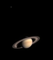
Cassini – the Earth from Saturn
This is easily the best picture ever captured by NASA’s Cassini spacecraft, and in the running for the best space pictures of all time. It shows Saturn in all its glory, backlit by the Sun. From this view, the rings glow with an ethereal light.
But this image is extra special. Take a look towards the upper left of the image, and you’ll notice a tiny blue-white dot. Once again, there’s Earth, seen from a distance of 1.4 billion km (1 billion miles).
Mars Express – the Earth and Moon from Mars
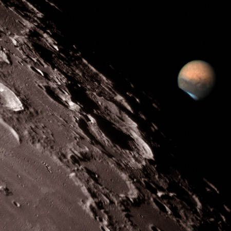
ESA’s Mars Express captured this image of Earth and the Moon on July 3, 2005 when it was 8 million km (5 million miles). This was actually the first observational data sent back by the probe. A fitting introduction to Martian system. Of course, Mars Express was designed to image the relatively nearby surface of Mars, and not such distant objects, so the resolution of the image isn’t very good. And yet, they’re instantly recognizable as the Earth and Moon.
Opportunity Rover – the Earth from the Surface of Mars
Here’s an image of Earth captured from the surface of another planet. In this case, we’re seeing Earth from Mars, as photographed by NASA’s Mars rover Opportunity on April 29, 2005. Normally operating only in the Martian day, Opportunity woke up a little after sunset, and captured this image of Earth as the stars were starting to come out. The image of Earth looks a little elongated because it was moving slightly during the 15-second exposures. Imagine what some future Martian might see, stepping out onto the surface of the Red Planet in the dusky twilight to see our bright planet in the sky.
Rosetta – Earth and Moon during a flyby
Now this is what you might have been expecting to see. A picture of Earth, with the continents clearly visible. This photograph of Earth and the other of the Moon were taken by ESA’s Rosetta spacecraft during a flyby on November 15, 2007. Rosetta’s primary mission is to visit Comet 67P/Churyumov-Gerasimenko in May 2014, but this flyby was a great opportunity for Rosetta to test out its OSIRIS camera system. The image of the Moon was taken separately.
Earthrise – seen from the Moon
This is the classic “Earthrise” photograph, captured by astronaut William Anders during the historic Apollo 8 mission – the first human mission to the Moon. This photograph was taken on December 24, 1968. If you’re standing on the surface of the Moon, the Earth doesn’t actually “rise”. Since the Moon is tidally locked to the Earth, our planet always hangs in exactly the same point of the sky. It takes an orbiting spacecraft to see the Earth actually rise from the horizon.
This photograph was recreated by the Japanese Kaguya spacecraft, which captured a similar sequence of the Earth using its high-definition video camera.
Earth from Galileo
And finally, I think I’ve saved one of the best pictures for last. This is a photograph of the Earth and Moon (not to scale) captured by NASA’s Galileo spacecraft as it was speeding away towards Jupiter. Galileo captured these images in 1992, and finally reached the Jovian system in 1995-97. You’re looking at the Pacific Image, with South America visible as well as the Caribbean.